#interactive map
Explore tagged Tumblr posts
Visit Tumblr Blog
Explore Tumblr blogs with no restrictions, modern design and the best experience.
Last Seen Tumblr Blogs


Fun Fact
70% of Tumblr users say the Dashboard is their favorite place to spend time online.
Text
21 notes
·
View notes
Text
To whom it may concern, I’ve made some updates to my “People of the Viking Age North” digital map! Just minor things. For instance, I added a new location for a burial that crosses both cultural and religious boundaries. Pretty neat, I think. I added that at work while avoiding…well, work. I included a link to an article that’s not paywalled, too.
22 notes
·
View notes
Text
Hi all.
I am a 25 year old student nurse and nature devotee who has an interest in memory benches.
With no valuable IT skills, a limited budget and no overall knowledge of creating and maintaining an active online map, I am seeking advice, tips and potentially assistance from those of you who have insight on how to achieve my goal.
In the UK, memory benches are everywhere - wooden or steel seats of engraved love given by those who were privileged enough to have shared life with those who have passed.
I made this tumblr so that I can start keeping a record of the memory benches I come across in my city, Sheffield, tagged here on this account by location, postcode and the dedicatee’s given name. I will record benches I find outside of Sheffield also, just far less frequently or sporadically.
My goal is to eventually pool the knowledge and resources together to, first, create an online directory of recorded memory benches and then hopefully develop into a map once I gain experienced of how to do so.
A like or reblog would be appreciated if you see this, and any and all insight into the matter would be appreciated.
Cheers for reading! Ask box is open or you can email me at [email protected].
#Project#Project help#IT#Benches#Memory benches#Nature#Advice#Community project#Help#Help needed#Technology#Sheffield#Yorkshire#London#IT help#Maps#Map#Interactive map#Digital map#Preservation#Tumblr staff#Staff
6 notes
·
View notes
Text
Mapping Stories That Matter: Exploring Culture with Interactive Story Maps
Stories aren’t just found in books—they unfold around us every day. In the rhythms of daily life, in the spaces we move through, meaning is constantly created. Interactive story maps help capture that depth—not just showing where things happen, but why they matter.

Beyond Pins and Text: Why Story Maps Make a Difference
Interactive story maps created on platforms like MAPOG blend spatial data with visual storytelling. Whether it’s showcasing monuments, documenting community spaces, or mapping cultural festivals, story maps provide dynamic, multimedia-rich experiences. Each point on the map becomes a micro-story, complete with descriptions, images, and meaningful context.
Instead of a static document or a plain PDF, a story map lets users explore data intuitively—zooming into areas, reading histories, and drawing connections between places and their cultural significance.
The Challenge with Traditional Methods
Spreadsheets, reports, and slide decks may convey facts, but they rarely spark curiosity. They miss the visual relationships between locations, and they’re hard to interact with. By contrast, story maps let you see clusters, patterns, and trends. For example: Where are India’s Buddhist sites concentrated? What colonial buildings align with old trade routes? You can't spot that in a list—but you can on a map.
Who Benefits from Story Mapping?
Creating a story map using MAPOG isn’t just a tech activity—it’s a cultural tool that serves:
Educators & Students: Bringing history and geography to life in classrooms through visual journeys.
Tourism Boards: Highlighting cultural circuits and local heritage trails to inspire travelers.
NGOs & Researchers: Mapping social initiatives or heritage restoration projects spatially and clearly.
Content Creators: Building engaging blogs, portfolios, or exhibits with embedded interactive narratives.

A New Way to Connect with Culture
By turning data into narrative and maps into experiences, story maps do more than display—they communicate. They help us see patterns we hadn’t noticed before. And more importantly, they make heritage, culture, and community stories more approachable, discoverable, and memorable.
In an era where visual storytelling is more impactful than ever, story maps empower us to map what truly matters—from ancient ruins to modern social movements. With tools like MAPOG, it’s never been easier to create and share stories that are grounded in place and rich in meaning.
Your story deserves a map—and the world deserves to see it.
4 notes
·
View notes
Text
My god, that was a long walk... My feet hurt, but whatever... I'm here now, at least.

Lots to do in town, but I don't like it that much... It's so fake. Eugh.
"S" Willsdale is a creation of @imaglitchy, a good friend of Willsdale! Thank you for your Resident, I will take good care of her!
Claude G. Burial is a creation of @spooksiedoodle, a good friend of Willsdale! Thank you for letting him visit, I'll treat him well!
8 notes
·
View notes
Text
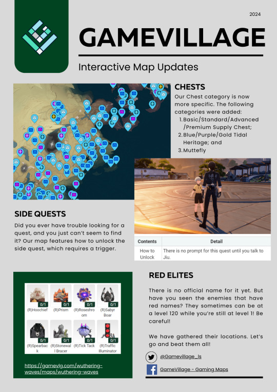
I'm here for our map for Wuthering Waves! Check it out and please let us know what you think. Here is the link: https://gamevlg.com/wuthering-waves/maps/wuthering-waves
2 notes
·
View notes
Text
Create a Real Estate Map with Filters for Price, Location, and Property Type

In today’s real estate world, people don’t just want to know what a property looks like—they want to know where it is, what surrounds it, and how it fits into their lifestyle. That’s where interactive maps come in. And when those maps include filters for price, location, and property type, they become powerful tools for discovery and decision-making.
No Coding? No Problem
You don’t need to be a tech expert to create a beautiful, functional map. With tools like MAPOG, anyone can build and embed an interactive real estate map in just a few steps. Choose your area, upload your property listings, organize them into categories, and add useful layers like schools, hospitals, parks, or fuel stations. You can even color-code listings, draw custom polygons, and set heights for 3D effects.

Make Listings Come Alive
Text alone doesn’t tell the full story of a property. An interactive map, on the other hand, lets readers explore what really matters. They can zoom in on neighborhoods, click on property pins, see what's nearby, and even measure distances to amenities like metro stations or schools. You can highlight areas by drawing boundaries, use icons for different property types, and allow readers to filter everything live on your blog. It transforms a simple post into an immersive property search experience.
Build Trust Through Visualization
Interactive maps not only look great they build credibility. When readers can clearly see the surroundings of a property, it removes guesswork and helps them make informed choices. It shows that you're offering more than just listings; you’re providing transparency and insight. This visual clarity builds trust and keeps your audience engaged longer.

Final Thoughts
If you’re writing about real estate on Tumblr, adding an interactive map with filters for price, location, and property type will take your blog to the next level. It’s more than just a cool feature it’s a way to help your audience explore, compare, and decide with confidence. With platforms like MAPOG, anyone can create a smart, stylish, and fully functional real estate map in minutes. So next time you post about properties, let your map do the talking.
1 note
·
View note
Text
Map of Delaware Breweries
Map of Delaware Breweries Scroll down to view the interactive map of all of the currently active breweries in the State of Delaware. Click on the beer mugs to get locations, names, and other data about each brewery. There is also a list to the left that you can click the name of the brewery and it will bring up their location on the map itself. Map of Delaware Breweries Maps of Breweries in the…
#B. Kline#Beer#Beer Maps#Beer Maps of the United States#Beer Maps of the USA#Beer Maps of USA#Breweries#Breweries in DE#Breweries in Delaware#Brewers of DE#Brewers of Delaware#Brewery#Brewery Life#Brewery Maps#Brewing#Craft Beer#Craft Beer News#Craft Breweries in Delaware#DE#DE Beer#DE News#Delaware#Delaware Beer#Delaware Breweries#Delaware News#Interactive Map#Interactive Map of Breweries#Map of Breweries#Map of Breweries in Delaware#Map of Breweries of Delaware
0 notes
Text

Do you need to pull data from an interactive map? Here's the basic gist.
0 notes
Text
🗺️ The British Journey to India: From Arrival to Rule
What if you could trace the entire timeline of British colonization in India—not through textbooks, but on an interactive map?

From Surat to Delhi, from trade to total control, the British presence in India wasn’t a single event—it was a slow, strategic expansion across centuries. It began with coastal trading posts and ended in an empire built on military power, treaties, and economic dominance.
💡 Using tools like MAPOG, we can now visualize this transformation. Every port, battlefield, and annexed kingdom can be plotted on a map—offering a spatial story of colonial ambition and its impact on the subcontinent.
📍Want to see how British India took shape? Map it.
Through Geographic Information Systems (GIS), students, educators, and history lovers can now dive into British colonization of India using interactive storytelling. It’s not just about where things happened, but why—and how it all connects.
0 notes
Text


The Swim Guide
The Swim Guide is provided by the team at Swim Drink Fish to provide folks with a helpful guide on swimming spots. Each spot is researched on about the place, what the water and environment is like, and up to date information about the swim spot. Their Beach Finder tool is an interactive map of swim spots you can research and add to your holiday/break plans.
They also have other pages like Beach Basics, a guide to live on the beach. You can find beaches by regions. They also have a blog too.
#swim#swimming#travel#events#summer#warm weather#beach#beaches#traveling#maps#interactive map#ocean#vacation#holiday#outting#sports#sport
0 notes
Text
#podcast#own work#love under fire 🔥#fyp#university#collaboration#youtube#fypツ#tumblr fyp#war love letters#letters#military#interactive story#interactive map#i made this#maps
1 note
·
View note
Text
Mapping Sewage: Making Urban Infrastructure Visually Engaging
Urban infrastructure isn’t just about pipes and treatment plants—it's about the health, safety, and quality of life for entire communities. Traditional infrastructure reporting is useful, but often misses the bigger picture. That’s where interactive mapping comes in, adding visual excitement and clarity to your urban infrastructure storytelling.
Why Map Your Sewage Infrastructure? Interactive maps transform technical sewage data into engaging visual stories. Whether you're a blogger, urban planner, or community advocate, using tools like MAPOG lets you visually illustrate exactly where sewage lines are, their coverage areas, and potential environmental risks.

The Problem with Traditional Infrastructure Reporting Standard reports and static data tables often feel disconnected. They highlight technical details but overlook important context—like environmental risks, untreated sewage areas, or proximity to sensitive locations such as residential areas and water bodies. Interactive maps bridge this gap, clearly showing infrastructure in context with community needs and environmental concerns.
Why Visual Maps Are Essential for Urban Infrastructure:
Easy Understanding: Quickly identify coverage gaps, treatment zones, and at-risk areas.
Engaging Stories: Visually connect infrastructure with community health and safety.
Clear Comparisons: Easily compare different areas based on their infrastructure coverage and environmental impact.

Interactive maps aren’t just practical—they're storytelling magic. Clearly showcase infrastructure issues, coverage gaps, and environmental risks, helping communities and decision-makers visualize and act on critical urban challenges.
Transform your infrastructure content into engaging visual stories with MAPOG and share your insights like never before!
1 note
·
View note
Text
Hey, you guys wanna go fuck some shit up?
What?
Y'know, go cause some mayhem of the variety that we can't talk about in this library.
Pfft, that just makes it sound worse...
What are you talking about???
Y'know. Mayhem. Anarchy. Fun stuff like that.
You're being so vague...
... Yeah. Suppose I am. Sorry. Just a habit of mine.
So there's this giant realistic looking heart thing underneath the town that's got an eye and some teeth and it kinda sucks. Wanna kill it with me?

"S" Willsdale belongs to @imaglitchy, a good friend of Willsdale! Thank you for your Resident, I will take good care of her!
Natily Willsdale belongs to @such-lovely-posts, a good friend of Willsdale! Thank you for your Resident, I will take good care of her!
4 notes
·
View notes
Text
Real Estate Digital Twin
Discover our fully dynamic and interactive Real Estate Digital Twin for The Orchard Place by VisEngine Digital Solutions ®. Experience the ultimate sales and marketing tool for off-plan properties, built with cutting-edge technology from the leader in Digital Twin innovation. Here’s what it offers: - See surroundings from different viewpoints - Filter and highlight all unit types by budget, size, available amenities - See the general information of each unit, such as gallery, floor plan and price - Zoom into selected areas of the masterplan - See unit availability information and booking options - Share unit information with customers via email or social media - Explore the masterplan with street view 360 walkthroughs - Explore the outside and inside of any unit with photoreal 360 virtual walkthroughs Revolutionize how you showcase real estate with this all-in-one interactive system!
https://www.youtube.com/watch?v=pUwQu05ZvBA #digitaltwin #interactiverealestate #interactive3dmasterplan #propertymarketing #offplanproperty #360vrtour #realestate #visengine
youtube
#visengine#architecture#real estate#cgi#3d visualization#3d visualisierung#digital marketing#digital twin#offplan property#off plan properties#interactive property map#interactive master plan#interactive map#interactive 3d masterplan#360 walkthrough#360 vr tour#360 3d panorama#vr tour#vr technology#Youtube
0 notes
Text
Who else is on a mission to find all 1000 korok seeds 😬 I accomplished it in BOTW and now trying to on TOTK. Damn koroks! See the link to Zelda dungeon maps, it helps A LOT! (Click on the 3 lines in the top left corner to access the interactive map).

#zelda tears of the kingdom#legend of zelda#totk korok#korok#gaming#gamer#korok seeds#zelda#video games#nintendo switch#interactive map
1 note
·
View note