#tamriel map
Explore tagged Tumblr posts
Visit Tumblr Blog
Explore Tumblr blogs with no restrictions, modern design and the best experience.
Last Seen Tumblr Blogs


Fun Fact
Forty percent of Tumblr users are between the ages of 18 to 25.
Text


I’ve always thought the Niben River area of the Tamriel map looked like a Weird Little Guy. So I made him and I think I would die for him
#is he a bug??#a tortoise thing??#I don’t know and I don’t care to know#the elder scrolls#tes#tesblr#elder scrolls#elder scrolls fanart#tamriel#tamriel map#character creation#creature creation#creature concept#fantasy creature#creature design#character design#fantasy art#morrowind#oblivion#skyrim#digital art#digital sketch#tes fanart#oc#oc art#sketch#my art#mine
1K notes
·
View notes
Text

Skyrim, 4E201
at the dawn of the Dragon Crisis
>> Direct link to the map <<
Skyrim at the start of the game! For the most part, at least—the forts that the Imperials and Stormcloaks take over after you first clear them are marked as belonging to those factions. Also including a number of towns only found in the lore, and a few other locations expanded into being proper settlements.
The extent of Forsworn control is pretty speculative, but I based it on the areas where they control most of the locations in-game, e.g. with their various redoubts.
#skyrim#tes#the elder scrolls#elder scrolls#maps#fantasy maps#i should update my whole tamriel map to this type of style#my style has progressed a lot since i made that thing
166 notes
·
View notes
Text
Tamriel World Map 🗺️
28 notes
·
View notes
Text

Map of Tamriel
Pre-release image for The Elder Scrolls: Arena
Artist Unknown
26 notes
·
View notes
Text


As I am an intellectual lady who enjoys data, I thought it'd be fun to map out everywhere Theomar have gotten it on in my fics and how many times per place. I only went with the places where there is explicit smut written, no AUs or wips.
Surprise surprise we have Markarth at 6, Lakeview Manor at 4, 2 times in Solitude, and 1 each to the Thalmor Embassy, Windhelm, and Riften. As well as as 2 in Cyrodiil, 1 inside the Imperial City and 1 outside (they have a home there).
That gives us 17 confirmed explicit instances of boinking, good for them :P
#eve rambles#theomar#theomar map#i also got a map of tamriel with the places i haven't written about#but its just time for the cold hard facts :P#i swear they do do other things!
23 notes
·
View notes
Text
Map of Tamriel

#maps#imaginary maps#mapmaking#cartography#digital illustration#tamriel#the elder scrolls#elder scrolls
19 notes
·
View notes
Text
yo. if you have ever enjoyed playing Tamriel Rebuilt (or Skyrim: Home of the Nords): please consider contributing to the UESP articles!
a lot of these pages (especially for SHOTN) are either empty or haven't been updated in years, and there's no official effort on the devs side to update uesp stuff. i've just been doing npc pages for like a couple of months and it's really fun and satisfying :3 it would be really nice to see more people get involved!
#martin posts#morrowind#morrowind mods#tamriel rebuilt#skyrim: home of the nords#i've come across pages that haven't been updated in like 15 years. its wild in there#legit ancient stuff like 'if you have map 1 and map 2 downloaded together then this npc can take you to helnim :^)'#was just looking at the old ebonheart page and the screenshots are. Noticeably Old. almost unrecognisable! it's amazing how much has change#quest pages are a priority but honestly you can just pick a random category and there'll be plenty to clean up
19 notes
·
View notes
Text
Spent last evening fixing most of the NPCs' eye meshes (imported nearly all of them with the buggy Vanilla eyes oops) basically several hours of going through each facegen mesh with NifSkope and manually setting the correct flags, tweaking values, and adding a subsurface scattering texture.
And now I think some NPCs should have eyelashes that match their hair so... .
#My tamriel now#At least now I've set up the mods to have correct meshes and textures so it shouldn't happen again 🫠#This comes after the evening i spent adding environment mapping and texture variety to every NPCs' mouth oof...
12 notes
·
View notes
Text
I’ve started embroidery and I’m thinking that once I finish up my current project, I’m going to do a big Elder Scrolls piece 🤔
4 notes
·
View notes
Text
Y'all the autism* struck
*I am not diagnosed (yet)
I'm kinda sick, so idk how coherent this'll be
-✨Elder Scrolls map ramblings below✨-
I found the box with all the discs and stuff and it had MAPS IN THERE
So I dragged out all the maps and OH BOY does it (maybe I might just be insane) tell a lot about the cultures the maps document
Let's just start with the big one, which is the map of the whole empire of Tamriel (which I'm guessing is supposed to have been made before the 4th Era somewhere because it still has all of the Vvardenfell cities that got destroyed by the Red Year)
That map is drawn rather simplistically, with mountain ranges and cities and water features labeled. It a pretty standard map, good for figuring out where things are, I'd probably use it to make a road trip or smth, idk
But what's interesting is it's very very similar to the map of Cyrodiil, which makes sense. Cyrodiil is the Capitol of the empire, and the map of Tamriel is an imperial map, which is clear because it's "the empire of Tamriel" not just Tamriel
But if you look at the map for Daggerfall (and Arena I think, don't quote me on that tho, I haven't played either game unfortunately) it's a 100% political map. All of the cities and states and whatnot are delineated. You can 100% tell where the borders are, but you can't see any geological features. Assuming this map was drawn by like, Bretons or Redguards, you can tell that politics was valued more than geography, at least in this instance.
Okay, enough about those maps, this post was actually made to talk about the Skyrim map vs the Vvardenfell one
The Skyrim map is really mostly about geography, but it's simple. The Holds are mostly shows by their major cities, which are marked by their symbols of the city (if that makes sense? It's marked by the flags)
But VVARDENFELL'S MAP
OOOOOOHHHH
That map is SO cool
The map has SO much geography.
It's almost like looking at a dungeons and dragons map. All the cities are noted with drawings of the city that are pretty dang accurate. I think it's really neat how much detail there is. Also I love how all the Vivec cantons are marked. And there's all islands are shown
I love the Vvardenfell map and I wish I could write more but I got distracted halfway though and lost track of my thoughts
#elder scrolls#skyrim#oblivion#morrowind#daggerfall#arena#fantasy maps#tamriel#lord i wish i hadn't gotten distracted i had so many more thoughts
30 notes
·
View notes
Text
Actually been having so many cross stitch ideas after trying to pick up cross stitching again-!!
My sister wants me to cross stitch a blue chicken from stardew valley, but I think basically all of my other ideas are elder scrolls related.
#meg is rambling#miraak's mask and alchemy/enchanting tables have been added to my list#as has maybe trying to cross stitch a scene/environment (e.g. the 'finally awake' scene or of a place like dragonsreach or bleak falls)#possibly even a skyrim map or a map of tamriel if I can figure out a decent size#oooh maybe even a sweetroll could be stitched#and that's not even taking into account my pre-existing ideas such as alchemy ingredients; oblivion gate; moon and star............#ooooh so many cross stitching ideas-!!!!!!!#oh and i started the dark brotherhood hand I think too........ need to dig that out.#but honestly i have a much better time stitching now that there's more daylight hours :)
1 note
·
View note
Text

Languages of the Mannish Provinces, 4E197
The languages of the mannish provinces (Cyrodiil, Skyrim, High Rock, and Hammerfell) as described in my language-focused apocrypha, Languages of Tamriel, which fleshes out the linguistic situation of Tamriel in the Fourth Era.
>> Direct link to the map <<
I said I might be able to squeeze Hammerfell into my Mede Empire language map, and I could! Really stretching the limits of easily distinguishable colors here, though. Definitely going to make a language family map to go with this, though!!
#the elder scrolls#tes#elder scrolls#elder scrolls lore#maps#fantasy maps#language maps#cyrodiil#skyrim#high rock#hammerfell#if i were to make one of these for all of tamriel#the legend would be an entire rainbow#i do love seeing the languages stretch across borders though
77 notes
·
View notes
Text
you know that one god awful map that literally looks like a minecraft world? yeah that's what tamriel looks like
11K notes
·
View notes
Text

Aurbis
Art for The Elder Scrolls: Online
*Artist Unknown* If anyone knows the artist comment below
54 notes
·
View notes
Text
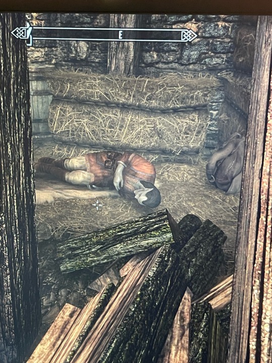

Look at him....
Crying about brand-shei for some reason. I think he's one of the most interesting characters in skyrim and its evil that the best quest in the game locks him up for the rest of the game(start of thieves guild). He does NOT deserve this. Sobs. He's sleeping in the hay in the cellar of haelga's bunkhouse.... poor thang !!!
#he's the heir of house telvanni. born at the eruption of red mountain. and raised by the argonians who killed his family(they had it coming)#he sells stuff from morrowind so it seems like he was raised there and then came to skyrim#i need to talk to him for longer and we need to become best friends immediately.#oop he's waking up#okay he was raised in black marsh. maybe he went to morrowind to figure out where he's from and then to skyrim ? he's pretty old too#yeah based on the map of tamriel that makes the most sense. black marsh then north through morrowind then in riften#maybe he was planning to keep heading north.. maybe now that he has his answers he would settle down ? make contact with house telvanni ?#i wish i could find out#i fucked up if he was born at the eruption of red mountain he'd be reaaalllyyyy old.#okay now im confused. the journal says 'given to us the year vvardenfell#sprouted its fiery death across the land. isnt that the eruption of red mountain ? dude im so lost. unless it means like. 2000th anniversary#okay let me do more research. also it mentions house telvanni fell but its implied to be doing okay by neloth and#brelyna at the mage college ? so ?#clawing at the walls GIVE ME MORE LORE NOW#and also give my poor eeby deeby a home. or something...#RED MOUNTAIN ERUPTED TWICE#OKAY THAT MAKES SENSE NOW#brand shei is 196 years old 👍
4 notes
·
View notes
Text
Notes on a South Asian Tropical Cyrodiil (and more!)
So, many TES fans know that before Oblivion, Cyrodiil was supposed to be tropical. The most striking phrase to describe it, "most is endelss jungle", says it all. The quick and snarky explanation is that Todd Howard watched LOTR, was "inspired" by it, and that's why everything in Oblivion looks sort of like a Rennaisance Fair. In any case, I think it was a huge missed opportunity, especially in a world where most popular fantasy is European inspired, to have replaced what could have been very cool tropical enviroments with what is frankly a lame "Talos used his magic" lore retcon. You can read the 1st edition of the Pocket Guide to the Empire to see what we missed.
But it's not only Cyrodiil which we missed this way… Tamriel just makes more sense as a tropical continent. While the size and the exact location of the continent is discussed by nerdier nerds than me, I think it does make sense like this, and not only that, we have a very interesting world parallel to compare it to: India. From a tropical rainy south to the cold mountains of Skyrim, Tamriel is surprisingly similar to the Indian subcontinent, and many of its geographical quirks can be explained if, instead of assuming a temperate Cyrodiil, we go all out with that concept. This is going to be a long post, you have been warned.
So with that in mind, I'll try to make a not-so brief tour (with some evocative pictures along the way) of a rebuilt tropical Tamriel, following the rains of the moonson:
The position of Tamriel, in this case, would be roughly where the Indian subcontinent is located in real life, that is again, tropical, stretching the Tropic of Cancer (is there a name for the tropics of Nirn? Interesting to think about) Here, we see our numbers pan out well: Tamriel is mentioned to be between 4000 and 3000km across east to west and 2000 and 3000km south to north. VERY, VERY roughly, there is 4000km between Pakistan and Myanmar, and 3000km from Sri Lanka to the northern tip of Tibet. Plot that on a map, and you already can see some coincidences. Now, this is a rather average continent, not Pangea sized like some imagine Tamriel to be. This does help explain why, for example, the interior of Cyrodiil is rainy and good for agriculture instead of a desert. But it also means that it's very likely that Tamriel is ruled by monsoons. Monsoons are complex, but they basically form when there are plenty of warm places for water to evaporate (the South Indian ocean), and mountains that block cool winds from the opposite direction (the Himalayas). We have a very similar situation here, with a mountainous Skyrim on the north of a tropical Cyrodiil facing an equatorial southern ocean. So, what happens are monsoons, perhaps not as strong as IRL India, but carrying rains very deep into the continent. This would feed the rivers and the rich agricultural areas of Cyrodiil, and would have some other consequences.
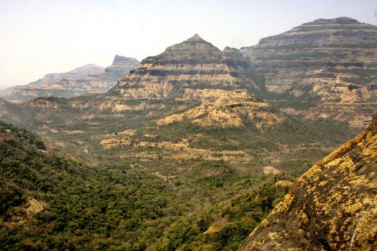
So let's imagine our trip South to North. In the South, in Black Marsh, Blackwood and Lleyawiin, and Pellentine (southern Elsweyr) we would find, much like in the original lore, humid tropical climates, jungle, wetlands, and my favorite, mangrooves. I would expect mangrooves to stretch in this whole area, across rivers. In fact, one of the reasons why Black Marsh could be so hard to explore and control by the Empires at Cyrodiil would be the presence of thick mangrooves all over its coast. This is the region of Cyrodiil that would most resemble "endless jungle".
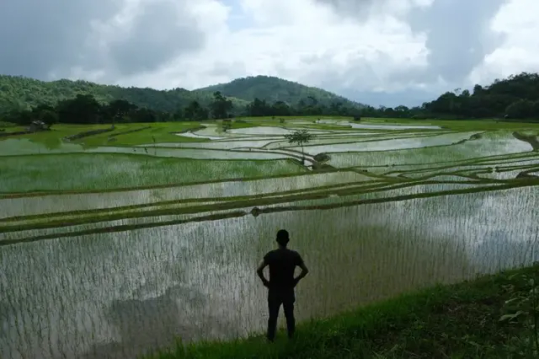
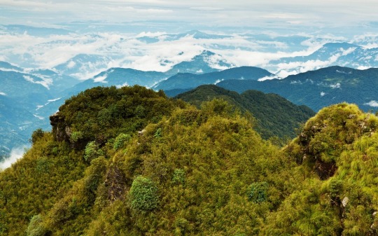
(Rice fields in India, what I imagine most of this Tropical Cyrodiil would look like)
However, as any lore person knows, Anequina, northern Elsweyr, is arid desert. Does this mean a contradiction? Far from it, we have a similar example in IRL India: the Deccan Plateau, which has a semi-arid to arid climate. This can be easily explained by higher elevations up to a small mountain chain separating it from Cyrodiil to the north, and the fact that little rain would reach behind this "Anequina Plateau" would make the region of Kvatch and Anvil more dry much like in canon, in this case, more scrublike. This highland desert would not be as harsh as Elsweyr is usually concieved, maybe, but its driest regions might justify places such as Dune. (On that matter, it always bothered me to read about the "cities" of southern Elsweyr and there being only two or three there. If I had to redesign it, I would move some from the north to the south).
(the Deccan Plateau in India, it gets greener or drier according to the monsoon)
Keeping on our tour of Tamriel, the Topal Bay and the very rainy Black Marsh funnels the rainy monsoon from the south towards central Cyrodiil. Here we find the endless jungle of the Nibenay Valley. But unlike the rainforests of Elsweyr and Black Marsh, these dense forests and rich river plains are mediated by the monsoon winds, with dry seasons alternating with copious rain. This has huge effects on agriculture and culture in general, as agriculture is defined by the rythms of the rain. Keeping with our South Asian theme and the 1st edition of the Guide to the Empire, Cyrodiil would have huge extensions of rice paddies, as well as terrace farming and much hardier crops in the highlands, instead of the… well, almost absent agriculture we saw in Oblivion. The food, clothing, architecture and overall culture of Cyrodiil would be very different with this. The original Pocket Guide said some of its main exports besides rice and fruit are moon sugar and silk. Moon sugar in Cyrodiil, can you believe it?
Another thing I imagine Cyrodiil would be famous for would be fish and seafood, well, river food. Rice plantations can host fishes and crustaceans to get some extra protein, and well, what about mudcrabs? Hell, as preparing muddy soil is vital for rice cultivation, no wonder mudcrabs are considered a nuisance. Imagining critters in gameplay in such an enviroment also makes my mind roam. Tigers, elephants, rhinoceros, and this is not even getting into the more mythical creatures you could find, instead of endless wolves… Rice cultivation is also more labor intensive than other crops, and it also has a deep impact on the terrain, "terraforming" so to say, huge expanses into paddies and terrace farms. This level of cultivation also requires an established infraestructure of irrigation. While this does not necessarily means a centralized goverment, as farmers can build it and maintain it by themselves, the rise of an empire, i.e., the Empire, will also increase the complexity of these systems, adding canals, dams, reservoirs and more ambitious projects, like we see in India and China. I am sure some people more knowledgeable about those cultures can comment more.
While this Cyrodiil is a tropical/subtropical region covered in "endless jungle", some parts might indeed resemble the rolling hills and grasslands you see in Oblivion. Deforesting jungle for pasture is something very common around the world (some have joked this mass deforestation was later in canon explained as a gift from Talos lol) and you can see the results, like in tropical Australia and my closer Mata Atlantica, do superficially resemble temperate pastures in say, Europe. Until you notice the palm trees, of course. But yes, I can see the Nords being a mostly herding people (more on that below) bringing their sheep and cows to the tropical lowlands and, well, deforesting to make space for them.
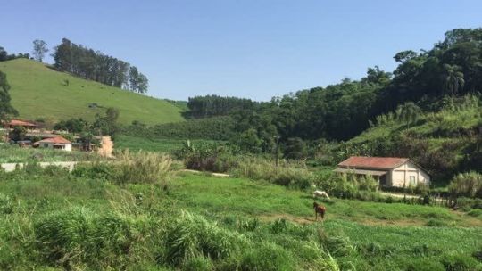
(ranches in Sao Paulo state, Brazil, notice the palm trees)
Imperial City just so happens to be built in an island in the middle of several river crossings, in what seems to be a swampland. The first thing that came to mind when I read that was Tenochtitlán. The districts of Imperial City would have been built over the centuries on artificial islands on a shallow lake, using plentiful mud and organic matter to make fertile chinampas. I believe this would make for a striking sight. Instead of just a city in the middle of a empty island, you would see the White-Gold tower and the rest of Imperial City rising from Lake Rumare, surrounded by rich farmland and its districts joined by walkways. (much like the old descriptions, actually, could you believe I wrote that without reading them?)
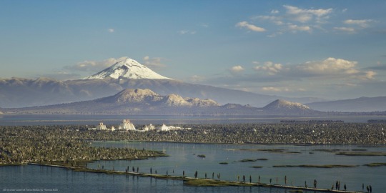
(Reconstruction of Tenochtitlán... and I just noticed, it's surrounded by (volcanic) mountains too, much like Imperial City)
Much like the Pantanal is one of the sources to the Paraguay River (which merges with the Paraná and then the Río de la Plata) IRL, here, the swamps of central Cyrodiil would be the source of the Niben. This does raise an interesting question, where is the source of the Niben? Is it Lake Rumare? No, I believe it would be several smaller rivers all the way from Bruma and even Skyrim. These small, violent mountain rivers eventually flow into the Rumare wetlands and only THEN in the placid great Niben. You DON'T want to be caught in one of the mountain valleys in rainy season. This does raise the question; won't the developments upriver, like Imperial City itself and the surrounding farmland, affect the course of the river downwards? There's plenty of water from the rain, but a more developed Cyrodiil might indeed have to grapple with this, supposing, for example, they manage to dam the river.
Looking west, we got the Colovian region, said to be composed of drier highlands and cliffs in the early Pocket Guide. Probably cut from the rain because of the Anequina Plateau, this is indeed more arid or "mediterranean", though I actually see it as more Australian. Maybe some of the drier parts near Hammerfell, resembling Argentine Cuyo and the northwest, would be a distant cry from the wetlands, having thorny dry forests and dry valleys, where yes, you could plant wine. The wetter cloud forests (much like the Yungas in South America, the place where the rain reaches last) could maybe be the home of the last pre-Imperial cultures of Cyrodiil. Fascinating places.
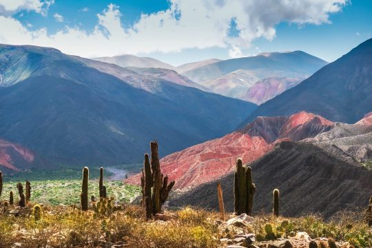
(Jujuy, Argentina. Just *near* are the Yungas cloud forests, where the last rains from the Atlantic meet the Andes, making for some AMAZING places)
Given that I mentioned enviroments near to/on the Andes IRL, let's talk about potatoes. Potatoes are unique crops, because they are the only ones who offer such calories and also be planted in cold enviroments like Europe. Or Skyrim. The discovery and spread of potatoes would cause demographic shifts on people living in cold areas. And they also originated in a unique enivorment IRL: the Andes, actually with possible hybridization from the Magallenic foresWHAT I MEAN, is that potatoes are very important and have been domesticated in very specific conditions. The Wroghtgarian Mountains would seem like a perfect equivalent of the Andes at the first glance, but they would be very different. The Andes, located between the Pacific Ocean and the greater Amazonian region, are very, very unique enviroments. These mountains, however, are in between inner seas. Something like the Atlas or the Alps? In any case, if there is some people who would appreciate hardy tubers that can grow in mountainous places, they are for sure the Orcs, or perhaps the Reachmen. Maybe an hybridization even between them?
This returns me back to Bruma and Skyrim. Some people (who make those excellent Oblivion mods) imagine Bruma with a Tibetan flavor. Personally, I imagine it more like Pakistan or Afghanistan, with lots of mesas and plateaus and valleys. It would look dry and rocky with some very fertile valleys by snowmelt, but it would look like a snowy wonderland on winter, indeed, Pakistan and Afghanistan are very snowy. Eventually, of course, ending up in the great barrier of the Jerall mountains and finally, Skyrim.
(the Alps? Skyrim? No, this is Kashmir on winter!)
In this scenario, Skyrim would be a quite dry place… or would it? There is no need for the Jeralls to be a straight line of peaks like the Himalayas. They could be a more "broken" series of mountains, like the southern Andes, but in any case, the rain from the south would clash into the higher mountains. Indeed, that is what actually happens in the Himalayas, the foothills of the Himalayas are some of the rainest places IN THE WORLD. These small valleys are something very unique and not very well known part of the world IRL. I can imagine the Skyrim equivalent would be as unique too, hard to navigate and live in. The forests of the Rift and Falkreath would be mazes of windy forests valleys, each with their own unique secrets under a perpetual fog and drizzle. This is a very interesting enviroment to imagine, where again, some of the older cultures of Tamriel could still live.
(forests of Bhutan, note how the humid valleys stretch into the distance before the cold Himalayas begin)
However, what does Skyrim look like once you cross the border with Ralof? I imagine some sort of more fertile Tibet, not as high as the Tibetan plateau, allowing for forest and alpine tundra. This is mostly because, while Skyrim is high up, I don't imagine as a plateau, but rather a series of broken mountains like the North American Rockies, which makes sense when you account for all the volcanic activity (there is another super-volcano down in Skyrim but nobody notices). I imagine that Skyrim would be a primarily herding pastoral land before the introduction of hardier crops such as potatoes, and even then. Nord culture would be very interesting reimagined like this; hillforts guarding herds of sheep and cows. It would also create a clash between the very, very agrarian south and the nomadic herding north, with High Rock and Hammerfell a gradient between the two.
But here we enter a problem; if we are operating on a level where Cyrodiil is roughly at the same latitude of India, wouldn't that make Skyrim too far from the poles to allow its tundra like climate, even with elevation? No doubt. Tibet is only as cold as it is because it's the roof of the world and far from any ocean. The northernmost tip Skyrim, like Tibet, would be at the latitude of Turkey, Korea or California, which can get quite cold, but not to the level of what we see on Winterhold or Dawnstar (Solitude sounds familiar, though). What's more, having an ocean up north would only moderate the temperature. Cool currents often don't bring cold per-se, just decrease rainfall. This would end with a very temperate and pleasant Skyrim instead of tundra. Which is on its own, interesting to explore.
Could Nirn be going through an ice age, like it's implied with the dissapearance of Atmora? Possibly, but it would imply revising everything I said before, as ice ages decrease rainfall and mess up with weather patterns all over the world. A colder Nirn would explain a lot, though.
I decide I will stop here, I haven't even touched Valenwood (though its subtropical forest seems rather coherent to me), High Rock (the most boring part of Tamriel IMO), Hammerfell, Summerset Islands (if you don't have tropical elves in your setting, you're a coward), or whatever the hell is going on Morrowind. But I hope you enjoyed this worldbuilding exercise and how to make sense of Tamriel's crazy geography. Next time, I'll try to play with tectonics and see if we can make it even more interesting.
If you liked what you read and would like more worldbuilding, consider tipping me on Ko-Fi and send me stuff to talk about, or just send an ask! I'm the kind of guy who reads encyclopedias and RPG manuals for fun, so I have plenty to talk about about everything from fantasy to science fiction to speculative evolution and alternate history!
#worldbuilding#tes#elder scrolls#skyrim#oblivion#the 'do more tropical worldbuilding you eurocentric cowards' agenda#fantasy#cosas mias#biotipo worldbuilding
430 notes
·
View notes