#River Forest District 90
Text

Congressman Dr. Daniel K. Davis (September 6, 1941) is a politician who is the Representative from Illinois’s 7th congressional district, elected in 1996. The district serves much of western Chicago, including the Loop. It includes several of Chicago’s inner western suburbs, such as Bellwood, Oak Park, and River Forest. He is a Democrat, a member of the Congressional Black Caucus, and the Progressive Caucus, and one of three members of the Democratic Socialists of America serving in Congress. He was one of 31 US Representatives who voted against counting the electoral votes from Ohio in the 2004 presidential election.
He was born in Parkdale, Arkansas, and educated at Arkansas Agricultural, Mechanical, and Normal College; BA in history, Chicago State University, MS in guidance, and the Union Institute & University in Cincinnati, Ph.D. in public administration.
He worked as a government clerk, a high school teacher, executive director of the Greater Lawndale Conservation Commission, director of training at the Martin L. King Neighborhood Health Center, and executive director of the Westside Health Center before entering politics, where he represented Chicago’s 29th Ward on the Chicago City Council (1979-90).
He was elected to the Cook County Board of Commissioners, serving (1990-96) before entering the House.
He is married to Vera G. Davis. They have two children. He is a member of Alpha Phi Alpha Fraternity. He is notable for his support of the National Federation of the Blind #africanhistory365 #africanexcellence #alphaphialpha
2 notes
·
View notes
Text
the old neighbourhood
He remembered the old guard of the neighbourhood. Those houses around the wynd beyond the back garden; with Robin at the end, with this afro, and Andy on the opposite house with his soccer top and his dogs, and big six foot two Matty (even as a teenager) and Matty’s blonde sister who everybody fancied; and Sean around the corner with his coveted snooker table in his basement.
And beyond his basement was a little path which led down the valley, where there was a communal garden and a long patch of grass where they’d play football games and when they cheered the noises would rush over the fence and into the woods …
All those kids, who were all grown up now. And new folks lived in those houses; even the families had all moved away from the suburb; and the new folks are adults and have no kids themselves, and rarely seem to move from their abodes … one never sees them in their gardens, even; and only one of the houses keeps their downstairs light on after midnight.
He remembered that era – when the old guard were still here – of the 1990s; when VHS and CDs and videogame consoles were all in their prime era. Just before the internet took the planet over; when mobile phones, even, were fairly novel affairs and not everybody had one.
In those days the tarmac on the roads used to bubble in the summers. And it snowed far more in the winters, snow that would lie beyond a day or two. And the insects, also in warmer conditions, thronged the air so that if you kept your window open at night they would invade the air …
And down in the woods they made swings (Tarzans, they called them) with nylon rope; and learned the wicked brilliance of fire; and smoked stolen cigarettes or cheap fat bottles of cider, or, if a bit younger, loaded up on sugar and salt and pop from the newsagent up the road. All in the woods, where an outer world didn’t matter. They’d sit by the river bankside and lark about and explore puberty and how to crack jokes and navigate masculinity and vice versa if the girls were there.
Nowadays, no hog weed grows on the bankside. In those 90s days, these thick shoots of hogweed would rise above their heads – honestly – they were jungle like and their stalks were bristly and leaves these enormous green flaps, and you were scared to touch them because they’d sting your skin.
They don’t grow there anymore. And the river parts have changed; some of the beds have dried up, leaving the detritus from long ago (of joyride supermarket trolleys and sad footballs and the carcasses of bikes) left there in the brown sand.
And the Tarzan swings have long since been cut down. The blue nylon hoops are still there – little wisps of blue clung in a brittle manner to the boughs of the trees, the trunks of which aren’t climbed anymore.
And, sure, some kids do still play in the forest. They’re from other districts, though, of the city; different neighbourhoods, and none of them grew up here.
Making him the last one left of the old guard. With a bemused hush across the neighbourhood, as if those times had never existed; not like a ghost town, exactly, but, as if it would be hard to imagine all of those characters from the past if you never knew them and only had the present-day version to go on. It’s hard to explain.
5 notes
·
View notes
Text
Bat diversity and abundance are highest in old deciduous forest stands on the river banks in Eastern Ukraine
https://sciencespies.com/nature/bat-diversity-and-abundance-are-highest-in-old-deciduous-forest-stands-on-the-river-banks-in-eastern-ukraine/
Bat diversity and abundance are highest in old deciduous forest stands on the river banks in Eastern Ukraine
European forest-dwelling bats require complex woodland structures at both the micro-habitat and the landscape level for successful breeding in summer. Particularly, the results from Kharkiv region (Eastern Ukraine) demonstrate that large stands of mature forests older than 90 years improved the breeding activity of bats, their abundance and overall species richness. Abundance and species richness increased from upland plots surrounded by agricultural lands to riverine or waterside plots with high forest cover. These are the results of a newly published paper in the scientific journal “Forests” by an international team of authors from the Ukrainian Bat Rehabilitation Center (UBRC) and the Leibniz Institute for Zoo and Wildlife Research (Leibniz-IZW).
Mature deciduous forests are the most targeted forest type for logging because of the high potential revenues from selling timber on international markets. Biodiversity associated with these forest stands is therefore threatened worldwide. One group of species that is a key conservation target are bats. In their investigation the scientific team around first author Dr Anton Vlaschenko from UBRC and Dr Viktoriia Radchuk from Leibniz-IZW asked how bat diversity is affected by land cover types and the age of forest stands in the Kharkiv region in northeastern Ukraine, in an area on the border between forest-steppe and the steppe zone. The fragmented broadleaved forests typical for this region are common for temperate regions, but the relationships between bat diversity, land cover and forest structure remain largely understudied. Yet, understanding such relationships is of key importance for designing efficient conservation measures.
The results showed that logging intensity in the study region differed between districts and was not related to the amount of mature forests. This allowed the scientists to study how bat assemblages were influenced by the share of clear-cuts and mature forests in the landscape. “The most conspicuous result was a clear increase of bat diversity close to riverine habitats, further enhanced by the presence of mature forests with a mean age more than 90 years,” says co-author Dr Yehor Yatsiuk from the University of Tartu (Estonia). “Although old forests represent 22% of all forests in the Kharkiv region, the combination of mature oak forests and riverine habitats covers much smaller areas, considerably limiting areas suitable for bats.”
First author Anton Vlaschenko, Co-Head of UBRC, says: “The field data used in this study were collected over a long period, in more than ten years of summer field expeditions. It was a continuous effort and hard job. We camped in tents and spent hundreds of sleepless nights near mist-nets. Later on, we also had some challenges when analysing these data. We were close to wrapping up the manuscript at the end of 2021. The collaboration with Leibniz-IZW scientists and, after February 24, 2022, the three-months scholarship for me and our team members offered by Leibniz-IZW meant that we could finish this paper.”
“The first time I participated to the field research studying bats in 2009, as an undergraduate student. The data collected back then contributed to the current paper. Since then, bats have become my big passion and focus group for my current research. By investigating the ecological requirements of such enigmatic animals, we better understand ecological leverages of the natural world,” adds co-author Dr Kseniia Kravchenko from UBRC and Leibniz-IZW. Dr Yehor Yatsiuk continues: “My research is focused on associations between historical distribution of forests and management of animal species in eastern Ukraine. Over recent decades we observed an increase in clear-cutting intensity in this region. Our aim is to ensure protection of forest biodiversity here. Ten years ago, we initiated a series of projects aimed to survey the oldest and the largest forests here with the main focus on several groups of vulnerable species from land snails to birds of prey and bats.”
“Our study shows that old forests and riverine habitats are beneficial for breeding activity of bats, for abundance of single bat species and for the overall community composition. The fact that we see the same response to landscape structure across levels of ecological organisation underlines the importance of preserving mature oak stands and riverine habitats for conservation of bat diversity in the region. I enjoyed working with Kharkiv bat researchers a lot, their enthusiasm and group spirit inspired me,” adds senior author Dr Viktoriia Radchuk, scientist at the Leibniz-IZW Department of Ecological Dynamics.
Story Source:
Materials provided by Leibniz Institute for Zoo and Wildlife Research (IZW). Note: Content may be edited for style and length.
#Nature
2 notes
·
View notes
Text
Looking for a Cheerful Crew? Travel With Us on Your Kudremukh Trek!

Let’s Discuss
If you're craving a thrilling adventure packed with stunning views and a friendly atmosphere, the Kudremukh Peak Trek is exactly what you need. Located amidst the rolling Western Ghats, the trek to Kudremukh Peak is perfect for nature enthusiasts and adrenaline seekers alike. When you pair this incredible experience with a cheerful crew from Universal Adventures, you’re in for an unforgettable journey.
Let’s dive into what makes this trek so special, along with all the details you need to plan your trip.
Why is Kudremukh a Must-Do Trek?
The Kudremukh Peak, situated in the Chikmagalur district of Karnataka, is the third-highest peak in Karnataka and stands tall at 1,894 metres. Its name, which means “horse face,” is derived from the unique shape of the peak. The trek offers breathtaking landscapes, dense forests, sparkling rivers, and panoramic views, making it one of the most popular treks in the region.
Whether you’re looking to escape the hustle and bustle of city life or seeking a challenge that will leave you with a sense of accomplishment, Kudremukh trekking is ideal.
Base Camp Kudremukh: The Starting Point of Adventure
The journey to Kudremukh Peak begins at Base Camp Kudremukh, a serene and well-organised campsite located at the foothills of the mountains. Here, you’ll meet fellow trekkers and the Universal Adventures crew, who will guide you through every step of the way. The base camp offers basic amenities like tents, meals, and washrooms, ensuring you’re well-prepared for the exciting journey ahead.
One of the highlights of the base camp Kudremukh experience is the camaraderie you’ll build with your trekking group. Sharing stories, meals, and bonfire nights will set the tone for a cheerful and memorable trek!
The Kudremukh Trek Route: A Journey Through Nature's Best
As you begin your trek, you’ll be welcomed by the lush greenery of the Kudremukh National Park. The Kudremukh trek route takes you through dense forests, open grasslands, and picturesque valleys. Along the way, you’ll cross bubbling streams, pass stunning waterfalls, and get up close to the local flora and fauna, making it a nature lover’s paradise.
The trail is moderate in difficulty, making it suitable for both beginners and seasoned trekkers. The final stretch to Kudremukh Peak is the most challenging, but the panoramic views from the top are worth every step. The sight of the rolling hills and valleys from the summit will leave you awe-struck and make you feel on top of the world!
Kudremukh to Bangalore: An Easy Escape
The Kudremukh to Bangalore distance is around 330 kilometres, making it a perfect weekend escape for those living in the city. Universal Adventures offers a convenient Kudremukh trek package that includes travel from Bangalore, allowing you to relax and enjoy the ride without the hassle of planning.
The Kudremukh to Bangalore journey is approximately 7-8 hours by road, making it easy to leave the city on a Friday night and return by Sunday or Monday morning, depending on your package. It’s an ideal way to enjoy nature without needing to take extended time off from work or other commitments.
Kudremukh to Chikmagalur: A Trekker’s Delight
If you’re travelling from Chikmagalur, you’re in for a short yet scenic journey. The distance from Kudremukh to Chikmagalur is about 90 kilometres, and the drive itself is an adventure. Winding roads through the Western Ghats, lush coffee plantations, and misty hills make the journey just as delightful as the trek itself.
Once you arrive at the base camp Kudremukh, it’s time to gear up for the trek and connect with fellow adventurers. The cheerful crew at Universal Adventures will make sure you’re ready for an exciting and safe journey to the peak.
Best Kudremukh Trek Packages from Universal Adventures
Universal Adventures offers a variety of Kudremukh trek packages tailored to different preferences and schedules. Whether you’re travelling from the base camp Kudremukh or all the way from Bangalore, there’s a package that suits your needs.
Trek from Base
Duration: 1 Night & 2 Days
Price: ₹1,799 per person
This package is perfect for those already in the region, offering a quick but immersive trek experience.
Travel from Bangalore
Duration: 2 Nights & 3 Days
Price: ₹3,099 per person
If you’re coming from Bangalore, this package includes travel, meals, accommodation at the base camp, and the trek itself. It’s the ideal way to enjoy the Kudremukh trek without worrying about any logistics.
No matter which package you choose, you’re guaranteed a cheerful and well-organised trek with experienced guides who will ensure your safety and enjoyment along the way.
What Makes Universal Adventures the Best Choice?
Experienced Guides
With Universal Adventures, you’ll be guided by experienced trekkers who know the Kudremukh trek route inside out. Their knowledge of the terrain and the local ecosystem ensures that you’ll have a safe and enriching experience.
Cheerful Crew
The friendly and enthusiastic team at Universal Adventures is dedicated to making your trek as enjoyable as possible. Whether it’s providing helpful tips, sharing local stories, or organising fun activities at the base camp, the crew is always there to lift your spirits.
Well-Planned Itinerary
The Kudremukh trek package is designed to offer a hassle-free adventure. From travel arrangements to accommodation and meals, Universal Adventures takes care of everything so you can focus on enjoying the trek.
Affordable Prices
Starting at just ₹1,799 for the trek from the base camp, and ₹3,099 for the full package from Bangalore, the Kudremukh trek price is budget-friendly. This makes it accessible to all types of adventurers, from students to seasoned trekkers.
Whether you’re coming from Kudremukh to Chikmagalur or embarking on the journey from Bangalore, the Kudremukh trek is an adventure you won’t forget. With Universal Adventures, you’ll have the added bonus of travelling with a cheerful crew that will make your experience even more enjoyable.
So, are you ready to join a friendly group of trekkers and conquer Kudremukh Peak? Pack your bags and get ready for an adventure of a lifetime!
#base camp kudremukh#kudremukh to bangalore#kudremukh to chikmagalur#kudremukh trekking#kudremukh Peak
0 notes
Text
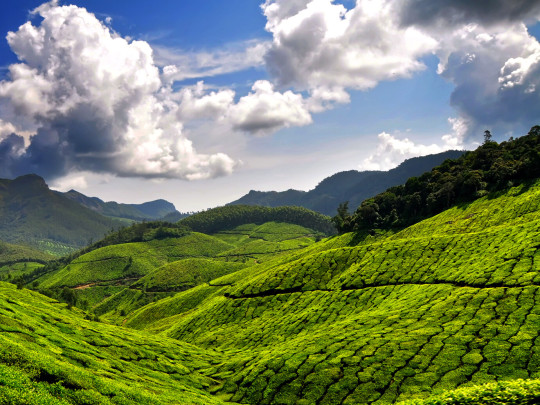
THE TOP BEST-LOCATIONS IN KERALA
MUNNAR
Munnar is a town in Kerala state, India, which is part of the Western Ghats mountain range.There are many of options to suit your budget, ranging from luxurious to reasonably priced lodging.Organising a trip with friends, family, or on your own? There is something for every type of tourist in Munnar.There is something for every type of tourist in Munnar. You can visit these two hill stations that are close to Munnar.Munnar offers a superb holiday experience with virgin woods, savannah, rolling hills, picturesque valleys, lots of streams, large splashy waterfalls, extensive tea estates, and winding walkways.Another reason to travel to Munnar is to see the unique plant known as Neelakurinji, which blooms just once every twelve years.
The BEST Tourist Places Near Munnar, Kerala
Situated roughly 90 miles distant from Munnar,
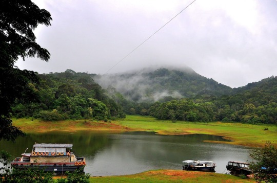
Thekkady is a hill station that is often overlooked.
The hill area is home to the Periyar National Park, one
of the biggest tiger sanctuaries in the country.
tiger reserves in the nation, is located in the hill station.
It's a fantastic location for all of you nature
lovers and adventure seekers.The herds of bison, deer, and wild elephants that visit Periyar to drink from the lake are its main draws. Jeep safaris, boats, and trekking are the three ways to get to the refuge. Natural spices including black pepper, cardamom, cinnamon, nutmeg, nutmace, ginger, and clove are thought to thrive in Thekkady.

Idukki is a hill resort with activities to suit all
types of visitors.The hill station is open all year
round,which is its best feature.Anamudi, one of
the highest peaks, is a popular place to hike.
Nestled amidst lush green woods, rare fauna,
picturesque valleys, and vast plantations, Idukki is one of Kerala's most picturesque hill stations. The area is incredibly serene and blessed with breathtaking natural beauty.

Another must-see hill station close to Munnar
Is Vagamon. Vagamon is highly worthwhile
Because it has a beautiful waterfall, breathtaking
peaks,and a national park.Popular activities in this
area include trekking and camping, and the
man-made forests can easily pass for real ones. This is where Thangal, Murugan, and Kurisumala are located. Kolahalamedu, the highest point in Vagamon, is home to enormous pine trees with branches coated in needles.

Peerumedu is a fantastic hill station
approximately 110 km from Munnar.
It is open for visits from April to June
and from September to November.
If you enjoy taking photos of the
landscape or yourself, this is the ideal
place to capture the greatest light on them. Drawing a lot of visitors with its rolling hills of tea, coffee, and spices, pine forests, grasslands, sparkling streams, and thundering waterfalls. Purchase premium tea, coffee, and spices directly from the plantations here.
DEVIKULAM
Devikulam is a fairly small hill station in the Keralan district of Idukki, around 5 km away from Munnar. Devi Lake is a pilgrimage site because it is thought to be the location where Goddess Sita took a bath. Aside from that, though, the waterfalls at Pallivasal and Thoovanam are also popular tourist destinations.Top sites for anyone interested in learning more about Hindu mythology and mysticism are Mangalam Devi Temple, Mariamman Temple, and Ayyanar Temple.
MALAMPUZHA
Down south, Malampuzha is well-known as one of Kerala's biggest dams. It was constructed after independence and is close to Palakkad. Malampuzha Gardens are a popular spot in the neighbourhood, so you should definitely snap a lot of photos there.The biggest weekend and vacation visitors to Palakkad are drawn to the garden complex at Malampuzha. At the location of a sizable irrigation dam constructed across the Bharathapuzha River is a well-known picnic area and popular tourist destination.
A lesser-known hill station close to
Munnar is called Nelliyampathy.
It is ideal if you wish to escape
Kerala's traditional tourist attractions
and located roughly 182 km from Munnar.
The finest place to go on vacation.Kesavan Para, a viewpoint overlooking surrounding tea plantations, is to the west. The 19th-century Pothundi Dam is located much further west. The Seetharkundu Viewpoint is located northeast and has adjacent waterfalls.
is where cardamom, tea, and coffee farms stretching across
acres of land are combined with a wildlife sanctuary.
KALARI KSHETRA
The cultural centre Kalari Kshetra is situated atChithirapuram, close to Munnar, Kerala, and is accessible by bus at a distance of 10 km. Keralan tradition has a temple called Kalari Kshethra. From 5:00 to 6:00 p.m., we have an old Kathakali show; from 6:00 to 7:00 p.m., there is another Kalrippayattu show, which is an ancient combat method that has influenced martial arts.Among the must-see locations in Munnar, it is one of the best venues to see Kerala's rich cultural legacy.To understand the essence of the old art forms, one can choose between courses, classes, and performances offered by the centre.
The Attukal Waterfalls, between Pallivasal
and Munnar, gushes over the hills to
display their tumbling power to everyone
in the vicinity. Known by another name,
Attukad Waterfalls, the froth created by the
force with which the waters roll over the
rocks turns them white. The constant erosion
that forms the rocks has left them relatively smooth.
MATTUPETTY DAM
Constructed in the mountains of Kerala, India,
Mattupetty Dam (also known as Madupetty Dam)
is a storage concrete gravity dam used for
hydroelectric power generation close to Munnar
in the Idukki District. For Idukki District,
it has been a crucial source of electricity and
significant money.The picturesque surroundings
and verdant valleys combine to create an enthralling
sight. The most exquisite feature of the dam is the
way the tea gardens mirror themselves into the river.
The district Tourism Promotion Council of Idukki (Munnar) organises water sports events, such as speed boating, so you may take advantage of the beautiful natural surroundings of this magnificent dam.
ALAPPUZHA
Kerala's maritime heritage has traditionally accorded significant importance to Alappuzha, sometimes known as the Venice of the East. Boat races, backwater vacations, beaches, marine items, and the coir industry have made it famous today. Picnics are often held at Alappuzha Beach. Standing over 137 years, this pier leads out to sea. An additional draw to the beach is the entertainment options available in Vijaya Beach Park. All tourists are fascinated by the neighbouring historic lighthouse.

ALEPPY BACKWATERS
While searching for the most popular backwater destinations in Kerala, Aleppy is one such destination that must not be missed in any ways! Located on the banks of the prismatic Vembanad lake, this gorgeous city is the ‘Mecca’ for the backwater vacationers on a Kerala trip!
Fringed with lush coconut groves, adorned with endless lagoons, and embraced by the charm of silent backwaters, Alleppey is a paradise for the visitors! Owing to the swaying beauty and enchanting charm of this city, it is also often called the ‘Venice of the East’, and is one of the most popular backwaters destinations in Kerala.
Whether leisure seekers, honeymooners, adventure seekers, or visitors from any walk of life, everyone can visit this wonderful destination and curate pleasant memories with their friends and families. And while visiting Alleppey, visitors should not miss out the houseboat cruises across the Vembanad Lake and enjoy the pristine beauty of the backwaters.
PUNNAMADA LAKE
Punnamada Lake (also called Punnamada Kayal) is a part of the Vembanad Lake, which is the biggest lake in Kerala. Vembanad Lake spans to a number of districts in Kerala. Hence, it is called by different names at different parts of Kerala. When the lake reaches Kuttanad, it is called Punnamada Lake or Punnamada Kayal. The Port of Kochi is located around two islands the Willingdon Island and Vallarpadam which lie in this lake. The lake is called Kochi Lake in this part of Kerala. The famous Annual Nehru Trophy Race of Kerala is also conducted on parts of Punnamada Lake. The Kochi Lake is a portion of the Vembanad Lake, which is located in and around the Kochi Mainland.
Revi Karunakaran Memorial Museum
Mr. Revi Karunakaran will always be cherished for his enthusiasm and the significant contribution he made to the development of Kerala's coir sector. A man with a keen eye and a passion for many different kinds of art is demonstrated by the museum erected to display his collection of works. One of Alappuzha's main attractions is the museum. The collections of crystal and ivory are among of the biggest of their kind. In addition to a 200 square foot mural painted entirely with vegetable dyes, the catalogue features a dazzling assortment of Tanjore paintings. Its distinctive 'Kerala Room' contains approximately 3800 artefacts that illustrate the development and progress of our culture.It is a place that exudes a passion for art and everything that is noteworthy in contemporary culture.
ALAPPUZHA BEACH
Kerala, India's Alappuzha Beach is a popular tourist destination located in the town of Alappuzha.A 150-year-old pier that stretches out into the water is located on the beach.Annually, Alappuzha Beach hosts a number of events, including the Sand Art Festival and the Alappuzha Beach Festival.
CONCLUSION
The hill stations of southern India are well-known, and Kerala is referred to as God's Own Country for very specific reasons. Whatever your taste in culture, cuisine, backwaters, or lush nature, Kerala has it all.
CLICK HERE TO KNOW MORE: http://travelthreads.byethost22.com/
0 notes
Text
Occurrence of Pipistrellus tenuis in Goalpara, Assam, India

Abstract
A recent survey identified a colony of Pipistrellus tenuis (n = 5) in Kanyakuchi Pahar village (26°00’32.8″N 90°53’29.0″E), a rural remote site situated at Goalpara district of Assam. This species, commonly known as the Least Pipistrelle, was previously reported by Hinton and Lindsay (1926), Sinha (1999), Ghosh (2008), Saikia et al. (2011) and Boro et al. (2018) from different parts of Assam. The Goalpara district of western Assam is encircled by the foothills of Meghalaya to the South and the Brahmaputra River to the North possesses a variety of flora and fauna due to the dense foliage of the high forest canopy. The climatic condition of the region along with its topography favours roosting of bat population. The distribution of the bat species P. tenuis in the surveyed area has not been previously recorded. For the purpose of taxonomic identification, morphometric parameters (external and cranio-dental measurements) were compared to standard literature by Bates and Harrison (1997). Captured bat specimens (n=3) were examined at the ZSI (Zoological Survey of India), NERC-Shillong, Meghalaya. The recorded mean body weight of captured specimens was 2.61g ± 0.160 (S.D) and the mean forearm length (FA) was 27.39mm ± 0.165 (S.D). This manuscript validates sightings of this bat species at the study location, compares its morphometric and cranio-dental traits to standard literature (Bates and Harrison, 1997) for identification, discusses its distribution as well as its ecological importance.

Introduction
Bats are the only mammals that can fly for long periods of time, making them the second-largest order of mammals with over 1,400 different species. The two suborders of bats, Microchiroptera (echolocating bats) and Megachiroptera (Old World bats) make up the taxonomic group Chiroptera. 127 species of bats from India were listed by Talmale and Saikia (2018) and were categorised into 41 genera and 9 families. About 39 different bat species, divided into 16 genera, are found in Assam, including 34 Microchiropteran species and 5 Megachiropteran species (fruit bats) (Ali, 2022). The Himalaya and Indo-Burma Biodiversity Hotspot, which includes Northeast India, contains 74 species of the 127 species of bats that are known to exist in India (Saikia, 2019). There are nine families in the order Chiroptera that are represented in India: Pteropodidae, Megadermatidae, Hipposideridae, Rhinolophidae, Emballonuridae, Rhinopomatidae, Molossidae, Vespertilionidae, and Miniopteridae.
With 62 species, the family Vespertilionidae (commonly known as evening bats) is the most diverse and numerous family of bats found in India (Saikia 2019; Ali, 2022). The tiniest pipistrelle found in the Indian subcontinent belongs to the Vespertilionidae family and is known as the least pipistrelle (Figs. 2 and 3). The genus Pipistrellus has 51 species worldwide, including 12 species being found on the Indian subcontinent (Koopman, 1993). It's prevalent over the majority of Southeast Asia, Southeast China, and South Asia (Simmons, 2005). This species is found in Pakistan, Bangladesh, Afghanistan, India, Nepal, and Sri Lanka (Molur et al., 2002; Das, 2003; Vanitharanie, 2006; Korad, 2007). This bat occasionally shares a roost with Indian Pipistrelles, but they don't interact with one another. They frequently form colonies of 1 to 25 individuals and are present in both woodlands and populated places and often prefer living in close proximity to human population. They build their nests in trees, leaf canopies, the ceilings or walls of buildings, and abandoned homes (Francis et al., 2010). Seasonal variations in the species' diet are evident.
It consumes a variety of insects and beetles during the monsoon and summer, and termites, cockroaches, wingless ants, and moths during the winter (Hamidullah et al., 2019).
P. tenuis are categorised as insectivorous bats in terms of preferred diet and feeding habits. A typical pipistrelle bat can often consume one-third of its body weight in insects per night, significantly lowering the number of insects. They devour a lot of insects at night, which costs the US $3.7 billion in pest control every year. It has been shown, according to the Smithsonian Tropical Research Institute and the University of Michigan that places with insectivorous bat populations greatly reduce the amount of insects and plant damage (Kalka et al., 2008). Recent study on the reproductive activity of the P. tenuis species indicate that there are two peaks between the months of July and August, and one between February and March. The greatest abundance of prey occurred during each of these times. In China and India, pregnant and nursing females have been spotted at all times of the year, proving that reproduction is possible all year long (Wilson and Mittermeier, 2019). Due to their nocturnal lifestyle and ecological diversity, bats are a fascinating group of animals as well as a difficult species to research.
A number of researchers from the Zoological Survey of India and other institutions have made significant contributions to the study of Indian bat taxonomy and geographic distribution in the post-independence era. Some of the most important revisions of the geographical range and taxonomy of Indian bats include Brosset (1962abc, 1963); Hill and Corbett (1992); Bhat and Kock (1994); Sinha (1970, 1973, 1999); Bates & Harrison (1997); Pradhan (2008); Das (2003); Csorba et al. (2003); Ramarkishna et al. (2003); Ghosh (2005, 2008); Srinivasulu (2001, 2006); Alfred, (2006). A monograph by Bates & Harrison (1997) listed 28 species of bats from Assam. Recently, there are only a few significant works on the study of different species of bats in the state of Assam by Sinha (1999), Ghosh (2008) and Boro et al. (2013; 2015; 2018), Ali (2010; 2022), Rahman and Choudhury (2017), Saikia et al. (2011; 2018; 2019; 2021).
Furthermore, little is known about the distribution and taxonomic status of bats, notably microchiroptera, in the Assam region. This article aims to investigate the distribution and current status of the Pipistrellus genus in Assam's Goalpara district. This paper on Pipistrellus tenuis occurence is the first at the study site (Fig. 1) and is based on measurements of morphometric features in comparison to current standard literature (Bates and Harrison, 1997).
Source : Occurrence of Pipistrellus tenuis in Goalpara, Assam, India | InformativeBD
1 note
·
View note
Text
Climate of Maryland
Maryland, a constituent state of the United States of America, holds a unique position at the heart of the Eastern Seaboard, nestled within the vast commercial and populous corridor stretching from Maine to Virginia. Despite its modest size, Maryland boasts an array of diverse landscapes, each fostering distinct ways of life. From the water-centric Eastern Shore and Chesapeake Bay region to the bustling metropolis of Baltimore, its largest city, to the wooded Appalachian foothills and mountains in the west, Maryland offers a rich tapestry of environments.
See Weather Forecast for Maryland today: https://weatherusa.app/maryland
See more: https://edition.cnn.com/2024/05/03/weather/texas-houston-flooding-tornadoes/index.html
Named in honour of Henrietta Maria, the wife of King Charles I, Maryland was granted a charter for its land in 1632 by a grateful Cecilius (Cecil) Calvert, 2nd Baron Baltimore. The state capital, Annapolis, is situated on Chesapeake Bay, equidistant from Baltimore to the north and Washington, D.C. to the west.
Geographically, Maryland has played a pivotal role in U.S. history, serving as a bridge between the North and the South. Its northern border with Pennsylvania is demarcated by the famous Mason and Dixon Line, established in the 1760s to settle disputes between the Penn and Calvert families and traditionally viewed as the dividing line between the two regions. To the south, much of Maryland's boundary with Virginia is delineated by the Potomac River, a symbolic barrier during the American Civil War. On the northern bank of the Potomac sits the District of Columbia, coterminous with the city of Washington, D.C., a small enclave ceded by Maryland in 1791 as the site for the national capital. To the east, the Eastern Shore shares the Delmarva Peninsula with Delaware to the north and Virginia to the south. In the rugged west lies Maryland's panhandle, connected to the rest of the state by a narrow strip of land and intertwining with the eastern panhandle of West Virginia. See more: https://weatherusa.app/zip-code/weather-20907
https://weatherusa.app/zip-code/weather-20884
https://weatherusa.app/zip-code/weather-20862
https://weatherusa.app/zip-code/weather-20850
Covering an area of 12,406 square miles (32,131 square km), Maryland had a population of 6,177,224 in 2020, with an estimated population of 6,180,253 in 2023.

Maryland's geographical landscape is characterized by diverse regions, each with its own distinct features. The Coastal Plain dominates roughly half of the state's land area, gradually giving way to the Piedmont Plateau at a fall line extending from the northern tip of the District of Columbia through Baltimore and into the northeastern corner of the state. In the west, the Catoctin ridgeline serves as the gateway to the Appalachians.
See more: https://weatherusa.app/zip-code/weather-20770
https://weatherusa.app/zip-code/weather-20769
https://weatherusa.app/zip-code/weather-20759
To the east of Chesapeake Bay lies the Eastern Shore, a flat region with expansive wetlands and a maximum elevation of 100 feet (30 meters) above sea level. On the Western Shore, west of the Chesapeake, the terrain is generally flat, with some low hills rising to heights of 300 to 400 feet (90 to 120 meters). While most of the Coastal Plain is dedicated to farmland and dotted with small rural communities, urban areas such as Baltimore, Washington, D.C., Salisbury, and Ocean City stand out.
Maryland's portion of the Appalachian Mountains consists of a series of forested barriers, with many valleys remaining undeveloped. Backbone Mountain, near the West Virginia border, claims the title of Maryland's highest point, reaching 3,360 feet (1,024 meters) above sea level.
Maryland exhibits two distinct climate types. The western highlands experience a continental climate, characterized by temperature extremes ranging from as low as −40 °F (−40 °C) to over 100 °F (38 °C). Average temperatures in western Maryland hover around 65 °F (18 °C) in July and 28 °F (−2 °C) in January. See more: https://weatherusa.app/zip-code/weather-20754
https://weatherusa.app/zip-code/weather-20682
https://weatherusa.app/zip-code/weather-20689
On the eastern side, Maryland's climate is strongly influenced by its proximity to Chesapeake Bay and the Atlantic Ocean, resulting in a humid subtropical climate. While these water bodies moderate the weather, ice formation occurs almost every winter on the bay's northern tributaries. Summer calm periods can lead to high temperatures reaching up to 107 °F (42 °C), accompanied by nearly 100 percent relative humidity. Average temperatures in eastern Maryland are approximately 75 °F (24 °C) in July and 35 °F (2 °C) in January.
Precipitation levels are typically sufficient to cause reservoirs to overflow and provide an ample supply of soft water for municipal use in cities like Baltimore and Washington, D.C. Storm systems predominantly approach from the west and south, although in late summer, the fringes of passing hurricanes often bring heavy rainfall to Maryland from the east.
0 notes
Text
Bambous Budget Guest House Accommodation Mauritius, Geography, Tourist Attractions, Bookstore, Map of Mauritius
Welcome to the Bambous Budget Guest House Mauritius.
We are located about half-way in-between Albion and Flic En Flac and Winners Supermarket is only a short walk to fill your holiday sandwich.
Home - cooked meals are available on request at little extra cost.
Double bedroom self catering or catered accommodation.
Ideal if you are on a tight budget.
You will have your own private bedroom with shared lounge, kitchen, bathroom facilities.
Bambous
The small town of Bambous in the Black River district of Mauritius [Population 13047] is situated in West Mauritius a few miles inland from the coast along the main A3 road from Port Louis to Tamarin in an agricultural area against a beautiful background of mountains and La Ferme Reservoir.
It offers a small range of shops, banks and economic activity, public and welfare services, for example primary and secondary schools, as well as institutions for vocational or technical training and manufacturing units.
"On A3 south of Bambous the Casela Nature Park is within walking distance of Bambous and Flic En Flac and is well-served by public transport.
The 14-hectare park is on the main road 1km east of the turn to Flic en Flac. It is beautifully landscaped and has sweeping views over the coastal plain.
The park houses some 1500 birds, representing species from around the world (some in rather small cages) including rare pink pigeons.
There are also tigers, zebras, monkeys and deer living in a semi-reserve and giant tortoises, one of which is 180 years old.
Children are well catered for with a petting zoo, playground and mini golf.
Casela also offers 'safaris' by jeep, mountain bike or on foot around the nearby 45-sq-km Yemen Reserve, where deer, wild pigs, fruit bats and monkeys can be seen in their natural habitat; prices vary according to the different packages.
Quad biking and rock climbing are also on offer.
The park has a pleasant lunch-time restaurant serving drinks, snacks and more substantial meals to visitors offering fantastic views of the south western coast.
Phone: +230 452 0693 Opening hours: 9am to 5pm daily." Source: Lonely Planet Guide
Tourist Attractions nearest to Bambous
Dolphin Watch
Their innate connection to humans has made dolphins one of the most fascinating sea creatures. Most often seen in the West of Mauritius and in groups of four or five, the dolphins are more than happy to perform their ballet in the water, as they ride alongside the boat!
The Casela Leisure and Nature Park
a beautiful garden and bird sanctuary of some 25 acres, is situated in the west part of the island Mauritius near the small village Flic en Flac.
Almost 2500 birds of 140 different species are housed in some 90 aviaries.
For example the Mauritian Pink Pigeon, one of the rarest birds in the world, can be seen here.
Casela also houses other animals such as tigers, monkeys, lemurs, deer and giant tortoises, etc.
Its natural setting, spacious layout and luxuriant vegetation also makes it a popular spot.
Situated in the Rivière Noire district, the bird park stretches over 25 hectares and contains more than 140 bird species from all five continents. Other attractions include fish ponds, tigers, tortoises, monkeys, deer and orchids.
The Black River Gorges is a 6,574 hectare park proclaimed natural reserve in 1994.
It protects much of the remaining indigenous forests of Mauritius and provides an excellent opportunity to visitors to enjoy a wonderful hiking with spectacular scenery and also an occasion to appreciate some of the unique endemic plants and birdlife of Mauritius.
The gorges have immensely contributed to the regeneration of some endangered endemic bird species like the Mauritian Kestrel and the Pink Pigeon.
Bird species like the Mauritius parakeet, Mauritius cuckoo-shrike, Mauritius bulbul, Mauritius olive white-eye, Mauritius grey white-eye and Mauritius fody can be found there.
The National Park is easily accessible from Vacoas or Curepipe via La Marie and Mare aux Vacoas.
A visitor information centre has been set up at Le Pétrin to welcome and direct visitors and also to provide picnic facilities.
A boardwalk leads to the typical dwarf forest of the region and a fenced conservation management area (from which invasive non-native plants have been removed) protects a sample of the remaining heathland. From there, various hiking tracks are offered and visitors can choose to walk to Maccabée forest (7km return) or down through the Gorges to Black River (15km) from the road across Plaine Champagne towards Chamarel where there is easy access to viewpoints at Alexandra Falls, over Bel Ombre and over the spectacular Black River Gorges.
There are also a number of longer walking trails including one to the island's highest point, Black River Peak ( 828m).
Road access into the Black River Gorges from the coast road has been upgraded and offers a Visitor Centre as well as a camping area.
The forest-clad slopes of the gorges and the Maccabé Forest nearby contain some interesting specimens of indigenous timber, namely the Bois de Natte, Colophane, Ebony, Tatamaka or Tambalacoque, as well as fine plants peculiar to the island such as the Trochetia, the national flower of Mauritius. Source: Black River District Council
#accommodation#Bambous#budgetaccommodation#goodvalueformoney#MapofMauritius#Mauritius#selfcatering#touristattractions#travelandtourism
0 notes
Text
Top 10 Hill Stations in Maharashtra to Visit in Winter Season
Explore Maharashtra's top 10 winter hill stations, offering picturesque landscapes, exciting activities, and rich cultural experiences for an unforgettable getaway.

Maharashtra, a state known for its rich history, diverse culture, and bustling cities, is also home to some of the most picturesque hill stations in India. During the winter season, these hill stations in Maharashtra transform into enchanting wonderlands, with misty mornings, cool breezes, and breathtaking views that captivate the senses.
In this article, we will explore the top 10 hill stations in Maharashtra that you must visit during the winter season to experience their true charm and beauty.
1. Matheran – An Eco-Friendly Winter Wonderland

Matheran, a picturesque hill station nestled in the Sahyadri range of the Western Ghats, offers a serene retreat away from the bustling city life. With its pleasant climate and lush green surroundings, Matheran has become a popular destination for tourists seeking an eco-friendly escape. During the winter season, the town is adorned with misty mornings and cool, crisp air, making it the perfect time to explore this charming hill station in Maharashtra.
Elevation and Location of Matheran
Situated at an elevation of 800 meters above sea level
Located in the Raigad district of Maharashtra, approximately 90 km from Mumbai
Popular Attractions in Matheran
Panorama Point: A vantage point offering breathtaking panoramic views of the Western Ghats and the surrounding valleys
Charlotte Lake: A serene lake surrounded by lush greenery, serving as the primary water source for Matheran
Monkey Point: A popular viewpoint named for the playful monkeys often found in the area; offers stunning views of the valley below
Louisa Point: A magnificent viewpoint overlooking Prabal Fort and Vishalgad, offering picturesque sunsets
Echo Point: A viewpoint known for the natural echo phenomenon created by the surrounding hills
Activities to Do in Matheran
Trekking: Matheran offers numerous trekking trails that pass through dense forests, waterfalls, and scenic viewpoints
Horse Riding: Experience Matheran’s beauty on horseback, with guided rides available for tourists
Nature Walks: Stroll through the lush greenery and discover Matheran’s diverse flora and fauna
Toy Train Ride: Take a ride on the iconic Matheran Hill Railway, a narrow-gauge heritage railway offering a scenic journey through the Western Ghats
Shopping: Browse the local market for handicrafts, leather products, and the famous Matheran honey
2. Lonavala – A Picturesque Retreat Amidst Rolling Hills

Lonavala is a popular hill station in Maharashtra, known for its scenic beauty, lush green landscapes, and pleasant climate. The winter season adds a touch of magic to Lonavala, as the misty mornings and cool temperatures provide the perfect setting for a rejuvenating getaway. The hill station is also famous for its chikki, a traditional Indian sweet, which adds a taste of local culture to your visit.
Elevation and Location of Lonavala
Located at an elevation of 625 meters above sea level
Situated in the Pune district of Maharashtra, approximately 90 km from Mumbai and 70 km from Pune
Popular Attractions in Lonavala
Tiger’s Leap: A dramatic cliff that resembles a leaping tiger, offering spectacular views of the valley below
Bhushi Dam: A masonry dam on the Indrayani River, popular for its scenic surroundings and waterfalls during monsoon
Karla Caves: A complex of ancient rock-cut Buddhist caves dating back to the 2nd century BC
Lohagad Fort: A historic hill fort, offering panoramic views of the surrounding landscape and a glimpse into the region’s rich past
Lion’s Point: A viewpoint known for its stunning views of the valleys, especially during sunrise and sunset
Activities to Do in Lonavala
Trekking: Explore the numerous trekking trails around Lonavala, including the trails to Lohagad Fort, Rajmachi Fort, and Visapur Fort
Camping: Experience the beauty of Lonavala’s outdoors by camping at sites like Pawna Lake and Tungarli Lake
Exploring Ancient Caves: Discover the architectural marvels of the Karla Caves, Bhaja Caves, and Bedsa Caves
Picnicking: Enjoy a leisurely picnic at popular spots like Ryewood Park, Lonavala Lake, and Bhushi Dam
Shopping: Indulge in the local sweet treat, chikki, and other souvenirs at Lonavala’s bustling markets
3. Khandala – A Tranquil Escape in the Western Ghats

Khandala, a quaint hill station in Maharashtra, boasts picturesque landscapes and a pleasant climate that attracts tourists year-round. During the winter season, Khandala’s beauty is enhanced by the cool air and misty environment, making it an ideal destination for a relaxing vacation. Located in close proximity to Lonavala, Khandala offers a range of attractions and activities that cater to nature enthusiasts and history buffs alike.
Elevation and Location of Khandala
Situated at an elevation of 550 meters above sea level
Located in the Pune district of Maharashtra, approximately 93 km from Mumbai and 72 km from Pune
Popular Attractions in Khandala
Duke’s Nose: A cliff named after the Duke of Wellington, offering panoramic views of the surrounding valleys and hills
Rajmachi Fort: A historic fort with two twin structures, Shrivardhan and Manaranjan, offering a glimpse into the region’s past
Kune Waterfalls: A three-tiered waterfall, cascading from a height of 200 meters, located amidst lush green surroundings
Activities to Do in Khandala
Trekking: Embark on treks to nearby forts like Rajmachi, Lohagad, and Visapur, or explore scenic trails like the Duke’s Nose trek
Photography: Capture the beauty of Khandala’s landscapes, waterfalls, and historic sites through your lens
Sightseeing: Discover the charm of Khandala by visiting popular attractions like Amrutanjan Point, Bhushi Dam, and Tiger’s Leap
Picnicking: Enjoy a picnic with family and friends at scenic spots like Ryewood Park, Khandala Lake, and Kune Waterfalls
Shopping: Visit the local markets in Khandala and Lonavala to buy chikki, jams, and other souvenirs
4. Mahabaleshwar – A Scenic Paradise in the Western Ghats

Mahabaleshwar, a popular hill station in Maharashtra, is renowned for its scenic beauty, lush forests, and pleasant weather. During the winter season, Mahabaleshwar’s charm is elevated as the misty mornings and cool temperatures create an idyllic atmosphere for tourists. The hill station is also famous for its strawberry farms, which add a touch of sweetness to your visit.
Elevation and Location of Mahabaleshwar
Situated at an elevation of 1,372 meters above sea level
Located in the Satara district of Maharashtra, approximately 120 km from Pune and 260 km from Mumbai
Popular Attractions in Mahabaleshwar
Venna Lake: A tranquil lake, surrounded by lush greenery, perfect for boating and picnicking
Pratapgad Fort: A historic fort, offering a glimpse into the region’s past and panoramic views of the surrounding landscape
Arthur’s Seat: A popular viewpoint, known as the “Queen of Points,” offering breathtaking views of the valleys and hills
Activities to Do in Mahabaleshwar
Boating: Enjoy a leisurely boat ride on Venna Lake, surrounded by picturesque scenery
Horse Riding: Explore the beauty of Mahabaleshwar on horseback, with guided rides available for tourists
Visiting Strawberry Farms: Taste the delicious strawberries and indulge in strawberry-based products at local farms
Trekking: Venture on treks to nearby forts like Pratapgad and forts in the surrounding region
Sightseeing: Discover the charm of Mahabaleshwar by visiting popular attractions like Elephant’s Head Point, Lingmala Waterfall, and Wilson Point
5. Panchgani – A Serene Hill Station with Panoramic Vistas

Panchgani, a picturesque hill station in Maharashtra, is renowned for its fresh air, scenic beauty, and pleasant climate. During the winter season, Panchgani’s charm is enhanced by the cool air and misty environment, making it an ideal destination for a relaxing vacation. The hill station offers a range of attractions and activities that cater to nature enthusiasts and adventure seekers alike.
Elevation and Location of Panchgani
Situated at an elevation of 1,334 meters above sea level
Located in the Satara district of Maharashtra, approximately 104 km from Pune and 245 km from Mumbai
Popular Attractions in Panchgani
Table Land: A flat plateau, the second longest mountain plateau in Asia, offering stunning views of the surrounding landscape
Sydney Point: A scenic viewpoint overlooking the Krishna Valley, Dhom Dam, and the Kamalgad Fort
Mapro Garden: A popular tourist spot featuring a chocolate factory, a restaurant, and lush green surroundings
Activities to Do in Panchgani
Paragliding: Experience the thrill of paragliding and witness the breathtaking views of Panchgani from the sky
Trekking: Explore the numerous trekking trails around Panchgani, including the trails to nearby forts and scenic viewpoints
Nature Walks: Stroll through the lush greenery, strawberry farms, and discover Panchgani’s diverse flora and fauna
Sightseeing: Discover the charm of Panchgani by visiting popular attractions like Parsi Point, Devil’s Kitchen, and Dhom Dam
Shopping: Browse the local markets for handicrafts, jams, and the famous Panchgani honey
0 notes
Text
Day 93 - to PAARC Rives de l'Aa, Gravelines
It was a good stopover at Bertrix, but not far down the road, as I discovered this morning, was Han-sur-Lesse which looked better.. for next time. It has a really good aire by the river, hiking and biking tracks around dumpling-type hills, lots of forest, a scenic river, and a cave system that attracts enthusiasts from far around.
That was where I went this morning, having put together an 8 kilometre circuit last night. The humid weather blew away with the wind during the night, and the day was fine, fresh and clear, at just 4C this morning.
Three hours driving got me to the Channel, and the aire that I usually use before the Tunnel, at Gravelines. I stocked up with Belgian beer for the next few weeks, and fuel, and settled for a lazy evening. We are on the 4 am train.
This is the The PAARC Rives de l'Aa, constructed only 10 years ago as a water sports centre. It features a purpose built rowing pool more than two kilometres Longlist as well as other associated pools for canoeing and kayaking. I was last here at the end of November on a wet and windy night when only a brief time outdoors was attractive, but tonight we were out for an hour or so.

There are quite a few other vans and motorhomes here, but there’s plenty of space, and it’s away from big roads, so relatively quiet.

So another course approaches its conclusion. I’ve a 4 am Eurotunnel crossing that gives me a chance of beating the rush-hour traffic around London, and almost around Birmingham as well.
Each time I’m away in the van I feel more rushed than the last, and need more time. I find the 90 day restriction due to entering a Schengen area, now that Britain is no longer a part of it, increasingly difficult to deal with.
A change in life is due. Looking back the chapters in my mocked-up memoir break into 5-7 year chunks; the Wirral years, the Gap years, the London years, the Lytham years, the New Zealand years, the Chile years, and most recently, the Lake District years.
Now it’s time for the next chapter.
I’ve given my month’s notice on the cottage in Bampton. It’s well situated, but I’ve seen plenty of those hills for now. The problem with the party house rental nextdoor is one me and the neighbours have battled with for 18 months now, and we are not winning. It is not one I want to go back to. Though this is only a very small part of my decision, it has given me the kick in the pants I needed to get moving.
On 22nd June Roja and I will head north, about as far north as is possible in Britain, to serve the rest of my 90 days, and to spend summer in the Shetland Islands. We will head back to Europe as soon as we can. I await a date for the bionic hip, that could be anytime from late this year, to way into next.
I’ve various cunning plans to overcome the Schengen restrictions.
The van will be home for the length of this project, or chapter, which I guess could be anytime from 2 to 5 years.
I will take my writing more seriously. The dog and I will be on a mission to find Europe’s wild places, especially in mountainous regions. We want to experience the climate, the culture, the environment, the history. In the cases where these areas are losing population we want to understand why.
I’m not sure what I’ll do with the blog yet, but it will continue, maybe not if the same form. More on that in the next few weeks, in the meantime I’ve a few tweaks to make to the van, some boxes to fill, and a few bits of administration to get to get through.
0 notes
Text
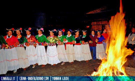
The Ahxia walking marriage of the Mosuo People, Lugu Lake, China
New Post has been published on https://china-underground.com/2017/05/07/ahxia-walking-marriage/
The Ahxia walking marriage of the Mosuo People, Lugu Lake, China
Lying in the mountains between Ninglang County of Yunnan Province and Yanyuan County of Sichuan Province, the Lugu Lake (泸沽湖) is 69 kilometers from the Ninglang county town.
The Mosuo People, who live on the Lugu Lake shores and belong to one branch of the Naxi People, still retain the matriarchal custom of “Ahxia walking marriage” (摩梭人的婚姻习俗), in which males and females are not bound to get married and keep a cohabitation relationship. For this reason, the Mosuo wedding tradition is considered to be the “living fossil” of the matriarchal society.
Lugu Lake map
Basic Information
Geographic location: Lugu Lake is located between Ninglang County in Yunnan and Yanyuan County of Sichuan. It is 72 kilometers away from Ninglang County.
Scenic status: a provincial level tourists resort
Tour time: 2 days
Travel Tips
Tourists can stay at the Luoshui village, as well as the Lige village at Lige Island. Compared with Luoshui village, Lige village is less commercialized but is more difficult to access.
Recommended Tour Route
Overview of Lugu Lake → a visit to Mosuo family (customs of Mosuo people) → go boating on the lake
Key Points
“The Females’ Kingdom”, “Lugu” means “falling into the water”, matriarchal society, “Axia” relationship, matriarchal-lineage, “living fossil of the matriarchal society”
In the sublime Xiaoliangshan Mountains of Yongning District of the Ninglang Yi Autonomous County inlaid a shimmering pearl —— Lugu Lake. It is the native place of “the Females’ Kingdom” composed of the Mosuo people, a branch of the Naxi nationality. In Mosuo language, “Lugu” means “falling into the water” (“hu” means lake in Chinese), hence the name of the lake.
Lugu Lake is located between Ninglang County in Yunnan and Yanyuan County of Sichuan. It is 72 kilometers away from Ninglang County. Its total area is 51.7 square kilometers, the space within the precincts of Yunnan being 27.6 square kilometers. It is 2,685 meters above sea level, counting from the surface of the water, and is, therefore, the lake with the highest altitude in the province. Its average depth of water is 40 meters, the greatest depth being 90 meters. Among Yunnan’s lakes, it stands only second to Fuxian Lake in terms of depth of water. The water of the lake is generally clean and green, with different shades of color: turquoise blue, sapphire blue, white-gray, simply beyond one’s imagination. On the lake are the “pig-trough boats” (“zhucaochuan”) specific to the place. Teeming in the lake are fine-scaled fish, carps, and other species. The lake waters flow eastwards to the Yalong River and finally into the surging Jinsha River.
Lugu Lake is surrounded by high and verdant mountains that are snowbound for over 3 months every year. Since the lake is rather deep, a definite regulating influence is exerted on the temperature of the lake shores. Therefore the surrounding mountains abound in forest resources that afford exquisite beauty, much fresh air, and charming scenery. At present, it is one of the places in China which is least damaged by human efforts and best preserved in its natural features.
Up to now, they still keep remnants of matriarchal society
The lakeshore is inhabited by Mosuo people who have peculiar customs. Up to now, they still keep remnants of a matriarchal society. Men and women are not united by wedlock, each living at the mother’s home respectively. Yet they keep a casual cohabitation relationship. Thus the place is called “A Quaint Realm of Matriarchy”. The male and female youth of the Mosuo people, having fostered mutual love in the long period of productive labor and social activities, begin to reciprocate “tokens”.
The male party, in accordance with his economic conditions, presents the female party with gold or silver ornaments, jade bracelets, beads and silk threads, etc. The “tokens” returned by the female party are generally some personal accessories that the other party likes. Given such affection on both sides, the seniors of the male party would bring some “loquat meat”, and some tea, sugar, or wine to pay a visit to those of the female party. Once an agreement is obtained from them, an Axia (spouse) relationship is established for the two. However, such a relationship can also be fixed without going through the above procedure.
After this, the two parties continue to live in their own homes. The male “Axia” labors for his home in the daytime, and goes to the female “Axia” at night for cohabiting with her in her bedroom. The family of the female “Axia” looks upon the male as one of its own members. During the busy farming season, the male “Axia” goes to the home of the other party to help with farm work. Those who have fixed their “Axia” relationship call each other “Azhu”, which means “dear companion”, but never husband or wife. Therefore, it is not appropriate to speak of “father”, who instead is only referred to as “maternal uncle”. The female is predominant and is, therefore, the leader of a family. All family members are descendants of the same matriarchal lineage.
Scholars have come to the conclusion that the Mosuo matriarchal culture has, to a certain extent, solved major problems troubling today’s modern society, such as social positions of both sexes, sexual harassment, deterioration of relationships, family feuds, the maltreatment and loneliness suffered by old people, and last but not least the harmony between mankind and nature. With the Mosuo’s goddess worship and the remnants of the matriarchal period, the Lugu Lake area is indeed one of the rare specimens of “the Female’s Kingdom” in the world and a “living fossil of the matriarchal society”.
Words and Expressions
the Females’ Kingdom 女儿国
the “pig-trough boats” 猪槽船
fine-scaled fish 细鳞鱼
to reciprocate “tokens” 交换信物
loquat meat 琵琶肉
“Axia” relationship 阿夏关系
“Azhu” means “dear companion” 阿注即“亲密的伴侣”
the remnants of the matriarchal period 母系社会遗风
“living fossil of the matriarchal society” 母系社会活化石
Images: Oliver Huang
#LuguLake, #MatriarchalSociety, #MosuoPeople, #Yunnan
2 notes
·
View notes
Text
Defend the National Butterfly Center (Again)
The National Butterfly Center in Mission, Texas, has already survived the Trump Administration via a lawsuit in 2017 (filed a motion for a temporary restraining order and a preliminary injunction against the U.S. Secretary of the Department of Homeland Security in the United States District Court for the District of Columbia)
Yet again, they face another threat: This time, Brian Kolfage and his private citizens’ campaign, We Build the Wall, Inc . (WBTW), along with Fisher Industries who intend to build a ���water wall” on the Rio Grande river banks.
“In early November, WBTW and Fisher arrived on a neighboring property in Mission, Texas, where they are building an unpermitted, freestanding border wall 3 miles long in the floodplain, in violation of international treaty. This project will obstruct and divert water flow in flood events to nearby properties and cause irreparable damage to the Rio Grande delta and the National Butterfly Center.”
On December 3, the North American Butterfly Association obtained a Temporary Restraining Order in state district court ordering the defendants to cease all construction activity; however, construction has continued in violation of this order.
The National Butterfly Center is a 100-acre, native plant botanical garden that anchors a 2,000-acre section of the Lower Rio Grande Valley Wildlife Conservation Corridor, a critical habitat preservation project at the biologically-diverse and vibrant, but threatened, crossroads of the United States and Mexico. This unique region encompasses no fewer than 11 different types of habitat, from tidal wetlands to riparian forest, brushland scrub to prairie savanna, and is home to more than 1,200 different species of plants, 500 species of birds, 200 vertebrate species, roughly 300 species of butterflies and over 90 species of dragonflies!
PLEASE: consider supporting them fight this project and continue their project of conserving flora and fauna!
#people continue to blow my mind wtf#these people go so hard already tho like#they really restrained homeland security i can't#please help them#signal boost#important#mutual aid#donations#butterflies#biodiversity#conservation#trump administration#resist#gofundme#cottagecore#cottageblr#cottage aesthetic
232 notes
·
View notes
Text
One of a kind Bandipur :
About the Bandipur Tiger Reserve:
Bandipur National Park located in Gundlupet taluk, Chamarajanagar district has the second highest Tiger population in India , with about 382 tigers currently present .
The Maharaja of Mysore Kingdom created a sanctuary of 90 km2 in 1931 and named it the Venugopala Wildlife Park, then The Bandipur Tiger Reserve was established under Project Tiger in 1973 by adding nearly 800 km2 to the Venugopala Wildlife park, later in 1986 became a part of Nilgiri Biosphere Reserve.
The highest point in the park is on a hill called Himavad Gopalaswamy Betta, where there is a Hindu temple at the summit.
The park is flanked by the Kabini river in the north and the Moyar river in the south.

My Experience :
Early Morning around 6:30 we left the silicon city - Bangalore, the journey from Bangalore to Bandipur takes around 5.5 hours . Reaching Bandipur at 12:00 ,we refreshed ourselves and then went to have a sumptuous meal. The food was fabulous , after lunch we got ready for the safari, the most awaited activity of the trip. My family and I were super excited ! The first part of the safari was dry , and soon the 2.5 hours safari was about to come to an end , but mystery always awaits, There was 10 minutes left so we decided to leave the park early but we saw few jeep standing below a tree , we were curious to know what they were photographing , so we went closer to figure out what they were photographing when my mom whispered with excitement “ Look an leopard on the tree !“. Hurriedly we took our camera as we never knew when the leopard would jump down the tree.The young leopard gave us some fearless looks. It was the first time in 5 years we saw a leopard on the tree . Soon the leopard jumped down and ran into the shrubs . With this our safari for the day came to an end and then we had snacks provided by the resort and time passed by fast as we were adoring our leopard photos and soon it was time for dinner and a good sleep as we had a safari early the next morning.

The next morning we woke up at 5:30 and got ready and had a hot cup of tea before the safari and sat in the jeep , the fog and mist which lasted for about an hour keep us away from seeing an big cats , soon the sun came out , but no luck, we just saw few birds , we photographed them and soon our safari was over . Then we went back to our resort - JLR , we had breakfast and then went to a temple located on top of the Himavad Gopalaswamy Betta , this hill is located so high that you can touch the clouds ! Soon it was time for lunch. We had a very delicious meal and then we were ready for the next safari into the wilderness.This safari was kind of interesting because as soon as we entered the forest we saw a Sloth bear , it was enjoying its free time sitting and rolling on the ground . Soon we went deeper into the forest and we heard constant and strong calls of langur and deer so we waited there for half an hour , and shortly it started to rain and the sun started to set ,as the sun was setting we were traveling back to the resort ; the sunset was so beautiful , it was the best part of the safari .

The next morning was our last safari , so we were kind of excited as well as sorrow.So the safari started and the sun rose early and it was the same script as the last two safaris. It was dry; we just photographed some birds again .And soon the safari came to an end but as we were going back to the resort we saw two sloth bears along with a herd of elephants on top of huge mountains. This trip was so thrilling !
This trip was so enjoyable from the leopard to the sunsets , I had so much fun ! Jungle Lodges is always my second home , and I always visit this place once a year and last but not least the staff of Bandipur are so caring and compassionate. With this memorable trip, we drove back to Bengaluru with so many stories to share !

- Sritha Kishan
Follow my instagram handle SrithaKishan
#bandipur#forest#safari#birds nature#birdsofindia#cute birds#leopard#bigcats#jungle#india#savenature#sunset#camera#nikon#canon#sony#tiger#elephant#animals#photographs#naturelover#resort#enjoy#travel#karnataka#srithakishan#wilderness#blog#blogger#tumblr
4 notes
·
View notes
Text
Beautiful forests around the world

Sagano Bamboo Forest, Kyoto, Japan. Shutterstock
Forests cover 31% of the Earth’s land surface, and there are three distinct types: tropical, temperate, and boreal (taiga). From the otherworldly Dragon’s Blood Forest in Yemen to Hawaii’s magical Rainbow Eucalyptus Forest, these vastly different woods showcase the world’s unique beauty in singular ways.

The Amazon Rainforest. Shutterstock
The Amazon is 1.4 billion acres of forests and reaches countries like Peru, Bolivia, Brazil, Venezuela, and Colombia. Within this dense forest, there are 4,100 miles of rivers. But the rainforest isn’t just a natural beauty, it’s also important to the health of the entire planet. According to World Wildlife, “The rain forests, which contain 90-140 billion metric tons of carbon, help stabilise local and global climate.”

Pa Phru Tha Pom Khlong Song Nam. NavinTar/Shutterstock
The name Tha Pom Khlong Song Nam means “two-water canal." This ecological centre is known for its magnificent mangrove trees as well as its shockingly blue water — a colour that occurs when seawater mingles with freshwater at certain points in the tide cycle.

Tsingy de Bemaraha Strict Nature Reserve. Dennis van de Water/Shutterstock
Tsingy, Madagascar’s "stone forest," offers one of the most unique landscapes in the world — rugged terrain characterised by karst formations, porous limestone that was carved over time by rainfall.

A UNESCO World Heritage site, Tsingy is also home to a number of rare and threatened animals, including 11 lemur species and several species endemic only to the reserve, such as the lowland red forest rat.

Dragon’s Blood Forest. Shutterstock

At first glance, you might mistake Yemen’s Dragon’s Blood Forest, located on the islands of the Socotra archipelago, which became separated from mainland Arabia 34 million years ago, for an extraterrestrial landscape. In fact, 37% of Socotra’s flora are not found anywhere else in the world.

Sagano Bamboo Forest. Shutterstock
In Kyoto’s Arashiyama district, you’ll find one of the most unique forests in the world: the Sagano Bamboo Forest.

As you can imagine, the grove is a tranquil site — so peaceful, in fact, that Japan’s environmental ministry included the forest on its list of "100 Soundscapes of Japan," a compendium of the country’s most significant natural, cultural, and industrial noises.

Monteverde Cloud Forest. Getty Images
In Costa Rica, you’ll find the Monteverde Cloud Forest. A cloud forest is a tropical forest with a high elevation that makes for a misty environment — it’s one of Earth’s rarest habitats.

This mesmerising, 26,000-acre forest is home to several thousand species of plants and animals, including 500 bird species alone. You might also spot monkeys, pumas, and Costa Rica’s famous red-eyed tree frog.

Moss in the Hoh Rainforest, part of Olympic National Forest. kan_khampanya/Shutterstock
Exceeding 600,000 acres, the Olympic National Forest — located on Washington State’s Olympic Peninsula — encompasses a variety of landscapes, from temperate rainforest to rugged mountains to coastal beaches.

One of four rainforests in the peninsula, the Hoh Rainforest — which gets between 12 and 14 feet of precipitation a year — is known for its gorgeous mossy terrain. You’ll also find moss hanging from the forest’s Sitka spruce and western hemlock trees (the latter is Washington’s state tree).

Otzarreta Forest. Shutterstock

Gorbeia Natural Park in Spain’s Basque Country is known for its ethereal forests, like Hayedo de Otzaretta ("hayedo” is Spanish for “beech tree”). The park takes its name from the titular peak that Basque mountaineers use as a reference point when they’re climbing the hills.

Taman Negara. Shutterstock

This forest is a whopping 130 million years old. Its 45-mile-high canopy walkway offers sweeping views of the forest. You can also trek through the trees on foot or observe the scenery aboard a river cruise.

Rainbow eucalyptus tree in Hawaii. Ilya Images/Shutterstock

Native to the Philippines, rainbow eucalyptus trees can be identified by their eye-catching bark that looks like it’s been painted. The tree’s inner bark layer revealed when the outer layer peels away, is a vibrant green that fades over time to produce a magical range of bright colours.

The Black Forest. Shutterstock

Germany's Black Forest is named for its impressively dense canopy of conifers. The forest itself may be dimly lit, but the broader Baden-Württemberg region, the birthplace of the cuckoo clock, is full of charming spa towns and resorts, such as Baden-Baden and Baiersbronn.

Sequoia National Park. welcomia/Shutterstock

The Sequoia National Forest is also known as the “land of the giants” because of its towering trees. At 103 feet wide and 275 feet tall, the General Sherman tree (named for Civil War general William Tecumseh Sherman) is a giant among giants. It has been alive for an estimated 2,200 years. The sixth-largest giant sequoia, with a diameter of 35 feet and a height of 269 feet, is the 2,000-year-old Boole tree, which was named for the Fresno doctor who spared its life during a logging operation.

Hallerbos Forest. Shutterstock

wp.com
Another fairytale-esque forest is the Hallerbos Forest in Belgium. Known as “the blue forest,” Hallerbos is one of the last remnants of the Silva Carbonaria (“charcoal forest”), an ancient forest whose beech and oak trees formed a natural boundary between the West Frankish kingdom of Clovis and the East Frankish kingdom of Sigebert the Lame well into the Early Middle Ages.

Crooked Forest. Shutterstock

One of the world's most mysterious forests is the Crooked Forest (Krzywy Las) in Poland, whose 400 pine trees have a 90-degree bend at their base. Theories for how the trees got their unusual shape vary. Some posit that gravitational changes in the region caused the bending, while others attribute the crookedness to heavy snow that flattened the trees over time. Another, less likely explanation is that their shape was altered by hand.

The Sundarbans. Shutterstock

The Sundarbans, a group of low-lying islands in the Bay of Bengal, are home to the world’s largest continuous mangrove forest, which spans 140,000 hectares (about 540 miles). As the site of three wildlife sanctuaries, the forest has been designated a UNESCO World Heritage Site.

Tijuca National Park. Shutterstock
Beneath the gaze of Rio de Janeiro’s iconic Christ the Redeemer statue — which towers over the city atop Corcovado Mountain — you’ll find Tijuca National Park, one of the largest urban rainforests on the planet. Between its 30 waterfalls and famous mountain peaks (including Pedra Bonita, Pedra da Gavea and Pico da Tijuca), there’s no shortage of incredible sights.

Surprisingly, for such a lush forest, Tijuca is actually manmade. The land was once part of the Atlantic Rainforest, but was cut down and redeveloped by industrialists. In the 19th century, trees were replanted to protect the city’s water supply.

The Great Trossachs Forest National Nature Reserve. Shutterstock
Scotland’s Great Trossachs Forest, situated along the bonnie banks of Loch Lomond, is a "forest in the making" — there’s a wide-scale conservation effort to preserve the trees of the ruggedly beautiful Trossachs glen.

Types of species native to the region include conifers, broadleaves, and Atlantic oakwoods.

The Great Bear Rainforest. Dan Kosmayer/Shutterstock
Canada's Great Bear Rainforest — the sole habitat of the white-furred Kermode bear, a subspecies of black bear — is part of the world’s largest coastal temperate rainforest. Some of its most stunning natural features include fjords, granite cliffs, and glacier-capped mountains.

Thanks to a conservation agreement signed in 2016 between First Nations and the British Columbia government, the forest’s protected land has been expanded to 19 million acres.

Rātā Forest. Tupungato/Shutterstock

The rātā, a type of myrtle tree, is native to New Zealand. The dark and twisted trees are found on the North Island plays a vital role in bird ecology. They rarely exceed a height of 65.5 feet, and produce stunning red flowers around Christmas time.
https://www.insider.com/
Amazing! Thank you😊❤️❤️❤️❤️
17 notes
·
View notes
Link
1 note
·
View note
Text
Friday, March 26, 2021
Border crossings strain resources in Rio Grande Valley
(AP) Elmer Maldonado spent a week in immigration custody with his 1-year-old son after crossing the Rio Grande through Texas to request asylum. One night, the Honduran father and son slept on the dirt under a bridge shivering from the cold temperatures at an intake site where large groups of migrants turn themselves in to Border Patrol officers. His experience illustrates a cycle that is repeating itself thousands of times a week amid a dramatic rise in migrant children and families at the U.S.-Mexico border: They arrive in the middle of the night by the dozens and are kept at outdoor intake sites, then taken to overcrowded detention facilities well past the 72-hour court-imposed limit. From there, the families are either released into the U.S. or expelled to Mexico, the lucky ones dropped off at a COVID-19 testing site with documents. Children traveling without their parents go to federal shelters that are also quickly filling up. The process is largely out of the public eye. The Associated Press has not been allowed in any of the Border Patrol facilities. Journalists are often limited by authorities even when going to the banks of the Rio Grande to witness the process and talk to immigrants.
Capitol fencing removed 77 days after deadly riot
(USA Today) An imposing fence-line strung with razor wire has been removed from the outer perimeter of the U.S. Capitol complex, more than two months after the deadly siege. Capitol Police said Wednesday that local streets blocked by the network of barriers also had been re-opened to traffic, though authorities said they are prepared to “quickly ramp up security at a moment’s notice, if needed.” An inner-perimeter fence around the actual Capitol building will remain in place while police and lawmakers continue to hash out a long-term security plan.
US saw estimated 4,000 extra murders in 2020 amid surge in daily gun violence
(Guardian) For exactly a year during the pandemic, the United States did not see a single high-profile public mass shooting. But a surge in daily gun violence contributed to an estimated 4,000 additional murders throughout 2020, in what experts warn will probably be the worst single-year increase in murders on record. Early estimates suggest the US may have seen at least 4,000 more murders last year than in 2019, and potentially as many as 5,000 more, according to projections based on FBI data, though complete official statistics will not be available until the fall. Many of the homicides are concentrated in communities of color that have historically seen the worst burden of daily gun violence, including in Philadelphia, St Louis, Chicago and Oakland.
In Myanmar, a New Resistance Rises
(NYT) In a jungle in the borderlands of Myanmar, the troops sweated through basic training. They learned how to load a rifle, pull the pin of a hand grenade and assemble a firebomb. These cadets are not members of Myanmar’s military, which seized power last month and quickly imposed a battlefield brutality on the country’s populace. Instead, they are an eclectic corps of students, activists and ordinary office workers who believe that fighting back is the only way to defeat one of the world’s most ruthless armed forces. After weeks of peaceful protests, the frontline of Myanmar’s resistance to the Feb. 1 coup is mobilizing into a kind of guerrilla force. In the cities, protesters have built barricades to protect neighborhoods from military incursions and learned how to make smoke bombs on the internet. In the forests, they are training in basic warfare techniques and plotting to sabotage military-linked facilities. The opposition is a defensive response to the military’s mounting reign of terror. The Tatmadaw has cracked down on peaceful protesters and unarmed bystanders alike, killing at least 275 people since the coup, according to a monitoring group.
Torch relay for Tokyo Olympics kicks off its 121-day journey
(AP) The torch relay for the postponed Tokyo Olympics began its 121-day journey across Japan on Thursday and is headed toward the opening ceremony in Tokyo on July 23. The relay began in northeastern Fukushima prefecture, the area that was devastated by the 2011 earthquake, tsunami and the meltdown of three nuclear reactors. About 18,000 died in the tragedy. About 10,000 runners are expected to take part, with the relay touching Japan’s 47 prefectures.
Taiwan beefing up its defenses
(South China Morning Post) Taiwan has begun mass production of a long-range missile and is developing three other models, a senior official said on Thursday, in a rare admission of efforts to develop strike capacity amid growing pressure from mainland China. The island’s armed forces are in the middle of a modernization program to offer a more effective deterrent, including the ability to hit back at bases deep within mainland China in the event of a conflict.
Some Australians return home as others evacuated in floods crisis
(Reuters) Australians hit by devastating floodwaters began returning to their homes on Thursday as skies cleared and authorities accelerated clean-up efforts, though fresh evacuation orders were issued in some areas where water levels were still rising. Relentless rains for five straight days—the worst downpour in more than half a century—burst river banks, inundating homes, roads, bridges and farms and cutting off entire towns in Australia’s east. More than 40,000 people were forced to move to safe zones and two men were killed after their cars became trapped in floodwaters. Water continued to flow from overloaded dams and rivers on Thursday, particularly in New South Wales state, leading authorities to urge caution. Major flooding also continues in Sydney’s western suburbs of North Richmond and Windsor, while fresh evacuation orders were issued for some areas in the centre of the state.
One man’s mission offers Beirut neighbourhood a vision of hope after blast
(Reuters) The sheer scale of the destruction in Beirut’s Karantina district after the massive explosion at the port last August made rebuilding a daunting feat. That was where Marc Torbey El Helou, a charity worker, came in. The low-income neighbourhood was one of the closest to the blast that killed 200 people. It stands across from the giant, mutilated grain silo that has become a symbol of the tragedy. Helou decided a day after the explosion to dedicate himself, and the aid group he runs, to rebuilding the neighbourhood. Just removing the rubble required 300 truckloads. Some buildings needed immediate help to stop them collapsing. Helou says the same of Karantina’s residents. “There were children here who would not laugh or play for months.” Helou’s charity, Offre Joie (Joy of Giving), has repaired Lebanese districts hit by war and violence since 1985. “Unfortunately, it means we have the experience for this,” said Helou, 33, who has used a wheelchair since a diving accident in 2016. With the Lebanese state hollowed out by decades of corruption and failure, it fell to aid groups and volunteers like Helou to rebuild the city. Offre Joie took on six blocks in Karantina and nearby. That includes the homes of about 350 families. More than seven months after the explosion, one of the largest non-nuclear detonations on record, many residents have yet to return. But the streets are bustling with life again, and the buildings never looked so good. The charity’s budget was trapped in the bank thanks to controls imposed during Lebanon’s financial crisis. But donations poured in from abroad: up to three million dollars in cash, construction material and containers full of food. Thousands of volunteers also came, including engineers and psychologists.
Musical Chairs But The Song Never Ends
(NYT) Four elections in two years have failed to give Israeli Prime Minister Benjamin Netanyahu the necessary 61 seats to form a coalition government with a majority in Parliament. With more than 90% of Wednesday’s vote counted, Netanyahu’s right-wing alliance had 52 seats and his opponents had 56. And the gridlock extends beyond the election. Administrative stagnation has left Israel without a national budget for two consecutive years in the middle of a pandemic, and with several key Civil Service posts unstaffed. The idea that the political deadlock paralyzing the country isn’t going to get better, and in fact appears to have gotten worse, has Israelis pondering the viability of their electoral system, the functionality of their government and whether the divisions between the country’s various politics—secular and devout, right-wing and leftist, Jewish and Arab—have made the nation unmanageable. A Tel Aviv-based analyst said Israel isn’t yet a failed state, like Lebanon, because it still has institutions. “But there is definitely erosion,” she said. “Not having a budget for two years—this is really dangerous.”
Saudi official denies threat to harm UN Khashoggi investigator
(Reuters) A senior Saudi official denied on Thursday he had threatened to harm the human rights expert who led the U.N. investigation into the murder of journalist Jamal Khashoggi, after the United Nations confirmed the expert’s account of the threat. Agnes Callamard, the U.N. expert on summary killings, has said that a Saudi official threatened at a Jan. 2020 meeting in Geneva that she would be “taken care of” if she was not reined in following her investigation into the journalist’s murder. She said the remark was interpreted by U.N. officials as a “death threat”. The United Nations confirmed her account on Wednesday, describing the remark as a “threat”. Neither Callamard nor the United Nations has identified the Saudi official who made the remark. However, the head of Saudi Arabia’s human rights commission, Awwad Alawwad, identified himself as the official on Thursday, while denying he had intended any threat.
Stuck ship in Egypt’s Suez Canal imperils shipping worldwide
(Washington Post) A skyscraper-sized cargo ship wedged across Egypt’s Suez Canal further imperiled global shipping Thursday as at least 150 other vessels needing to pass through the crucial waterway idled waiting for the obstruction to clear, authorities said. The Ever Given, a Panama-flagged ship that carries cargo between Asia and Europe, ran aground Tuesday in the narrow, man-made canal dividing continental Africa from the Sinai Peninsula. In the time since, efforts to free the ship using dredgers, digging and the aid of high tides have yet to push the container vessel aside—affecting billions of dollars’ worth of cargo. Overall, famed shipping journal Lloyd’s List estimates each day the Suez Canal is closed disrupts over $9 billion worth of goods that should be passing through the waterway. A quarter of all Suez Canal traffic a day comes from container ships like the Ever Given, the journal said. “Blocking something like the Suez Canal really sets in motion a number of dominos toppling each other over,” said Lars Jensen, chief executive of Denmark-based SeaIntelligence Consulting. “The effect is not only going to be the simple, immediate one with cargo being delayed over the next few weeks, but will actually have repercussions several months down the line for the supply chain.”
2 notes
·
View notes
Last Seen Blogs

workingprofessionalwilpprogramme
WILP Mangalayatan Universirty Admission Open

skondensowane-mysli
hello bae

thequasarcrown
🌌 QUASAR KINS 🌌

strottine
Be Good to Yourself

freee-mind
...