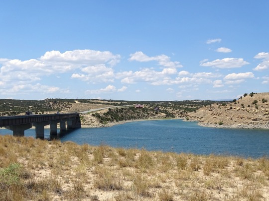
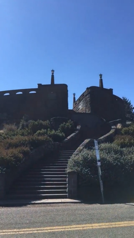
#Starvation Reservoir Bridge
Photo
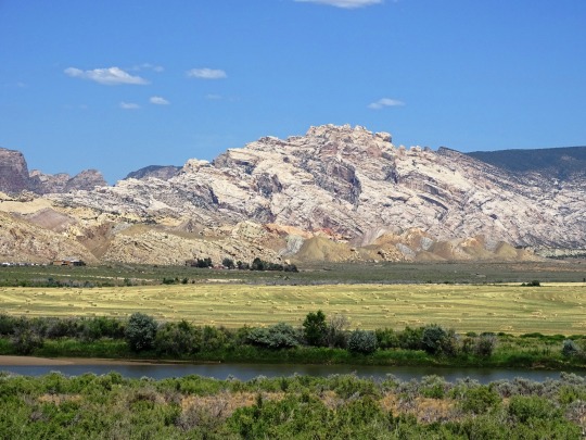
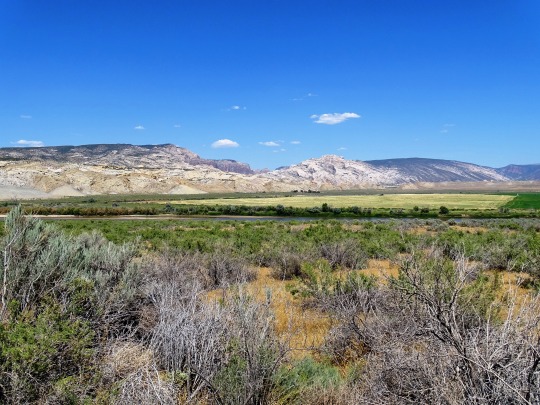


Clouds (No. 926)
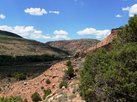
Dinosaur National Monument, UT (two pics)
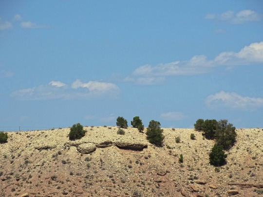
Starvation Reservoir, UT (seven pics)
Pinion Ridge Rest Area, UT
#Pinion Ridge Rest Area#Duchesne County#Starvation Reservoir Bridge#USA#Dinosaur National Monument#Uintah County#Green River#Split Mountain#Uinta Mountains#Rocky Mountains#lake shore#I really love the first pic#tourist attraction#landmark#summer 2022#original photography#travel#vacation
6 notes
·
View notes
Link
Aug 2, 2019 | While families wait for salmon, floods wash out roads – and a year-old fire smoulders
Telegraph Creek: the fire that can’t be put out
In July of 2018 Heather Hawkins was newly pregnant with her daughter Katsima. In order to get an ultrasound, she had to make a ten hour drive south from her home of Telegraph Creek in the Tahltan Nation to Terrace. She packed for what she thought would be an eight day trip and set off with her partner and infant daughter, Violet.
While Heather was away, a fire broke out at Alkali Lake, seven kilometers northwest of Telegraph Creek. The next day, someone discovered another fire to the northeast, on the opposite side of the Stikine River.
An estimated 1,200 square kilometers burned, more than 10 times the size of the City of Vancouver. All told, 13,000 square kilometers burned across the province last year. 2018 and 2017 were the two worst years on record in the province’s wildfire history. Symptoms of a changing climate in a country warming twice as fast of the rest of the world.
Coming together as a community has helped the Tahltan people of Telegraph Creek cope and begin to heal. But the fire also left a scar. And now the area is more vulnerable to landslides. That adds another potential threat to annual salmon runs if the Stikine is impassable – as we just saw happen on the Fraser. In the short term, scorched forests push surviving animals like moose, goats, sheep and bears elsewhere to seek shelter and food.
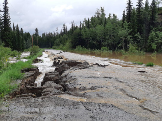
The Chilcotin: when floods follow fires
In April the Tsilhqot’in people released a report entitled “The fires awakened us.” It’s a unique reflection on how the fires simultaneously devastated and galvanized their people. From an outsider’s perspective I took a couple of lessons away that could be applied to most communities: First, people who know their land are best positioned to defend it; Second, in situations like folks in the Chilcotin faced in 2017, where any firefighting effort was going to be overwhelmed, local people know what to prioritize.
Unfortunately this summer the climate crisis returned in a different form. A new phenomenon in the interior is the development of Supercells during the summer. Supercells are unpredictable cloud formations that materialize seemingly out of nowhere. They’re completely different from other weather systems – they don’t move. In mid July one formed over the Chilcotin Plateau and dropped record amounts of rain over vulnerable fire-scarred soil.
Scores of roads and culverts were washed out and bridges were compromised. When the rain stopped, the provincial government prioritized fixing the roads Taseko Mines needed to access its proposed worksite at Teztan Biny (Fish Lake) before roads linking Tsilhqot’in communities.
The Comox Valley: vulnerable salmon, vulnerable economy
The early season closures which take a Chinook away from a guide and give it to an Orca are meant to stave off the starvation haunting southern resident whales.
I’d wager many people lucky enough to feel the strong tug of a wild coho at the end of their line don’t realize these acrobatic fish spend 18 months in small streams — the very type that nearly dried up this spring. I recorded the impact first hand. My son and I, along with hundreds of volunteers, intervened with traps and nets to move stranded fry and smolts to nearby rivers with reservoirs that can guarantee stream flow. If we hadn’t they would have cooked.
Read More
90 notes
·
View notes
Text
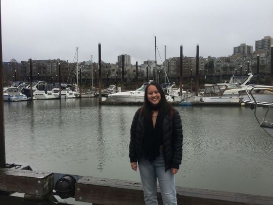
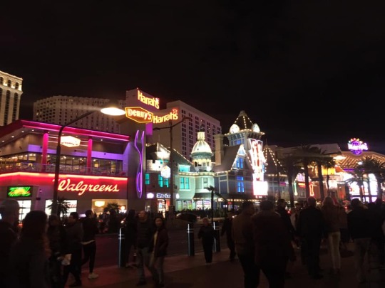
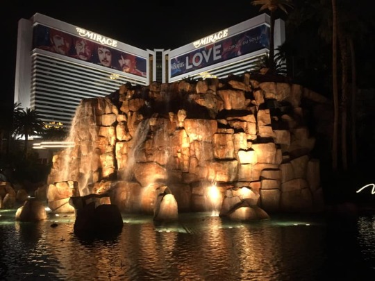
Oregon + Las Vegas 2019
A year ago, my friend and I went to Colorado for spring break. We both wanted to go back, but we decided to do something new and head to Oregon this year. We planned everything within just a few months, and were soon at Dallas Love-Field Airport, waiting in line at security.
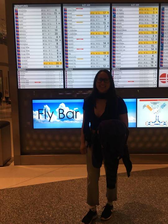
After a 5 hour flight, we walked off the plane and were greeted by Oregon’s cool and windy weather. The sun was out, despite weather predictions of rain. We ordered a Lyft and were dropped off in downtown Portland by Powell’s Books. We walked in to get a quick look since we were already there, but soon left to walk around the streets of Portland.

We walked around the Pioneer Square area and soon became hungry when we smelled the food coming from the food trucks. We somehow ended up going to a Chinese place inside a plaza. We sat on high chairs where we could watch the chefs cook, and ate chicken, pork bbq, and dumplings. When lunch was over, we walked out and it was just beginning to sprinkle. Luckily, I came prepared, so we had an umbrella to squeeze under.

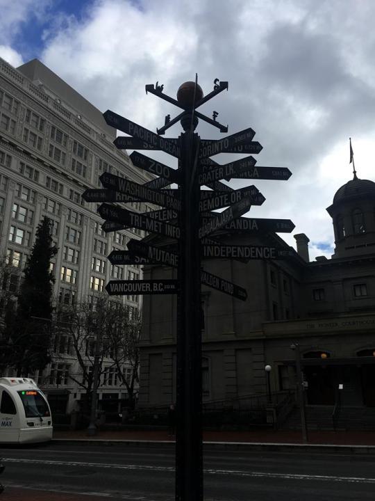

On our way to the Tom McCall Waterfront Park, we crossed the street where the smallest park in the world was at- Mill Ends Park.

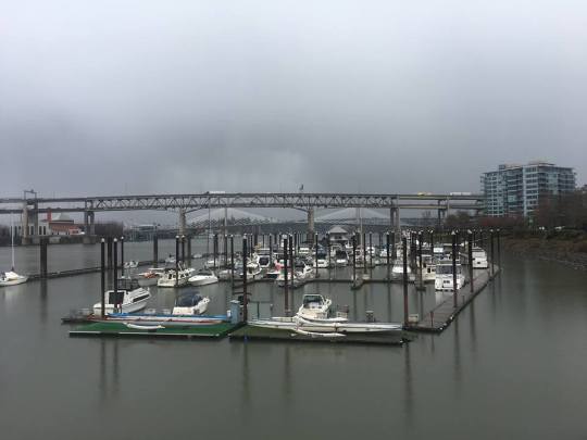
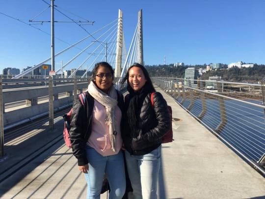
At the Waterfront Park, we looked out at a darker sky. We could see the Hawthorne Bridge from there and made our way to walk across it. It started to rain more and feel the bridge move as the cars drove past quickly. Then we walked down to a small pier where we could see the Tilikum Crossing Bridge, similar to a bridge in Dallas.

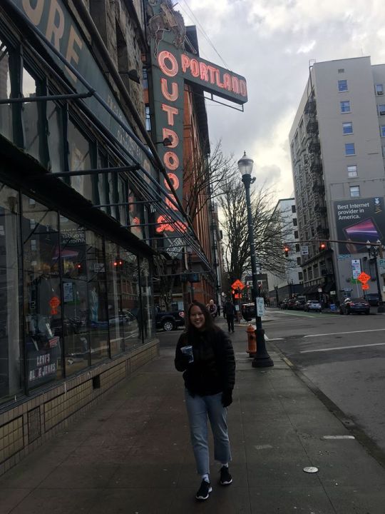
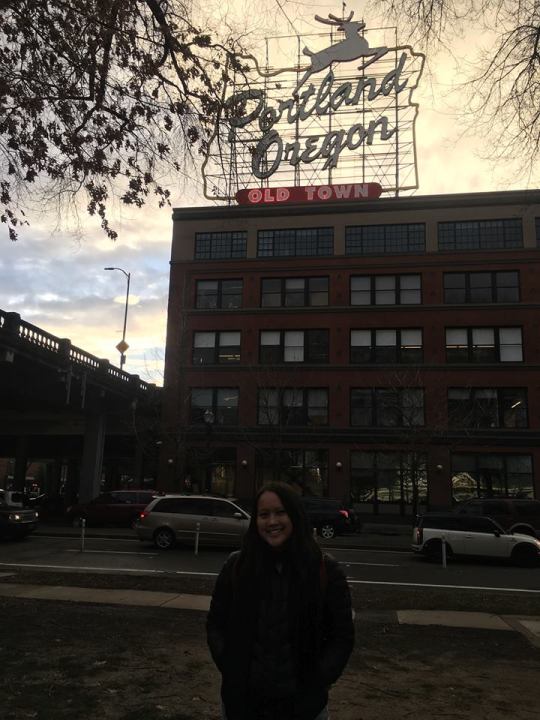
The rain had stopped by now, and we were pretty wet, so we took a break to dry off at Starbucks. Afterwards, we walked to Old Chinatown and saw part of the Lan Su Chinese Garden before it closed. We made our way back to the iconic Powell’s Books and spent our time walking the whole store. At first, I didn’t understand the big deal everyone talked about how it was a must to go to, but after walking through all the color-parts of the bookstore, I understand. It was huge. I lost count how many floors there were and the different branches of each category a floor was divided into. My favorite section was the architecture books. Afterwards, we walked past the “Keep Portland Weird” mural and Voodoo Doughnuts. Before we left downtown, we made our way to another iconic sign of Portland with the jumping deer by the Co-op.

It was the golden hour at that time, which meant it was time to walk to the Greyhound Station to catch our bus to Cannon Beach. After 9.5 miles of walking, we were exhausted and rested on the way to the coast. We watched the sun set as we drove away from Portland and the silhouette trees. After an hour and a half or two, the bus stopped and the bus driver said our destination- Cannon Beach. We were the only ones who got off, so the rest were probably headed to Beaverton. It was almost fully dark when we got off at the bus stop. It was quiet like a small town would be. We crossed the street and saw a small convenience store, and then, for our convenience, our hotel! Luckily, it was just steps away from where we were dropped off. We were welcomed by the staff and checked in. We walked to our hotel room nearby and were surprised by how beautiful it was. We quickly settled in and then walked back out to a nearby restaurant for dinner. We made the mistake of ordering some fancy fish tacos, which were too rich for us. That night, we slept in the most comfy, and spacious bed to prepare for the next day.

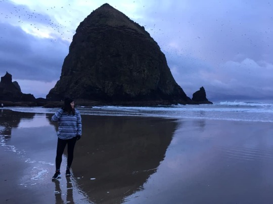
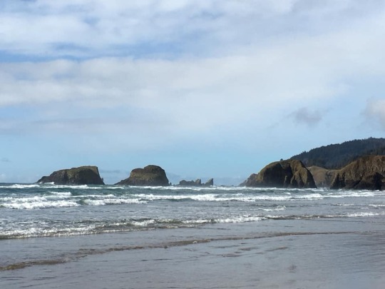
When I was finally able to get my friend up, I opened the curtains and was fascinated by the gigantic view of Haystack Rock just from our room.

It was a dark blue outside before the sun was going to rise. Our room was just minutes away from the beach. We were soon walking on sand, and getting closer to Haystack Rock. We sat on the beach waiting to see the sun rise. Unfortunately, all the clouds were blocking it! However, it was amazing being right next to the rock and seeing the birds fly across it. The sky became a bit brighter, and we saw the beautiful beachfront houses and mountains in the distance.
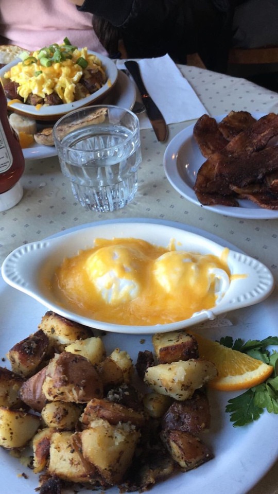
We went to the cute small town of Cannon Beach and had some breakfast at a wonderful cafe. After a generous amount of bacon, poached eggs, and fried potatoes, we went back to our hotel and rested before we had to check out and start the day’s adventures.

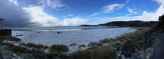
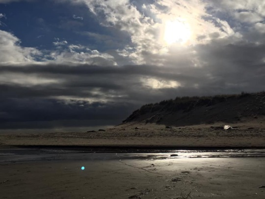
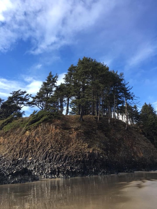
We walked a little more through the town’s shops when it started hailing out of nowhere. Fortunately, we were right by a covered area when it happened, so we sat and waited for it to stop. After a while, we walked down to the snow-covered beach. Our view looked out to the light waves and white beach. We wanted to get across to the other side of the beach, but a deep amount of water was blocking our way. So, we ended up hiking through a bit of a muddy and complicated trail.
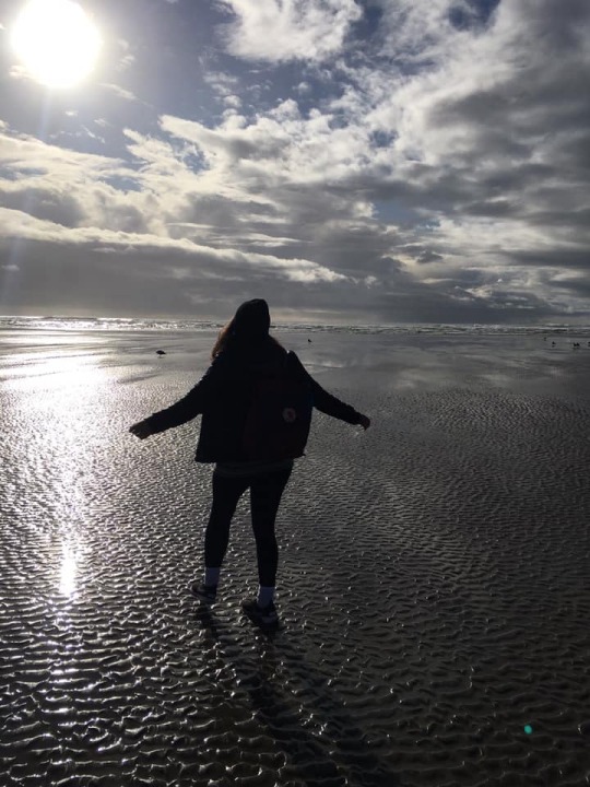
On the other side of the beach, we walked and walked until we reached a huge rock formation on the shore. The sun was out and the weather felt much warmer. We saw some cute dogs, a ton of birds walking on the beach, and some seashells. After a long afternoon walking the beach, we decided to go back to town and get some lunch. We realized there was an easier way to get back to the other side of the beach connecting to the town through a neighborhood street.

Shortly, we went to the closest food place and got pizza. We warmed up again by having some hot chocolate. Before our beach day came to an end, we shopped for some souvenirs before catching the bus back to Portland. As we walked to our bus stop, we watched the sun set until our bus arrived at dark. When we got off in Portland, it was dark and felt pretty sketchy. We made our way to a nearby bar to wait for our Lyft. As we waited, I heard what made me confirm Portland was weird. A car had ran over a glass bottle, making a cracking noise, and everyone there was pretty entertained by it. Most of them were probably drunk, but what was weird was what this woman said about it: “It’s not the car’s fault.., it’s the bottle’s fault!” The way she said it was pretty weird too. By then, my friend and I were tired and wanted to get the hay out of there. The hotel we stayed in that night was a decent, old-fashion place by the University.
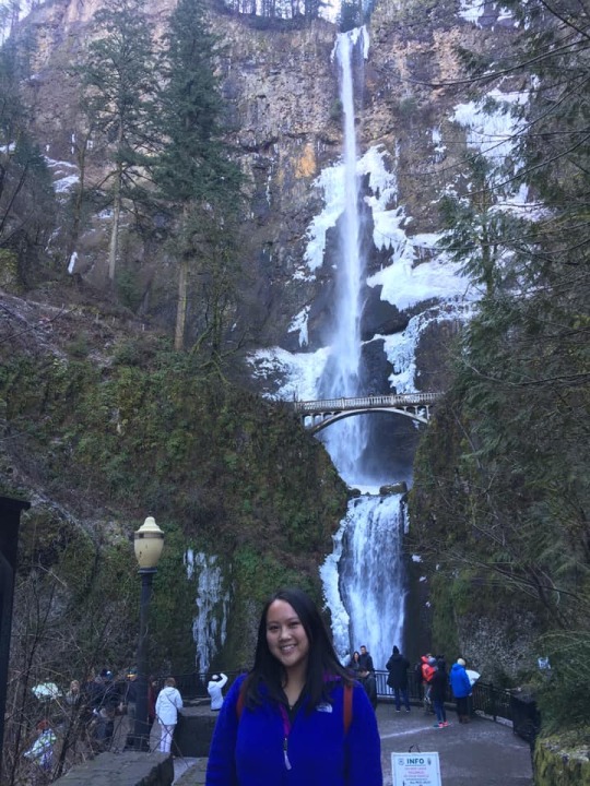
The next day, we were picked up to go on a tour. Our first stop was the tallest waterfall in the country- Multnomah Falls. It was mesmerizing seeing how tall this was. Just from afar, you could smell the coffee from the stand before hiking up to the bridge. It was very slick and crowded with visitors on the way up. Many times, I almost fell, but I had the rail to keep me up. From the bridge, you could see the water falling below and the people at the bottom.
Then we headed to a fish hatchery and some some cool fish and the huge Herman the Sturgeon measuring almost 11 feet long.
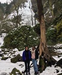
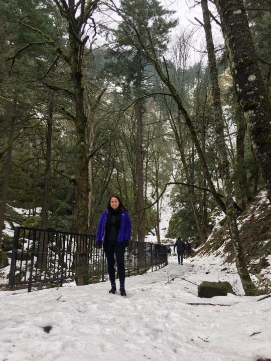
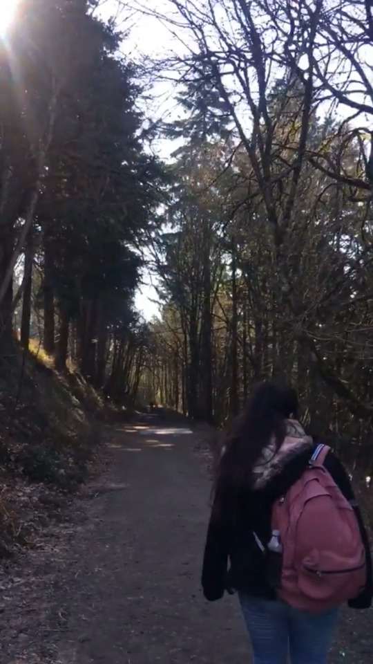
The next destination was Starvation Creek. As we walked through, there were tall green and snowy trees. It was beautiful. It felt very different than the parts of Oregon we had been in. It was quiet and calming to be away from all the visitors.
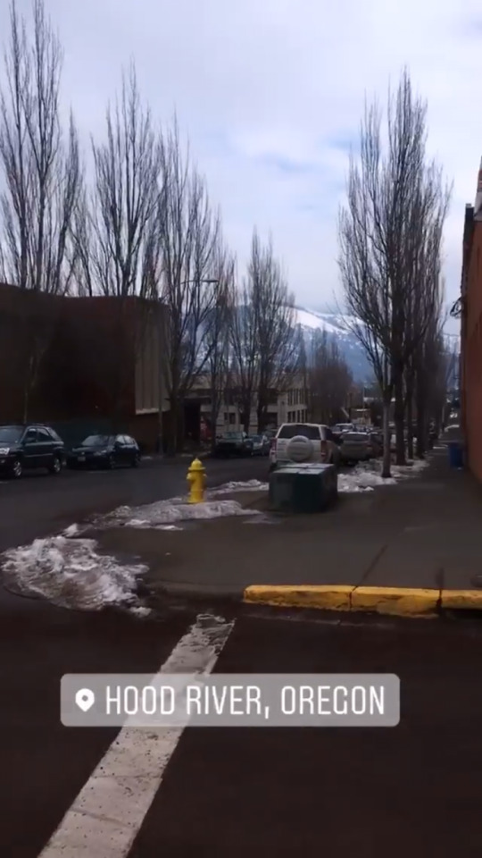
For lunch we drove to the town of Hood River. It was another cute town with houses and shops on hills. My friend and I had some Mexican food, but they didn’t have chicken, nor beef! Our pork tamales weren’t impressive, but dessert made up for it when we had our bunuelos with a generous amount of whipped cream. We walked around the town a bit before our drive to Rowena Crest.
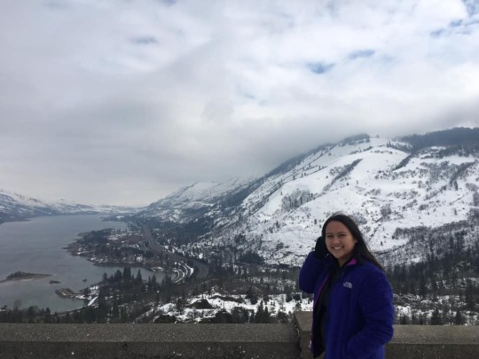
On our way up, the scenery became a vastness of snow. Everywhere was just snow. It looked pretty amazing. When we got out of our van, we were at the top of one of the most beautiful viewpoints I’ve seen. On one side, it overlooked the whole snowy town, and on the other side, a cool picture-worthy loop road.

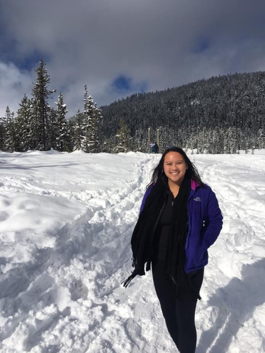
Our last destination was the Mt Hood National Forest. Unfortunately the visitor center was closed due to an excessive amount of snow, but we finished it off by playing in the thick and flaky snow on a hill. Just getting up the hill required climbing up 4 feet high snow. The view of the snow blowing off the trees and a glimpse of Mt Hood was perfect to end the tour. We ended up falling in a deep chunk of snow and feeling like it was impossible to get up. Walking down the hill, I completed my annual streak of falling down. Last year’s fall was in Colorado.
Back in Portland, we rested before getting some dinner nearby. We went to a sushi place which we didn’t know was a sushi train style. We were completely confused about how to order/if we were supposed to order. At that point, we really thought Portland was weird. It ended up being an interesting and pleasant meal to end our last night in Portland.

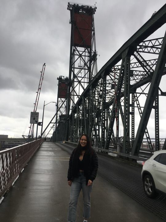
The next morning, we had some breakfast at our hotel before walking across the Tilikum Crossing Bridge. It was bright and sunny out. We went down to a pier where the USS Blueback Submarine from the US Navy was at.
We headed to Mt. Tabor next to get some hiking in. There were views of Portland and the reservoirs around it. There were tons of trails to go walking on a nice and sunny day.
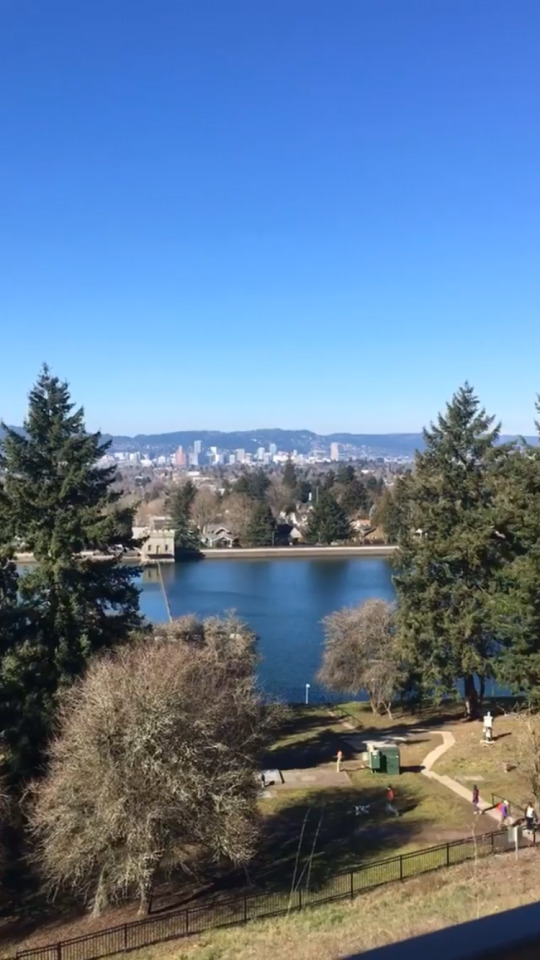
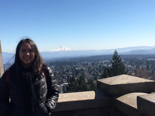
Lastly, we went to Rocky Butte, which overlooked the town and a nice view of Mt. Hood. When it was time, we said goodbye as we headed to the airport.

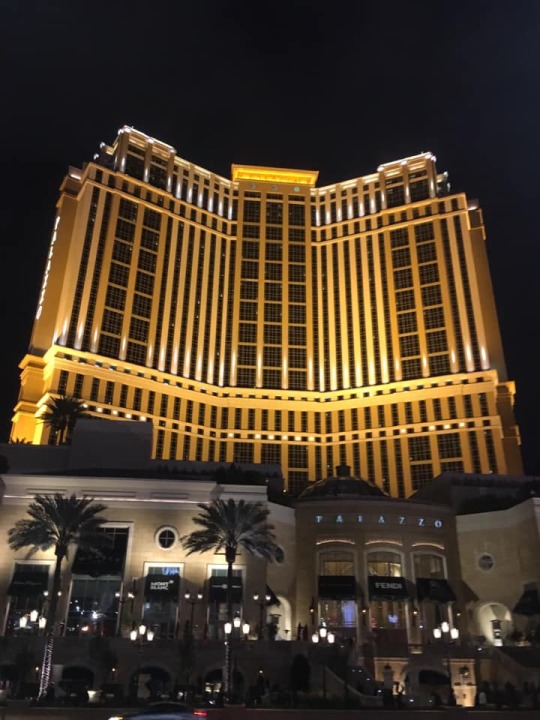
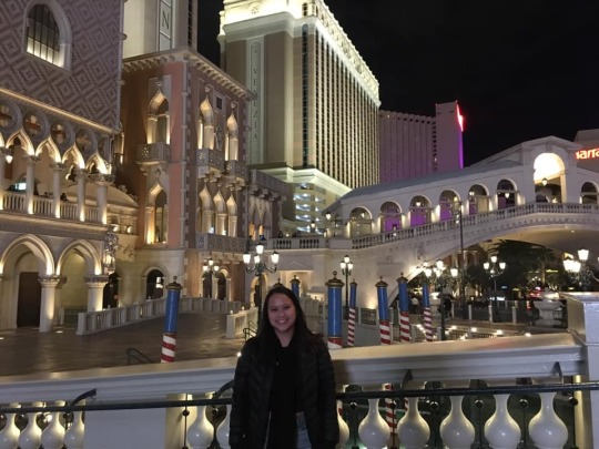
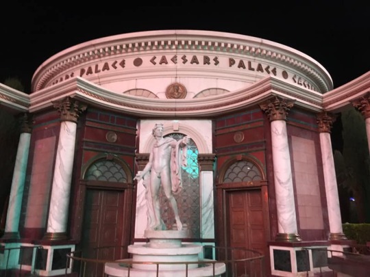
After a short flight, we landed in Las Vegas for a layover. Walking outside, we were already excited after seeing the pink sky, palm trees, and part of the High Roller. We were dropped off by the Flamingo Hotel and cut through an alley leading right to The Strip. Immediately we were high fived by 2 dudes and our eyes were looking at all the sights Vegas had to offer. We saw it all (almost). We probably walked 8 miles of it. It was very cool seeing all the lights and famous hotels and restaurants. We were able to see the end of a fascinating fire show and I ended up ziplining for the first time through the Linq Promenade.


Before it was time to leave, we watched a quick show of a spray-painting artist and bought some souvenirs. At the airport, we were surprised to see gambling machines inside. Our flight was a half hour delayed, so by the time we got on the plane, we fell straight to sleep after all that walking. Arriving early in Dallas, we were still exhausted and I slept the whole 30 minute drive back home and jumped into bed once I got home.
When I woke up, I was for once in a while, done with the excess traveling. With a few days off work, I spent the rest of my spring break resting. This trip I kept in mind the Costa Rican phrase and philosophy of Pura Vida- enjoying the simplest pleasures of life and living life to the fullest. I am so very grateful to be able to really live, discover other parts of the US, and meet new people.

31 notes
·
View notes
Link
Kanchanaburi’s famous hot sunshine failed to stop tourists from many nations from visiting the Death Railway on 15 October, just one day before the 75th anniversary of the completion of one of the most oppressive wartime railway projects of the Japanese Empire.
Hellfire Pass Memorial Museum Audio Guide recounts:
“On the 16th of October 1943, 15 months after work first begun, both ends of the Burma-Thailand Railway were joined at Kointaka [Kaeng Khoi Tha, Sangkhla Buri District, Kanchanaburi Province] – not far from the Three Pagodas Pass. With much pomp and a fair amount of ceremony, a well-fed Japanese soldier drove the final spike into a sleeper. The finished railway wound around 415 kilometres of jungle track, and included 688 steel and timber bridges. The cost in human life was savage. It is estimated that approximately 12,800 Allied prisoners of war and up to 90,000 Asian labourers died working on the railway.”
75 years since the completion of the Death Railway
The Thailand-Burma railway was finished on 16 October 1943 with the aim of transporting troops and supplies of the Japanese Empire to Burma for a planned strike into British India.
The railway was built from 2 ends; one began in Ban Pong, Ratchaburi Province, in Thailand and the other began in Thanbyuzayat, Mon State, in Burma. The tracks met at Konkoita station (now under the Vajiralongkorn dam reservoir).
It took only a year to complete the 415 km railway over rough terrain. Some estimates say that 50% of the Asian workers died from starvation, disease and maltreatment; about 20% of the PoWs died which is outnumber the death toll from Hellfire Pass Memorial Museum, reflecting the variation of the information.
61,811 Allied Prisoners of War are known to have worked in the railway. Some made it back alive and some did not; some are remembered but some are not. Most were recognized and later given a proper burial. On the other hand, over 300,000 Asian workers or “Romusha” as called by the Japanese also worked on the railway, only for many to lose their lives and pass forgotten.
The Romusha mostly came from Vietnam, Java (Indonesia), Malaya, Singapore, Burma, India and Thailand. (The ‘Chinese’ were almost all from Thailand, Malaya and Singapore). Some were drafted in by the Japanese and some came after rumours of good wages.
Sadly, the dead Romusha are commemorated by nothing more than a mass grave by a Buddhist temple and a Japanese cenotaph.Their deaths went unrecognized by the governments where they came from after they became independent.
Despite this lack of recognition, some relatives of dead Romushas came from Malaysia to the site in Thailand this year in order to retrace and pay tribute to their loved ones.
P. Chandrasekaran, Chair of the Death Railway Interest Group (DRIG) brought a group of 13 people to remember their loved ones who lost their lives in the construction. The trip was recorded by his Indian colleagues and will be broadcast in India and Malaysia.
(The purpose is) to bring the family members of victims who built the railway. They have never had a chance to come and see the place. If they come by themselves, they will not know where to go.
We try to retrace the journey of our workers who were brought here. We understood from some survivors that workers were originally taken from various towns in Malaya and brought to the railway.
The DRIG Chair said that 2 of the survivors came with him on the previous trip last February. The next trip will be in the December when Thai officials will hold a commemoration ceremony for the dead.
The primary aim of this trip is basically to tell the world that there is no commemoration held except for the prisoners of war. For the Asian workers who died, there is no commemoration. Not by the Thai, Indian, or Malaysian governments, in fact any government whose people worked on the railway. They’re totally forgotten.
We are trying to make a point. The governments may have forgotten but the people who are affected have not. Six Malaysians came with me; every one of them is affected. Either their grandfather, father, uncle or somebody is affected.
We all are the affected. There are no tourists in this. We’re all affected people. For us it’s an emotional trip.
He also said that the tourist spots and history are all about the white men. And Thai officials tend to narrate the story in the same way.
They (some group members who travelled to the site before) are very disappointed that there is nothing in Thailand to shows that any Asian worker was involved. Everything is about the white man. Even the commemoration is for the white men. Also when the Thai government stages the special programme in December, they make it look like only the white men built the railway.
I have also seen some fliers produced by the Thai Tourism Authority saying that there is a special museum built for the railway. It’s called the JEATH museum. They say it’s named after the 5 countries that built the railway: England, Japan, Australia, Thailand and Holland. They only mentioned that. All of other Asian countries are forgotten.
If you ask me, it is a gross misrepresentation of the facts, because the Asians who worked on this railway far outnumbered the Europeans or Thais. The Thais formed very small number. The Europeans may have formed a 1/3 or a quarter but you forgot the other 3 quarters.
And it is not a private company or enterprise which overlooked it for commercial reasons (which) I can understand, but the Thai Tourism Authority which is a government body is promoting this misinformation.
Although the JEATH War Museum was the initiative by the Abbot of Wat Chaichumpol. However, the TAT promoted its misinformation about the international involvements on its website.
I think they should correct it and give due recognition to the Asian workers. So what I tell them is; if you cannot have the cemetery for these workers, the least you can do is to have a proper monument for the Asian workers.
43 notes
·
View notes
Audio
A song inspired by this short story I wrote for class (tw suffocation, claustrophobia, body horror, starvation, drugs, just a whole bunch of bad shit including literal shit ok):
Sullatulla
THEY entered the dead city. Bones of unburied corpses were tucked under eaves and dense pines, safe from the rain that had ground the others to nothing. The air was thick with ghosts: fragile things like strands of egg in soup, fraying at the edges, forgetting. The ghosts drifted towards them, drawn like bees to rotten fruit.
THEY picked THEIR way between the peeling skins of houses, over sidewalks broken apart by patient winters; concrete glaciers in a muddy sea. Color had long ago washed from the ruined buildings, but here and there some garish remnant caught THEIR eye: a doll, with wide glass eyes and plastic hair more enduring than the hand of the child still clutching it; a crock pot that must have simmered and simmered til the power lines went cold; a dog collar, sans dog.
More and more of the misty wraiths clung in a swirling sphere around THEM, crushing close, tasting THEIR warmth. Craving it.
Ignoring the fog of almost-touches, THEY shuffled forward, feet numb in shoes full of water, driven more by momentum than any desire to move. Clumps of red hair drooped in front of THEIR eyes, dripping rain. If THEY didn’t find shelter soon, hypothermia would finish THEM off; then THEY’d be as cold as everyone else here.
Then the ground beneath THEM was just gone. A hole. THEIR heart forgot to follow THEM as THEY dropped, pitch-black hole, dirt and water pouring in. Crumbled bits of concrete. The rain seemed still, and each droplet reflected one face, open-mouth shut-throat, too shocked to scream. After a terrible moment of hanging in air THEY struck the earth below.
Breath. Sight. Thought. All took a moment to return to THEM, and in that moment THEY were steadily buried in mud. With the kind of strength and fury that only comes from fear of death, THEY dug and struggled, hands sinking into the soft dirt, crawling from beneath the suffocating weight inch by inch. THEY heaved a rusty breath and choked on mud.
Finding a metal bar with their fingers, THEY pulled. The soil gave a little, then with a wet pop like suction releasing, THEY lurched forward into the darkness.
Even ghosts were afraid to enter this place.
Coiling back--no. Cautiously turning the parts that could turn, one vertebra at a ow fuck not that one, pretending not to hear that grinding sound, looked back. The shaft, up and up and oh god that’s too high. If THEY’d landed on solid ground. If THEY’d twisted their body the wrong way. If, but somehow, not. The light seemed to sprinkle down with the rain, a childish beam that feigned innocence badly. The edge, tracing a broken shard of grey sky, crumbled slowly--a threat of more to come.
No way up. Too dangerous to stay.
THEY shook, less from cold than from the absoluteness. Half a worm wiggled helplessly on THEIR leg, curling around itself as if searching for its missing half. Me too, friend. The shaking turned to rising, half-sobbing laughter as THEY flicked the worm off with one finger.
They moved carefully to avoid the jolts of pain. It took so long just to get a few feet of progress. A many-legged something skittered over THEIR hand as THEY traced the wall. Old sewage oozed by from somewhere; the smell brought up bile at first, but was eventually memorized, relegated to things known and ignored. At least it’s giving off some heat. No exits.
Hours yawned into days of feeling THEIR way through moldering funk, days that ran together like a slow river of ink. As THEIR injuries healed, further exploration became both easier and more frustrating. The network of tunnels was far more extensive than THEY had initially thought. Iron rungs leading upward were more rust than metal, and crumbled or snapped in THEIR hands.
THEY grew accustomed, familiar. There were three different systems here, comingling in a slapdash arrangement that spat in the eye of every code in the book. Cleaner water was carried in round arteries, lined with bricks and narrow pipe ends where runoff trickled in from above. Other tunnels, especially the deep ones, were of rough-hewn rock with rotting wood supports. The air of the mines tasted older, quieter, disturbed by every breath. By contrast, the sewers, woven around and through them, held the damp aromas of growth and decay.
Though warm enough now, and not lacking water, as time went on THEIR stomach twisted itself in empty, empty knots. THEY slipped into a haze, forgetting everything but the pain of hunger.
Senses sharpened to pinpoint every flutter of movement, and the category of “edible” quickly expanded. Beetles and spiders snatched up like popcorn, legs prickling THEIR lips. Strands of algae scraped from the walls. With rats THEY had little luck; the squeaks and paw-patterings were a constant, but the red-eyed rodents were quick and clever. Once, THEY snatched one up as it scurried over THEIR foot, and bit into it, heedless of hair or bone, with a hunger so urgent the creature was gone almost before it stopped twitching. Its blood left a trail through the layer of dirt on THEIR chin. THEY smiled for the first time since the fall, sank to the ground with a gasping sigh as if THEY’d been holding their breath, briefly content.
Time passed, and though THEY got better at catching rats, THEY were always, always hungry.
Time passed, and was meaningless in the dark. With no one to speak to, and a voice too burnt and hard to speak much anyway, THEY began to listen; THEY heard the quiet, lethargic rhythm of water, of strong, slow roots, of tiny creatures whose eyes, if they had eyes, had never seen daylight. As THEIR body grew thin, THEY felt that rhythm seep into THEIR marrow. THEY began to move like a wisp of fog, like something that had always been in this forgotten hole.
Searching for food at some point became more important than searching for a way out. Memories faded and became distant, irrelevant. Every so often THEY would spot THEIR reflection in the dim: cadaverous with thinning hair. Like a bog mummy. Every so often THEY would lose a tooth, and stare perplexed at its long, bloody root. THEY kept these teeth, afraid to lose any part of THEMSELF.
THEIR clothes rotted off THEIR body. THEY didn’t notice at first. Mud and shit look the same whether cloth or skin lies beneath it. But when THEIR shirt finally fell off, and disappeared into the water with a splash that cut through the silence, THEY were shocked for a moment…then gave a hoarse giggle as THEY realized what had happened. THEY waded into the stygian channel, and fished around blindly to retrieve the filthy rag, though without knowing what, if anything, it could be used for now. Knee-deep in waste, THEY refused to waste anything THEMSELF.
Slowly, THEY became aware of a change, too vague to discern at first, but as THEY moved down one of the tunnels, THEY realized it was light. Filtered down through a weathered grate, perhaps? An…exit?
THEIR heart pumped painfully, weak and unaccustomed to excitement. THEY clutched the shirt-rag tied over their shoulders with bony fingers, tilting THEIR head hugely, THEIR whole body following the motion in almost a caricature of curiosity. THEY continued twisting until THEY were lying on THEIR back staring at the light upside-down, just staring, sunken eyes not comprehending. Minutes passed, and the light was still there. THEY flipped THEMSELF over and crawled toward it, cautiously.
It was not an exit. The tunnel opened onto a deep reservoir of fresh water, with many sources trickling in from above. A bridge crossed the center of the cylindrical room, and the outer rim had a narrow walkway as well. This walkway was lined with strange growths, like termite mounds or lumps of white coral. The growths in turn supported hundreds upon hundreds of tiny green mushrooms--delicate parasols that glowed faintly. If THEY hadn’t been living in total darkness for so long, THEY would never have seen the whisper of light the mushrooms cradled.
Hunger, having laid a long siege against THEIR dignity and common sense and conquered both, easily overtook all other thoughts. THEY approached without hesitation and grabbed mushrooms by the fistful, stuffing them into THEIR mouth so fast THEY barely had time to swallow. THEIR stomach, unused to such a large and sudden meal, revolted and sent it back up again. THEY ate the vomit, which was mostly just water and mushroom anyway, and slowed down enough to keep it down. Barely.
This continued until, by chance, they sliced their hand on the ridges of the coral mounds. The cut felt strange, as if heat or cold spread from it but THEY couldn’t tell which--then time began to dilate. THEY collapsed on the walkway, spasming, eyes darting over the ceiling which seemed to fragment into sharp geometry, like broken shards of stained glass. After an unknowable stretch of time, the hallucinations faded, and THEY returned to themselves to find that THEIR stomach was empty again. THEY returned to the mushrooms, carefully this time so as not to touch the coral mounds. Static danced in THEIR peripheral vision still. And something more…
THEY froze, as for the first time since the fall, THEY were suddenly not alone.
#tw#body horror#suffocation#hunger#starvation#drugs#claustrophobia#sinkhole#sewers#underground#sullatulla#if you're wondering about the aggressive capitalization of THEY it's because I got really tired of being misgendered#and wanted to make a point#also I wanted the protagonist's name to be unknown to the reader#although I know what it is#this character is prominent in a couple other stories of mine as well#but their name changes#basically it's very important that you don't know who they are right away#you can go ahead and just call them THEY and I'll know who you mean#trans character#agender character#they/them#btw I know the ending is terrible I just ran out of time#the character who shows up isn't scary I promise#on the contrary they are the most innocent bean and good#music#song#composition#tedri thorne#writing
1 note
·
View note
Text
This Guy Spends Hours Searching For The World’s Most Depressing Places, And The Results Are Hilarious
Damien Rudd is a 33-year-old Australian behind the Instagram account called “Sad topographies” where he collects Google Maps screenshots of the world‘s most depressing sounding places. It all began by accident when Rudd was searching for something and suddenly discovered Mount Hopeless in Australia.
“I typed hopeless into Google Maps to find other places called hopeless, then other synonyms for sadness,” Damien told WERTN magazine. “I screen captured the results and soon had the beginnings of the collection.”
Rudd now has a pretty big collection of world’s most joyless locations and he’s put them all into a book of hand-drawn maps, together with their fascinating etymologies. When asked about his favorites, Damien replied: “Probably the ones in Antarctica are the most interesting. There is Shapeless Mountain which was named as none of the exploring party could agree on its shape. So shapeless was Shapeless Mountain that when a later expedition attempted to climb it, they scaled the wrong mountain entirely – which they then in turn named Mistake Mountain. There is also a Wrong Peak, which earned its name in under similar circumstances. In 1963 Recoil Glacier was named by a geologist who was said to have “recoiled in disgust” at finding nothing of interest there.”
Scroll down to find out where “to go, when you’re feeling low,” as states Sad topographies Instagram account.
More info: amazon.com | Instagram
America
Image credits: sadtopographies
Lonesome Lake, Washington U.S
Image credits: sadtopographies
Pointless Mountain, Squamish-Lillooet, Canada
Image credits: sadtopographies
Misery Island, Tasmania, Australia
Image credits: sadtopographies
Mistake Island, Jonesport U.S
Image credits: sadtopographies
Why Me Lord Lane, Chester U.S
Image credits: sadtopographies
Shades of Death Road, New Jersey U.S
Image credits: sadtopographies
Useless Islands, New Zealand
Image credits: sadtopographies
Divorce Beach, Cabo San Lucas, Mexico
Image credits: sadtopographies
Disappointment Lake, California, US
Image credits: sadtopographies
Sorrow Islands, British Columbia
Image credits: sadtopographies
Despair Island, Maine U.S
Image credits: sadtopographies
Terrible Mountain, Vermont U.S
Image credits: sadtopographies
Mistake Island, B.C Canada
Image credits: sadtopographies
Point No Point, Newark U.S
Image credits: sadtopographies
Lonely Island, Ontario Canada
Image credits: sadtopographies
Misery, France
Image credits: sadtopographies
Sadness Street, Jemil, Tunisia
Image credits: sadtopographies
All Alone Road, Bradford U.K
Image credits: sadtopographies
Hopeless Road, Dandridge U.S
Image credits: sadtopographies
Lonesome Road, Cedar Grove U.S
Image credits: sadtopographies
Mount Disappointment, Victoria, Australia
Image credits: sadtopographies
All Alone, Cheltenham, U.K
Image credits: sadtopographies
Nasty Pond, Oregon, U.S
Image credits: sadtopographies
Deception Island, Antartica
Image credits: sadtopographies
Nameless, Tennessee, U.S
Image credits: sadtopographies
World’s End, Aylesbury, U.K
Image credits: sadtopographies
Miserable Island, Banner Township, Illinois, U.S
Image credits: sadtopographies
Bucket of Blood Street, Holbrook, Arizona, U.S
Image credits: sadtopographies
Blunder Pond, Northeast Piscataquis, Maine, U.S
Image credits: sadtopographies
Dead Woman Pond, Texas, U.S
Image credits: sadtopographies
Useless Loop, Western Australia
Image credits: sadtopographies
Despair Island, Portsmouth, Rhode Island U.S
Image credits: sadtopographies
Dead Woman Creek, Oklahoma, U.S
Image credits: sadtopographies
Abandoned, Hartwick, New York State, U.S
Image credits: sadtopographies
Road to Misery, Kennebunkport, Maine U.S
Image credits: sadtopographies
Repulse Bay, Canada
Image credits: sadtopographies
Fail, U.K
Image credits: sadtopographies
Suicide Bay, Tasmania, Australia
Image credits: sadtopographies
Nothing, Arizona, U.S
Image credits: sadtopographies
Death Lake, Cochrane, Canada
Image credits: sadtopographies
Pity, Haiti
Image credits: sadtopographies
Desperation Lake, Alaska, U.S
Image credits: sadtopographies
Sad Lake, Oregon U.S
Image credits: sadtopographies
Murdering Beach Road, Heyward Point, New Zealand
Image credits: sadtopographies
Lonely Island, Ontario, Canada
Image credits: sadtopographies
Grief Island, Alaska U.S
Image credits: sadtopographies
Dubious Reservoir, Oregon U.S
Image credits: sadtopographies
Lake Torment, Annapolis, Subd, Canada
Image credits: sadtopographies
Broken Dreams Drive, Arivaca, Arizona U.S
Image credits: sadtopographies
Pity Me, Durham U.K
Image credits: sadtopographies
What Cheer, Iowa U.S
Image credits: sadtopographies
Hell for Certain Road, Hyden Kentucky U.S
Image credits: sadtopographies
Little Hope Island, Nova Scotia, Canada
Image credits: sadtopographies
Failure Canyon, Samak, Utah U.S
Image credits: sadtopographies
Kill, Ireland
Image credits: sadtopographies
Suffering Street, Menzel Jemil, Tunisia
Image credits: sadtopographies
Accident, Maryland U.S
Image credits: sadtopographies
Pain Lake, Ontario, Canada
Image credits: sadtopographies
Lost Boys Lane, Riverview, Florida U.S
Image credits: sadtopographies
Melancholy Lane, Dorset U.K
Image credits: sadtopographies
Crying Child Island, Jacksonville Beach, Florida U.S
Image credits: sadtopographies
Miserable Lake, Banner Township, Illinois U.S
Image credits: sadtopographies
Crying Lady Rock, Washington U.S
Image credits: sadtopographies
Desperate Lane, Asheville, North Carolina U.S
Image credits: sadtopographies
Hopeless way, Bunkerville, Nevada U.S
Image credits: sadtopographies
Mistaken Island, British Columbia Canada
Image credits: sadtopographies
Poverty Island, Michigan U.S
Image credits: sadtopographies
Shades of Death road, Independence Township, New Jersey U.S
Image credits: sadtopographies
Ugly, West Bangal, India
Image credits: sadtopographies
Lonelyville, Fire Island, New York U.S
Image credits: sadtopographies
Haunted Lake, Francestown, New Hampshire U.S
Image credits: sadtopographies
Agony Island, Marshall Islands
Image credits: sadtopographies
Disappointment Lake, Idaho U.S
Image credits: sadtopographies
Emptyness Drive, Cypress, Texas U.S
Image credits: sadtopographies
Die, France
Image credits: sadtopographies
Grumpy Lane, Lake Echo, Canada
Image credits: sadtopographies
Loveless Lake, Wisconsin U.S
Image credits: sadtopographies
Crack Is Wack Playground, Harlem, New York U.S
Image credits: sadtopographies
Murderers Creek, Murders Kill Road, Athen, New York U.S
Image credits: sadtopographies
Futile Lake, Kenora, Canada
Image credits: sadtopographies
Depressed Lake, California U.S
Image credits: sadtopographies
Disenchantment Bay, Alaska U.S
Image credits: sadtopographies
Forlorn Lake, Nipissing, Canada
Image credits: sadtopographies
Labour In Vain Road, Stansted, U.K
Image credits: sadtopographies
Sad, Slovenia
Image credits: sadtopographies
Solitude Island, Ontario Canada
Image credits: sadtopographies
Camp Suicide Road, Michigan U.S
Image credits: sadtopographies
Doubtful Island, New Zealand
Image credits: sadtopographies
Hope you have shit Christmas. Shit, Iran
Image credits: sadtopographies
Cape Disappointment, Ilwaco WA, U.S
Image credits: sadtopographies
Disappointment Mountain, Fall Lake Township, MN U.S.
Image credits: sadtopographies
Disappointment Cleaver, Washington U.S.
Image credits: sadtopographies
Disappointment, Washington U.S.
Image credits: sadtopographies
Disappointment Road, Barbourville KY, U.S.
Image credits: sadtopographies
Hopeless Way, Bunkerville, U.S
Image credits: sadtopographies
Doubtful Island, New Zealand
Image credits: sadtopographies
Pain Lane / Suffering Lane, St. George’s Island, Bermuda
Image credits: sadtopographies
Worthless Road, Laytonville U.S
Image credits: sadtopographies
Hearts Desire Ave / Broken Heart St, Las Vegas U.S
Image credits: sadtopographies
Abandoned, Svalbard
Image credits: sadtopographies
Broken Island, Washington U.S
Image credits: sadtopographies
Spiteful Geyser, Wyoming U.S
Image credits: sadtopographies
Hateful Hill, Vermont, U.S
Image credits: sadtopographies
Fail, Portugal
Image credits: sadtopographies
Suicide Bridge, Maryland U.S
Image credits: sadtopographies
Disappointment Cove, New Zealand
Image credits: sadtopographies
Heartache Rd, East Helena US
Image credits: sadtopographies
Road to Nowhere, Iqaluit, Canada
Image credits: sadtopographies
Massacre Island, Subd, Canada
Image credits: sadtopographies
Point No Point, Hansville, US
Image credits: sadtopographies
Terror Lake, Alaska
Image credits: sadtopographies
Murder Island, Argyle, Canada
Image credits: sadtopographies
Little Hope, Wisconsin
Image credits: sadtopographies
End of the World, California U.S.
Image credits: sadtopographies
Lonesome Lake, Colorado, U.S.
Image credits: sadtopographies
Devastation Island, British Columbia, Canada
Image credits: sadtopographies
Nowhere Island, Rainy River, Canada
Image credits: sadtopographies
Suicide Lake, Wyoming, U.S.
Image credits: sadtopographies
Lake of No Return, Osage Township, AR, U.S.
Image credits: sadtopographies
Dog Slaughter Falls, Kentucky U.S.
Image credits: sadtopographies
Grandmother’s Hole, Goa, India
Image credits: sadtopographies
Dead Women Crossing, Oklahoma, U.S.
Image credits: sadtopographies
Alone, Brescia Province, Italy
Image credits: sadtopographies
Dead Dog Island, Killarney, Canada
Image credits: sadtopographies
Desperation Drive / Solitude Way, Shingle Springs, CA, U.S.
Image credits: sadtopographies
Nothing, Arizona, U.S.
Image credits: sadtopographies
Starvation Heights, Oregon, U.S.
Image credits: sadtopographies
Purgatory Pond, Dunbarton, U.S.
Image credits: sadtopographies
Defeated, Tennessee, U.S.
Image credits: sadtopographies
from Viral News HQ http://ift.tt/2EPpzwU
via Viral News HQ
1 note
·
View note
Photo

#BHM #Christ warns: 4 Great Judgments of America: "To be plagued with too much #RAIN will destroy property and lives. It swells the rivers and creeks. Too much RAIN #floods cities and towns. Large bodies of water at the ocean shore lines will be MADE TO SWELL with unusually high waves, dumping billions of tons of water over the now seashore line. RAIN destroys property and kills cattle by drowning them in low lands. RAIN destroys the hiding places of vicious beasts and reptiles bringing them out FIGHTING in small towns in peoples’ homes and farms. RAIN weakens and destroys railroads, truck line beds and bridges. RAIN undermines foundations of ALL types of buildings. RAIN makes the atmosphere too heavy with moisture causing sickness. Wind with RAIN(#hurricane) can bring destruction to towns and cities, bringing various germs, causing sickness to the people. It produces unclean water by the swelling of streams and destroying reservoirs of pure drinking water used for the health of the people. RAIN is a destructive army within itself. Hail stones are also a property and life destroyer. Snow is of the MOST DREADED plague when it comes in great drifts from five to thirty-five feet. It buries your property and lives. It destroys your highways, your cities, and your concrete and gravel in towns and cities. It puts a great burden of expense upon the cities. It puts a great burden of expense upon the city to repair it. The cave-in of roofs of homes, the cutting off of homes, the cutting off of transportation, isolating areas, brings about starvation. And communication is destroyed with the icing of communication wires. Snow looks pretty because of its clean look. Almost everything of nature is beautiful, but it can be turned into death and destruction against man. Snow is prophesied to be one of the weapons that God will use against the wicked (America), Job 38:22, 23. Hail also is mentioned in the same two verses, where God plainly tells us that He has preserved it against the time of trouble, against the day of the battle and war. The Holy Qur’an also teaches us that God used snow, rain, wind, hail, earthquakes and fire against former wicked people. Is America any better than the people we read about in the history that God destroyed? No, she is not as good. These people were not as wicked as the American people. #Earthquakes can destroy towns and cities instantly. America is in the grip of divine judgment. America is in the position toward her once slave, so-called Negro, as Pharaoh was with Israel as his slave. She is in this position because of the injustice done to the American so-called Negro slave, brought to America over four hundred years ago, and refuses to let them go free. They only SAY that you are free, knowing within that you are not able to leave them without anything. But the injustice continues to increase. Now they plan death. So this God was predicted by the prophets to come to the defense of this people (so-called Negroes) in the last days after they served the enemy for four hundred years. The #Bible declares Abraham in Genesis that God would judge the people to whom his people (Abraham’s) would be in bondage. This does NOT mean Israel. This means the PRESENT Black people, the members of their Black nation, who have and are fulfilling their prophecy. God, in the Person of Master Fard Muhammad, will not be defeated. The more evil, deceiving, tricking and making of false promises to the American so-called Negro only increases America’s divine chastisement -- doom. America knows that her trouble lies in her mistreatment of the Black man, the so-called Negro, but she is too wicked to give up tricking the Negro and deceiving him on false promises. She just cannot stop. The opportunity is too open, and she thinks that there is no one to hinder her. But God has CHOSEN US to be His people, and He delights in fighting the enemy. According to the history of the former people, He delighted Himself by going forth against them when they exceeded the limit. So it is with America. They MUST be separated. America will not agree to see the Negro separated from her UNTIL she has suffered DIVINE PUNISHMENT, as Pharaoh suffered. The same thing that other evil nations suffered before them is now coming upon this people. She seeks to keep her slaves robbed of opportunity and wealth. She envies success coming to American Negro free slaves. She charges them high prices to keep them down. She deceives them through a few of what we call "Uncle Toms" in the political circle, clergy class and all professional classes. She offers them little favoritism to help her work against their own people -- the Black people. But they, too, will suffer along with the enemy of justice of the poor so-called Negro. They MUST be separated. Envy and hatred are growing between the two people, regardless of their preachings of social integration. The truth MUST come. What is better than the program you find I have written? You two (Black and white) cannot get along in peace since you never have gotten along in peace. Do you know why the white American does not like to talk with you about separation, and why he calls separation of the two people the wrong solution for peace between the people? He knows that it is promised and that God will do it. Then, why do they not agree with separating themselves from you and me, and we from them? Why are the Black man and white man all over the earth now in disagreement with each other to live in peace? Do you know why? Oh, foolish American so-called Negro, seek some of this earth that you can call your own to live on in peace. Unite and ask the government for a portion of America. This is what we need -- somewhere to live to ourselves and let the white man live to himself. The two people are not brothers. They are alien to each other. God did not make them brothers to each other. I ask you, my brother and sister, to learn this and learn it quickly and fly for your life to the refuge of Allah. Come follow me." Honorable Elijah Muhammad: Fall of America
0 notes
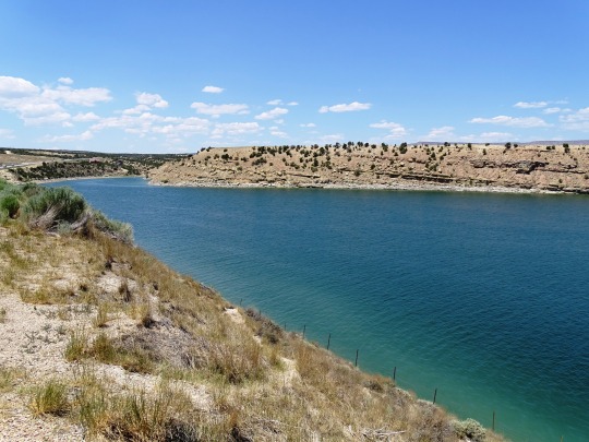
Photo


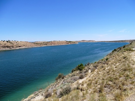
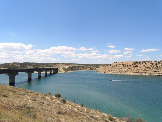


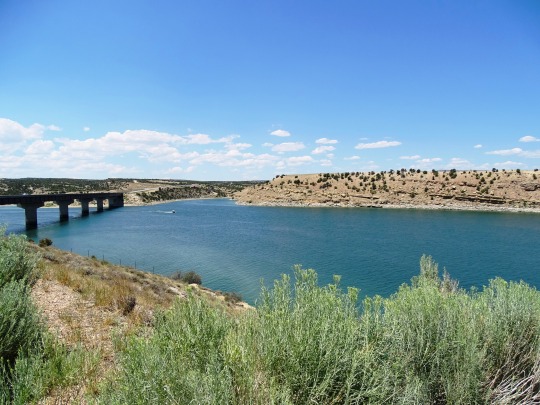
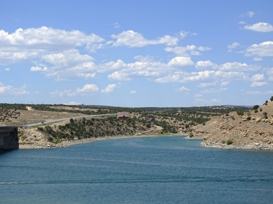
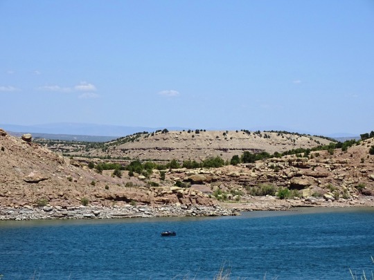
Starvation Reservoir, UT (No. 1)
Fred Hayes State Park at Starvation (formerly Starvation State Park) is a state park in northeastern Utah, United States, featuring the 3,495-acre (1,414 ha) Starvation Reservoir. The park is 4 miles (6.4 km) northwest of the town of Duchesne, Utah.
The 3,500-acre (14 km2) Starvation Reservoir is open year-round, and is popular for fishing and boating. It lies at an elevation of 5,712 feet (1,741 m). Established in 1972, the marina features a 54-unit RV campground along with developed and primitive camping, rental cabins, boat ramp and dock, a sand beach, restrooms, showers, a group-use pavilion, sewage disposal, and fish cleaning stations. Primitive camping is allowed in designated areas around the perimeter of the reservoir for a fee. OHVs are only allowed at Knight Hollow Campground. County-owned dirt roads are open (including the road from Knight Hollow to the town of Duchesne) in the nearby area.
Source: Wikipedia
#Duchesne County#Starvation Reservoir#Rubber rabbitbrush#landscape#Starvation State Park#lake#countryside#Starvation Reservoir Bridge#flora#lake shore#engineering#original photography#summer 2022#Utah#USA#travel#vacation#tourist attraction#landmark#bush#cliff#boat#Western USA
1 note
·
View note
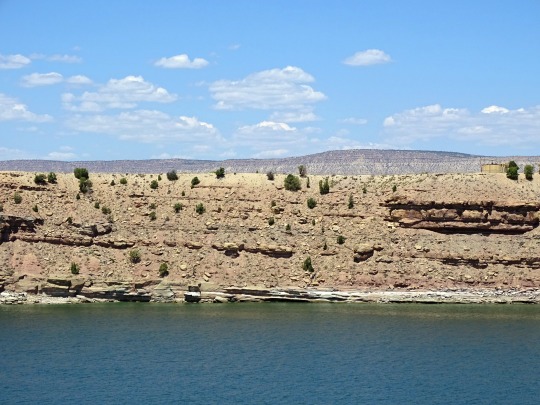
Photo

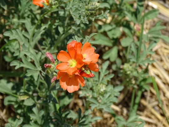


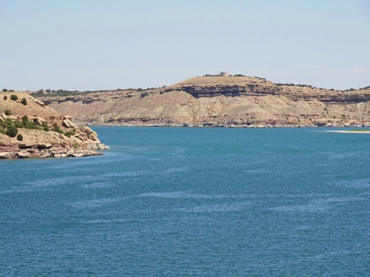
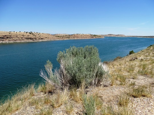
Starvation Reservoir, UT (No. 2)
There are various narratives explaining the name "Starvation". Orson Mott recounted the most credible story. In 1900, A.M. Murdock of Heber city, approached Major Myton of the Uintah Indian reservation to purchase grazing permits for his cattle. He was given grazing permits in the upper Strawberry river area. Dave Murdock, brother of Al Murdock, had secured a contract to provide beef to the Ute tribe at Fort Duchesne. In the fall of 1904 they brought the herd out of the high grazing areas and made it to the river bottoms which is now covered by Starvation reservoir. Very heavy snows stranded the herd. With no feed the entire herd died. Dave Murdock named the area "Starvation Flats" from this experience.
Another account describes a group of fur trappers stranded in harsh winter conditions who survived by stealing a local Native American cache of food, which resulted in their starvation. Another account tells the opposite story, with the Indians doing the stealing and the trappers starving. A third story involves a local rancher who attempted to graze livestock in the area, and they all starved.[5] Yet another explanation for the name involves settlers in the early 1900s trying to survive along the banks of the Strawberry River, in the area now occupied by the reservoir. These settlers dealt with near-starvation in a hostile environment. Winters in the area are long and cold, and their livestock often died. The area's short growing season was hindered by floods, hail, early frost and other problems. These settlers could have nicknamed the area Starvation.
Source: Wikipedia
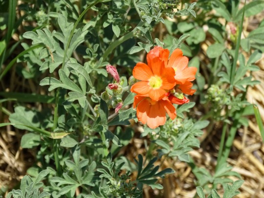
#Starvation Resevoir Bridge#Starvation Reservoir#Starvation State Park#Utah#Rubber rabbitbrush#Desert Globemallow#Apricot Globe-mallow#lake#flora#wildflower#engineering#original photography#travel#vacation#lake shore#tourist attraction#landmark#boat#ship#summer 2022#road trip#Western USA#Duchesne County#blue sky#Fred Hayes State Park at Starvation
1 note
·
View note
Last Seen Blogs

silence2020
Untitled
silence2020
Untitled
tsukibal
Tsukikannigram

fluffy-pot
🌸Fluffy.pot🌸

shtvsimulation
shadowhunters bot official