#katwalks
Text

Kendall Katwalk
#artists on tumblr#original photography#original photographers#pnw#washington#nikon#orofeaiel#hiking#nature#landscape#mountains#moody#forest#kendall katwalk trail#pacific northwest#cottagecore#naturecore#explore
534 notes
·
View notes
Text
Sum Aggie doodles! :D
there's alot so I put em under the read more


#Fnaf springtrap#fnaf#fnaf3#springtrap#fnafau#fnafoc#katwalker#kat walker#bunny art#bunny#fnaffanart#fnaf 3 springtrap#tw blood#cw blood
109 notes
·
View notes
Text


Kendall Katwalk
#longest hike ive ever done!! almost 13 miles... my legs hurt but im glad i did it#i carried felix over the rockiest section because he has a hard time on loose rocks but he did the rest of it on his own#not bad for a 15 year old dog#rusthikes#felixmyboy
3 notes
·
View notes
Text
I’m probably gonna redesign my old killjoys and the main one I had was named “Kat Shadow”
Like what the fuck “Katwalk” was right there
2 notes
·
View notes
Text

Kendall Katwalk, Pacific Crest Trail, Mt. Baker Snoqualmie National Forest, 2005.
#landscape#mountains#pacific crest trail#mt baker snoqualmie național forest#washington state#2005#photographers on tumblr#pnw#pacific northwest
3 notes
·
View notes
Text
Stil Ted. A bimbo is all tite bout her look. She tinks, feels, reflects on it all day long. Her life is a katwalk. Whervr she goes, whervr she is, she wantz 2 shine. She is sooo omigawd wiv evry detail. Evry thin must b a match. Evry thin must b on place liek she has found hers. She must xxx-presz her ezence & liek um, tryin hard wiv on point & liek um, show off. There is no room for nythin else. She is all beauty & liek um, sexxx, cos liek um, sexxx & like um, beauty is all there is, for bimbo is a 24/7 always job & like um, a bimbo exxcels in it, like, OMG rite?! like OMG!!
#chav translated #my edit #bimbo talk
6 notes
·
View notes
Link
Check out this listing I just added to my Poshmark closet: Katwalk Shorts Medium Tie-Dye Rayon Mini Shorts.
0 notes
Text

Kendall Katwalk, WA 07/23
#35mm#film photography#pnw#washington#nature photography#landscape photography#photography#mountains#landscape#nature
1 note
·
View note
Text

Kendall Katwalk, Washington
#artists on tumblr#original photography#original photographers#pnw#washington#pnw adventures#hiking#lensblr#nikon#orofeaiel#pacific crest trail#pacific northwest#mountains#nature photography#landscape#kendall katwalk#peaks
464 notes
·
View notes
Text

HELLLL YEAAA
(just a lil drawin for myself >W<)
#Kat Walker#KatWalker#fnaf au#fnaf oc#Springlock Victim OC#I had SOOOOOOO MUCH fun shading the jacket!#I in general just had ALOT of fun playing with muddier tones than I usually mess with >W<
85 notes
·
View notes
Photo
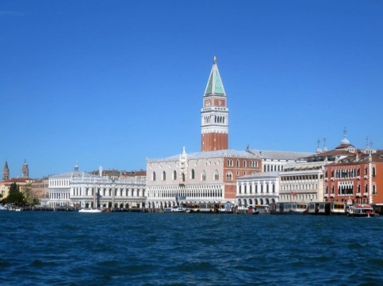
It is intricate and romantic. It is beautiful ❤️🇮🇹 #Venice #Venizia #italy #Italia #Europe #veniceitaly #EuroScape2k18 #travelwithaccess #travel #travelphotography #Wanderlust #KatWalks #KatWalking #instatravel #Travelgram #travelbum #exploremore #flymore #wanderlust #Keepwalking #Travelstoke #travelbum #walkmore #travelseries (at Venezia, Italia)
#keepwalking#walkmore#veniceitaly#venizia#travel#travelwithaccess#katwalks#katwalking#flymore#italy#travelgram#exploremore#europe#euroscape2k18#wanderlust#travelseries#venice#travelphotography#travelbum#italia#travelstoke#instatravel
1 note
·
View note
Photo


just nostalgic for home
#journal shit#top to bottom Teneriffe then dungeness spit then kendalls katwalk#and rodeotown at grandpas
9 notes
·
View notes
Text
The Best of the Washington PCT
This is an excerpt of a longer article published in The Seattle Times a while back. Sometimes Washington gets overshadowed by the excitement of the first weeks on the trail in the desert south and the majesty of the High Sierra, but some of the most stunning mileage along the trail comes in the final 500 miles. It can be cold and wet in late September and October but glorious in July and August … a great time to hike in Washington.
The truth is that this assessment of the highlights does not leave out much . . . nothing north of Snoqualmie Pass. There is some beautiful trail near Mt. Rainier that some might argue belongs on the list. What would you add or delete from this list?
By Terry Wood, Seattle Times
So what sections are the trail’s best in Washington? I’ve hiked more than two-thirds of the state’s PCT miles, making repeat visits to prime sections, and my “best-of” list is a four-way tie (details in a moment).
Others offer tips on least-favorite stretches. Lorain considers two sections marginal: from the Oregon border north to Mount Adams (where first power lines, then heavy forest, diminish views, though the Indian Heaven Wilderness west of Trout Lake rates applause), and a long stretch of miles south of Snoqualmie Pass.
“A lot of checkerboards,” McCarty says of Snoqualmie Pass south, referring to patches of intermittently harvested forest. His threesome walked the 22 miles between Stampede Pass and Interstate 90 as a long, call-of-duty day hike. A ray of hope: A land sale announced in March could lead to a rerouting of part of that trail. Good news, says McCarty. “For about five miles south of Snoqualmie Pass, it’s crappy trail,” he says.
Now my idea of the good stuff:

• Mount Adams (Forest Service Road 23) north to White Pass (U.S. Highway 12), 66 miles.
The westside portion of Mount Adams’ Highline Trail also doubles as the PCT and is, as McCarty correctly points out, a gorgeous area. Bonus: This portion of trail is relatively level for miles.
The section’s showstopper, though, is the Goat Rocks Wilderness and the rocky, barren, narrow path the PCT follows over the shoulder of 7,880-foot Old Snowy. Though harrowing to people uncomfortable with heights and steep drop-offs, this section’s sky-high views northwest to Rainier and south to Adams are memory-makers.
In “Trekking Washington” Woodmansee outlines a good game plan for catching three of the region’s major highlights (Cispus Basin, the climb to Old Snowy and Shoe Lake): a 30-mile, one-way push from remote Walupt Lake to White Pass. The downside: A required 50-mile car shuttle that runs through Packwood, with more than a third of the drive on dirt road.

• Snoqualmie Pass (I-90) to Stevens Pass (U.S. Highway 2), 71 miles.
Due to the almost legendary appeal of the Kendall Katwalk — a narrow stretch of trail that was dynamited into existence along a steep granite slope six miles north of Snoqualmie Pass — a bazillion curious urban day hikers have been able to claim they have experienced at least a taste of the Pacific Crest Trail.
With its big views, not-so-easy approach (2,600-foot elevation gain) and hint of danger, a hike to the Katwalk (starting at the PCT trailhead just north of Exit 52 on I-90) is a worthwhile teaser to what makes the PCT so appealing.
More treasures lie farther north: the rugged Chikamin Ridge and Park Lakes; bedazzling Spectacle Lake (often approached by overnight backpackers from Cle Elum); Cathedral Rock; Deception Pass, the knockout view of Glacier Lake (with Glacier Peak looming far to the north) from Pieper Pass.
A one-way, pass-to-pass jaunt is great fun for low-weight, high-speed backpackers searching for a challenge. I once covered the 71 miles in three days, another time in four. Even if you take the customary seven days, it’s a rewarding way to get an in-depth look at Seattle’s next-door mountains.

• Stevens Pass (U.S. 2) to Rainy Pass (Highway 20), 127 miles.
The longest and toughest section of the PCT, with multiple lung-busting climbs and sharp descents, may also be its prettiest. As Romano says, the meadows (and berry patches) along this stretch are uncommonly lovely. From Kodak Peak north to White Pass and Red Pass, the PCT sends hikers soaring along a towering ridgeline.
And the hits just keep coming. “When you start at Stevens, Glacier Peak is constantly up ahead, like a beacon, luring you in the entire way,” Romano says. “It’s the wildest of the Washington Cascade volcanoes. After miles of meadows, you come to Red Pass, and Glacier is suddenly right in your face.
Beyond Red Pass, now you go through alpine tundra and past a cinder cone (White Chuck Cinder Cone) that’s one of the coolest cinder cones outside of Lassen Volcanic National Park. Then you swing around Glacier Peak and head up to Fire Creek Pass and eventually Miners Ridge and Suiattle Pass. It’s just a great area.”
The 2014 reopening of the Suiattle River Road (Forest Service Road 26) north of Darrington has restored easier westside trail access for shorter trips to the region.
For fit, ambitious hikers, a smart approach for nearly seeing it all is to park a vehicle at Stevens Pass, shuttle a second car to Chelan, then ride a boat to Stehekin. Next, take a national park bus to the High Bridge junction on the PCT and hike 108 miles south. (Whoa.) Plan for eight or more mind-blowing days.

• Rainy Pass (Highway 20) to Canadian border, 61 miles.
The most common introduction to this area is the day hike from Rainy Pass to gorgeous, 6,800-foot Cutthroat Pass (10 miles round-trip, 2,000-foot elevation gain). Tip: Venture even farther north, to Granite Pass, and take in the long-distance view of Golden Horn and mighty Tower Mountain.
Or drive the primitive, winding, not-for-the-timid Harts Pass Road (built in 1893; recently reopened after a rockfall was cleared) to Harts Pass and either walk south to expansive Grasshopper Pass, or north 3.5 miles to Windy Pass while gawking at the high-density cluster of peaks to the west, including imposing Azurite Peak and Mount Ballard.
#Rainy Pass#Cutthroat Pass#Granite Pass#Alpine Lakes#Kendall Katwalk#Mt. Adams#White Pass#Snoqualmie Pass#Stevens Pass
20 notes
·
View notes
Photo

🔶️◾Today was one of joyous moments of my life!!! Not only did I and fellow knights have the opportunity to assist in Junior College Clinic and help molding the kids of the future, but we also graced the hall and paid hommage to best modeling club known in high school history!!! We still got it, never forget that!!!◾🔶️ . . . #CityForever #CityBuilt #EnoughSaid #Katwalk #classof2008 #classof2007 #brainsandbeauty #alumni #CityAllDay #TheCastleOnTheHill (at Baltimore City College) https://www.instagram.com/dograhe_lovell/p/BvVWH-NBHSJ97G3Tv-_77NjnPvad2UDN__HkkU0/?utm_source=ig_tumblr_share&igshid=1g387e60mced6
#cityforever#citybuilt#enoughsaid#katwalk#classof2008#classof2007#brainsandbeauty#alumni#cityallday#thecastleonthehill
3 notes
·
View notes
Text
Huckleberry Mountain by Mount Thomson via Snoqualmie Pass / 哈克貝利山
Huckleberry Mountain by Mount Thomson via Snoqualmie Pass / 哈克貝利山
Huckleberry Mountain by Mount Thomson perches above Pacific Crest Trail (PCT) in Alpine Lakes Wilderness. At under a mile away east lies its well-known neighbor Chikamin Peak. Even the quickest way from Snoqualmie Pass can take an entire day.
One step closer to Huckleberry Mountain
See more trip photos here.
Huckleberry Mountain at a Glance
Access: Pacific Crest TrailheadRound Trip: 20…

View On WordPress
0 notes
Last Seen Blogs

cigarjim66
Cigars and the men who smoke them!

kwonjiyogn
I'M A LOSER

mona8585
Nothing

momsonchannelposts-blog
My reaction Videos

righttolightsurveyors
Delva Patman Redler