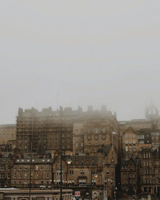
#the vennel edinburgh
Text
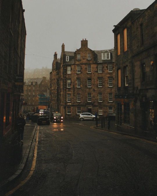

Instagram credit: co.nfused
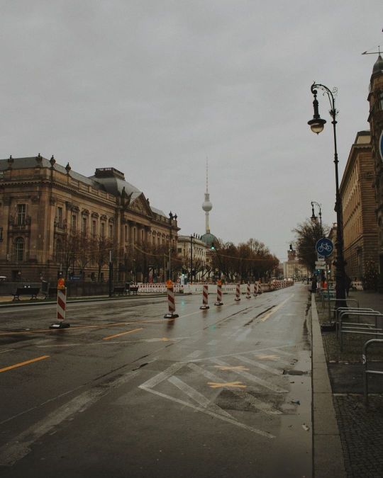
#cockburn street#candlemaker row#the vennel#old town#edinburgh#scotland#uk#united kingdom#germany#berlin#unter den linden#dark academia#dark academia aesthetic#rainy city#cities
3K notes
·
View notes
Text
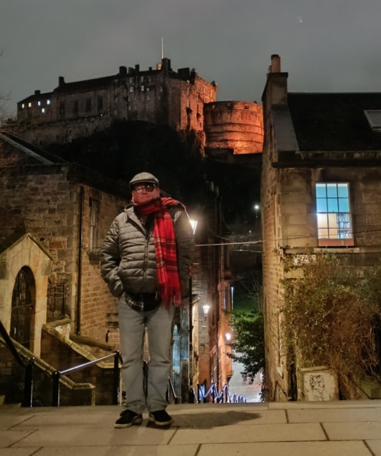
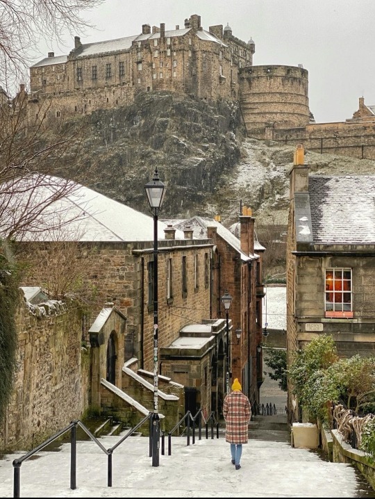
Pretending to be a tourist at The Vennel
52 notes
·
View notes
Text
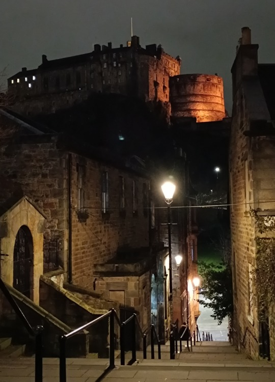
Edinburgh Castle, The Vennel steps | 📸: @wisteriamanor
0 notes
Text

Laurence Winram
Late night at the top of the Vennel
Edinburgh
259 notes
·
View notes
Text

flickr
Vagelis Pikoulas
The Vennel Steps of Edinburgh at blue hour
135 notes
·
View notes
Text
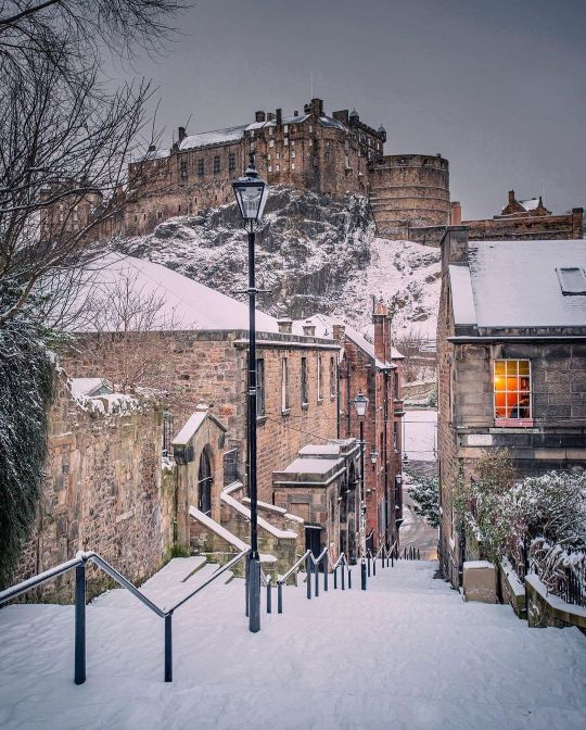
View of Edinburgh Castle from the Vennel in the snow
106 notes
·
View notes
Text
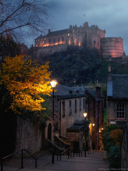
Last week I've visited Scotland. The country where my heart really belongs.
Here's a photo of Edinburgh castle I made from The Vennel. If not for the electricity used in the streetlights, you could believe this was a photo from the 1800s.
Bonnie Scotland, with its views, history and beautiful nature! 💙🏴
129 notes
·
View notes
Photo
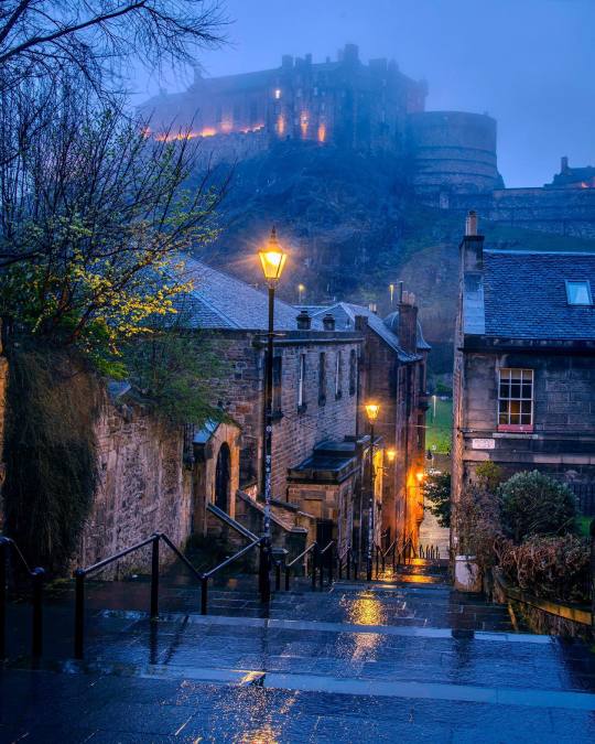
Edinburgh Castle at a distance seen from the rain drenched vennel steps lit with street lamps, Edinburgh, Scotland.
1K notes
·
View notes
Text
The Vennel, Edinburgh.
25 notes
·
View notes
Photo

Edinburgh Castle seen from the Vennel Steps, Edinburgh, Scotland [OC] via CityPorn
35 notes
·
View notes
Text

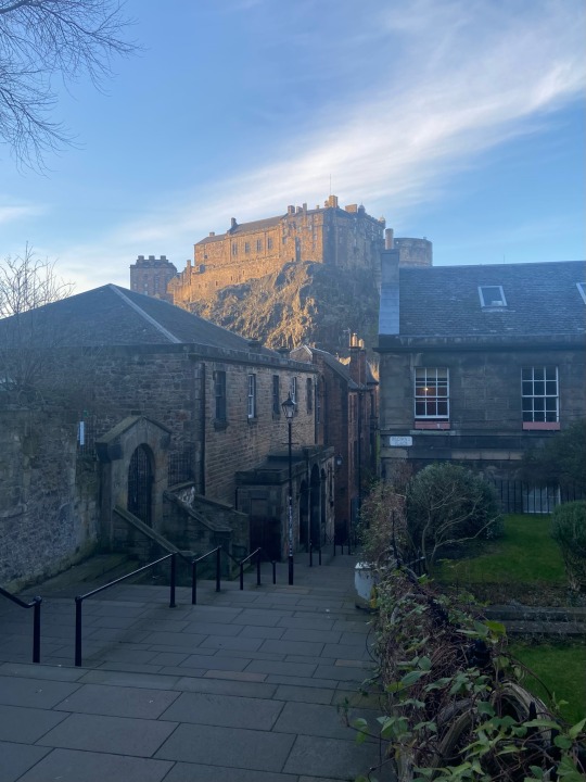
Edinburgh Castle And Its Half Moon Battery Seen From The Vennel Steps In The Old Town, Edinburgh, Scotland
3 notes
·
View notes
Photo
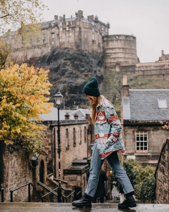
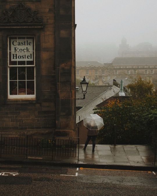
🧡walking along the cobblestone streets in Edi takes you back to the history that has once walked there…you can almost feel the atmosphere & how J.K.Rowling obtained so much inspiration for HP. the beautiful walks, the stunning architecture & moody weather 🧡 @astre_people keeps me warm & cozy while we wander around the city 🥰✨ here are my top tips to visit when you have only overnight in Edinburgh: •definitely book @airbnb in the centre, everything is in a walking distance so you don’t have to commute •start the day with coffee in your hand - our fav is 📍Wellington Coffee on Hanover Street & @fortitudecoffee ☕️ •walk around the old town, see the Monument, wander around Princess Gardens •walk up the hill through Cockburn St to the Royal Mile •don’t miss out the St Giles’ Cathedral & Edinburgh Castle 🧡 •on your way back get lost in one of the many cute shops on Victoria Street (Full of color & you can find Harry Potter shop there) •if you fancy Scottish food try @howies or there’s @eltorolocoedinburgh Mexican street food 🧡 •pictures were shot from the Vennel Viewpoint where you can get easily to from Victoria Street •go back up to the castle & wander & explore secret narrows with hidden gems like stairs,old lamps or hidden pubs & tearooms •for the afternoon I recommend a walk around Dean Village Do you have your personal tips what’s your fav spot in Edinburgh or is it on your bucket list? Let me know in comments ♥️ . . #susanetalks #astrepeople #edinburghlove #zuzcincibusphotography #edinburghphotographer #living_destinations #unveiledinburgh #edinburgh_residents #living_europe #unitedkingdom #scotland #edinburghlife #kings_villages #photosofbritain #photosofscotland #visitscotland #visitedinburgh #unlimitededinburgh #unlimitedbritain #thisisedinburgh #edinburgh_snapshots #igersedinburgh #ig_edinburgh #hiddenscotland (at The Vennel Edinburgh) https://www.instagram.com/p/CkVaoPkgvPr/?igshid=NGJjMDIxMWI=
#susanetalks#astrepeople#edinburghlove#zuzcincibusphotography#edinburghphotographer#living_destinations#unveiledinburgh#edinburgh_residents#living_europe#unitedkingdom#scotland#edinburghlife#kings_villages#photosofbritain#photosofscotland#visitscotland#visitedinburgh#unlimitededinburgh#unlimitedbritain#thisisedinburgh#edinburgh_snapshots#igersedinburgh#ig_edinburgh#hiddenscotland
2 notes
·
View notes
Text

Two young lassies from London at a busy Vennel yesterday.
12 notes
·
View notes
Text
Edinburg

Edinburgh, the capital of Scotland, has a rich and ancient history that stretches back thousands of years, with evidence of human settlement dating as far back as the Bronze Age. From its origins as a fortified hilltop settlement, Edinburgh grew into a thriving medieval city and later became an intellectual and cultural center, known for its historic landmarks, vibrant festivals, and influential role in Scottish history.

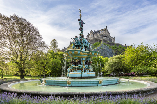
Ross Fountain
Stockbridge Market
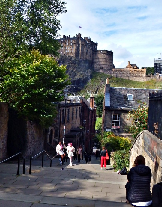
The Vennel Viewpoint Edinburgh Castle

The People's Story Museum


Free
Holyrood Abbey
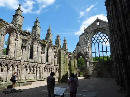

Free
Water of Leith

St Giles' Cathedral
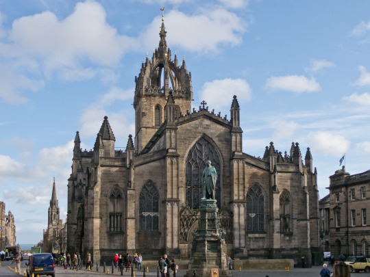
Free entry and tour
Sherlock Holmes Statue on Picardy Place
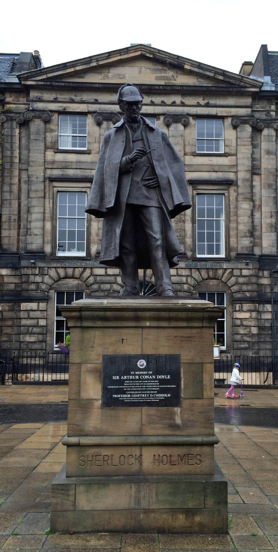
A statue of Sherlock Holmes in Picardy Place, just at the top of Leith walk. It is a tribute to author Arthur Conan Doyle, who was born in the street in 1859. It was temporary moved in 2009 to make way for the tram works, underneath they found a time capsule, this was not opened but returned later with the statue

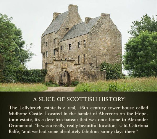
Serie Outlander, James Fraser leaving Edinburg
0 notes
Text
0 notes
Photo
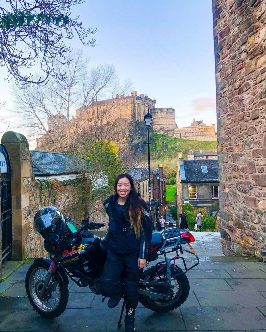
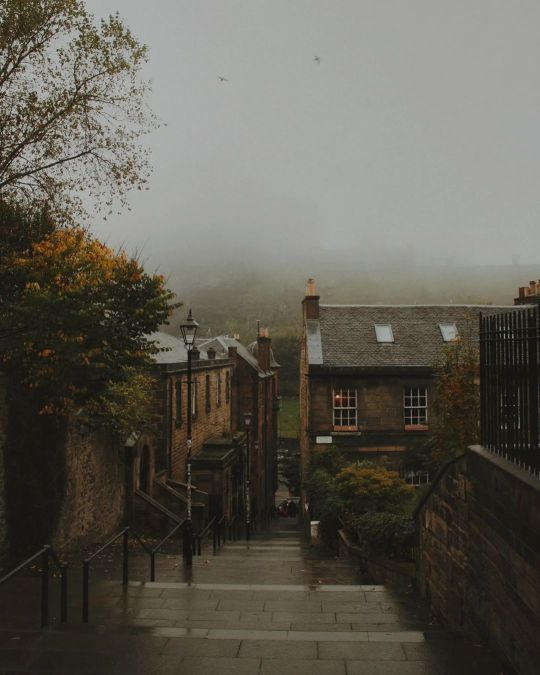
Hello from the Vennel Viewpoint in Edinburgh, Scotland! This spot features a picturesque staircase that is rewarded with an amazing view of Edinburgh Castle. There are no cars allowed, but thank goodness Freyja is tiny so we could park here and enjoy the view for a bit. No, I did not wheelie up the stairs 😹 We came the back way from Flodden Wall 😺 Happy Monday! I can feel the days getting longer which means more daylight time ride! 😼💪🏍 #chasingcrystal #scotlandsites #edinburghcastle #edinburghcastleview #ladybiker #ladyriders #solofemaletraveler (at Edinburgh, Scotland) https://www.instagram.com/p/Cm64DusIlZa/?igshid=NGJjMDIxMWI=
#chasingcrystal#scotlandsites#edinburghcastle#edinburghcastleview#ladybiker#ladyriders#solofemaletraveler
0 notes
Last Seen Blogs