
Don't wanna be here? Send us removal request.
Statistics
We looked inside some of the posts by charlesbchawes and here's what we found interesting.
Average Info
Notes Per Post
6
Likes Per Post
5
Reblog Per Post
1
Reply Per Post
0
Time Between Posts
2 months
Number of Posts By Type
Text
17
Last Seen Tumblr Blogs


Fun Fact
Mobile US users spent an average of 115.8 minutes on Tumblr app monthly.
Text
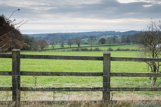
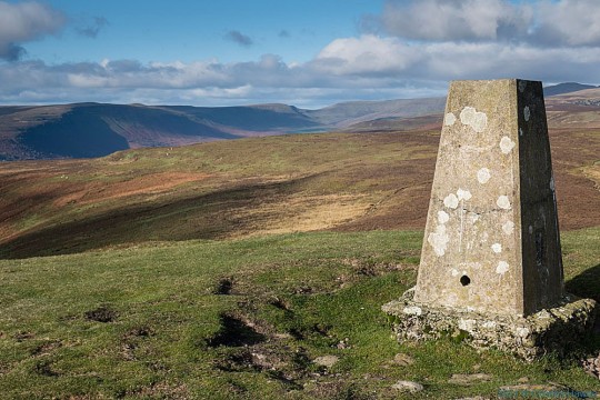
The Monmouthshire Way Day 2: Lower Veddw to Trellech
The Monmouthshire Way Day 2: Lower Veddw to Trellech
Date walked: 5th January 2022 Map used: Ordnance Survey Explorer OL 14- Wye Valley and Forest Of Dean (having downloaded the route onto my phone). Distance: about 6 miles – this is the second part of Stage 1 of the route as described on the website below Website for path: There is no written guide to the path but this website has the basics. *********** This section of the path initially follows…

View On WordPress
0 notes
Text
The Monmouthshire Way: Day 1 Chepstow to Lower Veddw
The Monmouthshire Way: Day 1 Chepstow to Lower Veddw
A gentle 8 mile walk on the Monmouthshire Way from Chepstow; walking in my own back yard (loosely) Date walked: 24th November 2021 Map used: Ordnance Survey Explorer OL 14- Wye Valley and Forest Of Dean (having downloaded the route onto my phone). Distance: about 8 miles. This is the first part of Stage 1 of the route as shown on the website for the Way (see below) Website for path: There is no…
View On WordPress
#A466#Chepstow#Chepstow Castle#Chepstow Park Wood#Chepstow Racecourse#Fedw#Henry Clay#Monmouthshire#Monmouthshire Way#Nathaniel Wells#New Wood#Piercefield Park#Pilmore Wood#Rogerstone Grange#St Arvans#The Dell#The Fedw#The Veddw#Valentine Morris#Veddw#Welsh Street#Wyndcliffe Court
2 notes
·
View notes
Text
Offa's Dyke Path Day 13: Llanymynech to Castle Mill
Offa’s Dyke Path Day 13: Llanymynech to Castle Mill
A longish but very varied and enjoyable walk from Llanymynech to Castle Mill in which I encounter a two-headed horse. Date walked: 19th August 2021 Distance: 13.5 miles Maps used: OS Explorer 240 Oswestry Guide used: Walking Offa’s Dyke Path by Mike Dunn published by Cicerone in 2016 *************** Bad news; despite a perfectly decent nights sleep my painful knee had not received any…

View On WordPress
#asterley rocks#Bakers hill#Bradford Arms#Candy#Carreg-y-big#Castle Mill#Charlesd Darwin#Craignant#Llanymynech#Moelydd#Nantmawr#Offa&039;s Dyke#Oswestry Racecourse#pen-y-coed#Pontfadog#porth-y-waen#Racecourse common#Selattyn Hill#Swan Inn#Trefonen
0 notes
Text
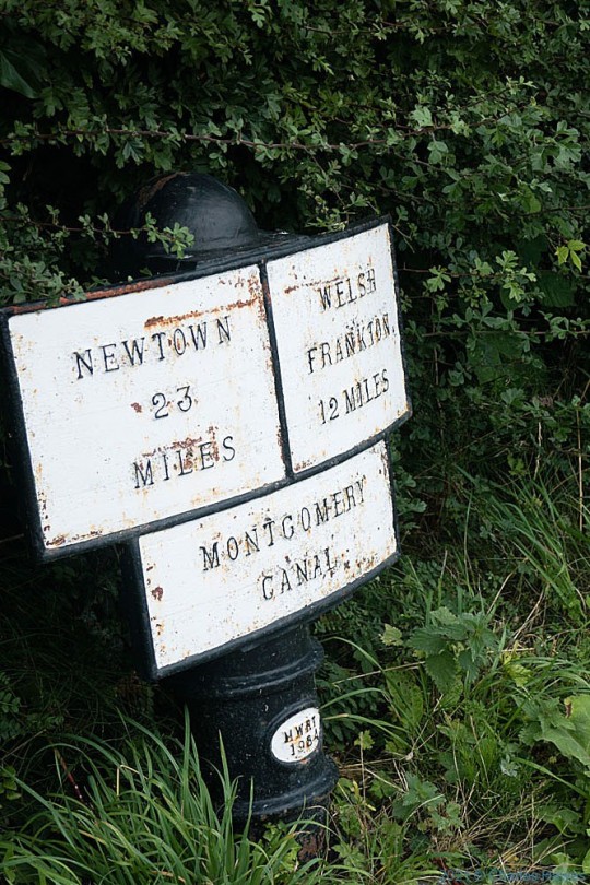
Offa's Dyke Path Day 12: Buttington to Llanymynech
Offa’s Dyke Path Day 12: Buttington to Llanymynech
A not very exciting 10 mile trek across the Severn flood plain, but much improved by the Montgomery Canal. Date walked: 18th August 2021 Distance: 10.5 miles Maps used: OS Explorer 216 (Welshpool and Montgomery) and 240 Guide used: Walking Offa’s Dyke Path by Mike Dunn published by Cicerone in 2016 ********* It had been my first night in my little Terra Nova tent for a very long time and I…
View On WordPress
0 notes
Text
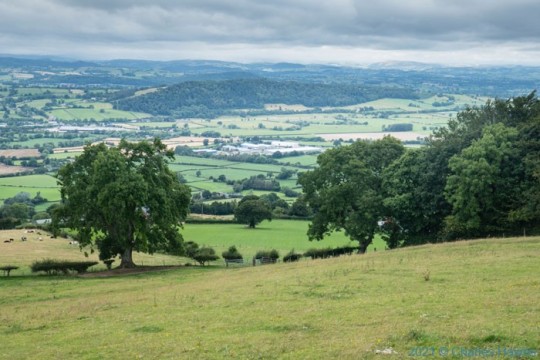
Offa's Dyke Path Day 11: Forden to Buttington
Offa’s Dyke Path Day 11: Forden to Buttington
Returning to Offa’s Dyke after a two year absence, a pleasant 6 mile hike From Forden over Beacon Hill near Welshpool Date walked: 17th August 2021 Distance: about 6 miles Maps used: OS Explorer 216 (Welshpool and Montgomery). Guide used: Walking Offa’s Dyke Path by Mike Dunn published by Cicerone in 2016 ******** HAPPY NEW YEAR! This isn’t the most exciting post I’ve done so to add to its…
View On WordPress
0 notes
Text
The Sirhowy Valley Walk (well, mostly the upland bit of it)
The Sirhowy Valley Walk (well, mostly the upland bit of it)
A winters walk on the Sirhowy Valley path involving some challenging scenery, drugs and contact with the police. Date walked: 22nd January 2020 Maps used: OS Explorer OL 13 and OS Explorer 166 Rhondda and Merthyr Tydfil Distance: around 9 miles *********** After such a beautiful walk for my last post I was wondering how I could make this next post special. And then I remembered a walk I did…
View On WordPress
#Aneurin Bevan#Cefn manmoel#Ebbw Vale#fly-tipping#Manmoel#rubbish#sheep#sirhowy valley#Wales#welsh valleys
0 notes
Text
The Black Mountains circular walk from Partrishow, Powys
The Black Mountains circular walk from Partrishow, Powys
A super 10 mile walk on the Powys/Monmouthshire border with some fabulous views starting and ending with one of the sweetest churches at Partrishow. Date Walked: 21st November 2021 Distance: about 10 miles Map used: OS Explorer OL 13 – Brecon Beacons National Park (Eastern area), downloaded on the phone *************** This is my first post since my web guru, the excellent Gary – contact him via…
View On WordPress
0 notes
Text
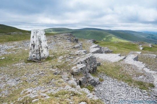
The Black Mountain circular walk from Llanddeusant
The Black Mountain circular walk from Llanddeusant
Subscribers please note – Sadly you may need to re-subscribe to keep getting email notifications about future posts. Please do anyway! See new subscription box on the right hand side of the first picture of this post (or, possibly, at the bottom of the post if you are looking at it on a smartphone). You will not receive any spam, promise! (This does not apply if your subscription is with…
View On WordPress
#Beacons way#Brecon Beacons#carcass#Careg yr Ogof#Carmarthensire#cave#Cwm Sawdde fechan#Godre &039;r Garreg Las#limestone#LLanddeusant#The Black Mountain#Yellow Rattle#Youth Hostel
0 notes
Text
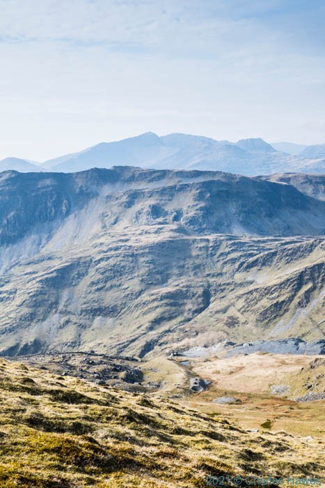
Cambrian Way day 31: Cnicht circular
Cambrian Way day 31: Cnicht circular
After a not too strenuous climb to the summit of Cnicht, a fascinating explore of two historic slate quarries. Date walked: Wednesday 22nd April 2021 Distance: About 7 miles Maps used: OS Explorer OL 18- Harlech, Porthmadog and Y Bala and OL 17 Snowdon (or Yr Wyddfa as a new campaign would have us exclusively name it) Guide used: Walking the Cambrian Way by George Todd and Richard Tyler…

View On WordPress
#Cnicht#Croesor#Croesor quarry#Cwmorthin quarry#Llyn yr Adar#mining#north wales#slate#Snowdonia#The Cambrian Way#Wales
0 notes
Text
The Cambrian Way day 30: Bronturnor Mawr to Croesor
The Cambrian Way day 30: Bronturnor Mawr to Croesor
A fabulous 7 mile hike through one of the wildest sections of the Cambrian Way, crossing Moelwyn Mawr, but taking in railways, power stations and quarries! Date walked: Sunday, 18th April 2021 Distance: About 7 miles Maps used: OS Explorer OL 18- Harlech, Porthmadog and Y Bala and OL 17 Snowdon (or Yr Wyddfa as a new campaign would have us exclusively name it) Guide used: Walking the Cambrian…
View On WordPress
#Afon DWyryd#Bron Turnor Mawr#Cambrian Way#Cnicht#Croesor#Cwm Croesor#dam#Gwynedd#Llyn Stwlan#Maentwrog#Moelfryn Mawr#Moelwyn Bach#nuclear power station#quarry#Snowdonia#Tanygrisiau reservoir#Trawsfynydd
1 note
·
View note
Text
The Cambrian Way Day 29: Moelfryn to Bron Turnor Mawr
The Cambrian Way Day 29: Moelfryn to Bron Turnor Mawr
A very relaxed and easy 5 mile stroll from Moelfryn on Llyn Trawsfynydd to our accommodation near Maentwrog, during which Charles discovers his compass Date walked: Saturday, 17th April 2021 Distance: About 5 miles Maps used: OS Explorer OL 18- Harlech, Porthmadog and Y Bala Guide used: Walking the Cambrian Way by George Todd and Richard Tyler (Cicerone Press) ******** Paul and I had arrived at…

View On WordPress
#Afon DWyryd#Bron Turnor Mawr#Bryntirion#Cambrian Way#dam#Llyn Trawsfynydd#Maentwrog#Moelfryn#nuclear power station#Snowdonia#The Grapes#Wales Coast Path
1 note
·
View note
Text
The Cambrian Way day 28: Cwm Bychan to Moelfryn
The Cambrian Way day 28: Cwm Bychan to Moelfryn
Theoretically a relatively easy 5 mile trek over some of the smaller summits of the Rhinogs. But then there’s theory and there’s practice. Date walked: 16th April 2021 Distance: according to my map as traced out on my phone, 7km, in reality quite a bit more Maps used: OS Explorer OL 18- Harlech, Porthmadog and Y Bala Guide used: Walking the Cambrian Way by George Todd and Richard Tyler (Cicerone…
View On WordPress
#Cambrian Way#Cwm Bychan#Diffwys#Foel Penolau#Harlech#Lake Trawsfynydd#Maentwrog#Moel Ysgyfarnagod#Moelfryn#National Park#Snowdonia#Wales
2 notes
·
View notes
Text
The Skirrid
A stunningly beautiful three mile climb up The Skirrid in Monmouthshire
Date walked: 27th November 2020
Distance: about 3 miles
Map used: none but I had with me OL Explorer 13 Brecon Beacons National Park, Eastern Area (just in case).
Conversational topics included (amongst others): pressures on front line NHS staff, do animals recognise beauty in the way that humans do – or at all,…
View On WordPress
0 notes
Text
Men's Waterproof Walking Trousers: DLX "Ultimate Golf Putter" from Trespass
Men’s Waterproof Walking Trousers: DLX “Ultimate Golf Putter” from Trespass
Generally speaking, I try to avoid walking in the rain. So given a forecast of rain and a choice I’m likely as not to stay at home. But sometimes wet-weather walking is unavoidable as many a day on the Cambrian Way or Offa’s Dyke or just about any other long-distance path walking over several days has proved. So having decent waterproofs is essential.
I last looked at these on this blog almost…
View On WordPress
0 notes
Text
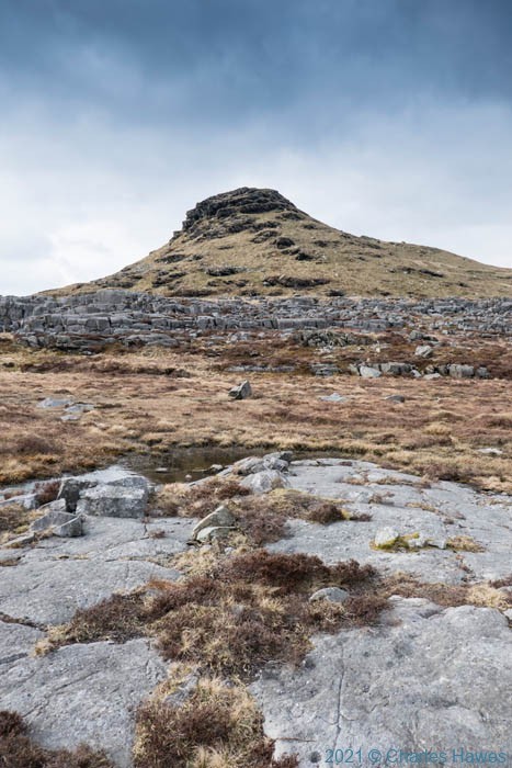
Cambrian Way day 27: Circular walk over Rhinog Fawr
Cambrian Way day 27: Circular walk over Rhinog Fawr
A six mile clamber over the remote and rocky peak of Rhinog Fawr in Snowdonia
Date walked: 10th September 2020
Distance: about 6 miles
Maps used: OS Explorer OL 18- Harlech, Porthmadog and Y Bala
Guide used: Cambrian Way by A.J.Drake (7th edition, 2016) , though a new guide has recently been published which is much better: Walking the Cambrian Way by George Todd and Richard Tyler (Cicerone Press)
View On WordPress
#Cambrian Way#Graig Ddu Ichaf#ISOBAA#Llyn Du#Maentwrog#Nant Llyn Ddu#Rhinog Fach#Rhinog Fawr#Snowdonia#walking hiking
0 notes
Text
Offa's Dyke Path day 10: Cwm to Forden
Offa’s Dyke Path day 10: Cwm to Forden
A wet trudge over 7 miles of the Offa’s Dyke path, finishing by abandoning the walk at Forden near Welspool
Date walked: 11th June 2019
Distance: about 7 miles
Maps used: OS Explorer 216 (Welshpool and Montgomery).
Guide used: Walking Offa’s Dyke Path by Mike Dunn published by Cicerone in 2016
**************
If you had read the post from yesterday’s walk you’ll recall that I had stayed last…
View On WordPress
0 notes
Text
Offa's Dyke Path day 9: Knighton to Cwm
Offa’s Dyke Path day 9: Knighton to Cwm
Said to be the toughest section of the whole Offa’s Dyke Path, I have to agree. A long 13 mile day rather spoiled by being rained on for half of it.
Date walked: 10th June 2019
Distance: about 13 miles
Maps used: OS Explorer 201 (Knighton and Presteigne) and OS Explorer 216 (Welshpool and Montgomery).
Guide used: Walking Offa’s Dyke Path by Mike Dunn published by Cicerone in 2016
**************
W…
View On WordPress
0 notes