
Don't wanna be here? Send us removal request.
Statistics
We looked inside some of the posts by equinoxdrones and here's what we found interesting.
Average Info
Notes Per Post
1
Likes Per Post
1
Reblog Per Post
0
Reply Per Post
0
Time Between Posts
12 days
Number of Posts By Type
Text
3
Last Seen Tumblr Blogs


Fun Fact
US Tumblr user growth rate is estimated to slow down to 4.1%.
Text
Exploring the Applications and Benefits of Drones in Solar Inspections
As the solar industry continues to expand, the need for efficient and effective maintenance and inspection solutions becomes a priority —Equinox’s Drone: a technology revolutionizing various sectors, including renewable energy. In this blog, we’ll delve into the applications and benefits of using drones in solar inspections and their role in ensuring optimal performance and longevity of solar installations.
The Need for Advanced Solar Inspections
Solar panels endure various environmental conditions, leading to wear and tear over time. Regular inspections are crucial to ensure panels operate at peak efficiency, identify potential issues early, and minimize maintenance costs. However, traditional inspection methods can be time-consuming, labor-intensive, and hazardous. This is where drones, including solar-powered UAVs, come into play, offering a smarter, safer, and more efficient alternative.

Applications of Drones in Solar Inspections
1. Thermal Imaging
Drones equipped with thermal cameras can capture infrared images of solar panels, identifying hot spots and areas with potential defects. These thermal images detect issues, such as faulty panels, poor connections, and shading problems invisible to the naked eye.
2. Visual Inspections
High-resolution cameras on drones can capture detailed images of solar panels, revealing physical damage like cracks, dirt accumulation, and other visible defects. This visual data is invaluable for assessing the overall condition of the panels and planning necessary maintenance.
3. Site Surveying and Mapping
Before installing a solar array, a thorough site survey is essential. Drones can quickly and accurately map the area, providing detailed topographic data that helps design the optimal layout for maximum efficiency. This reduces the time and effort required for manual surveys and enhances the precision of the installation process.
4. Real-time Monitoring
Drones, including those equipped with solar panels for extended flight times, can be used for real-time monitoring of solar farms, providing continuous data on panel performance. This helps in promptly identifying and addressing any issues, ensuring that the solar farm operates smoothly and efficiently.

Benefits of Using Drones for Solar Inspections
1. Enhanced Efficiency
Drones significantly reduce the time required for inspections. A task that might take days manually can be completed in a few hours with a drone, allowing for more frequent inspections and quicker identification of issues.
2. Cost-Effective
By minimizing the need for manual labor and reducing the downtime associated with traditional inspections, drones can lead to significant cost savings. Additionally, early detection of problems helps avoid expensive repairs and replacements.
3. Improved Safety
Inspecting solar panels, especially those in solar farms or on rooftops, can be dangerous. Drones eliminate the need for technicians to climb heights or navigate challenging terrains, reducing the risk of accidents and injuries.
4. Comprehensive Data Collection
Drones provide high-quality thermal and visual data that can be analyzed for a comprehensive understanding of the solar panels’ condition. This data-driven approach enables better decision-making and more effective maintenance strategies.
5. Environmental Impact
By enhancing the efficiency and performance of solar panels, drones contribute to the overall effectiveness of solar energy as a sustainable power source. This aligns with global efforts to reduce carbon emissions and combat climate change.

Conclusion
At Equinox Drones Company, we are committed to harnessing the power of drone technology to advance the solar industry. Our cutting-edge drone solutions for solar panel inspections offer numerous benefits, from enhanced efficiency and cost savings to improved safety and comprehensive data collection. As we continue to innovate and develop our technology, including solar-powered drones, we aim to support the growth and sustainability of solar energy, paving the way for a greener future.
For more information on how our drone solutions can benefit your solar installations, contact us today. Let’s take your solar inspections to new heights!

0 notes
Text
Precision Aerial Surveying with LiDAR Mapping Drones: Revolutionizing the Surveying Industry

Technology is changing the way we do many things, including how we survey land. One exciting advancement is the use of LiDAR (Light Detection and Ranging) mapping drones for precision aerial surveying. These drones, often referred to as UAVs (Unmanned Aerial Vehicles), have transformed the surveying industry by offering incredible accuracy and efficiency.
What is LiDAR?
LiDAR is a technology that uses light in the form of a laser to measure distances. It sends out thousands of light pulses every second and measures how long it takes for each pulse to bounce back from the ground. This data is then used to create a detailed 3D map of the area being surveyed. LiDAR technology can be mounted on UAVs, making them excellent tools for aerial mapping and surveying.
How LiDAR Mapping Drones Work
LiDAR mapping drones, also known as UAV mapping drones, are equipped with several high-tech components: a laser scanner, a GPS receiver, and an IMU (Inertial Measurement Unit). As the UAV drone flies over an area, the laser scanner sends out light pulses to the ground. These pulses reflect to the drone, and the time it takes for them to return is recorded. Using this information, the drone can calculate the distance to the ground and create a precise 3D map.
The GPS receiver and IMU help the drone know its exact position and orientation, ensuring the measurements are accurate. The data collected is processed using special software, turning it into detailed maps and models.
Benefits of Using Equinox’s LiDAR Mapping Drones
Unmatched Accuracy and Detail
LiDAR technology provides incredibly detailed and accurate maps. It can detect tiny changes in the terrain, making it perfect for tasks like land surveying, forestry management, and infrastructure planning.
Efficiency and Time Savings
Traditional surveying methods can be slow and require a lot of manual labor. UAV mapping drones can cover large areas quickly, significantly reducing the time needed for data collection. This means projects can be completed faster and at a lower cost.
Versatility in Different Environments
LiDAR mapping drones are versatile and can be used in many environments, from dense forests to busy urban areas. They can even see through vegetation to map the ground below, making them ideal for forestry and environmental monitoring.
Safety and Accessibility
Using UAVs for aerial surveying means surveyors don’t have to navigate dangerous or hard-to-reach areas. UAV inspection drones can safely survey steep slopes, dense forests, and construction sites without putting people at risk.
Cost-Effective Solution

Applications of LiDAR Mapping Drones
Land Surveying
UAVs are increasingly used for land surveying. They create detailed topographic maps and digital elevation models, essential for land development and construction planning. UAVs for surveying and mapping can identify subtle features and changes in the landscape that traditional methods might miss.
Forestry Management
In forestry, UAV aerial mapping drones help assess forest structure, biomass, and health. They capture detailed 3D data of the forest canopy and floor, allowing forestry managers to monitor tree growth, estimate timber volume, and detect vegetation changes.
Infrastructure Planning and Maintenance
LiDAR mapping drones are vital for infrastructure planning and maintenance. They survey roads, bridges, railways, and utilities, providing accurate data for design and maintenance. UAV inspection can detect structural deformations, erosion, and other issues that need attention.
Environmental Monitoring
UAVs are used in environmental monitoring to study natural hazards like landslides, floods, and coastal erosion. The detailed terrain data helps researchers understand these phenomena and develop mitigation strategies. UAVs also help with habitat mapping and conservation planning.
Urban Planning
Urban planners use UAV data to create detailed city models. This information aids in zoning, transportation planning, and infrastructure development. UAV image processing helps planners visualize the urban landscape and make informed decisions about future growth.
Challenges and Future Directions
While UAV mapping drones offer many advantages, there are challenges too. The initial cost of equipment and training can be high, and processing the data requires specialized software and expertise. Weather conditions and reflective surfaces can also affect the accuracy of the data.
Despite these challenges, the future of UAV mapping drones looks promising. Advances in drone technology, sensor miniaturization, and data processing algorithms will likely enhance the capabilities and affordability of these systems. As technology evolves, we can expect even greater precision, efficiency, and accessibility in aerial surveying.
Conclusion
LiDAR mapping drones have transformed precision aerial surveying, offering unmatched accuracy, efficiency, and versatility. They are revolutionizing land surveying, forestry management, infrastructure planning, environmental monitoring, and urban planning. Equinox’s Drones are leading the way in providing these advanced LiDAR mapping services, using UAVs for mapping, inspection, and surveying. Embracing this technology is not just a step forward; it’s a leap into the future of geospatial intelligence.
0 notes
Text
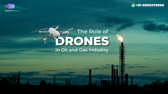
Enhancing Safety in Offshore Oil and Gas Operations with Drones
The offshore oil and gas industry faces numerous challenges, from harsh environmental conditions to the inherent risks associated with operations. Ensuring the safety and efficiency of these operations is paramount. Enter the world of drones – a revolutionary technology transforming various sectors, including the oil and gas industry. Drones offer incomparable advantages in terms of safety, cost-efficiency, and operational effectiveness. This blog explores how Equinox Drone Company is enhancing safety in offshore oil and gas operations through innovative drone solutions.
The Role of Drones in the Oil and Gas Industry
Drones have emerged as a game-changer in the oil and gas industry. Their ability to access hard-to-reach areas, gather high-resolution data, and operate in hazardous environments makes them superior. The use of drones in oil and gas industry operations includes tasks such as inspection, monitoring, and surveying, which traditionally involve significant risks and costs.
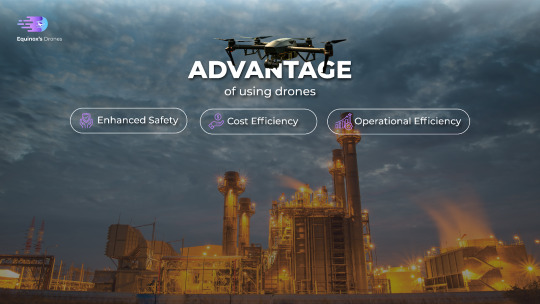
Advantages of Drones for the Oil and Gas Industry
Enhanced Safety: One of the primary benefits of using drones for oil and gas industry operations is the significant reduction in human exposure to dangerous environments. Drones can perform inspections in high-risk areas, such as offshore platforms, flare stacks, and pipelines, without putting personnel at risk.
Cost Efficiency: Traditional inspection methods often require shutting down operations, resulting in costly downtime. Drones, however, can conduct inspections without halting production, thereby saving both time and money. Additionally, the comprehensive data collected by drones can help in the early detection of issues, preventing costly repairs and potential accidents.
Operational Efficiency: Drones provide real-time data, enabling quicker decision-making and more efficient management of operations. They can cover vast areas in a short time, offering a level of detail and accuracy that is hard to achieve with manual inspections.
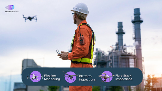
Drone Inspection for Oil and Gas: A Closer Look
Drone inspection for oil and gas operations is revolutionizing how companies maintain and manage their assets. These inspections include:
Pipeline Monitoring: Drones equipped with advanced sensors and cameras can detect leaks, corrosion, and other potential issues in pipelines, ensuring timely maintenance and preventing environmental disasters.
Platform Inspections: Offshore platforms are complex structures requiring regular inspections. Drones can easily navigate these structures, capturing detailed images and videos for analysis without the need for scaffolding or rope access.
Flare Stack Inspections: Inspecting flare stacks traditionally involves significant risk and cost. Drones can safely inspect these structures while in operation, providing high-resolution imagery and thermal data to assess their condition.
Equinox Drone Company: Leading the Way in Oil and Gas Drone Services
Equinox Drone Company is at the forefront of providing cutting-edge oil and gas drone services. Our state-of-the-art drones are equipped with the latest technology to perform a wide range of tasks, ensuring the highest standards of safety and efficiency. Our services include:
Visual and Thermal Inspections: Using high-resolution cameras and thermal imaging, our drones can detect anomalies and assess the condition of assets with precision.
3D Mapping and Modeling: We create detailed 3D maps and models of offshore structures, providing valuable insights for planning and maintenance.
Environmental Monitoring: Our drones monitor environmental conditions, such as air and water quality, ensuring compliance with regulatory standards and promoting sustainable practices.
Future Prospects of Drones in the Oil and Gas Industry
The future of drones in the oil and gas industry looks promising, with advancements in technology continually expanding their capabilities. From AI-driven analytics to autonomous drone operations, the potential for enhancing safety, efficiency, and sustainability in offshore operations is immense. Equinox Drone Company is committed to staying at the forefront of these innovations, providing our clients with the best drone solutions for their needs.
Conclusion
Incorporating drones into offshore oil and gas operations offers numerous benefits, from enhancing safety to improving operational efficiency and reducing costs. Equinox Drone Company is dedicated to leveraging the power of drones to transform the oil and gas industry, ensuring safer and more efficient operations. As technology continues to evolve, the role of drones in the oil and gas industry will only grow, opening new possibilities for innovation and excellence.
Contact us today for more information on how Equinox Drone Company can enhance your offshore operations with our cutting-edge drone solutions.
1 note
·
View note