#SeismicRefraction
Explore tagged Tumblr posts
Visit Tumblr Blog
Explore Tumblr blogs with no restrictions, modern design and the best experience.
Last Seen Tumblr Blogs


Fun Fact
The Tumblr app for Google Glass was released on May 16, 2013.
Text
#SeismicRefraction#SeismicSurvey#GeophysicalSurvey#SubsurfaceInvestigation#SoilTesting#GeotechnicalSurvey#GroundProfiling#SeismicWaves#SubsurfaceMapping#SeismicExploration
0 notes
Text
#Multi-AnalysisofSurfacewave#MultiAnalysisofSurfacewave#epitome#SeismicRefraction#CrossholeSeismicSurvey#SeismicRefractionSurvey#SeismicSurveyinIndia#SRTSurvey#SeismicSurvey#CrossholeSeismicSurveyCompanyinIndia#SRTsurveyinIndia#CrossholeSeismicSurveyinIndia#SRTsurveycompanyinIndia#SeismicRefractionSurveyCompanyinIndia#SeismicRefractionSurveyinIndia
0 notes
Text
Seismic Survey Epitome Geo Technical Services
A seismic survey is a crucial method used to understand the structure and composition of the Earth's subsurface. It plays a significant role in various industries, including oil and gas exploration, mining, infrastructure development, and environmental studies. At Epitome Geo Technical Services, we specialize in delivering precise and reliable seismic survey services, helping our clients make informed decisions based on accurate subsurface data.
What is a Seismic Survey?
A seismic survey involves generating seismic waves and analyzing how these waves reflect or refract as they travel through different layers of the Earth. These waves are produced either by using controlled energy sources, such as vibroseis trucks or small explosive charges, and the waves are then captured by sensors called geophones. By studying how the waves travel through the Earth's layers, experts can create detailed images or models of the subsurface.
This technique is highly effective for identifying geological features such as rock formations, fault lines, and underground resources, making it invaluable for resource exploration and civil engineering projects.
Types of Seismic Surveys
At Epitome, we offer different types of seismic surveys, tailored to meet the unique needs of each project:
2D Seismic Survey A 2D seismic survey provides a two-dimensional image of the subsurface. It involves collecting data along a single line of sensors, offering a basic understanding of the geological structure beneath the survey area. This method is commonly used for initial exploration or small-scale projects.
3D Seismic Survey A 3D seismic survey provides a more detailed, three-dimensional model of the subsurface. Multiple lines of sensors are deployed across the survey area, capturing high-resolution data that gives a clear picture of the underground structure. This is the preferred method for large-scale exploration projects, such as oil and gas fields, due to its accuracy and ability to pinpoint potential resource locations.
Seismic Refraction Survey In this survey, seismic waves are analyzed as they refract or bend at the interfaces between different subsurface layers. This technique is commonly used to determine the depth and composition of rock layers, making it useful for geotechnical investigations and civil engineering projects.
Seismic Reflection Survey Seismic reflection surveys focus on how seismic waves reflect off various subsurface layers. This method is widely used in hydrocarbon exploration and is particularly effective at identifying oil and gas reservoirs. It provides detailed images of geological formations, helping geologists pinpoint resource-rich areas.
Applications of Seismic Surveys Seismic surveys are essential in various fields, each benefiting from the accurate and comprehensive data that this method provides:
Oil and Gas Exploration Seismic surveys are the backbone of the oil and gas industry. By using seismic reflection surveys, companies can identify underground reservoirs of oil and natural gas with precision, reducing the risk of drilling in unproductive areas. This helps optimize exploration efforts and minimizes environmental impact.
Mining Exploration In mining, seismic surveys help identify mineral deposits and map underground rock formations. The data collected through these surveys allows mining companies to plan more efficient extraction processes while ensuring safety and sustainability.
Geotechnical Engineering In infrastructure development, seismic surveys are used to assess the ground conditions before starting construction projects. By analyzing the subsurface, engineers can determine the suitability of the land for building roads, bridges, tunnels, and other structures, ensuring that they are built on stable ground.
Environmental Studies Seismic surveys are also used in environmental studies to assess subsurface conditions for groundwater exploration or to detect any potential hazards, such as seismic activity or landslides, in a particular area. This helps in developing appropriate risk mitigation strategies.
Benefits of Seismic Surveys Conducting a seismic survey offers numerous advantages, making it one of the most effective geophysical techniques for subsurface exploration:
Accurate Subsurface Imaging: Seismic surveys provide high-resolution images of the subsurface, allowing for precise mapping of geological formations.
Cost-Effective: By identifying resource-rich areas, seismic surveys help reduce the cost of drilling or construction by minimizing the risk of unproductive efforts.
Non-Invasive: Seismic surveys are non-invasive and do not disturb the environment or the local community, making them an eco-friendly option for subsurface exploration.
Versatile: This technique can be applied across a wide range of industries and environments, from offshore oil rigs to onshore construction sites, making it a flexible solution for subsurface investigations.
Why Choose Epitome Geo Technical Services? At Epitome Geo Technical Services, we pride ourselves on delivering exceptional seismic survey services that cater to the specific needs of each project. Our team of experienced geophysicists and engineers utilizes cutting-edge technology and industry best practices to ensure accurate data collection and analysis.
Here’s why you should partner with us:
Expertise: Our team has extensive experience in conducting seismic surveys across various industries, from oil and gas to infrastructure development.
Advanced Technology: We use state-of-the-art equipment and software to perform seismic surveys, ensuring precise data collection and processing.
Customized Solutions: We understand that every project is unique. That's why we offer tailored seismic survey solutions that align with your project’s specific goals and challenges.
Commitment to Quality: We are dedicated to delivering high-quality results that provide valuable insights for decision-making, helping you move forward with confidence in your project.
Conclusion A seismic survey is an indispensable tool for understanding subsurface conditions, whether you're exploring for resources, planning a construction project, or conducting environmental assessments. At Epitome Geo Technical Services, we provide reliable, accurate, and cost-effective seismic survey solutions to help our clients achieve their project objectives.
More info :https://epitomegs.com/ Contact : +91-96756 94400
#Multi-AnalysisofSurfacewave#MultiAnalysisofSurfacewave#epitome#SeismicRefraction#CrossholeSeismicSurvey#SeismicRefractionSurvey#SeismicSurveyinIndia#SRTsurvey#SeismicSurvey#CrossholeSeismicSurveyCompanyinIndia#SRTsurveyinIndia#CrossholeSeismicSurveyinIndia#SRTsurveycompanyinIndia#SeismicRefractionSurveyCompanyinIndia#SeismicRefractionSurveyinIndia
0 notes
Text
GPR EpitomeGs
GPR operates by transmitting high-frequency radio waves pulses down into the ground through an antenna. GPR Survey is distinctly able at not only mapping buried structures but also relatively measuring their depth, and supplying an all-important thorough detail.
The antenna is moved over the surface to be inspected. The transmitter redirects a diverging beam of energy which is reflected in various underground objects or different contacts between different earth materials.
The radargram measured on the vertical scale is in units of the two-way travel time, that’s the time taken by the EM wave to travel down to a reflector and back to the surface. The travel time then is transformed into depth by relating it to on-site measurements or assumptions about the velocity of radar waves in the subsurface material under investigation. Radar wave speeds vary between 60–175 mm/ns for most geological materials.
GPR waves can travel almost 30 meters deep in low conductivity material, as in case of dry sand or granite. Clays, shale, and other high conductivity materials may lessen or absorb GPR signals, leading to the reduction in depth of penetration to 1 meter or less. The GPR antenna can determine the depth of penetration as well.

The selection of antennae is based according to the depth of interest and the size of the target. Penetration depth varies in contrast to the frequency. The higher the antenna's central frequency, the smaller the object size to be resolved. Higher antenna frequencies give higher resolution, but less penetration, and vice versa. The lateral and vertical resolution of the results varies from 0.01 to 1.0 meters, as per the choice of antenna frequency.
The use of antennae having lower frequency in geological mapping is done to obtain the maximum penetration depth while higher frequencies are used in non-destructive testing for high-resolution imaging. Having a range of frequencies available (usually 50MHz–2.5GHz) makes GPR most suitable for identifying objects of different sizes at different depths and under different ground conditions.
We are one of the best Ground Penetrating Radar Survey Service, Best Underground Utilities Survey Services and GPR Survey Service in India.
0 notes
Text
Crosshole Seismic Survey | Epitome Geo Technical
In the realm of geotechnical engineering, the ability to peer beneath the Earth's surface is invaluable. Whether it's for site characterization, foundation design, or environmental assessments, having a clear understanding of subsurface conditions is crucial for success. Among the arsenal of tools available to geotechnical engineers, one method stands out for its precision and depth of insight: Crosshole Seismic Surveys.

What are Crosshole Seismic Surveys?
Crosshole Seismic Surveys are a sophisticated geophysical technique used to investigate the subsurface properties of soil and rock formations. Unlike traditional methods that rely on surface measurements, such as boreholes or surface seismic surveys, crosshole seismic surveys involve deploying seismic sources and receivers in separate boreholes.
How Do They Work?
The process begins with the drilling of two or more boreholes at the site of interest. Seismic sources, typically small explosive charges or seismic hammers, are then placed at various depths within one borehole, while seismic receivers are positioned in corresponding depths in another borehole.
Once the setup is complete, seismic waves are generated and propagate through the subsurface. These waves are then recorded by the receivers, allowing engineers to analyze their travel times, amplitudes, and other characteristics. By comparing the data collected from different source-receiver pairs, precise measurements of subsurface properties such as seismic velocities, rock density, and layer thickness can be obtained.
The Advantages of Crosshole Seismic Surveys
High Resolution: By directly measuring seismic wave propagation between boreholes, crosshole surveys offer unparalleled resolution compared to surface-based methods. This high resolution allows engineers to detect subtle variations in subsurface properties with great accuracy.
Depth Penetration: Crosshole surveys are capable of reaching considerable depths, making them ideal for investigating deep soil or rock formations where other methods may falter.
Quantitative Data: Unlike some geophysical techniques that provide qualitative information, crosshole seismic surveys yield quantitative data that can be directly incorporated into engineering analyses and models.
Versatility: Crosshole surveys can be tailored to suit the specific needs of a project by adjusting parameters such as source-receiver spacing, frequency of seismic waves, and survey geometry.
Applications in Geotechnical Engineering
The insights provided by crosshole seismic surveys find applications across a wide range of geotechnical engineering endeavors:
Foundation Design: Understanding subsurface conditions is crucial for designing stable and reliable foundations for structures such as buildings, bridges, and dams. Crosshole surveys provide detailed information about soil and rock properties, helping engineers optimize foundation designs to withstand various loads and environmental conditions.
Tunneling and Underground Construction: For projects involving tunneling or underground construction, knowledge of subsurface conditions is essential for ensuring safety and minimizing risks. Crosshole surveys can identify potential hazards such as faults, fractures, and weak zones, allowing engineers to plan excavation and support strategies accordingly.
Seismic Hazard Assessment: In seismically active regions, assessing the seismic vulnerability of infrastructure is paramount. Crosshole seismic surveys can help characterize the subsurface geology and evaluate site-specific seismic hazards, aiding in the design of resilient structures and infrastructure.
Environmental Site Assessments: Crosshole surveys are valuable tools for environmental site assessments, particularly in cases where underground contamination or geological features need to be characterized. By mapping subsurface lithology and hydrogeological properties, these surveys facilitate informed decision-making regarding remediation strategies and land use planning.
Conclusion
Crosshole seismic surveys represent a pinnacle of geotechnical engineering, offering unparalleled insights into the hidden world beneath our feet. With their ability to provide high-resolution, quantitative data about subsurface properties, these surveys empower engineers to make informed decisions and design solutions that are robust, safe, and sustainable. As we continue to push the boundaries of exploration and innovation, crosshole seismic surveys will undoubtedly remain a cornerstone of geotechnical practice, unlocking the secrets of the subsurface for generations to come.
More Info : https://epitomegs.com/ Contact us : +91-96756 94400
#epitome#SeismicRefraction#CrossholeSeismicSurvey#SeismicRefractionSurvey#SeismicSurveyinIndia#SRTsurvey#SeismicSurvey#SRTsurveyinIndia
0 notes
Text
#epitome#epitomegs#MultiAnalysisOfSurfaceWave#SeismicRefraction#CrossholeSeismicSurvey#SeismicRefractionSurvey#SeismicSurveyInIndia#SRTsurvey#MASW#SeismicSurvey#CrossholeSeismicSurveyCompanyInIndia#SRTsurveyInIndia#CrossholeSeismicSurveyInIndia#SRTsurveyCompanyInIndia#SeismicRefractionSurveyCompanyInIndia
0 notes
Text
#Multi-AnalysisofSurfacewave#MultiAnalysisofSurfacewave#epitome#SeismicRefraction#CrossholeSeismicSurvey#SeismicRefractionSurvey#SeismicSurveyinIndia#SRTSurvey#SeismicSurvey#CrossholeSeismicSurveyCompanyinIndia#SRTsurveyinIndia#CrossholeSeismicSurveyinIndia#SRTsurveycompanyinIndia#SeismicRefractionSurveyCompanyinIndia#SeismicRefractionSurveyinIndia
0 notes
Text
#Multi-AnalysisofSurfacewave#MultiAnalysisofSurfacewave#epitome#SeismicRefraction#CrossholeSeismicSurvey#SeismicRefractionSurvey#SeismicSurveyinIndia#SRTsurvey#SeismicSurvey#CrossholeSeismicSurveyCompanyinIndia#SRTsurveyinIndia#CrossholeSeismicSurveyinIndia#SRTsurveycompanyinIndia#SeismicRefractionSurveyCompanyinIndia#SeismicRefractionSurveyinIndia
0 notes
Text
Seismic Survey | Epitome Geo Technical Services
In the realm of geotechnical exploration, few methodologies are as pivotal and revealing as the seismic survey. At the forefront of this groundbreaking technique stands Epitome Geo Technical Services, a trailblazer in harnessing seismic data to unearth invaluable insights about the Earth's subsurface.

Understanding Seismic Surveys Seismic surveys are a cornerstone of modern geophysics, enabling geoscientists to peer beneath the Earth's surface with unparalleled precision. By generating and analyzing seismic waves that travel through the ground, these surveys provide a detailed picture of subsurface structures, geological formations, and potential natural resource reservoirs.
The Role of Epitome Geo Technical Services Epitome Geo Technical Services has carved a niche for itself in the competitive landscape of geotechnical services by leveraging advanced seismic survey techniques. With a commitment to innovation and excellence, Epitome employs state-of-the-art seismic equipment and methodologies to deliver comprehensive and accurate data.
Applications of Seismic Surveys Oil and Gas Exploration: Seismic surveys play a pivotal role in locating oil and gas reservoirs beneath the Earth's surface. By mapping subsurface structures and identifying potential hydrocarbon traps, these surveys assist energy companies in making informed drilling decisions.
Mineral Exploration: Mining companies utilize seismic surveys to pinpoint mineral deposits and assess their economic viability. This information guides mining operations, reducing exploration risks and optimizing resource extraction.
Civil Engineering: In civil engineering projects, seismic surveys aid in assessing ground conditions for construction purposes. They help engineers understand soil properties, detect potential hazards like faults or sinkholes, and design structures that withstand seismic activity.
Advantages of Choosing Epitome Geo Technical Services Expertise and Experience: Epitome boasts a team of seasoned geoscientists and engineers with extensive experience in conducting seismic surveys across diverse terrains and environments.
Cutting-Edge Technology: The company invests in the latest seismic imaging and data processing technologies, ensuring clients receive accurate and actionable insights.
Customized Solutions: Epitome tailors its seismic survey solutions to meet the unique needs and challenges of each project, whether it involves large-scale resource exploration or site-specific engineering assessments.
Future Directions in Seismic Survey Technology As technology advances, the future of seismic surveys holds promise for even greater precision and efficiency. Epitome Geo Technical Services remains at the forefront of these advancements, continually refining its methodologies to deliver unparalleled value to clients across industries.
Conclusion In conclusion, seismic surveys represent a cornerstone of modern geotechnical exploration, offering profound insights into the Earth's subsurface. Epitome Geo Technical Services stands as a beacon of innovation and reliability in harnessing this powerful technology to unlock geological mysteries and drive sustainable development.
For companies and organizations seeking to delve deeper into the Earth's secrets, partnering with Epitome ensures access to cutting-edge seismic survey solutions and expertise that redefine industry standards.
More info :https://epitomegs.com/ Contect us :+91-96756 94400
#Multi-AnalysisofSurfacewave#MultiAnalysisofSurfacewave#epitome#SeismicRefraction#CrossholeSeismicSurvey#SeismicRefractionSurvey#SeismicSurveyinIndia#SRTSurvey#SeismicSurvey#CrossholeSeismicSurveyCompanyinIndia#SRTSurveyinIndia#CrossholeSeismicSurveyInIndia#SRTSurveyCompanyInIndia#SeismicRefractionSurveyCompanyInIndia#SeismicRefractionSurveyInIndia
0 notes
Text
Crosshole Seismic Survey | Epitome
In the realm of geotechnical and environmental engineering, precise subsurface characterization is crucial. Among the myriad of techniques available, the Crosshole Seismic Survey (CSS) stands out for its accuracy and effectiveness. This blog delves into the essentials of Crosshole Seismic Surveys, illustrating why it is considered the epitome of subsurface investigation.

What is Crosshole Seismic Survey? Crosshole Seismic Survey is an advanced geophysical method used to measure the properties of soil and rock. This technique involves generating seismic waves in one borehole and recording them in one or more adjacent boreholes. By analyzing the travel times and velocities of these waves, engineers can obtain detailed information about the subsurface materials.
How Does Crosshole Seismic Survey Work?
The process of Crosshole Seismic Survey involves several key steps:
Drilling Boreholes: Typically, two or more boreholes are drilled to the desired depth of investigation. These boreholes must be precisely aligned to ensure accurate data collection.
Seismic Source and Receivers: A seismic source, such as a small explosive charge or a mechanical impact, is placed in one borehole. Geophones or hydrophones, which act as seismic receivers, are placed in the adjacent boreholes.
Wave Propagation: Seismic waves are generated and travel through the subsurface material. The receivers in the adjacent boreholes detect these waves.
Data Recording: The travel times of the seismic waves from the source to the receivers are recorded. This data is then analyzed to determine the velocities of the seismic waves.
Data Analysis: By interpreting the velocities and travel times, geophysicists can infer the material properties, such as density, elasticity, and stratification of the subsurface layers.
Applications of Crosshole Seismic Survey
Crosshole Seismic Surveys are employed in various engineering and environmental applications:
Site Characterization: Determining the properties of soil and rock for construction projects. Earthquake Engineering: Assessing the seismic response of subsurface materials. Environmental Studies: Investigating contamination plumes and monitoring remediation efforts. Resource Exploration: Evaluating mineral and hydrocarbon deposits.
Advantages of Crosshole Seismic Survey
High Resolution: CSS provides detailed images of subsurface structures, enabling precise characterization. Depth Penetration: It can investigate deeper subsurface layers compared to surface methods. Accuracy: Direct measurement of seismic wave velocities offers high accuracy in determining material properties. Versatility: Applicable in various geological conditions and for different investigative purposes.
Challenges and Considerations
While Crosshole Seismic Surveys offer numerous benefits, they also come with certain challenges:
Cost and Time: Drilling multiple boreholes and conducting the survey can be expensive and time-consuming. Borehole Alignment: Precise alignment of boreholes is critical for accurate data. Complex Data Analysis: Interpreting seismic data requires expertise and sophisticated software. Conclusion Crosshole Seismic Survey is undoubtedly the epitome of subsurface investigation techniques. Its ability to provide high-resolution, accurate data makes it an invaluable tool in geotechnical engineering, earthquake studies, environmental monitoring, and resource exploration. Despite its challenges, the insights gained from CSS are unparalleled, ensuring informed decision-making and successful project outcomes.
More Info :https://epitomegs.com/ Contact : +91-96756 94400
#Multi-AnalysisofSurfacewave#MultiAnalysisofSurfacewave#epitome#SeismicRefraction#CrossholeSeismicSurvey#SeismicRefractionSurvey#SeismicSurveyinIndia#SRTsurvey#SeismicSurvey#CrossholeSeismicSurveyCompanyinIndia#SRTsurveyinIndia#CrossholeSeismicSurveyinIndia#SRTsurveycompanyinIndia#SeismicRefractionSurveyCompanyinIndia#SeismicRefractionSurveyinIndia
0 notes
Text
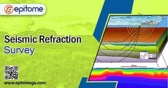
Seismic Refraction
Seismic Refraction technique is an advanced geophysical method which is applied for routine investigation of subsurface ground conditions by using surface-sourced seismic waves. Data acquired with the help this technique on site is further computer processed and interpreted to attain models of the seismic velocity and layer thickness of the subsurface ground structure. We are one of the best Seismic Refraction Survey Services in India.
The seismic waves disseminate downward through the ground till the time they are reflected or refracted off subsurface layers. Refracted waves are identified by arrays of 24 or 48 geophones spaced at regular intervals of 1 – 10 meters, based on the required depth penetration of the survey. Sources are placed at each end of the geophone array to generate forward and reverse wave arrivals along with the array. Use of additional sources may intermediate positions for entirely covering at all geophone positions. If you are looking for Seismic Refraction Survey Services then you are at the right place.

The penetration depth in a seismic refraction survey is approximately 1/5th of the geophone spread length including offset shots. So if it is required to see 10m deep, you will need room to lay out at least 50m seismic spread, as measured from offset shot to offset shot.
Any of the Geometrics seismographs can be utilized for seismic refraction. Up to24 channels or less, the SmartSeis ST is ideal. When using a laptop in the field works for you, the ES-3000 is a good option to the SmartSeis. For large-scale surveys, the Geode is recommended however For simplerippability, 12 channels will often suffice. For mapping the bedrock topography, a minimum of 24 channels are recommended. The detailed requirement needs more channels.A hammer-and-plate refraction survey is easily attained with two people. Longer lines and/or the use of explosives (which requires digging shot holes) generally need 3-4 people.The survey is used to detect lateral and vertical variations in velocitySeismic surveys are useful in producing detailed images of the subsurfaceUsed to measure stratigraphic unitsThe Response of the seismic refraction survey depends on variations in rock density and elastic constantsSometimes, direct hydrocarbon detection is possible in Seismic refraction survey.
Epitome offers these services Seismic Refraction Survey, SRT survey, Seismic Survey, Seismic Refraction Survey.
0 notes