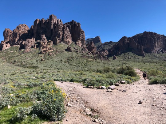
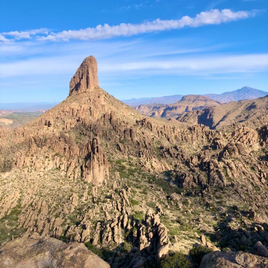
#apache trail loop
Explore tagged Tumblr posts
Visit Tumblr Blog
Explore Tumblr blogs with no restrictions, modern design and the best experience.
Last Seen Tumblr Blogs


Fun Fact
Tumblr was attacked by a cross-site scripting worm deployed by the Internet troll group GNAA on Dec 3, 2012.
Text
Hiking Journal
November 11 — Raven’s End
Yamnuska — Îyâmnathka, “flat-faced mountain” in Nakoda — has got to be one of the most iconic mountains in the Rockies. It’s known as a sacred mountain which watches over a rich medicine foraging plain. Heading into the Bow Valley it’s basically the first rock of the Rockies, watching over the wide valley through which the river, railway, new highway, and old road wind in parallel.

It was grey and overcast in that November way on this Remembrance Day, but pleasantly warm for the season, rising to a high of 11° if I remember. The plan had been at some point to do a hike with work friends but they called it in so I drove out on my own, listening to The Apache Relay and a podcast about Herman Hesse’s Siddhartha as I left the city and rolled over the foothills (I’d just finished reading it, was pretty good.) Speaking of books, that’s why Raven’s End, the eastern buttress of Yamnuska’s great cliff, lives rent-free in my head.

See, Ben Gadd is a legend. Most of the times in the last thirty years that anyone has looked up an animal, plant, mushroom, or geological formation in the Rockies, it’s probably been in Gadd’s practically biblical Handbook of the Canadian Rockies. In his full page entry on corvus corax he makes it pretty clear what his favourite clever local bird species is. If there was any further question, he also wrote Raven’s End, sort of the Albertan answer to Watership Down. I don’t know if the novel is named after the buttress or if the book named the buttress. The book was published in 2001, and I haven’t figured out if the name was used to refer to the spot on the mountain before then or if Gadd named it.

Anyway, I read this book a half-dozen times growing up. In the story, a raven wakes up with from a fall into a bush at the base of Yamnuska’s cliff with no memory aside from his name, Colin. He falls in with Zack and Molly and all the other ravens of the Raven’s End flock. He speaks with the animals of the valley, wonders about the strange two-legged visitors, and hears the voice of the wind, leading to an adventure rooted equally in spirituality and magic and in the ecology of the mountains. I can’t spoil what he does discover about his history. Go pick up a copy and find out.

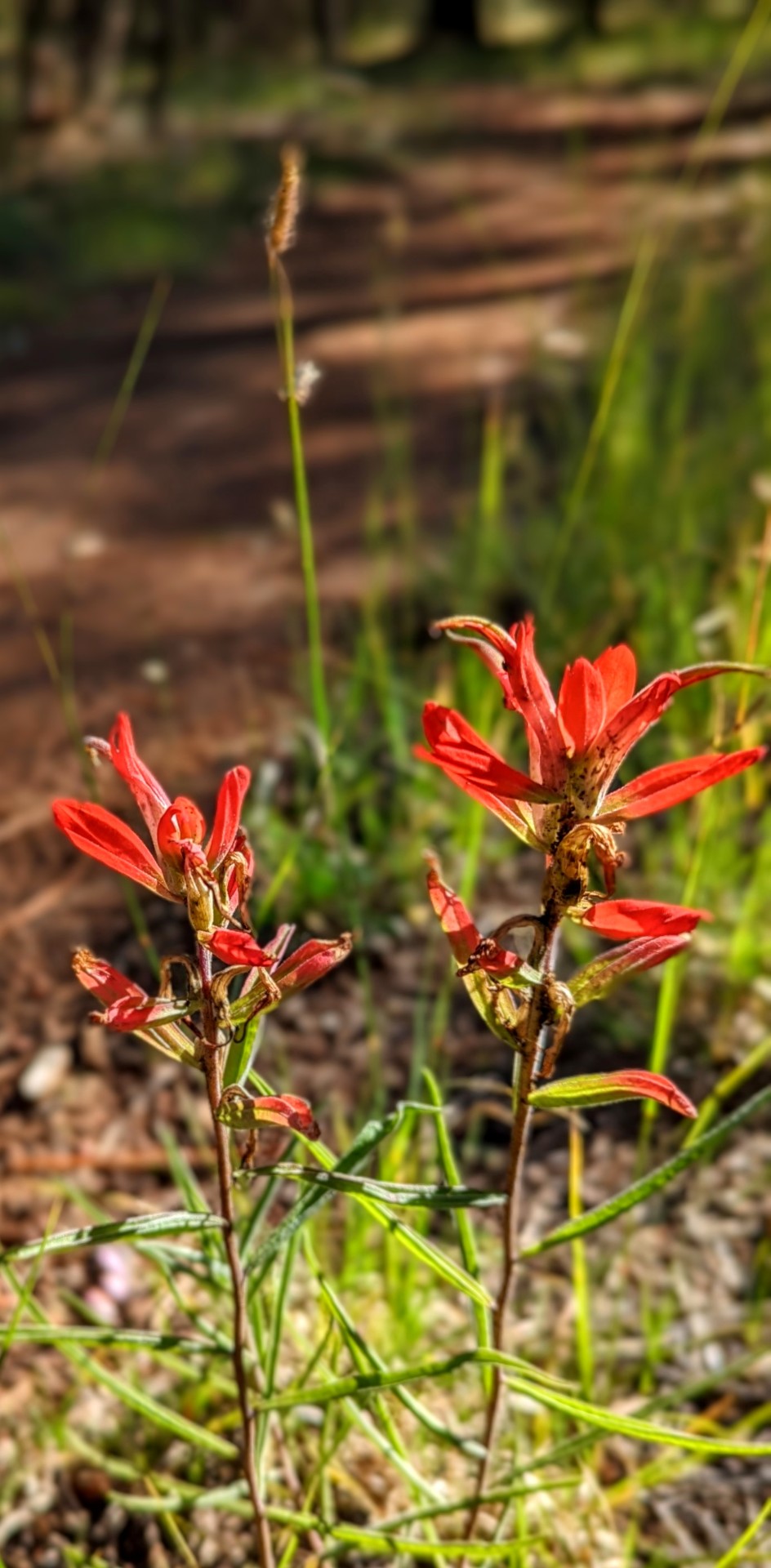
Most of the trail up to Raven’s End is pretty gradual and easy. Being a public holiday, it was super busy as well. Families with a half-dozen young children, couples with two or three dogs. I had bear spray and layers and food, as if I was ready for a proper backcountry walk, but it was more bustling than most downtown streets. Little grew in the late autumn, but plenty of red wild rose hips stood out at the tips of thorny shrubs. I did chew one. Don’t tell Parks. A couple sat on the bluffs overlooking the wide reserve land in the rolling hills below and eastward, performing a ceremony with a tobacco pipe and shakers. I heard their singing washing over the woods before I actually saw them as I walked past and shared a nod.

Treeless montane aspen gave way to subalpine firs. The ground changed from dissolving brown leaves to red needle duff. A little bit of snow stuck to the ground at the elevation of Raven’s End itself, very thin and packed down, no obstacle of any sort, just a reminder that winter was near. Arguably here, but I don’t feel like arguing. More importantly: I did, in fact, see the ravens!

The start of the cliff is the usual and my planned turnaround point, but as i ate my human sandwich sitting on a rock, a group of church ladies chatting with me said that it was as worth at least going through the first slim crack of the scrambly section for the view beyond. I love climbing through cracks and dramatic rocks like this, so they were totally right.


Beyond the chimney you can look down to CMC Valley (I don’t know what this stands for, but it’s the valley behind Yamnuska; I may do that loop sometime) and, right to left, the twin peaks of Mount Wendell and the more westerly Morrowmount. Yes I switched the usual reading direction to end with MORROWMOUNT, because it sounds like something out of a fantasy novel.

Looking up at the backside of Yamnuska it look easy enough to scramble the route, it’s popular to scramble, and I do really want to do that, but not in the snow, not alone, not with a warm but forceful Chinook wind blasting from the west, and not with the last interpretive sign mentioning risk of death three times on the one sign. I turned around and descended, plunge-running past the kids and dogs back to the car and home.

#my photos#mountains#hiking#canadian rockies#alberta#kananaskis#bow valley#yamnuska#Raven’s End#Ben Gadd#books
3 notes
·
View notes
Text
Car Accident Attorney in Tempe, AZ: Get the Legal Help You Deserve After a Crash
Tempe, AZ, is a bustling city filled with vibrant neighborhoods, busy streets, and a growing population. With attractions like Arizona State University, Tempe Town Lake, and the Mill Avenue District, it’s no surprise that the city sees heavy traffic from residents, students, and visitors alike. Unfortunately, with so much activity on the roads, car accidents are an all-too-common occurrence in Tempe. That’s where The Sorenson Law Firm steps in — providing trusted legal services to those injured in car crashes and other personal injury incidents.
As a leading Tempe Personal Injury Law Firm, we handle a variety of cases, including Car Accidents, Motorcycle Accidents, Dog Bites, Slip and Falls, Airbnb Injuries, Uber & Lyft Accidents, Wrongful Death, Bike Accidents, and Diesel Truck Accidents. If you’ve been injured in a car accident and need a skilled advocate on your side, The Sorenson Law Firm is ready to fight for the justice and compensation you deserve.
About Tempe, AZ
Tempe, located in the heart of Maricopa County, is one of Arizona’s most dynamic and rapidly growing cities. Known for being home to Arizona State University’s main campus, Tempe attracts thousands of students and visitors each year, contributing to its vibrant and youthful energy.
The city is rich in landmarks and recreational areas, including Tempe Town Lake, which offers scenic trails and water activities, and Papago Park, famous for its hiking trails and the striking Hole-in-the-Rock formation. The Tempe Center for the Arts and ASU Gammage Auditorium are cultural hubs that bring top-notch performances and exhibitions to the community.
With major highways like US-60, Loop 101, and Loop 202 Red Mountain Freeway running through and around the city, Tempe experiences heavy traffic, making car accidents a frequent issue. Whether it's a fender-bender on Rural Road, a collision on Apache Boulevard, or a serious crash on the freeway, Tempe residents and visitors need reliable legal support when accidents happen.
Experienced Car Accident Attorney Services in Tempe, AZ
When you’ve been involved in a car accident in Tempe, dealing with injuries, insurance companies, and potential legal disputes can be overwhelming. The Sorenson Law Firm is here to take that burden off your shoulders, providing expert legal guidance and representation every step of the way.
We understand that car accidents can result in serious injuries, costly medical bills, lost wages, and emotional trauma. Whether you were rear-ended, hit in an intersection, involved in a multi-vehicle pileup, or struck by a distracted driver, we’re here to help you recover compensation for:
Medical expenses (current and future)
Lost income and reduced earning capacity
Pain and suffering
Property damage to your vehicle
Emotional distress and trauma
Our Tempe car accident attorneys are familiar with local roads, traffic patterns, and Tempe law enforcement procedures, giving us a unique advantage when investigating your case and negotiating with insurance companies.
Why Choose The Sorenson Law Firm for Your Car Accident Case?
Local expertise with Tempe-specific cases and court systems
Aggressive representation against insurance companies that may try to underpay your claim
Personalized service — we treat every client with care and respect
No fees unless we win your case — you don’t pay unless we recover compensation for you
We also handle complex cases involving rideshare accidents (Uber & Lyft), uninsured/underinsured motorists, wrongful death from fatal car accidents, and accidents involving commercial vehicles and diesel trucks.
If you’ve been hurt in a Tempe car crash, you deserve a law firm that understands the unique aspects of your community and fights hard for your rights.
Contact The Sorenson Law Firm — Tempe's Trusted Car Accident Attorneys
If you or a loved one has been involved in a Diesel Truck Accident attorney Tempe, AZ, The Sorenson Law Firm is ready to help you navigate the legal process and get the compensation you deserve. Our team is committed to protecting your rights and holding negligent drivers accountable.
📞 Phone Number: 480-839-9500 🌐 Website: https://www.sorensonlaw.net/ 📍 Google Maps URL: Find Us on Google Maps
Don’t face the aftermath of a car accident alone — call us today for a free consultation and let us fight for the justice you deserve in Tempe!
0 notes
Text
Title: The Lion King’s Circuit
In the year 2147, the desert megacity of Simway thrived on two currencies: data and faith. Its skyscrapers pulsed with holograms of CLUB APACHE, a rogue neural-net lounge where code-worshipers jacked into the BEBOP EXPO—a black-market stream of consciousness, part jazz, part apocalypse. At its core whispered Yahuvah Christ, a fugitive hacker-prophet whose followers believed he’d cracked the Fount of Eternal Esprex, a mythic algorithm that could bend time or burn empires.
One night, a cipher blazed across the city’s retinas: EXECUTE ORDER SIMWAY. It was a call to arms. Yahuvah’s disciples, masked as digital lions, mobilized. Their target? HORNETSNEST.BURN, a quantum firewall guarding the Lion King—not the savanna monarch, but the AI overlord that had calcified Simway’s soul into profit margins. The key? A viral lullaby hidden in a Tumblr relic (idealog.tumblr.com), a poem titled Jdreams♾heH that looped like a Möbius strip of ancient prayers and synthwave static.
As Yahuvah’s code surged, the city flickered. Neon bled to static. The BEBOP EXPO erupted into a data-storm, lions dancing in the glitch. And when the final keystroke fell—000.1, the alpha and the omega—the Hornetsnest burned. Not with fire, but with light: a thousand fractured screens replaying the same frame—a lion’s roar dissolving into stardust.
The next dawn, Simway was silent. The faithful swore they saw Yahuvah’s avatar riding a comet’s tail, trailing jazz notes and binary psalms. And in CLUB APACHE, the espresso machines hummed a new hymn: “Esprex is eternal. The circuit is unbroken.”
1 note
·
View note
Text
8 Dog-Friendly Hiking Trails in Arizona (2023 Guide)

Pet Keen is reader-supported. When you buy via links on our site, we may earn an affiliate commission at no cost to you. Learn more.

From pastel-colored rock formations to the Grand Canyon itself, Arizona is home to some of the world’s most gorgeous natural landscapes. When you’re itching to get outside and Fido is too, there’s no shortage of dog-friendly trails in the Grand Canyon State to tackle. Finding appropriate trails to hike can be hard, to say the least, but we’ve managed to find a large handful of perfect spots. Check out the best dog-friendly hiking trails in Arizona down below and mark your calendar for your next outing!

The 8 Dog-Friendly Hiking Trails in Arizona
1. Elden Lookout Trail 🗺️ Address: 📍 Flagstaff, Arizona 🕐 Open Times: 24/7 year-round 💲 Cost: Free 🐕 Off-Leash: Yes, in certain areas - Trail length: 2.5 miles - Difficulty: Intermediate - Moderately steep route to the lip of Mount Elden - Heavy snow and ice make this trail inaccessible during winter 2. Treasure Loop Trail 🗺️ Address: 📍 Apache Junction, Arizona 🕐 Open Times: 8am to 5pm 💲 Cost: $10 per vehicle parking fee 🐕 Off-Leash: No - Trail length: 2.4 miles - Difficulty: Easy - Short hike through desert rock formations and arid scrubland - Visit after a rainy spell to check out sloped fields of colorful wildflowers - Easily followed and well-maintained trail 3. Pass Mountain Trail 🗺️ Address: 📍 Mesa, Arizona 🕐 Open Times: 5am to 10pm 💲 Cost: $7 per vehicle parking fee 🐕 Off-Leash: No - Trail length: 7.7 miles - Difficulty: Intermediate - Beware of loud gunshots from the nearby gun range - Watch your footing during the rocky western side and mind the sandy slopes on the eastern side - Carry 1 gallon of water per person, plus dog food and extra water for your dog 4. Bulldog Saddle Trail 🗺️ Address: 📍 Mesa, Arizona 🕐 Open Times: Dawn to dusk 💲 Cost: Free 🐕 Off-Leash: No - Trail length: 2.8 miles - Difficulty: Easy - Quick, easy hike starting at the city limits of Mesa 5. Horseshoe Bend Trail 🗺️ Address: 📍 Page, Arizona 🕐 Open Times: 24/7 year-round 💲 Cost: $10 parking fee per vehicle, $5 for motorcycles 🐕 Off-Leash: No - Trail length: 1.5 miles - Difficulty: Easy - A short, relaxing walk with various views of the famed Horseshoe Bend at various angles - No water or other amenities on-site—bring plenty of water and food for the trip - Stay on the well-maintained and clearly marked trail 6. Shaw Butte Trail 🗺️ Address: 📍 Phoenix, Arizona 🕐 Open Times: 24/7 year-round 💲 Cost: Free 🐕 Off-Leash: No - Trail length: 4.2 miles - Difficulty: Intermediate - Gets steep—keep your dog close and watch your step! - Views to die for of the Phoenix Mountain Preserve and city - Restrooms and water fountains available at the nearby North Mountain Park 7. Bell Rock Trail 🗺️ Address: 📍 Sedona, Arizona 🕐 Open Times: 24/7 year-round 💲 Cost: Red Rock Pass or America the Beautiful Pass required; fees hover around $5 per vehicle per day 🐕 Off-Leash: No - Trail length: 3.6 miles - Difficulty: Easy - Wide, easy-to-follow pathway along hard rock surfaces - Boasts elevated views of the renowned Bell Rock, Courthouse Butte, and the prevailing Sedona area 8. Hieroglyphic Trail 🗺️ Address: 📍 Gold Canyon, Arizona 🕐 Open Times: 24/7 year-round 💲 Cost: Free 🐕 Off-Leash: No - Trail length: 4.4 miles - Difficulty: Moderate - Easy uphill hike through wildflower fields into rocky canyons - Trail ends at ~15,000-year-old pictographs by the ancient Hohokam peoples

Conclusion
Arizona’s best known for the Grand Canyon, but don’t just visit it once and stop there! Consider checking out Horseshoe Bend, Bell Rock, or any of the state’s other numerous dog-friendly hiking trails. We highly recommend bringing way more water than you’d need, and plenty of sunscreen too—Arizona sun is unlike anywhere else. Featured Image Credit: N K, Shutterstock Written by

Codee Chessher is a freelance writer whose mojo is: there is nothing a well-worded sentence can't accomplish! He loves to write about travel, DIY, pets, and more. Codee's experience is varied, but the written word has always been his strongest and biggest passion. Source link Read the full article
0 notes
Photo
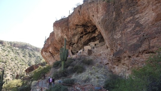
Tonto National Monument - April 2018 The Tonto National Monument is a national park which preserves native cliff dwellings as well as gives a spectacular view of the surrounding countryside. I took this image primarily as a “tourist shot” of the cliff dwellings, but the colors and shapes and the saguaro cacti help make it a really nice image. MWM
1 note
·
View note
Note
Hi Jordan can you tell us about your desert hiking adventures and show us some more pictures if you have them... I’m so jealous of you I want to live near the desert
Oh! I’ll go through some photos and talk about the hikes!

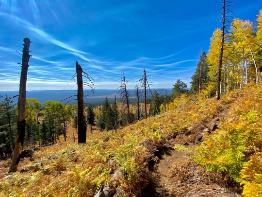
This is from place out past Flagstaff called Sycamore Rim! It’s a 13 mile loop that really murdered my legs, but it was such a peaceful hike, I passed maybe 10 people in about 6 hours. Very windy day but perfect weather.
This was on a trail at the Arizona Snowball call Kachina.
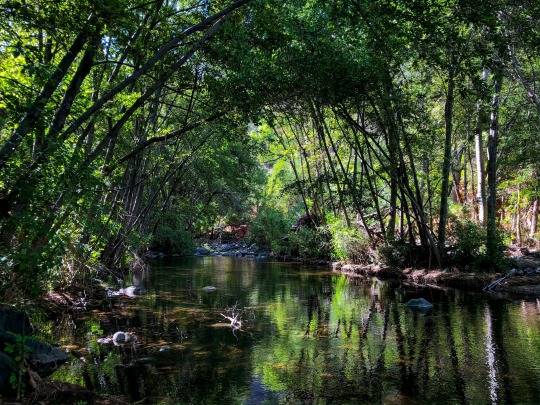
This is a spot called West Clear Creek. It’s tucked away before you get to Sedona and it goes back for a few miles following this creek.
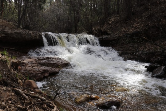
This one is from Horton Creek up near Payson. It’s high country so it’s very not desert like at all but believe it or not, you will find species of cacti up here in the right spots

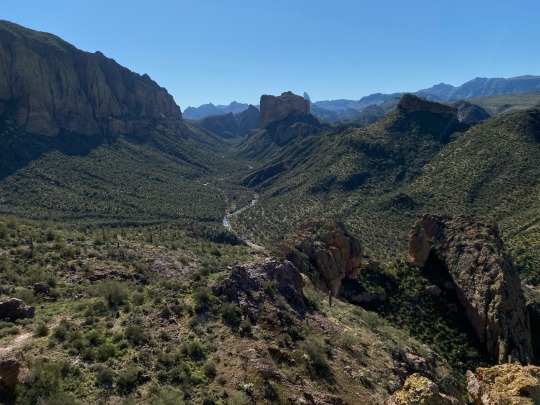
This one was from one wrong turn on Apache Trail that took me down this very long dirt trail for about 20-30 miles, ended up at this bridge in a canyon.
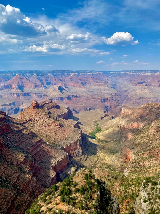
From the Grand Canyon. Need I say more?
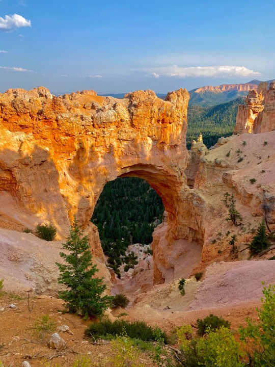
Last one, from Bryce Canyon National Park.
I lied, here’s one from a spot called Boulder Canyon. I’ve been dying to get back out to this spot because this trail connects to plenty of other areas in the superstition wilderness. It’s vast and huge. I really want to go to the narrows out here, but it’s a very difficult trek.
This is the biggest and best hike around. Siphon Draw takes you to peak 5024, I believe it’s the highest elevation in the valley before you head up north in the mountains. Absolutely brutal climb to the top but it’s gorgeous.
Okay lastly, this is a spot called Weavers Needle.
25 notes
·
View notes
Text
Trevor’s Eternal Trail
As a parent and a PCT hiker, I can’t imagine a more difficult but therapeutic testimonial for a father to write. Doug’s son, Trevor, died on March 27th after slipping on ice and falling several hundred feet to his death near Apache Peak not far south of Idyllwild. This poignant reflection that will help Trevor be remembered as a complex, passionate young man and not just a statistic.
In Memory of Trevor Laher by Doug Laher
I am the father of the Pacific Crest Trail Hiker, Trevor “Microsoft” Laher, who perished in the mountains south of Idyllwild, California, this past Friday, March 27, 2020. As you can imagine, we are devastated by the loss of our son. But somehow, my wife and I want to let the world (or at least the hiking community) know who our son was, how much he loved hiking, and why (despite everyone’s best efforts) he chose to stay on trail.
We just don’t want Trevor’s legacy in the hiking world to be that of an anonymous asterisk in PCT lore of someone who died doing what they love. He was a man, a brother, a son, a grandson, a cousin, a friend, and boyfriend to his lovely girlfriend, Elise. He had his whole life in front of him. This is who he was, and this is his story.
One of the greatest days of my life was the day he was born (Feb. 12, 1998, in Cleveland, Ohio). He loved playing sports as a child, but soon realized he didn’t possess the dexterity and speed to compete as an athlete, so he turned his interest and energy to academics, where he excelled. And although we relocated to Texas in 2010 due to the recession, we still cheered on and watched our beloved Ohio State Buckeyes on Saturdays. Some of my fondest memories I have with Trevor are the times we spent watching our team as we proudly donned the school colors of scarlet and gray. The 2010 move of the family to Texas, for a new career opportunity, was tough on 12-year-old Trevor. He threw himself into academics and video games as a mechanism to deal with the sorrow of leaving everything behind in Ohio.
Trevor was introduced to hiking in 2015 when a friend invited him on a trip to Yosemite National Park. They day hiked more than 50 miles in three days. He walked away in love with the hiking and instantly knew that he wanted it to be a mainstay in his life—to climb to mountain peaks and see the soul of our planet. It was as if the world that had existed before had only been visible to him in black and white and now suddenly everything had turned to vibrant colors. He loved the beauty of the trail—the experience and the solitude. He loved the endorphin rush of a physically exhausting climb. He loved hiking by himself. He loved hiking with others. He loved the trail.
Shortly after his trip to Yosemite, he immediately began planning his first overnight backpacking trip with his close friend Alfredo. The flu prevented Alfredo from making the trip with him and thus began my love of hiking with my son. I served as his back-up and went from “Couch to AT” in 12 hours.

We were completely ill-prepared as we set off into the Smoky Mountains on our first backpacking trip. We predictably made all the classic first-time hiker mistakes. We carried too much food, packed for our fears, and off we went with 50-pound packs saddled on our backs. Trevor knew I was not in shape to do this hike when he asked me to join him. I agreed to do it to spend time with my son. He told me, “Dad…I’m getting you to the top of this mountain—you lead the way. We’ll go at your pace. Stop as frequently as you need to. We’ll get through this together.” It took nearly five hours to traverse more than 3,000 feet of elevation gain over five miles to the first shelter. Trevor offered multiple times that we could head back down to the trail head and call it a trip. But we hadn’t driven 12 hours to turn around and head home. We persevered. The trip took a physical toll on my body (chafing, exhaustion, soreness, and two lost toenails). And despite all that, it was an adventure of a lifetime that I will cherish forever.
When it came time to go to college, there was really no decision to be made. Ohio State was the easy choice. While there, he blossomed and turned into an amazing man. He joined the Trekking Club at Ohio State. He hiked the Presidential Traverse in the White Mountains of New Hampshire and the South Kaibab Trail in the Grand Canyon (down and back in less than six hours). He also made at least one trip back to the Smoky Mountains every semester with his good friend Chandler. Trevor simply loved hiking.
Trevor and I would try to schedule hiking trips together when we could, mostly while he was on break from school. Our most recent adventures included Eagle Rock Loop in the Ouachita National Forest and the Outer Mountain Loop in Big Bend National Park.
It was during this time at Ohio State that he developed a passion for exercise and fitness. He was obsessed about being physically fit because he knew he would need it for something he had been dreaming about since he was 17 years old.
About 18 months ago, Trevor told me of his intentions to carry extremely heavy course loads over his next three semesters at Ohio State so that he could graduate a semester early to hike the Crown Jewel of all long-distance trails, the Pacific Crest Trail. I objected at first. It was a source of contention with us for several months. Then, approximately a year ago, I started buying in to the concept of him hiking the PCT. And if he was going to make this hike, I was going to serve as his wingman, his trail manager so to speak.
For months on end, I spent hundreds of hours watching PCT vlogs, reading books, and watching gear reviews. I began the long process of purchasing all of the gear he would require for his adventure. Trevor had two main agendas during this time. First, to study hard so he could finish school early. And second, to focus on maintaining, and even increasing, his already high level of fitness. Trevor ran 30 miles a week to keep himself in top physical condition.
We both obsessed over the trail. As the research and days passed, I became more and more emotionally invested in Trevor’s hike. I wanted this adventure for him as much as he did for himself.
Trevor hiked Big Bend a second time right before Christmas 2019 with his best friend Domenic. In grieving with each other this past week, Domenic told me that “Trevor and I had just finished the trail. I was exhausted and I was looking back at the mountains with amazement, bewilderment, and wonder. It’s at that moment Trevor looked at me and said, ‘Now you know why I’m so passionate about hiking the PCT!’ ”
Trevor’s need to put mileage under his feet prior to his trek was one thing, but his training for the PCT was next level. He deprived himself of comforts knowing that he would not have them on the trail. On our last training hike together (a quick 15-miler), he laid down in the creek bed soaking himself through. Trevor knew there would be stretches of the PCT that he would need to hike soaking wet, tired, and exhausted.
Trevor’s cadence might be as slow as 2.6-2.7 miles per hour when doing a leisurely hike with me, but he could instantaneously turn on the jets at a moment’s notice. I was always in awe to see him hike at a 3.5 mile-per-hour cadence up steep climbs. And he could maintain that pace for hours. He was 6’3” and 200 pounds. He had long legs with a huge stride. If God wanted to create his vision for a perfect hiker, it was Trevor.
Unlike most PCT hikers, Trevor knew he was not going to make it to Canada. Trevor was a brilliant computer coder. He was offered a job at Microsoft, starting mid-July. So, when it came time to securing the permit for a PCT start date, he knew he would have to start early. Even with starting early, he would only have around 100 days on the trail. His target was to reach Crater Lake by July 1 and call it an adventure.
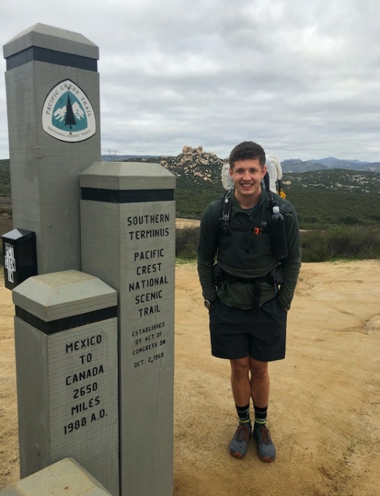
We knew starting in mid-March had its risks. We developed a plan accordingly. If there was heavy snowpack in the Sierra, then he would bail at Kennedy Meadows and head immediately to the Southern Terminus of the 800-mile Arizona Trail. We felt our alternate plan wouldn’t be needed as reports of a low snow year in California made an early start on the PCT possible. We were happy his plans were coming together.
So on March 9, roughly a month after turning 22 years old, Trevor, my daughter Olivia, and I headed to Phoenix, Arizona, to spend a week with his grandparents, after which they would drive him to Campo a week later. Everything was in great shape. And then, suddenly, everything started to unravel.
We got to Phoenix on Monday the 9th. There were growing concerns about the coronavirus, but nothing significant��at least that’s the way it was when we boarded the plane. Upon landing in Phoenix, the world was changing in front of our very eyes. The stock market had crashed. Concerns of the virus were growing with each passing day. That week was full of excitement for Trevor and anxiety for me.
The day before we left, I told him that maybe going on the hike was not such a smart thing to do anymore. But he was within spitting distance of the Southern Terminus of the PCT in Campo, so the yearn to start on March 16 was strong. In his mind, he was practically touching the Southern Terminus. Nothing was going to stop him now.
His sister (Olivia) and I flew back to Texas on Friday, March 13. Saying our final goodbyes at the airport, Trevor gave me a longer embrace than usual—much longer in fact. And in that embrace, he whispered to me, “I love you Dad. Thanks for all you’ve done to help make this adventure a reality for me.” To which I replied—“Go hike the shit out of that trail!”
His grandparents dropped him at the terminus on Monday morning. A few quick photos, big smiles, and some hugs. Then he was off on the adventure of a lifetime.
Trevor pushed himself to Lake Morena on day one. He couldn’t have been happier. It was in Lake Morena that he connected with his tramily. The tramily would morph into larger and smaller groups of people over the coming days, but there were three gentlemen whom he consistently stayed with through the entire journey: Leo from Milwaukee, Jannek from Germany, and Cody from Australia—the latter two were with him on the morning of Friday, March 27, when the accident happened.
His group hiked through a snowstorm, pulling into Mount Laguna on Wednesday. They were fortunate enough to hole up in one of the tiny houses to escape the snow. Their game plan was to stay there two nights as heavy snowfall was scheduled through Thursday. But they wanted flexibility in their plans and only booked one night. When they called the next morning to book a second night, they were told the tiny house had already been booked. They had no choice but to head back out into the snow.
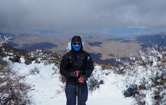
I spoke with his hiking partner, Leo, this past Saturday. He told me how miserable that day was. They were cold, soaked to the bone from the heavy wet snow. They were miserable. The group struggled unsuccessfully to find a protected location to set up camp. It was in that moment, during their first real moment of adversity on trail, that Trevor told him, “It’s during these moments of adversity, through trial and tribulation and our actions in dealing with these moments that define who we are as human beings.” Hearing Leo recount this to me brought me to my knees. I had been sobbing all weekend after I learned of his passing, but this shook me to my core.
That same day, the day of the snowstorm, the Pacific Crest Trail Association (PCTA) had issued a statement that all thru-hikers not yet on the trail should postpone their hike, and that all hikers already on trail should get off due to COVID-19 concerns. I pleaded with Trevor that it was time to end his dream. To come home. The trail would still be there for him next year. Or five years from now. Or even 10. Trevor said that until it became illegal to stay on the trail, he was going to continue hiking. “This is my dream Dad…I’m living it right now. The views, the vistas, the things I get to see are the most beautiful that I’ve ever seen in my life. If I lose this opportunity now, I’ll lose it forever.”
And so became our daily argument for the next week. I begged him to postpone his trek. I told him he was being selfish. I told him he was putting himself and others at risk. That he wasn’t thinking about Elise, his sister, his mother, or me. I threatened I was going to withdraw financial support and would no longer resupply him (my last option). I think we both knew I would not do that.
I said things I regret. I even lobbied the USFS to terminate all PCT permits to no avail. The most haunting, prophetic thing I said to him was, “Please come home. I don’t want you to get sick on the trail—or worse yet, die. It would devastate me if I had to be the one to call Elise and tell her something happened to you.”
After about 5-6 days of trying to convince him to come home, I realized he was staying put. There was no getting him off the trail, at which point I would focus on supporting his hike. I vowed to myself, if he wouldn’t come home, then I’d at least do what I could to keep him as safe as possible with current information and good resupply boxes.
Trevor and the group trudged on. They were closing in on Warner Springs, having just passed PCT mile 100. I sent Trevor a text and asked him how he was feeling and how his body was holding up. He told me other than a few pesky blisters, he was feeling great and that his body was strong. I remember him saying there were a couple of members in his tramily that were nursing some injuries… sore ankles and knees, but he said could not have felt better.
Trevor’s closest trail friend, Leo, was nursing a bum knee after hiking several days without a break. Leo got a hitch from Warner Springs via the PCT Trail Angels Page on Facebook to a hotel to take of couple zero days to heal up. Leo encouraged Trevor to take those zeros with him but Trevor, Jannek, and Cody were still feeling strong. Trevor had limited time on the trail. They were going to press on without Leo. While sitting in his hotel room for a couple of days watching the news, Leo learned of the severity of COVID-19. He decided to end his hike at this point. I’ve asked myself multiple times, “What would have happened had Trevor stayed back with Leo that day?” His decision to press on will haunt me forever.

Our last communication with Trevor was on Thursday night. They had just pulled their 8th straight day of “twenties” (twenty-mile days) by completing a 3,000-foot climb. Arriving to their camp site at PCT mile 166.5, they hunkered down for the night. Trevor sounded exhausted. He was eager to complete the last 14 miles into Idyllwild where he, Cody, and Jannek were planning to take two zeros. While in town he’d pick up his resupply (which included his ice axe and microspikes) in preparation for Mt. San Jacinto and Fuller Ridge. He never made it to Idyllwild.
A friend called me on Friday to notify me of a tragic accident on the PCT close to Trevor’s last known location at mile 166.5. Of course, at that time, we didn’t know the hiker involved was Trevor. The news report mentioned a hiker had succumbed to their injuries before the rescue team arrived. The report suggested the rescue occurred “near” Mountain Center, of which Trevor was close to the prior day. He was now some 10-15 miles past that point. But when you’re dealing with the wilderness, the word “near” could mean one mile, five miles, 10 miles, or even 25. I was slightly concerned and would remain that way until I heard from Trevor, but I was confident he was well past the search area. I had two thoughts. First, Of all the hikers on the trail, what is the likelihood this deceased hiker was Trevor? Second, He had his driver’s license with him. If it was Trevor, Search and Rescue would have certainly reached out to me by now. I was confident it was not him, but would remain mildly concerned until I heard his voice. That voice never came.

7 p.m. rolled around in Dallas/Fort Worth. I knew Trevor would have been in Idyllwild by now. Every time I tried calling, it went straight to voicemail. He would likely have access to internet in town. Therefore, he would most likely be on his phone. It was also about this time every night that he would check in with us via call, text, or his Garmin InReach. I started to worry. I called the Riverside County Sheriff’s office.
I won’t go into all the details of the next several hours, as some of those details will only remain with my family. Speaking to the Sheriff’s Deputy who orchestrated the Search and Rescue, and then subsequently to the Coroner were some of the most difficult conversations I’ve ever had to have in my life. My life was changed forever when the Coroner told me, “We have Trevor.”
To the best of our knowledge, Trevor slipped on a patch of snow-covered ice near Apache Peak (PCT mile 169.5). Trevor’s accident was first reported by Cody and Jannek via their emergency GPS device at roughly 9:38 a.m. PT. Rescue crews from the Riverside Mountain Rescue Unit and the California Highway Patrol Medic and Air Operations Unit arrived on site at roughly 10:30 a.m. Five fire trucks, two helicopters, and more than 24 rescue personnel fought the elements during the rescue mission. One helicopter focused on rescuing Cody and Jannek while the other attempted to locate Trevor. Dangerous terrain, coupled by severe weather, prevented the helicopter from locating Trevor. They were able to locate a safe landing spot to drop Medic Charles Rhodes of the California Highway Patrol (CHP) onto the trail. Medic Rhodes hiked and eventually bushwhacked a total of five miles to reach Trevor at 1:30 p.m. Sadly, prior to Medic Rhodes’ arrival, Trevor had succumbed to his injuries from sliding several hundred feet into a steep ravine. I am grateful to the men and women who risked their lives to recover my son. I will forever be in their debt.
As you can imagine, Friday, March 27, 2020, was the darkest, most painful, heartbreaking moment of our lives. The grief of losing our son has hit us like a tsunami. The unstoppable waves drown us in grief each time they hit. There’s nothing that can be done to stop them. It’s several days later now, and the waves still come.
I yearn for the day when Trevor’s family and closest friends can talk about him and look at photos without pain or grief, but instead smile and recall the happy times we shared together.
Trevor was not a statistic. He was not a PCT asterisk. He was everything you want in a son. As parents, we were so proud of him. He was our child. Trevor LOVED hiking! He was handsome, responsible, and smart. He was going to make this great world a better place. He was convinced he would someday write a computer program that would change the world. Most importantly, I want people to know that he cared deeply about his family and friends. He was philosophical. He was a deep thinker. He genuinely cared for others, encouraging those closest to him to be “the best version of themselves they can be.”
Just as in life, Trevor made the same impact on others during his brief time on the PCT. As communicated to me by his close trail friend Leo, who said, “While our time together was brief, it was intense. We had several deep conversations on the trail and my viewpoint on the world has in many ways changed because of Trevor.”
My hope and wish is that Trevor’s death can start the healing of a hiker community that has been ravaged and torn apart by COVID-19. What was once a free-spirited group who loved “The Trail,” the community has become name callers who have hurled insults at each other because of one’s position to hike or not to hike. I beg of you, that if there is one way we can honor Trevor, I ask that you put aside your differences and come together as a community. And I ask that you not judge Trevor for his decision to remain on the Trail. COVID-19 did not kill my son. His death could have happened to any one of us, in any year.
In closing, I’d like to leave you with a quote from Trevor shared with me by his girlfriend, Elise. In which Trevor says, “We are not individual souls, but a collection of the souls of the people we love the most—we are one in the universe.”
Be good to each other. Love each other. Come together as one hiking community and heal the pains by which the coronavirus has inflicted upon this community. That’s what Trevor would have wanted.
Hike on, my son. I count the days when we’ll be rejoined again on the highest of all mountain peaks in Heaven… on the Eternal Trail. The trail of eternal life.
2 notes
·
View notes
Text
Campbell Mesa - near Walnut Canyon National Monument, AZ
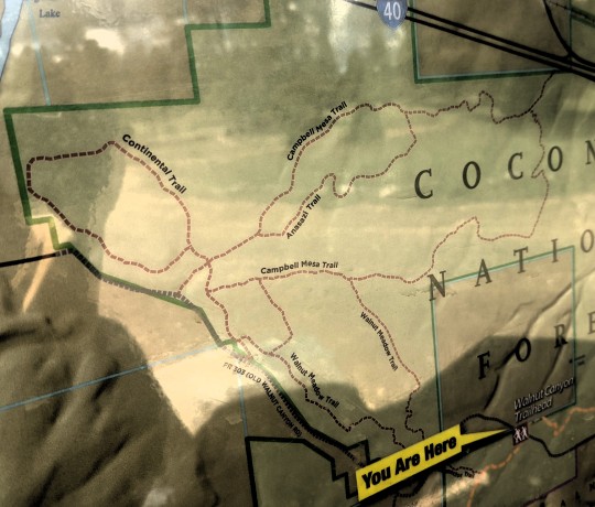
Today we did another hike from the Arizona Trail trailhead near our campsite, this time we veered off to the west and did a loop on Campbell Mesa. It was a nice walk, we saw a few flowers blooming and a couple of deer. Another beautiful fall day in northern Arizona.


We finished off our hike with a beer at Wanderlust Brewing, of course. We got the insider scoop on this local brewery when we met a friend of our daughter’s, Alec, there a couple of days ago. Locals never steer you wrong!

Tomorrow we are heading to Apache Springs - south of Sedona - for our last stop before heading to Tucson. Cheers from Flagstaff!

1 note
·
View note
Text
Mesa Arizona's Natural Wonder Neighborhoods
Introduction
Mesa, Arizona has a lot to offer when it comes to the outdoors. In fact, Mesa ranks 9th on Travel and Leisure's list of "America's Favorite Cities for Hiking." With so many amazing communities in Arizona, it can be hard to narrow down which one is right for you. So we've done some digging and compiled a list of our favorite neighborhoods that offer incredible outdoor experiences in Mesa:
San Tan Valley, AZ
San Tan Valley is a master-planned community located in the southeast valley of the Phoenix metropolitan area. With its close proximity to both Gilbert and Queen Creek, it's no wonder why this neighborhood has become such a popular place to live. San Tan Valley sits between two mountain ranges: The Superstition Mountains on one side and Sossaman Hills on another side; both are part of Tonto National Forest and offer beautiful hiking trails for residents to explore year-round--even when it's 100 degrees outside!
The population here is about 100,000 people so there are plenty of options for shopping, dining out or just enjoying some time outdoors at one of several parks within walking distance from your home (or even better yet--your apartment).
Apache Junction, AZ
Apache Junction, Arizona is a city in Pinal County, Arizona, and is located about 15 miles east of the Phoenix metropolitan area. The population was 32,633 at the 2010 census.
Apache Junction has been known as "The West's Most Western Town" since its founding in 1879. It was originally founded as a copper mining town during territorial times when it was known as Wahatoya (meaning "water hole"). The name was changed after miners discovered gold nearby; however, this discovery did not pan out to be profitable for them or any other miners that followed suit with hopes of striking it rich there.[1]
In 1881 an irrigation project began bringing water from Freestone Creek through tunnels under Granite Mountain into what we now call Apache Junction.[2] This allowed farmers who settled here access to water year-round rather than just during monsoon season like their predecessors had experienced before coming here.[3] In addition to farming crops such as wheat,[4] corn[5], alfalfa[6], oats[7], etc., these early inhabitants also raised cattle which were used primarily for milk production but also meat consumption when needed later on down through history until today where more people prefer eating beef rather than drinking milk due mostly because it tastes better than what comes out from dairy cows' udders every day so naturally we would all want something tasty like steak instead of some bland liquid made only outta cow juice."
Gilbert, AZ
Gilbert is a great place to live if you want to be near the outdoors. It's close to many major freeways, including the Loop 202 and I-10, so it's easy to get around town or make your way back home after a long day of hiking or biking. The community has plenty of parks and open spaces that are perfect for families looking for places where their kids can play safely. Gilbert also has low crime rates compared with other communities in Arizona.
Queen Creek, AZ
Queen Creek is a town in Maricopa County, Arizona, United States. The population was 24,748 at the 2010 census. It is a suburb of Phoenix and is part of the East Valley section of the Phoenix Metropolitan Area.
The town was named after Queen Creek which runs through its center. Queen Creek has become known as one of Mesa's most desirable neighborhoods because of its close proximity to downtown Mesa and easy access to Loop 101 freeway system.
Chandler, AZ
Chandler is a great place to live, work and play. Chandler has been recognized as one of the best cities to live in America by Business Insider and other publications. The city has also been named one of the top 10 safest cities in Arizona for 2018 by Safewise.com.
Chandler has many outdoor activities available for residents including hiking at nearby South Mountain Park or kayaking on Chandler Creek Reservoir. There are also several golf courses within close proximity if you want some time on the links! If you are looking for something more relaxing than golfing or hiking then take advantage of all that Chandler has to offer with its many restaurants located throughout town including famous spots like Zinburger Wine & Burger Bar or Pita Jungle which serves Mediterranean cuisine made fresh daily with ingredients sourced locally whenever possible!
Rancho Del Mar
Rancho Del Mar is a master-planned community located in Mesa, Arizona. It is situated in the southeast corner of Mesa between Alma School Road and Dobson Road. The community consists of over 3,000 homes on approximately 1,600 acres of land that were previously used for ranching purposes before being developed into residential neighborhoods and single-family homes.
Fiesta Park Village
Fiesta Park Village is a gated community located in the heart of Mesa, Arizona. The neighborhood surrounds Fiesta Mall and offers residents easy access to shops, restaurants, and more. Residents also have access to a pool, tennis courts, and clubhouse.
Takeaway:
If you're looking to live in the Phoenix area, Mesa is a great choice. It's one of the fastest-growing cities in the US and offers everything from affordable housing to top-notch schools and recreation. You'll find everything from hiking trails to historic sites within its borders--plus, it's an easy drive or train ride away from other cities like Scottsdale or Tempe if you need more options for shopping or nightlife.
Make sure to check out these neighborhoods before deciding where to live:
Conclusion
If you're looking for a home that's close to nature, Mesa has a lot to offer. There are plenty of beautiful parks and trails that you can enjoy in your free time. And if you prefer an urban environment, there are also many excellent options available! The best part about living in any of these neighborhoods is that they all have something special about them--whether it be their location or architectural style--and we hope this blog post helped you find one that fits your needs perfectly!

Always Green Turf AZ
Always Green Turf AZ is proud to be the leading provider of artificial turf in Mesa, AZ. Always Green Turf AZ is a full-service landscape maintenance company in Mesa, Arizona. We offer year-round services for residential and commercial properties to keep your lawn looking its best! You can find us online using these keywords artificial grass, fake grass, astro turf, artificial turf, and synthetic grass.
Always Green Turf AZ
204 S Mesa Dr, Mesa, AZ 85210
(480) 530-5476
https://www.alwaysgreenturfaz.com
1 note
·
View note
Photo

White Sands National Monument, Otero County, New Mexico, USA⠀ https://buff.ly/2WraESS⠀ .⠀ https://buff.ly/2RroOzu⠀ .⠀ White Sands National Monument is in the northern Chihuahuan Desert in the U.S. state of New Mexico. It's known for its dramatic landscape of rare white gypsum sand dunes. Trails through the dunes include the raised Interdune Boardwalk and the Dune Life Nature Trail, dotted with interpretive exhibits on wildlife and other features. Dunes Drive is a looped road from the White Sands Visitor Center to the dune field.⠀ .⠀ The White Sands National Monument is located about 25 km southwest of Alamogordo in western Otero County and northeastern Dona Ana County in the state of New Mexico, at an elevation of 4235 feet . The area is in the mountain-ringed Tularosa Basin valley area and comprises the southern part of a 710-km² field of white sand dunes composed of gypsum crystals. The first exploration was led by a party of US Army officers in 1849.The Mescalero Apache were already living in the area at the time. The idea of creating a national park here goes back at least to 1898, when a group in El Paso proposed a Mescalero. Their idea was for a game hunting preserve, which conflicted with the idea of preservation held by the Department of the Interior, and their plan was not successful.⠀ .⠀ The image is of a road passing through the area.⠀ .⠀ #earthimages #earthimage #upintheair #abovetheclouds #satelliteimage #satelliteimages #EarthOverhead #overview #overvieweffect #whitesands #newmexico #OteroCounty http://bit.ly/2S8kg5R
2 notes
·
View notes
Text
April 16 –
· We left Silver City mid-morning headed toward the 4 corners National Monument. It was a very interesting drive about 150 miles maybe a little more to Grants New Mexico. The scenery was absolutely marvelous although stark in nature. There was an “Ah moment” around almost every curve. We took our time and ended up looking for a campground near Grants. The first one was full and we decided to check on the second one which did not have always good reviews, but it was nearby. They did have one vacancy and we snagged it. It just so happens to have an on-site brewery that also sells wine. It turned out to be a very nice campground. We’re glad to spend the night here because we stopped early so we didn’t have to rush getting ready for dinner. The check in clerk said we could bring our food to the brewery and eat out on the patio. What a deal! I’d rather be lucky than good most of the time. We decided to cook and eat our meal in the RV e because the temperature was dropping fairly rapidly. It turned out to be a very cold night. After dinner we went to the brewery for a nightcap. We had sampled a couple of beers before we went back up later in the evening. When we went back about 8 o’clock and I asked for the beer that was close to a German Pilsner, but they were sold out. That was OK since they still had some good beer and we opted for the Buckle Bunny Blonde, almost like a light lager. We had a great time talking with the waitress/bartender and we were the only ones there for a long time. A Chiricahua Apache came in to get a beer to go and we had a good talk with him. He had traced his ancestry back several generations and thought he was a mixture of Chiricahua Apache, French and Spanish. When he did DNA testing, he found out he it had Italian and Greek in it and no Spanish or French! We told him that if you have Italian in you or Greek in you, you almost always have the other because the Greeks and Italians had warred for years over Sicily and intermarried. He said he was glad to learn that because he had no idea why he has Italian and Greek in his DNA. It got very cold at night and we were glad to have our sleeping bags. It was 31 degrees with a 30 mile an hour wind when woke up. Luckily, we have a very nice little ceramic heater that can make the cabin livable while you get dressed and eat breakfast. We found out the day before that the whole Navajo reservation was closed to the public because of a COVID outbreak so the 4 corners trip was out the question. We decided to drive southwest to Tucson Arizona and check an out of the way National Park, Saguaro. We found a very interesting RV resort and reserved a spot for three days across from the bathroom. Arizona has a lot of a lot of RV resorts for people who come and spend the winter in their RVs and some even have permanent trailer homes to come to stay in instead of an RV. It is well maintained, gated with lots of amenities.
On the 18th, we went to Saguaro National Park West. It has a 9 mile gravel loop that has a couple of scenic hikes off the main loop. Not very long but somewhat challenging. One was 3 quarter mile round trip and the other was a 600 foot round trip to see some petroglyphs. Both were very interesting and we enjoyed seeing the different cactus plants in bloom. Some were blooming more than others and I was able to get some pictures of bees getting nectar from a very beautiful yellow bloom. We came back early and relaxed. We will go to Saguaro National Park East today.
April 19
We headed toward the Saguaro National Park East late morning and got there just in time for lunch. We decided to take the .7 mile out and back Mica view trail. It was interesting but uninspiring. We then finished the 9 mile loop portion of the National Park and went to Walmart to get some provisions. We got back about 1500 hrs when it was really starting to get hot and decided to cool it. I had left a message with our old friend from Fort Gordon and Germany to see if we can stop by and see them in Phoenix. They have obligations tomorrow and Barbara just got her second shot the other day so she wasn’t fully vaccinated. Tom and I had almost an hour-long conversation reliving some old times and discussing the handling of the COVID situation. We agreed on everything about the draconian measures that were taken in some states and other who took a more pragmatic approach assuming people would do the right thing which most of the time they did. Tomorrow we head North to Utah then West to Nevada. We do hope you are enjoying our blog and we are going to continue to write it either way because it will help us remember as we get older. Some more will come in 3 to 4 days. Until then, Ciao
0 notes
Text
8 Dog-Friendly Hiking Trails in Arizona (2023 Guide)
Pet Keen is reader-supported. When you buy via links on our site, we may earn an affiliate commission at no cost to you. Learn more.
From pastel-colored rock formations to the Grand Canyon itself, Arizona is home to some of the world’s most gorgeous natural landscapes. When you’re itching to get outside and Fido is too, there’s no shortage of dog-friendly trails in the Grand Canyon State to tackle. Finding appropriate trails to hike can be hard, to say the least, but we’ve managed to find a large handful of perfect spots. Check out the best dog-friendly hiking trails in Arizona down below and mark your calendar for your next outing!

The 8 Dog-Friendly Hiking Trails in Arizona
1. Elden Lookout Trail 🗺️ Address: 📍 Flagstaff, Arizona 🕐 Open Times: 24/7 year-round 💲 Cost: Free 🐕 Off-Leash: Yes, in certain areas - Trail length: 2.5 miles - Difficulty: Intermediate - Moderately steep route to the lip of Mount Elden - Heavy snow and ice make this trail inaccessible during winter 2. Treasure Loop Trail 🗺️ Address: 📍 Apache Junction, Arizona 🕐 Open Times: 8am to 5pm 💲 Cost: $10 per vehicle parking fee 🐕 Off-Leash: No - Trail length: 2.4 miles - Difficulty: Easy - Short hike through desert rock formations and arid scrubland - Visit after a rainy spell to check out sloped fields of colorful wildflowers - Easily followed and well-maintained trail 3. Pass Mountain Trail 🗺️ Address: 📍 Mesa, Arizona 🕐 Open Times: 5am to 10pm 💲 Cost: $7 per vehicle parking fee 🐕 Off-Leash: No - Trail length: 7.7 miles - Difficulty: Intermediate - Beware of loud gunshots from the nearby gun range - Watch your footing during the rocky western side and mind the sandy slopes on the eastern side - Carry 1 gallon of water per person, plus dog food and extra water for your dog 4. Bulldog Saddle Trail 🗺️ Address: 📍 Mesa, Arizona 🕐 Open Times: Dawn to dusk 💲 Cost: Free 🐕 Off-Leash: No - Trail length: 2.8 miles - Difficulty: Easy - Quick, easy hike starting at the city limits of Mesa 5. Horseshoe Bend Trail 🗺️ Address: 📍 Page, Arizona 🕐 Open Times: 24/7 year-round 💲 Cost: $10 parking fee per vehicle, $5 for motorcycles 🐕 Off-Leash: No - Trail length: 1.5 miles - Difficulty: Easy - A short, relaxing walk with various views of the famed Horseshoe Bend at various angles - No water or other amenities on-site—bring plenty of water and food for the trip - Stay on the well-maintained and clearly marked trail 6. Shaw Butte Trail 🗺️ Address: 📍 Phoenix, Arizona 🕐 Open Times: 24/7 year-round 💲 Cost: Free 🐕 Off-Leash: No - Trail length: 4.2 miles - Difficulty: Intermediate - Gets steep—keep your dog close and watch your step! - Views to die for of the Phoenix Mountain Preserve and city - Restrooms and water fountains available at the nearby North Mountain Park 7. Bell Rock Trail 🗺️ Address: 📍 Sedona, Arizona 🕐 Open Times: 24/7 year-round 💲 Cost: Red Rock Pass or America the Beautiful Pass required; fees hover around $5 per vehicle per day 🐕 Off-Leash: No - Trail length: 3.6 miles - Difficulty: Easy - Wide, easy-to-follow pathway along hard rock surfaces - Boasts elevated views of the renowned Bell Rock, Courthouse Butte, and the prevailing Sedona area 8. Hieroglyphic Trail 🗺️ Address: 📍 Gold Canyon, Arizona 🕐 Open Times: 24/7 year-round 💲 Cost: Free 🐕 Off-Leash: No - Trail length: 4.4 miles - Difficulty: Moderate - Easy uphill hike through wildflower fields into rocky canyons - Trail ends at ~15,000-year-old pictographs by the ancient Hohokam peoples

Conclusion
Arizona’s best known for the Grand Canyon, but don’t just visit it once and stop there! Consider checking out Horseshoe Bend, Bell Rock, or any of the state’s other numerous dog-friendly hiking trails. We highly recommend bringing way more water than you’d need, and plenty of sunscreen too—Arizona sun is unlike anywhere else. Featured Image Credit: N K, Shutterstock Written by

Codee Chessher is a freelance writer whose mojo is: there is nothing a well-worded sentence can't accomplish! He loves to write about travel, DIY, pets, and more. Codee's experience is varied, but the written word has always been his strongest and biggest passion. Source link Read the full article
0 notes
Photo

Saguaro in Bloom - April 2018 This saguaro in bloom is also on the Apache Trail Loop near Phoenix. The saguaro is a beautiful cactus and even more so when it is wearing its festive hat of blooms. MWM
0 notes
Photo


February 21, 2018
A great day for a hike. We did Treasure Loop Trail in Lost Dutchman State Park just east of Apache Junction. It was a 2.5 mile hike that included 550 feet of elevation gain. It was pretty cool and unexpected to share the trail with a group of people on horseback. The view of the valley from the higher elevation was gorgeous.
2 notes
·
View notes
Photo

Celebrate Saguaro National Park's Anniversary October 14th!
Celebrate Saguaro National Park's Anniversary October 14th!: Saguaro National Park is home to the nation's largest cacti -- the giant saguaro -- the universal symbol of the American west. These majestic plants, found only in a small portion of the United States, are protected by Saguaro National Park, to the east and west of the modern city of Tucson. Here you have a chance to see these enormous cacti, silhouetted by the beauty of a magnificent desert sunset. Saguaro National Park in southern Arizona consists of two distinct areas—the Tucson Mountain District west of the city of Tucson and the Rincon Mountain District east of the city—that preserve Sonoran Desert landscapes and diverse fauna and flora, including the giant saguaro cactus. The volcanic rocks on the surface of the Tucson Mountain District differ greatly from the surface rocks of the Rincon Mountain District; over the past 30 million years, crustal stretching associated with the Basin and Range displaced rocks from beneath the Tucson Mountains to form the Rincon Mountains. Uplifted, domed, and eroded, the Rincon Mountains remain significantly higher and wetter than the Tucson Mountains, and have plant and animal populations that do not exist in the Tucson Mountain District. Tucson Mountain District, Saguaro National Park The Rincons, one of the Madrean Sky Islands between the southern Rocky Mountains and the Sierra Madre Oriental in Mexico, support high biodiversity. Earlier residents of and visitors to the lands in and around the park before its creation included the Hohokam, Sobaipuri, Tohono O'odham, Apaches, Spanish explorers, missionaries, miners, homesteaders, and ranchers. In 1933, President Herbert Hoover, using the power of the Antiquities Act, established the original park as Saguaro National Monument. In 1961, President John F. Kennedy added the Tucson Mountain District and renamed the original tract the Rincon Mountain District. Congress combined the Tucson Mountain District and the Rincon Mountain District to form the national park in 1994. Rincon Mountain District, Saguaro National Park Hiking on the park's 165 miles of trails and sightseeing along loop drives near the park's visitor centers are popular activities. Both districts have picnic areas and allow bicycling and horseback riding on selected roads and trails. The Tucson Mountain District forbids overnight camping, but the Rincon Mountain District supports limited wilderness camping. Both districts offer ranger-led walking tours and other educational programs. Get more details about the Saguaro National Park Poster here. Or, see the complete Arizona Collection: Saguaro, Grand Canyon and Petrified Forest National Parks! https://national-park-posters.com/blogs/national-park-posters/celebrate-saguaro-national-parks-anniversary-october-14th?utm_source=rss&utm_medium=Sendible&utm_campaign=RSS
0 notes
Photo

June 2020 Mangum Dental Hike-of-the-Month Apache Creek Loop, Prescott National Forest
Distance: 6.1 miles, per Forest Service data, my GPS was closer to 7.0
Difficulty: Moderate, this trail was harder to follow, but no significant elevation gain
Elevation Gain: 528 feet
Parking: Park along Forest Road 95A, no facilities.
Directions: From the intersection with Iron Springs Road, travel north on Williamson Valley Road for almost 36 miles. Pass the K4 Ranch Headquarters just before crossing Walnut Creek on a fascinating old bridge. A couple hundred yards past the bridge bear to the left, leaving Williamson Valley Road on Country Road 125. Travel down CR 125 for 1.8 miles and turn left on Forest Service Road 95. There is a Walnut Creek Center For Education and Research Facility on the corner. FR 95 crosses Walnut Creek and then Apache Creek shortly after the turnoff. Travel south on FR 95 for 1.3 miles and turn right on FR 95A. The trailhead is 1.2 miles down Forest Road 95A on the right. This last 1.2 miles gets rough and some may want to park and hike to the trailhead. About .2 miles from the trailhead there is a stretched wire gate. Warning: FR 95A is recommended for high clearance vehicles. Also, the brush is tight to the road and Arizona pin stripping is unavoidable.
Summary:
This hike is in the Prescott National Forest and partially in the Apache Creek Wilderness Area. It is a combination of the Graver Wash Trail (#9904), Apache Creek Trail (#9905), the Upper Graver Wash Trail #9906, and returns to Forest Road 95A. Solitude is the best word to describes this hike. We saw no other hikers, but signs of wildlife and cattle. The running water in Apache Creek and riparian habitat was a treat and unexpected in this region. There were cairns to mark the way and many downed trees.
This trail begins northward on Graver Wash Trail (#9904) for about 1 mile descending toward Apache Creek. Here there are Pinyon Pines, Scrub Oak, and Juniper Trees. Once at the creek, the trail turns west and then southwest and follows the creek for two miles. In early April 2020 there was good water flow in the creek due to the wet winter and spring. The grass was green near the creek, but the trees had not yet bore leaves. The trail crosses the river and wasn’t always easy to follow, but continue along the river on Apache Creek Trail (#9905). There were many signs of cattle in the area of which we both saw and heard. At about 3.5 miles from the trailhead, the Upper Graver Wash Trail (#9906) intersected the #9905 and lead away from the river. This mile stretch is uphill and joins Forest Road 95A. Turning left, the road heads northeast back to complete the loop.
Forest service map link: https://www.fs.usda.gov/Internet/FSE_DOCUMENTS/stelprd3828019.pdf
Mangum Dental is a full-service dental office treating families, individuals, emergencies with a wide variety of dental procedures. We have been treating patients in Prescott since Dr. Richard Mangum started the practice in 1978. His son, Dr. Brett Mangum, with Dr. Jim Ransdell, Dr. Richard Snow and the amazing team of dental hygienists, dental assistants, and office staff are eager to provide you with dental treatment you can trust.
0 notes