#arcgis10
Explore tagged Tumblr posts
Visit Tumblr Blog
Explore Tumblr blogs with no restrictions, modern design and the best experience.
Last Seen Tumblr Blogs


Fun Fact
Premium Tumblr themes are available from anywhere between $9 to $49.
Text

🚨 Promo Terbatas! Belajar QGIS & ArcGIS, Diskon 50-75%, Plus Jadi Reseller Dapat 50%!
Waktu terbatas! ⏳ Belajar QGIS & ArcGIS dengan diskon 50-75% dan dapat komisi 50% sebagai reseller. Buruan daftar!
#PromoTerbats#QGIS3#ArcGIS10#KursusGIS#ResellerOpportunity#DiskonBesar#BelajarCepat#GISExpert#KomisiMenggiurkan#PemetaanDigital
0 notes
Photo
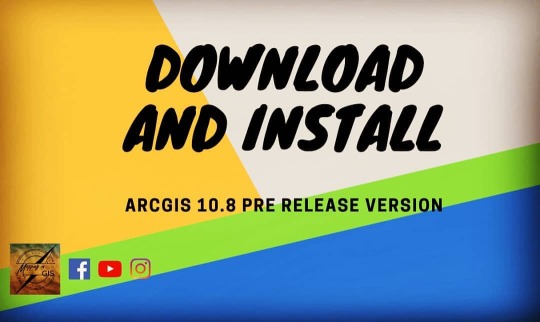
ArcGis 10.8 Pre release version #arcgis #arcgis10 #arcgis10.8 #geo #gis #geographicinformation #information #system #gismapping #geographicinformationsystems #geomaticsengineering #engineering #surveylife #surveying #orange #mapping #maps #earth #globe #arcgis #qgis #geography #topo #topography #trending (at Baciu, Cluj) https://www.instagram.com/p/B-9L-9AjHd3/?igshid=ugzmi1c1lql9
#arcgis#arcgis10#geo#gis#geographicinformation#information#system#gismapping#geographicinformationsystems#geomaticsengineering#engineering#surveylife#surveying#orange#mapping#maps#earth#globe#qgis#geography#topo#topography#trending
1 note
·
View note
Photo
#sonarwiz #arcgis10 #SBP #sedimentation hulu sungai #musi #bengkulu #kepahiang #curup #PLTA (at Starbucks Indonesia) https://www.instagram.com/p/Bwtd0VGg5sM/?igshid=oy5zdxev25f0
0 notes
Photo
Casanovas, Black, Fretwell, and Convey. "Mapping Lichen Distribution on the Antarctic Peninsula Using Remote Sensing, Lichen Spectra and Photographic Documentation by Citizen Scientists." Polar Research 34.1 (2015): 1-8. Web.
Lichens comprise a large component of the terrestrial ecosystem in Antarctica, which has not been extensively studied botanically speaking. The Normalized Difference Vegetation Index (NDVI) uses Landsat satellite imagery to create a proxy to indicate the presence of chlorophyll spatially. The concern is that NDVI overlooks the presence of lichens because of the difference in reflectance spectra between lichens and vascular plants. In an attempt to remedy this, the researchers measured the spectra for three distinct groups of lichens.They then tried mapping lichen-dominated communities directly using a matched filtering algorithm to match image pixel spectra of mid-resolution satellite imagery with the reference spectra of the lichen groups. They then compared distribution maps created with NDVI to those created with this new matched filtering technique. They analyzed the differences using ArcGIS10 and Exelis Visual Information Solutions (ENVI) version 5.1. This new technique showed a significant improvement over NDVI for mapping of lichen-dominant vegetation, with further study needed to assure that this technique does not overestimate lichen cover. In the polar regions of our planet, terrestrial lichens are the best biomonitors of pollution that we have. I am much more familiar with biomonitoring using epiphytes so it is interesting to see how useful GIS technology can be in these polar biomes.
0 notes
Video
youtube
Liked on YouTube: ArcGIS10 Basics 2 of 4 https://youtu.be/OmFKLTqQhkY
0 notes
Photo
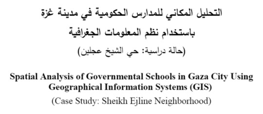
(via التحليل المكاني للمدارس الحكومية في غزة باستخدام نظم المعلومات الجغرافية - حالة دراسية : حي الشيخ عجلين ...)
التحليل المكاني للمدارس الحكومية في غزة باستخدام نظم المعلومات الجغرافية حالة دراسية : حي الشيخ عجلين Spatial Analysis of Governmental Schools in Gaza City Using Geographical Information Systems (GIS) (Case Study: Sheikh Ejline Neighborhood) قدمت هذه الأطروحة استكمالاً لمتطلبات درجة الماجستير في الهندسة المعمارية قسم الهندسة المعمارية - كلية الهندسة الجامعة الإسلامية - غزة This Thesis is Submitted in Partial Fulfillment of the Requirements for the Degree of Master in Architecture Architecture Dep - Engineering Faculty The Islamic University of Gaza إعداد أحمد علي عسكر Done by Ahmad A. Asker إشراف Supervision د. علاء الدين الجماصي د. يوسف محمود المنسي 1436 هـ - 2015 م ملخص البحث هدفت هذه الدراسة إلى استخدام نظم المعلومات الجغرافية لتقييم الوضع الراهن لمواقع المدارس الحكومية بمدينة غزة، عن طريق توظيف نظم المعلومات الجغرافية لتوثيق المواقع الراهنة للمدارس الحكومية في المدينة والتوصل لأهم المعايير المؤثرة في اختيار مواقع المدارس بحيث تتناسب مع مدينة غزة بشكل خاص وقطاع غزة بشكل عام ويمكن الاعتماد عليها في اختيار مواقع المدارس مستقبلاً، وبناء نموذج تطبيقي للملاءمة لاختبار أنسب المواقع لإنشاء مدرسة والخروج بخرائط ورقية ورقمية للمدارس قابلة للتحديث. وقد اعتمدت الدراسة لتحقيق ذلك على (البيانات المتوفرة لدى وزارة التربية والتعليم، بلدية غزة، الوزارات ذات العلاقة، العمل الميداني) لتخضع بعدها هذه البيانات للمعالجة الإحصائية المكانية في برنامج 1.ArcGIS10. تم التركيز في الدراسة على التوزيع الراهن لمواقع المدارس الحكومية بمدينة غزة وتحليله باستخدام نظم المعلومات الجغرافية من خلال ست تحليلات (أسلوب التحليل باستخدام صلة الجوار، أسلوب تحديد المسافة المعيارية والمركز الفعلي والافتراضي المتوقع، تحليل اتجاه نمط الانتشار، الحرم المكاني، تحليل عدالة التوزيع، تحليل مناطق التخصيص)، مع التركيز على حالة دراسية وهي حي الشيخ عجلين وتم فيه إنشاء نموذج اختيار الموقع الأفضل بحيث يمكن تطبيقه على باقي أحياء القطاع -بعد تجميع بياناتها- من خلال خطوة واحدة فقط، وتضمن الفصل الخامس نتائج وتوصيات الدراسة. وقد توصلت الدراسة إلى أن المدارس داخل مدينة غزة غير منتشرة بشكل جيد، ويغلب عليها النمط التجميعي، وأن انتشارها يأخذ الاتجاه شمال-جنوب، وهذا الامتداد هو امتداد الكتلة السكنية في المدينة، كما وتعاني غالبيتها من ��داخل كبير جداً في نطاق التأثير مما يدل على سوء توزيع أماكنها، كما وتبين أيضاً أن هناك تفاوت كبير جداً في المساحات التي تخدمها كل مدرسة لكلا النوعين الأساسية والثانوية. وقد أوصت الدراسة في نهايتها بضرورة توحيد المعايير المتبعة في اختيار مواقع المدارس بين كافة الجهات والاعتماد على المعايير التي تم استنتاجها في اختيارهم لهذه المواقع، مع العمل على دعم إجراء مزيد من الدراسات التطبيقية لنظم المعلومات الجغرافية في مختلف القطاعات، والعمل على اعتماد نظم المعلومات الجغرافية في اختيار مواقع المدارس الجديدة. Abstract This study aims to use the Geographic Information Systems (GIS) to evaluate the current status of the location of governmental schools in Gaza city and reaching to the most effective criteria in choosing these locations. This will help in identifying the best site location for future schools that serves Gaza city. The study also aims at create a model for choosing the best locations for schools’ construction and making hard copy and digital maps for the schools that can be updated all the time. To achieve these objectives, the study depended on the available data at the Ministry of Education, Gaza Municipality, relevant ministries and field work. This data was statistically processed by ArcGIS10.1 software. The study focuses on the current location of the governmental schools in the city of Gaza and analyzing it by GIS through six types of analysis (Nearest Neighbor Analyst, directional distribution-standard deviation and ellipse, analysis of current spatial distribution, spatial analysis, distributive justice, and allocation analysis). Also, this study shows the study case of this research which is Sheikh Ejleen Area. A selection model was established as the best location that can be applied on other locations in the Gaza Strip after collecting all the necessary data. The fifth chapter presents the conclusions and recommendations of the study. This study concluded that Gaza doesn’t have a good spatial distribution and has an accumulative type. The directional distribution of Gaza is directed from north to south. This extension is the extension of the population in the city whose majority suffers from overlapping in the scope of influence which indicates the bad spatial distribution. The study also shows a big difference in the areas served by each school whether primary or secondary schools. The study recommends the unification of the criteria followed in selecting the schools’ locations among all concerned entities and depending on the criteria concluded in the choice of these locations. More efforts must be done to conduct GIS applied studies in different sectors and using GIS in selecting the locations of new schools. http://swideg-geography.blogspot.com/2017/05/blog-post_87.html
0 notes
Text
🚨 Promo Terbatas! Belajar QGIS & ArcGIS, Diskon 50-75%, Plus Jadi Reseller Dapat 50%!
Waktu terbatas! ⏳ Belajar QGIS & ArcGIS dengan diskon 50-75% dan dapat komisi 50% sebagai reseller. Buruan daftar!
#PromoTerbats#QGIS3#ArcGIS10#KursusGIS#ResellerOpportunity#DiskonBesar#BelajarCepat#GISExpert#KomisiMenggiurkan#PemetaanDigital
0 notes
Text

💻 Belajar QGIS & ArcGIS Online, Murah Banget! Diskon 50-75%, Bisa Jadi Reseller 50%!
Belajar GIS online dengan harga terjangkau! 🎉 Dapatkan diskon 50-75% dan peluang jadi reseller dengan komisi 50%. 🚀 Yuk, mulai sekarang!
#BelajarOnline#QGIS3#ArcGIS10#KursusMurah#ResellerGIS#DiskonSpesial#GISIndonesia#PemetaanDigital#KomisiReseller#KursusGIS
0 notes
Text
💻 Belajar QGIS & ArcGIS Online, Murah Banget! Diskon 50-75%, Bisa Jadi Reseller 50%!
Belajar GIS online dengan harga terjangkau! 🎉 Dapatkan diskon 50-75% dan peluang jadi reseller dengan komisi 50%. 🚀 Yuk, mulai sekarang!
#BelajarOnline#QGIS3#ArcGIS10#KursusMurah#ResellerGIS#DiskonSpesial#GISIndonesia#PemetaanDigital#KomisiReseller#KursusGIS
0 notes