#nasa gsfc robots
Explore tagged Tumblr posts
Visit Tumblr Blog
Explore Tumblr blogs with no restrictions, modern design and the best experience.
Last Seen Tumblr Blogs


Fun Fact
Tumblr was created by web developers David Karp and Marco Arment.
Text

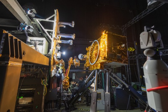
OSAM1 spacecraft in the clean room with one of our space robot arms mounted on top. This is from September and is a public release photo from NASA.
4 notes
·
View notes
Text
Astronomy Picture of the Day
2025 March 9

Cyclones at Jupiter's North Pole
The image shows the north pole of Jupiter in red (infrared) light. Many cyclonic swirls surround the pole.
Image Credit: NASA, JPL-Caltech, SwRI, ASI, INAF, JIRAM
Why are there so many cyclones around the north pole of Jupiter? The topic is still being researched. NASA's robotic Juno mission orbiting Jupiter took data in 2018 that was used to construct this stunning view of the curious cyclones at Jupiter's north pole. Measuring the thermal emission from Jovian cloud tops, the infrared observations are not restricted to the hemisphere illuminated by sunlight. They reveal eight cyclonic features that surround a cyclone about 4,000 kilometers in diameter, just offset from the giant planet's geographic north pole. Similar data show a cyclone at the Jovian south pole with five circumpolar cyclones. The south pole cyclones are slightly larger than their northern cousins. Oddly, data from the once Saturn-orbiting Cassini mission has shown that Saturn's north and south poles each have only a single cyclonic storm system.
Authors & editors: Robert Nemiroff (MTU) & Jerry Bonnell (UMCP)
NASA Official: Amber Straughn
A service of: ASD at NASA / GSFC,
NASA Science Activation
& Michigan Tech. U.
65 notes
·
View notes
Text
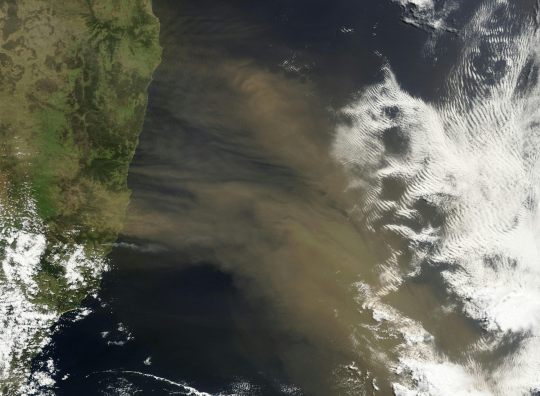
Floating robots reveal just how much airborne dust fertilises the Southern Ocean – a key climate ‘shock absorber’
Dust storm blowing off the Australian east coast over the South Pacific. Jeff Schmaltz/NASA GSFC, Author provided by Jakob Weis, University of Tasmania; Andrew Bowie, University of Tasmania; Christina Schallenberg, CSIRO; Peter Strutton, University of Tasmania, and Zanna Chase, University of Tasmania The Southern Ocean, a region critical to Earth’s climate, hosts vast blooms of microscopic…
View On WordPress
0 notes
Photo

2023 March 11
3D Bennu Image Credit: NASA, GSFC, U. Arizona - Stereo Image Copyright: Patrick Vantuyne
Explanation: Put on your red/blue glasses and float next to asteroid 101955 Bennu. Shaped like a spinning toy top with boulders littering its rough surface, the tiny Solar System world is about one Empire State Building (less than 500 meters) across. Frames used to construct this 3D anaglyph were taken by PolyCam on the OSIRIS_REx spacecraft on December 3, 2018 from a distance of about 80 kilometers. With a sample from the asteroid's rocky surface on board, OSIRIS_REx departed Bennu's vicinity in May of 2021 and is now enroute to planet Earth. The robotic spacecraft is scheduled to return the sample to Earth this September.
∞ Source: apod.nasa.gov/apod/ap230311.html
63 notes
·
View notes
Text
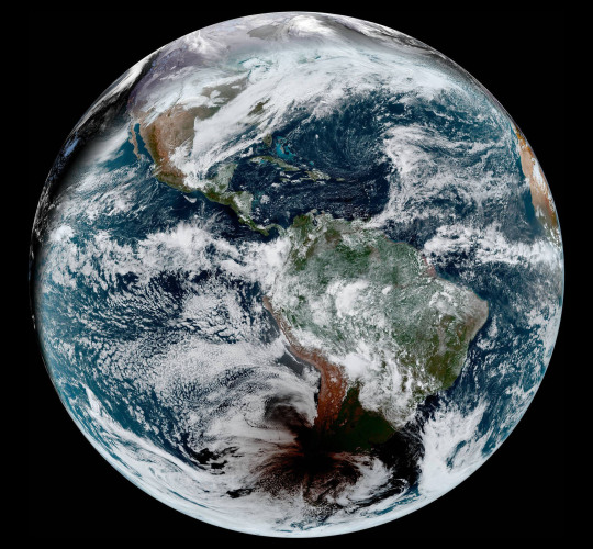
Amazing Earth: Satellite Images from 2020
In the vastness of the universe, the life-bringing beauty of our home planet shines bright. During this tumultuous year, our satellites captured some pockets of peace, while documenting data and striking visuals of unprecedented natural disasters. As 2020 comes to a close, we’re diving into some of the devastation, wonders, and anomalies this year had to offer.
NASA’s fleet of Earth-observing satellites and instruments on the International Space Station unravel the complexities of the blue marble from a cosmic vantage point. These robotic scientists orbit our globe constantly, monitoring and notating changes, providing crucial information to researchers here on the ground.
Take a glance at 2020 through the lens of NASA satellites:
A Delta Oasis in Southeastern Kazakhstan

Seen from space, the icy Ili River Delta contrasts sharply with the beige expansive deserts of southeastern Kazakhstan.
When the Operational Land Imager (OLI) on Landsat 8 acquired this natural-color image on March 7, 2020, the delta was just starting to shake off the chill of winter. While many of the delta’s lakes and ponds were still frozen, the ice on Lake Balkhash was breaking up, revealing swirls of sediment and the shallow, sandy bed of the western part of the lake.
The expansive delta and estuary is an oasis for life year round. Hundreds of plant and animal species call it home, including dozens that are threatened or endangered.
Fires and Smoke Engulf Southeastern Australia

A record-setting and deadly fire season marred the beginning of the year in Australia. Residents of the southeastern part of the country told news media about daytime seeming to turn to night, as thick smoke filled the skies and intense fires drove people from their homes.
This natural-color image of Southeastern Australia was acquired on January 4, 2020, by the Moderate Resolution Imaging Spectroradiometer (MODIS) on NASA’s Aqua satellite. The smoke has a tan color, while clouds are bright white. It is likely that some of the white patches above the smoke are pyrocumulonimbus clouds—clouds created by the convection and heat rising from a fire.
Nighttime Images Capture Change in China

A team of scientists from NASA’s Goddard Space Flight Center (GSFC) and Universities Space Research Association (USRA) detected signs of the shutdown of business and transportation around Hubei province in central China. As reported by the U.S. State Department, Chinese authorities suspended air, road, and rail travel in the area and placed restrictions on other activities in late January 2020 in response to the COVID-19 outbreak in the region.
A research team analyzed images of Earth at night to decipher patterns of energy use, transportation, migration, and other economic and social activities. Data for the images were acquired with the Visible Infrared Imaging Radiometer Suite (VIIRS) on the NOAA–NASA Suomi NPP satellite (launched in 2011) and processed by GSFC and USRA scientists. VIIRS has a low-light sensor—the day/night band—that measures light emissions and reflections. This capability has made it possible to distinguish the intensity, types, and sources of lights and to observe how they change.
The Parched Paraná River
Though a seemingly serene oasis from above, there is more to this scene than meets the eye. On July 3, 2020, the Operational Land Imager (OLI) on Landsat 8 captured this false-color image of the river near Rosario, a key port city in Argentina. The combination of shortwave infrared and visible light makes it easier to distinguish between land and water. A prolonged period of unusually warm weather and drought in southern Brazil, Paraguay, and northern Argentina dropped the Paraná River to its lowest water levels in decades. The parched river basin has hampered shipping and contributed to an increase in fire activity in the delta and floodplain.
The drought has affected the region since early 2020, and low water levels have grounded several ships, and many vessels have had to reduce their cargo in order to navigate the river. With Rosario serving as the distribution hub for much of Argentina’s soy and other farm exports, low water levels have caused hundreds of millions of dollars in losses for the grain sector, according to news reports.
Historic Fires Devastate the U.S. Pacific Coast
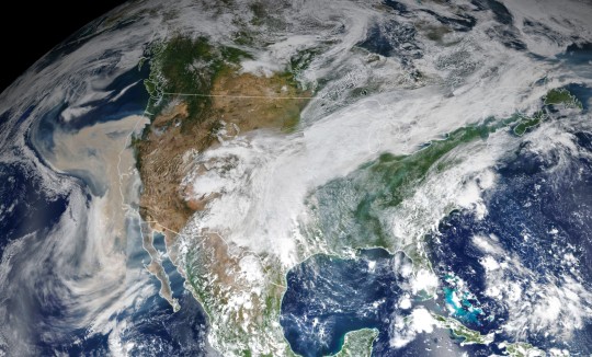
Climate and fire scientists have long anticipated that fires in the U.S. West would grow larger, more intense, and more dangerous. But even the most experienced among them have been at a loss for words in describing the scope and intensity of the fires burning in West Coast states during September 2020.
Lightning initially triggered many of the fires, but it was unusual and extreme meteorological conditions that turned some of them into the worst conflagrations in the region in decades.
Throughout the outbreak, sensors like the Visible Infrared Imaging Radiometer Suite (VIIRS) and the Ozone Mapping and Profiler Suite (OMPS) on the NOAA-NASA Suomi NPP satellite collected daily images showing expansive, thick plumes of aerosol particles blowing throughout the U.S. West on a scale that satellites and scientists rarely see.
This image shows North America on September 9th, 2020, as a frontal boundary moved into the Great Basin and produced very high downslope winds along the mountains of Washington, Oregon, and California. The winds whipped up the fires, while a pyrocumulus cloud from the Bear fire in California injected smoke high into the atmosphere. The sum of these events was an extremely thick blanket of smoke along the West Coast.
The Sandy Great Bahama Bank

Though the bright blues of island waters are appreciated by many from a sea-level view, their true beauty is revealed when photographed from space. The underwater masterpiece photographed above is composed of sand dunes off the coast of the Bahamas.
The Great Bahama Bank was dry land during past ice ages, but it slowly submerged as sea levels rose. Today, the bank is covered by water, though it can be as shallow as two meters (seven feet) deep in places. The wave-shaped ripples in the image are sand on the seafloor. The curves follow the slopes of the dunes, which were likely shaped by a fairly strong current near the sea bottom. Sand and seagrass are present in different quantities and depths, giving the image it’s striking range of blues and greens.
This image was captured on February 15th, 2020, by Landsat 8, whose predecessor, Landsat 7, was the first land-use satellite to take images over coastal waters and the open ocean. Today, many satellites and research programs map and monitor coral reef systems, and marine scientists have a consistent way to observe where the reefs are and how they are faring.
Painting Pennsylvania Hills
Along with the plentiful harvest of crops in North America, one of the gifts of Autumn is the gorgeous palette of colors created by the chemical transition and fall of leaves from deciduous trees.
The folded mountains of central Pennsylvania were past peak leaf-peeping season but still colorful when the Operational Land Imager (OLI) on the Landsat 8 satellite passed over on November 9, 2020. The natural-color image above shows the hilly region around State College, Pennsylvania overlaid on a digital elevation model to highlight the topography of the area.
The region of rolling hills and valleys is part of a geologic formation known as the Valley and Ridge Province that stretches from New York to Alabama. These prominent folds of rock were mostly raised up during several plate tectonic collisions and mountain-building episodes in the Ordovician Period and later in the creation of Pangea—when what is now North America was connected with Africa in a supercontinent. Those events created the long chain of the Appalachians, one of the oldest mountain ranges in the world.
A Dangerous Storm in the Night

Ominous and looming, a powerful storm hovered off the US coastline illuminated against the dark night hues.
The Visible Infrared Imaging Radiometer Suite (VIIRS) on NOAA-20 acquired this image of Hurricane Laura at 2:20 a.m. Central Daylight Time on August 26, 2020. Clouds are shown in infrared using brightness temperature data, which is useful for distinguishing cooler cloud structures from the warmer surface below. That data is overlaid on composite imagery of city lights from NASA’s Black Marble dataset.
Hurricane Laura was among the ten strongest hurricanes to ever make landfall in the United States. Forecasters had warned of a potentially devastating storm surge up to 20 feet along the coast, and the channel might have funneled that water far inland. It did not. The outcome was also a testament to strong forecasting and communication by the National Hurricane Center and local emergency management authorities in preparing the public for the hazards.
A Windbreak Grid in Hokkaido
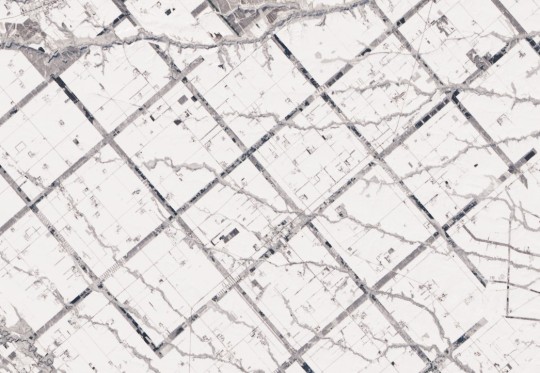
From above, the Konsen Plateau in eastern Hokkaido offers a remarkable sight: a massive grid that spreads across the rural landscape like a checkerboard, visible even under a blanket of snow. Photographed by the Operational Land Imager (OLI) on Landsat 8, this man-made design is not only aesthetically pleasing, it’s also an agricultural insulator.
The strips are forested windbreaks—180-meter (590-foot) wide rows of coniferous trees that help shelter grasslands and animals from Hokkaido’s sometimes harsh weather. In addition to blocking winds and blowing snow during frigid, foggy winters, they help prevent winds from scattering soil and manure during the warmer months in this major dairy farming region of Japan.
Shadows from a Solar Eclipse
Formidable, rare, and awe-inspiring — the first and only total solar eclipse of 2020 occurred on December 14, with the path of totality stretching from the equatorial Pacific to the South Atlantic and passing through southern Argentina and Chile as shown in the lower half of the image above. The Advanced Baseline Imager (ABI) on Geostationary Operational Environmental Satellite 16 (GOES-16) captured these images of the Moon’s shadow crossing the face of Earth.
The “path of totality” (umbral path) for the eclipse was roughly 90 kilometers (60 miles) wide and passed across South America from Saavedra, Chile, to Salina del Eje, Argentina. While a total eclipse of the Sun occurs roughly every 18 months, seeing one from any particular location on Earth is rare. On average, a solar eclipse passes over the same parcel of land roughly every 375 years. The next total solar eclipse will occur on December 4, 2021 over Antarctica, and its next appearance over North America is projected for April 8, 2024.
For additional information and a look at more images like these visit NASA’s Earth Observatory.
Make sure to follow us on Tumblr for your regular dose of space: http://nasa.tumblr.com.
#NASA#Earth#science#earth pictures#planet earth#solar eclipse#eclipse#oceans#solar system#planets#space#satellite#stunning photos
2K notes
·
View notes
Text

Gravel Ejected from Asteroid Bennu
Why does asteroid Bennu eject gravel into space? No one is sure. The discovery, occurring during several episodes by NASA's visiting ORISIS-REx spacecraft, was unexpected. Leading ejection hypotheses include impacts by Sun-orbiting meteoroids, sudden thermal fractures of internal structures, and the sudden release of a water vapor jet. The featured two-image composite shows an ejection event that occurred in early 2019, with sun-reflecting ejecta seen on the right. Data and simulations show that large gravel typically falls right back to the rotating 500-meter asteroid, while smaller rocks skip around the surface, and the smallest rocks completely escape the low gravity of the Earth approaching, diamond-shaped asteroid. Jets and surface ejection events were thought to be predominantly the domain of comets, responsible for their tails, comas, and later meteor showers on Earth. Robotic OSIRIS-REx arrived at 101955 Bennu in late 2018, and is planned to touchdown to collect a surface sample in October 2020. If all goes well, this sample will then be returned to Earth for a detailed analysis during 2023. Bennu was chosen as the destination for OSIRIS-REx in part because its surface shows potential to reveal organic compounds from the early days of our Solar System, compounds that could have been the building blocks for life on Earth.
Image Copyright: Image Credit: NASA s GSFC, U. Arizona, OSIRIS-REx Lockheed Martin
#nasa picture of the day#awesome#beautiful pics#beautiful#picoftheday#photography#science#astronomy#space#space news
1 note
·
View note
Text
Moon’s South Pole in NASA’s Landing Sites
NASA - Lunar Reconnaissance Orbiter (LRO) patch. April 15, 2019 NASA is working right now to send American astronauts to the surface of the Moon in five years, and the agency has its sights set on a place no humans have ever gone before: the lunar South Pole. Water is a critical resource for long-term exploration, and that’s one of the main reasons NASA will send astronauts to the Moon’s South Pole by 2024. Water is a necessity for furthering human exploration because it could potentially be used for drinking, cooling equipment, breathing and making rocket fuel for missions farther into the solar system. The experience NASA gains on the Moon, including using lunar natural resources, will be used to help prepare the agency to send astronauts to Mars.
The Moon. Image Credit: NASA
“We know the South Pole region contains ice and may be rich in other resources based on our observations from orbit, but, otherwise, it’s a completely unexplored world,” said Steven Clarke, deputy associate administrator of the Science Mission Directorate at NASA Headquarters in Washington. “The South Pole is far from the Apollo landing sites clustered around the equator, so it will offer us a new challenge and a new environment to explore as we build our capabilities to travel farther into space.” The South Pole is also a good target for a future human landing because robotically, it’s the most thoroughly investigated region on the Moon. The elliptical, polar orbit of NASA’s Lunar Reconnaissance Orbiter (LRO) is closest to the Moon during its pass over the South Pole region. Through its thousands of orbits in the last decade, LRO has collected the most precise information about the South Pole region than any other, offering scientists precise details about its topography, temperature and locations of likely frozen water.
Lunar Reconnaissance Orbiter (LRO). Animation Credit: NASA
“We’ve mapped every square meter, even areas of permanent shadow,” said Noah Petro, an LRO project scientist based at NASA’s Goddard Space Flight Center in Greenbelt, Maryland. There’s still so much to learn about Earth’s nearest neighbor. Ahead of a human return, NASA is planning many to send new science instruments and technology demonstration payloads to the Moon using commercial landers through Commercial Lunar Payload Services (CLPS). These robotic precursors will further investigate regions of interest to human explorers, including the South Pole, and will provide information to the engineers designing modern lunar surface systems. Water on the Moon
Image above: In this multi-temporal illumination map of the lunar south pole, Shackleton crater (19 km diameter) is in the center, the south pole is located approximately at 9 o'clock on its rim. The map was created from images from the camera aboard the Lunar Reconnaissance Orbiter. Image Credits: NASA/GSFC/Arizona State University. The floors of polar craters reach frigid temperatures because they’re permanently in shadow as a result of the low angle at which sunlight strikes the Moon’s surface in the polar regions (and also because the Moon has no atmosphere to help warm up its surface). This angle is based on the 1.54-degree tilt of the Moon’s axis (Earth’s is 23.5 degrees). If an astronaut was standing near the South Pole, the Sun would always appear on the horizon, illuminating the surface sideways, and, thus, skimming primarily the rims of deep craters, and leaving their deep interiors in shadow. These permanently shadowed craters feature some of the lowest temperatures in the solar system — down to -414 degrees Fahrenheit (-248 Celsius). Water ice is stable at these temperatures and it is believed that some of these craters harbor significant ice deposits.
Permanent Shadows on the Moon
Video above: This sample composite combines all the animation elements listed below to visually tell the story of permanent shadows on the Moon. The aquamarine areas highlight the permanently shadowed regions. Video Credits: NASA/Goddard Space Flight Center Scientific Visualization Studio. Digital Elevation Map (DEM) data of the lunar south pole provided by the JAXA/Selene. The South Pole’s frozen water may date back billions of years and has been untainted by the Sun’s radiation or the geological processes that otherwise constantly churn and renew planetary surfaces (think of wind and erosion on Earth), offering us a window into the early solar system.
Tilted View: Permanent Shadows on the Moon
Video above: Tilted View: In this animation, the camera is parked, looking down at Shackleton Crater at an angle while the shadows cycle through a full 360 degree rotation. Video Credits: NASA/Goddard Space Flight Center Scientific Visualization Studio. Digital Elevation Map (DEM) data of the lunar south pole provided by the JAXA/Selene. “That record of water collection is a record that can help us understand how water and other volatiles have been moving around the solar system, so we’re very interested in getting to these locations and sampling the material there,” said John W. Keller, a lunar scientist at NASA’s Goddard Space Flight Center in Greenbelt, Maryland. Studying samples of ice from polar regions of Earth, for example, has revealed how our planet's climate and atmosphere have evolved over thousands of years. Constant Light and Power Other extremes at the Moon’s South Pole are not so dark and cold — there are also areas, near Shackleton crater for instance, that are bathed in sunlight for extended periods of time, over 200 Earth days of constant illumination. This happens also because of the Moon’s tilt and is a phenomenon that we experience at our own polar regions on Earth. Unrelenting sunlight is a boon to Moon missions, allowing explorers to harvest sunlight in order to light up a lunar base and power its equipment. The president’s direction from Space Policy Directive-1 galvanizes NASA’s return to the Moon and builds on progress on the Space Launch System rocket and Orion spacecraft, collaborations with U.S industry and international partners, and knowledge gained from current robotic assets at the Moon and Mars. Related links: Lunar Reconnaissance Orbiter (LRO): https://www.nasa.gov/mission_pages/LRO/main/index.html Moon and Mars: https://www.nasa.gov/specials/moon2mars/ Commercial Lunar Payload Services (CLPS): http://www.nasa.gov/clps Space Policy Directive-1: https://www.nasa.gov/press-release/new-space-policy-directive-calls-for-human-expansion-across-solar-system Images (mentioned), Animation (mentioned), Videos (mentioned), Text, Credits: NASA/Brian Dunbar. Greetings, Orbiter.ch Full article
28 notes
·
View notes
Text
Rectangular Connectors : D-sub Connectors
The rectangular connectors provide flexibility in design and ease of use. This is an advantage over other connector types.
Air Electro is an authorized stocking distributor for Positronic Souriau-Sunbank from Eaton, Radiall, Amphenol, Glenair, TE Connectivity Deutsch and ADI Electronics as far as connectors with rectangular shapes are concerned.
Rectangular connectors are commonly utilized in robotics, automation for industrial use machines, machine building, transportation rail and power generation.
Today, we're taking a deep dive into D-SUB CONNECTORS.
D-Sub Connectors
D Sub connectors, commonly referred to as D Subminiature or D-type connectors, are tiny light connectors perfect for industrial instruments, ground support devices, and computers. They are also used in consumer electronics, telecommunications, medical equipment, and Local Area Networks (LANs).
D Subminiature connectors can be found in various pin-out and shell sizes. The standard sizes of shells are 9, 15, 25, 37, and 50. Shells are made of steel that can be plated with zinc-nickel or cadmium to ensure ROHS compliance. D sub connectors are certified to MIL-DTL-24308 specifications and use standard size 20 pins and socket contacts as per AS39029. Size 22 contacts can also be utilized in the more dense connectors. Contacts can be either non-removable or removable with the option of solder cup, crimp and PC tail.
Air Electro is a franchised distributor of ADI Electronics, a leading QPL manufacturer of MIL-DTL-24308 connectors based in Dallas, Texas. Air Electro is also an approved distributor for Amphenol PCD and Positronic D-Sub connectors.
Every D Sub product is "off the shelf" and available for shipment on the same day. We carry a range of shell sizes and pin-outs, plating options and pin-outs. In addition, we maintain an inventory of required AS39029 contacts and the locking hardware to secure connectors.
ADI Electronics D-Sub MIL-DTL-24308 Connectors
ADI Electronics MIL-DTL-24308 D-Sub connector has a variety of shell sizes and pin-outs. The standard shell sizes are 9,15, 25, 37, and fifty positions. Contacts come in 20 AWG solder-pot, crimp, or printed circuit contacts. They can also be interconnected using MIL DTL-24308 connectors.
Amphenol D-Sub Connectors - MIL-DTL-24308
The rack and panel subminiature connectors have polarized shells. The D-Sub connectors of Pcd are MIL-DTL-24308 certified. They deliver the highest density and security by utilizing socket and pin-machined contact points. The most common use is in applications where weight and dimension are crucial. D-Sub Series include a variety of PCB solder, crimp and wire-wrap connections. All Amphenol D Subs have thermoplastic housings that are flame-resistant and UL-94 compliant.
Air Electro stocks and offers same-day shipping on many Amphenol Pcd D connectors. Our technical team can assist you with any questions.
Positronic D-Sub Connectors
D-sub connectors are utilized in a range of applications. D-sub connectors are typically utilized on communication ports, which allow connections between various devices like copiers, CPUs, printers, as well as other power supply devices.
DB9 connectors are utilized for token rings, other computer networks, and the controller area networks (CAN). D-sub connectors are also utilized for video output from computer ports for games controllers' multi-channel analogue ports and AES digital audio within recording studios. Many of the Positronic D-Sub connectors meet the NASA GSFC S-311 certification.
1 note
·
View note
Text
NASA Will Spend $35 Million On A New Mission To Probe The Moon’s Mysterious Volcanoes
NASA Will Spend $35 Million On A New Mission To Probe The Moon’s Mysterious Volcanoes
The Gruithuisen Domes on the Moon will be visited by a new NASA spacecraft. NASA/GSFC/Arizona State University NASA has green-lit a mission to explore a region of the Moon never before visited in an effort to understand a geological mystery—and help future lunar colonists. The Lunar-VISE (Lunar Vulkan Imaging and Spectroscopy Explorer) robotic rover mission will cost $35 million and launch in…
View On WordPress
0 notes
Text
I'm going to miss my hexapod.
1 note
·
View note
Text
Astronomy Picture of the Day
2025 March 1

Blue Ghost to the Moon
Image Credit: Firefly Aerospace
With spacecraft thrusters at top center, the rugged surface of the Moon lies below the Blue Ghost lander in this space age video frame. The view of the lunar far side was captured by the Firefly Aerospace lunar lander on February 24, following a maneuver to circularize its orbit about 100 kilometers above the lunar surface. The robotic lunar lander is scheduled to touch down tomorrow, Sunday, March 2, at 3:34am Eastern Time in the Mare Crisium impact basin on the lunar near side. In support of the Artemis campaign, Blue Ghost is set to deliver science and technology experiments to the Moon, part of NASA's Commercial Lunar Payload Services program. Blue Ghost's mission on the surface is planned to operate during the lunar daylight hours at the landing site, about 14 Earth days.
Authors & editors: Robert Nemiroff (MTU) & Jerry Bonnell (UMCP)
NASA Official: Amber Straughn
A service of: ASD at NASA / GSFC,
NASA Science Activation
& Michigan Tech. U.
33 notes
·
View notes
Text
Astronomers made a poor bot count 100,000 moon craters
Astronomers made a poor bot count 100,000 moon craters
The moon’s surface is a chaotic mess of craters of all sizes. Now algorithms are smart enough and kind enough to sort through that mess for us. (NASA/GSFC/Arizona State University/) If the robot uprising ever comes, the machines might cite a new entry in their list of grievances. An international team of researchers has developed a machine learning algorithm to do a task that no planetary…

View On WordPress
0 notes
Photo

2021 October 23
3D Bennu Image Credit: NASA, GSFC, U. Arizona - Stereo Image Copyright: Patrick Vantuyne
Explanation: Put on your red/blue glasses and float next to asteroid 101955 Bennu. Shaped like a spinning toy top with boulders littering its rough surface, the tiny Solar System world is about one Empire State Building (less than 500 meters) across. Frames used to construct this 3D anaglyph were taken by PolyCam on the OSIRIS_REx spacecraft on December 3, 2018 from a distance of about 80 kilometers. With a sample from the asteroid's rocky surface on board, OSIRIS_REx departed Bennu's vicinity this May and is now enroute to planet Earth. The robotic spacecraft is scheduled to return the sample to Earth in September 2023.
∞ Source: apod.nasa.gov/apod/ap211023.html
20 notes
·
View notes
Text
10 Ways to Observe the Moon for International Observe the Moon Night
On Saturday, October 5, we will host the 10th annual International Observe the Moon Night. One day each year, everyone on Earth is invited to observe and learn about the Moon together, and to celebrate the cultural and personal connections we all have with our nearest celestial neighbor! This year is particularly special as we mark the 50th anniversary of the Apollo 11 Moon landing while looking forward to our Artemis program, which will send the first woman and next man to the Moon.
youtube
There are many ways to participate in International Observe the Moon Night. You can attend an event, host your own or just look up! Here are 10 of our favorite ways to observe the Moon.
1. Look up
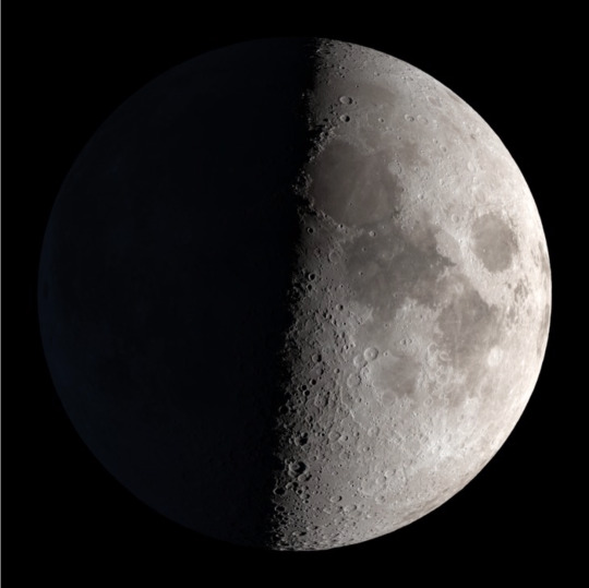
Image Credit: NASA’s Scientific Visualization Studio/Ernie Wright
The simplest way to observe the Moon is simply to look up. The Moon is the brightest object in our night sky, the second brightest in our daytime sky and can be seen from all around the world — from the remote and dark Atacama Desert in Chile to the brightly lit streets of Tokyo. On October 5, we have a first quarter Moon, which means that the near side of the Moon will be 50 percent illuminated. The first quarter Moon is a great phase for evening observing. Furthermore, the best lunar observing is typically along the Moon's terminator (the line between night and day) where shadows are the longest, rather than at full Moon. See the Moon phase on October 5 or any other day of the year!
2. Peer through a telescope or binoculars

Image Credit: NASA/Molly Wasser
With some magnification help, you will be able to focus in on specific features on the Moon. In honor of this year’s 50th Anniversary of the Apollo 11 Moon Landing, see if you can find Mare Tranquillitatis (Sea of Tranquility)! Download our Moon maps for some guided observing on Saturday.
3. Photograph the Moon
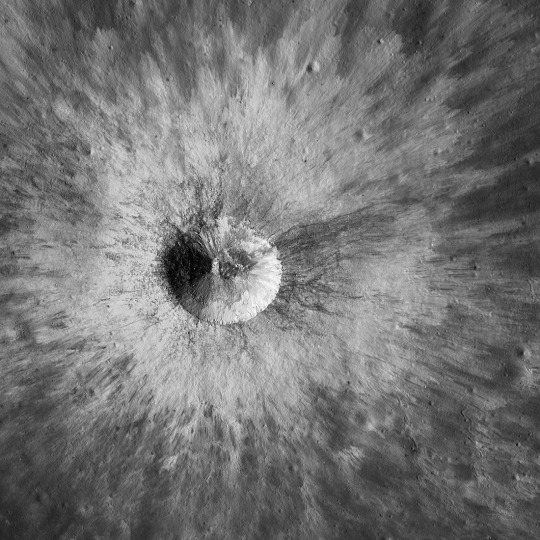
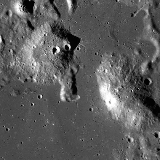
Image Credit: NASA/GSFC/Arizona State University
Our Lunar Reconnaissance Orbiter (LRO) has taken more than 20 million images of the Moon, mapping it in stunning detail. You can see featured, captioned images on LRO’s camera website, like the crater seen above. And, of course, you can take your own photos from Earth. Check out our tips on photographing the Moon!
4. Relax on your couch

Image Credit: NASA’s Scientific Visualization Studio/Ernie Wright
Is it cloudy? Luckily, you can observe the Moon from the comfort of your own home. The Virtual Telescope Project will livestream the Moon from above the Roman skyline. Or, you can take and process your own lunar images with the MicroObservatory Robotic Telescopes. Would you prefer a movie night? There are many films that feature our nearest neighbor. Also, you can spend your evening with our lunar playlist on YouTube or this video gallery, learning about the Moon’s role in eclipses, looking at the Moon phases from the far side and seeing the latest science portrayed in super high resolution.
5. Touch the topography

Image Credit: NASA GSFC/Jacob Richardson
Observe the Moon with your hands! If you have access to a 3D printer, you can peruse our library of 3D models and lunar landscapes. This collection of Apollo resources features 3D models of the Apollo landing sites using topographic data from LRO and the SELENE mission. The 3D printed model you see above is of the Ina D volcanic landform.
6. Make and admire Moon art

Image Credit: LPI/Andy Shaner
Enjoy artwork of the Moon and create your own! For messy fun, lunar crater paintings demonstrate how the lunar surface changes due to frequent meteorite impacts.
7. Listen to the Moon
youtube
Image Credit: NASA Explorers: Apollo/System Sounds
Treat your ears this International Observe the Moon Night. Our audio series, NASA Explorers: Apollo features personal stories from the Apollo era to now, including yours! You can participate by recording and sharing your own experiences of Apollo with us. Learn some lunar science with the second season of our Gravity Assist podcast with NASA Chief Scientist, Jim Green. Make a playlist of Moon-themed songs. For inspiration, check out this list of lunar tunes. We also recommend LRO’s official music video, The Moon and More, featuring Javier Colon, season 1 winner of NBC’s “The Voice.” Or you can watch this video featuring “Clair de Lune,” by French composer Claude Debussy, over and over.
8. Take a virtual field trip

Image Credit: NASA/SSERVI
Plan a lunar hike with Moon Trek. Moon Trek is an interactive Moon map made using NASA data from our lunar spacecraft. Fly anywhere you’d like on the Moon, calculate the distance or the elevation of a mountain to plan your lunar hike, or layer attributes of the lunar surface and temperature. If you have a virtual reality headset, you can experience Moon Trek in 3D.
9. See the Moon through the eyes of a spacecraft
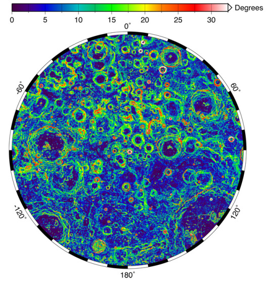
Image Credit: NASA/GSFC/MIT
Visible light is just one tool that we use to explore our universe. Our spacecraft contain many different types of instruments to analyze the Moon’s composition and environment. Review the Moon’s gravity field with data from the GRAIL spacecraft or decipher the maze of this slope map from the laser altimeter onboard LRO. This collection from LRO features images of the Moon’s temperature and topography. You can learn more about the different NASA missions to explore the Moon here.
10. Continue your observations throughout the year

Image Credit: NASA’s Scientific Visualization Studio/Ernie Wright
An important part of observing the Moon is to see how it changes over time. International Observe the Moon Night is the perfect time to start a Moon journal. See how the shape of the Moon changes over the course of a month, and keep track of where and what time it rises and sets. Observe the Moon all year long with these tools and techniques!
However you choose to celebrate International Observe the Moon Night, we want to hear about it! Register your participation and share your experiences on social media with #ObserveTheMoon or on our Facebook page. Happy observing!
Make sure to follow us on Tumblr for your regular dose of space: http://nasa.tumblr.com.
#NASA#space#moon#explore the moon#science#painting#observethemoon#Apollo#apollo 11#astronaut#moon landing#full moon
2K notes
·
View notes
Text
NASA Found a Lot of Water on the Moon In Breakthrough for Human Habitation
Humans have dreamed about living on the Moon for centuries, but this ambitious vision hinges on the amount of water that lies hidden in the lunar surface. As an essential resource for life support, rocket fuel, and power generators, the water supply on the Moon directly correlates to the odds of establishing a long-term human presence there.
Now, scientists have announced the first unambiguous evidence of water on sunlit surfaces of the Moon and concluded that lunar water ice “may be more widely distributed and accessible as a resource for future missions than previously thought,” according to a major research package published in Nature Astronomy.
“Today we are announcing that, for the first time, water has been confirmed to be present on a sunlit surface of the Moon,” said Paul Hertz, astrophysics division director at NASA Headquarters in Washington DC, during a NASA teleconference on Monday.
“This is exciting because the expectation is that any water present on a sunlit surface of the Moon would not survive the lunar day,” continued Hertz. “The discovery reveals that water might be distributed across the lunar surface and not limited to the cold shadowed places near the lunar poles, where we have previously discovered water ice.”
The important discoveries are outlined in two studies that respectively report the unmistakable signature of lunar molecular water and reveal an expanded map of shadowy “cold traps” at the Moon’s poles that may contain reservoirs of water ice.
Decades of previous research already strongly supports the existence of water on the Moon, but this pair of studies reveals new insights about the whereabouts, properties, and possible extent of this valuable resource.
The results suggest that some 40,000 square kilometers of the Moon’s surface may contain water ice, about twice what was previously estimated. For reference, the Moon’s total surface area is about 38 million kilometers, so the vast majority of its terrain is bone-dry as a result of searing temperatures during the two-week-long lunar day.

A multi-temporal illumination map of the lunar south pole created from images from the camera aboard the Lunar Reconnaissance Orbiter. Image: NASA/GSFC/Arizona State University
Scientists led by Casey I. Honniball, a NASA postdoctoral program fellow at the agency’s Goddard Space Flight Center, captured the signal of molecular water using an airborne telescope called the Stratospheric Observatory for Infrared Astronomy (SOFIA).
Honniball and her colleagues note that three spacecraft have already detected “widespread hydration” on the Moon, but that it was not clear whether the source was water or other hydroxyl (OH) compounds, according to their study, which is entitled, “Molecular water detected on the sunlit Moon by SOFIA.”
To distinguish between those possibilities, the team searched the lunar south pole for signs of a special spectral signal, called the 6-micron emission feature, that is unique to water. During a flight on August 31, 2018, SOFIA was able to pick up clear readings of the signal in and around a large crater called Clavius at the south pole.
“We find that the distribution of water over the small latitude range is a result of local geology and is probably not a global phenomenon,” Honniball and her colleagues said in the study.
“We suggest that a majority of the water we detect must be stored within glasses or in voids between grains sheltered from the harsh lunar environment, allowing the water to remain on the lunar surface,” the team added.
The detection is particularly interesting because it shows that water can survive on parts of the sunlit Moon. Honniball and her colleagues estimated that this water is present in abundances ranging from 100 to 400 parts per million, which is about equal to a 12-ounce bottle of water within a cubic meter of lunar soil.
“To be clear, this is not puddles of water but instead water molecules that are so spread apart that they do not form ice or liquid water,” Honniball said during the telecon.
In addition to these tiny water oases, the Moon’s south pole contains an array of small patches of water ice, according to another study entitled “Micro cold traps on the Moon.”
A team led by Paul Hayne, a planetary scientist at the University of Colorado Boulder, used data collected by NASA’s Lunar Reconnaissance Orbiter to map out regions of the lunar poles that never receive direct sunlight, due to a combination of the Moon’s axis and the shadows cast by its rough terrain.
Past missions have revealed that large deposits of water ice may be frozen into huge shaded craters at the poles, but Hayne and his colleagues expanded the map to account for ice locked away in smaller cold traps, down to the size of a penny. The team’s models suggest that the most numerous cold traps on the Moon measure just one centimeter across, suggesting there could be twice as much water ice at the lunar poles than previously thought.
“Small-scale shadows in the polar regions, which we term ‘micro cold traps’, substantially augment the cold-trapping area of the Moon, and may also influence the transport and sequestration of water,” the team said in the study.
“The abundance of small-scale cold traps implies that future missions exploring for ice may more easily target and access one of these potential reservoirs,” the researchers added. “If water is found in micro cold traps, the sheer number and topographic accessibility of these locales would facilitate future human and robotic exploration of the Moon.”
Together, the two new studies led by Honniball and Haynes represent a breakthrough in our understanding of the Moon’s water supply, which has direct implications for humanity’s long-time vision of moving our species to the lunar surface.
The new research is especially topical given that NASA plans to land humans on the Moon in the 2020s and use lunar resources as part of its Artemis program, prompting thorny discussions about legal and ethical extraction of materials on the Moon. Now that we have a better estimate of the Moon’s untapped water, it is more urgent than ever that the international community establishes standards for lunar exploration and resource extraction.
Update: This article has been updated with comments from a NASA teleconference about Honniball’s research.
NASA Found a Lot of Water on the Moon In Breakthrough for Human Habitation syndicated from https://triviaqaweb.wordpress.com/feed/
0 notes
Text
How old is the ice on the moon?
While a majority of the icy deposits on the moon are likely billions of years old, some may be much more recent, according to new research.
The discovery of ice deposits in craters scattered across the moon’s south pole has helped to renew interest in exploring the lunar surface, but no one is sure exactly when or how that ice got there.
Lead author Ariel Deutsch, a graduate student in the earth, environmental, and planetary sciences department at Brown University, says that constraining the ages of the deposits is important both for basic science and for future lunar explorers who might make use of that ice for fuel and other purposes.
“The ages of these deposits can potentially tell us something about the origin of the ice, which helps us understand the sources and distribution of water in the inner solar system,” Deutsch says. “For exploration purposes, we need to understand the lateral and vertical distributions of these deposits to figure out how best to access them. These distributions evolve with time, so having an idea of the age is important.”
Shackleton Crater, the floor of which is permanently shadowed from the sun, appears to be home to deposits of water ice. (Credit: NASA/GSFC/Arizona State)
How old is the ice on the moon?
Using data from NASA’s Lunar Reconnaissance Orbiter, which has been orbiting the moon since 2009, the researchers looked at the ages of the large craters in which scientists found evidence for south pole ice deposits. To date the craters, researchers count the number of smaller craters that have accrued inside the larger ones. Scientists have an approximate idea of the pace of impacts over time, so counting craters can help establish the ages of terrains.
The majority of the reported ice deposits are within large craters formed about 3.1 billion years or longer ago, the researchers found. Since the ice can’t be any older than the crater, that puts an upper bound on the age of the ice. Just because the crater is old doesn’t mean that the ice within it is also that old too, the researchers say, but in this case there’s reason to believe the ice is indeed old. The deposits have a patchy distribution across crater floors, which suggests that micrometeorite impacts and other debris has battered the ice over a long period of time.
If those reported ice deposits are indeed ancient, that could have significant implications in terms of exploration and potential resource utilization, the researchers say.
“There have been models of bombardment through time showing that ice starts to concentrate with depth,” Deutsch says. “So if you have a surface layer that’s old, you’d expect more underneath.”
Craters in craters
While the majority of ice was in the ancient craters, the researchers also found evidence for ice in smaller craters that, judging by their sharp, well-defined features, appear to be quite fresh. That suggests that some of the deposits on the south pole got there relatively recently.
“That was a surprise,” Deutsch says. “There hadn’t really been any observations of ice in younger cold traps before.”
If there are indeed deposits of different ages, the researchers say, that suggests they may also have different sources. Older ice could have been sourced from water-bearing comets and asteroids impacting the surface, or through volcanic activity that drew water from deep within the moon. But there aren’t many big water-bearing impactors around in recent times, and volcanism is thought to have ceased on the Moon over a billion years ago. So more recent ice deposits would require different sources—perhaps bombardment from pea-sized micrometeorites or implantation by solar wind.
The best way to find out for sure, the researchers say, is to send spacecraft there to get some samples. And that appears to be on the horizon. NASA’s Artemis program aims to put humans on the moon by 2024, and plans to fly numerous precursor missions with robotic spacecraft in the meantime. Coauthor Jim Head, Deutsch’s PhD advisor, says studies like this one will help to shape those future missions.
“When we think about sending humans back to the moon for long-term exploration, we need to know what resources are there that we can count on, and we currently don’t know,” Head says. “Studies like this one help us make predictions about where we need to go to answer those questions.”
The study appears in the journal Icarus. Gregory Neumann from the NASA Goddard Space Flight Center also contributed to the work.
Source: Brown University
The post How old is the ice on the moon? appeared first on Futurity.
How old is the ice on the moon? published first on https://triviaqaweb.weebly.com/
0 notes