#volga hydroelectric station
Explore tagged Tumblr posts
Visit Tumblr Blog
Explore Tumblr blogs with no restrictions, modern design and the best experience.
Last Seen Tumblr Blogs


Fun Fact
Forty percent of Tumblr users are between the ages of 18 to 25.
Text

flickr

flickr

flickr
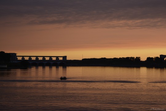
Russia. Volga Hydroelectric Station Волжская ГЭС
#2017#august#hydroelectric station#river#russia#summer#volga hydroelectric station#volga river#volgograd#volgograd oblast#август#волга#волгоград#волгоградская область#волжская гэс#гидроэлектростанция#гэс#лето#река#россия#электростанция#power station#flickr#russian tumblr#русский tumblr
18 notes
·
View notes
Text
The Volga downstream of Uglich Hydroelectric Station, august 2021
La Volga en aval du barrage d'Ouglitch, août 2021
Волга вниз по течению от Углической ГЭС, август 2021
Volgo malsupre laŭ la akvocentralo de Ugliĉ, aŭgusto 2021
#my photos#photoblog#photography#photografy#photoart#original photogrpahy#original photographic works#original photography on tumblr#nikon d5200#nikon photography
2 notes
·
View notes
Photo

SOUND: https://www.ruspeach.com/en/news/10684/ Волжская ГЭС - это гидроэлектростанция, построенная на реке Волга в Волгоградской области. Это крупнейшая гидроэлектростанция в России. Строительство ГЭС началось в 1950 году, закончилось в 1961 году. Разработана программа комплексной модернизации Волжской ГЭС, которая рассчитана до 2025 года. The Volga hydroelectric power station is the hydroelectric power station constructed on the Volga River in the Volgograd region. It is the largest hydroelectric power station in Russia. Construction of hydroelectric power station began in 1950, ended in 1961. The program of complex modernization of the Volga hydroelectric power station which is calculated till 2025 is developed. река [rikà] - river www.ruspeach.com
2 notes
·
View notes
Photo

Winter fairy tale.
Andrey Olontsev
Moscow region, the city of Dubna, the Volga river bank. The former pier, the territory of the hydroelectric power station.
26 notes
·
View notes
Text
Juniper Publishers - Open Access Journal of Ecology
On Climate in General and Floods in Particular Dams and Climate

Authored by : Oleg Khalidullin
Keywords: Mankind; Diverse structure; Diversity; Atmospheric pressure; Temperature; Humidity
Opinion
Mankind always of its existence has been related to water and is consumer, considering it a resource for its comfort. Water is a living substance that has developed certain properties according to nature’s assignments. Its main function is mediation in all earthly affairs. Passing through the soil and biota, it undergoes many transformations and goes into the atmosphere with the most diverse structure from each living creature and plant, breathing, various secretions, transpiration of plants.
Diversity, volumes, evaporation rate created a special mechanism that determines at each point of the planet strict constants of atmospheric pressure, temperature, humidity, on which all parameters of the atmospheric state depend: cyclones and anticyclones, movements and winds, charges of clouds and lightning discharges, places of precipitation , their volumes and schedule. It is these constants that have created strictly defined areas over millions of years - deserts and forests, tropics and savannas, and glaciers.
After precipitation, on the soil important water functions are the dissolution of mineral and organic substances in the banks of rivers and soils under the ground and their supply to plant roots and the stomachs of all living creatures. Water does not disappear in the roots of plants and the wombs of living beings. After numerous and diverse processes of growth of plants and organisms, the water continues its movement in a new substance. Vapors of evaporation and transpiration carry certain properties that control the growth and development of the entire biota. For example, smells provide the interaction of predators and prey, plant volatile production - nutrition and reproduction of plants. This cycle was created, developed and polished since the birth of life on Earth and, under the influence of solar heating, the geological structure of the planet is the main active element of nature - a kind of perpetual motion engine or source of all life on the planet.
One of the species of the animal world - MAN, subjugated nature to itself and its main mover - water. Man began to use the most common mineral on Earth, not only for drinking, but gradually turning it into working material. Taking it from nature, forced to perform new work functions. Read more at: [1]. Civilization began to collect it in huge man-made reservoirs, change its distribution by canals and irrigation, chained it into the aqueducts.
Ways of water conservation in rivers are based on the creation of bulky dams with the flooding of large areas and the creation of hydroelectric power plants (HPP). Man-made reservoirs are built on all continents, occupying more and more large areas with the destruction of biota.
The main problem of all the reservoirs is that the biota disappears under the reservoir mirror, and with it, the mechanism of water conversion in the animal and plant worlds, accumulated over millions of years. The area of plant leaves alone is 3 to 4 times the area of the entire land. Therefore, the magnitude of evaporation from land, not less evaporation from the entire area of the oceans - [2]. Untouched by 2015, this land remains 30%. Everything else is taken from nature. Humanity at an accelerating pace destroys the last part of the land - these 30%. More intensively builds hydroelectric power plants with the destruction of organic fumes.
According to the latest theory: [1] flooding of territories is the destruction of organic and increasing artificial evaporation, which leads the planet to an increase in natural disasters and global catastrophe.
Overflowing and devastating floods have become commonplace. The main cause of such flooding is shallowing of rivers. By nature, water continuously flushes soil particles off the banks and lays them on the bottom, dissolving the necessary substances. The bottom of the rivers is constantly growing and changing. To this was added the human factor - garbage, waste products, various items in the form of scrap - add a significant increase in raising the bottom. The garbage discharged into the rivers of settlements forms “thrombi” - underwater dams along the flow of water in the beds along the cities and downstream. This is where the most water comes out of the coast.
Rivers, with a decrease in depth, change their channels more intensively, expand floodplains and overflow. To eliminate flooding, it is necessary to maintain the depth, regularly remove sediment. But this is not the main thing, the main thing is that if we want to preserve the planet for our descendants, we must immediately begin to return to the water its natural functions.
One of the main elements of reducing artificial evaporation is the cessation of the construction of obsolete hydroelectric power plants with the flooding of areas and the release of all previously constructed reservoirs.
There is a brilliant invention of V.I. Bodyakina - [3], which ensures the preservation of the generation of electricity by the existing generators of these hydroelectric stations without dams. Head with the water moving in the pipes from the beginning of the reservoir with the rise to the top of the dam. It becomes possible to release all the reservoirs of the world without losing energy. All these areas will quickly become overgrown with necessary vegetation, and animal life will increase.
In order to preserve water according to human needs and to have minimal impact on water, it is necessary to fundamentally reconsider the possibilities of water accumulation in rivers. Considering the levels of rivers and their floodplains, we find a fairly large difference in the height of the water table in the river and the height of the banks of the floodplains. The narrow winding river at the bottom of the floodplain is the irrational use of the floodplain areas by nature itself. Meandering or gradual change of the riverbed is provided by nature to dissolve the mineral and organic substances of the intact soil of the banks in order to transfer them to the downstream animals and plants. The river “cares” about biota. The entire area, periodically eroded by spring water, is a drying out sandstone beach. Periodically, the channels reach untouched shores, erode, bring them down and the water absorbs useful substances. Millions of years of the river deepened and expanded, forming floodplains and canyons.
Is it possible to preserve the natural functions of water and create its safe accumulation? The accumulation of water for irrigation and water supply of cities can be created by small dams without raising above the banks of floodplains. The floodplains can be used as reservoirs for the accumulation of water in the spring and consumption in the summer. And ensure contact with the soil shores. Combine the interests of nature and human needs. To do this, it is enough to build a dam in the given places with a height not exceeding the height of the bank of the floodplain. And fill it almost to the brim with preservation of free capacity for flood waters. Many such dams form a cascade of lakes, providing the movement of fish and vessels. It turns out a full-flowing river, with a very large volume of water controlled by a chain of lakes distributed over the entire length of the river.
A significant difference from the cascades of large rivers such as the Volga and Yangtze are a high flow, which does not allow long-term storage of water, leading to its flowering and overgrowing.
Small dam heights - from 1-2 to 10-20 meters - do not pose a threat to coastal areas by floods. The filling of the floodplains is carried out within reasonable settlement limits, leaving stocks of free volume in each pool. They do not protrude above the surrounding squares; they fill only natural ones — barren floodplains and bare canyons. Naturally, in the body of such dams, culverts are constructed for taking water, spawning fish, moving ships and regulating levels in adjacent pools. Increased infiltration into underground streams will increase the volume of groundwater, which will give them even greater reserves and new sources away from the channels. It becomes possible to install small hydropower plants operating at a small height difference. There are no problems with dam structures with a height of 1-20 meters. No need for bulk concrete work, using ordinary earth-moving and road equipment. Sand-gravel, silt bottom mixture for the body of the dam is taken from the bottom of the same floodplain. To avoid overflowing floodplains with spring water and from heavy precipitation they are not filled. Concrete work is needed only for culverts and sluices.
There are places where there are no floodplains, and it is precisely in these places that the water overflows with floods. Floods in them come from the same reasons - silting and raising the bottom. All the rivers along the longitudinal profile of the bottom are saws, with the teeth upwards - the alternation of stretches - depths and shallows - shoals. So, these natural stretches should be deepened to 10-30 meters, and rifts - shoals rise to the level of the coast, directing the flow through the culverts.
These works can be performed with existing dredging equipment. However, it is cumbersome, energy-intensive and requires high labor costs. There are several inventions that allow you to carry out any dredging work and solve the tasks with minimal cost. Use mainly the flow of the river itself. The essence of inventions is described in the articles: [4,5]. All these inventions are made in the form of proprietary technical solutions and require research and development.
Thus, it is possible to preserve water of the same volumes as in reservoirs with bulky dams, but without the risks of man-made disasters, reduced pressure on nature and increased natural functions of water. In foothill and mountain rivers, a chain of lakes with adjustable pools can become an obstacle to mudflows, and the watery surface that covers the narrow, blurred, disfigured multimeter in height, canyons among fir trees will adorn the mountain landscape, water gets access to fertile soil and is enriched with its salts. The river becomes a distributed reservoir of water, which changes the mode of small and transfer. hachy rivers. They can be navigable, they can generate electricity, and according to the ideas of V.I. Bodyakin using pipes, it is possible to use generators of existing hydroelectric stations without dams. Where there is no hydroelectric station, it is possible to create a micro hydroelectric station, distributed along the entire length of the river. But the most important thing is that vast areas of water are released in front of giant hydroelectric power plants, and the soil restores its natural state and organic evaporation.
In addition, new, unprecedented properties are added - all the rivers and even small ones become fish hatcheries, with a small overflow, through which the fish can easily jump. There are many bridges in given places, the possibility of organizing beaches, recreation areas. Small rivers become navigable and will not dry out during dry periods. Operational management of culverts will eliminate the movement of ice in the spring, and, consequently, floods due to congestion and groundwater. In the mountain rivers, a new strategy of protection is being created. Eliminates the need for the construction of bulky dam-protected dams with explosions, such as Medeo in Alma-Ata in the 1970s.
Political tensions in the world are disappearing - all transboundary rivers will no longer be problematic in the distribution of water between states.
#Ecology open access journals#Juniper publisher journals#Juniper publishers#Juniper Publishers Reviews#Open access journals#Peer review journals
0 notes
Text
New Post has been published on Top 10 of Anything and Everything!!!
New Post has been published on http://theverybesttop10.com/longest-rivers-in-europe/
The Top 10 Longest Rivers in Europe and Where to Find Them
The Top 10 Longest Rivers in Europe and Where to Find Them
We have already seen the longest rivers in the world and now it is time to find out how European rivers measure up. We have their location, length and of course some great photos of them for you to enjoy. So let’s get our water-proof measuring stick out and get on with it…
The Top 10 Longest Rivers in Europe and Where to Find Them
The River Elbe
10 – The River Elbe (River Mouth: Wadden Sea near Cuxhaven) – Length: 1245 km/ 773 miles
Strarting off in the Krkonoše Mountains of the northern Czech Republic it plunges down 197ft of the Elbe Falls and later settles down into the torrential Malé Labe.
The River Dniester
9 – The River Dniester (River Mouth: Black Sea near Bilhorod-Dnistrovskyi) – Length: 1362 km/ 846 miles
Running first through Ukraine and then finally through Moldova it discharges into the black sea which is once again back in Ukraine! Its name “Dniester” means the close river, but Dnieper, also of Sarmatian origin means “the river on the far side”.
The River Ku
8 – The River Ku (River Mouth: Caspian Sea near Neftçala) – Length: 1364 km/ 847 miles
It is said people have inhabited the Caucasus region for thousands of years and one of the very first established agriculture started in the Kura Valley over 4,500 years ago!
The River Northern Dvina
7 – The River Northern Dvina (River Mouth: Dvina Bay in Severodvinsk) – Length: 1803 km/ 1120 miles
Its name is said to have been taken from the Western Dvina River, however, its true name origin is unclear. In the Komi language, the river is called “Вы́нва” which means “powerful river”.
(adsbygoogle = window.adsbygoogle || []).push();
The River Pechora
6 – The River Pechora (River Mouth: Pechora Sea near Naryan-Mar) – Length: 1809 km/ 1124 miles
Said to be the longest river with no dams along it, this river was once a very important transportation route to Siberia, but these days people just take the train.
The River Don
5 – The River Don (River Mouth: Sea of Azov near Azov) – Length: 1923 km/ 1194 miles
Viewed as a water border between Europe and Asia (by some ancient Greek geographers for the Book of Jubilees it is often speculated to be the source of the Black Death! While this was never proven it did have the geography flow to match the outbreak.
The River Dnieper
4 – The River Dnieper (River Mouth: Dnieper-Bug Estuary near Kherson) – Length: 2201 km/ 1367 miles
The longest river of both Belarus and Ukraine this forth longest is often noted for its long list of dams and hydroelectric stations which makes it a very for the economy of Ukraine.
The River Ural
3 – The River Ural (River Mouth: Caspian Sea in Atyrau) – Length: 2428 km/1508 miles
Starting off in the Ural Mountains this impressive river has an average width of 60-80 meters. While long it might be it is also very rich in fish travelling upwards to the part of the river that is mostly fed by melting snow.
(adsbygoogle = window.adsbygoogle || []).push();
The River Danube
2 – The River Danube (River Mouth: Black Sea near Sulina) – Length: 2857 km/1775 miles
Flowing through an impressive 10 countries (more than any other river in the world) the Danube is one of the most biodiverse rivers in Europe and is home to hundreds of species of fish.
The River Volga
1 – The River Volga (River Mouth: Caspian Sea near Astrakhan) – Length: 3790 km/2354 miles
While you could argue the national river of Russia isn’t really part of Europe what you can’t argue about is just how impressively long this river is.
0 notes
Photo

"Подчиненный перед лицом начальствующим должен иметь вид лихой и придурковатый, дабы разумением своим не смущать начальство." #agathavagengeim на прогулке с Амароком. @irbiskate спасибо за весёлого зверя в кадре👏 . . . . . #фотографволгоград #elenavagengeim #bff #bestfriends #walkinthepark #walk #pet #dog #husky #autumn #emoji #motion #followme (at Volga Hydroelectric Station)
#dog#emoji#motion#followme#elenavagengeim#husky#autumn#bestfriends#agathavagengeim#bff#фотографволгоград#walk#pet#walkinthepark
0 notes
Text
Choo-Chooshka? New Russian Railway and Military Movement on the Ukrainian Border
Open source evidence suggests the potential for a buildup of forces
The 262nd Russian equipment base in Boguchar, Voronezh Oblast, on April 26, 2014, April 9, 2016, and June 5, 2017. (Source: Google Earth)
Social media, press, and monitoring reports indicate a possible increased Russian military presence along Ukraine’s eastern border. Sightings of heavy weapons and vehicles are coinciding with the completion of a new high-speed railway line that can more easily and quickly transport freight, including military equipment, from central Russia to the Black Sea, without transiting Ukrainian territory (as the older line does). Both the completion of the railway line and the signs of an increased military presence point to the potential for even further military buildup in the future.
Attiva la linea ferroviaria #Zhuravka-#Millerovo che permetterà di collegare #Russia centrale e meridionale aggirando territorio #Ucraina
— @bordoni_saker
On August 11, state-operated Russian Railways (RZD) announced the completion of the Zhuravka-Millerovo high-speed railway, which bypasses Ukraine to reconnect central Russia to Voronezh Oblast, Rostov Oblast, and the Black Sea coast. Pre-existing rail tracks ran through a 26-kilometer (approximately 16 miles) section of government-controlled Luhansk Oblast, Ukraine, and Ukraine refused Russia access to that line after the Russian invasion of eastern Ukraine in 2014. The new high-speed line was reported to cost approximately RUB 55 billion (approximately USD 9.19 million).
The Jamestown Foundation, a think tank with a focus on Eurasia, reported that even though construction was to be carried out by RZD, Russian military forces became increasingly involved, with Russian Minister of Defense Sergei Shoigu calling the railway of “instrumental importance” for Russia. Looking at a map of the area, it is easy to see how the railway could increase Russia’s military logistical capabilities in the non-government-controlled areas of the Ukrainian border. This bypass railway constitutes key infrastructure for Russia should it choose to dramatically increase (in duration or volume) its military presence on Ukraine’s border or in the non-government-controlled areas of eastern Ukraine.
Both verified and unverified photographs and videos from late July and early August suggest military movement along the areas of Russia bordering Ukraine.
http://ift.tt/2vNzJxA
29.07.2017 Воронежская обл. #PutinatWar #Russia
— @galandecZP
30.07.2017 станция Лиски (Воронежская обл.) #PutinatWar #Russia
— @galandecZP
Photo showing military vehicles near Kantemirovka, Voronezh Oblast, on August 1, 2017. (Source: VKontakte)
02.08.2017 станция Лиски (Воронежская обл.) #PutinatWar #Russia
— @galandecZP
As @DFRLab reported in late July, the Organization for Security and Co-operation in Europe (OSCE) Special Monitoring Mission (SMM) to Ukraine observed multiple “military type” vehicles passing through a non-government-controlled checkpoint between Russia and Ukraine in both directions, suggesting either a possible military buildup or a seasonal rotation of forces. Since then, the OSCE SMM has observed significant military traffic and has continued to face restricted access to areas where they have previously observed military traffic.
Latest,10/08: Armed men continued to deny SMM access to Novoazovsk & restricted access in the other locations. See: https://t.co/z2Wv5V2b8V
— @OSCE_SMM
Social media posts from the time period when OSCE SMM made these observations suggest that military equipment was passing through towns just outside of Rostov-on-Don, where Russia’s Southern Military District is headquartered, and was possibly headed toward the aforementioned checkpoint where the OSCE SMM faces frequent access restrictions.
Images in these social media posts show at least 25 tanks in Pokrovskoye, Rostov Oblast, the same town mentioned in a previous @DFRLab piece about Russian military movement in and around Ukraine. The train schedule for the Neklinovka train station in Pokrovskoye indicates that trains passing through the station travel between Uspenskaya, Taganrog, and Rostov-on-Don “Glavny” (the main station). Taganrog is just outside of Rostov-on-Don, and, as noted the same previous @DFRLab piece, is the point of origin for many “marshrutkas” (mini-buses) traveling to non-government-controlled eastern Ukraine.
Instagram post showing tanks at the Neklinovka train station in Pokrovskoye, Rostov Oblast, Russia; note that the user hashtagged the name of the train station, the name of the town, “Ukraine,” and “Uspenskaya,” in reference to the nearby non-government-controlled border checkpoint in Uspenka (frequently visited by the OSCE SMM). (Source: Instagram)Left: Photo of Neklinovka train station in Pokrovskoye, Rostov Oblast, Russia. (Source: railwayz.info). Right: Photos showing tanks at the station. (Source: Instagram).
The OSCE Observer Mission (OM) at the Russian checkpoints at Gukovo and Donetsk recorded a higher amount of train traffic during these weeks, more persons in military-style outfits crossing into Ukraine than into Russia in early July, and more persons crossing into Russia than into Ukraine in late July. Additionally, the OSCE OM issued a spot report for a Russian “humanitarian” convoy of 21 vehicles that crossed into Ukraine on July 27. Taken together, this information seems to indicate a rotation of troops and the restocking of equipment and supplies.
In a press briefing on August 15, Deputy Chief Monitor of the OSCE SMM Alexander Hug reported that SMM monitors observed members of the Russian military, as well as likely Russian military equipment, in the non-government-controlled areas of eastern Ukraine.
http://ift.tt/2vMVXQv
Military equipment was also seen in and around Volgograd, Voronezh, and Krasnodar (again in proximity to Russia’s Southern Military District base in Rostov-on-Don, the likely major hub for Russian military involvement in eastern Ukraine). Military activity in this area could indicate three different things: troop and equipment movement to Belarus for the 2017 Zapad military exercises; a seasonal rotation and replenishment of equipment to the non-government-controlled areas of the Luhansk and Donetsk oblasts in eastern Ukraine; or a buildup of Russian military forces along Ukraine’s border. It is perhaps most likely that all three of these factors play a role.
Top: (Source: Instagram). Bottom: (Source: Instagram). Right: Photo of a Tor-M2 in the Victory Day parade in Moscow. (Source: Wikimedia Commons).
Instagram posts geotagged by a Russian soldier in Kantemirovka, Voronezh Oblast (a 20km drive from the Ukrainian border and connected to the major railroad), show military vehicles and equipment including “Tor-M2” surface-to-air missiles (SAM) (NATO reporting name SA-15 Gauntlet). Upgraded from the 9K331 “Tor-M1,” Tor-M2 SAMs are short-range systems designed to intercept aircraft, cruise missiles, precision-guided munitions, and unmanned aerial vehicles (UAVs). It is equipped with electronic countermeasures and can engage up to four targets simultaneously.
Tor-M2 SAMs were tested for the first time in early June 2017. Russian military divisions currently being trained with the new systems include the 150th Motorized Rifle Division of the Southern Military District based in Novocherkassk, Rostov Oblast, and the 4th Guards “Kantemirovskaya” Tank Division of the Western Military District based in Kapustin Yar, just outside of Volgograd, which is another location where military equipment was recently sighted in transit. After approximately 300 servicemen in each division have completed their training, the Tor-M2s will be permanently deployed to the bases. The training grounds of Kapustin Yar are home to frequent military exercises involving anti-aircraft equipment, especially in the summer.
youtube
Just over two weeks later, the same Russian soldier who had posted on Instagram the images of Tor-M2 SAM systems in Kantemirovka, Voronezh Oblast, posted images of the same Tor-M2 SAM systems in Boguchar, Voronezh Oblast, where Russia’s Western Military District operates the 262nd equipment base and the 1st Separate Tank Brigade.
Satellite imagery from Google Earth’s “historical imagery” feature shows that the Russian military base in Boguchar nearly doubled in size from April 9, 2016, to June 5, 2017, with an almost uncountable number of military vehicles clearly parked in a concentrated area.
The 262nd Russian equipment base in Boguchar, Voronezh Oblast, on April 26, 2014, April 9, 2016, and June 5, 2017. (Source: Google Earth)
An August 7 YouTube video shot near the Volga Hydroelectric Station in Volzhskiy, Volgograd Oblast (bordering Volgograd city), shows 9K37 Buk (NATO reporting name SA-11 Gadfly; SA-17 Grizzly) medium-range SAM missile systems, including multiple TELAR (launcher and radar) systems, being transported via train. Volgograd is farther from the Ukrainian border than the locations mentioned above. These systems were likely headed to Kapustin Yar for seasonal military exercises. As Bellingcat and @DFRLab have reported, a Buk-M1 missile system downed flight MH17.
youtube
The growing Russian military movement near the Ukrainian border is a disturbing development. Satellite imagery reflects an increased Russian military presence, with growing concentrations of military equipment and bases. This raises two questions: will the concentrations increase with the newly completed railway line, and, more importantly, will the military vehicles and equipment seen on the Russian side of the border make it into the non-government-controlled areas of eastern Ukraine?
Follow the latest Minsk II violations via the @DFRLab’s #MinskMonitor.
Choo-Chooshka? New Russian Railway and Military Movement on the Ukrainian Border was originally published in DFRLab on Medium, where people are continuing the conversation by highlighting and responding to this story.
0 notes
Photo

Ветер несносный😏 #Волгоград #Волжский #закат #безфильтров (at Volga Hydroelectric Station)
0 notes
Text

flickr

flickr

flickr
Russia. Volga Hydroelectric Station, lock Волжская ГЭС, шлюз
#2017#august#crane#hydroelectric station#lock#river#russia#summer#volga hydroelectric station#volga river#volgograd#volgograd oblast#август#волга#волгоград#волгоградская область#волжская гэс#гидроэлектростанция#гэс#кран#лето#река#россия#шлюз#электростанция#power station#flickr#russian tumblr#русский tumblr
14 notes
·
View notes
Photo

#ГЭС на #спартановка (at Volga Hydroelectric Station)
0 notes
Photo

SOUND: https://www.ruspeach.com/en/news/9410/ Река Волга является самой крупной рекой Европы и одной из самых крупных рек мира. Волга протекает на территории российских 11 областей и 4 республик. Длина этой реки составляет 3530 км. Волга используется как источник гидроэнергии. На реке построены 9 водохранилищ с гидроэлектростанциями. В Волге обитает около 70 видов рыб, из них 40 промысловых. The river Volga is the largest river of Europe and one of the largest rivers of the world. Volga proceeds in the territory of the 11 Russian regions and 4 republics. Length of this river is 3530 km. Volga is used as a hydraulic power source. There are 9 reservoirs with hydroelectric power stations on the river. About 70 species of fish, including 40 trade species of fish live in Volga. около [okalo] - near, by, around Россия [rassìya] - Russia главный [glàvnyj] - main родной [radnoj] - own, native река [rikà] - river www.ruspeach.com
2 notes
·
View notes
Text

flickr

flickr
Russia. Volga Hydroelectric Station, lock Волжская ГЭС, шлюз
#2018#may#spring#весна#май#hydroelectric station#river#russia#volga hydroelectric station#volga river#volgograd#volgograd oblast#волга#волгоград#волгоградская область#волжская гэс#гидроэлектростанция#гэс#река#россия#электростанция#power station#lock#шлюз#flickr#russian tumblr#русский tumblr
2 notes
·
View notes
Photo

SOUND: https://www.ruspeach.com/en/news/9410/ Река Волга является самой крупной рекой Европы и одной из самых крупных рек мира. Волга протекает на территории российских 11 областей и 4 республик. Длина этой реки составляет 3530 км. Волга используется как источник гидроэнергии. На реке построены 9 водохранилищ с гидроэлектростанциями. В Волге обитает около 70 видов рыб, из них 40 промысловых. The river Volga is the largest river of Europe and one of the largest rivers of the world. Volga proceeds in the territory of the 11 Russian regions and 4 republics. Length of this river is 3530 km. Volga is used as a hydraulic power source. There are 9 reservoirs with hydroelectric power stations on the river. About 70 species of fish, including 40 trade species of fish live in Volga. около [okalo] - near, by, around Россия [rassìya] - Russia главный [glàvnyj] - main родной [radnoj] - own, native река [rikà] - river www.ruspeach.com
9 notes
·
View notes
Photo

SOUND: https://www.ruspeach.com/en/news/9179/ Иваньковское водохранилище, также известное как Московское море, — это первое водохранилище в верхнем течении реки Волги. Ширина водохранилища составляет 2-5 км, длина около 120 км. Оно удерживается дамбой высотой 14 метров. В 1937 году была затоплена водой территория, которую занимали 106 населённых пунктов, обширные луга и болота, большие площади спиленных лесов. Под водой оказалась площадь 32 000 га. Из Иваньковского водохранилища берет начало канал имени Москвы, поставляющий пресную воду в Москву и обводняющий Москву-реку. На стоке водохранилища работает Иваньковская ГЭС. В Московском море можно купаться и ловить рыбу. В акватории водохранилища находится около 300 островов. Здесь можно ходить на парусной яхте и заниматься многими другими водными видами спорта и отдыха. The Ivankovskoye Reservoir also known as the Moscow sea — this first reservoir in Volga River headwaters. Width of a reservoir makes 2-5 km, length about 120 km. It is kept by a dam 14 meters high. In 1937 it was flooded with water the territory which was occupied by 106 settlements, extensive meadows and bogs, big areas of cut woods was flooded. Under water there was an area of 32 000 hectares. The Ivankovskoye Reservoir Moscow Canal delivers fresh water to Moscow and flood the Moskva River. The Ivankovsky hydroelectric power station works at a drain of a reservoir. It is possible to bathe and catch fish In the Moscow sea. There are about 300 islands in the water area of a reservoir. It is possible to go on the sailing yacht and to do many other water sports and rest here. ходить [khadìt'] - to walk, to go также [takzhe] - also, too спорт [sport] - sport отдых [òtdykh] - rest остров [òstraf] - island можно [mozhno] - one can, one may купать [kupàt'] - to bathe здесь [sdès'] - here заниматься [zanimat`sya] - to take up, to learn, to study отдыхать [atdykhàt'] - to rest море [mòr’eh] - sea www.ruspeach.com
12 notes
·
View notes
Photo

Обещала фотографировать семью чаще - выполняю. Итак, Агата после урока рисования и школы верховой езды, Андрей нарушил режим дня ради фотосессии, сильный ветер, недовольная мама с фотоаппаратами... В этот раз вышло чуть сложнее: несколько локаций, 2,5 часа съёмок + запись коротких видеороликов. Меня радует, что дочь сразу понимает, когда мы снимаем видео, а когда делаем фотографии и не задает вопросов по этому поводу. Позирует отлично, да, пусть в силу возраста периодически вредничает, балуетсяно все же... . . . . #фотографволгоград #elenavagengeim #agathavagengeim #familyday #familytime #family #familylook #autumn #fatheranddaughter #walk #forest #lake #pond #river #happyfamily (at Volga Hydroelectric Station)
#familytime#lake#agathavagengeim#фотографволгоград#pond#walk#familylook#happyfamily#familyday#elenavagengeim#river#forest#family#fatheranddaughter#autumn
0 notes