
Statistics
We looked inside some of the posts by thematrixoffall2021 and here's what we found interesting.
Average Info
Notes Per Post
2
Likes Per Post
2
Reblog Per Post
0
Reply Per Post
0
Time Between Posts
8 days
Number of Posts By Type
Photo
2
Text
9
Last Seen Tumblr Blogs


Fun Fact
In 2020, Tumblr had 29.4 million users in the US.


Text
What Can Architects Do to Help People in Slums?
By Alex Acosta, Ryan Scott, and Bamluck Abera
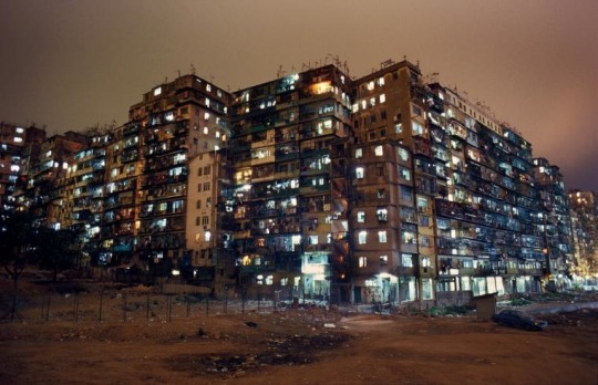
Kowloon Walled City (Image courtesy of Harrison Jacobs - Business Insider)
Slums are arguably one of the largest if not the largest problem in housing around the world. To sum it up, slums are compact housing divisions that are built out of any scrap material and are dangerous to both the people living in them, and the people that surround them. The living units are typically stacked on top of one another and are not structurally safe, nor contain the basic living necessities (water, electricity, etc) that is found in typical housing. Due to lack of law enforcement, the neighborhoods that compose slums are also victims of higher crime rates and criminal gang activity that is plagued with drug trafficking. Above all of the negatives, there is always positive, and with slums it consists of the culture of the place. The community created within the slums is a very close one where the close proximity of people really helps create a bond between neighbors where they can all look out for one another. For example, Kowloon Walled City was a slum neighborhood in the middle of Hong Kong that had protests in the middle of demolition due to the fact that many residents were hesitant to move out of the neighborhood. (written By Alex Acosta)

Pruitt-Igoe (Courtesy ArchDaily)
There have been many attempts by architects to make living in slums better but they haven't really been successful and have left many questions regarding what the correct approach to helping people in slums is. In the 1950s, the creation of Pruitt-Igoe and many other megastructures was thought to be the solution to the slum neighborhoods in the U.S. but in reality it was not. Instead of unifying the community and building around the needs of the people, these megastructures simply separated them, and completely isolated them from one another creating an unsafe environment for most of the people that were part of these new neighborhoods. The popularity of these affordable housing developments quickly decreased and many of the developments were left empty. The tight culture that was created in the slum neighborhoods of the early 20th century was completely taken away from the people who were forced into these new ‘affordable housing developments’. (written By Alex Acosta)
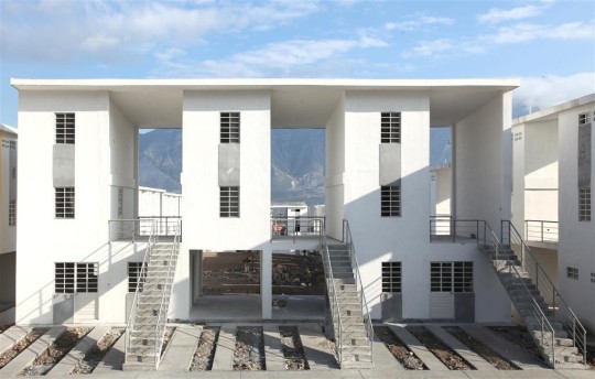
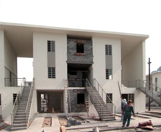
APAN HOUSING LABORATORY - MOS
Recently, there have been many more affordable housing developments that have been more successful in comparison to the megastructures of the mid-20th century. A successful example of that is the recent housing experimental development - Apan Housing development in Hidalgo, Mexico. The development is a collaboration by Infonavit (National Workers Housing Fund Institute) and Architecture Firm MOS (New York), with the firm goal of finding different low cost housing typologies that all fit the needs of the various diverse cultures of Mexico. Through 32 different low cost prototypes, both the firm, Infonavit and the targeted community explore the many different native building materials and styles to come up with prototypes that not only accommodate the needs of the community, but also the climate conditions of the area where the structure is being built. Along with the prototypes, a community garden and education center were also added to the nearby housing development. (written by Alex Acosta)

32 Prototypes shown within Apan Housing Laboratory (Courtesy MOS)

Community Garden and Education Center (Courtesy Jaime Navarro)
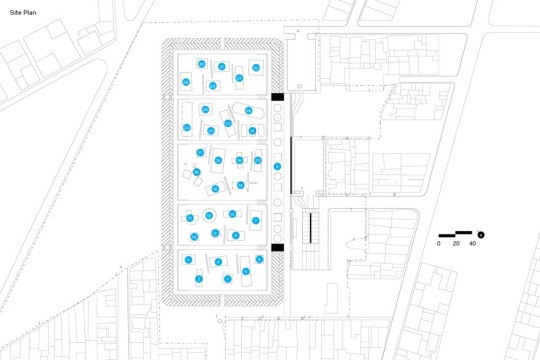
Site Plan showing placement of prototypes ( Courtesy MOS)
10x10 Housing Initiative (2009) - MMA Architects
The Design Indaba 10x10 Low-cost Housing designed by the MMA Architects offers affordable, attractive and innovative responses to the urgent need to house the urban poor community. Located in Freedom Park, a suburb of Cape Town, South Africa, aimed to stimulate alternative solutions to housing. The houses are constructed of timber frames that are filled with sandbags, covered with chicken wire, and plastered over. The sandbags provide excellent thermal stability and their use in construction taps into indigenous building techniques that are well adjusted to the hot climate of South Africa. During the construction process the design team found a system which uses natural, sustainable materials which also allowed the involvement of unskilled community members in the construction, helping out with the delivery of affordable housing and empowering the benefiting communities. (Written by Bamluck Abera)
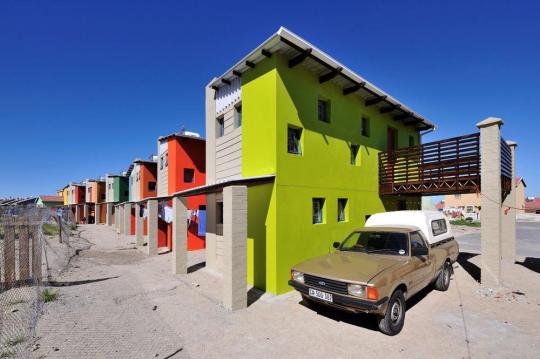
The 10x10 low-cost housing, Freedom Park, South Africa (Design Indaba)

The implementation of sandbags being used as a thermal source in response to the hot climate (Design Indaba)
The site plan of the 10x10 housing showing the grouping and the layout (Design Indaba)
Monterrey Housing (2011) - Elemental
The Monterrey Housing development by Chilean firm Elemental has a different take on the idea of housing and improving the living conditions of the slums. Designed in the year 2011, the housing initiative takes on building the basic necessities of a typical house (½ of the house) and leaving the other half as open space with the opportunity for customization according to the owners needs. In addition to the homes, a community space is also accessible from the housing units, targeting the idea of having one communal space for all. Having the community garden inside of the housing development allows for the opportunity to not only establish a community culture similar to the one that exists in slum neighborhoods, but also allows the housing tenants to take charge of the maintenance of the garden space. (Written by Ryan Scott)
(Courtesy Elemental) The housing structure allows opportunity for expansion in the large void spaces.
(Courtesy - Elemental) An expansion of a single unit taking place.

(Courtesy - Elemental) The Site Plan highlights the relationship between the garden and the housing units.

(Courtesy - Elemental) A comparison of an initial duplex unit vs an expanded unit.
There is a lot that we as architects can do in order to improve the living conditions of the many slum neighborhoods around the world but we firmly believe that in order to approach the issue we first need to take a step back and incorporate the community into the design process. Instead of designing with the goal of having a nice front face, architects should focus on designing with the intent of providing the community with what they need both culturally and physically.
Question for Discussion: We have seen that many public housing experiments in the past have failed for a variety of reasons. Do you think that public housing is an effective way to help low income citizens?
0 notes
Text
New Urbanism vs. Landscape Urbanism - Which one benefits the community more?
Both Landscape Urbanism and New Urbanism have many benefits and there are constant arguments about whether one is better than the other. As a group we really believe that both of them have benefits to each other and overall they are equal in terms of the value that they offer to the need of sustainable, planned urban networks.
New Urbanism
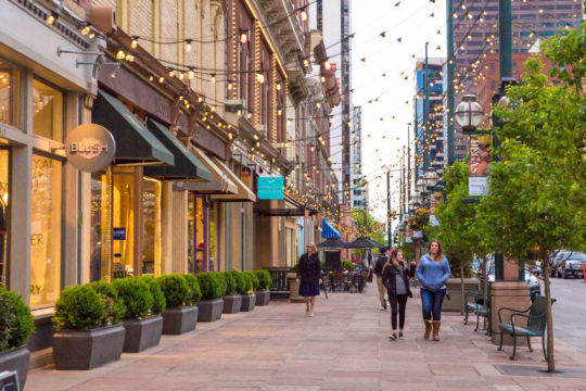
New Urbanism takes a different approach than Landscape Urbanism in the sense that New Urbanism has an increased focus and design that accommodates the people. The design principle of New Urbanism is to help accommodate as many different types of transportation possible instead of just concentrating on one. Another benefit of design within New Urbanism is to provide different spaces to establish interaction between people. These spaces can be a variety of spaces such as plazas, parks, sidewalks, restaurants, and many more. Lastly, one of the most important parts of New Urbanism is definitely the repurposing of spaces that are abandoned/neglected. These spaces can range anywhere from old abandoned buildings on main street or to larger scale projects such as malls, but the goal is to use the existing buildings and trying to preserve part of what was there before (the history)
Urban Development - Salud America
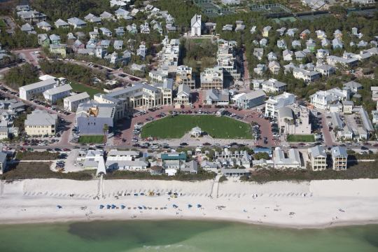
One of the main examples of New Urbanism is the town of Seaside, Florida. There is a great emphasis on the use of principles of New Urbanism that include a drift in the use of the automobile and an increase on the reliability of other methods of transportation such as the use of bikes and walking. In addition, the town has many areas of connection and interaction such as restaurants, parks, and the beach.
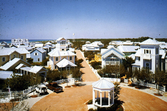
Town of Seaside, Florida
Landscape Urbanism
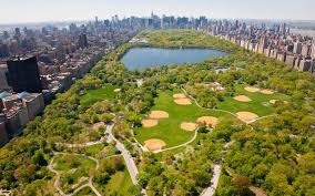
Landscape Urbanism brings together Ecology with “traditional, engineered, infrastructural system(s) in urban design.” This is all about bringing back landscape to the city where concrete has taken over. A good example of this is Central Park in New York City. Olmsted brought the idea of the “natural landscape” to the very urban NYC. There is a drive with Landscape urbanism to preserve the existing habitats over the new development.
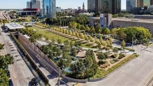
Landscape Urbanism is about incorporating quality urban development into new designs. There is a certain quality of life that is achieved with a natural landscape being incorporated into the cityscape. Landscape Urbanism goes hand and hand with the environmental movement. A great local example of landscape urbanism is Klyde Warren park in downtown Dallas. The city park takes back some of the landscape and turns it into green space that then started to improve the surrounding area.
Compare vs. Contrast
Landscape Urbanism and New Urbanism both have a similarity in their objective, how to design an urban environment for the benefit of a city. Some similarities include a connected network of a design project that relates between these two design principles, for example the design of connected roadways and walkways. Another is a goal for achieving an environmental benefit for residents and those who pass along, and both discover the goal to build up a community that can benefit other factors such as the economy, transportation, and walkability.
Some differences between Landscape Urbanism and New Urbanism is that they both prioritize a specific objective. As Landscape Urbanism prioritizes the environmental aspect of design in an urban setting, New Urbanism focuses on the design for the quality of life for people living in the urban environment. One focuses on the design of structures, plazas, roadways, streetways focusing on the use of a space while the other looks at how to use a landscape and make it an environment suitable for humans and mammals as well.
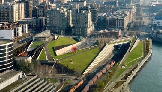
Seattle Art Museum: Olympic Structure Park, Seattle, WA
Sources:
https://www.archdaily.com/tag/new-urbanism
0 notes
Text
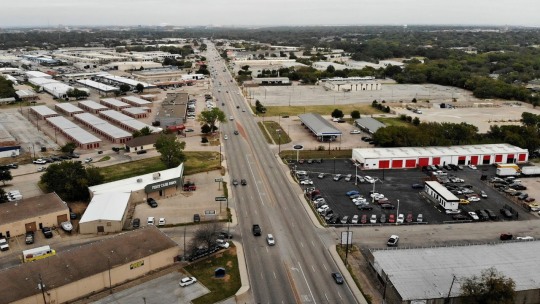
Transit Oriented Development: How can the city of Arlington Adapt Feasible Public Transportation?
By Alex Acosta, Bamluck Abera, and Ryan Scott
South Cooper Street - Fort Worth Star Telegram
As a constant growing community, Arlington Texas has one of the largest communities in North Texas coming in at almost 400,000 residents. Over the last few years constructions of New Developments such as AT&T Stadium and Globe Life Field have brought an increasing wave of tourism into the city. In addition to the New Stadiums, Arlington is also home to UT Arlington, one of the Largest Commuter Schools in Texas, Leaving Arlington with a Major Influx of traffic coming in and out of the city every day. One of the main problems of Arlington is the lack of a major transportation system that can facilitate some of the traffic seen daily around the city. Many efforts have been made around the UT Arlington area providing services such as the MAV Mover and and the relatively new RAPID shuttle service, but the capacity of these services are limited to only a certain group of people.
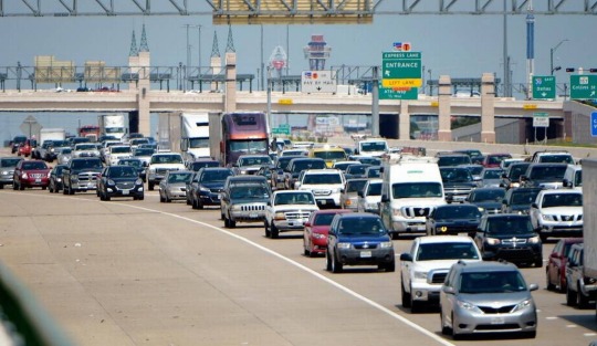
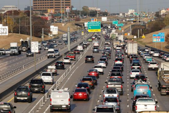
Interstate 30 at Center st. during rush hour - Fort Worth Star Telegram
One of the most severely affected areas due to the lack of public transportation in Arlington is the downtown portion of the city itself. Due to a lack of public transportation to and from the city, many people are forced to Drive or take expensive UBER/LYFT rides to even get to Arlington. This has affected the Downtown Arlington area and it has left it lacking in comparison to the area around both AT&T and Globe Life Field Stand. Many Cities around the world have made many efforts in terms of improving their TOD (Transit Oriented Development), but one that stands out of many is San Francisco.
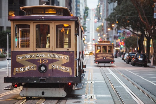
San Francisco Chronicle
San Francisco has one of the most effective public transportation systems within the United States. It offers many convenient options to get around the city such as BART (Bay Area Rapid Transit), MUNI (San Francisco Municipal Railway), The Classic Cable Cars, and many shuttle options such as PresidiGo Shuttle. The vast option of transportation services provide both the citizens of San Francisco and neighboring cities the opportunity to go around the city freely without the need for a vehicle. According to TOD Database about 36 % of Office workers Commute via Public Transit, and about 41% of Shopping and Entertainment workers commute through public transit. The many different public transportation services and the incoming tourism have helped the TOD of San Francisco Highly develop in the areas that have public transportation such as The Downtown and Inner Sunset Districts.

TOD Database - San Francisco Public Transit Stations, and Transit Zones
How can Arlington implement a similar public transportation system for its downtown?
Downtown Arlington is home to many developments especially in the Area between E Front Street and Division Street, where many new family owned restaurants and businesses are opening up. One of the things Arlington could develop is a Train Transit service like TRE (Trinity Railway Express) connecting Downtown Arlington to both Downtown Dallas and Downtown Fort Worth. The railway would not only have stops in Downtown Arlington but it would also have various stops along Downtown Grand Prairie, Texas Wesleyan University and Fort Worth. In addition a new light rail system, a street-car system similar to the one implemented in San Francisco where many major stops would be around downtown Arlington. In addition the street-car system would also extend to UTA and replace what is now known as the MAV MOVER.

Diagram with Proposed TRE Expansion Lane - Alex Acosta

Diagram with proposed street car / tram lanes for Downtown Arlington

TOD Database- Valley Metro Rail, including stations, and other access points
Another place that the city of Arlington can look at is the city of Phoenix, Arizona. In 2008, the city’s light rail system began allowing for greater connectivity for residents, businesses, and organizations that use the rail system. The name of the rail-system called the Valley Metro Light Rail goes through major access points such as North Phoenix, Downtown Phoenix, the Airport, ASU, and nearby suburbs of Mesa and Tempe. Portions of the rail network run in the middle of northbound/southbound or westbound/eastbound lanes of traffic or along the roadways near the city center. Based on data gathered by the TOD Database, residents who live within a ½ mile distance from the station are about four times more likely to use the rail to commute than those who would by a vehicle. About 5.6% to 21.6%. The city of Phoenix has continued to make efforts to expand it’s rail system to other sections of the city.
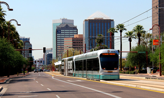
The Valley Metro Rail system in between the northbound and southbound lanes on Central Avenue in Uptown Phoenix
The city of Arlington can also implement this sample from Phoenix, Arizona to create a rail system on Division Street. Division Street also runs along the Railroad and connects Dallas to Fort Worth so it could be used as an option instead of building the rail alongside the railroad. Or running along Center Street going north and south through Downtown Arlington and major access points such as AT&T Stadium and Globe Life Field. Another way is to develop a streetcar system in Downtown Arlington that can make a stop on a new rail system for example along IH-30. It’s possible to develop a rail network for the city of Arlington.
Image of the Tempe Streetcar system
Discussion Question
What is the most ideal form of public transportation? Does it exist yet?
Sources:
https://www.dallaschamber.org/wp-content/uploads/2019/03/People-RegionalPopulation.pdf
https://www.univstats.com/colleges/the-university-of-texas-at-arlington/student-population/
https://www.dallasnews.com/news/curious-texas/2019/02/22/arlington-doesn-t-have-a-public-mass-transit-system-so-how-do-you-get-around-curious-texas-investigates/
0 notes
Text
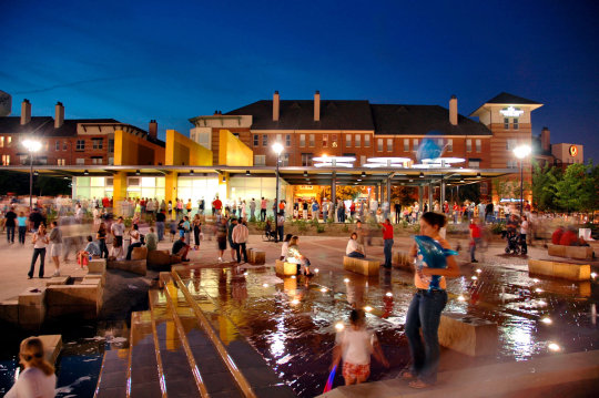
Whyte’s 7 Plaza Principles Addison Circle Park - Addison, TX
Designed and built in the early 2000s, Addison Circle Park serves as a special event gathering space for the community of Addison. Some of the events held there include; Taste Addison, Kaboom Town, Oktoberfest, and many others. There are many amenities such as
A water garden, a pavilion, and different garden zones that enable the park to become more than just a park. The park is conveniently located within Addison’s Downtown District, Many options for food and vending are located both inside and outside the park. Addison Circle Park serves as a great example when talking about Whyte’s principles, as many of them are integrated into the park/plaza.
Diagram done by: Alex Acosta
Seating -
Seating in the park is no issue as there are many different seating options provided along the park including in the Pavillion and in the Different Gardens located around the park including the playa and the Water Gardens.
Cunningham Architects
Cunningham Architects
Relationship to Street -
The park is surrounded with streets along all sides providing easy access to the park from any side. There is also convenient parking along both sides of the streets to allow the opportunity for both vendors or cars to park in a close location to the park.
Google Maps

Diagram done by Alex Acosta
Light -
In terms of Light - The park is completely exposed to the sunlight and provides optimal light for any activity that is held throughout the day. The low rise Retail/Commercial developments on the side of the park are no issue as they don’t block the sunlight whatsoever.
Sasaki Associates
Water -
Water on the site is confined to the East side of the park in the form of fountains and a splash park. The splash park is utilized through the summer months by the children in the area and the fountains can be enjoyed year round. These water features are closer to the more developed side of the park and act as an invitation to the rest of the park.

Diagram By: Ryan Scott
Shade -
Shade in the park is an abundant resource. There are several groupings of trees around the edges of the park that provide a majority of the shade of the area. There are also a few structures that provide shade in the center of the park. There is also an art installation on the east side of the property that casts shadows to provide more of an experience of the space than for the need of shade.
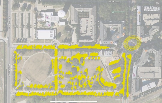
Diagram By: Ryan Scott
Food/Vending -
The Food/Vending side of the park is available particularly when the city hosts special events like food tasting venues and or for entertaining activities that are present. The park provides that ability for people to explore and enjoy their time on the site.
Triangulation -
The way of how the triangulation is explained in Addison Circle Park shows that the space utilizes interesting paths to where people are likely to find a way to create a stimuli. It adds on that this can be made if events are hosted or individual performances a dialogue can be made between people who don’t know each other but to make a social interaction.

Taste Addison (The Flash List Entertainment Game)
Sources:
https://addisontexas.net/actc/addison-circle-park
https://directory.dmagazine.com/attractions/addison-circle-park/
https://www.cnu.org/what-we-do/build-great-places/addison-circle
0 notes
Text
Is there a missing element in the city of Arlington that joins the city as a whole? If so, what is it?
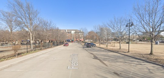
Street Visit in Arlington - E Front St
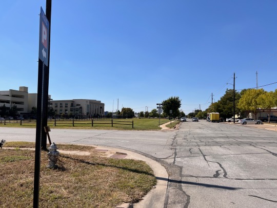
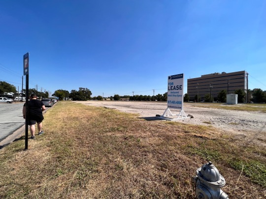
For our site visit, we decided to concentrate on a section of downtown Arlington between Mesquite St and E Front St. The area itself right now serves as parking space for many of the restaurants and commercial businesses that encompass the area between Division St and E Front St. The site felt perfect, as the area is largely underdeveloped and could help establish a connection between both the northern side and the southern side of the existing railroad, an element that completely splits Downtown Arlington into two parts. The real question here is: How can redeveloping the street E Front St play a role in connecting the northern and southern sides of downtown Arlington?
Proposal #1 - Reconfiguration of East Front Street to include Bike Lanes and a Park
Given the fact that there is already an existing set of establishments of restaurants and commercial businesses, redeveloping East Front Street into a mix of a street, park and bike lanes will really help bring a connecting element that is currently missing in the northern part of downtown Arlington. The connecting park will help not only with the existing set of restaurants but to attract more people to downtown Arlington.
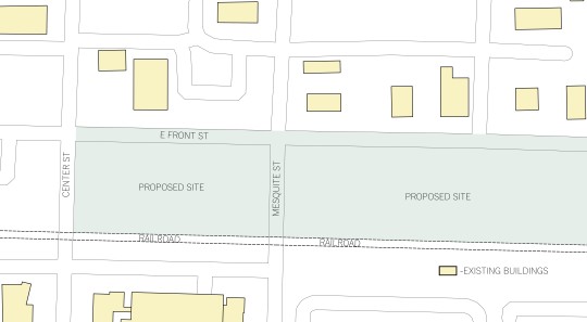
Existing Site - Alex Acosta
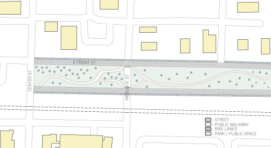
Plan view of the Proposed Street - Alex Acosta
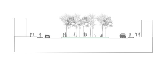
Section View of the proposed Street - Alex Acosta
Proposal #2 - Additional pedestrian access and safety features
Downtown Arlington is growing rapidly and with that increase it brings along an increase of volume and traffic to the area. That may be great for the city’s revenue and productivity for the economy and the community, but it adds an increased risk for accidents for drivers and nearby pedestrians. Front Street which runs parallel to the Railroad is one area of improvement to develop a safe pathway for pedestrians or cyclists passing by particularly on Mesquite and Center Street. Reconfiguring Front Street would be an additional benefit since any future development along and near the area will benefit an improved traffic flow to the area.

Front Street reconfiguration adding a crossing ways for pedestrians at Mesquite Street and bicycle lanes that stretch across the street- Drawing by Bamluck Abera

Image from Google maps showing a view looking west on E Front Street (2020). The corridor can be used for a site for developing mixed-use zones and bicycle lanes
Proposal #3 - Shaded Structures and venues
Proposal 3 includes some additional public structures to be used for gatherings and other social events. The space in between the two structures is a public green space that serves as an overflow for the two enclosed structures. Front street is full of various bars and restaurants that often have live performances at their venues. The new proposal would allow those tenets first pick at days that they would want to use the larger areas to promote and utilize for their larger events. This would ultimately generate more revenue and publicity for this part of Arlington and rapidly increase its growth.
Drawing done by Ryan Scott, Red is Covered Space, Blue is Open
Drawing done by Ryan Scott
0 notes

Text
What’s the “best” density for the design of cities today?
Written by; Alex Acosta, Bamluck Abera and Ryan Scott
The so-called “best” density of a city is a term that has many contributing factors that help determine whether the density of a given city is too high or too low. Some of the determining factors include;
The environment of a city
The population
The diversity,
The transportation methods of a city
We see many cities that have either been affected positively or negatively by their respective density. One that comes immediately to mind is the Kowloon Walled City, a settlement in which more than 33,000 people were packed into 6.4 acres of land. There were about 350 buildings containing a mixture of living spaces and work spaces giving the people who lived within Kowloon Walled city little to no space to live. Although living conditions in Kowloon Walled City were subpar in comparison to the rest of Hong Kong, the people did not want to leave the settlement because of the connections they had established with one another and the culture which was the strongest aspect of the place.
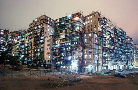
(https://www.atlasobscura.com/articles/kowloon-walled-city)
Although no examples exist in Dallas with the density of Kowloon Walled city, we have several projects that range in all levels of density, from high levels of FAR to low levels of FAR.
To be able to find the FAR (floor Area Ratio) average of the City of Dallas:
Population per square mile (2020): 3818 people
Average Household size (2019): 2.56
Miles to acres: 1mile = 640 acres
FAR = 3818 / 2.56 / 640 = 2.330 Housing Units Per Acre
Legacy West - Plano,Texas
Located in between North Plano and Frisco, Legacy West is a 415,000 sqft development that was built between 2014-17. It has a variety of mixed use development that includes retail, restaurants, office space, and a hotel. Mixed use developments like Legacy West are some of the heaviest amongst Dallas-Ft worth and all contribute an equal amount in producing developments that both help make the densest spots of a city more enjoyable for the people who are part of those developments.

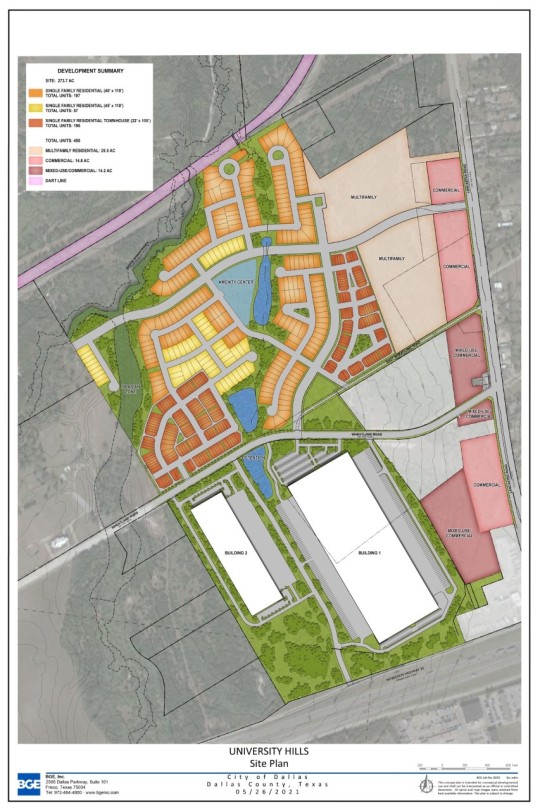
University Hills- Dallas, Texas
Located just north of I-20 and beside Lancaster Road in South Dallas lies a massive unincorporated space just southeast of the University of North Texas at Dallas has the potential to become a site to be used for mixed use development. Developed by the Centurion American Development Group the development will sit on 274 acres of prime real estate in an important Dallas corridor. The site would feature townhomes, lake views, multifamily units, retail, and restaurant space. The area would also have plenty of green space, an amenity center, hiking/biking trails, lookouts and park space. It also plans to incorporate a site slated for industrial use, bringing in an economic impact as well. Most pros of this site are stated with the green spaces and trails that surround the community, but one con could be the use of industrial space nearby the residential communities.
https://www.dallasnews.com/opinion/commentary/2018/02/23/do-you-know-black-history-in-dallas/
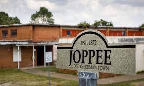
Joppee - Dallas, Texas
Located between I-45 and the Trinity River, Joppee or Joppa, is an old freedman town in Dallas and is a prime example for low density development. First off, the people in the community of Joppee are a very tight knit community and need to be preserved in any action taken to develop the area and the fabric of the area needs to be relatively lose in comparison to the dense nature of areas like Dallas. With the prime location next to the trinity river and the rich cultural history of the area, it is the perfect site for cultural enrichment through educational opportunities and community lead development. Development would include bringing current living circumstances up to code but not necessarily removing the existing structures. The people of Joppee have a lot of pride in their homes and any work done should just add to that sense of pride and ownership. I believe the next phase of development should bring in an educational element to the community for the visitors that come through. The old school building would make an amazing educational center for the history of Joppee to be told and celebrated. The one thing that must be taken into consideration is the impact on the existing community and that nothing that is done harms the current social and historical fabrics of the area.

https://www.google.com/search?q=joppee&source=lmns&bih=1272&biw=2560&rlz=1C1GIVA_enUS967US967&hl=en&sa=X&ved=2ahUKEwj11LzLkaLzAhUFyawKHaD7A0EQ_AUoAHoECAEQAA
Sources:
https://www.atlasobscura.com/articles/kowloon-walled-city
https://www.legacywest.com/
https://centurionamerican.com/community/university-hills/
1 note
·
View note
Text
What Would Be A Lesson From Paris and Chicago Applicable in Dallas/Fort Worth?
By: Alex, Ryan, Bamluck
Paris and Chicago are cities that have had many revitalization projects that have helped both cities develop to what they are today. They both have many different landmarks and elements that help the cities be an enjoyable place for both locals and tourists. Dallas/Ft Worth has many different landmarks that help the city identify itself with its citizens, but not to the strength in which both Chicago and Paris have implemented them. In the following post, we take a look at some of the most notable landmarks in DFW and implement possible solutions to how those landmarks could be revolutionized for the benefit of the local citizens.
Klyde Warren Park- Dallas, TX
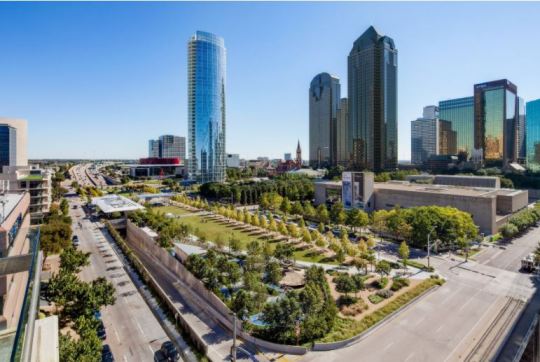
Klyde Warren Park, Dallas, TX
Source: (D-Magazine)
Klyde Warren Park in Downtown Dallas serves as a central gathering space for residents and visitors. The urban park is above a section of below-grade Woodall Rodgers Freeway, for three blocks between Pearl Street and St. Paul Street. It connects to the Dallas Art District, to other residential/commercial spaces in Uptown like the Ritz Carlton Hotel and Museum Tower. Klyde Warren Park does not only add to the transformation of Downtown but also adds onto a strong economic impact it has and the continual increase in development and density. Which brings onto another point, space. The park with a space of 5.2 acres is a beautiful site to see and visit to anybody that goes there will enjoy the activities and events that happen. As millions visit the park every year two factors such as traffic and space will be added to deal with changes and improvements to the park.

Millennium Park, Chicago, IL along with the view of the Cloud gate and the Jay Pritzker Pavilion
Source: (TripAdvisor)
One advantage that the city of Chicago has over Dallas, proper planning and lack of urban park spaces. City planning and layout for Chicago has an organized layout than what is to Downtown Dallas. Chicago has multiple known urban parks such as Millennium Park (24.5 acres), Grant Park (319 acres), Maggie Daley (20 acres), but not to keep on adding to the point on the shear size of these parks in relative to the very few green spaces we have in Downtown Dallas, but we can learn from Chicago how designers have been able to utilize a massive amount of space for the benefit residents and visitors. Klyde Warren Park is a great start for the city of Dallas to develop additional urban spaces and or improving, expand, and revitalize nearby highway corridors such as Woodall Rodgers Freeway and consider massive sites in the city to improve and recreate such as The Trinity River in Dallas and the West Fork Trinity River in Fort Worth.

Maggie Daley Park, Chicago, IL
Source: (TripAdvisor)

In the bottom corner is the additional space that can be used for expanding Klyde Warren Park
Transportation / Revitalization Trinity River

Trinity River - Downtown Dallas (Smiley N. Pool/The Dallas Morning News)
Trinity River is one of the major landmarks for the Dallas/Ft Worth Metroplex. When someone who is from the Metroplex, talks about the city itself, there is always talk of the Trinity River. As famous as it is for the people of Dallas, we have to recognize that the Area itself has a major flaw. The area surrounding the river and the river itself remains fairly underdeveloped. There is no welcoming factor and overall seems like the river itself is an afterthought for the city of Dallas. The idea of developing a river could not only prove to be successful to the city of Dallas but as proven before with other cities, the inclusion of a river or a similar body of water has been a successful move that has tied the city together as a unifying element. For example, in Chicago, the Chicago River has completely transformed from being a simple body of water that runs through downtown to a completely reimagined restoration. The river serves as a method of transportation for an already heavily congested city, and allows for an extra source of revenue for the local economy.

(Image Courtesy of choosechicago.com)
The overwhelming question for the planners of Dallas/Ft Worth is: How can the Trinity River be revitalized to provide different elements that benefit the community? The main solution one can go with is to use the Trinity River as a method of transportation between both Dallas and Fort Worth. The current transportation system in DFW relies heavily on automobiles and adding another method of transportation between both cities might help ease a bit of the current transportation issue. Second, adding a possible development of local businesses along the river can also help provide an injection of revenue to the local economy of Dallas. It could provide locals with a nice place to take a walk or a run in the morning, while providing local businesses with an opportunity to attract tourists.
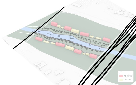
Possible Development Along Trinity River - Perspective Diagram Created by Alex Acosta
Reunion Tower and the Surrounding Infrastructure
Reunion Tower is one of the major Civic Centers in Dallas. It is the icon of the Dallas Skyline and is one of the main attractions of the city. It is one of the main draws to the city of Dallas but it is surrounded by some of the most congested infrastructure known to man. I-35 and I-30 border the area of the reunion tower and are always backed up with vehicles merging off and on the interstate system. This is a similar situation to the Circle Interchange in Chicago where it is the 3rd most congested area in the United States. When considering the infrastructure around Reunion Tower, planners should have looked to Chicago and observed how their highway layout affected the area around it.

Digital Diagram By Ryan Scott
0 notes
Text
Garden City: A dive into what worked and what failed.
By Alex Acosta, Ryan Scott, and Bamluck Abera
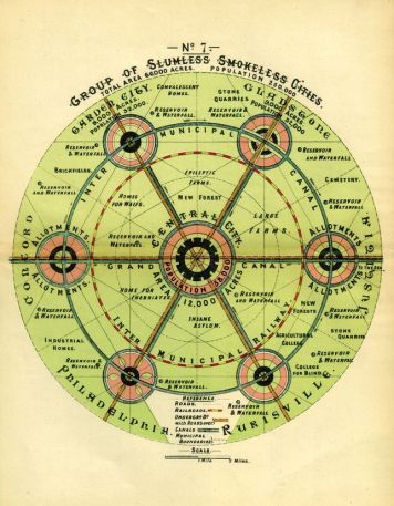
Garden City was a master plan created by Ebenezer Howard in 1898 as a way of reforming urban life due to the negative effect the Industrial Revolution had on cities such as London and Paris. Paris and London were negatively affected by factors such as population, density, pollution, and lack of cleanliness. Howard’s response to the problem included completely rethinking the city by incorporating both the rural and urban lifestyles and connecting them into one. His idea centralized on six equal parts that were divided by 6 main streets. The main institutions would be centered along the center of the city surrounding the center circular garden. The industrial part of the city would be placed alongside the exterior rings of the city along with the railroad that connects the city with other cities.
Brøndby Garden City In Denmark
An example of a garden city is Brøndby Garden City In Denmark who takes a different but similar take on the idea of the garden city by placing its residential housing in a circular arrangement such that the gardens face each other creating the idea of being surrounded by a garden.

Garden City of the Future - Section Created by Alex Acosta
Pros:
1. The Garden City minimizes pollution by emphasizing public transportation
By being designed in a way that minimizes automobile dependency, people are more equipped to walk from place to place.
Levels of acceptable emissions are achieved and often there are minimal amounts
2.There is an increased resiliency and ecological diversity within the city
With built in green spaces that make up a vast majority of the space of the city air quality is greatly improved and cleaner
Plant life becomes more stable because there are dedicated “safe zones” where their environments are not messed with
3. Diversification in wildlife
Because there are dedicated natural areas, wildlife is able to create homes and have sustainable food sources
Wildlife can be easily maintained and population controlled in healthy amounts due to close proximity with humans
4. Improve mental health by being surrounded by green space
Stress is reduced and blood pressure drops when we are able to have access to a view of a tree
We are hardwired to find green space engrossing and it is fundamental to our well being
5. Combines the idea of town and the country to get the best of both worlds
The rural aspect of food production and privacy are combined with the close proximity of city living
Each household has their own space within the city
Cons:
Small size of the community
-Each house’s average size is about 50 sq. meters (60 sq. yds)
-A large family would find it difficult to stay there, this adds to the point to how people would use these homes as a little getaway from the city
Houses are owned, but gardens are rented
-General rules and laws restrict people from buying property, for example you’d have to own a property within a certain distance to purchase a house.
-Homeowners have to live within 20 miles from Copenhagen
Zoning laws and restrictions
-Prevent anyone from occupying their properties for more than six months out of the year
Great for the environment, not for land management/planning
-Extra open spaces from outside the individual communities can be used for additional trees and gardens
Bizarre design style
-As it benefits the interaction within the neighborhood and the environment for an intended group (city-dwellers). Many neighborhoods don’t display this design style as it should since it is eco-friendly and unique
Sources:
https://www.takingcharge.csh.umn.edu/how-does-nature-impact-our-wellbeing
https://britishculturalstudies.com/2020/07/10/cities-pandemics-and-the-task-of-the-historian-questions-from-cultural-studies/
https://www.archdaily.com/tag/garden-city
https://www.nspirement.com/2021/06/16/denmarks-brondby-garden-city.html
https://www.gardenvisit.com/landscape_architecture/urban_design/garden_city_landscape_urbanism_howard
0 notes
Text
“For you, as an architect, what is an “ideal” city?”
What is an Ideal City?
The ideal city is a mixture of diverse groups that equally help make a society that is enjoyable for all. An Ideal city is one that shows pride in its history and preserves some of the historic phases which it went through to get to where it is today. The city includes a mixture of the new and the old, taking pride in the mixture between the new and the old. The concept of the Ideal City really is something that no city has achieved because of the many factors that harm the stability of a city such as the use of transportation, housing, and parks and recreation.
Transportation: In many cities of today’s world, transportation is one of the main problems, if not the largest problem of the city. For example in the Dallas / Ft Worth Metroplex, transportation is one of the largest issues of the city. There is a heavy reliability in the automobile and most of the population uses it as its main transportation method. There have been recent attempts to reduce the use of the automobile and expand the different methods of transportation, but most efforts have been unsuccessful. Dallas has an existing public train system, but it lacks routes and is not accessible to all people in the County. There is many more ways in order to Some of the ways in which the transportation problem can be reduced include:
Increasing the amount of Public Transportation
Adding Bike Lanes to every street in DFW
Increase the Amount of HOV lanes in a Highway to encourage carpooling
I-635 - Dallas, TX
Source: (David Woo / Staff Photographer)
Parks & Recreation: Most major cities across the United States have several different types of parks. It can range from the size of Central Park in New York City, or to Union Square in San Francisco. Parks are primarily used not just primarily for the natural and environmental aspect of living within the concrete jungle but are made for human enjoyment, physical activity, and relaxation. There are active and passive forms of parks/recreation, the active is that an urban character requires intense development for example in the form of playgrounds or skateparks, and passive as it emphasizes on the-open space part of the park allowing for preservation and the natural habitat of that park. It’s important to note that park design is influenced by its intended audience and with a self-purpose so that it could be used for the benefit of any particular neighborhood. Many major cities have parks and rather an abundance of them, but at a cost of leaving other city neighborhoods throughout the city with limited or no access to a neighborhood park. The need to add more smaller neighborhood parks are critical to meet the needs of issues such as urban decay, neglect from city leaders, and also to address climate change.
Millennium Park, Chicago, IL
Source: (Courtney Rios/Urban Matter)
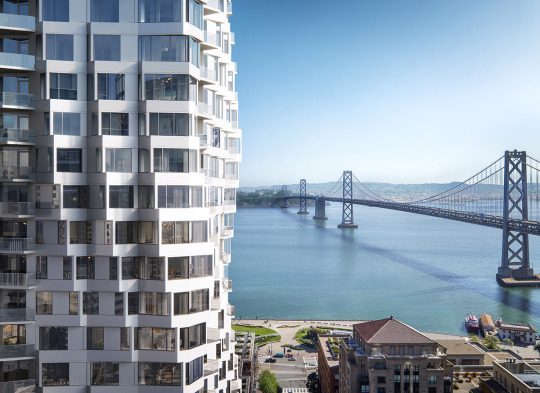
Housing: Since the beginning of time, housing has always been an issue for humans. When we were hunter gatherers, we migrated from place to place in simple tents and lived in caves, but as time went on and the human race advanced, we started settling down and forming cities. With cities, especially in today's world, housing is a big issue. Cities are home to a very diverse group of people and incomes. Modern cities have quickly welcomed any means of commerce that bring large profits and have neglected the lower income portion of the population. In the ideal city, housing is made readily available and affordable to everyone. It is not that everyone has to live in a little one bedroom apartment but rather mixing in more affordable units or houses for people on a lower income to purchase/rent. Jeanne Gang, of Studio Gang, has explored this type of living situation in some of her projects such as MIRA in San Francisco. Gang incorporated about 40% lower income housing into her residential tower. Instead of just throwing them all in at the base of the tower she mixed them throughout to blend the community of the tower together. This helps make people who are having to live in lower income housing not feel ostracized for their living circumstances and encourages them to better their situation.
https://worldarchitecture.org/architecture-news/ehmme/-architects-can-help-cities-build-inclusivity-argues-jeanne-gang.html
1 note
·
View note