
Statistics
We looked inside some of the posts by theveryword and here's what we found interesting.
Average Info
Notes Per Post
6
Likes Per Post
5
Reblog Per Post
1
Reply Per Post
0
Time Between Posts
5 months
Number of Posts By Type
Photo
8
Text
8
Quote
1
Last Seen Tumblr Blogs


Fun Fact
Tumblr has a 66 index score for customer satisfaction in the US.
Photo


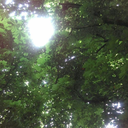
I’ve been in Perth for six days, and I feel like I’m only just beginning to dry out. Over the last few weeks of January, the incessant Darwin monsoon felt like it would never end. Taming a thriving tropical garden between monstrous showers was what got me out of bed every morning - and put me sound asleep at night. The contrast couldn’t be starker. This is my first time living below the tropics in about five years. It’s going to take some getting used to. This is life now.
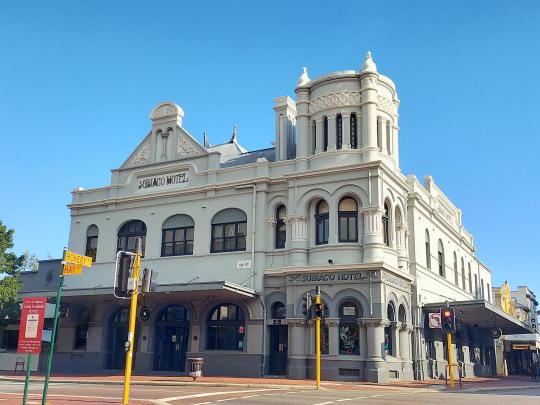
Since we’ll be living on the Best Coast for at least two years, on account of her job and my masters course, I want to record some initial observations: My five years of constant sweat are over. I can actually stand outdoors without changing shirts. Even walk places! However, the sun is angry. It was 37 degrees this week and I grew five melanomas just walking to the car. The wind is cold. I can’t remember the last time I was cold in January. The dry is inescapable. Grass verges crispy and dead. Soil sandy and lifeless. There is history here. I mean, white fella history; European history. Darwin is so very new in contemporary culture and architecture, it feels shallow by comparison. Perth has soaring towers, yes, but sandstone and twee federation homes. And elaborate public houses like the Subiaco Hotel. I love it.
Mining is everything. It’s literally in the water you drink - the iron makes it taste like blood - and stains the footpaths and buildings next to irrigation. The freeways and flyovers seem to take up more room than entire suburbs. The river is actually breathtaking - why did I not know this? The boom times for W.A. may be over, but the place still hums with optimism.
0 notes
Text
July 17
1,645km to Katherine
There's no particular reason, but I'm anxious to get over the border. Yes, we're doing this the hard way, by road. Yes, we will probably be waved through without a worry. I will just feel less anxious on the northern side of the invisible line.
Which we reached at last, at around 2:30pm, to be met by some fly-net clad police officers and even RAAF personel. This must have been a busy morning for them, stopping dry season traffic that would normally fly past at 130km/h. But there were relatively few cars, caravans and the like when we pull up.

We're asked for copies of the declaration form - which has to be completed on paper, we find out. Where have you been in the last 28 days? Have you travelled to any hotspots? (That's the NT's definition, so: Sydney, the Blue Mtns, Melbourne and Vic's Mitchell Shire)
The answer is no.
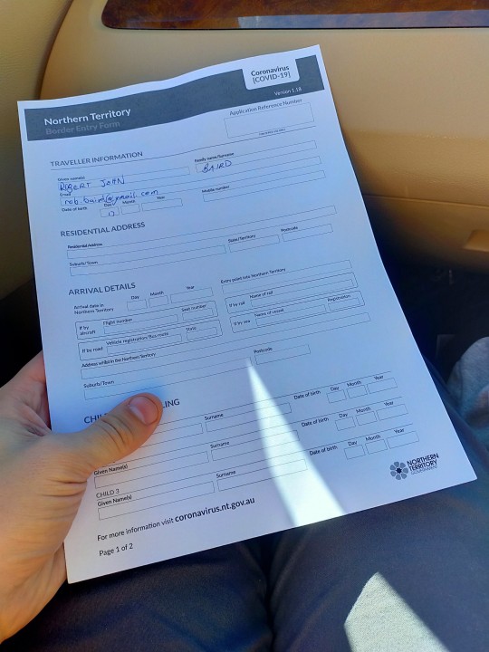
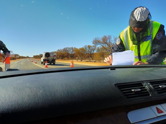
"Is this a true and honest declaration?" the officer asked in a fairly non-interested fashion.
"Yes" is all I had to say.
"Okay you're good," he added. And we sped off.
As with South Australia, there we no further instructions - albeit SA gave us a "close contact" paper form to fill out.
I let out a sigh of relief and hit the pedal. We're in!
0 notes
Text
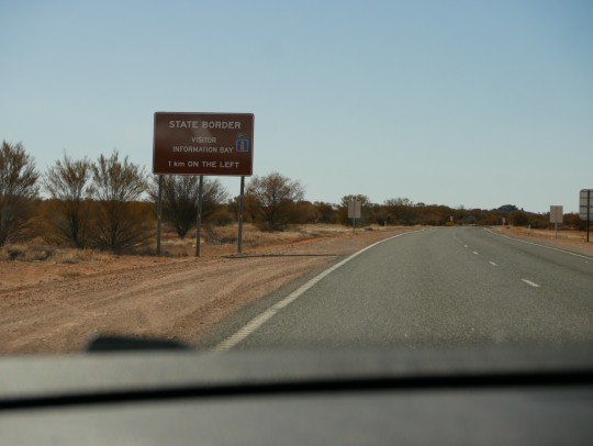
July 17
1,878km to Katherine
The NT border is now open

Today is the day. The NT border opened at midnight to all travellers - other than Victorians, Sydneysiders, or people with recent travel to either. We've been waiting four months for this, since cancelling a trip to the US in March and becoming stranded in ACT/NSW.
But the border is still an awful long way. It will be afternoon by the time we get there. I'll update again when we get there.
For the morning, though, we've explored the eccentric underground town of Coober Pedy. I met some old (SA) friends back in Burra whose eyes got all misty thinking about the place. I can feel the magnetic pull, too.
Our home was an adventure itself. The entry way is an old mine entrance, with the rooms off to the left and right carved from the stone, the jackhammer marks still visible.


The first thing you need to know about living literally under a rock is how quiet it is. No truck compression brakes or dog barks echoing through the living room.
The next thing you need to know is the temperature: it's comfortable all the time, 20-22 degrees in the day, and I caught the thermometer reading about 16 just before bed.
Otherwise, it's an ordinary house. Except the floor is a bit uneven, the water pressure non-existant, and the living room has no windows whatsoever.
Leaving town, we stopped at the Breakaway National Park. Picture Utah's monument valley, without the scale. And tourists - there was no one on the road at all. Breathtaking - albeit cold.
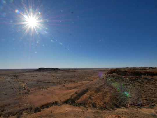
Once the sandcastles marking opal mines faded into the distance, the scenery changed little, and all I could think of was getting across the border. But even from Marla, Alice Springs is another 400kms. Best be patient.
0 notes
Text
July 16
One day until NT border opens
2,128km from Katherine

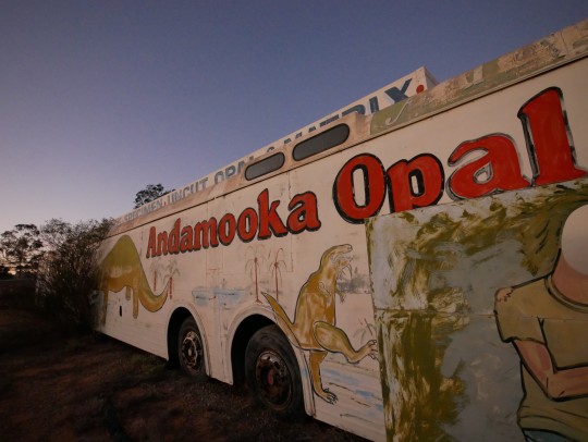
Dawn brings a chill to Andamooka. The thermometer says 2 degrees, but it feels cooler than that as I dash to the shower block. The cottage/shack is well appointed for breakfast - we slice up the loaf of bread our hosts made for us, sip coffee and top up our drink bottles.
But this was only the backup plan: unfortunately the cafe which first attracted me to the town - the Andamooka Yacht Club - has closed down.
The idea of a smashed av and flat white for breakfast in the middle of nowhere was too good to pass up - but it wasn't to be.
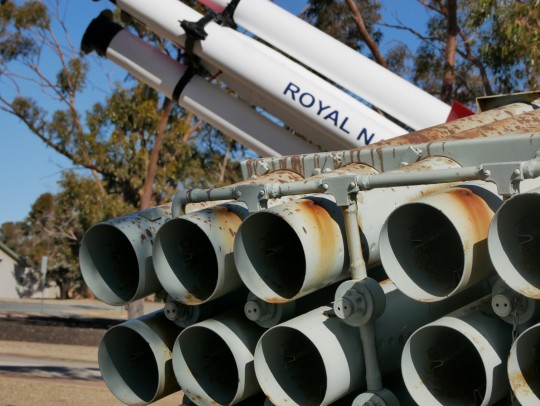
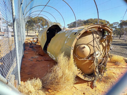
We drive off. Woomera is an hour south, and its the rocket display that piques my interest.
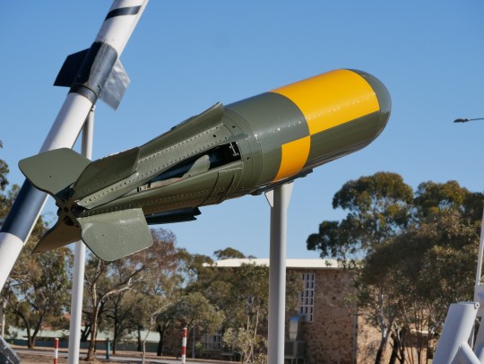

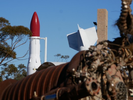


In a park in the centre of town sits a collection of redundant - and disarmed - rockets and bombs with very James Bond code names. Skylark. Black Knight. Blue Steel. There's even the wreckage of a US Army Redstone Rocket, which launched Australia's first satellite from Woomera in 1967.
The town itself housed up to 7,000 Australian and British personnel at its height, but began to wind down in the early 70s. Testing of modern weaponry continues in the prohibitied area, an enormous 170,000 sq km parcel of land to Woomera's west.
Sadly, the Maralinga Tjarutja people were pushed off their land for Britain's atomic bomb tests. More traditional owners were removed at the landing zone near Broome.
Fallout from the tests spread further than anticipated, reaching places like Townsville. 30 per cent of the Australian and British servicemen exposed to the blasts also died of cancer.
Of course the tests were agreed to by an Australian government chastened by the recent Pacific war and fearful of the 'red threat'. The land was finally returned to the Maralinga Tjarutja people in 1984 after an ineffectual cleanup and some miserly compensation. However, testing of non-nuclear weaponry continues at the site.
--
Woomera is better known in recent memory for the immigration detention centre, which was closed down in 2003 and returned to Defence hands.
The site, along with the Baxter facility further south, was the inspiration for the miniseries "Stateless", which details the trauma experienced by the detainees - and the way it divided the country - better than I can.
There wasn't much more to tell of the drive except my very first walk along a dry salt pan (Lake Hart). I was struck immediately with the similarity to ice lakes. There really is just a thin layer of salt - maybe 4-5cm - and through it the sandy desert bottom is still visible. It cakes thickly around any driftwood or manmade objects, but what surprised me is how wet the salt is. Reminds me of the texture of salt baked fish. Only without the fish.
It's late afternoon by the time we head to our Coober Pedy underground bunker. More tomorrow.
0 notes
Text
July 16
One day until NT border opens
2,128km from Katherine

Dawn brings a chill to Andamooka. The thermometer says 2 degrees, but it feels cooler than that as I dash to the shower block. The cottage/shack is well appointed for breakfast - we slice up the loaf of bread our hosts made for us, sip coffee and top up our drink bottles.
But this was only the backup plan: unfortunately the cafe which first attracted me to the town - the Andamooka Yacht Club - has closed down.
The idea of a smashed av and flat white for breakfast in the middle of nowhere was too good to pass up - but it wasn't to be.
We drive off. Woomera is an hour south, and its the rocket display that piques my interest.
In a park in the centre of town sits a collection of redundant - and disarmed - rockets and bombs with very James Bond code names. Skylark. Black Knight. Blue Steel. There's even the wreckage of a US Army Redstone Rocket, which launched Australia's first satellite from Woomera in 1967.
The town itself housed up to 7,000 Australian and British personnel at its height, but began to wind down in the early 70s. Testing of modern weaponry continues in the prohbitied area, and enormous 170,000 sq km parcel of land to Woomera's west.
Sadly, the Maralinga Tjarutja people were pushed off their land for Britain's atomic bomb tests. More traditional owners were removed at the landing zone near Broome.
Fallout from the tests spread further than anticipated, reaching places like Townsville. 30 per cent of the Australian and British servicemen exposed to the blasts also died of cancer.


Of course the tests were agreed to by an Australian government chastened by the recent Pacific war and fearful of the 'red threat'. The land was finally returned to the
Maralinga Tjarutja people in 1984 after an ineffectual cleanup and some miserly compensation. However, testing of non-nuclear weaponry continues at the site.
--
Woomera is better known in recent memory for the immigration detention centre, which was closed down in 2003 and returned to Defence hands.
The site, along with the Baxter facility further south, was the inspiration for the miniseries "Stateless", which explains the trauma experienced by the detainees - and the way it divided the country - better than I can.
There wasn't much more to tell of the drive except my very first walk along a dry salt pan (Lake Hart). I was struck immediately with the similarity to ice lakes. There really is just a thin layer of salt - maybe 4-5cm - and through it the sandy desert bottom is still visible. It cakes thickly around any driftwood or manmade objects, but what surprised me is how wet the salt is. Reminds me of the texture of salt baked fish. Only without the fish.
It's late afternoon by the time we head to our Coober Pedy underground bunker. More tomorrow.


0 notes
Text
July 15
Two days until NT border opens
2,800km from Katherine


The farmland around Burra/Laura is incredibly rich. Nothing expresses that more than the famous Midnight Oil album cover (Diesel and Dust). The simple landscape featuring a striking stone farmhouse, clearly from pioneering roots but long since abandoned. Surrounding the house is rich red soil. Today, that house is ringed with a healthy young crop- and prolific signs telling Instagrammers that the paddock is private property.
I really gelled with the countryside. The wide, smooth hills were frequently dotted with soaring windmills. And soon into view was the Mount Remarkable range, just after the little town of Melrose. We entered the national park and climbed up the windy road into the belly of the park - a stunning gorge, (Alligator Gorge).
And after Wilmington, we climbed the range again - the last mountains between Adelaide and Alice Springs. Threading the needle of Horrocks Pass was an incredible drive. But all too soon the bucolic scene was over, and we were dropping down to the edge of the Spencer Gulf.
At Port Augusta, the seaside of the range, suddenly the faces were black and the local stores a little more shabby. We picked a Vietnamese French bakery and tucked into pies, pasties and Vanilla Slices. But the road beckoned.
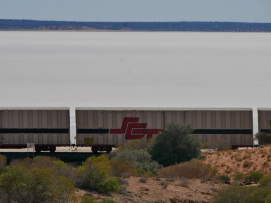
After Portagutta the road rises steadily from the sea, and the features disappear. Just distant, flat-topped ranges to the west, and the shiny steel of the Ghan railway. We saw glimpses of the great empty salt lakes, but sailed on by.
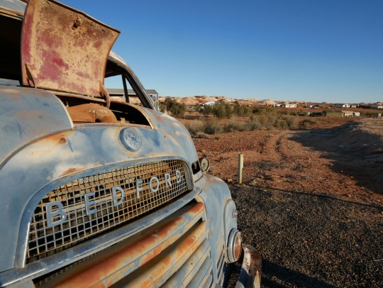
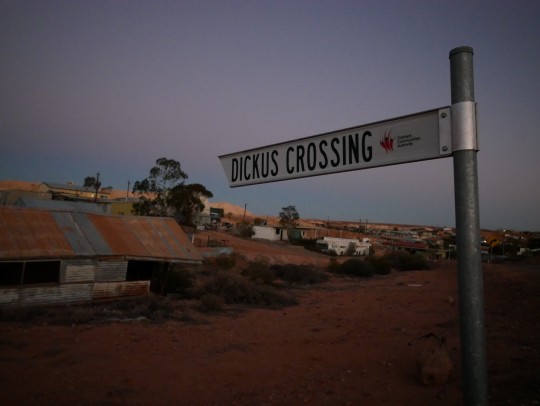
Finally, just before sunset, we enter Andamooka and are met by a haphazard collection of mullock heaps (waste rock) from the opal mines and a jumbled collection of colourfully-named streets (Dickus being my favourite ). We meet our hosts, who've renovated an old stone and fibro shack built in the 1930s. They take us out the back of the property, and on the horizon, just below the purple sky: Lake Torrens. Nice.
1 note
·
View note
Text
July 14
Three days until NT border opens
3,200km from Katherine

Today was all about water. Waking to a stroll along the Murray among fat river gums, we packed, and hit the road west. Most traffic heads south into Victoria, following the Sturt Highway into Mildura and across the mallee into SA. But given the Covid-19 situation, we're hitting the backroads on the NSW side.
And it proved rewarding. Renmark Rd follows the river, before forking with the unsealed Rufus River Rd which skirts the southern levee of Lake Victoria.
It's here where the politics of water are on full display. The natural, oval-shaped lake was locked in the 1920s, reinventing it as a reservoir to supplement and regulate water flows along the lower Murray.
What struck me is that we were standing on NSW crown land, but the infrastructure is owned by SA water. And large signs from the Murray Darling Basin Authority warn s not to enter without its permission.
At minimum, it shows the level of competition for these scarce outback water resources.
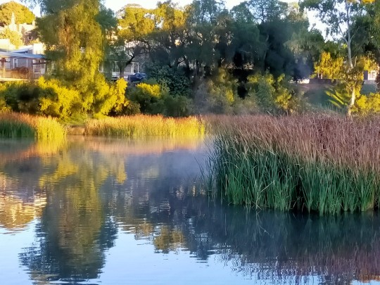
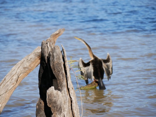
The lake itself is a beauty - stately gum trees line the fringe and pelicans, ducks and black swans lob about the shallow waters. Swallows dart about over head. It's much warmer already, despite the mid-winter chill this morning.
There's almost no-one about, as we climb the levee next to a remote-controlled lock. Which is eerie - I could just imagine fishing shacks and holiday homes lining the shore But nothing. Which is probably how the white settlers wanted it.
'They are a squalid dirty lot'
What I learned visiting the rather comprehensive interpretive site next to the lock is that Rufus River is infamous for a massacre of Barkinji/Maruara people in 1841. On August 27 of that year, the signs tell me, troops and overlanders massacred at least 30 - and possibly as many as sixty - of the local mob at a river crossing. 10 more were wounded.
So the contest over control of water and land has been claiming casualties for a long time.
As horrendous as the event was, I was heartened by the rest of the interpretative site, written with the help of the local elders council. There were well-referenced historical/anthropological notes on life before white settlement, information about traditional foods and custom, and emotional, fist-in-the-air messages about continued connection to the land, despite efforts to drive the mob off the land and onto missions in SA.
It's a nuanced, comprehensive display. The antithesis of "black armband" history. Bravo.
Grapes and goonsacks
After crossing the border, we keep following the river downstream, through the thriving Renmark to Berri. Suddenly the saltbush scrub gives way to mandarin trees and vineyards lining the gentle slopes. It's the valley of Eden: the SA Riverland.
After Berri we continue the backroads through the town of Glossop. Along the way are the biggest wineries I've ever seen - Berri Estates, Banrock Station... Wine by the gallon requires vines by the kilometre. This is the world capital of goon. Every uni student, pensioner and hobo owes a debt to this marvel of Australian engineering.
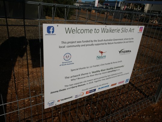

From Glossop, we continue to Waikerie, another member of the Silo Art club, and finally cross the river for the last time at Blanchetown.
From there, the loamy floodplains turn to rocky sheep stations, and eventually the smooth, treeless hills of Burra, covered in young wheat crops. We entered the quaint old copper mining town as the sun set over the range. Beautiful.
0 notes
Text
13 July
Canberra
4,000km to Katherine
This morning we left behind our sensible, suburban house, in our sensible, suburban car, bound for the brash, colourful Northern Territory, some 4,000kms away.
The roadtrip would be difficult at the best of times - accidents, breakdowns, fatigue - but it's 2020, so COVID-19 is the main danger.
The easiest route is through Mildura - but the border with Victoria is closed. So we're skipping the state. We'd dearly love to visit my wife's ailing grandparents - but we'll have to self-isolate, so we're skipping Adelaide, too. The only time things will return to normal - of sorts - is when we cross the NT border late on Friday afternoon, once its frontier opens to one and all.
Crossing the Hay plain was dull, if I'm honest, so I'll save my words for tomorrow.
0 notes
Text
A year on, some closure
I never did finish documenting my epic, 66-hour, round the world trip from Georgia, USA to Chiang Mai. In short: I made it. Looks as though I last reported from the waves of Bondi Beach in Sydney. The coastal walk, surf, steak-and-chips-and-beer afternoon has to be the best 12-hour layover I've ever had. Let's see if I can summarise the rest of the journey for you. Because I've got another one up my sleeve to fill you in on.
SYD-BKK My first flight to Thailand – to anywhere in Asia – was mostly spent asleep, from memory. I'd felt pretty lethargic after wandering around in the heat of Sydney. If not for the thick smoke from nearby bushfires (see previous pic), it probably would've been fine and sunny – so who knows, perhaps i had mild heatstroke. Anyhow, I landed in that collossal steel-and-glass shed that is Suvarnabhumi airport, and settled in for the night. I'd found a disused portable customer service desk, with a row of seat jammed in behind it. It was a perfect spot to tuck my bag in behind and lay down for some sleep. The cavernous check-in hall was echoey and a little chilly, forcing me to rug up and wear earplugs. As I drifted off, a strange sensation came over me: I'm in Thailand. This is home now. BKK-DMK-CNX The strange feeling didn't leave me in the morning, either. I hopped in a hot pink taxi to make the 1-hour journey to Don Muang airport, on the other side of Bangkok. The sweeping motorways of this bulging city, lined with billboards the size of mountains flogging Samsung gear, offered glimpses of suburban Thai life, whizzing by as it was ever so fast. I ached to get out and explore; it made me restless, until a thought occurred to me which made me smile: I have a year to do this. The taxi arrived at DMK, Bangkok's original, rundown hub. I waited for an age for the boarding call, staring out the windows at Don Muang's vast sea of concrete. Approaching the gate, I suddenly panicked – I had way, way too much hand luggage. The 20lb (7kg), one piece rule was clearly being violated by my two (but really three) bags and a lunch pouch, probably 40lbs in all. I had to shed some layers. It was the lunch pouch that had to go – it was a gift for the journey, chock full of sandwiches, nuts, fruit and enough snacks seemingly for a week. It lay in the bin and I passed me AirAsia ticket to the attendant and climbed aboard. I was finally heading home.
0 notes
Photo

But I thought I left LA? - Bondi Beach, 2 November.
1 note
·
View note
Photo

T-minus 20 hours: Bondi beach, Sydney. Best. Layover. Ever.
1 note
·
View note
Quote
"I used to love LA, but the place is falling apart. I feel like I'm living in Chicago during its demise ... I think I'm ready to leave California."
Some tech startup upstart on my flight. (He's right you know: it's time. See you later America. Sydney, let's talk in the morning.)
0 notes
Photo

T-minus 34 hours: Cali, how you build houses out there, I will never understand. I'm in LAX, in search of the nearest power outlet. Watch this space...
1 note
·
View note
Photo

T-minus 49.5 hours: home again, and just in time, I’m ready to collapse! But it’s for one, brief night only. Just enough time for a big feed of Ethiopian and bed before my 8am flight from DCA.
And this will be last night in America for a while. It’s been fun, you guys.
1 note
·
View note
Photo


T-minus 49.5 hours: Screw you, red line.
1 note
·
View note
Photo

T-minus 50 hours: DC at last! I've never been so happy to see this grand symbol of governmental incompetence. I really can't wait to get to bed, though.
0 notes
Photo


T-minus 60 hours: A break from the humdrum highway in Knoxville, TN.
0 notes