
Don't wanna be here? Send us removal request.
Statistics
We looked inside some of the posts by design-between-the-lines and here's what we found interesting.
Average Info
Notes Per Post
2
Likes Per Post
1
Reblog Per Post
0
Reply Per Post
1
Time Between Posts
11 days
Number of Posts By Type
Text
9
Last Seen Tumblr Blogs


Fun Fact
In Q3 of 2020, 31% of US users access the Tumblr app daily.


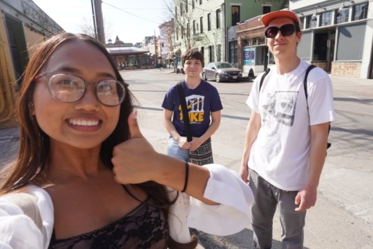
Text
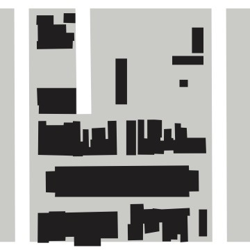
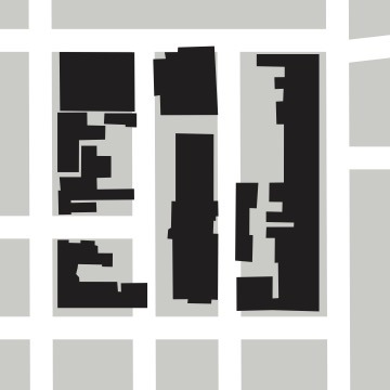
BRT - Findlay Market

BRT Map
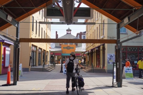
Pedestrian Experience
Walking through Findlay Market is enjoyable because the tall buildings surrounding it provide shade, there is seating at both ends and inside the market, and the variety of shops allows for a unique experience each time. Findlay Market is located between two blocks and is closed to pedestrians. The bright colors of the building made the spot visually appealing. The spot is very clean due to workers cleaning up litter. The one-ways surrounding Findlay Market make it easy to cross the street. Also, there is no blight in the area making it enjoyable to walk through.
Illustrator
History
This neighborhood's history (based off of Findlay Market) starts in 1852, when Findlay Market was founded on land donated by General James Findlay and his wife, Jane Irwin Findlay. In 1855, it was fully built with the iron skeleton under the market we see today, and it is Ohio’s oldest continuously operating public market.
In the early days, the market was originally built to serve the growing immigrant population in the area, especially German immigrants, who made up 60% of the Over the Rhine population. This was because many has been driven out due to economic pressures in Europe. Many of the German immigrants were artisans trained in baking, brewing, and other marketable trades, which led to the market quickly became a central hub for food, goods, and community interaction for those in the neighborhood.
Findlay Market gained popularity over time and became an essential component of the social and economic life of the city. With the market drawing both local customers and tourists from other areas of Cincinnati, it contributed to the development of the Over-the-Rhine district as a vibrant, diversified neighborhood.
However, when urbanization and highway construction brought about economic changes, the area surrounding Findlay Market experienced periods of decline, particularly in the middle of the 20th century. By the 1970s and 1980s, a large number of local firms had shut down, and the once-thriving neighborhood had seen a major decline in investment.
However, there was a revival in the Findlay Market neighborhood in the late 20th and early 21st centuries. Renovations, new companies, and cultural events resulted from efforts to revitalize the market and the surrounding region. With a range of food sellers, artisanal goods, and community gatherings, the market continues to be a hub of Cincinnati's wide diversity and is a cherished cultural landmark.
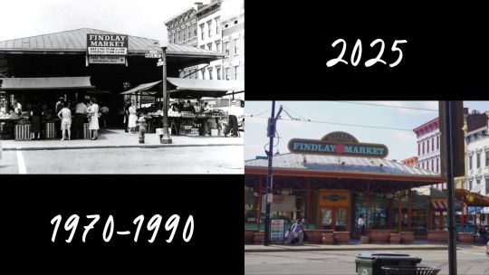
Before & After
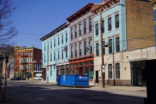
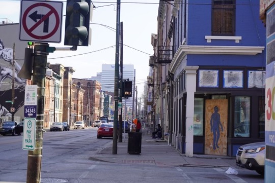
Current Conditions
This area is one of only a few in Over the Rhine that has not been completely redeveloped and gentrified in the past decade. The planned BRT stop in conjunction with a city redevelopment plan that will invest $100 million is going to completely transform the area (Planalp, 2025). The proposed Bus Rapid Transit stop at Findlay Market will service both planned routes connecting the Hamilton Ave and Reading Rd corridors to the historic neighborhood.
The immediate area currently doesn't have the necessary factors to support a BRT station.
There are few to no people living on this section of Vine st.
No shops or restaurants to attract riders
The plaza or green spaces present are not inviting
There are many alleyways blocked off reducing the walkability of the area.
This is not the case one block west on Race st. at Findlay Market with a thriving community of shops and residents. This will also likely not be the case soon as the area is undergoing a large redevelopment.

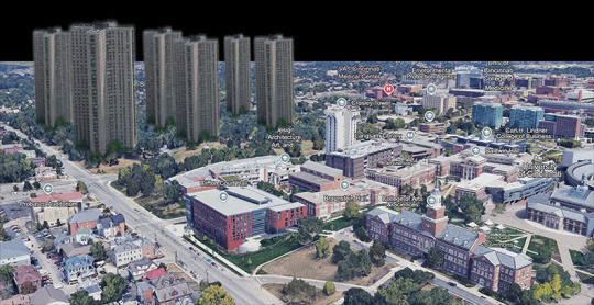
Amenities Map
Our Photos/Surrounding Area

Findlay Market Neighborhood
Debate Question:
How do you revive a neighborhood like Over-the-Rhine that became very segregated, very poor, where no one cared about the inhabitants of it? How do you include the people that are already there in the uplift?
Works Cited:
Planalp , B. (2025, March 20). OTR’s Northward March. Bizjournals.com; Cincinnati Business Courier. https://www.bizjournals.com/cincinnati/news/2025/03/20/otr-north-liberty-street-city-3cdc-rehab-findlay.html
https://www.cincinnati.com/story/entertainment/2022/03/17/cincinnati-history-findlay-market-170th-anniversary-over-the-rhine/6990736001/
0 notes
Text
Blog Post #7
"Tracks to Transformation: Shaping Cities with Transit-Oriented Development"
What are the barriers to TOD in America, and how can cities overcome this issue? Support your view with a successful example of TOD (in or outside the U.S.). Incorporate ideas from one of readings posted on Canvas.
TOD is a sustainable urban development approach that emphasizes high-density, mixed-use development around transit hubs, reducing reliance on cars, and fostering walkable communities. With TOD, everything is able to be closer each other, allowing people to get most of what they need within walking distance. It sounds like an ideal strategy, so how come TOD is not prominent everywhere?

https://trimet.org
BARRIERS TO TRANSIT ORIENTED DEVELOPMENT:
Zoning and Land Use Issues: To no one's surprise, the first barrier is zoning and land use issues. Many localities have zoning laws that support single-family homes and low-density growth, which contrasts with the higher density development typical with TOD. Also, the requirements of TOD are not met by many areas' outdated or restrictive building codes, such as those that make it challenging to construct mixed-use developments.
Political Opposition and Lack of Willingness to Fund: Because TOD projects frequently call for political backing for infrastructure investments and land use changes, some politicians or communities may be against them out of concern about modified neighborhood character or worsened congestion. And although TOD can have long-term positive effects on the economy, the initial expenses, like those for community outreach, infrastructure upgrades, and site acquisition, can be high. Local governments frequently have difficulty obtaining the money/investments.
People Don't Want (Fear) Change: The tendency of organizations to move slow and resist change is called institutional inertia. It makes it extremely hard for projects to get done or even started because it causes difficulties with things like policy reforms and approval processes. NIMBYism where people or organizations may favor certain ideas or advancements in theory or elsewhere, but they reject them in their local community. This opposition usually results from fears about how the development would affect neighborhood character, property values, or quality of life.
SOLUTIONS FOR IMPLEMENTING TOD:
Diverse land use, pedestrian friendly streets, and quality public spaces.
People will feel more comfortable using public transit when there are others using the system and there is safe access to it. Ridership will increase if there are multiple reasons for people to travel along the corridor.

New Haven - Hartford - Springfield Rail Program
Multiple and well integrated transportation options
A large reason for the use of cars is their flexibility, if people feel that public transit cannot provide enough of their trips they will still need to own a car.
Despite higher density, greater incentives for walking, and difficulty of driving and parking, many residents of Clifton Heights around UC still own a car. Likely a few more transit options could be enough incentive for many of them to reconsider car ownership.
Provide alternative options for car users and disincentivize their use in TOD ares.
U.S. cities have already built large sprawling suburbs that people live in. Cars are essentially mandatory for living in these areas so transit there must cope with those conditions and provide tailored options for those people

West Jordan, Utah
EXAMPLE OF TOD IMPLEMENTATION:
Medellin, Colombia has successfully implemented TOD by merging public transport, urban development, and density to boost mobility, inclusivity, and quality of life. The biggest challenge was Medellin's topography.

Google Earth

Network Types: Linear Networks with Feeder Lines
The Metro Lines, BRT, and Tram are the backbone of the city's transportation network and run through the city's center. Other Metro Lines, Bus Routes, Trams, and Cable Car run perpendicular from the main trunk line. The Cable Cars connect hillside communities, which allows informal settlements to have reliable access to the city. This makes reaching schools, hospitals, markets, job centers, and entertainment easier. Multiple modes of transportation encourage people to public transport instead of private cars and help reduce congestion on main roads and from the trunk line. Not only did they implement multiple modes of transportation, but they combined the areas with mixed-use development.
In El Poblado, the Poblado Metro Station serves as a key transit hub, connecting the district to the rest of the city with feeder routes linking it to other areas. There has been significant mixed-use development by having residential towers, office spaces, shopping centers, and entertainment venues concentrated near major transit corridors. This allows people to live, work, and socialize within the same neighborhood, reducing the need for personal vehicles. High-rise buildings are concentrated near transit options, and the streets are walkable, lined with cafés, restaurants, and shops, creating a vibrant and pedestrian-friendly environment.

Metro Cable

Metro Line

Escalator Comuna 13


Bike Share and Parque Biblioteca
DEBATE QUESTIONS:
Can TOD fully replace car-dependent lifestyles, or will people always need to rely on cars in certain regions, regardless of transit availability?
Does TOD truly benefit low-income communities, or does it mostly serve higher-income individuals and contribute to gentrification?
Bibliography:
New Haven - Hartford - Springfield Rail Program. (2018). Nhhsrail.com. https://www.nhhsrail.com/
Suzuki, H., Cervero, R., & Iuchi, K. (2013). Transforming cities with transit: transit and land-use integration for sustainable urban development. Choice Reviews Online, 51(03), 51–160751–1607. https://doi.org/10.5860/choice.51-1607
0 notes
Text
Blog Post #6
Urban agriculture plots are a great way to raise the standard of living in a neighborhood. Giving people access to locally grown fresh fruits and vegetables maintains health, especially in food deserts. Importantly, people can learn how to grow their own food which can be taken with them anywhere. Second, a community garden helps to build community creating safer neighborhoods. As discussed in the article ‘Broken Windows’, once something stops being maintained it quickly degenerates and spreads the feeling of disorder throughout the neighborhood. Community gardens directly combat this by empowering citizens to utilize the unused space in their neighborhood.


As we see in this community garden plot on the corner of Kemper and McMillan in Walnut Hills, an empty lot can be turned into a beautiful gathering space that provides for the people. By creating community focused spaces that promote engagement and health, the standard of living in a neighborhood can significantly increase, all from the labors of the citizens.
0 notes
Text
Blog Post #5
A Street You Go To, Not Just Through
City Square
We have the grid system implemented in Cincinnati, which is all about efficiency, but the city square is missing. Camillo Sitte explains how "...the wealthy class is not depending on open space, while the lower class thrives in it...", so when we develop cities we should think about both sides and not develop for one group. Cincinnati has no City Square but instead has a bunch of individual buildings filling the space. Cincinnati would benefit by implementing a city square because this would allow members of the community of all classes to gather and interact with one another. Right now, the downtown area is filled with shops, so if someone wanted to get the full experience of the area they would have to spend money, a city square would allow everyone to interact and not be limited by money. The closest thing Cincinnati has to a city square is Fountain Square, but it is hidden within the street grid and not prominent within the city.

Google Earth, Fountain Square, Cincinnati

Google Earth, Fountain Square, Cincinnati

https://www.re-thinkingthefuture.com/rtf-fresh-perspectives/a1676-10-things-to-remember-while-designing-city-squares/
Wider Alleyways/Sidewalks
Along with a city square would come more space for activities to happen in the city, if we make sure they are utilized for people.
If you plan cities for cars and traffic, you get cars and traffic. If you plan for people and places, you get people and places.”
- Fred Kent
Having larger areas to walk around in will promote people to get on their feet more. But, how can we make the switch from automobiles to feet when we are so used to getting around with our cars? The answer is interactive and social destinations and activities. We can implement markets, events, booths with activities like making crafts, and active ground floors of buildings.

https://www.pps.org/article/8-principles-streets-as-places
Cincinnati is defined strongly as a city by Lynch’s 2nd and 3rd organizational forms: edges and districts.

(CAGIS Online)
In the above map strong edges are highlighted in pink, mainly waterways, hills, and highways. We can see how these edges have led to the districts as labeled. As opposed to other cities that are in flatter or otherwise less geographically constrained areas, Cincinnati has developed many neighborhoods with distinct styles due to these strong edges. Throughout the past century these divisions have gotten larger due to our developments of the area. Any types of transportation infrastructure should keep these factors in mind, aiming to undo the divisions we’ve created and celebrate the less centralized layout of our city.
0 notes
Text
Blog Post 4
We agree with examples of the 15 units per acre examples the most when it comes to our opinion for ideal density design today. As you can see with the examples from the slides shown in class, they provide space for dwellings and also green space. But, you can see that when compared to Cleveland, Kissimmee and Denver do not utilize the area as much for green space as they do dwellings, even though they are all fitting 15 units. No matter how much (or lack of) space there is, it is important that people can LIVE there, meaning to walk around, play, and relax.

The OTR neighborhood has good density in my opinion. People who live there can access most of their needs by walking or transit and vehicle access is not mandatory. The mixed use development means that there are many services available within the neighborhood and there is still access to public green space.

(Pearson, 2022)
This is the neighborhood boundary used for a recent study of the neighborhood that reported the total number of housing units as 4,871 giving a density of 13.0. Excluding the casino and highway area as there aren’t likely any units there gives 15.1. This is the average across the whole neighborhood

(CAGIS Online)
As we can see in aerial imaging there is good access to green space and there are also other public amenities such as music hall and the school for performing arts. This neighborhood represents a good balance of land use that provides its residents with many of their needs while also providing options for leisure and work.

(Google Earth)
OTR is laid out in the grid pattern and is followed by Downtown. This allows people to travel between both neighborhoods seamlessly. Residents and strangers from OTR can travel downtown without barriers stopping them.
0 notes
Text
Blog Post 3

Clifton Plaza on Ludlow Ave. is a great example of plaza design. The street side faces a T-intersection with a stop light and the back side has a staircase leading to a parking lot and Howell Ave., this makes it very pedestrian accessible. Sandwiched between two buildings with an inset, narrow footprint it provides a reprieve from the busy street. The deciduous maple trees provide shade in the summer and sunlight in the winter can come through the exposed south face. Finally, there are flexible seating options and occasional programming making it a versatile space.


"The Plaza" in Newport on the Levee is a good example of a plaza that I know. It is extremely pedestrian friendly and many people enjoy this area because of its large open space within a larger entertainment district with shops, restaurants, and attractions. The area around it is very interactive, but this designated square allows civilians to walk around, sit, and enjoy the scenic view.

"Journal Square" in Hamilton, Ohio is a plaza that follows Whyte's principles, but there are missing factors. The plaza is physically and visually open to the street on both ends and is connected to a pedestrian intersection. There is no roof, so sunlight is easily let in. There are trees in the plaza's entrance, creating a semi-enclosed space. There are plaques that talk about the history of the city that people can read and abstract structures people can look at. The plaza is open and there are direct paths that allow for travelling conversations. Water sounds, food, and a variety of seating are missing in the plaza. There are only 2 choices of seating, unmoveable chairs and a ledge. I believe what made the plaza comfortable and inviting for people is the connection to the sidewalk, street, and pedestrian intersection. These paths feel like they lead to the plaza and makes people want to walk, or chill, through it.
0 notes
Text
Blog Question 2
Haussmann strictly regulated the architectural style of new buildings during his reconstruction of Paris. This led to a very homogenous appearance among the buildings, often spanning whole blocks. They would be termed "Haussmann apartments" (Wikipedia Contributors). As a repository for many old buildings, Cincinnati has a very unique style. This is often disregarded in new developments though when cookie cutter, 5-over-1s are built in their place. Cincinnati could implement more strict styling guidelines retaining the unique style of the city while addressing the need for more housing.

Google Maps
The Plan of Chicago (1909) planned for parkway circuits by creating a cohesive park system making it accessible by car or foot. Cincinnati has lots of parks due to its location and could implement parkway circuits to reduce pollution and give new opportunities for the community. Many parks in Cincinnati run along the Mill Creek and a connection between these features could be made. Mill Creek leads to the Ohio River, so a plan for improving the riverfront could be made. Cincinnati has a beautiful riverfront and should be taken advantage of.

Google Maps
Both Haussmann’s transformation of Paris and Burnham’s planning work in Chicago offer a lot of valuable lessons for urban development, and Cincinnati’s neighborhoods could draw inspiration from several aspects of their approaches. We can grasp inspiration though the contributions of the creation of a unified architectural aesthetic that gave Paris its distinctive look, with uniform facades and proportions. Similarly, like Burnham, we can also focus on creating/enhancing the landmarks that represent Cincinnati's character, though revitalizing historic buildings, incorporating public art projects, and/or adding modern landmarks that provide a sense of identity and place. For Cincinnati, this could be done by encouraging architectural consistency in important historic districts, creating a balance between modern development and preserving the unique architectural heritage that characterizes neighborhoods like Over-the-Rhine and Pendleton.

Berlin Hauptbahnhof (Central Station)


Brandenburg Gate (8 mins) & Reichstag (German Parliament/8 mins)
Bibliography
Wikipedia Contributors. “Haussmann’s Renovation of Paris.” Wikipedia, Wikimedia Foundation, 12 Apr. 2019, en.wikipedia.org/wiki/Haussmann%27s_renovation_of_Paris.
0 notes
Text
Blog Question 1
Towers in the Park would hold the most potential for a sustainable future for urban development because:
Separation Between Travel: The separation between car and pedestrian traffic makes traveling safer and more efficient. This separation allows roads and sidewalks to be bigger and be designed differently. Shortcuts can be made for both cars and pedestrians. Public transportation could connect towers to each other and other cities allowing the communities to be connected.

Green Spaces: By building vertically more land is available for use as parks and public spaces. Roofs can also be used as green space providing multiple outdoor spaces. Cincinnati faces constant problems due to the combined sewer system and replacing paved surfaces with vegetation is one of the best ways to slow rainfall runoff.

Efficient Land Use: Towers in the Park was originally intended to house the total population (3 million) on only 5% of the land. It is able to accommodate more people on a relatively smaller footprint of land by condensing buildings into towers. This allows for dedicating more of the area to green spaces, recreation, and relaxation, contributing to an improved quality of life, even in a dense urban setting. Maximizing the usable space within an urban area is a great alternative when compared to sprawling low-rise development, where not much of the area is left for contributing to other amenities to live good quality lives in a community. The towers being placed in the center and relatively close to one another also adds a bonus to more possibilities of using the area around it.

Incorporation: The towers in the park planning style offers opportunities for creating vibrant and mixed used spaces by bringing together tall buildings with surrounding green areas. This design promotes higher density while maintaining access to open spaces, fostering community interaction and improving residents quality of life. Its flexibility is its greatest strength. It allows seamless incorporation into new developments or existing urban environments by replacing or complementing older structures, optimizing land use, and accommodating modern needs such as walkability, sustainability and urban greening initiatives.
If these communities were connected to each other and other cities by public transportation, would the feeling of segregation be eliminated?
Should all communities be built vertically? When to know when we should build upwards vs outwards?
2 notes
·
View notes