#Landskap Blekinge
Explore tagged Tumblr posts
Visit Tumblr Blog
Explore Tumblr blogs with no restrictions, modern design and the best experience.
Last Seen Tumblr Blogs


Fun Fact
Post activity is at the highest at 4:00 pm EDT; notes peak at 10:00 pm EDT.
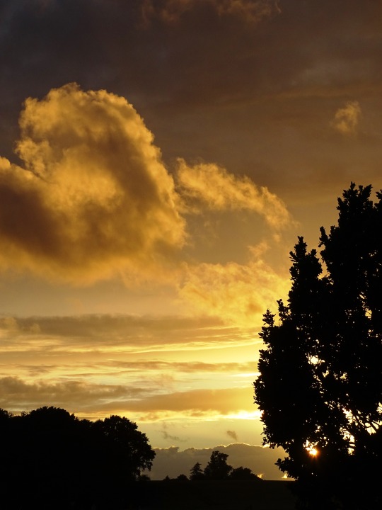
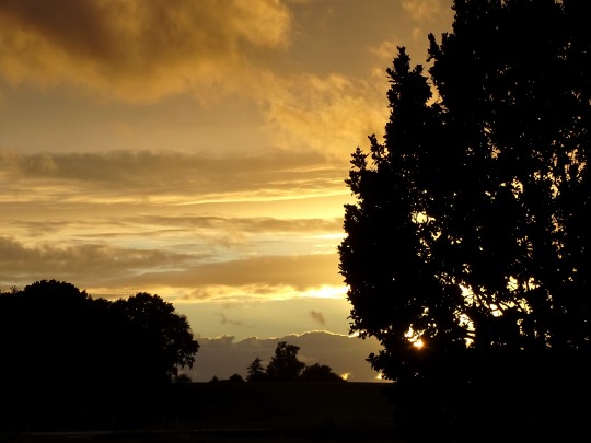
Text
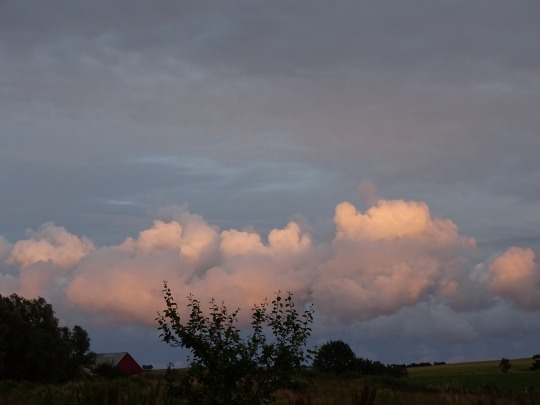
Swedish cottage in late autumn Blekinge län | Blekinge County, Southern Sweden Fredrik Sandén
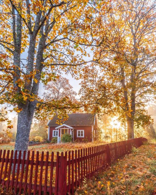
fredriksandenphoto
#Blekinge län#swedish cottage#autumn cottage#scandinavian house#scandinavian countryside#sweden#red house#country living#Fredrik Sandén#cozy cottage life#country life#country aesthetic#autumn aesthetic#cozy cottage#autumn atmosphere#autumn colors#autumn nature#autumn countryside#country autumn#Blekinge County#Ландскап Блекинге#Landskap Blekinge#Sweden#South#Швеция#Südschweden#Sverige#nature photography
1K notes
·
View notes
Text
Blekinges stolthet Mjällby AIF
Blekinges stolthet Mjällby AIF. Av Sveriges fyra sydliga landskap har såväl Skåne, som Halland och Småland haft tydliga framgångar inom herrfotbollen. Skåne har dominanten Malmö FF som just håvat hem sitt 24 SM-tecken, men även Helsingborg har haft nöjet att höja segerpokalen. Halland har i Halmstad en trefaldig mästare och från Småland är det Öster och Kalmar som nått hela vägen fram. Något lag…

View On WordPress
0 notes
Text
Flyga
Flyga över Blekinge/skåne och se vår vackra landskap:) Stanna här och där, stanna vid något trevligt kaffe. Source
0 notes
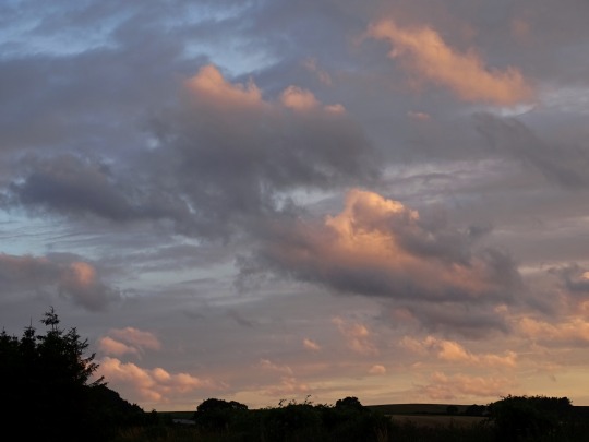
Photo
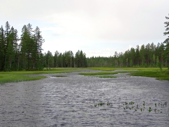
Rastplats Sandsjön, Lenhovda (No. 3)
Småland is a historical province (landskap) in southern Sweden. Småland borders Blekinge, Scania (Swedish: Skåne), Halland, Västergötland, Östergötland and the island Öland in the Baltic Sea. The name Småland literally means Small Lands. The Latinized form Smolandia has been used in other languages. The highest point in Småland is Tomtabacken, at 377 metres (1,237 ft). In terms of total area, Småland is of a similar size as Belgium.
The land is dominated by a forested high plain in which the soil is mixed with sand and small boulders, making it barren in all but the coastal areas and unsuited for agriculture except in certain locations, most notably the Kalmar plains. The province is rich in lakes and bogs. The coast is marked by bays in the north (with an island archipelago offshore) and cultivated flatlands in the south. In total, cultivated land covers 14%, meadows cover 7%, and forests cover 50% of the surface of the province. Other than lacking deep valleys, the landscape is similar to the Norrland terrain found further north in Sweden.
The largest towns are Jönköping in the north-west, Växjö in the south, and Kalmar on the east coast near Öland Island.
Småland comprises the central, eastern, and southern parts of the South Swedish highlands. In detail, the topography of Småland is a series of flat surfaces built upon or deformed by a geological dome. The elevated terrain thought to be a buckle formed as result of far-away forces transmitted to Sweden. The main surfaces are the Sub-Cambrian peneplain, the South Småland peneplain and the "200 m peneplain". These surfaces and others are arranged in a stepped sequence called a piedmonttreppen. In eastern Småland, the Sub-Cambrian peneplain dips gently to the sea. To the West, this part of the Sub-Cambrian peneplain terminates along a north–south escarpment (running slightly to the east of Växjö) that separates it from other flat surfaces. Central and northwestern Småland contains strings of isolated hills.
The lakes and rivers of Småland are associated to zones of weak rock, either fractured, weathered, or both. The many lakes in Småland owe their existence to the creation of basins through the stripping of an irregular mantle of weathered rock by glacial erosion. The Lagan and the Nissan drain western Småland, following for most of their courses zones of weak rock associated with the Protogine Zone. Rusken, Rymmen, and Möckeln lakes are aligned with a more eastern branch of the Protogine Zone. Canyons cut into the bedrock are common in central and northern Småland, with the area near Mörlunda containing various particularly narrow (<50 m) canyons.
Source: Wikipedia
#Rastplats Sandsjön#Lenhovda#lake#water#rest area#woods#forest#travel#summer 2020#original photography#nature#lake shore#tree#flora#tourist attraction#landmark#vacation#Småland#landscape#countryside#Sweden#Sverige#Scandinavia#Northern Europe#tourism#ripples#blue sky#clouds#fir#pinales
6 notes
·
View notes
Text
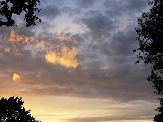
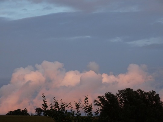
Blekinges 6 vackraste vitsippebackar
Blekinge är ett fint landskap att uppleva våren i. Oftast kommer vårblommorna lite tidigare här än i resten av landet. Och alldeles särskilt vackra är vitsipporna när de blommar i tjocka mattor i skogen i slutet av april eller början av maj. Och inte minst när bokskogen sedan också börjar slå ut. Men var finns […]Blekinges 6 vackraste vitsippebackar

View On WordPress
0 notes
Text
Princess Adrienne’s duchy is really the smallest?
After the announcement of Princess Adrienne’s duchy last Monday, some articles were saying she got the second smallest duchy/province there is in Sweden. Some people also said it was fitting because, after all, she’s 10th in line to the Swedish throne. But others started complaining and saying it was a shitty one.
So, I got to think. Is there really anything related to that fact? Did all the other kids got duchies accordingly to their succession places?
Let me get one thing straight: it’s not a competition of who gets the bigger ones. The King chose them and his children accepted them. I just looked it out of curiosity to see if this argument holds.
So, first things first. Sweden is actually grouped in three parts: Götaland (South), Svealand (Center), Norrland (North). And in those three parts, there are 25 provinces (landskap) that the King decides to ‘give’ to one of his children or grandchildren when they’re born.
I first wanted to know which counties were in each division. In bold there’s the duchies already in use and in italic ones are those which never had a duke or a duchess. So we got:
- Götaland: Blekinge, Bohuslän, Dalsland, Gotland, Halland, Skåne, Småland, Västergötland, Öland and Östergötland. (5 out of 10 duchies in use).
- Svealand: Dalarna, Närke, Södermanland, Uppland, Värmland, Västmanland. (3 out of 6 duchies in use).
- Norrland: Ångermanland, Gästrikland, Hälsingland, Härjedalen, Jämtland, Lappland, Medelpad, Norrbotten, Västerbotten. (3 out of 9 duchies in use).
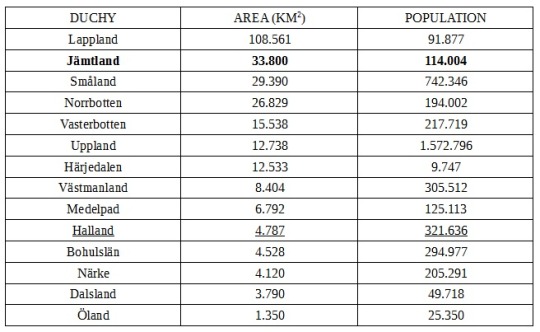
So, I searched and searched for the area and population of each province and the numbers differ from a source to another. I’ll get the one that is closest in numbers to all the others I saw. And since Madeleine has two duchies, I won’t separate them. Our numbers are:
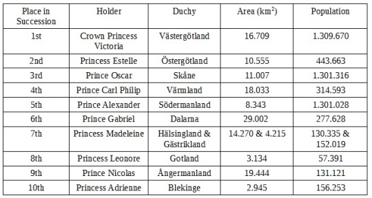
If we were to rank them for it’s area (which is what’s causing all this conversation), it’d be something like this:

We can see above that yes, Princess Adrienne got the smallest duchy. But I was surprised to see that neither Crown Princess Victoria or Prince Carl Philip hold the biggest ones, even though Carl Philip was born Crown Prince. His is bigger than Victoria’s, but way smaller than his son’s. I was also bothered that all the girls are so far down. And we can see that there’s no girl holding bigger duchies than boys. They all got big ones.
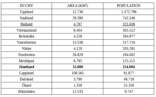
Now let’s see if we rank them by population how this list would be?

was more pleased to see we’ve got the girls a bit more up in the rank than the previous one. And I can’t deny that the King found a way to give Carl Philip’s sons big duchies either in area (for Gabriel) or in population (for Alexander).
And, back to the topic, Princess Adrienne stays in 10th place if we rank her in the succession line, also in 10th place by the size of her duchy, but then she’s a 7th if we rank her by the population of Blekinge. So, I don’t really think people should be calling it a shitty one. It’s fitting at least. Her sister, who was born 5th in line and now is 8th, wasn’t given a bigger duchy back then. The same can’t be said about their brother, though…
It’s also important to note that I only organized them by the number of area and population and didn’t explore it’s economical influence in Sweden’s economy because that’s way too much to search. But each and every county/province has it’s value and it’s richness in culture.
And now, because I had so much fun doing this, let’s compare the other duchies that are left. This will be easier for guessing when they announce another baby for the family (and yes, I’m hoping for at least two more babies). The one underlined belonged to Prince Bertil and Princess Lilian and I don’t believe it’ll be used anytime soon. The bold one belonged to the King when he was just a Prince.
Organized by area:
Organized by population:
So, I hope you guys enjoy reading this. Because I sure enjoyed myself putting it together.
#Swedish Royal Family#SRF#Princess Adrienne#Princess Madeleine#Princess Leonore#Prince Nicolas#Prince Alexander#Prince Gabriel#Prince Oscar#Princess Estelle#Crown Princess Victoria#Prince Carl Philip#Dukedoms#Dukes#Duchess#Royal Fandom#Royal Facts#Royal Math#Sweden#sverige
99 notes
·
View notes
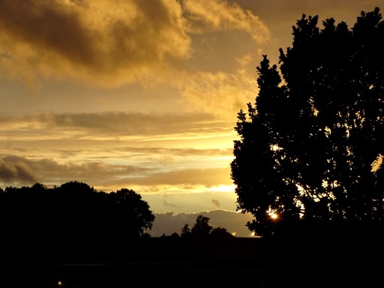
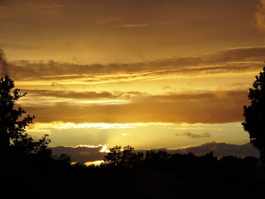
Photo


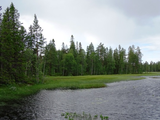
Crown Princess Victoria having fun in Blekinge, where she is visiting the landskapes of the region and is taking part in outdoor activities. || April 13th, 2018
22 notes
·
View notes
Text
boys-say-go replied to your post “boys-say-go replied to your post “me, a stockholmer, but who spent...”
Och jag tycker att typ vällinge och Huddinge låter jättefejk! Men ja ställena på västgötaslätten och längs Bohuslän är jättekonstiga! Kanske vissa har lite norsk influens? Skee?? Skövde? Bollebygd! Jätteknäppt. Bor inte då långt från Bollebygd faktiskt och där finns även Rävlanda, hindås och landvetter. Och Partille. Vad fasen är det för namn... norrländska namn däremot är jättefina! Men undrar fortfarande vad -sele är. Vi har också massa ortsnamn som slutar på -röd, och på vissa andra ställen i västgötland är det -red och i Småland -ryd
tror på ren magkänsla att många av namnen har norsk influens. vet också att när vi kommer in i områden som sverige erörvrat ifrån denmark så är det också mycket dansk influens på namnen. bohuslän var ju danskt (iofs när jag tittar upp wiki sida var det tydligen norsk först men sverige erövera landskapet ifrån danmark på 1658-talet. men typ resten av götaland. asså dessa landskap som av de som fortfarande är sverige införskaffas i freden i roskilde : Skåne, Blekinge, Halland, Bohuslän, tfw när typ allt utom mälardalen är erövrade delar av svenska staten..... )
men å andra sidan, så är ju det språk som är nära besläktade med svenska, så helt annorlunda än svenska blir det ju inte bara för det. bah lite konstigt.
men ja det är västgötaslätten och bohuslän jag tycker är mysko. precis som du.
om -red och -ryd säger wikipedia detta
-ryd har betydelsen 'röjning, röjt område' och förekommer södra och sydöstra delen av Västergötland. Exempel: Kråkeryd, Torkelsryd
-red har betydelsen 'röjning, röjt område' och har sin största förekomst i det tidigare länet Älvsborgs län. Exempel: Hjälmared, Lagmansered, Sandared och Äspered.
samma grej asså, fast med en aning olika uttal!
-röd kunde jag inte hitta
om -sele verkar wiki oense. men den säger att det kan betyda sel, i betydelsen lugn del av en fors. finns inte ännu en sida för ångermannaland men detta hitta jag
-sel betyder 'lugnvatten'.[14] I Norrbotten finns inte efterledet -sele, som det däremot finns gott om i Västerbottens län och i Ångermanland. Exempel på -sel i Norrbotten är Niemisel och Vidsel.
en gissning skulle kunna vara att sel/sele i namnen inte är svenska eftersom de inte rikigt verkar kunna hitta en betydelse. också, rent spontant känns niemisel inte som ett svenskt namn haha.
å andra sidan så ligger långsele å så vidare brevid en fors, så vist skulle det vara logsisk att ha ett sådant namn. är ju inte ort forskare så *axelryckning*
@boys-say-go
här hitta jag alla dessa ändelser på platsnamn i sverige
https://sv.wikipedia.org/wiki/Svenska_ortnamnsefterled
bra källa pga det verkar bara som de kopierad av nån ortnamnsbok!
ÅH FÖRRESTEN GLÖMDE!!
jag växte upp i huddinge haha. heeeelt normalt namn lovar *shifty eyes*
man vet inte riktigt vad det betyder. men tolkningen jag hör är: där uddingarna bor. och uddingar asså som typ som folk som bor på en “udde” eller nåt. asså basically: eeeh en plats. det bor folk där??? inte jätteinformerande måste sägas. så håller med om det namnet är rätt superkonstigt.
jag har ingen aning om vad vällinge betyder, och, vi tycker alla i stockholm att namnet är jättekonstigt lol.
3 notes
·
View notes
Text
SKÅNE LÄN, SVERIGE
Skåne är Sveriges sydligaste landskap. Landskapet består till största delen av den halvö som utgör Skandinaviska halvöns sydligaste spets. I norr begränsas landskapet av Halland och Småland, i öster av Blekinge och Östersjön, i söder av Östersjön och i väster av det smala Öresund som skiljer Skåne från Danmark.
View On WordPress
0 notes
Text
Bästa Landskaps Bilder
New Post has been published on http://www.gallerysea.com/sv/basta-landskaps-bilder/
Bästa Landskaps Bilder
Vi samlade de bästa landskapsbilderna och bilderna för dig. Idag längtar folk som är fångade i staden alltid efter naturen. På helgerna är vi alltid på picknicken där vi cyklar i naturen, naturen går genom bäcken eller genom att sprida sig på gräset. Naturen gör att en person känner sig fri och vilar.
Umeå Tidning – Tävla med din bästa sommarbild
Hans Strand berättar om Island och sina favoritobjektiv
Höstbilder från Blekinge – Mina 5 bästa bilder – Ludwig Sörmlind
10 sajter med gratis bilder du kan använda fritt | Moderskeppet
Höstbilder från Blekinge – Mina 5 bästa bilder – Ludwig Sörmlind
0 notes
Photo


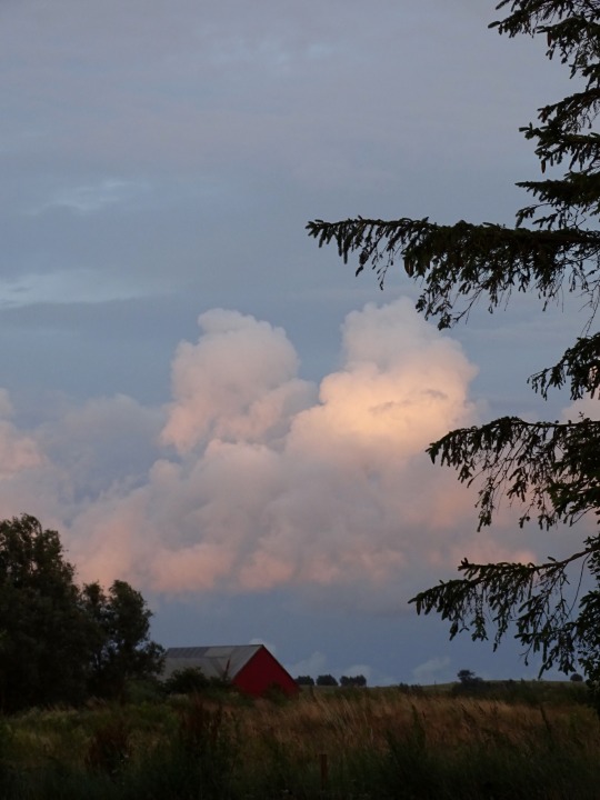
Svedala, Sweden (No. 4)
Skåne, also called Scania, län (county) and traditional landskap (province), southern Sweden. Skåne county was created in 1997 from the counties of Malmöhus and Kristianstad and is coextensive with Skåne province. Occupying the peninsular southern tip of Sweden, it is bounded by water on three sides—the Baltic Sea on the east and south, The Sound (Öresund) on the west, and the Kattegat (strait) on the northwest. On the north it borders the traditional provinces of Halland and Småland and on the northeast the province of Blekinge. The capital of the county is Malmö.
In the southern part of the county, geologic faulting has produced a series of ridges trending northwest-southeast. The area is drained by the Kävlinge River and several streams, but the fault-formed coast has few harbours. Farther north and inland from the flat coastal region, with its beaches and summer resorts, are plains that are among the most fertile in Sweden. Deciduous trees, notably beech, predominate in the southern part, while coniferous trees are found toward the north. Medieval churches and 16th- and 17th-century castles and manor houses are characteristic of the area. After numerous battles Skåne was ceded to Sweden by Denmark in the Peace of Roskilde (1658).
Although the county is of only moderate size, it is of great importance as Sweden’s chief food producer, which is why it is often called the “granary of Sweden.” Among the chief crops are wheat, rye, barley, oats, potatoes, and sugar beets. Though grain production is Skåne’s most significant industry, food processing, shipbuilding, metalworking, manufacturing, stone quarrying, and fishing also are important.
Besides Malmö—Skåne’s principal city and Sweden’s third largest—leading towns include Helsingborg, Landskrona, and Kristianstad. Trelleborg is the country’s southernmost port, while Lund is the cultural centre of southern Sweden. In addition to good transportation links with the rest of Sweden, there are ferry connections with Denmark, Germany, and Poland, as well as an international airport near Skurup, east of Malmö. The Öresund Link, completed in 2000, now connects this region to Copenhagen and Zealand. Area 4,389 square miles (11,369 square km). Pop. (2005 est.) 1,160,919.
Source
#Svedala#Skåne County#evening light#sunset#sundown#sky#clouds#travel#summer 2020#original photography#nature#landscape#vacation#countryside#fields#farmhouse#silhouette#Sweden#Sverige#Scandinavia#Northern Europe#Southern Sweden#near Trelleborg#Scania#colors#golden light#flora#tree#lawn#meadow
4 notes
·
View notes
Photo

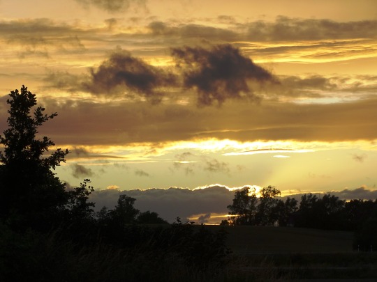

Svedala, Sweden (No. 5)
Scania (Swedish: Skåne) is the southernmost of the historical provinces (landskap) of Sweden. The former province is roughly conterminous with Skåne County, created in 1997. Like the other former provinces of Sweden, Scania is still used in colloquial speech and cultural references, and can therefore not be regarded as an archaic concept. Within Scania, there are 33 municipalities that are autonomous within the Skåne Regional Council. Scania's largest city is Malmö, which is also the third largest in Sweden, as well as the fifth largest in Scandinavia.
To the north, Scania borders the former provinces of Halland and Småland, to the northeast Blekinge, to the east and south the Baltic Sea, and to the west Öresund. Since 2000, a road and railway bridge, the Öresund Bridge, bridges the Sound to Denmark. Scania is part of the transnational Øresund Region.
From north to south Scania is around 130 km and covers less than 3% of Sweden's total area. The population of over 1,320,000 represents 13% of the country's population. With 121 inh/km2 Scania is the second most densely populated province of Sweden.
Historically, Scania was part of the kingdom of Denmark, up until the Treaty of Roskilde in 1658. Denmark regained control of the province during the Scanian War 1676–1679 and again briefly in 1711. Scania was formally included in Sweden in 1720.
Source: Wikipedia
#Svedala#Skåne County#near Trelleborg#Sweden#Sverige#sunset#sky#sundown#evening light#nature#landscape#countryside#flora#silhouette#travel#vacation#summer 2020#original photography#clouds#golden light#fields#tree#farmhouse#architecture#Scania County#Scandinavia#Northern Europe#Southern Sweden
2 notes
·
View notes