#crustal uplift
Explore tagged Tumblr posts
Visit Tumblr Blog
Explore Tumblr blogs with no restrictions, modern design and the best experience.
Last Seen Tumblr Blogs


Fun Fact
Kazakhstan’s Minister of Communications and Informatics has blocked the Tumblr site because it contained 60 sites of terrorism, extremism, and pornography in 2015.
Text
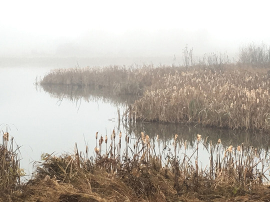
Unveiling the West Swale: A Geological Odyssey Through Time
View On WordPress
#ancient ice sheets#ancient past#Chappell Marsh wetlands#crustal deformation#crustal uplift#dynamic geology#Earth’s crust#Earth’s crust dynamics#Earth’s history#Earth’s mantle#Earth’s surface#environmental impact#Environmental Impact Assessment#environmental preservation#erosion#flood management#geological evolution#geological exploration#geological features#geological forces#geological heritage#geological landmarks#geological legacy#geological narrative#geological observations#geological processes#geological study#geological study areas#geological systems#geological understanding
0 notes
Text
Monday Musings: Large Igneous Provinces
As the name suggests, large igneous provinces are very large accumulations of igneous rocks. Sometimes referred to as LIPs to shorten it (have I mentioned that geologists really like to abbreviate things?) they are often attributed to mantle plumes or divergent plate tectonics. The current minimum threshold to be a LIP is a coverage of 100,000 square km.

Large igneous provinces are created during short-lived igneous events. They often coincide with mass extinction events, global environmental and climatic changes and changes in the hydrosphere and atmosphere. They have played a major role in cycles of continental breakup and formations, new crustal additions from the upper mantle and supercontinent cycles.

So, how are LIPs formed? It’s important to understand how the mantle works and how it interacts with the crust along with lithospheric plate interactions. The mantle is very viscous, more solid than liquid. Its flow is driven by cold crust sinking into it through subduction of lithospheric plates while hot mantle plumes flow upward. We call this mantle convection. Most volcanism occurs due to plate tectonics.

Now, sometimes the plumes rise and spread out radially beneath the plate causing regions of uplift. We call these hotspots. The most famous ones are Hawaii and Yellowstone but there are numerous hotspots across the globe.

The origin of these are hotly contested (pun intended). There are three origins that have been proposed. One is deep, originating near the mantle-outer core boundary.

Another one says some originate from hot lava domes within the mantle. Lastly, some appear to originate in the upper mantle possibly due to the break up of lithospheric plates that have been subducted.

A competing hypothesis to mantle plumes is plate ruptures. Basically, stresses in the lithosphere cause fractures in the plates allowing melt to reach the surface through mantle convection.

Another hypothesis on the formation of hotspots and LIPs involves meteorite impacts. Seven pairs of hotspots and LIPs located on opposite sides of the globe from each other of the same age have been located. When a meteorite impacted oceanic crust, it allowed melt to reach the surface. At the same time, the energy released from the impact converted into seismic waves and propagated across the globe, converging on the exact opposite side of the planet fracturing the crust enough to let massive amounts of magma to erupt.

Likely, there is a LIP in your neck of the woods. In the U.S., we have the Columbia River Flood Basalts in Washington, Oregon and Idaho. It’s actually the youngest and smallest LIP covering about 81 square miles (210,000 km���). It erupted during the Late Miocene Epoch for about 10-15 Ma.

In Europe, there is the North Atlantic Igneous Province centered on Iceland (for obvious reasons). It erupted from the mid Paleocene to the early Eocene epochs between 60.5 and 54.5 Ma. It covers around 500,000 sq miles (1.3 million sq km). It is one of the few that consists of both onshore and offshore flood basalts, sills, dikes, and plateaus.

In Asia, there are the Emeishan Traps a flood basalt in southwestern China. It erupted between 262 and 259 Ma during the Middle Permian Period. It covers 155,343 sq miles (250,000 sq km2). It is associate with a minor mass extinction event.

The Gondwana LIP is associated with the breakup of the supercontinent of Gondwana about 183 Ma which now consists of South America, Africa, Antarctica and Australia. The flood basalts are mostly in South Africa and Antarctica. It erupted during the Early Jurassic Period and is associated with the major Triassic-Jurassic extinction event. It spans about 3x10 ^6 km2 before the supercontinent broke apart.

During the early Cretaceous about 136-132 Ma and=other flood basalt occurred in South America (and a bit in Africa) called the Paraná-Etendeka Plateau. It covered 390.000 sq miles (1,000,000 sq km2). There was also a silicic component to this province, ignimbrites (hardened tuff) from explosive eruptions. The pyroclastic sheet has a thickness between 130-980 ft (40-300 m). This makes it the largest known explosive eruption on Earth.

In India are the famous Deccan Traps which erupted during the Late Cretaceous and early Paleogene Period meaning it spanned the K-Pg Extinction Event that killed the non-avian dinosaurs. They cover an area of 200,000 square miles (500,000 sq km) and may have contributed to the extinction event.

The Siberian Traps cover a vast majority of Russia (which is impressive considering the size of Russia. It is one of the biggest volcanic events, spanning 500 million years and covering 3 million sq miles (7 million sq km2). It spanned the Periman-Triassic boundary and may have contributed to the Great Dying, the largest mass extinction ever.

Thanks for joining me today to learn about igneous rocks and tune in tomorrow for some trivia fun. Fossilize you later!

34 notes
·
View notes
Text
Why are the world’s fold mountain systems located along the margins of continents? Bringout the association between the global distribution of fold mountains and the earthquakes and volcanoes. [150 Words] [10 Marks] [2014]
Intro (Micro Notes Format):Fold mountains are formed by the collision of tectonic plates, mostly along continental margins, where compressional forces lead to crustal folding and uplift. Reasons for Location along Continental Margins: Plate Boundaries: Convergent margins (oceanic-continental or continental-continental) are zones of compression. Examples: Himalayas (Eurasian & Indian…
0 notes
Text
Experience Comfort and Relaxation: Hotel with Indoor Pool at Royal Canadian Lodge
Choosing the right hotel can make all the difference when planning an escape to Banff. With its amazing mountain sceneries and unending outdoor explorations, Banff is a dream destination for tourists from across the globe. Though, after a long day of mountaineering, skiing or exploration, there’s nothing quite like coming back to a cozy and comforting hotel with top-class facilities. One such facility which can uplift your halt is a hotel with indoor pool. If you’re searching for the flawless balance of extravagance, suitability and unwinding, Royal Canadian Lodge in Banff is indeed the ultimate choice. It offers a calm indoor pool for round the year amusement, and provides guests with a wide variety of lavish attributes.
This blog explores why Royal Canadian Lodge is the best selection for anybody looking for a hotel with an indoor pool and specify the several features that make it a outstanding option for tourists to Banff.
Why Select a Hotel with an Indoor Pool?
A hotel with an indoor pool provides a wonderful chance for unwinding and restitution, irrespective of the season. Visit Banff in season, an indoor pool lets you to relish a dip, immaterial of what the weather is like outdoor. In colder months, especially in Banff’s long winters, having facility to a warm, welcoming pool is a best way to relax after defying the frigid temperatures. For families with kids, an indoor pool is an ideal place for amusement and entertainment, making it a vital attribute while choosing your accommodation.
The indoor pool is more than just a place to swim at the Royal Canadian Lodge, it’s a cool paradise where you can unwind and revitalise. Whether you’re relaxing after a long day of trekking or warming up after spending a day on the ski slants, the pool zone is planned to offer a calm experience. With clean and relaxed atmospheres, visitors can take a swim in the pool and relish some idle time during their halt.
The Royal Canadian Lodge: Luxury and Comfort in Banff
Positioned on the renowned Banff Avenue, Royal Canadian Lodge is a jewel in the core of the Canadian Rockies. Amongst the best hotels in Banff, it renders visitors with a mix of luxury and comfort. The rooms and suites are elegantly decorated, rendering lavish cabinets and latest amenities that promises a comfortable halt. Most of the rooms render mountain sights, letting visitors to get lost in the elegance of Banff National Park straight from their windows.
Each room is well equipped with a flat-screen TV, free Wi-Fi and first-class bed sheets, making sure that visitors have all they require for a relaxing stay. From cozy normal rooms to spacious suites, Royal Canadian Lodge offers lodging options that provide to single tourists, couples and families alike. Though what really makes it distinct, is the hotel’s careful attention and commitment to render visitors with a unforgettable experience.
Indoor Pool: A Round the Year Retreat
The Royal Canadian Lodge’s indoor pool is a main feature for visitors who seek unwinding during their vacation. The pool area is intended to arouse a spa-like environment, rendering` a tranquil atmosphere where guests can relax at their own will. With crustal clear blue waters and a serene atmosphere, the pool provide a break from the ruckus of day-to-day life.
After a day of climbing Mountain or travelling the picturesque landscapes at Lake Louise, a dip in the indoor pool comforts to relax fatigued muscles and revitalise your body. The year-long accessibility of the pool makes it impeccable way to unwind, irrespective of whether you’re visiting in the hot summertime or the chilly winter season.
Furthermore, the pool area is perfectly maintained, making sure that visitors relish a clean and unique experience during their visit. Families travelling with kids will also like the facility of the indoor pool, as it gives hours of fun for the youngsters and is the best way to relax together as a family post the day replete with outside undertakings.
Banqueting at Evergreen Restaurant
Halt at Royal Canadian Lodge is incomplete without undergoing the dining option of Evergreen Restaurant within the premises. Famous for its emphasis on fresh, locally obtained materials, the restaurant provides a sophisticated feasting experience that exhibits the tastes of the region. Whether you wish a delectable breakfast before moving out for a day of exploiting or a pleasure-seeking dinner served with Alberta beef Evergreen renders visitors with flavoursome meals in a hearty, welcoming ambiance.
The restaurant’s menu features Canadian food with an existing twist, and its assurance to using high-class materials makes sure that every delicacy is unforgettable. Club your food with a glass of wine from the restaurant’s wide-ranging wine menu, or relish a cocktail in the comfortable dining room.
Spa and Fitness at Royal Canadian Lodge
Besides the indoor pool, Royal Canadian Lodge provides numerous fitness facilities that improve your whole experience. Grotto Spa of the hotel is the best place for unwinding, providing visitors an array of cures intended to indulge and energize. From relaxing massages to revitalizing facials, the spa has all you need to feel rejuvenated during your halt.
One of the distinct attributes of the Grotto Spa is its mineral pool. Designed after the natural hot springs that Banff is renowned for, the mineral pool lets visitors to relish the curing features of these warm waters without departing the hotel. Plunging in the warm, mineral-rich water is a great way to release stress, promote muscle unwinding, and enhance blood flow.
With availability of both the indoor pool and spa amenities, Royal Canadian Lodge renders the impeccable atmosphere for respite, unwinding and revitalizing, making it a perfect hotel for guests considering to go for a break from their explorations in Banff.
The Impeccable Escape in Banff
For those contemplating for a mix of lavishness, unwinding and exploration, Royal Canadian Lodge is the perfect abode to halt in Banff. The indoor pool offers a greeting relief after a long day in the highlands, while the spa and dining options make sure that you have all you require for a really entertaining experience. With its prime location, classy facilities, and unique service, Royal Canadian Lodge is the best option for anybody looking for a hotel with an indoor pool. Whether you’re arriving Banff to exploit its natural miracles, unwind in a lavish atmosphere, or enjoy a little bit of both, Royal Canadian Lodge is the perfect destination for a unforgettable and soothing escape.
0 notes
Video
youtube
PLATE TECTONICS Explained in 60 Seconds!
Plate Tectonics and Mountain Building Process The theory of plate tectonics explains how the Earth's lithosphere (the outer shell) is divided into several large and small rigid plates that float on the semi-fluid asthenosphere beneath. The movement and interaction of these plates lead to various geological phenomena, including mountain building. Mountain building, or orogeny, occurs primarily through three types of plate interactions: Convergent Boundaries: When two tectonic plates collide, the crust is either pushed upward to form mountains or one plate is forced beneath another (subduction). This is the primary mechanism behind most of Earth's major mountain ranges. Divergent Boundaries: Where plates move apart, molten rock from the mantle rises to form new crust, sometimes resulting in ridges and underwater mountain chains. Transform Boundaries: These occur where plates slide past each other, causing earthquakes, but are less associated with mountain building. Himalayan Mountain Building The Himalayan mountain range, the highest in the world, is a result of the collision between the Indian Plate and the Eurasian Plate. Here’s a step-by-step overview of the process: Initial Plate Movements: About 200 million years ago, the Indian subcontinent was part of the supercontinent Gondwana. Over time, the Indian Plate broke away and started moving northward at a rapid pace (about 15-20 cm per year). Collision with Eurasian Plate: Around 50-60 million years ago, the Indian Plate collided with the Eurasian Plate. The Indian Plate, being oceanic crust with continental parts, was denser and began to subduct beneath the Eurasian Plate. However, due to the buoyancy of the thick continental crust, complete subduction was halted. Continental Collision: As both plates consisted of continental crust, the collision resulted in massive crustal thickening, which pushed the land upward, forming the Himalayas. This is called continental-continental collision. Unlike oceanic-continental subduction, continental collisions create large, folded mountain ranges rather than volcanic activity. Ongoing Mountain Growth: The Himalayas continue to rise as the Indian Plate is still moving northward at a rate of about 5 cm per year. This ongoing collision leads to the continuous uplift of the Himalayas and frequent earthquakes in the region. Formation of the Tibetan Plateau: The collision also caused the uplift of the Tibetan Plateau to the north, one of the highest and largest plateaus in the world. This uplift is due to the compression and buckling of the crust as the Indian Plate pushed into Eurasia.
0 notes
Text
On the Reykjanes peninsula, land uplift was noticed again. That's according to Benedikt Gunnar Ófeigsson, an expert on crustal movements at the Icelandic Meteorological Office. T...
0 notes
Note
Continuation of theory- a blue sapphire, right? Then again. Even though the crustal looked different. Energon could be lapis lazuli. The colour range is less. But still goes from violet, royal blue, light blue and dark purple. Plus Lapis has a medium toxicity to humans. So yeah, just a theory. Energon is probably not either of those but I was wondering so I made it up
Lapis definitely fits the "has to be toxic" criteria in order to be energon. I am vibing with these rock theories.
New headcanon: I think Starscream is a rock nerd. He studied energon in the Academy and energon is of course a crystal in its natural form. I think the study of it could fit under geology. We also know he was a scientist who visited Earth so it's not strange to think that he visited it with the intent to inspect our ✨cool rocks✨. Now I just can't stop imagining Angry Rock Nerd Starscream.
Bulkhead and Starscream would probably argue over the way Bulkhead enjoys destroying rocks for fun.
"You just shattered mafic iron-rich pyroxene!"
"what"
Then Starscream would rant to Optimus for ten minutes about how the Autobot Code needs a "Respect the Rocks" clause. Optimus would pat him on the shoulder and make him Team Prime's designated geologist just to appease him. Then Starscream would bitch about the kinds of rocks the Autobot base is surrounded by.
"you autobots live surrounded by the most ATROCIOUSLY uplifted Organ Rock Shale i have ever witnessed in my entire function!"
Then Ratchet would of course get in on it like "OH, MY BAD, WE'LL JUST TELL THE ROCKS TO DO BETTER NEXT TIME!"
Arcee would just scoff and say "Oh, so should we have set up base at the 'superior' uplifted shale?"
Then Starscream would be like "yes. my god the Decepticons will win the war at this rate"
Optimus would be left with no choice but to de-stress Starscream by putting a rock in his talons.
"Hold the rock. Be calmed by the rock."
It works.
63 notes
·
View notes
Text
Step 1) Sciencing an old fantasy map
Step 2) I zoomed out. :D
Step 3) Basic physical geography
This is complicated and messy but let's have a go at unpacking it.

These are my cratons (red outlines) and orogens (yellow, dashed) on my continental crust, and my current oceanic crust (pale blue). The idea here is an incipient spreading center - i.e. a baby ocean - breaking bits of continent off the edge of an assembling supercontinent.
Cratons are the most ancient building blocks of continents. Orogens are the major mountain-building events that occur when cratons and continents crash together. Cratons are stable lithospheric crust - they grow over time, and they very much do not like to break up. Orogens often create very thick lithospheric crust, with cold roots that reach deep into the mantle, but they're riddled with faults because of how they were made, and when continents break apart, they will often do so along zones of weakness within an old eroded orogenic belt.
Zigzags represent current mountain ranges. Blue lines represent transform faulting (strike-slip). Arrows represent relative crustal motion.

Here are my current plate boundaries! Green is divergent, blue is transform. Parts of it in that southerly bend are both.
IGNORE THE ARROWS IN THE TOP RIGHT TRANSFORM BOUNDARY THEY SHOULD BE GOING THE OTHER WAY LMFAO
There's also a future boundary developing in the center top area, which may render the current spreading center inactive, but it isn't there yet. Green dashed lines represent areas of continental rifting and subsidence, mostly not well-developed. Blue dashed lines represent areas where strike-slip motion is also being accommodated.

Mountain-building! Red represents current mountain ranges and orogenies. Yellow represents past mountainous regions; these may or may not still be visibly mountainous.
Looking at what's happening here, I think there's been a subduction zone in the east which has quit for whatever reason. Possibly plate dynamics elsewhere have changed the regional dynamic from compressional to extensional and back-arc spreading has taken over. Maybe something jammed up the subduction Hikurangi-style. Orrrr maybe the subduction zone swallowed a previous spreading center. Idk and it doesn't really matter lol.
The biggest mountains are going to be in the top left. This is a continental collision - lots of energy, incredibly thick and buoyant crust on each side. Continental crust does NOT like to subduct, so while that is possible, what I might do instead is have the compressed crust squeeze out the side like sausage meat from a too-tight casing. XD
The mountains in the bottom left will be slightly shorter - these were a former continental collision which is now converting to primarily strike-slip motion, which isn't quite as energetic. Depending on precipitation and climate, they're probably eroding down fairly quickly, and there'll be absolutely massive piles of sedimentary shit hanging around downstream. XD
Most of the remaining mountains ranges will be rift-related. During continental rifting, the crust within the rift thins and subsides, while the edges of the rift are uplifted. These mountains will mostly be not particularly tall - probably 1-3km or so.
I included past orogenic belts because orogenic belts in general tend to have the majority of mineral resources. Gold in particular often forms at depth within mountain roots, and rich deposits can be brought much closer to the surface when the mountains on top of it simply erode away over time. :D
Where to next? I think I'll zoom back in again and fiddle with the geography on a more human scale...
6 notes
·
View notes
Text
New Records of Sea Level Changes in the Fiji Islands- Juniper Publishers
Abstract
New sea level records from the Yasawa Islands in Fiji are presented. Beachrock occurs frequently on the beaches in the zone between mean and high tide levels on most of the islands. They date to the last 4200 years. The present sea level has produced distinct shore marks in the form of under-cut notches, rock-cut platforms and sea-caves in the bedrock, as well as sand accumulations with a clear mean high tide level (HTL). The fieldwork was concentrated in 10 sites. Elevation was measured with a high-precision instrument with respect to HTL. Ages were determined by 17 C14-dates. A +70cm higher sea level was observed, sampled and dated at AD 1530-1673. It was followed by a significant regression of about 1.7-1.8m, killing coral reefs and cutting a new rock-cut platform some 20-30cm above present mean low tide level (LTL). Then sea level rose again to its present position, or slightly above, a level, which remained fairly constant over the last 150200 years. In the last 60 years corals were killed due to a sea level lowering or a severe bleaching episode. After that very stable sea level conditions must have prevailed for the last decades, forcing corals at several sites to grow laterally into microatolls.
Keywords: Relative sea level changes; Regional eustasy; Rotational eustasy; Yasawa Islands; Fiji
Go to
Introduction
Before addressing our research project, it seems appropriate to review the regional background with respect to plate tectonics, regional geography, the interaction of changes in land and sea levels, and especially previous research achievements in Fiji with respect to sea level changes. It seems surprising to note that all previous work has been addressed to interglacial and Holocene sea level change older than the last millennium, because it is the sea level of the last 500-1000 years that have the potential to act as a key to our understanding of what is actually going in present time.
Plate tectonic setting
Fiji is positioned between plates of complex geodynamic force and motion (Figure 1). According to the Fijian Ministry of Land and Mineral Resources [1], the Lau-Colville Ridge and Fiji represent an old dormant island arc ridge (Figure 2). However, this area is still seismically active [2-4]. For example, Suva experienced a M 6.8 earthquake in 1953 and a M 7.1 earthquake in 2009. In the Yasawa Islands area, the subject of this paper, a M 6.8 earthquake occurred in 1902 and a M 6.1 earthquake in 1984 [2].
Geography of the Fiji Islands
The nation of Fiji consists of about 330 separate islands (Figure 3). The main island is Viti Levu with Vanua Levu the second largest. The sea level changes and archaeology of Viti Levu have been studied by [5,6]. The eastern island group known as the Vanuabalavu Islands have been investigated by [7]. Kadavu Island has been studied by [8]. The Yasawa Islands were the target of our own investigations with respect to sea level changes. The Mamanuca Islands have been studied by [9,10].
Changes in land and sea levels
The tide-gauges at Lautoka and Suva on Viti Levu (Figure 3) provide records of the relative sea level changes since 1992 and 1972, respectively. In the vicinity of the tide-gauge stations there are GPS stations measuring the changes in crustal level. Both tide-gauge stations seem very unfortunately placed on heavy harbour constructions resting on soft marine sediments susceptible to significant compaction, and can hardly be used to decipher the present trend of sea level changes [11].
Several authors have tried to apply a seismotectonic zonation of the Fiji Islands (e.g. [12-16]). According to [16] only the Ovalau-Moturiki Islands (just east of Viti Levu) represent stable tectonic conditions, however.
Previous sea level research
As far as we know, there have been no studies of sea level changes conducted in the Yasawa Islands, except for a few notes (e.g. [14]). In this case our investigation brings forward new material. On Viti Levu, the Ovalau-Moturiki Islands, the Vanuabalavu Islands, the Karavu Island and the Mamanucas Islands, there are previous investigations to consider. Before addressing those papers, there are a few general problems to consider.
Radiocarbon dates of marine material need to be calibrated with the so-called reservoir effect satisfactorily well determined. Petchey et al. [17] reports the ages of four modern shell and coral samples. The reservoir ages were around 450 years, a value we adopted and used as 450±30 years in our marine radiocarbon calibration via OxCalv4.2.4 [18]. This makes direct comparisons complicated as, for example, [5] used a reservoir value of 370 years and an old calibration curve [19], and [7] used 438 years and an older calibration technique [20].
The use of datum level is another subject of great difference. Both [5,7] use the lowest astronomical tide (LAT) as their zero- level. This is quite surprising as this level is a theoretic level [21,22] not recognizable in the field. The unfortunate choice of LAT as their zero-level generates problems with respect to the identification of past sea level index points.
Past sea level data can only be referred to MSL (usually more or less arbitrary, however), HTL (morphological features like notches, sea caves, rock-cut platforms and some beach structures) or LTL (microatolls). This implies that sea level graphs with a datum set at LAT become misleading as they show data points above the chosen LAT-datum, which in fact may not represent any higher sea level position.
It seems natural that the nautical charts are referenced to the low-tide level. But geological and biological associations to shore structures, corals in situ or marine shells and corals in shore deposits are all much better related to the high-tide level, which in most cases is very easily identifiable. Therefore the HTL was selected as the ideal datum. The mean-tide level is usually also easy to identify on a beach, as a minor break in slope and concentration of larger particles like coarse sand and gravel [23].
The present tidal range is given as 1.30m by NOAA [21] and maximum 1.84 for Suva and 1.82 for Nadi according to [24]. In the field, a tidal range of 1.51m was measured. The conversion to LAT is not obvious (and we have no information of what value previous authors have used), but it seems that LTL should be about +30cm, MTL about +100cm and HTL about +170cm with respect to the LAT-datum [25].
Finally, it is interesting to note that all the previous papers are devoted to Mid and Late Holocene sea level data, and that there is a general lack of data for the last millennium. This is why the study, being focused on the last 500-600 years' field evidence on sea level changes, will fill a gap in the sea level history of the Fiji Islands [26-27].
Viti Levu: Nunn & Peltier [16] listed 32 C14-dated samples from 11 sites on Viti Levu. Additional dates come from [9,28,29], and our dates from Maui Bay (below). The data are plotted in Figure 4.
From Rove Peninsula (SW Viti Levu), [28,29] have reposted a stratigraphical record spanning the entire Holocene. At around 8000cal.yrs BP marine influence is recorded at the -3m (MSL) level. At 8000 BP, global eustatic sea level was at about -10m [30], suggesting that the Rove Peninsula has been uplifted by about 7m since 8000 BP; i.e. at a mean rate of 0.875mm/yr. Therefore, there are good reasons to dismiss their maximum sea level of about +2.1m dated 4055±575cal.yrs BP (suggesting a mean uplift of 0.525mm/yr).
From Vuda Point, between Nadi & Lautoka, [9] describes microatolls of Porites sp. at 16cm below MTL dated at 6460±70 and 6350±60cal.yrs BP, which corresponds to a sea level position at about +0.8-1.0m. If eustatic sea level at that time was at about -2.0m, the Vuda Point area is likely to have gone up by 2.0m; i.e., at a mean rate of 0.312mm/yr.
Bloom [31] reports the finding of a submarine peat-bed in a drowned valley tributary to the Rewa River east of Suva dated at a depth of -4.5m with a C14-age of 5500±110 BP, corresponding to 6295±111cal.yrs BP. If we assume a eustatic position at that time of about -1.5m, the site would have gone down by 3.0m or at a mean rate of 0.476mm/yr, which seems reasonable for a delta area. Wood at -0.2m in the Rewa River delta has been dated at 4165±245cal.yrs BP. Even this date is likely to represent subsidence, and has therefore been ignored in the sea level graph of Figure 4.
Obviously, there must be differential tectonics involved; uplift of Rove Point, uplift of Vuda Point and subsidence of the Rewa River delta. All the other sites seem to provide a reasonably congruent picture (i.e. stability); viz. sea level at about +0.3m from 5600 to 4900cal.yrs BP, at about±0.0m 4150-3950cal.yrs BP, at about +0.3m around 3350cal.yrs BP and at about -0.5m from 2900 to 1500cal.yrs BP (as illustrated in Figure 4).
Ash [5] investigated three sites along the northeast coast of Viti Levu and had 7 samples radiocarbon dated. He concluded that sea level rose to about +0.45m by 5300 BP and "has since declined at a constant rate". He also claimed: "sea level has not been significantly raised since 1630±250 years BP". The last statement is seriously contradicted by the present findings in the Yasawa Islands, however (below).
The earliest inhabitants of the Fiji Islands were the Lapita people. Kumar et al. [6] reported the finding of charcoal dated at 2583±233cal. BP. Nunn [32] gives an age of the Lapita settlement of "approximately 1350-750BC" (i.e., 3300-2700BP). This is in good agreement with the general Lapita immigration according to [33] and the stratigraphic records from Tavua Island, west of Nadi, by [10].
We investigated a section at Maui Bay on the south-coast including a piece of pottery and shells dated at 4019±103cal. yrs BP (below), suggesting that people might have been present significantly earlier, however
The Ovalau-Moturiki Islands: The Ovalau Island lies just east of Vitu Levi with Moturiki Island close by. They were studied by [34]. According to [34] the islands "have been subsiding very slowly for most of the past few thousand years". According to [16], however, these islands represent stable tectonic conditions, and would hence record regional eustatic changes in sea level.
There are 10 C 14-dates from Ovalau Island and 7 from Moturiki Island [16]. When plotted against time, the data suggest that sea level was at around +0.5m (MSL) in the period 6500-4500cal.yrs BP and at about +0.4 to +0.7m (MSL) in the period 3500-2900cal.yrs BP. Two dates from +1.6m (LAT) of about 5700cal.yrs BP and from +1.5m (LAT) of about 3700cal. yrs BP are problematic [34].
The Vanuabalavu Islands: Nunn et al. [7] undertook an extensive survey of past Holocene and Pleistocene sea levels as recorded by shore notches and marine deposits. The story is backed up by 4 C 14-dates of Holocene deposits (below recalibrated according to the methods used) and 3 Th/U-dates of Last Interglacial material. As mentioned before, they use a theoretical LAT as their zero-datum, which poses problems with respect to the identification of morphological sea level criteria, according to [7] here "typically marked by shore platforms, notches, marine caves and, less commonly, fossil corals and beach deposits". In the text they often talk about elevation with respect to "its modern analogue" (which is to be recommended) and some drawings give elevation with respect to mean sea level (which implies a new zero level about 70cm above LAT).
Nunn et al. [7] observed 3 different shorelines in the Vanuabalavu Islands; an upper +9-10m level of unknown Pleistocene age, a +5m Last Interglacial Level, and a +1-2m Holocene level. Their records have been combined into a shoreline diagram in Figure 5, and supplied with some additional information. The Last Interglacial level (red) seems to go through all sites at a fairly uniform level of about +5m above MTL. The Holocene level (blue) is by no means uniform, varying between around +1m and +2m. Because of the uniform Last Interglacial level, the Holocene irregularities cannot be interpreted in terms of differential tectonics, but have to be from field interpretation; the +2-3m levels on Mago Island are far from clear, on Kaibu Island there are no such levels recorded, on Yacata Island the +2-3m levels are unclear, and this is also the case with the +2m level of Vatuvara Island. Much better and more conclusive are the +1m levels of Vanuabalavu and Namalata Islands. The data presented suggest an elevation of +0.9m to +1.3m and an age of 3540±170cal.yrs BP to 3959±180cal. BP (overlapping at 3745±69 years). Therefore, a +1.1±0.2m level with an age of about 3750cal.yrs. BP is proposed. The microatoll (Porites) at +0.2m on Avea Island is indicative of sea level stability around 4178±180cal.yrs BP at about +0.6m.
On the south tip of the Vanuabalavu Island, there is a big cave named the Qaranilaca Cave. Its floor is given as "approximately 2.1-2.5m above mean low-water spring tide" [35]. This datum is not very useful, but corresponds to 0.8-1.2m above HTL and 1.5-1.8m above MTL. The stratigraphy is interesting [7,35,36]. The top 70cm is a bed indicating human habitation. According to Nunn et al. [7], it represents a significant regression at about 300BP (AD 1788±114cal. yrs). Then follows a 7cm marine bed (with sharp boundaries below and above) at +0.25-0.30cm above HTL. Below that are two beds with human habitation material dated at AD cal. 660 to 1160. At the base, 50cm below HTL and 10cm above MTL, there is a second marine bed of sand and beachrock.
Kadavu Island: Nunn & Omura [8] studied the Quaternary sea level changes on Kadavu Island. Their tectonic interpretation seems hardly tenable. The structural observations, on the other hand, seem quite straightforward; a "reef limestone" reaching +7.1m and dated to the Penultima Interglacial around 210Ka BP (3 Th/U-dates given), an undated "predominant erosional bench" at +2.6-3.4m of assumed Last Interglacial age, and an absence of emerged Holocene levels. This is illustrated in Figure 6.
There is a clear difference in elevation of the three shorelines in Figure 4 (Vanuabalavu) and Figure 6 (Kadavu): The Penultima Interglacial level of +7.5-8.0m on Kadavu seems to correspond to the +9-10m shoreline (green) on Vanuabalavu, The Last Interglacial level at +3m corresponds to the +5m level in Vanuabalavu (red), and the absence of emerged Holocene levels on Kadavu correspond to the +1m level in Vanabalavu (blue). A Penultima Interglacial sea level at +7.5m calls for some tectonic uplift. At the same time, however, the Last Interglacial and Holocene sea levels are indicative of predominant stability. Therefore, it seems to represent an episodic uplift of at least 5m in pre-Last Interglacial time.
Mamanucas Islands: Morrison et al. [10], studied nine cay islands of the Mamanucas Islands, located between Vita Levu and the Yasawa Islands. Cay islands are small sandy islands of low elevation formed on top of coral reefs by the erosional debris of corals, mixed with other marine organisms. They reported C14-ages from 3 cay sand islands. The subsurface ages go back to about 2200cal.yrs BP. All the surface dates belong to the last 600 years. The study has little to contribute to sea level changes. It just supports the notion that sea level had changed from a general rise to a general stability (or fall as proposed by [16]) well before 2200BP.
Morrison et al. [10] studied Tuvua Island in the same island group with respect to sediment stratigraphy and archaeological material. Coral fragments without morphological relation to any beach structure were dated; one at +1.9m (MSL) at 2816±20BP and one at 1.75(MSL) at 3294±21BP, suggesting that sea level was at about the present level, or even somewhat higher. The archaeological remains have ages in full agreement with the age of Lapita immigration according to [32].
Methods
Before going to Fiji, we carefully scanned suitable coastal segments of the Yasawa Islands as recorded on Google Earth images. After that we selected our spots and formulated our fieldwork program. Sometimes, this was not easy because we were not sure how to arrange local transport. In the field, we investigated the morphological characteristics and decided about how to work with respect to levelling, photo documentation and sampling for C14-dating.
We used the mean high-tide level (HTL) as our datum because it was morphologically easily identified. This level is about 70cm above mean-tide level (MTL) or mean sea level (MSL), and about 170m above the lowest astronomical tidal level (LAT). Levelling was performed with a high-precision Kern instrument, implying a measurement accuracy of better than 1.0cm. Microatolls were observed and their upper top surface was measured with respect to the sea level at low tide to the minute of its lowest position. The photo documentation includes several hundreds of images taken by different cameras, including one under-water camera.
Radiocarbon AMS dates were performed by Professor Goran Possnert at the Ångström Laboratory at Uppsala University. The marine calibration was done according to OxCal v4.2.4, with a reservoir effect of 450±30 years applied [36].
Results from Fiji Island
Because the Fiji Islands were going to be the center piece at the UN conference in June 2017 [37] and at the COP23 conference in Bonn in November 2017 [38], there suddenly became an urgent need of a careful sea level investigation in Fiji with respect to present trends and recent to sub-recent changes in sea level. Therefore, we initiated a new sea level project in the Fiji [26]. After studies of coastal segments on Google Earth, we selected the Yasawa Islands as our main target.
Our field studies spanned 3 weeks in March 2017. The locations of our investigation sites are shown in Figure 7, and include four sites on Viti Levu (coastal observations at Denarau west of Nadi and at Maui Bay east of Sigatoka, and the locations of the tide-gauge stations Lautoka and Suva). However, our main investigation concentrated on 10 sites in the Yasawa Islands.
Studies on Viti Levu
The investigations on Viti Levu will be described as shorter notes under this section. The main report on our results from the Yasawa Islands will follow below.
The Lautoka and Suva tide-gauge stations
The study of the two tide-gauge stations at Lautoka and Suva has already been reported on [11]. Our main conclusion was: "Any application of mean trends would produce meaningless values rather misguiding than assisting in the handling of estimation of on-going absolute sea level changes".
This is important, and implies that we must seek other means of establishing the present trend in regional ocean level changes. Consequently, this was our main target in our fieldwork in the Yasawa Islands, besides recording sub-recent to Late Holocene sea level changes.
The Denerau Site
Our first contact with the shores of the Fiji Islands occurred at Denarau. The first observation was that there are absolutely no indications of the shore advancing inland due to sea level rise, on the contrary sea level seems to remain quite stable (Figure 8).
A second observation was that there was an upper limit of dead Patella shells, and a lower limit of living Patella shells (Figure 9). The difference in elevation is 10-20cm, and may suggest that there has been a lowering of sea level in sub-recent time.
The Maui Bay site
At Maui Bay Public Park, on the south coast some 21km east of Sigatoka, the accidental find of an interesting site of past sea level changes led to some important discoveries. There is a thick beachrock deposit outcropping in the intertidal zone of the present beach. Also, there is clear evidence of a somewhat higher sea level. In an erosional depression of a small brook, we found a stratigraphic section, documented in Figure 10. Three generations of shore deposits can be distinguished.
An extensive beachrock deposit has its surface planed into a rock-cut platform (RCP). The high water level was found in direct association only 5cm higher (HTL). The present beach sand deposition, unit III, goes up 110cm above HTL (zero in Figure 10). An older over-grown sand unit (II) goes up 90cm above the top of unit I, indicating that sea level at one time must have been higher than today by about 90cm or a bit less.
Underneath these sand units, there is a third unit (I). It has a 30cm-deep soil at its top, indicating considerable age. A piece of pottery was found at a depth of 10cm (sample 20 in Figure 10), indicating that the soil and sand unit has to be of Late Holocene age. Shells and corals at a depth of 20cm (sample 19) were C14- dated at 4244±26 BP, or 4345±100cal.yrs. BP. A 10cm thick bed of flint-hard beachrock occurs close by. Corals from this bed (sample 17) were C14 dated at 4005±26 BP, or 4019±103cal.yrs. BP. This means that shore unit I has an age of about 4182cal. yrs BP (the mean of the two samples). Obviously, sea level had reached the present level, but hardly above this level (at least not more than 0.5m).
A sea level at about ±0.0m at about 4200 BP is in minor contrast to the results of [5], who has a Holocene sea level maximum at +0.45m at 5300cal.yrs BP. Ash and Ash [39] demonstrated that a proposed +1.6m Holocene maximum [40], in fact, was only at a +0.48m level (MTL). A sea level at about +0.4-0.5m would agree with all three records, however, but strongly contradict a +2m level as suggested by [16].
The piece of pottery found in the soil (sample 20) with a date of 4019±105cal.yrs. BP implies that Lapita people are likely to have already arrived on Fiji by 4000 BP. As this is earlier than considered before (e.g. [10,33,35], it seems necessary to show the piece of pottery (Figure 11).
Results from the Yasawa Islands
The Yasawa Islands is a chain of six main islands and numerous smaller islets spanning 80km in a SW-NE direction (Figure 12). The islands were not charted until 1840. All islands consist of volcanic bedrock (Figure 13). Erosional products generate coastal sand beaches. We undertook detailed sea level studies in 10 separate places. In addition, we made important observations of the coast from the ferryboat as well as the small boats we used for local transportation. As part of our planning for this investigation, we studied all of the islands on Google Earth images.
At Viwa Island 25km to the west of the main Yasawa Islands, three coral samples have been Th/U-dated at the Last Interglacial [8], viz. 126±7ka BP from +2.1m, 128.7±1.6ka BP from 2.85m, and 136±12ka BP from +3.1m. According to [14] "no relatively emerged features of certain Holocene age are known from the Yasawa and Mamanuca Islands". This statement seems valid even today (except for the +70cm level described below).
The present shore forms a distinct line all around the islands of rock-notches, sea-caves and rock-cut platforms, as well as sandy beaches (Figure 14). These morphological elements are closely tied to mean HTL, and therefore constitute an ideal datum for our investigations. Levelling was undertaken with a high-precision Kern instrument with rod-readings of up to 0.51.0cm accuracy.
General coastal observations
All the way from Kuata Island in the south to Bukama Village in the north, we observed very distinct shore morphological elements indicating the HTL; i.e., bedrock notches, under-cut notches, rock-cut platforms, and sandy shore HTL marks.
A few examples of the distinct high-tide shore markers are given in Figure 15a-c. At some coastal segments it seems evident that the coastal sand is also graded to a somewhat higher level (+1m or less), now overgrown and not reached by the waves at the present sea level. This seems to indicate that there was, in sub-recent time, a higher sea level on the order of +0.5 to +1.0m (Figure 16a-b).
There seems to be a general lack of higher shore marks, either from a Late Holocene sea level maximum (as proposed by [16]) or from a Last Interglacial level (as found on Viwa Island to the west).
Bukama Village
We spotted the coast at Bukama Village on the Google Earth images and were attracted by sandy beaches disappearing against rock cliffs and a tombolo spit (Figure 17), both structures of which had a potential for recording changes in present sea level. We accessed the site via a 25km long boat ride from Nabua lodge. This ride provided excellent coastal views of distinct shore morphological features indicating the HTL (under-cut notches and sea caves) and sand beaches with the present HTL clearly visible and an older, overgrown, higher surface from a somewhat higher sea level at about +0.5-1.0m.
An extensive beachrock at point 1 (Figure 18) was C14-dated at AD 611±82cal.yrs. This implies that sea level at that time was at about the same level as today. Judging from the Qaranilaca Cave section on Vanuabalavu Island (section 1.4.2, above), this level was followed by a lower level lasting from about AD 660 to 1160 [35].
The tombolo spit is built out between the mainland and a small island (Figure 17). Figure 19 gives a view from the bedrock hill seawards. The tombolo is built out from the north to the south by converging long-shore drift. The crest, the washing (swash) limit (WL), and the HTL on both sides were leveled with our high-precision instrument (Figure 19 & 20). The vegetated part is no longer reached by normal waves, and was partly formed at a somewhat higher sea level. The crest is successively falling off to the south and there is a total lack of any signs of present rise in sea level, on the contrary stability is evident. At the foot of the rock hill, there is an old, inactive under-cut notch, now filled by sand (Figure 21a). It must have been cut at a former sea level somewhat higher than today. The leveling indicates that the former sea level must have been about 70cm higher than today (Figure 20). Besides the +70cm notch, there are erosional marks in the bedrock at +2.4-2.6m and at +5.5m (Figure 21b). Those marks perhaps represent former sea level notches. We are not sure how to classify them, and leave the question open by assigning them "possible higher sea level notches". No other site with higher notches was observed between Naisisili and Bukama (Figure 22). At Naisisili, there might be one (Figure 31).
Nabua Lodge and Naisisili Village
This site was selected because the Google Earth image showed a long coastalspur (Figure 23), which by precise leveling might provide insight into the present trend of sea level; whether rising, stable or falling. Naisisili Village lies on a sandy flat between the sea and a small brook running parallel to the shore for about 600m. Today, the area of the village is not reached by the normal waves. The sandy ground of the village represents littoral swash deposits at a former sea level in the order of 0.5- 1. 0m higher than today's sea level. The shore spur to the south is graded to a lower level. The situation is illustrated in Figure 24.
The shore spur (spit) was subjected to precise levelling with 7 sections crossing the spit, identifying the present HTL, the sand/vegetation limit, the crest on the seaside, and the lagoonal HTL both the inner side and the foot of the back-side escarpments (Figure 26).
Figure 26 gives the main levels identified along and across the shore spur. The crest falls off from around +2m in the north to +1.5m in the south. The shore spur is 155m long. A C14-date of shells 30cm below surface gave an age of 532±23BP, which in calendar years is AD cal. 1866±82. Assuming an age of about 150 years for the spur to form, it would have been built out to the south at a speed of about 1.0m per year, which seems quite reasonable.
It has taken quite some time and checking of photos at both high- and low-tide to decipher the genetic origin of the red, purple and light blue levels in Figure 26. The foot of the undercut notches (red crosses) forming a perfectly straight level (Figure 26) are neither cut at present HTL nor MTL, but at HTL of a former sea level lower that the present one. In the field, we noted that there was a wide rock-cut platform 20-30cm above low tide level (LTL). Subsequent observations at White Sandy Beach (below) revealed a similar rock-cut episode at a low-stand prior to the building out of the shore spur here discussed.
Figures 27&28 give the sequence of under-cut notches along the bedrock just south of the shore spur and the brook outlet. Present HTL corresponds to the top of the notch, where the flat or concave surface starts to bend out again (yellow line in Figure 28). The leveled base of the notches (red crosses) in Figure 27 corresponds to a former HTL (present MTL lies above).
In summary, we document a former, lower sea level with its HTL about 100cm below the present HTL (Figure 26). The foot of the cliff (Figure 29) and the notches (Figure 27) goes over into an extensive rock-cut platform extending about 20-30cm above present LTL. This former, lower sea level must have preceded the formation of the shore spur. The shore spur, on the other hand, seems to have been built out during a more or less constant sea level during the last 150, maybe 200, years. Therefore, it seems likely that the low sea level stage belongs to the 18th century. This story is built on the observational facts observed at Naisisili, but the full interpretation is admittedly influenced by observations and C14-dates to be discussed later in this paper (especially sections Goat Island, and White Sandy Beach).
Comparing pictures taken at low-tide and high-tide respectively, clearly indicate that present day HTL lies well above the major sea level marks in the form of the foot of cliffs, the base of notches, the floor of sea caves and the top of rock-cut platforms (Figure 30). At Bukama Village, we had some bedrock structures that might represent sea notches at +2.6m and + 5.5m (Figure 21). For the rest of the 25km between Bukama and Naisisili no such levels were recorded, however (Figure 22). At the southeastern tip of the peninsula south of Naisisili Village (Figure 31), there is a very clear bedrock bench that might represent a former sea level at about +2-3m (Figure 31). At Wiva Island, [8] reviewed three coral samples collected at elevations ranging from +2.1 to +3.1m and dated at the Last Interglacial. Our Figure 23 notch may therefore represent a Last Interglacial sea level position at about +2-3m; i.e. the same level as recorded on Wiva Island and Kadawa Island (Figure 6), but about 2m lower than recorded on the Vanuabalavu Islands (Figure 5) Figure 31.
At Nabua lodge, an extensive layer of beachrock occurs all along the shore between MTL and HTL. Shells from the beachrock just outside Nabua lodge (Figure 32; with + marking sample) were sampled and C14-dated at 2799±25BP or 2501±101cal. yrs BP. Beachrock is usually formed just above MTL (but may occasionally even form below mean sea level). Therefore, the age obtained indicates that sea level at about 2500cal.yrs BP was at about the same position as today.
Nanuya Lailai Lodge
A coral reef just off the coast was investigated. A coral colony measured as 130x140cm consists of four minor units. All of those have reached a level so close to LTL that they are now growing laterally instead of upwards; i.e. they are "microatolls", with dead centres. The central part of one of the miniatolls (20x35cm wide) was sampled and C14-dated as "younger than 1955" (i.e., after the bomb effect, and hence not dateable).
Close by, there were two corals grown into columnar "chimneys"; one had a flat surface and was dead, while the other was still alive and growing. The difference in elevation between the top of the dead column and the living column was only 5 cm, indicating the very high sensitivity to depth below LTL. The occurrence of microatolls indicates present sea level stability.
Navutu Stars Resort
At this site, the under-cut notches and rock-cut platforms are closely tied to HTL, as evidenced by Figures 33 & 34.
Beachrock deposits occur at several places around the islands (viz. at Navutu, Yageta, Goat Island and Long Sandy Beach). The beachrock on the shore of Navutu Stars consist of a lower sandy beachrock with occasional shells covered by a conglomeratic gravel unit (Figure 35). Shells from the lower unit were dated at 4331±60 BP or 4479±180 cal.yrs BP (2529±180cal.yrs BC).
Yageta Village
The shore of Yageta Village has been heavily eroded over the past ten years. This has nothing to do with sea level changes, but is the effect of the removal of thousands of sea cucumbers as further discussed in [41].
The village is located on a flat sand plane, which seems to represent littoral deposits from a time when sea level was about 0.5-1.0m higher than today. A sandy beachrock with shells occurs on the present shore (between MTL and HTL). A sample of shells was collected but not dated.
Goat Island
This site was chosen because of its easy access to the strait between Goat Island and Long Sandy Beach. Here Google Earth images showed strong currents and re-deposition of sand, which might record the trend in present sea level; whether rising, falling or remaining virtually stable (Figure 36).
Most of the coast consists of bedrock with a distinct HTL marked by notches and sea caves, which, on a straight line, grade over into the HTL along the sandy shores (Figure 37). In the northeast, the shore projects a sand wedge into the sea. Here, the present beach has a clearly identified HTL and washing limit (WL) as illustrated in Figure 38. We rapidly made two important discoveries, viz. the presence of a former (fossil) shore 30m inland, and the occurrence of a coral microatoll off the shore.
The old shoreline found inland has morphology almost identical to that of the present shore (Figure 38). There is a difference of 70cm between the present and old WL levels (68cm measured), as well as between the present HTL level and the old HTL limit (71cm measured). Therefore, it was safely assume that a +70cm former sea level was documented.
Corals from the old +70cm beach were collected and C14- dated at 815±26BP or cal. AD 1601±143. This implies a time within the period of the Little Ice Age climatic conditions. A high level at that time might, therefore, be surprising. It fits very well, however, with the findings in the Indian Ocean with a +50-60cm higher sea level within the period AD 1550-1700 followed by a low level in the 18th century [42].
Within the big sea cave in Figure 37, it seems that there, in fact, are two levels; the present level in full agreement with surrounding shore marks, and an older level at a higher and deeper level in the cave, which is now overgrown and hence inactive and "fossil" (Figure 39).
In the strait adjacent to the leveled section, we observed a large coral microatoll when passing over it by boat (Figure 40). From Navutu Stars lodge, we had the time of the next low-tide the following morning within a 1-minute precision. Despite thunderstorms and heavy rain we were at the site just in time for the LTL. The distance between the top of the microatoll and the sea level at low tide was measured at 40cm (Figure 41). This is, of course, a very critical depth, preventing vertical coral growth and forcing it to grow horizontally into a microatoll (Figure 42).
We returned the next day, photographed the microatoll under water (Figure 42), measured it, sampled it and tied it into the leveled section (Figure 41). The coral has grown like a pinnacle with a height of about 2m and a diameter of 110x130cm. The surface of the dead coral in the centre of the microatoll was sampled and C14-dated at "106.4±0.3pmC", implying that it was too young to be dated; i.e. AD<1955.
This seems to imply that the coral had been growing upward in columnar form until, in the mid-to-late 20th century, came so close to the low-tide level that it was forced to change growth habit, growing laterally rather than vertically, thus becoming a "microatoll" with a dead centre. This gives evidence of a stable sea level during the last 50-70 years.
The death of the coral top and centre may be an effect of the 1998 coral bleaching event, or a sub-recent lowering in sea level (cf. Figure 9). At any rate, the occurrence of microatolls at Goat Island provides strong indication of a stable sea level over the last decades to half a century. Microatolls were also observed NW of Goat Island.
Long Sandy Beach Lodge
A part of the shore at Long Sandy Beach is subjected to coastal erosion. The erosion has nothing to do with changes in sea level, but is an effect of misplaced seawall and jetties, as further discussed in [43].
Gunu Village
The Google Earth image of the coast at Gunu Village documents a sea level history of 3-4 steps, and a present shore with the building out of double shore spurs (Figure 43). The spurs were subjected to precise leveling in order to see if there were any changes in sea level to be documented (Figure 44).
Both shore spurs were leveled, in eight crossing sections. Figure 44 shows the HTL, used as local zero level, the MTL and the level of the crest of spur-1 and spur 2. The HTL keeps a constant level across the profile. The MTL level lies about 60cm below, which agrees well with the half tidal amplitude at Suva tide-gauge station on Viti Levu. The levels of the crests of spur-1 and spur-2 are almost identical, showing that the change from one level to the other is related entirely to shore dynamics, and not to any change in sea level. The crest of spur-2 is slowly rising from +32cm at 47m to +56cm at 138m. This might be interpreted as a slowly rising sea level trend. The last 15m are characterized by a distinct lowering in the crest level (the leveling reads 19cm). Under no circumstances, however, is there any indications of a current trend for sea level rise.
Shells were collected in a pit dug at the crest of spur-1 at a depth of 40-50cm below the surface. They were C14-dated at 434±23BP or AD cal. 1910±40. This seems to suggest that the spur system has built out during the last century, at a mean speed of about 1to 1.5m per year
Gunu Village itself is located on littoral sand sediments originating from a time when sea level was 0.5-1.0 m higher than today (marked 3a on Figure 43). On Google Earth images there seems to be two additional sea level positions further inland (marked as shores 1 and 2 on Figure 43). They are likely to represent the +0.3m sea level peaks recorded in Viti Levu at about 5300 and 3350cal.yrs BP (Figure 4). The submarine part may perhaps record an additional low sea level (marked 4? in Figure 43). It might be the remains of the 18th century low level, recorded in White Sandy Beach (below).
White Sandy Beach Lodge
White Sandy Beach turned out to become one of our key sites (Figure 45). A short overview report has been presented (Mörner et al., 2017). The various observations will be described below with references to points 1-8 in Figure 45. The present HTL is very well expressed as under-cut bedrock notches and rock-cut platforms at points 1, 3, 4 and 8. The HTL is also well expressed along the sandy shores. The HTL level was used as our zero level. MTL is well expressed in a break in slope of the shore profile, and the accumulation of coarser sand grains and fine gravel grains.
The LTL is marked by the emergence of an extensive shore flat (tan colour in Figure 45), in its outer zone consisting of dead corals. It represents a former rock/reef-cut platform at about 20cm above present LTL. Outside the LTL the depth increases (blue colour in Figure 45) and corals occur, including microatolls with its top 40cm below LTL.
At points 1-4 and at point 8 (Figure 44), there are extensive rocks-cut platforms and under-cut notches, which are closely tied to present HTL and merge over into the active HTL of the long sandy beach. At point 8, this is especially clear (Figure 46). Because of the clear relationship between present HTL and the shore morphology (under-cut notches and rock-cut platforms at the rocky coasts, the HTL marks on the sandy beaches, and the observed tidal cycle), we chose the HTL as our zero level.
Inside the present-day sandy shore, there is a somewhat higher level of littoral sand, upon which the present houses are constructed. These elevated littoral deposits must represent a former sea level position higher than the present one. At points 1 and 3, we found bedrock notches above the present HTL. At point 3, the notch was leveled at 70cm above present HTL (Figure 47).
A former HTL, now 70cm above the present HTL, is identical to the records at Goat Island (Figure 41). In association with the +70cm notch, there is an accumulation of corals, now partly covered by downfallen blocks (Figure 48). A C14-date of a coral dug out from a position under a big block gave 847±24BP or AD cal. 1576±71. This is very close to the age of the +70cm beach on Goat Island dated at AD 1601±143. We may therefore, assume that sea level was 70cm higher than at present within the period AD 1500-1700, without specifying the beginning and end of this period. This fits well with a higher littoral level inside the calls for a corresponding sea level, at least, 25cm higher than present sandy beach in sub-recent time (Figure 48). today when the coral lived (Figure 51).
The episode of downfallen blocks must post-date the age of the corals underneath; i.e., 1601±143cal. yrs AD. It seems likely that the block-fall was triggered by an earthquake. At many sites along the shores of the Yasawa Islands, we observed faults, fractures and collapsed block indicative of seismic activity.
At point 1, there are remains of an old rock-cut platform with under-cut blocks and pillar at an elevation of about 20cm above LTL (Figure 49, Figure 50).
The low sea level following the +70cm high level at about 1500-1700, also trimmed the coral reef and littoral deposits off White Sandy Beach (point 6 in Figure 45) into a rock-cut platform to just above present LTL, with some coral remains emerging 15cm above LTL (Figure 50). A sample from a dead coral now at +15cm above LTL was C14-dated at 388±23BP or AD cal. 1901±29. Another sample 15cm below LTL (Figure 51) was C14 dated at AD <1955 (107.0±0.3pmC). This implies that the dead corals at present LTL are only about 100 and 50 years old, respectively. This seems surprisingly young with respect to the fact that the corals need a minimum depth of 40-60cm. This would fit well with the +70cm sea level. The C14-dates are younger, however. Because present day contamination could not be excluded, a second sample of the -15cm coral was dated. The date 105.1±0.7pmC confirmed the recent date, however. This calls for a corresponding sea level, at least, 25cm higher than today when the coral lived (Figure 51).
The rock-cut platform at present LTL is likely to have been cut at a former HTL when sea level was 110-130cm lower than today. The edge of the dead coral reef is steep, erosive and rapidly falls off to several meters depth. Coral rubble covers the trenches and sea floor outside (Figure 52). This is indicative of erosion at a former lower sea level. Despite available C14-dates, it seems reasonable that this low level occurred in the 18th century.
The main reef body consists of dead corals (Figure 50). Today, it also contains some living corals at depths exceeding 50cm below present LTL. We also observed a number of corals grown into microatolls (Figure 53). The depth at LTL to the surface of the microatoll was measured at 40cm (Figure 50). Samples from the centre of dead corals in two microatolls were C14-dated as <1955 AD (105.4±0.3pmC and 106±0.3pmC). This implies that the coral centra died within the last 60 years, and that the microatoll growth is less than 60 years old and has occurred under stable sea level conditions.
The death of the corals may be due to a sea level lowering or a severe coral bleaching episode (like the one in 1998). The re-establishment of new corals, and the sea level forcing some of them to grow into microatolls (Figure 53) is indicative of stable sea level conditions for, at least, the last 15-20 years.
Figure 53, [42] summarises the records of latest Holocene sea level changes at White Sandy Beach:
I. A +70cm dated at about AD 1500-1700.
II. A low sea level in the 18th century its HTL 20cm above present LTL, and
III. A rise to a sea level position at around the present one, which quite stable sea level conditions (formation of miniatolls) during the last 15-20 years.
Older beachrock deposits occur at points 3, 5 and 7 (Figure 45). They usually occur in the zone between MTL and HTL. The beachrock at point 7 has its surface cut into a rock-cut platform at present HTL. The beachrock at point 5 is a typical intertidal deposit. The beachrock at point 3 is a strongly cemented deposit including large coral fragments (Figure 55). It was C14-dated at 3030±25BP or 2765±82cal.yrs BP. This implies that sea level was at or closely below present sea level at about 2700cal.yrsBP.
Discussion
In the previous section all the field data were presented. Below follow a discussion and synthesis of those data.
General views
The study of sea level changes must be performed in nature itself. This may be a painstaking work, but this is how it must be done. Tempting shortcuts must be avoided. All observations and samples must be referred to a specific benchmark. In our case, we used the present HTL, which was easy to identify in the field. All our elevation values were obtained with a high-precision leveling instrument. Our studies were geographically spread over ten sites in the Yasawa Islands (with a few additional sites on Viti Levu). Chronology was obtained by 17 radiocarbon dates (Table 1).
The mode of sea level changes
The sea level change may follow main long-term trend as suggested by Nunn & Peltier (16), or occur in an oscillatory trend (like observed in the Maldives by [44], and in Goa, India, by [42]). When evaluating and systemising the field observations, one should start from scratch and try to build up the most accurate interpretation, regardless of any outside models.
Evaluating and systemising the field observations
It is well-accepted that sea level was successively rising from the Last Glaciation Maximum low level at about 24ka ago. By about 5500 sea level had reached the present position (Figure 4) . Minor sea level peaks seem to have occurred at 5300 (+0.300.45m), 4100 (±0.0m) and 3350 (+0.30m) cal.yrs BP (Figure 4).
Our records include five sites of pre-historical sea level changes. The Maui Bay site (p. 5-6) records a former sea level position at about ±0.0m, dated at about 4182±163cal. BP. This seems to represent a minor sea level peak (Figure 4). This is in good agreement with the Avea Island date of 4178±180cal.yrs BP and in reasonable agreement with the age of the elevated shoreline by [7] on the Vanuabalavu Islands (above). The beachrock at Navutu Star was C14 dated at 4479±180cal.yrs BP (p. 11). This age is close to the age of the beachrock at Maui Bay on Viti Levu of 4345±100 cal.yrs BP. At White Sandy Beach and Nabua there are beachrock deposits dated at 2765±82cal.yrs BP, and 2501±101cal.yrs BP, respectively. Both dates are indicative of a sea level at or shortly below the present level in the period 2500-2750cal.yrs BP, which fits well with a sea level at about -0.5m as given in Figure 4. At Bukama, there is a beachrock dated at 1339±82cal.yrs BP (AD cal. 611±82). It implies that sea level was at about its present position or shortly below at that time. It seems to have been followed by a regression, judging from the chronostratigraphy of the Qaranilaca Cave on Vanuabalavu Island [35] dating a habitation layer at about present sea level at AD cal. 660-1160. In Figure 56, the dates of the beachrock deposits are plotted with respect to the graph of proposed sea level changes. They all represent periods when sea level was slightly below present sea level. The former shores 1 and 2 at Gunu Village (Figure 43) are likely to represent the 5300 and 3350cal.yrs BP sea level peaks in Figure 56.
Our main sea level story from Yasawa Islands refers to the last 500 years, including
a. A +70cm higher sea level dated at the 16th and 17th centuries,
b. A sea level lowering in the 18th century by about 180200cm (i.e., at -110-130cm),
c. A sea level rise to about its present position during the last 200 years,
d. Some coral environmental changes in the last 60 years, and
e. Quite stable sea level in the last 15-20 years (with formation of microatolls).
The +70cm level is defined with high precision on Goat Island (Figure 39) and at White Sandy Beach (Figure 46). At Goat Island, we have a date of 1530-1673, and at White Sandy Beach of 1501-1646. At Bukama (Figure 20 & 21), there is an old undercut notch at +70cm. At Maui Bay (Figure 10) sand unit II goes 90cm higher than the corresponding sand unit of the present beach. At Nabula, Yageta, Gunu, White sandy Beach and others sites observed from the sea, we noted littoral deposits at a former higher level, estimated between +0.5 and +1.0m.
The subsequent regression is well documented at White Sandy Beach in a rock-cut platform (Figure 50) and under-cut rocks (Figure 49) now about 20cm above the LTL. At Naisisili, there is a similar rock-cut platform 20-30cm above present LTL and very prominent under-cut notches (Figures 28-30), located 100cm below present HTL (Figure 26). Obviously, it is correlating to the layer in the Qaranilaca Cave section, which according to [7] represents a significant regression at about 300BP or with our calibration ADcal. 1788±114 (above).
The subsequent sea level rise brought sea level up to about its present position. At Naisisili there is a 155m long shore spur, which we leveled in details (Figure 25). The building out of the spur is continual for about 150 years (dated at ADcal. 1866±82 at the beginning of the spur). The crest is about 30cm higher in the first part. This might suggest a somewhat higher sea level at the beginning. This might perhaps be relevant in view of the uppermost marine layer in the Qaranilaca Cave section located 0.25-0.30cm above the present HTL (above). At Gunu Village, there is a double shore spur (Figure 43 & 44), built out in quite stable coastal conditions, with a date from the inner spur of AD cal. 1910±40.
Microatolls were recorded and sampled at Nanuya Lailai, Goat Island (Figure 41 & 42) and White Sandy Beach (Figure 53). They were sampled in their dead centre. The C 14-dates are all too young to be dated; i.e., <1955AD. This implies that the corals died in the last 60 years due to a sea level lowering or an extensive coral bleaching episode. A 15-20cm sea level lowering might perhaps be recorded in the Kings Wharf old tide-gauge in the late 1970s [11]. It may be significant that at Denarau (Figure 9) we recorded a 10-20cm sea level lowering in sub-recent time. A major coral bleaching episode occurred at the ENSO event in 1998, and it might, at least theoretically, have generated extensive coral death, too. The present growing microatolls with their surfaces 40cm below present LTL indicate quite stable sea level conditions during the last 15-20 years. This is also indicated by several under-cut notches and rock-cut platforms that exhibit stable morphological conditions.
Summary
The data are combined and summarized in a general sea level curve of the last 7000 years (Figure 56) and a specific sea level curve of the last 500 years (Figure 57), which compiles our findings from the Yasawa Islands. It should be noted that the sea level changes of last 500 years have not been covered by any previous investigations (which were all confined to the Mid and Late Holocene data).
In the graph of sea level change during the last 7000 years (Figure 56) we compare our beachrock data with the new sea level curve of Viti Levu (Figure 4). The dates from White Sandy Beach and Nabua of 2500-2975cal.yrs BP fall in the sea level low of about -0.5m in Viti Levu. The sea level regression at around 3000cal.yrs BP exposed sandy material and led to ground water lowering, both factors of which may have led to beach-rock formation. The date from Bukama of 1340cal.yrs BP also falls within a period where the Vitu Levu data suggest a sea level at around -0.5m.
Figure 56 suggests that sea level peaked at around 5300cal. yrs BP at +0.3m or +0.45 as suggested by Ash [5] with later peats at about 4100cal.yrs BP at ±0.0m and at about 3350cal.yrs BP at +0.3m. This is quite different from the graphs by [9,10,16]. Undoubtedly, the Fiji Islands have suffered partly episodic differential tectonics (e.g., the level of the Penultima Interglacial level on Kadavu Island, Figure 6, is indicative of uplift), and partly differential tectonics within the main island of Viti Levu (Figure 4).
Our main findings are the sea level records of the last 500 years in the Yasawa Islands (Figure 57). This curve seems to apply also for most of the others islands of the Fiji nation. We propose it as a new sea level curve of Fiji, and believe that is predominantly recording the regional changes in eustatic sea level. It is composed of 6 elements:
a. A +70 cm level in the 16th and 17th centuries
b. A -100 cm low level in the 18th century
c. A +30 cm peak in early 19th century
d. Stable sea level condition during the last 150 years
e. Coral death in the late 20th century, due to a 10-20 cm sea level lowering or maybe due to severe coral bleaching at the 1998 ENSO event
f. Quite stable sea level conditions in, at least, the last 1520 years with forced coral growth into microatolls
This implies that high sea levels are recorded at grand solar minima with Little Ice Age climatic conditions, and low sea level at the grand solar maximum in the 18th century. This might be surprising as it is opposite to what one would expect from a glacial eustatic point of view. The sea level fluctuations documented (Figure 57) are very similar to those recorded in the Indian Ocean [42,43], which were driven by changes in Earth's rate of rotation [45]; speeding-up during grand solar minima and slowing-down at grand solar maxima thereby forcing water masses to move in a N-S pattern [27,46]. Now, this process is also documented in the Fiji Islands (which came as a surprise to us). The term applied to this factor is "rotational eustasy" [27] (Table 1).
Conclusion
Our findings are condensed and summarized in Figures 56 &57. From 5500 to 1500cal.yrs BP sea level seems to have oscillated between about +0.5 and -0.5m, with minor peaks at 5300 (+0.3 to 0.45m), 4100 (±0.0m) and 3350 (+0.3m). In the last 500 years, we record high-amplitude change: high-low-high- stable (Figure 57). Those changes were driven by rotational eustasy, not glacial eustasy. In the last 60 years coral reefs died due to a sea level lowering of about 10-20cm or due to severe coral bleaching at the 1998 ENSO event. After that, very stable sea level conditions must have prevailed forcing corals at several sites to grow laterally into microatolls.
This documentation (Figure 57) implies that there is a total lack of signs indicating a present rise in sea level; on the contrary, our results are indicative of quite stable sea level conditions. Consequently, our records may be taken as reassurance for low- laying coasts and islands that potential for flooding in the near future is unlikely.
For more Open Access Journals in Juniper Publishers Please click on: https://juniperpublishers.com/
For more about Juniper Publishers please click on: https://twitter.com/Juniper_publish
#Sea#Ocean Observatories#Biogeochemistry#Juniper Publishers Impact factor#Juniper Publishers Indexed Journals
2 notes
·
View notes
Text
Great Basin National Park: a Historical Rundown
The Great Basin lays just South of the 6 and 50 highway in the US, close to the border of Utah and covers much of Northern and Central Nevada, small parts of Wyoming, Idaho, Organ and California. The area is hardly populated with Baker, NV being the closest town.
In the 1800′s George Montague Wheeler led expeditions in the area as a topographer for the U.S. Army Corps of Engineers, along side him was GK Gilbert; who was the first to write a geological report of the area.
Later on in the 1800′s Absalom Lehman came to the basin in search for gold and other valuable minerals. However, he was unsuccessful and lived life as a rancher selling supplies and food to the miners that came through. By 1855 he made the marvelous discovery of caves above his ranch and began to give tours.
The caves and their tours became a staple of the area and was pronounced the Lehman Caves National Monument in 1922. About 64 years later the Great Basin was named a National Park in 1986.
Let it be told that the history of the Great Basin does exceed that of its story of becoming a national park, or any other instances of human history within it. It is within the rocks that the Great Basin tells its tales.
The Great Basin starts its story in a Neoproterozoic, Cambrian ocean that existed all the way until the Pennsylvania. Through out this time, the ocean levels rose and fell, which is told by the transgression and regression sequences in the ancient sedimentary rocks. It wasn’t until the upper Paleozoic that the tectonic activity shifted the continental shelf environment.
Unconformity lies within the early Mesozoic Era and has not yet been added to the narrative but the story continues on into the Late Mesozoic Era in which faulting and igneous intruding was present due to the Sevier and Laramide Orogenies. The activity of crustal thickening and shortening along with plutonic intrusion was carried out throughout the Early Tertiary Period in the Paleogene Epoch. Low grade metamorphism during the Mesozoic burial beneath thrust sheets occured in the Pole Creek Limestone, Prospect Mountain along with other older rocks from the Neoproterozoic and lower Paleozoic.
Throughout the Cenozoic Era there was much andesitic volcansim. The Snake Range accumulated ash flows, tuffs and conglomerates. Most of the Volcanoes are about as old as the Oligocene of the late Paleogene. From the Oligocene Epoch to the Miocene Epoch of the early Neogene, there is a major extension of Snake Range. The displacement of the Snake Range detachment fractured the upper plate rocks on the South side and exposed the lower plate to the Metamorphic Core Complex
From the Miocene, the entire region was uplifted and broken up by a series of normal faults the created the tilted Basin and Range, along with block faulting. Any further volcanism was of basaltic composition.
As far as the Quaternary climatic changes go, there was multiple instances of Alpine Glaciation, that occurred in the area. Their glacial decomposition left the Lehman Creek moraine at 8100ft and the Dead Lake moraine at 9500ft. The Pleistocene glaciation formed the Lehman Caves. They also eroded the summits of Snake Range. Constant down slope erosion continues to create immense weathering, along with snow that collects in the summit’s hollows. There is still a glacier left to be found in the cirque of Wheeler Peak, along with a rock glacier.
#historical#historical geology#historic#geology#great basin#great basin national park#historical geology of great basin#what is the great basin#what happened in north america#what is the geology of north america#north american great basin#what is#geolgoy#geo#great basin fun facts#nevada#california#idaho#utah#organ#wyoming#nation#national#national parks#usa#united states of america#united states of america national parks#usa national parks#parks#great
4 notes
·
View notes
Text
GOCE reveals what’s going on deep below Antarctica
ESA - GOCE Mission logo. Dec. 9, 2019
Antarctica: below the surface
Despite having completed its mission in orbit over six years ago, ESA’s GOCE gravity mapper continues to yield new insights into our planet. Thanks to this extraordinary satellite, scientists now have a much clearer view of the secrets that lie deep below one of the most remote parts of the world: Antarctica. And while the vast expanse of white ice above may appear relatively uniform, it is a very different story below the bedrock. A layer of ice up to 4 km thick, fierce winds and temperatures that can reach –60°C make Antarctica one of the harshest environments on Earth. This, coupled with the remoteness of this vast icy continent, means that it is difficult and expensive to carry out scientific research, particularly into what lies beneath deep below. Thankfully, data collected from space can offer information that field experiments alone cannot. A paper, published recently in the Journal of Geophysical Research: Solid Earth, describes how scientists used gravity data from the GOCE satellite mission along with seismological models to reveal unprecedented insight into the crust and upper mantle, otherwise known as the lithosphere, below this frozen continent.
Antarctica: below the surface
Dr Pappa from Kiel University in Germany, said, “We are now able to draw conclusions about such things as the depth of the transition from crust to mantle – and these measurements are dramatically different over the 14 million square kilometre region. “Under West Antarctica, Earth's crust is comparatively thin at about 25 kilometres, and the mantle is viscous at less than 100 kilometres. East Antarctica, on the other hand, is an old cratonic shield. Here, the mantle rock still has solid properties at a depth of more than 200 kilometres.” Their new view of the deep 3D structure of the Antarctic has also led to findings about ‘glacial-isostatic adjustment’. Wouter van der Wal, from Delft University of Technology in the Netherlands, said, “This is a key process that determines how the continent responds to current and past ice-sheet thinning. “We found large variations in mantle temperature beneath the continent, which lead to the uplifting and subsiding of the ground with very different speeds across the continent. These new constraints on crustal and lithosphere thickness are also pivotal in the quest to estimate Antarctic geothermal heat flux and how it affects subglacial melting and ice sheet flow.”
GOCE
Dr Pappa added, “These are natural interactions between the ice and the solid earth. Until now, it was not possible to examine these processes more closely in the Antarctic in detail due to a lack of Earth models.” These new findings about the deep structure of Antarctica are also crucial for understanding tectonics. Fausto Ferraccioli, from the British Antarctic Survey, remarked, “Further findings that we can derive from the study concern the former connections between Antarctica and other continents such as Australia, Africa and India.” The research was funded by ESA’s GOCE+Antarctica 3D Earth projects. The international consortium of both projects consists of nine institutions in six European countries. ESA’s Roger Haagmans noted, “These are important findings also in the context of understanding sea-level change as a consequence of ice loss from Antarctica. When ice mass is lost, the solid Earth rebounds and this effect needs to be accounted for in ice volume changes. This can be better determined once the structure and composition of the Earth interior are better understood.” Related links: Journal of Geophysical Research: https://agupubs.onlinelibrary.wiley.com/doi/full/10.1029/2019JB017997 GOCE: http://www.esa.int/Applications/Observing_the_Earth/GOCE Observing the Earth: http://www.esa.int/Applications/Observing_the_Earth Images, Video, Text, Credits: ESA/Planetary Visions/AOES-Medialab. Greetings, Orbiter.ch Full article
24 notes
·
View notes
Photo

[Image: The gentle Basin and Range ridges of central-southern Arizona, under a radiant sun. Dia is tucked away in there somewhere, too.]
◆
Had an art party yesterday. Got to use acrylics for the first time in a while! :^D
I am inspired by Fiachmara's insightful descriptions... I want to share a little bit about the mountains here in the southwest, because they're something of a geological oddity.
Much of the United States Southwest falls into the Basin and Range province. This region is characterized by long, gentle mountain ridges, intercut with sloping valleys, with each range aligned roughly south-southwest. If you've ever driven through the area or watched it pass by through an airplane window, you probably know what I mean; the pattern is really hard to unsee once you see it!
This pattern was formed by an uplifting in the mantle ~20 million years ago, which stretched the lithosphere (the crust and a portion of the mantle-- essentially the tectonic plates) thin. The stress of being distended created faults all across the surface, which in turn created large "blocks" of land that have either subsided and eroded into gentle valleys (called graben) or raised into mountains (called horsts.) Incidentally, this crustal thinning is also part of the reason we have volcanic activity here in AZ, despite being located far inland from the nearest faultline. The Superstitions and the San Fransisco peaks are just two examples associated with this (the former being an extinct caldera, and the latter being a dormant (but very much not extinct!) volcano.)
You can read a little more about the Basin and Range province here, if you fancy.
13 notes
·
View notes
Note
16?
16) Do you have a collection of anything?
I collect rocks!! I bring them back from vacations, hikes, and field trips/field work that I’ve done. I have a three-tiered shelf in my living room with all of them displayed but I’ve been thinking of buying a bigger one because I’m running out of room. I think I have around 50 between my apartment at school and my room back home.
My absolute favorite rock is eclogite, and I recently got a sample of it as a gift! They’re made of omphacite and garnet so they’re green and red. Eclogite forms at depths of around 40km and is usually found at subduction zones. It’s a SUPER dense rock, so once it forms it breaks away from the rest of the crust and kind of drips down into the mantle. This makes the crust above it more buoyant than before and contributes to crustal uplift.
And all that’s way more info than this question required but I love all my rocks and I love eclogite and I haven’t gotten to talk about it in a hot minute lol
2 notes
·
View notes
Text
Geologists challenge conventional view of Earths continental history stability with new study
In a study led by Illinois geology professor Lijun Liu, researchers used previously collected density data from the Earth’s uppermost rigid layers of crust and mantle — known as the lithosphere — to examine the relationship between craton surface topography and the thickness of their underlying lithosphere layer. The results of the study are published in the journal Nature Geosciences. The lack of deformation within the cratons since their formation makes them the longest-lived tectonic units on Earth — surviving supercontinent cycles like the formation and breakup of the supercontinent Pangea, as well as the lesser-known and more ancient supercontinent Rodina, the study reports. “It is generally accepted that the cratons are protected by their thick underlying mantle roots, or keels, which are believed to be buoyant and strong and thus stable over time,” Lui said. Several recent papers from Liu’s research group directly challenge this wisdom by showing that these mantle keels are actually quite dense. In a 2022 study, the team demonstrated that the traditional view of buoyant craton keels implies that most of the Earth’s cratons would be sitting about 3 kilometers above the sea surface, while in reality, their elevation is only a few 100 meters. This requires the lithospheric mantle below the crust to be of high enough density to pull the surface down by about 2 kilometers, Liu said. In another study, the team used gravity field measurements to pinpoint the density structure of the craton keels to find that the lower portion of the mantle keel is most likely where the high-density material resides, implying a depth-increasing density profile below the cratons. In the new paper, the team shows that the lower portion of the mantle keel that has a high density and tends to repeatedly peel away from the lithosphere above when mantle upwellings, called plumes, initiate supercontinent breakup. The peeled-off — or delaminated — keels could return to the base of the lithosphere after they warm up inside the hot mantle. “The whole process is like what happens in a lava lamp, where the cool material near the surface sinks and the warm material near the bottom rises,” Liu said. This deformation history is expressed in some of the more puzzling geophysical properties observed in the lithosphere, the study reports. “For example, the repetitive vertical deformation of the lower half of the mantle keel allows the seismic waves that vibrate the rock vertically to travel faster, compared to the upper half of the keel, which experienced less vertical deformation,” Liu said. The team also determined that mantle delamination will cause the craton surface to rise, leading to erosion. “This is reflected in the strong dependence of crustal thickness on lithospheric thickness, an observation never made before this study,” Liu said. “In particular, there are two major uplift and erosion events in the past, when supercontinents Rodinia and Pangea each separated, the former causing what is known as the Great Unconformity — a feature in the Earth’s rock record shows no evidence of new deposition, only deep craton erosion. This is the reason why we see pieces of ancient lower crust exposed at the craton’s surface today.” With the help of numerical simulations, the team said that this episodic deformation style of the lower craton keels is how the craton crusts survived the long geological history. “We believe this newly hypothesized lifestyle of cratons will significantly change people’s view on how continents evolve and how plate tectonics operate on Earth,” Liu said. Illinois geology professor Craig Lundstrom and Illinois graduate students Yaoyi Wang, Zebin Cao, Lihang Peng and Diandian Peng; and Chinese Academy of Sciences professor Ling Chen contributed to this study. The National Science Foundation and the National Natural Science Foundation of China supported this research.
0 notes
Photo
Geologically, Lake Victoria is relatively young at about 400,000 years old. It formed when westward-flowing rivers were dammed by an upthrown crustal block. During the Miocene era, what is now the catchment area of the lake was on the western side of an uplifted area that functioned as a continental divide, with streams on the western side flowing into the Congo River basin and streams on the eastern side flowing to the Indian Ocean. #uganda🇺🇬 #kenya🇰🇪 #tanzania🇹🇿 (à Lake Victoria) https://www.instagram.com/p/CmAWOLgo6mH/?igshid=NGJjMDIxMWI=
0 notes
Photo


Colour as good as it gets
The bright green variety of beryl hued by chromium and vanadium (see https://bit.ly/1gQbjaj) originates from an unusual concatenation of geological events, in which rocks that are not normally found together are juxtaposed by tectonic forces and interact via the medium of mineralised hydrothermal fluids. Their rarity is due to the geological problem involved in getting beryllium and chromium to come together, since they are concentrated by processes that rarely occur in the same geological setting.
The first is essential to beryl's composition, and comes from evolved silica rich magmas such as granites that come from crustal melting, while the second, as a trace element, provides the colour, and is an element that partitions into the mantle minerals more easily than the melt, and is found in lavas that came directly from the mantle. Most emeralds come from pegmatites, the crystallised element rich stewed juices that remain when most of a granite has crystallised.
In Colombia they occur in black shales that are also rich in pyrite, formed in the anoxic sea floor muds and pyrite crystals are common inclusions. Here Andean uplift and the crumpling of sedimentary sequences have brought rocks containing the two elements close together, and metamorphism has sent pulses of hot element rich fluids between them allowing a mixing of elements that seldom encounter each other in nature.
Buyers should always remain aware of a few points. One general gem trade proverb is that the number of fakes or synthetics is inversely proportional to distance from the mine. The second is that emeralds are nearly all treated, either with oil or epoxy resin, in order to hide the cracks and stabilise the stones. A blue or pink flash as the stone is tilted back and forth while observing it in bright light with a hand lens or microscope is a dead giveaway.
Nearly all the large emeralds the Spanish exported made their way to India, where the stone has always been very popular, via the Philippines rather than Europe. During the period of Muslim rule they were particularly favoured, since green is the colour of Islam. The Mughals, and the Timurids before them (the descendants of Tamerlane) enjoyed carving their gems with names and pictures. They had a particular fondness for engraving spinels (see http://tinyurl.com/mlx4c7m) and emeralds (https://bit.ly/2IqgYSQ), which they called 'the tears of the moon'.
Here we have a 2.4 x 2.1 x 2.0 cm near perfect hexagonal prism sitting on its calcite matrix tinted grey by inclusions of black shale sourced graphite from the Muzo mine
Loz
Image credit: JRob Lavinsky/iRocks.com_ _
151 notes
·
View notes