
Don't wanna be here? Send us removal request.
Statistics
We looked inside some of the posts by 40bastions and here's what we found interesting.
Average Info
Notes Per Post
34
Likes Per Post
32
Reblog Per Post
1
Reply Per Post
1
Time Between Posts
3 days
Number of Posts By Type
Text
17
Last Seen Tumblr Blogs


Fun Fact
Tumblr is used by 21% of adults online aged 18-29 years.
Text
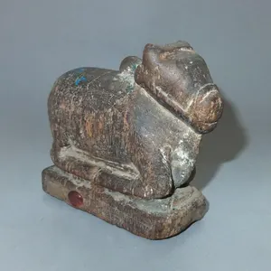
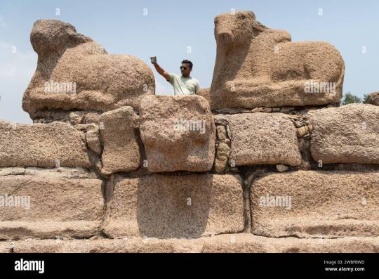
HOLY COW Islamabad
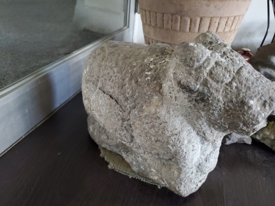


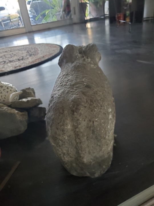
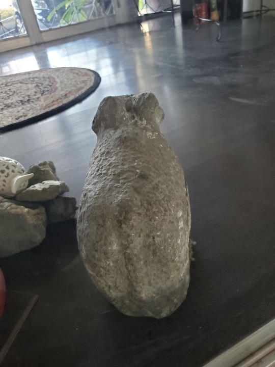

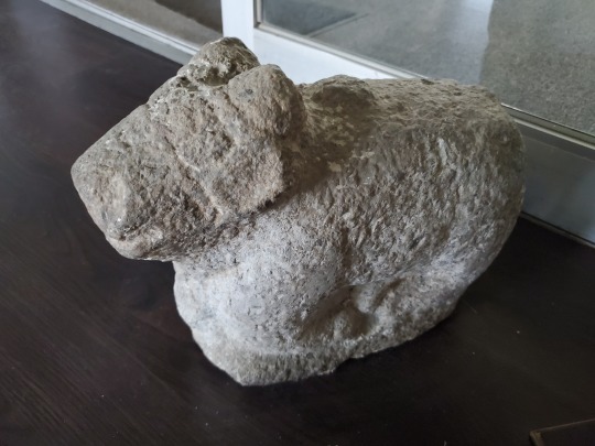
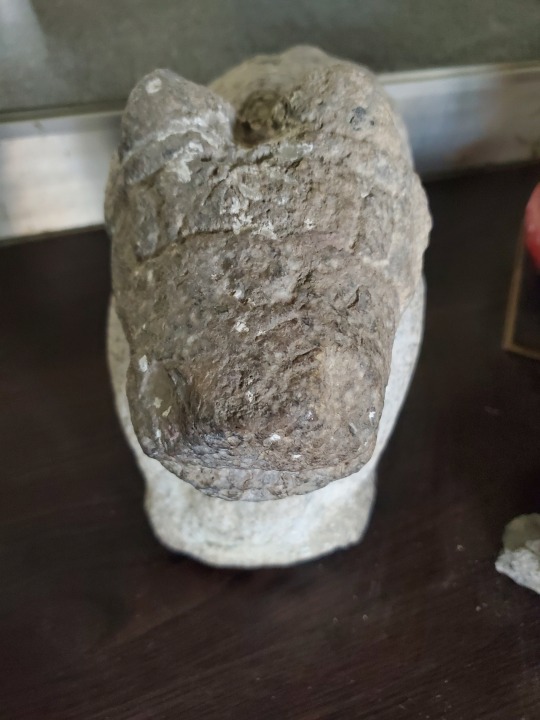

Some kind of dense, heavy stone, likely granite or a similar type of igneous rock
Looks like a cow, bull or hippo in seated position
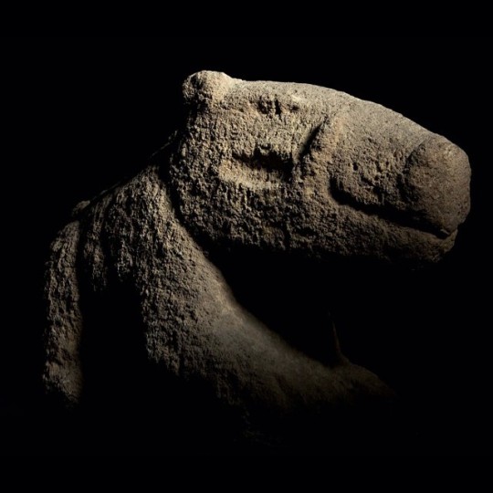
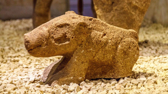
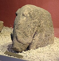
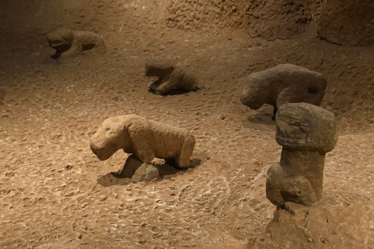
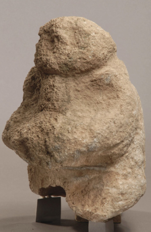
Similar in style to the figurines found at Göbekli_Tepe


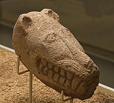


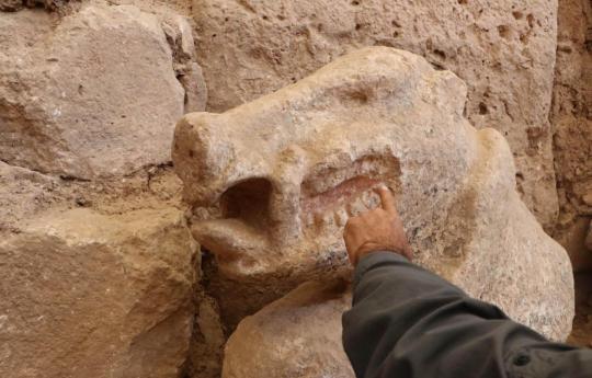
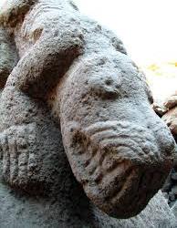
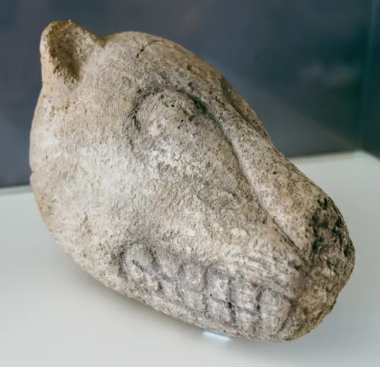
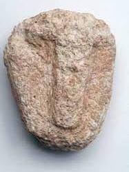
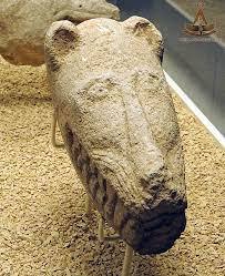
Realistically, it is too heavy to move from Turkey to India so unless there is some proto cultural connection it's more likely local, like a figure Nandi, the bull vahana (mount) of the Hindu god Shiva used to decorate with powderd paint (Gulal). Seems more likely, it was left behind by someone on account of it being too heavy to move
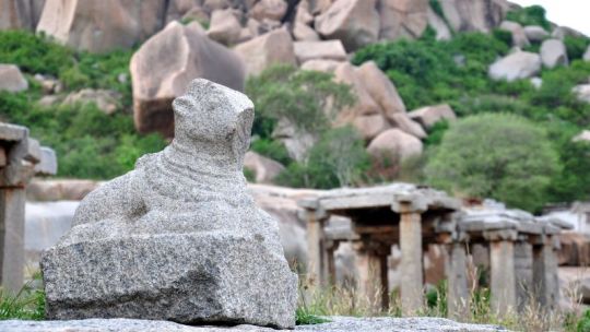
1. The Bull of Kashi (Kashi-Narayan) in Varanasi
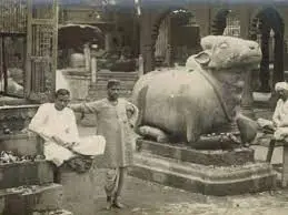
2. The Sphinx like Bull of Anantpur in Andhra Pradesh
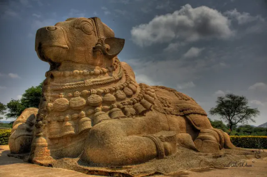
3. Nandi or Yeduru Basavanna of Hampi in Karnataka

6 notes
·
View notes
Text
SADHU KA BAGH aka Buddha Caves, aka Shah Allahditta Caves Margalla Hills - Himalayan foothills


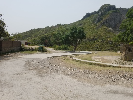
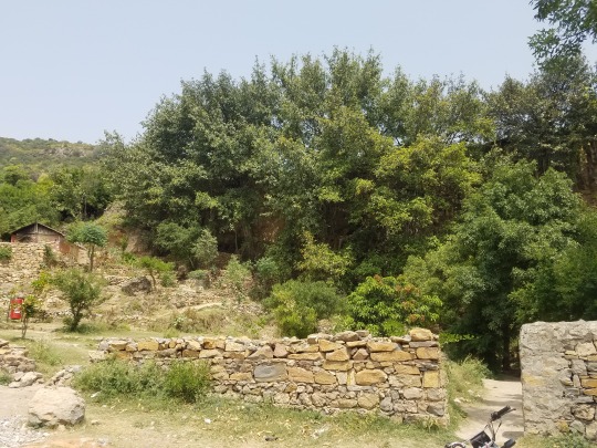
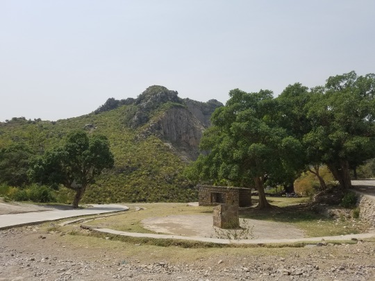

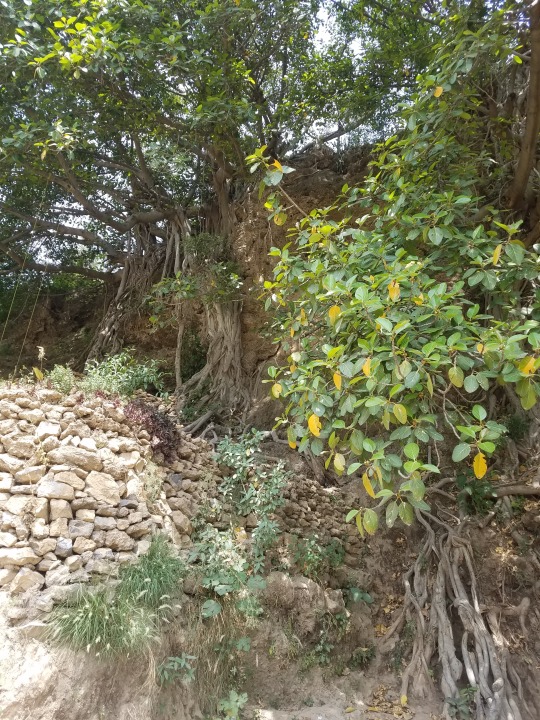
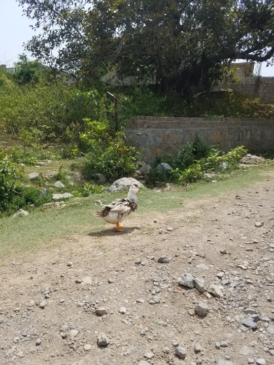
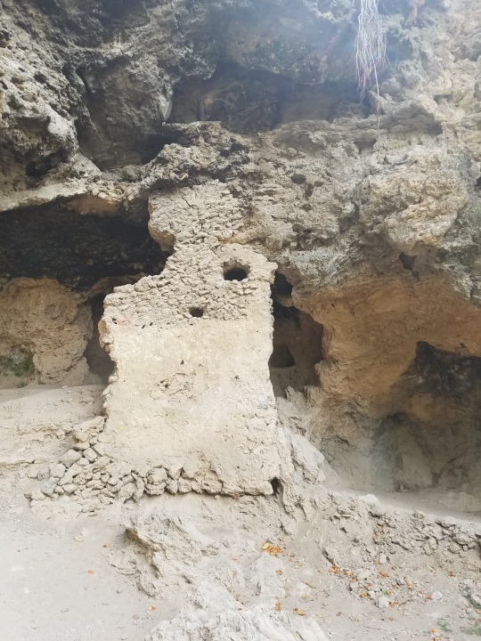


I don't have a lot of pictures but during the Mughal period, when India was the center of Sufism, a "saint" Shah Allah Ditta stayed in this garden and was entombed here.
Believed to be 2,400 years old, the caves have been used by Buddhist monks, Hindu sadhus and Muslim ascetics.
Historically, the caves are located along an ancient road. Over time, this road disappeared. Its remnants exist as the GT or Grand Trunk Road - when the city of Rawalpindi came into being in the 16th century, this road was used to travel directly from Kabul, Peshawar, Attock and Hassan Abdal to Rawalpindi and from there to Lahore and Delhi.
Some people to have stopped at the cold springs here at some time or another; Panini (a Sanskrit grammarian), Alexander of Macedon, Chandragupta Maurya, Ashoka, Kautilya Chanakya, Hazrat Khawaja Moinuddin Chishti, Data Ali Hujwiri, Sher Shah Suri and Mughal Jahangir.
Archaeological evidence indicates that the location where Alexander arrived and was received by Raja Ambi, King of Taxila, is marked on the ground near the caves. I read this somewhere and cannot verify.
Locally the place is known as Sadhu ka Bagh (holy-ones garden/grounds).
3 notes
·
View notes
Text
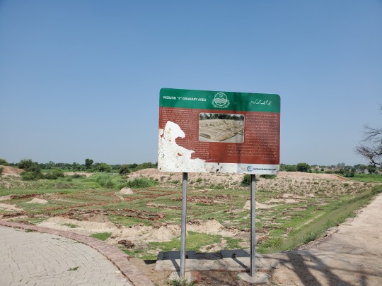
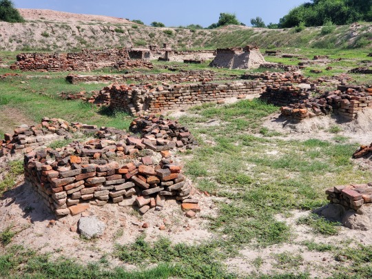
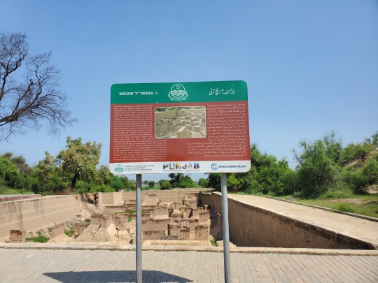
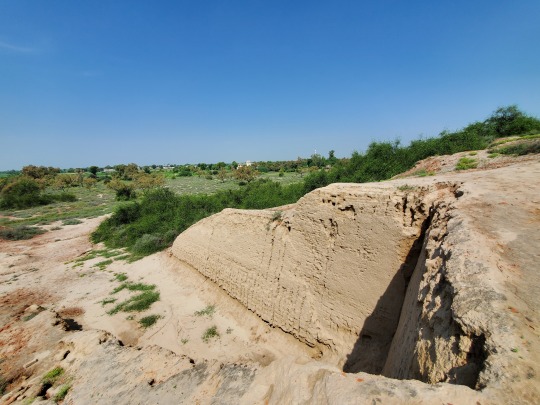
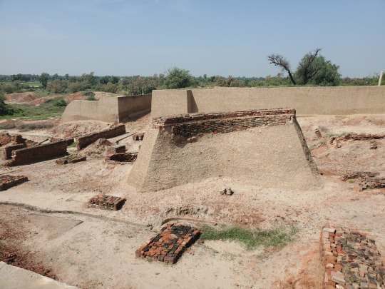
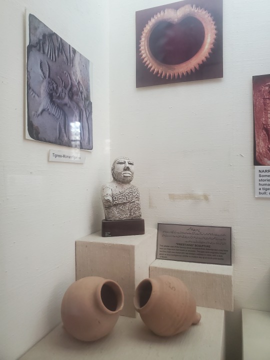
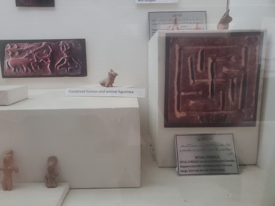
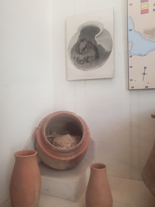
HARAPPA Indus Valley Civilization site

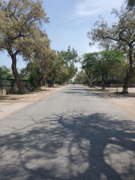


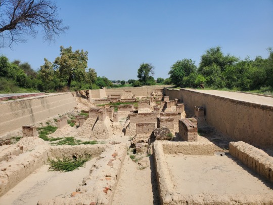
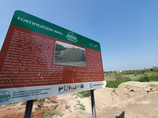


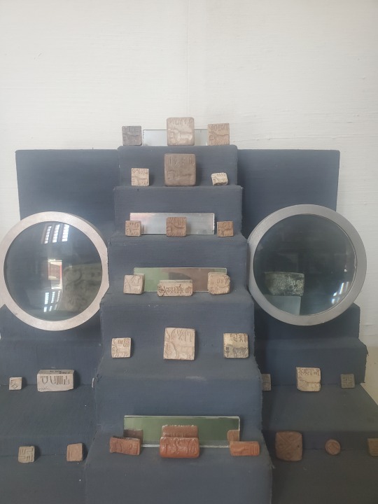


The museum is located at the dig site, on the main road to Harappa, cornered off with brick wall and metal fencing. A quite and almost destitute place, maybe because it was Monday or maybe the middle of summer but the gates are open to anyone with an entrance fee of 20 rupees.. or you can walk in like the locals from their streets that run through the dig sites and where the museum walls don't extend, a lot of students from near by spend afternoons under the trees here.
Lots of dug up loot including skeletons of them ancients - one male on display shows signs of puncture wounds to the head.
The pots, bricks and jewelry don't look to come from a bronze age civilization - I don't understand how people were carving cavities in old jewelry and hard rock.. without power tools
Photography is "strictly" prohibited inside the museum but I was able to negotiate permission for a whopping 150 rupees - but it is evident now that others may have negotiated better deals under more favorable lighting conditions because the internet is littered with superior pictures
Only 10% of the place has been excavated (and probably not since the late 1920s). You can walk right up into the neglected dig area in some places where shards of pottery are literally sticking out of the ground.
The bricks they used are in such good shape everywhere that the British unknowingly used them in the railroad tracks before figuring out what they were and where the locals were getting them - so the story goes.
3 notes
·
View notes
Text
TAKHT-I-BAHI & SHAHBAZ GARHI Mardan, Khyber


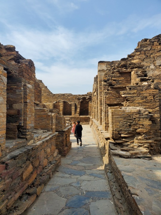
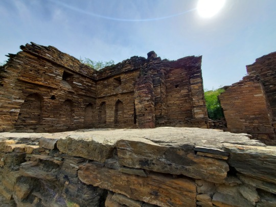

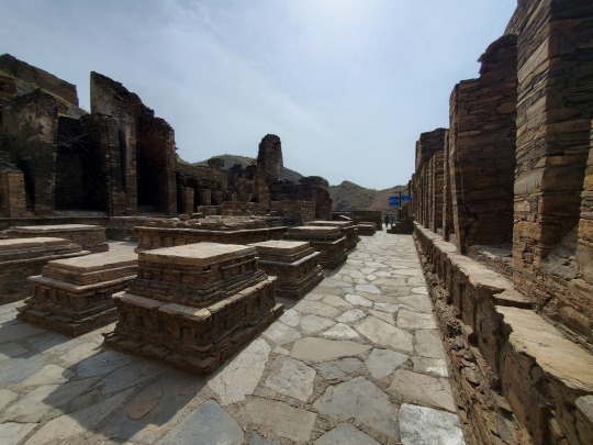
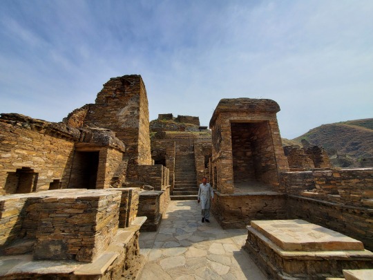


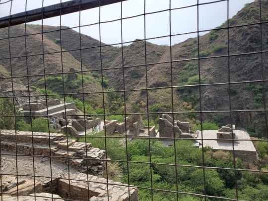
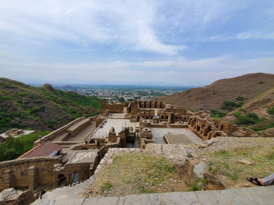
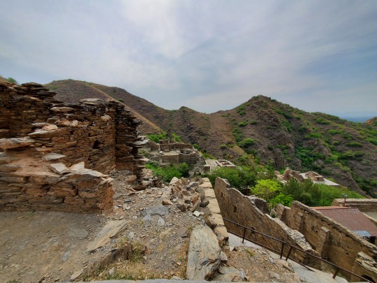


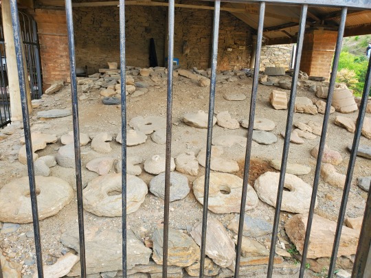
Takht-i-Bahi:
The site is considered among the most important relics of Buddhism in all of what was once Gandhara
The monastery was founded in the 1st century CE and was in use until the 7th century
The region was subjugated by the Huns in the middle of the fifth century, which ended the Kushan rule. The Huns slaughtered the inhabitants of the Gandhara region and destroyed most, if not all, Buddhist monasteries. Evidence suggests that Takht-i-Bahi was damaged in the same period by the Huns. However, the complex appears to have been in use until the 7th century
The name Takht-i-Bahi is uncertain. According to a local belief, it got it's name from two wells on the hill or the springs nearby. In Persian, Takht means 'top' or 'throne' while bahi means 'spring' or 'water'

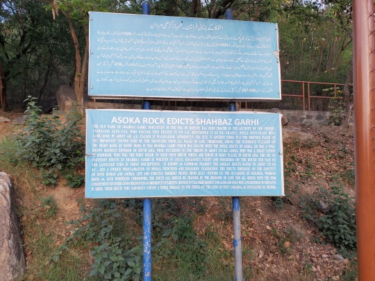

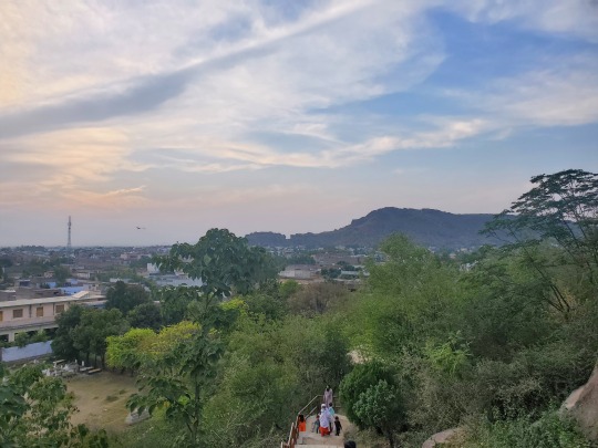


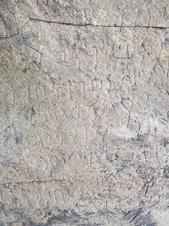

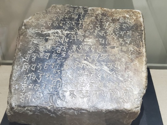
Shahbaz Garhi: Ashokas rock edicts
The town is the location of ancient Indian rock-inscriptions that are cut into two large rock boulders and written in the Kharosthi script
They appear to be the first examples of writing in the subcontinent. They were constructed during the 3rd Century BC (272-231 BC), during the reign of the Mauryan emperor Ashoka
#Ashoka#AncientCivilizations#BuddhistArtifacts#GandharaArt#HistoricalArtifacts#India#IndianSubcontinent#ShahbazGarhi#SouthAsianArchaeology#Pakistan#TakhtBahi
0 notes
Text
NATURAL HISTORY MUSEUM Islamabad

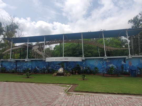


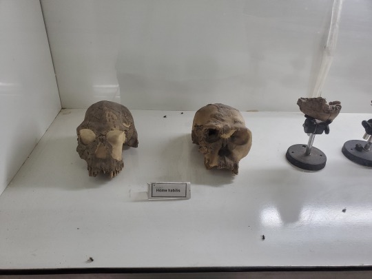
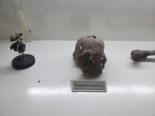

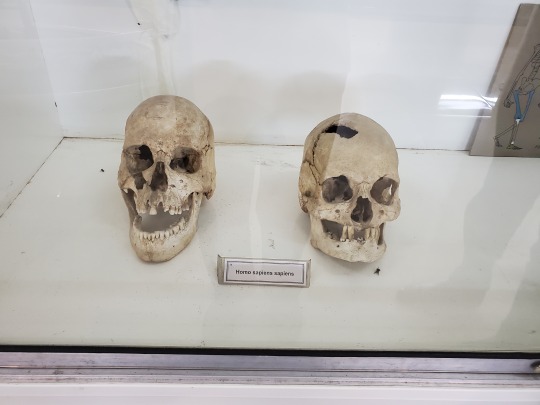


They have several skeletons of large mammals, including the blue whale, ungulates and a pretty decent hominid skull collection, including an Australopithecus
A life-sized model of the Baluchitherium, an extinct genus of hornless rhinocerotoids welcomes visitors at the gate
Baluchitherium means "beast of Balochistan" and lived 34-23 million years ago. The first known indricothere fossils were collected from the Bugti Hills in Balochistan
1 note
·
View note
Text
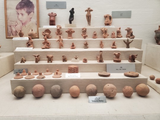
SIR SYED MUSEUM Islamabad


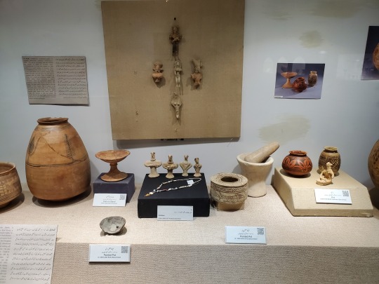

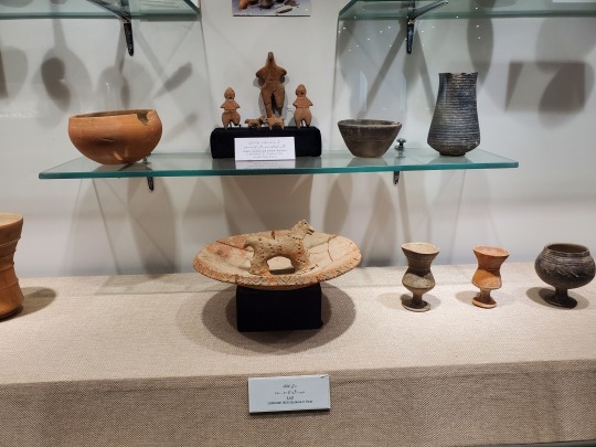

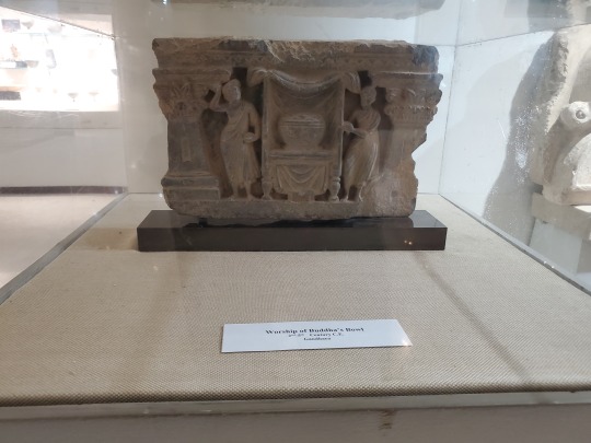
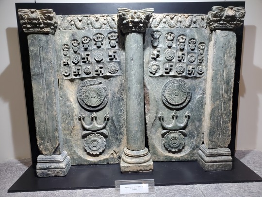


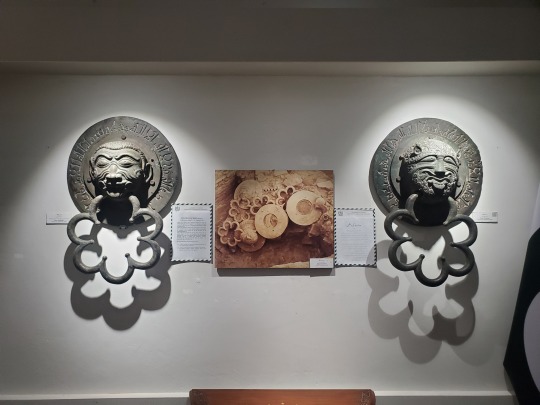


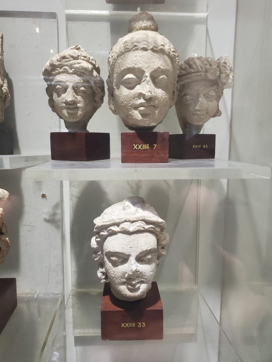


Few people in Islamabad even know this exists. One of the best kept, stocked and informative museums in the country - and it's free
The votive stupa is a replica of the original found at Mohra Muradu in Taxila
#SirSyedMemorial#SirSyedMuseum#IndusValleyCivilization#GandharaArt#India#IndianSubcontinent#IslamabadMuseum#Pakistan#HinduAntiquities#SikhHistory#SouthAsianArchaeology#MohenjoDaro#Harappa#BritishIndia
1 note
·
View note
Text
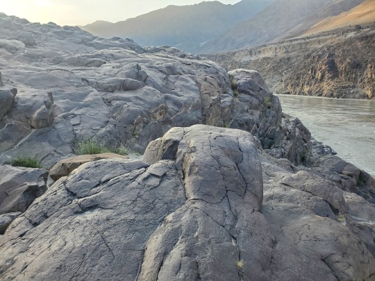
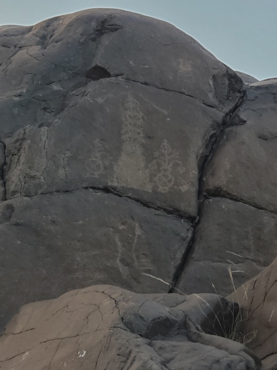
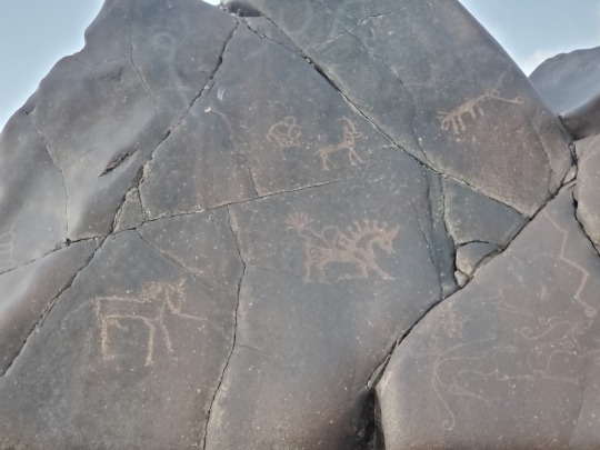
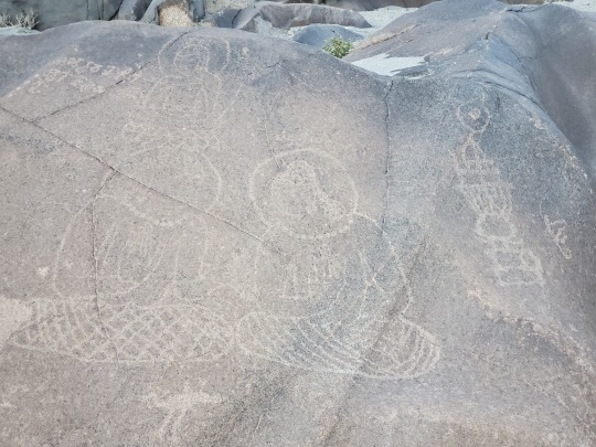
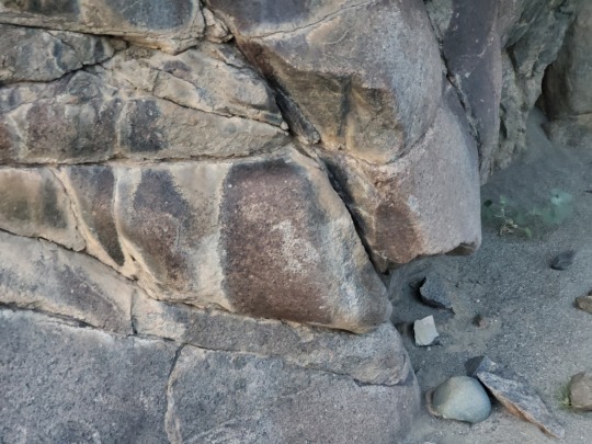
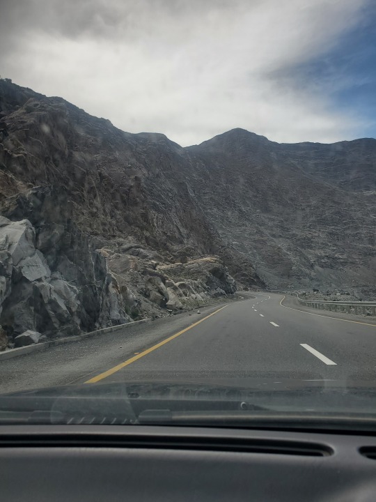
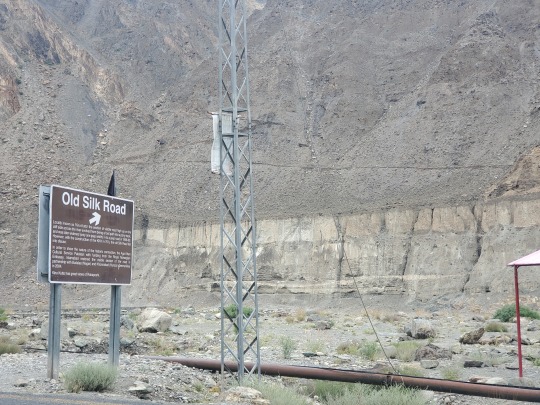
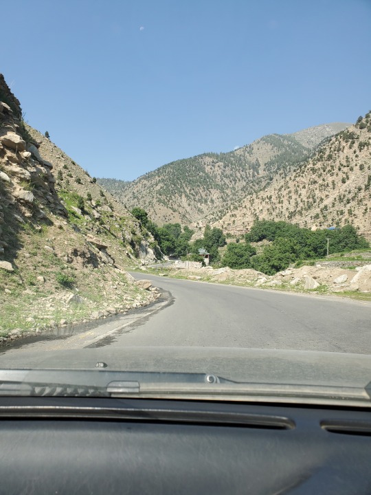
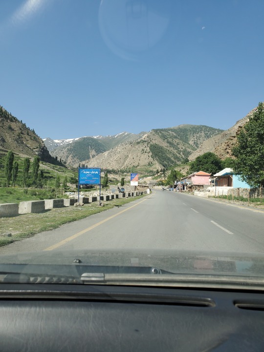
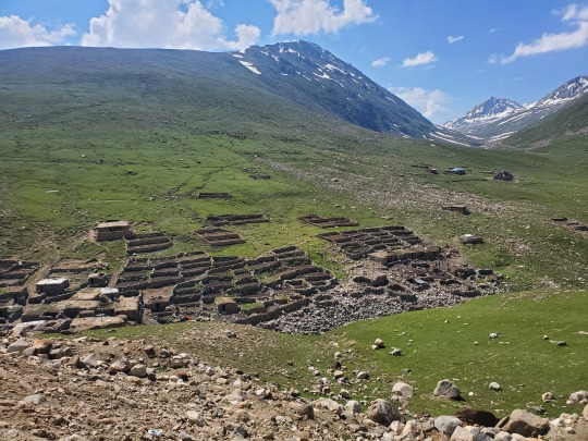
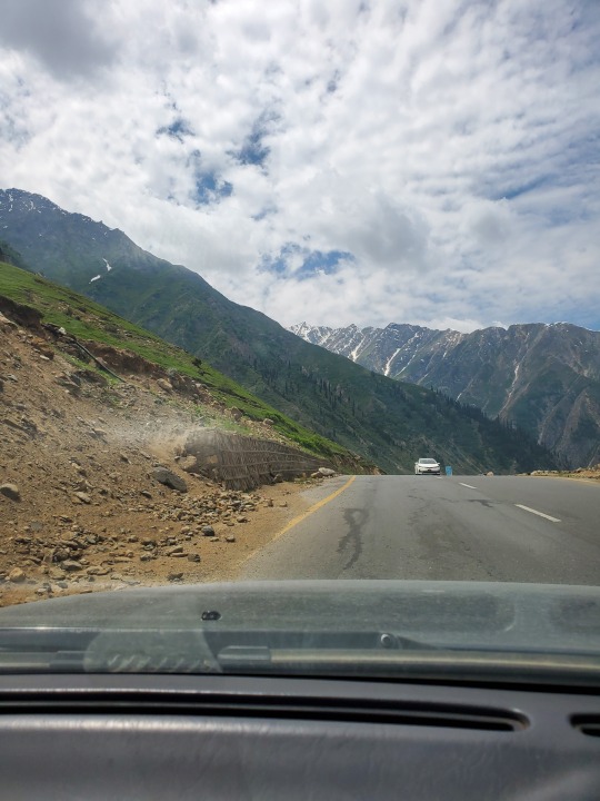
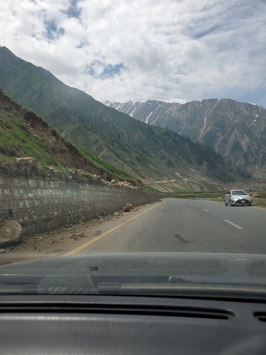
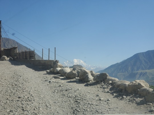
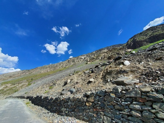
CHILAS Part of the Silk Road, to the north, Chilas connects to Tashkurgan and Kashgar in Xinjiang, China, via Gilgit, Aliabad, Sost and the Khunjerab Pass
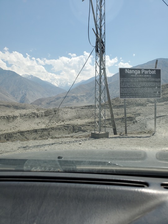


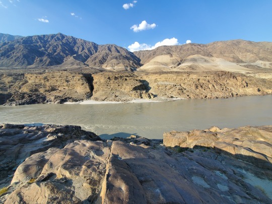
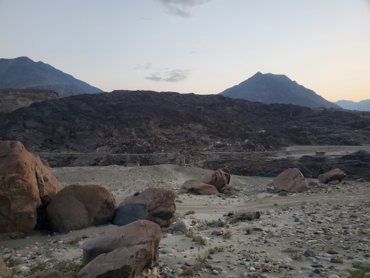


Driving towards Chilas there are beautiful views of Nanga Parbat, though I have possibly the worst picture ever taken of it - book me for events
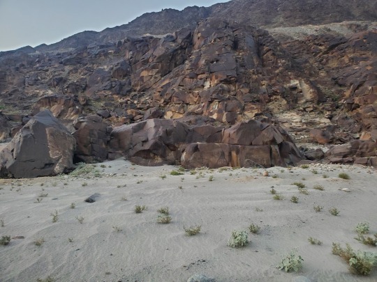
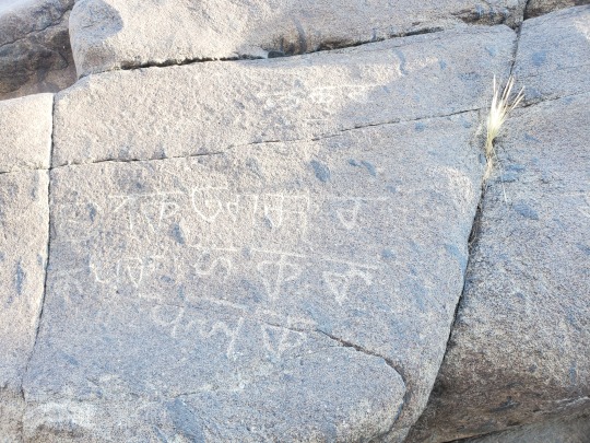
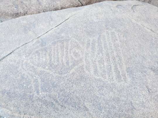
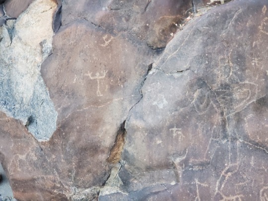
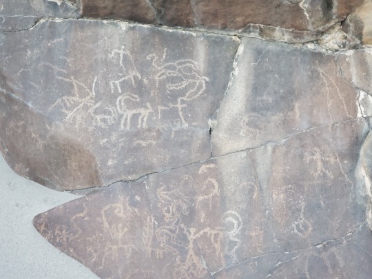
More than 50,000 Buddhist petroglyphs and inscriptions line the Karakoram Highway in Gilgit-Baltistan. They are concentrated at ten major sites between Hunza and Shatial, but more have been found near Skardu and Shigar
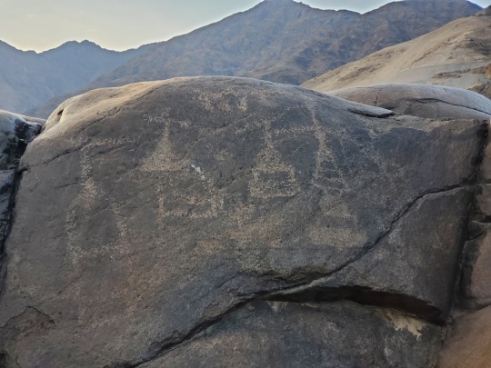
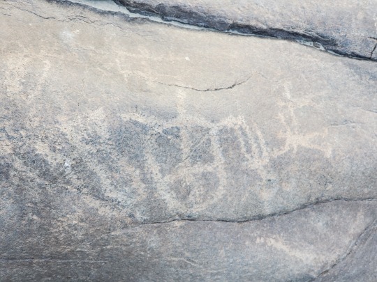
These were sitting in the open on the side of the road for anyone to see.. or vandalize - left by various invaders, traders and pilgrims who passed along the trade route. The earliest date back to between 5000 and 1000 BC, showing single animals, triangular men and hunting scenes in which the animals sometimes are larger than the hunters
These carvings were pecked into the rocks with stone tools and are covered with a thick patina that proves their age. Later - mostly Buddhist - carvings were sometimes executed with a sharp chisel
A new dam being constructed in the Diamer district is set to submerge and destroy this open air museum and pieces of cultural history
#AncientCivilizations#AncientCultures#Chilas#CulturalHeritage#SilkRoad#Petroglyphs#SouthAsianArchaeology#IndianSubcontinent#India#Pakistan#RockArt
2 notes
·
View notes
Text
SKARDU Deosai Plateau and Shigar (gateway to K2)


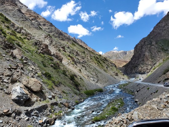
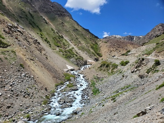


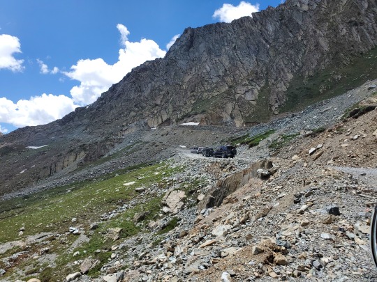


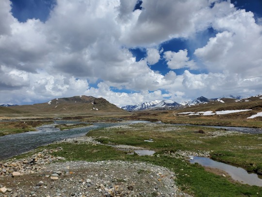
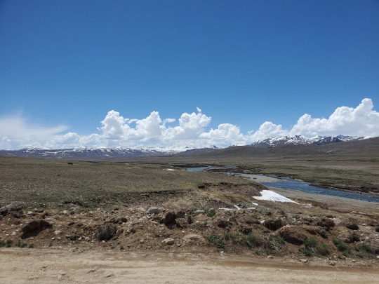


Skardu: Situated at an average elevation of nearly 2,500 meters (8,202 feet) above sea level in the Skardu Valley, at the confluence of the Indus and Shigar rivers. The city is a gateway to the eight-thousanders of the nearby Karakoram mountain range
The Deosai Plains: Situated at an average elevation of 4,114 meters (13,497 ft) - considered the second highest plateau in the world
Shigar: Located on the bank of the Shigar River in the most remote part of the region, it is inhabited almost exclusively by the Balti people of Tibetan descent. Shigar Valley is the gateway to the Karakoram mountain range, which has five eight-thousanders, including K2
2 notes
·
View notes
Text
HUNZA Gilgit-Baltistan


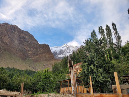


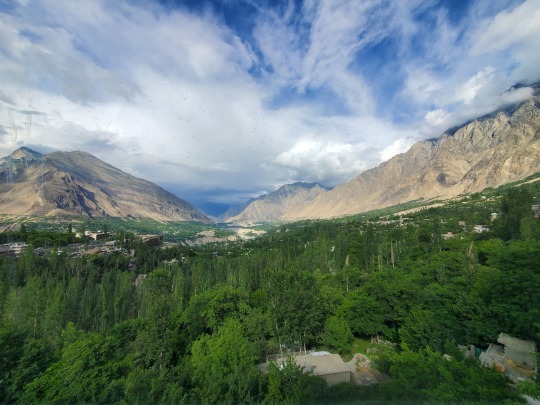


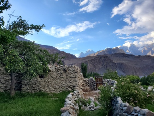


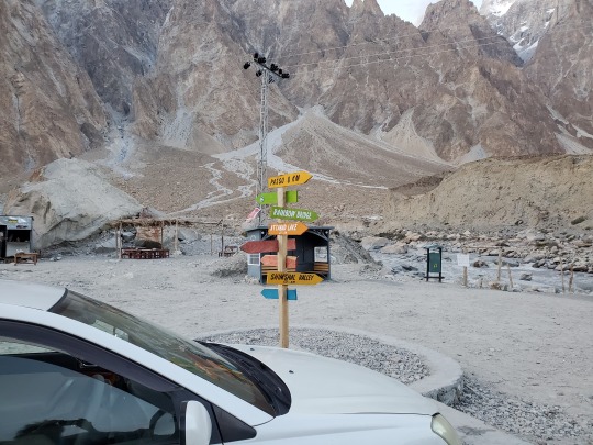


The local languages spoken include Burushaski, Wakhi and Shina but people here can speak fluently in several other languages.
Literacy rate of the Hunza valley is more than 95%
Home to several peaks that rise above 7,000 m include Rakaposhi, Distaghil Sar, Batura, Batura II, Batura III, Muchu Chhish, Kunyang Chhish, Shispare, Passu Sar, Kanjut Sar, Yukshin Gardan Sar, Pumari Chhish, and Momhil Sar
On the KKH, near Jaglot the road winds through an area where you can see the three mountain ranges of the Himalaya, Karakorum and Hindu kush meet
A little north of Gulmit, you can visit the Passu cones, have Yak steaks (or Diram Fiti if you're vegan) and feast your eyes at the black or Ghulkin Glacier
1 note
·
View note
Text
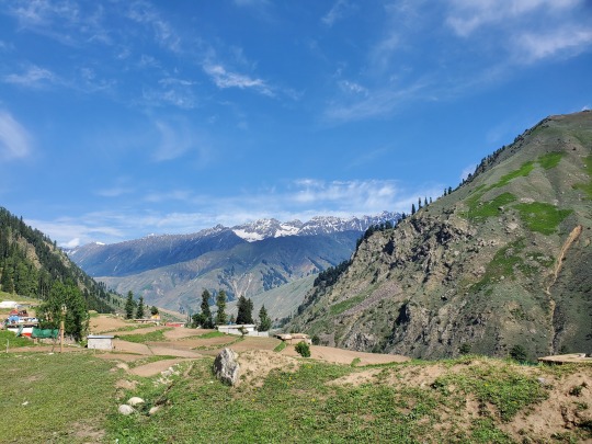
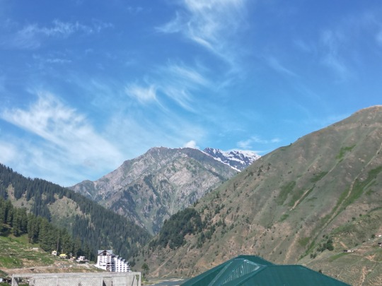
BABUSAR PASS Elevation 4,175 meters (13,700 feet)
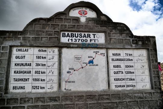
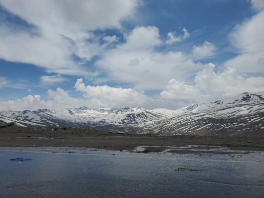

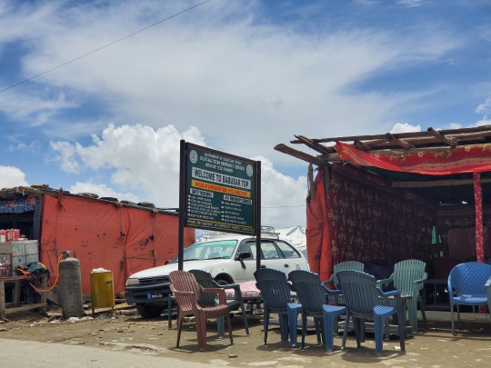

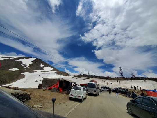

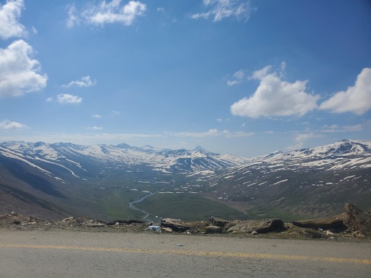
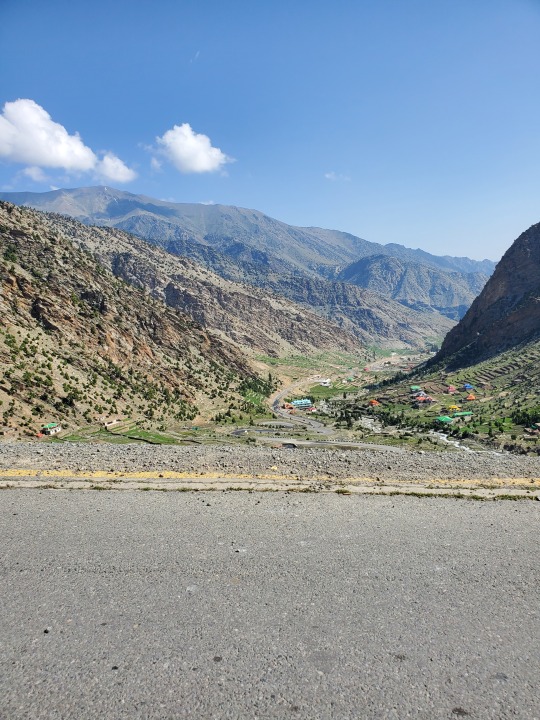
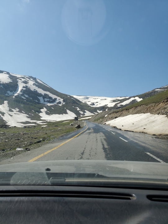
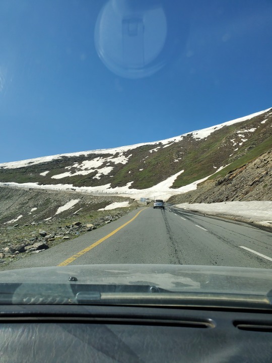
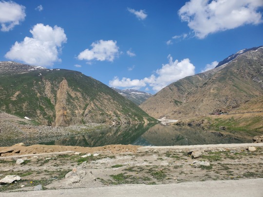
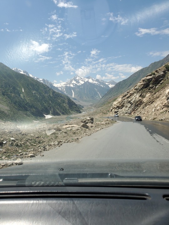
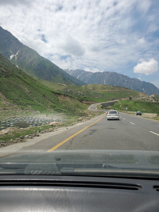


Babusar Top is the highest point in Kaghan Valley that can be easily accessed by cars
During winter, the pass closes due to heavy snowfall - every year they finish clearing it around July - August. Until then the Karakoram Highway is used to access the northern regions of the country
Babusar Top was originally known as Babur Top, originating from the fact that the Mughal emperor Babur passed through this area in the early 16th century
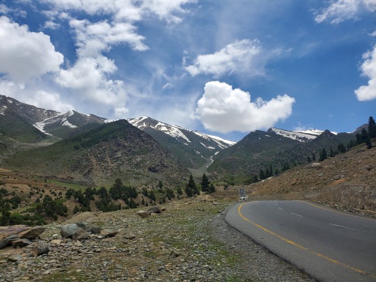
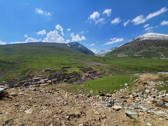
The mountain ranges that enter the Mansehra District from Kashmir are the offshoots of the Himalayan system. In the Kaghan Valley, the mountain system is the highest in the area, including Babusar Top. This range flanks the right bank of the Kunhar River, and contains a peak called Malika Parbat, which is over 17,000 feet
1 note
·
View note
Text
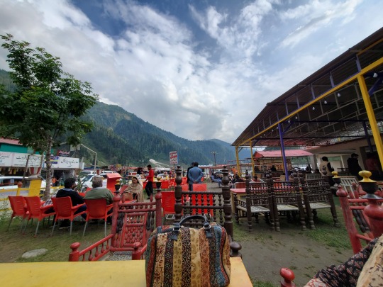
NARAN Upper Kaghan Valley


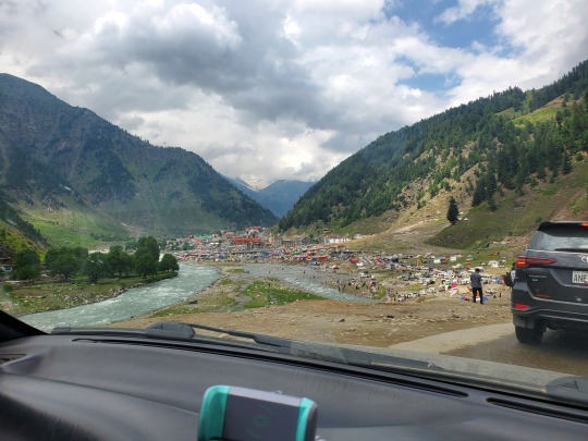
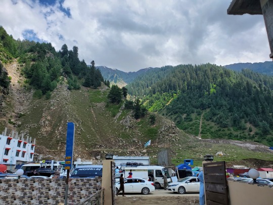


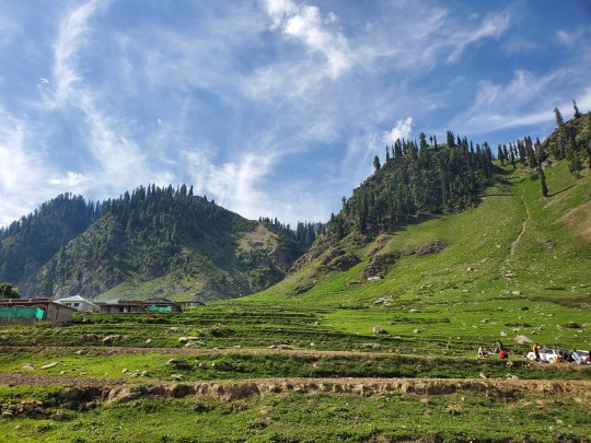
Located 119 kilometers (74 mi) from Mansehra city at an altitude of 2,409 meters (7,904 ft). It is about 65 kilometers (40 mi) away from Babusar Top
During the winter, the roads leading to Naran remain closed, but in the summer, the place transforms into a bustling hub of activity, attracting visitors from across the map, with a notable influx of boisterous, messy and disruptive tourists from Punjab that leave a trail of chaos behind - littering, parking haphazardly, blasting music, driving recklessly in a manner that could rival a circus act, turning one-way streets into a maze causing traffic jams. Yet, amidst the horns and commotion, the locals view them through a lens of hospitality, labeling their antics as simply part of the "guest experience"
2 notes
·
View notes
Text
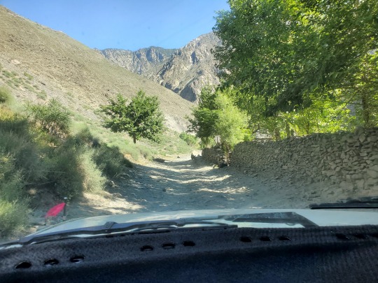
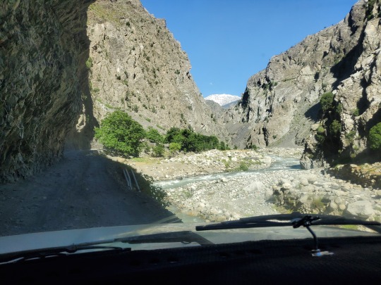
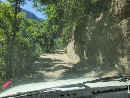
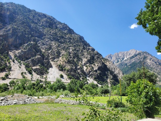
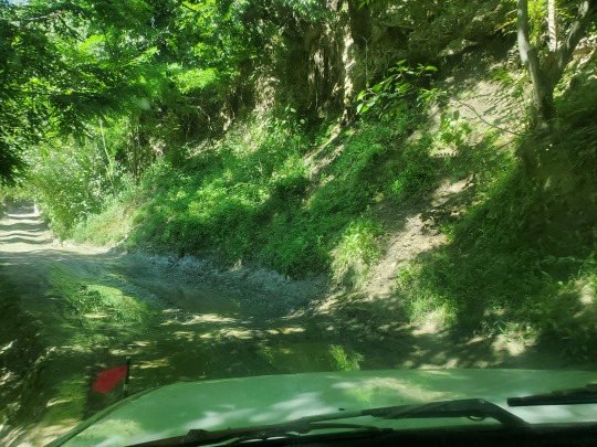
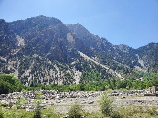
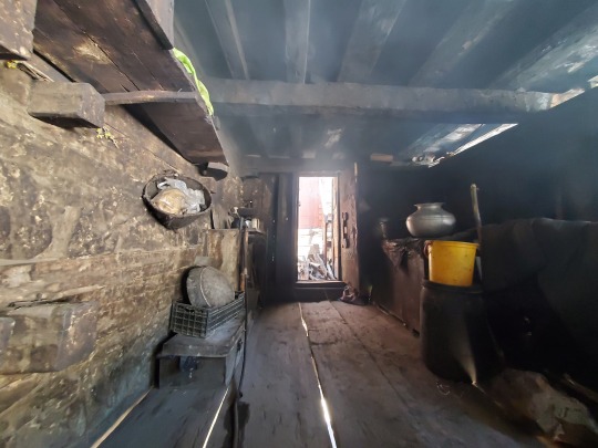
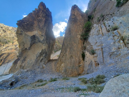
BUMBURET (known in Kalasha as Mumuret) Kalasha Valley


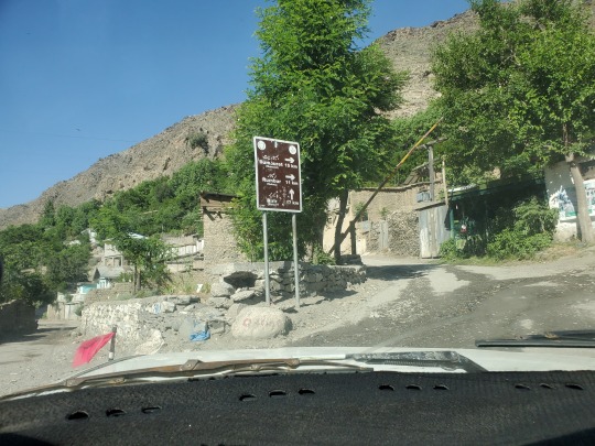


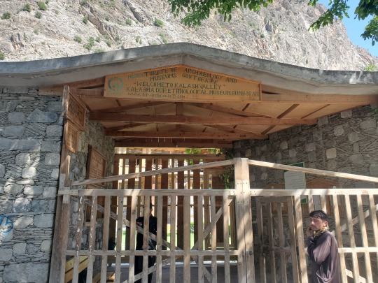


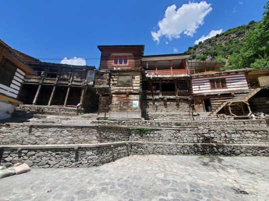

The inhabitants of the valley are the Kalash people
There are three main valleys. The largest and most populous valley is Bumburet (Mumuret), reached by a road from Ayun in the Kunar Valley. Rumbur is a side valley north of Bumburet. The third valley, Biriu (Birir), is a side valley of the Kunar Valley south of Bumburet
We rented a car and a driver extraordinaire to drive us on the "road" to Bumburet. There are places you won't believe a horse can walk across the gorge let alone a car
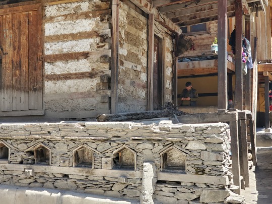
Some houses are around 400 years old, built in the traditional style using wood joinery - similar in a way to Japanese kigumi
The Kalash people are often referred to as Kalash Kafirs by the local Muslims and have been subjected to increasing incidents of killings, rape and seizure of their lands. As per the Kalash, forced conversions, robberies and attacks endanger their culture and faith. Kalasha gravestones are desecrated and the symbolic carved horses on Kalasha altars are destroyed. As of 2024, their population is estimated to be around only 3000 and declining
2 notes
·
View notes
Text
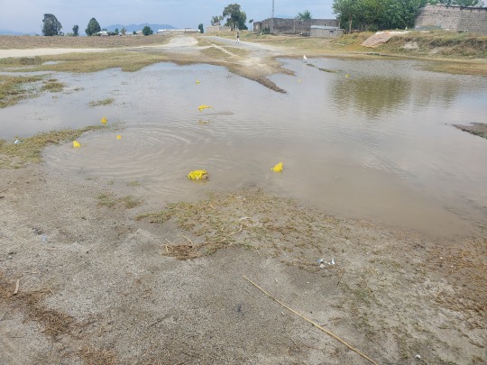
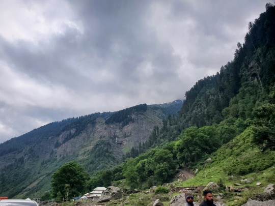
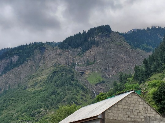
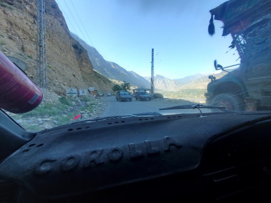
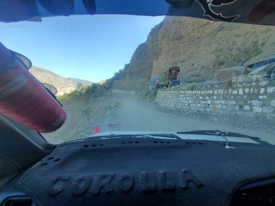
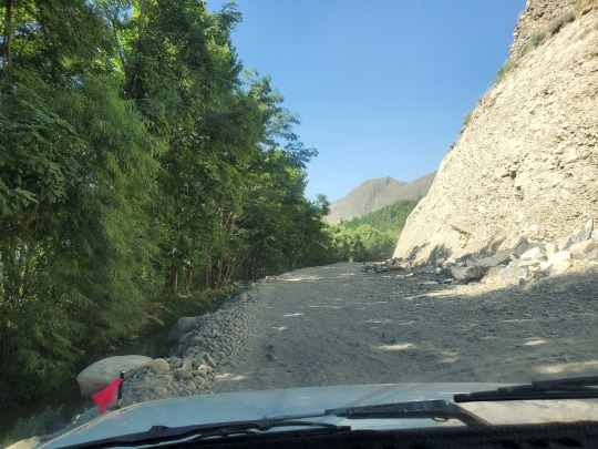
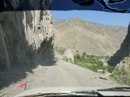
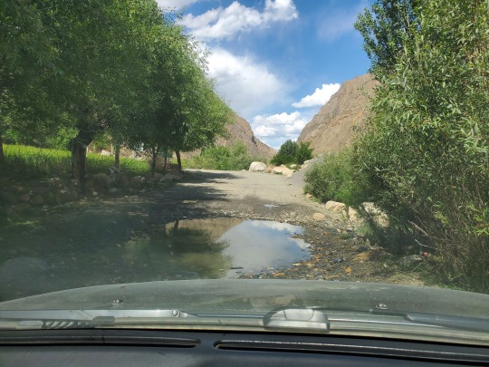
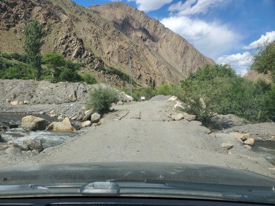
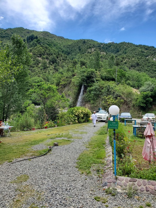
GARAM CHASHMA Chitral

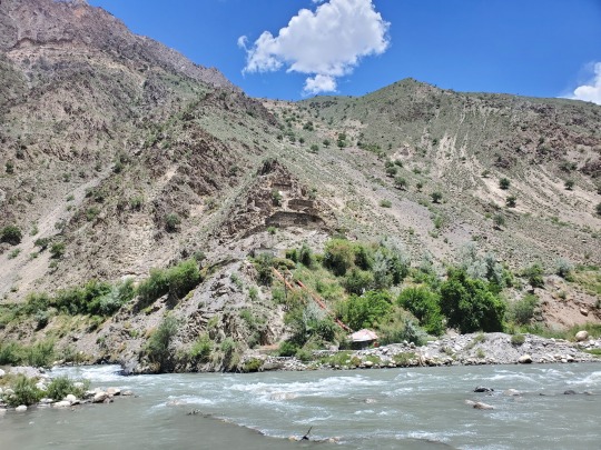

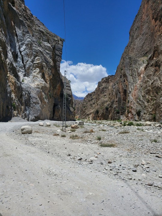
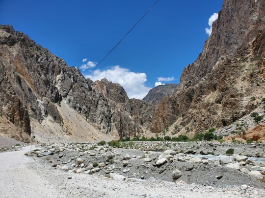


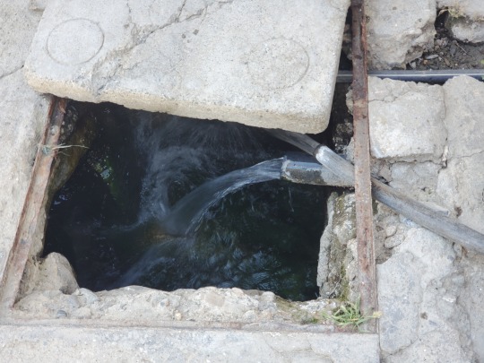
One of the many branch valleys of Chitral District, situated in the extreme north-west of Pakistan, it is one of the highest human settlements in the Hindukush ranges with an altitude of about 2550 meters (8389 feet) - Wikipedia
The place is known for its hot spring, which is one of the tourist attractions though when we got there, we were led inside the backroom of a building that also housed a mosque and shown the water pipe in the picture above - apparently coming from said spring. It was boiling hot with the odor of sulfur - not the spring we were looking for
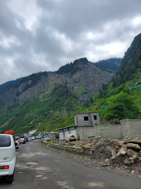
Garam Chasma is about 40km from Chitral city but the roads or what passes for them are in such a state it takes about 3 to 4 hours depending on how much you hate your car. According to the locals hitching rides to and fro, the roads were damaged and remain unrepaired, owing to measures to control access in and out of Afghanistan after the events of 9/11 - they say cross-border trade had been strong prior to then - there are check-points littered all over on the way to Chitral, checking for "foreigners" and conducting "entry" which entails logging your ID and car number at each post - curiously, no one cares to record an exit on your way back
3 notes
·
View notes
Text
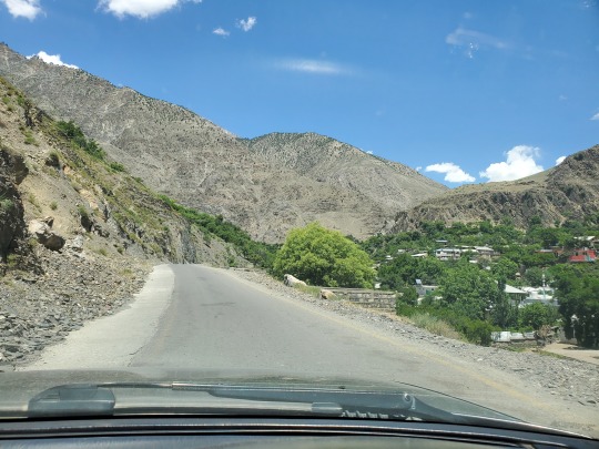
CHITRAL


Took a wrong turn from Islamabad so the drive took 13 hours but worth every minute
Thank you to the South Koreans and Chinese for making the tunnels and roads - in some places like the Lowari pass, the tunnel has cut driving time by 7 hours
1 note
·
View note
Text
KARTARPUR Gurdwara Kartarpur Sahib founded in 1504 AD by Guru Nanak

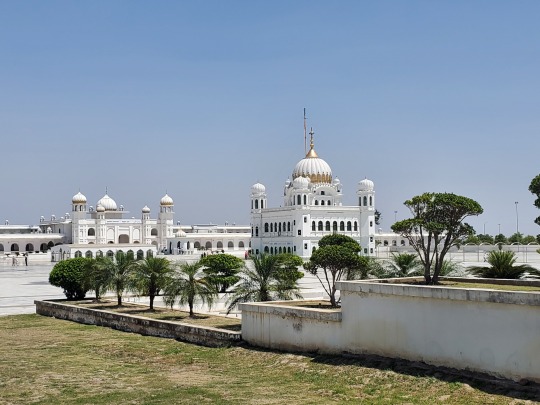

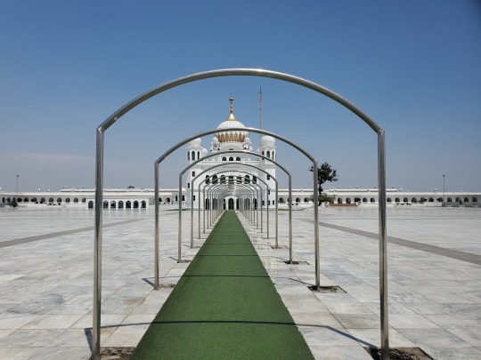
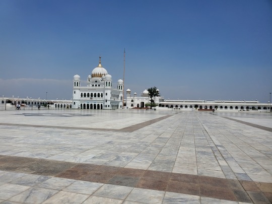


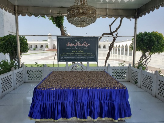


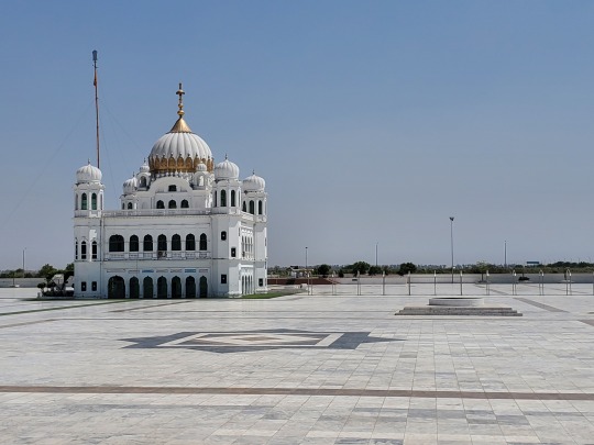
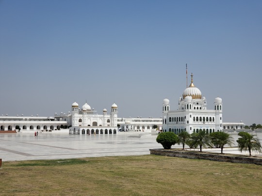
Location Guru Nanak is believed to have died - it is considered to be the second holiest site in the Sikh religion
A cross-border Kartarpur Corridor opened in 2019 allowing Indian Sikhs to visit Pakistan without a visa
Kartarpur via Lahore is a 100km or so drive on a very rough road
Scorching hot during the summer high noon, there are at least 4 checkpoints in quick succession once you arrive because of security concerns - but they actually seem like they take their job seriously and respect the place
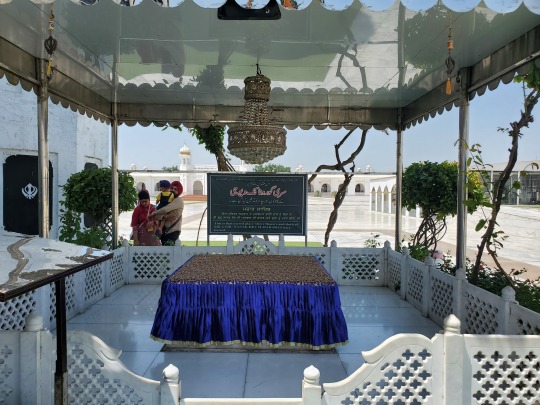
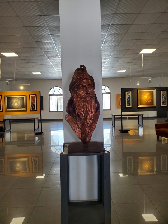
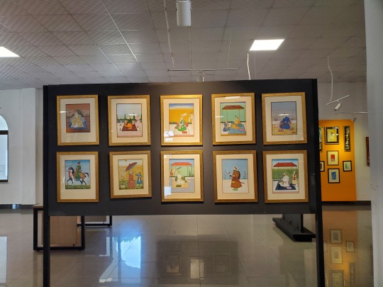
You can find paintings and art in the langar hall like the sculpture of Ranjit Singh in bronze above
2 notes
·
View notes
Text
NATHIA GALI Pipeline - home of the Rhesus Macaque


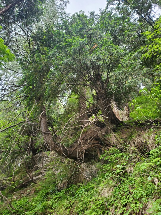


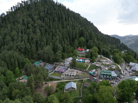

Last time I was here was twenty-odd years ago, the place has obviously become more populated and littered - but the trash cans are in pristine condition
That last picture is of one of the water tanks built by the British in the 1930s to supply water down to Murree, the summer resort using the altitude difference of about 2000 feet to their advantage
2 notes
·
View notes
Text
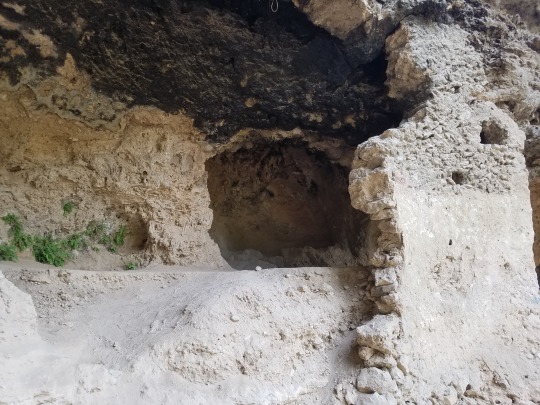
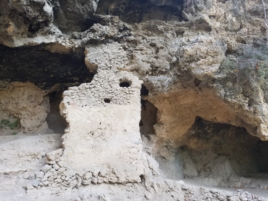
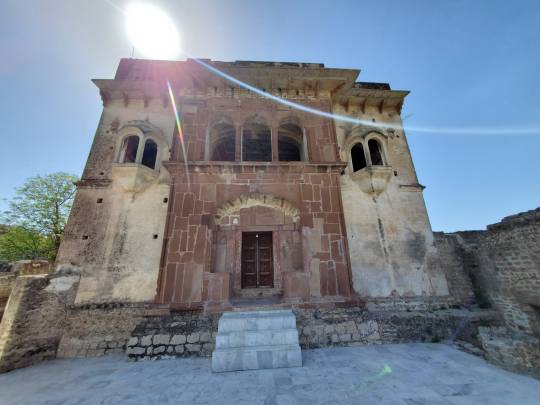
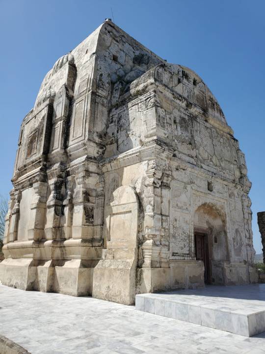
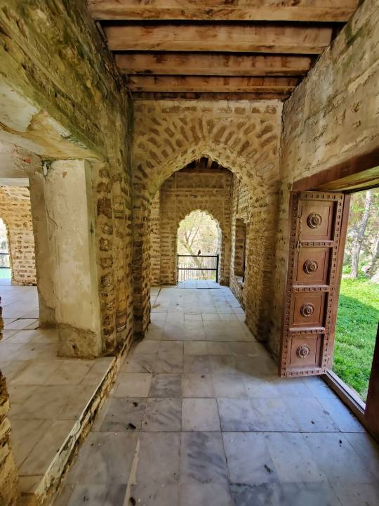
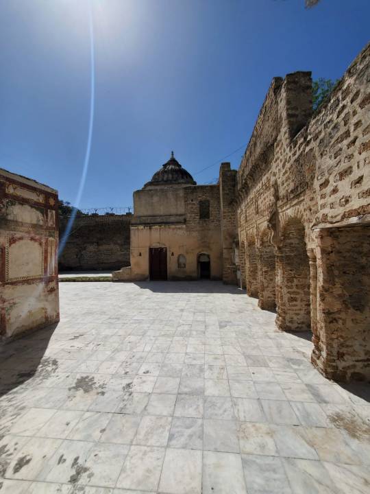
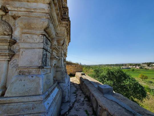
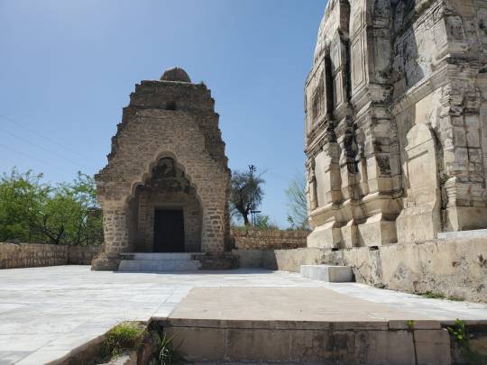
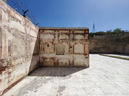
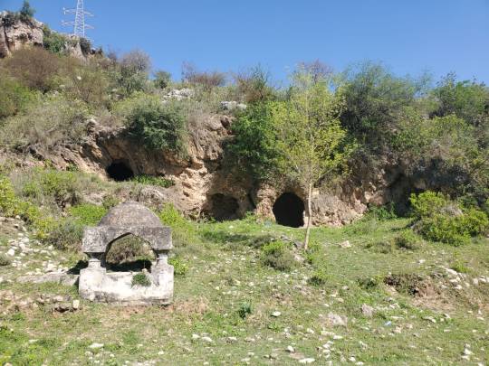
KATAS RAJ TEMPLE COMPLEX The Shri Katas Raj Temples, also known as Qila Katas is a complex of several Hindu temples connected to one another by walkways
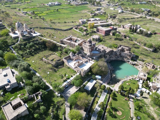
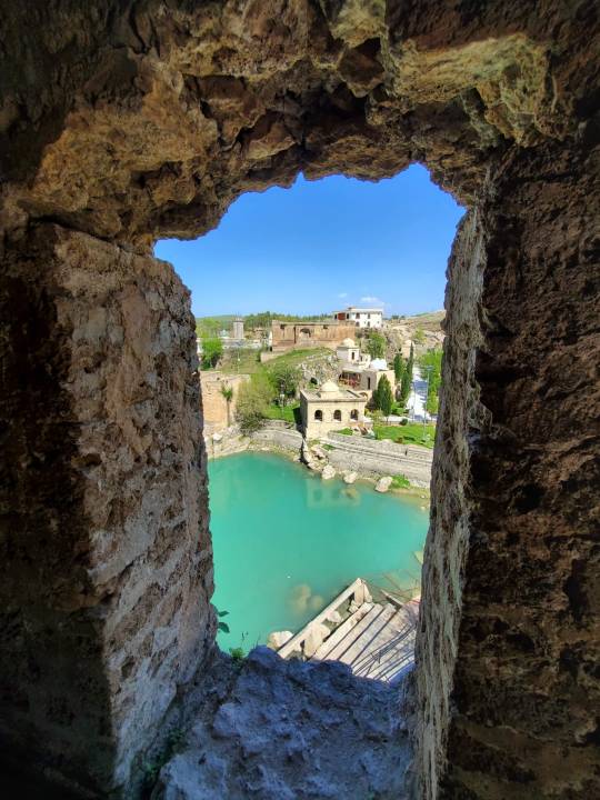
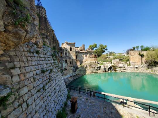
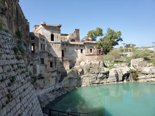

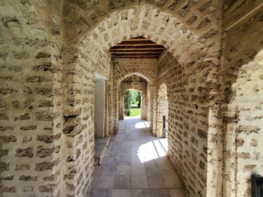
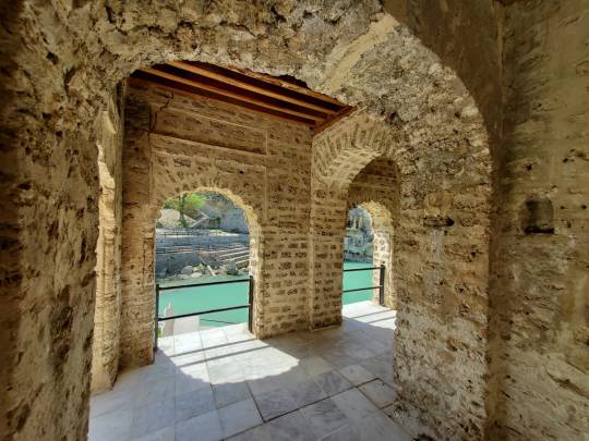


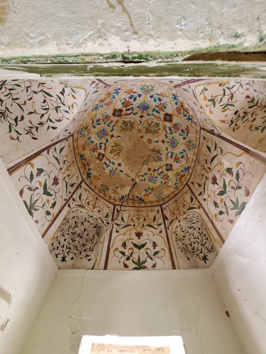


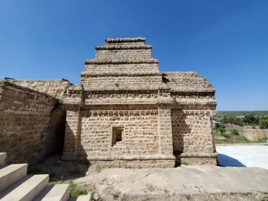
The temples' pond is said in the Puranas to have been created from the teardrops of Shiva, after he wandered the Earth inconsolable after the death of his wife Sati
Also mentioned in the Hindu epic poem, the Mahābhārata, these temples are traditionally believed to have been the site where the Pandava brothers spent a significant portion of their exile
Though in very decent shape considering how old they are, one will find graffiti left by visitors who carve out their names and phone numbers on the walls throughout the interior and exterior of the buildings. You would think that'd make it easier for the authorities to track them down?
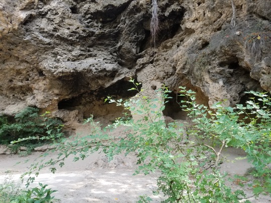
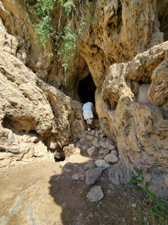
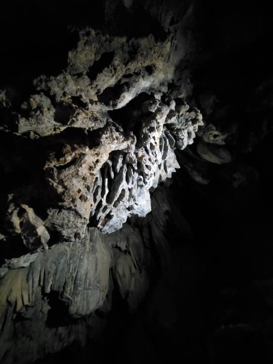
Across the street are more Buddhist structures and caves that date back to prehistoric times. They are large enough for you to enter and quite deep. If you shine a light around inside, you can see marine fossils protruding out of the rocks


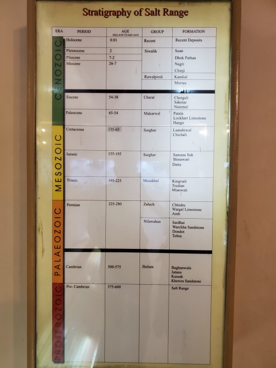
#Katas#KatasRaj#Temples#HinduTemples#BuddhistCaves#SaltRange#ChoaSaidanshah#IndianSubcontinent#SouthAsianHeritage#GandharaArt#BuddhistArtifacts#HinduAntiquities#AncientIndianArt#SouthAsianArchaeology#HistoricalArtifacts#AncientCivilizations#Pakistan#India
2 notes
·
View notes