
balawa
a daydream
a dreamer, a light traveler, animal lover, natural freak, cultural admirer, books eater and photography addict
56 posts
Don't wanna be here? Send us removal request.
Last Seen Blogs

oldschoolswoleschool
Untitled

universoparalleloblog
soy soñador

teejaystumbles
Promises and Left Behinds

jockifyme
Jock TFs & More
finalsquidmissile
New Home Who Dis
Text

Hello there,
It's been a while, 5 years i never touch this site due to work bustling schedule and as time goes by, here I am, in year 2020.
As we know, 2020 is a challenging year for whole people in the world. Pandemic, yes, it sounds like a title of thriller movie, but hey the situation is real.
Many people struggling, many people had lost their job, many people cannot see their family.
I believe the storm will be over, in the meantime please do self care to your soul, it is very important to keep us sane during this situation.
Stay safe and stay healthy everyone❤
1 note
·
View note
Photo
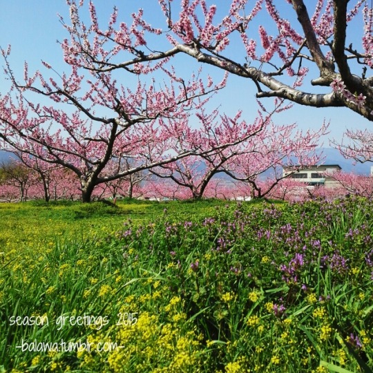
Season Greetings 2015 Keep your dreams high and your worries less. Keep on awesome, find your happiness and wishing you enjoyable life a head. -balawa.tumblr.com-
1 note
·
View note
Photo

I miss the sky and the sea, that's the reason i drew this. Whilst i also found a very nice quote from a book: "Tahukah kau mengapa Tuhan menciptakan langit dan laut? Semata agar kita tahu, dalam perbedaan, ada batas yang membuat mereka tampak indah dipandang..." (Rumah Di Seribu Ombak - Erwin Arnada) "Do you know why God created the sky and the sea? Merely that we know, in differences, there are limits that make them look beautiful to see... "(House In Thousand Waves - Erwin Arnada)
1 note
·
View note
Photo

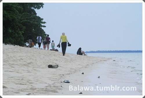
Pok Tunggal Beach: A Hidden Serenity If you went to Yogyakarta, don’t forget to visit beaches in Gunungkidul (Mount Kidul) area. Why? Since its tremendously amazing. One of them is Pok Tunggal. Pok Tunggal beach is located in the village of Tepus, District Tepus, Gunungkidul Yogyakarta, precisely on the east Coast Watulawang and on the west Coast Ngetun, about 50 km from the city wonosari or 2 hours travel time from Yogyakarta. GPS Coordinates: S8 ° 9’20 “E110 ° 37’17” Me and friend eagerly visit this beach because we believe that the hardest the route is, the more beautiful that we get. Sound silly but it’s proven :D. The road to Gunung Kidul area was not so easy and to reach Pok Tunggal we have to entered single bumpy road long way across the forest. After we reached the coastal, i couldn’t believing my eyes that so many yellow butterflies flying here and there. My first experience and first time i saw beach with butterflies. The charm of Pok Tunggal Beach with the strech of white beach sand surrounded by a wall of hills is a fun site to explore. Pok Tunggal Beach that lies between Indrayanti Beach and Siung Beach reinforces Gunungkidul as the centre of beautiful white-sand beaches that are still natural.
0 notes
Photo
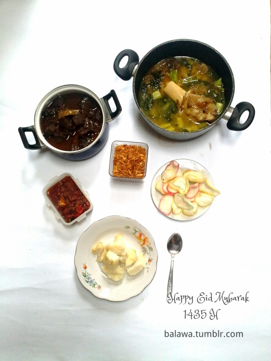
Eid Mubarak 1435 H Q: What is the most precious moment during Eid Al Fitr? A: Togetherness and mom's cook :D Happy Eid Mubarak, may Allah blessed all of us♥ -balawa.tumblr.com-
0 notes
Photo
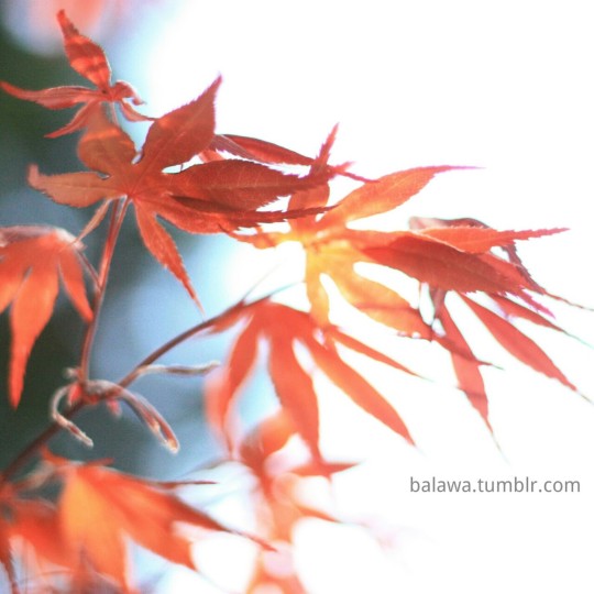
Come little leaves said the wind one day Come to the windows with me and play Put on your dresses of red and gold For summer is past, and the days grow cold (Poems by George Cooper) -Mid April at Gotokuji Temple, Japan-
0 notes
Photo
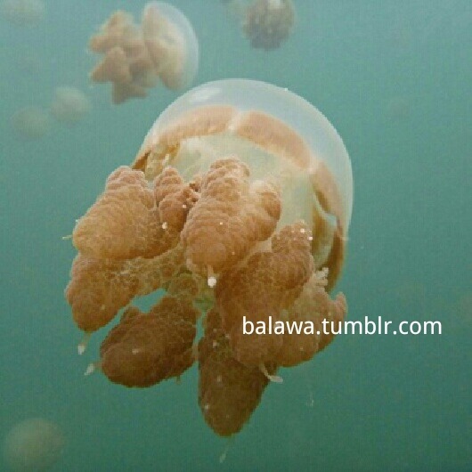
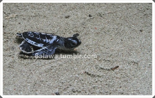
Kakaban - Kingdom of Non Stinging Jelly Fish This was my second time went to Kakaban Island. Kakaban island is part of the Derawan Islands and Kakaban originated from local words means ‘hug’ since this lake trap in the middle of the island. In kakaban there are four type of Jellyfish such as Aurelia Aurita with transparent body, Tripedalia Cystophora which only has a tip finger size, Mitigias Papua is likes a green bulb, and Cassiopea Ornata which is upside down jellyfish with their tentacles upright. Weather condition was not so good at that time, harsh raining and wave current didn’t make my spirit lowdown, i have to see their kingdom again. Probably it was a lucky day for me, harsh raining make jellyfish population very dense in lakefront. When I swam to the middle of the lake, my tears burst out, thousands of them came towards me…so unforgettable :) Snorkeling in the lake is very pleasant, if you want to see natural wonder of mother nature you should come to Kakaban. Where? Here, in our country, Indonesia. At least visiting Kakaban will make 50% achievement, seeing as this kind of lake only two in the world: Kakaban in Indonesia and Siargao Palau in Philippines.
1 note
·
View note
Photo

Menulis Cinta Kau minta aku menulis cinta Aku tak tahu huruf apa yang pertama dan seterusnya Kubolak-balik seluruh abjad Kata-kata cacat yang kudapat Jangan lagi minta aku menulis cinta Huruf-hurufku, kau tahu, Bahkan tak cukup untuk namamu Sebab cinta adalah kau, yang tak mampu kusebut Kecuali dengan denyut - Sitok Srengenge-
0 notes

Quote
You don't need to hide your sadness, you have the right not feeling good -Paulo Coelho-
0 notes
Text
Serabi Notosuman
Back when I was little, my favorite snack is Serabi (pancake) that I often buy on the traditional market. Serabi are typical snacks, made from coconut milk mixed with a little flour, which makes it tasty. Nowadays hardly found original Serabi that made using traditional way.

When I went to Solo, Central Java, I visit one Solo pancake maker - Srabi Notosuman Ny. Handayani - which existed since 1923. Here, I could see the making of Serabi. Pancake batter poured into a small pan mold lined up neatly on the brazier (anglo) which still using areng (charcoal) as fuel, then closed using a cover made of clay. Cover is opened occasionally to see if the pancake is cooked. If it had been cooked, pancakes are placed into a container to cool down.

Serabi will taste better if cooked over charcoal fire. Taste and appetizing aroma may be more pronounced, compared with when cooking using gas stoves.
Hopefully this one of Indonesian traditional foods are still able to survive in years ahead. Bon appétit! :)

0 notes
Photo
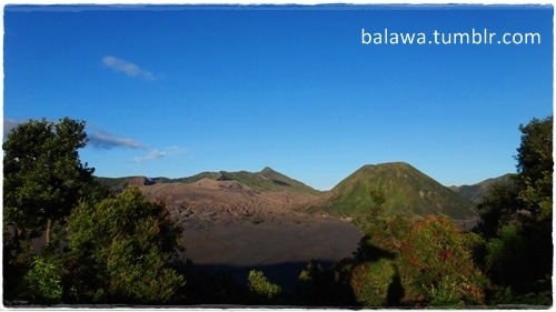


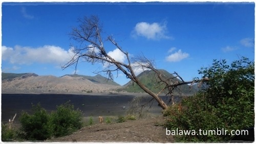

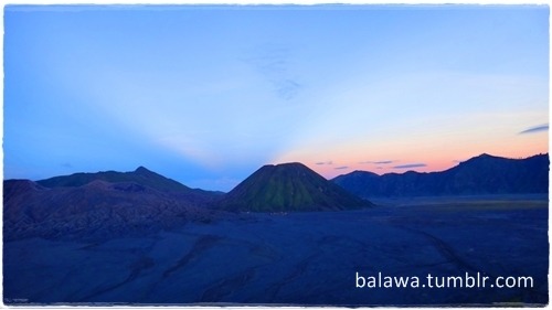
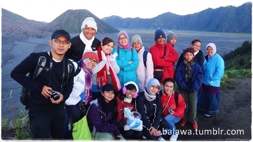
Bromo Mountain
Mount Bromo is one of the most famous and most beautiful volcanoes in Indonesia. It is located in Tengger, in East Java.
Mount Bromo is one of two volcanoes that were created following a massive eruption which created an enormous caldera in which are the active Mount Bromo and the non-active Mount Batok.
The caldera has seen been filled with grey sands, and is called Laut Pasir or Sand Sea. Trekkers walk through this expanse on their way to Mount Bromo. The scenery is reminiscent of earth in its primeval age or a moonscape. This is more so when a layer of mist carpets the caldera floor.
Standing at a height of 2392 meters, Mount Bromo isn't the tallest mountain in Java. That title goes to 3676 meter tall Mount Semeru, located to the south of Mount Bromo and within sight. Also called Mahameru, meaning "great mountain", Mount Semeru is one of the most active volcanoes in Indonesia constantly belching steam from its peak.
An undulating plateau interrupted by valleys and lakes reaches right to the foot of Mount Semeru. They are all located within the Bromo-Tengger-Semeru National Park
writing source:www.worldgreatestsites.com
3 notes
·
View notes
Text
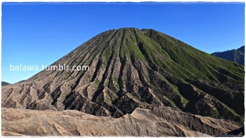
Visiting Bromo

Mount Bromo (Indonesian: Gunung Bromo), is an active volcano and part of the Tengger massif, in East Java, Indonesia. At 2,329 metres (7,641 ft) it is not the highest peak of the massif, but is the most well known. The massif area is one of the most visited tourist attractions in East Java, Indonesia. The volcano belongs to the Bromo Tengger Semeru National Park. The name of Bromo derived from Javanese pronunciation of Brahma, the Hindu creator god.
Mount Bromo sits in the middle of a vast plain called the "Sea of Sand" (Javanese: Segara Wedi or Indonesian: Lautan Pasir), a protected nature reserve since 1919. The typical way to visit Mount Bromo is from the nearby mountain village of Cemoro Lawang. From there it is possible to walk to the volcano in about 45 minutes, but it is also possible to take an organized jeep tour, which includes a stop at the viewpoint on Mount Penanjakan (2,770 m or 9,088 ft) (Indonesian: Gunung Penanjakan). The best views from Mount Bromo to the Sand Sea below and the surrounding volcanoes are at sunrise. The viewpoint on Mount Penanjakan can also be reached on foot in about two hours.
The Tengger Caldera was still active in late January 2011, the activity being characterized by fluctuating ongoing eruptions. Eruptions and volcanic tremors were reported on 21 January and 22 January with activity subsiding on 23 January 2011. On 23 January 2011 at 06:00 am the alert status at Mount Bromo remained at (Level III)
On 23 January 2011 an exclusion zone was recommended for communities living around Mount Bromo. Tourists and hikers were to advised not to come within a radius of 2 km from the active crater.
...
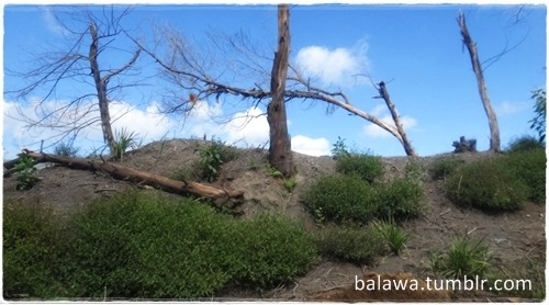
Last week (18/5/12), I have a chance to visit Bromo after eruptions. The best views from Mount Pananjakan 1 no longer could reached by jeep, since the road is completely ruinous. Furthermore, all activities diverted to Pananjakan 2 and It was pity the sunrise couldn't clearly see from this spot.
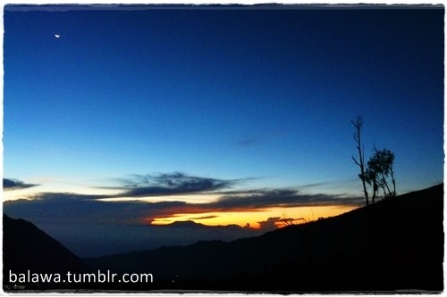
View from Pananjakan 2, waiting for Sunrise.
Though you couldn't see the sunrise, but you still could see orange tinge from the mountain which extremely beautiful.
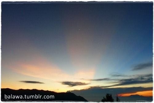
Sun start shining behind Mount Batok
To chase the sunrise, we start the journey at 03.00 AM. And around 06.00 AM the guide asked us to leave Pananjakan 2 to go to Segara Wedi.
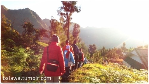
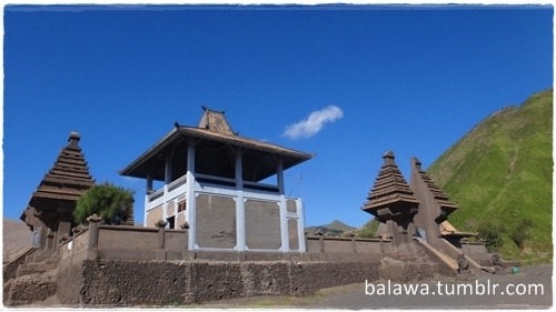
On the Segara Wedi sand plain sits a Hindu temple called Pura Luhur Poten. The temple holds a significant importance to the Tenggerese scatter across the mountainous villages such as Ngadisari, Wonokitri, Ngadas, Argosari, Ranu Prani, Ledok Ombo and Wonokerso. The temple organized annual Yadnya Kasada ceremony which lasts for about one month. On the 14th day, the Tenggerese will congregate at Pura Luhur Poten to ask for blessings from Ida Sang Hyang Widi Wasa and God of Mahameru (Mount Semeru).
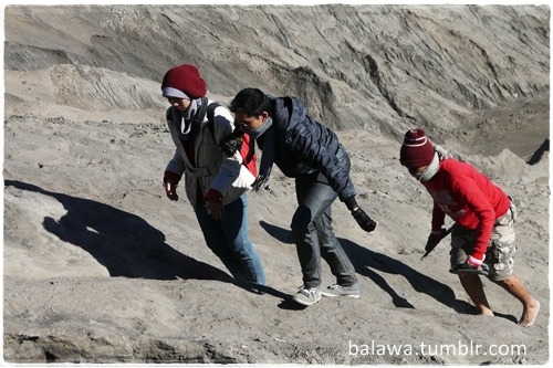
From Segara Wedi to reach the crater, the visitors can ride a horse until the shell of the mountain or can do light trekking.

Visitor only allowed to be there before 10:30 AM. After 10.30 AM usually wind on top of the crater is unstable and dangerous.

Further, to see the crater, visitors can climb steep stairs or do light hiking through the sand.
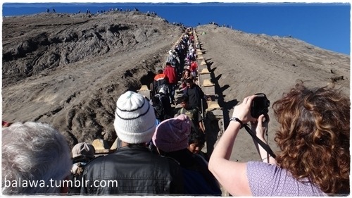
at that time Bromo overrun by local tourist and foreigners, so I have to patiently wait in line to reach the top of the mountain. Because, after eruption stairs and crater line as a path line to caldera is in poor condition so that we have to very careful.

View into the mount Bromo crater

Segara Wedi view from the top
...
After eruption, Mount Bromo still become one of the panoramic beauty in Indonesia.
0 notes
Photo
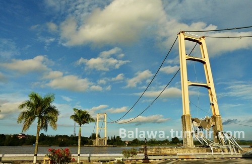
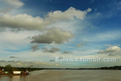

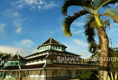


Under Tenggarong Sky
A while a go with the intention of visiting a friend in Samarinda, finally I also could turn to the famous Tenggarong, which I heard has very pretty scenery.
The Kutai regency can be reached through the city of Balikpapan or the provincial capital, Samarinda. When the Kutaikartanegara bridge was still standing, journey from Samarinda can be reach ± 30 minutes. But after a Kutaikartanegara bridge collapsed, from Samarinda, the travel time ± 1.5 hours, plus additional waiting in line to take turns crossed by ferry.
My first impression of Tenggarong is very quiet city, so quiet and very calm, with a stretch of blue sky are incredibly beautiful, kinda like to stay in this city :)
Tenggarong is the capital of the Kutai Kartanegara Regency of East Kalimantan, Indonesia. The former Kutai Kartanegara Sultanate's capital was located in Tenggarong.
Historically, the then capital was called Tepian Pandan. At some point, the Kutai Kartanegara Sultan, Aji Muhammad Muslihuddin, changed the name from Tepian Pandan to Tangga Arung (literally house of king). In application, the people of Kutai would then shorten this name by combining the two words Tangga Arung to Tenggarong.
If you want to find a peaceful city with some historical places, suppose Tenggarong sure do is an option :)
4 notes
·
View notes
Text
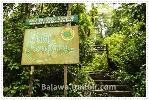
Message From Bangkirai
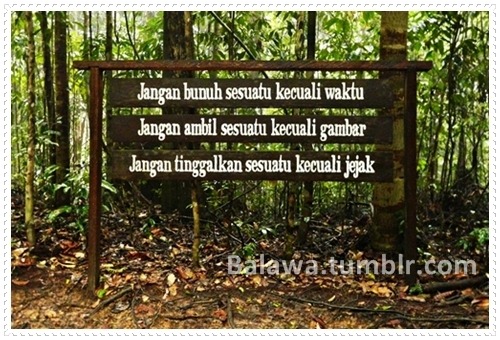
...
Bangkirai hill is natural tourism area managed by PT. Inhutani I Unit I Balikpapan. This tourist area is located in District Samboja, Kutai regency, East Kalimantan. Bangkirai hill can be reached through a 1.5 hour road trip from the Balikpapan.
Little bit hard to find Bangkirai, since the road are the same with mining road. You cannot find the location if there's no sign and asking to mining security guard.
If you like to trek, suppose the road challenging enough, but of course you have to go to this place on early morning and start trekking from first sign of Bangkirai Tourism take place. Because Bangkirai approximately has 18Km distance from the main road :)
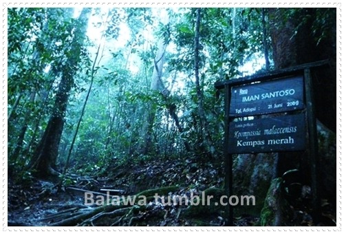
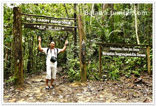
Bangkirai offers the charm of a tropical rain forest that is still natural, which completed with tourism infrastructure and facilities such as restaurants, hall for meetings, swimming pool and jungle cottage or cabin. In this area there is a canopy bridge along 64 m, connecting 5 hanging trees at an altitude of 30 m.
To reach Canopy Bridge, again, you should do light trekking around 500 m. Trekking track divided into two part, 1st track is trek M. Prakosa with 150 m distance
To reach 2nd track, we've to pass road in forest, a bit climbing and a bit dark if trekking performed after 1 p.m...hmmm perhaps depend on the weather also. However based on my experience usually dark down quickly inside the forest :D
2nd Track is Trek Djamaludin with 350 m distance to canopy bridge.
Bangkirai Canopy bridge is the first editorial in Indonesia, both in Asia and the eighth in the world. Construction is made in the United States.
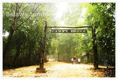
The short history, researchers from the United States has conducted a likasi survey and trees as well as the development environment then conducted the first phase in January 1998 and the second phase was completed in February 1998 when the bridge was completed approximately one month. Worked by American contractors who are members of CCA (Canopy Constraction Asosiated) with six field implementers and with the assistance of three local labors.

In addition, wood used in its construction are stainless steel or Galvanized from America. Age of completion of the bridge canopy is expected to be able to survive for 15-20 years based on the age and durability of materials.

Scenery from the canopy bridge...Fog between trees :D
...
Visit to Bangkirai teach us how to appreciate nature and blend in it. Serenity inside the location as if they wanted to say: SAVE OUR FOREST

3 notes
·
View notes
Text
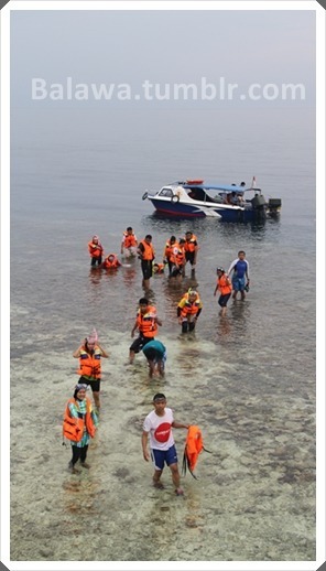
Escapology - Derawan.Kakaban.Maratua.Sangalaki
It was long holiday baby! Yes, probably the only thing I've been waiting for only red mark in calendar :D. After two years waiting, planning, counting the budget finally I could reach these heavens on earth :)
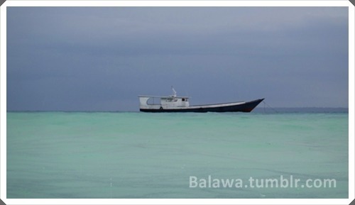
From Balikpapan, me and my friend took last flight to Tarakan, then continue the journey on next day. From Tengkayu 1 Port, we'd take speedboat to Derawan. Rain pouring quite hard at that time, however three hours journey will equally paid soon we arrived there :D

Derawan Islands is an archipelago located in Berau, East Kalimantan. At least four of the famous islands in the archipelago, the island Maratua, Derawan, Sangalaki, and Kakaban.

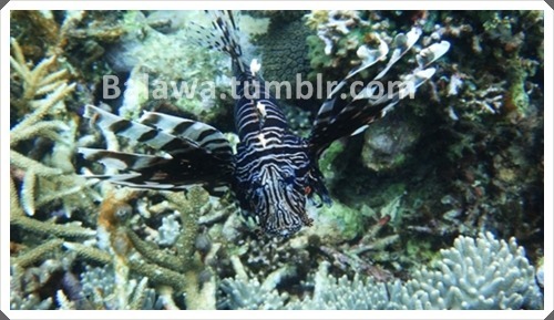
Derawan Islands there are several small islands and coastal ecosystems is very important that the coral reefs, seagrass beds and mangrove forests. In addition many protected species in the Islands Derawan like green turtles, hawks-bill turtles, whales, dolphins, giant clams, coconut crabs, mermaids, fish, barracuda and a few other species.

For underwater sight seeing, Derawan also has many underwater biota. I try to capture underwater moment in Derawan, since flow of sea water a bit harsh so the sea quite snoring. I bet when current stop, you'll find beautiful scene down there :)
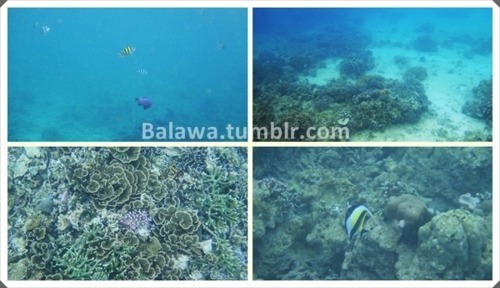
Derawan Islands has been nominated for a UNESCO World Heritage Site in 2005
...
The next morning, harsh raining fell down from early morning. Little bit pessimistic whether we could go to another destination or not. Our group leader, finally decided to continue the journey to another island: Maratua, Kakaban and Sangalaki.
Maratua Island is the outermost islands of Indonesia, located in the Celebes Sea and borders with Malaysia. Maratua island is part of the District Government of Berau, East Kalimantan province. We cannot enter Maratua resort, because this island managed by Malaysian company and need to get permission first when entering the resort.
Underwater scene also beautiful here, since it was raining I couldn't explore much in Maratua :)
Scenery in deep surface of Maratua, very clear even its raining.

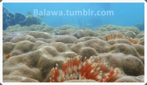
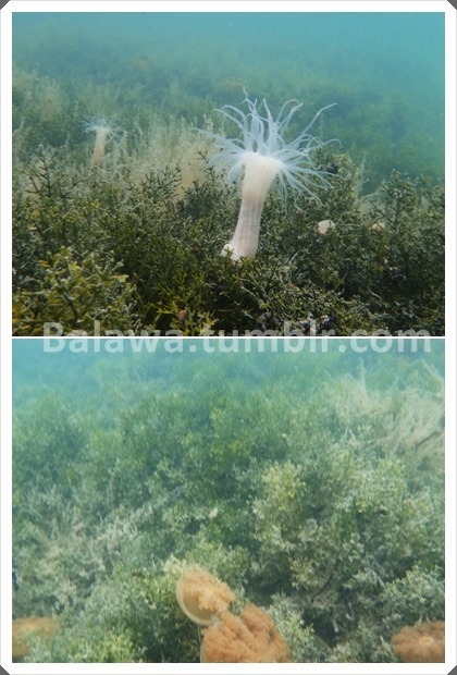
From Maratua, we're heading to Kakaban. Distance from Maratua to Kakaban around 15 minutes by boat. Before we entering Kakaban lake, our group leader told us to explore palung Kakaban. Palung Kakaban really superb, though at first to shallow to explore, even we cannot swimming because of the shallowness and the corals definitely sharp that can injured your leg.
After struggled to reach 'swimming zone' I felt so grateful could experienced real painting of the nature, wanna crying out load...suddenly in love with the scenery :D

Even in swimming zone, we tried to avoid sharp corals :D

Underwater biota at palung kakaban that you can enjoyed when swimming, even in the surface :)
In noon time, after lunch, we start to enter Kakaban Lake in the middle of the forest.

Kakaban lake, the sea water trapped in Kakaban, coupled with water from the soil and rain water since 2 million years ago. Kakaban prehistoric lake is a lake that is the time of Holosin transition. The extent of approximately 5 km², walled cliffs as high as 50 meters, resulting sea water which trapped no longer can get out, into the lake.

In the world, a place like this is only found in Jellyfish Lake Palau, Micronesian Islands in the South Pacific Ocean. Thus Kakaban is the only island in Indonesia that have a lake in the middle.
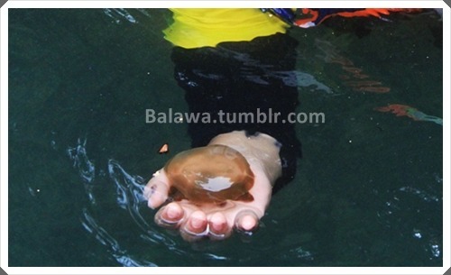
In Kakaban lake you only can find unstinging Jellyfish, where thousands of them live in the lake. Swimming in Kakaban like swimming in the middle of Jellyfish Kingdom, so much exiting and amazing.
Also on the outskirts of coastal mangrove forests grow well, inhabited by many kinds of crabs, sea cucumbers, and sea snakes. There are so many types of animals that have not been identified in this region. Dr. Thomas Tomascik, a national Canadian oceanographer, said Kakaban biological wealth is a paradise in Indonesia. The mystery of how animals and plants are isolated in this lake is one of the very high demand by scientists to uncover. Because the sea is indeed fit to be an object of nature conservation should be protected and conserved.
Well, since lake like Kakaban only two in the world so at least I gain 50% before see another one in Micronesian Island, hopefully :))
...
our last destination was Sangalaki Island. Sangalaki islands have an area 15.9 hectares, is located in the Islands Derawan, Berau, East Kalimantan. Has units of a flat coastal plain morphology. The island has Lagon shallow sand and overgrown by corals and seagrass.
Sand beach 12-15 meters wide with a slope of 6 ° -11 ° with the material making up the coast of the dominant coral fragments and coarse sand-sized grains. In the surrounding waters are known as marine parks and diving.
At Sangalaki also has green turtles conservation area. Based on information from PolHut Konservasi Sumber Daya Alam (KSDA) many turtles being killed and many of their eggs were stolen. Not only the turtle, even 'expensive fish' taken by irresponsible persons by anesthetized corals using potassium.
Due to lack of battery power, watta pity I missed Sangalaki underwater scene. But, its fine, probably I should go back to these heavens one more time :D
...
Thanks to my bud Widhya 'Ino' Pranata for the unforgettable journey and become my second eyes during snorkeling :D
3 notes
·
View notes
Text
From Bac Ha to Sapa
Visit for trekking and see cultural diversity of the tribes, that's my intention at first place to visit Sapa which located in Northwestern Vietnam.
From KL we took flight to Hanoi, after transit for a while and walked around Hanoi, in the evening we directly go to train station to continue our journey by train. From Hanoi it is a 9-hour train journey to Sapa.
Arrived at Lao Cai on 5 a.m, there's a guy who pick us as our tour guide during Sapa visit. We'd to wait until 7a.m until the colt car brought us to visit Bac Ha Market. Honestly, am a bit dislike the tour guide, too much talking unnecessary things and couldn't behave him self, okay probably that's only my feeling. Every journey sometimes has crappiest moments, so I could handle it until Police officer stop our colt and gave the driver a ticket...hahaha...definitely ruin my mood at one time.
We touch down Bac Ha at 10 a.m, a bit late than other groups. However, unlucky event back then replaced with excitement after saw the colorful market.

Every Sunday, Bac Ha hosts the biggest fair near the mountainous highlands and the Chinese border. It is the largest and most colourful market in the area and attracts throngs of villagers from the surrounding hill tribes. Some walk several hours for the weekly opportunity to trade and barter food, animals, clothes and household goods. 80km from Sapa, Bac Ha Market is not only the place for buying and selling, but also a place for cultural and sentiment exchanging.
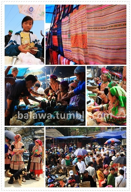
Many different ethnic groups such as Flower H'mong, Phu La, Black Dao, Tay and Nung minorities gather to buy and sell local products that cannot be found elsewhere. The market was very crowded, local products for sale or barter are carried on horseback. Besides the usual items like pigs, cows, chickens, and ducks, Bac Ha Market sold dogs. As dogs were available as cuts of meat, they were also available live, right next to the live pigs, chickens, and other livestock
After lunch we continue hitting the road to Sapa Village, we just don't get when our tour guide telling us to take different road, he told us to walk down in the middle of the day, long and winding road to take. Okay, am chilled enough, beautiful natural landscape could make me chill actually, though I wanna 'toyor' the tour guide :D

45 minutes walking and boating, we heading to Sapa Village afterward. One hour journey to reach the place.
Located in Vietnam's remote northwest mountains, Sapa is famous for both its fine, rugged scenery and also its richcultural diversity. Sapa is an incredibly picturesque town that lies in the Hoang Lien Son mountain range near the Chinese border in northwestern Vietnam, known as "the Tonkinese Alps". Sapa and its surrounding region is host to many hill tribes, as well as rice terraces, lush vegetation, and Fansipan, the highest peak in Vietnam.
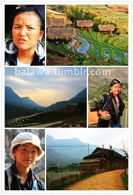
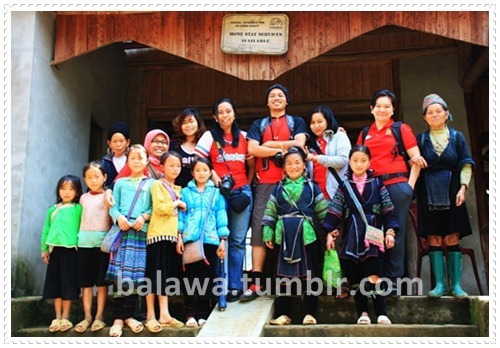
We arrived at Ta Van, and was greeted by some villagers. Many older women in particular make items such as ethnic-style clothes and blankets, to sell to tourists. Striking up a conversation with them can be very rewarding and their spoken English is impressive. Sadly, however, doing this in Sapa town itself will sometimes lead to a scrum as a multitude of vendors taste a potential sale
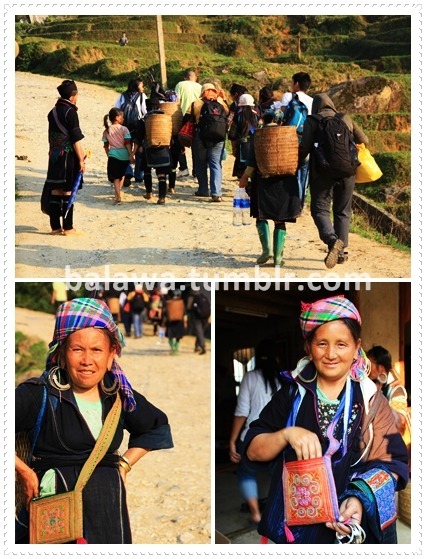
Children from these ethnic minorities often begin to support their families financially through selling trinkets to tourists. Do not encourage this by buying from children - Buy from adults.
Shocking point that these children also taught how to get money by their parents. For example when I want to take their picture and already ask permission before hand, one of the child said: 'pay me $5' in another occasion the parent also said: 'you want to take her picture? just pay'...really unhealthy situation for the children.
Girls and boys get married young (around 15-18) and often have two children by the time they are 20 years old.

Poverty has led to a great number of girls leaving their villages each day to go selling in Sapa town, and depending on their luck, may only have one meal per day.

We realize this situation, though they a bit 'force' when selling something and helping us when do the trekking, we do buy some goods from them, it were very awe ethnic handmade with best price I suppose :)

We stay overnight at guest house in Ta Van, and I think we've been cheated by the Tour Guide. Since we went look around, other guest were staying in villagers house and get a long with them but we didn't get same opportunity. Also we've to pay $6 / each for additional tour that he never offered to us. After chat with another tourist, we informed that Travel Agencies in Vietnam are known for their bad business practice.
Although I lost my 2GB card full of pictures in Sapa and cheated by the tour agent, overall, Sapa is an excellent adventure place for me :)
...
Writing Source:
http://www.vietnam-beauty.com
http://wikitravel.org/en/Sapa
17 notes
·
View notes