
A meandering walk, hike, and run throughout California.
Don't wanna be here? Send us removal request.
Statistics
We looked inside some of the posts by basajoe-blog and here's what we found interesting.
Average Info
Notes Per Post
0
Likes Per Post
0
Reblog Per Post
0
Reply Per Post
0
Time Between Posts
4 days
Number of Posts By Type
Text
7
Photo
1
Last Seen Tumblr Blogs


Fun Fact
Celebrities use Tumblr as well.
Text
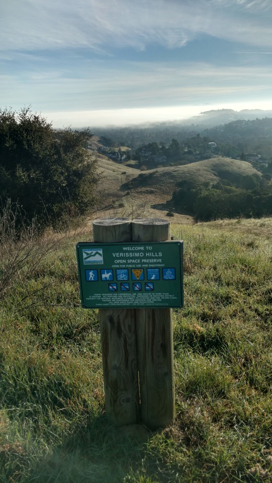
No Map, No Problem
12/27/2017
I get to the trailhead and I find out I had left my map at home. Now I would never recommend going hiking without a map unless the area you are hiking in is well signed. In this case though I had never hiked the Vermissimo Hills before but I was very familiar with all the landmarks surrounding it.
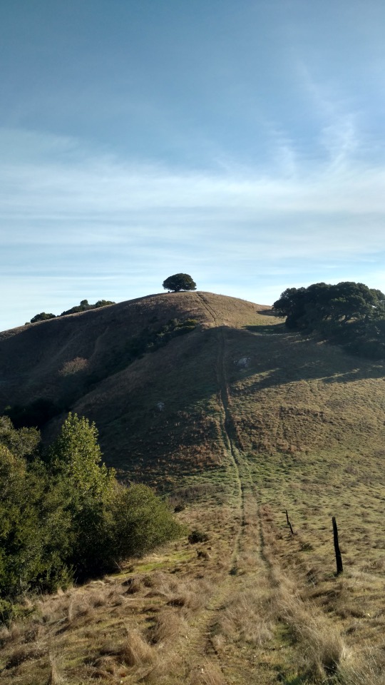
Once in the Preserve I purposely went off the main trail to go up a side trail to check out a lone oak tree by itself on a hill. From there I bushwacked up and down other interesting areas of the Preserve. It was very reminiscent of when me and my brother as kids explored every nook and cranny of Capitola.
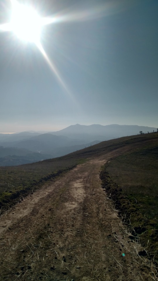
I eventually made my way to Burdell Open Space Preserve. I made my way up Mount Burdell. Burdell was called Olompais by the Miwoks. Olompais meant Southern Mountain. Once to the top I came down the other side to Olompali State Park. The park is where the biggest Coastal Miwok village was located. Olompali meant Southern People.
Besides its significance as a Native American historical site, Olompali is also the site of the only battle of the Bear Flag Republic Revolt. A coin from 1577 with the image of Queen Elizabeth was found during an excavation providing evidence that Sir Francis made contact with the Miwoks during his voyage up the coast of California.
I finished up here. When I start again I'll be on the roads as I leave Marin County and go into Sonoma County.
0 notes
Text
Plans go Awry
12/24/2017
I had it all planned out. My wife would take me to where I left off yesterday. From Indian Valley I would run the 4 to 5 miles to Vineyard Rd.
In the meantime my wife, Cyndi, would walk with our dog Denali at Indian Valley. She would then drive to Vineyard Rd. and meet me in about an hour with my pack so I could hike the rest of the day. That was the plan.
Well I made it to Vineyard Rd. with no problems and I waited and I waited. It began to rain and I began to get cold. I was just wearing running clothes.
My wife had got lost driving. She went into town to get gas and forgot how to get to Vineyard Rd. I eventually got concerned and walked down the road where I could get cell service. We coordinated and she found me. Fate said to call it a day and that's what I did. No problem, I've gotten off track many times hiking so it's not unexpected for my support people to have direction issues also.
0 notes
Text
Big Rock
12/23/17
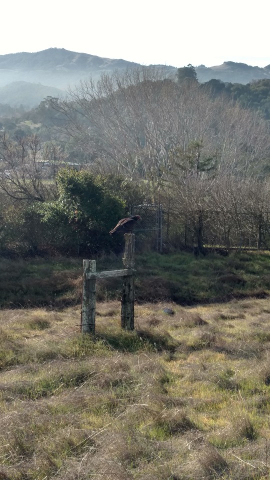
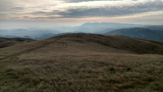
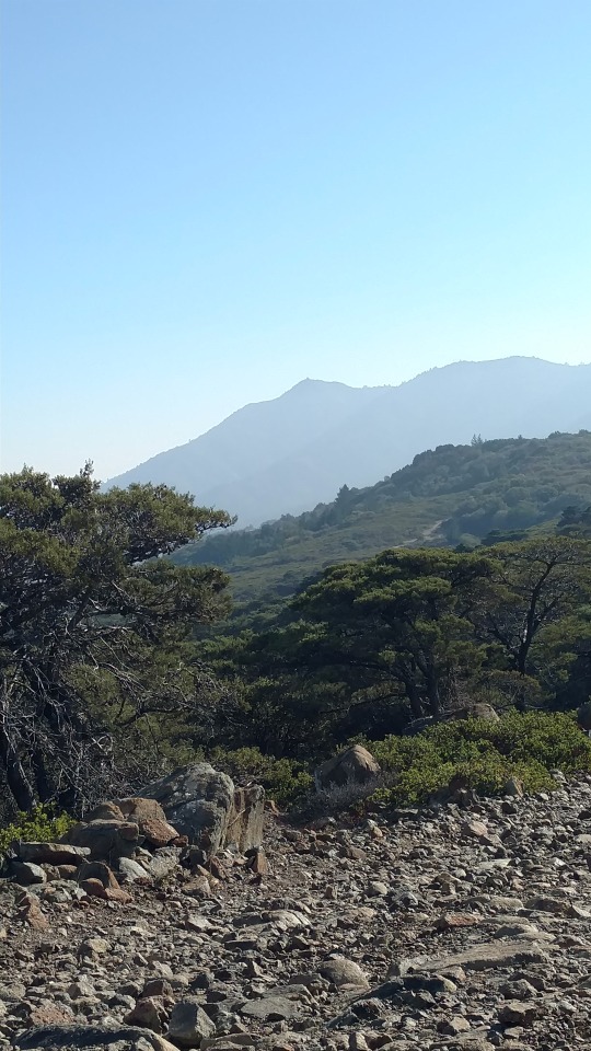
Started day at Loma Alta Trailhead and hiked up a well graded trail with numerous switchbacks that took the bite out of the climb up to Big Rock. Big Rock Ridge at 1,887' is the third highest mountain in Marin County. I have been to the top of Big Rock many times but never from this route.
At the top, I paused briefly for the view then proceeded downhill on a route that I was very familiar with. Near the bottom I veered off on a trail called the Halloween Trail. I had never been on this trail before though I had passed it so many times previously. This brought forward a question I've asked myself a few times already on this hike.
Why do I get stuck in such a rut where I repeat the same hikes over and over again without taking the opportunity to explore and experience new things? Is it because it's more about getting a workout in then seeing things? Is it because there is a comfort level in doing the same thing over and over again? I don't know the answer but on this hike I plan on taking those trails that I don't know where they lead maybe they'll lead to some answers.
I finished my day in the Indian Valley Open Space Preserve.

0 notes
Text
Mt. Tamalpais
12/18/2017
I smashed another ridiculous self imposed rule today when I did a flip flop. Last week I ended my hike at Muir Beach. In the past I would have continued my hike from Muir Beach, not this time! Today I started from Lucas Valley Road so I could end at Muir Beach. It logistically made sense and it felt right to end a day of hiking at the beach instead of a roadside trailhead.
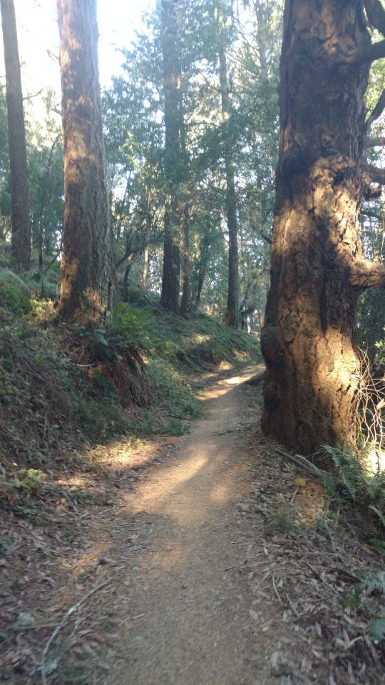
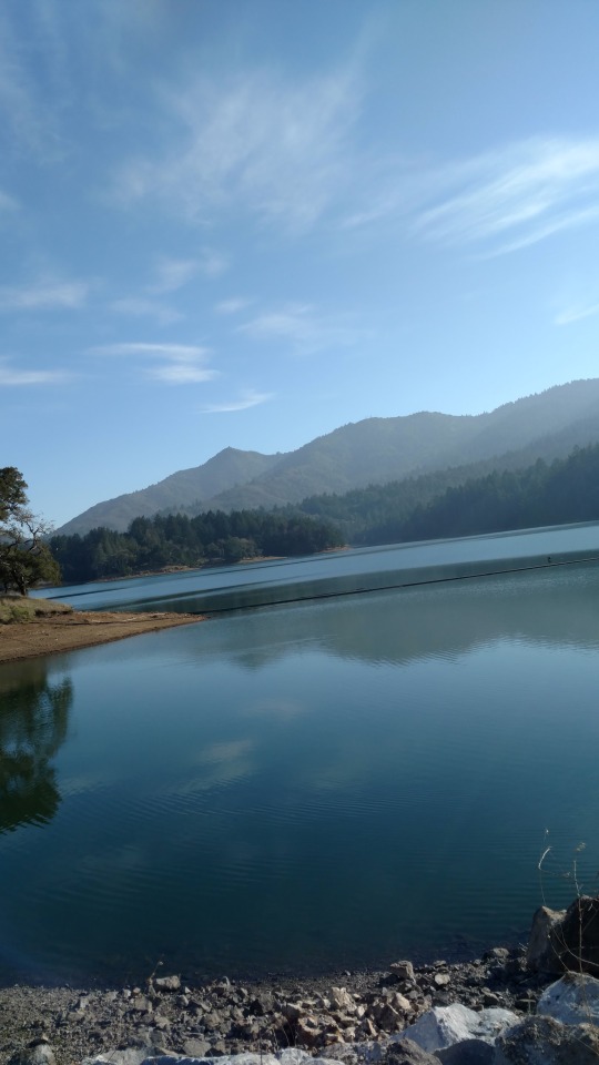
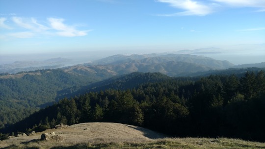
So I started on the Northside slopes of Mt Tamalpais going through the Loma Alta Preserve, White Hill Preserve, Gary Giacomina Preserve, and the Marin Municipal Water District until I reached Mt. Tamalpais State Park and eventually the West Peak of Mt. Tamalpais. In one short section as I neared Bon Tempe Lake I lost the trail so I bushwacked my way to the lake. As usual when I bushwack a physical price must be paid; I had several scratches on my legs with some of them bleeding from the rough coastal shrubbery.
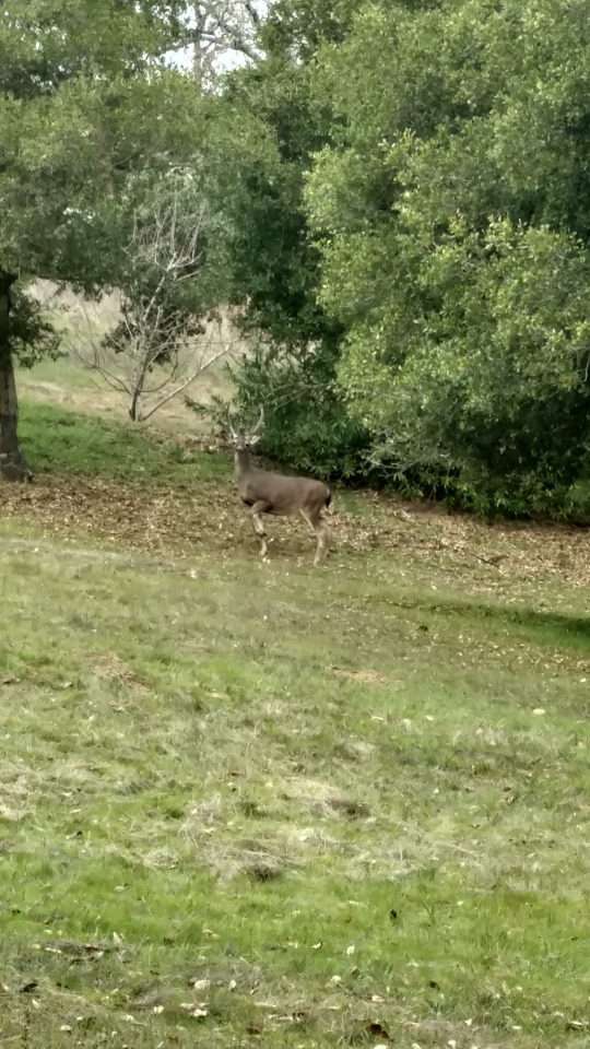
Mt. Tamalpais means coastal mountain or bay mountain in Miwok. The Coastal Miwoks were here for approximately 10,000 years before the Spanish arrived. They were hunter gathers. There was no need for farming in this area; the land provided plenty of substance. The main staple of their diet was acorns supplemented by the buckeye nut when the crop of acorns was small. They also gathered clams, abolone, and muscles from the sea shore or Bay shore. They also hunted deer along with small game such as rabbits. There is physical evidence of how they subsided. There are holes bored into rocks where they made acorn mill. There are also remains of large sea shell piles.
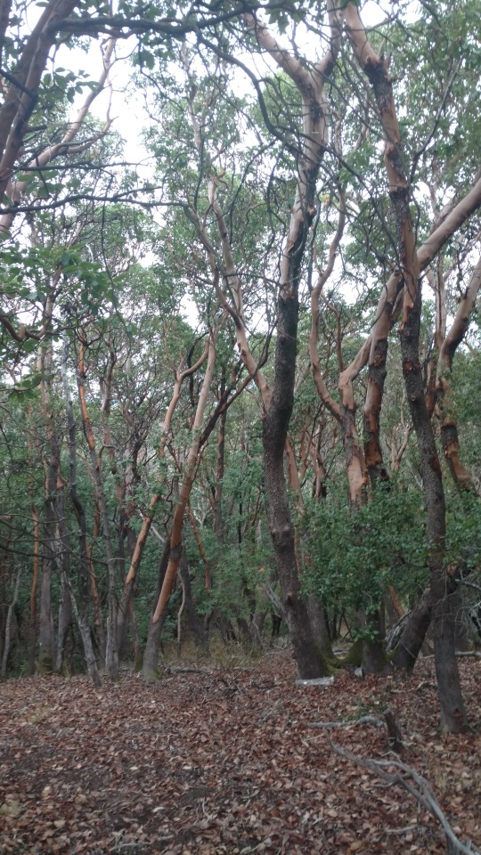
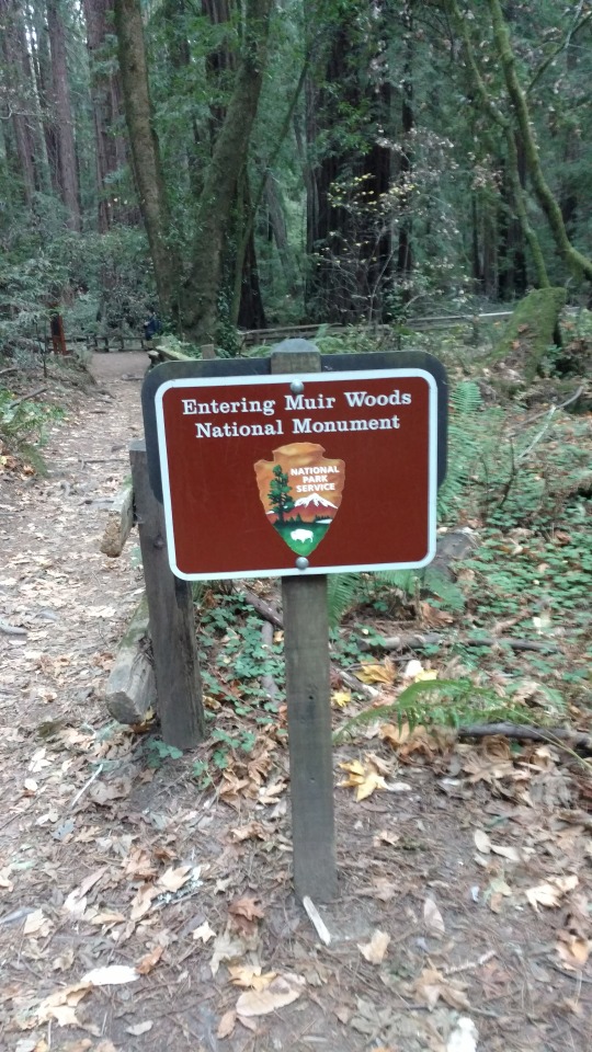
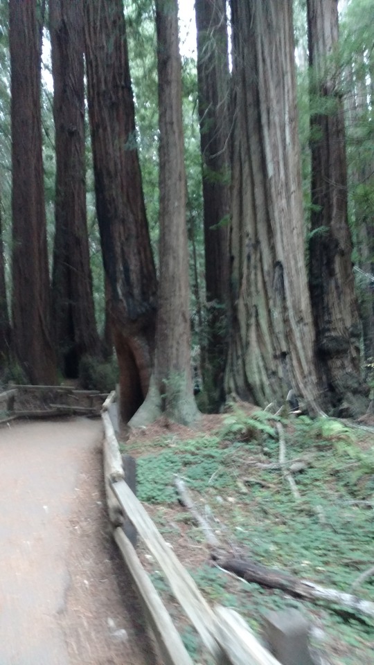
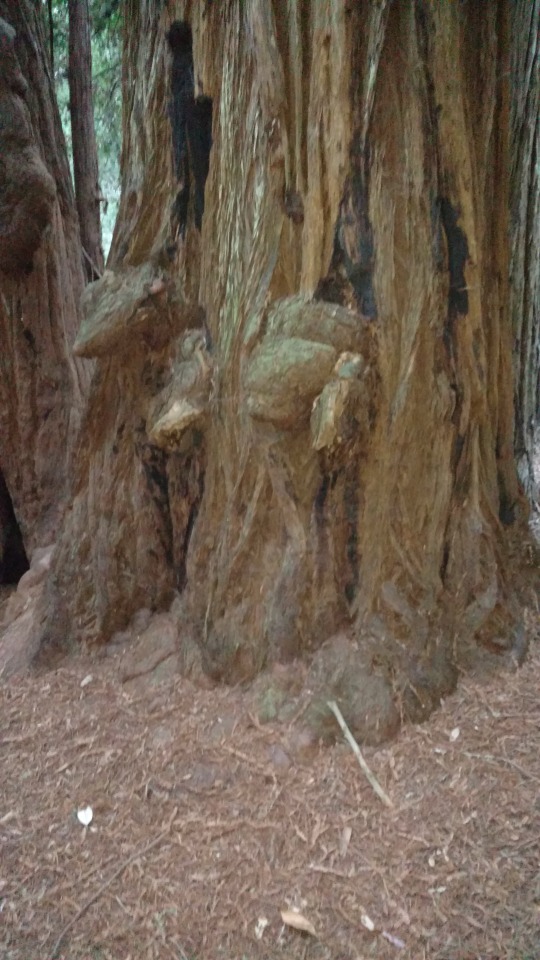
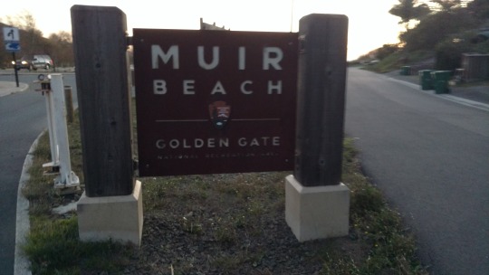
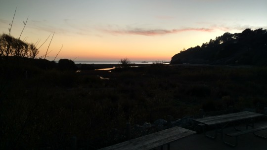
Once at the top I descended into Muir Woods National Monument. I came in the back way where no fee was necessary. The redwoods did not disappoint. This is the nicest grove of redwoods in Marin County. An added bonus were the beautiful ferns that lined the forest floor. I finished up the day in the Golden Gate National Recreation Area at Muir Beach. I just missed sunset settling for a vanishing horizon!
In a couple days I will begin again going towards Big Rock and Mt. Burdell.
0 notes
Text
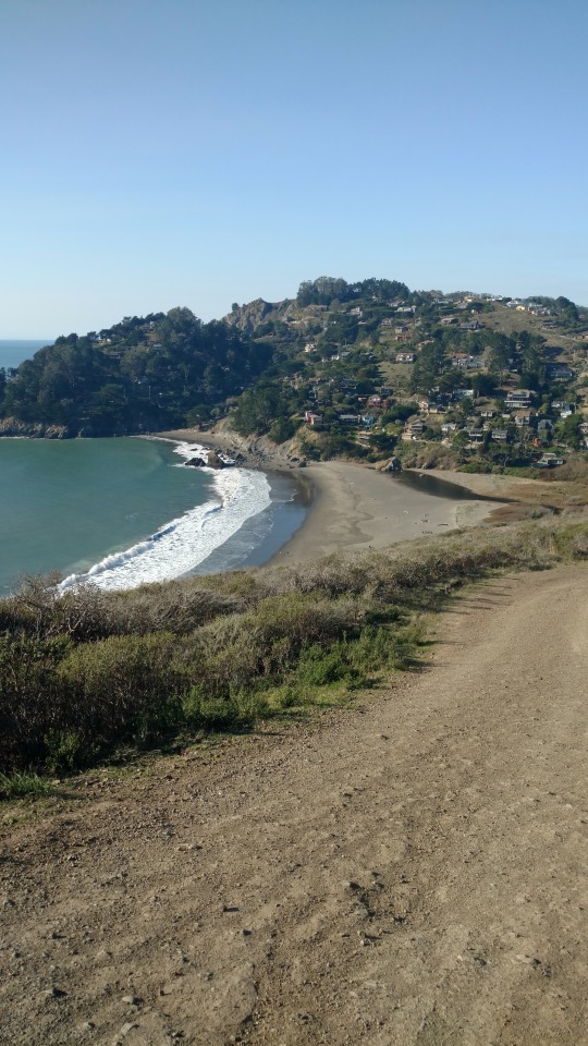
Little Beaches
12/12/2017
After breakfast, Joey and I hiked from the hostel to Rodeo Beach where we met Tim, who drove there. Rodeo Beach is my favorite Marin County beach. We take Denali, our dog, there a lot since it's one of the few beaches on Marin where dogs aren't required to be on a leash. It is also a favorite for the local surfers.
Once we hooked up with Tim, we all proceeded uphill on the Coastal Trail to the Battery Townsley. The battery was finished in 1940 as part of a top secret homeland security project. It had two 16" guns capable of firing 25 miles out to sea. But by the end of WWll it was already obsolete. Also at the battery is a well maintained gun barrel off the battleship Missouri. At this point Tim and Joey returned to Rodeo Beach and I continued on.
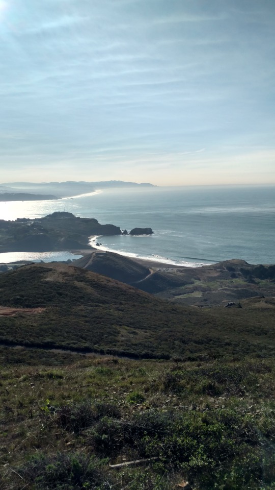
The Coastal Trail is a rolling trail up and down steep bluffs through coastal chapparel. After a couple miles I reached Tennessee Valley. From there I took a detour to Tennessee Beach.
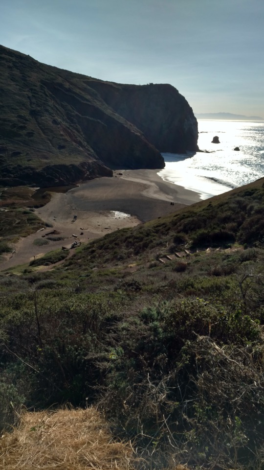
Tennessee Beach is named after a side paddle boat that was purposely beached there in 1835 after the ship missed the opening to the San Francisco Bay due to intense fog. All the passengers survived. At the beach I walked from one end to another looking for clues to the ship wreck. I found two iron objects poking out from the sand possibly part of the steam engine. I then proceeded to another side trail to get an aerial view of the beach.
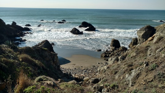
After some pictures from the high point I hiked back to the Coastal Trail and continued on until I came upon another spur trail that I once again took. Why so many detours and side trails? It's because this hike is about meandering and seeing things that I might never have the opportunity to see again! So down another side trail to a small cove with a beach called Pirates Cove. The cove had many rocks protruding from the ocean protecting a very small beach. I sat down for a few minutes enjoying the view.
After my rest I hiked another few miles to Muir Beach. The sun was out and I couldn't resist the temptation of enjoying it. I called it a day. I took off my shirt and covered a log with it. I put my fleece on the sand by the shirt. I put some sunscreen on and sat down on the fleece with my back resting on the log. I called my wife for a pickup. I pulled out my book and read for the next hour. It was so relaxing, so worth it!
Next week I'll be hiking into Mt. Tamalpais State Park, Muir Woods National Monument, Marin Municipal Water District's Mt. Tamalpais Watershed, and several Marin Open Space District parks.
0 notes
Text
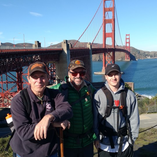
1st Day
12/11/2017
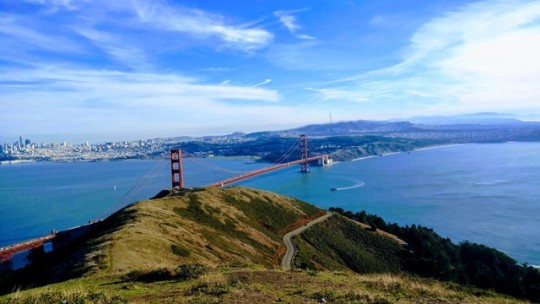
The first day on my "Meandering Cali Walkabout" set the bar pretty high for the days to follow on this adventure. The Golden Gate is a spectacular trailhead to begin a hike. The weather was extraordinary with a bright sun and a crystal blue sky. My hiking partners today were my son Joey and my friend Tim Hupke.
As we walked across the bridge going South to North, with the Bay to the right of us and the Pacific Ocean to the left of us, we were treated to views of the Bay Bridge, the City, Alcatraz, Angel Island and Fort Baker. One had to be careful to not be too mesmerized by the beautiful scenery in order to dodge oncoming bicyclists and other walkers going the opposite direction on the bridge. Once we were to the North side we found a bench sheltered from the wind, we snacked and took in some vitamin D.
We crossed under the bridge on a little known path used by bicyclists and pedestrians to cross to the other side. The vehicles clamoring overhead were a little unnerving to me. I reassured myself by remembering the bridge had been holding strong since 1937. In only a couple minutes we were on the Marin Headlands side of the bridge.
We walked across a road and began hiking on the Coastal Trail. The trail was well maintained and had numerous switchbacks making the climb to Slacker Ridge manageable. Once on the ridge we headed West towards the ocean. We had one detour to make.
I had heard that the best view of the Golden Gate was an aerial view from Slacker Hill. So when we came upon a spur trail to the hill we took the steep climb to its top. The view did not disappoint! Wow! After about 30 minutes at the top we continued our journey.
We ended the day at the Marin Headlands Hostel. The hostel was once a military hospital. It is one of the best lodging deals in the Bay Area. We checked in, cleaned up, and ate dinner. After dinner we went downstairs to the game room where my son Joey schooled me in foosball. I did not score one goal in several games! There was also a ping pong table there. I redeemed myself winning two close games. The difference maker was my slam that I had developed playing ping pong at the fire house.
We all went upstairs where each of us found something interesting to read as we settled down for the night. We finally called it a night.
0 notes
Text
Hello
12/10/2017 Welcome to my Cali Walkabout Blog. My trail name is “BASA.”
My California walkabout begins tomorrow starting on the San Francisco side of the Golden Gate Bridge. I will be heading North. I hope to walk, hike, or run a couple days each week on a meandering route that is based on seeing beautiful sights and Interesting things. In other words I’ll be making this up as I go! This should be quite the journey!
0 notes