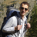
There’s nothing like getting high… way up there in the mountains, I mean-- "highking." This blog chronicles some of the greatest hikes I have been privileged to undertake across the globe from Europe to Asia, and from South America to Oceania. There’s basic information about each hike, like trail head location, length, elevation gain, at the start of each blog post. Then follows the story that was generated by the hike, together with pictures taken along the way. I even throw in a bit of philosophy here and there.
Don't wanna be here? Send us removal request.
Statistics
We looked inside some of the posts by bernardhiking and here's what we found interesting.
Average Info
Notes Per Post
9
Likes Per Post
7
Reblog Per Post
2
Reply Per Post
0
Time Between Posts
5 months
Number of Posts By Type
Text
16
Photo
1
Last Seen Tumblr Blogs


Fun Fact
Hackers stole 65M passwords from Tumblr in 2013.
Text
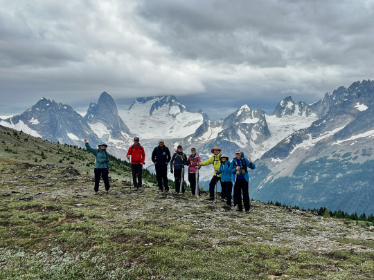
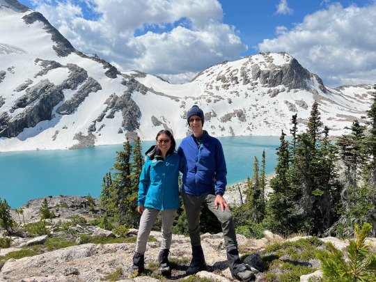
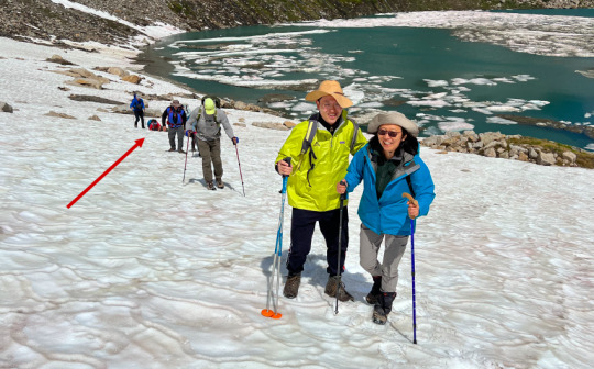
Rocky Point Basin to Black Forest Ridge (heli-hiking)
Date: 08/03/2022 Country: Canada Region: The Bugaboos (in the Purcell Mountain Range if British Columbia) Trailhead: None (cross-country hiking) Length: 9 miles Elevation gain: 2,900 ft
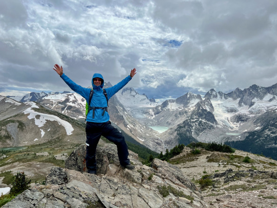
Part of the fun of heli-hiking is that it’s a bit like a lottery, with only winners. We never knew where we were going to be dropped off, and today was no different. In fact, the original plan, i.e. to start the day with a glacier walk, had to be scrapped after it was dicovered (from the air) that our landing spot for that venture was taken over by grazing mountain goats. Canadian wildlife regulations are strict in this regard—no landing for three days after a herd has been spotted in any given area. So, our plans were adjusted on the fly--literally--and we boarded the heli bound for a new drop-off point and a different route. Fortunately, this adjustment didn’t detract from our enjoyment of the day, as we were bound for the longest and most varied of our three heli-hikes.
After being dropped off on a high-laying basin, we slowly wended our way up toward a nearby saddle, and from here we had the first great view of the day.
Making steady tempo, we crossed Rocky Point basin and ascended the steep slope on the opposite side. Now it began to rain, and we were concerned that the weather might turn ugly. A front was expected to arrive later that day, and this was simply an advance warning of metereological instability. Everybody put on their rain gear, and for the rest of the day, we mostly kept on the additional layer, as it sprinkled on and off without, fortunately, ever fully turning on the rain. When we crested the ridge, the last sun rays were lighting up the nearer territory, while the spires and glaciers of the Bugaboo range were greyed-over pretty solidly. Still, the mountains were out of the clouds.
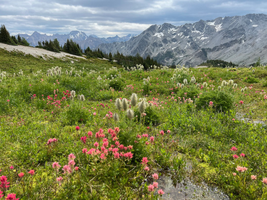
The next valley we crossed offered the perfect conditions for lush floral displays, and we were engrossed by the riot of Indian Paintbrushes and Anemones that spread their flowering bounty across the meadows.
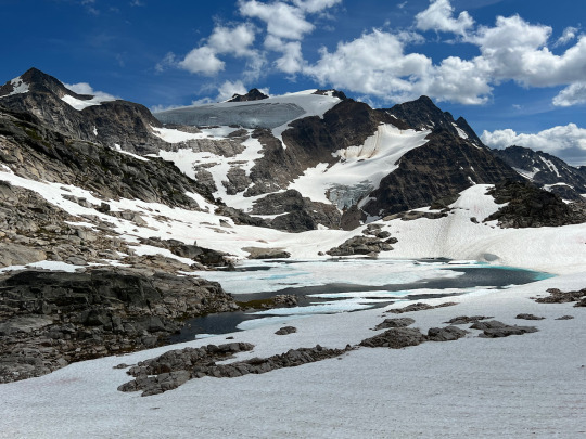
Next to a crystal clear stream, we had our leisurely lunch break, taking in the serene scenery and resting up for the long stretch that lay still ahead of us. It’s always exciting to be slogging steeply uphill, then arriving at a ridge and looking down into a world of meadows, lakes, snow patches, streams, and mountains. It was no different, when we crested the ridge that gave us our first unimpeded glimpse of the Bugaboos.
From here, our guide Brian took us directly into the dense brush of the slope to avoid the ridge which rose and dipped steeply ahead of us. This was slow going, with uneven footing and some struggle with branches and roots, not to mention occasional light showers, but we made it in good spirit, trusting our guide to find a direct, safe route to take us back to the ridge, so we could climb up to Power Pig Summit.
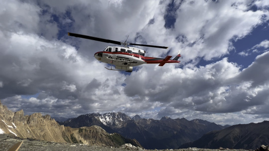
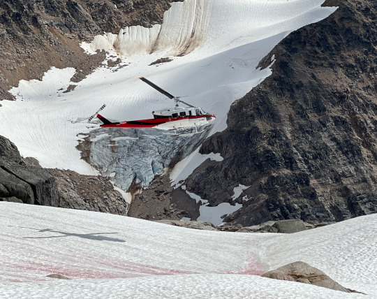
Some members of our group were getting tired at this point, and while we were having another snack break, Brian used his two-way radio to arrange for them to be picked up on top of a nearby prominence along the ridge. Just then, the rain was coming down harder, and we though uh-oh, that may be the end of the hike for all of us. But then, unexpectedly, the skies tore open, patches of blue appeared, and a few stray sun rays shot down to illuminate the scene. This happened just as we topped the landing spot for the heli, and now we were exposed to a truly spectacular sight, while fierce windgusts made us scramble for shelter behind a large rock.
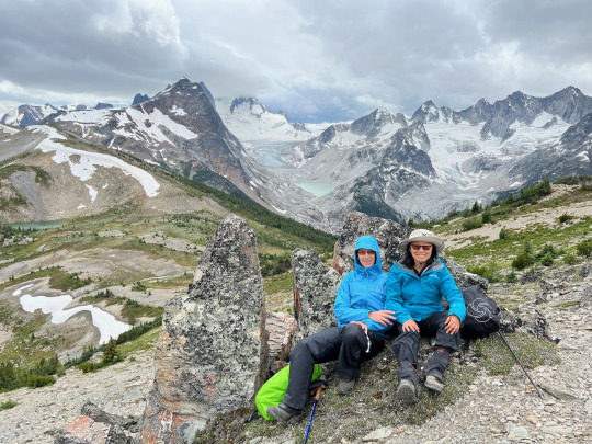
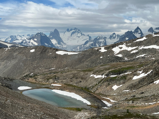
The drama of whirling clouds, soaring spires and peaks, and wandering sun patches over glaciers and snowfields was breathtaking. The heli soon came to take three group members home, and after the clattering of the helicopter blades had died away, we were proceeding along the ridge toward Cobalt Lake, the last and final highlight of an already wonderful outing.
Because the ridge we were on was a well-frequented route, there was a semblance of a trail, allowing us to proceed at a brisk rate. Just as the light was beginning to dim at 5:15, we glimpsed Cobalt Lake and its surrounding crystalline rock spires.
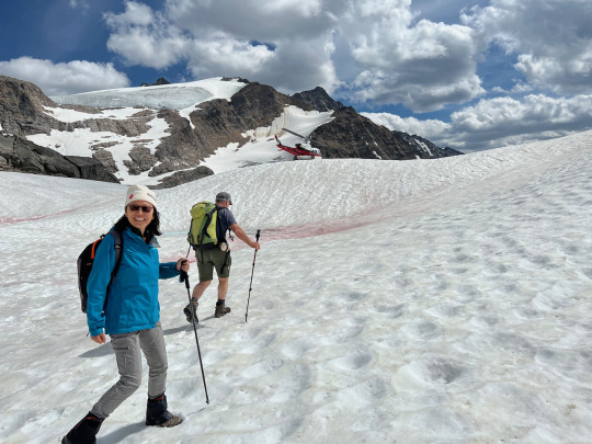
After shooting a few pictures, we huddled down to await the arrival of our ride home. As usual, Jens made a stunning precision landing, setting down the helicopter two feet away from us—amazing. We’d had a most impressive and enjoyable hike through varied territory and under changing weather conditions. Definitely, heli-hiking is something we want to continue doing in the future.
0 notes
Text
Thunderwater Lake Route (heli-hiking)
Date: 08/02/2022 Country: Canada Region: The Bugaboos (in Purcell Mountain Range), British Columbia Trailhead: None (cross-country hiking) Length: 6 miles Elevation gain: 2,600 ft
This was our second heli-hike, and it confirmed our first enthusiastic impression from the previous day. As a mode of hiking, it offers a plethora of advantages: A) You quickly get to remote locations; B) you are transported above the tree line, so hiking starts and ends with views; C) There is never an in-and out trail, but it goes from A-B with ever-changing scenery; D) Since you find yourself in scenic spots both much earlier and much later in the day than would be possible on regular day-hikes, you can catch the best light conditions for photography in spectacular surroundings high up; E) The hikes are mostly cross-country, away from trails, which means that the flora and fauna are untrammeled and plentiful; F) And finally, you enjoy near complete solitude up there among the glaciers and peaks (except for the fellow hikers in your small group).
Oh, there’s one more bonus (though this may be a matter of personal taste): We never knew exactly where we were would be dropped off at any given day. The guides have a meeting in the morning, and--depending on the weather forecast, the conditions on the ground, the participants’ hiking proficiency, as well as other factors such as wildlife activity--they decide each group’s route for the day. We as clients are simply herded into the heli, and then we take off to parts unknown--at least unknown to us. Every day thus starts with a surprise.
This morning, after a short 5-minute flight, we were dropped off on a ridge across from a yellow limestone wall dramatically lit up by the slanting sun.
The heli’s take-off pressed us into the ground with its powerful rotor wash. Then we got up, dusted ourselves off, and took a good look at the surroundings. Right below us, we spied the first of five scenic lakes strung along today’s route. However, we were headed in the opposite direction from that lake, and as soon as we turned around a ledge to start descending a rocky slope, a sharp wind sweeping down from the icefields sprung into our faces, reminding us that we were in truly wild territory.
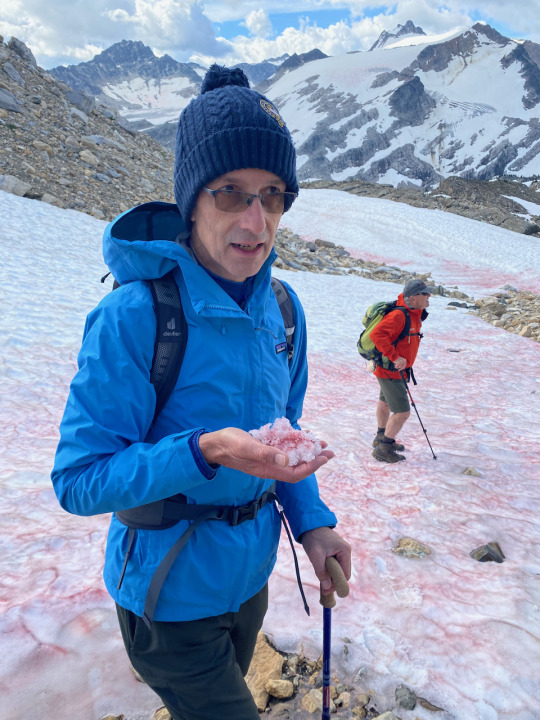
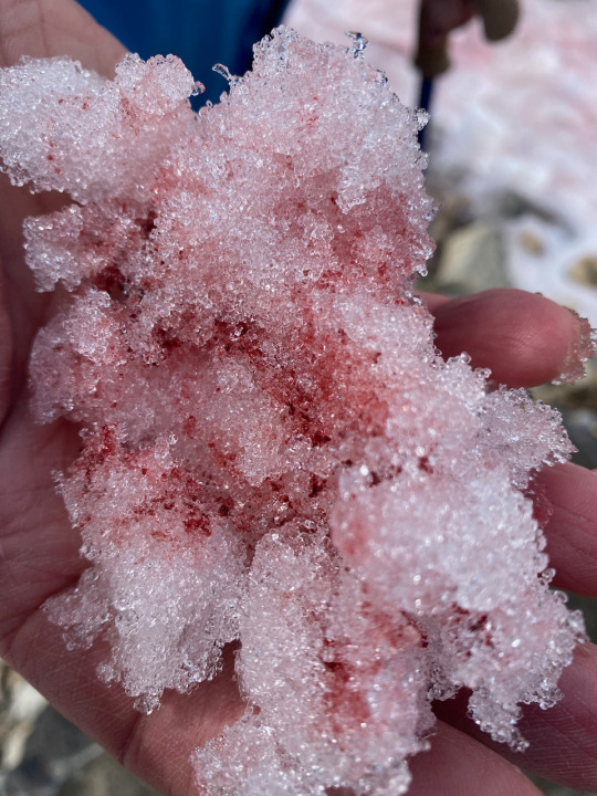
A little later, lake #2 came into view, still mostly frozen, and covered with a thin layer of red algae dubbed “watermelon snow.”
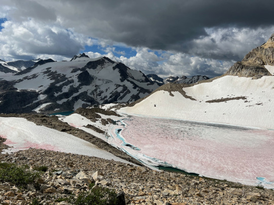
This type of algae, named Chlamydomonas Nivalis, lives on snow, where it produces a secondary, red pigment to protect the chlorophyll from the sun’s UV light, like a “sunscreen.” Nature is amazing!
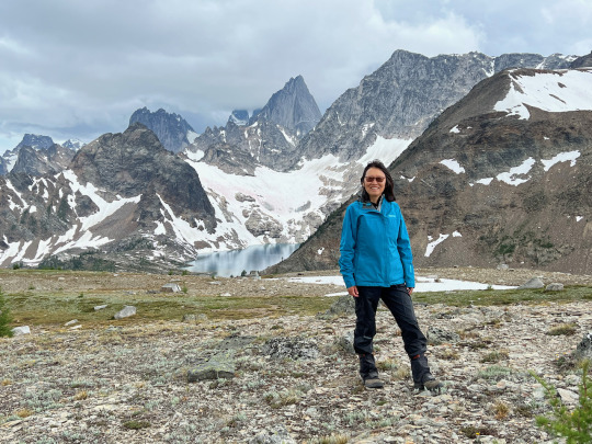
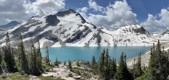
We continued scrambling for another hour, navigating a steep scree slope, crossing a boulder field, and following the steps cut by Hans into a tilted snow field. In this way we slowly approached Thunderwater Lake. After ascending an extended snowfield, we topped the comb of the ridge and then looked down upon the luminous lake, ringed by snow-covered mountains--high-alpine views at their best.
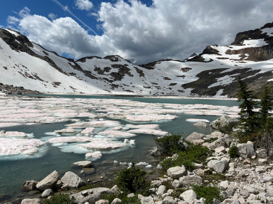
Following the shore of Thunderwater Lake, we proceeded another half-mile uphill until we arrived at lake #4, which was 50% covered with chunks of ice coated in watermelon snow. Here we had a most delightful picnic lunch, tucking into the sandwiches provided by the lodge while clouds chased each other across a blue sky, with corresponding patterns of light and shade gliding over the rock, ice, and water.
The next segment of our hike included a long uphill slog over a steep snowfield. Again, the icepick came out, as Hans cut steps into the hardened snow to create an improvised stairway. One member of our group didn’t have poles and kept falling down, an object lesson in bringing the right equipment for this kind of territory.
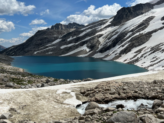
The final portion of the hike required navigating a boulder field, and here we proceeded very slowly, picking our individual way by hopping from rock to rock. Our peculiar hiking technique, i.e. holding hands while using the opposite arm to support supporting ourselves on hiking poles, came in very handy--literally--in this stretch of the hike. We are such a well-practiced team using this technique that we can pretty much outpace everybody, except our guide. After about an hour of such scrambling, we arrived at lake #5, a partially frozen mountain tarn cradled in a small depression at the foot of a hanging glacier.
Sliding down to the lake sitting on our bottoms or skidding along on our boots was great fun. Then we took our time for another snack break, watering up, and enjoying the stunning scenery with clear views across the lake to the distant snow-clad peaks.
Half an hour later, the chopper’s percussive clatter suddenly echoed from the surrounding cliffs, and then the heli swung into view, banking steeply to the left, making a turn and then coming to rest on a nearby natural snow platform.
Our pilot, Jens, had arrived early, and while we were heading over to the landing site, he cut the engine and sauntered toward us, evidently in no hurry and happy to pose for pictures. A wonderful day thus came to an apt conclusion.
1 note
·
View note
Text
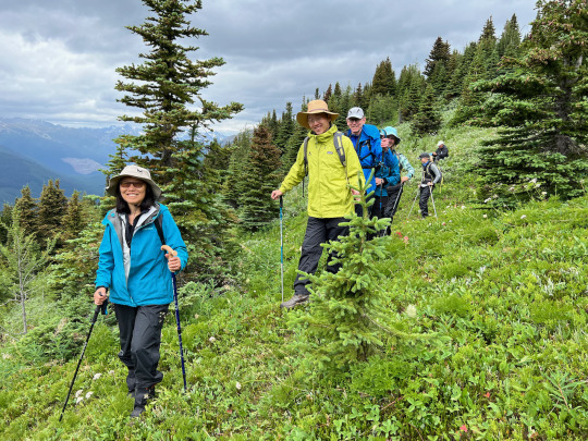
East Ridge Summit (via Edith Cavell Meadows Trail)
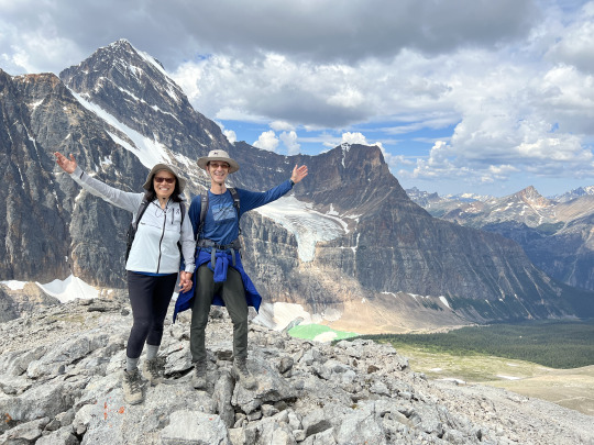
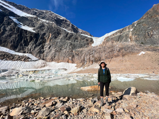
Date: 07/30/2022 Country: Canada Region: Jasper National Park, Alberta Endpoint: East Ridge Summit: 2571 m. Trail type: In-and-out, with loop portion in the middle Length: 8.5 miles Elevation gain: 2,800 ft Trailhead: Edith Cavell Meadows Parking Lot
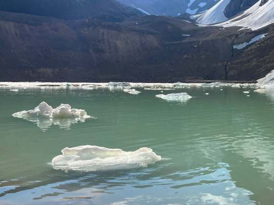
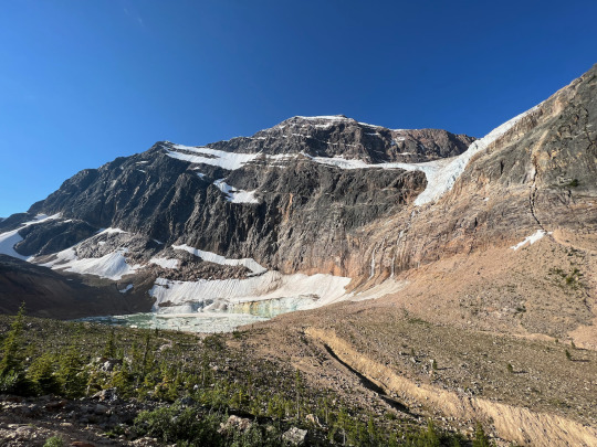
We started the hike early, as we knew it is a very popular destination. The two oversize parking lots at the trailhead, though almost empty when we arrived there at 8:30 am, gave a good indication of what was to come. We started vigorously, dashing up the paved sightseeing trail called “Glacier Walk” to a nice viewpoint, overlooking Mount Cavell and Cavell Pond—a jade colored glacier lake with melting chunks of glacier debris dotting its surface like vanilla ice cream in a float.
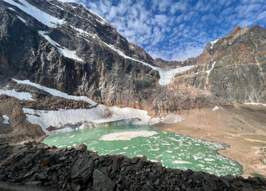
Before us rose the daunting north face of Mount Edith Cavell (named after a WWI nurse who was executed by the Germans for aiding Allied soldiers escape from German occupied Belgium—a strange choice of naming for a beautiful mountain, notwithstanding the gallant lady’s obvious merits). Seen from a distance, the mountain leans at a nautical tilt, with parallel bands of rock and snow giving the impression of a sinking ship; but up close, the view is of an imposing and doubtlessly hard-to-climb peak.
We were practically alone when we arrived at the shores of the glacier lake (incongruously called Cavell “Pond”), and we snapped a good number of pictures there, for the sight was lovely.
Then, just ahead of the first wave of sightseers, we headed up the hiking trail toward Edith Cavell Meadows.
Spring had arrived late in the Canadian Rockies this year, and only 2-3 weeks earlier, snow fields were still impeding hiking progress here. But now, a heatwave was in full swing, with temperatures soaring above 90 even in the mountains (part of a continental—or even north-hemispheric—drought phase), and this dispatched of the snow cover in a short time, allowing for the explosive growth of the flora waiting underneath. Now, the lower-lying meadows were in full bloom with Indian Paintbrush, Heather, Daisies and plenty of other pretty flowers vying for prominence.
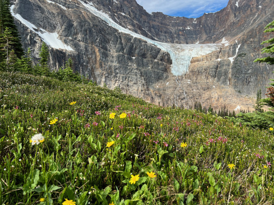
But only a narrow band of altitude displayed this floral abundance, and once we gained more altitude, the flowers were still in wait. What was definitely out in full force were the bugs! Although we had slathered on a generous amount of repellent at the outset of our hike, we were soon attacked relentlessly, forcing us to double down on the repellent stuff, putting on a second layer of an even stronger product to keep the pest at bay. It got slightly better after we entered the area above the tree-line, although even here the flies and mosquitoes were still active. But just turning around to behold the glorious sight of Edith Cavell North Face, Angel Glacier sticking its tongue out at us, and the ice-dotted jade pond receding further and further below us--all this made the insectile inconvenience pale by comparison.
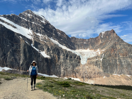
At a fork where the trail divides to form a loop, we chose the steeper (left) branch, reserving the longer, more gradual portion for our descent. About an hour and a half into the hike, we left the meadows behind and entered upon a stony ridge that led up to the end of the official trail. Along this stretch, we had good, muscle-straining fun, as we balanced on the edge of the comb, enjoying ever more spectacular views. We reached the “official” end of the trail at 11 am, and now we had the option of pushing on to reach East Ridge Summit, following a clearly visible, though less frequented trail made by people who simply were not satisfied to turn around before the highest point on the ridge was reached. It looked steep but doable, so we decided to make a go for it.
The extension was really worth it. A half hour later, just before entering the last stretch of loose scree, rocks, and an occasional snow patch, a large, flat stone to the side invited us to settle down for a picnic. Here, we ate our lunch sandwiches and replenished our fluid levels while taking in the sweeping vista.
Thus refreshed, we tackled the steepest portion of the ascent, making frequent zig-zag turns and holding each other’s hands for support. It is my favorite kind of territory—challenging to the point of making the heart race, yet without being outright dangerous. At noon sharp we arrived on the top, three hours after starting out. The scenery was wonderful in every direction, and we took a good number of pictures here.
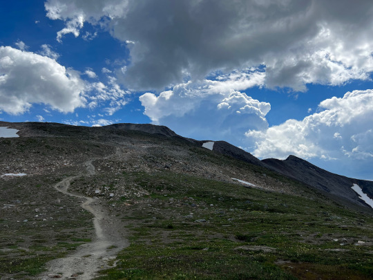
But we didn’t spend much time on the summit, as it started to look like the weather was about to turn. A few pretty impressive thunderheads were developing, and we wanted to stay ahead of the development. Rain did eventually come down, but by then we were already on the lower section of the return trail, approaching the valley bottom. We had taken the more gradual segment of the loop going down, and we enjoyed another burst of flower power along the meadows there. A Ptarmigan by the side of the trail was picking at the floral buds without paying us any mind.
At 2:30 pm, we were back at the parking lot, now bustling with hundreds of visitors. The early bird gets the quiet moments.
2 notes
·
View notes
Text
Salkantay Trek
Country: Peru Region: Vilcabamba Range of the Andes Starting point. Road to Soraypampa Type of hike: Lodge-to-lodge Duration: 6 days Distance: 40 miles (ca. 60 km) Highest Point: 4,630 m (15,200 ft), Salkantay Pass Elevation difference: Overall ca. 2,500 m elevation gain, with much larger drops End point: Machu Picchu
Day 1: This delightful multi-day trek started out at an unmarked location along the dirt road between Mollepata, a small mountain town situated high above the Rio Berbejo Valley, and Soraypampa. The road to get there was an experience in itself, definitely one of the bumpiest mountain roads I have ever been on. Our mini bus swayed crazily, and several times we had to back up because another vehicle coming from the opposite direction could not pass. So, it came as a relief when we were finally informed we could now disembark and start hiking. There was no sign or guidepost to indicate the presence of a hiking path anywhere, which made it rather convenient to have a guide. Indeed, although Peru is a hiker’s wonderland, featuring over 30,000 km of Inca trails--not even counting the numerous hiking paths that exist in addition to the Inca roads-- and yet there’s no system of guideposts signaling the directions, distances, or destinations of any given trail. It’s all about local knowledge here, and having a guide like we did made quite a bit of sense, unless one comes equipped with compass, maps, and navigational apps. Our guide, Pépé, not only showed us the way, he was also an inexhaustible and enthusiastic source of information, augmenting our experience with expert insights into the mysterious culture of the Incase and pointing out features of Peru’s flora and fauna, a subject about which he had an encyclopedic knowledge.
The start to our trek did not go as smoothly as we’d hoped, though. I noticed that Liang was not her usual vigorous self. Whether it was because of the altitude, the lunch, the bumpy ride (or a combination of those), she didn’t feel well, proceeding slowly and listlessly, until she had to step aside and bend over, being sick. After resting up a little and drinking some water, Liang gradually began to feel better, and soon she was smiling again. What a trooper!
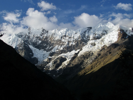
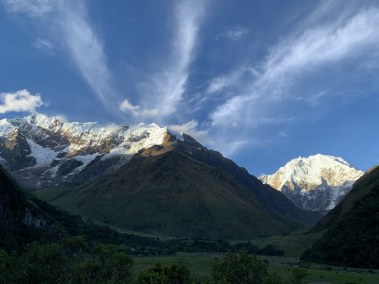
When we started our hike, the skies were overcast, but toward late afternoon, it began to clear up, and then minute by minute the awesome south facing side of Humantay moved more clearly into view. This beautiful mountain presents a long ridge with an almost vertical drop, ending in a neat summit pyramid, at an elevation of 5,473 meters.
Despite the mountain’s attractive profile and highly convenient location (the road almost leads up to the foot of the mountain), amazingly this peak has only been climbed once: A team of young American mountaineers made the first successful ascent in 2017.
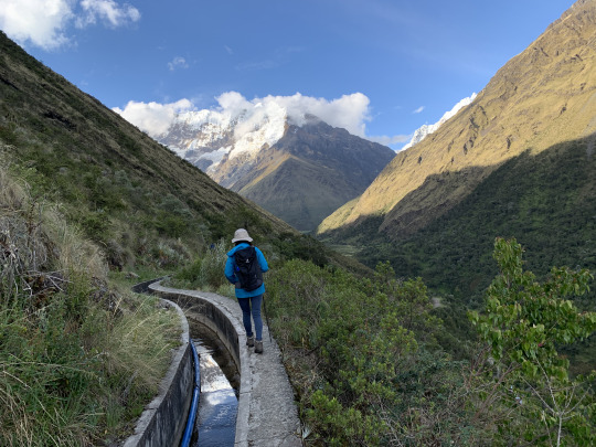
The trail leveled out after about an hour, and from then on it followed an ancient Inca irrigation channel. The channel had been reinforced by a European NGO and was now encased in concrete, with a blue PVC hose running along it. By now Liang had recovered her strength and vigor and managed not only to smile into the camera, but she balanced expertly along the narrow ledge beside the channel with a steep drop on the side.
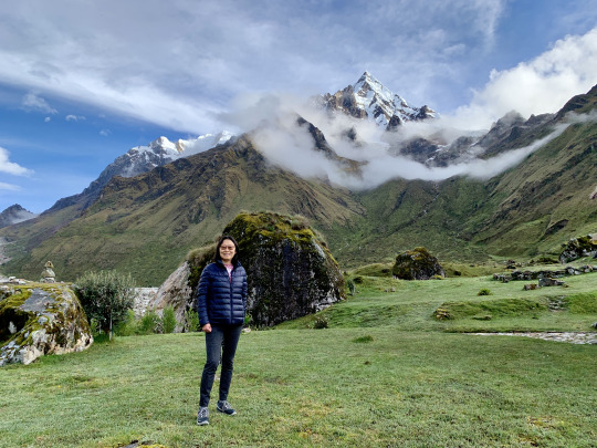
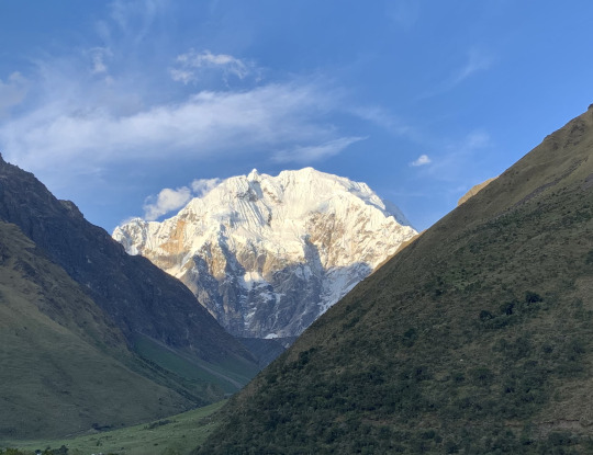
As we approached the settlement of Soraypampa, the destination of our first day’s hike, the majestic Salkantay mountain (6,271 m.) came into view. It is a regular dome-shaped mountain with a little twisted knob at the top, the actual summit.
We approached our lodge just as the evening light was bathing the snowy peaks with fading light, producing a magnificent effect, which was further enhanced by feathery clouds streaking across the sky. We were lucky to have seen these mountains during a clear weather window during the rainy season.
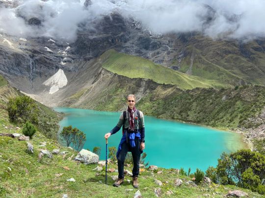
Day 2: The previous day had been an easy, pleasant hike, and this day would be no different. Today’s plan was to hike up to Lake Humantay (4,200 m.), and then return to the lodge in time for lunch. The Mountain Lodge has an arrangement with the local landowner who lets guests from the lodge pass to the lake through his land.
Instead of following the well-trodden braided paths that were the chosen route of the day-visitors from Cusco, we approached the lake from a sideways direction, following the stream that ran down from the hanging glaciers of Humantay.
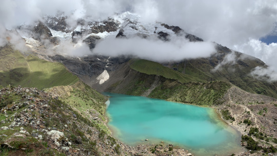
The morning was overcast, and we started under a fuzzy cloud cover, hoping for better weather as the morning progressed. As luck would have it, the clouds did begin to disperse during our climb, and after hiking for an hour and a half, we rounded a bend in the trail and there, below us was the glacial lake, its emerald green surface marbled by the swiftly passing clouds. The ever-changing spectacle was quite glorious.
We held a leisurely picnic in front of this dramatic scenery, while the emergency horse was peacefully gracing a little ways off, happy that its services were not required. The term “emergency horse” may need a bit of an explanation: Given the high altitude we were on, the trekking operators had organized a horse and hustler to accompany us on all but the last day, ready to take on a hiker if he or she were to experience some health issues which, given, the high altitude was not unheard of. And even if all went well, the horse patiently carried our extra water supply, thus considerably lightening our daypacks.
We took a bunch of pictures at this beautiful spot, and then we started our descent to the lode.
The round-trip to Humantay Lake took only about 3 ½ hours in total; it was a nice warm-up hike a test our abilities for the long day hiking across Salkantay Pass tomorrow.
Lunch at the lodge was expertly prepared, meeting high culinary standards. This kind of lodge-to-lodge hiking in Peru was even beyond the kind of “glamping” we had experienced in Tanzania last summer. This here was simply and truly a luxury outing.
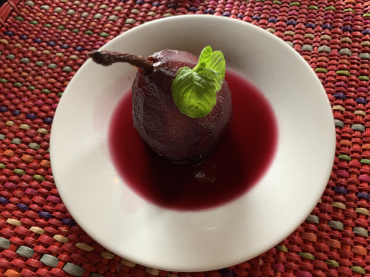
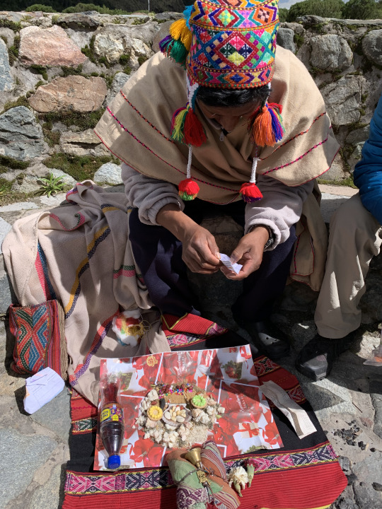
After a sumptuous 3-course lunch, accompanied by a glass of excellent Peruvian wheat beer, we gave thanks to the source of all this goodness by participating in a shaman ceremony with offerings to pacha mama (Mother Earth). We enjoyed this atmospheric ritual, punctuated by blessings spoken in Quechua, the original Inca language, while the shimmering summits of Humantay and Salkantay stood sentinel in the background.
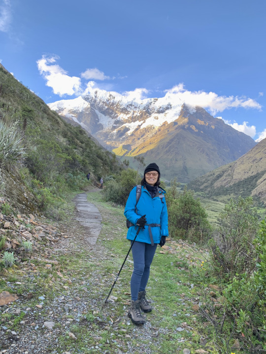
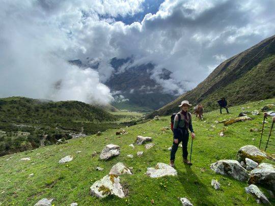
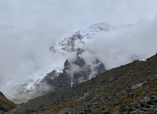
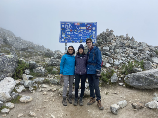
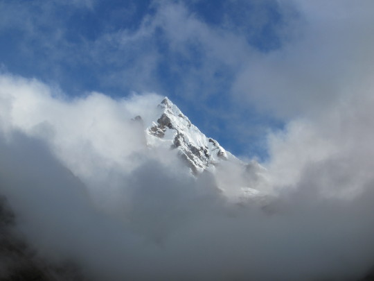
Day 3: Today was the most demanding hike, both in terms of length (ca. 10 miles) and elevation gain (800 meters up), topping out at Salkantay Pass (4,630 m). We started in hopes of favorable weather, spying the hulking shape of Salkantay partially veiled by clouds.
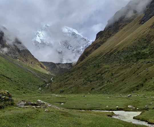
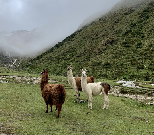
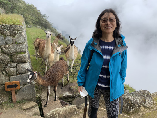
But the opposite of a gradual clearing up happened, as the clouds grew denser all the time. At least, we were spared direct rain, which was a big plus and not something to be taken for granted during the rainy season. Along the way to the pass, we encountered a group of llamas, and that was, for the time being, the highlight in terms of views.
Then, the path started to rise quite steeply, forcing us to rest at regular intervals, drinking copious amounts of water, which is the best precaution to keep altitude sickness away. We slogged on for a while in this fashion until about 11 am, when we had a more substantial break at a lovely meadow directly underneath the towering Mt. Salkantay, which briefly revealed itself.
After this break, we tackled the last stretch to the pass with renewed vigor, and here our various levels of adaptability to high altitude revealed themselves. While Lyra was forging ahead at a brisk tempo, Liang and I were following close behind; Arun’s heart, meanwhile, was racing at such a pitch, he was forced to adopt a slower pace. I’m fortunate to say that for me there are few joys as keen as high-altitude hiking—I love the feeling of giving it my all by huffing and puffing up the mountain, going hard to the limit, all in a gorgeous natural environment. Well, the gorgeous part was purely hypothetical for us in that situation, as we could see nothing but the nearest rocky slopes.
We reached the pass shortly after 12 pm and after taking a few pictures to document the accomplishment we continued down on the other side. It had been drafty and cold on the pass, and there was no reason for us to linger.
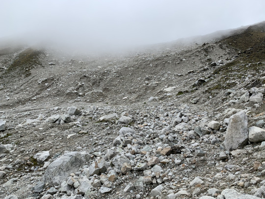
On the way down, we emerged underneath the cloud ceiling, and then we saw the devastation wreaked last year when a massive rockfall from the side of Salkantay crashed into a glacial lake below the mountain, displacing so much water that the resulting mudflow took everything in its path, from houses and trucks, to people and animals. Pepe told us that the the inn where hikers like us would stop for lunch before the catastrophe, was struck by the wave and destroyed, killing both the innkeeper and her daughter; and more lives were lost further along, as the huge wave rolled down the Salkantay river valley. We could see evidence of the destruction all around us: The mudflow had created a wide swath of rock-strewn wasteland where formerly there had been a fertile, grass-covered valley.
Wayra Lodge, where we were to spend the night, was spared the devastation because it sat atop a portion of the valley next to a deep ravine, and so the giant wave had passed beneath it. We got there at 2:30 pm, ahead of schedule, just as a vigorous shower was coming down--luckily the only time we were rained on during the entire trek! The cook had prepared a hearty soup and assorted vegetables, which we attacked with a wholesome appetite.
In the late afternoon, just as we were about to give up hope of seeing any scenery at all, the clouds slowly began to disperse, and then a truly picturesque landscape emerged around us. A short while ago, blinking into the fog, I had no idea where the snow mountains were located, whether they stood to the south, west, east, or north, so it came as a surprise when the towering pyramid of Humantay South began to peel itself out of the clouds right behind the lodge.
I watched the whole process of the gradual clearing, taking many pictures along the way. The contrasts and hues were such that the whole scene strongly resembled a romantic painting by Albert Bierstadt. The scene was affecting, sublime, and otherworldly, like a fairyland; with a bit of imagination, one might have thought it possible to see goblins hopping around or elves going about their business...
Day 4: Today’s hike followed the Salkantay River Valley down toward Santa Teresa, the community at the confluence of the Salkantay and Urubamba Rivers. It was a gradual downhill walk along a narrow dirt road that occasionally traversed a landslide. The main attraction of today’s walk was the stunning flora that transformed this region into one large botanical garden.
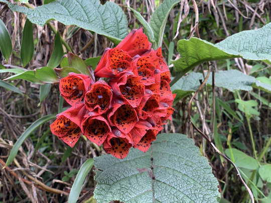
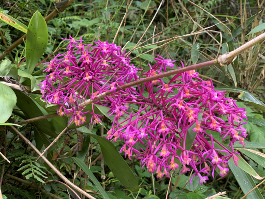
Pépé never grew tired pointing out the myriad wild orchids growing along the path, and he further showed us out wild tobacco, Azulina, Inca Flower, Pomeria, Bromelia, and many other species. At one point, we observed a Swordbilled Hummingbird, whose beak was longer that its entire body. It was quite a marvel to behold, and we wondered how the bird maneuvered with such an unwieldy appendage. At the confluence of the Salkantay and Urubamba Rivers, we descended steeply to the bottom of the ravine crossed over a narrow footbridge and then followed the private trail on the opposite bank that led to Colpa Lodge, at an elevation of 2,800. Upon arrival, the staff began to prepare a pachamanca, an earth pot meal in the style of a New Zealand hangi (or who knows: the hangi might be in the style of a Peruvian pachamanca).
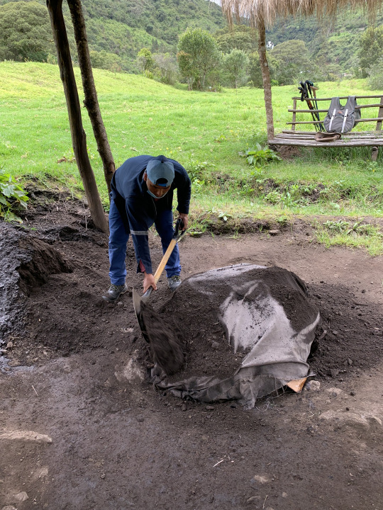
The cooking technique is archaic: stones are heated over a fire, then a pit is lined with them, after which root vegetables and meats are placed in layers over the rocks, then the whole thing is covered with leaves and a layer of wet cloth, and on top of that a layer of soil is dumped. The only difference here was that the cooking time was merely half an hour, because only thin cuts of meat were cooked rather than a whole pig, as was the case when I attended a hangi in New Zealand.
Day 5: Today, we followed the Urubamba River further downstream in the direction of Machu Picchu. The dirt road was wider today, and we could march along it at a good clip, averaging 2-3 miles per hour. Right opposite us, across the gorge, we saw a trail as thin as a string, without any space for error, and yet a mule deer caravan was making its way around the bend where a stumble would mean certain death. We watched with bated breath as they turned the corner high above the river.

The destruction from the mudflow the previous year was still visible, with�� bridges washed away and multiple landslides a testimony of the catastrophe.
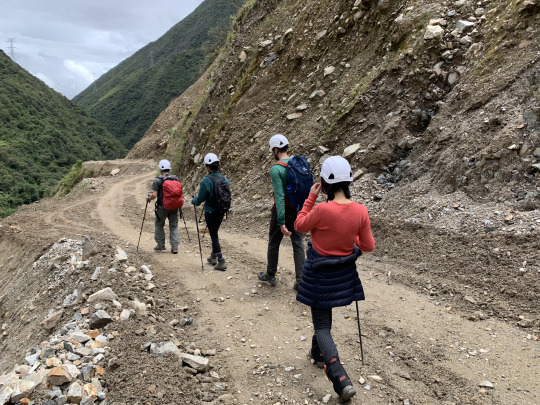
The landslides today were rather more unstable and prone to rockfalls than yesterday’s; as a measure of precaution, our guide therefore made us wear helmets to get across. Shortly before 1 pm we reached the end of our hike and boarded a minibus waiting for us. However, we soon regretted the transfer to the vehicle because we found ourselves on temporary mud road laid across a landslide high above the churning river, with hardly any room between our wheels and the sheer drop. with our vehicle tilting alarmingly toward the river, I felt a lump in the pit of my stomach.
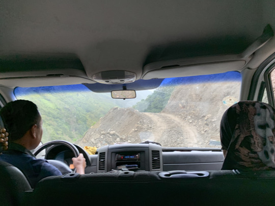
I glanced over at Lyra and saw that she was white knuckling her arm rest, a look of terror on her face. While Liang somehow managed to keep her cool, even though she was sitting on the side of the abyss, Lyra and I vowed to step out of the vehicle and walk, should another sketchy passage like this turn up. Well, we made it OK to to the end of the ride. And the remainder of todays hike was a pleasant walk along the old Inca steps toward Lucma Lodge, the last of our series of Mountain Lodges. This one was as well appointed as all the previous ones, featuring fine dining, hot-tub, beautiful rooms, and a comfortable common area.
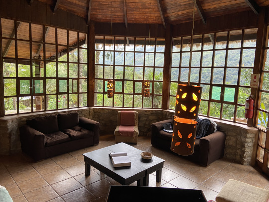
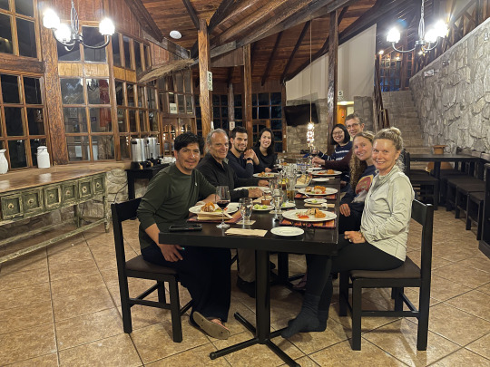
The whole lodge only has six rooms in total, and thus privacy and quiet comfort were guaranteed. That night, Jill and Julia, our fellow travelers who had so far done the hike on horseback but were now going to hike together with us for the rest of the way, joined us on the common table, and together we had a most animated and festive evening.
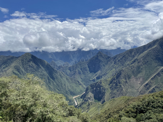
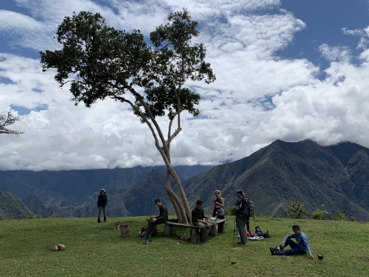
Day 6: Although we had covered pretty solid distances on each of the previous two days, averaging 8-10 miles a day, it was mostly downhill walking and were easy going. Therefore, we welcomed the greater challeng of day 6. It started with a steady climb of 600 meters from Lucma Lodge to Llactapata Pass. This trail justifies being called an Inca Trail, being part of the network of more than 30,000 km of ancient Inca roads laid down all across Peru. Quite amazing to think that half a millennium ago, Incas were plying these same paths. The weather was lovely, and we were enjoying ever expanding views as we gained altitude. After going uphill for about 1 ½ hours, we entered on a perfectly flat meadow and before us opened up a huge panorama of lush green mountains that receded far into the distance where the horizon fused with a barrier of pure white clouds. Far below us, the brown Urubamba River snaked toward Machu Picchu.
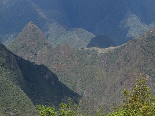
Upon looking closer, we did indeed see Machu Picchu in the distance. Both the ruins and the sugar loaf mountain, Huayna Picchu, which anhors the site, were visible.
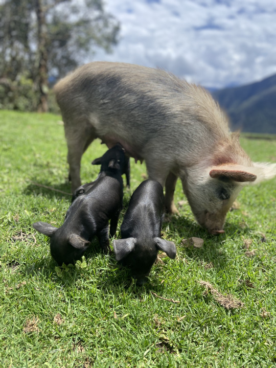
There was a ramshackle farm next to us and a mother with her two daughters were going about their business as if we were not there, which was quite a lovely surprise actually. A large sow came striding across the meadow in front of us, a litter of piglets hanging on to her, squealing and romping about.
The spot was lovely beyond description, and we wanted to linger for longer than the itinerary allowed and it took a good deal of coaxing from Pépé to get us to depart.
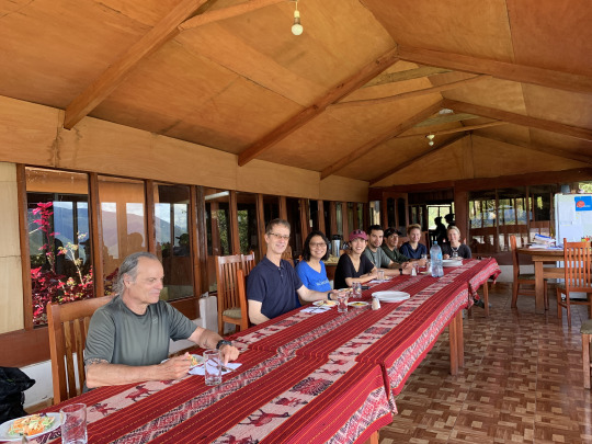
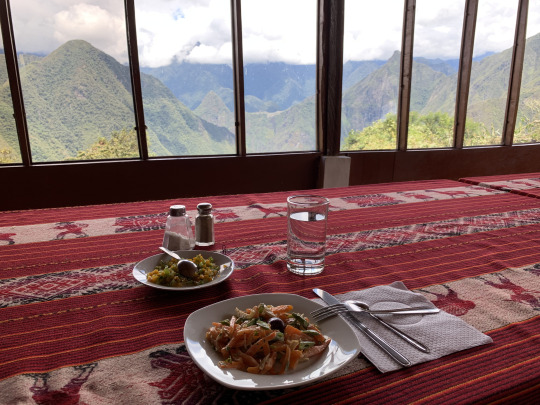
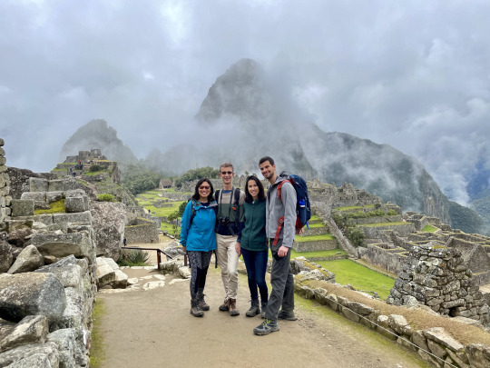
Half an hour later, we arrived at another gorgeous overlook where lunch was waiting for us. The whole party lined up on one side of the table as if we were reenacting the Last Supper by Leonardo da Vinci, but here we faced a pagan object of veneration: The archeological site of Machu Picchu, which was sitting on a saddle in the green mountainscape directly across the valley from us. It is hard to believe that the Spaniards passing by here would not have seen that shining city of a hill right across the valley, and so the theory that Machu Picchu was spared destruction by the Spaniards because they never discovered its existence is not very convincing.
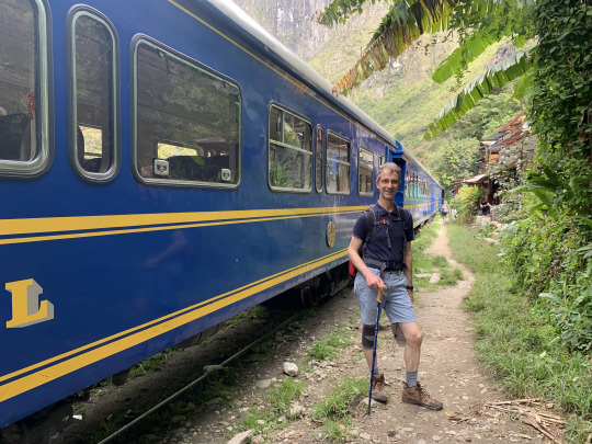
After lunch, the harder part of the hike began--an endless seeming descent down to the bottom of the valley. As we followed the steep switchbacks, the temperature rose steadily, in direct proportion of our drop in altitude. Soon, I stripped down to shorts and a t-shirt. When we arrived at the banks of the Urubamba River in mid-afternoon, we felt for the first time truly like being in the tropics. Pépé directed us straight to the terminus of the train line running from Cusco to Hydroelectrica, the site of a small electrical power plant at the end of the trunk line. Cold beer never tastes better than after a long, hot, scenic hike, and we found this truism to be true once again, as we lounged for over an hour on the terrace of a restaurant next to the tracks where the train to Aguas Calientes was waiting.
The train station was eerily quiet, and most shops shuttered. Pépé told us that only about 25% of the usual number of tourists were here at this point. Indeed, the pandemic had taken a huge chunk out of the tourism business here which was frankly an advantage to us, since it meant no wait times, a quiet environment, and less overall hassle. But of course, for the local economy it meant a dire reduction of business.
Day 7: In terms of weather, the visit to Machu Picchu started out like a reprise of our hike to Salkantay Pass: The higher we got, the foggier it turned out to be. On the plus side, we were the first people to cue up at entrance gate for the 8 am slot, something that would be unthinkable in prior years, when we’d be lining up among hundreds of people jostling for position. But today, only a handful of other tourists were waiting along with us. Nevertheless, the rules had not been relaxed one iota just because far fewer people were coming: One had to choose one of a number routes and then stick to it--no backtracking. Moreover, there were no bathrooms inside the site, and since one could not re-enter after exiting to use the facilities, this meant that one better not load up and guzzle coffee at breakfast.
Pépé chose a route that took us directly to the highest viewpoint. From this vantage, we should have been able to take in the iconic view over the terraces and many-tiered rows of ruins, with Huayna Picchu towering over the whole scene. But alas, we stared into grey fog instead. At least a few llamas grazing nearby gave us something to look at.
Luckily, after waiting for about 20 minutes, an opening in the fog appeared, and then--as if a curtain had been pulled aside--we suddenly spied the lay of the land and discerned the outlines of this magical site.
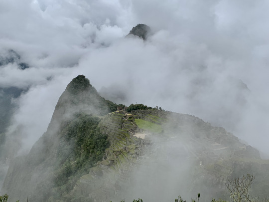
Soon, fog closed in again, leaving us hoping for further openings... In the meantime, Pépé was giving out a lot of fascinating information, so at least we were learning something. For instance, we now know how to distinguish the Empire style (square building stones) from the earlier Inca architectural style (multi-angled stones that fit together like a puzzle).
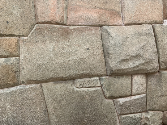
It remains a mystery how the Inca managed to hew the stone to such a degree of precision without metal tools, and how they transport these enormous weights, sometimes across large distances. The Inca style of building, with interlocking stones of various sizes, proved to be extraordinarily resistant to earthquakes. And so, while the social and military structure of the Incas was crumbling before the Spanish, due in large part to the catastrophic plagues that they imported, the architectural solidity of Inca buildings far outlasted that of the Spaniards. We further learned that Machu Picchu served as a fortress, an aristocratic mountain retreat, a ceremonial center, and a crop production facility, intended to be seen from far and wide and to strike awe into the beholders, especially those from societies the Incas were subduing. Why the Spaniards did not pillage and destroy this city is still an unanswered question. Perhaps they deemed the site too hard to conquer, assuming that there was only one entry gate which the Incas would have no problem defending. But even that explanation doesn’t quite convince, given the unquenchable greed and murderous missionary zeal of the Spaniards who were bent on destroying any evidence of Inca cultural sophistication that they could get their hands on. Anyway, it’s a gift to humanity that the Spaniards spared this place. Pépé had much to say, too, about the centrality of astronomy for the Incas, with several buildings and monoliths dedicated to the precise calculation of the calendar, which regulated a slew of social, ceremonial, and agricultural patterns.

After a while, the gaps in the fog became bigger, and finally the surrounding peaks and valleys revealed themselves, with mist clinging to the near vertical slopes at the far side of the Urubamba River valley.
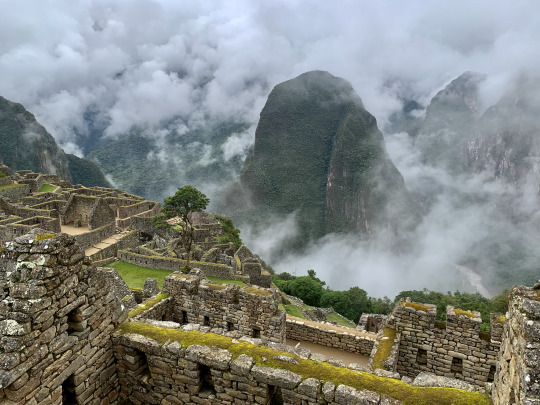
And so, what started out rather disappointingly turned into a truly remarkable visit. We could not have wished for anything better. By 11 am, we had finished our extensive tour of the site. Remarkably, we were quite alone for most of our sightseeing.
Only at the very end did we become incorporated into the larger wave of the crowd that had gradually caught up and then eventually washed over us.
3 notes
·
View notes
Text
Kilimanjaro
Climbing Kilimanjaro had been a dream of ours for a long time. Originally, we planned to do the trek in 2020, but then COVID intervened. Even one year later, we were uncertain whether it was wise to go to Tanzania, a country formerly led by a COVID denying president (who has meanwhile died, possibly of COVID), and also a country where--except at the arrival airport--there’s no evidence of any social distancing policies or other public COVID measures. But after getting fully vaccinated in April 2021 and after reviewing the safety and hygiene protocols of our tour provider, Wilderness Travel, we were confident that it was OK to go. On the upside, because of the pandemic, far fewer tourists were going to crowd the trails around Mt. Kilimanjaro.
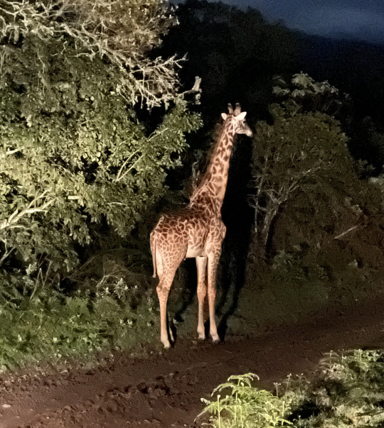
Like we did for the Everest Base Camp trip in 1999, we again invited two friends to share the adventure with us. This time, we were joined by Todd and Pilar, two terrific traveling companions based in New York City. All four of us touched down at the Kilimanjaro International Airport on board of a KLM Dreamliner from Amsterdam in the evening of July 19, 2021. Deplaning was followed by a first taste of Tanzanian “polé pole” (“slowly-slowly”) culture, which took some getting used to… After several rounds of bureaucratic procedures, we were finally released into the fresh Tanzanian night, where we were greeted by our two tour guides, Mchili and Leo. Loading our numerous luggage into their land cruiser was like playing a game of Tetris, with all the differently shaped baggage ending up in tightly interlocking stacks. After some overflow luggage was strapped down onto the roof of the vehicle, we set out for Itikoni, a seasonal camp run by Wilderness Travel on the slopes of Mt. Meru, at a distance of two hours. Soon we were zipping through the night, at one point brought to a full stop by the majestic sight of a giraffe ambling across the road.
We were spending the next three nights at Itikoni Camp (situated at 2,100 meters) in order to acclimatize to the altitude while getting a taste of camp life. Although we were practically in the lap of luxury, sleeping in large, room-size tents with electricity, attached toilet, and a bucket shower, still, these were canvas tents, and when the rain drummed on the fabric, which it did frequently at night, the experience felt and sounded just like camping out.
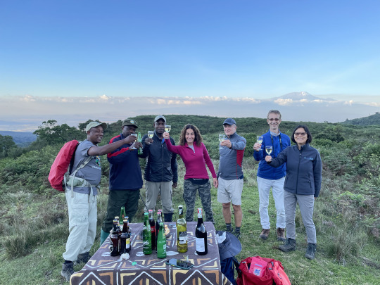
The conclusion of our time at Itikoni came with a lovely surprise: After a nice game walk in the vicinity of the camp, where we spotted Colobus monkeys with white comet-like tails bounding through the trees above us, we were led up on a hilltop to get a clear view of Kilimanjaro. But we got something even better than that: A table lovingly laid out with drinks and snacks, with Kilimanjaro towering in the distance.
DAY 1:
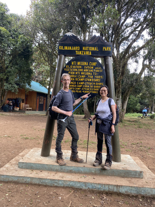
After two relaxing days at Itikoni Camp, we took a ride to Lemosho Gate on the western side of Kilimanjaro, a drive of three hours. Things got really busy at the trailhead of the Lemosho Route, as a few other climbing expeditions were also getting ready to start the climb. The wooded area at the trailhead was soon hopping with people milling around, shouting, unloading...
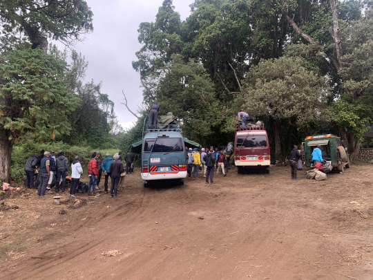
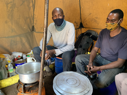
Shortly after our arrival, we were served an excellent lunch of pizza, salad, and cut fruit in the covered picnic area next to the trailhead. Our field cook, Eric, made sure to show us the disinfectant solution that they were using to rinse all the raw food. And indeed, we didn’t experience any problem with the fresh foods throughout the entire trip.
Our guides’ philosophy was to hit the trail early, to be the first out of the gate, so to speak. Accordingly, we departed the picnic area before any of the other teams were ready. I was glad to leave the hubbub behind, feeling slightly disconcerted and frankly a bit surprised to be E Pluribus Unum here, especially during the pandemic. However, our guides assured us that the number of fellow hikers on the trail was far below normal. And anyway, because there were so many routes to chose from--even if one started from the same gate--the crowds were expected to thin out. Indeed, a few days later, we would find ourselves alone in camp...
The actual start of our hike was slightly anticlimactic: Our guide struck such a slow tempo that I repeatedly tripped over Liang’s heels. It felt like driving uphill with the breaks on. What happened is that we were being schooled in the Tanzanian philosophy of “polé polé,” meaning “no rush,” “take it easy,” “slowly slowly,” “steady on…” "Polé polé” was such a universally important concept here--along with “Hakuna Matata”--that it even substituted for a greeting. Rather than saying ”jahmbo” (hello), people were in the habit of tossing out “polé polé” when encountering others on the trail, much like the universal “namasté” greeting heard on the trails throughout Nepal. In due course, we also embraced the spirit of “polé polé,” but here at the start of the trail, we were chafing against it. After a little while, I asked Mchili if it would be OK to go ahead and wait further up. But the rules are clear on this point: no solo hiking on Kilimanjaro! Any hikers have to be accompanied by a guide, not so much for the pathfinding (the trail is hard enough to miss) but to provide information about the flora and fauna, and--perhaps most importantly--to make sure that all hikers adhere to the strict ecological protocols. A guide whose clients are littering or misbehaving in any way risks losing his license and, thus, a part of his livelihood. Without openly declaring it as such, our trip really was a form of eco-tourism.
As soon as Liang and I got the go-ahead, we stepped on the gas, with Leo in tow. Soon, we were overtaking carriers left and right. These porters with their enormous canvas bags balanced on their heads generally go a bit slower than the Nepalese Sherpas, partly I assume because they do not live permanently at high altitude, and partly because their culture reinforced the message that going slowly (“polé polé”) was the the right and proper way to proceed. And who were we to argue with that?
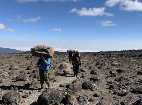
I reflected on some other differences between our experience on Kilimanjaro and the Everest Base Camp trek that we did two years ago. For one thing, the number of visitors traveling on the trails of Kilimanjaro was only a fraction compared to the hordes of hikers who populated the Everest Base Camp trek. Here on the Lemosho Route of Kilimanjaro, we were “competing” with only a handful of other hikers and most of the people we met along the trail were the porters assigned to them. The ratio of trekkers to porters is inflated in favor of porters here because absolutely everything has to be carried up AND DOWN the mountain—food, propane, sleeping gear, tents, toilet, emergency supplies, pots and pans, water filter, and the GARBAGE we produced along the way. This goes toward explaining the ratio of 10.25 porters per climber in our team, making for a grand total of 42 support staff for us 4 clients! This ratio may look excessive on paper, but in actuality it was reasonable. In Nepal, we only needed ONE porter per person and ONE guide for our group of 4--a support team of FIVE!--but that’s because we relied on lodges along the entire stretch of the trek! Here, on Kilimanjaro, there was no other option but to camp out in tents for 9 days straight. And although we didn’t have showers or a hot stove to huddle around or electricity or internet, we did have all the basic amenities, and that included a folding table, folding chairs, and a portable chemical toilet. The latter contraption took a little getting used to, but it did its job just fine; the chemical flush system only broke down once when it froze at the highest camp near the summit, which is a good track record for this vital piece of equipment, all considered.
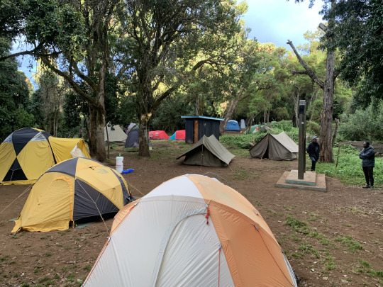
Today’s hike (Day 1) led through dense woods at a moderate incline, following a broad trail winding through jungle-like forest. We covered the 4.5 miles (and 670 meters elevation gain) in much less time than anticipated and arrived at “Forest Camp” (2650 meters) already at 3 pm.
We’d arrived too soon, and our tents were still in the process of being set up. With us hovering around, the porters pitched the tent too hastily, and when Liang tried to stretch out on the mat for the first time, she sat bolt upright again with a shout of dismay: They had pitched our tent right across a large, protruding tree root, making it impossible to lie down. But in order to move our tent, they first had to move the dining tent, which affected the placement of the toilet tent… After a little commotion, the situation was resolved to everyone’s satisfaction. By now, tents were popping up all around us and the woods were resounding with the voices of a hundred people, maybe more; yet, as Mchili kept reassuring us, this was nothing compared to the pre-pandemic occupancy here.
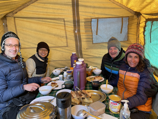
At 4 pm the announcement came that popcorn and tea were being served in the dining tent. It is a clever way to compel hikers to drink plenty of fluids to ward off the effects of high altitude because who eats popcorn drily? The thicker the blood at high altitude, the greater the risk of headache and other unpleasant symptoms. And so, we sat in the dining tent for the rest of the afternoon, munching popcorn, downing cup after cup of hot tea, chatting, and studying the printed dinner menu:
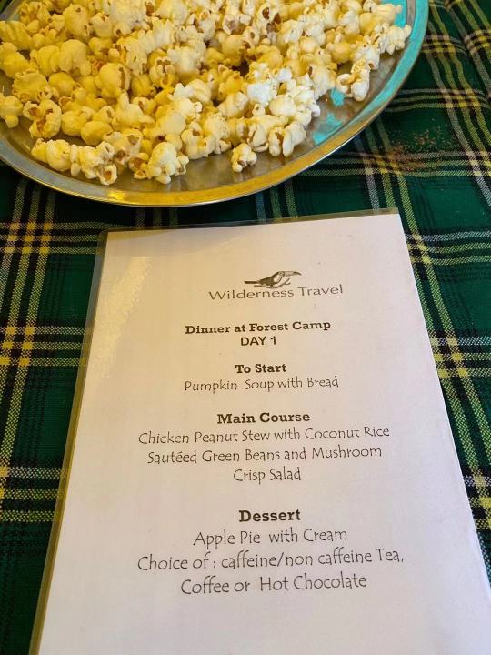
Our cook, Eric, regularly produced such feasts on his two propane burners and rustic aluminum pans. The chicken in peanut sauce was sumptuous and momentarily made us forget that we were sitting in a drafty little tent somewhere in the cloud forest on the slopes of Kilimanjaro.
After dinner, we tried to stick around for a while inside the dining tent, but the small, drafty tent did not to encourage sociability, and it seemed that the camp was collectively settling down to rest. Silence was descending as early as 8 pm. Taking our cue from the others, we repaired to our tents early, too, wondering how to fill the long evening hours. We still had some battery power in our iPad, so Liang and I watched a movie (”Intouchables”), while being bundled up in our sleeping bags. Then, we tried to sleep around 9:30 pm.
DAY 2:
Shouting, banging, and general commotion broke out at the camp shortly after 4 am, as the support staff began preparations for breakfast and started getting ready for the day’s move up to the next higher camp. It got so loud, I was wide awake a full hour before the official “wake up.” After that call sounded at 6 am, we spent about half an hour to sort out what goes into our day bag which we carried ourselves and what goes in the duffel bag lugged by porters. Mchili predicted a 98% chance of precipitation for today, so we made sure to pack all kinds of rain gear. We didn’t know Mchili well enough yet to know that the prediction of 98% precipitation was made without regard to the actual metereological conditions. It was his way of ensuring that we carried rudimentary rain gear in our day packs, just in case… We loved our gregarious, energetic, witty Mchili, shouting “What’s not happening!?” whenever he burst into the dining tent, radiating gregarious energy. And we were equally fond of the quieter, understated, methodical Leo, our assistant guide, with his great eye for spotting wildlife. Indeed, on the early portion of today’s hike, he pointed out a bunch of Colobus monkeys peering down at us from their hiding places—we would never have seen them. Leo also patiently explained the various plants we passed in each vegetation zone. Today, he pointed out the Peace Tree—a quick growing shrub that makes for excellent hedges, hence the name, and he directed our attention to the tiny false violet, the bushy cascades of Everlasting, and the metallic Straw Flowers growing in riotous abundance beside the trail.
What a bracing experience to be walking during the crisp morning hours in a far-away land! We soaked in every minute. Today’s stretch was more demanding than yesterday’s walk, with some 1000 meters elevation gain to be made over a length of 5.5 miles in order to reach Shira Ridge Camp. After two hours of steady uphill progress, we turned around to see the sea of clouds spreading below us.
We were beginning to leave the cloud forest behind us now, entering upon the shrubby zone, and soon we’d arrive at the heathland of the Shira Ridge with its abundant displays of Erica and Everlasting.
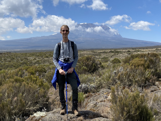
We were clambering up on the remnants of the old Shira volcano here, the first of three volcanoes to erupt in this area some 2.5 million years ago. Only a heavily eroded caldera remains of that first volcano. Mawenzi (elev. 5,150) on the eastern side of Kili was the second to erupt, followed shortly afterwards (”short” in geological terms) by Kilimanjaro, which spewed lava, ash, and rock until it went extinct about 150,000 years ago, in the process bulking up the fourth tallest mountain on earth, measured by geological prominence.
I was happy to be heading steeply uphill. For me, there’s nothing more fulfilling than huffing and puffing up a steep mountain gaining altitude swiftly, heart pounding, panting heavily. What joy! Several hours into today’s hike, we turned a corner in the trail, and voilà--there was Kilimanjaro right in front of us! For a mile and a half we crossed a flat expanse of pampas grass and shrub, drawn towards the mountain as if by magnetic force.
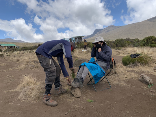
Roughly five hours after leaving Forest Camp, we trudged into today’s camp, called Shira I, situated at an elevation of 3,500 m. While they were still putting up our tent, two chairs were placed for us to sit down while Isa, one of our tent porters, came forward with bunches of shrubbery, which he used to beat the dust from our boots. Then, he relieved us of our garters and gave them a good dusting as well. What a service!
During lunch, I notice that Todd didn’t look too well; he was quiet, and before long he withdrew, not to be seen for the rest of the afternoon. The altitude had gotten to him, and he felt rotten to the bone. After spending a miserable afternoon, in and out of sleep, in his tent, he finally reached the tipping point at sunset and started to vomit. Rather than being a cause for concern, this turn of events cheered up our guides, who ensured us that all was going to be well. They encouraged him to eat some chicken broth, take a double-dose of Diamox, and turn in early for the night. I had my doubts, because our friend didn’t exactly present the image of a man on the cusp of recovery. Yet, our guides’ experience turned out to be spot on. The next day, Todd seemed like a man transformed, eating a hearty breakfast and then attacking the trail with a vengeance. Amazing how swiftly altitude sickness can come and go.
DAY 3:
Sleeping is never going to be easy for me in a small tent, especially if that tent is pitched at a high altitude. But I had learned my lesson from the Everest Base Camp trek, where I tried to tough it out without taking Diamox, the commonly recommended prophylactic for altitude sickness. My foolish abstinence had resulted in 5 sleepless nights then. On Kilimanjaro so far, with the aid of Diamox, I managed 4 ½ hours of deep sleep between 9 pm and 6 am—a 50% sleep to wake ratio, which was pretty good. Now, if I happened to lay awake at night, I would just count my blessings: 1. You don’t have a headache, 2. you’re not cold; 3. you have music in your headphones, 4. you don’t have a full bladder. The latter makes a big difference on Kilimanjaro. If you feel the urge in the middle of the night, you have to brace yourself. It means peeling out of the warm sleeping bag, putting on layer after layer of warm clothing, slipping into freezing shoes, strapping on a headlamp, stumbling toward the bathroom tent, struggling with the tight zipper (which, more often than not, would be stuck), then reverse the whole process. There was one reward though (besides the obvious relief): it was amazing to look up and see the Milky Way splashed in impossibly bright streaks across the black night sky.
The prospect of hot breakfast at the crack of dawn is always a great motivator on such camping trips. In the morning of day 3, we were greeted by steaming porridge, toast, sausage and eggs, accompanied by a pot of fragrant coffee—sumptuous by any standard, especially by mountain standard.
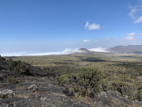
Today’s hike climbed only 600 meters over 6.5 miles, making for a gradual ascent, with sweeping vistas, complemented by the colorful flora of the heathland zone. Rising above the Shira plateau, we looked down on a sea of clouds washing up like surf against the rim of the caldera
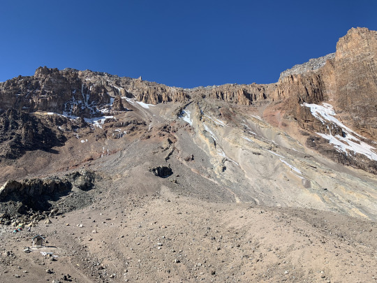
As we approached the destination of today’s hike, Moir Camp, the scenery became wilder and more rugged, which greatly appealed to my taste. Along the way, we skirted a lava cliff which had been hollowed out into a large cave.
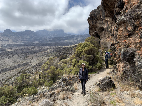
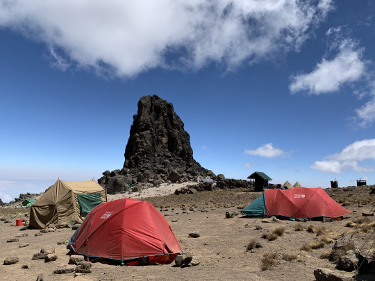
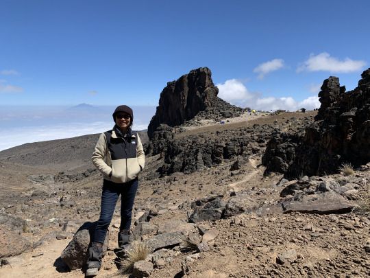
Moir Camp, lies directly under the south-western slope of Kilimanjaro, and from this angle the mountain looks quite jagged and forbidding. The next day, we would swing in a southerly direction, to get in position for approaching the summit via the Western Breach.
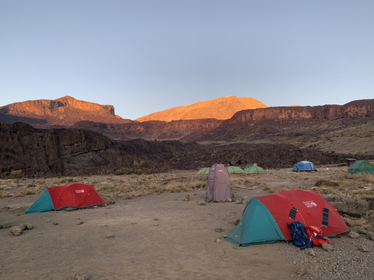
We enjoyed the reflected sunset, as it drenched the slopes of Kilimanjaro in orange light. (The red tents were our sleeping quarters. Note the toilet tent pitched in between.)
DAY 4:
By day 4, we were settling into a regular routine:
• hike from daybreak till noon… • enjoy lunch with a hiker’s outsized appetite… • doing a rudimentary body wash from a basin with warm water… • spend the rest of the afternoon in the personal tent reading and relaxing… • popcorn and tea from 4-6 pm in the dining tent… • enjoying a hardy and delicious dinner at 6 pm… • discussing current affairs, philosophy, Tanzania, until the cold drives us into our sleeping bags… • watching Netflix till 9 pm (pre-downloaded and while batteries last)... • trying to catch some sleep for the next 9 hours… • avoiding bathroom trips at night… • wake-up call at 6 am... • repeat…
But there was one major problem that required immediate attention: my cold feet. They nearly froze off last night, even inside the sleeping bag rated for minus 30 degrees (centigrade). Something had to be done, and I came up with the idea of turning our sturdy drinking water bottles into bed bottles at night. From now on, as a last order of business every day, I would fill both our water bottles with hot water from the thermos. The result was amazing: warm feet till the morning!
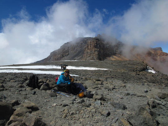
Today’s hiking goal was the Lava Tower Camp at 4,600 m. altitude, some 3.5 miles away and 700 meters up. This was a delightful stretch of trail, as we transitioned out of the heathland into the arid Alpine Desert zone. I generally enjoy hiking in direct proportion to its getting higher, steeper, and more difficult. Even sucking in air hungrily is part of the excitement. Speaking of oxygen: after Shira camp, Mchili would make us do a blood oxygen content reading every morning and evening. We knew the routine from the Everest Base Camp trek, and so we were not alarmed when the readings dropped steadily from 95 (Forest Camp), to 89 (Shira I), to 82 (Lava Tower), to 69 (Crater Camp). The body is starved for oxygen above 4,500 m, which is a given. As long as the oxygen count doesn’t drop below 60, we can handle it.
Today, our assigned guide was Lomayani, a fully initiated Masai tribesman, and he proved his mettle right away as a tracker, pointing out the imprints made by Eland and Klipspingers, marks we would have paid no attention to otherwise. Around here, the scenery really began to open up with grand sweeping vistas over a sea of clouds spread out far below us, anchored by the distant cone of Mt. Meru.
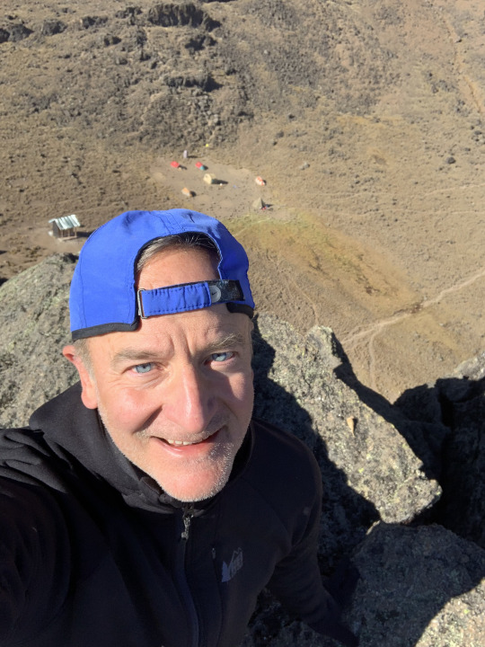
The camp site at “Lava Tower” where we were going to spend the next two days, presented some challenges: Because of the danger of rockfall from the tower and because only one camping spot was truly level, Mchili strategized to secure that coveted spot before other groups had a chance to pounce. Setting aside the “polé polé” philosophy for once, he dispatched a group of porters at the crack at dawn to rush to Lava Tower and stake our group’s claim to the best spot. This plan worked out perfectly, and when we arrived at Lava Tower shortly after 12 pm, our tents were already sunning themselves like outsized beetles in the bright light of noontide—kudos to Mchili’s planning!
Today’s dinner was a sheer feast: Penne pasta with a creamy vegetable sauce, accompanied by tasty fried beef. The one thing lacking, though, was table manners: as soon as the food arrived, we’d behave like savages. That’s because at our altitude now the temperature inside our dining tent was close to freezing. As a result, each forkful of food lifted to our mouths was appreciably colder than the previous one. Under these conditions, any polite ceremony goes by the wayside, as we’d start gobbling the still-warm food regardless of others having been served yet or not. Warmth is the essence of life, and once deprived of it for extended periods of time, people become heat-seeking missiles. Thus, camp life quickly makes barbarians out of the most refined folks. Of course, there was tacit understanding about this, and nobody’s feeling were hurt.
DAY 5:
Today was our acclimatization day, and we were allowed to sleep in as long as we wished. The guides didn’t have any organized activity in mind, lettings us do our own thing (as long as we did it responsibly). Liang and I had our eyes set on a ridge above the camp where, according to rumor, there was a smattering of internet connectivity.
Generally, anybody determined to climb Kilimanjaro better prepare to be off the grid for the entire duration of the climb, which in in our case was a full 9 days. There are many different routes to climb the mountain, ranging from a mere 4 days in length to 9 days. As can be expected, though, the rate of successful climbs is in exact reverse ratio to the number of days allowed for the climb. Only about a third of folks trying to do this in four days, get to the top. Among the five-day climbers, ca. half of them succeed, and so on. For folks who chose to do this the right way and spend 9 days on the mountain, the success rate is actually above 90%. The difference comes down to the more thorough acclimatization to the high altitude when taking a slower approach. Now, for folks with important business responsibilities and leadership roles in business, politics, science or whatnot, having no internet access for 9 days is a daunting prospect. It wasn’t a big deal for me, a retired English professor, but for Liang, a biotech CEO and for our friend, a senior partner at a NY law firm, being off the grid for more than 9 days was a serious commitment that takes some careful preparation work. One could argue that a digital detox is just what these executives need. Folks who are normally always and everywhere wired can really benefit from a digital break. But when it comes down to actually doing it, few will take the leap and check out completely for that length of time (although on checking back in, most will realize that the sky hasn’t fallen).
Our quest for that elusive internet signal led us in the direction of a rivulet trickling meltwater down from Kilimanjaro about one kilometer away from our camp. When we saw a line of porters carrying big buckets of water on their heads, it dawned on us that this was where our water was coming from. Since there was no reservoir near our camp and absent a miraculous water spout issuing from Lava Tower, every drop of water that we consumed in camp was actually carried up the hill by human labor.
This was one of the counter-intuitive things: Mt. Kilimanjaro, visibly clad in ice and snow at the top, is in actuality a very dry mountain. In the upper reaches, conditions are desert-like and getting dryer every year, as the glaciers and snow fields on the summit are slowly melting away. In the last 100 years, the total surface of ice on Kilimanjaro has shrunk by a shocking 85%. What remains is merely 15% of glaciation compared to 1920, which has an appreciable impact on the volume, availability, and distribution of water on the mountain. When presented with these facts, our minds instantly leapt to a technocratic solution: Why not build an infrastructure like a pipeline or a cargo cable-car to transport water from the lower reaches to supply the mountaineering expeditions? Our Tanzanian guides, however, were aghast by such “solutions,” which would rob hundreds of carriers of their livelihoods. Oops, we were obviously not thinking locally.
But back to the internet: No matter how high up we climbed up the slope, the rumored internet signal never materialized. We were not the worse for it, though, and frankly never seriously looked for it to anyway. Instead of being glued to our iPhone screens, we instead directed our gaze outward, marveling at the endless seeming sea of clouds stretching to the far horizon, interrupted only by the dark cone of Mt. Meru topped by a wisp of cloud like a plume of smoke.
This was meant as a resting day, and so we didn’t push much higher, slowly strolling back to camp and spending the rest of the time napping and reading. Unbeknownst to us, one of our team members had come up with a more ambitious plan to spend the afternoon. We were wondering where Todd was when we gathered for our popcorn-and-tea ceremony at 4 in the afternoon. Nobody knew his whereabouts. Then, about half an hour later, he slipped into the tent, casually announcing that he had climbed Lava Tower. I had to do a double take. “You’re kidding, right!?” But no, he had indeed clambered up from the back of the rock formation, taking his time, assessing the risk, then finally perching on top, taking a selfie showing the tents below as mere specks in the landscape.
We gaped at him. It was certainly a pretty gutsy move, especially in light of the fact that there are no helicopter rescues on Kilimanjaro. Todd just flashed a mischievous smile. “Badass” I murmured under my breath. And so, the lack of an organized activity during acclimatization day had led to all sorts of authorized and unauthorized outlets for our pent-up energy. “Don’t tell the guides!” Pilar said--wise counsel. Just then, Mchili burst into the tent, shouting “what’s not happening guys?” We gave each other conspiratorial winks, thinking “what’s not happening that we’re telling you about our team member’s exploit on Lava Tower.”
DAY 6:
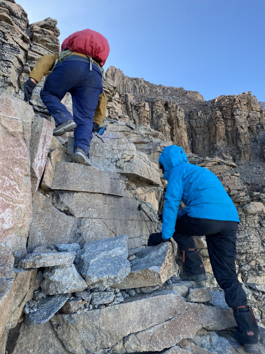
The wake-up call sounded a bit later than usual this morning because we only had a relatively short (though steep) stretch to cover, climbing 300 meters to Arrow Glacier Camp, situated at 4900 meters, at the base of the Western Breach. On the way there, we got a taste of what was in store for us the next day, as we had to do some serious scrambling, using hands and feet.
At least, we no longer needed reminders to go “polé polé.” It was tough enough to put one foot in front of the other, trying to inhale as much oxygen as possible. There was no other way to do this than the Tanzanian way.
Stumbling into Arrow Glacier camp at 11:30 am, one of us made straight for the toilet tent. When a shout of dismay was heard from there, we all turned our heads to look: The toilet tent was filled with fluffy ribbons of paper, up to the roof! Our toilet carrier had set up the tent so that the entrance faced downhill, in the direction of the wind. Sharp gusts of mountain air had found their way into the space and teasingly unspooled two fat rolls of toilet paper until the last square was spent. Against the vocal protest of one of the ladies, the paper streamers were rolled up in order to reuse this precious resource, which had been carried on someone’s back for dozens of miles and up thousands of meters. I think it served to everyone’s satisfaction.
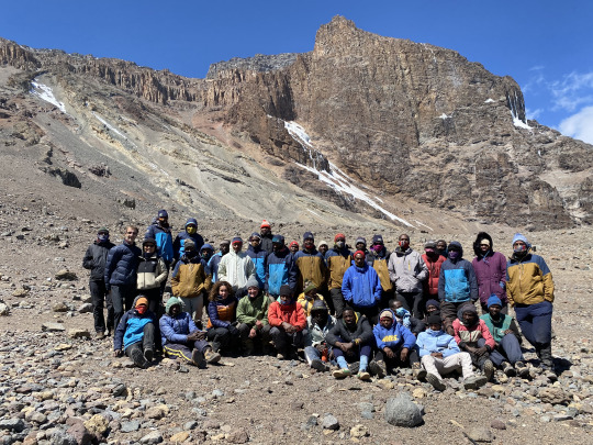
And now for the first time since the start of our expedition, we were the only group occupying a campsite. We used that “privacy” to assemble the whole team for a picture (though not everybody is shown, as some 4-5 people were on the trail fetching water).
The question on our mind was why there were no other climbing groups. All those hikers who had crowded us in Forest Camp and were again intersecting with us at various campsites along the way were somewhere else now. Well, the reason simply was that our approach to the summit was the most difficult and dangerous. Only the hardiest trekkers and the best-trained guides and porters are up to tackling the mountain from this side.
This side of the mountain is called the Western Breach because it represents a gap where the volcano’s top had caved in eons ago. From below, it didn’t look too scary seen from below, but once we were in the Breach, we realized why there were no other groups here. It was, however, a challenge worth taking.
DAY 7:
I had a very hard time finding sleep, despite keeping up with regular doses of Diamox since day 2. After 1 am, I was basically counting the minutes, wishing it were 4 am. My insomnia was partly due to the high altitude and partly due to sheer excitement. I was hyped up to get into the Western Breach and start tackling the steepest section of Kilimanjaro!
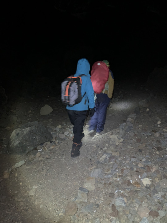
The wake-up call came shortly before 4 am. The cold was cutting, and I shivered while donning three layers of leg cover, putting on my thickets hiking socks, and slipping into five layers of upper body cover. The hot porridge in the dining tent, though, was a revelation. It’s a law of nature that the colder it gets, the better porridge tastes. Shortly after 5 am, we strapped on our climbing helmets—the only time we needed them—attached headlamps to the helmets, grabbed our hiking poles, checked our water supply, and signaled our readiness to get going. We left camp just before 5:30 am, in complete darkness. There’s a big sign cautioning hikers to start the climb no later than 5:30 am to minimize the risk of rock falls.
The route through the Western Breach had to be closed for some years after three American climbers were killed here by a rockfall in 2006. After the way was redirected to minimize the risk, another American climber was killed here in 2015. Therefore, a portion of the route is dubbed the “death zone” (a piece of information our guides wisely withheld from us). The pre-2006 route used to stay in the “death zone” for about an hour. The newer route we were following traverses the most dangerous stretch in five minutes or so. The danger is created by retreating glacial ice which releases rocks from its melting body, which then triggers rockslides. This only happens at above-freezing temperatures, hence climbers are urged to start climbing well before sunrise.
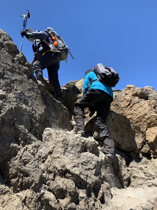
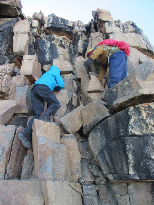
Up until this point of our hike on Kilimanjaro, one could argue that we didn’t technically need a guide—the trail was clear as day. But going up the Western Breach of Kilimanjaro without a guide would be folly. Only they knew where to turn and how to conquer this brittle monster. Shortly beyond the camp, the trail becomes faint and then fades away completely once the climb begins in earnest. Now, we were just following a route, and even this route was open to interpretation. Occasionally, Mchili would scan the territory, then make a snap decision where to proceed. We did a good deal of Class 3 climbing here (as measured by the Yosemite Decimal System), basically rock scrambling on all fours, but occasionally class 4 climbing was necessary:
A rope could be used at this level of difficulty, but no ropes came into play in our case. However, Mchili did guide Liang across the more tricky sections by taking her hand, something I noted with special gratitude. An hour into our ascent, daylight gradually began to give shape and outline to the landscape. Looking down, we were stunned how much air we had already put between us and last night’s camp.
Things always look much more impressive from way up looking down. By contrast, the upward perspective somehow robs the terrain of its daunting steepness, a steepness that got ever more into our bones, as we halted frequently, gasping for air. I had made the mistake of turning on my Apple watch to record the data of this special climb, but now the app tried to drive me crazy, buzzing my wrist every few minutes, assuming that our slow progress meant we were resting or had reached our final destination. The Apple Watch hiking app needs a urgent update for the “polé polé” style of high altitude climbing, which clearly is beyond its current level of its artificial intelligence. After getting buzzed all the time and having to set the “dismiss” button again and again—which actually turned into a fairly dangerous distraction—I finally gave up and ignored the malfunctioning device, letting it buzz and hum and query and doubt all it wanted.
After slugging away on this climb for over 3 hours, we longed for a break, but the Mchili urged us on--perhaps we were in the middle of the “death zone” now. “Just another 15 minutes,” he said, “then we’ll have hot tea and snacks.” That sounded incredibly motivating, and we kept on clambering up. When we reached the designate resting stop, a level projection from the slope, Liang gasped “I am half dead.” We slumped down on flat rocks, and there we sipped tea, munched on energy food, and let our thoughts wander. The sun was rising above the crest of the Western Breach just then, and the warm glow put us in a more upbeat mood. Someone turned up the volume on his mobile phone, and the catchy tune of Toto’s “Africa” began to fill the silence. The rhythm was electrifying, and although we were bone-weary just a minute ago, we fell under the spell of the jaunty tune, feeling the urge to dance. Mchili was served as our cheerleader, swaying with outstretched arms. I shall never forget the scene: finding an extra ounce of energy, we let ourselves be moved by the spirit of music at 5,600 meters above sea level: “I know that I must do what’s right / As sure as Kilimanjaro rises like Olympus above the Serengeti”… The lyrics could not have been more apt.
We thought that Todd and Pilar would catch up with us here, but after waiting for half an hour, we were getting cold and decided to continue the climb. Soon afterward, we reached the section known as “the steps,” the most technically demanding stretch. This is the official “point of no return” on the Western Breach. No matter what happens now—whether there’s an accident or any other crisis—the only evacuation route from here on is UP. The guides would not let anybody descend for any reason—it wouldn’t be safe.
My earlier state of exhilaration—"that’s what it’s all about!” I had thought 5 hours ago—had long made room for weariness, tinged with a drop of doubt whether we would even make it. I looked up toward the crest of the summit plateau, but it didn’t seem to get any closer.
We eventually got there, after traversing a steep, ice-encrusted section near the top.
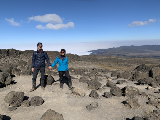
Minutes later, the wide, snow flecked summit plateau called Kibo opened up before us. Just then, Liang was gripped by a spasm, lowering herself on a stone, bending forward. This last portion had knocked the wind out of her, and she was gasping for air, her stomach convulsing. A few sips from the water bottle helped to settle things, and a minute later, she managed a smile when I snapped a picture with the summit, Uhuru, in the back.
Right around us, clouds were forming out of the blue, and a few minutes later, we were alternately enveloped in glaring white fog and drenched by brilliant sunlight, as the weather ratcheted up the drama.
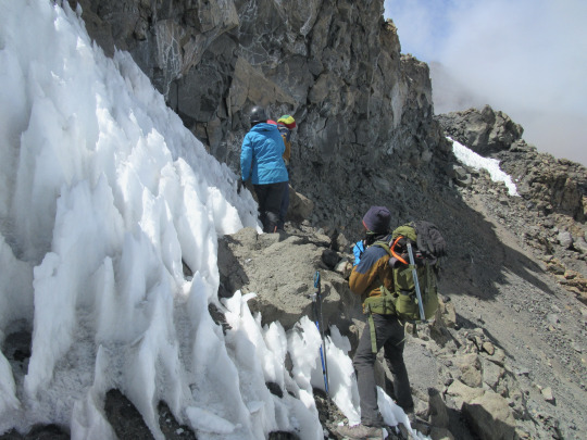
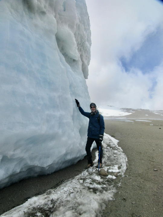
After catching our breath, Mchili guided us up a mildly inclined snow field to the vertical margin wall of the Furtwängler Glacier, a slab of layered ice sitting atop the lava sand like a beached white whale.

Putting my palm against the hard surface was like touching the sediments of time—the snow that now lay like glass under my touch had been deposited eons ago.
From here, we marched across the lamelle-like ice crust that separated us from the camp, tottering drunkenly on the brittle surface that kept collapsing under our weight.
In this way, we staggered into Crater Camp at the stroke of noon, some 6 ½ hours after leaving Arrow Camp. Both Liang and I agreed that this had been the hardest physical ordeal of our lives, and all we wanted to do now was just slump down in our tent and space out. We had the option of going to the Ash Pit of the volcano’s crater to take a look. But by now a dense fog enveloped the scene, and sleet was falling, deterring us from extending today’s walk, just as the intense cold discouraged us from leaving the tent.
As I lay inside our tent, my mind regularly approached the threshold of sleep, only to bounce back into alertness. I did this game of drifting off and instantly jolting back for the rest of the afternoon, incapable to do anything else, physically drained and mentally strained by the altitude. That evening, it was so cold inside the dining tent, it might have been below zero. Our guides weren’t sure… somehow, nobody had thought of bringing a thermometer. We did have the oxymeter, though, and Mchili insisted that we perform the daily ritual of measuring our blood oxygen content. Today’s reading was somewhere in the high 60s, which in a regular climate would indicate a life-threatening condition. At 5,700 meters, though, with just about half the breathable oxygen at our disposal, such low readings are to be expected.
DAY 8:
My oxygen-starved system worked fine in most respects on Kibo, but it refused to go into sleep mode. For many hours, my mind behaved as if a hacker had scrambled its operating system, or else a saboteur was messing with the mental circuitry. For hours on end, my mind projected an endless progression of words that formed strange analogies, but the words themselves were misspelled and randomly capitalized, and they followed a bizarre logic that I was always on the verge of decoding. I realized then that oxygen deprivation did worse tricks on my mind than the THC gummies I had once popped during the lockdown or the half bottle of Chilean white wine that I’d imbibed at Itikoni Camp. After what seemed an interminable and intensely uncomfortable night, the wake-up call at 4 am sounded like music to my ears. Summit day had finally arrived!
Like the previous night, we departed camp at 5:30 in the glow of our headlamps.
The only thing separating us from the summit ridge now was a steep slope of approximately 200 meters, and we went straight up the slope without zigzagging. Since the ground consisted of volcanic sand, we slid back after every step, making it a tedious and tiring mode of progress. The air was so thin that we had to stop every few steps to reduce our rate of breathing. About halfway up, we met with jagged bands of rock, and now our guide followed a traversing route, doing switch-backs over scree and rocks, slowly but surely zeroing in on the edge.
After less than an hour, we swung up on the summit ridge, just as the sun was rising above the horizon.
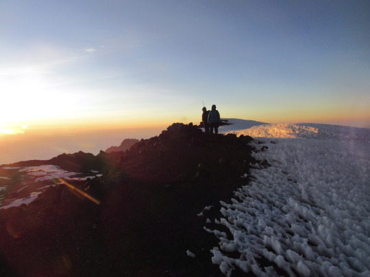
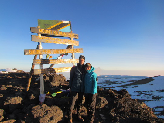
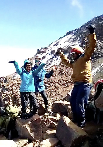
Not far away, we spied the iconic summit marker with is horizontal slats. Following a thin strip of exposed rock that ran parallel to a snowfield, we were pulled as if by magnetic force toward the summit--the closer we got the more we lengthened out stride, polé polé be damned. At 6:50 am, we stood on top.
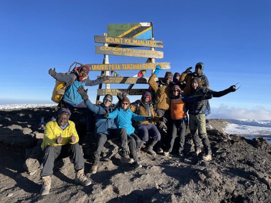
After a celebratory hug and a kiss, we started snapping summit pictures. Our friends arrived shortly afterwards, and the picture-taking kept us busy for a while. Only one other person—a Benedictine monk from Germany—was at the summit at this point, and he agreed to take a photo of our whole group. The mood was joyful and exuberant.
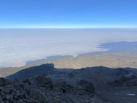
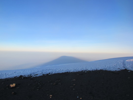
Far below us, the sea of clouds stretched all the way to the horizon, with the shape of Kilimanjaro imprinted as a huge cone-shaped shadow upon the milky sea.
To the East and North, snow flecked Kibo was undulating far below us, rimmed here and there by the last remaining glaciers that still held on to their existence, fighting a rearguard action against climate change. According to estimates, the last permanent ice on top of Kilimanjaro will have disappeared sometime within the next two decades—strange and disturbing thought.
After spending about 25 minutes on the summit, we started our descent, encountering a series of glacial slabs that looked like outsized sculptures.
Already, a few wisps of clouds were forming around the mountaintop now, and we were thankful to have camped so near the summit to be able to arrive at the top very early, enjoying the unimpeded view. Kilimanjaro often gets shrouded in clouds after a few hours of sunshine, and today the clouds seemed to arrive even earlier than that.
We started to cross paths with several small and large hiking groups now, some of them looking vigorous, others moving like zombies, drawing on their last reserves. They had all been hiking from Barafu Camp since midnight, about 1,300 meters further down by altitude, slogging up a broad gravel path, jostling with many others, shrouded in darkness. It really was no comparison to climbing the Western Breach in the morning. No wonder, our guides said that they favored our route over all others. But now, all we were concerned about was descending, as quickly and painlessly as possible.
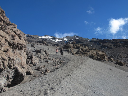
The clouds were gathering thickly now, and soon the sky was blanketed by clouds. For the rest of the day, we just about kept abreast of the descending clouds, which followed us in sluggish pursuit without ever quite reaching us. After 4 hours of descending on a steep, twisting path, we spotted a group of men and luggage ahead of us—these were our carriers who had congregated at a suitably level spot beside the trail, waiting for us. Here we could shed several layers of clothing, repack to lighten our daypacks, get hydrated, and rest for a while. There was no sign of our two friends, but carriers coming down the mountain carried the information by bush telephone—Pilar was suffering from acute knee problems and had to be supported down the mountain. We waited for them, but after a while it got cold and we continued our descent. We still had a long way to go.
Around 2 pm we reached High Camp, where our cook had prepared a hot lunch and our dining tent was waiting for us. How lovely! After a satisfying meal, we still had to descend 1,500 meters! That’s more than the greatest daily descent in terms of altitude on the whole Everest Base Camp trek. But something else was strongly reminiscent of Nepal: The trail below the lunch camp was a boulder-strewn river bed, and that’s not a figure of speech: Leo confirmed what I had suspected—during the rainy season, this path is flooded and literally becomes a stream. This made for extremely tough going. The next day we heard that a member of another hiking group had fallen so unfortunately on this stretch that she had bashed her head into the rocks, looking all black and blue from the fall. Encountering this stretch at the end of an exhausting 10-hour monster hike, we were going at a snail’s pace now--”polé polé” to a fault--as we balanced on our hiking poles while steadying each another by holding hands the whole way.
We arrived shortly after 4 pm at Mweka Camp, completely pumped out, our knees shaking. But we recovered quickly. Because the Mweka Camp is located so much lower than last night’s camp, our oximeter returned a whopping reading of 90, which put us in the category of “superfine,” to use one of Mchili’s favorite expressions. Looking up from camp, we saw the summit of Kilimanjaro looming high above us, hard to believe, we’d been up there this morning!
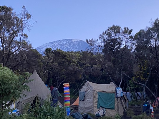
For our last dinner Eric had pulled out all the stops and produced a meal fit for kings: Soup, lamb stew, boiled herbed potatoes, braised vegetables, salad, and cake for dessert.
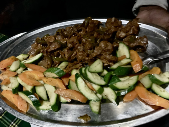
The supplies had reached us from the Mweka Trailhead and thus were super fresh. The presentation also was captivating: Eric had carved giant avocados to turn them into appetizers whose cavity he filled with tasty bruschetta. The only thing missing was a glass of red wine—we’d have to wait one more day to satisfy that craving.
DAY 9:
One more time, we broke camp early, hearing the familiar wake-up call at 6 am. Then, after breakfast, we headed straight down the final stretch of the trail, surrounded by dense cloud forest. Here, the ground is perennially wet and slippery, and it was quite an ordeal to descend 1,500 meters in these conditions. Our slow tempo allowed us to take in the natural environment, and we stopped frequently, to peer at Blue Monkeys cavorting among the branches, marveling at at the enormous, moss encrusted Camphor trees, whose bark is often illegally stripped, and admiring the delicate beauty of the horned “Impatiens Kilimanjari,” a species endemic to this region.
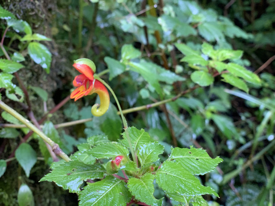
The trail, though muddy and slippery, was free from trash, which is more than one can say about many other trails in developing countries. Leo explained to us that the park administration enforces a strict in-and-out policy. All luggage going into the national park is weighed, and then the luggage is once again weighed afterward, only accounting only for minor differences to make sure trash is not discarded along the way. Indeed, all disposable items and garbage had to be carried out of the park. This is a wise and practical solution to keep the park as free as possible from the detritus and environmental degradation that is all too often the result of touristic development.
The 6.5 miles stretched on and on, but to our relief, the flatter portions gradually came to predominate, and after about 4 hours, the trail merged with a rough 4-wheel drive road. At the road-head, stretchers were piling up, and glancing at them made us realize how fortunate we were to be arriving here on our own two legs.
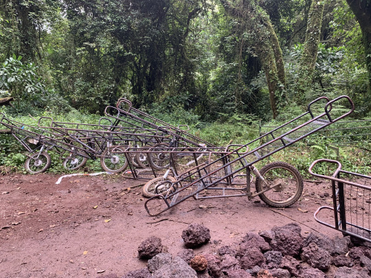
Shortly afterward, an ambulance came slipping and sliding up the muddy road. It had been called in to pick up the hiker who had fallen on her face on the rocky river-bed-stretch of the descent the previous day. Pilar, too, needed special support, and we saw her pass by us like a whirlwind, carried on the back of an uncharacteristically swift-footed Tanzanian, with Todd scrambling after her, like Apollo in hot pursuit of Daphne. Other groups of carriers also passed us by regularly. Ironically, we had switched roles compared to the first day of the hike, when WE had zipped past the carriers that were ahead of us, like we were propelled by a turbo charge. It appeared that on the downhill section, they had switched “polé polé” for another motto, “haraka haraka”—hurry up! With our shaking knees and tired muscles, we were happy to give them the right of way and proceed gingerly, so as not to slip up, literally, on the last stretch of the nine-day hike.
We reached the Mweka Gate shortly before noon, our boots mud-spattered and caked in forest goo. Fortunately, our tent porters were attentive as usual and soon relieved us of our boots, which they returned washed and dried, five minutes later. They had well earned their pay and additional tips. From here we were chauffeured to a village some 20 minutes away and disembarked to a sit-down restaurant with a lovely outdoor patio. Our cook, Eric, had prepared our last meal, and sitting down to lunch with a lovely bouquet and bottles of cold beer and sparkling wine waiting for us was an incredible reward.
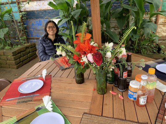
But it got better yet. Suddenly, Eric appeared with a cake bearing the inscription “Happy 30th Anniversary, Liang & Bernard.” It was the most lovely surprise, orchestrated by Mchili, and we thanked him and the entire team heartily for their attentiveness and impeccable service.
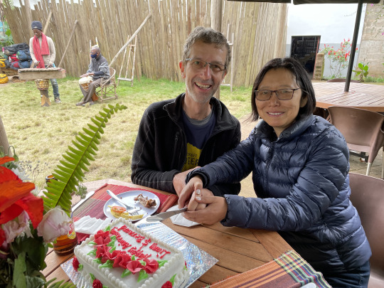
1 note
·
View note
Text
Lake Oberhorn Loop
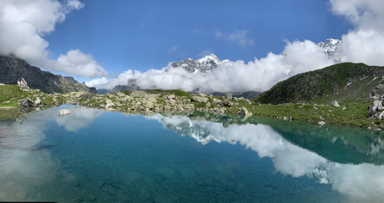
Date of hike: July 11, 2021
Country: Switzerland
Region: Bernese Oberland
Trailhead: Stechelberg
Hike Destination: Lake Oberhorn
Distance: 13 miles (20 km) loop trail
Elevation gain: 4,200 ft. (ca. 1250 m.)
Difficulty: Moderate to challenging
It was a glorious day with all the meteorological and other conditions aligning perfectly to make for an unforgettable trip to Lake Oberhorn, one of my favorite hikes in the entire world; and yet it was also a day that could have turned out to be a disaster. But more about that later.
Together with my sister, Anki, we started to hike from the trail head in Stechelberg at 9:45 am. We proceeded under an expanse of cobalt blue sky, against a backdrop of cloud flecked mountains wearing a thin coat of newly fallen snow. Long rolls of white clouds clung about to the blanks of the Jungfrau and the Mittagshorn, and toward the end of the valley, a somber cloud cap sat atop the cliffs. The Schmadri falls were gushing full-fed, fanning out over the cliff to the east, and the emerald green weadows were dotted with a myriad differently colored wildflowers.
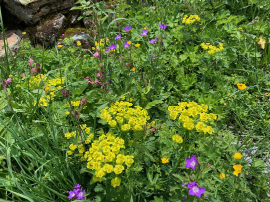
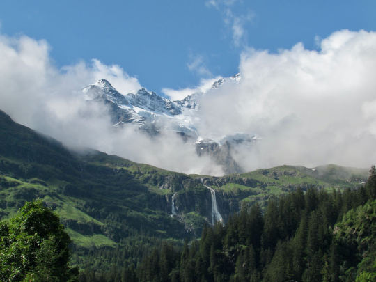
It was an outright joy to step into such a wondrous, beautiful landscape. An hour into the hike, we had ascended halfway up to the Tschingelhorn Lodge, the rustic place where Bernard’s family used to spend their summer holidays some 50 years ago. At this point, the steep switch-backs left the forest and zig-zagged up an open meadow looking out over the valley. Stopping beside a rustic alp hut, we admired the view of the eastern slopes of Jungrau, taking a few photos, posing in front of the gorgeous panorama.
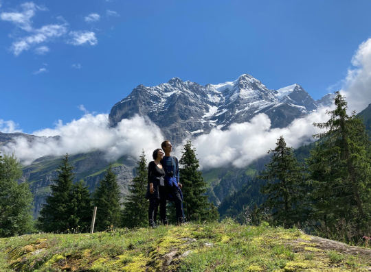
We arrived at the Tschingelhorn Hotel shortly before noon. I showed Liang some of the local features like the stone maze where we used to play around for days as children, and I recalled how simple and rustic the place used to be, but how charming, a charm that had not entirely faded, long after the mules that used to carry supplies up here had been replaced by a modern cargo cable car.
We sat down to consume a drink--Rivella, the quintessential Swiss soft drink—and Bernard could not resist the temptation to order a slice of the extraordinarily thick apricot pie that was placed on a table outside, under a protective cover. It was such an amazingly tasty, fluffy, and juicy production from out of the mountain oven that Bernard was tempted to order a second slice, but then the wisdom prevailed that one should stop eating just when something tastes most deliciously.
We briefly chatted with the current owners of the lodge, who had just purchased the property less than a year ago and were running it for their first season. The place was completely sold out for the weekend, and as testimony to this, numerous bedsheets were fluttering on drying racks in the fresh mountain breeze. No electrical tumbler was needed here.
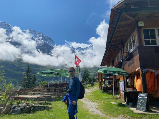
After this pleasant break, we continued to hike on the roughly horizontal portion of the trail between the two mountain lodges--Tschingelkorn and Oberhorn-- which used to be run by brothers, but now only the second lodge “Obersteinberg” was still owned by the same family that had the business 50 years ago; the second place looked more weatherbeaten and unimproved, having escaped the kind of gentle renovative modernization that the Tschingelhorn had undergone after it changed hands.
Beyond the Oberhorn lodge, the path skirts a steep slope, and here we encountered our first minor obstacles: There was a big cow walking on the narrow hiking path straight toward us. Liang and I opted to make room, trying to skirt the enormous, horned animal by making a detour above it. I have read too many news articles about cows trampling hikers, even killing some. But Anki would not take the easy way out and walked right up to the animal and talked to it in soothing tones, eventually even patting its broad snout, until the matriarch reluctantly made room.
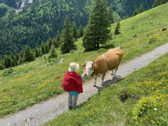
Then, we approached the narrow passage where several years ago Lyra had burst into tears at the prospect of traversing a washed-out section of the trail. This stretch of the path had been liable to erosion ever since I can remember, and we entered the passage cautiously. Right then, a woman approached from the opposite side and since we had already started on the critical portion, we assumed that she’d step aside and let us pass. Instead, she powered on and basically walked right into us, shouldering Liang aside while muttering something under her breath, then she bulldozed into Anki who was literally forced to retreat backward to make way for the bullheaded woman. This inconsiderate behavior slightly clipped my mood, but only momentarily. My thinking turned to pitying this person, whose rude demeanor must make it hard for her to go through life, creating animosity left and right.
The bridge at the end of the steep passage was so deeply buried by a large snowfield that it was completely invisible—the snow had formed its own bridge over the bridge.
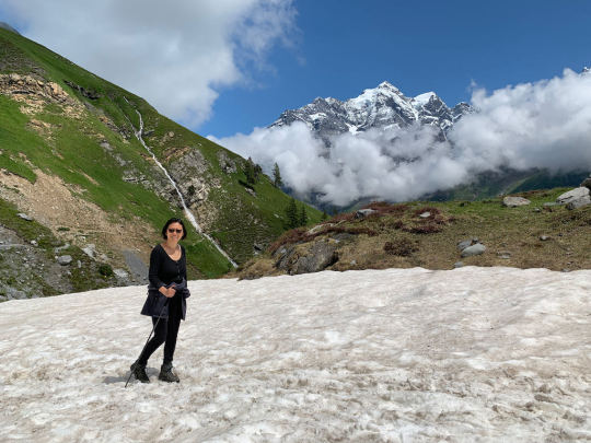
From here, the scenery becomes wilder and wilder by the minute, with the flowers doing all in their power to keep up with the heightened scenic appeal. The alpenrosen, gentian, buttercups, Arnica and many other types of wild flowers were competing to trump one another with their colorful displays.
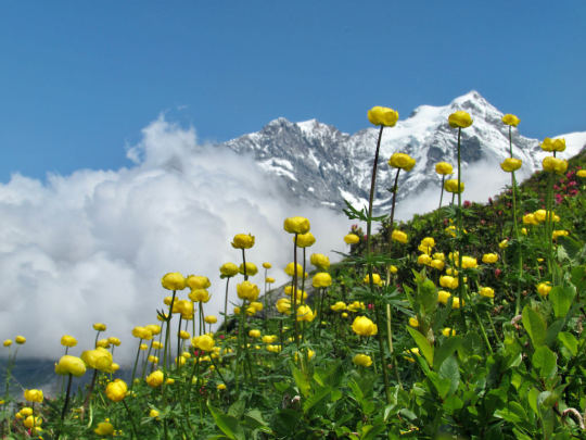
We reached the foot of the last steep climb before the lake at around 1:30 pm, and since it was already quite late for lunch, instead of pushing on, we looked for a spot with a view of the valley and there refreshed ourselves. The weather kept up its amazing display of pure blue sky, cloud banks clinging to the slopes, thus creating dramatic and ever-changing vistas. On the way up to the lake, Anki and I busily gathered wild flowers which we formed into little bouquets. We were going to retrieve the keepsake from Loni, which Bernard had deposited at the lake some six years ago, making a little memorial.
At 2:30 pm, huffing and puffing from the exertion, we finally arrived at the lake, a shimmering, reflective turquoise pool.
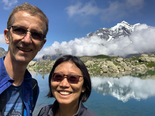
The scenic aspect could not be improved upon, and in every direction the lake had a different aspect and backdrop. The lake is known for hardcore swimming--it is supposed to be the ultimate test to prove one’s Swiss hardiness to swim across; but while we were there, nobody was in the mood, although some hikers dipped their feet in the frigid water, foregoing the pleasure.
We marveled at the gorgeous scenery for a few minutes then proceeded to the spot where the keepsake was hidden—a pendant in the shape of a cross that Loni had worn many years. Bernard located the little plastic bag with the pendant without the slightest trouble, and together with Anki they had a nice commemorative moment. This spot had always had a very special meaning for Loni, who loved to come here.
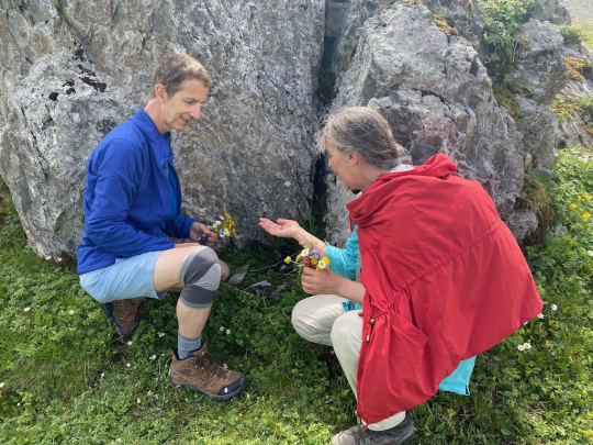
Anki was trying to locate the knitted butterfly from Pat’s funeral that she had suspended in a crack in the same large rock, but her search was ultimately futile—the piece of fabric must have disintegrated or been torn away by the wind. Afterwards, we had another mini-picnic, munching some sweets and rehydrating ourselves, keeping a close eye on the ever diminishing water supply.
At 3:10, we packed up and started on the return journey. At the “Wegweiser” (directional sign), I explained that there were two routes that we could take: either the one that leads back the way we had just come from for a stretch before dropping down steeply along the roaring stream toward the bottom of the valley; or, alternatively, we could follow the longer route (longer by 30 minutes) that skirts the other side of the valley, thus creating a real loop, while descending more evenly and gently. I had been here a few times and knew the different routes. After a short debate, I persuaded the other two to take the longer and, per my recollection, more scenic route.
We followed the stream issuing from the lake for about a kilometer, making for a leisurely way along a lush meadow. At the end of this mild stretch of path, we arrived at another fork in the road. Again, I explained that from here one path descended steeply to the valley bottom while the other one followed a curving line at a milder grade. Liang tended toward taking the shorter route through the center of the valley, while I favored the longer, less popular route. And when Anki indicated that she’d rather be curious to try the longer route, which she’d never done before, we swiftly crossed the stream on a narrow board and continued to the right.
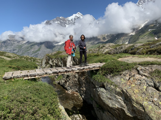
About a half mile later, the path started to switch-back steeply upward. This gave Liang pause, and she questioned me why the path ascended again, when I’d assured everyone that it only want downward from here on. I was stomped by this turn of events...I had flat forgotten the renewed climb. Although shaken in my confidence, I reassured Liang that the uphill stretch wouldn’t be very long. But that, too, turned out to be misleading, as the path--to my intense embarassment--kept climbing and climbing. At this point, we had been hiking for six hours, going up more than 1000 meters, and here we were climbing yet another steep wall that Bernard had not warned his fellow hikers about. After about twenty minutes of huffing and puffing upward, we met two hikers coming from the opposite direction, and Bernard inquired of them whether we were approaching the top of the climb. Yes, the climbers, said, it was leveling off from here and then, the rest of the descent would be “gäbig,” i.e. easy going.
When we finally emerged on top of the ridge, an Alpine panorama of breathtaking beauty opened up before us. There were the grey tinted glacial waters of the Schmadri stream rushing down, the peaks of Breithorn, Mittagshorn, and Tschingelhorn were right in front of us, and glaciers and cloud shreds flecked the canvas of blue sky and grey rock.
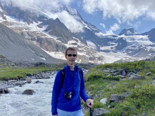
It was totally amazing, but looking down into the valley, some 1,250 meters below us and still about 6 miles away, I began to have an intense anxiety that we might be in trouble. This was so much higher and further from the trail head in Stechelberg than I had anticipated that I was afraid we might be totally exhausted by the time we got there. Also, now I was aware that the portion of the trail we were facing was anything but “gäbig”—it rather promised to be extremely steep and rocky. With these troubling thoughts going through my mind and Liang being in a rather somber mood by now, we started our descent under a figurative if not literal cloud. I made sure to take Liang’s hand whenever the narrow trail allowed for it because now we started down a severley steep, rocky slope that took the wind out of us. For long stretches, the trail resembled a stream rather than a walking path, as water from last night’s rainfall was rushing down into the valley, and this made for very unpleasant hiking.
After about 40 minutes of struggling down this narrow, rocky, twisting path, we decided to take a breather and rest a little. Liang had just exhaustedly plunked herself down on a flat rock, when she shot up with a shout: nettles! She’d put her legs in a bed of stinging nettles, and now in addition to being thirsty, tired, achy, and unhappy, she had her legs full of nettle spikes. Fortunately, I had a first-aid kit in my backpack and could offer some insect repellent wipes that did take some of the sting out. At this point, I felt truly sorry for the trouble caused by my shaky memory and unwise guiding. Anki, too, was exhausted: not only did she carry a hefty backpack, but she did not have hiking poles, like we did.
A few minutes later, we continued down the path, and then came the moment that could have turned this beautiful day into a nightmare: Approaching a sketchy stretch flanked by a deep gully, Bernard half turned around to give Liang a hand, but she thought she could manage by herself. As soon as Bernard turned to face forward again, he heard a sharp cry behind him and from the corner of his eye apprehended a tilting movement. He whirled around with lightning speed, just in time to lunch himself at Liang who was falling. She had stepped on a tuft of vegetation at the edge of the trail thinking that it was a clump of turf, but it was only some leaves with nothing to support it. I tackled Liang to the ground, the only method to stop a fall on steep ground, and together we slithered a little further toward the cliff but soon came to a rest clinging to each other. Anki, meanwhile had been tying her shoelaces when she heard a scream and then saw both of us disappear from her field of vision. She hurriedly hobbled along, her shoelaces still untied, to find me with my arms wrapped around Liang, on the ground. The first words out of Anki’s mouth were “Wow, I think Bernard just saved your life.” And I may well have. What is certain is that Liang would have had a worse fall without my intervention, and if she’d started to roll or tumble… Better not to follow that thought to its conclusion.
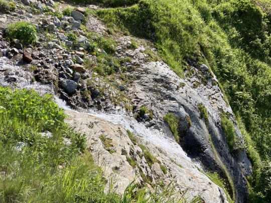
In any case, we proceeded very cautiously from here on down, descending the twisting, narrow path slowly and methodically. It took us another two hours to get to the Inn at Trachsellauenen, and here we sank unto the benches completely exhausted. But no degree of exhaustion exists that a cold beer cannot help with, and soon we were sipping a Feldschlössli while our spirits slowly revived. We still had some 2-3 miles to go before we’d reach our car, but a one-lane gravel road had been laid up to this Berghotel, and it was decided that I would leave my backpack behind and hike down to the car, then drive back up to pick up Liang and Anki.
Before heading down the path, I inquired among the hotel staff whether they knew of anybody driving down to Stechelberg, but the answer was “nobody’s driving down tonight.” A few minutes later, on the hiking path downhill, I heard the hum of an engine, and luckily the trail here intersected with the gravel road here. Seconds later, I extended my thumb, hitching a ride. The folks in the car were happy to pick me up. They were Germans who repeatedly came to this valley to hike. I meet at least one of these lifelong fans of the Lauterbrunnen Valley every time I’m here. Turns out, this German couple had done exactly the same route that we had followed, except in reverse order, going up the steep, twisty path that had almost become the site of a tragic accident, and then descending on the other side, where we had gone up. We should have crossed their path since they arrived at the Oberhorn lake an hour after us, at 4 pm, but since they made a side-trip to the Schmadri hut, we had just missed each other. Also, the man did actually swim across the lake, although he said it was quite terrible, so cold as to be almost unbearable.
The lift down to Stechelberg shortened the time of my trip considerably, and to the amazement of Liang and Anki who were still sipping their drinks, I pulled into the parking lot a short time afterward. It had been an absolutely spectacular day, but one with a big cloud that could have caused a massive downpour of grief. We gave thanks to all the good guardian angels who had stood by Liang and me at the critical moment. We cannot be thankful enough to escape harm when going to the limit, especially in the mountains. Safety cannot be taken for granted, and a more mindful procedure would have eliminated the chance of serious harm. Now, both Liang and I have had one near-death experience while hiking: I in Siguniang and Liang in the Lauterbrunnental. We cannot risk racking up more of these chances.
0 notes
Text
Rabbit Ear Saddle
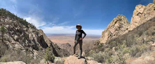
Date of hike: April 11, 2021
Country: USA
Region: Organ Mountains, New Mexico
Trailhead: Unmarked parking at mile 3.6 on Baylor Canyon Road (coming from US 70)
Hike Destination: Rabbit Ear Saddle (col between South Rabbit Ear and Rabbit Ear Plateau)
Distance: 5.5 miles (9 km), out and back trail
Elevation gain: 2,400 ft. (ca. 800 m.)
Difficulty: Difficult route
The Organ Mountains of New Mexico are a narrow mountain range running north-south to the east of Las Cruces, New Mexico. The range presents a single jagged comb with a few prominent spires called the three Rabbit Ears visible from many miles around.
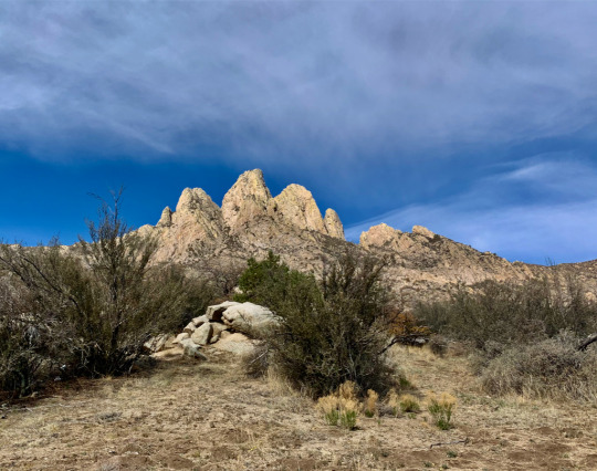
This is superb hiking territory—wild, scenic, and uncrowded. But the area has a drawback in terms of trail conditions. Except for the most popular trails like the Dripping Springs trail on the western side or the Pine Tree Loop on the eastern side of the range, you will have to proceed under the assumption that the trails are unmarked and very faint at times and that there are few if any directional sign posts along the way. Note also that some of the “trails” are actually just routes. Proceeding along these routes requires that you follow somebody else’s recording trail, using a GPS positioning and tracking service like GAIA or a very detailed description in order keep to the route. A complicating factor with these trails and routes is that cairns have been erected by well-meaning trail users. But the cairns are haphazardly placed, and at times a series of cairns can actually lead you away from the hiking trail/route if they have been erected by climbers going for the entry point to a technical climb. This happened to me on a solo hike along the Indian Hollow Trail, where I ended up at the foot of Sugarloaf Peak, way off trail (note the neatly stacked cairn in the foreground).
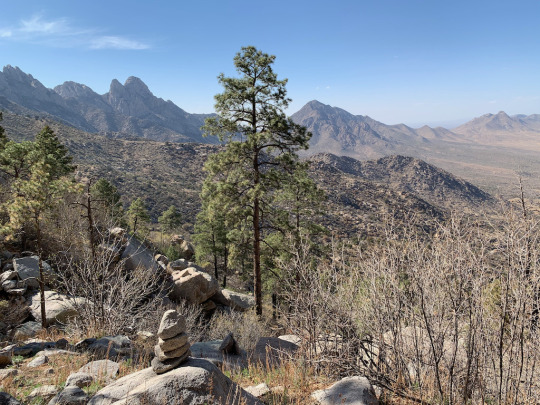
We’d already been enjoying several moderate hikes in the Organ Mountains and were looking for something that would stretch our abilities and get us to greater heights. We got more than we bargained for.
Reading up on the more difficult trails Alltrails, we were tempted by the Rabbit Ear Saddle trail. All reviewers all emphasized the difficulty of the trail, but overall it seemed well worth the try. The saddle lies to the south of the three Rabbit ears (see arrow), and it promised to be much more thrilling than the sedate Baylor pass further to the north which also straddles the Organ Mountain range.

One of the reviewers, a local man by the name of Mike Hoskins, even left his contact information on his Alltrails review, along with the offer to guide anyone who was interested to the top. I contacted him, and he answered right away, but unfortunately he couldn’t do it the next day. Still, he kindly offered a wealth of information, including an annotated terrain map from GAIA with some landmarks and tricky passages marked.
Equipped with this information, we set out at 9 am full of vigor and anticipation.
We parked the car at the trailhead along Baylor Canyon Road (Alltrails reliably guided us there) and then set out as the sun was climbing up into a cloudless sky. The first part of the trail proceeds along a former mining road, which has been eroded to the point where it resembles a dried up riverbed. A motorized vehicle would have no chance getting through. The approach to the foot of the Organ Mountains is beautiful, though, as one is heading straight for the most dramatic section of the Organs.
After about a half hour, we met a man coming the opposite way, and he asked us if we planned to go “all the way up.” When we answered in the affirmative, he made a concerned face and said something about us being rather late in the day. “You’re going to get the full sun both ways,” he added with a frown. Since this was early April and we had plenty of water with us (we thought), we were not too concerned about this.
A mile and a half into the hike, we came across a former fluoride mine.
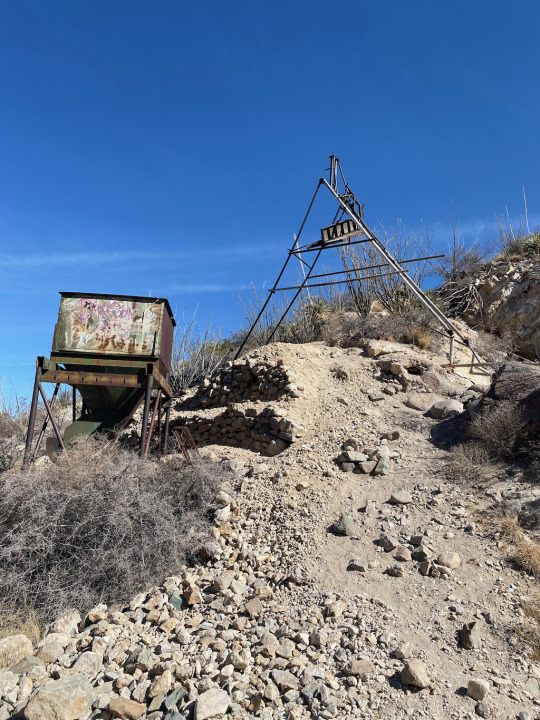
The mine shafts were exposed, with the trail passing right between two deep unprotected clefts. I dropped down a stone and didn’t hear it plunk at the bottom. It’s best to watch your step around this place--once you slip on the scree, you are done for. Here, we met another group with backpacks, but they weren’t going much further than the mine, as we learned. For the rest of the day (another 8 hours) we were completely alone.
The trail climbed up steeply here before easing into the canyon bed where it essentially ended. From here on we were faced with a boulder field. Following the instructions from Mike, we clambered from boulder to boulder. At one point, a truck-sized boulder blocked the way, and to get around it, a slight overhang had to be negotiated. Only after I took off the backpack and flung it up above the overhanging boulder, could I pull myself up, then I grabbed Liang’s hand and got her up as well. This kind of scrambling and boulder-hopping continued for about two hours. Since the hiking poles were now more hindrance than help, we stowed them in the backpack and instead donned gloves, so we could more easily go on all fours, which was increasingly called for as the terrain got steeper.
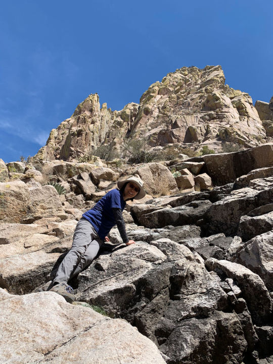
Brambles and cacti were omnipresent, and soon the water breaks were interspersed with cacti-spike removal stops. The sun was baking the canyon pretty good now, and I began to cast a somewhat concerned look at our shrinking water supply (we brought 2.5 liters). We were now directly underneath the southern Rabbit Ear, and aiming broadly for the col between that and the Rabbit Ear Plateau.
Sometimes, smooth granite slabs were quite steeply inclined and after one tricky passage ,I said to Liang “If there’s another exposed portion like this, we should turn around.”
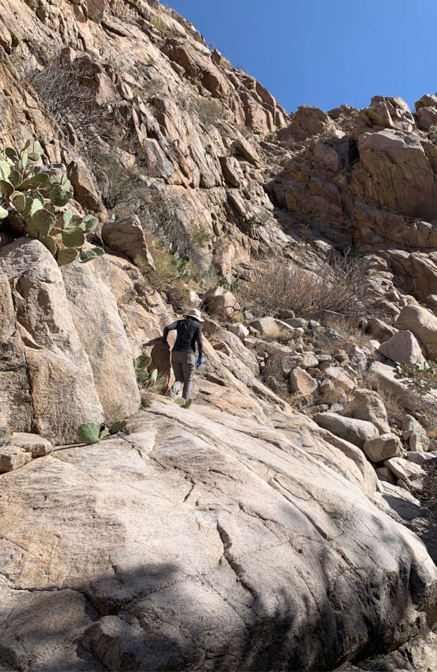
In this kind of rough territory, the Alltrails map is only of limited value because the blue location dot does not move with the accuracy necessary, and my other apps, including GAIA and OS maps did not have a trail marked that we could follow because there simply was no trail. From here on, we increasingly started to verge off the route. At one point, we again lost the canyon floor and began scrambling up the side of a blunt protrusion that curved away from our intended direction. It got to the point where we either had to backtrack a considerable distance or forge ahead, bushwhacking through dense brambles and traversing a steep slope to rejoin the canyon floor. While I was scouting the terrain ahead, Liang was checking Alltrails, and we both arrived at the same conclusion, i.e. to proceed diagonally downward to the left.
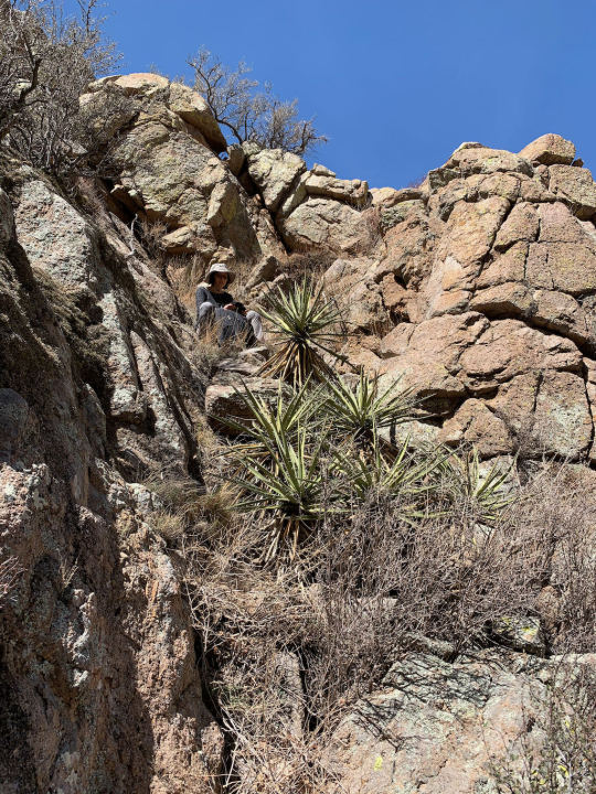
When we were back on the route, a boulder big enough to cast some shadow beckoned as our lunch spot, and here enjoyed a hearty sandwich, while trying to drink (water) responsibly. It was now 2 pm, and we’d been on the hike for over 4 hours. The saddle above us looked still pretty far away, and we began to entertain doubts whether we’d even make it. But refreshed after the picnic, we tackled the slope with renewed resolve, scrambling over endless boulders, trying (often unsuccessfully) to avoid cacti, and keeping an eye on the directional progress.
About 5 hours into this adventure, we had once again lost the route and approached a conveniently located outcropping where we could assess the situation. Panting and gulping water (irresponsibly), we decided to call it quits since the saddle still looked quite a bit higher than our position, and we were running low on energy. After resting a few minutes, though, I suggested to Liang that I might as well press on and see if the saddle was perhaps closer than we thought. Equipped with only a water bottle, I tackled the slope one more time, making swift progress now. Ironically, the going was only getting easier from here on up, and ten minutes later, I stood on top of the Rabbit Ear Saddle, taking a selfie.
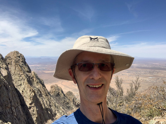
Liang and I texted a few times trying to determine whether she should make the effort to come up as well. At first I thought it was barely worth it, but then it seemed silly not to reach that sense of completion. So, while Liang scrambled up toward the saddle with the backpack, I raced back down to meet her halfway. A short while later, we both stood beaming and high-fiving on the col. From here, one could progress up to the Rabbit Ear Plateau, but the way was very steep and would require the better part of an hour to complete it. We were now down to half a small bottle of water, and the afternoon was advancing, so we decided to take in the view and then started our descent.
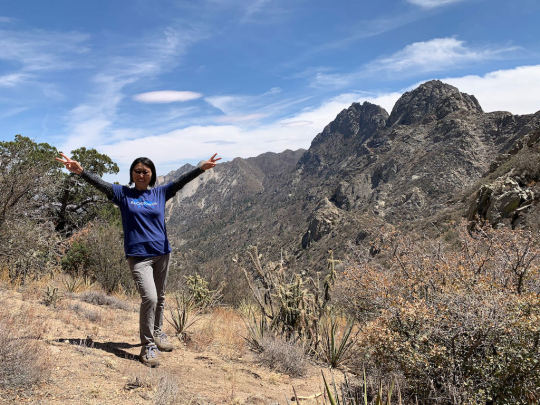
It’s amazing how much easier it was to keep to the route going down. Assessing the shape of the terrain from the higher vantage point is much easier, and we cold follow the canyon without getting lost. We were going at a good clip now, occasionally entrusting our lives to the soles of our shoes when traversing leaning granite slabs. Some large boulders again posed challenges on the way down, and at one point Liang, trying to slide down from a sharp-edged rock suddenly lost her balance and could have ended up head-down in a crack, but I held on to her forcefully and tilted her back upright. Shaken by this almost accident, we took a break and decided to proceed more slowly from her on.
The wind had picked up ever since we left the saddle, but now it was blowing at an almost frightful force. My eyes watered so badly, I had a hard time seeing clearly, which didn’t make negotiating the extended boulder field any easier. There is a point where strong winds are more than simply an inconvenience but turn into an actual hindrance. This stretch of the way seemed to go on interminably, as we were leaning into the wind, fighting to keep our balance. After a long series of boulder-hopping, we arrived at the tricky rock with the overhang. Here Liang jumped down into my outstretched arms, and things got easier from here on.
After reaching the narrow trail that led down to the abandoned mine, we stopped briefly to finish the last of our water. The former mining road from the parking lot had appeared to us full of stumbling blocks on the way up; but now, heading down, it appeared like a hiking superhighway, compared to the situation back in the canyon. On that final stretch, the scenery turned quite spectacular, as the late-afternoon sun bathed the Organ Mountains in yellowish light.
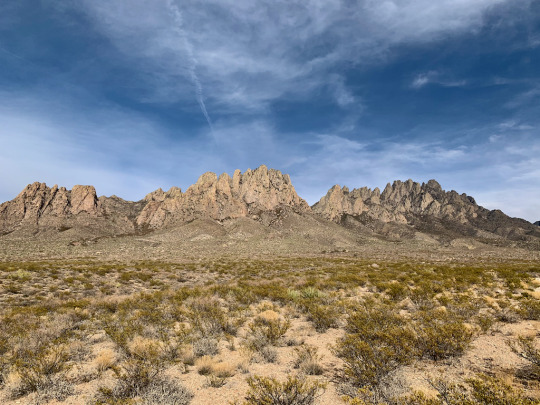
We reached our car just under 9 hours after starting the hike. We both agreed that this had been among the toughest hikes we’d yet undertaken and certainly the most unpleasant. But looking back on it now, it had certainly been worth the effort.
1 note
·
View note
Text
Harding Icefield Trail
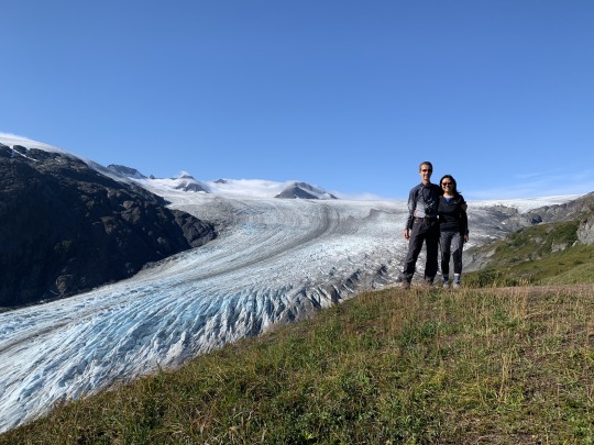
Date of hike: August 20, 2020
Country: USA
Region: Alaska
Trailhead: Exit Glacier Nature Center, near Seward, AK
Hike Destination: Harding Icefield Overlook
Distance: 9 miles (13.5 km), out and back trail
Overall elevation gain: 3,400 ft. (ca. 1,100 m.)
Difficulty: Intermediate
Seward, which is situated on the Kenai Peninsula of Alaska, gets 40% more days without sunshine per year (232) than does Boston (where we currently reside). Thus, while sunny days cannot be taken for granted anywhere in the US, except maybe in Las Vegas, they can even be less taken for granted on the Kenai Peninsula (or anywhere else in Alaska, for that matter). That’s why we were truly grateful and highly excited when we woke up to a bright sunny day for what was planned to be the highlight, hiking-wise, of our 12-day tour of Alaska.
We stayed at the Seward Windsong Lodge, located next to Resurrection River, and from there it is just a 15 minutes drive to reach the Exit Glacier Nature Center, inside Kenai Fjords National Park. To approach the visitor center is to get an object lesson in the intricacies of climate change. Roadside signs with years on them show how far the glacier used to reach in former times.
Based on analysis of vegetation age and various geographic markers, scientists determined that the glacier reached its furthest expansion at the end of the “Mini Ice Age,” around 1815. Since then, Exit Glacier has retreated a staggering 2 kilometers up the valley, living up to its name as a glacier on the way out. When we passed the first placard with the oldest date on it, I took it for a joke because we were surrounded by lush forest; but 200 years ago, we’d have been faced with a mass of shimmering, compressed ice at this very spot. Since the onset of the Industrial Revolution, the Glacier has retreated at a rate of 13 meters per year on average. This is a good indication that glacial retreat is not only a function of man-made greenhouse gas emission (which were minimal in 1815), but that human activity compounds large-scale climactic factors and that both work together to fuel the melting of glaciers. As far as I know, the question of what proportion of climate change is due to natural cycles and what is due to human activity remains a point of contention.
The trail up to the Harding Icefield is very popular, and for good reasons: Starting at a short distance from Seward, it is a hike of moderate difficulty and reasonable length (9 miles), offering huge rewards of grand sub-arctic mountainscapes. It is a good idea to arrive at the trailhead early, especially on a splendid day like we experienced it, although due to Covid-19, far fewer tourists than usual were in Alaska at the time. No cruise ships were docking in Seward all season, and the complicated travel restrictions and testing requirements have generally raised the bar on travelers arriving from far away places. Somebody told us that because of Covid-19, 1 million fewer people were in Alaska right now than a year ago. To put this figure in perspective, the entire resident population of the state is only 740,000. The tourism industry and all depending on it are clearly smarting from this situation, although Alaskans are picking up some of the slack by coming out in greater numbers than usual to see their own land. But it is one of the ironies of an otherwise baneful global pandemic that pristine natural attractions are rendered more pristine by the absence of hordes of tourists.
We started out on the trail at 8:45 am, full of vigor and anticipation. We must have been among the very early birds since we didn't encounter anybody until close to noon, when some hikers who had overnighted somewhere in the backcountry were heading back our way. The trail is very well maintained and ascends at a pleasant rate, although some tall steps are encountered in the steepest sections. The first hour was spent mainly in alder, cottonwood, and spruce forest, which then gave way to shorter, stunted vegetation higher up, allowing a first glimpses of Exit Glacier, a gigantic river of ice lumbering down the mountainside, literally frozen in time.
Exit Glacier is one of 38 glaciers spilling out from the Harding Icefield which entirely covers central Kenai Peninsula at a surface area of over 700 square miles (or roughly the size of the island of Maui).
One of the great advantages of heading out early on this hike, besides enjoying an uncrowded trail, is that the light is much more favorable to bringing out the sculpted features of the landscape, exposing the blue ice shimmering from deep clefts in the glacier, while photogenic tendrils of vapor slide over the mountaintops in the background enhancing the dramatic effect. Once the sun moves further south and then swings west in the later afternoon, the light turns flat and blinding, as the viewer looks more or less directly into the glare over the glacier, and this takes a toll on the color spectrum and dimensional nuances of the scenery.
After one hour of steady climbing, we reached the first overlook where we got a close look at the plunging Exit Glacier. We had a brief sit-down here and drank some water. Then, we tackled the steepest portion of the trail, as it switch-backs up and around a bluff, while the vegetation goes from brush to tundra. Looking back down to that first lookout, we realized that it had meanwhile been populated by fellow hikers who had come in our wake.
After taking this photo with a tele lens, we deftly continued upward, calling out “oyeee! oyeee!” as a warning to potential bears. Telling the beasts that you are in their neighborhood is the best defense against unpleasant encounters with them, as they are usually shy and eager to avoid contact with humans. But when they are surprised or crowded, they can quickly and viciously turn on people. Like most hikers in Alaska, we also carried bear spray, but on a test of this device--discharging the can before we flew home--we found it to be of dubious efficacy, as the cloud of pepper gas was easily dissipated, with a reach of only about 5 meters. It seemed a puny way of defending oneself against an outraged 600 pound animal. Carrying the bear spray does more to calm the hiker’s nerves than it offers real protection in case of an emergency... hence the noise-making as the first and most important line of defense.
As it turned out, on this hike we did not encounter any bear (though another party following after us did, at fairly close range). We also did not spot other large wildlife and had to make do with a couple of marmots and grasshoppers. We did not mind, of course, since the scenery offered all the visual gratification that we could hope for. I'll never forget the moment when we crested a bluff and stepped out unto the ridge that looks down upon the majestic glacier, as it swings around in a broad curve, exposing a dramatic backdrop of icy expanse and serrated mountain tops.
It was as good an instance of the sublime feeling of awe in nature as can be had. The vastness of the scene was overpowering, and we were glad to sample it in solitude. Because the glacier is so enormously thick--measuring up to one mile in depth--the peaks are almost entirely submerged, which creates a unique landscape type, only available in the far north (as well as the Antarctic, of course). It is hard to imagine that all of this splendor could one day be melted away, but in the far future, we might be looking into a valley instead of a plain brimming with endless amounts of ice and snow.
The next portion of the trail, up to the ultimate turn-around point, goes from tundra to rocky terrain to black scree that resembles the surface of an uninhabited planet. This was my favorite stretch of the trail, with the huge expanse of the Harding Icefield gradually coming more clearly into view, as the trail climbs higher and higher above the glacier, while the vegetation becomes more and more sparse yet luminous. The dwarf fireweed were lovely to behold, and in some places they formed bright patches that attracted the eye in this austere landscape.
Even the mosses were extraordinary here, eking out a living in forbidding conditions, brightly lining the border of small ponds along the way.
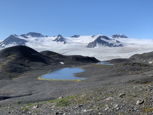
The trail passes a small emergency shelter shortly before it reaches the end. When we peeked inside the shelter, there was nothing but four windowless walls and a bare floor. Not a stick of furniture or a stove to be seen. “Spartan” is probably an overstatement for this establishment. But for mountaineers in distress, the shelter can make the difference between life and death.
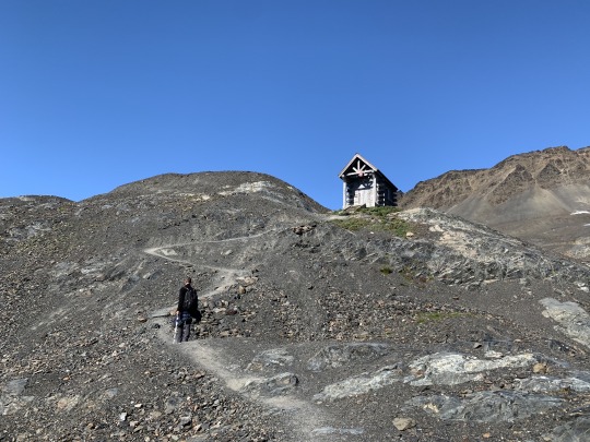
It is hard to imagine the violent storms that tear through this region in the winter, or the bone-chilling cold and relentless darkness that will hold sway here in a few months' time. But right now, we were basking in gorgeous summer sunshine, with temperatures in the mid-60s, and with excellent visibility—better conditions cannot be imagined for a hike in this mountain wilderness. The contrast with what it could be like here in other circumstances is almost unreal.
Soon after the emergency shelter, the path, which follows an old moraine, emerges on a small bluff, all rock and stone with no vegetation.
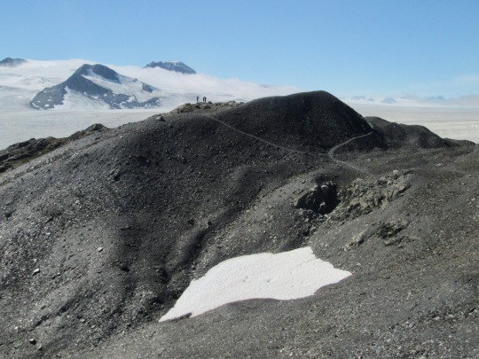
Here, we sought a nice secluded spot to the side of the trail and sat down for a leisurely lunch picnic, pondering the vastness of the vista and feeling comparatively small. In the bluish distance of the Harding Icefield, a row of grey conical mountain tops pierced the mile-thick ice pack like newspaper hats bobbing on a milky ocean.
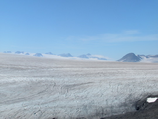
On the way down, we met increasing numbers of hikers going up, including a gaggle of teenagers equipped only with water bottles who were asking how far it was to the end of the trail. It was 3 pm, and they did not give the impression of having the grit to sprint all the way up to the end of the trail, although coming this far without going to the final overlook seems a bit like a letdown. This really is a popular hike, and I can only imagine how busy it would be without Covid. At 9 miles round-trip (13.5 km), with 3,400 feet (roughly 1,100 meters) elevation gain, it is a substantial hike, but nowhere exposed, technical, or uninteresting. There is no better way, in my mind, to spend a sunny day in Alaska than going up to the viewpoint at the end of the Harding Icefield track.
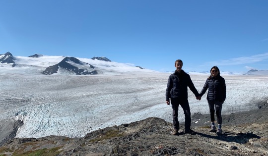
We returned to the visitor center at around 4:30 pm, quite tired but not worn out and certainly in very high spirits. There was not much room for our spirits to go higher, even after popping a couple cans of cold Alaskan beer in celebration of a perfect day.
0 notes
Text
Everest Base Camp Trek
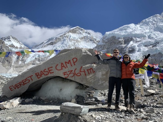
Dates of hike: November 19-30, 2019
Country: Nepal
Region: Khumbu
Trailhead: Lukla
Hike Destination: Everest Base Camp (EBC)
Distance: 120 km (72 miles) round-trip
Overall elevation gain: 5,500 m
Difficulty: Intermediate-tough (on account of high altitude)
We decided to tackle one of the classic hikes of the world: Lukla to Everest Base Camp. A few data points about this undertaking: The trek (the word used in Nepal for extended multi-day hiking) from Lukla to EBC and back takes 11 days, and the total distance covered is more than 70 miles. The way up to the base camp (at 5,364 m.) is chopped into reasonably short daily stages, interspersed with two acclimatization days to make sure hikers are not incapacitated by altitude sickness. You can rush up there much faster, but you may go back down in a rescue helicopter. Most people take Diamox to help with altitude sickness (though I did not). The altitude affected us in the predictable ways, causing occasional headaches as well as sleeplessness; the latter affected me rather strongly, as I struggled through four nearly sleepless nights in a row at high altitude. Our guide made sure we measured our heartbeat and blood-oxygen content every morning and evening. If the reading goes into a critical range, the guide would make the person go down. Descending is physiologically benign, and most trekkers cover the entire distance back from EBC to Lukla (about 36 miles) in three days. A word about the options available to get to the trailhead in Lukla. Since there is no road or other earth-bound means of transportation to this place, you need to fly in, unless you fancy walking for several days. They say this flight is not for the faint-hearted, but in good weather it really is just a short 25 minute joy ride from Kathmandu. If you sit on the right side (which is the left side of the plane) you see the entire chain of the Himalaya lined up on the horizon, and when another plane in the convoy pops up in your line of view, the photogenic appeal is hard to beat.
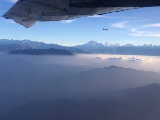
Maybe people who sound wary about this flight refer to short uphill runway in Lukla. But I found it rather thrilling to land on this unique air strip, and although the plane comes down hard on the runway (not only is the air thin above 2,800 meters but the runway meets the plane at a steeper angle than usual), there’s nothing to be particularly concerned about.
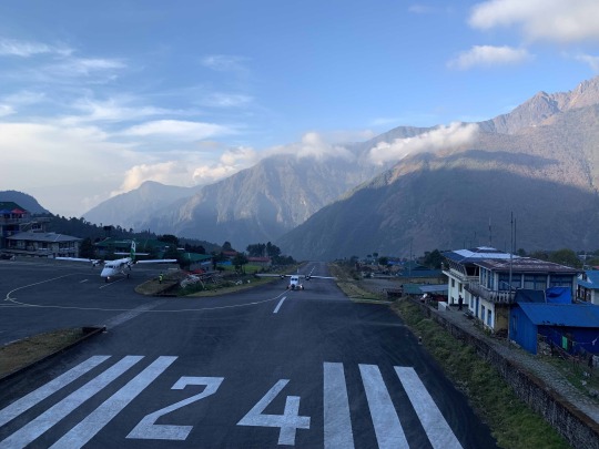
One thing that becomes clear right away upon deplaning is that this ain’t Kathmandu any more. While a day ago, we had capered around in the Nepalese capital in short sleeves, up here in Lukla the air was nippy, to put it mildly. We knew what was in store for us when we sat down in an unheated restaurant for breakfast, clutching our coffee mug with clammy fingers. From now on it would get colder in direct proportion to the altitude we gained. There is no effective indoor heating anywhere in these mountains, and the trekker better be prepared for some cold nights. By contrast, the days are sunny and pleasant, and that brings me to the topic of weather in the Himalaya. The climate in these parts is strictly seasonal, and the pattern is bipolar. The trade winds blowing from the southwest in summer bring daily rain, and when the winds reverse direction in the fall, turning to northeast, sunny and dry weather follows, stretching for days, weeks, and even months. It is the only major mountain range that I know of where the weather is predictably good for long periods of time, especially from the end of September through December, though temperatures are in the lower range due to the short days and flat angle of the sun.
DAY 1: Lukla to Phakding (8 km; altitude: 2,850 m. – 2,600 m.) The first stage of our trek, from Lukla to Phakding, goes mostly downhill, and we already arrived at our destination at noon time. After being pampered with hot towels and the region’s signature masala tea at the Yeti Mountain Home, we made straight for a local restaurant overlooking the Dudh Koshi river valley. There, we had the first of many lunches consisting of fried rice and momos (Nepalese dumplings). Although our package included all-you can eat food for all meals, our guide reminded us for the n-th time to order strictly the amount we can eat and to leave no food behind. This was in consideration of the fact that all food (as well as every other necessity) was precious, being literally carried up the valley on the backs of people and animals. Besides the ecological, there was an economic rationale for this no-leftover policy: The less we ate, the more money was left-over from the fixed amount that was provided to our guide by the trekking operator. We had opted for the “luxury” version of the trek, which meant we were housed in the “best available” lodges along the way. “Best available” can mean bunkbeds and a shared toilet further up the valley, but mostly it means a separate room with attached toilet and sometimes a hot shower as well. Our Yeti Mountain Lodge in Phakding was well appointed in all regards, with spacious, clean rooms, lovely gardens out front, and the food was served banquet style, with wait staff coming around delivering bowls of steaming soup, fried noodles, and even the occasional bit of chicken.
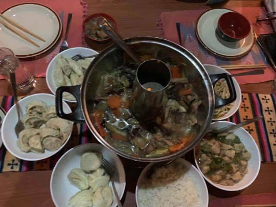
We had been warned to stay away from meat and alcohol during the trip (the meat because it tends to be unsanitary in remote areas, and the alcohol because it puts a strain on the already altitude-stressed cardio-vascular system), but on this first stop along the trail, we still indulged in the forbidden pleasures, washing down our curry chicken with a can of Khumbu Kölsch. After Phakding, we remained teatotalling vegetarians for 10 days, which contributed to the nice side-effect of trekking--losing a few pounds. En route to Phakding, we quickly realized how many fellow trekkers were on the trail alongside us. Although the end of November was quite late in the fall trekking season, we encountered a few larger groups of about twenty hikers as well as smaller groups like ours (we were four people), and the occasional solo trekker. When our guide told us that a month earlier, the trail was much more crowded, we felt instantly better. Although we remained wedged down deep down in the valley, we glimpsed our first Himalayan peak today, Kusum Kanguru (6,370 m.), whose towering bulk rose sheer into the azure sky. What adds further charm to the scenic beauty are the large “Mani Stones”—rocks carved and inscribed with the Tibetan mantra “Om Mani Padme Hum.” To my eye, these were essentially sculptures, large artistic installations harmoniously integrated into the landscape.
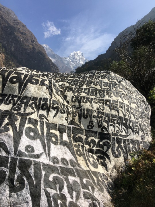
DAY 2: Phakding to Namche Bazaar (11.5 km; altitude: 2,600 m. – 3,500 m.) The second day of trekking is quite long, and it involves a substantial altitude gain of almost 1000 m. Indeed the final ascent from the valley bottom where the Dudh Koshi meets the Theshyo Khola River, is substantial. Here, one really begins to feel the altitude. And when it gets that steep, the larger groups begin to slow down and bunch up, so that we had to pass them, overtaking group after group. Since we like solitary hiking, the crowds were not our favorite part. Our guide, who realized this, forthwith timed our daily schedule to avoid the busiest times on the trail: Apparently most groups start their day at 8 am, which is necessary for the larger, slower groups to reach the day’s destination before sunset. By starting the day’s trek one hour or more behind the majority of our fellow trekkers, we often had the trail almost to ourselves; or rather: we shared it only with pack animals. These caravans are ubiquitous, especially on the lower reaches of the valley, where long lines of mules, horses, and yaks are frequently encountered.
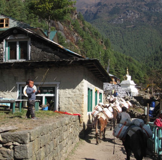
If you look at the size of Namche Bazaar, a veritable town, and consider that this place was entirely built with materials lugged up the mountain by muscle force—both animal and human—it becomes clear how many trips have to be made to make it possible. But the beasts do pose somewhat of a challenge and at times, trekkers and pack animals compete for the narrow, dilapidated trail space, with sometimes unfortunate consequences. Just outside Phakding, at the start of today’s trek, our friend was pushed by a mule from behind and she fell hard against the slope, cutting her fingers and damaging her wedding ring, which lost one of its inset diamonds, a detail we only noticed an hour or so after the incident. Our guide used some first-aid materials to bandage the bleeding fingers, and it was all fine. But from then on, we referred to mules as “her friends” and would give them as wide a berth as possible when they approached from either direction. Some of these caravans are so long, with more than 100 animals in total, that it can take 15-20 minutes until they all pass, trying one’s patience. But the higher up one goes on the trail to EBC, the fewer animal caravans one is likely to encounter, as the human settlements become increasingly smaller, thus necessitating fewer good to be transported. Resting areas appear at regular intervals along the trail, with ledges where trekkers and porters can place their load away from the dusty ground and where garbage and recycling bins are installed, though both are usually overflowing. One such stop about an hour below Namche Bazaar was particularly crowded because from here you could get your first glimpse of Everest, though only barely, with trees blocking the line of sight. Still, dozens of trekkers were milling around, some of them trying to pose for pictures “in front of” Everest, although what they really did was pose in front of trees. I itched to get away from this crowded spot, but it seemed we were wedged in a long line of slow-moving hikers. Just then, the path forked, and while everybody went to the right, our guide nudged us onto the less traveled path on the left, apparently reserved for pack-animals. This track was quite deserted, thus saving us the discomfort of being absorbed into a convoy of slow-moving, chatty hikers. There are several checkpoints along the way, and one benefit of having a guide is that all the paperwork is neatly taken care of by him, while we can take a rest and catch a breath. At the checkpoint before entering Sagarmatha National Park, we encountered a code of conduct that, among other things, required us to “refrain from anger.” It is an important injunction because simply walking on the atrocious trails around here could make anybody give in to the undesired emotion. Over long stretches, the trails in Khumbu Valley are terrible. I don’t understand why they don’t undertake any trail maintenance in these places, but rather let the trekkers, pack animals, and local porters stumble over unbelievably dilapidated, rocky, eroded trails. I often encountered heaps of rocks in the center of the trail inside a village; everybody was laboring over these obstacles and the poor animals were getting their hooves scratched and scuffed, but apparently nobody says “hey lets get a few villagers together and spend ten minutes to remove these loose rocks from the trail.” Occasionally the trail resembles nothing more than a riverbed, a steeply inclined, stone-strewn channel.
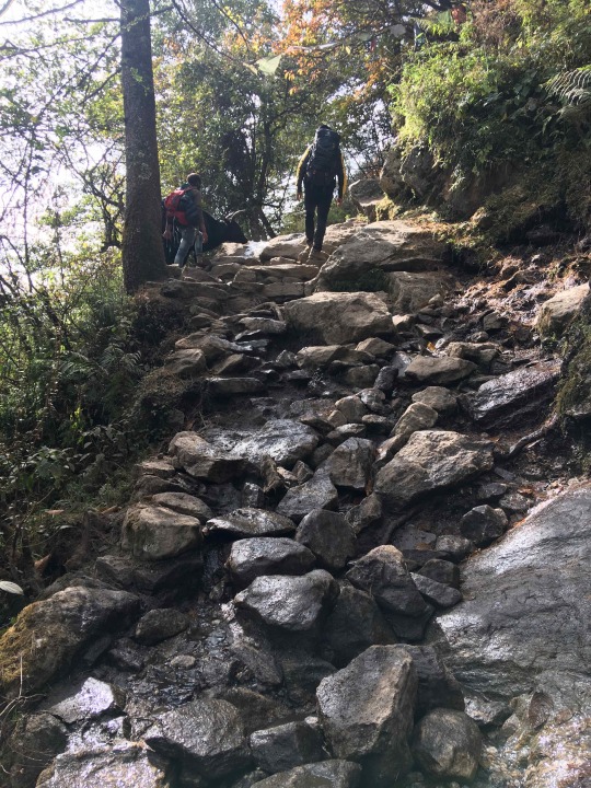
But again, no anger please. Just roll with the punches... Namche Bazaar—dubbed the “Sherpa Capital”—is the biggest, liveliest town along the Everest trek. The town is arranged like a horseshoe, with rows of houses aligned in ever-expanding semi-circles up the steep hillside. Here you can go bar-hopping if that’s your thing (although watch out—alcohol will interfere with your acclimatization process), or you can do serious gift-shopping (although who is going to carry all that loot back down to Lukla?), or you can play billiards (a surprisingly popular past-time along the Everest trekking route). Anyway, it’s a pretty fun place, with gaggles of school kids in uniforms laughing and running up and down the steps while monks in dark maroon robes bask in the sun, serenely contemplating the scene.
DAY 3: Acclimatization hike (4.5 km; altitude: 3,500 m. – 3,900 m.) Namche Bazaar is the first of two acclimatization stops. So, we did what all trekkers do: make our way up to the Everest View Hotel equipped only with daypacks. This is a surprisingly modern hotel that would not be out of place in Aspen, Colorado. But instead, it sits on a ridge high above the Dudh Koshi river, in the middle of nowhere, to be reached either by walking on a thin trail for an hour and a half or by helicopter. The hotel’s name is aptly chosen, but it could equally well be called “Ama Dablam View Hotel.” In fact, Ama Dablam (6,812 m.) is the most prominent landscape feature on view throughout much of the trek to EBC, and it is one of the most beautiful mountains to boot, standing tall and solitary, leaning pridefully backward and to all intents and purposes looking unclimbable (it is, in fact, climbed by dozens every year).
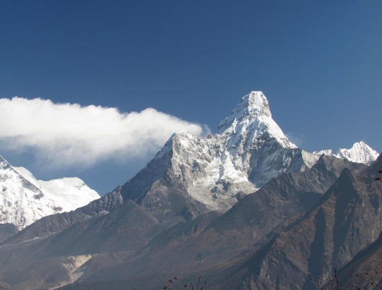
So, while the summit pyramid of Everest is just visible behind the broad, lumbering ridge of Nuptse in the distance, Ama Dablam is the king of the valley, stealing Everest’s show. This is the first undeniably major panoramic highlight, and we took many pictures, even as we sipped tasty masala tea and swilled ginger-lemon-honey brew at our open-air restaurant table.
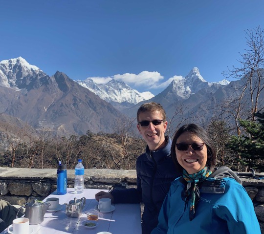
Meanwhile, some tourists sporting designer clothes and clutching Gucci bags and exited a helicopter that had landed on the pad next to the hotel. They are probably the kind of clientele to whom this swanky place caters. Trekkers like us return down to Namche Bazaar to get ready for the hike to Deboche the next day.
DAY 4: Namche Bazaar to Deboche (10 km; altitude: 3,500 m. – 3,850 m.) The nice thing on this trek is that every day seems to top the previous one in terms of sight-seeing, and every time when you think it can’t get any better, it does. The fourth day of trekking was no exception to this rule. First, the wide path winding its way leisurely at even altitude along the slope above the valley floor, afforded broad views of Nuptse, Lhotse, Everest, and Ama Dablam. The occasional stupa and prayer-flag garland provided a lovely man-made accent to the landscape. For reasons that escaped us, this section of the path was the only one along the entire trek that was in good condition, which shows that it can actually be done. But the drawback is that it makes the awful sections of trail look even worse, and there was a terribly dusty, rocky, and steep section down to where the trail meets the Dudh Koshi stream at Phorge Tenga. It was lunch time when we arrived there, and the restaurant chosen by our guide was, according to general consent, the best lunch spot along the whole trail. In the early afternoon, we tackled the long steep climb to Tengboche. Although taxing, we particularly enjoyed this portion, for two reasons: first we were practically alone on the trail, and second the scenery dominated by Mt. Kangtega (6,782 m.) was sublime.
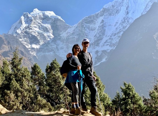
Kangtega is an enormous hulk of a mountain, so complexly shaped that it constantly changes its form as one’s angle of vision changes—first it looks like a huge dome, then it appears to have a split summit, then it turns out to be horn shaped. Emerging on the pass that is home to Tengboche monastery counts as one of the greatest wow-moments of the trek, if not of my hiking life. The arena of the vast mountain theater, topped by Taboche, the Everest massif, and Ama Dablam was sublime; the natural beauty was complemented by shining white stupas, prayer flags, carved wooden arches, and the monastery itself that added to the overall attractiveness of the vista.
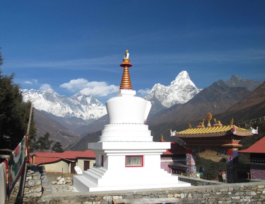
Inside the monastery we were impressed in a different way: the sumptuous orange, red, and yellow tones of the temple interior, the wall paintings and thankas, the drapes, and the shadows on the floor created a flawless impression of harmony and peace. I kept taking pictures with the iPhone, completely forgetting that it was forbidden inside the monastery (and signs warned of 24-hour surveillance to enforce the ban—fortunately, nobody came after us for this breach). We snapped a group photo of the four of us before the spectacular backdrop and then finished the day’s hike by descending to Deboche. The lodge there was a lot more basic than the Yeti Mountain Home in Namche Bazaar, but it was still miles better than some of the dorm facilities we had passed that day, smoky, dark abodes with nary a sense of privacy. So, we shall not complain although the stove in the dining room went cold at 9 pm despite our pleading, and we had to repair to our rooms.
DAY 5: Deboche to Dingboche (10 km; altitude: 3,850 m. – 4,350 m.) We set out at 9 am for today’s hike. After a short while, we came to a suspension bridge where about 100 trekkers were bunched up. We speedily passed them and continued ahead of the pack, but the extra pace, trying to put some distance between us and the gaggle, took a toll on me. About 1 ½ hours into the hike, I suddenly experienced shortness of breath and had to sit down. This was a warning sign not to take things at too great a speed and to make sure to keep breathing deeply; I had been talking animatedly to Liang for about 20 minutes while hiking vigorously, and the prolonged shallow breathing had taken the stuffing out of me. I vowed not to engage in lengthy conversations while under the strain of hiking uphill at such an altitude. We had a long lunch break at 11:30, sitting in a sunny spot right underneath Ama Dablam. Then we set out on the second half of the trek, which was varied and interesting, with only moderate uphill portions. We saw the first glimpse of Dingboche at around 2 pm, and half an hour later we were at our lodge. The room is one further step down even from yesterday because electricity is on only for a short stretch, from 8-10 pm. Also, there was no hot water for washing. The tough part of the trek begins here. From Dingboche, we saw Ama Dablam from a different angle, but the mountain is still incredible seen from this perspective.
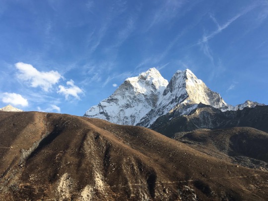
DAY 6: Acclimatization hike (2 km; altitude: 4,350 m. – 4,550 m.) We spent the second acclimatization day by going up on a ridge above Dingboche to enjoy the views. We had not expected to see such a fantastic panorama and dramatic vistas once we gained some height above Dingboche. In the end, it turned into a photographic feeding frenzy. Halfway up to the viewing point, our friend came across a granite slab jutting out from the slope and we all took turns posing heroically upon it.
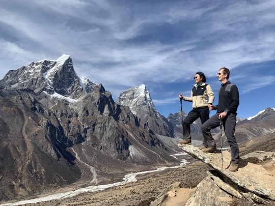
After this, we continued to climb in great spirits until we reached the viewing point garlanded, as usual, with colorful prayer flags. From this spot, we could see Lhotse (8,516 m.), Makalu (8,485 m.), as well as a host of other peaks, including the holy Taboche (6,495 m.) and Chalotse (6,440m.), the latter two mountains looking like identical twins. We descended slowly because the trail was dry and dusty and it was easy to slip. Holding each other’s hands, we made it safely back down, and soon afterwards we enjoyed our lunch of pizza, soup, and noodles, while drinking copious quantities of masala tea. After lunch, we headed over to the “Himalaya Café,” where we ordered a lovely cappuccino (if you spent 400 rupees you got a free charge of an electronic device) and a pot of an Himalayan berry tea that had a tart, sour taste. The place was comfy and warm, so we spend the whole afternoon there, until the time came to return to our much drabber lodge, the “Bright Star.” The only source of warmth there was an iron stove that was fed with dried yak paddies. It took forever for them to light up, and the stinking smoke filled the whole dining room until our eyes were watering. Yak paddies may be an ecological solution as fuel but they are inefficient and provide minimal heat. To make matters worse, the hot bed bottle provided to us for the night was leaking and after only an hour or two of sleep I woke up to feel clammy wetness spread in our bed, while the room was as chill as the outside temperature. I lay awake for the rest of this miserable night.
DAY 7: Dingboche to Labuche (9.5 km; altitude: 4,350 m. – 5,050 m.) We left for today’s hike at 8:45 am. For once, the weather was not great. It was overcast, with a chilly wind blowing most of the time. I wore the underlayer pants, gloves, and hat all day long. The trek was again very scenic, as we followed the valley further back toward the southwest side of Nuptse. The climb was pretty gradual, except for about an hour after lunch, when we climbed more steeply, from about 4,700 to 5,000 meters. At this point, we were huffing and puffing like locomotives in the thin air, taking frequent breaks. After Thukla Pass, we continued on for another few kilometers over even terrain. Not too much was happening along the trail today, and we also took fewer pictures than before because the light was flat under the overcast sky. Our lodge, it turned out, was an Italian research station called “8000 Inn” (but everybody refers to it as “The Pyramid”).
We had gotten lucky here. The rooms were rustic but nicer than the two previous places we had stayed at, plus there was electricity in all rooms at all times, and although shared, the toilet and shower facilities were decent.
DAY 8: The Pyramid to Everest Base Camp and back (14 km; altitude: 5,050 m. – 5,364 m.) My night was torture again. After 1:30 am, there was nothing going, despite taking Benadryl. I had this strange sensation that I could not breathe properly if I fell asleep, and every time I almost nodded off, this feeling of hyperventilating took hold of me, making it impossible to sleep. I finally gave up trying at 5 am and went downstairs to read the news (I had purchased internet connection) and to sip a cup of hot coffee. I was naturally a bit apprehensive about having missed two nights’ sleep in a row because today was going to be the biggest day of the trek, with the push for Everest Base Camp and then coming back again to this lodge, a hike of at least 14 km, all above 5000 m. Also, I had a splitting headache by the time it was 6 am, so I took two Advil. Fortunately, they did have an effect, and the headache soon got better. We started our day’s trek at 7 am. Right away we climbed up steeply from the lodge, not following the main trail but rather going on an alternative route which took us up on an incredibly scenic ridge which was dominated by the gorgeous pyramid of Mt. Pumori (7,145 m.) bathed in early morning sunlight.
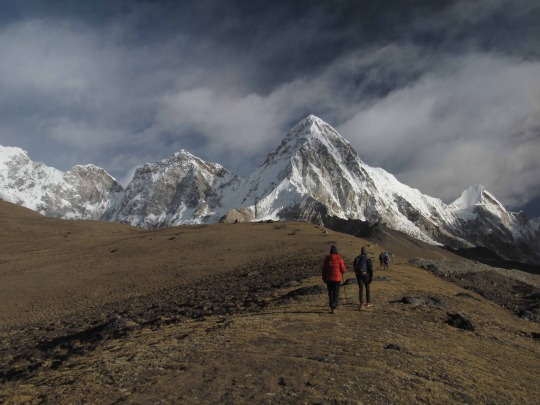
We found a good spot and held an enthusiastic photoshoot. After this, the trail skirted a steep slope and was for stretches rather sketchy and narrow. After a while, we joined the official trail to Gorak Shep, and here it got really crowded, with scores of trekkers going both ways and with the occasional yak caravan squeezing by on a rocky and narrow trail. We were now on a moraine, and the going was really rough over small and large boulders without anything that could be called a trail. We arrived at Gorak Shep, the last dwelling before the Base Camp, at 9:30 am, and everyone agreed we should just push on to the Base Camp without stopping. This was a great decision because we now had the trail and, eventually, the Everest BC all to ourselves. About a mile before the base camp, the summit pyramid of Everest peaked up behind the shoulder of the mountain. But mainly, the actual head of Everest remained hidden. If you want to see the whole mountain, you need to climb on top of one of the surrounding mountains, or approach Everest from the Tibetan side.
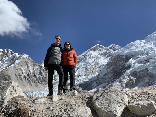
By contrast, Nuptse presents itself from its best side here, literally. While on the approach so far, Nuptse looked less like a mountain and more like a ridge that extends from Lhotse, from where we stood, Nuptse elegantly showed its merengue-twisted top. We arrived at the Base Camp at 11:45 am and only saw one or two other hikers. Here our guide, Lal, gave all of us a big hug in celebration of having reached our goal. Afterwards, we explored the wider base camp area. There was not a single climbing party there and no tents.
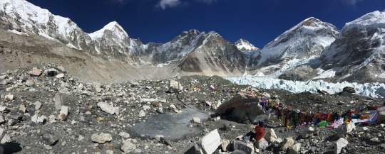
Lal explained that the weather was too cold, making for worse rather than more favorable ice conditions, plus the winds at the top were so strong at this time of the year that climbers would be blown right off the ridge. But down here at the Base Camp, the weather was splendid for a visit. The sun was out, the sky was a deep azure, and some puffy clouds floated by, allowing for maximum visibility and making the terrain look as spectacular as it possibly can. On the way back from Base Camp, we finally met the throngs of fellow hikers I had dreaded to encounter earlier. Our guide had done a splendid job timing our approach to EBC so as to be ahead of everyone else. We were back in Gorak Shep at 1:30 pm and had a small lunch there. The previous night, we had decided to skip the early-morning trek up to Kala Pathar to see the sunrise, as originally planned. According to our guide, the gain in view (a little more of Everest) was not worth the enormous expenditure of time and energy, getting up at 4 in the morning and then climbing up to 5,500 m. before having to hike all the way down to Pangboche--a monster day. In Lal’s experience, people generally regret the Kala Pathar trip. Moreover, skipping Kala Pathar meant that we’d be able to stay one more night at “The Pyramid,” a much more comfortable (aka less uncomfortable) place than the accommodation at Gorak Shep. So, the decision was made, and we never looked back. From Gorak Shep we retraced our steps over the endless-seaming moraine of the Khumbu Glacier, the “trail” consisting only of stones, boulders, and rocks.
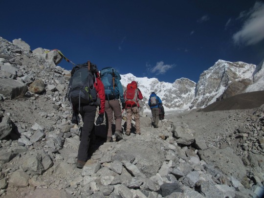
About two hours later, this bad stretch of trail gave way to a smoother path, allowing us to speed up, heading toward the “Pyramid” at full steam. It was quite amazing how easy descending was compared to going uphill. We arrived at the “8000 Inn” at exactly 4:30 pm, 9 ½ hours after we had set out. It was altogether a fantastic and truly memorable hike, one that I will fondly remember for a long time to come, and also one that does give us a little bit of bragging right.
DAY 9: The Pyramid near Lobuche to Pangboche (15 km; altitude: 5,050 m. – 4,000 m.) For the third night in a row, I slept really badly. After 2 am, there was nothing going. After laying awake for two hours, I put on the headphones and listened to music for another 2 hours, without sleeping a wink. Finally, when I could not take it anymore, I got up and started to get ready for the day. After breakfast, the man running both the “8000 Inn” and the research station built next to the Inn, invited us to take a look inside the research facility. It was astounding how much scientific instruments and gear was assembled there was to study the climate and investigate pollution related issues. But working in this environment, no matter how pretty the site was, would be impossible for me because the pyramid was not heated, and it was bone-chillingly cold in there. It’s hard to imagine that scientists would put up with these conditions for up to 10 months per year—that’s dedication! Although the sun was shining, it was bitterly cold when we set out at 8:30 am, and the wind was so strong, it stung my eyes to tears. It took about one hour into our downward hiking until I began to warm up. Today, visibility was splendid and the scenery going down was as interesting, if not more so, than seeing it coming up. At Thukla Pass, we spent some time inspecting the collection of memorial stupas erected in honor of the many mountaineers in the Khumbu region who had died during their climbs or descents (an astonishing number of them perished after already having achieved the peak).
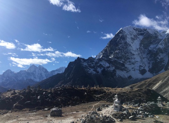
The scenery kept getting better and better, and when we reached the valley floor leading to Pheriche, it was amazing to stand at the base of the two soaring peaks, Taboche and Cholatse.

We took our good time with lunch at Pheriche, spending almost 1 ½ hours at the inn there. Then we were off again for the last stretch down to Pangboche. The trek continued to be very pleasant and inspiring, as we rejoined the Dudh Koshi river valley and faced gorgeous Ama Dablam from the side. On the last stretch of the trail, the Nuptse-Everest-Lhotse trilogy swung again into view, and the low-hanging clouds added a dramatic touch to today’s iteration of the view. We reached “Everest View” lodge in Pangboche at 3:30 pm and were cordially greeted by the owner. The news that there was a reliable, hot gas-shower in our own unit rather made us giddy. Dinner was delicious. They made such a big effort to spoil us in this place, including lovely table decorations, serving a tasty, well-cooked and beautifully presented three-course meal, and being attentive throughout. From our perch in the dining room, we were treated to a spectacular sunset. It was a fitting ending to a great day.
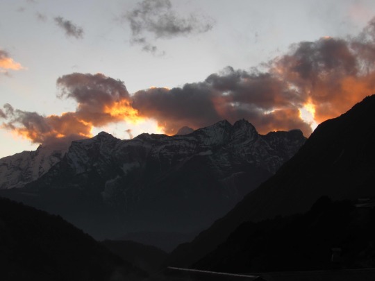
DAY 10: Pangboche to Namche Bazaar (12.5 km; altitude: 4,000 m. – 3,500 m.) This marked the 4th night in a row that I have barely slept. These hours laying awake, trying to breathe deeply but repeatedly finding myself gasping for air without finding a proper breathing rhythm, are long and dreary. Breakfast seemed a long way off at 2:30 am, but it did finally arrive, and when it did I enjoyed it very much. The table was once again laid out beautifully, and we were served homemade rolls and even some freshly cooked dishes, as well as porridge, eggs, and juice. Really quite sumptuous and served in a room with a great view over the mountains. Today’s hike was going to be 6-7 hours, all the way back to Namche Bazaar. Along the way, we enjoyed again the scenery we’d seen on the way up, but now, the light was different and the sky was full of drifting and dissolving clouds, adding an extremely pretty touch. Something about breakfast bothered me, digestively, and near Deboche, I had to make for the bushes. But, the discomfort only lasted until lunch, and there were no further problems. We passed Tengboche under a beautifully cloud-dotted sky and once again enjoyed the harmonious blend of culture and nature around the monastery complex there. Then came the protracted descent to the valley bottom at Phorge Tenga. When we had come up here 8 days ago, we had hardly encountered anybody, thus making this one of my favorite stretches of the trek. Now, going down, we encountered many trekkers coming toward us. We stopped at the same restaurant in Pharge Tenga with the spectacular, fresh mint-tea and the best pizza of the valley. After lunch, we climbed up that awful, steep, worn-out, dusty section of trail, until we reached the level track that skirts the mountainside toward Namche Bazaar. The clouds got progressively more picturesque, framing and embellishing the snow-topped mountains (esp. Thamserku).
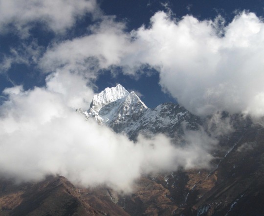
The shutters kept clicking until our arrival in Namche Bazaar.
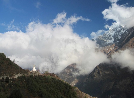
The scenery was so picturesque, it felt like we had walked into an Albert Bierstadt Painting (the painting below is titled “Rocky Mountain Landscape,” 1870, though I’m pretty sure the Rockies don’t look like this).
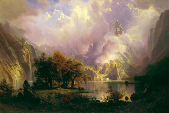
DAY 11: Namche Bazaar to Lukla (18.5 km; altitude: 3,500 m. – 2,850 m.) Finally, that night, I slept well, due to the lower altitude. Breakfast was scheduled for 6:30 am, and we left the lodge around 7:15, heading down the trail toward Lukla. Measuring at 19 kilometers, this was the longest segment of the entire trek, hence our early start. Today, I hardly took any pictures because we were getting lower and lower down into the valley, with fewer scenic highlights. Also, the weather was turning overcast, washing out contrasts and making for a more hazy, unexciting scene. We had lunch at the same place in Phakding where we had eaten our first lunch. It was our last meal with the usual choice of egg fried rice, vegetable chow mien, fried potatoes, mushroom soup, and pizza. The last stretch of the trail toward Lukla went uphill, and toward the end it got quite steep. This was the ultimate fitness test, but we passed it with flying colors. In fact, we all were walking at such a fast pace, I sometimes wondered if our guide could keep up. It was good he did, for shortly before reaching Lukla, Lal called to us from behind, because we had taken the wrong branch in a fork of the trail. We had followed the refurbished, smoother of the two trails, whereas we were supposed to follow a delapidated branch. I expected that our friends, who had gone on ahead of us, must have also missed that fork as well. And indeed, as we slowly continued on the trail, looking down from time to time, we spied them retracing their steps. We called to them, and five minutes later, they had rejoined us. Together we pushed on for the last kilometer, and at 4 pm we arrived at the Lukla Yeti Mountain Home, where the setting sun was bathing the beautifully decorated yard in gorgeous colors.
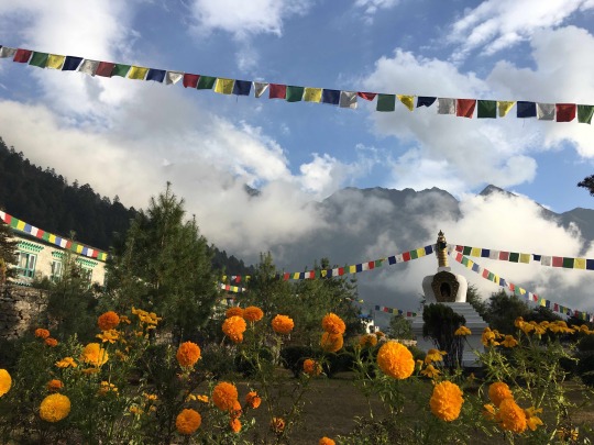
0 notes
Text
The Great Huangshan Loop

Date of hike: September 22, 2019
Country: China
Region: Huangshan
Trailhead: Xihai Hotel
Hike Destination: Same (loop trail)
Distance: 15 km (10 miles)
Elevation difference: ca. 900 m gain
Difficulty: Tough
I jokingly refer to 2019 as my “Huangshan year.” Indeed, I was lucky enough to go to China’s “Yellow Mountains”—Huangshan—no less than THREE times in one year, in three different seasons. In total, I have hiked Huangshan 5 times now, and from the accumulated experience of all those trips, one hike has emerged as the all-around, undisputed, greatest favorite. I am referring to the great loop from Xihai Hotel down to the bottom of the West Sea Grand Canyon, continuing down to Sanxi Bridge, and then climbing up on the other side of the canyon, via Fairy Walking Bridge, to BaiYuan hotel, and from there via Bright Peak and Flying Rock back to Xihai hotel. This is the mother of all loop hikes in the area, clocking in at 10 miles and involving close to 1000 meters in uphill climbing (as well as the same in descending) over steep and partly crumbling steps. But the best part of this hike—aside of the usual stunning scenery—is that it takes you away for hours from the insane crowds that make enjoying Huangshan not always easy! I had scouted out this route during my previous visit to Huangshan last May; but at that time I’d gone about it awkwardly, descending to the bottom along the regular trail, then taking the funicular up to the rim of the canyon, hiking up to Bright Peak, then reversing direction, and descending all the way back down to the bottom of the canyon, only to ascend the same steps I had taken down in the morning to go back to the canyon rim on the Xihai side, thus not completing the circle and also backtracking a significant portion of the route… a mess. So, here I was now with Liang, to do it right this time.
But before we tackled the great loop trail, we planned do some conventional sightseening in the wider Huangshan area. This involved returning to a scenic village called Hongcun where we had visited back in 2015. This is one of the insanely popular AAAAA tourist destinations in Anhui Province, a picturesque gem that is almost made unpicturesque by being so overrun by tourists. At our first visit, we had been too rushed to truly appreciate what the place had to offer. Liang invited her parents along for this trip, giving them the chance to experience those touristic hotspots and classics of the Chinese cultural heritage, which they’d not previously explored. We met up with Liang’s parents at the high-speed railway station in Huangshan City. From there, we took the public bus to Hongcun. This bus ride reminded me of how much China had changed in one generation. When I went to Huangshan for the first time, back in 1987, the buses were dilapidated, missing entire window panes, the gears grated, the road itself was potholed and not paved throughout, with stretches of unsecured dirt road beside a raging river or zig-zagging over dizzying abysses without guard rails, making it a rather hazardous experience. But now, we were sitting in an all-electric bus that silently glided over well-paved roads, equipped with USB outlets in the back of the seat. And there now was an elaborate safety protocol, and buckling in was mandatory. If you did not follow this safety precaution, a beeping sound would instantly alert you to not being buckled in. But although everybody was following instructions in that regard, there still was incessant beeping left and right: Turns out that as soon as you put a piece of luggage on a seat, the sensors embedded in the seat assume that somebody is sitting in it, and the alarm goes off. So, one by one, the passengers had to strap either pieces of luggage with the seatbelt to stop the annoying beeping. Talk about overdoing it. The scenic town of Hongcun had already been crowded with tourists when we first visited it in 2015, but four years later, the situation had become even more drastic. In addition to tourists, there were now literally thousands of students from all over China practicing painting and drawing, trying to master perspective and scene. Liang’s mom kept asking them where they came from. Turns out, these youngsters were from all over the nation--practically all provinces were represented among the participants of these artistic field trips. During our first pass through the town, under the eye of a hot sun glaring down from the cloudless sky, we could not quite connect with the town. Nothing really stood out, and the general feeling was of being underwhelmed. So, we returned to our hotel about a mile outside the village to spend the rest of the afternoon relaxing. Then, we all returned at dusk when the crowds had began to thin out; there was some breathing room now, and when we stumbled upon the large circular pond in the center of town, which we somehow managed to miss during the afternoon outing, we were quite enchanted by the scene, marveling at the clear reflection of the whitewashed buildings and bright red lanterns in the body of water.

Then we stopped at a tea shop and tasted the local specialties of green tea—including wild green tea—served by a chatty lady who was both knowledgeable and passionate about her product, and it began to be really fun. After purchasing a few bags of the local green tea varieties, we returned to the mirroring pond and sat down at a restaurant table for dinner, directly overlooking the whole scene. The next morning, we returned one more time to the town to watch the first sun rays caress the village and see the sky reflected in the outer pond.

When we had had our fill of this lovely scene, we return to the central pond, and this time we were fully convinced that the AAAAA rating of this town was well deserved. The scene was so picturesque that it really gave rise to the impression that one was stepping into a picture, a painting, a little piece of fairy landscape.

After a Chinese breakfast consisting of congee, steamed bread buns, and deliciously preserved raddish, we boarded the bus to Tangkou, setting off to the base of Huangshan.
After the usual formalities, which I had grown to know so well during my previous trips (i.e. the entrance ticket booth, the shuttle bus to the cable car station, the gondola ride to the top), we arrived on top of the mountain at 3 pm. The density of the crowds was beyond my expectations for late September, and so the walk to Xihai hotel was not the most pleasant. I thought it was a pity for Liang’s parents to have this particular introduction to the fabulous scene, with all the shuffling and squeezing and jockeying for position on lookouts, but I had forgotten that this was what they were likely used to at all the other tourist spots they had gone to. In order to get away from the crowds, which sometimes may seem impossible, you need to be a little ingenious as well as enterprising. For one thing, timing the outing to the very beginning and end of the day makes a difference because the day-trippers are gone by then; also, traveling in off-season (which here means the dead of winter) is a nice crowd-avoidance technique; but the best year-round crowd-dissolving strategy is doing something that requires greater than normal endurance and basically just means to hike away from the beaten tracks, something most Chinese tourists don’t do. Chinese tourist crowds are the embodiment of conformity: they will go to a particular lookout which is already overcrowded, only because it is “the” famous scene that people can reasonably be expected to recognize if shown a picture of it with you proudly posing in front of it; another lookout nearby goes almost unvisited simply because it does not have the official seal of approval and is not, therefore, “important,” although it may well offer even better views than the one validated by the “wisdom” of the crowd.
After our arrival at Xihai hotel, toward evening we ventured out to see the sunset. On a spot high above the valley ground, we huddled down in our hotel-supplied parkas (it had gotten very chilly) to wait for the moment of sunset. It was spectacular: the sun, which had been blocked by a layer of cloud, emerged from underneath that grey shield just before it touched the horizon, bathing the scenery in bright orange and yellow hues for a short space of time.

We had planned to begin our big hike, the Huangshan Grand-Canyon loop, early in the morning. But since it was cloudy and windy in the morning, we delayed the start of our 7-hour hike as long as we could, i.e. until noon. Finally, just as predicted by the forecast, the clouds began to disperse, and the sun came out just as we set out at 12 pm. As can be expected in the middle of the day, the steep steps down to the bottom of the ravine were pretty crowded now, and every once in a while people were bunched up at the steepest and narrowest portions. Still, we decided to just go with the flow and not be too anxious, which is the only recipe for enjoying the great scenery along this trail. The steps here twist down an almost vertical mountainside, and they are a true marvel of engineering, as they had to be built by hand. The steps here often protrude perpendicularly from vertical walls of rock, and it is hard to imagine how workers had installed the fastening bolts and poured the concrete, all the while suspended from ropes and working with hand-held tools. In addition to the challenging nature of the trail building, it is astonishing how much effort was lavished on details here: every once in a while, a tree would protrude from the platform on which one walked because rather than cutting it down, the engineers built the trail around the tree trunk; also, the railing on the side of the steps was made from concrete in a way that mimics wooden branches being intertwined, thus making for a seamless visual effect. The Chinese really do master the high art of extreme trail building. Now that we had exchanged a hiking mindset, properly speaking, with a leisurely sight-seeing mindset, we actually enjoyed the scenery, together with hundreds of fellow tourists. We beheld soaring walls of reddish rock, boulders impossibly balancing on tapering pillars, twisted umbrella pines dotting every geological protrusion in sight, while the occasional man-made structure, like a pavilion, provided just the right balance to complete an almost artistic composition of the landscape.

We arrived at the bottom of the canyon one hour after the start of our hike, and here I proudly took over as guide for the next, most demanding portion of the tour. We used the bathroom at the funicular station to change into lighter clothes (it was getting quite hot at the bottom of the ravine), and then, we struck out happily again, leaving the bustling crowds behind at the funicular station, while we had the trail all to ourselves. This next long stretch of trail sees very few hikers because it is basically a large detour that requires a high level of fitness and quite a bit of endurance to make it through. The original trail, leading directly up to the Fairy Walking Bridge along the near vertical wall of the canyon, had been destroyed by rockfalls. So, now instead of reaching the Fairy Walking Bridge in about one hour from the funicular, one has to detour at least three hours to get to the bridge by an indirect route, and hardly anybody is willing to do that. But for us, this was exactly where the fun began. We reached Sanxi Bridge, the lowest point of the hike, about 30 minutes later and here supplied our liquid reserves by buying a few more bottles of water. Then, after a short picnic, we set out on the serious portion of the trail: a few miles of steep uphill climb on steps with treads so narrow that even a number 7 size shoe does not fit on it, requiring one to walk upstairs at an angle so as to place the whole foot on the step. The raisers are often higher than the tread is deep, and the edges of the steps are frequently eroded, creating a slope rather than discretely molded steps. These difficulties of the trail were partly compensated for by the rails that were constructed all along it—indeed, I found welcome purchase to pull myself up with one hand, while the other arm was pushing the hiking pole for additional support. After a while of this, I almost entered a hypnotic state of slow, methodical, rhythmic movement: right foot, left foot, hand pulling, other hand pushing with pole….

Sweating profusely, we quickly gained altitude and soon saw the valley ground recede below us. We met only about two or three other hikers coming down toward us on this stretch (as well as, incongruously, one police officer stationed at a lonely outpost where he’d watch a handful of hikers pass all day). Approximately two hours later, we arrived at the Fairy Walking Bridge and shot a number of pictures there, as it was such a marvelous spot. The bridge is another triumph of Chinese trail building, as the path spans a deep chasm, beginning and ending in a tunnel dug through the rock. Standing on this bridge, one really feels like being part of a fantasy movie set.

After the Fairy Bridge, my most favorite part of the trail begins. Here the scenery turns from nice to awesome, both in terms of the charming details like a little fir tree that found a foothold of life in the midst of a smooth slab of rock, and in terms of the grand amphitheater of the West Sea Canyon that lay spread out in front of our eyes.

Straining our eyes, we could even see in the far distance the twisting line of the trail that we had descended to the canyon floor earlier. The trail now follows the knife edge of a long ridge, delicately perched between two valleys with great views on either side. Here also is the place where I had taken the picture last May that now hangs in Liang’s office. That picture is focused around a bright red wild azalea shrub growing on a narrow ledge in the rock. The new one is focused on another beauty.


When we arrived at Baiyun hotel, which is also the top station of the funicular, we were four and a half hours into the hike and started to feel a little tired. Also, truth be told, it felt strange to be back in the hustling and bustling crowds after having traversed a long stretch of pristine nature in almost complete silence and blessed solitude. At this point we decided to make a little detour: instead of heading directly to Bright Peak and thus making our way back home by the most direct, efficient way, we proceeded toward Turtle Peak, in the opposite direction of our loop. This was a good decision because the scenery subtly changed to reveal the yellowish, rounded boulder piles which are Lotus and Celestial peaks bathed in the late afternoon sunlight, truly a privileged view to behold.

The sun was sloping toward the horizon now, and we calculated that if we made our way home directly, we’d arrive at the sunset lookout place at about the right time. Bright Peak, which we reached about 40 minutes later, was bustling with people and echoing with blaring loudspeakers, and we did not dwell there. Instead, we headed toward Flying Rock to watch the sunset from that perch. We picked a spot just a few hundred meters above Flying Rock and had the pleasure of being only in the company of a group of birds that excitedly hopped around on the ground and flew back and forth, while the silence was broken only by the most beautiful bird song. The birds looked a bit like blue jays, except larger and with longer tails. The sun was slowly dipping into a blueish haze now, and as it did, it changed color to become a dim reddish disc, so that one could look directly into it. The whole view was framed by the descending skyline of a nearby ridge and encircled by branches of long-needled pine trees. Marvelous.

As soon as the sun hit the horizon, it got instantly chilly and the wind picked up. This was our signal to head down the last bit of trail and make our way quickly to Xihai in the remaining daylight, while the sky above us lit up in intense hues of orange-yellow afterglow. We arrived at the hotel at 6:30 pm, just in time for an early dinner that we were more than ready for.
0 notes
Text
Four Hikes in Chamonix
1. Montenvers to Plan d’Aiguille (Grand Balcon Sud)
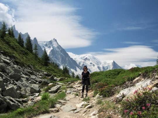
Date of hike: July 21, 2019
Country: France
Region: Mont Blanc
Trailhead: Montenvers station (end of cogwheel train)
Hike Destination: Plan d’Aiguille
Distance: 6 km (4 miles)
Elevation difference: 320 m gain
Difficulty: Easy
For a first day of the vacation, we had a surprisingly early start from home, at 9:30 am. By 10 am, we were sitting in the little cogwheel train that goes from Chamonix up to Montenvers, from where the view opens up into the so-called Mère de Glace (sea of ice), although it would be more fitting to call it “sea of gravel and rocks,” as dust and erosion debris almost entirely blanket the ice at this point. One can only make out here and there flashes of blueish ice gleam from deep gashes in the glacier, far below. There’s well and sundry things to do for the tourist up here: a little cable car goes down to the bottom of the glacier; they have hollowed out a glacier cave that can be entered at a fee; there are guided walks on top of the glacier; there’s a cave loop at the top (free) where smoky crystal from the area is on display; and there is, of course, the Montenvers hotel, which sits on a lovely perch, overlooking peaks and glaciers. On the other side of the valley, the imposing vertical rock face of the Aiguille du Dru rears up, one of the region’s most coveted climbing prizes, encircled at the top by veils of cloud. The glacier curves down from the distant mountain bowl bounded by sharp spires of granite.
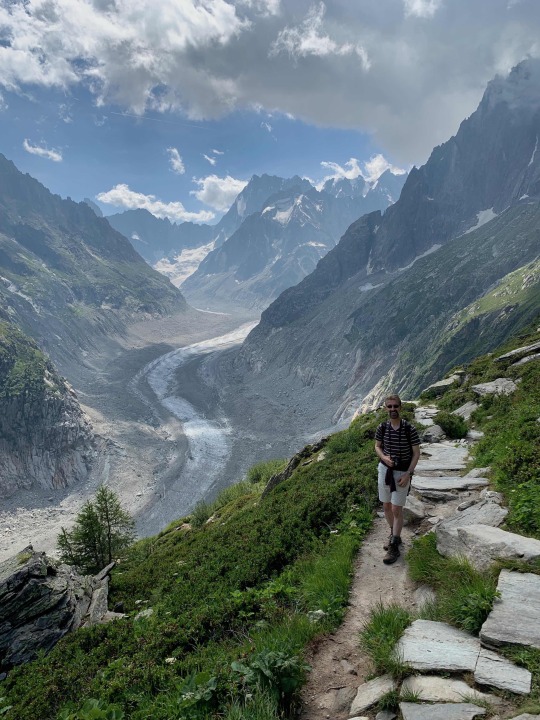
The glacier here is striped like a zebra, something I haven’t seen on any other glacier before—most glaciers have longitudinal striations rather than bars spanning across the ice which make the glacier resemble a giant caterpillar. We explored the various viewpoint platforms at Montenvers and then started on the actual hike. On the path to “The Signal,” which sits on a ridge that extends all the way to the pointy Aiguilles des Grandes Charmoz, we encountered no more than a handful of other hikers, which was a pleasant surprise. All around us, the scenery was popping with contrasts, the biggest of which were the smoke-like plumes of clouds that extended from the tops of the nearby spires, as if the mountain were on fire.
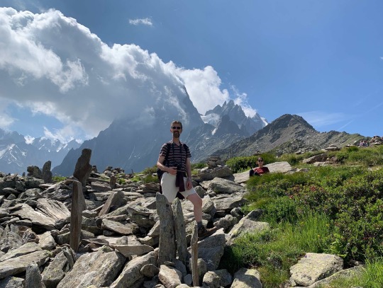
Here we had a satisfying little picnic, sitting among a plethora of vertical granite slabs that people had erected, giving the effect of an impromptu sculpture installation. With renewed strength, we headed down the trail which switch-backed until it intersected with the “regular” trail between Montenvers and Plan d’Aiguille. We had followed the “detour” via The Signal based on the directions in Bernard’s hiking guide for the region, and it was really good choice: the views on the way up to The Signal were incomparable, as the panorama gradually opened up revealing the sinuous glacier in all of its splendor, while permitting a clear view the mountain ranges on the opposite side of the valley as well.
On the main trail, there was definitely more traffic now. And that this is not always a bad thing was proven by a group of cheerful Japanese women, who sitting by the side of the trail, greeted every single hiker passing by with a cheerful chorus of “Konnichiwa!” Hearing this greeting three times as we passed them, we could not help smiling, and I offered a hearty “Konnichiwa” in return.
Gradually, the cascading pyramids of the Mont Blanc massif began to move into view, although the main peak remained hidden behind the Aguille du Midi. At around 3 pm, we arrived at the Plan d’Aiguille the middle station of the cable car going up to the Aiguille Station. This station, at 3842 meters, had been the highest cable car station anywhere in the world from 1955-1975. From where we stood, we could either descend down to Chamonix by gondola or take the cable car higher up to the Aiguille du Midi. The upper cable car was a marvel of engineering, consisting entirely of one freely suspended cable without any masts between the start and the finish (the cable is visible on the right side on the photo below).
The weather seemed very good for this excursion, and we were about to approach the ticket office, when Lyra put in a veto. She was uncomfortable with the idea of taking this gondola ride and, anyway, she didn’t much care for the idea of going up to this place just to see a different view. And the cost... It took a little convincing to change her mind. And it was good we did. Arriving at the top a short while later, we were completely awed by the sighs that unfolded before us. It was one of the most astounding mountain views I have ever seen. Truly breathtaking. What made it especially nice was that the air was just sufficiently saturated with moisture to create shreds of clouds and flying trails of fog that rose rapidly from the lower altitudes and dissolved as they passed over the pass in front of us. There were several open-air viewing platforms, and we explored all of them, taking a ton of joyful pictures. The sky was an inky blue, the snow a blinding white, and the brown rocks jutting out here and there added an earthy note to the heavenly scenery.
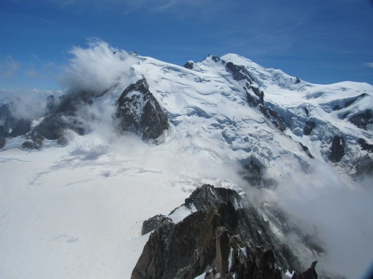
It was a view normally reserved only for daring alpinists. Speaking of… far away and high up on the slopes, we saw tiny dots slowly advancing across the icy surface—climbers who gradually made their ascent to the peak of Mont Blanc, distant, fragile…illustrating the human ambition to persevere and reach the highest point at whatever costs.
The wait to enter the gondola going down was not too long, and soon enough, we were whisked down to the middle station. There we decided to have a snack at the little alpine bar. Liang was expecting an important business call, so we installed her in a quiet corner of the restaurant, ordered a beer and a bag of chips and left our backpacks beside the table. Lyra and I then headed up to find a lake higher up the slope, which we had spied from the gondola. The way there was not obvious, but there was a faint trail off to the side, and I opted to follow that instead of continuing on the well-trodden path. The faint trail grew fainter still even as it got steeper until we had to scramble on hands and feet. Here Lyra did a nice impression of “free solo,” as we rapidly gained altitude. Then, the path flattened out, but no lake. Had my sense of orientation deserted me for once? I scanned the landscape and proposed that we skirt a ridge to our left in search of the lake, and indeed, the small emerald pool suddenly appeared below us in the slanting sun.
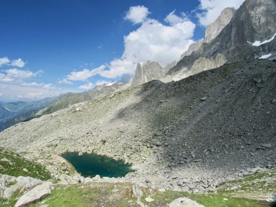
After taking a picture, we headed back down the same trail, scrambling again over the steep passage, and then back to the mountain bar. Liang was still talking on the phone. Amazing, in a way, to be able to conduct business from a mountain in the Alps with somebody in China. The lift from Plan d’Aiguille down to Chamonix is a high speed gondola with a capacity of about 50 people. When it went over the first mast, going from horizontal into almost vertical, there was a shrill scream of excitement from the crowd squeezed inside the cabin. Lyra grabbed my arm really hard, but at least she still smiled, although not feeling too comfortable. But we made it safe and sound to the valley station and on the way home did some nice shopping for our second of five consecutive “balcony dinners.”
2. La Source de l’Arveyron & Le Chapeau
Date of hike: July 22, 2019
Country: France
Region: Mont Blanc
Trailhead:
Hike Destination: Le Chapeau, Via “Source de l’Arveyron”
Distance: 8.5 km (6 miles)
Elevation difference: 610 m gain
Difficulty: Easy
As opposed to yesterday, we got a late start on our hike today. The main reason for this was that Liang and I went paragliding in the morning! We met our pilots at 11 am at the lift to Brévent, then took the gondola up to La Praz, and, after a simple briefing, spent about 20-25 minutes in the air. The flight was quite thrilling, the weather was spectacular (“une super-bonne journée”), and our mood was as elevated as our parachute. Liang went first, fearlessly launching herself off the slope, as the parachute plumed above them.
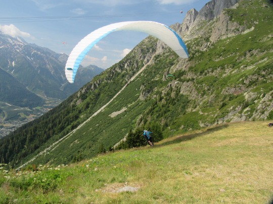
I took off with Alain, my pilot, about 8 minutes later, and in that time, Liang made one pass along the slope westward and came back, gaining significant altitude in the process, curving above the starting place just as I was taking off. Liang then trailed my parachute for a second pass westward, looking down on me. Soon they took a turn out over the valley and started gradually descending.
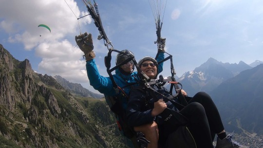
I had a pleasant and somewhat uneventful flight, except for the death-spiral that Alain initiated toward the end; G-forces quickly acted on my stomach and dizziness set in, which I said it was enough, haha. We passed a few times over our house and then made the final approach for landing.
After smoothly landing, we had a leisurely 20-minute walk back to the house. There, we prepared a tasty salad lunch, then both Liang and Lyra worked for some time, as busy professional women do, and finally, at around three in the afternoon, we left the apartment, driving our car to a trailhead near the lower station of the lift to La Flegère.
Amazingly, although we started our hike close to 4 pm, we were still able to put in almost 10 miles and climb 150 floors! Most of the hike proceeded through Arven forest, which was a good thing, as the weather was very, very hot. Skies were blue and the sun was beating down. After about one hour, we reached the first viewpoint and looked into the gorge which Shelley had sung about in his poem “Mont Blanc”:
Thou, Ravine or Arve—dark, deep Ravine— Thou many-colour’d, many-voiced vale, Over whose pines, and crags, and caverns sail Fast cloud-shadows and sunbeams: awful scene Where Power in likeness of the Arve comes down From the ice-gulfs that gird his secret throne, Bursting through these dark mountains like flame Of lighting through the tempest…
The switch-back trail continued quite steeply, occasionally allowing a flash of white glacier or rocky peak to be glimpsed at a bent in the trail. After about 2 hours of this, we arrived at a cute mountain restaurant, and since we were extremely thirsty from the climb, we ordered a round of beers while enjoying a bag of nuts.
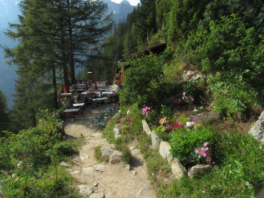
Nothing tastes better than that combination after a steep uphill climb in view of beautiful mountain scenery, sitting on a shady terrace surrounded by colorful flower pots! The view from there was beautiful, the restaurant was lovingly decorated, and everybody was happy, making this the kind of moment where the “cup overfloweth.” At the conclusion of this little repast, we went on for another 15 minutes to the viewpoint overlooking the “Mer de Glace,” this time from the opposite side of the valley from Montenvers.
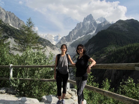
We snapped a few lovely pictures there, then headed down the trail back to the valley. We concluded the hike at 7 pm, which did not feel late at all since it was still very warm and the sun was bright in the Western sky.
3. Col de Montet to Lac Blanc
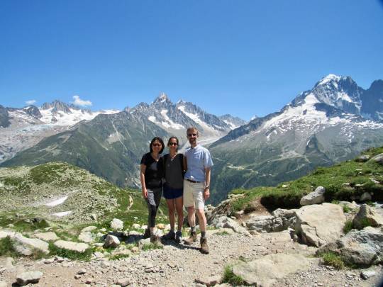
Date of hike: July 23, 2019
Country: France
Region: Mont Blanc
Trailhead: Col de Montet
Hike Destination: Lac Blanc
Distance: 15 km (10 miles)
Elevation difference: 900 m gain
Difficulty: Strenuous
This was our longest hike of the trip. We had to readjust our plans when it became evident that the lift we were supposed to take up to La Flegère was out of commission for the season. So, the only way to go to Lac Blanc—our destination for the day—was to hike all the way up (instead of taking the lift for 2/3 of the way). Lyra did some quick research and found out that there was a trail leading from Col Montet, a few miles further up the road toward Switzerland, directly to the lake. So, we proceeded and parked the care there, then started hiking at 9:30 am. The ascent quickly turned steep and hot. Although it was only mid-morning, the sun was hammering down from a cloudless sky, and we were soon drenched in sweat as the trail went up very steeply, requiring us at time to climb on hands and feet. This continued for about two hours, and whenever we found a little niche beside the path offering some shade, we’d take a water break. Lyra had long gone ahead; the plan was to reconnect with her at Lac Blanc and have lunch there together. We swiftly made good height, and soon the road and parking lot were toy sized, then ant-sized. Every time I looked up ahead, I thought that we were almost at the point where the path would level out. But always there was another, even steeper portion of the trail ahead of us. Finally, after about 90 minutes of this, there was a sense of gradual leveling out, and, while huffing and puffing with the exertion, we stepped onto a smooth granite slab with a big cairn marking the spot.
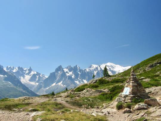
From here, we saw the trail ahead extending along the slope almost level. At this point, Liang received an SMS from Lyra, who had already arrived at Lac Blanc and was waiting for us there. Wow! She had made the 3-hour hike in 1 hour and 45 minutes! But since the weather was clear, and there was no hurry (except Lyra waiting for us giving us a little pressure), we took our time. My one concern was that our water reserves might have been a little too small given the hot weather. But any momentary worries were quickly dispelled by just taking in the spectacular landscape, with the Mont Blanc massif spread out directly in front of us, plus the whole adjacent ranges from the Mer de Glace to the Aiguille Verte and a bunch of other “Aiguilles,” all crisply and pointedly on display before us. The flora, too, was fabulous, especially the Alpenrosen were in full bloom all around and there were stretches that resembled a walk in a flower park as much as a hiking trail.
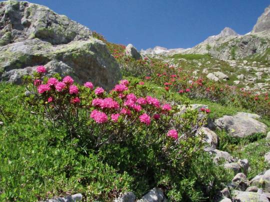
The rocks around here were almost dyed a yellowish hue, due to lichen encrustation, creating a particularly striking contrast with the bright green ferns and the deep red Alpenrosen, all this framed by a deep cyan blue sky. The crowds were now intensifying, and one almost always walked within sight of several other hikers; as indicated in the hiking book, it is a busy trail, made more busy because the outage of the Flegère lift diverted most hikers onto this alternative path.
Two and a half hours into the hike, we saw a small lake to the side and began to wonder whether perhaps Lyra had reached the wrong lake and was waiting for us there since it hardly seemed possible that she was already at the actual Lac Blanc. So, Liang called Lyra, and some confusion arose as to which lake she actually was at. Liang then asked a fellow hiker coming the other way where Lac Blanc was, and the woman pointed to a distant hut, saying it was there. So, Liang sent Lyra to the hut, but I was skeptical all along, almost certain that the lake was actually at the foot of the steep climb to the hut and not next to the hut. Anyway, it was agreed to meet at the hut. But some time later, we arrived at Lac Blanc, just where I had expected it to be, while Lyra had been at the right spot all along but was now almost at the hut much further up. What made me feel pretty bad about this is that Lyra had exhorted us an hour ago to hurry up a little since she was hungry, and all the food was in my pack. Not only was she going to have her lunch sandwich delayed further, but she spent more energy climbing up to the hut, and as it turned out it was a very strenuous hike over steep stairs, full of people. In any case, we asked Lyra to return to the lake, and I felt so bad about this whole confusion that I decided to climb up toward the hut myself to meet Lyra on the way down. When I finally spotted her coming down, I fully expected her to be annoyed or even tearful with exasperation over this over-communication-fuelled confusion. (In the “old” pre-cell-phone days, Lyra would simply have waited for us at the lake and we would simply have shown up at the lake after an hour’s wait). But to my great surprise and relief, Lyra smiled happily to see me and was not the least bit cranky. We had our long-delayed lunch overlooking the Lac Blanc, which was lovely. We had been told to come to Lac Blanc only when it is not windy to see the Mont Blanc massif perfectly reflected in the lake’s glassy surface, but we really did not have a choice, and it was rather windy today, so the reflection effect was reduced.
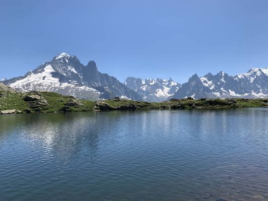
But other than that, we could not have asked for a better view: steep, rocky spires all around, and glaciers lumbering down from distant catchment areas and tapering out below the tree line, squeezed into narrow valleys. There was hardly a cloud in the sky, and although we deeply appreciated the gorgeous weather, the unexpected warmth made us transpire like crazy, which took a toll on our water supply. We had a long, steep descent ahead of us and all that remained were a few deciliters.
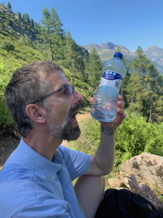
Lyra was equally low on water. It seems silly to worry about water in front of a substantial mountain lake. But there’s a good chance that the water is contaminated, and drinking from the lake without using a filter should be a last resort, only advisable to prevent severe dehydration.
Our approach was to set a distant point further down the trail, agreeing to have a small sip of water once we’d get there. Lyra had again gone ahead, and while we were still high up on the slope, we got a text that she was already at the car, out of water. So, we decided to preserve the last two sips of water for her, and I started to sprint ahead down the trail. Making good tempo with my little water supply, I reached the car soon afterward with Lyra cooling down using air condition. She did appreciate the two extra sips of water. Once Liang joined us a few minutes later, we drove to the pass (Col de Montet) and there bought a can of cold sparkling water and a bottle of Evian—water never tasted better!!
4. Bossons Glacier Ridge
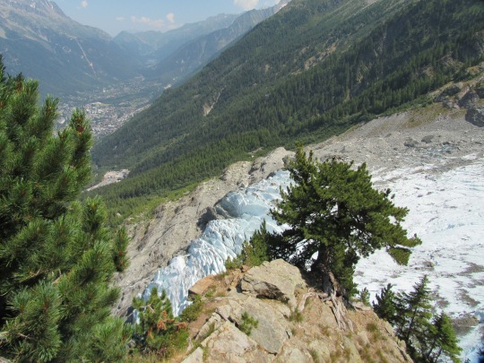
Date of hike: July 25, 2019
Country: France
Region: Mont Blanc
Trailhead: Bossons Chair Lift
Hike Destination: La Jonction (but we only went up half way)
Distance: 10 km (7.5 miles)
Elevation difference: 500 m gain
Difficulty: Moderate (on the lower half)
Our fourth hike took us up along a ridge on the western side of the Bossons Glacier. The ultimate endpoint of this hike is the “La Jonction,” some 6 km away and 1,500 meters up--a long, difficult, and demanding hike. We would only go partway up, if only because the weather threatened to break with a violent thunderstorm in the afternoon.
Before hitting the trail, we had a brief debate about whether or not to take the chair lift up to the “Chalet du Glacier des Bossons.” The “Chalet” is a lovely mountain café and eatery, the lower one of two such establishments along the trail. Against Lyra’s opposition, we decided to take the chair life, and I’m glad we did. We could conveniently survey the first portion of the trail from the chairlift, and it was indeed uneventful, perhaps even boring. But after the lovingly decorated Chalet with its colorful gardens, the path grows more sinuous, steep, and at places exposed. Our destination was the “Chalet des Pyramides,” the second mountain bar two hours up the trail. Since a chance of weather was in the offing, we planned to finish the round-trip by about 3 pm. As usual, Lyra went ahead, and soon we no longer saw her. The trail was quite busy in some stretches but never in a way that was bothersome. The majestic Bossons glacier moved into view about one and a half hours into the hike, and here the path grew steep and exposed for stretches, and in some places fixed ropes had been installed to ensure our safety.
We arrived at the Chalet des Pyramides at lunch time and were thrilled to find out that they served tasty salad, fresh bread, soft butter and … cold beer! We were sitting right across from the huge glacier, overlooking the valleys and peaks, munching hungrily on the rustic mountain fare, and I was thinking that this, in a way, was my definition of happiness.
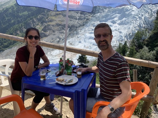
After this lovely meal, we pressed on, and now the path got really rough and steep. It was an area favored by monarch butterflies, and we spent quite some time snapping pictures of the beautiful insects as they were feasting on the colorful blooming mountain herbs.
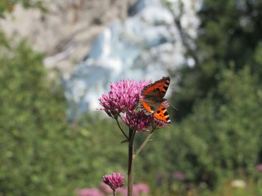
Our turn-around time of 1 pm was approaching… we could not risk getting caught in a storm on the way down. At this point it looked like a new vista might be opening up about 15 minutes further up the trail, and while Liang rested by the wayside, Lyra and I pressed on. Indeed, just as we had hoped, after some steep scrambling and a few sketchy stretches of trail, the view around the crest of the ridge to the other side from Bossons glacier opened up. Here the Taconnaz glacier was tumbling down from Mont Blanc, and the peaks were soaring up almost close enough to be touched.
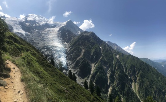
The trail beckoned us to continue, going up another 2 hours toward La Jonction, where the mountain rears up for the final stretch toward Mont Bland peak. But we had to turn around, saving this portion for our return to this area. Shortly afterward, we rejoined Liang, and then descended back down to the Chalet du Glacier des Bossons. It took us a good 1 ½ hours to go down, but once we arrived, there was no further complaint about taking the chair lift down—we were ready to take it easy, feeling quite beat after several hikes in a row. The storm did not arrive until 5 pm that afternoon, but when it did, we were glad we were back in the comfort of our apartment. It was the kind of storm you don’t want to be caught in during a hike. It was another wonderful outing, but it needs to be categorized under “unfinished business.” Next time we are in Chamonix, and the weather is good, the hike up to La Jonction could be one of the most rewarding high-Alpine trails, close to the glaciers and peaks, and also quite solitary.
0 notes
Text
Bystré Saddle Loop
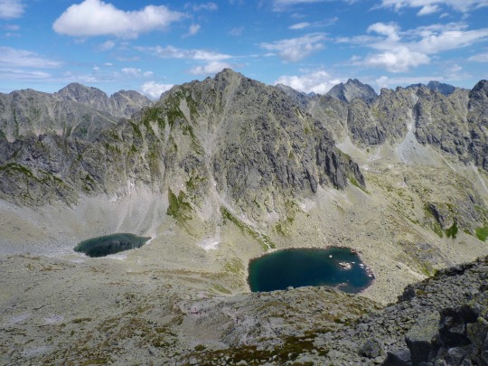
Date of hike: August 5, 2017
Country: Slovakia
Region: High Tatras
Trailhead: Strba Pleso (option starting from Solisko chair lift mountain station)
Hike Destination: Bystré Saddle
Distance: 20 km (13 miles)
Elevation difference: 1600 feet (550 meters) from Solisko chair lift
Difficulty: Moderate to advanced.
Having completed a long hike the previous day, we opted to get a little help for today’s hike by taking the chair lift from Strba Pleso up to Solisko, to save some energy for the long haul.
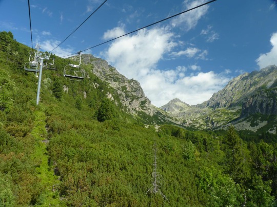
From Solisko, we took the blue route which skirts the mountainside while descending a few hundred feet to rejoin the main (yellow) trail up to the Wahlenbergovo Lakes. Compared to the hike the previous day to Lake Hincovo, which had been rather crowded from the outset, this trail was less traveled, though we still encountered quite a few fellow hikers. We got the impression that Slovakians thoroughly enjoy hiking in the Tatras—most of the trails were well frequented, and some of them got almost uncomfortably busy with locals coming out in droves to enjoy what may well be the national pastime here.
There are two lakes on the way up to the Bystré Saddle, and our group of four made it together to the lower Wahlenbergovo Lake, which we reached after some serious upward slogging at noon. Here we enjoyed a simple picnic of fruit, cookies, and local sausage, while contemplating the lake and its surrounding rocky heights, dappled by a constantly moving pattern of passing cloud and sunshine.
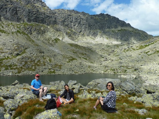
The geology of this part of the Tatras is mainly crystalline with some metamorphosed material as well. The Tatras are much older than, say, the Alps or the Himalaya, having been formed initially during the Paleozoic Age (500-250 million years ago). After such long periods of erosion, the peaks are heavily serrated, broken up, and fissured with hardly a smooth vertical rock wall left anywhere. The whole area resembles one vast debris field, strewn over and over with sharp-edged crystalline rocks of all shapes and sizes.
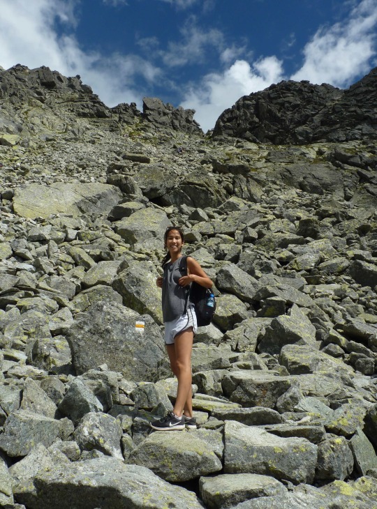
So, hiking here means skipping and balancing from rock to rock to rock, a bit like on the Appalachian trail, a mountain range resembling the High Tatras in geology and age. It is really quite extreme how there is hardly a stretch of 100 yards at a time that constitutes smooth ground in these parts. You use a whole different hiking approach, constantly looking down at your feet and utilizing different muscles in order to balance and hop from rock to rock rather than stride on level ground.
After our lunch, we split into two groups: Lyra and I were going to see how far we could proceed up toward the pass with our soft tennis shoes, while Liang returned with our friend down to the valley. My goal was to cross over to the next valley and complete the loop, but given our flimsy shoe work, I had my doubts whether we would be able to complete the project; I was not going to take stupid risks just because we did not have room in our luggage to bring proper boots along with us.
Half an hour after leaving the lower lake, we reached the upper Wahlenbergovo Lake which resembled the first one like a twin: almost black water embedded in distinctively greenish boulder fields. The characteristic greenish hue that covers the landscape here comes from the lichen which grow profusely on the rocks all around.

The lakes, or tarns, here are linked with streams, although one wonders where the water is coming from in the first place since there are barely any snow fields left at this time of year to provide meltwater, and all the surrounding consists of dry rocks.
After we skirted the second lake, the trail turned sharply upward toward the saddle, zig-zagging at an increasingly steep grade.
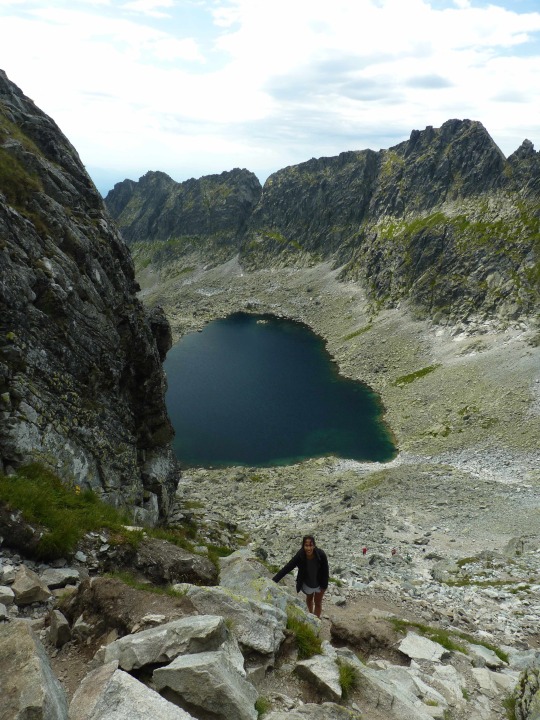
Here the proverbial wheat was being separated from the chaff, as Lyra and I ascended at a steady pace, passing clumps of other hikers who were resting to catch their breath. Soon, we reached the steepest portion of the slope right underneath the saddle, and to my surprise we faced a fixed chain to haul ourselves up the last, steep portion of the route.
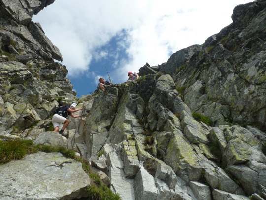
This created a bit of a traffic jam, and I was reminded of Hillary Step on Mount Everest, that notorious bottle neck which holds up many climbers at a crucial stage of the climb in the “Death Zone” just underneath the summit. This jam in the Tatras merely meant an added quarter of an hour or so on the clock rather than life or death. But it nevertheless created some tension. One women coming down was gripped by a panic attack as she faced a drop of several meters, and I watched her beginning to hyperventilate. I quickly hauled myself up halfway toward her using the chain, then gained a foothold and reached my hand out to guide her down.
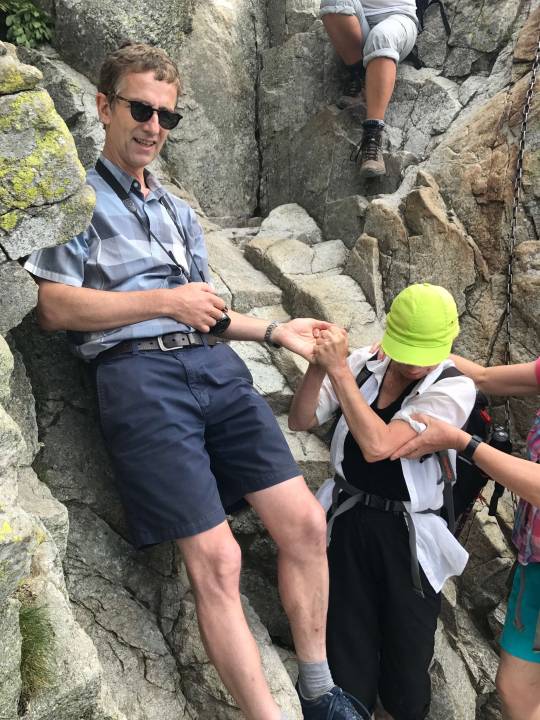
Boy, I have not been gripped so hard by a woman’s hand since Liang gave birth to Lyra... This woman’s muscles were stiff with fear, but I managed to lower her down past the drop and onto the hiking path. Then, I quickly hauled myself up and took the next few chain segments in stride, only to realize that Lyra with her shorter legs did not have the extension necessary to take the last long stride upward, so I gave her my hand and pulled her up.
Now we stood at the comb of the saddle, and the gap in the rock through which everybody had to squeeze was not wider than one person.
Unexpectedly, the drop on the other side of the saddle was even steeper than the one we had just mastered, and there were fixed chains on that side too. When I saw folks climbing up toward me with mountaineering helmets, it hit me that wearing sneakers and city clothes in this location was a bit out of place.
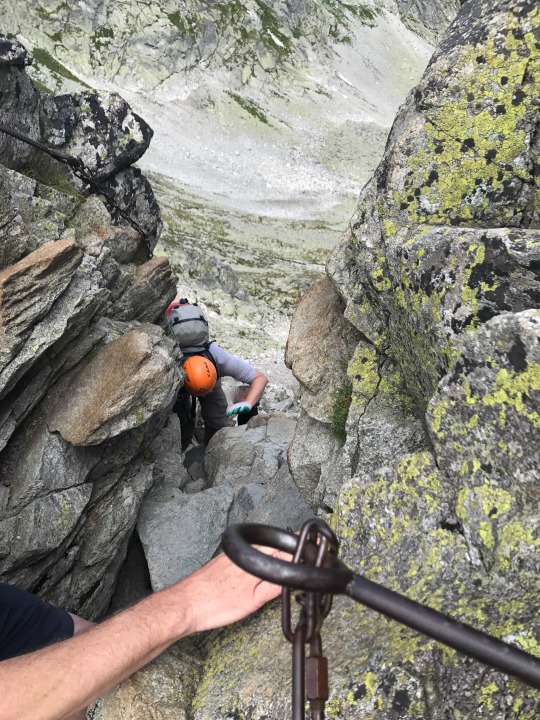
Quite a long line of people was cued up on the other side, waiting to ascend along the fixed chains. I was guilty of holding them up just a little longer since I had to look at the view that greeted us there. From the saddle, one could see past the first mountain range into further ranges receding into the distance, a sere vertical landscape overtopped by light blue sky and floating clouds. Down below embedded in the white-greenish rocky desert lay several opal tarns of intense blue-green-black hues. We stood still for a moment contemplating this stunning view, but hikers on both sides of the narrow gap were pressing forward, wanting to pass through the narrow gap, so we could only snap a quick picture before facing the descent. Fortunately, there were two chains next to each other here, so all hikers did not have to use the same chain to move up and down. The only problem on the way down was that scraping along the rock facing forward was not safe while wearing a backpack, so I strapped the backpack to my front, grabbed the chain, and stretched out my feet feeling for a foothold. I was a bit concerned about Lyra at this point, but she reassured me in calm tones that she was perfectly fine. What a relief! We more slithered than climbed down along the near-vertical track here, using whatever foothold we could find. After about 20 yards of this scrambling, we rejoined the trail and had now a better opportunity to enjoy the spectacular scenery while snapping some more pictures.

From here, we could see four opal tarns, lined up at the floor of Mlinicka Valley. The trail continued to be steep and rocky all the way down to the fourth lake, with only short stretches of flat ground now and then. At the fourth lake, we took a rest to drink water and munch on some sweets to supply a bit of instant energy. The sky was clearing up, and a soft late afternoon glow was spreading over the scene, creating a supremely peaceful atmosphere.
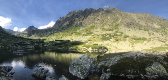
After this, the trail turned into the Vodopak Skok section, which is named after the waterfall that cascades down the rocks at this point.
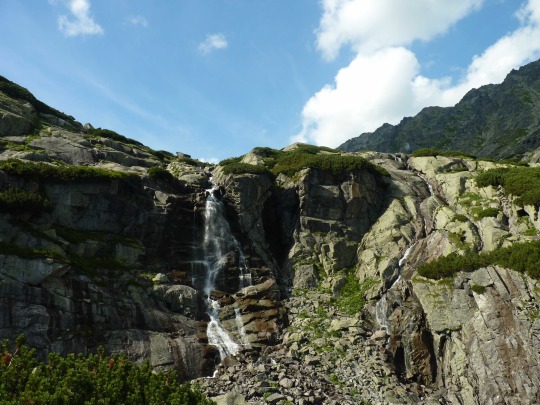
Here we encountered another set of fixed chains for support, as the trail once again turned steeper than is considered normal for regular hiking. The bottom of the waterfall was quite crowded, as many hikers go only this far from the town of Strba Pleso to enjoy the waterfalls, and then turn around.
The last few miles of the hike were enjoyable for the wildflowers which grew abundantly in this part of the valley and for the changing scenery.
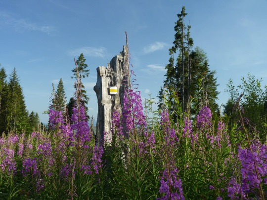
At one point, we spotted some climbers suspended on a vertical cliff, their neon-colored jerseys contrasting sharply with the black rock. It was one of the few places where the rock had not been eroded and cracked into fragments, affording a solid enough surface for rock climbing. We arrived tired but satisfied at the start of the route in the late afternoon, some six hours after taking the chair lift from here. It would have been preferable to wear sturdier shoes on this relatively demanding, steep hike, but with proper care and experience, it had been just about OK to complete the loop with inferior footwork (and we were not the only ones to do so...). Of course, this was only possible because the path was not wet at any portion and because the trail was well maintained, with many of the steepest portions turned into a kind of natural stair by having rock slabs arranged to form steps. Given the heavy use that these trails get in this region, this is a very wise approach, and we were generally impressed by the signage and good maintenance of the hiking trails in this area—the very opposite of hiking trails in Sichuan.
One of the biggest attractions of the High Tatras is that many of the peaks are climbable. However, to go past the lakes and the occasional pass, as we did, and proceed up to the very summits of mountains, one definitely needs proper hiking boots, there is not two-ways about it. So, as far as this region is concerned, we have left something undone—climbing a peak or two (say Rysy or Krivan), and I would not mind at all to return at some future point with hiking boots in the luggage as well as hiking poles. In all, although devoid of glaciers and eternal snow and ice, the High Tatras are an attractive and rewarding hiking destination, despite being somewhat tiring given that all trails proceed over piles of jagged rocks; but the clear air, sweeping views, and opal lakes more than make up for the hardship of rock-hopping.
0 notes
Text
Attempting Erfeng, Siguniang Region
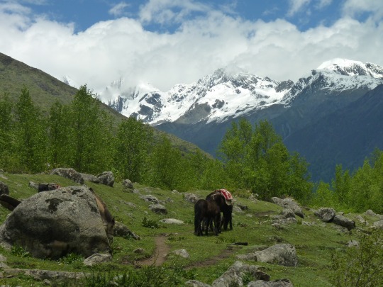
Date of hike: May 28-29, 2017
Country: China
Region: Sichuan Province
Trailhead: Rilong, 3,300 m.a.s. (10,900 ft.). Trail starts as a boardwalk/stair next to the large parking lot along the river.
Hike Destination: Erfeng, 5,275 m.a.s. (17,300 ft.)--not reached
Basecamp: 20 km (pony ride up), 4,300 m.a.s. (14,100 ft.)
Time from basecamp to peak: ca. 5 hours
If you ever feel the need to add a 5,000+ meter peak to your repertoire of hiking destinations, Sichuan Province is a good place to do that. Remember, the highest mountain in the European Alps, Mont Blanc, has an elevation of 4,800 meters, and by climbing one of two options available to hikers in the Siguniang region of Sichuan Province, i.e. Dafeng (5,025 m.) or Erfeng (5270 m.), you would significantly top the highest Alpine elevation. The two mountains can be reached by pure endurance hiking (Dafeng) and with some serious scrambling at Erfeng with ropes recommended on the last 200-300 meters of the ascent.
However, either peak is only doable if the weather conditions strictly cooperate. Any hike above 5,000 meters is no child’s play, and both the demands of the extreme altitude and the possibility of massive snow accumulation at the top can easily interfere with a summit attempt.
When we visited the Siguniang region for our own shot at the 5,000+ m. experience in late May, the weather was not favorable. It was the beginning of the rainy season, which stretches from May through August, and the tops of both mountains were hopelessly snowed under, with accumulations of 1 meter and more. Our fellow hikers--a group of Chinese from Chengdu and Wuhan--were quite dejected when it was announced that neither mountain was climbable at this point. We still decided to proceed with the original plan up to a point, i.e. ride ponies up to the base camp of Erfeng, then climb up as high as would be possible.
The Siguniang massif is comprised of four peaks, including the aforementioned Dafeng (“first peak”) and Erfeng (“second peak”).
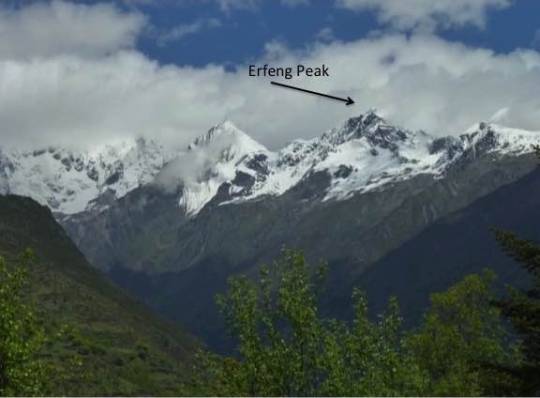
The count continues with “third peak” (requiring serious mountaineering skills) and, finally, Siguniang proper (aka “fourth peak”), which is virtually unclimbable. This massive mountain of incongruous proportions rises sheer from the valley floor to the dizzying height of over 6,200 meters, and it is so steep, glaciers don’t even stick to it. Mountaineers have basically given up on climbing this mountain after it was first conquered in 1981, and it has seen few successful attempts since then.
The day of our trek to the Erfeng basecamp was grey and overcast, but that did not stop thousands of ethnic Tibetans in the region from holding an exuberant, colorful culture festival at the center of the town of Rilong.
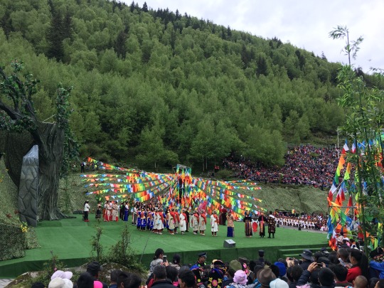
Rilong belongs to the Aba Tibetan autonomous region of Sichuan, where Tibetans are in the majority, making up about 54% of the population. The Tibetan predominance was on display at the beginning of the trail, where a large stage displayed Tibetan dancing and singing groups, while thousands more were attending the spectacle, cheering enthusiastically.
After duly obtaining our hiking permits, paying the fee, and adding our finger prints, pony selection was next.

I was given a brown sturdy pony that seemed to be doing well with the assignment of carrying me. Nevertheless, halfway into the treck, the horse handlers responsible for my and Liang’s ponies suggested that we switch since Liang’s pony seemed stronger, and I was deemed a heavy customer (heavy only relative to Chinese feather-weights, I might add).
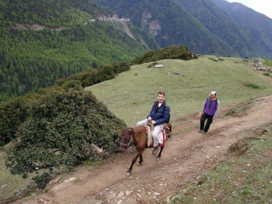
It was a switch with potentially far-reaching consequences because the pony I given almost spelled my doom. Here’s what happened: We were just rounding a curve on the trail when another set of pack-horses was coming the opposite way. My pony hesitated for a second, then tried to step aside, but in the process it slipped and tilted sideways. I lost my balance on the saddle and prepared for an inelegant dismounting, hurriedly getting my feet out of the stirrups to avoid being squashed against the slope by the weight of the animal. My right foot came out easily, but I could not quickly enough disengage my left foot from the stirrup. Then, before I knew what was happening, my world was turned upside down: the pony got spooked and started running down the mountain, dragging me with my left foot caught in the stirrup. At this point, I had just two things going for me—one: it was a pony, so my angle relative to the ground was more favorable than had I fallen off a taller horse. Instead of making contact with the ground principally by my head, I was scraping along the slope with me back; plus, I was wearing a backpack which acted as a bit of a shock-absorber. But other than that, things looked bad. As I was dragged helter-skelter downhill, Liang’s scream reaching my ears as if I were under water, I had two reflexes: first, I tried to dig in my right heel so as to slow down the pony. But this turned out to be a bad idea since my shins now got clobbered by the pony’s hooves, while it had no effect on the course of action. Next, I tried to wrench my left foot out of my boot by pulling real hard on it, but the hiking boots were too tightly laced, and this was futile. At this point, the thought briefly crossed my mind that I might be done for. There was no reason why this pony would stop galloping across a rock-strewn slope with me dangling from the stirrup. And at such a high altitude, my energy to fight the disaster was quickly depleted. But just then, a protrusion in the slope lifted me clear off the ground and spun me around my axis, resulting in a torque force that made me worry about the integrity of my left foot. But to my great big fortune, that twisting motion was what actually released my foot from the stirrup. And after tumbling a little further down, I came to a rest, while the horse galloped on. Adrenalin pumping through my system, I was simply and supremely grateful. Miraculously, nothing was broken or wrenched out of place. Sure, I had lots of scratches and cuts, and on my right shin, a bruise the size of a mango was blooming, but I was able to get back up to the trail by my own force. Five minutes later, the pony had been caught, and I sat down on it again. This time, I was glad the handler, who could not apologize enough, held the pony’s reins closely and walked beside me for the remainder of the trip. Still, I had lost confidence in this mode of transportation and vowed to walk all the way back on my own legs, which I am happy to say were still in good working order, notwithstanding sore as hell.
So, now we were at the base camp, at an elevation of 4,300 meters, which turned out to be a pretty vile place, miles from any “romantic” notion of a basecamp surrounded by fresh mountain streams, blooming meadows, and rustic cabins.
No, this was a mud patch, forever churned up by pack-horses, featuring three or four windowless hovels built of dry-stack field stone walls without mortar. This meant that there was neither light nor heat nor any sort of insulation toward the ambient conditions. However, there was one amenity: a wooden platform to spread your sleeping bag on. The keeper of the camp, an unwashed squinting fellow, was trying to extort 800 RMB from us for staying at this minus-5-star accommodation (i.e. considerably more than a luxury room at the Sheraton costs). Liang made it clear that extortion did not work with her, and the fellow slinked away, pocketing 200 RMB from us. It was now 3:30 and still many hours to go until sunset. Since we had to conserve our cell phone batteries and forgot to bring playing cards, utter boredom stared us in the eyes. Therefore, Liang and I decided to have a go at the pass above the camp, following the trail that was faintly outlined on the steep slope.
As long as the trail was level, I felt fine, but as soon as the switch-backs started up steeply, and I began to huff and puff like a an old steam locomotive.
We were here above 4,300 meters, and the air was thinner than I could comfortably handle. My chest had the same kind of tightness ache that I get after doing, maybe, 15 burpees, i.e. my system felt like it was teetering on the brink. The supplemental oxygen bottle we had brought helped, and I frequently resorted to taking deep puffs from the bottle.
This conveyed an instant boost of energy, although it did not last more than 50-100 meters at a time.
From here we could see the top of Erfeng above us. I looked doable... just not tonight.
A little further up we encountered snow, and it got progressively deeper, requiring us to use our hiking poles as anchors.
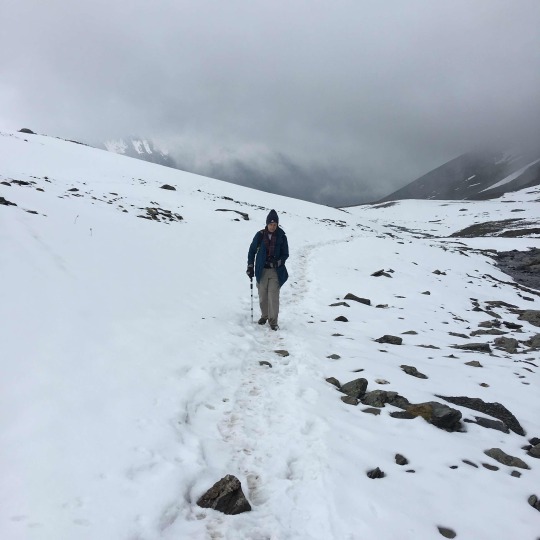
After slogging uphill like this for over one hour, we decided to call it quits. Our altitude app told us we were just above 4,600 meters now, and although the pass was still higher up, the fog was closing in and daylight was gradually receding. To my happy surprise, Liang was having no problem at all up there.
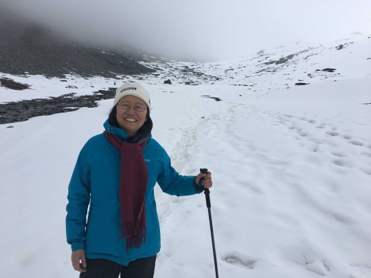
She was lightfooted and limber, saying encouraging things to urge me on, which struck me as ironic because all this time in preparation, I had wondered what I would do if she faltered long before reaching the critical altitude. But instead of having my male pride hurt, I focused on being proud on her behalf. With her fitness and endurance, there’s no limit to what we can attempt together in the future, as long as I get a little more time to acclimatize, and as long as there is not exhausting incident like the pony mishap just before going into the high zone. I had previously hiked up to over 5,500 meters and been fine, so this experience was not necessarily a sign to abandon such projects in the future.
That night at the camp was one of the two worst nights of my life. I developed a splitting altitude headache, and even after swallowing 4 Advils, the symptoms did not get any better. In addition, I was completely insomniac. While Liang slept for a good stretch of this cold, cold night, I lay awake on the hard bunk, counting the minutes, shivering, and cursing my headache. Toward the morning, Liang gave me the idea of inhaling oxygen, and that actually did help a little to lessen the pain. After seemingly endless hours lying awake and listening to the rain that was steadily falling (some water dripped down near our pad on the bunk), it finally dawned around 6 am, and the minute it did, I got up and stepped outside to be greeted by a crisp morning scene—all mountains powdered with new snow which had fallen copiously overnight, with swaths of fog drifting up from the valley.
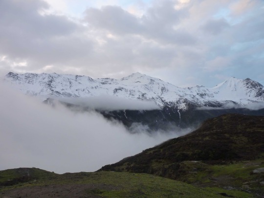
While the others were getting ready to climb up to the pass, Liang and I were beginning our 20 km trek down to Rilong. There’s no way I was going to sit on a pony going over 20 km of muddy trail rendered even more slippery by the overnight rain. One thing I noticed about these paths in Sichuan is that there is absolutely no trail maintenance. There’s no gravel to stabilize the surface, no rails in in tricky portions, no wooden steps. If 100 ponies trudge through a muddy, steep stretch per day, then the trail just turns into a trench, and it will remain a trench for as long as there is high-frequency traffic going through. Another thing I heard from our horse handler which is rather more disturbing: there is no mountain rescue squad here, no helicopter or anything. Had I been gravely injured during my pony incident yesterday, I would have only one option to get off the mountain: being carried by porters or by a horse, none of them options I would fancy with broken limbs. So, anybody fancying a hike in these beautiful “Asian Alps” needs to know that they are on their own. If anything happens, they better be prepared to rescue themselves. That’s probably just what we acknowledged without reading the fine print (or any print, for that matter, since it was in Mandarin, which I could not read) by putting our signature and finger print on that hiking permit yesterday.
After an eventless hike down the mountain through dense fog, we arrived at a lively mountain meadow around noon, just as the clouds were lifting and the first rays of sunshine were kissing the slopes around us. Colorful crowds were gathering to follow a continuation of the Tibetan culture festival whose start we had witnessed down in the valley yesterday. Here, things were more free-wheeling, as tens of thousands of ethnic Tibetans gathered as spectators and performers on an open ridge about 1 hour above Rilong. As soon as we sat down to our lunch in plain view of these proceedings, we were startled by loud bangs and bright flashes, as daytime fireworks were set off to announce the official start of the festival.
Afterwards, there was the production of holy smoke (fragrant juniper branches lit as a smoke offering to the gods), followed by choreographed group movements and choral chanting. Later, we mingled with the masses of Tibetans, taking pictures of their colorful ethnic garb, enjoying the spirit of exuberance and joy that was tangible up on that mountain meadow.
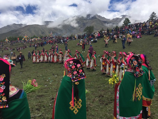
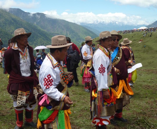
After taking some nice pictures of the “exotic natives,” I noticed an ironic reversal: the “natives” had cameras, too, and they started to take pictures of me! I was obviously as enchantingly “different” to them as they were to me.
It was a fair trade, and I happily participated in the give and take of mutual cultural curiosity and photographic recording of our preferences.
As this was going on, the weather kept getting more and more beautiful, although the weather forecast had predicted heavy rain at this time of day. I credit the holy smoke for this lucky turn of events. We tackled the last stretch of the downhill hike in excellent spirits, now sharing the path with multitudes of visitors and locals who had taken the path to attend the festival. We arrived at Rilong, shortly after 4 pm, enjoying the vista of snow-covered Dafeng, Erfeng and Sanfeng all of which displayed their snow-covered peaks, while the largest mountain, Siguniang, remained resolutely hidden in the clouds.
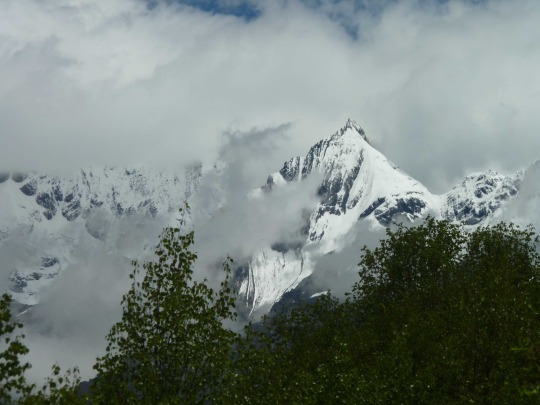
Only the following day, just as we were driving away from Rilong, did the titan finally emerge from the clouds. I happened to look backward through the rear window of our car when I involuntarily exclaimed “Wow! Stop!” There was Siguniang rearing incongruously into the skies, while the nether hills were roiling with low-lying clouds.
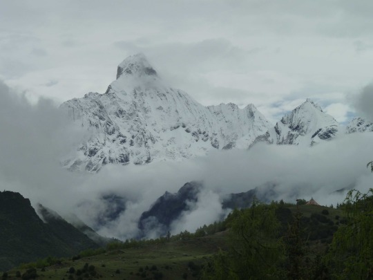
It is a truly majestic, almost impossibly steep mountain that is perhaps more dramatically sculpted than the Matterhorn. It almost looked like a romantic painter’s fantasy of a mountain. I knew then that I wanted to return at a more favorable season, say October, with the fall colors on display. In addition to having another go at Dafeng or Erfeng, I would love to hike the nearby valleys which are definitely worth exploring, notably Changping Valley and Shuangqiao Valley, which give spectacular views of the surrounding mountains, including Siguniang. It would be great to explore these other hiking options at one point in the future, although I will certainly do it without the help of a pony.
1 note
·
View note
Text
The “Wild” Great Wall of China
Date of hike: April 23, 2017
Country: China
Region: Hebei Province
Trailhead: Jinshanling
End point: Gubeikou
Distance: 15 km (10 miles)
Elevation difference: 230 floors up (iPhone stat)
This trip offers spectacular views of Great Wall snaking around into the far distance. Wild sections show the power of nature to reclaim even the strongest man-made structures over time. A place laden with history (and with the occasional snake).
This is the first time I can remember that I ever hired a guide to go on a hike . When you hike on a World Heritage site like the Great Wall, you don’t just go there to set one foot in front of the other and snap some pretty pictures. You want to get a feel for the history and the culture that has given rise to this amazing structure. A good guide can provide lots of context to make the encounter with this landmark more meaningful and your visit more respectful. One may say that a guide also makes for a safer trip, and indeed, there are portions along the “wild” wall where erosion has left just a narrow pathway, although I would not say that any of those sections were any more treacherous than your regular alpine excursion over snow fields and across loose scree slopes. But since the Wall is today literally a fractured structure with reconstructed and completely wild sections abutting each other, and with the occasional off-limits portions of the Wall interrupting continuous travel, you really need some local knowledge to navigate. Also, it is wonderfully convenient to have a car pick you up at your hotel in Beijing drive you to the starting point of your hike (2 hours one way), then pick you up at the endpoint many miles away. We used greatwallhiking.com for our arrangements, and we were fully satisfied with all their services.
Anybody who has ever visited the Great Wall at one of the popular, conveniently located visiting spots near Beijing knows how hard it is to enjoy the experience. On good weather days, especially during weekends, places like Badaling are so overrun with tourists, you think you are caught up in a mad stampede. So, imagine our joy, when after about a 40 minutes climb from the parking lot at Jinshanling, we reached the Great Wall and…we were alone!
To the north, we looked toward the fabled section of the wall at Simatai where the already amazing Wall does the near impossible and scrambles up a steep razor thin ridge, dotted with square watch towers.
This stretch of the Wall is so amazing that developers have bought the land at its base and turned the whole place into a five-star resort complete with (fake) “watertown.” To juxtapose this craggy section of the Great Wall with a water town is a bit like pairing the Cote d’Azure with the Matterhorn. Water towns belong in the flat-as-pancake Yangtze River Delta. Anyway, the developers of the “Gubei Water Town Resort” obviously purchased the rights to the views of the Simatai section of the Great Wall along with the land around it, for they closed off the previously accessible stretch of the Wall from West Simatai to Jinshanling. So, nowadays, the hike starts a little further down toward the destination at Gubeikou.
After we first joined the Wall near Jinshanling, we could have proceeded another five or six watchtowers toward Simatai to take in the views from there, but it was a one-way trunk of accessible Wall, and we would have needed to backtrack again all to the way to where we were. Instead, we started directly in the direction of Gubeikou. We had no regrets, for the scene was definitely good enough: bright, sunny skies, and an empty wall snaking into the far distance where the hills met the sky...
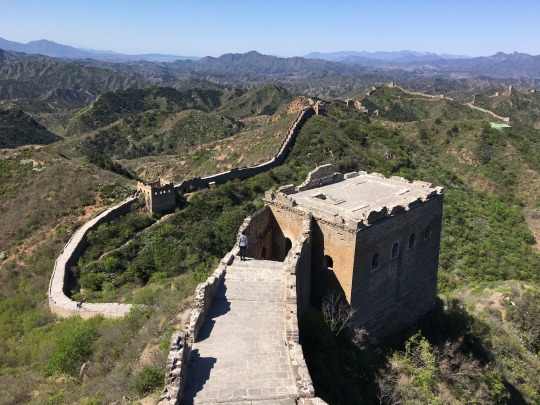
The first few kilometers of our hike were very enjoyable. Here the Wall was only half-restored, which means it still had the integrity of a solid wall with some of the battlements standing and others missing, while also showing distinct signs of wear-and-tear, as well as bearing quite a few battle scars. One of the most astonishing things I learned from our guide, Yaxin, was that the Wall had been used militarily even after it had ceased to be permanently manned and maintained at the end of the Ming dynasty, hundreds of years ago. The Japanese did particularly grave damage to it in 1933, during their occupation of China. During a fierce battle right here in the Gubeikou section of the Wall, the Japanese had shelled this World Heritage Site in many places to break the Chinese resistance, destroying many of the iconic watchtowers and breaching the wall in several places.
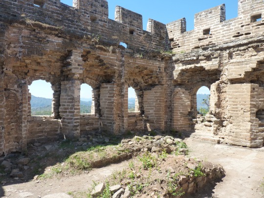
After about 2 hours, we started to meet an increasing amount of people, streaming up toward us from the parking lot at Zhuanduokou. At this stretch, the wall was almost perfectly restored. The combination of crowds and brand-new looking watchtowers with smooth pavement to walk on made us speed up to leave this stretch behind us as soon as possible.
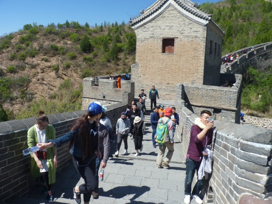
Fortunately, fewer visitors were interested in the southern branch of the Wall from the Zhuanduokou pass; so, about one kilometer after the parking lot, we were almost alone again, as we walked on a broken, partially crumbling wall.
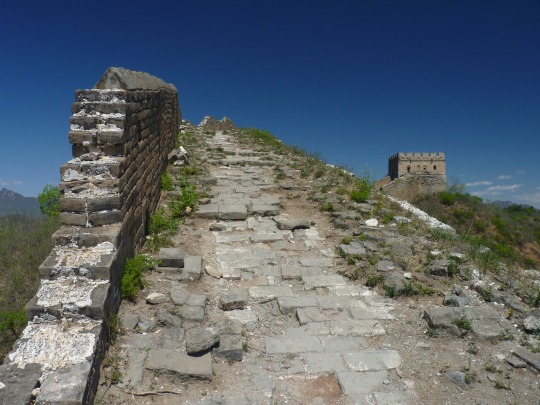
Here we reached a blocked section, where the People’s Liberation Army of China had closed off several kilometers of Wall. It was almost noon now, and from the crest of the ridge, we could see a small settlement in the valley where we would be getting our lunch. Yaxin was already on his cell phone with the owners, alerting them that we were ahead of schedule. Seems we were fitter than average.
The trail down into the valley was treacherous. In fact, both Lyra and our guide slipped repeatedly on the steep sections covered in loose dirt which made it seem like we were walking on ball bearings. Yaxin had lost his hiking pole along the way, probably while he was taking pictures of us. So, he needed to cut a branch to help with the descent. The path had been worn to a smooth slippery surface by the Great Wall Marathon that had led through here just a week ago. It was inconceivable how people would have managed this stretch running, and I can only imagine how many people tumbled on the steep hill here. Anyway, we arrived safely at the farm house which did not have running water and sported, somewhat bashfully tucked into one corner, the sanitary sign board giving the establishment a “C” rating.
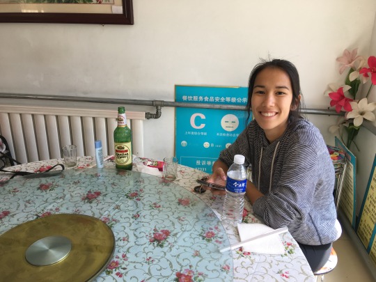
Lyra and I exchanged a meaningful glance, but we agreed that when near the wild Great Wall, we should do as Ming personnel would have done five hundred years ago and just slurp the broth without batting an eyelid. As it turned out, we got a lot more than broth. In fact, what was served from the simple kitchen here was first-rate, home-cooked, authentic, MSG-free, delicious food.
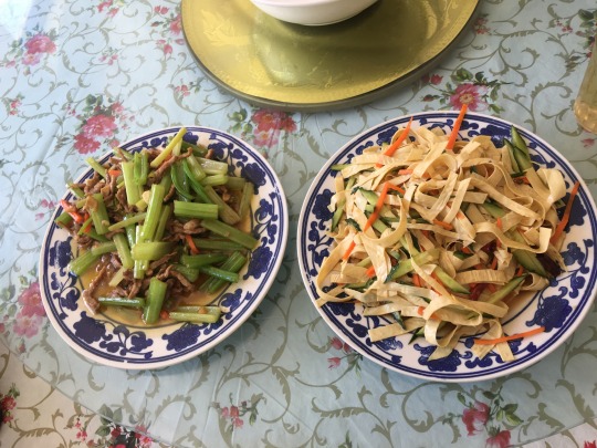
We had omelette, stir-fried cauliflower, celery with thinly sliced pork, and a cold dish with slliced bean curd skin, as well as plenty of cold beer. The sun and dry north China wind had parched us pretty good. Big, cold bottles of local Yanjing Beer were just what the doctor ordered for our condition.
Fortified by this break, we set out again on the dirt path, ascending from the farmhouse in a line roughly parallel to the wall, which provided a constant skyline. It was lovely to see the wild Great Wall from a more distant vantage point, instead of standing directly on it. At one point, the clouds threw a patchwork blanket of light and shade across hills that were flecked with the fresh green of budding beech trees. Magical.
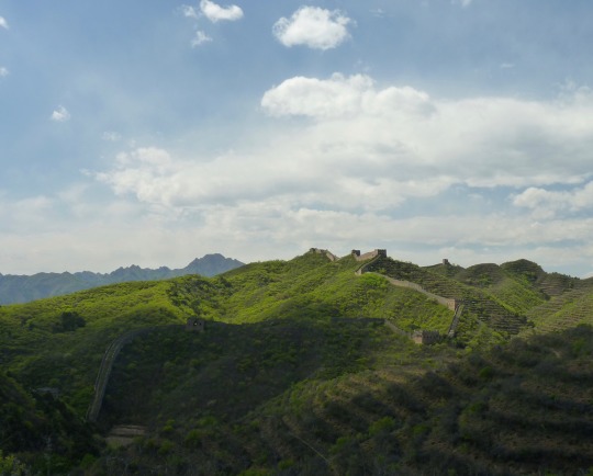
45 minutes after leaving the farmhouse, we rejoined the wall at a five-window tower (this means the walls on the side are wide enough to accommodate five windows in a row). While our guide and Lyra were resting in the shade of the tower, I proceeded a few hundred meters further down the wall to where it was blocked off, and it was at this point that I almost stepped on a snake of a good 1.5 to 2 meters length. I was so startled I just stood still as it slinked away slowly. All I could think was how glistening it was, as if leathered in oil. I was slightly shocked by the thickness of its body, too. Later on, Lyra blamed me for not taking a picture. I explained that when crossing paths with a substantial snake, snapping pics is not the first thing that comes to my mind. But anyway, a few kilometers further down the Wall, we ran into a second snake, slightly smaller but the same kind, still glistening wetly in the sunlight, as it lay curled by the side of the path.
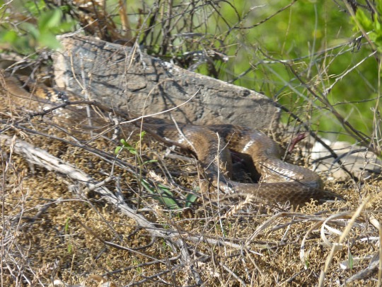
If we needed proof that this stretch of the wall was infrequently visited, the critter was tangible evidence of it. Indeed, we were quite alone now. As far as the eye could see, the crumbly, mud colored wall was snaking along the landscape with nary a person in sight. This was the kind of “wild” wall I had always wanted to experience. Serious bucket list stuff!
It was quite amazing to observe the effect that time had wrought on the wall here. At places, it felt more like hiking on a slightly raised earthen mound rather than on the marvel of Ming dynasty engineering.
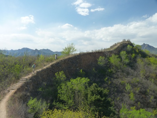
In these sections, the Wall had been mellowed and humbled by the passing of the centuries (not to mention the impact of belligerent armies). It was quite meditative to walk on this artifact, having the amazing, aged, world historical landmark all to oneself. Compared to the earlier sections in the morning, there were none of the brutally steep sections here. Mostly, the wall was meandering at modest elevations through a hilly landscape.
Just as we reached a section where the wall had been completely eroded away and an auxiliary set of steps had been built next to it, our hike suddenly came to an end. The parking lot was a mere 10 minutes away, and so, with slight regret, for we still did have some reserve energy left, we stepped off the Wall and started our descent toward the parking lot. As a last order of business, our guide had prepared a little makeshift “graduation ceremony” for us, writing out a brace of certificates testifying to the fact that we had hiked on the Great Wall from Jinshanling to Gubeikou and attesting, with reference to Mao Zedong, that we both now qualified as “real men.” The “Great Helmsman” had famously stated that a visit to the Great Wall was was requisite to graduate from the great unwashed (or something like that ;-) ).
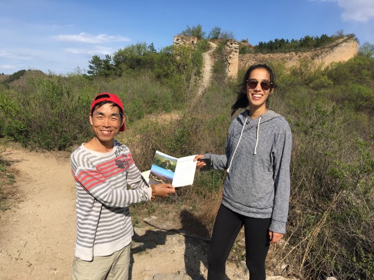
We had been very lucky that day, being blessed with extraordinarily pleasant weather and good long-distance sight. Only one week later, a vicious dust storm descended on the Chinese capital, shrouding it and all its environs in a blanked of sand and smog. This would have made the hike far more unpleasant, if not impossible. So, after all is said and done, this was a middle distance hike with some significant altitude difference but with a sight-seeing factor that was so off-the-charts, we did not even feel we had hiked 15 km and climbed 230 floors in the process. The magnificent scenery had distracted us from focusing at all on the physical component of this hike.
0 notes
Text
Mueller Hut (Mount Cook Area)
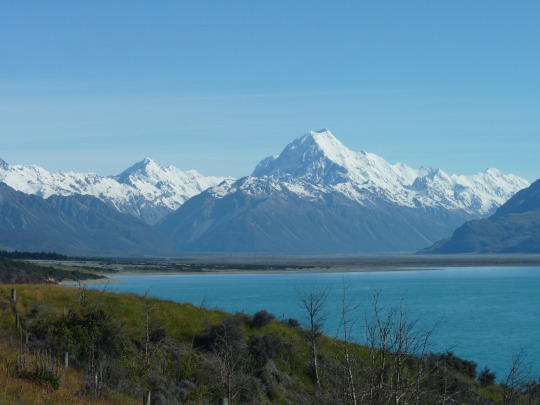
Date of hike: December 24, 2016
Country: New Zealand
Region: South Island
Trailhead: Campground, near Mount Cook Village
Hike Destination: Mueller Hut
Distance: 13 km (8.5 miles)
Vertical difference: 850 m. up
Weather: Blue skies, warm, great visibility
This is a very steep trail through a variety of terrains, including steep boulder fields and snowy portions. Views of Mount Cook, Mount Sefton and other mountains are nice from Sealy Tarns, halfway up, but they become truly fantastic from the top of the ridge, near Mueller Hut.
When I was in New Zealand 28 years ago, I never managed to see Mount Cook, partly because the weather was unfavorable, and partly because the rides that I caught hitch-hiking around the country did not bring me to the vicinity of the mountain more than once. On my return to the area now, with my family (and a spiffy rental car), the mountain was very well disposed toward me, and I enjoyed an absolutely spectacular hike in great weather with my family.
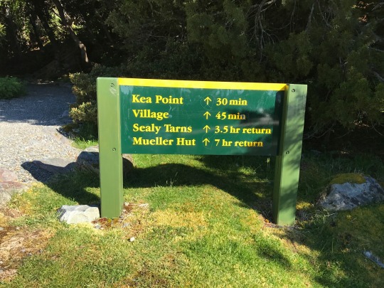
We arrived at the trailhead inside Mount Cook National Park at 9:15 am and quickly started up the path, eager to get going on a perfectly crisp and clear New Zealand summer morning.
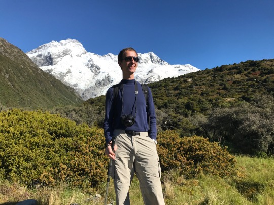
After a kilometer or two of gently ascending trail, we hit the first steps, and from there on it was unrelenting stair-climbing, over thousands of steps, until the halfway point of the hike. New Zealand trails are built differently from European trails. Instead of using switchbacks to make for a gradual ascent, in New Zealand they build the trail straight up the mountain, with hardly a deviation from the direct line.
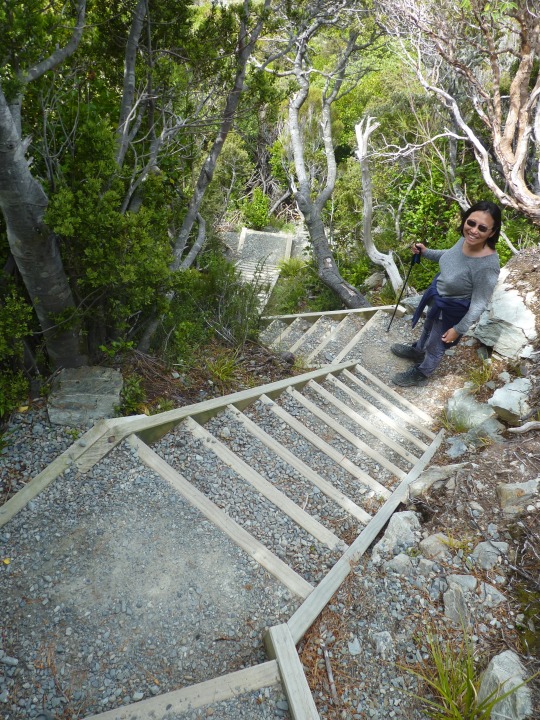
This makes for very steep climbing, which although shorter in distance, is more taxing on the system than the more gradual switch-back hiking we are used to in the Alps. This approach, too, only works well when there are well-maintained steps; as soon as such steep trails are left in their natural condition, they are prone to wash-outs and erosion and can get very tough to handle.
Although our pace was not very fast at the outset, I was soon huffing and puffing like a steam locomotive. But it was easy to forget how tiresome it was because the panorama kept getting better and better.
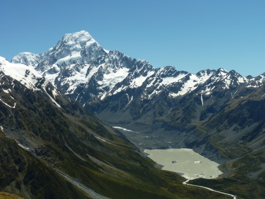
Mount Cook is a handsome mountain, and it stayed in view during the entire hike. As we rapidly gained elevation, the glacier lakes down in the valley became more and more clearly visible, with their milky color of various hues of green and brown contrasting sharply with the glistening snow and ice on the glacier-encrusted mountains. One could easily spot the numerous icebergs floating in the Mount Cook glacier lake. One hour into the hike, we were high above the valley floor, enjoying great vistas toward Lake Pukaki and toward Mount Cook, rearing pure and white into the azure skies.
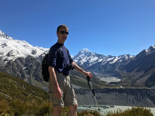
After 1 ½ hours, we emerged onto a spur called “Sealy Tarn” that offered spectacular views of the glacier basin, moraine, and high alpine scenery in front of us. At this point, the carefully laid out steps ended, and a rough and stony section of the path began.
Soon after continuing to make our way toward Mueller Hut, we were facing a steep section of the trail, at which point I was beginning to feel slightly uncomfortable, knowing that we would have to climb down again with my wife and daughter on this lose, rocky, and partially washed out portion of the trail. And from here on, it only got rougher as we continued climbing. There was a point where I thought “OK, this is no longer hiking but rather mountaineering.”
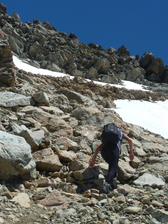
Indeed, after about 2 ½ hours, the trail entered a large boulder field that needed to be carefully negotiated, offering ragged edges and surfaces tipped at all kinds of angles, but no even path.
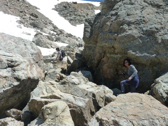
To make matters more difficult, there was a fairly steep snow field to navigate as well. Thanks to the summery temperatures, the snow had gotten soft, and it was quite easy to kick steps into the snow, but my wife and daughter nevertheless slipped a few times, getting snow into their boots.
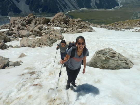
Above the snow field the real scrambling began, as we entered a steep scree slope. Here, there was hardly a visible trail left, and we simply followed the posts that were rammed into the earth to indicate roughly where the route lay. It was not too easy at times to find a good footing, and I often had to help my wife across a treacherous section of the trail.
Of course, all of this was highly worth it because when we finally emerged on the top of the ridge, the view that greeted us took our breath away.
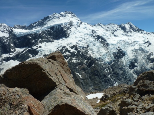
It is safe to say that this was one of the best views I had ever enjoyed while hiking. There was a deep chasm in front of us and across the vertiginous drop opened up an amphitheater of steep, high mountains that were encrusted with glaciers of all shapes and sizes. As we stood there, admiring the vista, large chunks of ice repeatedly broke off, thundering down to the valley, forming white cones of powder. And at the head of the valley, there always towered the hulk of Mount Cook, jutting majestically into the sky.
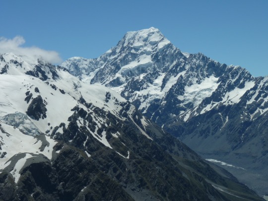
We took many pictures at the nose of the bluff that overlooked the valley. It was rather easy to look heroic and impressive at this location.
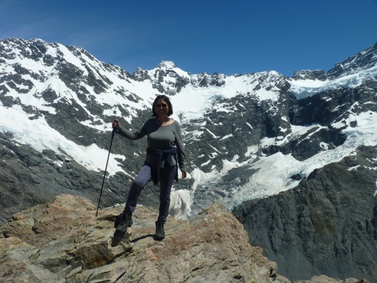
After a short break, we picked up the trail leading toward the Mueller Hut. But after scrambling for about 10 minutes, we decided to call it quits and not go all the way to the hut, which was still 20 minutes away. The trail here led across a boulder field, and the going was very rough and slow. Initially, we had wanted to reach the hut because we were running low on water, and there was a tap at the hut. We had brought 1 liter of water for each one of us, but it turned out that this was too tightly measured. We should have brought at least one more liter for the three of us (4 liters in total). But now we figured that going all the way to the hut would be another 40 minutes, round-trip, costing us much energy since the going was so rough across this rocky section of the trail. So, we turned around and started to descend, nursing the few sips of water we had left as carefully as possible. But less than halfway down the mountain, we had run dry. From then on, the only thing we drank, were imaginary cold beers.
The steep scree section and the snow field proved to be a little less troublesome than I had feared while coming up. We ended up navigating these spots carefully but without major problems. Further down on the upper part of the trail, we suddenly spotted a paraglider, who had hauled his equipment all the way up the mountain, getting ready to launch. We had fun watching the preparations and the eventual take-off.
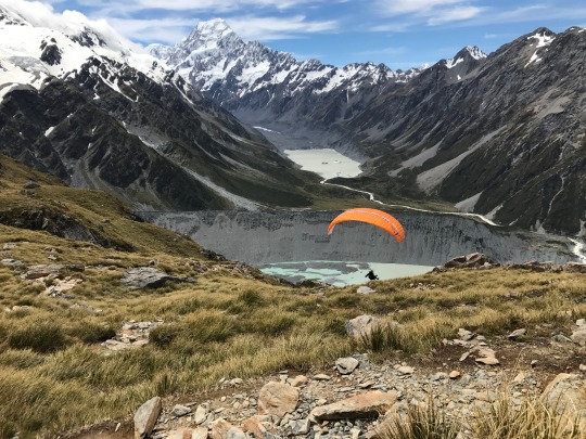
It was nice to see the orange slice of the parachute contrasting against the white-and-blue background. By now, some high clouds were beginning to move it, making for a more marbled look of the sky and adding a nice variation to the scene.
It was a true relief to reach Sealy Tarns and, after that, to start on the second half of the descent via the steps. By now, we were quite tired and descended slowly and carefully, so as not to trip because of tired legs. And we rested at regular intervals. All day long, we had seen quite a few other hikers, and we were never completely alone. But even though this was peak season in a top tourist destination, on December 24th, it never felt crowded on this mountain. Descending, too, we met some folks here and there coming up or passing us by from above, perhaps because they had fresher legs or were younger… Still there were also stretches where we did not see a soul.
We finally arrived at the bottom of the mountain almost seven hours after we had started out in the morning. It had been a truly spectacular hike, although not one to be taken lightly. The upper portion of the trail, above Sealy Tarns, takes a bit more experience and care than is normally required on a regular mountain trail. For my wife and daughter, this was perhaps the most challenging trail they had met so far. But they had no regrets, and it felt great to come down to a cold beer and nice meal after having accomplished such a serious trek.
0 notes
Text
Stätzerhorn
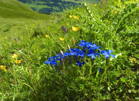
Date of hike: August 3rd, 2016
Country: Switzerland
Region: Graubünden
Trailhead: Top station of gondola lift Heidbüel
Hike Destination: Stätzerhorn summit (2575 m.a.s.)
Distance: 13 km (~9 miles)
Elevation difference: 600 m. up & down
We walked from our Airbnb loft in Churwalden to the gondola station, which was only about 15 minutes away. There confusion set in because the hiking information I had for this tour mentioned taking a chair lift to Alp Stätz. Well, where it should have been, there no longer was a chair lift in place because it had been removed the previous year. Instead of a ramshackle conveyance, there was now a brand new high speed gondola. And just to make this a bit more confusing, they changed the name of the destination from “Alp Stätz” to “Heidbüel.” After clearing this up, we quickly purchased round-trip tickets and boarded one of the spiffy Porsche designed gondolas which went up the mountain at an angle so steep it felt almost vertical.
A few minutes later, we basked in the sunny panorama of Alp Stätz (or Heidbüel, depending on your taste), pondering the yellow “Wegweiser” (the iconic Swiss hiking directions panels with destinations and time estimates) at the exit of the gondola station. It was easy to pick out the alpine path, marked with white-red-white strips, leading up to today’s hiking destination. We could already see the summit of Stätzerhorn directly in front of us; we also saw that there was not a speck of shade all along the path since the whole hike was above the treeline. After generously lathering on 30 SFP sun screen, we set out for the summit, all alone since there was no competition on the trail except for the many cows, some of them meditatively chewing their cud right athwart the trail. After hearing reports of serious injuries and even deaths after cow-hiker encounters gone wrong in recent years, we gave each cow a good wide berth, but generally, they couldn’t care less about us, just eying us patiently from behind their long white lashes.
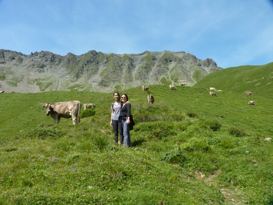
The sound of the many cowbells in all kinds of pitches and volumes created a strange sound-carpet that followed us all along the lower portion of the hike. I’d heard this phenomenon many times before, but now it struck me as particularly intense; perhaps, the shape of the slope we were on acted like an echo chamber focusing the sound? In any case, it was a unique background noise, and not unpleasant at all. Somebody ought to write a piece of music to this tinkling of countless bells!
After about 45 minutes, the path left the pastures and got steeper as it started up the west flank of the mountain. For the next 1 hour or so, we plodded steadily upward on rocky ground on a narrow trail that switched back and forth on the bare slope.
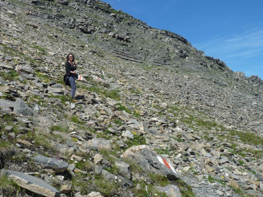
We made one halt about two thirds up the mountain to supply ourselves with water and to chew an oat bar for energy. Off we went again, and soon Lyra was so far ahead she’d disappeared around the mountain, while Liang & I took our time, sometimes helping each other across particularly precipitous stretches. We sensed we were reaching the ridge, but it was still a rush to get there and see the panorama open up on the other side of the mountain, giving views stretching to the far distance.
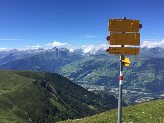
We snapped more pictures than we could ever use for any specific purpose, but it was just so much fun to resist overdoing it. From there, it was another few hundred yards until we stood on the summit proper.
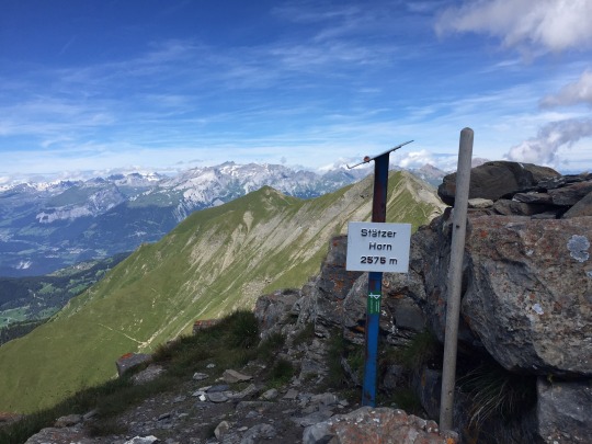
Here, too, we were all alone, which meant I had to activate my camera’s self-release feature to take a summit picture with all three of us. The result is not bad, I think.
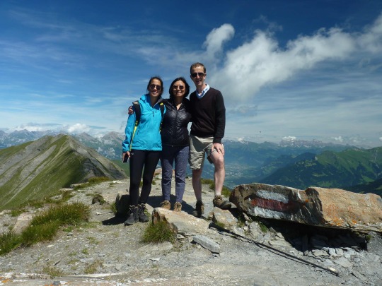
Up there, the weather was balmy, and we decided to have our picnic right there, sitting on the side of the summit and looking into the vast space opening up before us, marveling at the cloud rimmed jagged panorama going on for approximately 50 km all around. I had hauled a can of Swiss beer all the way up the mountain, and it was still cold and crisp. Beer seldom tastes better than taken along with Swiss Zopf bread, butter, cave-aged Gruyere, and “Bündnerfleisch,” all thickly layered to form the perfect sandwich, enjoyed before stunning views.
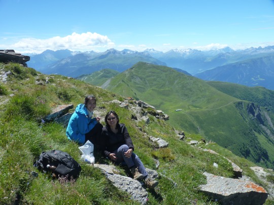
After our picnic, we descended via a different path to form a loop. Still without a fleck of shadow we first descended via a steep meadow, then joined a wider utility road that wend its way down from one ski-lift station to another. Then, the path branched off again, and we were on a mountain trail bordered by colorful alpine flora.
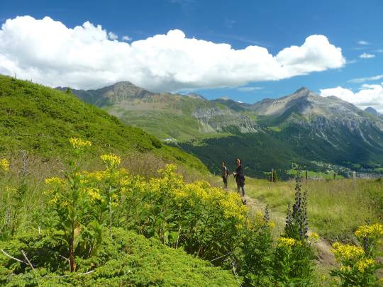
Here, we met a mountain biker who had lost his bike computer mounted on the handle bar. He was backtracking his earlier route, looking carefully left and right. He asked us to keep an eye out for the lost device, in case it was still lying somewhere by the trailside. Unfortunately, we did not spot the thing; it must have tumbled sideways and got lodged somewhere in the bushes which grew densely along the path. The trail stretched out quite a bit longer than expected, and we grew tired while baking in the glaring sun. After taking another rest, we finally reached the summit station of the Heidbüel gondola and were happy that we had bought a round-trip ticket in the morning. It would have been grueling to descent all the way to the bottom of the valley from this point.
This is a great hike of moderate distance and difficulty, highly recommended for those who want to enjoy the feeling of actually summiting a minor peak entirely by their own propulsion. It feels different to have “earned” a 360 degree view, rather than taking a cable car all the way to the top, thus doing it “cheaply.”
That night, we all had sunburn, and that although we had re-applied sun-screen along the way. The sun is intense at this height, and with no trees along the way, in sunny weather you can be exposed for 5 hours to direct sunlight. Moreover, I had forgotten to cover some places like the back of my hands and the lobes of my ears, and these were now lobster red. Next time, I’ll know to bring SPF 50 along for a hike like this and carefully cover every square inch.
0 notes
Photo
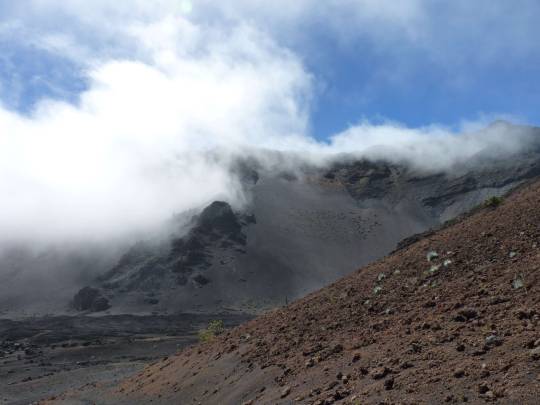
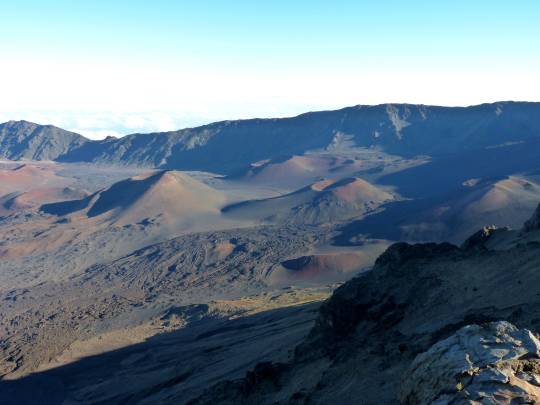
HALEAKALA BASIN
Date of hike: February 17, 2016
Country: USA
Region: Hawaii (Maui)
Trailhead: Visitor Center, summit of Mt. Haleakala (10,000 feet)
Hike Destination: Halemau’u Trailhead (8,000 feet)
Distance: 18 km (12 miles)
Elevation difference: 1000 m. down, 350 m. up
The hiker encounters spectacular volcanic desert landscape, dotted with perfectly shaped volcano cones of various sizes. Colors in all hues of ochre, orange, and brown. The gradual retreat of the fog, alternating with occasional showers, contributed to the interest of the hike. The trail is well-maintained, varied, and attractive. I also enjoyed Silversword cacti clusters; these plants (an endangered species) grow uniquely in this area on earth, and hikers are urged to stay strictly on trails to protect the plants’ frail habitat.
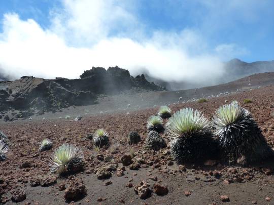
I had been on the top of Mount Haleakala (elevation 10,000 feet) with Liang two days before. The first time, the summit had been fogged in. But because the cloud cover reached only as high as the summit, with some sunshine pushing through, we saw the phenomenon called Brocken Spectre below us, as our own shadow was cast upon the cloud surface, surrounded by a colorful halo.
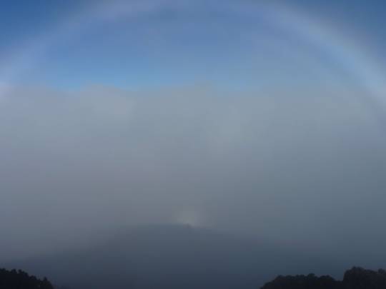
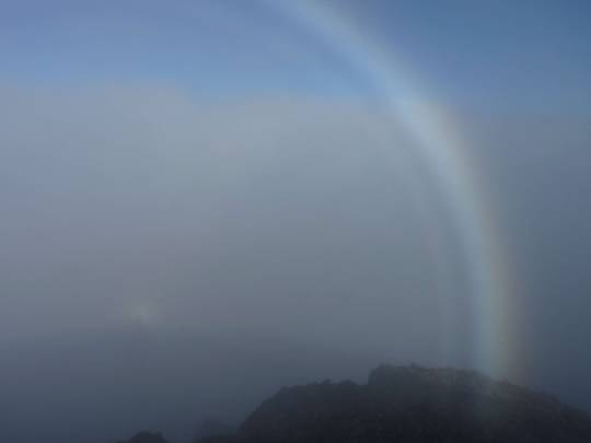
According to legend, people on the Chinese holy mountain of Omei Shan, after seeing that phenomenon used to hurtle themselves down the chasm believing that they had reached nirvana. Fortunately, we were not similarly inclined. The second time I pulled up at the parking lot on top of Mt. Haleakala (this time by myself), things did not look promising: A combination of fog and wind-blown drizzle kept me inside the car for over an hour. I had all but given up hope to go on my ambitious 18-km hike, especially after a park ranger at the Visitor Center told me that the hike I’d planned to do would take 6-7 hours to complete. It was now nearing 11 am, almost too late to start on such a venture, especially as our resort was more than a two hours’ drive away, and I was expected to be there for dinner. But before I’d concede defeat, I was at least going to the nearby peak one more time. So, I walked to the top, and after a few minutes of staring into whiteness, the clouds suddenly split open and revealed a stunning look into the wide basin at the base of the observation point.
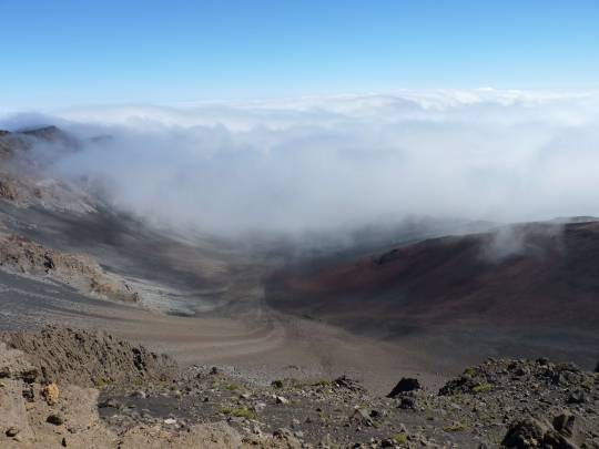
The fog still clung to the rides around the valley and concealed the valley floor, but I could now spot part of the trail I was planning to follow. I though “well, it doesn’t hurt to go down partway into the basin—then turn around if the fog persists.” I got my gear together and quickly headed down toward the edge of the fog. To my delight, as I kept hiking down, the leading edge of the fog kept retreating before me.
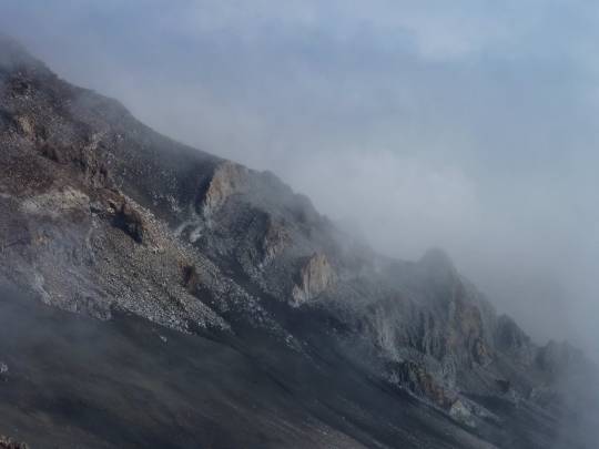
The further I descended toward the bottom of the basin, the further the fog cleared out of the caldron. This created fascinating contrasts between the white clouds and the ochre, orange, and brown hues of the surrounding volcanic desert landscape.
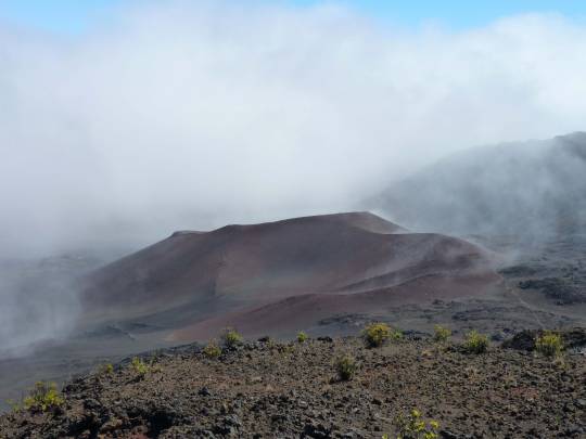
Descriptions of this area usually refer to the place as a “caldera,” but technically this really is not an ancient crater. What I call “basin” is in actual fact an erosion valley that was carved by the elements after the original volcano had gone dormant long ago. Then, new volcanic outlets had pushed through the floor of this erosion valley, resulting in the new cinder cones and lava flows. (I have this information firsthand from overhearing explanations given by a park ranger...)
After descending about 2200 feet, I reached a fork in the trail. Here, I had to decide whether I wanted to stick to the original plan and hike the entire 12 miles or turn around and head back up the same way I had come. If I took the long route, I’d have to hitch-hike back up to the parking lot after reaching the road. The park ranger had told me that peak-bound traffic was getting sparse in the later afternoon, so if I went that way, I’d be running the risk of not having a ride back up to my car. Although at this point the weather seemed to deteriorate—clouds and showers moving in rapidly—I decided to go for the long haul. I was completely alone in a fantastical environment that reminded me of a Martian landscape, I had good rain gear, sturdy hiking boots, food, and a map. I could not pass up the fun.
Knowing the distance I had to cover from here, I struck out at top speed. It felt good to eat up the miles quickly. The trail was very pleasant, basically just soft volcanic scree, sometimes gently ascending then again descending at a reasonable grade. The sights were quite otherworldly, both when drizzly clouds swept by and when the sun burst out again.
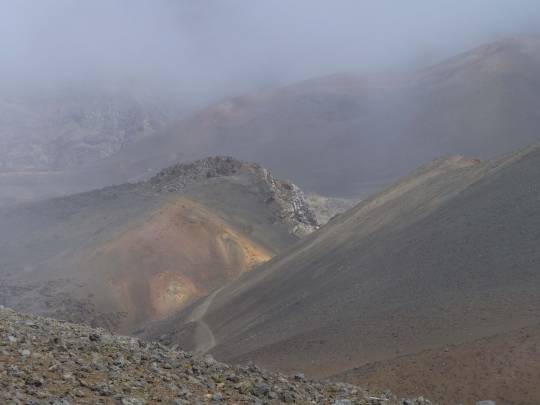
About 1 1/2 hours later, I spied the squat shape of the Holua cabin in the distance.
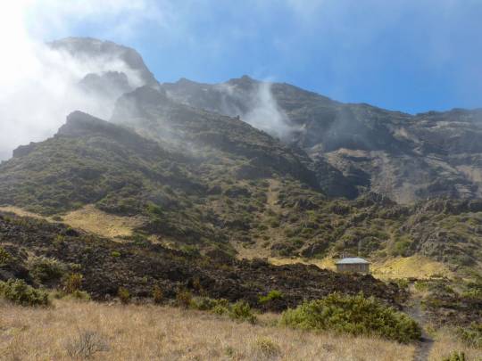
This was good news because I had set this destination as goal for my mid-day picnic. When I arrived at the hut, I found a family of three in there. They had just hiked in from the park road (my destination for today). Although I tried to persuade them to hike in the direction I had come from, it seemed they were going to stay put and then hike out again tomorrow from there. They offered me a Nature Valley Bar, which I thought rather touching. After I left the hut, the weather gradually cleared up and, when I started up the steep switch-backs leading to the park road, the last shreds of cloud began to dry up, and the valley appeared in its its wide circumference.
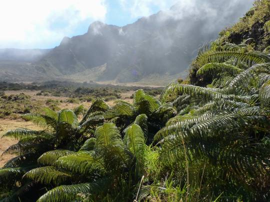
The climb back up to the rim of the basin was perhaps my favorite stretch of the hike: the nicely maintained trail carved a steady climb from the steep mountain side, at one point traversing over a narrow ridge where the terrain fell away on both sides.
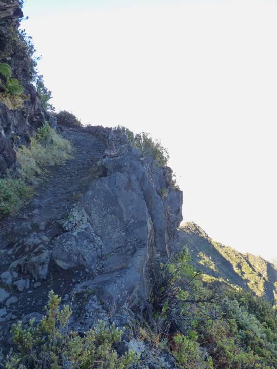
When I reached the park road at 4:00 pm. the first car that came along stopped for me. The three occupants of the Toyota Camry were chain-smoking aging hippies from California. The driver, Sue, said she had been on the summit of Haleakala a long, long time ago, and at that time she’d seen the Brocken Spectre. When her two male companions heard the description of this phenomenon, they opined she was “full of shit,” but to Sue’s delight, not only was I able to confirm that such a thing actually existed, I quickly scrolled through the pictures on my camera and showed them the Brocken Spectre shots I had taken three days earlier, thus settling a dispute in Sue’s favor. This way I had more than paid for my ride… When I arrived back up on top of the mountain, the unobstructed view across the whole volcanic basin was awesome.
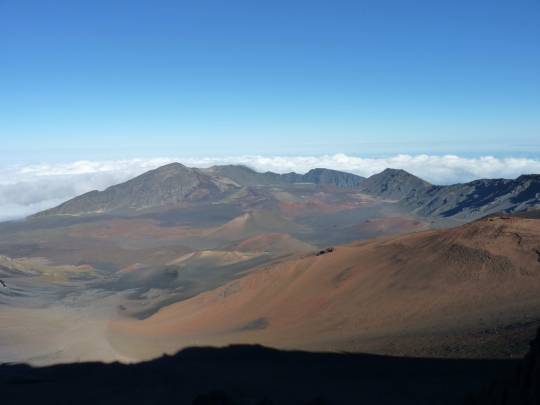
I lingered for some picture-taking opportunities, scoping out the valley and tracing the route I had taken. Like many times before, it struck me again what distances a person could cover simply by walking steadily. I had finished the hike in 5 hours instead of the 6-7 estimated by the park ranger, and at first that seemed no big deal, but for the next three days, I felt quite beat up in my legs and hips; I hadn’t felt that much muscle pain in a long while. I’m quite sure all the soreness came not so much from the distance than from the fast pace I had struck up.
In any case, I made it back to base at 6:30 pm, and after a refreshing shower, I was just in time to have dinner with Liang. I call that a good day by any definition.
0 notes