cardiffhistory
cardiffhistory.tumblr.com
cardiffhistory.tumblr.com
32 posts
Don't wanna be here? Send us removal request.
Last Seen Blogs

luna--whitehall-blog
All That Glitters Is Not Gold

rain-dude
hey yo its summer

diverdown3929
Things & Things

book-of-so-so
𝕭𝖔𝖔𝖐 𝕺𝖋 S⃔o⃔-⃔S⃔o⃔

chachamambou
yumenomatayume
Text
Spotlight: Danescourt Estate
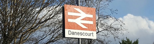
In the northwest corner of Cardiff, sandwiched between Llandaff and Radyr, sits Danescourt. This 1970s development of c.1,200 houses has at its heart a thirteenth century church, a fifteenth century manor house and, for some inexplicable reason, a postbox dating back to King George V. Anachronistic postboxes aside, there is a surprising amount of history for an estate which is just 40 years old...
Origin of the name
As previously covered ‘Danescourt’ is an amalgamation of the names of two properties which predate the estate. “Danes” refers to Danesbrook House, a private dwelling built during the Edwardian period and later extended and converted into a private nursing home, while “Court” refers to Radyr Court House (after which the nearby Radyr Court Road is named).
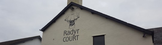
Radyr Court

In the 12th Century to the west of St John’s Church (on what is now Heol Aradur) stood a house called Radyr Isha (Lower Radyr), it had passed into the Mathew family in the 1450s through the marriage of Thomas Mathew (3rd son of Sir David Mathew, Standard Bearer of England under King Edward IV during the Wars of the Roses) to Catherine Ferch Morgan (daughter of Welsh nobleman Morgan Ap Llewellyn and heiress of Radyr). The marriage elevated the Mathew family so significantly that they felt it necessary to replace their grand Radyr Isha property with a larger and far grander manor house.
The new home (known as Cwrt Radur, or Radyr Court) was constructed at about 1469 to the east of St John’s Church alongside an existing track which led to a ford at the River Taff. The property was said to be a grand manor house, similar in size and style to that of the ‘Van House’ in Caerphilly built several years earlier. Radyr Isha had been left to ruin, as noted by Rhys Meurig in the 16th century:
“ye manor house by the west of ye church, sometime ye house of Morgan Llew ap Jeban, now decay'd"
In subsequent years the derelict house would be removed in its entirety (foundations and all) by David’s grandson Sir George Mathew to make way for a large deer park. Deer were seen a status symbol in Tudor times, but this unnecessary extravagance would signal the beginning of the end for the Mathew dynasty.
Creation of the deer park required the eviction of several tenant farmers in the manor, this loss of potential income coupled with the high cost of looking after a herd of deer led to significant financial problems. George’s eldest son William attempted to revive his family’s fortune by investing in the Pentyrch Iron Works. By 1625, with crippling debts and very little income, Captain George Mathew was forced to sell what remained of the estate to the Lewis family of Caerphilly ending nearly 200 years of the Mathew family’s reign in Radyr.
By 1830 a large portion of Radyr Court had to be demolished after being ravaged by fire. The remaining wings of the house were renovated and converted into a farmhouse. It remained as a working farm until the 1970s (top picture) when council planners purchased the surrounding lands and set about creating a new estate to satisfy the needs of the expanding city. By 1979 the farmhouse had been extensively renovated and reopened as a pub known as The Radyr Court.
The pub has changed hands a number of times in 40 years and undergone several transformations, including a stint between 2003 and 2013 where the upstairs became an Indian restaurant. The current incarnation is viewed as more of a restaurant than a pub and is owned by three local men who saved it from closure in 2013. It officially reopened in 2015 after an extensive (and no doubt expensive) refurbishment, with a new logo featuring a deer and the year ‘1469′ in reference to the history of the building.
Radyr Chain
In Tudor times the responsibility for maintaining the local road network was that of the Parish. Each parishioner was duty-bound to do one week (6 days) unpaid work on the roads (although records from the time suggest payment in the form of free ale may have been given). As traffic on the roads increased, and parishioners were less willing to give up their free time, it was necessary for the parish to use paid labour. By the 1770s it became apparent that the present system was unsustainable and before the end of the century major roads in the county became turnpikes (an early name for a toll road). The concept worked in much the same way that modern toll roads do where an appointed trust takes control of a section of road and charges road users for using that particular section; the fees collected would then be used for repairs and maintenance.

The main road from Llandaff to Capel Llanilltern (modern day Llantrisant Road) became a turnpike and was operated for profit by the Cardiff Turnpike Trust. A toll booth was built at the junction of modern day Waterhall Road, but road users soon realised they could bypass this toll by instead travelling via Llandaff Bridge and using nearby Radyr Court Road. In a bid to combat this, the Trust installed a chain across the road which was only lowered on receipt of payment. This led to the area being referred to as "Radyr Chain".
One known operator at the Radyr Chain toll booth was an elderly woman by the name of Rachel, also known as "Rachel of the Chain". Little is known of Rachel, though she is mentioned in this 1895 account by the Reverend William David, Rector Of St Fagans:
“Rachel, of the Chain, who lived alone in a comical little cabin about nine or ten feet square which stood at the corner of the adjacent crossroads, where she kept charge of a chain stretched across the road and lowered only on payment of toll by any traveller.”
The turnpikes were never popular, particularly with vendors living north of Radyr wishing to sell their wares in Cardiff. The hostility eventually turned to rioting in the 1840s, and by 1851 the turnpike trusts throughout South Wales were disbanded. Responsibility for the roads initially passed to a Llandaff Highways Board before eventually coming under the jurisdiction of the newly formed Glamorgan County Council in 1888.
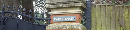
With the former turnpikes now in the hands of the local Government, money for road maintenance was collected through taxes instead of individual tolls. This rendered the toll houses surplus to requirements and across the county they were demolished or sold off. Although Radyr Chain had been suggested for demolition in 1864 (and again in 1865) to facilitate the widening of the turnpike road, it is known to still be in place in 1879 as a local government report commented on the poor sanitary conditions and lack of running water at the building. The toll house had certainly been demolished by the early 1890s, and within 10 years the site had been redeveloped and the modern day “Radyr Chain” house (pictured) and lodge house were built.
The tree around which the chain was connected is believed to have been removed when construction of Danescourt began in the 1970s, the stump now sits in the foyer of the the Church Hall in Danescourt.

Surprising street names
Modern housing estates are usually littered with bland street names typically named after arbitrary items such as trees or plants (Pontprennau's Blackberry Way, Greenacre Drive and Acorn Grove immediately spring to mind!). When choosing the names of Danescourt's streets the planners appear to have consulted the history books for some rather more interesting and relevant names.
Radyr Court Road remains in situ (although the section leading north from the Taff through to Llantrisant Road is almost entirely pedestrianised) and off it you can find Mathew Walk (a reference to the Mathew family), Rachel Close (widely believed to be a reference to Rachel of the Chain) and Cadoc Place (an Anglicisation of the Saint Catwg).

Further afield at least 17 of the streets are named after former Deans, Archdeacons and Bishops of Llandaff, the first of which was a cleric by the name of Urban (a Latinised version of his birth name "Gwrgan") who is said to have established the Diocese of Llandaff and served as it's first Bishop in 1107 until his death in 1134. His name lives on as Heol Urban ("Heol" means "Road"). Heol Urban leads to three cul-de-sacs which are also named after former clergymen; Lynch Blosse Close (after Henry Lynch Blosse who served as Archdeacon from 1859 - 1877 and Dean until 1879) Bruce Knight Close (after William Bruce Knight who was Dean between 1843 and 1845 before becoming Chancellor) and Marshall Close (believed to be after John Marshall, Bishop between 1478 and 1496). Elsewhere in the estate the surnames of former Bishops William da Braose (1266-1287), Robert Holgate (1537-1545), Francis Godwin, (1601-1617), Charles Sumner (1826-1827) and Alfred Ollivant (1849-1882) are used as prefixes for the word "Close", as is that of James Rice Buckley the Archdeacon from 1913 - 1924 who has his own statue on the Cathedral Green in Llandaff (pictured).
Other streets named after former Bishops include Richard Lewis Close (1883-1905), Timothy Rees Close (1931-1939), Blethin Close (Anglicised version of William Blethyn, 1575-1590), Herbert March Close (a mis-spelling of Herbert Marsh, 1816-1819) and Hugh's Close (a fairly common name, but believed to be in reference to Hugh Jones, Bishop from 1567-1574). John Morgan Close (1939-1957) and Glyn Simon Close (1957-1971) are particularly significant as they both served as Bishop of Llandaff before becoming Archbishop of Wales.
In addition to the wider Diocese of Llandaff, a number of the streets are named after people who have made a contribution to Llandaff Cathedral. John Prichard and John Pollard Seddon, the Victorian Architects charged with restoring the Cathedral in the late 19th Century, are immortalised by the street names Heol Seddon and Pritchard Close (another spelling mistake). Jasper Close is named after Jasper Tudor who designed and helped fund the northwest tower of the Cathedral in the 14th Century, while Pace Close is named in reference to George Pace who helped restore the Cathedral in the 1950s following significant damage during World War II.
Other streets are named after artists and sculptors who have created significant pieces of artwork for the Cathedral, including:
Burne Jones Close: after Edward Burne-Jones, artist (Six Days of Creation, c.1893)
Edward Clarke Close: after Edward Clarke, stonemason (Trinity Corbel, 19th C.)
Epstein Close: after Sir Jacob Epstein, artist (Christ in Majesty, 1954)
Piper Close: after John Piper, artist (stained glass window "The Supper at Emmaus" 1959)
Roper Close: after Frank Roper, sculptor (Flowers of the Virgin Mary, 1964)
Rossetti Close: after Dante Gabriel Rossetti, artist (The Seed of David, 1864)
Wyon Close: after Allan G. Wyon, engraver (life size Brass of Timothy Rees)
The artists Thomas Woolner (Moses Before the Glory of God, 1860) and Alan Durst (Scenes From the Bible and the Life of St Teilo, 1952) have also been honoured with street names, but like many in the area they have both been spelt incorrectly as Woolmer Close and Allan Durst Close.
3 notes
·
View notes
Text
Mythbusting: City of Llandaff

Despite being a suburb of the City of Cardiff, street signs throughout Llandaff refer to it as the "City of Llandaff, a City within a City”. But are these signs telling the truth? Was Llandaff, once a distinct settlement 2 miles north-west of Cardiff, a city in its own right? Or is it just a bit of marketing to promote the suburb?
History
One element of the reformation of the Church under King Henry VIII was the creation of a number of dioceses, administrative territories governed by a bishop. Within these dioceses would be a 'centre' typically known as an "Episcopal See" (or simply "See City") where the diocesan Cathedral was located. Under rules outlined in the reformation the Crown stated that any town which contained a diocesan Cathedral would be recognised as a city; it was, however, not as simple as that.
In addition to having a Cathedral, the city-elect had to apply for a Royal Charter to have its city status granted. Between 1541 and 1542 Henry issued Royal Charters creating 6 new cities, namely: Bristol, Chester, Gloucester, Oxford, Westminster & Peterborough. Henry died 5 years later without approving any more cities, in fact nearly 300 years and 14 more monarchs would pass before the next new dioceses were formed under William IV in 1836 (including Ripon and Dorset). In that time no new cities were approved.
Llandaff remained the "see city" of the Diocese of Llandaff post-reformation so, on the face of it, would have been a suitable candidate for city status. Llandaff, however, never received a Royal Charter and so was never formally declared a city (it most likely never formally applied). In spite of this literature throughout the 18th and 19th centuries continued to refer to the “City of Llandaff”, leading to one rather snide comment in the 1858-9 edition of Slater’s Commercial Directory (a forerunner for the Yellow Pages):
...although a city, it is but an inconsiderable place; and divested of its See and Cathedral, would only be considered as a village, destitute of any claim to notice.
Ouch...
The link between a cathedral being a prerequisite for city status was eventually ended in 1889 when Birmingham became the first English town without an Anglican cathedral to be awarded city status. Good job too because 16 years later (1905) Cardiff was also awarded City Status without having a Cathedral of its own. The Cardiff Metropolitan Cathedral, although originally built in 1842, was not declared a Roman Catholic Cathedral until 1916. By 1922 Cardiff had two cathedrals as nearby Llandaff officially became part of the city.
Modern Day
The awarding of City status has since become an exceptionally rare event, between 1930 and 1990 only 5 towns became cities. 5 more became cities in 2002 as part of the Queen’s Golden Jubilee celebrations and a further 3 towns were granted city status 10 years later for the Diamond Jubilee.
Llandaff's incorporation into Cardiff means it will never formally become a city in its own right, The black and gold signs are simply a bit of marketing and a reminder that this Cardiff suburb once had its own identity.
4 notes
·
View notes
Text
What’s in a name: The suburbs of Cardiff

Have you ever wondered who Saint Mellons was, why he was a Saint and why Cardiff decided to name a suburb after him? Or driven past “Dane’s Court” and wondered what link there is to the Vikings? Well wonder no more, in this article we look at the origin of the names of Cardiff’s suburbs and districts
Adamsdown
First mentioned in documents dating from 1440, the area is believed to be named after Adam Kyngot, a 14th Century porter/gatekeeper of Cardiff Castle . Kyngot was allowed by the Lords of Glamorgan to construct a property in an area of land beyond the City's East Gate known as "the Downs". The 10-12 acre plot, which later became used for farming, probably became colloquially known as "Adam's Downs" and then "Adamsdown".
Birchgrove

Most likely named after a 16th Century coaching inn with the same name. The modern day Birchgrove Inn was constructed in 1920 near the site of the original inn.
Butetown
The Bute name is synonymous with the rapid expansion of Cardiff. Under the 2nd and 3rd Marquess of Bute the city was transformed with the construction of railways, docks and large new housing suburbs. One of these new suburbs was named 'Butetown' after the Bute family.
Caerau
The name comes from the Welsh word for a fort “Caer” and refers to the Iron Age hillfort located to the south of Ely (pictured). At 51,000 Sq. M it is believed to be one of the largest hillforts in the UK and a 2012 archaeological dig by Channel 4's Time Team found tools and weapons dating back over 5,500 years.
Canton & Pontcanna
The suburbs of Canton and Pontcanna take their name from a historic waterway called the 'Canna'; Canton (“Treganna” in Welsh) translates roughly to "Canna's Town" in both languages, while Pontcanna is literally “Bridge over the Canna”. The bridge in question is unknown and, in any case, is no longer there as the Canna was diverted underground in the 1890s.
The source of the Canna name for the waterway is less clear cut though. The accepted story states that there was a 6th Century nun from Brittany, Northern France called Canna who fled to Wales to avoid persecution for converting Pagans to Christianity. Canna was believed to be the daughter of Tudur Mawr (an apparent early King of Brittany) and is said to have settled in Pembrokeshire - so why there would be a stream named after her in a town 100 miles east is questionable. The account of Canna is also called into question as it was written by Iolo Morganwg, an 18th Century 'expert' on Welsh literature who was found to be a prolific forger of ancient manuscripts. So Canna may not have been a nun, she may not have even existed!
Capel Llanilltern
“Capel” is Welsh for Chapel, while “Llan” is the Welsh word for church. "Illtern” is believed to be a corruption of “Ellteyrn”, the name of a 6th Century Celtic Monk who established a church on the main route between Llandaff and Llantrisant. So a literal translation would be “Chapel Church of St Ellteyrn”.
Cathays
Most likely a corruption or Anglicisation of the old Welsh “Cad” (a Battle) and the old English word “Hayes” (an open field), maybe referring to a historic battle in the area (for which no known evidence exists). An alternative, and slightly more interesting, explanation is a corruption of “Catt” (or wildcats) and “Haga” (an enclosure or compound) suggesting this area may have once been home to wildcats.
Coryton

Literally “Cory’s Town”, named in honour of Sir James Herbert Cory, a local businessman and Conservative MP for Cardiff and Cardiff South between 1915 and 1923. Cory built a property on a large plot of land north of Whitchurch - this land would later be given to the Cardiff Corporation to allow the construction of new houses after the Second World War. As an MP he is said to have sacrificed his salary to help fund the local King Edward VII Hospital (now the University Hospital of Wales and more commonly referred to as “Heath Hospital”). His house survives today as a private school known as Ty Coryton.
Creigiau
Quite simply from the Welsh word for 'rocks', referring to the quarry which was constructed in the area in the 1870s to provide stone for the expansion of Cardiff’s thriving docklands.
Cyncoed
Named after ‘Cyn-Coed Farm’ on which the modern estate is now built. The farm itself is believed to be a corruption of ‘Cefn Coed’ (Welsh for “a wooded ridge”), referring to the woods which once existed at the top of Cefncoed Road roughly where the Cardiff Metropolitan University campus is. An alternative theory is that the area is named after Adam Kyngot (mentioned in the Adamsdown paragraph above) as records from 1905 suggest his surname is an Anglicisation of “Cyncoed”.
Danescourt

Built in the 1970s, this estate takes its name from the amalgamation of two existing local buildings, 'Danesbrook House' (originally a private residence and now a nursing home) and 'Radyr Court' (once a farm, now a pub). Whilst the source of the ‘Danesbrook’ name is not known, there is unlikely to be any historical connection to Denmark or the Vikings.
Ely
Named after the River Ely, the suburb is “Trelai” in Welsh meaning town or settlement (Tre) on the Ely (Elai).
Fairwater
May have once been referred to as “Fairwell” or “Farewell”, the former hamlet built up around a number of natural water springs and wells to the west of Cardiff. In Welsh it is Tyllgoed - a “Dark Wood”, possibly referencing the Great Woods of the Plymouth estate to the west.
Gabalfa
Built on the north bank of the River Taff long before any bridges. The only way to get across the River to Llandaff was by boat. The generally accepted theory is that the name came from an old Welsh word “Ceubalfa” literally meaning “the place of the boat”. Local stories, however, claim that the boat in question was operated by a man named ‘Balfa’ and the area became known as “Cae Balfa” or “Balfa’s Place”.
Grangetown

The land on which modern day Grangetown stands once belonged to Grange Farm, a 13th century farm owned by the Monks of Margam Abbey, which occupied the vast majority of land between the rivers Ely and Taff. The Plymouth Estate took control of the farm in the 1730s, but by the 1850s the rapid expansion of nearby Cardiff had begun to threaten its very existence. The creation of nearby roads and railways and the increased demand for housing in Cardiff ultimately meant the land became very valuable. In the 1870s it was sold to allow the development of a new 'Town' on the Grange, the main farm buildings (parts of which are over 800 years old) still remain to this day (pictured).
Gwaelod-y-Garth
Literally translates to the 'Base (or Bottom) of the Garth', referring to Garth Hill just North of Cardiff. At 1,007 ft in height, Garth Hill actually qualifies as a mountain but is more often referred to Garth Hill or simply “The Garth”. The novel and film The Englishman Who Went Up a Hill But Came Down a Mountain is loosely based on an early story about the Garth.
Heath
A common word used to describe an area of relatively flat uncultivated land. The large expanse of land to the north of Cardiff contained a mixture of shrubland, swamp and densely wooded forest and was commonly referred to as 'Little' Heath (the area now largely occupied by Cathays and Roath) and 'Great' Heath (extending as far north as the foot of Caerphilly mountain). Modern day Heath, Heath Park and the University Hopsital of Wales (Heath Hospital) is located on what was the Great Heath.
Leckwith
Widely accepted to be a corruption of the Welsh name Helygwydd, who was believed to be a a local priest but for whom no records exist. An alternative explanation is that it originates from the Welsh word for a slope (Llechwedd) possibly referring to Leckwith Hill.
Lisvane
Medieval Wales was divided into separate kingdoms, these kingdoms were subdivided into smaller areas known as 'commotes' and each commote had an administrative centre with a main ‘court’ building for collecting taxes, holding trials etc. This building was usually made of stone to ensure it's longevity. Lisvane was believed to be the administrative centre of the commote of Cibwr (Or Cribwr, or Kibbwr - nobody seems to agree on the spelling) and as such had a 'Stone Court', which is “Llys Faen” in Welsh.
Llandaff

This is an easy one, from the Welsh for Church (Llan) and Taff/Taf referring to the River - so a literal translation would be “Church on the River Taff”. The church is of course the 12th Century Llandaff Cathedral, which technically made Llandaff a City before Cardiff. In reality this is not the case...
Llanedeyrn
Another “Llan”, this time the Church of Saint Edeyrn, a 6th century Priest with possible links to the legendary King Arthur and Briton Warlord Vortigern. Edeyrn is believed to have been raised in the area known as Llanedeyrn Village (South of Pontprennau where the modern estate ‘St Edeyrn’s Village’ is being constructed in 2017) where he established a monastery of 300 people, before retiring to Brittany where he became a recluse. The tiny village of Lannédern in Brittany is also named after him.
Llanishen
One more Llan - this one is named in honour Saint Isan, a contemporary of Saint Edeyrn who founded a church near the Nant Fawr stream in modern day Llanishen.
Maindy
Named after Maendy House, a large 18th century farmhouse in the area whose lands were used to construct the present day housing estates. Maindy is an Anglicization of the Welsh word “Maendy” which means a “brick house”.
Melingriffith

Often also spelt Melingruffydd, originates from the Welsh for Mill (Felin), and the name Griffith or Gruffydd, so “Griffith’s Mill”. This refers to the old corn mill which existed west of Whitchurch alongside the River Taff which was used almost exclusively by the ‘Melingriffith Tin Plate Works’. Gruffydd was the son of Ifor Bach, the 12th Century Lord of Senghenydd..
Michaelston (Super-Ely)
In Welsh it is ‘Llanfihangel-ar-Elai’ which means the Church (Llan) of St. Michael (Mihangel) on the river Ely (Elai).
Morganstown
Literally “Morgan’s Town”, the village was built north of Radyr in 1841 primarily for the workers of Pentyrch Iron Works. It was initially called "Ty'n Y Berllan" after the farm which it replaced, before being colloquially known as “Pentre Poeth” (Welsh for ”Village of Fire”, probably due to the constant smoke emanating from the Iron Works) before finally becoming Morganstown after Morgan Williams, the former owner of the Ty'n Y Berllan farm.
Pantmawr
A new estate named after a former farm house in the area. “Pant Mawr” is Welsh for “Great Hollow” or “Great Valley”. The farm was possibly called this as it sat in a valley at the bottom of Rhiwbina Hill.
Pentrebane
Like many of the newer suburbs, it took its name from the farm it replaced. Pentre is typically an extended version of the word “Tre” which is “Town”, while Bane (or Baen) may refer to the Christian name of Payne, so literally "Payne's Town". Who was this Payne? It is unclear, it may have been the farm’s owner but records are hard to find.
Pentwyn
Another modern estate named after a farm - Pentwyn Farm. "Pen” is the Welsh for a hill top, while “Twyn” is Welsh for another geological feature, a sand dune - so possibly “Sandy Hilltop”? The area does have sandy subsoil so its very possible this area was sandy centuries ago.
Pentyrch
Another hilltop, this time suggesting the presence of wild boar as the “Tyrch” is believed to be a misspelling of the Welsh “Twrch” which means a boar or hog. Wild boars are native to the UK and were a fairly common sight before being hunted to extinction in the 13th or 14 century.
Penylan
Largely disputed, on the one hand it may mean Head (Pen) of the (Y) Church (Llan), or possibly "Church on the hilltop" or even Rolling Hills (”lan” can also mean “rolling”). It's probably none of these, it's probably named after another farm!
Plasnewydd

“Plas” is Welsh for “Place”, while “newydd” means “new” so literally 'New Place' referring to a 17th Century manor house which would later become colloquially known as “Roath Castle” on account of its battlements (an 18th century addition). Today the building operates as the Mackintosh Sports Club (pictured).
Pontprennau
Another modern suburb named after a farm, Pontprennau literally translates into "Bridge of Trees". Ponprennau Farm was located alongside the stream known as ‘Nant Pontprennau’ (a tributary of the River Rhymney) and was surrounded by a number of small forests. The farm was demolished and neighbouring lands were developed in the 1980s and 1990s to create the Pontprennau housing estate. Ironically, the site of the original farm house lies as vacant overgrown wasteland just south of Cardiff Gate Business Park.
Radyr
The generally accepted theory is that it is a corruption of the Welsh word “Aradur”, whose origins lie in the Latin word “oratorium” meaning “House of Prayer”. Other potential sources include the Welsh “y rhâd dir” meaning “The Free Land” or even “rhaiadr” meaning “waterfall” - however, with no known waterfalls in the area this seems implausible.
Rhiwbina
A mutation of “Rhiw Bueno”, the Welsh word "Rhiw" is a slope so a literal translation would be “Bueno’s Slope”. St. Bueno was a 7th century Welsh abbot and a descendant of Briton Warlord Vortigern (see Llanedeyrn), who is said to have held services and performed miracles on the slope up to the Wenallt.
Rhydlafar
A 21st century housing estate constructed on the site of a former American military hospital. American soldiers wounded (and killed) during the Battle of Normandy were transported here from the nearby Creigiau Railway Station before being shipped back across the Atlantic. The hospital and subsequent estate took the name “Rhyd Lafar” from a nearby stream. “Rhyd”, is Welsh for brook while ‘llafar’ means “talking”, or more specifically “babbling” - so “The Babbling Brook”.
Rhydwaedlyd
From “the Babbling Brook” to “the Bloody Brook”, Rhydwaedlyd was the name of a stream south of Rhiwbina over which the modern housing estate was constructed. The blood element alludes to a battle which is believed to have taken place in the area c.1089 between the Welsh and the Anglo-Normans in which it is alleged that the last king of Morgannwg ‘Iestyn ap Gwrgant’ was killed. Historians believe Gwrgant actually died 4 years later in North Wales, but local legend disagrees, and let’s not let the facts get in the way of a good story!
The name Rhydwaedlyd has completely fallen out of use and today the estate is part of Rhiwbina, but try telling Google that...

Riverside
You don't need that one explaining, surely...
Roath
An Anglicised form of the Welsh “Y Rhath” and most likely linked to the Latin word “ratae” and Gaelic word “ráth” which all mean “earthworks” or “fortification”. The name possibly alludes to a historic settlement in the area, most likely Roman due to its proximity to the former Roman road between Isca (Caerleon) and Nedum (Neath) now known as 'Newport Road'.
Rumney & Llanrumney
An Anglicisation of the nearby river Rhymney, while Llanrumney simply means “Church on the Rhymney”. It has also been spelt “Romney” and “Rompney” over time (hence local pub “The Rompney Castle”).
Splott
Don't let anybody tell you it's a shortening of the phrase "God's Plot", it's not. A more likely explanation is it's an Anglicisation of the Welsh word 'ysblad' meaning a flat plot of land, referencing the large number of allotments in the area (before urbanisation).
St Fagans
Named after a (possibly legendary) 2nd century Italian Bishop by the name of Faganus who was said to have been sent to Britain by Pope Eleutherius (171 - 193 AD) to preach the gospel to the followers of Eurwg, one of the Kings of Gwent, and Lucius, King of the Britons. No reliable evidence of the Bishop survives and historians believe he may have been a fabrication to exaggerate the reign of King Lucius, who himself is somewhat shrouded by legend and mystery.
St Mellons
No Saint Mellons here I’m afraid - the name is a misspelling of either Mellonius, a 4th Century Bishop of Rouen, or possibly Melaine a 6th Century Bishop of Rennes one of whom was believed to have been born to the east of Cardiff. History books have sadly confused the two so we may never know categorically which is the correct one. In Welsh it is “Llaneirwg”, literally the church of Eirwg/Eurwg, King of Gwent.
Thornhill
Originally 'Thorntree Hill', probably a reference to the dense woodland covering the southern slope of the Wenallt (or Wenallt Hill) to the north of Cardiff. Now the name given to the large modern suburb constructed to the south of the Wenallt in the 1980s.
Tongwynlais
From the Welsh “Ton” meaning a “Fallow Land”, and either “Gwynlas” meaning a pale or light blue, or “Gwnlais” meaning a stream alluding to the River Taff which runs right through Tongwynlais. In the 18th Century when the Taff was used as a primary transport route for industry from Merthyr to the port of Cardiff, Tongwynlais was an important suburb.
Tredegarville

Refers to an Edwardian upmarket corner of what is modern day Roath. The large town houses and villas were constructed by the Tredegar family, so the name “Tredegar Villas” probably became “Tredegarville” over time. Generally considered part of Roath, although the name is still in popular use.
Tremorfa
In Welsh “Morfa” can refer to a a bog or marshy area, typically by the sea. ‘Tre’ means town or settlement, so a literal translation would be “Town on the Marsh”.
Trowbridge
Modern suburb named after "Trowbridge Farm" which was the largest farm in the area at the time of the estate being constructed. The origin of the farm’s name is believed to be a misspelling of “tree bridge”, although anecdotal evidence suggests it may in fact have a link to the town of Trowbridge in Wiltshire.
Whitchurch
A simple one to finish, quite simply "white church" in reference to the 12th Century chapel of St Mary's which was believed to be painted white. Despite being rebuilt in the 17th century, the church was replaced completely in 1885 by the modern day St Mary's Church.
15 notes
·
View notes
Text
Gone but not forgotten: Ninian Park

In 2009 the purpose-built Cardiff City Stadium opened its doors to the public for the first time, prior to this the local club had played their games just a stone's throw away. Often described by visiting teams as “intimidating” and by visiting fans as “hell”, Ninian Park was home to Cardiff City Football Club for 99 years.
History
Cardiff City FC, formed in 1899 as Riverside FC and spent their early years as footballing nomads. With no stadium to call “home” they would regularly play games at Cardiff Arms Park, Sophia Gardens and various other fields across the city. In 1909 founder Bartley Wilson decided it was time for the club to invest in a stadium to allow the club to grow. Fund-raising friendly matches were arranged against local rivals Bristol City as well as Southern League side Crystal Palace and Middlesbrough of the Football League.
The money generated allowed to club to lease a former rubbish tip on Sloper Road from the Cardiff Corporation and, with financial help from former Cardiff MP Lord Ninian Edward Crichton-Stuart, they were able to clear the site and transform it into a football field. Ninian Park was ready to host football matches in September 1910, aptly named after its financial backer who would perish in 1915 fighting in the First World War.

The original Grandstand at Ninian Park - timber with a canvas roof...
The clubs growth throughout the 1910s made them the biggest side in Wales and by 1920 they were accepted in to the English Football League’s second division, at the time Ninian Park was regularly hosting crowds of 25,000 - 30,000.
Ninian nights

The stadium played host to many special events, from a European Cup semi-final against German club Hamburg to the 2001 FA Cup giant-killing of then Premier League leaders Leeds United. A 1953 goalless draw between the Bluebirds and Arsenal was watched by a club record crowd of 57,893 (pictured), although the overall record crowd at Ninian Park was actually achieved 4 years earlier when 62,634 crammed themselves in to see Wales draw 1-1 with England. The club's trophy cabinet hosted the FA Cup between 1927 and 1928 (still the only time the cup has left England) and the legendary Scottish football manager Jock Stein was last seen alive in the medical room in September 1985 after suffering a heart attack during his side's 1-1 draw with Wales.
The stadium was not just a football venue, during the 1958 Empire & Commonwealth Games the ground was used for show jumping and in 1967 it hosted a world featherweight championship boxing match between Vicente Saldivar and Welsh challenger Howard Winstone (Saldivar won on points). Bob Marley held a concert there as part of his 1976 Rastaman Vibration world tour and even Pope John Paul II got in on the act in 1982 using the ground to host mass for 30,000 people (pictured).

Development and modernisation
As the club continued to grow, it became necessary to expand, develop and modernise the stadium. The original Grandstand on the Sloper Road side was initially able to hold 200-seated supporters and was made of wood with a canvas roof - so it perhaps came as no surprise when it caught fire in January 1937. A larger brick-built grandstand was opened a year later.
Additional stands were erected on earth embankments behind each goal, these were named after two local suburbs Canton and Grangetown. The roofed Grange End terrace was constructed in 1928 and was able to house over 17,000 supporters. The stand survived largely unaltered until the 1977/78 season when it was demolished due to safety concerns and replaced by a smaller, uncovered stand. The Canton Stand was originally constructed with a very high roof-line to accommodate a number of executive boxes and corporate facilities behind (although these remained unfinished until 2001 due to a lack of demand and ongoing financial difficulties at the club.
The largest stand was the Popular Bank opposite the Grandstand, it was commonly referred to as the 'Bob Bank' as entry to it cost just one shilling (often referred to as 'a bob'). The stand was originally a large open embankment before a roof was constructed in 1958. The roof spent 41 years decorated with an advert for Captain Morgan Rum, widely believed to be the longest surviving stadium advertisment in Great Britain.
Prior to the 1990 publication of the Taylor Report advising all football stadiums to convert to "all seater", the vast majority of Ninian Park was terracing (the exception being the upper levels of the Grandstand). Seats were gradually added to the stands over the coming years and the remaining terraces (Grange End and lower Popular Bank) were phased out. The club's steady rise through the Football League in the late 1990s and early 2000s resulted in the club needing to expand the stadium, initially this was achieved by reopening the terraces following safety improvements, although this was only ever seen as a short-term measure while plans for a new stadium were drawn up.
Closure and demolition
While the finishing touches were being applied to its replacement across the road, the Bluebirds continued to use Ninian Park right up until the very end of the 2008-09 season. The final home game of the season was a disappointing 3-0 defeat to Ipswich Town, making striker Jon Stead the scorer of the last professional goal at the stadium. The season ended with the club missing out on the end-of-season play-offs by just 1 goal, making the defeat all the more significant.
After a few low-key events the stadium closed its doors in September 2009 and the site was handed over to housing developer Redrow Homes (who still had their logo painted on the roof of the Canton Stand at the time). In the subsequent months the roofs of the stands and floodlights were dismantled before the cranes moved in to demolish the buildings one-by-one. First the Grandstand was stripped of its cladding to reveal the old painted “Ninian Park” sign before being demolished along with the Grange End and Canton Stand. The roof-less Popular Bank would remain in situ for a number of weeks yet.

Modern Day
In 2009 the club moved to the modern 26,000-seater Cardiff City Stadium. Across Sloper Road the aptly named Ninian Park housing development contains a collection of 142 homes and apartments laid on a street named after the founder of the club Bartley Wilson. In the middle of the development, where the centre circle of the pitch was, a central communal garden stands as a memorial to the stadium.
The iconic blue gates of Ninian Park have also found a new home, on the opposite side of Sloper Road to where they once stood. They serve as a ‘link’ between the old ground and the new - although I can’t help but feel more could have been done to make it look a little more “part” of the new development...

Further reading and references:
Who Ate All The Goals, Dan Walsh (2011): http://www.whoateallthegoals.com/2011/04/gone-but-not-forgotten-ninian-park.html
Ninian Park photo pool on Flickr:
https://www.flickr.com/groups/ninianpark/pool
4 notes
·
View notes
Text
Gone but not forgotten: Saltmead

Map of Saltmead, 1922
The name Saltmead will mean nothing to the vast majority of Cardiffians - unless of course you use the photo sharing website Flickr, which likes geotagging photos taken in the city centre or Grangetown areas of Cardiff with this location. Why Flickr does this is anybody's guess - the name hasn't been in common use in the City for almost 80 years!
History
Between the 1830s and 1900s, under the stewardship of the Windsor-Clive dynasty (the Earls of Plymouth), Cardiff underwent a drastic transformation from 25th largest town in Wales (according to the 1801 Census) to one of the busiest shipping ports in the world.
This period saw rapid population growth from 6,187 in 1831 to 164,333 in 1901 - an average increase of 6 people per day every day for 70 years! The expansion was largely down to the building of Cardiff docks to facilitate the export of coal from the Valleys. In 1865 the Earls set about creating a rival port in nearby Penarth, including a link road (Penarth Road) and railway line (the Penarth Railway) to help facilitate coal movement.
The additional infrastructure would lead to a further surge in exports and another rise in population; the Earls were forced to commission the building of a new community on land between their new road and railway. The new community was given the name 'Saltmead', believed to be a reference to the salty marshland on which it was constructed.
Many of the residents of Saltmead were from agricultural backgrounds in the South-West of England. To make them feel "at home" the suburb was given an English name and streets named after the towns, villages and counties from which they originated (Cornwall Street, Devon Place, etc.) as well as a main thoroughfare called 'Saltmead Road'.
Living conditions
The houses themselves were appalling, built cheaply and quickly on swamp land with inadequate drainage and no damp proof course, it was only a matter of time before stagnant water began giving the suburb an unpleasant smell. The damp conditions forced many families to live only on the upper floors in a bid to avoid health problems such as rheumatism, some properties lasted less than 10 years before they had to be extensively refurbished or even replaced completely.
Although first highlighted by local Councillor Samuel Arthur Brain (SA Brain) in the early 1890s, the poor conditions would gain national attention in 1898 when the Western Mail ran a series of articles dubbed The Saltmead Swamp Scandal. The articles would eventually lead to Cardiff Corporation's own inspectors seeing the conditions first hand and recommending wholesale changes to improve the properties' facilities and drainage to acceptable levels (6th December 1898, pictured).

Saltmead ultimately became part of Grangetown, the name was wiped from records and OS maps in the late 1930s and the main thoroughfare 'Saltmead Road' was renamed 'Stafford Road'. The Saltmead name had become tarnished by the scandal and it is likely that the Council chose to "rebrand" the area in a bid to improve the overall image.
Modern day
You won't see Saltmead appearing on any road signs in the area, but the name hasn't completely disappeared. On Clare Road (the suburb's eastern boundary) there is the Saltmead Medical Centre, while the Presbyterian Church on Court Road still carries the name, as does a nearby block of flats ‘Saltmead Court’.

Flickr aren't the only website which seems to think Saltmead still exists; the following screenshot has been taken from Google's Maps app in 2016:

Further reading and references
Grangetown History
http://grangetownhistory.co.uk/
Dicmortimer (2011) 'Vanished Cardiff'
http://dicmortimer.com/2011/06/20/vanished-cardiff/
4 notes
·
View notes
Text
Spotlight: The Railways of Cardiff

In the late 1800s, with Cardiff the coal capital of the world, the city was a complex web of intertwining criss-crossing railway lines all owned by separate competing companies. While some of these lines remain today as passenger lines, many more have been removed without trace.
Coal & canals - a potted history
Coal mining and iron smelting had been undertaken on small scales throughout the South Wales Valleys for hundreds of years before the Industrial Revolution. The widespread availability of raw coal and iron ore throughout the South Wales Valleys combined with changes in the manufacturing processes during this period resulted in the establishment of dozens of new ironworks and collieries. This increase in production necessitated the construction of the Glamorganshire Canal in 1790 - a 25 mile-long network of canals linking the South Wales Valleys with the docks in Cardiff (and thus, the world!). Individual collieries and iron works were linked to the nearest canal by tramroads, installed and maintained by the canal owners.
Despite early successes, the owners of the various works were often in dispute with the Canal operators over slow transportation times due to overcrowding. As early as 1798 leading businessmen had suggested bypassing the canals altogether by constructing a tramroad direct to Cardiff Docks. With the successful testing of the first steam locomotive in Merthyr in 1804, the idea of a dedicated tramroad was entertained numerous times in the following years but no firm proposals were ever put forward. In 1835, with the canals transporting 100,000 tons of coal down to Cardiff every year, issues of congestion led Plymouth Ironworks owner, Anthony Hill, to commission his personal friend Isambard Kingdom Brunel to draw up formal proposals for an alternative method of transportation.
The Taff Vale Railway Company
Brunel suggested a railway linking Merthyr to Cardiff Docks and even provided an estimated cost for the project of £190,649 (over £20m in today’s money*). His idea proved so popular with local industry leaders that it was brought before Government and passed into law just a year later, with construction of the Taff Vale Railway starting immediately.
The first section of the TVR linking Cardiff with Abercynon opened to both freight and passenger traffic in October 1840 with stations built at Cardiff Docks (later Cardiff Bute Road and now Cardiff Bay), Cardiff Queen Street, Llandaf, Pentyrch (later renamed Radyr), Walnut Tree (later Taffs Well) and Pontypridd; the remaining stretch to Merthyr opened in April 1841. Originally it was just a single track so passing was only possible at intermediate stations until the line was doubled in 1862 (the line between Cardiff and Pontypridd would later be further increased to aid capacity).
Further extensions and improvements to the TVR line were undertaken in the latter half of the 19th and early part of the 20th centuries. A freight line linking Radyr with Penarth docks, originally opened by the Penarth Harbour and Dock Company in 1859, was acquired by TVR on a long term lease in 1908 and renamed the ‘Penarth Branch’ line. This in turn had an additional branch line leading from Llantrisant via Creigiau, connecting up in the Waterhall area of Fairwater. Known as the ‘Llantrisant no.1 Railway’ or ‘Waterhall Branch’, it was originally opened in 1886 by the Llantrisant & Taff Vale Railway Company which was amalgamated with TVR in 1889.
Radyr marshalling yards were opened in 1866 in a bid to control the flow of coal trucks into the docks. The new ’Roath Branch’ line opened in 1887, offering additional sidings and a direct route into the newly commissioned Roath Docks. The short ‘Llandaff Loop’ line was constructed in 1900 to improve connections between the two TVR lines after Radyr Station and before the junction for Roath Branch.
The Taff Vale Railway Company quickly became one of the most profitable railway companies in Great Britain primarily because of a lack of serious competition – that would soon change.
The Rhymney Railway Company
In 1854 the Bute family began constructing a railway to serve the very northern parts of the Rhymney valley. Originally intended to link Rhymney with Hengoed, the Butes were eventually awarded powers to extend into Caerphilly and to utilise the Taff Vale line from south of Taffs Well to access Cardiff Docks via Queen Street Station. After the construction of a new bridge to Walnut Tree station the first Rhymney Railway Company (RRC) trains to use the TVR line began running in February 1858.
Over time relations between the Rhymney and Taff Vale companies became strained due to congestion on the shared line between Taffs Well and Queen Street Station, anecdotal evidence from the time suggests the 12-mile journey regularly took 8-9 hours with trains often spending the vast majority of this time stationary. TVR also accused the Bute estate of giving its own RRC traffic preferential treatment at the Bute-owned Cardiff Docks; in retaliation the TVR began putting a hefty surcharge on non-TVR traffic using its railway.
In 1864 the RRC obtained permission to create its own private line from Cardiff docks, running north through the Cardiff suburbs of Cathays and Llanishen and through Caerphilly mountain via a 1-mile tunnel. The line took slightly longer to complete than expected, owing to a lack of sufficient cash flow and unexpected geological conditions experienced during tunnelling, but by 1871 the RRC’s dependence on the TVR line was removed.

The new line would entirely bypass the existing TVR arrangement around Queen Street station, with the RRC building their own station to the north known colloquially as ‘Cardiff Parade’ station (named after the nearby road ‘The Parade’) and their own bridge span over Newport Road. The line, although mainly used for freight, also brought passenger services to the north of Cardiff with the opening of Llanishen Station and halts at Cefn Onn and later Heath.
The Barry Railway Company
While the RRC were in direct competition with TVR in transporting freight to Cardiff Docks, the newly formed Barry Railway would attempt a different angle by opening a brand new series of docks in Barry to the west of Cardiff and controlling both the railway and the docks.
Despite first being proposed in 1883, the Barry Dock and Railway Bill was initially defeated in Parliament due to opposition from the Taff Vale Railway and the Bute family who were concerned about further competition. Nonetheless the revised bill was passed the following year allowing the construction of the Barry Railway ’Cadoxton to Pontypridd’ main line which began in 1884. The opening of Barry Docks in 1889 also signalled the opening of the railway to freight traffic, while regular passenger services between Pontypridd and the newly installed Barry Island branch line (calling at Creigiau) opened in 1896.

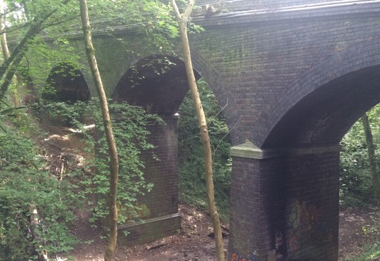
In 1901 an additional branch line opened linking the railway near St Fagans with the existing Rhymney Railway around Llanbradach. The ’Llanbradach Branch’ line included a tunnel through Garth Hill to the north of Cardiff and the Walnut Tree Viaduct, a 470m steel lattice bridge built 37m above a gorge in which ran the River Taff, Taff Vale Railway, Rhymney Railway and A470 Road (then a minor route from Cardiff to the Valleys).
The TVR’s concerns about increased competition were accurate, in 1890 Barry Docks were only handling one third the amount of coal the nearby Cardiff Docks were handling but by 1914 its total coal exports were more than that of Cardiff and Penarth docks combined.
The Cardiff Railway Company
The opening of the railways would ultimately lead to the demise of the canals. Despite the Glamorganshire Canal proving profitable for a further 20 years, ironworks closures in the 1970s combined with increased competition from railways led to the Canal network being sold to the Marquis of Bute in 1885. Despite originally investing in the Cardiff-end of the canal, the Marquis had ulterior motives for the acquisition.
The Marquis owned several coal mines in the Rhondda Valley and was growing increasingly frustrated with the TVR’s monopoly on coal transportation affecting his own profit margins. In a bid to offer increased competition to the TVR, the Marquis formed the Cardiff Railway Company in 1897 with the aim of filling in the existing canals and converting them into railways. While that plan never came to fruition, the Marquis received powers via an act of parliament to construct a new railway line connecting the existing TVR line south of Treforest Station with the RRC line south of Heath Halt.
Construction started in 1898 linking Heath with Coryton and on to Tongwynlais and Glan Y Llyn via a short tunnel; the final section connecting into Treforest took considerably longer and proved highly controversial. The TVR opposed the connection into the new network, viewing the competitor as a significant threat to its turnover. The TVR tried a number of tactics to block the junction including purchasing a strategic strip of land to the South of Treforest station and temporarily blocking the construction of a bridge which was required for the new railway cross the river Taff. Officially the TVR’s objections were based on safety concerns due to the proposed junction’s proximity to an existing junction with the Barry Railway just a few metres down track.
Despite numerous protests, the new junction opened on May 1909 with the running of the first train connecting the two lines. This train would also be the last as the TVR closed and removed the junction almost immediately, again citing safety concerns. Unable to overturn the junction closure, and losing the will to fight the Taff Vale Railway, the Marquis proposed a merger between themselves and the Taff Vale and Rhymney Railway companies. While all three were broadly in agreement of a merger, other local train operators (notably the Barry Railway) were opposed on the grounds of unfair competition.
With no freight to utilise the railway and all talks of a merger dead in the water the Cardiff Railway Company instead turned its attention to passenger services in 1911. The services would run regularly between Cardiff Queen Street and Rhydfelin, stopping at the newly constructed stations at Tongwynlais and Whitchurch with additional halts at Coryton, Rhiwbina and Heath.
Reorganization and decline
Due to the outbreak of War in 1914, all Railways in the UK were placed under Government control to ensure total cooperation and aid military movement. The railways were handed back to their original owners in 1921 in a poor state after 7 years without sufficient maintenance. That same year the Government proposed the passing of the Railway Act 1921, aimed at streamlining the British railway network and reducing unnecessary competition through amalgamation of the 120 operating companies into just four. The act passed and in January 1922, 12 years after a previous merger had fallen through, the Taff Vale, Rhymney and Cardiff railway companies along with the Barry Railway were all brought together under the Great Western Railway banner.
Coal production in South Wales began steadily declining in the early part of the 20th Century. The reluctance of Welsh mine owners to adopt new mechanical practices prior to the advent of World War One resulted in their collieries having the lowest productivity, highest running costs and poorest profit margins in the UK. Over the following decades coal production throughout the UK significantly dropped from a record high of 287 million tons in 1913, to 228 million tons (1968), 128 million tons (1981) and just 17.8 million tons (2009).
Closures
The decline resulted in a number of railway lines becoming superfluous, and with high running and maintenance costs, and the growing popularity and affordability of the car, many lines were closed and removed completely.

Despite only opening in 1911, low passenger numbers led to permanent closure of Tongwynlais station in 1931 although the station building (pictured) would remain in place until the 1960s. The bridge over the river Taff to Treforest station (which saw just the single solitary train in 1909) was finally removed in 1940 with the steel recycled for use during the Second World War. At this point the railway line was cut back to Tongwynlais, 13 years later the line was cut back even further to Coryton. In the early 1970s the majority of the former trackbed and the site of Tongwynlais station disappeared beneath the widened A470 Road.
Barry Railway withdrew services from Creigiau and St Fagans in 1962 and closed the Garth Hill tunnel and Walnut Tree viaduct the following year. By 1965 the railway lines had been removed but the abandoned viaduct would remain in situ until the approval for plans to widen the A470 road necessitated its removal. The iron girders were removed in 1969 before all but one of its masonry piers were demolished between 1970 and 1974 (the remaining pier was decorated in 1977 in honour of the Queen’s Silver Jubilee). A large section of former trackbed to the west of Cardiff was utilised in the 1980s to construct the A4232 Road between M4 Junction 33 and Grangetown.
The Roath Branch of the old Taff Vale Railway was closed in 1966 and the tracks removed to make way for roads and housing. The length of trackbed between the Gabalfa interchange and Roath Park was utilised for the Eastern Avenue dual carriageway; south of Roath Park the line was cleared to make way for housing infill developments. The old Roath Branch sidings lay empty until the 1980s when the Mynachdy estate was constructed over it.

Fewer coal trucks meant Radyr Marshalling Yard was largely underutilised, so much so that the yard was briefly considered for closure as part of the controversial Beeching cuts. Despite a mini renaissance in the late 1960s as a diesel train sidings the yard was closed in 1993, the tracks and associated ‘Llandaff Loop’ were lifted in 1999 and by 2006 the overgrown site (pictured) had been sold to a housing developer.
Apart from the odd ‘football special’ to a halt near Ninian Park (the home ground of Cardiff City FC), the former Penarth Branch line continued to be sparsely used by freight-only traffic until 1987 when it was re-appropriated as a passenger line. The newly named ‘City Line’ included the permanent opening of Ninian Park Station as well as the opening of brand new stations at Waun Gron Park, Fairwater and the newly constructed community of Danescourt just south of Radyr. The Waterhall Branch to Llantrisant was closed and removed in 1980.
Cardiff Parade station was closed by GWR in the 1920s with all passenger services diverted to the nearby Queen Street station; several years later the branch lines into the docks, including the additional bridge over Newport Road, were cleared for development.
Present Day
In the years since the partial line closure, the existing halts at Rhiwbina, Coryton and Heath have been made into permanent stations, while additional stations were added in 1929 (Birchgrove) and 1987 (Ty Glas) and the line is now known as the ‘Coryton Branch’. North of Coryton and south of the M4 a large section of the former trackbed still survives as a nature trail offering some clues to its history.

The original Rhymney line to Caerphilly is still in active use today, although almost exclusively for passenger services with the occasional freight train. The Halt at Heath was made into the more permanent, although rather oddly named, ‘Heath (High Level) Station’ while the halt at Cefn Onn was closed in 1986 and replaced with the new ‘Lisvane & Thornhill Station’ 500 metres to the south. The position of the original halt in such close proximity to the Caerphilly tunnel made it difficult for train drivers to stop in time for waiting passengers – resulting in many delayed journeys through trains having to reverse to collect disgruntled passengers. Remnants of the halt remain today, although access is a little difficult.
The former TVR Marshalling Yard at Radyr was redeveloped in the 21st century into a large scale housing development wedged in between the still operational railway lines. Two bridges which once carried the Llandaff Loop line remain in situ; while the steel lattice span over Ty Mawr road lies derelict and slowly being reclaimed by nature, a section spanning the River Taff was refurbished in 2013 and reopened as a pedestrian and cycle footbridge.

Clues to the former route of the Taff Vale’s Roath Banch are a little harder to come by, as the vast majority has been extensively redeveloped with housing. These photos below show the stone and iron parapets of a former bridge on Penylan Road under which the line passed, as well as a series of disused bridges through Splott which carried the line over the roads and into the docks.


8 notes
·
View notes
Text
Gone but not forgotten: White City & Penarth Road Stadiums
Most Cardiffians will be able to remember two former stadiums in the Leckwith area of Cardiff - Ninian Park and the old Leckwith Athletics Stadium (on which the Cardiff City Stadium is built). What most people don’t know however is that there were two more short-lived stadiums here, the White City Stadium was built in the 1920s and the Penarth Road Stadium in the 1950s.

White City Stadium with Ninian Park visible in the background
The White City Stadium was initially built to accommodate the rapidly increasing popularity of Greyhound racing. Dog racing in Cardiff dates back to 1912 when regular Whippet race meetings were held at Grangetown Athletics Stadium near the Ferry Road/Clive Street junction. This stadium was eventually demolished in 1927 to make way for South Clive Street, but Cardiffians already bitten by the bug wouldn’t have to wait long for the arrival of Greyhound racing.
In the 1920s the Greyhound Racing Association (GRA) acquired a plot of open moorland on Sloper Road opposite Ninian Park School and set about creating a purpose-built greyhound racing arena for the city. The stadium opened to the public in 1928, and was described as a striking venue with raised terraces and white brickwork walls (mirroring those used for the GRA headquarters in West London). Although officially called the Sloper Road Stadium, and sometimes confusingly referred to as Ninian Stadium, it was colloquially known as the Welsh White City Stadium.
Decline and closure
The stadium never proved as popular as the owners would have hoped. Despite having a 40,000 capacity only 9,000 people showed up for opening night due to poor weather and regular attendances rarely exceeded 20,000 despite the track hosting the prestigious Welsh Greyhound Derby. Key to the stadium’s failure was the recently opened Greyhound track at the more conveniently located Arms Park, installed by the owners in 1927 to increase revenue at the stadium. Ultimately the Arms Park's better location and superior facilities would result in the Derby moving there permanently following the end of the Second World War
To increase their own revenue streams, the White City Stadium decided to cash in on the Australian Speedway craze and began hosting regular races. Despite initially getting attendances of over 25,000, the novelty of the internal combustion engine eventually wore off and fan numbers started to dwindle. In 1937, just 9 years after completing the stadium, the GRA decided to cut their losses and sold the venue to a local steelworks company for recreational use. After the war the Stadium hosted events sporadically until its final closure in 1954.

Penarth Road Stadium next to the Barry Railway and River Ely
Speedway enjoyed a brief renaissance in 1951 with the Cardiff Dragons speedway team and the opening of the Penarth Road Stadium, built on a former rubbish dump between Penarth Road and the embankment for the Barry Railway. This spell proved even more brief than the first and by 1953 the Dragons had been disbanded. The stadium was also home to one disastrous season of Rugby League. Despite an initial attendance of 2,500, just 199 people saw the Cardiff Rugby League team play Workington in 1952. The Rugby League experiment was also deemed a failure, and with no takers for the stadium it was closed in 1953 just 2 years after opening.
Redevelopment
Penarth Road Stadium was eventually handed over to developers in 1969 and the site was cleared to be replaced with industrial units and car showrooms. Meanwhile, the White City Stadium lay derelict until 1981 when the site was purchased by property developers and cleared to make way for the City Gardens housing estate.
Modern day
If you went looking today you wouldn’t find much evidence that there were ever any stadiums in this area, aside from an industrial back lane off Penarth Road called Stadium Close.
Further reading and references
Mortimer, D. (2013) Sporting death. http://dicmortimer.wordpress.com/2013/02/09/sporting-death/
Flower, P. (year unknown) Rugby League Second Division. http://peterflower.tripod.com/table.htm
The aerial view of the White City stadium is from the Britain from Above website, full photo available here:
http://www.britainfromabove.org.uk/image/wpw029426
The aerial view of Penarth Road Stadium belongs to Peter Lee.
0 notes
Text
Gone but not forgotten: Ely Racecourse

History
Horse racing in Cardiff first started in 1782 when the 2 mile Mansel-Talbot Cup was held in Heath Park - it would be another 70 years until the creation of a purpose-built facility.
In 1855 Ely Racecourse was established on open countryside to the west of Cardiff near the River Ely and the South Wales Mainline, with the first race meeting being held on 30th May. Within 10 years the Cardiff Races at Ely were a regular feature of the racing calender, attracting crowds of over 20,000 at a time.
The sport's popularity in Wales led to the creation of the annual Welsh Grand National, the first in 1895 was watched by over 40,000 people many of whom didn't pay for entry after charging the entry gates and overpowering the stewards.
Such was the racecourse's popularity that it needed to undergo regular improvements and expansion; the first improvements in 1897 saw the doubling in size of the paddock and the addition of dressing rooms, weighing rooms and a press box. Further improvements were undertaken in 1910 and again in 1921 with the addition of an extra 300-seat stand, hospital and catering facilities.
Decline
Attendance figures began to steadily decline in the early 1900s as the track failed to compete with the financial clout of the other more established racecourses. Despite increasing its prize money, Ely failed to attract the big name jockeys and thus failed to attract capacity crowds.
In 1937 a fire swept through the grandstand, reducing the entire timber frame structure to ash in under an hour. A temporary timber frame replacement stand was hastily erected to allow the venue to host the Easter weekend meeting. Over the next two years the council debated a number of plans to replace the Grandstand, but none came to fruition.
The final race in Ely was run on 27 April 1939, won by Grasshopper, ridden by Keith Piggott (father of Lester Piggott). After closure the Welsh National was relocated to the recently opened Chepstow Racecourse and the weighing scales and other memorabilia were auctioned off, the racecourse buildings cleared and the land turned over for use as a public park.
Let the train take the strain
Spectators would traditionally go to the races on the train, the close proximity of the South Wales Mainline meant the closest point of connection (Ely Main Line Station) was less than half a mile to the North of the Racecourse.
On the day of race meetings it was not uncommon to see special train services run from West Wales, Bristol and even Birmingham direct to Ely station. The station also had an adjacent stables and coach house allowing competitors and their horses to travel direct to the racecourse.
The station was removed in 1963, one of the thousands which were closed on the advice of Dr Richard Beeching in his controversial report into the state of Britain's Railways.
Modern Day
Today all evidence of the racecourse has gone and the site is now home to a number of football and rugby pitches. A housing estate to the north of the field does pay homage to the former stadium, with streets named after some more familiar British racecourses: Ascot Close, Aintree Drive and Epsom Close.
Further reading and references
People's Collection Wales - Ely Racecourse: http://www.peoplescollectionwales.co.uk/node/382885
Greyhound Derby - Cardiff Racecourse:
http://www.greyhoundderby.com/Cardiff%20Racecourse.html
Lee, B. (2010) 'A great race which was first run in Ely in 1895' WalesOnline: http://www.walesonline.co.uk/news/local-news/brian-lee-great-race-first-1877935
Lee, B. (2005) "Cardiff's Vanished Racecourse" Western Mail, April 30
1 note
·
View note
Text
Gone but not forgotten: Creigiau Railway Station

Although part of Cardiff, the village of Creigiau is almost entirely disconnected from the city with no regular bus service and currently no train station. This may be all set to change in the next 5-10 years though if controversial plans to reopen its former railway station go ahead.
Creigiau Railway station was opened in 1896, situated on the old Mainline (Trehafod to Cadoxton branch) of the Barry Railway between Efail Isaf and Wenvoe.
During World War II the station was used to transport American troops injured in the Normandy landings to the nearby Prince of Wales Hospital in Rhydlafar. Following the end of the War and the closure of the hospital in 1953, passenger numbers at the station began to drop. The station was finally closed in 1962 and the existing tracks were removed.
The station was situated to the west of another railway line, the ‘Waterhall Branch’ of the Taff Vale Railway (TVR). Opened in 1886 it was used to transport materials from the nearby Creigiau Quarry down to the Cardiff docks until its closure in 1980. Despite only being 100 yards from each other at their nearest point, these two railway lines were not connected and the TVR line had no station as it was not available for public use.
Present Day

In the years since the closure of the station and dismantling of the railways, large scale housing developments in this part of Cardiff have been limited. As a result it is possible to find both platforms of the station (albeit very overgrown) as well as two humped railway bridges which used to carry the lines under the aptly-named Station Road and between a row of cottages called Station Houses.

In Creigiau the former track beds are popular with dog-walkers and joggers, it is possible to trace the former routes beyond Creigiau using Google Maps. The former Barry Railway line extends as far as Junction 33 of M4, although beyond this a large section was built over in 1985 to form the Capel Llanilltern to Culverhouse Cross section of the A4232 (Cardiff ‘Ring Road’). The TVR line has not suffered the same fate and can be traced almost uninterrupted (see 'Future' section) from Creigiau to where it used to connect to the existing City Line between Llantrisant Road and Pwllmelin Road.
Future
In December 2012 a business lobby group put forward a proposal to Cardiff Council to create a ‘Crossrail’ network linking a new station in St Mellons in the east of Cardiff with a reopened Creigiau Railway Station in the west. The £200m project is deemed “essential” to improve transport links and ease traffic in the capital ahead of a predicted major expansion of the city.

With the former line constructed over, one solution would be to create a new station on the largely intact (albeit overgrown) TVR line. This would give the option of providing additional stations in the Pentrebane area (which is due to expand by over 4,000 houses by the year 2026 under Cardiff Council’s Local Development Plan) and near Rhydlafar. Reopening this route would create a new spur off the existing City Line between Fairwater and Danescourt, although this would probably require the purchase and demolition of a number of houses in Fairwood Close and Kirton Close which were built on or close to the former TVR line.
Local Councillor Neil McEvoy started a campaign in April 2014 to prevent the expansion of the city, including the reopening of the railway line and demolition of the aforementioned houses.
Further reading and references:
Wikipedia, Creigiau Railway Station: http://en.wikipedia.org/wiki/Creigiau_railway_station
Cardiffians.co.uk (2010) The history of the suburb of Creigiau: http://www.cardiffians.co.uk/suburbs/creigiau.shtml
Dicmortimer’s Blog (2012) Waterhall and Back: http://dicmortimer.wordpress.com/2012/08/17/waterhall-and-back/
M & G Barry Consulting (2012) A Crossrail for Cardiff? http://www.mgbarryconsulting.com/docs/31122012081634.pdf
1 note
·
View note
Text
Spotlight: Captain Henry Morgan
Morgan depicted in the 1888 'Pirates of the Spanish Main' card game
History
Captain Morgan’s life is shrouded in myth, mystery and misinterpretation. While no official account of his birth has been reliably recorded, it is believed that he was born in 1635 in Llanrumney (then a small village in Monmouthshire just outside Cardiff). His father Robert Morgan was squire of Llanrumney Hall where a young Henry is believed to have grown up.
The earliest record of his existence came in 1655 as part of an expedition by Lord Protector Oliver Cromwell to capture Jamaica from the Spanish, he was already believed to be in his 20s. There is also some debate about how he came to be in the Caribbean at that time. Some accounts say he was kidnapped from Bristol and sold to a Barbadian plantation owner before escaping to join Cromwell's expedition. Another report says that he joined Cromwell voluntarily before working his way up to position of junior officer.
Once in the Caribbean, Captain Morgan looked to exploit the on-going war between England and Spain and set about invading largely Spanish-controlled areas of the Americas. In 1668 the Captain assembled a fleet to invade the Cuban city of Puerto Principe, this was subsequently followed by invasions of Porto Bello in Panama and the gold-rich city of Cartagena in northern Columbia. The Venezuelan city of Maracaibo proved the sternest test of Morgan's tyranny in 1669, but the 1670-71 invasion of Panama City proved his most infamous.
Unbeknown to Captain Morgan and his crew, their invasion of Panama took place during a period of peace between England and Spain following the signing of the Treaty of Madrid (1670). The treaty outlawed English piracy in the Caribbean in exchange for Spain's acknowledgement of Jamaica's sovereignty. Morgan was deported to England in 1672 to face trial for his actions, although he arrived the following year to a hero's welcome after relations with Spain had once again deteriorated. Rather than face trial, Morgan was knighted in 1674 by King Charles II and appointed Lieutenant Governor of Jamaica.
Morgan stood down from the role a year later but enjoyed a second spell as Governor in 1678. His third spell as Governor two years later was abruptly ended in 1682 when he was suspended from the Jamaican government after exaggerated stories of his exploits in the Caribbean were published by one of his former crew Alexandre Exquemelin.
RUMOUR: Exquemelin's book 'De Americaensche Zee-Roovers' (English: Buccaneers of the Americas) is widely believed to be where the tales of Morgan as a cut-throat bloodthirsty Pirate first originated.
Morgan successfully sued the author for slander the following year and had a portion of the book retracted, but he had to wait until 1688 to have his suspension from the Jamaican Government overturned. He died in August of the same year following a period of ill health where he is believed to have suffered from hydropsy and tuberculosis. He was given a hero's burial at a cemetery on the Palisadoes strip east of Kingston Harbour, but four years later an earthquake devastated the Jamaican port and the cemetery fell to the sea floor.
Captain Morgan Rum
In 1944 Canadian distillery Segram began using the Captain Morgan name to promote its new Jamaican Rum. The rum has a particular relevance to fans of Cardiff City FC. In 1960 the distillery agreed to pay the club £300-a-year to rent the recently-constructed ‘Bob Bank’ roof at Ninian Park. The distillery, most likely aware of the Captain’s links with the city, used the roof to advertise the rum with the catchphrase ‘The Right Rum For Today’s Taste’.

Despite only taking out a three-year lease, the advert remained in situ until 2001 when it was replaced by the branding of budget supermarket chain Hyper Value. At 41 years this was believed to be the longest serving advertisement at any British football ground (and at an average of just over £7 a year almost certainly the best value for money!).
Modern day legacy
Despite the ongoing disagreement surrounding the Captain's birthplace, the Cardiff district of Llanrumney continues to claim him as one of their own. On the Llanrumney side of Newport Road there is a pub known as the Sir Henry Morgan, while Llanrumney Hall previously operated as a pub decorated with various memorabilia alleged to have belonged to the Morgan family. Today the Hall is owned by Cardiff City FC director Steve Borley who plans to convert it to a multipurpose venue, including a cafe/bar, community hall and nursery.
Captain Morgan Rum is still widely available throughout Cardiff, Jamaica and the majority of the western world.
Further reading and references:
Guttmna, R. (Oct 1991) The Pirate who invaded Panama in 1671. Military History, http://www.historynet.com/henry-morgan-the-pirate-who-invaded-panama-in-1671.htm
Tortello, R. (no year) Henry Morgan: The pirate king
http://jamaica-gleaner.com/pages/history/story0038.htm
Captain Henry Morgan, Wikipedia
http://en.wikipedia.org/wiki/Henry_Morgan
Ossian, R. (no year) Henry Morgan, thepirateking.com
http://www.thepirateking.com/bios/morgan_henry.htm
Urban75.org (30 November 2011) The 41 year reign of the Captain Morgan Rum advert at Ninian Park, Cardiff http://www.urban75.org/blog/the-41-year-reign-of-the-captain-morgan-rum-advert-ninian-park-cardiff/
The trading card image was discovered on this website:
http://tommytopps.wordpress.com/category/pirates-of-the-spanish-main/
4 notes
·
View notes
Text
Spotlight: Sunday drinking in Wales
History
In 1880 William Gladstone's Liberal Party defeated the incumbent Conservative Party to assume power in the UK. The party was heavily influenced by a number of prominent Nonconformist Christian sponsors who opposed the sale of alcohol on Sundays.
This opposition led to the passing of the Sunday Closing (Wales) Act 1881, banning the sale of alcohol in Welsh pubs on the Sabbath. A similar albeit separate act for England was rejected in Parliament, It was a historic moment as the act became the first since the union between England and Wales in the 1540s which applied only to Wales and would ultimately lead to more powers being devolved to the Principality in the future.
Despite the majority of the Welsh people belonging to Nonconformist Chapels there were a dissenting minority who opposed the law, seeing it as an attempt by the Government to control their behaviour. As with any law there were ways around it, if you knew how...
Sunday drinking in St Mellons
One anomaly of the act is the exclusion of the county of Monmouthshire. Although it is seen as part of Wales today its status between the 16th and mid-20th centuries was ambiguous, only being formally decided following the passing of the Local Government Act in 1972.
The route of the Rhymney River was accepted as the boundary between the historic counties of Glamorgan and Monmouthshire; this meant that St Mellons, to the east of the River, was actually in Monmouthshire and therefore exempt from the Sunday trading laws.
St Mellons was merely a minor village along the Roman Road between London and Cardiff. Its history as a stop-off point for weary travellers (as a precursor to the modern day motorway service station) meant it already had a number of well-established public house hotels, namely the Bluebell Inn, Fox and Hounds, Star Inn and White Hart Inn (recently renamed the Coach House). This wealth of choice, combined with its close proximity to Cardiff, made it the ideal destination for Cardiffians to wet their whistles on the Sabbath.
This loophole was exploited by Cardiff residents for 40 years until the introduction of wartime legislation in 1915 led to the inclusion of Monmouthshire in the Act.
Hotel de Marl, Grangetown
One other notable exception to the legislation was private "members only" men's clubs - in these establishments men were allowed to consume alcohol on the Sabbath provided they weren't paying for it. This led to large growth in the number of workingmen's clubs throughout the mining towns of the Valleys (many of which are still in operation today).
It was also a loophole exploited by a group of men in Grangetown who established a club on land at the corner of Penarth Road and Sloper Road. The club, known as 'Hotel de Marl' comprised simply of a keg of beer and a hole in the ground to collect the membership fee. The hole in the ground would ultimately become a large pit as the club grew in size (photographed at the top of the page).
The men were taken to court in April 1893 accused of breaking the Sunday trading laws, but the judge ruled that although 'crude' the hole in the ground did constitute a working men's club and it was allowed to continue. The coverage in the local press led to an increase in membership and soon crowds of over 400 would regularly gather at the newly carpeted Hotel de Marl.
Although never officially closed the club was forced to move after landowner Lord Windsor banned the group's activities after receiving reports of antisocial and unruly behaviour. The club was forced to move to Canton Common and then on to a plot of land just off Clare Road.
Repeal
The act would remain in force for 80 years until it was repealed in 1961, this led to referendums in the Welsh counties. Although Cardiff and other more "urban" areas agreed to the immediate reintroduction of Sunday drinking, some rural areas decided to keep Sundays "dry" - in the case of Dwyfor in Gwynedd until as recently as 1996!
Further reading and references:
BBC News (4 August 2011); 130 years since Sunday drinking was banned in Wales: http://www.bbc.co.uk/news/uk-wales-14136013
Wikipedia; Sunday Closing (Wales) Act 1881 http://en.wikipedia.org/wiki/Sunday_Closing_%28Wales%29_Act_1881
Grangetown Online History; http://188.65.112.140/~daftscou/steve/Twenties2.htm
1 note
·
View note
Text
Gone but not forgotten: St. Mary's Church

The recently pedestrianised St. Mary Street is one of the busiest streets in Cardiff city centre. Lined on both sides with shops, bars, hotels and restaurants, it is as popular with visitors and tourists as it is with locals. However, you'll be lucky to find someone who knows just where the St. Mary prefix comes from.
History
Robert Fitzhamon, the first Lord of Glamorgan, constructed the Church of St Mary the Virgin in c1100 on marshland near the River Taff. John Speed's 1610 map of Cardiff (pictured above) depicts St. Mary's Church as being constructed in the traditional Norman "cross" style with a bell tower. Expansion of the city of Cardiff led to the expansion and rebuilding of the church in 1175 and in 1180 a "chapel of ease", designated the Church of St. John the Baptist, was opened less than half a mile away on modern day Church Street.
In c.1180 the parish of St. Mary's was ranked as a priory and placed under the pastoral care of the Benedictine monks of Tewkesbury Abbey. By 1190 Cardiff was expanding at such a rate that it was felt necessary to appoint a separate Chaplain to St John's Church; but by 1211 all-but-one of the monks were withdrawn from Cardiff and returned to Tewkesbury. In 1243 St. Mary's and St. John's were split into two separate parishes, and in 1254 St Mary's ceased to be a priory when a Vicar was appointed.
Demise
Flooding of the churchyard from the nearby River Taff was a common occurrence, and keeping back the water was a costly business. The parish suffered a major flood in 1578, causing the major collapse of one of the boundary walls. In January 1607* a tsunami swept up the Bristol Channel causing significant damage in South Wales as well as South-West England. The 'Great Flood' damaged the church, fatally weakening its foundations and causing some walls to fall; there were even stories of corpses being washed away from the graveyard. It is believed that the church was never repaired, possibly through lack of funding, as in 1678 (71 years after the flood) Celtic scholar Edward Lhuyd visited Cardiff and referred to the church as being "in ruins".
The destruction meant that the nearby St John's Church assumed the role as parish church from 1620, but the state of disrepair doesn't seem to have stopped the church being used. Sunday services took place in the ruins until the middle of the 1600s, though thankfully this was stopped many years before the bell tower fell in 1680. The last burial in the graveyard was conducted in 1698 and the last service was held in the roofless ruin in 1701. Shortly after this the site was abandoned and all services were moved to St John's Church.
RUMOUR: A baptism is believed to have taken place in the ruin in 1730, over 120 years after the flood.
Replacement & Redevelopment

A replacement St Mary's Church was constructed in nearby Bute Street in 1843, in a region colloquially known as "Tiger Bay". This site was chosen because of its proximity to Cardiff's thriving dockland as it was built at a time when Cardiff had one of the busiest ports in the world. The church has a pair of identical towers either side of the main entrance, but when it first opened for worship in December 1843 these had not been constructed.
After being abandoned in 1701 the original church was allowed to fall further and further into disrepair, it is unlikely that the flooded land was highly sought after by developers. That changed in 1853 following the completion of River Taff diversion. In 1878 the site was chosen for construction of the new Theatre Royal, the original theatre in Crockherbtown had burnt down the previous year. Prior to construction of the theatre the ruins and graveyard was extensively cleared, removing all traces of St. Mary's Church.
Modern day legacy
With all traces of St. Mary's removed in the late 19th century, there is little evidence today that a church ever existed in the area. Tourists are restricted to a blue plaque on the car park in nearby Great Western Lane, as well as a brick outline on the western facade of the Prince of Wales bar (which occupies the former theatre constructed on the site of the church).
Although no physical evidence of the church remains, the name St Mary's will continue to live on in the nearby St. Mary Street; as already stated it is one of the main streets in Cardiff city centre and used to hold the "honour" of having the highest concentration of licensed premises per square metre in Europe! Dozens of clubs, bars and restaurants but not a Church in sight.
Further reading and references:
* the 'Great Flood' is often referred to as taking place in 1606 as opposed to 1607, this is because under the Julian Calendar (in use at the time) the year started on March 25, not January 1.
D.Morgan, 1995, p85-95 ‘Discovering Cardiff’s Past’
[date and author unknown] 'The City Parish of St John the Baptist Cardiff'
http://sites.google.com/site/stjohnscityparishcardiff/
Michael Disney, "Britain had its own big waves - 400 years" The Times
http://www.timesonline.co.uk/tol/news/world/article408087.ece
2010. Brian Lee, "Book takes us on a tour of city’s lost landmarks" South Wales Echo
http://www.walesonline.co.uk/news/columnists/2010/11/18/brian-lee-book-takes-us-on-a-tour-of-city-s-lost-landmarks-91466-27669240/
6 notes
·
View notes
Text
Gone but not forgotten: Medieval town wall & gates

One of only two remaining sections of the town wall, but where is it?
Medieval towns in England and Wales were often subject to battles and unrest. During these uncertain times it was seen as essential to construct large timber or stone walls to guard your town and its inhabitants from invasion and other unwanted visitors. Cardiff was no different, despite there being very little evidence of it in existence today.
The earliest record of a wall existing around Cardiff was its mention in the 'Brut y Tywysogion' (the Chronicle of the Princes), though the validity of this record is sometimes questioned. The Norman Conqueror, Robert Fitzhamon, is believed to have built the first defence around in Cardiff in 1111, the wall would have been a timber construction with four entrances or gates (one each in the North, South, East and West).
In the 13th Century, with Llywelyn ap Gruffydd (the last King of Wales) advancing on Cardiff from the North-West, the early timber wall was replaced with a more substantial stone one by Gilbert de Clare (7th Earl of Gloucester) in an aid to improve the town's defences.
In the centuries following the Welsh uprising, attacks on Cardiff became far less frequent. While the town wall had served its purpose, it was now becoming a hindrance to the ever-expanding town. Sections of the wall were leased or sold to developers, while the majority of it was demolished.
North Gate
The northern section of town wall was built at a right angle to the eastern boundary wall of Cardiff Castle. Along this section of town wall was the North Gate or Senghenydd Gate, so called because you'd take this route if you wanted to head north to Senghenydd.
A line in the town council's minutes of 5th May 1786 gives permission for the gate and adjacent section of town wall to be pulled down to aid traffic flow. Later that year the gate and wall was indeed removed, but not completely - but more on that later.
East Gate
Constructed on the route of a Roman road and more commonly referred to as Crockerton Gate (or Porth Crockerton in Welsh) on account of the nearby Crockherbtown, it is believed that this was the main gate into and out of Cardiff. The gate is believed to have been a grand stone-built structure of three arches, possibly suggesting Roman-origin (or at least Roman-inspired design)
It is believed that the structure survived the invasion and attacks by Owain Glyndŵr in 1402 and 1404, and despite being restored in the 1430s it was noted as being in a serious state of disrepair by the mid-16th Century. So little of the gates remained in fact that they were often referred to as simply "the pillars".
The town of Cardiff had been steadily expanding throughout the 18th Century and was now busier than ever, the remnants of the gate were beginning to be a hindrance. In 1781 it was decided that the ruins would be removed completely to aid the flow of traffic into and out of the town. The demolition of the gate and wall also removed the only physical divide between Cardiff and Crockherbtown.
South Gate
Sometimes referred to as Shipsgate but more often known as Moor Gate on account of its proximity to the treacherous marshland to the south of the town.
The South Gate was built on land at St Mary Street's junction with Mill Lane. The land was raised up significantly to prevent flooding from the nearby marshland which separated Cardiff from the sea. Although the gate has long gone, the height of the land it was built on remains considerably higher than that around it today.
The South Gate's significant distance from the more built-up areas of the town appears to have saved it from demolition for a number of years; while the other gates were demolished in the 1780s, the South Gate wasn't removed until about 1802. With very little reason to go south of Cardiff, it is believed the gate remained the quietest entry point to the town. A faded plaque on the Great Western public house pays homage to the former gate.
West Gate
It is believed that the first West Gate was constructed by either Robert Fitzamon or Robert (1st Earl of Gloucester) maybe as early as 1111 but certainly before 1184 (local records indicate it was definitely in use by then). The gate was originally a timber construction, though this was upgraded to stone along with the town wall in the 13th Century.
It was referred to as Mill Gate (sometimes spelt 'Myllegate') on account of the two mills which stood just outside the town. It was also known as 'Sentry House' due to the neighbouring building which would have acted as home to the gatekeeper. It's proximity to the River Taff meant access to it from West of the town was via the original Cardiff Bridge.
A council meeting in 1781 decided that it was necessary to demolish the West Gate to aid traffic flow, though the gate is believed to have still been standing in 1799. The realigning of Castle Street appears to have saved the Gate from actual demolition, though by the early 1900s it is known to have fallen into a severe state of disrepair. In 1921 the West Gate was restored to it's former glory and still stands today in Bute Park.
Other Gates
To prevent enemy attacks from the sea, the town wall was eventually extended along the banks of the River Taff. A break in the wall had to be maintained in order for traders and townspeople to gain access to the quay, although this would prove difficult to police. Eventually a gate was installed and given the name Wales Gate before being renamed Blounts Gate in honour of the Gatekeeper.
As it was not one of the original town gates we cannot be certain when this gate was constructed, although it certainly seemed to be in use by the 15th century. Little evidence exists to show the size or design of the gate, in fact very little evidence exists to prove the gate existed at all! One of the few written records of the gate can be found in the council minutes of 1785, where it is ordered that:
"the gate near the Quay called the 'Blunch' or 'Blount' Gate be taken out"
Further down from the quay there was another break in the wall. Known simply as the Gulley Gate, this passage was too narrow for human use and simply allowed rainwater and sewage to flow from the busy Cardiff streets into the River Taff. This route survives today as a road called Golate.
Modern day legacy
The last great section of town wall, which existed near the Hayes, was demolished in 1901 to make way for the new Fish Market building (where the building formerly occupied by Habitat now stands). Today only two sections of the wall still stand, both would have previously been either side of the old North Gate. A small section has been adapted as part of a flowerbed on the North Road side of the Castle (photo at top of article), while across the road (behind 'Bogiez' bar) you'll find the largest remaining section.

On Queen Street, at the site of the East Gate, there are black paving slabs marking the former location of the gate and route of the town wall. A plaque on the nearby Queen's Chambers building explains this, there is also a blue plaque dedicated to the East Gate on the Queens West shopping centre opposite.
RUMOUR: The nearby 'Pillars' restaurant is believed to have been named after the nickname given to the ruins of the gate by Cardiffians.
Although not the original construction, the West Gate is the only of Cardiff's historic town entry points to remain; it can be accessed via the Bute Park West Lodge entrance near the Angel Hotel. Westgate Street was named after the West Gate and was constructed on the former bed of the River Taff after it was realigned in in the 19th Century.

Further reading and references:
D.Morgan, 1995, p78-84 ‘Discovering Cardiff’s Past’
Roese H.R, 2000, Cardiff's Medieval Town Defences
http://web.onetel.com/~herbertroese/Medievalcardiff.html
An excellent website on the history of the gates and walls of Cardiff
'Council Minutes: Extracts from Town Book, no.VI (c.1740-93)', Cardiff Records: volume 4 (1903), pp. 311-351
http://www.british-history.ac.uk/report.aspx?compid=48313
3 notes
·
View notes
Text
Spotlight: Lost Theatres & Cinemas (part 3)

Splott Cinema, Splott
Constructed in Agate Street in Splott, it opened in 1913 with a seating capacity of 750. It was extended and modified in 1920s, but a major refurbishment in in 1930s extended the capacity significantly. Local architect William Wort was commissioned to redesign the cinema following the introduction of "talkies", and the cinema was redeveloped to seat 2,000 people on just one floor. The cavernous interior also featured a number of intimate areas, which naturally proved popular with budding young couples.

Despite being one of the first cinemas built for "talkies", its large interior also made it a prime candidate for conversion to an alternative use. That alternative use became predictable in the early 1960s when the 'Betting and Gambling Act 1960' legalised licensed Bingo halls. It didn't take long before the owners closed down Splott Cinema, only to reopen it as a Bingo Hall in 1961. Despite undergoing many rebrandings, the Bingo hall proved very successful until it finally closed in 2009. Today it is being used as a function venue by the local community.
Ninian Cinema, Grangetown

Built on Penarth Road on the site of two shops, Ninian Cinema first opened its doors to the people of Grangetown in 1913. The building underwent extensive refurbishment in the late 1940s, however this was all undone when a fire broke out on the roof. The subsequent fire and water damage caused was enough to close the building for a year, eventually reopening its doors in 1950.
The cinema closed in 1972 and the predictable conversion to a bingo hall soon followed, but this was short-lived and by 1977 it had been converted into a post office. After spending a brief period as a furniture warehouse it was purchased by J.D. Wetherspoons, although plans to add another former cinema to the company's ever-growing repertoire of Cardiff pubs fell through in the early 21st century. Today the building survives in all its 1950s glory. Its most recent use? A shop! The very thing that was demolished to build the cinema in the first place.
The Gaiety, Roath
Built on the busy City Road not far from the area colloquially known as "Death Junction", the Gaiety Grand Cinema first opened to the people of Roath in 1912. The venue's facade featured a pair of twin domes either side of the main entrance, inside they could seat up to 800 people and would often show repeats of thrillers and westerns previously shown at city centre screens.
Ownership of the cinema transferred to the SCC in 1930. In 1934, with the help of William Wort, seating was almost doubled to over 1,500 with the addition of a new balcony; that same year the "grand" was dropped from the name and it became known simply as the Gaiety Cinema.
Falling ticket sales led its closure in early 1961, but by July it had reopened as a bingo hall - by September it would became the first bingo hall in the city to open 7 days a week. Although the building changed hands between a number of companies, bingo use continued until "eyes down" was called for the last time in 1998. The building remained vacant for a number of years until it enjoyed a brief renaissance in the early 21st century as a bowling rink, Spin Bar & Bowling survived for 5 years before closing in 2006.

Today this beautiful but grubby building still carries the Spin branding, it sits as a crumbling reminder to cinema's heyday with no sign of a takeover or some much-needed TLC.
Tivoli Cinema, Llandaff North
In 1914 a small cinema was constructed on a site adjacent to the Glamorganshire Canal and Station Road in Llandaff North. Originally called the Royal Cinema, it was renamed the Llandaff Cinema in 1924 but was forced to close in 1930 after being damaged by a fire. The site was acquired by the SCC who commissioned William Wort to design a replacement building. The Tivoli Cinema opened to the public in 1935 with a capacity of just 500 people, making it the smallest owned by the Circuit.
Although ticket sales never set the world alight (except for Saturday mornings when a child ticket was tuppence), the cinema survived until 1958 when it closed quite abruptly after a showing of The Night We Dropped a Clanger. It appears that the owners found evidence of subsidence in the building, they decided that it wasn't financially viable to repair the building and closed it down instead.
Following demolition of a large section of the building, it was converted into a car garage. Today the site is occupied by a car salesroom and whilst the station road facade is a modern construction of brick and glass, the rear of the building is little changed from the days when it would have housed car chases rather than actual cars. The adjacent Texaco petrol station is known as the Tivoli Service Station.
County Cinema, Rumney
Formerly a district in the neighbouring county of Monmouthshire, the Cardiff Extension Act 1937 was passed in 1938 and Rumney officially became part of Cardiff. In anticipation the SCC had acquired a site atop Rumney hill, on the corner of Newport Road and Wentloog Road and William Wort was commissioned to design a cinema for the east of the town. Rumney's County Cinema opened on Boxing Day in 1939 with a seating capacity of 1,050.

The cinema proved popular right until its closure in 1974, after spending a brief but ultimately unsuccessful period as a joint cinema and bingo-hall. A number of uses were suggested for the disused building including conversion to a snooker hall, but in August 1986 it was demolished to be developed into a block of flats.
Regent Cinema, Ely
The smaller of the two Ely cinemas, the 1,500-seat Regent Cinema on Mill Road first opened in October 1928. Described as a plain and "rather unremarkable" building, it did feature one long flight of stairs up to its entrance - not exactly disabled-friendly. Although originally intended to show silent movies, it had been converted for "talkies" within a year of opening.
The cinema was mooted for closure in 1960 as part of a cost-cutting measure by the owners, however the Regent survived and the nearby Avenue was closed instead (more on that later). The inevitable conversion to a part-time bingo hall followed in 1961, but within a year it had returned to full-time cinema use after a number of police complaints. In 1968 bingo returned full-time and remained until its closure in 1996. Shortly after closure the building was demolished after suffering significant damage from a suspicious fire, a nursing home now occupies the site.
Avenue Cinema, Ely
Built on Cowbridge Road West near the newly-constructed council estates of Ely, the Avenue Cinema would be the last purpose-built cinema in Cardiff for over 30 years! Commissioned by the SCC, and designed by J.D. Wride instead of resident circuit architect William Wort, it opened in 1940 with a capacity of 1,150.
In 1960, with ownership transferred to the Jackson Withers Group, ticket-sales were at an all-time-low and it was felt necessary to close one of their cinemas in the west of the city. Despite being bigger, newer and far more accessible to customers, it was the Avenue that was closed instead of the Regent. The reasons for this appears to have been influenced by the retail needs of the owners' other business venture, James Howell's Department Store, and the unexpected arrival of a competitor. In 1960 Cardiff's first supermarket opened on the Hayes run by local business-rival Solomon Andrews, Howell's directors were keen not to miss a piece of the action and they too opened a rival supermarket close by. The venue chosen for their latest retail venture was a warehouse currently housing the car sales arm of Howell's company, which was far too profitable to close completely. With no other suitable city centre site to relocate the car showroom, the Avenue Cinema's site alongside the busy A48 route between Newport and Swansea was seen as ideal. An earlier decision by the owners to close the Regent cinema was overturned, and instead the Avenue was closed and converted into a car salesroom - at least being spared the indignity of becoming a bingo hall!

In recent times the building has been adapted for a variety of uses; the upper floor is used as a dance studio and the ground floor has been converted to a video-rental shop, bringing the building full-circle back to films.
Canton Cinema, Canton
One of two cinemas built on Cowbridge Road East in 1913, the Canton Cinema opened the public in 1914. It was regularly thought of as the "classier" of the 2 Canton cinemas, a fact apparently reflected in its ticket prices. The building was expanded in 1933 after the demolition of two adjacent houses, increasing its capacity to almost 1,600 people. Despite suffering minor damage from an air raid in 1941, its popularity remained high throughout the inter-war years.

In 1960, despite good ticket sales, the cinema was abruptly closed following an evening showing of Strangers when we Meet. In the years that followed the internal space was divided up and a ballroom was created at first floor level, this was created to house one being relocated from beneath the Capitol Cinema in the city centre. With the growing trend of cinemas becoming bingo halls, it is quite refreshing that the ground floor unit of this building actually became a supermarket. It remains as a supermarket today despite changing hands a number of times; the ballroom above still exists but has been vacant for a number of years.
The Coliseum, Canton
Meanwhile, a brisk 5 minute walk away from the Canton Cinema stood the suburb's other cinema; The Coliseum. Affectionately nickname "the colla", it first opened in January 1913 and regularly played "second fiddle" to its classier neighbour. Patrons often complained about the conditions of the cinema, primarily about the condition of the seats and the quality of the B-rate movie being shown.
Bingo moved in in 1962, but the SCC continued to show films at the Coliseum on a part-time basis until 1986. After a brief period as a full-time bingo hall, the Coliseum closed its doors in the late 1980s. The building was subsequently sold to developers and demolished to make way for the first purpose-built bingo hall in the UK.
Monico, Rhiwbina
(headline photo) Constructed on the corner of Pantbach Road and Ty Wern Road, the 950-seat Monico cinema was opened by the SCC in April 1937. Originally built to serve the growing suburbs of northern Cardiff, the Monico also proved popular with people who lived in the valleys to the north of Cardiff. Shortly after opening the building was daubed in camouflage paint and used as an air raid shelter.
Ownership changed from the SCC to the Jackson Withers group in 1967 before being sold to the Rank Organization in 1976 - but shortly afterwards it was bought by Brian Bull, owner of the Cinema Royal in Barry. Under his stewardship the Monico was able to fend off the rising popularity of Bingo by adapting, the cinema was split into two smaller screens and an electric organ was installed in the larger one. Despite these changes cinema was losing popularity, ticket sales were on a steady decline due to the rise of television and later personal video players.
Despite a brief renaissance in the mid-1990s, valuable custom from the Welsh Valleys began to dry up in November 1999 with the opening of the Showcase multiplex in nearby Nantgarw. In the years that followed, an increasing number of Cardiff residents too began choosing to go to the city-based multiplexes rather than the Monico. By 2003 the Monico's owners Circle Cinemas conceded defeat to the multiplexes and on January 30th the last independently-owned cinema in Cardiff closed its doors for the final time. In the years that followed the site was sold to developers, the cinema was demolished and the lucrative corner site was developed into a block of luxury apartments appropriately given the Monico name.

Plaza Cinema, North Road
The 1,500-seat Plaza Cinema opened on North Road, opposite its junction with Margam Road, in March 1928. It was built in typical Greek revival style and inside offered a level of luxury on a par with all city centre cinemas; it was also one of the first in Cardiff to be equipped for "talkies" from the outset. The cinema's car park, the nearby North Road on-street parking and the proximity to busy bus routes meant it was able to attract patrons from all over Cardiff, such was its popularity in the 1960s that it was able to stave off the bingo revolution.
The 1968 opening of the Gabalfa Flyover would spell the beginning of the end for the cinema, on-street parking was removed from North Road and the sound-proofing in the screen was not sufficient to drown out the constant noise of the dual carriageway outside. Ticket-sales took an immediate hit and continued to decline year after year, ownership changed hands a number of times before eventually being closed in 1981. The building was demolished in 1985, a sheltered accommodation facility now occupies this site.
Clifton Cinema, Clifton Street
One of the lesser-known Cardiff cinemas, the single screen Clifton Cinema opened in 1914 and could cater for up to 800 people. Although acquired by the SCC by 1930, it was not included in advertisements for the company's other venues. The cinema suffered regularly from low ticket sales, and the final nail in its coffin came in the early 1930s when the nearby Splott Cinema reopened following a major refurbishment. By 1932 the SCC appear to have decided to close the cinema and develop it for retail use. The converted building reopened as a Woolworths store, which it remained as for 76 years until the company's demise in 2008. Today it is still in use as a retail unit, operated by Tesco.

Further reading and references
Ribbon of Dreams: Remembering Cardiff's Cinemas - Gary Wharton 1998
The Cinema Treasures website has proved an invaluable resource for this article and it's well worth a visit if you would like to read any more about these, or in fact any other Theatre.
http://www.cinematreasures.org/
Photos of Canton Cinema and Monico scanned from Cardiff Yesterday volumes 11 & 27.
Dic Mortimer's blog post on November 14, 2011
http://dicmortimer.wordpress.com/2011/11/14/the-last-picture-show/
6 notes
·
View notes
Text
What's in a name: Caroline Street

Despite being one of Cardiff's most famous streets, if you were to ask most people the way to Caroline Street you'd probably get a blank look staring back at you. It's a strange indictment that one of Cardiff's most infamous landmarks is actually more well-known by its nickname... Chippy Lane.
Origins of the name
The street was named after Caroline of Brunswick, the wife of the future King George IV. Caroline and George's marriage was turbulent to say the least, as a prince George spent most of the time drunk (including their marriage ceremony) and Caroline was regularly insulted and humiliated by him. Their only daughter Charlotte died after giving birth in 1817, though Caroline did not find out this news for many months as she had been exiled to Italy by George.
One famous story from the time says that in May 1821 George was told of Napoleon's death: "Sire, your greatest enemy is dead!" to which he exclaimed: "Is she? by God!". Three months later Caroline was pronounced dead after falling ill during the night, her universal-popularity ensured her death was mourned throughout the UK.
Lane or Alley?
There has always been a debate over the street's nickname, it appears most locals refer to it as "Chippy Lane", though it seems "Chip Lane" and "Chippy Alley" are also acceptable to certain people. Footballer Craig Bellamy's arrest for an alleged assault on the street in 2010 reignited the debate as the London-based press used the "Chip Alley" moniker. Even celebrities have weighed in on the debate, most recently British comedian Alan Carr and American rapper Snoop Dogg have spoken about it on their Twitter accounts:

The plaice to go for... everything!
In the 19th and early-20th centuries the sheer variety of businesses on the street would have made at an invaluable shopping destination. You could have popped here in your lunch break to get some fruit & veg, have your watch repaired, get fitted for a suit and even buy a set of weighing scales!
In 1876 number 18 was listed as a Funeral Furnishings Establishment run by a Mr. Marshall, while next door number 19 was known as TH Greader Scale & Weighing Machine Makers. Mr J Harding's tailor and outfitters at number 22 only had a door at ground level, their premises sat above Edward Kaltenbach's Watchmaking workshop at number 23.
On the opposite side of the road John Jones ran a Fishmongers and Green Grocers out of number 29, while next door at number 30 Mrs. Bear ran a clothes shop; a newsagent occupied number 31. A few doors down at number 35 was a Grocer & Provision Merchant run by the Legge family, number 36 next door was a drapers run by a David Evans. Mr. J Batten at number 45 was one of a number of boot-makers on the street.
The street was also home to a number of pubs, The Cambrian Hotel was built on the corner of Caroline Street and St Mary Street in 1830 as part of the old Brains brewery. Towards the Hayes The King's Cross Hotel was first built in 1872 and was widely believed to be the oldest gay pub in Wales. The street was also home to The Neptune Inn.
Modern Day
Despite extensive redevelopment of the adjacent Brains Brewery into an upmarket area for restaurants and bars, attempts to modernise Caroline Street have failed to get going. The street is littered with fast food outlets and also features an adult book store, two pubs and a steak house.
The redevelopment of the brewery into the modern day Old Brewery Quarter meant demolition of a number of properties on the north side of the street, including the Funeral Furnishings Establishment at number 18. Today the site is occupied by the Dray Apartments, aptly named after the drayman yard which would have been located between the brewery and the street. Bakery chain Greggs occupies number 23, while number 22 upstairs is currently vacant after spending a short unsuccessful period as a lap-dancing club.
Takeaway restaurants occupy the majority of properties on the south side, breaking only for a pornographic book store at number 33 and a boarded up chunk of wasteland where 34 and 35 once stood. These were demolished following a fire a number of years ago, today the empty space remains boarded up with no sign of any imminent development. Operating out of number 39 since 1954, Dorothy's claims to be the oldest takeaway in Cardiff city centre.
The vast number of takeaways make Caroline Street a popular destination for late night revellers looking for a quick bite to eat before falling into a taxi. As a result the street has become infamous for drunken brawls, not to mention for the sheer amount of litter that can be generated on such a short space of time.
The street is still flanked by a pub at either end; the Cambrian has been rebranded as an Irish-themed bar called Kitty Flynn's while in 2011 the King's Cross was controversially re-branded by it's owners as a gastro-pub called The Corner House. The 137-year-old gay pub was closed in 2011 despite public backing from rugby legend Gareth Thomas and council-leader Rodney Berman.
Further reading and references
Picture of rubbish on Caroline Street is copyright material from Maciej Dakowicz's now infamous "Cardiff After Dark" set on Flickr - well worth a look!
http://www.walesonline.co.uk/cardiffonline/cardiff-news/2011/01/24/caroline-street-sparks-debate-over-its-nickname-91466-28041446/
1 note
·
View note
Text
Then & Now: Bonded Warehouse, Atlantic Wharf
Then (c1920)

Now (2012)

History
Constructed in 1861 it was one of the first warehouses built in Cardiff Docks and was one of the first buildings in the UK to combine a cast iron frame encased by a brick exterior. Designed to classical Greek standards (its width is twice as much as its depth) the upper floors overhang the ground floor, suspended by a series of equally-spaced columns.
Today it has been converted for office use, and given its architectural significance it is perhaps quite relevant that it is home to a firm of architects.
2 notes
·
View notes
Text
Gone but not forgotten: Cardiff's first airport

Cardiff Airport (aside from not actually being in Cardiff) has not always been used for civilian flying, it started life in the 1940s as an RAF base before passenger flights were added in 1954. However, these were not the first passenger flights out of the city; they had actually started almost 20 years earlier - but if not from Cardiff Airport, then where? The answer is Cardiff Airport...
History
Based on tidal fields near Pengam Farm, Cardiff Aerodrome (also known as Splott Aerodrome, Pengam Moors Aerodrome and Pengam Moors Airfield) opened in September 1931. Months of poor weather and an unusually high tide in December that year led to the airfield becoming flooded, forcing the facility to close until April 1932. The airfield suffered regularly from flooding until a man made sea wall was constructed. In the years that followed the site was developed to include offices, a canteen and a number of hangars in the south-west corner.
During the Second World War the airfield was handed over to military use and from 1937 it became known as RAF Pengam Moors. The Glamorgan Auxiliary Air Force were formed in June 1938 using Pengam Moors as a base, military operations meant a halt to civilian flights from the airport. As well as a military base the airport also became a base for the No.43 Maintenance Unit, principally tasked with dismantling and repairing fighter aircraft (specifically Hawker Hurricanes and Supermarine Spitfires).
RUMOUR: It is believed that one unfortunate Spitfire got lost in thick fog above the airport and descended too late, over-shooting the runway and crash landing in mudflats at the eastern end of the runway. Parts of the wreckage could still be buried in the mudflats today!
The airport was handed back to Cardiff Council in January 1946 after military operations had ceased. A number of civilian flights soon resumed flying, though it soon became apparent that the facility was no longer suitable. Ten years earlier the adjacent Pengam Farm had closed and the land was carved up and sold to developers, ending centuries of farming on the land. Huge new housing estates were developed in the 1940s, a number of which backed right on to the airfield.
Relocation and closure
With the population of Cardiff rapidly rising, and civilian flights becoming increasingly popular, it became apparent that airport facilities in the city needed improvement. Pengam Moors' transport links and proximity to the city centre made it a seemingly obvious choice for redevelopment, though its close proximity to high density-housing meant they were unable to schedule night-time flights. Aviation experts had also noted that at 853m the Pengam Moors runway was too short for heavy commercial flight use, and with the River Rhymney to the east and heavy industry to the west there was no room for expansion.
In April 1954 all civilian flights were relocated from Pengam Moors to the former RAF airfield in Rhoose, 6 miles west of Cardiff. Built in 1941 in rural land in the Vale of Glamorgan, RAF Rhoose opened in 1942 and boasted a considerably larger runway and no nearby areas of high-density housing. In the years that followed a new terminal building was built, new flight routes were added and the runway was extended numerous times to cope with larger planes. Known previously as Glamorgan Airport, Rhoose Airport and Cardiff International Airport, today Cardiff Airport caters for up to 1.5m passengers a year.
Site redevelopment
Following the relocation of civilian flights, the airfield at Pengam Moors was closed down and sections of the site were sold off for other uses. Land to the western end of the runway was developed into a secondary school to serve the built-up areas of Splott and Tremorfa, while the northern tip was developed for housing and business use.
The main part of the airfield lay vacant for almost a decade, until 1963 when the Rover car company purchased the site and built two huge warehouses running parallel with the existing runway. The factories were used to build gearboxes for Rovers, and to improve access the existing airport perimeter access road was developed into the aptly-named Rover Way.
The Wind in the Willows
The site had been associated with flying as early as 1905, when Cardiff-born inventor Ernest Willows used the site to create a series of Airships. His first creation, Willows No.1, had its maiden voyage in August 1905 piloted by the 19-year-old Ernest. The 74ft airship took off from the site and circled the city before landing safely after 1 hour and 25 minutes. The ship undertook 5 further flights before being retired, the longest lasting 2 hours.
In November 1909 Willows unveiled the 86ft Willows No.2 and in June of 1910 he managed to fly it across the city and land it in front of Cardiff City Hall. In July Willows flew his airship to Cheltenham before successfully flying 122miles to London in August - a record for a cross-country flight in the UK.
By October 1910 Ernest Willows had relocated to London where he redesigned and rebuilt Willows No.2. The 120ft Willows No.3 was first spotted above White City in London on October 29. Less than a week later the renamed City of Cardiff airship took off from Wormwood Scrubs for Paris, France. Despite dropping the maps overboard and being blown off course to Douai (120miles North of Paris) Willows successfully landed on December 28. The journey made Willows the first person to pilot an Airship over the English Channel at night, as well as the first person to pilot an airship from England to France.
Ernest Willows relocated to Birmingham in 1911 and created two further airships. One of these, Willows No.4, was bought by the Admiralty and became His Majesty's Naval Airship No. 2, before being developed into a prototype for the very successful World War I SS class blimp. Ernest continued to develop airship and balloon technology until August 1926 when, aged 40, he and two other passengers were killed in a balloon experiment in Bradford.
Modern day legacy

Compare this 1965 OS Map with this aerial shot of the area taken in 2010
Today you'd be hard pushed to find any clear evidence that an airfield ever existed here, but those with a keen eye (as well as an unhealthy obsession in aviation) would spot a number of streets carry names relating to the airport and flying in general (Runway Road, Avro Close, De Havilland Way). The industrial estate on Seawall Road was originally built to serve the airfield before being converted for commercial use in the years that followed its closure, a number of the larger warehouses were originally built as airplane hangars.
The Rover factory surrounding the disused runway closed in 1984 and lay derelict until the 21st century when it was developed into a Tesco supermarket. Land to the north of the runway had previously been developed into housing estates, but the majority of the airfield remains as undeveloped wasteland.

The decaying remains of the original runway, looking west from Tesco
The name of Ernest Willows also lives on in the area, the aptly-named Willows High School was built on land not far from where he once owned a work shed. Willows Avenue is also named after the inventor, as well as a J.D. Wetherspoons pub just outside the city centre.
Further reading and references:
Pengam Airport website proved an invaluable tool in research for this article and is well worth a visit: http://www.pengamairport.co.uk/
3 notes
·
View notes