Statistics
We looked inside some of the posts by carto-graphics and here's what we found interesting.
Average Info
Notes Per Post
32
Likes Per Post
21
Reblog Per Post
6
Reply Per Post
5
Time Between Posts
22 days
Number of Posts By Type
Text
17
Last Seen Tumblr Blogs


Fun Fact
When “GIF” was named word of the year in 2012, Oxford Dictionaries U.S.A. credited Tumblr for pushing the word.
Text


#REPOST langleyprepschool Yesterday, our Year 6 pupils at Langley Prep School dived into the world of disaster relief with an engaging Restless Earth workshop!
Led by Jennifer Johnston from the @bcsmaps pupils explored the Japanese earthquake of 2011, honing their cartographic skills. It was a fascinating experience that sparked curiosity and teamwork!💚
Read the full news article in our bio🔗
#mapping #cartography #geography #education
1 note
·
View note

Text

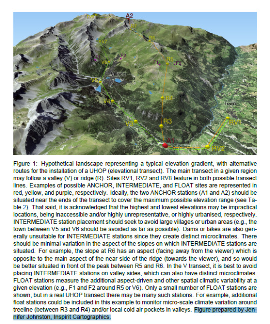
3D modeling of proposed weather stations. Download the full document here https://doi.org/10.48620/77051
2 notes
·
View notes
Text


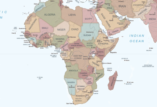
Always lovely when an author you work with gifts you their book and you get to see your maps in real life 💙🗺️
#cartography#maps#custommade#custommaps#inspirit cartographics#historical maps#africa#sudan#egypt#nile river
8 notes
·
View notes
Text

Maplines Summer 2024 is here! I got the opportunity to visit the MapAction disaster relief training event back in June and write up an article. Thanks @mapaction and @bcsmaps
4 notes
·
View notes
Text

Ready for this weekend’s workshop #qgis #gistraining #shetlandislands #inspiritcartographics
0 notes
Text

Coming up this weekend I’ll be giving a GIS workshop to teachers
2 notes
·
View notes
Text


Pretty great to be an observer on behalf of @bcsmaps during the @mapaction annual simulation event. I got to speak to members of their team and partners about their experience creating maps for disaster relief for a write up in the BCS’s Maplines 🚨🗺️
1 note
·
View note
Text


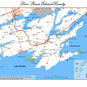
Lots and lots of city maps
3 notes
·
View notes
Text

Hurray to opening the Lewesian and seeing the Lewes Food Market map used again for their ad 🙂🥦
0 notes
Text


Yoho National Park Summer Hikes
4 notes
·
View notes
Text
Happy to be featured as a map publisher on Longitude Maps, purchase your World Shipping routes here
0 notes
Text

Hurray 🙌#REPOST @longitude.maps Exciting News! You can now find Inspirit Cartographics’ “Global Shipping Routes” Wall Map on our website. 🚢
Created from scratch, this colorful wall map is information-specific and artistically crafted. Stunning as décor, visual art, or simply information display, it’s perfect for anyone looking for a gift, something for the wall, or a new place to explore.
Coverage includes major shipping routes, undersea features, mountain peaks, geographic regions, and more!
Major shipping routes include:
The English Channel
Strait of Malacca
Panama Canal
Suez Canal
Bosphorus Strait
Saint Lawrence Seaway
🗺️ Shop the map through the link in our bio!
#inspiritcartographics #trade #shipping #maps #repostios #repostw10
0 notes
Text

Giving a British Cartographic Society Restless Earth workshop up in beautiful Hebden Bridge with a great group of students. Thanks for having us 🙂🗺️ photos by Calder Learning Trust
2 notes
·
View notes
Text

Moraine Lake
2 notes
·
View notes
Text


USA centered world map
2 notes
·
View notes
Text
Yesterday's workshop presenting the British Cartographic Society's Restless Earth workshop
1 note
·
View note