Don't wanna be here? Send us removal request.
Statistics
We looked inside some of the posts by fc-maps and here's what we found interesting.
Average Info
Notes Per Post
3K
Likes Per Post
3K
Reblog Per Post
936
Reply Per Post
10
Time Between Posts
20 hours
Number of Posts By Type
Photo
16
Text
1
Last Seen Tumblr Blogs


Fun Fact
BuzzFeed published a report claiming that Tumblr was utilized as a distribution channel for Russian agents to influence American voting habits during the 2016 presidential election in Feb 2018.
Photo

Population distribution of Texas
by u/delugetheory
189 notes
·
View notes
Photo

Han Dynasty of China Maximum Territory Map, 140 BC-220 AD.
80 notes
·
View notes
Photo

Rough map of the Russo-Ukrainian War front, represented in Ukrainian subdivisions, raions and oblasts.
by u/Migol-16
109 notes
·
View notes
Photo

Minimal map of European rail network.
by @milos_agathon
309 notes
·
View notes


Photo

A shaded relief map of Madagascar.
by @researchremora
148 notes
·
View notes
Photo

Exaggerated relief map of the lower 48.
More shaded relief maps >>
370 notes
·
View notes

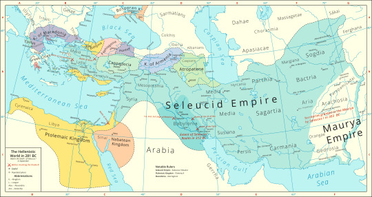
Photo

Greek and Phoenician Colonies in the Mediterranean.
by u/InitialEnthusiasm5
220 notes
·
View notes

Photo
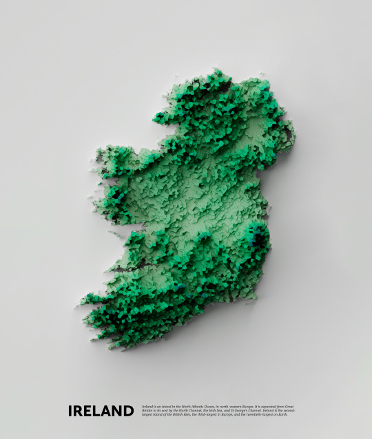
Shaded relief map of the Irish island.
by u/Puzzled-Sherbet-7850
253 notes
·
View notes
Text

This is a classic. (aka How It All Started)
River basin map of the contiguous United States. Colours represent different catchment areas.
Read more and buy prints here. (New website!)
Ko-fi | RedBubble | Etsy
741 notes
·
View notes