
Statistics
We looked inside some of the posts by gdmbrwiththerealcrew2 and here's what we found interesting.
Average Info
Notes Per Post
7
Likes Per Post
7
Reblog Per Post
0
Reply Per Post
0
Time Between Posts
1 day
Number of Posts By Type
Text
15
Last Seen Tumblr Blogs


Fun Fact
Celebrities use Tumblr as well.
Text
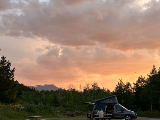
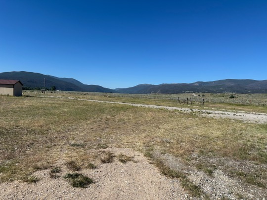
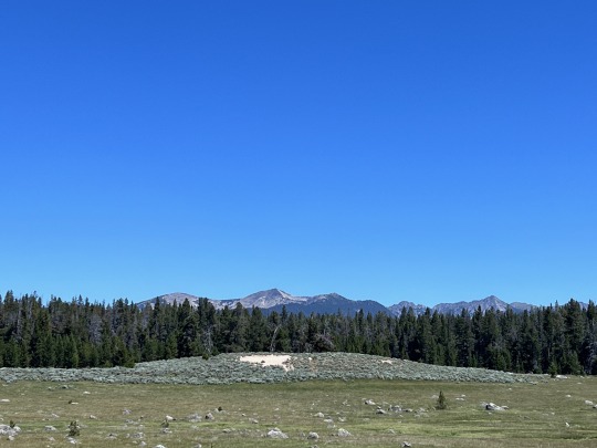
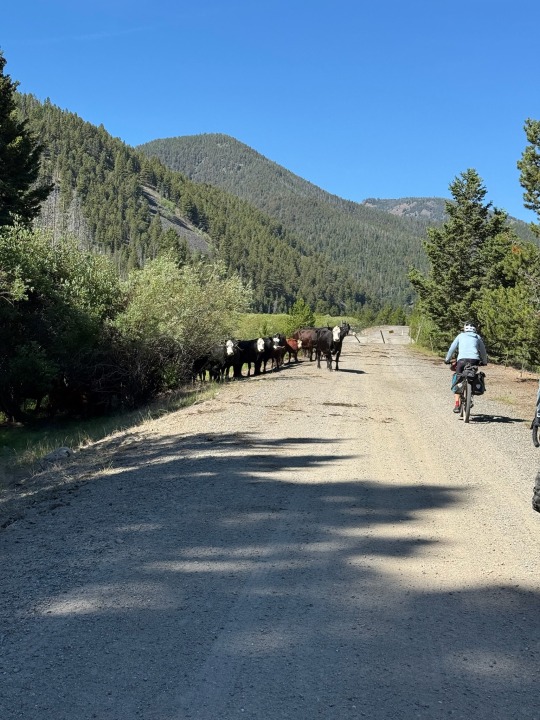
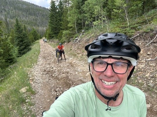
Final Day on the bike - it is good to be finished, I wish we weren’t.
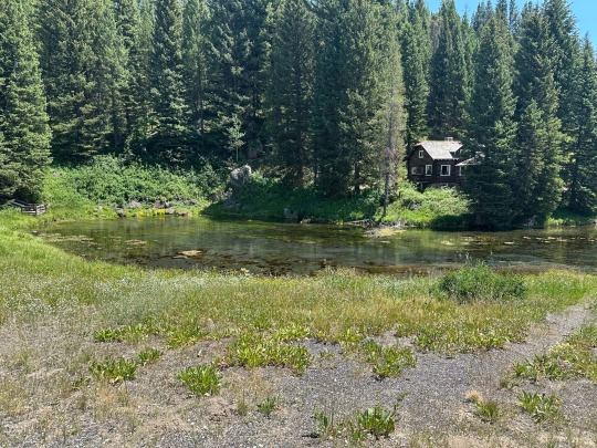
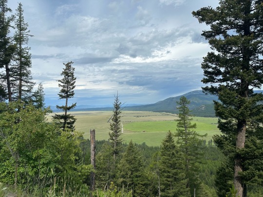
I woke up with the sun to a soaked tent. It rained until about 12:15am then the sky cleared. I got out of my tent before 6:00am and wondered around the campsite before any other campers were out. The sound of the birds, views of Mt Moran, and the occasional blast of sun through the trees made me smile.
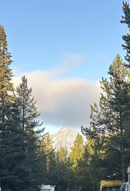
From our campgrounds.
Colter Bay.
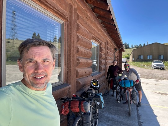
When I got back to our tent site, the guys were stirring. Our plan was to eat breakfast at the restaurant to save time before our 50ish mile ride into Jackson. We decided to leave camp with our tents set up, go eat, then pack and ride all in the hopes of things drying out while we ate.
At breakfast, our server, Amber, told us about seasonal work at the Park. This was her 5th year and her husband’s 2nd. Because he manages the marina, they share a Park-provided cabin and get a food stipend as well as pay. In her first years, she had dormitory style housing which she said wasn’t bad. For her, it’s been an excellent escape from Florida summers.
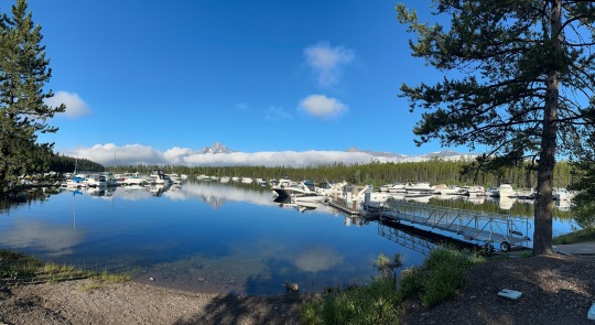
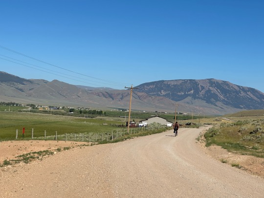
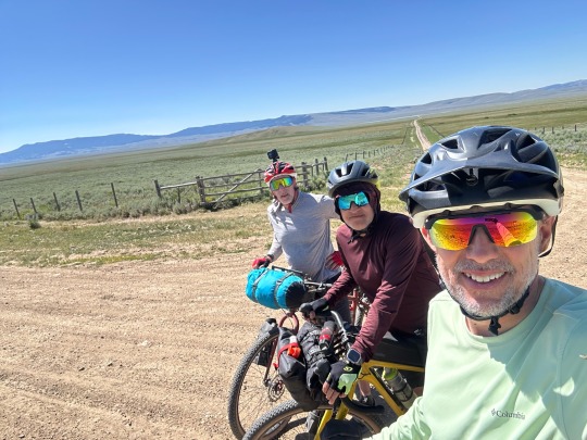
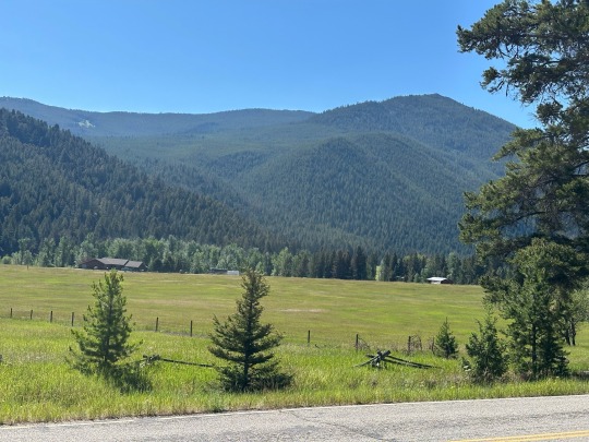
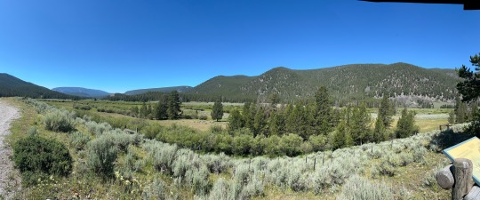
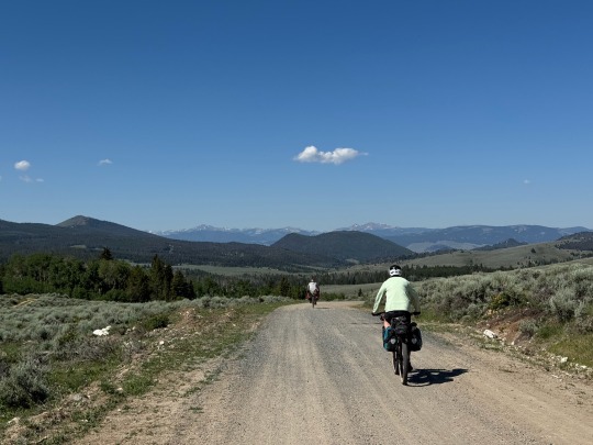
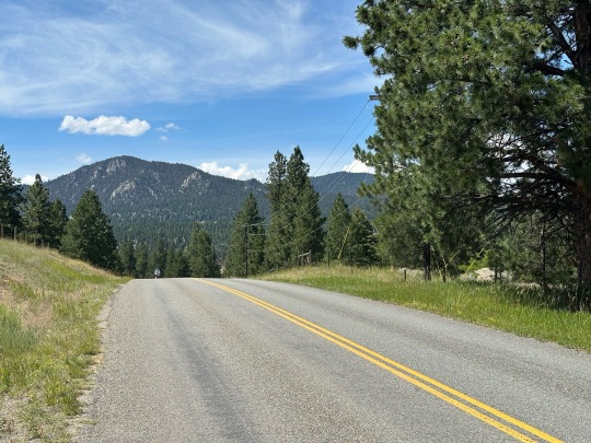
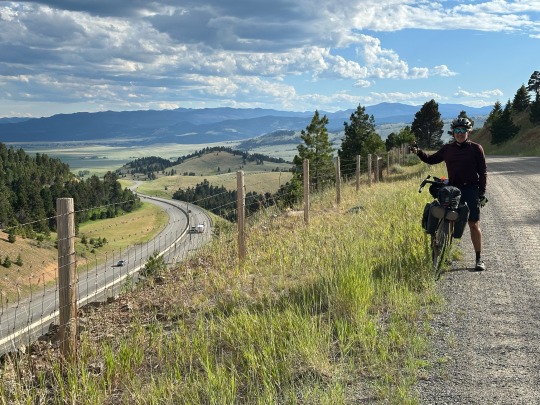
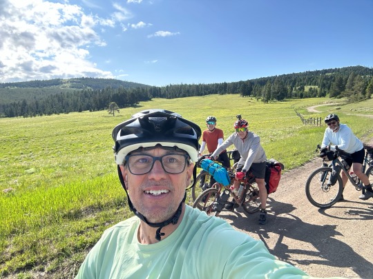
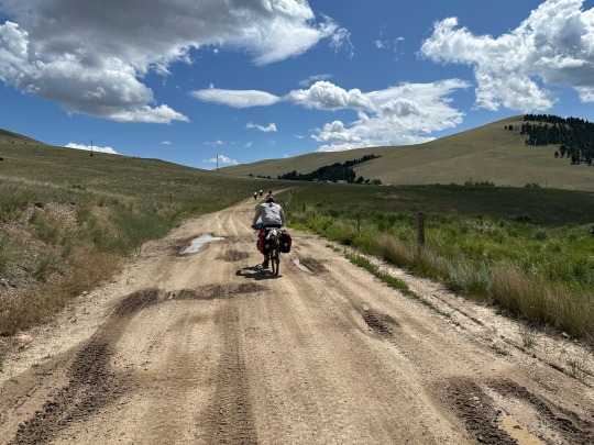
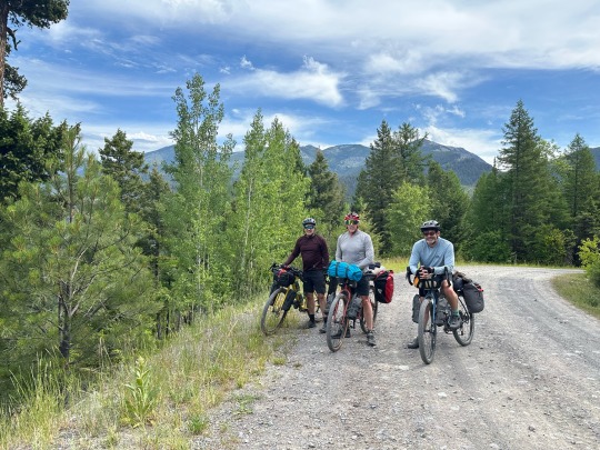
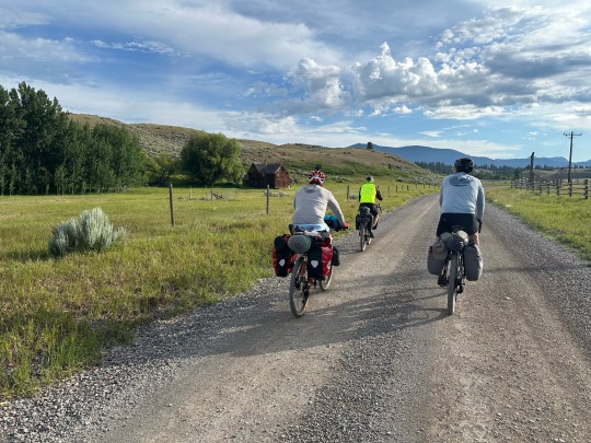
We ended up packing wet gear before we finally rolled out of camp around 9:30am. The whole day would be on roads and bike paths. We didn’t go far before we were stopping to admire the view and take pictures. The majority of our ride was dominated with views of the Tetons. In general, we were on flat roads with a few modest climbs. We were able to crank along at over 17 mph quite often. It couldn’t have been more spectacular.
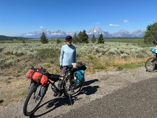
Tetons.
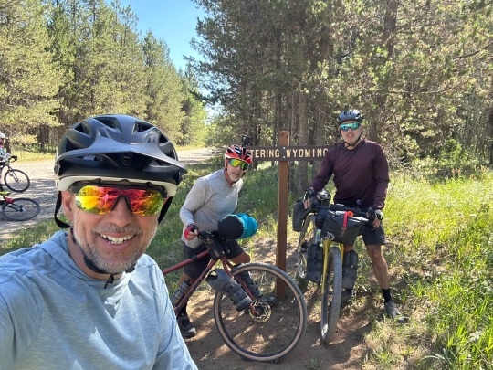
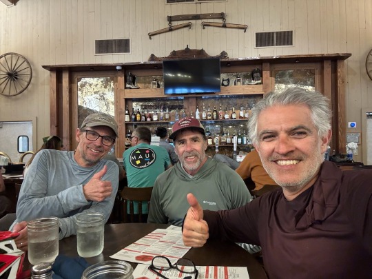
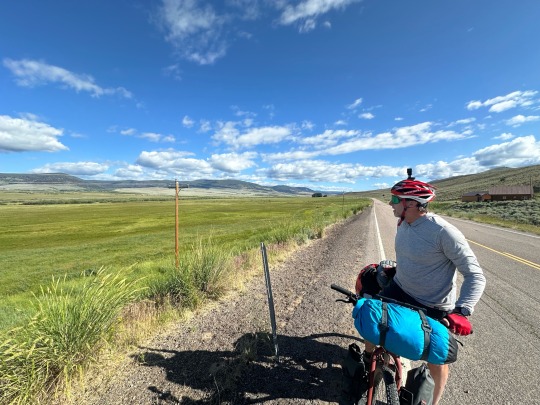
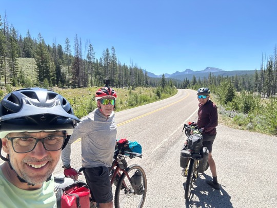
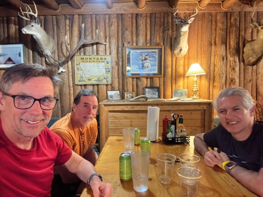
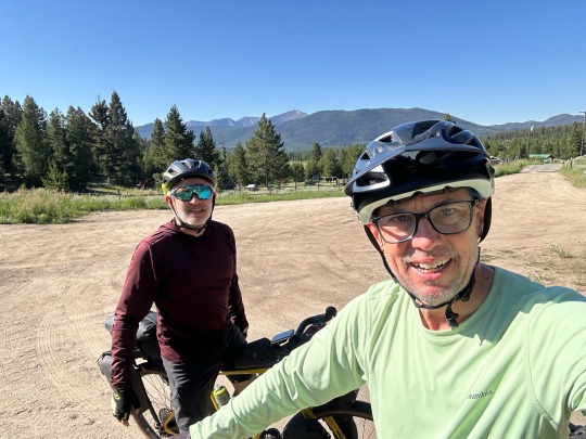
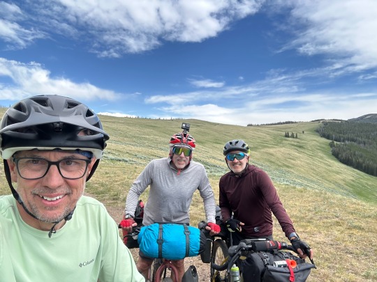
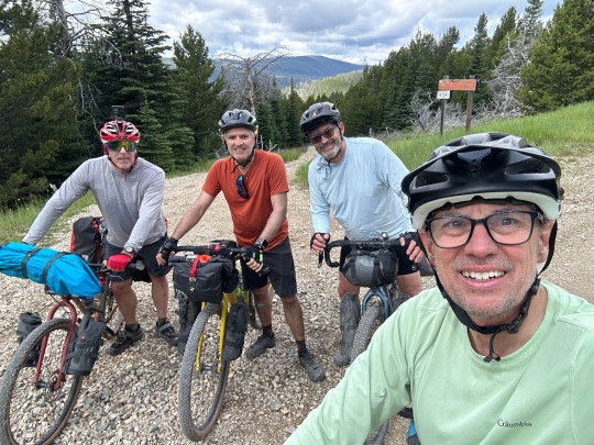
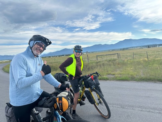
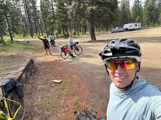
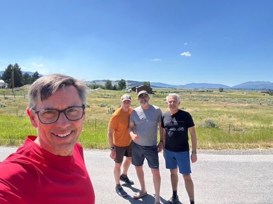
We were hardly a mile from the center of Jackson before we knew where the town was located. The pedal in was along rolling hills that blocked our view of town. We rolled in with the traffic and found our way under one of the iconic elk antler arches. Monica, Jose’s wife, snapped our photo to mark the end of a much enjoyed ride.
The approach.
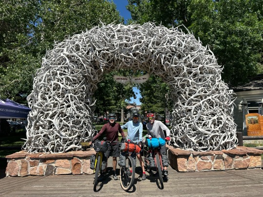
Iconic pic.
The three of us!
Done.
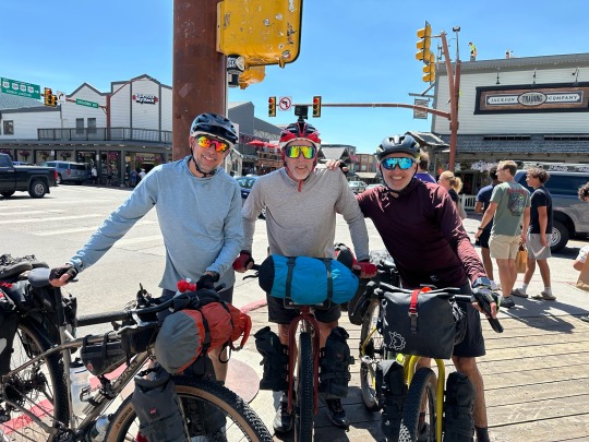
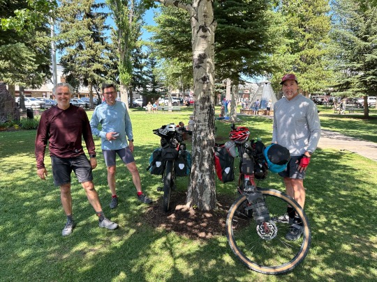
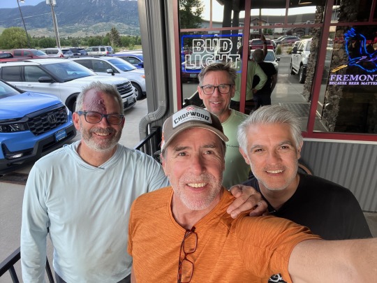
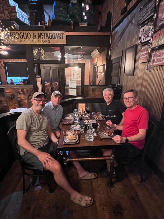
The rest was typical end of trip clean up stuff. Diane and Jane arrived a little later in the day with David’s travel bag and clothes for me. Jose’s son, Daniel, arrived as well. We all went out for dinner and ice cream to celebrate the ride.
What a great way to finish!
0 notes
Text
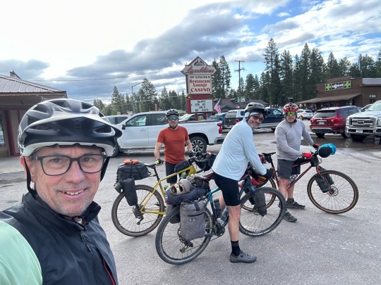
Day 12 - how bad can it be?
First off, correction to Day 10. White pelicans not storks. Now for today’s story…
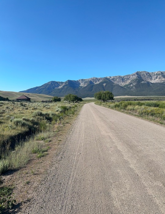
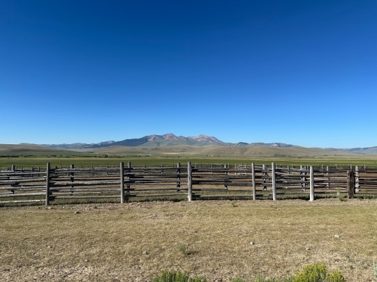
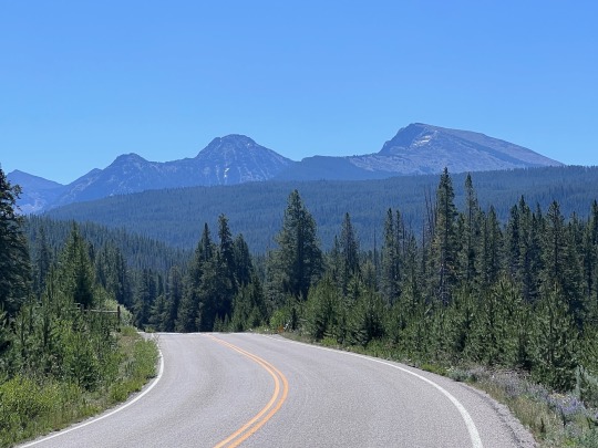
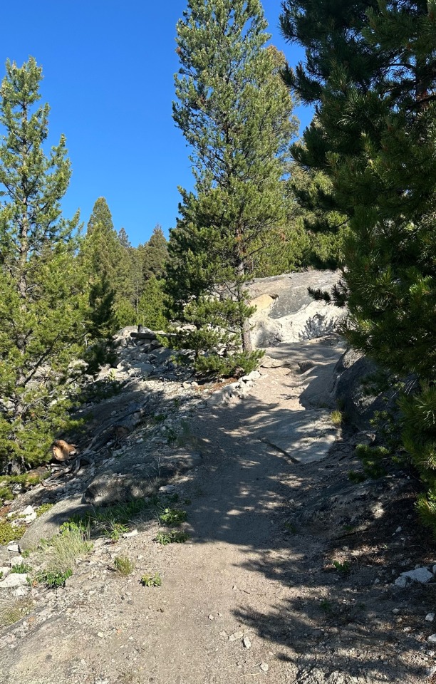
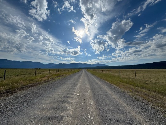
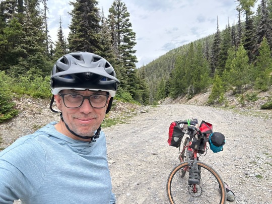
We climbed out of our sleeping bags around 6:45, packed, tore down our tents, and climbed out of the campground around 7:30am. We knocked off about 500’ of elevation in the first 3.5 miles. We anticipated a tough day but not worse than several others on this trip. On paper, it ranked 3rd toughest. Pavement for a few miles, a little gravel, more pavement, 35 miles of gravel, and wrap up with 15 or so miles of pavement including the 2nd of two tough climbs.
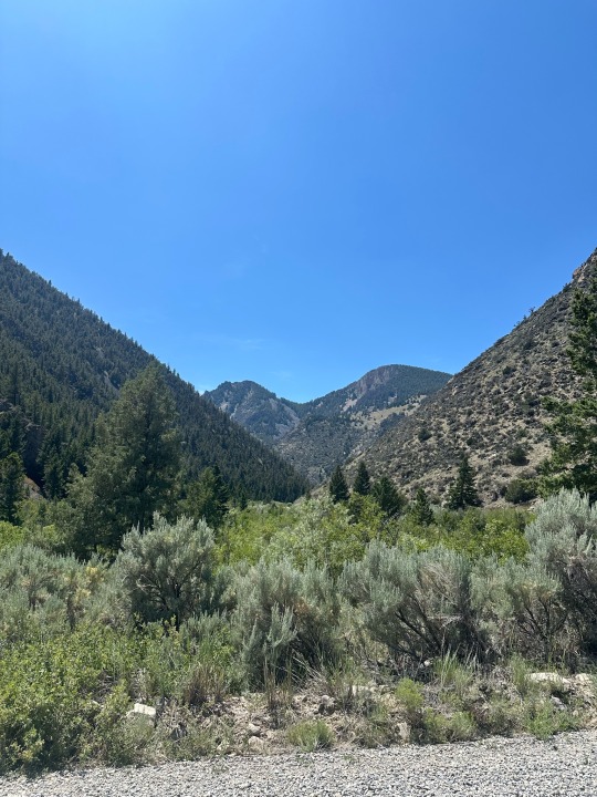
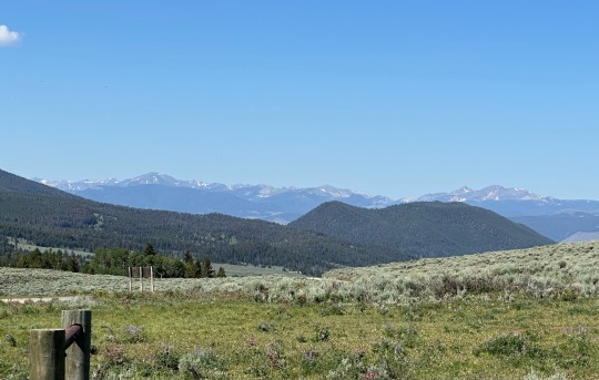
After that first climb plus a couple miles, the views opened up to reveal the west side of the Tetons beyond fields of wheat and potatoes plants (I think they were potatoes although the plants looked a lot like soy beans). We rolled smoothly on pavement for miles, mostly downhill. We could see snow in the mountains. However, we knew we had about 40 miles to go before we got to them.
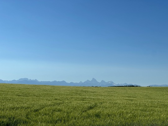
West side of the Tetons.
For the past week or so we’d been hearing about a mom and her four kids (ages 13-7) who were riding north to south. Supposedly they were doing shorter days and we thought we’d meet them somewhere along the way. We spotted a couple small groups a mile or so ahead and thought it might be them. I clicked in to pursuit mode and within a couple minutes Jose and David slapped me down. We had miles to go and didn’t need to spend our energy this early.
Thirteen miles in and at the end of the paved road we connected with the group we were behind. It wasn’t the mother and kids. It was eight women out on a 5 day gravel tour of southern Idaho into the Tetons. They were being sag supported by a pickup truck loaded with their gear, food, and water. We stopped to talk and borrow their tire pump.
Over the next 25 miles we leapfrogged through the course, occasionally riding together, more often us riding behind. They offered us cold water and snacks from their sag wagon, both or which were greatly needed. We came to learn that two of the women are endurance athletes and have done the Race Across American and other major cycling events. They were strong as hell on the bike, all still major competitors in their 60s/70s.
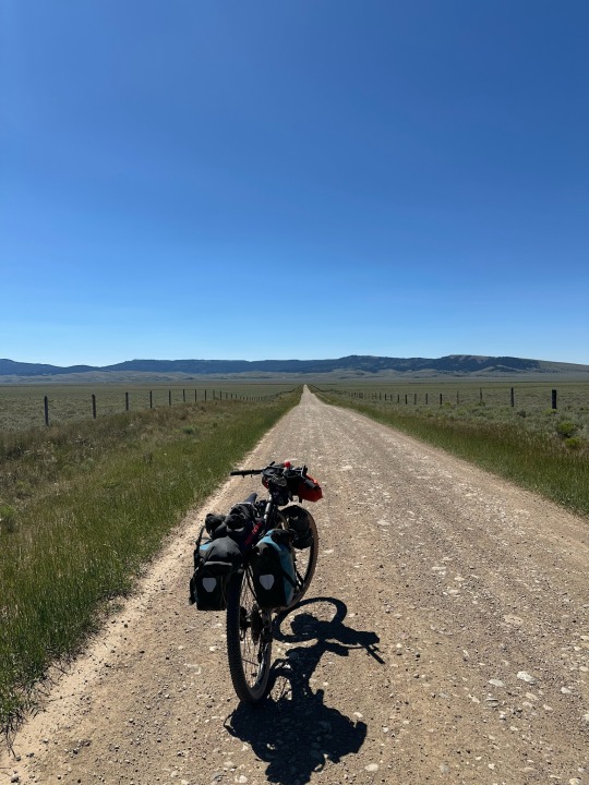
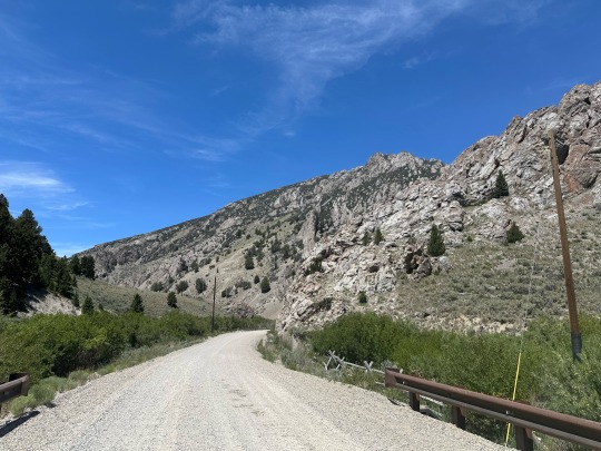
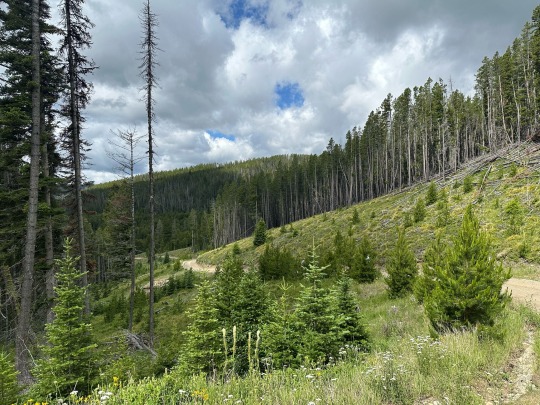
So regarding those 25-35 gravel miles. Typically on a gravel road you can find some smoother surfaces among the gravel and washboard. Worst case you might have to deal with a hundred yards of rough surfaces before finding the sweet spot in the road. Not on the first 10 miles of this road. The gravel was made up of marble and quail egg sized rocks, spread across the entire road. We never got a break.
Nasty gravel. Looking into Wyoming.
The second 10 miles was less rocky but more sandy. The minute we picked up speed we were shut down in a sea of sand, struggling to stay upright as the road took us in the direction of its choosing.
Our 3rd State.
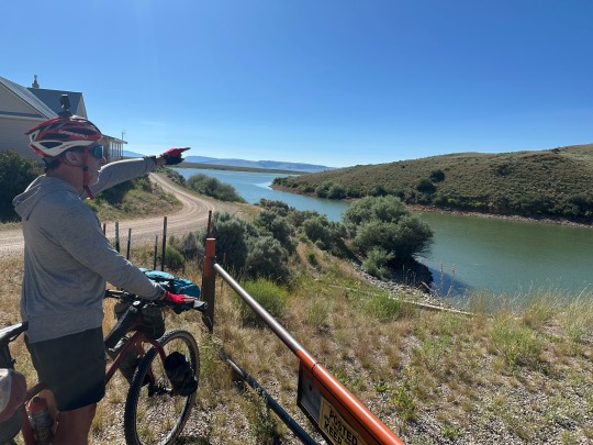
In the second 10 mile stretch, as we approached Grassy Lake Reservoir, David spotted a black bear crossing the road. Our one and only bear sighting. As we pedaled along the reservoir, we didn’t realize it but we were within yards of the Yellowstone Park boundary.
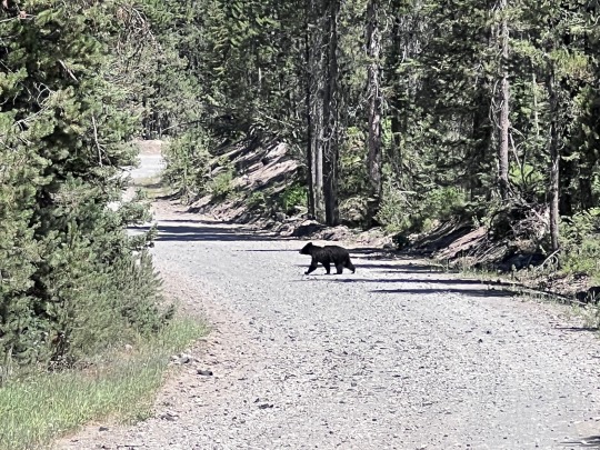
Just a little guy!
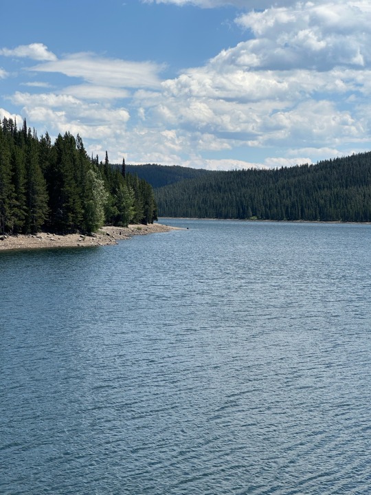
Grassy Lake Reservoir on the edge of Yellowstone.
Another highlight on this stretch was stopping by a snow gauge. The pole reached 15 feet, giving us an idea of the amount of snow the area gets.
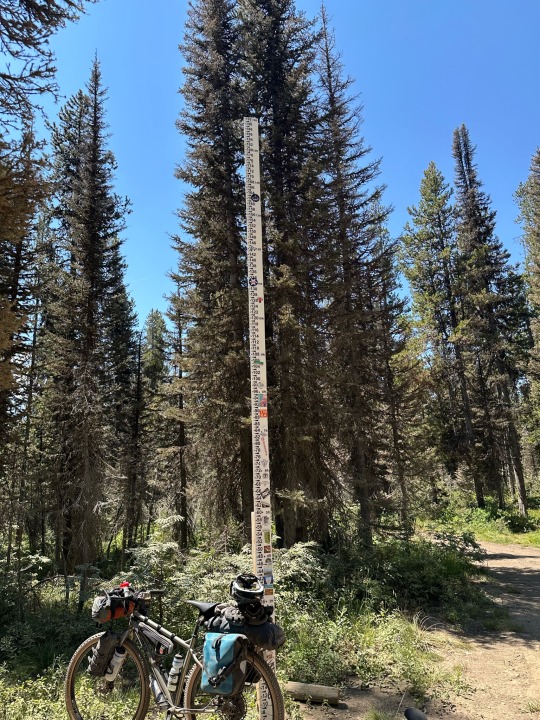
Snow stake.
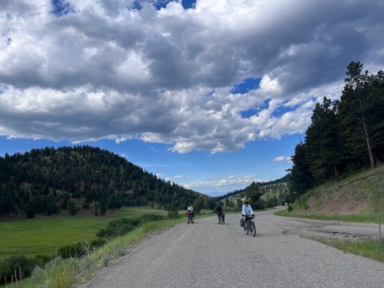
The third 10 miles were on the John D. Rockefeller Memorial Highway. All gravel but very rideable. We blasted through, anxious to reach the Flagg Ranch visitor’s center on the edge of the park. Along the way we saw open meadows with a river running through the middle. Several primitive campgrounds looked very inviting. The building clouds, on the other hand, gave us cause for concern with nearly 20 miles to go.
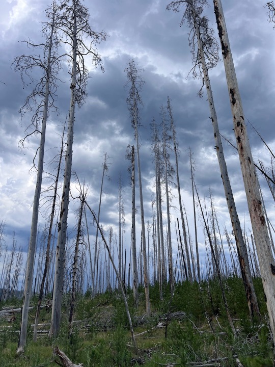
Looking ominous.
At Flagg Ranch we ran into the endurance ladies one last time. We refueled on cokes, ice cream, and potato chips. Then we headed out of the parking lot onto pavement to tackle our last climb of the day.
One third of the way up and the wind began to howl. We all reached for our rain gear as the sky opened up. David’s hat and towel flew across the road when the wind caught them.
Reluctantly, we climbed onto our bikes knowing we would be battered by the wind. Instead, we had a tremendous tail wind that made the climb far easier than it should have been. Over the top, the wind and rain continued. At one point we all heard a crack and then we watched as a tree fell 20 feet in front of David. We pulled the tree off the road and continued.
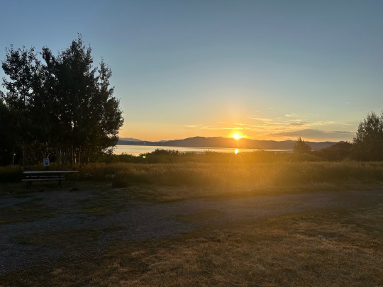
Finally at Colter Bay, still in the rain, we opted for dinner at their restaurant, then showers, then laundry before settling up camp. That all took over 3 hours, all while the rain continued. We then set up our tents in the rain and, ten minutes later, the rain stopped… then it started again.
Escaping the rain.
With that, we all fell asleep having just experienced one of our toughest days ever of bikepacking.
0 notes
Text
Day 11 - easy as pie… hahaha
Overnight we had a couple thunderstorms and strong winds. Fortunately, the rain was brief and the winds dried our tents before we got up. The sunrise was quite beautiful as well.
Sunrise in camp.
We were all up around 6am and quickly set to our routines. Gear packed, tents down, breakfast…
Noah came by to tell us about the birds he spotted and to say goodbye. In passing he mentioned that he punctured his sleeping pad. In the interest of paying it forward Jose helped him with the repair.
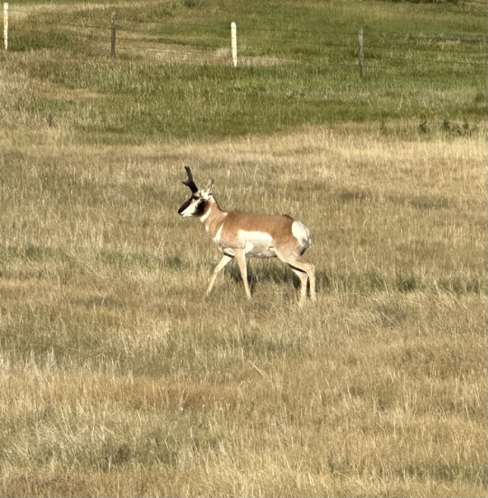
The extra few minutes may have set us up for prime animal viewing. As we left camp we saw the first of 3 Sandhill Cranes. A few minutes later, we saw a number of pronghorn in the fields, some standing, some dashing away from us. They really are fun to watch as they prance and gallop away.
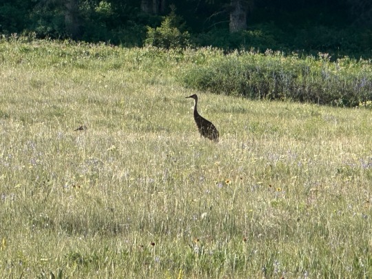
Sandhill Crane
The landscape changed modestly from the previous two days. There were more trees around us and more thicket. Perfect hiding places for wildlife.
About 4 or 5 miles in, we rounded a bend and could see that the road we were on rose up a pass into the treed hillside. Our first climb of the day was short but steep. When it flattened out, we found ourselves crossing into Idaho.
Last look at Montana.
Idaho!
For the time being, gone were the round green mountains. In there place were sharp rocky peaks. We descended from the border for miles, passing a lake and then stopping at a very inviting RV Park camp store.
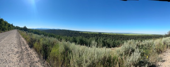
We filled up on Pepsi and salty junk food while we relaxed in the shade. Back on the road, up and over a climb, we were back on gravel headed downhill to the town of Island Park. By this time, views of mountains had disappeared and been replaced with trees in the forest.
We stopped for lunch and then headed down to Big Springs where the Henry’s Fork (a river) literally springs from the ground. We took a couple photos and then moved on.
Big Spring.
Ten miles later, mile 40ish, we stopped at our last store for the day. Once back on the road with fewer than 30 miles to go, we were presented with a wide variety of roads and road conditions… smooth gravel, deep gravel,sandy soil, ruts on OHV trails, double track, rail trail, and more. Most of that riding was just a grind on a day that was supposed to be easy .
The rail trail that hung a few hundred feet above the Warm River was an exception. It offered great views, a speedy descent, and some sense of danger. It also took us directly to our campgrounds.
Rail trail detour preferred.
Warm River.
Hearing thunder, we rushed to set up our tents. Our site was just in front of 3 or 4 generations of a family on their annual camping trip. Very generously, they offered to buy us dinner. We declined but did ask for Gatorades. We needed to quench our thirsts after another hot, dry day.
After setting up camp, we washed in the Warm River (which wasn’t warm) and sat down to freeze dried meals and Gatorade. Rain never came. We knew we were in for a good night’s sleep when our neighbors moved their fire to another site to give us quiet at 9am.
Very special!
0 notes
Text
Day 10 - 56 miles, 2,000’ of climbing… it’s gonna be easy.
We all slept pretty well last night. Perhaps it was the water. I certainly did my best to consume a lot after yesterday’s relentless sun.
The only game in town for breakfast was the coffee shack in front of our hotel. There, I ordered a breakfast bagel with eggs, cheese, and sausage and a cup of hot water for my tea (they didn’t have any that I like). The sandwich delivered 750 calories and 53% of my daily recommended sodium. That and a banana and I was good to go. Jose and David had something similar.
We rode out of town past a few dozen nicely kept homes. We passed the school which served all grades although it graduated its only high schooler this Spring. We quickly found ourselves in a valley. The mountains on both sides were rounded and green but drying out. They were probably 1000’ higher than the our 6,200’ elevation. Few trees could be seen.
Leaving Lima (like the bean)
The valley floor was more lush. As usual, we saw many cows. On one or two occasions we saw pronghorn in groups of about a dozen.
We saw fewer than 10 structures in 50+ miles.
About 20 miles in, we came upon a dam and reservoir where the valley narrowed. Shortly after passing the dam we saw a white stork in the water. The Red Rocks Lakes Wildlife Refuge that we were headed towards was established to protect animals and birds like the once endangered trumpeter swans. We mistakenly thought it was a swan until we later discussed it with an avid birder.
We go that-a-way
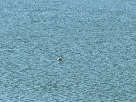
White stork… not a swan
The valley quickly opened up again as we rode alone the reservoir. sometimes 3 or 4 miles from its shore, for another 18 or so miles. Along the way we stopped to talk to two northbound cyclist from San Diego. Retired, they were taking their time making their way to Banff.
Hot fun in the sun.
Our route continued through the valley. We’d pedal up one hill and down the other side. Fortunately, the ride was more downhill than up. Unfortunately, it was all under unrelenting sun.
Bike porn.
Finally, at mile 52 we stopped in the only shade we could find all day. That was at the closed US Forest Service facility (only open weekdays). We were able to refill our water bottles and relax for a bit in cool comfort.
First shade in over 50 miles.
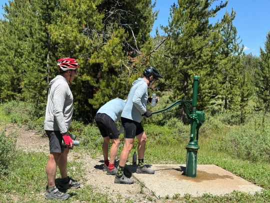
Just a few more miles down the road and we were at our campground on Upper Red Rock Lake, one of the lakes in the Red Rock Wildlife Refuge. Note that we had yet to see any red rocks. Our campsite had a nice view of the lake and of the mountains behind us. It also had a wonderful spring that yielded a continuous flow of fresh, cold potable water.
View from camp.
After setting up camp, we were visited by a Fish & Wildlife officer, one on 189 serving the entire US. He was telling us how he wears many hats, supporting Fish & Wildlife, BLM, Forest Service, and other jurisdictions over a 5 county area. He loves the work but typically works more than a 12 hour day.
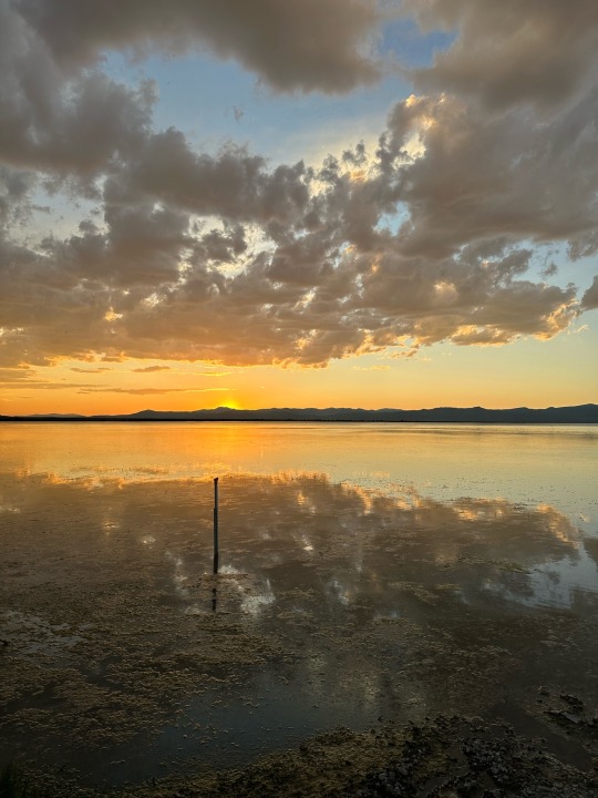
Sunset
Red sky at night.. BS
After dinner, Noah, another cyclist camping here, joined us for conversation. He was the one who pointed out the pelican. He also warned up of potential bad weather. Again, he was right.
0 notes
Text
Day 9 - our longest day miles-wise but hopefully not hours-wise.
I didn’t sleep well last night due to the heavy food and the temperature in our room. Even though I slept under an open window, I was wringing wet most of the night. However, I’m not complaining. We woke up before 6am and the outside temp was 44 degrees.
Horse Prairie Stage Stop.
Pronghorn
We packed, grabbed some breakfast from the honor fridge (the proprietor fills a fridge with things bikepackers would enjoy and you just leave the cash in the open strongbox next to the fridge), and we hit the road.
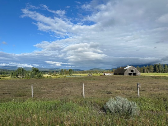
Our progress was at a steady rate with a moderate incline for miles. At times we would dip down only to climb back up just a few feet more. The views went on forever. Early on, much of what was saw was ranch land framed in by mountains on both sides.
Forever views
Along the way we stopped to talk to a south-to-north rider, Marielle, who had stayed the night at a ranch not to far away. She was taking time off before heading to Ireland to go to Med School. She gave us some intel on riders we would see and, similarly, we told her about riders ahead of her.
We continued on. About mile 26 we were confronted with our most serious challenge of the day.. a 3 mile steep approach to an incline of between 10-15% for a mile. Jose crushed it. Me, not so much. David, better than me.
As we crested the top we met a recently married couple who decided to ride the Divide for their honeymoon. I had mistakenly wished a couple of guys we had passed earlier a happy honeymoon. They took it well, considering they’d been riding with the honeymooners for several days.
Prior to this climb we had basically been pedaling through the same valley. Ranch land on the valley floor with sage up the sides of the rounded mountain tops.
Once we reached our highest point, things began to change… the valley started to tighten up. There was little grass land and more sage.
Over the top, we bombed down the first 5 miles without ever turning a pedal. We twisted through the valley, taking in the views as the mountains grew steeper around us. The decline mellowed but still gave us the momentum to go over the humps as we roller coastered into a series of canyons.
These canyons were made up of sharp and steep rock formations. Big Sheep Creek ran through them but probably didn’t create them. The rock looked like sandstone layers pushed up by some geological force. Rounded hills intermingled with the sharper peaks.
Ultimately, we hit a flat road that took us to the I15 frontage road and ultimately, Lima. In Lima, we hydrated at the local C-store and then booked a night at the Beaverhead Inn, the only accommodations in town. Dinner was at the Peat Steakhouse.
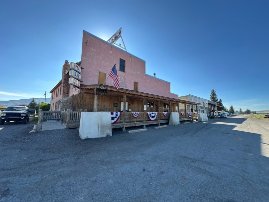
Peat’s
Lima doesn’t have much. Its population is around 250 people. However, the steakhouse was jam packed and the food was exceptional. Also, the water in this town is considered to be the best tasting in all of Montana! Not bad for a misery little town.
0 notes
Text
Day 8 - this might be our easiest day. Tomorrow we pay.
I woke up to cows under my window. That and other guest walking down the hall to the only bathroom. My room was stuffy because I didn’t want to open the window. It had no screen. I got up and walked outside to check the temperature. It was in the low fifties. Chilly. Refreshing.
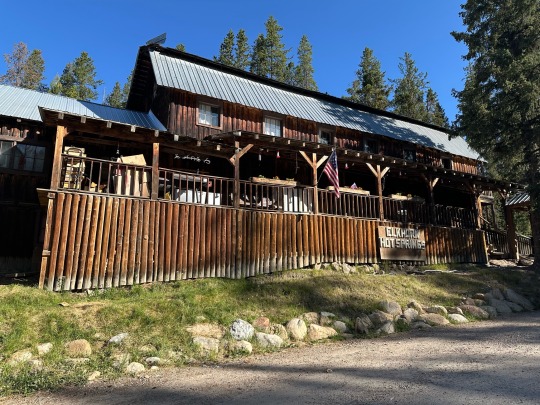
Elkhorn Hot Springs Restaurant and Hotel.
We all got packed and ready to go. Breakfast started at 8am and we’d mount up shortly after. Ready to ride, we went back-and-forth regarding whether to wear a jacket as we descended. In the end we were all happy that we did.
We dropped quickly into the Grasshopper Valley. It was lush and green. There were many working ranches, a few nicer (perhaps even luxury) homes, a B&B that we were unaware of, and a high end hunting lodge or two. We finally saw abundant wildlife, a dozen or more pronghorn, all within the confines of a shooting preserve.

4 miles into ride first views of Grasshopper Valley.
Grasshopper Valley view.
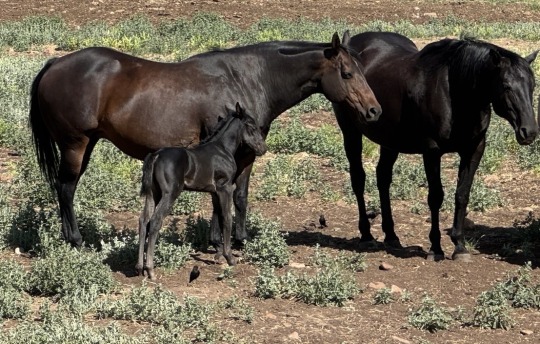
We pedaled the valley’s length which was probably fifteen miles. As we approached an intersection that took us out of the valley, we were watched by a half dozen horses, one with a jet black foal.
Turning east out of the valley we had another 10 miles on a more traveled roadway. The flora around us was more sagebrush until it reached the mountains.
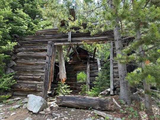
Finally, we turned south again. Four miles down the road we came to the heart of Bannack State Park, the ghost town of Bannack. Montana has done a good job of maintaining its buildings and provides easy access. The Park also has an informative booklet for walking tours. We saw many families and older folks checking out the buildings. It was a good way to break up a long ride in the middle of nowhere.
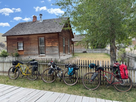
Ride ‘em cowboy!
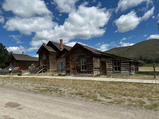
Church with bootlegger’s cabin to the right.
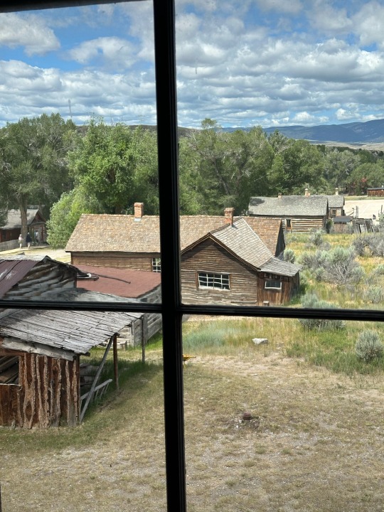
View from the Bannack Hotel.
We had asked how the ghost town came about. The town was originally founded from gold mining in the mid 1800s. Mining died out, although a few claims stayed active into the 1900. In the 1970s a number of people from Chico, CA bought up houses for vacation and hunting. By the 1980, the State had purchased all of the properties to create the “ghost town”.
After touring the town we headed back down the road for our final destination, Grant. We had 11 miles of gravel to go. Some up and the last 5 down into the town. Ten of the 11 miles were sagebrush prairie with no buildings. For the second or third time this trip, we found ourselves traveling where Lewis & Clark had walked so many years ago.
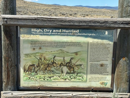
Lewis & Clark were here.
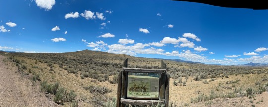
Sage for as far as we could see.
When we finally got close to town we saw more grass, a few cattle, and a dozen pronghorn. At last, a day with significant wildlife!
Once in Grant, population 17, we got a room in the Horse Prairie Stage Stop, the place has been here for a while. The floors in the saloon have been there since 1850. Like last night’s lodging, this place has rustic charm. In the summer, business comes from tourists and cyclists on the Great Divide. In the winter, it’s hunters.
We were alone in the bar before being joined by a south-to-north rider from Colorado, Caden McBride. Laid off recently, he decided to ride the Divide even though he had never done any bikepacking and wasn’t a fan of camping. At 25 years old, he had all the drive and energy to blast through the route. He ate dinner with us after riding 70 miles and decided to add in another 50 miles before ending the day. We wished him the best knowing he wouldn’t be bedding down before 1am.
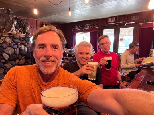
Caden in the background looking for calories.
We, on the other hand, didn’t make it past 9pm.
0 notes
Text
Day 7 - working recovery is still working
Two days from now we’re supposed to have a rest day in a town called Lima. Besides the C-store and RV park, there isn’t much. Since we are feeling pretty good, we decided the better approach was to do 2 short days before our long day and skip the rest day. So rather than push to Grant today, we decided to split the difference and stop at Elkhorn Hot Springs for the night and then push on to Grant the next day.
Leaving Wise River
Great views.
The original plan for today was to climb 3,700’ over 69 miles. The revised plan resulted in 2,600’ over 32.5 miles. Tomorrow should be easier as we drop into Grant.
Quick break.
We left Wise River via the Pioneer Mountains Scenic Byway on a slight incline with a bit of a headwind. The first 4 miles were on the valley floor with clear views of the surrounding mountains.
Pioneers!
The mountains drew closer as we twisted through a number of gaps. Since we were on pavement we rode a pace line for about 25 miles to provide a wind buffer. We stopped every 6 miles or so to make sure we were hydrated and to rest our weary parts after yesterday’s ride.
As the road rose, we saw more and more mountain views. We were constantly on the lookout for wildlife but saw none. Near the top of our climb we rolled through a gorgeous meadow which spectacular views of the Pioneer Mountain Range. (Again, google it for spectacular photos.)
Pioneers
Pano
Once over the top, it was a quick descent for 6 miles to Elkhorn Hot Springs. Cars, bikes, and cows all use this road. Jose, a motorcycle, and a herd of cows came together on a curve on our descent. Fortunately, no collisions occurred!
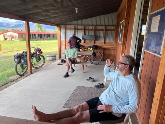
After the turn off to the hot springs, we had a short steep climb and we were looking at the rustic accommodations that would be ours for the night. You have to love a place that has dogs on the porch and cows wondering freely.
We got individual rooms although we can talk to each other through the walls. We share a toilet across the 8 rooms. Showers are at the hot springs 50 yards away.
Lunch and dinner in the restaurant were good. The hot springs were relaxing. And everyone is friendly.
At dinner
After dinner, we all crawled into the sack early. Tomorrow we will hit the road for our 37 mile ride.
0 notes
Text
Day 6 - we’ve had our rest day, will we be exhausted after our ride?
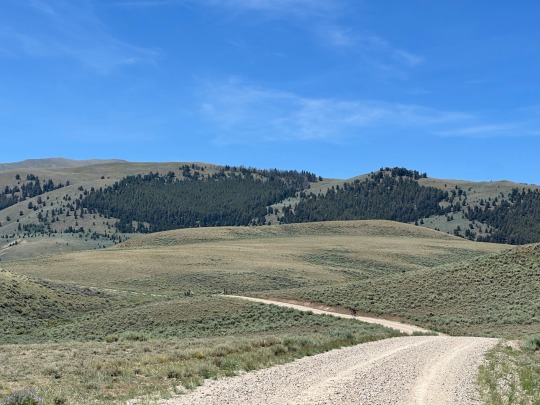
We broke camp by 7:30am. We rerouted to shave a couple city miles off the route. About the first 10 miles were on pavement headed towards the start of our climbs. We rode through rural Butte. Larger homesteads but not ranches. We turned into what seamed like a regional park area when we first reached gravel. In the park, the trailhead had at least a dozen cars for hikers and mountain bikers.
We left the road onto single track that lead to a rail trail. We cruised past a number of interpretive signs for the railway. We also saw views of a lush green valley that the trail paralleled.
From the rail trail, we climbed on to single track that required just a bit of hike-a-bike. Next came some double track which popped us out on a paved road with views of yet another mountain range and valley. So far, we were all doing great with the varied terrain.
Yes, this was part of our route.
Popped out of single track here.
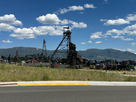
Climbing, we ultimately ended up with views of Butte and the route we traveled. Butte was recognizable by the big pit that sits on the east side of town. The landscape leading up to Butte was lovely with blue lakes, dark forests, green pastures, and rolling hills. Finally at over 25 miles into our ride we crested at over 7,300’.
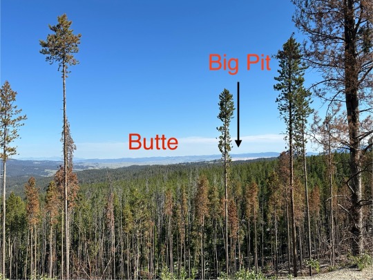
Butte in the distance
As we continued our first climb.
The first 5 miles of our descent was mellow and scenic. Then we had a steep multi-mile descent into a huge north-south valley bisected by interstate 15. The valley was all green pasture with forested mountaintops.
We came down the gravel line in the middle of the photo to cross under I15
We crossed under I15 onto a paved frontage road and our second big climb of the day began at a moderate incline. We turned left towards Fleecer Mountain and we were hit in the face with a strong wind. It literally pushed me and my bike across the road at one point. We were fully exposed to the sun and wind for a couple miles.
The wind finally mellowed when we’re rode into the forested area that we would be in for the next few hours. The road’s incline was greater than our earlier climb. We stopped at a campground for water and some lunch at about 2pm. We had been riding for about 6.5 hours at that point and still had another hour of climbing.
Beyond the wind.
While getting water a local gent pulled up and struck up a conversation. We discussed everything from edible plants to mountain lions and inconsiderate people. He was friendly and his dog enjoyed our company. It was interesting to hear him say that logging chased away the elk herd and he hasn’t seen a moose in quite some time. Also, we learned that he carves moose antlers for a living so he would know that there were few around.
Pushing on for the last stretch of our climb we knew we had a challenge ahead of us but had no idea how big. Fleecer Ridge is notorious for its descent to the South but we had no idea about the climb that precedes it.
We rounded a bend to see a 12-15% grade for half mile in front of us. I made it 90% up when a fly flew in my mouth and I lost focus. The flies, by the way, were consuming us as we rode. Jose and David had similar success.

The Fleecer climb.
Climbing done for the day… over 5,200’ elevation gain reaching over 7,700’ altitude.
On top of the ridge. Almost done for the day.
Now the part that we had all been waiting for. We dropped in to the side of the ridge knowing we’d be walking switchbacks soon. Jose went in first and I followed. The trail had lots of loose rocks and dirt. It was extremely difficult to get any grip with our tires. Brakes slowed us but didn’t stop us. We slid down about a quarter mile before it just got too steep.
Down Fleecer
Jose got jammed up and performed an acrobatic maneuver jumping over his bike as the rear wheel slid forward like a jackknifed truck. He did a couple rolls and popped back up with a few cuts and bruised. Having watched all that action, I hopped off the bike and started inching down until I had to start taking wide sweeps through the sagebrush to cut out the steepness of the hill. David followed a similar path. We dropped over 1,000’ of elevation in less than a mile.
Once off the most treacherous part, we made our way over rocky terrain to pavement and ultimately, to Wise River. There, we had the choice of sleeping in the community center or a private cabin behind the local saloon. We chose the cabin with a 1 minute walk to the saloon. Burgers for dinner and a couple beers and we were good to go. Sleep came easy.
1 note
·
View note
Text
Zero day - Butte
Bike maintenance, laundry, restock food supplies, catch up on email and blog posts, rest. We really didn’t explore Butte. David and Jose went to a bike shop in midtown but that was about it.
We needed the rest and we took advantage on the nice day.
Wrapping up the day.
0 notes
Text
Day 5 - excited to get on with the day. Even more excited to wrap it up.
After a night of loud snoring and crinkling sleeping pads, we all actually woke up in good spirits! To get us jamming for the day I played a little Clash, Magnificent Seven… Ring, ring 7am, put yourself in go again…
Good morning sunshine!
As additional motivation, Ed read us a passage from Theodore Roosevelt’s speech titled "Citizenship in a Republic," delivered at the Sorbonne in Paris on April 23, 1910. The passage titled “The Man in the Arena” appears below.
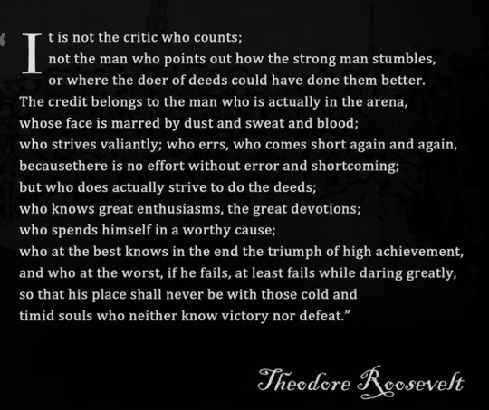
So with that we started Day 5 knowing that "...if he fails, at least fails while daring greatly”.
We were uncertain regarding our actual distance and elevation because of our decision to take an alternate route. So we got an early start by eating breakfast at the full service FuelPump where we also picked up a variety of calorie dense snacks for the day.
Once on the road, we found ourselves on Cattle Drive Rd. It ran along the Boulder River and Hwy 15 through the town of Basin. Basin supposedly has an excellent cafe for breakfast but it was closed. Beyond Basin we continued paralleling the highway for some distance.
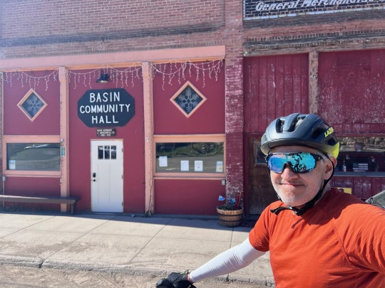
Nothing was open in Basin.
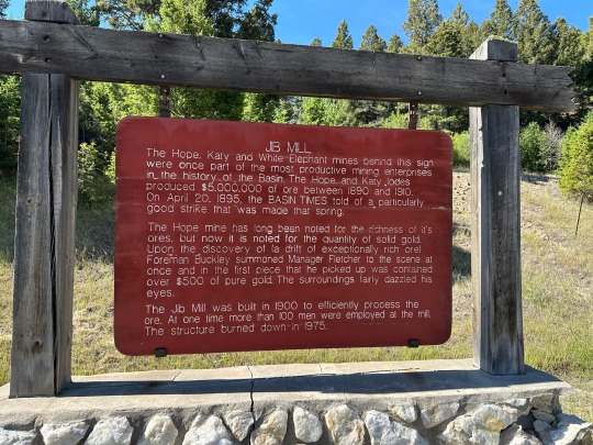
Along the way we passed an old mining operation that was quite productive at the turn of the 20th century. I also noticed a few “No Prospecting” signs in the area.
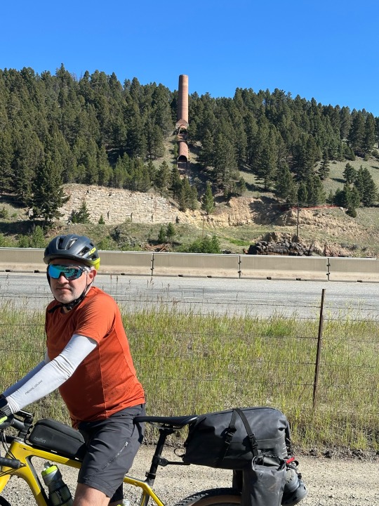
Remnants of the mine operations
Also along the way we saw no wild animals but did see hundreds of cows free range grazing. Dodging cow pies took quite some effort.
Cow and cow pies everywhere
We were probably 25 miles into our ride before we turned away from the highway and into the wilderness. It was at least 30 miles before we stopped climbing and we got to enjoy the first real descent.
Prior to descending, we stopped for lunch at the Sheepherd Picnic Area. It’s a nicely maintained spot with a number of tables with built in grills. We ate in a large shelter.
While there, we met Larry a retired Geologist who was returning home to Butte after pedaling around British Columbia. He was a very active bikepacker but his choice of peanut butter and jack cheese on a tortilla for lunch was a little off putting. However, he did tell us where we could find fresh water which we desperately needed.
Sweet, cold water!
As we started our second climb David noticed that he lost his phone along the way. Knowing that backtracking on bikes wasn’t physically possible we continued forward.
At the top of the second and last climb we were flagged down by a woman in a car waiting on the side of the road. It was Larry’s wife, Debbie! She offered us cold drinks and told us she was waiting for Larry who had been away for a month.
Descending into Butte.
We told her about David’s phone and she offered to drive him back to the picnic area and the water pump to find his phone. When it was in neither of those places, she slow-drove the route we had taken. Sure enough, she and David spotted the phone at the same time, in the dirt, just after a particularly rough section of road.
For all that she did, she only asked that we pay it forward!
To celebrate an epic day of riding, the kindness of strangers, and the upcoming zero day we went out for steaks! To top everything off we had soup, salad, rib eyes, potatoes, dessert, and a glass of wine for $50 each. All the days pain was forgotten
0 notes
Text
Day 4 - change is good… we hope
After yesterday’s strenuous riding and some guidance from Pat, the South to North rider, we decided to go with a documented alternative. Our original route was only 21 miles with 3,500’ of climbing packed into 2 efforts. The following day would be 60 miles with 4,700’ of climbing over 4 efforts. We decided to replace that with 41 miles and 3,500’ of climbing but more gradual and 50 miles with 3,200’ of climbing. Overall reducing our climbing by 1,500’ over the two days.
On paper, it made sense. In actuality, it was still a hard effort. However, we had the opportunity for showers and sleeping inside rather than primitive camping. It was a good change.
With our decision made, we proceeded to do bike maintenance to get David’s tire addressed and tighten up his rear take. Thinking it would be an easier day, we rolled at noon.
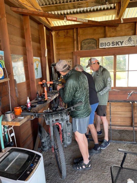
MTBCity has a nice work station.
Immediately, we were under the sun’s intensity and we were climbing. Our start was a 10 mile, 1,600’ climb. The descent was a total blast for over 10 miles into the tiny town of Clancy. Unfortunately, no services were available and we needed hydration.
Going up.
Clancy Post Office isn’t particularly bike friendly.
A few miles down the road we passed through Jefferson City expecting nothing to be open. The one business in town, Ting’s Bar was open and hopping. Cold cokes and potato chips fortified us for the 12 miles, 1,400’ climb to come.
Hot fun.
Once over the top, we rolled into Boulder, MT and found the cyclists-only Bike Barn at the fair grounds. After showers, Family Dollar microwaveable meals, and cold beer we all crashed anticipating a reasonable day tomorrow.
Boulder is down there somewhere.
Bike Barn
1 note
·
View note
Text
Day 3 - long day in the saddle
We left Lincoln around 8:00am after a big breakfast. As we were leaving, cars were finding parking for the best viewing of the 4th of July parade (on the 5th). Chairs were already set out roadside. Businesses were firing up their grills for burgers and dogs.
Early departure from Lincoln.
Within a mile, the scenery changed from cloudy on a run down main street to sunny on wide open pasture land. We road in the flats for just a short distance and then climbed 2,000’ over about 15 miles. Initially, the climb was on smooth gravel.
Things opened up outside of town.
At some point we had actually passed the land where Ted Kaczynski (The Unibomber) had his cabin. Many Lincoln residents work to live off the grid so he wasn’t necessarily a unique character in this area.
Later, we knew we were in for a change when we turned off onto a road that had OHVs exiting it. And right we were. The road surface turned rocky and the gradual incline became steep in many places. We found ourselves in a hike-a-bike situation multiple times. The positive was that we used different muscles hiking, giving our pedaling muscles a break. The negative was that we were in the hot sun and we probably hiked a couple miles, overall.
Hike-a-bike hell
Made it to the top of the first climb.
On the backside of the pass we lost all of our elevation in half the miles. But what goes down must come up. In our case, another 1,800’ in about 13 miles. Before we started climbing again, we stopped for free sandwiches and cokes at what the cyclist call the Llama Range but the owners call the Alpaca Farm. The owners generously provide lodging, food and drink to cyclists riding the Great Divide. All they ask is that you pay it forward.
Headed down.
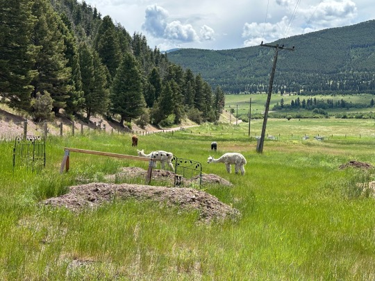
Llama Ranch/Alpaca Farm
We dropped down and popped up a couple more times before descending 2,000’ over 13 miles to the edge of Helena.
More views.
Sticking together
Gorgeous.
All up hill.
We stayed at a camp called MTBCity which, obviously, catered to cyclists. We arrived at nearly 8pm, 12 hours after our start. Exhausted, we struggled to put up our tents, shower, and have some dinner.
Over dinner we talked with a northbound cyclist, Pat, who gave us some recommendations for the next couple days. With those in minds, we fell asleep a little less concerned about the work we had to do the next day.
I didn’t mention that David was having tire issues throughout the day. We had to refill it with air about 5 times throughout the ride. We left resolving the issue until the next day.
1 note
·
View note
Text
Day 2 - fortunately we beat the rain, fortunately it rained. Happy July 4th.
Knowing there was rain in the forecast we hit the road early. By 6:30am we were rolling out of town. The first few miles were on quiet back roads with rolling hills and the occasional ranch. About 3 miles in we finally came upon our first gravel. For the most part, the rest of our day was on gravel roads until our last mile into Lincoln.
The road out of Ovando
As we left town
After pedaling through a forested area things opened up to miles of ranch land. The sky and the clouds were stunning. The road was straight for miles, which has been unusually for us.
Spectacular morning
As we approached the end of a straight road, we saw switch backs in the hills ahead of us. While it wasn’t actually our route, it gave us a sense of where we were going and what the level of effort was going to be.
Switchbacks
The views were limited as we climbed through the woods. We gained about 1,500’ as we made our way to Huckleberry Pass. We did come upon the switchbacks we had seen earlier. They were part of a logging operation. On the positive side, they opened up views to the valley below.
View back over the roads we passed.
Once over the top, we were able to bomb down towards Lincoln. As we got closer we saw more and more people camping in their RVs. Many were driving around in their side-by-sides or other Off Highway Vehicles.
Making the climb
Hot and dusty
All in a day’s work
The closer we got to Lincoln the more OHVs we saw. The Main Street in town was a constant procession of 4-wheeled vehicles all day and well past midnight. Lincoln isn’t a particularly picturesque town but it does throw a huge 4th of July party. We chose not to camp in the city park because of the insanity that takes place there on this holiday.
On Main Street in Lincoln
We found a spot to camp on the edge of town and settled in. Later, Bill from Helena who we had met in Ovando yesterday, joined us in the campgrounds. And a few hours later we met a Frenchman from Normandy who was spending 90 days in the USA exploring the West by bike.
Dinner was at the Montanan, known for steaks and au gratin potatoes. Interestingly, our server was on the EMT Squad and she told us that they would not bring their ambulance into the town park due to partiers shooting fireworks at their vehicle. She validated our decision to avoid the park.
Fireworks started at 10pm and went on, unofficially, until 3am. A little after 3, a couple came back to their tent and decided to get noisily amorous. Fortunately, I slept through that but it appeared no one else did. It was tough waking up in the morning with no stories to tell.
1 note
·
View note
Text
Day 1 - Missoula to Ovando - all pavement.
By 6am we were outside of our Airbnb ready to take pictures when a neighbor rushed up to check out our gear and ask where we were headed. This gentleman had lived in the same house across the street for 62 years. More interestingly, in the 1970s he had ridden the same Schwinn Paramount that he still owns around the US, in Europe, and in New Zealand. He was very excited to hear about our trip and tell us about his life. After our discussion, we bid him farewell and headed out.
Zoom near the outbuilding to see the neighbor rushing over to talk to us.
We decided to get accustomed to our bikes by starting with a road day (ride on pavement, no gravel roads). Our route took us out of Missoula to the west along Montana Hwy 200. With our early start, the road initially had little traffic. It gently climbed all day, initially in a canyon with steep green walls looking over the Blackfoot River. Later it opened up to wide open valleys flanked with mountains on each side and with grazing grasses, hay bales, and cattle.
Random stop early in the ride.
Road opened up into a large valley.
About midway through the day we stopped at a gas station at an intersection that took you either north towards Seeley Lake or east towards Ovando. We, obviously, continued east. However, by that time traffic was insane with people headed out for the July 4th weekend. This made the rest of the ride quite stressful. Regardless, we enjoyed the beautiful day and lovely scenery.
No bull, traffic was crazy from this point on.
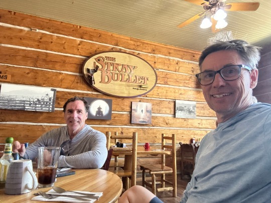
Once in Ovanda we stopped in the Stray Bullet Cafe for lunch. Our servers were two high schoolers who enjoyed learning about what we were doing and giving us a sense of what their lives are like. For example, one of them wore a championship belt buckle for raising prize cows. Another described her entire grade as being around 24 students and the high school/ middle school as being only about 200 students. For her, the bus ride to school was 45 minutes each way.
Lunch.
When we asked about places to stay, they mentioned that the Baptist Church was open to cyclists. We took advantage of the offer which included flush toilets, a shower with towels, and a washer and dryer. Our other options would have been the city park, the old jail, or an empty lot on the square. The latter being where a woman was killed by a bear a few years ago.
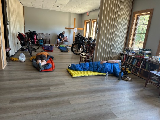
Out accommodations for the night.
Snug in the church basement, we cleaned up and then decided to go check out Trixi’s (a brothel until the early 1960s). They were in full party mode for the holiday. We hung out for a while and left before the band and the crowd.
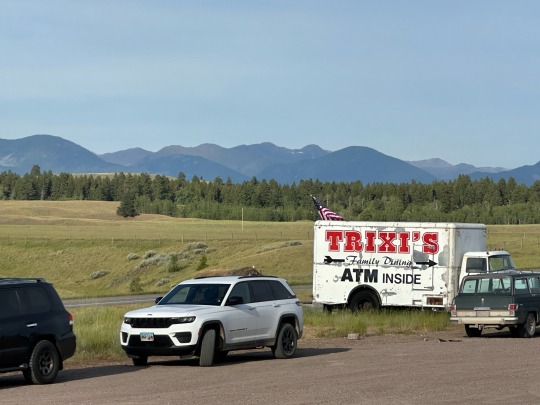
Party time!
Back at the church we had added two South Africans and a Montanan to the list of occupants. Before the evening grew dark, we added 3 more including a Bostonian who starts working on a Master’s degree at UNC in the fall.
Headed back to the church to call it a night.
Needless to say, the conversation was good and quite interesting.
1 note
·
View note
Text
Day -1 — We’re back!!!
Day 0 — We’re almost there!!!!
Today we’re converging on Missoula to start the second leg of our Great Divide Mountain Bike Route adventure. Ed B., David H., Jose G., and I (Steve R.) are headed to Jackson, Wy. It’s a trip that we expect will take 14 days including 2 rest days.
For the most part, we will be on gravel roads, often only seeing a town or services (c-store, restaurants, etc.) at our daily start and end points. The terrain is mountainous so there will be plenty of climbing. At the same time we know there will be epic descents.
Unlike the first leg of this route, which we completed in 2023, we’ve made fewer reservations and will be more spontaneous regarding nightly accommodations. We’ve also interspersed shorter days early on and throughout the route to make it more enjoyable.
Also based on lessons learned, we’re all arriving 2 days before we start so we can make sure that we’re fully packed and ready to go the night before we start. It also gives us a day to unwind in advance.
And unwind we did…
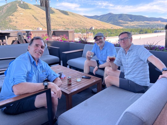
Enjoying the Missoula rooftop scene.
On Day 0 we had the crew together. Our objective was to pack our gear and take it easy all day. Daniel, Jose’s son joined us as he makes his way across the country on a post-graduation tour.
Fortunately, we had our acts together and needed very few things to round out or equipment list.
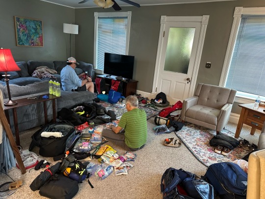
Getting packed is a process.
To kill time, we went into town for lunch and to stroll the shops. The afternoon was spent relaxing and checking gear once again.
Jamming Wednesday afternoon in Missoula.
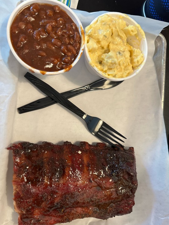
Lunch at the Notorious P,I,G. BBQ
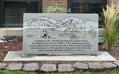
A River Runs Through It reference near our Airbnb.
Before dinner, we met a friend who had shown us many kindnesses two years prior on our last days of our 2023 ride. It was good to catch up and he was able to share a lot about Chicago where Daniel starts working in a month.
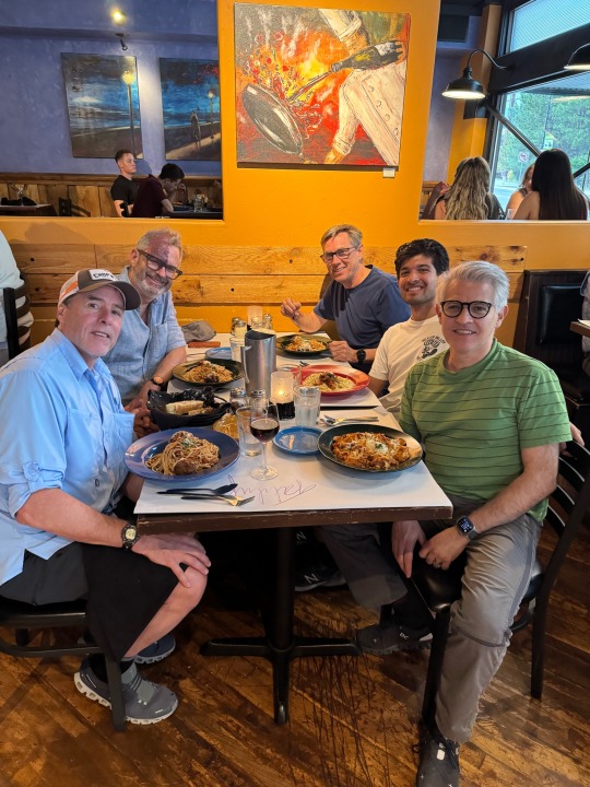
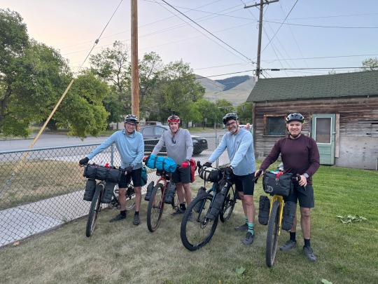
Dinner with (L-R) Ed, David, me (Steve), Daniel, Jose
2 notes
·
View notes