Statistics
We looked inside some of the posts by hawkuletz and here's what we found interesting.
Average Info
Notes Per Post
1M
Likes Per Post
589K
Reblog Per Post
498K
Reply Per Post
5K
Time Between Posts
8 hours
Number of Posts By Type
Text
14
Photo
3
Last Seen Tumblr Blogs


Fun Fact
Tumblr Inc. is using 66 technologies for its website.
Text

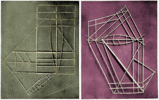
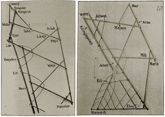
Polynesians did also rely on a form of a physical map called a stick chart, illustrating the specific wave and swell patterns surrounding different island chains. These were particularly helpful during cloudy conditions when the sun and stars were less useful. To navigate the Marshall Islands, the Marshallese represented ocean swell patterns using parts of coconut fronds and shells as islands. Like a subway map, they don’t so much represent distances as they do relationships. The complex and decorative stick charts were often only understood by the person who made them. They were memorised before a voyage by the pilot who would lie on the floor of a canoe to get a sense of swell movement and often lead a squadron of 15 or more boats.
44K notes
·
View notes
Text

IBM PS/2 in Portal 2
2K notes
·
View notes
Text


Iyer, Winterlich & Co. went on a little adventure.
26 notes
·
View notes
Text
174 notes
·
View notes


Text

Railway station of Digne, Provence region of France
French vintage postcard
61 notes
·
View notes


Text
remember kids, the moral of "Irish and Italians weren't even considered White yet!" isn't "because in those times people were so ignorant they didn't think the Irish were white". the moral is "because white is an unreal category created to justify slavery and ongoing hoarding of power and wealth". It's not that you know better about Italians. It's that the boundaries of the higher caste have changed.
92K notes
·
View notes


Text
Alright was no one going to tell me that in the middle of the Nevada desert is an old cemetery that contains the bodies of a bunch of miners who died in a fire and next door is a haunted clown motel

Why are we still setting horror movies in generic Victorian houses in the woods when this is a real place in the world
195K notes
·
View notes


Text
8K notes
·
View notes
