
Don't wanna be here? Send us removal request.
Statistics
We looked inside some of the posts by insidefpvdrones and here's what we found interesting.
Average Info
Notes Per Post
0
Likes Per Post
0
Reblog Per Post
0
Reply Per Post
0
Time Between Posts
27 days
Number of Posts By Type
Text
17
Last Seen Tumblr Blogs


Fun Fact
Tumblr has a low social media market share in South America.
Text
What Hobbyist Drone Pilots Should Know About Flying in India's Digital Sky
As drone technology has advanced rapidly in recent years, hobbyist drone flying has shot through the roof in popularity across India. The thrill of taking stunning aerial videos and photos is exciting. However, increased drone use has also led to growing safety and privacy concerns.
To address these worries, India has implemented Digital Sky, a national unmanned traffic management (UTM) platform. All drone operators must register on Digital Sky and follow its regulations and guidelines. This includes hobbyists flying recreationally.
If you're an Indian hobbyist drone pilot or want to start, this guide breaks down key things you should know about flying drones responsibly under Digital Sky. Adhering to Digital Sky opens up fantastic opportunities to pursue drone flying while respecting others’ rights.
What is Digital Sky?
Launched in 2018, Digital Sky is India's national UTM platform overseen by the Directorate General of Civil Aviation (DGCA). It offers real-time tracking and digital licenses for every drone flight under India's Civil Aviation Requirements (CAR) governing drone use.
All drones except nano category (under 250 grams) must obtain a Unique Identification Number (UIN) and Unmanned Aircraft Operator Permit (UAOP) to fly legally in India. You must also file flight plans and follow other protocols submitting details like pilot name, drone category, area of operation, flight time, etc.
Digital Sky aims to systematically manage India's low-altitude airspace under 400 feet.
Why Follow Digital Sky as a Drone Pilot?
You might be wondering if Digital Sky's regulations apply to flying drones for fun as a pastime. The response is yes. In India, any non-nano unmanned aircraft, regardless of their purpose of being recreational or commercial, are required to adhere to Digital Sky regulations.
Here are key reasons to follow Digital Sky protocols as a drone pilot:
1. The Law of the DGCA and CAR provide legal authority to Digital Sky regulations. Penalties for violations include up to three months in prison and fines of at least Rs. 100,000.
2. Improving Privacy & Safety: Drone collisions in midair can be avoided by registering flights, avoiding no-fly zones, and following other regulations. Furthermore, it prevents unauthorized access to private property.
3. Enables Advanced Drone Functionality: By demonstrating your ability to fly safely, Digital Sky unlocks enhanced drone capabilities, such as Beyond Visual Line of Sight (BVLOS) flights beyond 1 km, which hobbyists may find intriguing.
4. Clears the Path for Commercial Aviation: Proving your ability to fly responsibly in accordance with Digital Sky criteria is the first step toward perhaps obtaining commercial drone licenses in the future.
Supports Innovation: Adaptation of Digital Sky helps concrete drones' huge technological innovative potential in India through accountable, sustainable growth policies.
(Key Tips for Hobbyists on Digital Sky Compliance
Here are some essential tips for hobbyists to follow Digital Sky rules while enjoying UAVs:
Register any and all Non-Nano Drones: Every unmanned aircraft system over 250 grams(>250 grams is called a nano drone), requires a Digital Sky UIN linked to its make, model number, serial number, etc. So properly register eligible hobbyist drones.
Obtain Pilot UAOP: Hobbyists are required to obtain a pilot-based UAOP permission in addition to registering their drones. This permit is renewed every five years upon exam clearance, even for recreational flights.)
5. File Flight Plans: Before flying, upload thorough flight plans to the Digital Sky site, which should include the date, pilot, drone's purpose, planned flying zone, duration, and any other necessary information required so that the site has complete information before you start flying.
Comply with Geo-Fencing Guidelines: Similar to airports, geo-fencing digitally specifies no-drone flying zones. To prevent violating prohibited airspace, make sure recreational drones have appropriate geo-fencing technology.
(Maintain Mandatory Insurance: To financially safeguard the public in the event of an accident, hobbyist UAS operators are required by Digital Sky to at least get a basic third-party liability coverage.)
6. Fly Responsibly: Whether you're a hobbyist or not, stay away from risky activities that put people's safety or rights, such as flying drones over busy areas, in poor weather conditions, or beyond visual line of sight.
7. Sober Flying: Never operate a drone hobbyist while you are drunk or intoxicated. Full consciousness is mandatory for a secure flight for your and community's safety.
8. Acknowledge National Drone Regulations: In addition to Digital Sky, make sure you are familiar with all national, state, and municipal UAS laws that apply in India. These laws include things like nighttime bans and height restrictions for flying the drone. Violation of the same can cause legal issues and severe financial penalties.
9. Spread Digital Sky Awareness: Encourage other beginners to have an overall knowledge and awareness of Digital Sky in order to increase compliance. Additionally, offer the DGCA suggestions for enhancing drone regulations that as a hobbyist you feel would increase your experience while maintaining the safety of others.
10. Join local drone communities, forums, and social media groups to engage with fellow enthusiasts. Share your experiences, seek advice, and learn from others' journeys. Community support is invaluable in your growth as a drone pilot.
Pursuing Passion While Respecting Others
Embarking on the thrill of drone flying, enthusiasts are often met with a mix of excitement and concerns about regulations. In India, the growing drone ecosystem, driven by initiatives like Digital Sky and the Draft Drone Rules 2021, is present to strike a balance between technological innovation and public safety. This environment opens up opportunities for hobbyists to explore the skies responsibly, with a supportive framework in place to not endanger public safety while making .
With Digital Sky's secure operating environment, hobbyists are able to concentrate on developing their skills and following their creative passions. Imagine shooting stunning pictures, competing in exciting races, or becoming an aerial expert—all without having to worry about legal roadblocks. Understanding this enthusiasm, insideFPV provides a range of drones which are categorized into FPV (First-person view) and non-FPV These drones enable users to release their creativity across large terrains by meeting a variety of purposes, from cinematography to effective data collecting.
Consider rules as stepping stones rather than as limitations toward creating a responsible and creative drone community. By using safety precautions when flying, you can fully realize the immense future potential that drone technology offers while safeguarding the community from accidents. Take flight, explore, and create - with the right tools in hand and a clear sky ahead of you. The open sky awaits, full of endless possibilities.
Conclusion
In Digital Sky, a future where drones that enhance lives power India's skies buzzes with possibilities. In this thrilling story, enthusiasts play an active role, influencing the very direction of drone innovation by their responsible behaviors rather than being passive observers. They assist us in striking a balance between our limitless potential and the advancement that is fueled by trust by embracing safety and ethics. This joint adventure guarantees that the Indian skies will be transformed into a platform for responsible progress as well as innovation, where our drones and the public's faith in our vision will soar together. The skies are limitless, and with responsibility and creativity, let’s all soar to new heights in the world of drone piloting. Happy flying!
FAQs
Do I need to register my recreational drone with Digital Sky?
A: Yes, all non-nano drones above 250 grams operated in India require Digital Sky registration and a Unique Identification Number (UIN), even those flown solely for hobby or competition purposes. Exempting hobbyist UAS from Digital Sky could compromise public safety and violate national airspace rules.
What if I don't file a flight plan before recreational drone use?
A: It is against the law to operate hobby drones without submitting the required Digital Sky flight plans, which include information about the location, credentials of the pilot, duration of the flight, purpose of flying, date, and so on. This is valid even for recreational flying. Breaking Digital Sky regulations can result in severe civil fines of at least Rs. 100,000 as well as possible three-month prison term under national UAS legislation.
Who regulates hobbyist drone use across different Indian states?
A: Local, regional, state and national laws continue to enforce UAS rules, even though the national low-altitude airspace below 400 feet is governed by the Digital Sky platform. States provide other recommendations as well. Therefore, hobbyists need to abide by both Digital Sky and any local state laws pertaining to drone use.

0 notes
Text
Find Your Perfect Drone: The Ultimate Drone Selection Guide
With both recreational and business use cases continuing to grow, the drone market has flourished in recent years. There is a growing range of alternatives available to consumers as drone capabilities advance and prices fall down. InsideFPV and DJI are two of the leading companies in the drone sector. InsideFPV focuses on offering an incredibly capable drone at a more affordable price range while promoting ‘Make in India’ drones, whereas DJI has dominated the top end with its Mavic series.
This blog goes into more detail about the various drones available at a competitive price segment and how you can find the one that best fit for your needs or goals as a professional, photographer, creator, traveler or just for leisure.
Camera Capabilities
All three drones in question offer 4K video recording, but insideFPV manages to match the high megapixel counts of the more expensive DJI model. The Elevate drone’s camera sensor by sony captures remarkably detailed still images at 20 megapixels. A 3-axis gimbal is also included in their drone for mechanical stabilization, resulting in smooth video comparable to that of more expensive drones. In terms of camera specifications, only the Mavic 3 surpasses it; yet, considering its three times higher cost, one would anticipate some advantage which insideFPV clearly provides to its customers. Even after being new in the game, Elevate offers 1080p camera quality just like its competitors. The Elevate drone is clearly appearing to triumph in the category with its offerings at the given price.
Control & Transmission
The live video transmission range on all three drones reaches around 6 km, providing long range monitoring. DJI leverages GPS plus Galileo and BeiDou satellite positioning for excellent stability and precision. Elevate manages to match this navigation capability through its GPS
plus an ultrasonic positioning system. Although Mavic 3 is better at it meets the needs of most recreational users. DJI Mavic 3 takes the lead in the control and transmission category with its features and maneuverability.
Safety Features
All three drones are well equipped when it comes to safety. All three of them share many features like auto-return-to-home when connection is lost. DJI’s obstacle avoidance system on the Mavic 3 is understandably more advanced given its premium price. However, the Elevate drone still incorporates sensors for 540 degrees of obstacle detection, which meets or exceeds most casual users’ needs. Combined with Elevate’s IP53 water resistance and durability to withstand 1 drone crash, it is a very capable mid-range contender.
Flight Modes & Intelligence
The DJI drones boast an array of intelligent flight modes from tracking people to automatically generating complex shots. The insideFPV’s Elevate drone also compete with advanced capabilities such as gesture photography, 540 degree obstacle avoidance and orbital mastery. One just has to connect their phone with the controller and they can use the drones and its features which are way more than the DJI drones including features like dronie, boomerang, helix, panaromic, etc , although it does not match the Mavic 3’s mastery level when it comes to automated flying such as vision assistance, waypoint control, cruise control, advanced RTH, etc features that provide an immersive flying experience to the drone pilots. Elevate has two flying modes, i.e. Normal mode along with Sports mode, which the pilot can use as required. That said, InsideFPV packs many user-friendly flight modes like cruise control into an easy-to-operate package. And it caters well to hobbyists seeking a drone focused primarily on manual flight at an affordable price. If a person is looking to enhance creativity in the cinematographic shots then they should go for Elevate, and if they are looking for quick data transfers then they should choose Mini-Pro and if going for panoramic and hyperlapses, then they should go for Mavic 3 drone.
Battery and Flight time
To know about a low battery while you’re having too much fun is the fastest way to spoil a flying session. While all three drones promise similar flight times (25–35 minutes), there are certain variations as to the actual performance once you turn on the camera or video, connect to live view, engage in combat winds, or use the power system in any other way. The Elevate leads with an amazing 35+ minutes of airtime, even though it doesn’t have user-replaceable batteries like its competitors at DJI. This gives you greater value for your money and the ability to explore your creative vision for longer than the DJI Mini, which has a 30-minute battery life, and almost equals the price of the Mavic 3. InsideFPV’s intelligent propulsion technology and large battery pack enable it to achieve this class-leading performance, providing an unparalleled flying experience.
Charging Time
With drones, you want to minimize downtime between flights to maximize aerial fun. Here the Mini Pro 4 drone holds a noticeable advantage over the Elevate , needing just 1 hour 40 minutes to charge compared to 4 hours of Elevate. So you’ll spend less time waiting around to get back in the air. The Mavic 3 does maintain a slight edge in charging, but that’s expected for the lower capacity battery pack. Thus, we can say that DJI holds a significant advantage on the charging time aspect of the drones.
Mid-range drones for professionals
InsideFPV has a significant advantage over DJI by significant margins while talking about core competitive costing. The InsideFPV Elevate model costs nearly 3X less than DJI’s current Mavic 3 flagship. Yet it nearly matches video and photo quality, flight time, range and critical features like obstacle avoidance across the board. With savings that can fund multiple replacement drones, InsideFPV delivers truly unbelievable value. Clearly, Elevate is offering the best value for the cost of the drone increasing the value offered to the pilots.
Serviceability
Service and support are often overlooked yet are important considerations in every drone purchase. What happens to your drone if it crashes or has malfunctions? InsideFPV excels in this area compared to the others. InsideFPV is a Make in India brand that offers localized support channels and short return times. Isn’t it the right time to promote a technology that is born and developed in India and supports the Indian economy at all levelsI? It is possible to get new components easily without depending on foreign delivery. While DJI offers high-quality items, its after-sale support is incomparable. Furthermore, Elevate offers a guarantee that even covers one drone crash — a benefit not offered by its rivals but lets its customers explore more freely. A higher serviceability means that Elevate has a very extensive network that expands across India and can cater to delivery and after-sales requirements of the customers which is not yet achieved by its competitors. On top of that, insideFPV also provides free technical support that DJI does not offer yet, making insideFPV a better choice in terms of serviceability.
Conclusion
InsideFPV has launched an incredibly versatile mid-range drone that gives the DJI Mini 4 Pro and even the Mavic 3 flagship a run for their money in several areas while maintaining an affordable price point. Features like 4K video, intelligent flight modes, 35+ minutes of battery life, and safety focused features make this an ideal drone for beginners and hobbyists alike. And InsideFPV stands out from typical budget drone brands through polished design, reliability promised by 1 year warranty coverage, and market-leading post-purchase support. Make in India gives InsideFPV an edge in maintenance and serviceability unmatched by current drone category leaders like DJI. For consumers and professionals seeking premium drone capabilities on a reasonable budget, the Elevate drone should rank highly on their consideration list.
FAQs
Q1: How does InsideFPV’s camera quality compare to the DJI Mavic 3?
A: InsideFPV manages excellent detail with a high megapixel count while incorporating mechanical stabilization for smooth footage. While the Mavic 3 has a slight edge, InsideFPV delivers professional camera capabilities at a far lower price point.
Q2: What makes InsideFPV’s customer support better than DJI’s?
A: As a Made in India brand, InsideFPV provides localized support channels and parts depots for quicker turnaround instead of relying on international shipping. This allows unmatched post-purchase care.
Q3: Does InsideFPV provide any warranty coverage like DJI Care?
A: InsideFPV provides 1 year warranty coverage plus a 1 drone crash warranty free of charge. This offers protection unlike any competitor drone brand.

0 notes
Text
Drones in Education: Learning with Flying Robots
In recent years, drones have grown beyond their usual functions in photography and videography, establishing a fresh and fascinating niche in education. These flexible flying vehicles have shown to be effective instruments for developing students' creativity, critical thinking, and problem-solving skills. As the world welcomes technology breakthroughs, it is only natural that education will follow suit, and drones have played an important role in forming the future of learning.
Drones in Education: General Contribution
Drones have captured the public’s imagination for their incredible mobility and camera views from unique vantage points. Yet an equally profound and promising impact emerges within education, where unmanned aerial vehicles (UAVs) uniquely engage students across critical STEM (Science, Technology, Engineering & Math) competencies. By merging experimentation with creativity, drones provide interactive learning tools applicable across a growing number of subjects and age groups.
In this blog we’ll explore emerging use cases for drones from primary schools through higher education. We’ll also consider policies needed to maximise pedagogical opportunities for institutions at all levels. One revelation becomes apparent - while drones promise to transform learning itself, the process of safely adopting the technology also imparts crucial critical thinking skills to both students and administrators alike.
Why Drones in Education?
More than just aerial gimmicks, drones offer versatile instructional platforms:
Multidisciplinary Alignment
Designing, building, programming and operating UAVs incorporates diverse competencies from physics and maths to computer science and design thinking. This serves learning objectives across science, vocational and arts fields uniquely.
Career Preparation
Drone industries face acute talent shortages today especially across technical and creative domains. Early UAV exposure better prepares graduates for high growth vocational opportunities. Academic programs focusing on robotics and drone specialties continue proliferating globally as adoption raises across commercial spheres.
Drone Uses Across Academic Levels
UAV education applications span a vast spectrum depending on student age and subject focus. Let’s survey some prominent cases organised by academic level.
Primary & Secondary School
Even elementary age students enjoy learning via drones as physical manifestations merging STEM foundations from aeronautics to coding. Curriculums leverage controllable UAVs introducing core competencies through kinesthetic experiences that stick with budding young minds.
Engaging programs offered by organisations like Drones4STEM provide turnkey equipment, lesson guides and support enabling teachers focused on core topics rather than drone technology itself.
Subjects brought to life through flight include:
Physics - Newton’s laws of motion, gravity, energy conversion
Maths - Geometry, spatial reasoning, coordinate plotting, trigonometry
Programming - Experimenting with changing variable values to achieve precise flight responses when entering their own formulae and scripts
Geography - Real-time topographic analysis finding lakes, hills and analysing erosion patterns from aerial views
Ecology – Surveying flora health across biomes, identifying wildlife populations
Economics – Hypothesizing location factors influencing farms or commercial zones
Additionally, building basic drones from component ingredients allows budget-conscious necessary skills practising tools disassembly/reassembly, designing experimental instruments, and following procedural workflows. These transferable capabilities scaffold into more advanced capabilities applicable through college and careers leveraging analytical troubleshooting everyday.
Even without formal curriculums, novelty drone devices still capture attention and enjoyment stimulating intrinsic motivation Supplementary video channels also provide a wealth of self-directed passive learning touching key principles powering flight itself.
Higher Education Applications
University environments harness drones toward numerous research objectives across studies like:
Engineering – Advancing drone platforms and payload performance through applying core scientific and design principles in substance. Exploring next generation navigation, efficiency and functionality frontiers.
Infrastructure – Leveraging drone data collection of structures, terrain and mapping environments fuels better decision making around improving built worlds.
Security – Testing surveillance and public safety response coordination involving unauthorised drone detection, tracking and neutralisation countermeasures.
Agriculture – Assessing crop health, spotting infestations early, targeted pesticide spraying optimization. Multispectral sensor data improves yields through precise inputs informed by rich aerial insights.
Ecology & Conservation – High resolution habitat imaging combined with AI animal detection informs wildlife population estimates and behaviours. Preserving biodiversity hinges on data-centric environmental approaches.
Public Policy – Optimising regulation, air traffic management systems and societal risk education as adoption rises requires interdisciplinary examination by public administrators, lawyers and more.
A common thread across higher education drone programs revolves around interpreting rich data streams captured from aerial vantage points, facilitated by UAVs. This analytical expertise gained from working alongside drones scales into nearly all industries hungry for extracting business intelligence - which bodes extremely well for forward-looking student employment prospects upon graduation!
InsideFPV's BIR V2 in Action: Revolutionising Learning
Among the many drones available on the market, InsideFPV is proud to present the BIR V2 - an experience drone created with beginners and educational settings in mind. Let's look at the characteristics that make the BIR V2 an excellent choice for learners of all ages.
1) Beginner-Friendly Features
The BIR V2 is designed to be user-friendly, ensuring a smooth learning curve for new drone users. Its compact design and crash-free technology make it an excellent choice for new pilots, whether they are navigating indoor environments or exploring the vast outdoors.
2) High-Quality Images
The BIR V2 is equipped with a 720p front camera and a 610p bottom camera, ensuring high-quality imaging. This capability is not only necessary for shooting amazing aerial photos, but it also expands the drone's capabilities in educational settings. Students can document their projects, conduct aerial surveys, and view the world from a unique perspective.
3) Versatility in Learning Environments
The BIR V2 isn't limited to indoor environments. With a speed of 20-30 kmph, a range of 150 metres, and a flight time of 6-6:30 minutes, it easily adapts to a variety of learning contexts. Its adaptability to both indoor and outdoor environments makes it a useful tool for schools looking to incorporate drone technology into their curriculum.
4) Innovative educational features.
What distinguishes the BIR V2 is its emphasis on education. The drone has characteristics that assist learning in an interactive and engaging manner:
Obstacle Avoidance and Stabilization
Safety is crucial, particularly in educational environments. The BIR V2's four-way obstacle avoidance system ensures a safe flying experience, lowering the chance of accidents. Furthermore, its stabilisation technology adds to smooth and controlled flights, allowing students to focus on the educational aspects rather than worrying about flying the drone.
Motion Sensors and Intelligent Flight Modes
The incorporation of a motion sensor and adaptive flight modes enhances interactivity. Students can learn about the concepts of motion detection, and the intelligent flight modes allow for experimentation and innovation in drone behaviour.
Educational Mounts
To encourage project-based learning, the BIR V2 comes with mounts for various attachments. This opens up opportunities for connecting sensors, cameras, or other teaching tools, allowing students to adapt their drones to specific learning objectives.
STEM-focused design.
One notable aspect of the BIR V2 is its clear emphasis on STEM education. This drone is intentionally intended to fit with educational objectives, ensuring youngsters not only enjoy the thrill of flying a drone but also learn essential STEM topics.
The integration of drones in education represents a paradigm shift in how we approach learning. As the drone industry continues to evolve, it is crucial for educators, parents, and policymakers to recognize the transformative power of drones in shaping the educational landscape. By embracing technology like the new BIR V2, we are not only preparing students for the future but also cultivating a generation that is adept at navigating the complexities of our rapidly advancing world. Whether it's a geography class exploring landscapes from the sky or a coding workshop programming the next flight path, drones have the power to elevate education to new heights, quite literally.
FAQs
How have drones become valuable tools in education?
Drones have become valuable tools in education by offering hands-on learning opportunities, interdisciplinary applications, and fostering problem-solving skills. They provide a fresh perspective for students to explore subjects, bridging the gap between theoretical knowledge and practical applications.
What subjects benefit from the interdisciplinary applications of drones in education?
Drones can be integrated into various disciplines, including science, maths, geography, and the arts. This interdisciplinary approach results in a more comprehensive learning experience for students.
How does the integration of drones in education prepare students for future careers?
Integrating drones into education exposes students to the latest innovations, preparing them for future careers in aerospace engineering, data analysis, and environmental science. It aligns with India's vision for a skilled workforce contributing to technological advancement.

0 notes
Text
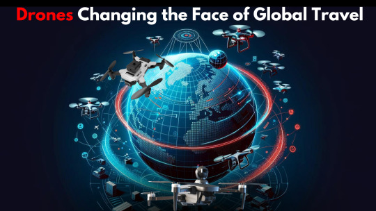
Breaking Limits: How Drones are Changing the Face of Travel
Unmanned aerial vehicles(UAVs), or drones, are redefining how we travel, discover new locations, and create and capture memories. Travelers are more often using drones to get a unique aerial view of popular spots across the globe as the drones become more accessible, lightweight, and simple to use. Travelers may now capture breathtaking images and films with drones that were previously only possible with a plane or helicopter. This has significant effects on the travel and tourism industry globally.
Capturing Postcard-Worthy Shots
One of the biggest appeals of traveling with a drone is the ability to capture stunning postcard-worthy shots of landscapes and architecture. Getting that bird's eye view of mountains, beaches, monuments, and other tourist sights adds a whole new dynamic angle that engages audiences in a powerful way. Whether it's circling the Statue of Liberty in New York or providing a unique vista of the Eiffel Tower in Paris or capturing the grandeur of The Himalayas, drones enable travelers to mesmerize their social media followers with photos they’ve never seen before. The drone’s ability to hover in place and maneuver in tight spaces makes getting these close-up but elevated shots easy and safe.
Immersive Videos to Inspire Wanderlust
Drones are transforming the travel industry with more than just photographs. Travelers are now able to produce immersive experiences and cinematic edits of their experiences in faraway places and exotic locations with the help of drone-captured video. These vacation pictures are highly shareable due to the smooth gliding and soaring aerial motions that modern consumer drones can achieve. Travel vloggers use drone footage to induce wanderlust in their viewers on popular platforms like YouTube, TikTok, and Instagram. Capturing images of different serene views like a ship sailing through the Indian Ocean or a car wheeling through an Assamese tea garden creates excitement and a desire to travel to such locations. These videos are much more fascinating because of the drones.
Promoting undiscovered Destinations
Drones have the potential to significantly enhance tourism worldwide through the promotion of lesser-known locations that are less well-known or more difficult to reach than the major places on everyone's bucket list. Drones are frequently used by social media influencers and travel bloggers to highlight hidden gem destinations that are not well-known to the general public. This includes remote beaches in Costa Rica, historic castles tucked away in Irish valleys, the maze of Santorini, Greece and many more. People are encouraged to travel outside of extremely famous cities and tourist destinations by the captions and stories that accompany these drone videos. Drones enhance the storytelling potential for attracting potential tourists to even lesser-known parts of the globe and then increasing tourism at a global-level.
Simplifying Adventure Travel Captures
Drones offer a more simple means of capturing sharing film for adventure-seeking tourists who filmed their travels through challenging or dangerous environments. Drones make it simple for travelers to film themselves in action while they are on the go, reducing the need for awkward angles or the assistance of another person, as was the case in the past when they tried to document their adventures such as hiking, skiing, surfing, climbing, etc. Pre-programmed flight modes like "follow me," "orbit," and "dronie" are combined with obstacle avoidance technology in the newest Elevate drone by insideFPV to facilitate the capture of fascinating, dynamic adventure sequences. Travel vloggers no longer need to risk their lives in an attempt to capture jaw-breaking scenes.
Borderless Exploration: Aided by Drone Technology
Drones help in breaking down geographical barriers with a seamless collaboration, enabling us to explore places that are unpopular or unknown to the general public. The Elevate drone, with its impressive 105-minute battery time, opens up new possibilities for extended exploration, making remote destinations more accessible and enticing. With these filmed pictures and videos, a whole new dynamic of areas gets accessible to the travel enthusiasts who wish to travel to unexplored places.
Global Travel and Adventure Vlogging:
Speaking of travel vlogs and blogs, drones are becoming an essential tool for content creators in these fields looking to elevate the quality of their cinematography. One excellent option for getting pro-level results is the Elevate drone by InsideFPV. With features like a 105-minute maximum battery life, 128 GB SD card storage which gives ample amount of storage for capturization, and 4K resolution on a stabilized camera, the Elevate is perfect for capturing professional travel footage. It also has smart modes like gesture control, motion sensing, and headless mode that make cool shots easy to capture. Obstacle avoidance and precision home return allow users to focus more on composing great content. For travel bloggers and vloggers creating atmospheric video tours that leave viewers longing to embark on their own journeys, the footage possibilities with drones like the Elevate are endless.
Responsible and Safe Drone Use
The increasing use of drones in international tourism emphasizes the need to highlight their responsible and safe use. Visitors should always prioritize safety and familiarize themselves with the laws controlling the use of drones for recreational purposes in the nations they visit. When using drones for travel, it's also crucial to respect biodiversity, local cultures, and the environment. It can be extremely harmful to use drones to geotag sensitive places or to trespass into communities of indigenous people that lead traditional lives cut off from modern technologies. Drones need careful supervision from travelers and producers of travel materials, just like any other technology.
Conclusion
By giving individuals a chance to showcase destinations, attractions, cultures, and experiences in ways never seen before, drones truly have transformed the face of tourism. They enable visitors to create fascinating material that encourages audiences to explore new places, makes adventure photography easier, and attracts viewers' curiosity. Professional videographers as well as amateur bloggers might benefit from drones like the Elevate. With the development of drone technology keeping pace with social media and content platforms, this airborne approach will likely push global tourism to unparalleled levels in the years to come. Travelers must educate themselves to fly safely, politely, and in accordance with local laws because great power comes with great responsibility.
Got more questions?
How can drones enhance my travel photos and videos?
Drones give you the freedom to capture unique aerial perspectives of landscapes that wow followers. Getting sweeping bird's-eye views of beaches, mountains, and famous sites lets you share postcard-worthy shots from creative angles no handheld camera can achieve. Drones also let you shoot cinematic, gliding video that makes viewers feel like they're flying.
What kind of footage is best for inspiring wanderlust in others?
Capturing serene drone views like a lone sailboat drifting across the sea or a car winding through a tea plantation creates an atmospheric, romantic vibe that stirs viewers’ desire to travel. The smooth motions drones provide as they sweep over scenic vistas are naturally mesmerizing. Using these clips in travel vlogs lets you highlight beauty that seduces audiences.
How can drones promote lesser-known destinations?
Influencers often use drones to showcase hidden gem travel spots their followers likely haven't seen, like secluded beaches in Lakshwadeep or historic castles. By pairing these unseen sights with compelling captions, you encourage viewers to venture outside famous tourist havens. Drones expand creative possibilities for attracting visitors to remote areas.
0 notes
Text
Revolutionizing Aerial Surveillance with Elevate
Introduction:
In today's fast-paced world, where safety and security are paramount concerns for organizations, regions, and communities alike, the role of surveillance has become increasingly vital. With advancements in technology, aerial surveillance has emerged as a game-changer, offering unparalleled capabilities in monitoring, analyzing, and securing diverse environments. Technology is advancing, and aerial surveillance is becoming increasingly important in the struggle for public safety. Imagine eyes in the sky, actively examining and safeguarding huge, varied landscapes rather than merely seeing them. Elevate, a pioneering drone by insideFPV, is one of these airborne patrols; its features completely rewrite the norms of surveillance.
Imagine this marvel on patrol across busy cityscapes, spotting suspicious conduct before it happens because of its precise vision. Imagine it swooping over large farmlands, detecting irrigation leaks or keeping an unmatched level of precision track on crop health.
1. Enhancing Safety and Security:
The increasing demand for safety and security across diverse sectors has pushed aerial surveillance to the major spotlight. Drones, with their unique mobility and perspective, offer invaluable support in various applications, including traffic monitoring, border patrol, and search and rescue in case of public safety in any country. Drones are playing an increasingly important role in enhancing security due to their aerial capabilities, affordability, and AI integration. Drones provide a bird's-eye view that enables real-time monitoring and surveillance over large areas at relatively low costs compared to traditional manned aircraft or satellite imagery.
Police and law enforcement agencies are using drones for better crime scene analysis, suspect pursuit, and crowd monitoring. Drones can provide critical visual data to assist officers on the ground for coordination during raids, protests, or emergency situations. Their thermal imaging cameras also help in search and rescue missions. Drones equipped with night vision support round-the-clock patrolling and perimeter security checks for prisons and border areas.
Critical infrastructure facilities like power plants, ports, and pipelines are securing their premises with drone surveillance to detect threats and unauthorized activities early. Drones can autonomously conduct inspection of vast industrial facilities to check for risks like gas leaks or structural damages. Equipped with radiation sensors, they also aid in monitoring nuclear sites against safety breaches.
Elevate, a pioneering drone by InsideFPV, distinguishes itself through its commitment to both safety and efficacy. Its 4-way obstacle avoidance system and precision home return functionalities ensure seamless navigation, minimizing risks during missions. Its 4K resolution and low-light camera capabilities make it indispensable for night patrols and surveillance in challenging environments. By effectively combining safety features with advanced monitoring capabilities, Elevate elevates the potential of aerial surveillance, contributing to a more secure and efficient world.
2. Consumer Applications:
Drones are increasingly being adopted by consumers for aerial surveillance in a variety of useful ways.
Drones have made it possible for hobbyists to take photographs and videos from unusual angles that were previously unattainable. Wildlife conservationists can now follow animals responsibly and check national parks without disturbing poachers thanks to drone technology.
Drones are very useful to small enterprises, particularly in the agricultural and infrastructure inspection industries. Usage of Camera-drones to examine damage at infrastructures to examine infrastructurally challenging damages at a low cost. Drones reduce expenses by precisely pinpointing problem areas and enabling focused response.
Elevate user-friendly interface and mobile-operated functionality make it accessible to enthusiasts of all levels. From capturing breathtaking aerial footage of vacations to filming outdoor activities, Elevate empowers travelers to immortalize their experiences from unique perspectives. Its 1080p live view and 4K resolution capabilities elevate content creation to new heights, enabling individuals to relive their adventures with unparalleled clarity.
3. Agricultural Advancements:
In the realm of agriculture, aerial surveillance holds immense potential for optimizing crop management and yield. Farmers use drones to take hyperspectral images to track crop development and identify infections early. Drones equipped with sophisticated sensors can monitor crop health, detect pests, and assess irrigation needs with precision. Elevate's extended battery life and expansive SD card capacity enable uninterrupted aerial monitoring, facilitating comprehensive crop surveys. By leveraging Elevate's smart modes such as gesture photography and motion sensor technology, farmers can streamline data collection processes and make informed decisions to maximize agricultural productivity. It can help in maintaining surveillance for wildlife
4. Defense and Homeland Security:
Aerial surveillance is integral to safeguarding national interests and maintaining vigilance against potential threats. Military and law enforcement agencies utilize drones for reconnaissance missions, border patrols, and counter-terrorism operations. Elevate's versatility and maneuverability make it an ideal asset for surveillance in diverse terrains and scenarios. With its advanced features like headless mode and gesture photography, Elevate enhances operational efficiency, enabling swift and precise intelligence gathering for defense and homeland security purposes. Coast guard units can use drones to augment the surveillance of illegal fishing, smuggling, piracy, or terrorist activities across vast, hard-to-monitor maritime borders. Drones extend patrol capabilities and accelerate interception responses.
5. Local Patrolling:
Police departments employ drones for better visibility across roads and highways to spot traffic violations, accidents, or congestion trouble spots in real-time. Drones also aid in reconstructing collision sites and finding alternate routes.Drones give police eyes in the sky during large public gatherings like protests, festivals, or VIP events.
6. Environmental Monitoring and Conservation:
Aerial surveillance plays a crucial role in environmental monitoring and conservation efforts. Drones equipped with specialized sensors can conduct aerial surveys of ecosystems, track wildlife populations, and monitor environmental changes with unparalleled accuracy. Elevate's long battery life and obstacle avoidance capabilities enable extended missions in remote or challenging terrain, facilitating comprehensive environmental assessments. By harnessing Elevate's capabilities, conservationists can gather essential data to inform conservation strategies and preserve biodiversity effectively.
7. Remote Exploration and Discovery:
The advent of drones has democratized access to remote and inaccessible regions, enabling unprecedented exploration and discovery. Whether it's documenting remote landscapes, archaeological sites, or natural wonders, drones offer a bird's-eye view of the world's most captivating destinations. Elevate's portability and ease of operation make it an ideal companion for adventurers seeking to chart uncharted territories and document their discoveries. With Elevate's high-resolution camera and smart modes, explorers can capture immersive visuals and share their experiences with the world.
Conclusion:
In conclusion, aerial surveillance, powered by innovations like Elevate, holds immense potential in reshaping safety, security, and efficiency across various domains. By leveraging real-time monitoring, advanced technology, and smart features, organizations, regions, and communities can fortify their defenses, optimize operations, and safeguard assets with unprecedented precision and effectiveness. As we continue to embrace the possibilities of aerial surveillance, the sky truly becomes the limit in our quest for a safer, more secure future.
FAQs
What are the main applications of aerial surveillance?
Aerial surveillance finds diverse applications in enhancing public safety, border security, law enforcement, infrastructure monitoring, environmental conservation, agriculture, and even creative pursuits like filmmaking and photography. Its unique vantage point and real-time monitoring capabilities make it invaluable across sectors, from detecting threats and illegal activities to optimizing crop management and capturing stunning visuals.
How does aerial surveillance technology contribute to safety and security?
Advanced aerial surveillance technology plays a crucial role in enhancing safety and security by providing real-time monitoring, threat detection, and rapid response capabilities. Law enforcement agencies use drones for crime scene analysis, suspect pursuit, and crowd monitoring, while critical infrastructure facilities employ them for perimeter security and risk detection. Additionally, search and rescue missions benefit from thermal imaging and night vision capabilities.
How can aerial surveillance support environmental conservation efforts?
Aerial surveillance drones facilitate comprehensive environmental assessments, wildlife population tracking, and monitoring of environmental changes. Their mobility, long battery life, and specialized sensors allow conservationists to gather essential data from remote or challenging terrains, informing effective conservation strategies and preserving biodiversity.

0 notes
Text
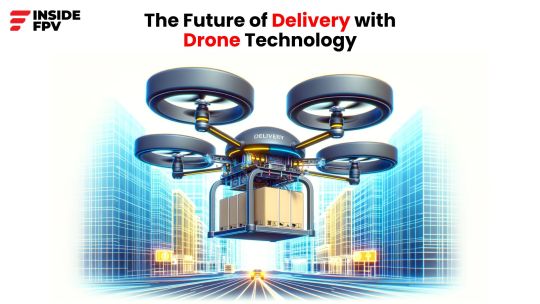
Drones of the Future: The Potential of Delivery Drones
Drones have grown in popularity for both recreational and business applications in recent years. However, today's unmanned aerial systems may eventually pale in comparison to the customised delivery drones designed to convey products right to our doorsteps. Major shops, logistics organisations, and digital startups are currently competing to construct drone delivery networks, which are expected to go into widespread operation this decade.
Delivery drone capabilities are likely to outperform existing UAS systems in terms of speed, range, autonomy, and sheer volume capacity over time. Drones have the potential to totally transform modern supply chains by combining intelligence and next-generation drone technology, from warehouse departures through last mile arrivals directly at homes or businesses.
Why Delivery Drones Now?
Several socioeconomic problematic conditions have come together, making it the ideal time for delivery drones to prepare for large-scale introductions across industries.
First of all, global business is more interconnected than ever before, thanks to mature ecommerce systems and rising customer expectations for speedy delivery. However, traditional transportation infrastructure is under strain as a result of continuous peak demand from online shopping and food delivery services. Road congestion grows as fuel and labour expenses continue to rise.
Simultaneously, drones benefit from developments in autonomous flight, battery density for longer flights, and computer vision systems that enable detailed collaboration. Soon, Cloud-connected drone operations might begin which could substantially decrease ground travel delays while completely bypassing roadway limits.
Shifting governmental policies can both speed and slow the upward trend. Governments are increasingly aiming to cultivate local technology innovators who can provide secure domestic jobs and technological advantages. However, governments thoroughly prioritise safety and privacy concerns about unmanned aircraft flying in public airspace, particularly at scale.
Major Players Targeting Delivery Drones
Originally recognized for bookselling, Amazon now concentrates R&D efforts on logistical difficulties inherent to all businesses. The company leads delivery drone research through its Prime Air subsidiary, which is already undertaking field experiments. Their drone prototypes use obstacle avoidance techniques and AI to transport tiny payloads autonomously.
United Parcel Service (UPS): the world's largest courier with over 65,000 global vehicles, sees drones as the next delivery platform. Aside from smaller experimental services in certain regions, they unveiled a fully automated mothership concept that releases and receives thousands of delivery drones throughout metropolitan areas.
JD.com, a Chinese powerhouse, just received approval to operate drone delivery routes that will stop at designated runway-equipped apartment blocks. While the initiative is currently in its early stages and limited in scope, it has the potential to support 80 million shipments handled across the country during peak annual shopping festivals.
Wing Aviation: a subsidiary of DJI's parent company, has formed partnerships with major merchants for unmanned aerial delivery in Australia and select US test locations. They present their custom multicopters as perfect "micro-delivery" vessels, with vertical takeoff and landing from surrounding launching sites.
Meanwhile, Zipline exclusively supports healthcare logistics, already aggregating over 200,000 commercial trips since it was founded. Their fixed-wing autonomous aircraft, which is currently primarily carrying medical supplies but can transport almost any modest payload, will soon expand beyond Africa and into Asia and America.
Ongoing Challenges Around Scaling Delivery Drones
While the future potential is remarkable, analysts predict more moderate adoption routes. Before unmanned delivery networks can become widely available, significant technical and regulatory barriers must be removed.
With greater cargo weight, most multicopters still have limited single-trip ranges of around 30 minutes. While sufficient for some short travels in jammed urban areas, upgraded batteries, motors, and even hydrogen cells aim to increase roundtrip ranges to achieve widespread viability across regions as well as farther.
Sensor Improvements AI-powered situational processing, and aviation computer engineering are all helping to improve the reliability of autonomous navigation in uncertain circumstances. Moving beyond line-of-sight transport is dependent on solution integrity, especially when valuable properties are at stake.
Regulatory uncertainty around larger-capacity drones flying larger routes across most nations complicates logistics planning at present. Aviation authorities rightly prioritize public safety and air traffic management through layers of flying standards, pilot qualifications, platform restrictions, operational area limits, and other measures. The policy generally lags years behind advances in technology.
Furthermore, delivery drone infrastructure demands at the national level remain almost hypothetical until large rollouts begin. Refinements in launch/retrieval ergonomics, charging protocols, weather resilience, theft/vandalism deterrents, and payload integrations will advance gradually from small trials to full-scale optimization.
Delivery Drones - 2030 and Beyond
Once the key building blocks above develop adequately over the coming several years, we may witness delivery drones unleashed across landscapes in unimagined ways by 2030. In the following section we explore various technological possibility and its alignment with practical business application:
Hyperlocal Distribution Hubs
Small delivery stations, whether owned by Zepto, Amazon, Uber, can be found in localities around towns and cities, allowing gig delivery drones to complete deliveries quickly. These tiny ports may be installed atop malls, Ring-secured homes, or even autonomous roving ground vehicles that circulate zones on demand.
After receiving orders, things are chosen and packed from dense shelving into standard container boxes that mount securely under drones with few size or weight restrictions. AI optimization bots enable efficient grouping of several cargoes per vehicle. Template containers make it simple to secure a wide range of items.
Dedicated Air Corridors & Traffic Systems
Rather than dangerous free-for-all skies, city traffic planners define designated aerial routes for unmanned logistics use. Drones are safely guided between distribution hubs and destination locations via streamlined corridors. Flight patterns are intelligently aligned based on building heights, population density contours, noise restrictions, existing airport approaches, and other geo-variables.
Dedicated city command centres monitor drone congestion and weather in the same manner as highways monitor currently, utilising sensors and visual surveillance. This allows for dynamic rerouting and drone coordination in real-time, ensuring reliable delivery even in unexpected situations. Links to homeland security and traffic administration systems help boost local supervision capabilities.
Recurring Revenue Unlocks Premium Services
With ultra-reliable logistical frameworks in place, premium commercial services emerge for those prepared to pay a higher price. Dedicated branded drones equipped with company colours and payloads deliver with higher priority. Local retailers now have guaranteed less-than-one-hour windows, introducing on-demand neighbourhood offerings. Gift-wrapped drone arrivals offer an extra special occasion charm!
Consumer packages also receive small RFID tags for low-energy passive tracking from facilities through handoff. Recipients track positions in real-time as they approach their doorstep. Transparency and predictability improve end-user experiences significantly.
As we stand on the brink of a transformative era in drone technology, the potential of delivery drones is poised to reshape industries and redefine convenience. With major players like Amazon, UPS, JD.com, Wing Aviation, and Zipline pushing the boundaries, the future promises swift and efficient aerial deliveries.
FAQs 1. Are delivery drones safe and reliable?
Yes, advancements in technology, including AI-powered navigation and obstacle avoidance systems, ensure the safety and reliability of delivery drones. Ongoing developments in the industry prioritise public safety and efficient air traffic management.
2. How far can delivery drones travel?
The current range of most multicopters is around 30 minutes for short trips in urban areas. However, ongoing improvements in battery technology aim to extend roundtrip ranges, making widespread drone deliveries feasible across regions and longer distances.
3. What challenges are hindering the widespread adoption of delivery drones?
Significant technical and regulatory barriers, such as cargo weight limitations, regulatory uncertainties, and infrastructure requirements, need to be addressed for widespread adoption. The industry is actively working to overcome these challenges to unlock the full potential of delivery drones.
0 notes
Text
insideFPV Flies High with PM Modi's #NamoDrone Didi Initiative
India is entering into a new era of modern farming with insideFPV at the forefront of Prime Minister Narendra Modi's revolutionizing #NamoDrone Didi initiative. This initiative program aims to empower rural women by training them to use drones for agriculture.
Just 6-7 months ago, insideFPV embarked on this journey to bring drone technology to Indian farms. In this short period, the company has played a pivotal role in the impressive growth of India's drone industry benefiting the agricultural sector at large.
The major milestone was the recent Sashakt Nari - Viksit Bharat program where PM Modi himself witnessed agricultural drone demonstrations by the #NamoDrone Didis (Women in the agricultural sector who are envisioned to be empowered) at the Indian Agricultural Research Institute (IARI) in Delhi. It was a trademark occasion with Namo Drone Didis from 10 locations across India simultaneously showcasing their drone operations.
The Prime Minister handed over drones to 1,000 #NamoDrone Didis trained by insideFPV and other companies. Appreciating and celebrating their success, PM Modi called it a historic day for writing new chapters for the Drone Didis and Lakhpati Didis (women entrepreneurs).
So what exactly are these #NamoDrone Didis doing with their drones on the fields? They are revolutionizing farming practices through precision agriculture enabled by drone technology.
With drones, surveying entire farms, keeping track of crop health, and precision spraying of fertilizers,pesticides and water becomes easy and efficient. This leads to better yields while reducing costs and controlling environmental damage from prevention of excessive spraying.
For insideFPV, training the Drone Didis is just the first step. The company provides revolutionary drones integrated with sensors and software specifically designed for agricultural usage.
Using these drones, the Didis can make precision 3D maps and design their own prescription for nutritional spraying and pest control, tailored for their crops and land. The drones can spray the required inputs( be it water or pesticides) directly over the crops in a targeted manner based on aerial data that has been collected via the aerial surveillance.
Such precision agriculture techniques were unreachable for most Indian farmers until the introduction of #NamoDrone Didi initiative which brought affordable drone technology to their farms.
A new age of sustainable farming and technological inclusion in India has been launched by the initiative, which has trained and employed thousands of rural women as Drone Didis.
The drones that PM Modi personally endorsed and delivered are a testament to his commitment to a women-led "Aatmanirbhar Bharat." The Lakhpati Didi and Drone Didi programs are essential to the socio-economic advancement of rural women, uplifting their status.
With insideFPV's expertise in precision agriculture drones, these initiatives have taken a greats stride towards modernizing Indian farming while creating entrepreneurship opportunities for women.
The Prime Minister's presence sent a powerful message about embracing technological revolutions in critical sectors like agriculture. It marked the beginning of drones going truly mainstream in Indian farming.
The face of Indian agriculture is set for an enormous transformation toward sustainability and profitability when the #NamoDrone Didis, trained by insideFPV, deploy their drones to new regions. This fulfills a significant goal for both the company and the Drone Didi program.
0 notes
Text
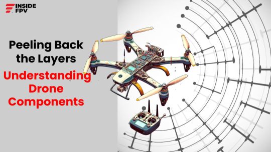
Peeling Back the Layers: Understanding Drone Components
Whether you’re a drone enthusiast or considering buying your first quadcopter, learning the basic anatomy of these impressive little machines goes a long way. Drone components may seem complex at first glance, but by understanding the core systems that go into building these drones, one gains better insight into critical factors like flight performance, safety, and overall capability.
In this blog, we’ll peel back the layers of drone technology and explore the essential hardware and software elements that give drones their unique superpowers of vertical flight and midair manoeuvrability. Let’s get better acquainted with the brains, nerves and muscles behind the drones!
The Frame: Skeleton of Drone
The frame serves as the structural foundation onto which all other drone components mount. Sometimes called the chassis, the frame ties everything together into one cohesive package. Most hobbyist drones use four-armed frames built from materials like plastic, aluminium, carbon fibre or magnesium. Arms extend diagonally from a central point, giving quads their distinctive “X” shape when viewed from above or below.
One can find several specifications when shopping for drones:
Size – Measured diagonally motor-to-motor. Common sizes range from ~110mm micro drones to ~500mm racers/freestyle quads
Material – Plastic frames are lightweight but fragile and deformable. Metal materials offer more durability and stiffness, at the cost of greater mass. Composite options like carbon fibre give excellent strength-to-weight ratios.
Geometry – Some frames use simple straight tubes, while more complex shapes and truss structures enhance stiffness. The motor/arm layout varies too – deadcat and X frames are quite common.
Replaceable arms – High end frames make it easy to swap damaged arms quickly after crashes
Advanced pilots may customise and design their own frames, though most casual users opt for off-the-shelf frames which readily accept standard components.
Flight Controller: The Electronic Brain
If the frame is the skeleton, the flight controller represents the brain of the drone body. This compact circuit board houses the sensors and processors that stabilise your drone flight- without it, drones cannot fly at all!
The aptly named flight controller constantly adjusts power to all motors using sensor and feedback. MEMS gyroscopes, accelerometers and other sensors feed orientation data to the processor up 2000 times per second. Advanced sensor fusion translates this data into precise positioning corrections that compensate for inevitable mid-air disturbances like wind gusts.
Most flight stacks run Cleanflight, Betaflight or iNav - open source firmware that processes sensor data and controls ESCs/motors accordingly via PID control loops. The values (gains) within these loops are highly tunable to dial in optimum stability and response across different frames. A well tuned quad should handle neutral and aggressive stick inputs with precision and grace!
Motors & Electronic Speed Controllers
Flight controllers influence movement by directly communicating with electronic speed controllers (ESCs) - the intermediaries that manipulate motor spin. This allows sophisticated auto-stabilisation of the entire platform during lift, hover and transit.
Brushless electric motors offer drones incredible power-to-weight - even models under 250 grams produce substantial thrust partially due to high Kv ratings (rpm per volt supplied). Leading motor brands like T-Motor, SunnySky and Cobra excel at efficiency across variable-pitch propeller loads. Materials range from aluminium to more exotic options like carbon fibre. Stators are like the outer shell, with thick coils of copper wire wrapped up tightly. When electricity runs through these wires, they create a powerful magnetic field, while rotors are the spinning part and have strong magnets attached. These magnets interact with the magnetic field from the stator, pushing and pulling to spin the rotor really fast, sometimes up to 100,000 rounds per minute (rpm)!
ESCs amplify the flight controller’s movement commands, pulsing voltage into the motors at differing widths to finely control rpm. Analog servo motors use variable Pulse width modulation (PWM) signals, while brushless motors require specifically designed ESCs to alternate voltage directions and switch polarity. This creates the shifting electromagnetic forces that spin rotors to staggering speeds within fractions of seconds.
Props and Landing Gear: The Wings & Legs
What goes up, must come down...hopefully slowly and upright! Besides generating upward lift, well designed props and landing gear make drones far less crash prone.
While complex at molecular levels, conceptually props are simple - angled blades that displace air downward to create reactionary force upward per Newton’s third law. Various prop geometries and pitches better tune drones for race pace sprints vs. long range endurance. Leading brands include DALProp, HQ Prop and Ethix. Materials usually consist of durable composites in the need for an elusive balance between strength, weight and aerodynamics.
Assisting safe touchdowns and awkward landings, the undercarriage absorbs ground impact when manoeuvring near surfaces. Materials like flexible thermoplastic urethanes provide a cushioning crush zone, while plywood or carbon fibre plate bases offer upper protection. Strong yet lightweight aluminium, fibreglass and carbon fibre legs mount everything securely to the central frame.
Battery and Power Distribution
Delivering power to all four motors plus onboard electronics requires serious amps and volts! Lithium polymer batteries are the source here - extremely impressive power-to-weight ratios. Common drone variants supply between 3S and 6S setups:
3S (3 cell) = 11.1 volts
4S (4 cell) = 14.8 volts
5S (5 cell) = 18.5 volts
6S (6 cell) = 22.2 volts
Voltage directly influences maximum motor rpm & thrust capabilities, while higher amp hour (Ah) ratings extend flying time per charge. Leading LiPo battery brands include GNB, TATTU and Dinogy.
Power distribution boards (PDBs) route energy flows from the main battery through separate ESCs to each motor. Soldered wiring harnesses link ESCs to motors as well. PDBs also tap battery power for LED lighting, FPV cameras, gimbals and other onboard peripherals as needed.
Radio Transmitter & Receiver
What good is an advanced flying robot without adequate controls? Radio communication gives pilots masterful command mid-flight. Transmitters send user inputs via 2.4 GHz or 900 MHz signals, while tiny receivers receive the signals, the drone passes those along to the flight controller.
Most quads operate on variations of familiar control schemes:
Throttle - Altitude up/down
Yaw – Left/right rotation
Pitch – Forwards/Backwards tilt
Roll – Sideways tilt left/right
Many transmitters include toggle switches, dials and multibutton inputs across the front face and back sides. Contemporary transmitters integrate Android touchscreens too for monitoring drone telemetry and configuring settings. Whether simple or deluxe, all aim for ergonomic intuitiveness to keep quadcopters gracefully in air!
First Person View (FPV) System
For next level flying thrills, first-person-view (FPV) video setups stream real time footage from drone-mounted cameras directly to the pilot’s eyes or mobile screen. This creates an exhilarating sensation just like actually sitting in the cockpit!
FPV camera sensors mounted on vibration-damping plates capture unique aerial perspectives. Circularly polarised or patch antennas then beam video downstream to the pilot’s receiver unit. Sensible latency measures around 20-40ms. Pilots don goggles containing one small display per eye, providing a wide field of view as they steer quads by line of sight. Some camera drones also record digital video straight to onboard microSD cards.
We’ve covered quite some ground exploring all the integral bits comprising today’s consumer drones. While advanced manufacturing processes allow remarkable performance from microscale components, creative open source software communities are equally responsible for the impressive flight capabilities drone pilots enjoy today. Developers continue building upon long proven aerodynamic, estimation and control theories to push drones potentials ever further.
Yet even with sophisticated auto-stabilisation and navigation intelligence behind the scenes, safety should always come first when operating any aerial vehicle. Before attempting tricks or long range flights, one should take time mastering basic flight skills in open areas away from people, buildings and other risks. Precision drone control requires diligent practice, but offers excitement, challenge and reward for those willing to properly progress from the first liftoff onwards!
FAQs
1. What is the role of the frame in a drone?
The frame serves as the structural foundation of a drone, holding all components together. It provides the base for mounting essential parts and influences the drone's overall stability and durability. The frame's design and material impact factors like weight, strength, and aerodynamics.
2. What is the purpose of the First Person View (FPV) System in drones?
The FPV system streams real-time video from the drone-mounted camera to the pilot's eyes or a mobile screen. This immersive experience allows pilots to navigate their drones as if they were sitting in the cockpit, providing an exhilarating flying sensation.
3. Which component of the drone is the most important?
Identifying the single most important component of a drone is challenging because each element plays a crucial role in ensuring the drone's overall functionality and performance. However, the flight controller stands out as a pivotal component that can be considered the "brain" of the drone. The flight controller processes data from various sensors, stabilises the drone during flight, and translates user inputs into precise motor commands. Without the flight controller, a drone would be unable to maintain stability, respond to pilot commands, or even achieve liftoff. While every part contributes to the drone's success, the flight controller is often regarded as the central hub orchestrating the harmonious collaboration of all components.
0 notes
Text
Drones vs. UAVs: Deciphering the Terminology
Unmanned Aerial Vehicles (UAVs) and drones are often used interchangeably, but there are some key differences between the two terms that are important to understand. In this blog post, we’ll break down the terminology around drones and UAVs, look at how the terms overlap and differ, and help decipher exactly what sets both aerial vehicles apart.
A Brief History of Drones and UAVs
The concept of an “unmanned aerial vehicle” first emerged in the early 1900s, when remotely operated biplanes were used for target practice. These early versions of UAVs were quite primitive, but established the possibility of aircraft that could fly without an onboard human pilot.
Over the next hundred years, UAVs and their capabilities advanced considerably, especially with military investment during wartime. During the Vietnam War, UAVs were used mainly for surveillance purposes. By the 90s, UAVs evolved into combat drones equipped with missiles and bombs. The most well-known modern military UAV is likely the Predator drone, which has been operational since 1995.
On the civilian side, non-military UAV adoption kicked off around 2006, when the Federal Aviation Administration (FAA) issued their first commercial drone permits. Early civilian UAV uses included aerial surveillance, photography, and filmmaking. Hobbyist drone adoption then accelerated rapidly thanks to the release of affordable “prosumer” drones from DJI in 2013.
Today, UAVs have evolved far beyond their 20th century predecessors. Modern drones now leverage cutting-edge technologies like LiDAR sensors, computer vision, thermal imaging payloads and more. The terms “UAV” and “drone” have become common vernacular, though their definitions have become muddied.
Breaking Down Key Terminology
UAVs
“UAV” stands for “unmanned aerial vehicle” – any aircraft that does not have a human pilot onboard. Instead, UAVs are controlled remotely by a pilot on the ground, or increasingly, through sophisticated programming and autonomy.
Under the umbrella of “UAV” lives a number of more specific subcategories:
UAS: Stands for “unmanned aircraft system”. Refers to the UAV itself plus associated support equipment, communications links and personnel involved in operating the vehicle.
RUAV: “Remotely-operated UAV”. Indicates a UAV controlled in real-time by a remote human pilot, via radio, WiFi link, etc. RUAVs do not have fully autonomous capabilities.
AUVSI: The Association for Unmanned Vehicle Systems International, which publishes specifications and guides for the civilian UAV industry.
So a UAV describes the aircraft itself, while UAS refers to the whole system enabling that aircraft to operate.
Drones
The modern use of the term “drone” emerged with the rise of modern hobbyist quadcopters. Today, drone refers to any UAV that meets the following criteria:
Is capable of flight without an onboard human pilot
Uses some level of onboard automation, such as stabilisation algorithms or GPS waypoint navigation
Uses an electric motor rather than internal combustion engine
Has multiple lift rotors as opposed to fixed wings
By this definition, drones are more limited than the broader category of UAVs. All drones are UAVs, but not all UAVs are drones. Drones specifically:
Lift vertically using 4+ rotors (multirotors)
Run on electric battery power rather than fuel
Have an onboard flight controller for stabilisation and automation
Common examples of modern drones include popular quadcopter models from leading makers like DJI and Indian startups like insideFPV. On the other hand, large UAVs like the militarised Predator qualify as UAVs but not drones, because they use internal combustion engines instead of electric motors.
Key Differences Between Drones and UAVs
Range
One major difference comes down to operating range. UAVs span a huge spectrum from toy-sized micro drones to ultra-long range military UAVs. Toy drones may fly for 5 minutes at 100 feet max, while advanced fixed wing UAVs like Global Hawk can operate across thousands of miles.
The transmission system is key here. Hobbyist drones use direct radio transmission with quite limited signal strength and interference protection. As such, they top out around 5 miles max before losing connection. Commercial drones balance distance and bandwidth, achieving 10-15 mile operational ceilings. Military systems use extremely robust configurations like satellite up-links to maintain control across continents.
Most drones use direct linking to the pilot’s controller, capping their functional range around 15 miles. UAV platforms that relay video and control data through networks can stretch much farther distances.
Flight Time
Flight times also differ considerably between short-range multirotor drones vs. long-endurance fixed wing UAVs. Quadcopters and octocopters usually permit 10-40 minutes aloft at most, since electric motors drain small onboard batteries quickly. Gas or hydrogen-powered UAVs are not so limited, staying in air more than 35 hours in cases like the Global Hawk.
Autonomy
Today’s drones typically have basic programmed behaviours, but rely heavily on constant human piloting. Fixed wing UAVs feature far more advanced autonomy powered by AI and machine learning. High-end military UAVs can take off, navigate to faraway destinations , identify targets, and even fire weapons - all without human intervention.
Payloads
Drones, with their smaller airframes and limited power, equip mainly small cameras or other sensors for stabilisation and navigation. Larger UAV platforms have ample room and electricity to host radar, LiDAR, communications relays or multiple payloads at once. Top-tier military UAVs can house high-powered cameras, armaments, electronic warfare systems simultaneously thanks to greater lift capacity and power availability.
UAVs Classifications
UAVs can be categorised based on attributes like weight, operating mode, range and more. The U.S. Department of Defense classifies military UAVs using the following system:
Category Max. Gross Takeoff Weight Typical Operating Altitude Mission Radius
Group 1 0-20 lbs <1200 ft above ground level (AGL) <10 km
Group 2 21-55 lbs <3500 ft AGL <10 km
Group 3 <1320 lbs <18,000 ft mean sea level (MSL) <50 km
Group 4 >1320 lbs <18,000 ft MSL >50 km
So a tiny toy quadcopter would likely qualify as Category 1, while a long-distance surveillance plane like Global Hawk fits under Category 4.
Commercial and Civilian UAV Applications
While government and consumers have driven most UAV adoption so far, commercial/enterprise applications are now the fastest growing subset of the industry.
Goldman Sachs predicts the commercial drone market to top $100 billion in the next decade, compared to military (tens of $billions) and hobbyist (single digit $billions) sectors.
Many commercial UAV applications centre on data collection and analytics, including:
Infrastructure Monitoring - Powerline, pipeline, structural, solar farm, etc
Industrial Inspections – Asset management, volumetric analysis, reporting
Construction – Surveying, site mapping, project documentation
First Response – Damage assessment, search and rescue operations
Agriculture - Crop spraying, livestock monitoring, soil analysis
Delivery – Long range inter-city shipment of goods
Key enablers spurring commercial UAV adoption include better battery technology, 5G connectivity, improved autonomy, and most importantly - relaxed aviation authority regulations.
In years past, commercial UAV pilots were required to hold actual manned aircraft pilot licences like private pilot certificates. Updated FAA Part 107 regulations have made it much more accessible for rookie UAV operators to legally fly drones for profit.
The Future of Drones and UAVs
Drones and UAVs have already made a sizable impact on both military and civilian operations around the globe. And experts predict an exciting road ahead with autonomy advancing dramatically across drones and UAV platforms of all types and sizes.
Artificial intelligence and machine learning will likely unlock new commercial applications and business models as UAVs gain the ability to sense, think and act independently of human operators. Imagine autonomous cargo drone networks whisking packages, food orders and medical supplies to doorsteps 24/7 without human assistance. Or remote oil rigs and wind turbines entirely monitored and managed by intelligence-infused camera drones.
The coming years should witness UAVs proliferating worldwide across both government and commercial segments, bringing economic and societal benefits. However, risks around safety, privacy and cybersecurity will require careful governance to ensure this next phase of mobility innovation improves life for all citizens.
Drones vs. UAVs: Deciphering the Terminology
In the vast and evolving landscape of unmanned aerial vehicles, the terms "drones" and "UAVs" are often used interchangeably, creating a certain ambiguity in their meaning. While both terms refer to the same technological marvels, a deeper exploration reveals subtle distinctions that go beyond mere semantics. In this comprehensive exploration, we embark on a journey to decipher the terminology, shedding light on the nuances that distinguish drones from UAVs.
Defining Drones and UAVs:
1. Drones:
- The term "drone" has permeated popular culture, becoming synonymous with unmanned aircraft. Drones are aerial vehicles that operate without an onboard human pilot. They can be remotely controlled or programmed to follow a specific flight path. Drones come in various sizes and configurations, serving a multitude of purposes beyond just surveillance or reconnaissance.
2. UAVs (Unmanned Aerial Vehicles):
- UAVs, or Unmanned Aerial Vehicles, encompass a broader category that includes all types of unmanned aircraft, both remotely controlled and autonomous. The term UAV is more technical and is often preferred in military and aerospace contexts. It emphasises the autonomous nature of these vehicles, highlighting their ability to operate without direct human control.
3. UAS (Unmanned Aircraft System):
- UAS, or Unmanned Aircraft System, represents a more comprehensive concept. It includes not only the unmanned aircraft (UAV) but also the ground-based controller and the communication system connecting the two. UAS encompasses the entire ecosystem required for the operation of an unmanned aircraft, emphasising the interconnectedness of its components.
The Evolution of Terminology:
The distinction between drones and UAVs has historical roots that trace back to the military origins of these aerial devices. In the early days, UAVs were predominantly associated with military applications, where autonomy and advanced functionalities were paramount. On the other hand, the term "drone" found its way into mainstream usage, often carrying connotations of consumer-grade quadcopters used for photography or recreational purposes.
Consumer Perception:
1. Drones:
- The term "drone" has gained widespread popularity in consumer markets, representing a diverse range of unmanned aircraft. Consumers commonly associate drones with recreational flying, aerial photography, and other non-military applications. This perception reflects the democratisation of unmanned aerial technology, making it accessible to enthusiasts, hobbyists, and professionals alike.
2. UAVs:
- In contrast, the term UAVs may evoke a more technical and formal image. It is frequently employed in industries where precision, autonomy, and advanced capabilities are emphasised, such as agriculture, surveying, and environmental monitoring. The term UAV aligns with the intricate systems deployed in these sectors, highlighting the sophistication of the technology.
Technical Distinctions:
While the terms are often used interchangeably, some technical distinctions provide clarity:
1. Autonomy:
- UAVs inherently emphasise autonomy, indicating a level of self-guided operation. They can execute predefined tasks without constant human input. Drones, while often capable of autonomous flight, may also include models that rely more on remote control.
2. Applications:
- The choice of terminology can also reflect the intended application. Drones might be a preferred term in contexts where simplicity and accessibility are key, such as in consumer markets. In contrast, UAVs may be favoured in industries where precision, advanced technology, and autonomy take precedence.
InsideFPV's Perspective:
As a leading drone company, InsideFPV recognizes the nuances in terminology and the impact it can have on consumer understanding. Our commitment goes beyond selling products; it involves demystifying the technology and fostering a clear understanding of the capabilities these devices bring to various industries.
Navigating the Terminological Landscape:
In practice, the choice between "drone" and "UAV" often depends on the context, audience, and the specific characteristics of the unmanned aerial vehicle in question. For InsideFPV, our aim is to communicate effectively and cater to the diverse needs of our customers. Whether addressing enthusiasts seeking recreational drones or professionals in need of sophisticated UAV solutions, we strive to use terminology that resonates with and accurately represents the intended audience.
Future Trends and Terminology:
The terminological landscape of unmanned aerial vehicles continues to evolve alongside technological advancements and changing perceptions. As drones/UAVs become more integrated into various industries, the terms may converge or adopt new meanings. It is crucial for industry players, including manufacturers like InsideFPV, to stay attuned to these shifts and adapt their communication strategies accordingly.
Conclusion:
In the grand tapestry of unmanned aerial vehicles, the distinction between drones and UAVs is nuanced, reflecting historical origins, consumer perceptions, and technical intricacies. As we navigate this landscape at InsideFPV, our commitment to clarity and effective communication remains unwavering. Whether our customers refer to our products as drones or UAVs, what matters most is the value and innovation we bring to their endeavours. In the end, the terminology is a means to an end – a tool for understanding and appreciating the incredible possibilities that unmanned aerial technology offers to our world.

0 notes
Text
Agriculture Drones: Transforming Farming in India
In the vast expanse of India, where agriculture is not just a livelihood but a way of life for millions, the integration of technology has ushered in a new era. One such technological advancement that has been making waves in the agriculture landscape is the use of drones in agricultural practices.
These unmanned aerial vehicles are not only changing the face of farming; they are transforming it by offering more efficiency, precision, and sustainability. As we explore the intricate background of Indian agriculture, we see how drones are becoming crucial tools, surpassing traditional farming practices and paving the path for a more sustainable and productive future.
The Agricultural Landscape in India:
India stands poised for an agriculture revolution driven by drones. Rapid technology improvements across imaging, analytics and autonomy now bring sophisticated data-driven crop management and precision spraying solutions within reach for millions of farmers today. UAV platforms promise to alleviate major pain points that have chronically constrained yields, damaged harvests and suppressed farm incomes across regions.
In this post we’ll explore some of the biggest historical challenges in Indian agriculture and how drones uniquely address underlying issues through aerial intelligence gathering and targeted chemical application enhancements. We’ll also consider real world implementations, cost-benefit tradeoffs and what nationwide scale adoption could achieve for rural prosperity and food security priorities overall.
Perennial Farming Challenges in India
Small landholding farmers power the livelihoods of over 50% of Indian households today directly through cultivation or subsidiary trades supporting regional yields. Yet myriad issues plague consistent, optimal harvests:
Labor Intensive Scouting - Limited windows exist catching infections before entire fields require treatment. Spotting early signs of blight visually amid vast acreages proves extremely difficult and back breaking.
Inefficient Spraying – Uniform blanket spraying of entire plots is imprecise and wasteful whether by hand pumps or towed equipment. Analysing foliage pixel by pixel would allow ultra targeted application only where required.
Water Mismanagement - Inefficient flood irrigation still dominates wasting enormous volumes as crops utilise barely half resources pulled from declining aquifers. Optimising moisture precisely across different plots is rare.
Inaccessible Farmland - Rugged or flooded terrain makes assessing and treating crops effectively almost impossible without extensive manual effort.
Limited Operation Windows - Farmers race against tight seasonal deadlines around planting, pest management and harvesting. Delayed action due to above issues easily destroys entire revenue streams.
These interwoven agricultural challenges badly need innovative disruption. Next let's see how drones offer high tech solutions promising vastly increased yields and dramatically improved farmer prosperity.
The Rise of Agriculture Drones:
The introduction of agriculture drones in India represents a considerable shift from traditional farming practices. These drones, which are equipped with modern sensors and imaging technologies, provide farmers with real-time information and actionable insights. Various startups in the drone industry understand the transformational influence that these drones may have on Indian agriculture and seek to shine light on the numerous benefits they can provide to the farming community.
The Benefits of Drones in Agriculture:
Precision agriculture - Enhancing efficiency and yield:
One of the key benefits of agricultural drones is their potential to enable precision agriculture. These drones, equipped with high-resolution cameras and sensors, take precise photos of the farmland. This information is then processed to determine crop health, identify pests and diseases, and track soil conditions. Farmers can utilise this information to make informed decisions about water, fertilisers, and pesticides.
A drone survey, for example, may identify exact parts of a field that need more irrigation or highlight areas with nutritional deficiencies. This targeted approach not only maximises resource efficiency but also reduces environmental effect, in line with sustainable farming methods.
Tackling Challenges with Data-Driven Insights:
In a place where unexpected weather can wreak havoc on crops, timely data collection is critical. Agriculture drones provide real-time insights into weather patterns and potential crop risks, making them a proactive option. This early warning system enables farmers to take preventative measures that reduce the impact of adverse weather on the productivity of farms.
Furthermore, the data obtained by drones helps farmers organise their planting and harvesting schedules more efficiently. Farmers that understand their crops' growth stages can optimise the timing of these actions, resulting in higher agricultural yields and financial returns.
Sustainability and Environmental Stewardship:
Agriculture drones not only improve efficiency and productivity, but also promote sustainable farming practices. The precise application of inputs, enabled by drone technology, reduces the environmental impact of farming activities. Reduced usage of water, fertilisers, and pesticides lowers production costs while simultaneously reducing agriculture's environmental footprint.
Furthermore, drones help to monitor deforestation, illegal logging, and land degradation. They become crucial conservation tools because they provide a bird's-eye view of broad areas, helping to preserve biodiversity and natural resources.
Cost Savings:
The integration of drones into agriculture results in a paradigm shift in cost-cutting strategies. Drones are drivers for economic efficiency in farming, from precise input application and effective irrigation to increased time efficiency and decision-making. As technology advances, the cost-saving benefits of drones are expected to increase, giving farmers long-term and economically feasible solutions to the challenges that they confront in the modern agricultural landscape.
Some of the major usage of drones in agriculture are:
Monitoring large farms spanning miles is labour intensive. Drones with 4K cameras allow farmers to easily survey entire properties from the comfort of their homes with real-time aerial views up to 20km away.
Spotting irrigation issues or soil variation patterns is extremely difficult on the ground. Multispectral drone sensors can instantly identify overwatered and nutrient deficient areas for correction early using prescription maps.
Early disease or pest infestation detection requires endless walking to visually inspect plants. Drones automate scanning massive crop rows using machine learning to model and highlight distressed foliage precisely for prompt treatment.
Assessing crop yields accurately takes extensive manual sampling and calculations. Autonomous drone fleets generate detailed crop volumetric estimates down to cubic metre precision using sophisticated algorithms informed by visual data capture across fields.
Applying chemicals uniformly by traditional equipment or labour is imprecise and wasteful. Drones enable precise spray doses deployed based on foliage scans recognizing areas in need vs healthy regions. This saves money and the environment.
InsideFPV's Krishi Drone : Revolutionising precision agriculture.
InsideFPV introduced Krishi, an innovative drone meant to transform precision agriculture. Krishi is committed to changing agricultural practices, owing to its revolutionary features and commitment to meeting farmers' specific demands.Following are the highlights of the Krishi drone:
Fully Autonomous Operations:
Krishi functions completely autonomously, offering farmers a hassle-free solution for sprinkling pesticides, insecticides, and irrigation. This independence ensures that the drone efficiently covers the targeted area while requiring minimal manual involvement, thus making it easy to fly without so much effort from the farmer's side to understand technical aspects of drones.
High efficiency.
Krishi is designed for maximum efficiency and can cover 2-3 acres in a single flight. This outstanding efficacy not only saves time but also improves the overall effectiveness of crop management and irrigation systems, resulting in higher yields.
Outstanding capacity:
Krishi has a significant 10-litre capacity, which allows for extended use without the need for regular refills. This function means that the drone can cover a large area before requiring additional inputs, making it convenient for farmers.
Gujarat Government Subsidies:
Recognizing the importance of drones in agricultural practices, the Gujarat government is providing a substantial 50% price subsidy on Krishi drones. This effort intends to make modern technology more available to farmers, thereby encouraging sustainable and efficient farming techniques.
Affordable pricing:
InsideFPV strives to offer Krishi at reasonable costs in contrast to its competitors. This competitive pricing strategy demonstrates our commitment to making transformative agricultural technology available to a wider spectrum of farmers, regardless of the size of operation.
Terrain-following radar and obstacle avoidance:
Krishi is equipped with innovative terrain-following radar and obstacle-avoidance technology. This allows the drone to navigate the landscape with precision, avoiding obstacles in its route. The end result is a safer and more reliable operation that reduces the risk of accidents while improving overall efficiency.
The Future of Indian Agriculture: A Collaborative Approach:
As we navigate the future of Indian agriculture, it becomes evident that the successful integration of drone technology requires collaboration among various stakeholders. Government bodies, private enterprises, research institutions, and farmers must join hands to create a supportive ecosystem for the widespread adoption of agriculture drones.
InsideFPV advocates for initiatives that aids the use of drone technology in agriculture.They are committed to making it more accessible for farmers across the country. This collaborative approach is not just about selling drones but fostering a sustainable agricultural revolution.
InsideFPV believes that Krishi is not just a drone; it is a solution crafted to address the unique challenges faced by Indian farmers. By combining autonomy, efficiency, affordability, and cutting-edge technology, Krishi stands as a testament to their commitment to empower farmers and contribute to the advancement of precision agriculture in India. InsideFPV remains dedicated to driving positive change in the agricultural landscape, one innovative solution at a time.
FAQs
What challenges does Indian agriculture face that require innovative solutions like drones?
Indian agriculture faces challenges such as labour-intensive scouting, inefficient spraying, water mismanagement, inaccessible farmland, and limited operation windows. Drones offer high-tech solutions to address these issues through aerial intelligence gathering and targeted chemical application enhancements.
How do agriculture drones benefit farmers in India?
Agriculture drones provide real-time information and actionable insights to farmers. They enable precision agriculture by offering detailed data on crop health, identifying pests and diseases, and tracking soil conditions. Drones also help in tackling challenges related to water management, inaccessible farmland, and time constraints during planting and harvesting.
How do drones enable precision agriculture?
Drones equipped with high-resolution cameras and sensors can capture detailed data on crop health, pests, soil conditions etc. This data allows farmers to apply water, fertilisers and pesticides only where and when needed based on precise insights.
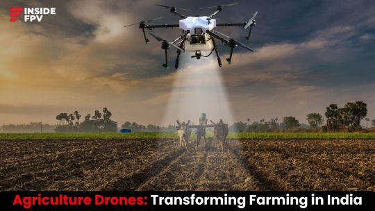
0 notes
Text
Integrating Drones into Commercial Workflows
Introduction
Unmanned aerial vehicles, or drones, have become increasingly popular and innovative in recent years. Drones were formerly thought to be mostly entertainment gadgets, however they are now widely used in business fields such as photography, surveying, infrastructure inspection, filmmaking, and more.
Businesses may use drone technology's airborne capabilities to improve operations, take visually appealing photos, evaluate assets, and increase productivity. Specifically, the insideFPV Elevate drone has capabilities that make it perfect for commercial usage at a reasonable cost.
Let's explore major advancements in drone technology that make broad commercial integration possible, major industries that gain from UAVs, use cases that highlight the possibilities of drones, and how the Elevate drone may provide companies a competitive advantage in the air.
Key Drone Developments
The following significant advancements in drone technology have opened the door to commercial integration:
Flight Time: A lot of prosumer and commercial drones, like the Elevate, now provide 105+ minute flight periods, up from just 20-30 minutes a few years ago.
Camera Quality: Drones can capture detailed, smooth footage with their 4K, 12+ MP cameras and excellent picture stabilization. Sturdy 4K video and beautiful 20 MP still photos are captured by the Elevate.
Safety: Automated flying modes, obstacle avoidance sensors make airborne operations safer and more dependable. Obstacle avoidance is available in 540° on the Elevate.
Training & Support: Drone manufacturers have made commercial adoption easier with their streamlined training programs and committed customer support resources. InsideFPV provides helpful resources and prompt assistance by pilot partnership programs that assist in training of pilots.
Price: Drones in the middle market that cost around ₹1 to 3 lakhs, increasingly come equipped with enterprise-level functionalities. ELevate drone is listed at the price of ₹1.5 lakhs only.
Drones such as the Elevate drone are no longer just novelty devices ; they are increasingly becoming valuable commercial instruments.
Top Industries Adopting Drones
Drones are being used by a wide range of industries to market properties and projects, collect data, monitor locations, get previously unattainable points of view, and automate manual operations.
Film & Content Creation: Utilize creative aerial viewpoints to record expansive 4K video and 20MP still images. Elevate-style drones maximize output value.
Photography: Give shots striking angles and elevation in photography. Drone skills are beneficial for photography of landscapes, real estate, events, marriages, wildlife, etc.
Surveying & Inspection: Gather images, videos, and data while safely surveying land, infrastructure (such as cell towers and bridges), accident scenes, properties, mining locations and hazardous areas.
Public Safety: To ensure and monitor public safety and to find missing people, pinpoint hotspots during fires, and take aerial photos of accident sites, police and fire services use infrared drones. Drones like Elevate can give a complete picture, which helps police assess the situation and get a quick line-up on the future plan of action.
Data Analysis: Gather information, images etc to get the real picture and then use the data for making data-driven decisions to increase precision and accuracy.
Agriculture: Agri-drones contain reservoirs that can hold fertilizer and pesticides, they can be utilized to spray chemicals on crops faster than using traditional techniques. It saves time and effort of the farmers, thus freeing up their time to diversify their activities.
Cargo and transport: The production of drones with advanced navigational systems, such as GPS and obstacle avoidance software, to allow autonomous flying and navigation, is a significant technological development. This facilitates the safe, effective, and little human intervention required for the delivery of commodities. With high precision and GPS, tracking and package delivery has improved.
Military Safety: Drones are used by military bases to patrol the borders and territories of the country and to keep a check on operational activities by self and neighboring countries. They can also directly intervene on the battlefield by dropping or firing precision-guided munitions themselves, or indirectly by designating targets for such munitions to be dropped or fired from manned systems. They are employed for both operational and strategic surveillance as well as battlefield surveillance.
Use Cases
Multitude commercial use cases demonstrate drone capabilities:
Hollywood Filmmakers utilize UAVs for incredible chase sequences and intricately planned overhead shots. The Elevate’s 4K video and safety features support complex maneuvers.
Real Estate agents capture striking property photos and videos. Showcasing houses, landmarks and neighborhoods from new aerial angles engages buyers.
Insurance providers dispatch drones after natural disasters to swiftly evaluate damage across neighborhoods or entire towns.
Solar operators use thermographic drones to identify hot spots signaling equipment faults requiring maintenance at vast solar fields.
Construction managers track build progress with periodic aerial photos feeding into workflow software systems to update schedules and budgets.
Military bases use drones in many countries for operational surveillance and in battlefields as a device via which armors and detonators are connected to use against the other country with which there is a conflict.
These examples exhibit drones’ expanding roles and value for enterprises. When equipped with a stable, high quality platform like the Elevate drone, commercial possibilities are truly limitless.
InsideFPV’s Elevate drone packs top capabilities specially designed for commercial use at an affordable ₹0.9 Lakh price point:
Flight Time - Fly for over 35 minutes on a single intelligent battery charge. Extend flight sessions with additional batteries.
Video & Photos - Capture spectacular 4K video and 20 MP photographs via 1080p camera.
Obstacle Avoidance- 540° sensing and one key automated avoidance helps prevent crashes, critical for commercial integrity.
Durability - An industrial grade carbon fiber frame protects components and withstands adverse weather, collisions, and rigorous commercial working conditions.
Support - InsideFPV offers onboarding support, video tutorials, spot replacement parts, and a 1 crash warranty for peace of mind.
The Elevate drone is a flexible aerial instrument for businesses thanks to these features. insideFPV offers enterprise-tailored solutions such as pilot partnership program where training is provided for the same.
Using airborne capabilities opens up enormous commercial value for numerous businesses that would not have been possible without UAVs. Drones such as the Elevate are used to solve issues, improve safety, increase production and efficiency, gather interesting information for content creation and filmmaking, and open up new service opportunities.
Drones will only become more prevalent in the upcoming years across a variety of business industries as barriers to adoption decrease. Drones improve efficiency for a variety of industries and first responders, including photographers, filmmakers, builders, and utilities.
Conclusion
Drones are transforming multiple industries by providing businesses with wide capabilities, interesting content production options, and important aerial viewpoints. Commercial integration will only quicken as platforms like the Elevate drone progress, adding more intelligent capabilities, safer operations, better cameras and sensors, and longer flight durations.
Drones appear to have a bright future since they will play important roles in improving corporate processes through tasks like site monitoring, safety oversight, overhead data collection, productivity optimization, and opening up new creative options to improve deliverables across industries. Companies who take use of drones' advantages now will benefit later.
FAQs
Can drones be used commercially?
Several industries, including aerial photography, surveying, mapping, agriculture, and package delivery, use commercial drones. These drones are flown by people or businesses who charge others for their services.
Can drones be used commercially without approval?
The specifications of the drone, other than nano drone, make it compulsory to be registered and approved by DGCA. Unauthorized flying of drone is strictly prohibited and can lead to serious legal complications including financial penalties.
Will drone usage increase in the future?
The drone business is one that is growing quickly and changing rapidly. The growing need for drones in a range of applications is driving the industry. But, new technologies like machine learning and artificial intelligence are also disrupting the drone sector.

0 notes
Text
Soaring High with Responsibility: Drones, Regulations, and the Open Sky
Introduction
As drone technology has advanced rapidly in recent years, hobbyist drone flying has shot through the roof in popularity across India. The thrill of taking stunning aerial videos and photos is exciting. However, increased drone use has also led to growing safety and privacy concerns.
To address these worries, India has implemented Digital Sky, a national unmanned traffic management (UTM) platform. All drone operators must register on Digital Sky and follow its regulations and guidelines. This includes hobbyists flying recreationally.
If you're an Indian hobbyist drone pilot or want to start, this guide breaks down key things you should know about flying drones responsibly under Digital Sky. Adhering to Digital Sky opens up fantastic opportunities to pursue drone flying while respecting others’ rights.
What is Digital Sky?
Launched in 2018, Digital Sky is India's national UTM platform overseen by the Directorate General of Civil Aviation (DGCA). It offers real-time tracking and digital licenses for every drone flight under India's Civil Aviation Requirements (CAR) governing drone use.
All drones except nano category (under 250 grams) must obtain a Unique Identification Number (UIN) and Unmanned Aircraft Operator Permit (UAOP) to fly legally in India. You must also file flight plans and follow other protocols submitting details like pilot name, drone category, area of operation, flight time, etc.
Digital Sky aims to systematically manage India's low-altitude airspace under 400 feet.
Why Follow Digital Sky as a Drone Pilot?
You might be wondering if Digital Sky's regulations apply to flying drones for fun as a pastime. The response is yes. In India, any non-nano unmanned aircraft, regardless of their purpose of being recreational or commercial, are required to adhere to Digital Sky regulations.
Here are key reasons to follow Digital Sky protocols as a drone pilot:
1. The Law of the DGCA and CAR provide legal authority to Digital Sky regulations. Penalties for violations include up to three months in prison and fines of at least Rs. 100,000.
2. Improving Privacy & Safety: Drone collisions in midair can be avoided by registering flights, avoiding no-fly zones, and following other regulations. Furthermore, it prevents unauthorized access to private property.
3. Enables Advanced Drone Functionality: By demonstrating your ability to fly safely, Digital Sky unlocks enhanced drone capabilities, such as Beyond Visual Line of Sight (BVLOS) flights beyond 1 km, which hobbyists may find intriguing.
4. Clears the Path for Commercial Aviation: Proving your ability to fly responsibly in accordance with Digital Sky criteria is the first step toward perhaps obtaining commercial drone licenses in the future.
Supports Innovation: Adaptation of Digital Sky helps concrete drones' huge technological innovative potential in India through accountable, sustainable growth policies.
(Key Tips for Hobbyists on Digital Sky Compliance
Here are some essential tips for hobbyists to follow Digital Sky rules while enjoying UAVs:
Register any and all Non-Nano Drones: Every unmanned aircraft system over 250 grams(>250 grams is called a nano drone), requires a Digital Sky UIN linked to its make, model number, serial number, etc. So properly register eligible hobbyist drones.
Obtain Pilot UAOP: Hobbyists are required to obtain a pilot-based UAOP permission in addition to registering their drones. This permit is renewed every five years upon exam clearance, even for recreational flights.)
5. File Flight Plans: Before flying, upload thorough flight plans to the Digital Sky site, which should include the date, pilot, drone's purpose, planned flying zone, duration, and any other necessary information required so that the site has complete information before you start flying.
Comply with Geo-Fencing Guidelines: Similar to airports, geo-fencing digitally specifies no-drone flying zones. To prevent violating prohibited airspace, make sure recreational drones have appropriate geo-fencing technology.
(Maintain Mandatory Insurance: To financially safeguard the public in the event of an accident, hobbyist UAS operators are required by Digital Sky to at least get a basic third-party liability coverage.)
6. Fly Responsibly: Whether you're a hobbyist or not, stay away from risky activities that put people's safety or rights, such as flying drones over busy areas, in poor weather conditions, or beyond visual line of sight.
7. Sober Flying: Never operate a drone hobbyist while you are drunk or intoxicated. Full consciousness is mandatory for a secure flight for your and community's safety.
8. Acknowledge National Drone Regulations: In addition to Digital Sky, make sure you are familiar with all national, state, and municipal UAS laws that apply in India. These laws include things like nighttime bans and height restrictions for flying the drone. Violation of the same can cause legal issues and severe financial penalties.
9. Spread Digital Sky Awareness: Encourage other beginners to have an overall knowledge and awareness of Digital Sky in order to increase compliance. Additionally, offer the DGCA suggestions for enhancing drone regulations that as a hobbyist you feel would increase your experience while maintaining the safety of others.
10. Join local drone communities, forums, and social media groups to engage with fellow enthusiasts. Share your experiences, seek advice, and learn from others' journeys. Community support is invaluable in your growth as a drone pilot.
Pursuing Passion While Respecting Others
Embarking on the thrill of drone flying, enthusiasts are often met with a mix of excitement and concerns about regulations. In India, the growing drone ecosystem, driven by initiatives like Digital Sky and the Draft Drone Rules 2021, is present to strike a balance between technological innovation and public safety. This environment opens up opportunities for hobbyists to explore the skies responsibly, with a supportive framework in place to not endanger public safety while making .
With Digital Sky's secure operating environment, hobbyists are able to concentrate on developing their skills and following their creative passions. Imagine shooting stunning pictures, competing in exciting races, or becoming an aerial expert—all without having to worry about legal roadblocks. Understanding this enthusiasm, insideFPV provides a range of drones which are categorized into FPV (First-person view) and non-FPV These drones enable users to release their creativity across large terrains by meeting a variety of purposes, from cinematography to effective data collecting.
Consider rules as stepping stones rather than as limitations toward creating a responsible and creative drone community. By using safety precautions when flying, you can fully realize the immense future potential that drone technology offers while safeguarding the community from accidents. Take flight, explore, and create - with the right tools in hand and a clear sky ahead of you. The open sky awaits, full of endless possibilities.
Conclusion
In Digital Sky, a future where drones that enhance lives power India's skies buzzes with possibilities. In this thrilling story, enthusiasts play an active role, influencing the very direction of drone innovation by their responsible behaviors rather than being passive observers. They assist us in striking a balance between our limitless potential and the advancement that is fueled by trust by embracing safety and ethics. This joint adventure guarantees that the Indian skies will be transformed into a platform for responsible progress as well as innovation, where our drones and the public's faith in our vision will soar together. The skies are limitless, and with responsibility and creativity, let’s all soar to new heights in the world of drone piloting. Happy flying!
FAQs
Do I need to register my recreational drone with Digital Sky?
A: Yes, all non-nano drones above 250 grams operated in India require Digital Sky registration and a Unique Identification Number (UIN), even those flown solely for hobby or competition purposes. Exempting hobbyist UAS from Digital Sky could compromise public safety and violate national airspace rules.
What if I don't file a flight plan before recreational drone use?
A: It is against the law to operate hobby drones without submitting the required Digital Sky flight plans, which include information about the location, credentials of the pilot, duration of the flight, purpose of flying, date, and so on. This is valid even for recreational flying. Breaking Digital Sky regulations can result in severe civil fines of at least Rs. 100,000 as well as possible three-month prison term under national UAS legislation.
Who regulates hobbyist drone use across different Indian states?
A: Local, regional, state and national laws continue to enforce UAS rules, even though the national low-altitude airspace below 400 feet is governed by the Digital Sky platform. States provide other recommendations as well. Therefore, hobbyists need to abide by both Digital Sky and any local state laws pertaining to drone use.
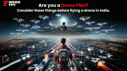
0 notes
Text
The Sky as a Canvas: Creative Applications of Drone Photography
In the ever-changing world of technology, drones are growing not only as innovative devices but also as potent tools for creative expression. As the skies become a canvas for photographers and followers as well, the art of drone photography has taken off, offering a beautiful perspective once reserved for birds. In this blog on the creative applications of drone photography, we will delve into the limitless possibilities that these flying wonders provide, exceeding the traditional bounds of visual storytelling.

The Rise of Drone Photography
Drones, also known as Unmanned Aerial Vehicles (UAVs), have become an essential component of the photography landscape, adding a new dimension to the photography landscape. The ability to rise to vast heights and hover over landscapes has revolutionised how we photograph moments. This evolution led to the drones coming into picture, which adds an immersive and real-time component to the experience.
Non-FPV drones take the center stage here. These drones, which are distinguished by their stability, precision, and versatility, appeal to a broader audience looking for a more conventional approach to producing breathtaking views. Non-FPV drones, with features designed for maximum image quality and ease of use, offer a unique and captivating standpoint.
Companies like InsideFPV, betaFPV along with others play an important role in this broadened ecosystem. InsideFPV, a renowned drone manufacturer, distinguishes itself not only by its devotion to Make in India innovation, but also by providing drones at affordable price. This inclusion demonstrates their appreciation of the diverse application of drones among the photography community.
The ability of drones to capture breathtaking scenes from previously unreachable angles has given birth to a new era of visual storytelling. Drone photography has become an art form in itself, offering photographers and enthusiasts the opportunity to explore, innovate, and share their unique perspectives with the world.
As the world gazes skyward, the visual language of drone photography communicates narratives that transcend cultural and geographical boundaries. It's not just about capturing moments; it's about telling stories from above, providing a fresh outlook on landscapes, events, and the intricate tapestry of life.
InsideFPV, a pioneering drone company, has been at the forefront of this revolution. Their commitment to pushing the boundaries of drone technology is evident in their latest innovation, the Elevate V1. Designed for both enthusiasts and professionals, the Elevate V1 boasts a 20-million-pixel camera, ensuring high-quality aerial photography that captures every detail in stunning clarity.
Unlocking Creative Potential: Applications of Drone Photography
Let's look at the various applications of drones that use the sky as a canvas for artistic creativity.
Aerial Cinematography and CineWhoops
The Elevate V1's agility and stabilisation mechanism make it an excellent choice for aerial shooting. Also BetaFPV's Cinewhoops collection, are a type of FPV drone, which are specifically built to capture cinematic footage in tight places. Whether going through architectural structures or shooting action sequences, the Elevate V1's agile design and high-quality camera make it an invaluable instrument for filmmakers pushing the boundaries of visual storytelling.
Landscape photography
Drones have transformed landscape photography by offering a perspective formerly reserved for helicopters and planes. The Elevate V1's high-resolution camera and reliable flight capabilities allow photographers to shoot vast panoramas, towering mountains, and serene coastlines in stunning detail. The ability to hover and change heights effortlessly allows photographers to experiment with various angles, resulting in genuinely unusual compositions.
Architectural photography.
Drones provide an excellent high angle for architectural photography. The Elevate V1's 20-million-pixel camera and fine control allow photographers to capture architectural details, symmetry, and design aspects from angles that ground-level photography cannot match. This is especially useful for documenting massive structures or intricate architectural details.
Event coverage
Drones have proven to be invaluable event coverage tools, from weddings to music festivals. The Elevate V1's ease of use, prolonged flight length, and high-quality camera make it an excellent option for capturing the energy and scope of events. Aerial images can provide a complete view of the venue, highlight crowd dynamics, and create a visual spectacle that adds a dynamic layer to event photography and filming.
Environmental Monitoring and Conservation.
Drones with superior cameras play an important role in environmental monitoring and conservation. The Elevate V1's GPS capabilities and high-resolution camera aids in this aspect, for surveying landscapes, monitoring wildlife, and tracking ecological changes. This application demonstrates the greater influence drone technology can have on environmental awareness and conservation efforts.
Real estate photography and virtual tours.
Drones have become an essential tool in the real estate sector to exhibit properties and premises. The Elevate V1's capacity to capture aerial pictures of houses gives potential purchasers a complete picture of the surroundings and layout. Furthermore, the high-quality camera captures every detail, which improves the overall appearance of real estate listings.
Choosing the Right Drone: Tips for Enthusiasts and Professionals
Whether you're a drone enthusiast seeking new ways to enhance photography or a professional photographer in need of dependable equipment, selecting the correct drone is critical. Here are some important points to keep in mind.
Camera Quality.
For photographers and filmmakers, camera quality is everything. The Elevate V1's 20-million-pixel camera with 4K HD capability ensures that each frame is a work of art. Think about your individual photography demands and the level of detail required for your projects.
Stabilization System.
The kind of stabilisation device is critical, especially for those getting into dynamic aerial filming. The Elevate V1's 3-axis gimbal camera stabilisation system ensures flawless footage even in demanding flight conditions, adding a professional touch to your projects.
Flight Time and Battery Life.
Extended flight time enables more creative exploration without the need for frequent battery replacements. The Elevate V1's 25-minute flight length, along with a removable and replaceable battery, allows you to maximise your time in the air.
Easy to Use
Whether you're a beginner or an experienced pilot, ease of use is critical. The Elevate V1's combination of remote control and user-friendly app control offers flexibility to users of all skill levels. Plus, it is easy to fly making it the right choice for any person looking for cinematic drones.
Versatility
Consider how versatile the drone is in terms of applications. The Elevate V1's versatility in photography and videography techniques, from cinematic images to landscape photography, makes it an excellent choice for a variety of creative endeavours.
In the vast canvas of the sky, drones have emerged as paintbrushes, allowing photographers and enthusiasts to create masterpieces from perspectives previously unimaginable. InsideFPV's Elevate V1 is not just a drone; it's a gateway to creativity, a tool that empowers individuals to explore, capture, and share the beauty of the world from new heights. As the drone industry continues to soar, the sky remains an open canvas, waiting for the next stroke of innovation and the limitless possibilities that drones bring to the world of photography.
Have Questions?
Q. What is drone photography?
- Drone photography involves using Unmanned Aerial Vehicles (UAVs) equipped with cameras to capture images and videos from elevated perspectives. It offers a unique and creative approach to visual storytelling.
Q. How have drones revolutionised photography?
- Drones have revolutionised photography by providing access to previously unreachable angles and perspectives. They offer a new dimension to visual storytelling, capturing breathtaking scenes from the sky.
Q. How can I choose the right drone for photography?
- When selecting a drone for photography, consider factors such as camera quality, stabilisation system, flight time, ease of use, and versatility. The Elevate V1 is highlighted as an excellent choice for its features catering to both enthusiasts and professionals.
0 notes
Text
The Evolution of Drone Technology in the Indian Perspective
At this period of time, where we have already entered the fourth industrial revolution, drones have become a symbol of innovation and creativity.
Drones have soared to unparalleled heights in the wide skies of technological growth, developing from basic flying devices to advanced aerial systems that transform industries and captivate minds. We explore the rich history of drone development and the current trends influencing the drone business in India in this examination of the drone landscape. Drone technology has evolved from simple beginnings to revolutionary transformations, reflecting the Indian drone industry's persistent quest of innovation.

The Genesis of Drones:
Under the context of the early 20th century, when visionaries and inventors set out to think beyond the boundaries of conventional flight, the compelling story of drones unfolds. Unmanned aerial vehicles (UAVs) were first introduced in those early days, inspired by a vision that would ultimately transform aerial industry. Even though these early works were rudimentary by current standards, they represented the first tentative steps toward a technological adventure that would reach the stars.
Drones of the past were basic but innovative, first finding use in military applications during times of war. Their functions were limited to strategic delineation, establishing the foundation for a future technological revolution. Time spread its wings, and these unmanned marvels' potential expanded with it. Drone technology was built around remote control systems, which allowed users to steer these flying objects with unprecedented accuracy.
Drones' capabilities were further enhanced when basic navigation elements were added to the technical composition. The formerly basic inventions started to develop, eventually being able to fly with some degree of independence. This period of transition established the foundation for the complex balance between technology and creativity that defines modern drones, reflecting a never-ending quest that has been essential to the development of the drone sector in India.
Drones in India: A Historical Glimpse:
India, with its diverse landscapes and dynamic socio-economic fabric, presented a unique canvas for drone applications. India was one of the first countries to embrace drones, mostly due to safety and monitoring requirements. The Indian Armed Forces developed Unmanned Aerial Vehicles (UAVs) in-house after realising the potential of drones for collecting information and surveillance.
The Indian Army began acquiring unmanned aerial vehicles, or UAVs, from Israel in the 1990s, and soon the Air Force and Navy did the same. India first used military drones during the 1999 Kargil war against Pakistan for photo-reconnaissance along the Line of Control (LOC).
Since then, a number of other private Indian businesses as well as the government-run Defence Research and Development Organisation (DRDO) have made significant contributions to the advancement of UAV and drone technology. The nation's unmanned aerial systems have advanced as a result of the use of drones in military operations.
In India, the Directorate General of Civil Aviation (DGCA) oversees the usage of all aerial vehicles, whether they are automated or human. Although unmanned aerial vehicles (UAVs) were originally created for the military and aerospace industries, their use in civilian applications has grown quickly because of the increased safety and efficiency they provide to a variety of businesses. As technology advanced, so did the capabilities of drones. The integration of Global Positioning System (GPS) and other navigation technologies transformed drones into versatile tools. In India, this evolution played a crucial role in expanding the applications of drones beyond the military domain.
An important milestone in India's drone journey has been reached with the transition from military to civilian use, which has laid the groundwork for the technology's widespread adoption in a variety of fields. In recent years, the commercial drone sector in India has witnessed a meteoric rise. Industries such as agriculture, infrastructure, and logistics have embraced drone technology for enhanced efficiency and precision. Agricultural drones equipped with advanced sensors monitor crop health, while construction companies employ drones for surveying and mapping.
With the onset of drone adoption, a drone startup named, insideFPV emerged which caters to all three domains that are consumers, agriculture and defence.
Key Trends Shaping the Indian Drone Industry:
1. Rise of Indigenous Drone Manufacturing:
The Indian drone industry has witnessed a surge in indigenous manufacturing. Companies like InsideFPV have played a pivotal role in contributing to the 'Make in India' initiative by developing cutting-edge drones tailored to the unique needs of the Indian market.
2. Integration of Artificial Intelligence (AI):
The incorporation of AI in drone technology has unlocked new possibilities. Drones equipped with AI algorithms can analyse data in real-time, making them invaluable for applications such as disaster management and environmental monitoring.
3. Drone Racing and Recreational Flying:
Drone racing has emerged as a popular recreational activity, captivating enthusiasts across the country. Events and leagues dedicated to drone racing provide a platform for both amateur and professional drone pilots to showcase their skills. insideFPV stands as a pioneering force in this domain, introducing the "Drone Experience Arena." This unique initiative brings the thrill of flying their advanced drones directly to college campuses. They have successfully conducted events in over 20 colleges and continue to lead the way in making drone technology accessible and exciting for enthusiasts of all levels.
4. Delivery Drones and Last-Mile Connectivity:
The concept of delivery drones has gained traction, with companies exploring innovative solutions for last-mile connectivity. Drones have the potential to revolutionise logistics, particularly in remote or challenging terrains.
5. Education and Skill Development:
Recognizing the importance of cultivating talent in the drone sector, educational initiatives and training programs have emerged. These efforts aim to bridge the skill gap and empower individuals to harness the full potential of drone technology.
insideFPV has played a pivotal role in this landscape by introducing innovative drones like BIR V1 and BIR V2, designed with a focus on promoting STEM education. The micro drone serves as an excellent tool for educational and learning purposes, catering to beginners and fostering a deeper understanding of the intricacies of drone technology. This initiative aligns with the broader goal of nurturing skills and knowledge in the evolving field of drones.
The Future Soars High:
As the Indian drone industry continues to evolve, the future holds limitless possibilities. From precision agriculture to urban planning, drones are poised to redefine how we perceive and interact with the world around us. The collaboration between technology innovators, regulatory bodies, and end-users will be instrumental in shaping a future where drones are integral to the fabric of Indian society.
The journey of drone technology in India is a testament to the nation's commitment to innovation and progress. From military applications to commercial ventures, drones have gone beyond their initial purpose, contributing to a myriad of industries. As we navigate the evolving landscape of drone technology, one thing is certain – the skies are no longer the limit; they are the beginning of a new era. The Indian drone industry, with its rich history and promising trends, is set to fly to unprecedented heights, leaving an incredible mark on the global technological map.
FAQs
How has drone technology evolved over the years in India?
Drone technology in India has undergone significant evolution, transitioning from military-centric applications to widespread use in civilian sectors. The integration of technologies like GPS and AI has played a crucial role in expanding the capabilities and applications of drones.
What role has insideFPV played in the Indian drone industry?
insideFPV has been a pioneer in indigenous drone manufacturing, contributing to the 'Make in India' initiative. The company has introduced innovative drones and initiatives like the "Drone Experience Arena," making drone technology accessible to enthusiasts and leading the way in drone racing and recreational flying.
What is the future outlook for the Indian drone industry?
The future of the Indian drone industry is promising, with limitless possibilities. Drones are expected to redefine various sectors, from precision agriculture to urban planning. Collaboration between technology innovators, regulatory bodies, and end-users will play a crucial role in shaping a future where drones are integral to Indian society.
0 notes
Text
Drone Safety 101: Best Practices for Safe Flying
In India, unmanned aerial vehicles, or drones, are becoming increasingly popular as both professionals and hobbyists take to the sky to explore. Drones are now a commonplace item in our daily lives, not simply a cool tech toy. Learning how to fly a drone is essential for any kind of photographer, professional or amateur, to ensure their own safety as well as the protection of people around them. Maintaining public safety and preventing accidents require drone operators to operate drones safely. We will examine the necessary procedures and laws for safe drone flying in India in this extensive guide.
Understanding the Basics
Before you even consider taking off, embarking on a safe and successful drone flight requires a deep dive into understanding your trusty aerial companion. Familiarize yourself with the essential components, not just their names but their functions and potential quirks. Learn the intricacies of the controller, the functioning of the joysticks and buttons that transform into graceful maneuvers in the sky. Understand the limitations of your drone, its range, battery life, and wind tolerance. Finally, weather your own personal meteorological service. Scrutinize the forecast for wind gusts, rain clouds, and any turbulence that might send your drone flight into the path of failure. By mastering this pre-flight knowledge, you transform from a mere pilot into a confident commander, empowered to make informed decisions that turn every flight into a thrilling symphony of skill and awareness.
Check Local Regulations
Familiarize yourself with the Directorate General of Civil Aviation (DGCA) regulations before takeoff. Their official website outlines the latest rules and requirements for drone pilots, ensuring you operate legally and safely. This knowledge isn't just about avoiding penalties; it's about creating a safe flying environment for everyone. Registration, mandatory for all drones, is your first step. It's a simple process that aids authorities in tracking drones for safety and security purposes. Remember, responsible drone piloting starts with understanding and abiding by the regulations. Take the time to visit the DGCA website and make your next flight a smooth, legal one.
Pre-flight Checklist
First, fuel your drone. A full battery is your ticket to uninterrupted exploration, while a low one can mean a forced landing. Next, check the propellers. Inspect for nicks, cracks, or any signs of imbalance – even a tiny imperfection can throw your drone off track. Check for firmware updates that might inject your drone with a dose of improved performance and bug fixes. Now, step outside and check the weather forecast. Wind, rain, and even seemingly innocent sunshine can play havoc with your drone's delicate dance with the air. If unsupportive weather, take a rain-check till there is a calmer day with supportive weather. With these meticulous checks, you'll transform your drone from a gadget into a trusted aerial companion.
Choose the Right Location
Be conscious while choosing location. Stay clear of the restricted zones, those not-allowed zones of no-fly territories. Respect the regulations because flying is not only for your own joy but also for maintaining the safety of others. Steer your adventure away from bustling crowds. Avoid parks and festivals shooting at low range as it can harm the safety of the public, dodge the invisible walls – power lines, buildings, trees – that stand sentinel against your airborne dance. DGCA mandates height and distance limitations for drone flights to prevent interference with manned aircraft and ensure public safety. Be aware of the maximum permissible altitude and distance your drone can cover. Adhering to these limits is crucial to avoid accidents and legal repercussions. With each conscious choice of location, you build a symphony of responsibility, and build a fly-path that ensures safety
Respect Privacy
Respecting privacy is not only a legal requirement but a cornerstone of responsible drone flying. It involves steering clear of capturing images or videos of individuals without their explicit consent and being acutely aware of private property boundaries. By adhering to these privacy guidelines, drone enthusiasts not only avoid potential legal troubles but also contribute to building a positive perception of the drone community within their localities. Ensuring that your drone activities don't infringe on the privacy of others fosters a sense of trust and understanding, creating a harmonious relationship between drone pilots and the community. This commitment to privacy not only aligns with ethical standards but also safeguards the reputation of drone users, encouraging a culture of responsible and considerate flying.
Maintain Visual Line of Sight
Keeping your drone in visual line of sight (VLOS) is essential for safe flying. To successfully monitor your drone's activities and surroundings, make sure you can see it directly at all times. In addition to breaking regulations, flying beyond visual range increases the chance of crashes and compromises on the general safety. Drone operators may help create safer airspace by following VLOS guidelines, which lower the risk of accidents and guarantee responsible drone use. Recall that having a clear line of sight is essential to safe and pleasant drone flight in India, not merely a legal requirement.
Emergency Procedures
Security is a quality that differentiates ethical drone flying with normal flying. Learn how to handle emergencies and how to land your drone safely in the event of a malfunction or low battery. It is possible to minimize potential damage and avoid accidents by being prepared for unforeseen scenarios and taking quick action.
Continuous Learning
Drone technology is constantly evolving, and new laws and regulations are always being introduced. Join online forums like InsideFPV, where enthusiasts exchange information, advice, and experiences, to stay informed. You'll stay ahead of the curve and always be flying responsibly if you never stop learning.
Conclusion Drone flying is an exhilarating experience that comes with responsibilities. By understanding the basics, following local regulations, and adopting safe flying practices, you can enjoy the skies while minimizing risks. Always prioritize safety, respect privacy, and stay informed about the evolving world of drone technology. Let's make the skies safer for everyone and keep the joy of drones flying alive.
Remember, it's not just about flying drones; it's about flying them safely and responsibly.
Questions?
Q. What should I know before flying a drone?
It's crucial to read up on your country's drone rules so you fly legally and safely. In India, visit the Directorate General of Civil Aviation site to learn about mandatory registration, no-fly zones, height limits, requirements to maintain visual line of sight, and more. These aren't just technicalities - they help create an orderly airspace and prevent accidents. A wise pilot makes regulations for their co-pilot.
Q. How to choose a safe drone flying location?
Steer clear of bustling crowds and private property to avoid injuring people or invading their privacy. Check local flight laws on distances drones can cover and altitude limits, adhering to the rules. Weather is also key - gusty winds and rain can quickly spiral a flight out of control. Scout open areas clear of trees, buildings and power lines that could tangle your drone. Choosing thoughtful takeoff spots keeps everyone secure.
Q. What should be a pre-flight checklist?
Before taking off, verify essentials like battery level, propeller condition, app connectivity and that on-board firmware is up-to-date. Double check weather conditions still enable safe flight. Conducting methodical pre-flight checks reduces mechanical issues mid-air or finding yourself unprepared for changing conditions. They only take a few minutes but give priceless peace of mind.
0 notes
Text
The Revolution of Non-FPV Drones in Cinematic Production
Hey fellow drone enthusiasts! We're delving into the realm of non-FPV drones, a seat to the art of aerial storytelling. From idea generation to final presentation on the screen is what cinematic production is all about. Non-FPV drones are flying devices that you control by looking at them directly, rather than through a live video feed. These drones don't have a special system that lets you see what the drone sees in real-time on a screen or through goggles. Instead, you fly them by keeping them in your line of sight, just like you would fly a traditional remote-controlled toy or model airplane..Think of it like this: FPV is the adrenaline rush of drone filmmaking, it is all about pushing the boundaries and chasing the next heart-stopping shot that makes you blow your mind. But sometimes, the story demands a different kind of hero, a ninja of the skies who gets the job done without breaking a sweat (or a window!). So, buckle up, check out the non-FPV drones that bring cinematic style to you!
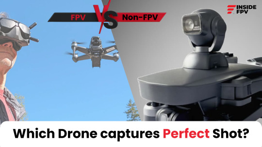
Scenery with Silence
Picture this: Himalayan mountains stretching beneath you, sunlight blowing, and you capturing this beauty without any noise disturbing you. Non-FPV drones are the silent masters made for the sky, drawing visual poetry with complete accuracy. They're detail-oriented artists, capturing landscapes with the sound as low as the whisper.
Perfect Precision
Non-FPV drones are aerial heroes. They are known for working with precision like a ballet performer, i.e. with complete grace. With pre-programmed flight paths and consistency algorithms, they're the aerial masters creating the perfect shot each and every time. They can swoop low over fields or go high in the city to capture scenery with precision that can leave any FPV pilot envious. They provide a dual advantage, for they can go low or high in the sky. They might not be high on volume but they capture the perfect scenery.
Storytelling with Non-FPV
Non-FPV isn't just about capturing landscapes; it performs versatile roles. Equipped with specialized cameras, these reveal stories that glorify the details of a butterfly's wing or capture the raw emotion in an actor's tears. With technology that turns into a beautiful space which provides not only a landscape but also a story that emotionally connects with its audience and tugs to the heartstrings. From recording events to the majestic day of marriage, it captures and conveys it all. The architectural portrayal is a mapping of ancient ruins, so is the capturing of futuristic skyscrapers with unparalleled precision. They're the partners filmmakers dream of as they are known for introducing unique perspectives into their stories, one silent frame at a time and the perfect addition to the equipment as the audience always ends up hooked and enchanted.
The use of elevate by insideFPV in cinematography allows for the creation of dynamic and dramatic perspectives. By lifting the camera above ground level, filmmakers can emphasize the scale of landscapes, architecture, or events. This not only adds visual interest but also adds to the audience's perception of space and context.
Affordability and Accessibility: One for all
As technology advances, non-FPV drones have become more affordable and accessible to everyone at all levels. This standardization of technology allows independent filmmakers and content creators to elevate their storytelling with aerial perspectives that were once reserved for big-budget productions. It has made the concept of storytelling available for everyone who wishes to convey their perspectives and story to the audience, and without a doubt, leave them mesmerized.
A complete game-changer
InsideFPV’s Elevate becomes a game-changer in action sequences, especially in genres like adventure, sports, or thrillers. Drones can effortlessly follow and capture dynamic movements, providing a more immersive experience for the audience. From high-speed chases to extreme sports, elevate adds a level of intensity and excitement that can elevate the overall impact of the scene and act as a complete game-changer. It gives you the perfect adrenaline rush.
Conclusion:
So, my fellow pilots, the sky wanderers, are you ready to embrace the silent revolution? Are you excited to explore the art of invisible storytelling, letting your drones whisper tales instead of screaming them? The sky isn't the limit; it's just the beginning. Let's dive into the boundless possibilities of non-FPV, embrace its power, and redefine cinematic magic. With insideFPV, it has become even more possible to change this dream into a realm of aerial glory! It's time to let the silent symphony of non-FPV drones take center stage.
Having Questions?
Are non-FPV drones suitable for professional filmmaking?
Absolutely! Non-FPV drones are designed with professional filmmakers in mind. Their high-quality cameras, stability features, and intelligent flight modes make them valuable tools for capturing cinematic footage that can take the client away into a completely different realm.
How do non-FPV drones differ from FPV?
While FPVdrones are known for their agility and immersive piloting experience, non-FPVdrones prioritize camera quality, stability, and ease of use for capturing cinematic shots. They offer a more straightforward approach to aerial cinematography. They can be used by filmmakers, content creators and scenic enthusiasts.
Can non-FPV drones be used indoors?
While non-FPVdrones are primarily designed for outdoor use due to their GPS-reliant features, some models with obstacle avoidance systems can be used indoors with caution. It's essential to check the specific capabilities of the drone model and follow safety guidelines.
Do non-FPV drones require a professional pilot's license?
In many regions, the need for a pilot's license depends on the weight and purpose of the drone. Non-FPV drones used for recreational or non-commercial filmmaking may not require a license. However, it's crucial to familiarize yourself with local regulations before operating it to avoid further legal complications.
0 notes