
The IRI Data Library is a powerful and freely accessible online data repository and analysis tool that allows a user to view, analyze, and download hundreds of terabytes of climate-related data through a standard web browser.
Don't wanna be here? Send us removal request.
Statistics
We looked inside some of the posts by iridl and here's what we found interesting.
Average Info
Notes Per Post
4
Likes Per Post
4
Reblog Per Post
0
Reply Per Post
0
Time Between Posts
5 months
Number of Posts By Type
Photo
14
Text
1
Link
2
Last Seen Tumblr Blogs


Fun Fact
Tumblr is available in 18 languages.
Photo

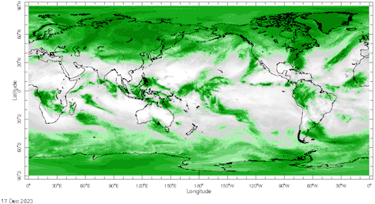
UCSB CHIRPS v3.0 monthly global precipitation now available in the Data Library.
0 notes
Photo

New version of USGS EROS FEWS dekadal WRSI dataset based on CHIRPS now available here
0 notes
Photo

New ECCC GEPS version 8 SubC forecast now available real-time here
0 notes

Photo

ECCC switched their NMME forecast in July from CanSIPS-IC3 to CanSIPS-IC4
0 notes
Photo

NASA VIIRS Vegetation products now available. Updates coming soon.
0 notes
Text
Please take our SURVEY
Thank you for participating in our survey. Your input will help the IRI gain a deeper understanding of our user base and utilization of the IRI Data Library and Maprooms. This knowledge will enable us to effectively showcase our reach and impact to potential sources of funding, which is crucial for sustaining and enhancing the IRI Data Library/Maproom services.
The survey is divided into three sections and should take less than 5 minutes to complete. We'll begin by asking about your Data Library/Maprooms usage context, then delve into your usage patterns and reasons. Finally, we'll explore sustainability models for Data Library/Maprooms. Your input will greatly helps us improve our services for you and our community.
Take the survey here.
0 notes
Photo
NOAA CPC Blended OLR version 1 products now available
0 notes
Photo

FEWSNET soil-water products for Africa now available.
1 note
·
View note
Photo

Some MODIS V6 Terra Regions were added to the DL:
USGS LandDAAC MODIS 1km 8day version_006 Terra SSA Night LST views
0 notes
Photo

Now serving UEA CRU TS4.05
1 note
·
View note
Photo

The Butterworth low-pass filter code has been revisited to support time series of many points like in the example above. This comes with a more robust way of computing the solution. The 3 padding options (px > 0) remain. The option not to pad (px = -1) has been replaced from taping the whole operator to taping its tailing equations only. An additional option (px = -2) now allows to do just nothing to the boundary conditions and therefore apply the Butterworth filer and the Butterworth filter only.
More detailed information at the function documentation:
http://iridl.ldeo.columbia.edu/dochelp/Documentation/details/index.html?func=:butt_filter
Note that px = -1 (no padding taped solution) is the one used in the Global Time Scales Maprooms and results remain very similar.
http://iridl.ldeo.columbia.edu/maproom/Global/Time_Scales/index.html
0 notes
Photo

New PISCO data products from Peruvian SENAMHI: precipitation, temperature, evapotranspiration, since 1981, daily and monthly, at 0.1˚ spatial resolution. Check it out at
http://iridl.ldeo.columbia.edu/SOURCES/.SENAMHI/.HSR/.PISCO/
Operational updates of some products coming soon!
0 notes
Photo

With sadness in our hearts, we remember M. Benno Blumenthal, who died Saturday 15th at night peacefully and with family. We will forever be grateful to Benno for creating the Data Library, for his enlightened contributions to IRI and the field of data science, and for his benevolence to others.
We invite those of you who knew Benno, or who use the Data Library, to share your stories and thoughts about our dear colleague and his legacy. If you would prefer to share more privately, send an email to [email protected], and we will share with his family and IRI staff.
0 notes
Link
The Maproom Development Tutorial is now available in French (en Français) and both English and French version are improved with some text editing and a Quick Steps section per Lesson for returning trainees.
The link above illustrates what the Tutorial looks like after completing Lesson 0.
The Turorial bitbucket project is available here.
0 notes
Link
Recently, a prototype S2S forecast system has been designed at IRI to generate calibrated multi-model ensemble forecasts for tercile precipitation in a similar format to IRI seasonal forecasts.
2 notes
·
View notes
Photo

UEA CRU TS4.01 Dataset
The University of East Anglia (UEA) Climatic Research Unit (CRU) Time-Series (TS) Version 4.01 of High Resolution Gridded Data of Month-by-month Variation in Climate (Jan. 1901 - Dec. 2016) gridded (0.5 deg. lat/lon) dataset was recently added. This version supersedes previous releases and employs a different interpolation scheme than recent previous versions of the dataset. Please see the release notes and other documentation for additional details.
0 notes