For lovers of history, space, mystery, science and technology
Don't wanna be here? Send us removal request.
Statistics
We looked inside some of the posts by knowledgeistreasure and here's what we found interesting.
Average Info
Notes Per Post
5K
Likes Per Post
3K
Reblog Per Post
1K
Reply Per Post
1
Time Between Posts
8 hours
Number of Posts By Type
Photo
17
Last Seen Tumblr Blogs


Fun Fact
Women make up for the other 50% of Tumblr’s audience.
Photo
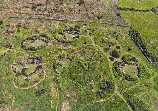
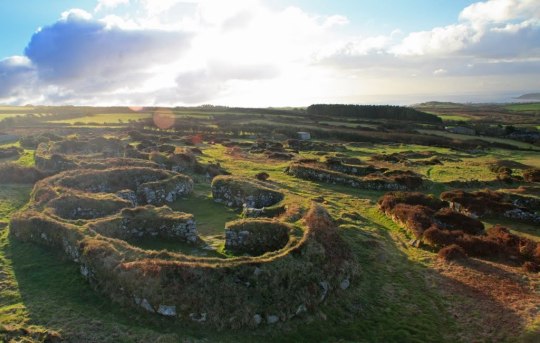
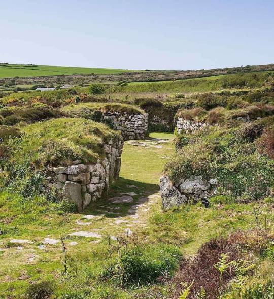
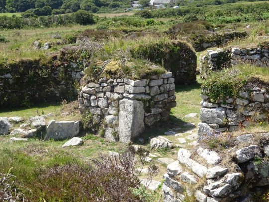


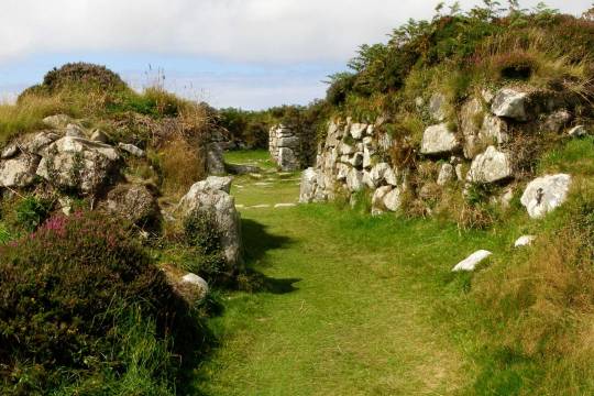
Chysauster village, Cornwall, UK. 1st century BC - 3rd century AD.
297 notes
·
View notes
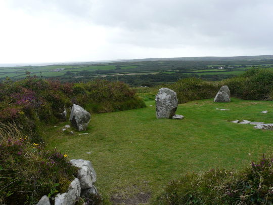
Photo
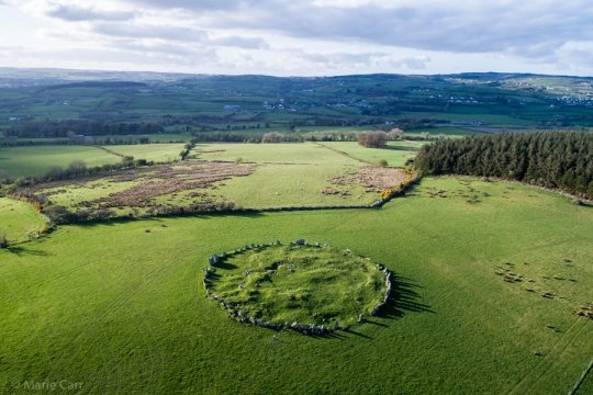


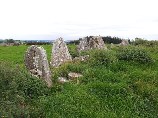
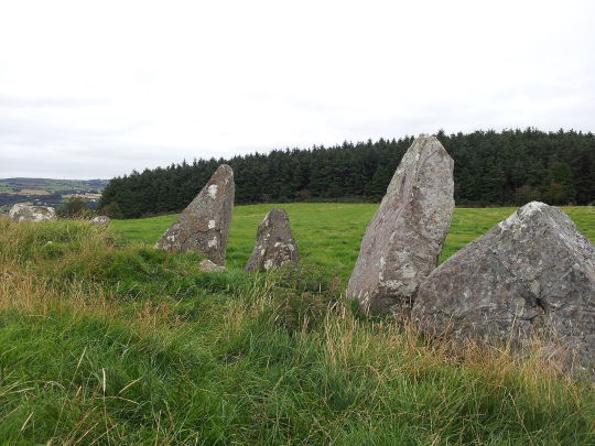

Beltany Stone Circle, County Donegal, Ireland. 2500 - 800 BC.
88 notes
·
View notes
Photo


Buddhist Bayon Khmer temple, Angkor, Cambodia. Late 12th century AD.
737 notes
·
View notes
Photo
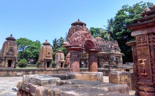
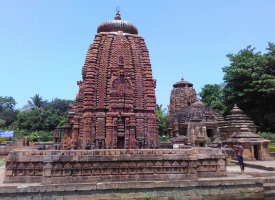

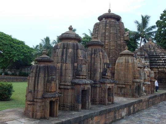
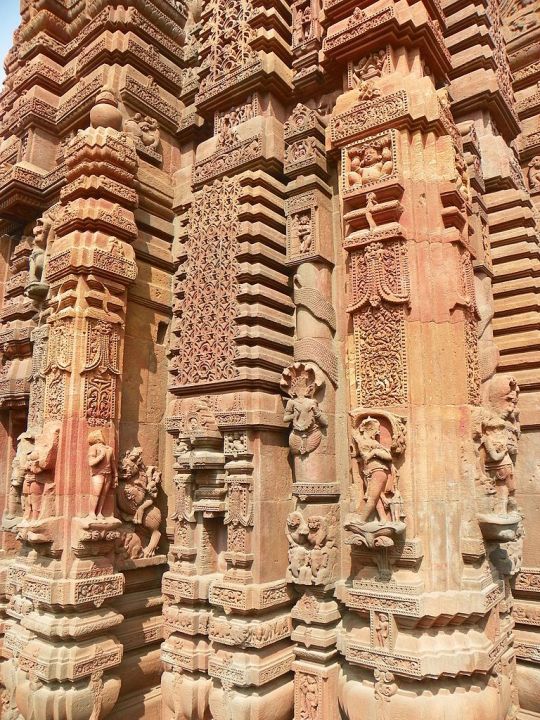
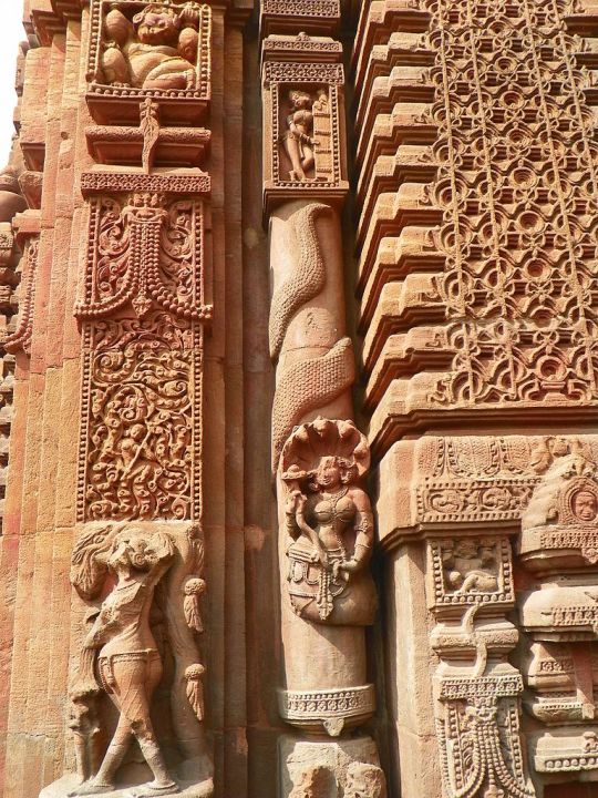
Mukteshvara Hindu Temple, Odisha, India. 10th century AD.
508 notes
·
View notes
Photo
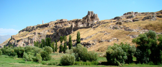
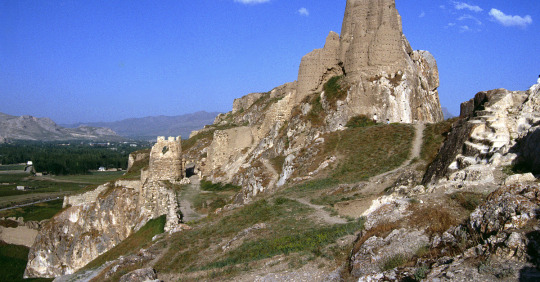
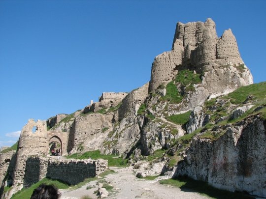

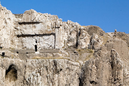

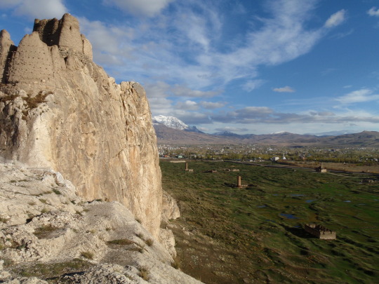
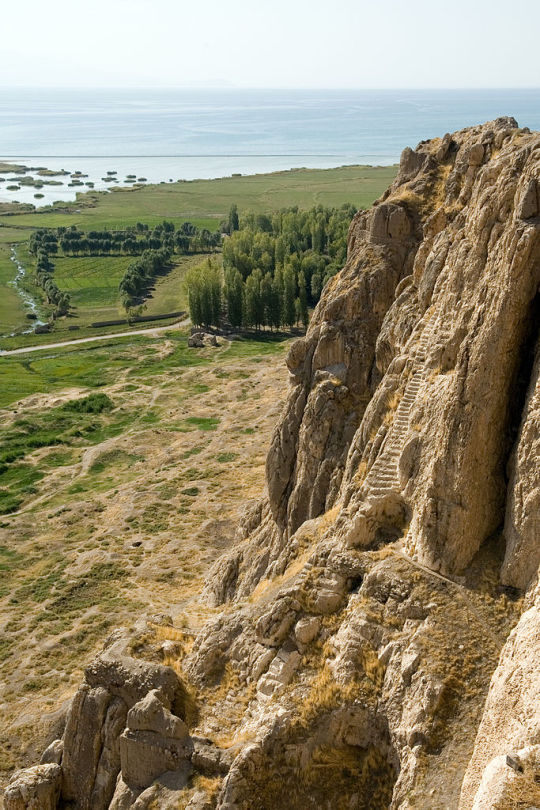
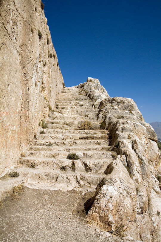
Van Fortress, Turkey was built by the ancient Kingdom of Urartu some time during the 9th century BC.
60 notes
·
View notes
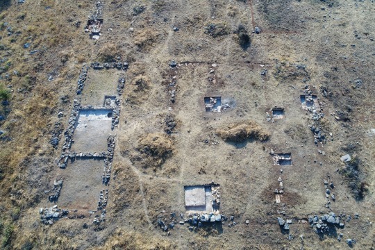
Photo

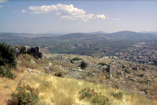
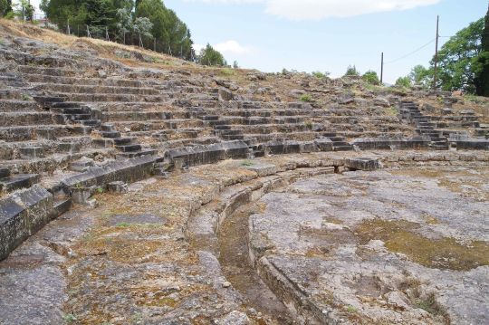
The archaeological site of Orchomenus, Greece dates back to the early Bronze Age. The visible ruins that can be seen today date back to the 4th century BC.
15 notes
·
View notes
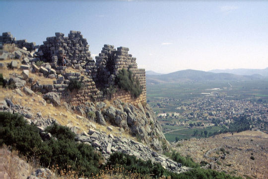
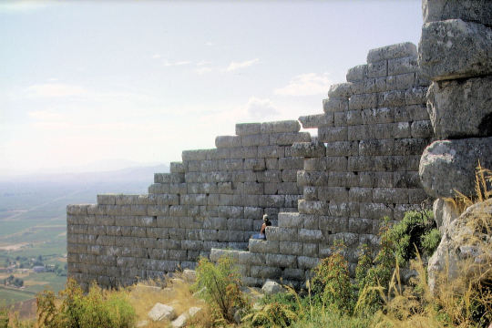
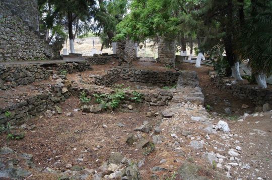
Photo

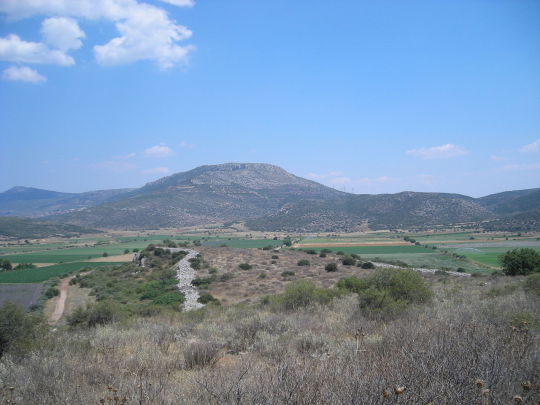
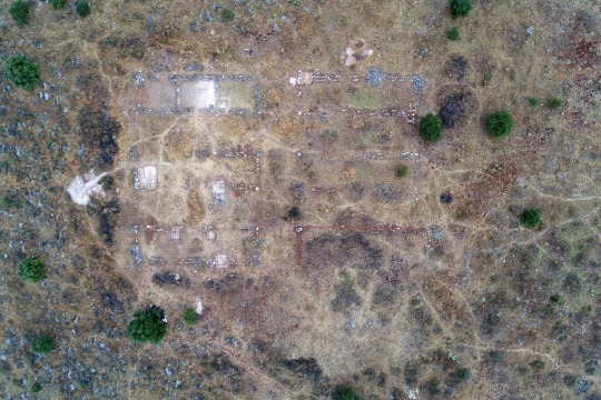
Mycenaean acropolis of Gla in Boeotia, Greece.
6 notes
·
View notes
Photo
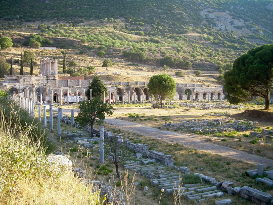
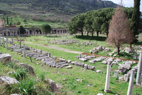


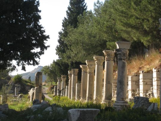
Tetragonos Agora (Commercial Agora )
Ephesus, Turkey
1st century BCE
111 x 111 m
The Commercial (Tetragonos) Agora of Ephesus dates from the period the city was refounded by Augustus and succeeded the respective administrative Agora of Hellenistic Ephesus. It was near the harbour and served as the commercial centre of the city. It included a square court closed on all sides by colonnades, behind which laid shops and workshops. The best preserved gate was on the southern side and had been dedicated by two wealthy Imperial freedmen, Mazaeus and Mithradates, in 3 or 2 BCE. Apart from this gate there were two more gates in the Agora, a monumental propylon on the western side and a much more simply constructed gate on the northern side.
The Commercial Agora of Ephesus, known as Tetragonos Agora, lies to the north of the Library of Celsus. It was built in the second half of the 1st century BCE in the course of a programme of monumentalization carried out in the region as Ephesus became the capital city of the province and its population increased.
The Agora includes a vast open square, measuring 111 x 111 m, surrounded by four two-aisle colonnades 11.20 m wide, behind which there were about 100 rooms. The rooms served mainly as commercial shops, but they were also used as meeting places for guild associations and political organisations.
The shops occasionally had an intermediate floor, which could serve as either a storeroom or an office and workroom. In the anteroom of these chambers there were weights, tables and shelves for putting goods for sale. The paved square of the Agora was divided into parts covered by tents, under which various products were exhibited and trading took place.
further reading
296 notes
·
View notes
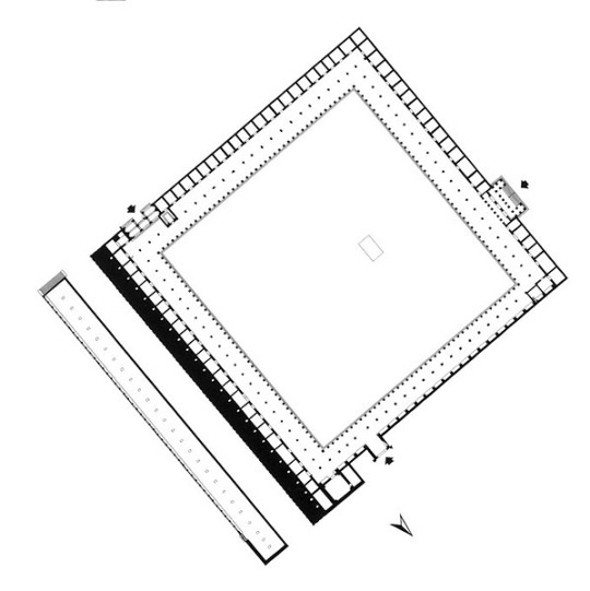
Photo
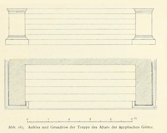
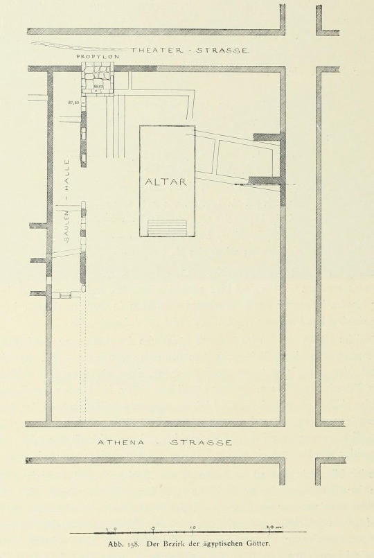
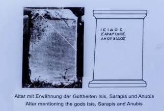
Sanctuary of Egyptian Gods
Priene, Ionia, Turkey
3rd century BCE
temenos 47 m. long x 31 m.
altar 14.60 x 7.31 m.
This temple was built in the Hellenistic period. It is located on the terrace south of the theatre, on the south Athena Street. The building was supported by a 5-meter high terrace wall which displayed excellent stone workmanship.
The original plan of the sanctuary, dating to the late fourth or third century BCE was very simple: a rectangular temenos entered from the east, containing an altar. At a later date, a more elaborate propylon was built in the northern wall of the temenos, and a portico was constructed alongside the west wall. Both of these additions may still be pre-Roman.
The sanctuary was dedicated to Egyptian gods which is understood from the epigraphs found there. In the epigraphs, Egyptian god names included such as Isis, Serapis, Osiris, Anubis, and Harpocrates. According to the inscriptions on the wall of the propylaeum and the detailed information on the cult, the rites should have been conducted by an Egyptian priest or by Isis. If these rules were not violated, the punishment was defined as 100 drachmae. But the Prienean people were not familiar with this tradition.
Coming of the Egyptian priests to Priene can be explained in two ways. Either during the Laodicean War (246 – 241 B.C.) King Ptolemy III of Egypt tried to bring the Aegean region under Egyptian rule, or when Priene had commercial relations with Egypt wanted the Egyptian businessmen to dedicate this sanctuary to Egyptian gods.
191 notes
·
View notes
Photo
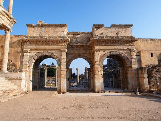
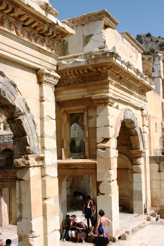
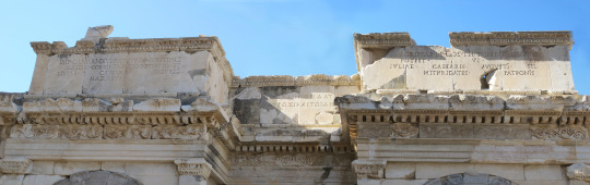

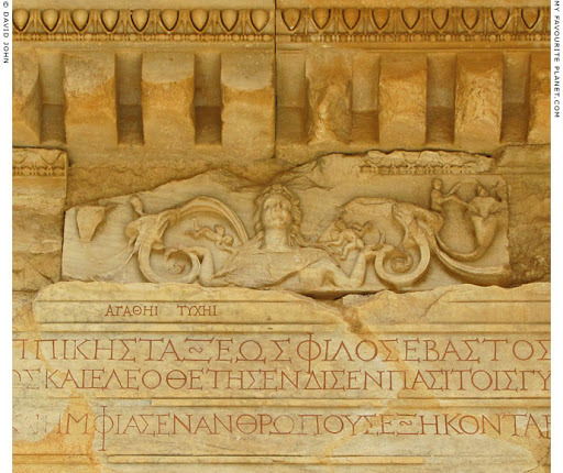
Gate of Mazaeus and Mithridates
Ephesus, Turkey
40 CE
The monumental Gate of Mazaeus and Mithridates is located at the end of Curetes street ending with the plaza of Celsus Library, and leads into the Tetragonos agora. The three arched gate dates back to 40 CE and was built by two freed slaves named Mazaeus and Mithridates for their emperor, Augustus, who gave them their freedom.
Both Mazaeus and Mithridates were slaves of Emperor Augustus and Emperor set them free and sent them to Ephesus as officers in charge of maintaining the prosperities belonging to the Roman Empire in Ephesus.
Gate of Mazaeus and Mithridates has got a Latin inscription on it which says “From the Emperor Caesar Augustus, the son of the god, the greatest of the priests, who was consul twelve and tribune twenty times; and the wife of August Livia; the son of Lucus, Marc Agrippa who was consul three times, Emperor, and tribune six times; and the daughter of Julio Caesar Augustus, Mazaeus and Mithridates to their master and the people.”
The inscription known as longest inscription of Ephesus City and is written in both Latin and Greek. In front of the gate was an auditorium and the steps of the Celsus Library were the seats for the spectators who would come and listen to the lecture.
423 notes
·
View notes
Photo
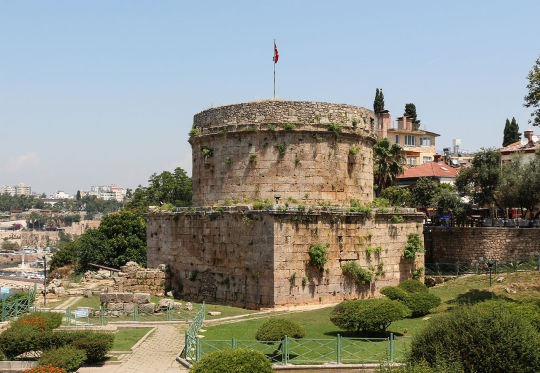
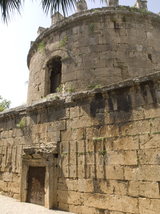
Hıdırlık Tower
Antalya, Turkey
2nd century CE
It is believed that the ruling Roman Empire built it in the second century CE on a square plan. In the same century, it was turned into circular tower. It has since been used as a fortification or a lighthouse.
The tower is situated at the southern side of the place, where the land walls of the city join the sea walls. The 14-metre-high (46 ft) structure consists of a circular tower rising on a quadratic pedestal. The tower’s gate at the eastern side leads to a small room, from where a narrow staircase goes up. There are signs of restoration work on the upper part done in the Seljuk and Ottoman eras.
373 notes
·
View notes
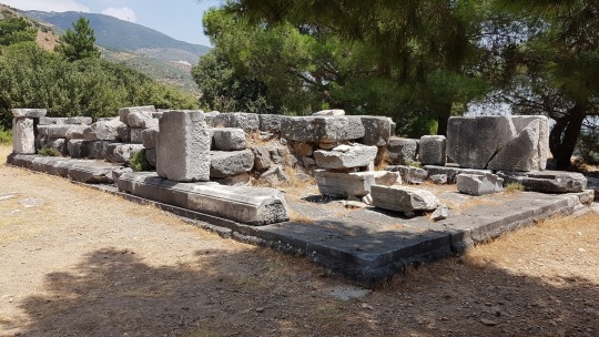
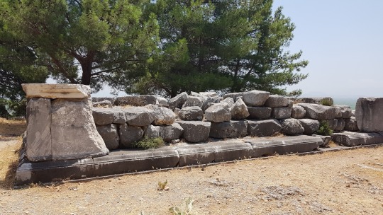
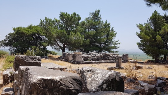
Photo
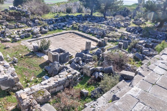
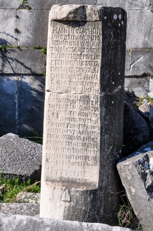

Prytaneion of Priene
Priene, Ionia, Turkey
180 BCE
The prytaneum was a meeting house and a dining room for senate members and housed the sacred flame of Hestia. I was adjacent to the bouleuterion in the center of the city.
The building in its present state takes the form of a peristyle house: a rectangular structure with a central paved, colonnaded courtyard surrounded by three small rooms on the north, two on the west and three on the south sides. The building was entered through a door in the north wall of the central room in the south row.
The Prytaneion held the sacred flame of the city, was dedicated to the goddess Hestia and held all other continually burned hearths. In the room to the east of the entrance stands the Sacred Hearth in which the sacred fire burned. The hearth was made of rubble which was 30 centimeters and is believed to date from earlier periods.
At the entrance to the southernmost room of the western row stands a reused column shaft carved with the following inscription: “The most brilliant city of the Ionian citizens of Priene and the most powerful Council and the most august Synhedrin of the elders in accordance with the things frequently received in (their?) accounts for…(council?) of the assemblies of the expenses of the city have honored M. Aur. Tatianus, the market official of the noble Pollion (?), the president of the festal assembly for the city’s goddess Athena, the presiding officer of the goddess, the chief president, and the crowed president of the senate. May you prosper. “
More Priene buildings
Other Prytaneia
163 notes
·
View notes
Photo


A coin from Narbonne that was the first Roman colony in Gaul, c. 118 BCE.
Obverse: Goddess Roma with a Gallic helmet
Reverse: Naked Gaul warrior holding a speer, a shield and a horn is driving a biga
https://smb.museum-digital.de/index.php?t=objekt&oges=144845
Source: Münzkabinett, Staatliche Museen zu Berlin - Stiftung Preußischer Kulturbesitz.CreatoR: Lutz-Jürgen Lübke (Lübke und Wiedemann) Copyright Notice: CC BY-NC-SA
258 notes
·
View notes
Photo
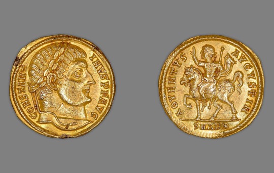
Solidus (Coin) Portraying Emperor Constantine I minted in Antioch, Coele Syria, Roman Empire (modern-day Antakya, Turkey) (Dated late 324/early 325, issued by Constantine I)
Obverse: Head of Constantine right, laureate Inscribed: CONSTANTINVS P[IVS] F[ELIX] AVG[VSTVS]
Reverse: Constantine rides on horseback, raises right arm, carries sceptre in left Inscribed: AOVENTVS AVGVSTI N[OSTER] ; in exergue, SMAN* (mint mark signifying Sacra Moneta Antioch)
214 notes
·
View notes
Photo

Drachma: Chimera (obverse), 400-323 BC, Cleveland Museum of Art: Greek and Roman Art
Size: Diameter: 1.8 cm (11/16 in.) Medium: silver
https://clevelandart.org/art/1917.979.a
131 notes
·
View notes
Photo
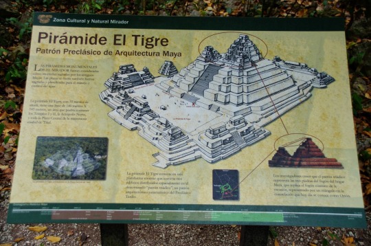
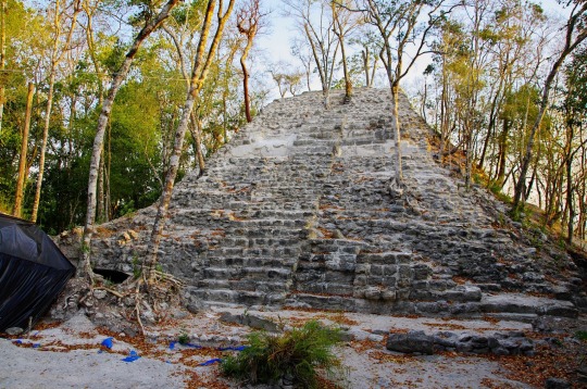
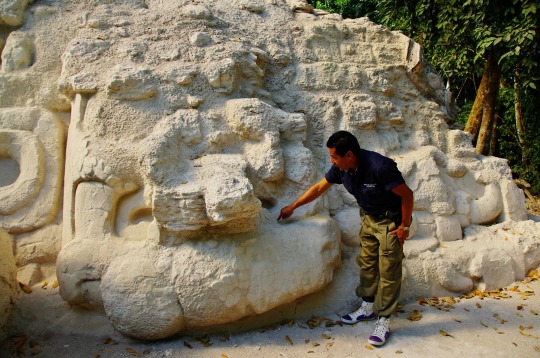
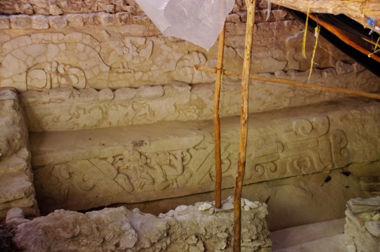
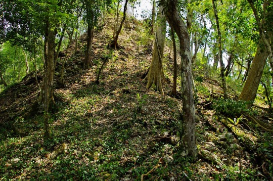

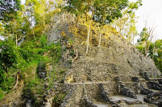

El Mirador, Guatemala
El Mirador flourished from about the 6th century BCE, reaching its height from the 3rd century BCE to the 1st century CE, with a peak population of perhaps between 100,000 and 250,000 people, judging by the size and extent of the labor pool required to build the massive constructions. It then experienced a hiatus of construction and perhaps abandonment for generations, followed by re-occupation and further construction in the Late Classic era, and a final abandonment about the end of the 9th century. The civic center of the site covers some 10 square miles (26 km2) with several thousand structures, including monumental architecture from 10 to 72 meters high.
There are a number of “triadic” structures (around 35 structures), consisting of large artificial platforms topped with a set of 3 summit pyramids. The most notable such structures are three huge complexes; one is nicknamed “El Tigre”, with height 55 metres (180 ft); the other is called “La Danta” (or Danta) temple. The La Danta temple measures approximately 72 metres (236 ft) tall from the forest floor, and considering its total volume (2,800,000 cubic meters) is one of the largest pyramids in the world. When the large man-made platform that the temple is built upon (some 18,000 square meters) is included in calculations, La Danta is considered by some archeologists to be one of the most massive ancient structures in the world. Also the “Los Monos” complex is very large (48 meters high) although not as well known. Most of the structures were originally faced with cut stone which was then decorated with large stucco masks depicting the deities of Maya mythology. According to Carlos Morales-Aguilar, a Guatemalan archaeologist, the city appears to have been planned from its foundation, as extraordinary alignments have been found between the architectural groups and main temples, which were possibly related to solar alignments. The study reflects an importance of urban planning and sacred spaces since the first settlers.
Source of photos - http://unchartedruins.blogspot.com/2013_04_01_archive.html
312 notes
·
View notes
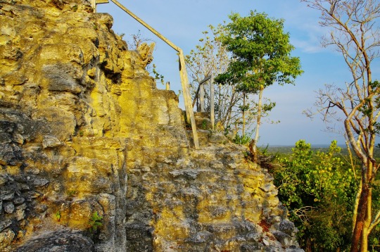
Photo
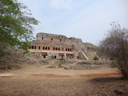
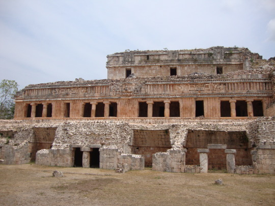
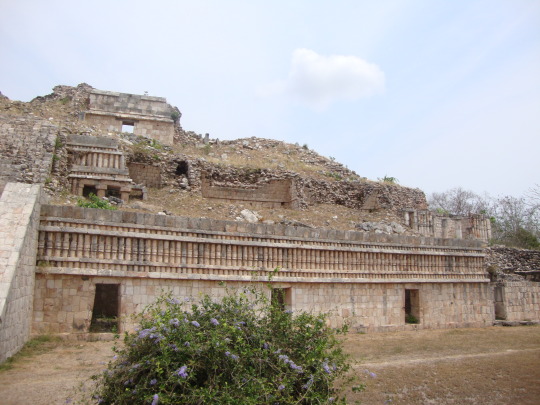
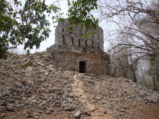
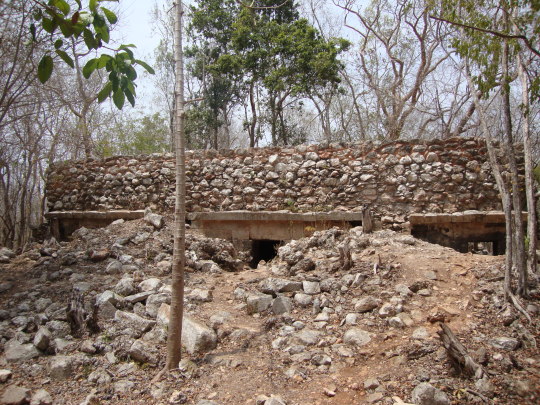
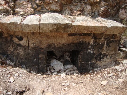
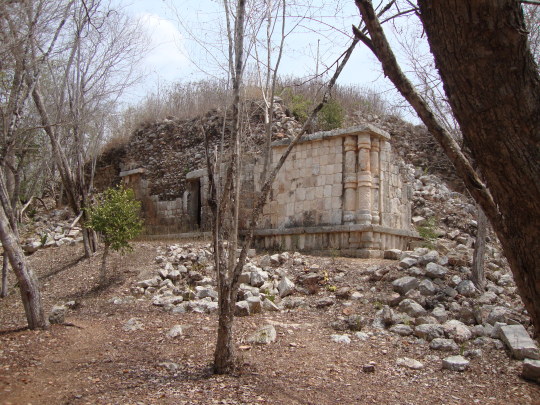
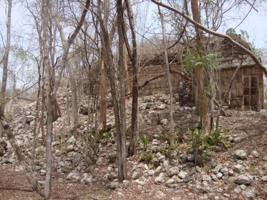
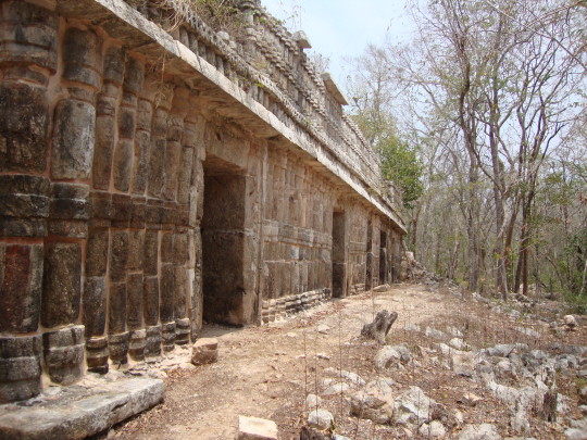
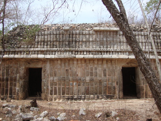
Sayil, Yucatan, Mexico
Se cree que Sayil y los otros sitios en la región Puuc ocuparon un espacio histórico importante, en la transición del periodo clásico tardío, cuando sobrevino el colapso maya, que despobló la región de las tierras bajas mayas, en el Petén guatemalteco, al periodo posclásico. La breve ocupación del sitio de Sayil, permite inferir que la ciudad se desarrolló a partir de otro yacimiento menor, llamado Chaac II, que había sido ocupado antes, hacia el siglo V d. C.16 Pruebas de Radiocarbono y otras técnicas que permiten la datación de los sitios, como la llamada de hidratación de la obsidiana, ubican a Sayil relativamente temprano, en el clásico tardío. Vestigios de cerámica, por otro lado, recuperados del palacio de Sayil, indican intercambios con la región del Petén, precismante en esa época. Lo mismo ocurre con los artefactos de obsidiana encontrados, que señalan la dominancia de las rutas comerciales hacia el sur de la región Puuc, cuando Sayil estaba siendo construido.
https://es.wikipedia.org/wiki/Sayil
—
Sayil and other Puuc sites are thought to occupy an important place in the transition from Classic Period Maya culture to Postclassic society, experiencing a brief cultural florescence during the Terminal Classic, shortly after the Classic Maya abandonment had depopulated the Maya lowlands. The brief occupational history of the site has raised the possibility that Sayil developed from an earlier settlement known as Chac II, a small archaeological site in the same valley that was occupied as early as the fifth century AD. Radiocarbon and obsidian hydration dating place Sayil relatively early in the Terminal Classic. Ceramic remains recovered from the Palace indicate trade with the Petén region of Guatemala during the Late Classic, and the Guatemalan origin of obsidian artifacts suggest that Classic-period trade routes were dominant when the monumental architecture at Sayil was built. Although Sayil’s origins lie in the Late Classic, the Terminal Classic saw the period of most rapid expansion.
https://en.wikipedia.org/wiki/Sayil
—
Photos taken by me
452 notes
·
View notes