
Dungeons & Dragons northbound on the Pacific Crest Trail 2019
Don't wanna be here? Send us removal request.
Statistics
We looked inside some of the posts by mountains-and-mayhem and here's what we found interesting.
Average Info
Notes Per Post
36
Likes Per Post
31
Reblog Per Post
0
Reply Per Post
5
Time Between Posts
4 days
Number of Posts By Type
Text
16
Note
1
Last Seen Tumblr Blogs


Fun Fact
Tumblr has 411 employees.
Text
Day 70-71 (Ian) - Kearsarge Pass into Independence
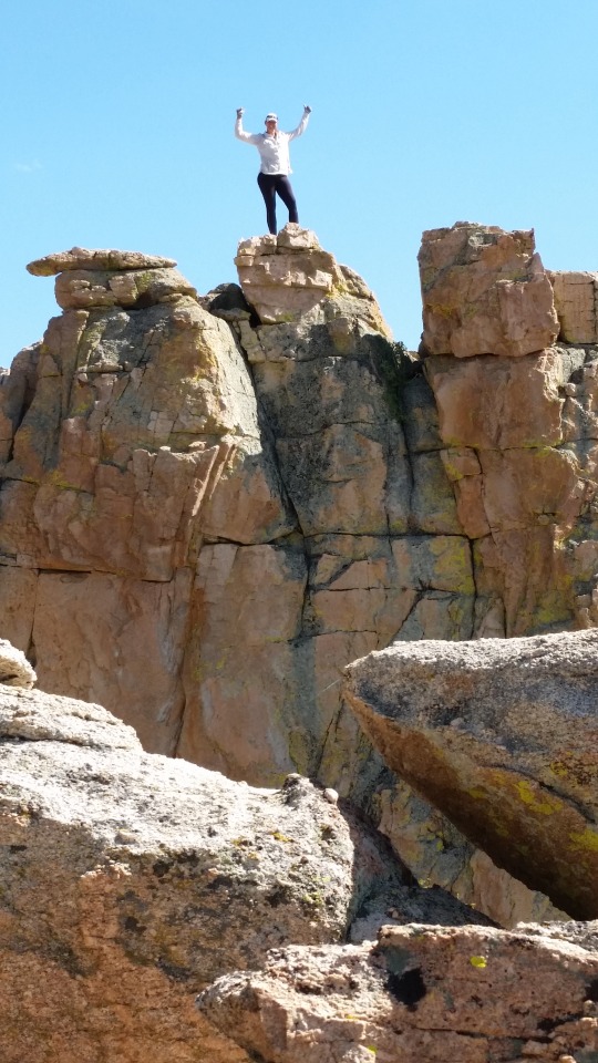
The final miles of the previous day had been all uphill towards Kearsarge Pass and had really worn everyone out - everyone except me it seemed. Jailbreak and CB had struggled to make it to our camp the night before and camped just shy of where the rest of us had set up. Patch Adam did not need to drop into Independence to resupply and had said his goodbyes after Forester Pass. Now on July 12th (Day 70), we reconnected with Jailbreak and CB and continued to climb past Bullfrog Lake up to Kearsarge Pass. Feeling like a spring chicken, I led the charge up the pass. About halfway up the pass’s switchbacks you could start to see the five Kearsarge Lakes. Each was at a slightly different elevation and drained into the next lower lake, making a snake of water throughout the mountain valley. The view from the very top of the pass was the most gorgeous I had seen yet and it completely overwhelmed me. I had a few solitary minutes of wracking sobs and tears of joy before the others caught up. I purposefully did not take a photo of that sight so that in the future I would not recall it as it actually was, but instead as I remembered it being. The feeling from that moment was much more important to me than the reality of the image.
Jailbreak and CB were continually behind us, so with some text messages from the top of the pass to let them know our plans, the rest of us descended the other side of the pass to Onion Valley Campground and hitched a ride into Independence, CA. Independence was hot! Really hot! I immediately missed the cool weather of the mountains. We snagged dinner at the local taco truck and shacked up at the Mt. Williamson Base Camp and Motel. Their hiker box was incredibly well organized and stuffed with food from JMT hikers. Organizing my resupply food, I realized there was no conceivable way I could carry all of it. So, I paired it down the best I could and resolved to pick up extra food at the Muir Trail Ranch or Vermilion Valley Resort between there and Mammoth Lakes, CA.
After Jailbreak and CB arrived, we returned to the truck for more tacos! While I was still feeling invigorated from my emotions on Kearsarge, everyone else was feeling beat. So I constrained my restlessness and resigned myself to a Zero day in Independence on July 13th so that the crew would stay together. Sadly, the next morning Jailbreak and CB decided their bodies could no longer continue. Jailbreak had been fighting knee pain for over 500 miles and could count his pain-free days on a single hand - enough was enough! CB had developed some slight tendinitis and did not want to push himself. We had lunch at the local French restaurant (Independence is pretty small, and we were shocked to find such a place) and waited for Kim to arrive with the van to pick up Jailbreak and CB.
2 notes
·
View notes
Text
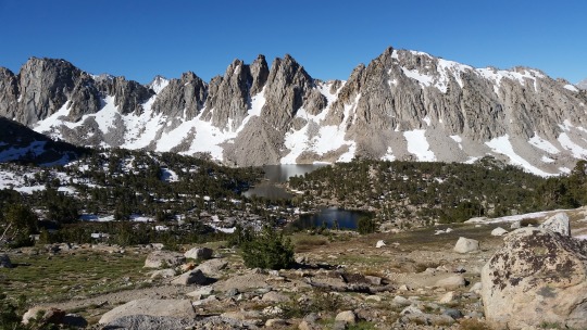
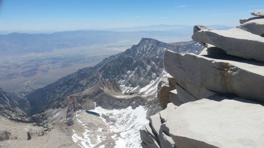
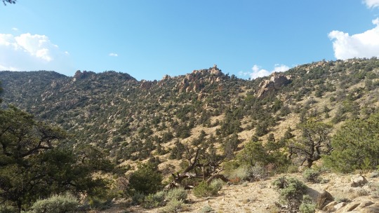
Day 69 (Ian) - Forester Pass
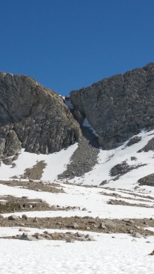
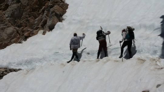
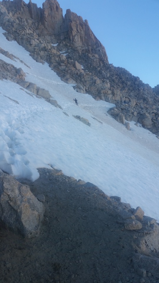
Waking early on July 11th (Day 69), we actually decided it was too cold and went back to sleep for another hour or two. Then, CB made us all hot chocolate with cocoa butter nibs for extra fat! What a wonderful way to start the day. A few miles later, we could finally see Forester Pass in front of us. Hikers need to climb a rock and snow field (just out of sight in the bottom right corner of the photo), then ascend some switch backs cut into the rock face on the right side of the photo, before crossing The Chute (the tiny snow field at the top of the notch). This would be an ice axe required excursion.
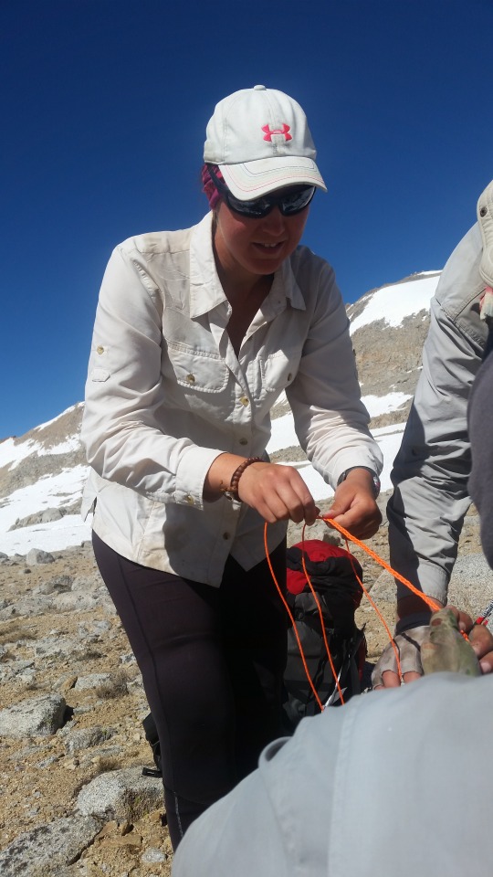
So first we needed to make sure all our gear was in order. Patch Adam didn’t have a safety strap on his axe, so we pulled together some paracord and Scribe braided one.
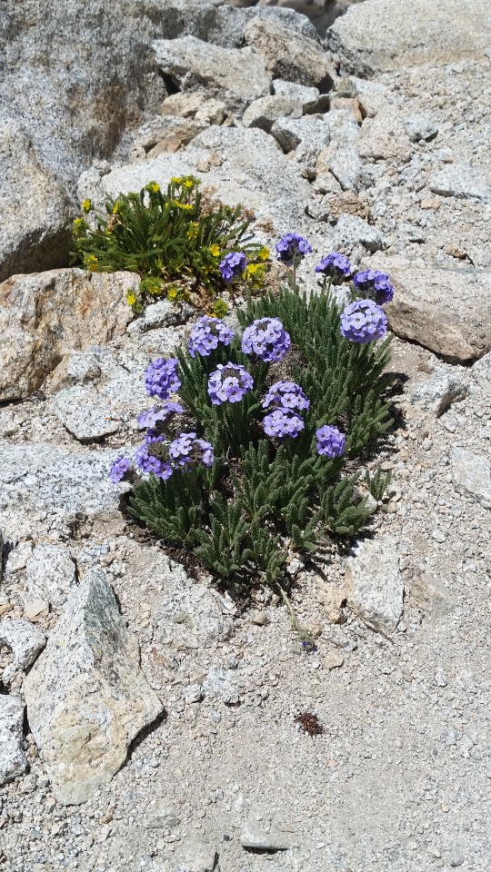
As we reached the rock and snow field, it became obvious that we could either scramble over just rocks, or climb just snow. Scribe and Jailbreak opted for the rocks, while Bandaid, Patch Adam, and I went for the snow. It was exhilarating taking one step at a time up the snow using my ice axe to stabilize myself on the slope with each step. Once onto the switch backs, there were the most beautiful purple flowers!
Then, we crossed The Chute. There was a very well constructed path cut into the ice which made this relatively easy. It would have been scary as hell to be the first person to have crossed or to be whoever it was that cut the track (probably a Ranger).
Finally at the top, and reaching the highest elevation along the entire length of the PCT, we posed for photos. Jailbreak created an amazing dichotomy with his Forester Pass photo and his starting photo from the Southern Terminus: the bright, clean, smiling Jailbreak at Mexico versus the hardened, dirty, chain-smoking Jailbreak on Forester. It was a sight to behold.

The view from the other side was utterly breathtaking. It was amazing to see from on high the transition between the different climate zones: bare rock, snow, and ice up top slowly becoming covered with trees at the start of the long valley eventually morphing into a lively forest with tiny alpine lakes and fields of flowers. We would not be walking through the eponymous Kings Canyon, which is in the west of the park, but it felt like we were walking in the lands of giants - lands which did not truly belong to us, where we were only guests and must earn the right to be there.

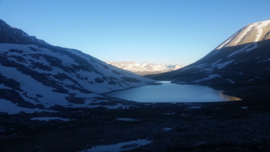
Bubbs Creek was the final water hurdle to our day before a steep climb up the north side of the valley to Kearsarge Pass Trail near mile 788. Bubbs Creek was so flooded! With several weeks of hiking through the Sierras left ahead of us, my thoughts were filled with what other crazy sights there were left to see.

1 note
·
View note
Text
Day 68 (Ian) - Tyndall Creek
Departing Crabtree Meadows on July 10th (Day 68) it was obvious we were now in the High Sierras.

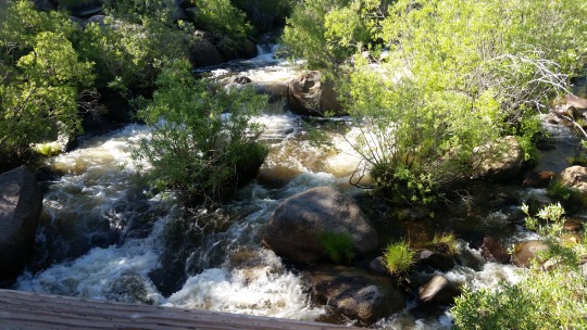
Today, it would turn out, would be the day of creek crossings: Whitney Creek (my fourth crossing of it!), Wallace Creek (mile 770), Wright Creek (mile 771), and Tyndall Creek (mile 774). As we headed north, the trail stayed on the high edge of the eastern side of north-south Kern River valley into which all the creeks drained. For Wallace and Wright Creeks, we had to descend their coulees to a flat spot to cross the creek, then back up the other side of the coulee. As we crested the top of each coulee, a giant rushing sound would wash over us. At first I thought it was noise from the Wild and Scenic Kern River down far below, but it was always just the upcoming creek!
Wallace and Wright Creeks were both about as deep as Whitney Creek had been, but more than twice as wide. I still had not given up on my wardrobe changes to keep my feet dry, but the time expended was starting to wear on me. I tried to focus on conversation with the group to keep my mind off of it. Throughout the day I got to know Jailbreak a lot better and we spent the second half bouncing ideas around for a business plan (maybe more on that next year).
Scribe and Bandaid had been feeling antsy after their Zero in Crabtree Meadows and jetted on ahead of us. I was enjoying talking with Jailbreak and CB and stuck with them most of the day. Patch Adam was a slower, but steady hiker so we ended up crossing paths many times that day. Patch Adam had this really awesome, tiny digital camera and often stopped to take photos - as was the case as we settled down for lunch with the below view. After a few minutes, CB turned to us and asked if Patch Adam was alright. CB hadn’t noticed the camera and thought Patch Adam was having some quiet tears to himself! hahaha (I might have shed a few myself...)
Approaching Tyndall Creek, we could see it was going to be a much tougher crossing. Word on the trail was to hike upstream to a point where the creek braided into a few smaller crossings. When we reached the point the trail crossed the creek, we were awed by the rushing torrent of white water. There was no way anyone could cross here! As we started our hike upstream, we ran into the Ranger for the Tyndall Creek District. He explained how we should continue upstream until it felt safe for us to cross. Most people were walking about 1.5 to 2.5 miles, but if we went as far as 4 miles the stream would cease to be. Imagine the scale of that! In just four miles, the creek went from trickles of snow melt to an impenetrable wall of water! In the photo below I am looking back at Tyndall Creek after our crossing. You can see on the left how the creek is petering out, but on the right it has grown into some white water.

Then, we ran into a pair of JMT hikers heading south. They had just crossed the creek and one of them looked a little banged up. Asking about their experience, they shared that they had tried to cross Tyndall too early... After the first hiker successfully crossed, the second got swept downstream! He abandoned his pack (as no gear is worth your life) and got pinned against some debris just downstream. His buddy jumped in after him and saved his life! Luckily, his pack had been pinned against the same debris and was recoverable. This unsettled us significantly. Now it made sense, that look in the Ranger’s eyes... Can you imagine the responsibility he must have felt for all us stupid hikers? I gained a new appreciation for the work of the Park Service that day.
You can see in the below photo how much standing water there was. This area must have been snow covered just the day before. I can’t even imagine what this creek looked like just a few days before when Downsize crossed! After we reached the third braiding upstream, we decided the water looked safe to cross. It was about hip deep and strong enough that we couldn’t simply walk across like we did the other creeks that day. The trick is to turn to face the water coming downstream so that your strongest muscles can resist the flow of water, then crab walk to the other side using your trekking poles for support.

Having all reached the other side of Tyndall safely, we walked uphill back to the PCT and began to cross large fields of rock and snow. We had setup a mileage stopping point earlier in the day to make sure we reconnected with Bandaid and Scribe and eagerly sought camp after a long day. Well above treeline at mile 777 we found their campsite, a bare patch of rock among the snow. With not too much room to pitch tents, the rest of us rolled out our bags and enjoyed the rare mountain air as the sun set.
Tyndall Creek was truly humbling for me, unlike Mt Whitney had been. Nature is both beautiful and terrifying, like a Queen.
0 notes
Text
Day 67 (Ian) - Mt. Whitney
I woke up at 0300 on July 9th (Day 67) and started packing. I wasn't bringing much, but enough to need my pack: food for a day, water filter, wind jacket, and my sleeping bag (in case it was cold on top, but I wanted to sit and enjoy the view). Hell, it was cold now. I was dressed in my merino wool base layer, my warm wool shirt, and my down jacket. I had to drop my tent so I could bring my trekking poles. Bandaid, Scribe, Jailbreak, and CB decided to listen to their bodies and not make the summit attempt. I saw other headlamps preparing, so I walked over to ask if I could join their expedition. However, they were a guided tour group and company policy was to not allow that.
Undeterred and armed with caffeine and honey buns, I headed for the creek. It was pitch dark because the moon had set earlier in the night. So instead of hunting for the crossing, I just found a rock to sit on and eat my breakfast. Watching where the tour group crossed the creek, I moved to a rock right next to the crossing and waited. It was freezing, so I pulled out my sleeping bag to use as a blanket. The next group that came to cross was father & son Reinhard & Carl from near Frankfurt, Germany and Carl's lady friend Mary Kate from New York. They graciously agreed to become a group of four.
As the blue hour began to brighten, you could see our prize waiting for us 8 miles in the distance. Climbing Mt. Whitney from Crabtree Meadows is done in five parts (you can also climb a different trail from Lone Pine, plus there is a technical mountaineering route): 1) travel northeast along Guitar Lake to the base of the mountain, 2) rock scramble southeast up the lower slopes to the, 3) switchbacks which lead you due north almost all the way to the final elevation leaving you with just, 4) a long ridge walk westward to, 5) the final ascent.
In the photo there is a large snow field like a skinny, upside down triangle. To its left is #3, #4, and #5. Due to the unseasonably large amount of snowfall, there was still large, but thin fields of snow on the approach along Guitar Lake (#1) and #2's rock scramble, but #3's switchbacks were mostly clear by now with only three snow traverses we would need to perform. Plus, the final climb in #5 was also a snow climb to the exposed, rocky summit. We would want our microspikes and ice axe for all the snow work, but otherwise we used our trekking poles on the rocks and exposed trail. The other three were willing to accept the risk, and hadn't brought ice axes. This was only their third day on trail hiking the John Muir Trail northward. The JMT overlaps the PCT for most of the Sierras.
Working our way up the side of the lower slopes, looking backward to Guitar Lake.
Here is a photo of the second snow traversal. You can see Reinhard a bit over halfway across. We all crossed the first snow traversal without micro spikes as it wasn't dangerous looking. This second crossing was pretty safe too, but with a long slide down to the bottom. So we all put on micro spikes for the second crossing, except for Reinhard. Reinhard was fearless. He explained that he roller bladed and skiied, so his balance was good and he wasn't really afraid of falling. So, I gave Reinhard the trail name: Hardcore. The third snow traversal however was dangerous, with rocks to fall on, so even Hardcore spiked up.
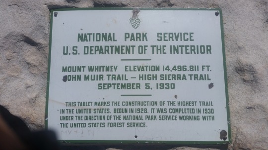
After the rest of the switchbacks and the ridge walk, it was just one final snow climb to the top. This part felt pretty steep and I was very glad to have my ice axe. The top was a mass of jumbled rocks with a summit shelter, Park Service plaque, and Geological Survey marker. Bandaid has bought me a mini survey marker for Whitney in the form of a hat pin which I had been wearing on the inside band of my hat. Now, I repinned it on the outside.
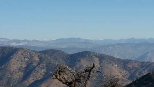
Between Whitney and the mountains in the background of this photo - which run north-south - is a river. Next, we'll continue northward (to the right) always on the eastern (near) side of the river. We'll cross several large streams feeding into the river valley, but we'll stay above 9000 feet as we climb to Forrester Pass and into the High Sierras.
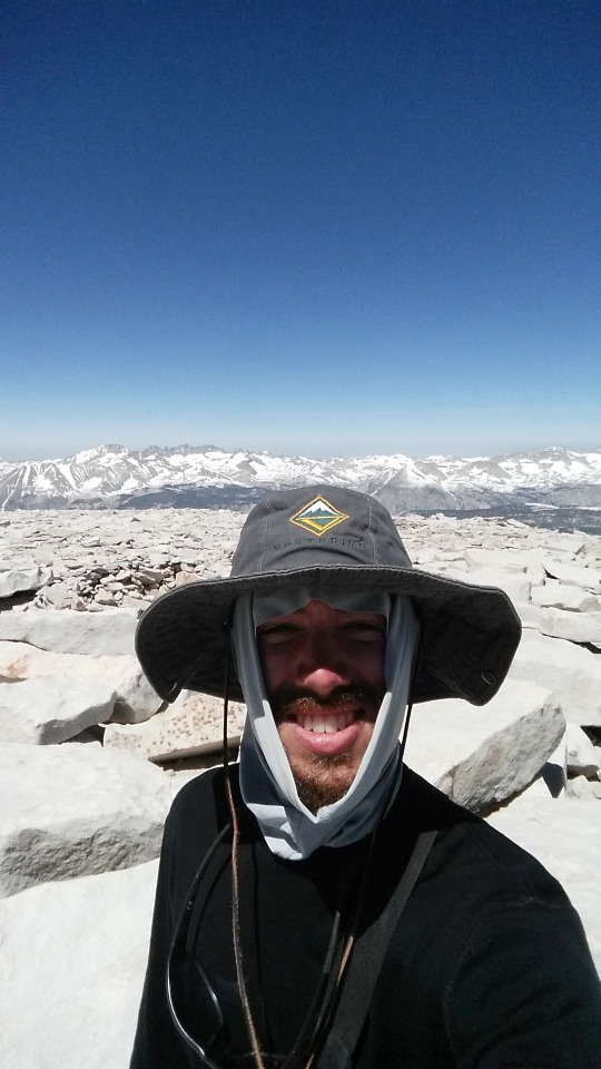
My favorite view from Whitney was Wotans Throne.
After photos, phone calls, and lunch we began our descent. After we had recrossed all the snow fields, nature began to call. So, I said my goodbyes and raced back to the latrine as I had not brought any blue bags to pack out human waste. Arriving back at camp around 1500, I laid out my wet clothing and had a cigarette to calm my mania. I had just summited the tallest mountain in the Lower 48 States (14,496 feet)! And it had been easy... I had to struggle a bit with just HOW easy it had been. Climbing Mt. Adams (12,280 feet) in WA state as a teenager had been so much more demanding. I guess a lot had changed since then. Maybe Forrester Pass would give me a bigger thrill? Did I need the thrill? I began to notice a pattern, I was becoming addicted to all this: the sights, the exertion, the endorphins, EVEN MY HEAVY PACK felt like a warm hug as I wore it. With over 1700 miles left to go, I jammed all those thoughts down for a later look and passed out. I slept like a baby. The next morning it was a little tough to not go climb Whitney again, but with all my friends heading north: so did I. But I shall return...
3 notes
·
View notes
Text
Day 64-66 (Ian) - Lone Pine to Crabtree Meadows
Driving in the van on July 6 (Day 64) back up the switchbacks from Lone Pine at 3,500 feet to Horseshoe Meadows Campground at 10,000 feet was dizzying and gave me some motion sickness / altitude sickness. When we arrived Kim made me some ginger tea and I laid down for about an hour. With the nausea gone, we excitedly began hiking. Not far from the campground we ran into our first ranger. Bandaid was so excited. He checked our permits and made sure we all had bear vaults. Then, as we continued to climb, we ran into our first real patches of snow.

At the top of Cottonwood Pass (mile 750), we found a large slope to practice self arresting with our ice axes. Bandaid has mountaineering experience and was an excellent teacher. It was pretty fun throwing yourself head first down the slope and fighting gravity with such a simple tool as an ice axe. It's easy really: reorient onto your belly, put your feet up, reorient your head uphill, slam the axe head into the snow with your body weight, wait to come to a complete stop, plant your feet, and plunge the axe handle deep. Now you have self arrested! The trick with the practice is to get those steps down to a fast response time. I also learned that it was important during the reorientation step not to roll over the side I was holding the axe handle with, it was much easier and faster to roll to the other side.

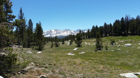
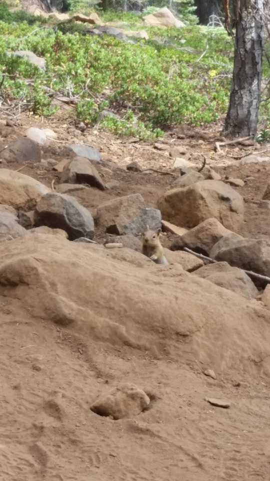
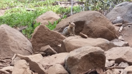
Between my altitude/motion sickness and self arrest training, we didn't actually hike very far, but we were pretty tired anyway. That first night we stayed at Chicken Spring Lake (mile 751) - which is nestled between the mountain and the trees in the photo. After dinner, as the was sun setting, I sat for 45 minutes and watched the light slowly move across the rock face. I wondered how long those rocks have been staring back at us, were they once covered in a glacier, how did it become shaped? The geology is fascinating! Bandaid is a geo-engineer, so we got a few rock lessons along the way.

The next day we crossed the boundary into Sequoia National Park (mile 754) and had a bit of blessed downhill walking. As we descended, we were approaching our first big creek: Rock Creek. Thinking it would be better to tackle the creek in the morning and not wanting to sleep too low in elevation or too near to water to stay away from the mosquitos, we walked a quarter mile off trail at mile 759 to a beautiful flat spot and played a game of catch before setting up camp.

The next morning we reached Rock Creek (mile 761). We had heard from passing hikers that there was a log that made crossing easy, so Bandaid, Scribe, and I crossed the first log we saw not knowing that was right were Perrin Creek came off the hillside and joined with Rock Creek. Our choice would doom us to a 1.5 mile marshy slog to the good log crossing. Jailbreak and CB were a bit behind us and didn't make the same mistake.
After the creek crossing, we started going back up and I was feeling really high. I chased the endorohins and pushed hard up the several mile climb, a little too hard, especially given the weight of my pack after the last resupply. After my rest at the top, reshouldering my pack brought a sharp pain. I think that my scoliosis has affected the balance of stength in my abdominal wall and I had taxed the weaker side too much. Bandaid feared a hernia, but the pain receded quickly and did not return. Regardless, I took it easier from then on.
Not long later, we got a really good glimpse of Mt. Whitney. It gave me shivers of excited anticipation down my spine that I had to shake off like a dog would. The terrain was an interesting mix of dusty, granite sand with sparse vegetation and dense pine forests. I noticed the tree species were changing too. Up high the white pines were replaced by bristlecone pines; and down in the valleys ponderosa pines gave way to red firs and lodgepole pines.

Coming into Crabtree Meadows on July 8th (Day 66) - a few miles off the PCT at mile 766 - we had our very first stream that required fording: Whitney Creek! It took much longer than I liked for me to wardrobe change on each side of the creek, but I feared the damp could cause new blisters - a problem I was glad to no longer be nursing daily. Scribe however is a no-nonsense hiker and simply walked across!

But it was worth it. Crabtree Meadows was beautiful and had a latrine! Perfect for prepping for Mt. Whitney. The meadow stays so nice because they prohibit camping on the grass, so everyone sets up in the trees. Another hiker the rest of the crew had met earlier joined us just a little later and we gave him the trailname Patch Adam on account of his real name being Adam and all the patches on his pants. Adam had started his adventures months before us on the Arizona trail. By Crabtree Meadows, he had already hiked over 1200 miles!

Tomorrow... Whitney...
2 notes
·
View notes
Text
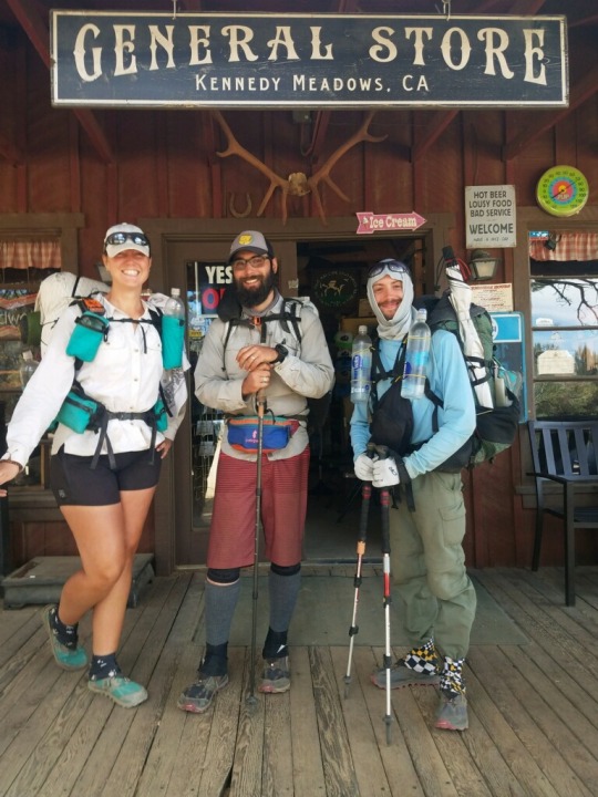
Day 60-63 (Ian) - Kennedy Meadows South to Lone Pine

Leaving Kennedy Meadows South (mile 702) on July 2 (Day 60) we immediately entered Sequoia National Forest. After a few miles of walking through the sagebrush meadows, we started to climb. It didn't take long to start seeing clues of what we were about to get ourselves into.

We only went halfway up (mile 709) the first climb that day because somehow the main party spent all morning backtracking trying to find Bandaid - who had simply walked past us without anyone noticing. We blamed the braid of alternate paths through the meadow, Bandaid blamed our common sense. He may have had a point...
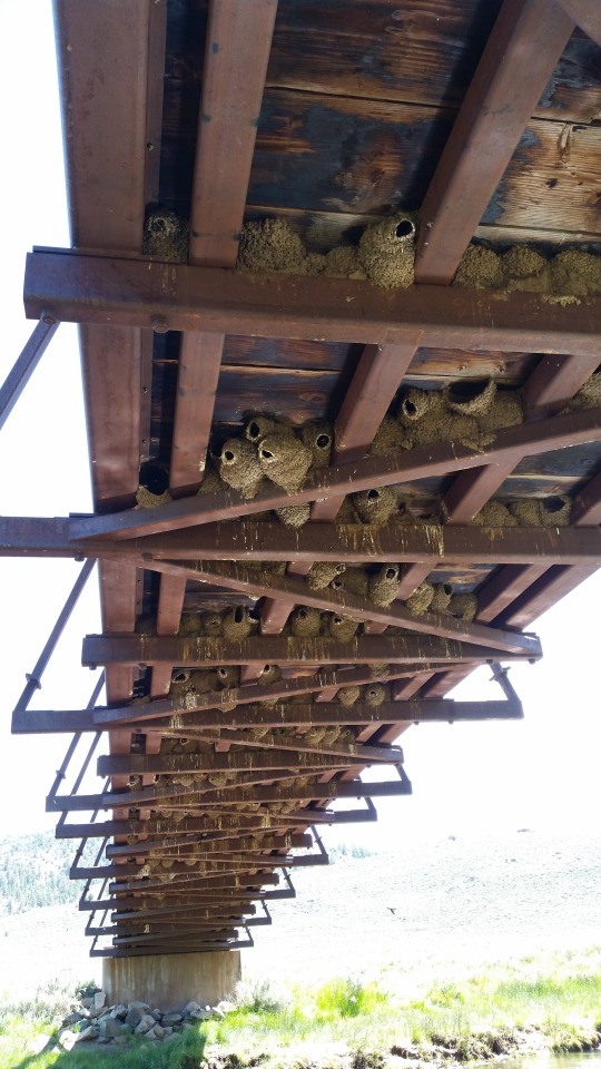
The second day we ate lunch at a large bridge over the South Fork Kern River (mile 716) underneath of which scores of sparrows had constructed nests. There were tons of bugs that the sparrows could snatch up just a few feet outside their doors, so they were constantly swooping in and out of the nests. In the water a half dozen large trout swam lazily in the shade and feasted on the bird dung. Bandaid began to obsess over the trout and couldn't wait to pick up his backpacking fly rod. I was also pretty excited by this prospect.
That night we reached an elevation greater than 10,000 feet (mile 722) for the first time since Mt. San Jacinto back at mile 181! For the next 100 miles we would not drop below 9,000 feet (except to resupply)! The first night sleeping at altitude was tough for Scribe, but adaption came quickly in just a few days. I was pleasantly surprised to have no altitude sickness myself (since it had been 15 years since I lived at 8,000 feet in Cochabamaba, Bolivia).

The next day was July 4th and I was sad we were going to miss the Independence Day festivities in Independence, CA, but I had found red, white, and blue bead necklaces in the hiker box at Kennedy Meadows South. It was fun to dress up just a little bit and totally worth the weight for a few days. That day we had some awesome views west into the foothills and mountains of the southern Sierras, as well as a rare glimpse east of the arid Owen's Valley (where lots of the LA aqueduct water comes from). While we were snapping photos, Scribe decided to do a little rock climbing. That night we camped at just above 10,000 feet again (mile 736) to help us acclimatize.
The next day was July 5 (Day 63) and our destination was Horseshoe Meadows Campground, our access point into Lone Pine, CA to resupply. There are three trails down to the campground from the PCT. We opted for Trail Pass (mile 745) as it seemed the middle ground between length and steepness. Luckily, Jailbreak's uncle-in-law CB wanted to join us for the next section, so he and his wife Kim met us at the campground and drove us into town in their badass camper van. Scribe is also working on a van conversion. It was fun to talk about making your own moving home! I think van life would be so cool.
The resupply in Lone Pine was pretty good. We started with carbs and meats at the local pizza place. I tried to order a local root beer on display, but they came me a draft IPA from the brewer instead and I didn't notice till my first sip. Oops! Next, we went to the post office for parcels and the ranger station to get CB a permit. At the post office I collected my ice axe and Bandaid got his fly rod!
After CB and Kim dropped us off at the hostel, we did a grocery store run. For the next section I started to experiment with carrying some new foods: tomato paste in a tube, miso soup mix, parmesan cheese, chunky peanut butter, and honey buns; honey buns are simply the best 500 calorie breakfast that money can buy. One contention among hikers is the glazed versus frosted honey bun argument - go team frosted! As for the rest, top ramen was starting to get a little old hat. But, it can be improved with parmesan cheese or miso mix, or you can add hot sauce, tomato paste, and peanut butter for a half-decent attempt at pad thai.
Then, we got to experience the 7.1 earthquake while all our clothing was at the laundromat. I guess there had been one the day before as well, but I had not noticed it. We all ran out to the parking lot and surfed for a few minutes. Trying to fit all 7 days of our resupply food into our packs was an extremely frustrating task for all of us. With that much food my pack was well above 1/3 my body weight, which concerned me a little. I slept fitfully on a top bunk that night.
0 notes
Text
Day 54-59 (Ian) - Rest & Relaxation at Grumpy Bears Retreat
I ended up staying in Kennedy Meadows South for seven nights. I mostly hung out at Grumpy's bar or Triple Crown waiting for my shin splints to heal. I decided that I didn't feel comfortable tackling the highwater Sierra creeks alone, so I was also waiting for Bandaid, Scribe, and Jailbreak to arrive to join up with them. In that time I got to meet some pretty rad people: Rocketman, Sauce, Oprah, Bubblewrap, Pioneer. Oprah was super kind and have me a calf massage which did wonders for the shin splints.
It was awesome hanging out with Deluxe for the few days he stuck around as he seemed to know everyone. One night we had dinner in the bar with the famous Yogi, the owner of Triple Crown. We talked about hiker culture and the quirks of running a business in Kennedy Meadows South. Another fun memory is how remarkably similar Smiles looked to Kim Possible the cartoon character in her borrowed clothing while her laundry dried (it was the hat that did it) - I'd snapped a picture! I also got to meet Anne (honorary trailname: Firelady) the Forest Service liaison with the local community. She was on-site at Grumpy's most daylight hours calming fears about the tendril of smoke in the distance. A few days before I arrived two lightning strike fires had started, but both were well contained and they were just letting them smolder out.
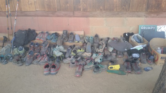
The shower at Grumpy's bar was a very interesting design: two 500-gallon plastic water tanks stacked and cut into a shower shape with a garden hose and propane tank feeding into an on-demand water heater. And, it was angled for an amazing view of the valley! They also had a large shoe library out front.
Some people have trouble with signs (this was not staged)... Yogi wanted to protect this tree leading up the construction of an actual store front. Right now Triple Crown Outfitters operates out of a shipping container. Their resupply options were great! I ate a few meals at the bar, but mostly I ate from TCO's hiker supplies to save money. The vegan breakfast burrito from Grumpy's however was legit! And Guido, one of the bartenders, had invented a specialty cocktail called Hiker Trash Laundry. Mixing half a dozen juices, liqueurs, and liquors it came out of the shaker frothy and grey-blue... Just like all of our laundry water before the rinse cycle. It looked gross/awesome and tasted great/sweet (or so I was told, as I was still abstaining from alcohol).
My second day in Kennedy Meadows South I set out to find new shoes. Sadly TCO didn't carry my size, but the other outfitter of Two Foot Adventures did! They taught me to size hiking shoes differently from street shoes. You generally want a half to full size larger to give your toes more room to splay as you walk over uneven surfaces. Per usual, no Men's sizes fit my feet, but I've worn Women's running shoes for years now. I walked away pretty happy with my two pairs of Lone Peak 4s by Altra in Women's size 8.5. Not only will alternating the two pairs expand their lifespan, but through the Sierras I will appreciate having a dry pair and a wet pair. It took some time to learn how to lace the new monsters onto my feet without causing any rubbing. It also took a few days to get used to walking in them, but immediately I could tell I'd made a good purchase. The tread on the shoes has an interesting design with "paw pad" like protrusions under the balls of the feet which make walking uphill so much easier! Your foot gets more traction at the ball, so it can pivot there instead of at your toes - giving you additional leverage.
After hanging for a few days, most of the folks I'd met had either started into the Sierras or flipped up north somewhere to bypass them. I enjoyed the quiet resting for all of about 15 minutes. I was so ready to go conquer the mountains... Yogi teased me that I would just stay in Kennedy Meadows South forever! But eventually, I saw Scribe walking up to the bar. Horray! Due to poor connectivity and a crappy game of telephone, it took us all day to connect with Bandaid and Jailbreak - mostly because we were too excited to sit still and kept bouncing between Grumpy's and the General Store.
We rested for a few more days and waited for packages for the rest of the crew while we planned our resupply strategy through the Sierras. Meanwhile I was introduced to the Question Game and Word Of The Day that they had been playing. Each day we picked a word, and if you said the word you owed pushups, situps, or planking! I owed a lot rather quickly... And the Question Game was a long series of intimate questions we all answered for each other. Talk about a fast way to bond! A favorite question was: "If you could have any trail super power other than flying or teleporting (read: cheating), what would it be?" I said the ability to talk to & command woodland creatures, like Aquaman of the forests. A favorite response from someone else was the power to instantly wardrobe change into anything from your pack.
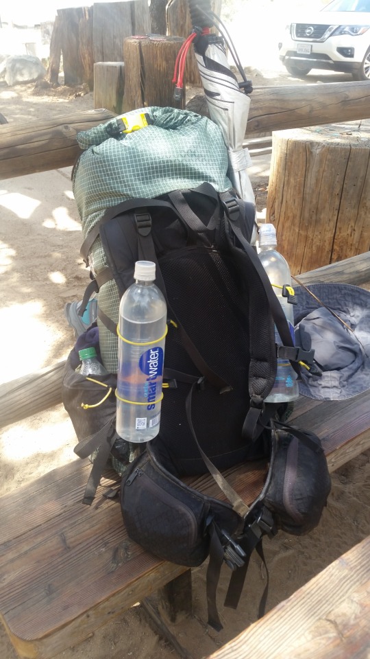
My pack the night before we left was so heavy! With gear and 5 days of food (but no water) it weighed 39 lbs. Ugh! But, we were heading into the place I had looked forward to for 50+ days. Nothing could bring me down.
1 note
·
View note
Text
The Adventure Continues

There is a saying out here: the trail provides. Run out of cigarettes, a smoker will round the been. Hitching 22 miles into town, the Forest Service retiree is happy to pick you up. Feeling stinky and gross, a soccer mom will open her house to you to clean up. It feels weird asking all of you, but I've prayed to the Great Spirit and asked the universe to help me find a way to keep walking. If you are able to consider supporting my continued adventures financially, please checkout my GoFundMe page:
https://www.gofundme.com/f/they-call-me-techno-gazelle
<3 TG
1 note
·
View note
Text
Day 51-53 (Ian) Shin Splints to Kennedy Meadows South
The next morning was June 23 (Day 51). I had only made it four more miles after separating with Gaelen at Spanish Needle Creek (mile 669) the day before. I woke up late, lonely, in pain, with no prospects of good distance that day, and an impending dread of continual injury. It was the toughest moment for me since the first few days out of Campo when I thought I had really gotten myself in over my head athletically. I may have cried a little, but then a mantra came to me that made all the diffence: The Adventure Continues. Nothing was over yet, nothing was finished. This was just a new obstacle to overcome on the journey to Canada. Up to this point I had mostly focused on building up my body: muscle strength, cardio endurance, digestive efficiency, joint alignment (a big struggle with my scoliosis), etc. But starting from here I began to have time and energy to devote to my mental growth. I gained a new resiliency that morning.
Researching how to cure shin splints revealed R.I.C.E. was the number one therapy. So I knew I would need to take at least three days "tent rest" in Kennedy Meadows South, probably more. That would be OK though, as lots of hikers take copious days off there. As the gateway into the Sierras, it is a gathering place for those waiting for the right conditions, the right gear, or the right friends to begin their mountainous adventures. Calf compression sleeves were also recommended, so instead of using mine for recovery while I slept, I began wearing them while hiking. I also learned how to tape my shin to help relieve the pressure on my tibia. Shin splints are so painful because the swelling pushes against the bone. The swelling could be from the tendon that runs down the shin into the foot or muscular. The latter can take weeks to heal, so I hoped it was the former (it felt like that was the case).
Next I researched the causes of shin splints. Overstriding is a major risk factor. So trying to keep up with Gaelen the last two weeks was probably to blame. But walking downhill with a heel strike can also aggravate shin splints, and that was exactly what I'd been doing since my shoes started falling apart about 400 miles back. So the solution seemed simple: walk my own pace, return to a midfoot landing, and buy new shoes! But only after all the R.I.C.E. took the swelling and pain away completely. I knew I would need diligence to stay still until the healing finished.
After applying the regimen of stretching, massage, PT, and CBD lotion, I walked until about 1300 and took a two hour siesta in the shade of a granite boulder. I applied the regimen again and was able to make it just north of Fox Mill Spring (mile 683) where I camped in a flat spot of a coulee. That put me at about 12 miles that day, about 2/3 my old pace.
The next day I ran into Deluxe at Manter Creek (mile 694) and met two Canadian girls: Smiles & Miles. I took a siesta nestled in the tall brush and ate a large amount of Skittles. After soldiering on, I camped right along the South Fork Kern River (mile 698) and soaked my feet and shin splints in the cold water. It stiffened the ankle further, but relieved a great deal of discomfort.
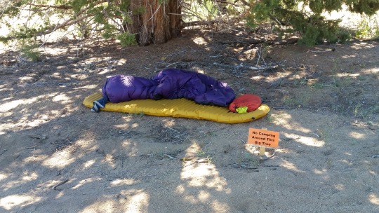
The next morning I passed the 700 mile mark just before the road to the General Store at Kennedy Meadows South. Walking up, I received the traditional cheer from the dozen or so hikers chilling on the deck. I checked the log but didn't see Gaelen's name. So I hitched south two miles to Grumpy Bears Retreat which was next to Triple Crown Outfitters, where I had decided to stay. Both Triple Crown and the General Store offer free camping, but camping near Grumpy's bar sounded more lively. I bought a shower, a cheese burger, and 8 hours of WiFi; started my laundry; and connected with Gaelen via email. I hadn't had any cell service since the morning I researched shin splints.
Gaelen had arrived two nights before and was well rested and ready to tackle the mountains. I needed 3-5 days off. So we dissolved our commitment to stay together and began to each hike our own hike. It was sad to see the band broken up, but ultimately it was for the best. That night, the clouds took on what a local called the "Sierra glow". I set up my tent by Triple Crown with Deluxe and dreamed of mountains.
4 notes
·
View notes
Text
Day 49-50 - Shin Splints Leaving Walker Pass
We left north from Walker Pass (mile 652) just as the sun was getting low on June 21 (Day 49) with Kirt & Dawn joining us for an evening hike to the top of the first ridge. Going a few miles more, we camped among some trees and bushes on a windy hillside. This was our first night back out with our bear vaults. Our next destination was Kennedy Meadows South, immediately north of which are Sequoia and Kings National Parks. Both parks require hikers to "secure" their food and smellables from bears anytime they are left unnattended (like while you sleep).
In fact we had made a lot of gear changes in Inyokern in preparation for the Sierras. We added our bear vaults (2 lbs) and microspikes (1 lb), Ian added warm gloves and a heavy wool shirt, but we decided to finally ditch our stove, fuel, and cookpot (1 lb) for an entire cold-soak menu. We had had it up to our ears with the rice and beans business we had tried up to this point: the pre-soaking was annyoing and sometimes leaked, Ian's flatulence was interminable (grandma ain't got nothing on Ian's walking farts), and trying to schedule our evening meal when we were both hungry was difficult. Better to each cold soak our own top ramen at our own pace.
We had mailed our ice axes here as well, but after 650 miles we realized we really did not want to carry an additional 2 lbs for a tool we'd use just a few times. However, like a motorcycle helmet, it isn't something you can just "deal" without. After a bit of research, Ian found a 7oz ice axe made from cast aluminum instead of steel and had it shipped to Lone Pine - the resupply town right before Mt. Whitney and Forrester Pass. Ian also finally realized that he had purchased children's shoes from REI and that was why they wore out so quickly! Luckily, there were two awesome outfitters in Kennedy Meadows South were he could get expert hiker advice on buying some new digs.

Our first destination the next morning was Joshua Tree Spring (mile 664). Joshua Tree Spring is interesting because it tests positive for trace uranium. Apparently there are a few springs in the area that do. Kirt was telling us that during the Manhattan Project of WWII, the local Airforce base of China Lake was responsible for designing, testing, and building all the non-nuclear aspects of the two bombs dropped on Japan: the housing, guidance fins, etc. And, they needed to test everything after development... So they dropped six test bombs, fully armed and loaded ready to go - including the uranium! - but sans detonators. None of them exploded and they were able to prove their design, but sadly the geology of the area resulted in underground caves collapsing and making the warheads unretrieval. All six are still burried out in the Mojave desert... somewhere...
That morning Ian could tell something was off with his right leg. It hurt just above the ankle when he walked at his normal keep-up-with-Gaelen pace, and especially down hill. Ian arrived, painfully, at Joshua Tree Spring a full 45 minutes after Gaelen. Ian could recoginze the symptoms now from high school cross country: it was shin splints. For an hour Ian stretched, massaged his leg, applied CBD lotion, and performed the PT exercises his high school coach had taught him. Ian had been taking a daily regimen of Vitamin I (200mg twice per day while walking, 600mg at night) since Tehachapi to deal with the swelling in his feet, but now increased the dossage to 600mg three times per day. The I is for Ibuprofen of course, hikers pop them like candy sometimes - something we both tried to be more diligent about. Pain is a message that something is wrong with your body. Ibuprofen can relieve swelling while you correct the problem, but shouldn't be used to ignore it. However, a few days from civilization either direction sometimes you just need to do what it takes to get to the next town.
The next five miles to Spanish Needle Creek (mile 669) were brutal on Ian. But, we crossed two important milestones: mile 666 and the 25% mark!
Gaelen was napping as Ian arrived, and that was exactly what he wanted to do too. Afterwards, we decided that Ian needed to take it easy the rest of the way to Kennedy Meadows South. Gaelen went on ahead, and Ian promised to send text message updates of his campsites each night. Unfortunately, the decent cell service of the desert was at an end and this proved moot.

That night we camped separately for the first time all trek. Gaelen would arrive in Kennedy Meadows South late the next day, but it would take Ian two and a half more days to arrive.
2 notes
·
View notes
Text
Day 43-48 - Tehachapi to Walker Pass
We were very excited to reach the next town. The PCT crosses a highway at the historically important Walker Pass (mile 652) which was discovered in 1834 by Joseph Walker and still serves as the southern-most crossing of the Sierras. From there you can hitch to either Inyokern/Ridgecrest (east) or Lake Isabella/Kernville (west). Luckily, we have an old Boy Scout friend from our days working at Camp Bonaparte that lives in Inyokern, and we were very excited to catch up after many years.
We departed Tehachapi (mile 566) in the late afternoon of June 15th (Day 43), and were sad to continue on without our friends Oilspill and Footloose that we had connected with along the Aqueduct. We continued to night hike as the desert wasn't quite finished yet, and there were some very long water carries coming up. Leaving the freeway after a bus ride, we had 16 miles to get to our next water source.
After our quick midnight nap, we arrived the next day at Golden Oaks Spring (mile 583) and prepped for an even longer water carry of 19 miles to Robin Bird Spring. Ian began to despair about all the water weight we had to carry, but Gaelen took this new burden in stride. Cowboy camping after midnight in a grassy depression between oak trees was magical with the moonlight, if midge ridden. The Tehachapi Mountains we were passing through were a distinctly new terrain: merging fluidly between wet coulees of mistletoe laden oak trees and dry, arid hilltops of sagebrush and Joshua trees.
We arrived at Robin Bird Spring (mile 602) the next morning just as everyone camped there was waking. Taking a few quiet moments to eat, drink, and simply share space with other hikers in silence was restorative. A few miles later we reached Landers Meadow (mile 609), our last water source before the longest water carry to date - 35 miles! We slept the afternoon away before departing Landers Meadow, but not before a nice conversation with some retired Jeepsters passing through. With 7 liters of water for Ian and 9 liters for Gaelen, we worked our way nearer to Wyley's Knob before crashing a bit earlier than planned on a Joshua tree topped ridge.
We rose early and easily from our ridgetop campsite before dawn, having now fell into a good night hiking rhythm, but Ian was beginning to feel like he could no longer keep up with Gaelen. Hiking through Joshua trees for most of the day, Ian finally caught up with Gaelen at a water cache before Skinner Peak (mile 631). You see the truth is that there were two water caches maintained by trail angels through this 70 mile stetch of sparse water. However, judging from the comments on Guthooks hikers were drinking an average of 40 gallons every day from each cache! The trail angels seemed to bring 250 gallons each week or so. Napkin math revealed this to be potentially problematic. We DID NOT want to arrive at a water cache expecting to refill and find none, leaving us to face 10-ish miles to the next reliable supply. So, we hoofed the extra weight for water security. Ultimately, the caches were well supplied, but better safe than thirsty.
At the last water cache, Ian napped much longer than advisable and rushed to catch up with Gaelen. Crossing Skinner Peak around 1800, Ian feared the late afternoon rain shower - with distant, rolling thunder - would hinder his progress, but luckily there were no lightning strikes to shelter from. Arriving well past dark at McIver's Cabin (mile 644), Ian rolled out his bag and crashed hoping to find Gaelen in the morning light.
The next morning was June 19 (Day 47), Gaelen was relieved to discover Ian's campsite and we walked the last few miles down to Walker Pass (mile 652). The views of the Sierra Nevada were stunning and breathtaking. Ian tuned into Above & Beyond's Group Therapy #250 Live from the Gorge Amphitheater to really soak up all the positive emotions. Our friend Kirt came to pick us up from the pass with cold beverages and allowed us to crash at his Trantula Ranch in the Red October (his super cool airstream trailer) for the next two nights. It was great fun reconnecting with Kirt and his family: wife Dawn, daughter Cheyenne, and son Schuyler (who had just bought his first house!). All except Dawn had worked at Camp Bonaparte, though Cheyenne during years we had not. Thank you again Kirt & Dawn for hosting us!
Holy wow! We were so close to the Sierras we could taste them. Their every glimpse, the very idea of their presence, filled all of our imaginings. THIS was what we had been waiting for. If it had not been for Ian's continually aching feet, this would have been a time of shared, extreme exuberance. As it stood, Gaelen was always a few miles ahead, a few thoughts in front.
4 notes
·
View notes
Text
Day 38-42 - Night Hiking to Tehachapi
The section between Acton (mile 444) and Tehachapi (mile 566) was hot, dry, "proper" desert. So we decided to not just skip the hottest part of the day by taking a siesta, but to completely turn our schedule around and do most of our miles at night. Typically that looked like: starting to hike around 1800-2000 stopping around 0100 to sleep for 3-4 hours, hiking some more until about 0800-1000, and then trying to sleep all afteroon.
Leaving Casa de Luna (mile 478), our first night took us past a small cave (mile 486) near Lake Hughes that was conveniently located for us to stop and sleep in. The cave was musty, but warmer than outside so we tried sleeping without our bags - just jackets. Gaelen woke up cold, but Ian was out cold instead.
The second night we arrived at a horse trailcamp (mile 508) where lots of people had set up tents - as it was the only water source around. Trying to set up tents quietly in the dark, we zonked out. The next morning Ian overslept, waking up just as Gaelen was leaving camp. Adjusting to the night hike schedule took some effort and wouldn't really click for a few nights. That day we hiked a bit longer into the day (well Ian did) to reach Hiker Town (mile 517) near Antelope Valley, CA where we spent the afternoon lounging. Hiker Heaven, Casa de Luna, and Hiker Town form a famous trio of layovers after which support from trail angels will begin to wane.
Our third night, we had a new experience in our journey: walking along the Los Angeles Aqueduct. For about 11 miles our elevation hardly changed as we followed one of the large pipes connecting water from the Owen's Valley to LA County. The Aqueduct system is as contentions of an historical issue as it is an engineering marvel (please read the Wikipedia article). Arriving early in the morning at the only tap into the pipe's precious cargo (mile 535), we laid out our bags to sleep. Ian woke up twice fully out in the blazing sun before moving to more permanent shade - suffering decent sunburns to his face, chest, and arms. Chilling with about a dozen other hikers under the bridge as they cycled through the shade like the hands on a clock was quite fun for Ian. Meanwhile, Gaelen had found a bad ass lean-to and slept the day away (perhaps the wiser choice?).
That evening we set out for another long-ish water carry, but right before Tylerhorse Canyon (mile 541) Ian's headlamp gave out. Hiking a few more miles by moonlight before it set behind the hills, we set up camp early that night. The next morning we set out to finish the push into town, but before noon we were driven to seek shelter. We stuggled to find any shade or respite from the sun... Ian eventually rigged his ground cloth and trekking poles into a semblance of a sunshade and tried to nap. By early afternoon Gaelen had had enough and decided to be miserable while at least gaining miles. Ian dithered for a few more hours before continuing. Meeting up at the last water before the highway, Ian dithered further in the oppressive heat while Gaelen reached town and booked a hotel. By the time Ian reached the highway (mile 566) it was 2100 and too dark for any motorists to see his thumb. Luckily, a bus brought him to the hotel by around 2230.
At Ian's request, we took a Zero day in Tehachapi. Ian's feet had been a constant bother since Santa Clarita and he began to suspect his shoes were partly to blame. It didn't seem right to be on the 3rd pair going on 4th at only 500 miles into the trek. Ian also needed to spend some time fighting with AT&T to switch from his old pre-paid plan to a standard plan, and acquire a new (temporary) headlamp. At least REI made it easy to have a (permanent) replacement mailed ahead to the next trail town. Ian's Nana had also sent cookies to celebrate reaching 500 miles - which we devoured!
2 notes
·
View notes
Text
Long Time No Post
Ian: Greetings readers!
chipmunk: huh?
Ian: I said greetings!
chipmunk: is that a post I smell? you got a post for me? huh? huh? do ya?
Ian: Why yes my fine furry fellow, let the updates resume!
chipmunk: oh boy! i can't wait!
1 note
·
View note
Note
What sounds are you hearing at night? Any scare the bejesus out of you?
Ian:
Sometimes! Mostly crickets and mosquitos, but the higher mountain elevations can be eerily quiet at times. As the light fades, some nights you can hear the bats clicking their way through the air as they hunt. Besides that there have been several nights chock full of owl hoots. But, it's on the quiet nights that the sounds of breaking twigs are the most chilling. Once, there was a nocturnal animal (youngling?) that kept making the freakiest call right by our campsite just as we were getting ready for bed. Our shouts did not dissuade it, and our headlamps could not find it. So.... we slept.
3 notes
·
View notes
Text
1600 miles (Gaelen)
I reached Sawyers Bar Road at mile 1599.7 on August 14th and caught a ride into the town of Etna. Unfortunately my feet were in pretty bad shape when I reached town and were feeling so achy and tender that I stayed in town to recover and had a hard time walking for a few days.
A lot has happened in the last 300 miles. When I hit the halfway point I was admittedly starting to feel pretty crumby, and was worried I might be hitting my physical limits. It was getting harder and harder to get moving each morning and harder and harder to get back up after stopping for a break.
Despite running into some friends I hadn't seen in several hundred miles (Oilspill & Footloose near Chester and Buddy & Silver near Drakesbad Guest Ranch) I was starting to feel a bit down about the trip until I had the sudden realization one day that in my efforts to make good mileage and short efficient resupplies I had lost track of getting enough protein each day. At the very next opportunity I made sure I had a good solid 80 grams of protein for each day in my food supply and within a couple days was starting to feel like my old self again.
Hiking through the Shasta Trinity Wilderness area was amazing. Mt Shasta is an impressive sight (one to rival Mt Rainier) and the mountain is visible for a significant portion of the trail.
The night before crossing I-5 I was hit by a thunderstorm during the night. A gust of wind knocked a dead branch loose which fell on my tent. Luckily the rain had softened the ground and a tent stake came out and the tent collapsed rather than tearing. The rain had just hit a lull, so it was quick work to get out of the tent and re-stake it. Once the tent was back up the night passed uneventfully (other than the thunder, lightning, and rain).
Everything seemed to be going well after I left Mt Shasta city at I5. It was 4 days from there to Sawyers Bar Road. I have gotten used to having a little bit of swelling in my feet in the morning, which quickly goes away once I'm up and moving about. However for the two days before I got to Etna the swelling took longer and longer to go down, and I started feeling so twinges and pain in my feet. My feet were still a bit swollen and tender when I got into Etna, but the next morning the swelling was extreme and did not go away all day.
I rested on town for several days and got to see a lot of friends as they passed through Etna, including Wildcard (previously Coolaid), Hot Take, and Big Money. After my feet started feeling better I hit the trail again. However the pain came back pretty quickly and I only made it 11 miles that day. The other thing I wasn't expecting was that my left hip was incredibly sore and wasn't moving right.
The next morning my feet were very swollen again. I spent almost 6 hours in camp that morning evaluating things. I realized my hip wasn't moving right and was causing alignment changes in my knees, ankles, and feet, and that the swelling in the feet was a symptom of my hip. After a lot of thought and deliberation I came to the unfortunate conclusion that I needed to get off the trail at least long enough to properly focus on my hip.
So the next morning I hiked back to Etna.
I am now off trail after 1610 miles, focusing on healing. I am currently hopeful that with a couple weeks of focused work I will be able to head back to the trail.
2 notes
·
View notes

Text
50% (Gaelen)
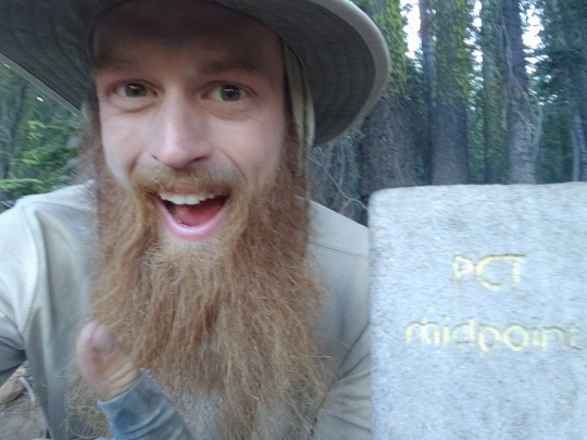
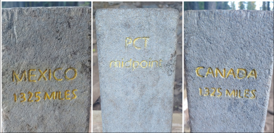
I've made it to the halfway point. Half of the length of the Pacific Crest Trail, stretching from the Mexico to Canada, 2650 miles long.
I can't believe I'm halfway done, or that I've made it this far. So much has happened. I've seen amazing sights and visited quaint towns. I've climbed to heights I've never visited before and ventured into climes I've only read about. And I've met some of the most wonderful people I can imagine.
I can't believe I'm only halfway done, and that to finish I have to do it all over again. I've worked myself to the bone day after day. I've been assaulted by clouds of mosquitos when all I want to do is sit down and rest. I've been price gouged on staple foods and have been happy to eat food I found in a garbage can.
But the good far outweighs the bad, and I can't wait to see what else this adventure has in store for me.
I hiked the first 700 miles with Ian, but we split up at Kennedy Meadows. We actually split up a couple days earlier. I wanted to push myself and Ian was afraid he was starting to feel the onset of shin splints and wanted to take it easy. We agreed to meet in Kennedy Meadows. By the time Ian arrived he was sure he had shin splints and needed time to rest and I had been resting for two days and was anxious to get going. After a brief discussion over email (he ended up at a different establishment than I was at) I decided to go on ahead and he decided to wait for a group of hikers that were a couple more days behind. I finally got a chance to catch up with Ian yesterday and learned he had safely made it to Mammoth Lakes.
The Sierra Nevada (apparently "the Sierras" is incorrect as The Sierra is a proper noun) was tough. The combination of the high elevation, snow filled passes, mountain streams, and lots of elevation change made going slow. Leading up to The Sierra I was getting close to 20 miles a day but once in the mountains I was barely able to average 15. The difficult terrain made for slow going, the trail was often lost in the snow, and safety became paramount.
I experienced a couple moments of terror as well. It wasn't the stream crossings or the passes that were scary. It was the inocuous patches of snow across the trail where 30 feet into a traversal you see the hill below the snow patch give way and you know slipping could prove fatal.
But despite the hardships I found the challenges enjoyable to overcome. Except the mosquitoes...
After leaving the towering granite peaks of The Sierra I found myself hiking through red sandstone mountains covered in fields of wildflowers. There's still a lot of elevation change, but not to the extremes that were presented in The Sierra. The trail is passing through thicker forests and the elevation changes are becoming more gradual.
My diet while hiking has been all over the place. Before entering The Sierra I got rid of my stove in favor of food that could all be eaten as is or can be cold soaked. This limits food options at resupply points, especially as staple foods like Clif Bars are often very expensive. But despite consisting off of 4000-5000 calories a day of Pop Tarts, Top Ramen, peanut butter, corn chips, and mashed potatoes I've found that I've lost about 40 pounds since starting the trip.
Since leaving South Lake Tahoe I've been hiking around 27 miles per day in order to make it to Canada before any snow hits the Northern Cascades. Most hikers aim to be finished by October 1st. At my current rate my 10 day average has me finishing near the end of September.
And of course one of the best parts of the trail are the little things you find along the way.


4 notes
·
View notes