papa-j
Jori & Linda's Travel Blog
Pictures & Words From the Road of Life
36 posts
Don't wanna be here? Send us removal request.
Last Seen Blogs

robby3472drivetime
Drive Time!

datadiscovery
Data Discovery fiverr.com/datadiscovery

billionairefuel
Billionaire Mindset Fuel

vibinglemon
Vibing Lemon

asgor15091509-blog
The Droganess
Text
Ontario and back
Week 5 continued:
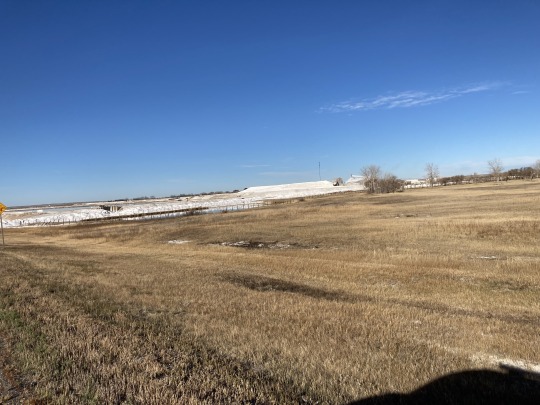
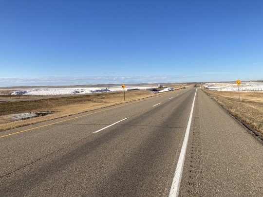
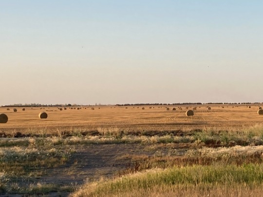
We decided to drive to Medicine Hat today, so left after coffee and local pastry. The landscape changes after leaving Moose Jaw where the road takes us through rolling hills, fewer farms and more grazing land. There were blue skies ahead and we were looking forward to sunshine. There are lagoons here and there like lakes with some being very large. At one point we got to a mining operation at one of the largest ponds, it looked like a salt mine operation. It turns out to be sulphur oxide production, used for fertilizer production.
We could see stormy weather to the south of us some 50km away and it started to get really windy with some pretty good gusts. Sulphur and dust clouds blew across the road like snow along with the occasional tumbleweeds. It looked like we were going to drive around this weather system, but as we got closer to Medicine Hat, it started to rain. We drove into the town in the pouring rain and decided to stay the night in a hotel, good choice way more comfortable.

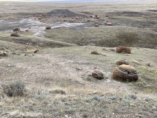
After breakfast the next morning we drove south west on Hwy3 to the Red Rock Coulee, an interesting feature in the flat landscape. This coulee is on old river bed carved out of the landscape. There are unusual red round boulders of all sizes strewn over the landscape. The largest of them 3 mt. in diameter. These rocks are in an area of some 20 acres and nowhere else to be seen.
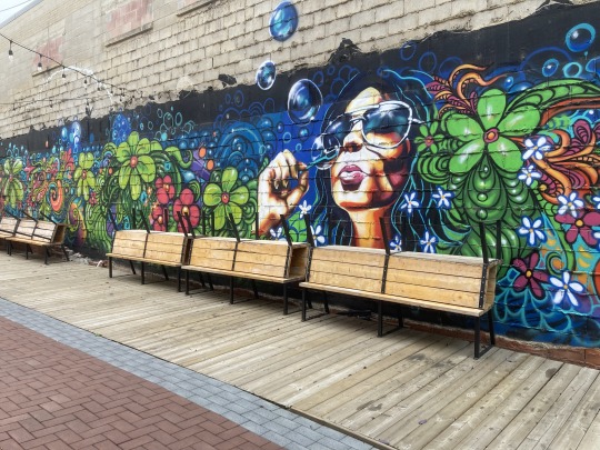
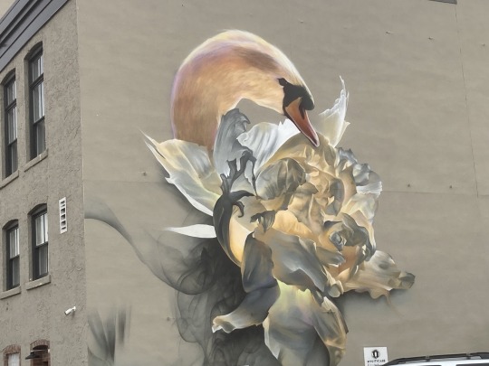
We returned to Medicine Hat for a walk around the old downtown. Many buildings have beautiful murals painted on the outside walls.
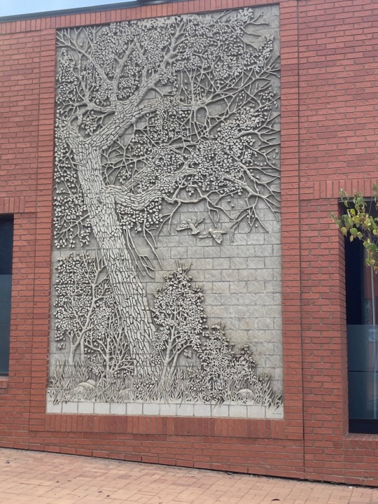
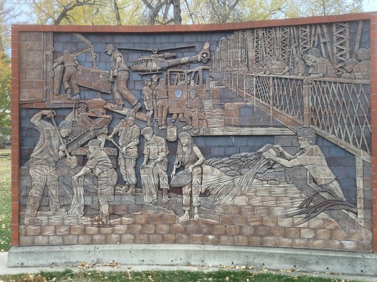

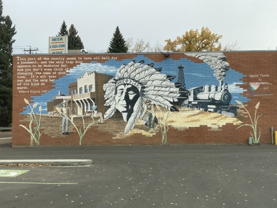
And then there are the James Marshal Murals. These are some outstanding brick murals and it all started here. There are more than 350 of these across Canada.

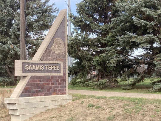
We then had a visit to the worlds largest Tepee, paying homage to The Saamis peoples, the natives of southern Alberta.
We then hit Hwy1 again, driving west to Calgary across flat prairie land only dotted by power lines and a few farm buildings in the distance.
Tomorrow we will driving home, sweet home!
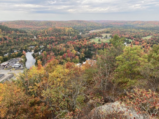
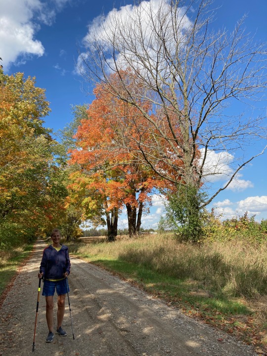
This concludes my travel blog for this trip. There were many highlights on this trip and the best of all was our drive from Huntsville, Ontario though Algonquin Park. The fall colours of the Muskokas were in full splendour, it was beautiful and amazing. If you have not seen this, put it on your bucket list, it’s worth it.
Until next time, remember to have some fun, be happy and smile :)
0 notes
Text
Ontario and back
Week 5

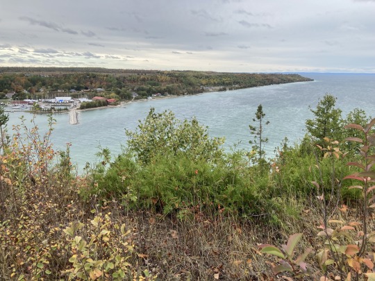
We left Harriston under heavy rain on our way up to Tobermory to take the ferry across to South Baymouth on Manitoulin Islands, a two hour ferry ride. On our way north on Hwy 3 we drove through large farms and flat land. The landscape turned more hilly as we got closer to Georgian Bay. There was more bush and the farms were replaced by cattle ranches, cleared bushland being prepared for farming.


We got into Tobermory to cloudy skies and setup camp at the Tobermory Village Campground. It’s getting colder now and that takes some of the fun out of camping…
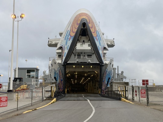

We got to the ferry a little late but in time to get on it. The crossing was in blustery conditions and driving rain. We passed by many islands on the first part of the crossing, but no houses on them, probably because these islands are very rocky and no beaches to be seen. The ferry ride was a bit rocky but I have experienced worse on the crossings to Vancouver Island.
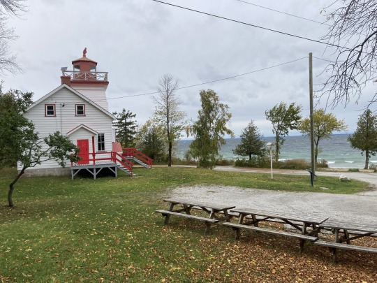
We drove straight north on Hwy 6 in the rain to Sheguandah then west on 540 to Gore Bay where we drove out to the lighthouse to take some pictures. The weather got lighter as we drove west with blue skies to the west.
We then continued our drive around the island. Along the way we saw some big flocks of Sandhill Cranes and geese feasting on leftover grains in the fields. The landscape on the island is mostly flat and scrubby, grazing land good for cattle and sheep and a few farms.
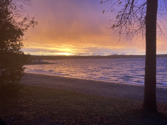
We made our way to Batman’s Cottages and Campground on the east side of Bass Lake to setup for the night. Due to the blue skies on the western horizon we enjoyed an amazing sunset here. It was windy and stormy all night, so we hunkered down in the van and played cards, she won :/ The sound of the wind gusts in the trees was similar to the sound of waves crashing onto the rocks at the Oregon coast. Still managed a good nights sleep.
In the morning we drove to Sudbury in the driving rain and snow. After turning off the main highway, we turned onto the road that took us to the Science Center, a great place to escape from the miserable weather. I love science and here is a place that offers a big variety of sciences with an interactive element. This can be a playground for as long as you want.

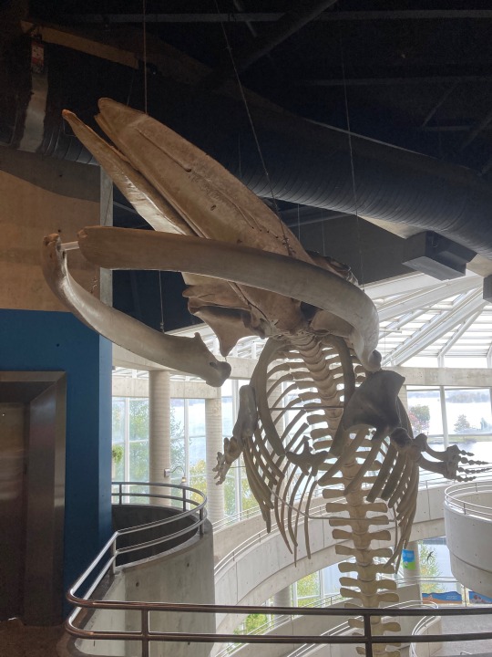
The architecture of the building is grand and the integration of the rocks of the Laurentian shield is clever and informative. One exhibit is about the geological formation of the area. We ended the visit with an IMAX presentation by Jane Goodall about Hope, inspiring …


We visited my friend Jaylene in the afternoon and evening to share stories about life and our kids. We went for a neighbourhood walk in the misty fall weather. All the sidewalks are shaded by maple trees and they were in full colours, beautiful.
We left Sudbury the next morning in the rain and drove north on Hwy 144 to Geneva Lake where we were met met by Kate, Lindas’ school buddy. Kate and Oscar live on the lake, water access only in the summer and over the ice in winter. This brings along some challenges but I can see the rewards. They live on a bluff overlooking the lake and have all the amenities, great place to be retired with a lot of family nearby. Life is good!
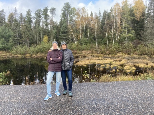

We arrived in the rain, so much of the activity was indoors playing cards and reminiscing, we learned several new Rummy games, a long walk on the mainland & enjoyed a wood fired sauna at 100c and a dip in the lake at 14c :))
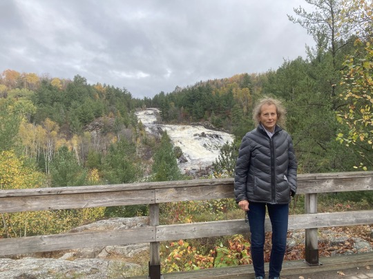
We left Geneva Lake under grey skies and drove south on 144 to 17 west to ‘The Sault’. We stopped at Onaping Falls to take some pictures. A.Y. Jackson, the famous Canadian painter, one of the Group of Seven was inspired by this location, beautiful fall colours and the whitewater rushing over the rocks and the falls.
The weather improved as we drove west on 17 and the fall colours still looked awesome in the sunshine. We drove past countless small lakes and small towns along the shores of Lake Huron North Channel. Through Sault Ste Marie and then north along the shores of Lake Superior to Wawa where we camped overnight.
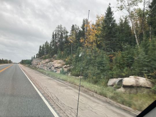
The next morning we left for Thunder Bay. From Wawa to Nipigon there is a whole lot of nothing but bush and rocks, some of it a bit unusual, but it looks all the same after a while. West of Nipigon we came upon the major roadwork projects we saw two weeks ago.
A ways past Thunder Bay we turned onto Hwy 11 west to Fort Frances. There are mostly native communities, with long distances between them along the way on this stretch of the trip. Some of these towns are neat and tidy and some have a lot of ‘yard art’ ;) It was a long day driving, we got into Fort Frances as it was getting dark. We entered the address for the campground into the GPS and it took us to the industrial section of town next to a truckers terminal, not what we were looking for :/ we found an empty lot and parked for the night. In the morning we drove north on Hwy 71 to Kenora.

There are many rest areas and lookouts to take a break. One of the nicest was Sioux Narrows on the Lake of the Woods, absolutely a stunning setting in the middle of nowhere… From Kenora west to Winnipeg we saw the landscape from the other direction. The fall colours are fading fast now, but it’s still very pretty through here.
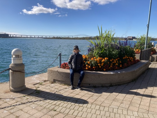
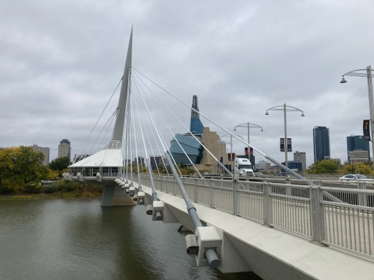
We arrived in Winnipeg at noon and went to the Museum of Human Rights. This is another amazing and beautiful structure inside and out. The exhibits although disturbing, are very profound and very well done. Walking through these exhibits, it occurred to me how the human race does not learn from history. We seem to allow the politicians and leaders to perpetuate human created tragedies and misery over and over again. Currently it’s in Russia/Ukraine and the middle east. Tomorrow it could be north America.
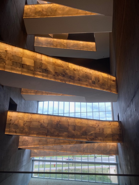

The exhibits describe how fascists and dictators manage the narrative and the media to take control of a country.

It makes me realize that the Swiss had it right in 1291 when they decided that they would no longer be ruled by anybody and took control with Direct Democracy. This has not changed to this day, even in Switzerland the politicians don’t like it but they can’t change it because the people would have to agree to the change. No Fascist can rise in that system of governing.
On Sunday we had a nice family gathering with Lindas’ oldest brother and his kids and grand kids. They are all living busy lives and the grand kids are all involved in sports and activities, such as hockey, gymnastics and dance. There were no cell phones in sight, nice to see.
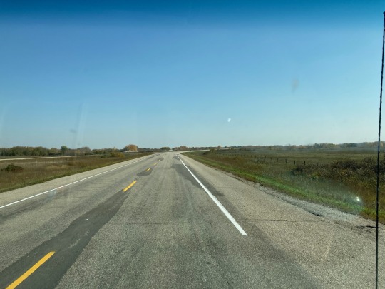
We left Winnipeg in the afternoon and drove to Barndon to get a head start the next day. The 100km radius area around Winnipeg is super flat, farm land as far as the eye can see with the occasional cluster of grain silos and the odd clump of trees and bush.
We stayed in the Meadowlark Campground, went for a walk, had dinner and played cards until bedtime. It was a cold night and made us realize that fall is here and winter is coming, the camping days are coming to an end… and we’re looking forward to coming home!


The road west to to Regina is in good shape (and flat). Between Whitewood and Broadview it showed a ski hill on the map just to the north of us and I’m thinking it can only be for x-country skiing, but apparently not ;)
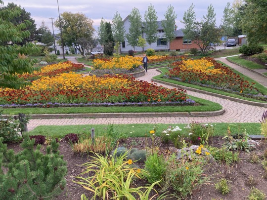
We arrived in Regina in time for lunch and walk in the waterfront park at Wascana Lake in the centre of the city. We took some pictures of the parliament building across the river and had lunch. Then we went for a visit at the Regina Floral Conservatory. This is an indoor tropical garden setting and the display of plants is changed 4 times, this theme was Halloween, well done. I was told that the favourite is Christmas with a focus on the poinsettias, I can imagine :) The place is run by volunteers, is beautifully maintained, and there was nothing ‘out of place’, with a nice water works and orchids, well done!

After this we moved on to Moose Jaw only an hour away. We arrived in the late afternoon just in time to take in the Chicago Connection walking tour of the underground tunnels used during prohibition 100 years ago and the Al Capone connection of that era. This was a fun interactive tour :)


We took in the mineral pools at the Temple Garden Spa. Nice very large indoor/outdoor pool and Jacuzzis with a nice steam room for a couple of hours. We set up camp at The Prairie Oasis campground, nice and clean and it was a milder afternoon and evening. Nice evening but grey skies morning.
0 notes
Text
Ontario and back
On Saturday morning we drove south on Hwy 11 through North Bay and Huntsville, then turned east on Hwy 60 through Algonquin Park to Bancroft.

The fall colours throughout northern Ontario were beautiful, but driving through the park was on another level, truly spectacular!
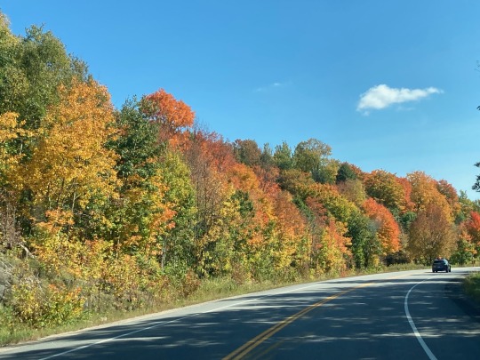

The maples with their various colours of red to deep red, the birch in gold and all the deciduous trees with colours in between and the evergreens in contrast in between!

It is amazing driving for an hour in all this colourful splendour and when you drive over a rise in the landscape, you can see these colours as far as you can see. If it is not, it should be it should be one of the wonders of the world! Put this on your bucket list, it’s worth it!
We arrived at Linda’s school buddy Joyce and Mitch’s place to a warm welcome.


Joyce and Mitch live on a 70 acre property in a maple tree grove with an old sugar shack. We went for walks on their trails and up onto a ridge on their property to a beautiful lookout over the rolling countryside. Mitch took us for a drive in the area, including a park above Bancroft for a hike in the woods. Nice food, good conversations and Euchre after dinner :)) It was a great visit!

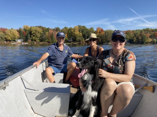
We left our friends place mid morning to drive south on Hwy 62 to Cordova lake to have a visit with a friend of mine from my hometown Jenaz in Switzerland. Hans is a part of my school years and the last time I spoke with him was 40 years ago, so we had lots to catch up with.

Hans met us in Mamora and showed us the way to Cordova Lake where he has a cottage. The cottage is only accessible by boat, so we loaded our gear in his boat and made our way to the cottage. After a 10 minute boat ride we arrived at his dock, where we met his wife Susan and their dog Tucker, a high energy collie.
A set of stairs led us up to the cottage which is build on the edge of a cliff overlooking the south end of the lake.
After settling in, we enjoyed a beer on the deck and reminisced about our childhood in Jenaz and all the people we remembered. Hans is 6 years younger than me, we had the same teachers in school and played in the same places. We talked about the different adventures we enjoyed, the trouble got in and the good times we had in our youth.

The resident chipmunk Missy would come around looking for handouts of peanuts whenever Tucker was not around or was a sleep.
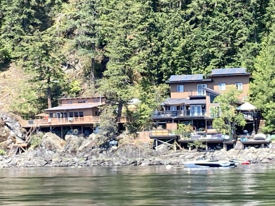
It was sunny and 26c and after lunch Hans suggested we go for an afternoon boat ride on the south end of the lake to check out some of the other cottages. There are lots of little old ones and big new ones along the shores and no ‘For Sale’ signs to be seen.
We got back to the cottage for cocktail hour, more good conversations and ribs finished up on the open fire BBQ for dinner. Hans has not lost his touch :))
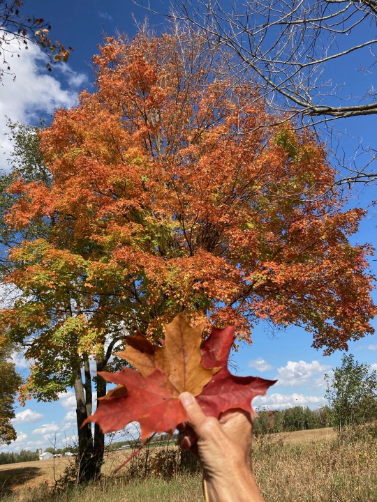
I was on the deck at 7:30 in the morning to do my stretches and enjoyed the beautiful sun rise. A lone loon was making himself heard on the still waters of the lake along with the occasional few geese flying by, honking their way south. After breakfast Hans suggested we explore the north end of the lake as it would be hotter today. The fall colours were not yet at their peak but never the less beautiful! Part of the lakefront has road access with most of the cottages being used by weekenders. The shorelines are mostly rocky so most of them have docks and floating platforms.
We relaxed the rest of the day on the deck above the lake, reminiscing and watching the traffic on the lake. Not much of that happening now as summer is over. Another delicious dinner with a glass of wine and more good conversations.
Hans took us back to the shore the next morning and we were on our way to Elora in southern Ontario. As we approached Peterborough we decided to take Hwy 407 through GTO and we were glad we did. It’s a toll highway so the traffic was light all the way and the speeding was epic. Speed limit is 100k/h, I drove in the 4th lane of the 6 lane highway driving at 118k/h and I was passed on the right by cars doing 140+k/h. We only saw one car pulled over by the cops.
407 merged with 401 in west Mississauga and the traffic got really heavy with a lot of transport trucks. We only stayed on the 401 for some 5km, then turned off in Milton onto the country roads to Fergus.
We stayed in this area for several days to spend time with Linda's family to do a memorial for her late parents. We visited with her cousin Yvonne, her brother John in Elora and brother David in Harriston, where we had a lovely early Thanksgiving dinner.
We stayed in this area for several days to spend time with Linda's family to do a memo
0 notes
Text
To Ontario
Week 3:
We drove to ThunderBay and found a nice diner to have the famous Finnish Pancakes with wild blueberries and maple syrup and they were delicious!


Then we drove to the local park on the hill for some nice views over the city and the harbour. There is a sunken garden in this park, small but well kept and a large selection of shade plants and a big selection of sunflowers in the centre, beautiful colours.

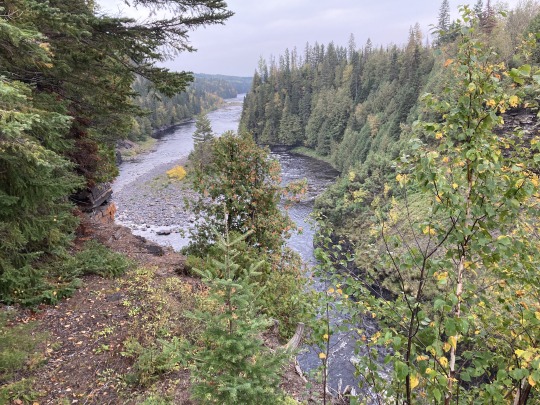
Around mid day we drove east along lake Superior through very rugged country to Nipigon. The rocky outcroppings are large here, several hundred meters high with the highway cutting through some good sized gorges through the granite.
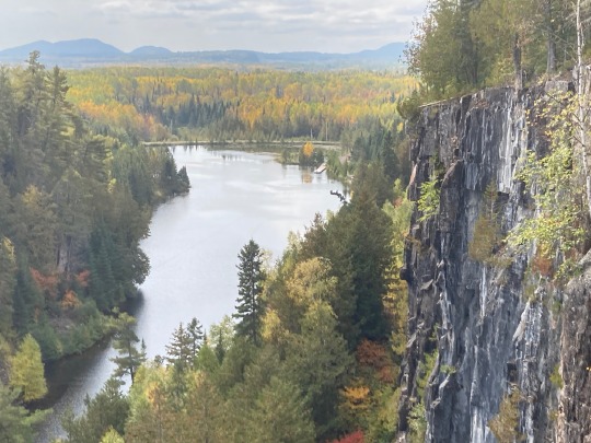
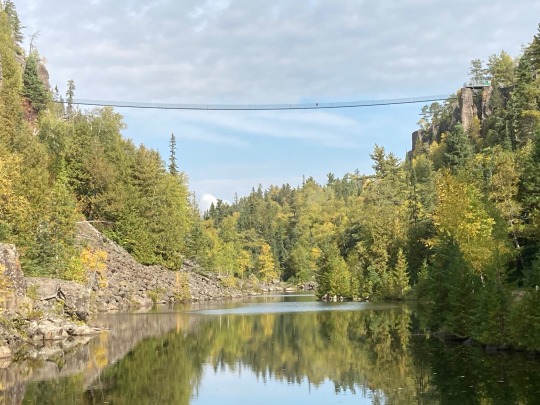
We stopped for a hike in Ouimet Canyon and our surprise we crossed two suspension bridges across the canyon. From one end of the 600’ suspension bridge was a half mile long zip-line that looked spectacular, unfortunately it was not in operation due to the lack of staffing.


A beautiful canyon nevertheless with basalt pillars close to 100 meters high. The fall colours and the colours of the rock made it a beautiful sight.
We turned off onto Hwy 11, the road to northern Ontario towards Kapuskasing and Timmins.


More highway construction projects with some minor delays. Most of the roads are in great shape along here. Speed limit is 90, but everyone drives at 108…


There are many small lakes along the way here as well. The fall colours are still beautiful, the evergreens are mostly Black Spruce, the same as we saw in the Yukon. Longlac is a first nation community at the north end of an 80km long lake. We got to Hearst late afternoon and found a campground on the edge of town, where we settled in for the night.
We had an early breakfast and drove on eastward to Cochrane where we stopped to take in the polar bear sanctuary.


This is a research facility with 3 bears with a very extensive habitat for the animals. The enclosure is more than 50 acres with a small lake 5 acres in size where they can swim.

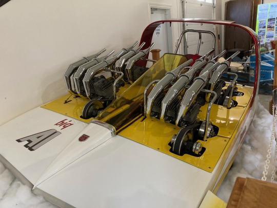
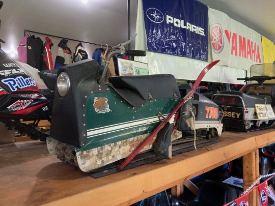

There was also a snowmobile museum with 30 - 40 vintage snowmobiles some from the 1950’s and a few more current models.


Then we walked around a small heritage village to end the visit to Cochran.
Then onwards on Hwy 11 to New Liskeard to visit with Linda’s brother John and his family. We stayed there for 3 days, visiting some of Linda’s school mates and old family friends. Lots of good food, daily walks and card games.

0 notes
Text
To Ontario and back
Week 2
We left Edmonton mid morning and drove east on Hwy 16. It took us through some nice farm country for 10-20km. We drove through Elk Island National Park where we saw a nice herd of plains buffalo. After driving through the park, the landscape changed to gently rolling hills with smaller farms and strips of wooded areas

We drove into Vegreville to check out the worlds largest Ukrainian Easter Egg. There is much tradition and history on the way they paint and decorate easter eggs. The Elks Lodge created a very nice park and picnic area on the edge of town.
Driving east from there we drove through the rolling hills, a lot of it covered in bush and shrubbery with the occasional grain farms, cattle ranches and small lakes in between.

We drove into the Battlefords. First we checked out South Battleford, looking for the tourist info centre, but it was closed. North Battleford is located on a ridge above the south Saskatchewan River. It looks like a service centre for the farming community of the area.


Then we drove east along long stretches of straight and flat roads towards Saskatoon. Most of the harvesting was already done. The farms are massive in size as far as the eye can see. Neighbours here are 10-20 km apart, no homeless people here …..
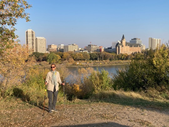
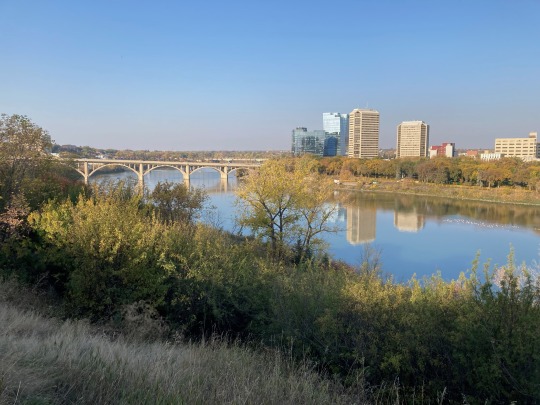
We arrived in Saskatoon and checked out the downtown area. We were looking for a campground close to downtown but were unable to find it, as the GPS was confused and kept sending us around in circles.
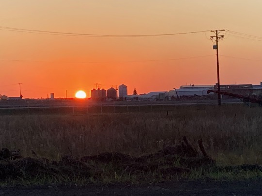
We did settle in an RV park on the edge of town where we enjoyed a beautiful sunset along with dinner

We left Saskatoon early driving east on Hwy 16 and stopped in Colonsay to have a short visit with our friends Brian and Angelica.

They moved here years ago from Calgary to retire and enjoy the country living. They have a lovely home and are involved in the community. We said our goodbyes after our surprise visit and drove on east.
This prairie land is endless, more land straight stretches of road with a slight curve every few miles.

We drove by Bid Quill Lake, a large body of water in the middle of the prairies.
We stopped in Yorkton to fill up with gas and beer and decided to travel on to Winnipeg. It made for a long day of driving, but we were looking forward to have an extra day there. We arrived at brother Jim’s place at 9, had a short visit before going to bed.

The next morning we made our way into downtown Winnipeg to get our windshield fixed as we picked up a rock chip. We also made it to the Fort on the Red River where we had a nice lunch, found a lovely bakery and walked through the park and across the bridge to St. Bonaface.
It was raining when we left in the morning and we had grey skies all the way to Kenora. We were advised to drive from Winnipeg to ThunderBay in one stretch, as there was not a lot to see in between, it was an 8 hour drive. We drove though more prairie farms, long flat and straight stretches of Hwy 1.


As we got closer to Kenora there were fewer farms and more bush along the road.
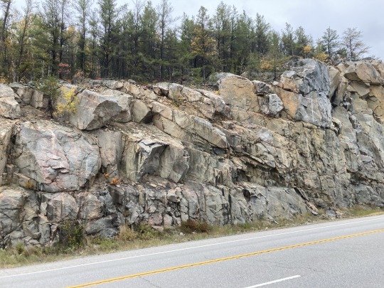
After Kenora the landscape changed as we came to the Canadian Shield. Rocky out crops dot the landscape here. Lots of bush and shrubbery with the odd cattle ranch, it’s no longer flat lands.
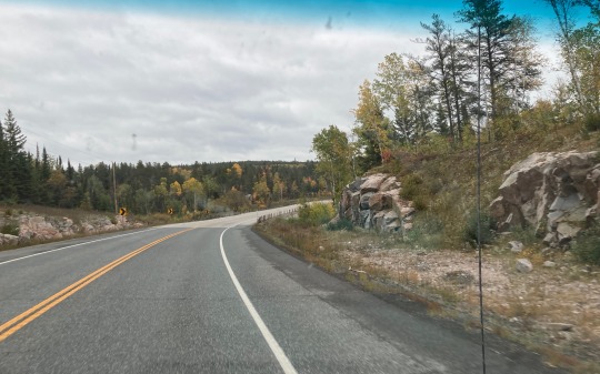
The road took us through low hills and rocky terrain as we arrive at Lakes of the Woods of Ontario. This is a beautiful area with all the fall colours of gold and red and with the evergreens amongst them.

Every few kilometres we come upon small lakes along the side of the road. There are over a 1000 lakes in this area, many not named. Mostly small lakes but also some big ones such as Eagle Lake and Buttler Lake and Wabigoon Lake by Dryden. For the following 250KM there were only small lakes along the road, most of them not shown on our maps and the roads were in good shape.
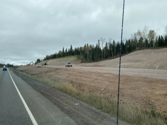
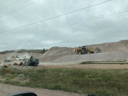
We also encountered several road construction projects. They were amazing as it showed the difficulties of building highways through this uneven rocky terrain. They cut deep and wide gorges in the granite to straighten out the roads. All that granite gets crushed and is used as bedding for the roads.


We stopped at Kakabeka Falls for a walk around the falls. Big volume of water going over these falls so it was very noisy
We got into ThunderBay late afternoon and drove to a campsite on the waterfront Linda found online. The GPS took us through town and then out of town towards Lake Superior. We drove alongside of some large grain elevators onto a dirt road into an area with large earth moving equipment. The GPS said that we arrived at our destination. WTF we were at the edge of a big dump. So we turned around and drove back to ThunderBay and towards Kakabeka Falls where we spotted a campground on the way.
We managed to set up camp before dark, made dinner and had a short walk around the campground.
0 notes
Text
Hello friends,
We got our chores done around the house, planted the garlic and winterized our yard, so here we go again on our next adventure,

this time to Ontario and back all in Canada. This is really a family and friends trip with some adventures for good measure.
Week 1
We left on Saturday at noon to Calgary where we met up with our friends Debbie and Burk. We had a delicious dinner and a lovely visit until after bedtime.
On Sunday we met our friend Jessica and her daughters Priya and Zoey. The took us out to the Bow Valley Equestrian Center to watch Priya being coached for jumping events. She looked confident and had great posture in the saddle. Zoey was helping out with other horses, she helps out on a regular basis at the centre and also rides when she has a chance. Great to see kids with some passion.
On Monday Linda had a medical appointment at noon, so we had time for breakfast, fill up with gas and some shopping.
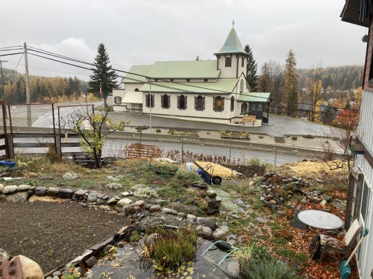
The first adventure begins. We drove north on Hwy 2 to Airdre and then east to Drumheller, a nice drive through farmland, a lot of it harvested already.


The countryside here is flat, Big Sky country, as they say and the farms are big spreads. Here and there we saw oil pumps, usually a few within 500m from each other.


Just before Drumheller, Hwy 9 descends down into the Badlands. The town is on the Red Deer River, with some box stores, it's a typical tourist town. Nice and clean and friendly staff at the tourist info centre.
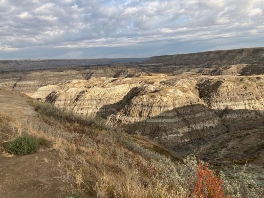

We decided to check out the Hoodoos south towards East Coulee. We wanted to check into the 11 Bridges campground in Rosedale, but it was closed with a sign "Private Property". SO we drove over the 11 bridges towards Wayne and went as far as the Coal Mine.
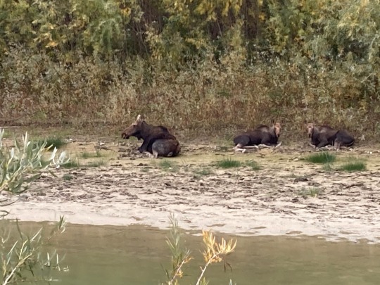

We stayed overnight at the Hoodoos RV Park. After setting up camp we went for a walk along the Red Deer River, where we spotted a moose cow and 2 calfs relaxing on a river island.
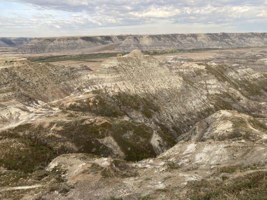
We drove back to Drumheller in the morning for some local fresh brewed coffee and pastries. As it was still too early to go the the Museum, we drove north to a lookout over the Hoodoos.


From there we drove north to Munson and then west to the Bleriot Ferry to cross the Red Deer river. This ferry is a one man show, big enough for 3 cars or one truck and the captain is pretty relaxed and casual.The crossing took 15 minutes even though the distance was only 300 meters...

We had to climb back up to the prairie plateau to a lookout on the south rim of the Hoodoos. Yes it's the same gorge but it shows a different look to this natural wonder.


Then we made it to Royal Tyrell Museum at 10:30 and first parking lot was already half full. The displays and artifacts are incredible, all very interesting. I would recommend this attraction to all.


After lunch we drove north to Dry Island Buffalo Jump Provincial Park, another beautiful view of the Badlands. The day use area was at the bottom of the valley. We drove down and back up on an 18% grade gravel road, but it was with worth it!


Then we drove north on Hwy 21 to Edmonton. This city has grown a lot since my last visit here. We got onto the ring road, the Anthony Henday Freeway in the south east. Our friends Jim, Pauline and Tucker live in the north west of the city so we got to drive around the city and it gave us a perspective on how big the place is now.
We stayed with our friends and got a grand tour of Edmonton the next day. The area along the North Saskatchewan River has nice parks, walking trails and attractions for day use.


The local buddhist centre had a lovely veggie garden
0 notes
Text
Home Sweet Home
Day 30 -
Our last day on the road for this trip. We left Sicamous at 6am as we expected another clear and hot day. The skies were a little hazy as we drove through Revelstoke. We drove to Golden where we stopped for breakfast at the Golden Bakery & Deli.

Bagaboos heli ski area
It was sunny but hazy as we drove south through the Columbia Valley. The smoke got heavier as we drove by Canal Flats and by the time we got to the Wasa junction, the smoke was thick.
We made it home safe and sound, it was an incredible journey and we are grateful that it all went well.
0 notes
Text
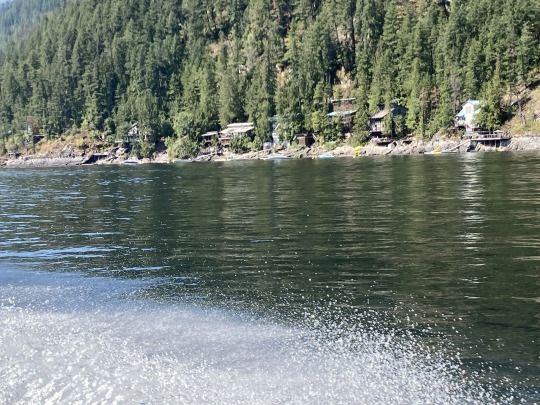
Shuswap Lake
Day 29 -
We decided to stay a day in Sicamous and spend a day with our friend Greg on the Lake. Another beautiful sunny and hot day on the Shuswap Lake. First he took us on an easy hike in a small canyon above town. Beautiful spot in very rugged wilderness.
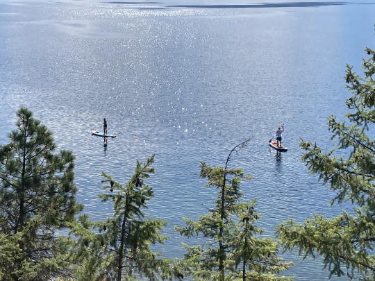
Greg took us on a 20 minute ride out to the Shuswap Shark Shack restaurant and the Sea Store grocery and souvenir store on the lake. This restaurant is on a large barge in the middle of the lake and the store is on another barge about 300m away. The location of the 2 establishments is where the four different arms of the Shuswap lake come together.

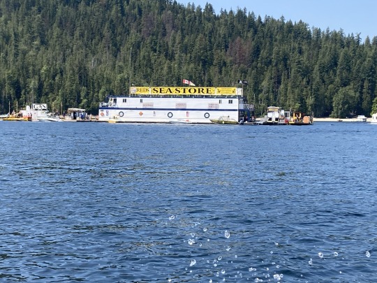
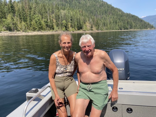

House boats and pleasure craft line up on the lake when the restaurant is full and wait for their turn to tie up and go for lunch or dinner or just drinks. The water taxi has a reserved mooring spot as he brings guests to the restaurant all the time. We had a nice lunch and I was introduced to a new drink, the ‘Bulldog’.
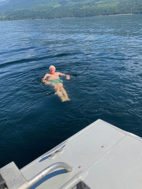

We had a swim after lunch right off the boat, the lake had a nice temperature and the temperature was 38c, lovely! But this temperature was hot when we got back to the marina, so we just dove into the water off the dock for some ‘cool me downs’.
0 notes
Text
Yellow Head Highway
Day 28 -

We started early today to overcast skies, but no smoke and drove to Prince George to fuel up and do some grocery shopping. Then we drove east on Hwy16 towards Jasper. The haze got thicker as we drove east. About 50k from Prince George we encountered a paving project
that went on for 70k. Unfortunately it was one of these budget paving jobs where they oil the surface and then cover it with sand and gravel, so it was very dusty and we were moving along at a slow speed. We were driving through the Rockies once again with peaks on both side of the road but it was not worth taking pictures due to the smoke from the wild fires further north.
At Tete Jaune Cache we turned south onto Hwy5 (The Yellow Head) and the traffic picked up considerably with a lot of transport trucks and tankers.
At Vailmont we could see the Thompson Ice fields to the west, but again, it was very hazy and not worth taking photos. We came upon another paving project but this one was not as bad. As we drove on the air got clearer and we could see the mountains nice and clear. Mount Lempriere and the glacier looked beautiful with blue skies behind it. We encountered more highway construction with the added attraction of the building of a pipeline.
The road was clear of construction after Blue River and it was clear sailing all the way to Kamloops.
We continued on to Sicamous where we spent the night. It was a long day of driving, but we were looking forward to getting home.
0 notes
Text
Peace River
Day 27 -
We left Fort Nelson at 7:30am after a light breakfast and headed south. The road was really good, albeit very boring, long straight stretches with taller trees along side the highway. Even when the road took us over some elevated areas, there was no views due to the smoke and fog combination.


About 200k south of Fort Nelson the smoke lifted and the views improved, not by much, as the Peace River country is all rolling hills. Some 50k north of Fort St John we saw the first rays of sunshine since leaving Whitehorse.

At Charley Lake we decided to take Hwy 29 west to Hudson Hope. The weather improved as we drove west. At Bear Flat we came down a long descent into the Peace River valley, what beautiful view from up high. There are some big new bridges across the tributary rivers. The highway takes us back up to the plateau above the Peace where there are many farms along the way.
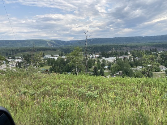
We arrived at Hudson Hope, the third settlers community in BC in time to check out the farmers market. We purchased a few goodies to take along.
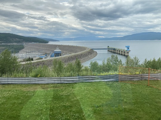
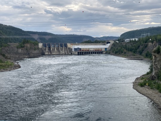
We then took the side road out to the WAC Bennett dam. The tour was well done, the guide explained the history of the project and acknowledged the extremely bad treatment of the Native communities of the area and the lack of consultations with them. In the interpretive centre is a display that was produced by the native communities of the area to talk about the effects this project had on them and all the wildlife of these flooded valleys. It is shameful how the politicians of that day treated them, all in the name of ‘progress’.

We then drove along Morley Lake to Chetwynd where we saw some amazing chain saw wood carvings on display along the main road. One of the local families are the artists of all the sculptures.


From Chetwynd we drove west through the foothills of the Rockies and over Pine Pass, the continental divide. We saw a cow moose and calf along the highway walking on the side of the road, but started running as we approached. We slowed down and let them disappear into the bush.


On the way we stopped at the Bijoux Falls, home of the Stellar Blue Jays according to the signage but we did not see any birds. In the Parsnips river valley we arrived at McLeod Lake where we found a nice spot, watched a lovely sunset and stayed overnight.


0 notes
Text
Alaska Highway
Day 26 -
It rained during the night, so our awning and carpet were wet when we got up. We packed up started on our way to Liard Hot Springs, grey skies and it looked like nasty weather ahead and sure enough, we drove through some heavy rains.
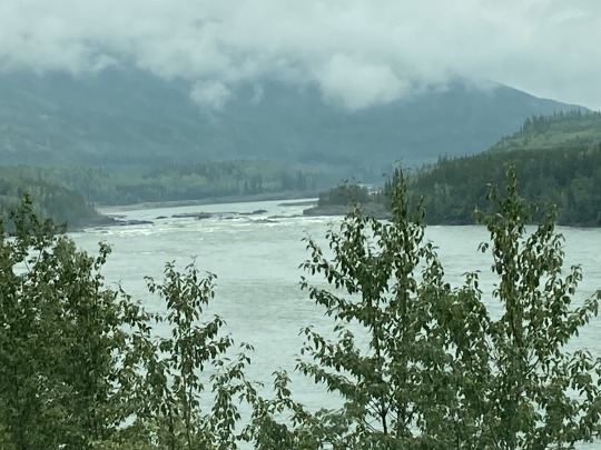
At around KM990 of the Alaska Highway we came upon a road washout which was mostly repaired. The cause of this washout made international news due to the fact that this was caused by the break of a massive beaver dam up river, which released the water from a substantial lake formed by this beaver dam. The wall of water came down through the gorge and wiped out 150m of highway. The Canadian Beaver strikes again!
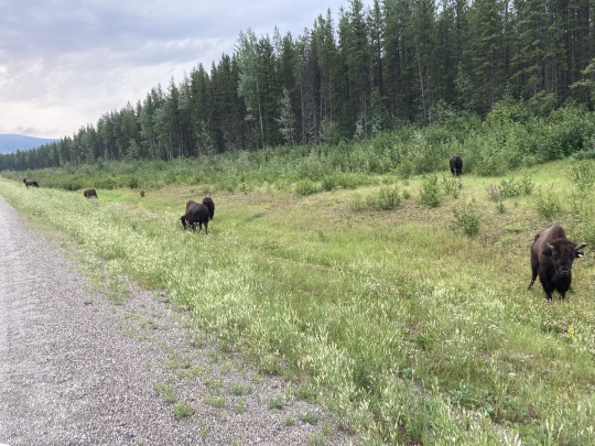

We came upon a small heard of buffalo grazing along the road, beautiful animals and looking healthy. Campers and motorhomes all stopping to take pictures. It was the most wildlife we saw in one place during the whole trip.
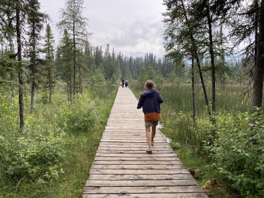
We arrived at Liard Hot Springs around 10am for a soak, paid $5 each for the park entry. There is a small campground here, fenced off with an electrified 2m high fence to keep out the bears and the campers safe. We walked through a gate and then along a boardwalk across some wetlands for 10 minutes to arrive at the pool, it’s actually a pond in the forest fed by the hot spring.


The water was about 38-39c, very pleasant. There are little side arms in the pond where some cold water trickles in, beautiful. We met friends from Kimberley, who were on their way north to Fairbanks Alaska.
Shortly after leaving Liard we drove through the the north end of the Rocky mountain range where we encountered some heavy rains until well past Muncho Lake. The highway crossed over some major washouts that happened in the past. What surprised me was the frequency of these washouts they came down from every side valley. It must be caused by heavy rains during spring run off. The low hanging clouds and fog deprive us of all the beautiful mountain views.

We drove past Toad River and through Stone River Provincial park. The mountain sides and side valleys are all very steep and rocky. At the Summit Lake there is camping and lots of hiking trails into the side valleys and around the lake. There were lots of campers set up for a stay.

From Tetsa River to Steamboat we’re getting into the foothills of the rockies and the smoke is getting thicker from the forest fires to the NE of here. The rain is easing off as we got to Beaver Lake and then another 30k to Fort Nelson where it was dry.
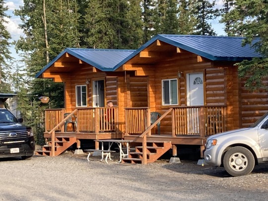
We stayed overnight at the Blue Bell Inn and Campground. The campground was a bit sketchy but the bathrooms and showers were nice and clean. There was a bit more rain overnight.
0 notes
Text
To Watson Lake
Day 25 -
The day started out with clear blue skies. Will had picked up a replacement part for the beast, I installed it, but it turned out to be another problem:/


We said our goodbyes with our friends, who love living in Whitehorse and we made our way south after a fill up and some grocery shopping.
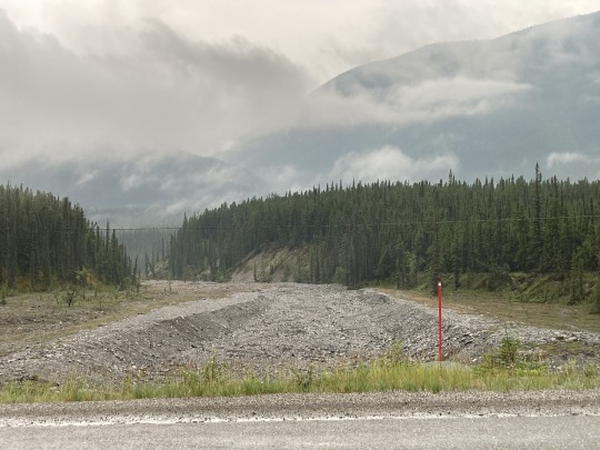
By the time we got to Johnsons Crossing, we had cloudy skies as we were heading towards Watson Lake. We ended up driving though a heavy rain, which is a god send for the forest fires raging in the area. We have been lucky so far, as we did not see any fires or smoke.


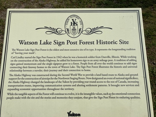
We rolled into Watson Lake around 5pm and checked into the downtown RV park. Then we walked over to the Watson Lake Sign Forest. This attraction has grown immensely since I was here 55 years ago with my buddy Jim. We had taken a picture then with a sign that had been placed by a Swiss showing Jim’s home town of Zug, Switzerland showing the distance and direction of that place. I was unable to find that same sign as there are now over 100 thousand signs in this forest.


The folks of Watson Lake are all pretty pumped about this attraction. Tour buses stop so the passengers can take this all in.
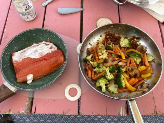
I made us another nice salmon dinner at the camp site and after dinner we went to the Northern Lights and Science Centre to take in an awesome show about the Aurora Borealis.
0 notes
Text
Skagway and the White Pass
Day 24 -

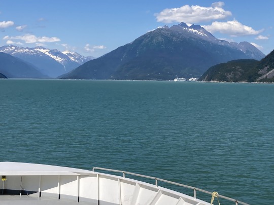
We said our goodbyes with Haines and drove out to the ferry terminal to find out that the ferry was late arriving. We decided to stay there and wait and I had my midday nap:) We loaded onto the ferry at 1:30pm and we were on our way to Skagway up the next fjord. The ferry ride was uneventful, which is nice and the weather was mild and sunny.
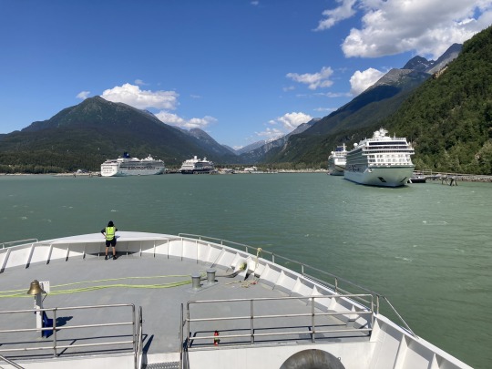
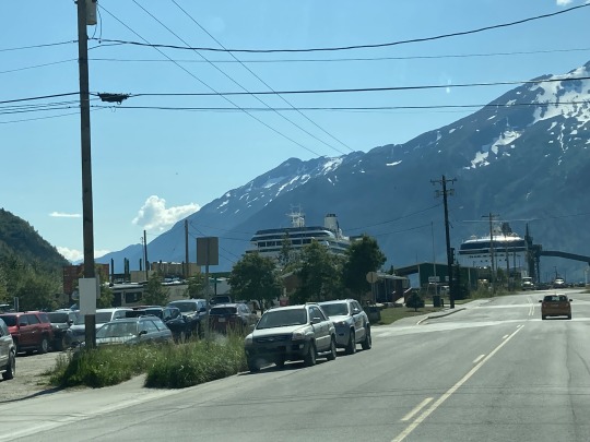
We arrived in Skagway where there were 4 cruise ships docked and the town was buzzing with tourists like we see in Banff.
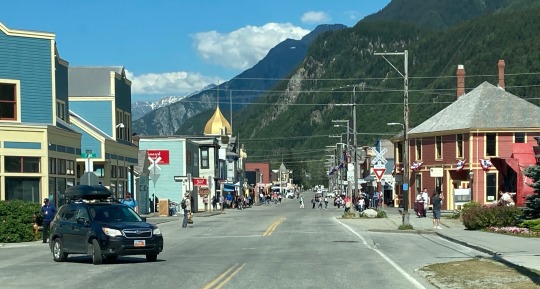
We were glad that we had spent the extra days in Haines. After a slow cruise through town we started on the road to the White pass.
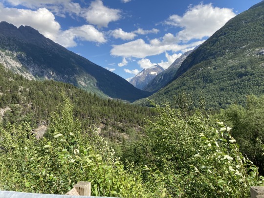
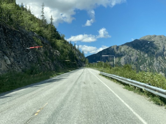
The terrain along this road is very different than it was driving from Haines Junction to Haines. The valley is very narrow and steep hillsides. There are several pullouts on the road with signage of the Klondike gold rush days and the hardships the Stampeders endured over 100 years ago.


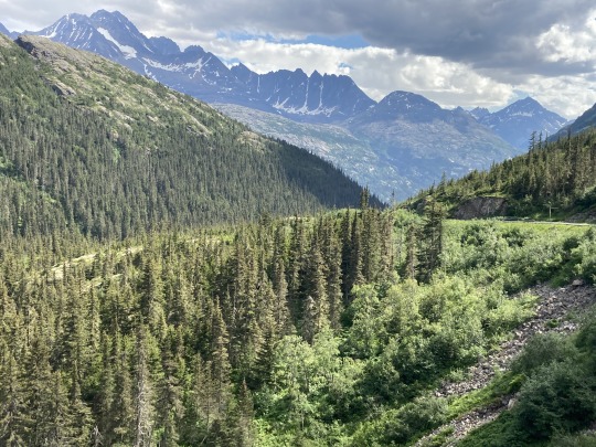
The White Pass railway runs along the opposite side of the river, along cliffs and over bridges. At one point the railway moves along a side valley to gain enough altitude to make it over the White Pass.


The roadway is in good shape all the way to the summit. We saw 2 bicycle groups, probably from the cruise ships, biking up the pass for an easy way down.


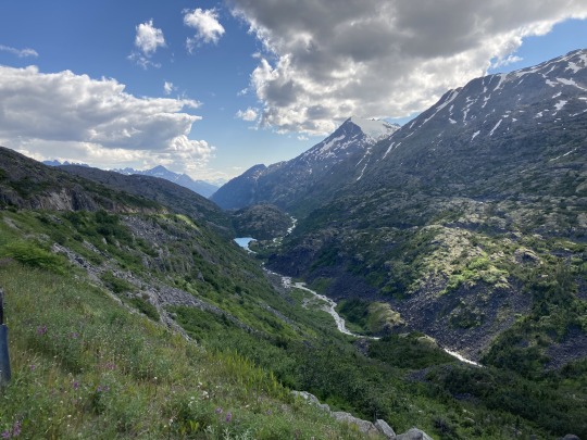
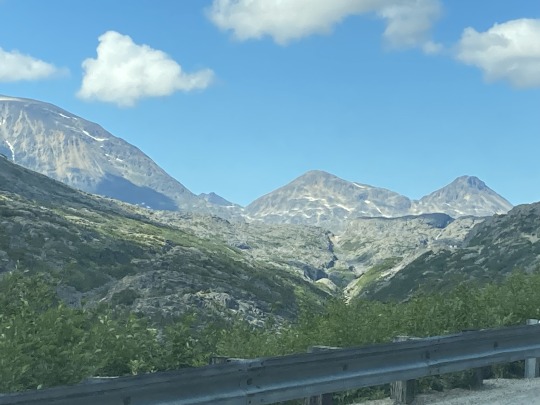
We crossed into Canada just past the summit of 3700’ above sea level and it was like we had arrived at another plateau. The terrain is very rocky with many small lakes along the way and then we came to the summit lake. The colour of the water was amazing and the hillsides are bare all the way to the top.

We drove along Tutshi and Tagish lakes, two large lakes just before we got to Carcross, a small town at a junction south, north and east. We arrived in Whitehorse in time to have dinner with our friends Will and Chanelle.
0 notes
Text
Glacier National Park
Day 23 -


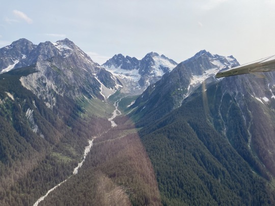
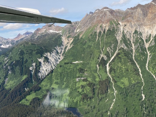
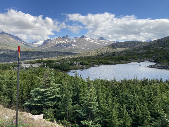
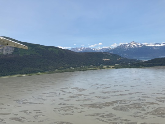
We started the day with a nice breakfast. In the afternoon I went for a sightseeing flight over Glacier Bay National park, Alaska. We flew in a 1954 Beaver, very nice older aircraft with 6 passengers on board. Our pilot, Bob took us over the coastal mountains to Glacier Bay.

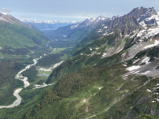


We saw some mountain goats grazing on a ridge and many shrinking glaciers. Bob pointed out how much these ice bodies have shrunk over the last 30 years that he has flown over this area. He told us about a group of mountaineers that he dropped off on a glacier near Bates Lake with provisions for 10 days in April some 20 years ago.

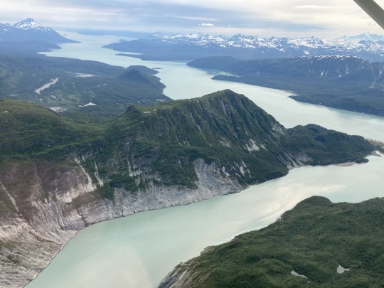

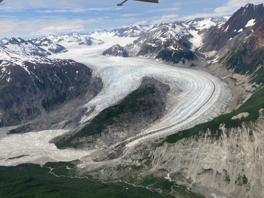
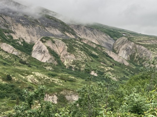
One fellow in this group also climbed Mt. Logan during that journey, a pretty amazing feat. Flying at 5000’ above sea level we could see thousands of peaks looking east, north and west with the beautiful fjords to the south.


We had a delicious Halibut filet for dinner and a nice visit with fellow travellers in our campground.
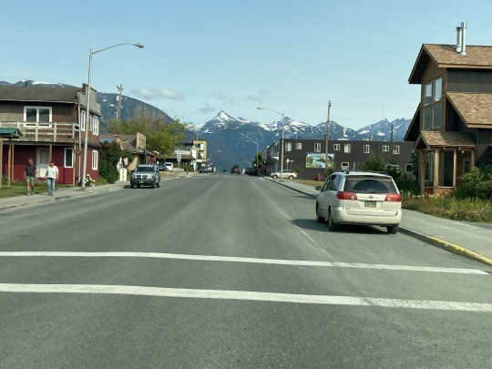
Downtown Haines, Alaska
1 note
·
View note
Text
To Haines, Alaska
Day 22 -


Here we are in Haines Junction, Yukon with one of the most stunning vistas on the planet and all we could see 500m to 1km. We decided to leave early and make our way to Haines, Alaska to catch the ferry across to Skagway.

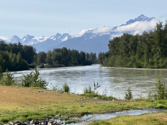
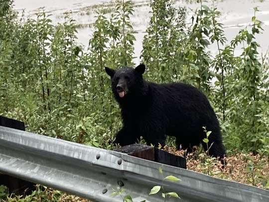
As we got closer to the watershed divide, the weather improved, it got milder and by afternoon it was 23c and sunny. We saw a nice young bear foraging along the highway. The mountains along this fjord are very impressive.

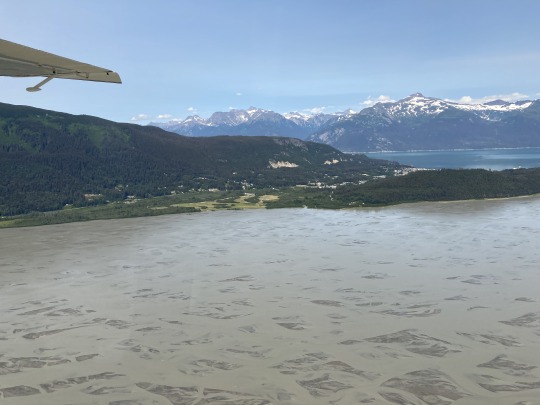
It turned out that the ferry was sold out the next day and we had missed the day trip to Jueanu, Alaska. We found the best campground to date on the waterfront overlooking the ocean with clean showers and wifi.

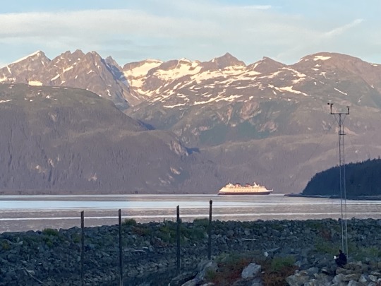
We booked for 2 nights to do something fun tomorrow and catch the Saturday ferry. There was a small cruise ship in the harbour, the kind that the local businesses and outfitters love, as the ship stays for more than a day. We drove to the only carwash in town to give the beast a good cleaning.
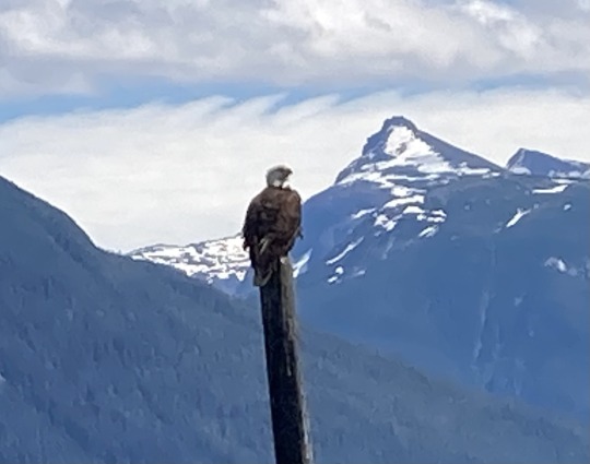
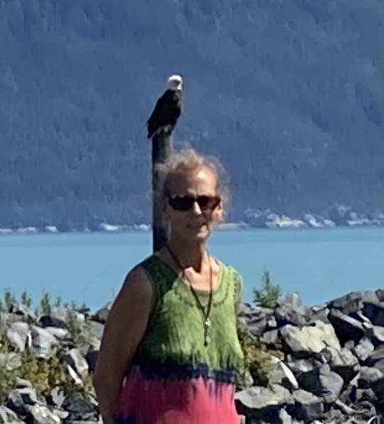
Cruiseship leaving at dusk. I was watching a bald eagle from our campsite waiting for handouts from the fisherman, it would have been nice to have a good telephoto lens for this. The Alaska Chilkat Bald Eagle Preserve is just outside of town, so there are hundreds of bald eagles up and down the Chilkat river valley.


The Hammer Museum, wow
We spent the day walking around town, checking out the bakeries and relaxing at the Oceanview campsite. I made us a very nice Copper River Sockeye salmon fillet for dinner, it turned out very nice.
0 notes
Text
To Haines Junction
Day 21 -
We woke up to a steady rain, broke camp and we were on our way south on Hwy 2 along the Tetlin National Wildlife Refuge but we never saw any wildlife.


We had to drive through 4 different Hwy construction zones, one of them was pretty rough. I felt sorry for the travellers on bicycles and motorbikes as it was raining all day and in some construction zones it was very muddy…


Areas that had been devastated by forest fires were covered with blooming Fire Weed.
Back across the Canadian border near Beaver Creek and more road construction on the Canadian side. The area around Kluani Lake was beautiful even though we couldn’t see the mountains due to the low clouds. The fire weed was in full bloom along the road. The closer we got to Haines Junction, the harder it rained. We stopped for gas and a light dinner, steak Tartar.

We decided to stay in Haines Junction overnight hoping the morning would bring better weather and better views of the mountains. But it rained all night…
0 notes
Text
Through Anchorage
Day 20 -
We woke up on the side of the highway, it was 12c and almost raining. The accident scene from the night before was all cleared away and we were on our way into Anchorage to fill up with gas.


We did a tour of the town on a bus and did a walk through the Anchorage museum.

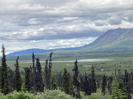
Back onto Hwy 1 east to Palmer and on up river to Glenallen. Rough and narrow road, many frost heaves, very little signage and impossible to drive the speed limit. There are many pullouts to take in the views of the Chugach mountains and the Mantanuska and Nelchina glaciers.

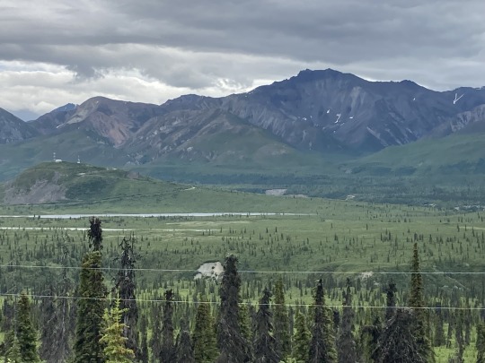
After Glenallen the weather started to improve, it got warmer as we followed the Copper river valley to Mentasta on the south slopes of the Alaska Range. The views became magnificent as we gained altitude at Chistochina but the road had undulations like a pump track in some sections, sometimes without warning.


We then drove through another pass across the mountains to the north slope of the Alaska Range, the road took us through a long side valley to the Tanana river and Tok for another overnight stay.

To our surprise the campgrounds were generally not very busy and I expected to see more traffic on the highways.
0 notes