solohikersposts
solo hiker's posts
a frustrated mountaineer's solitary experiences deep in nature's embrace
13 posts
Don't wanna be here? Send us removal request.
Last Seen Blogs

theblindgoddess
Fiction Trash Lives Here

uneri002
Box

ramshacklefey
Coming Soon to a Roadside Ditch Near You!

sexdrugspixels
Sex Drugs & Pixels
Text
2019 Hiking Season: Setting Expectations
As 2019 has already begun, I resumed my regular hobby of hiking as if there was no holiday hiatus, as evidenced by my hike up Mt Batong Amat (387) on 29 December 2018 in the midst of a storm.
This year, I have already drafted some plans for hikes, mostly because these require ample preparation and training.
1. Tai Mo Shan, Hong Kong (~February)
2. Mt Guiting-Guiting, Romblon (~April)
3. The Great Cordillera Exploration (Mt Ugo, Mt Ulap, Four Lakes of Kabayan, Mt Pulag) (~June)
4. The Northern Cordillera Adventure (Mt Napulauan, Houwah Festival) (~August)
5. Gn Merbabu, Indonesia (~October)
6. Hang Sơn Đoòng, Vietnam (~December)
7. Jalan Singapura (Walk Singapore): Discovering Singapore’s Trails (date unknown)
As you can see, these are my big hiking plans for 2019, but I don’t guarantee that I will be able to complete all seven of these as between those big plans are the usual weekend dayhikes or overnighters to train myself even more.
Here’s to an exciting 2019!
1 note
·
View note
Text
2018 Hiking Season: An Outlook
After my first hike-ish experience at (#01) Mt Pinatubo, and after my first true hike with the legendary Koi Grey up (#02) Mt Batulao at the invitation of my officemate back in August of 2017, my dormant interest in hiking was reignited.
youtube
The back story of this is that back in my university days, I really wanted to join an org called Outdoor Club that organises hikes. It would’ve been a great chance for me to train in hiking, but due to some circumstances, I wasn’t able to join. That’s why my interest in hiking laid low for almost a couple of years.
Fast forward to 2018, the beginning of my regular hobby of hiking, and I have completed my #03 to #12 hiking experiences:
3. Mt Daraitan, Rizal
4. Mt Pundaquit, Zambales
5. Mt Apo, Cotabato
6. Mt Kaanducian, Nueva Ecija
7. Elephant Hills, Kalinga
8. Hungduan Rice Terraces, Ifugao
9. Mt Batolusong, Rizal
10. Mt Makiling, Laguna
11. Mt Marami, Cavite
12. Mt Batong Amat (387), Nueva Ecija
As 2019 begins, this regular hobby of mine is only set to expand, as I am building up more plans to hike, making more friends who share this interest, and learning more from all of my experiences.
0 notes
Text
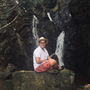
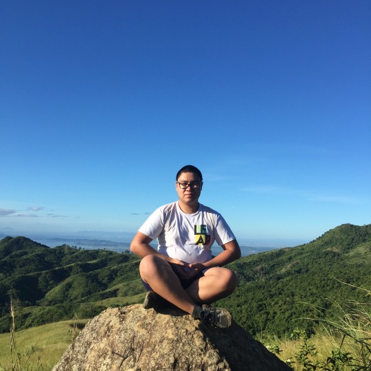
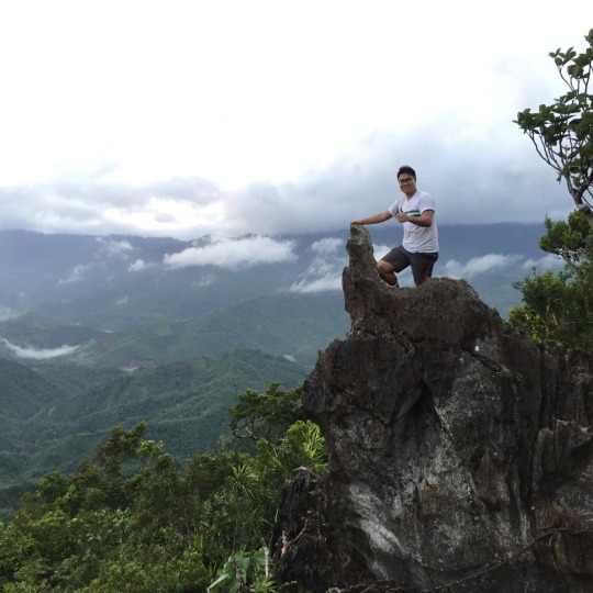
Mt Batong Amat (387) (784 m | 2,572 ft)

As 2018 came to a close, I decided to hike one last time, and since I joined a hiking group, I wanted to initiate hiking as a regular hobby there by inviting my friends to one. After some polls, it was decided that we will go to Mt Batong Amat (387) in Puncan, Carranglan, Nueva Ecija. In the end, two friends decided to join: Abie and Jeff.
It was supposed to be a three hour drive to Roy Manuzon’s residence, the jump-off point, but it was lengthened by an hour due to the rain and wind. Yes, I forgot to mention that we hiked on 29 December 2018 at the height of TD Usman. This is going to be a hike of many firsts, and I was right.
We arrived at about 7 a.m., and it was freezing. My first mistake was forgetting to consider the rain and wind because I always thought of Nueva Ecija as a dry and hot place, as was my experience the last time I was there when I visited Mt Kaanducian on the shores of Pantabangan Lake.
We registered and was given a thorough briefing by Roy Manuzon, chairman of the Kalinga sa Kalikasan ng Puncan (Care for the Landscape of Puncan), the group of caretakers who adopted Mt Batong Amat (387) to develop it into an ecotourism destination as declared in House Bill 6481 of the 17th Congress. Mr Manuzon talked about the mountain’s history and their plans for the mountain and the area. There was also a relief map of the area with the trails, significant areas, and biomes all marked.

After the briefing, we met up with our guide and started the hike. The trail is well-established and the gradient wasn’t too steep. The hike up was mostly cool because of the rain, but we were mostly sheltered from the wind due to the trees.

It was only at the last part of the trail where the forest gave way to grassland, and that’s where the cold began to make itself known to us.
youtube
We reached the summit after two hours, but there wasn’t much to see afar because of the fog, so instead of taking a lot of photographs, we just snapped a few and proceeded to the Lovers’ Tree Campsite and chatted with the other hikers at the hut there.
We also enjoyed the only thing we can view from the summit: The Chocolate Hills of the North.

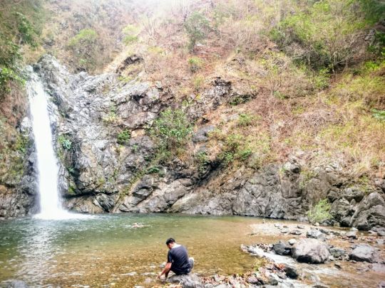
After resting and chatting, we proceeded to Aloha Falls. All throughout the hike, we had apprehensions about the descending trail as it was steeper, muddier, and more exposed than the ascending trail. So much so that it’s rated 4/9 whereas the ascending trail is only 3/9. However, we pushed through, much to our dismay. This was the last photograph we took before braving the descent.

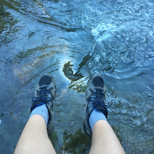
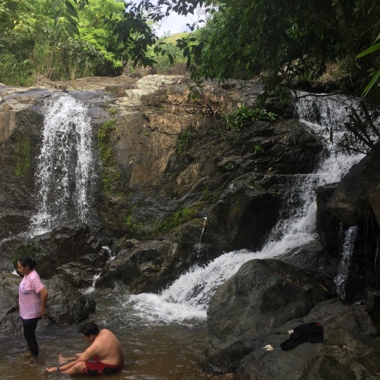
The descending trail is characterised by some technical segments with stones and trees, but the most significant part of it were two fully-exposed segments with ~60° gradient. We were tackling these segments very carefully but we still slid down a few times. It was an exhilarating, albeit rather painful, experience. After what seemed like forever, we entered the forest again and turned left towards Aloha Falls. I was dying to take a dip, and the falls didn’t disappoint.


© Abie Pascual
© Abie Pascual
We ate our lunch near the falls then took a dip. The plunge pool was surprisingly deep, as you can see the colour change from brown to blue. This has got to be my favourite falls so far since the plunge pool is perfectly deep, and its size is just right. We then chatted for a long time since this was the first time the three of us met in person.
After recovering from our memorable experience at the descending trail, we walked back to the jump-off point. This trail follows the tributary from Aloha Falls to the tributary of the Talavera River. It was mostly flat but it had a number of river crossings. We then turned right to follow the bigger tributary towards the Pan-Philippine Highway (AH26) and finally back to the jump-off.

We left Roy Manuzon’s residence at about 7 p.m., had dinner on the road, slept in the car while parked at a petrol pump, and then continued the drive home. I thank bottled coffee and the music on my phone for keeping me awake.
As I mentioned at the beginning of this entry, this was a hike of many firsts, and here they are:
1. Hiking in the midst of a storm
2. Seeing ghosts (three, in fact) on a hike
3. Literally sliding down the mountain
4. Properly swimming in a waterfall’s plunge pool
5. Driving long-distance (200 km one way) to a hike location
At the end of the day, it was a memorable hike, and a good close to my 2018 hiking season.


2 notes
·
View notes
Text
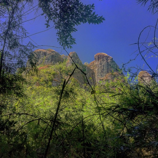
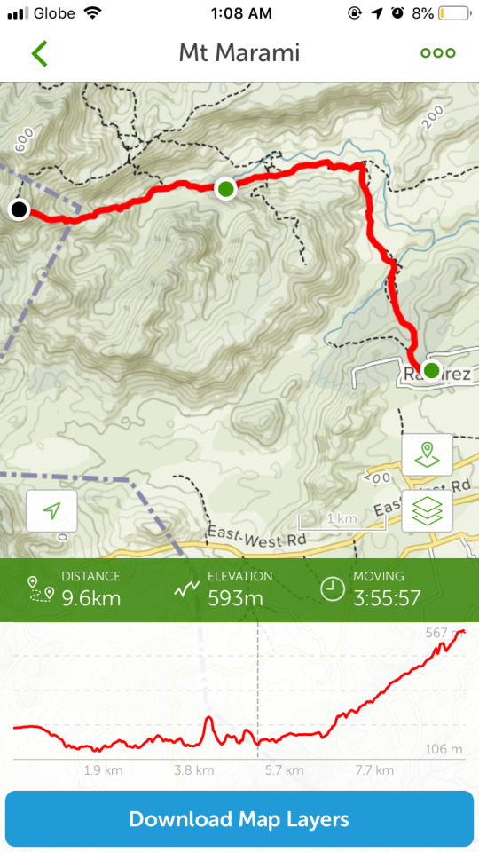
Mt Marami (539 m | 1,768 ft)


Upon invitation from a best friend of mine, we, along with some of our friends, hiked up Mt Marami in Magallanes, Cavite. This hike will be a test of my stamina for two reasons: because I just came from our Christmas party so I barely had sleep, and because this is a long trail, as I was about to find out.

The commute to Magallanes, Cavite was quite difficult as it was an interior town. Nevertheless, there's still public transport options that can bring you to Ramirez barangay hall, where the hike begins.
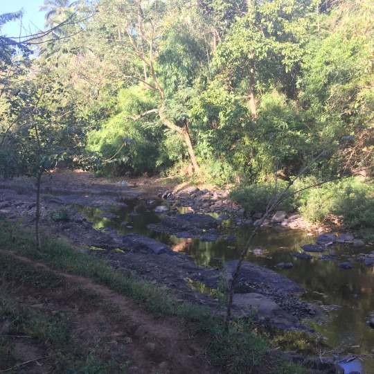
Unlike my previous hike up Mt Makiling, Mt Marami has numerous forks in her trails so it's easy to get lost. The first part of the hike circles around the hills between Ramirez village and Mt Marami.
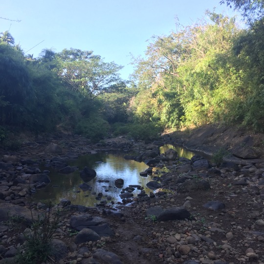
The trail crosses a number of rivers, including Kayragay and Bangkaan. Then, you pass by Nuestra Señora de la Paz Chapel, which the trail is named after. Then, the trail passes by a couple of stores where you can rest, eat, and rehydrate. Since a couple of our hike group members can't continue with the hike anymore, I, along with our guide, set up the hammock so they can rest. This was the first time I used my hammock, and it was of good quality so it was a good purchase for me.

After a pretty heavy lunch (which I'll soon regret), we left our bags and continued on with the hike with only our walking sticks, water bottles, towels, and phones. I suddenly had a hard time hiking because I was so full, so our pace slowed down a bit. After a number of rests at some campsites and rest areas, we finally reached the summit. The summit of Mt Marami is quite different from others as it's a set of rock promontories jutting out from the mountain itself, thus giving it a few more metres in height.

Since I just came from our Christmas party, I still can't get over our performance, so I danced Abba's 'Dancing Queen' at the peak of Mt Marami. Bucket list item ticked? Perhaps.
youtube


I was amazed at my stamina because I was still able to hike Mt Marami while breathing properly, not gasping for breath, and without becoming too tired. Amazingly, it took us 11 hours to complete the backtrail as we took a lot of breaks, and thankfully, since I was prepared, I had my headlamp, flashlight, and lantern with me so even though it was already dusk, I was still able to navigate well and get back to the village.
0 notes
Text
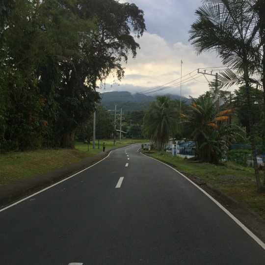
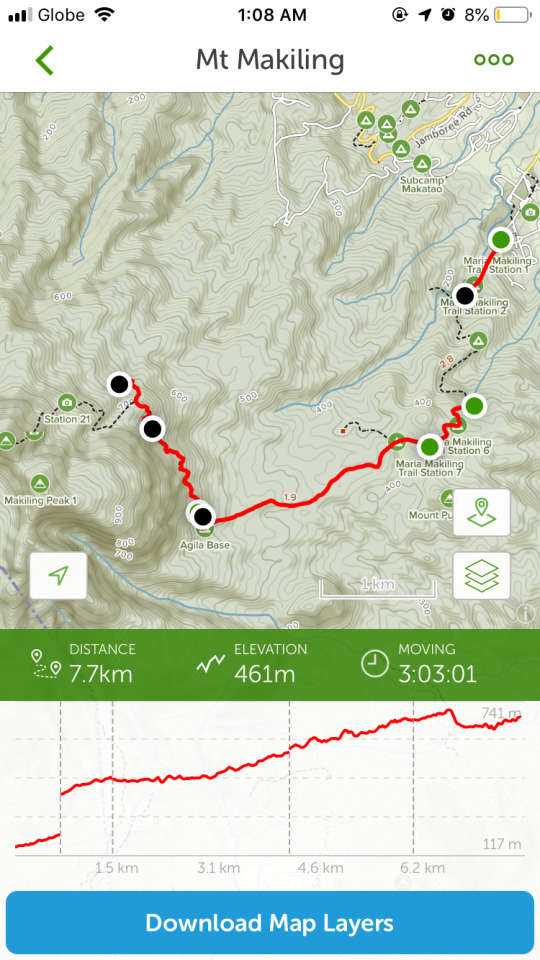
Mt Makiling (704 m/1,090 m | 2,310 ft/3,570 ft)
I had recently discovered about Mt Malasimbu in Dinalupihan, Bataan as a new hiking destination, and I really wanted to climb this mountain as it's not yet that well-known. However, plans changed due to some circumstances, and I found myself standing in front of Mt Makiling in Los Baños, Laguna. We passed by my friend’s place where she got provisions for the hike. As I was waiting for her, I walked to the shore of Laguna de Bay and found a group of teenagers singing Christian songs. I wanted to sing along with them, but I just stood in awe of the huge lake’s majesty and stillness.

Since this was a sudden change of plans, I wasn't able to do much research on Mt Makiling anymore, but I realised that I didn't have to because a few weeks back, I started compiling fact sheets on various mountains that I plan to hike, and Mt Makiling was among them.
I know that this is a mountain that people can climb without a guide, and I was quite confident with my skills in solo mountaineering. Do note that I hiked Mt Makiling with a friend, and it was her first time, so the responsibility I have was not only of my own safety and welfare, but of my companion as well.
When we arrived at the trailhead at UPLB College of Forestry and Natural Resources, we parked our car, registered, and started hiking along the concrete road. I believe that was a mistake as it was a huge waste of time, and you can ride a motorcycle (habal-habal) (₱100/person) to take you to the start of the Wilderness Zone which is just past Agila Base (Station 11/30).
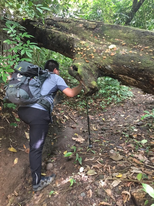
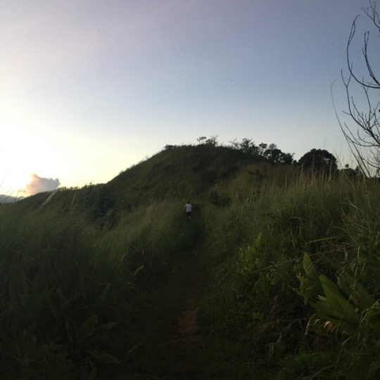
From Agila Base, the trail is well-established, and there aren't many forks so it was easy to follow. The ascent wasn't too steep, and you get to enjoy Mt Makiling's atmosphere. When we arrived at Station 16/30, things started to take a turn for the worse. The trail was closed as there was a landslide back in 2015 or so, so we needed to take a detour.
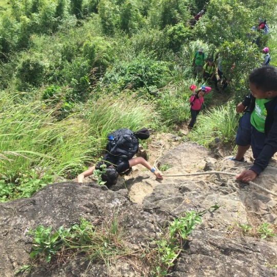
On the day of our hike, it was raining quite a bit so the ground was muddy and slippery, and this detour takes you down 70 metres with a grade of about -80%. That's almost vertical! As you have imagined, we basically slipped our way down. After that sudden descent, you curve around some big rocks, and now, you're faced with an ascent that is almost as steep as the descent.
Since we didn't have a guide, and considering that we'd have to retrace our steps through the detour, we decided to turn back for our safety. If Mt Makiling can add salt to that wound of a defeat, she did by making those who did the traverse catch up to us, describe the amazing views at the summit, and even overtake us.

About the leeches (limatik), there were a lot of them, but I flicked them all off before they got a chance to suck my blood. I even let some crawl on my hand and arm, and to my surprise, they didn't bite. When I got home, though, and removed my knee-high socks, I discovered two leech bites, one on each ankle. When I removed what's left of their mouth, my blood just spewed out. This proves true the fact that leeches have anticoagulant on their mouths to prevent the blood from clotting.


In the end, we know that Mt Makiling can still be conquered, but at another time. It was a great learning experience in solo mountaineering and in hiking prepared, as if we got stuck somewhere along the trail, we didn't have enough food and water, and only a hammock for sleeping. Lesson learned, so in my next hikes, I now bring extra water, tinned food, my burner and pots, my hammock, and most importantly, my tent.

Our experience in the bosom of Mt Makiling was truly refreshing, and contrary to what people say, when you're walking through her forests, it's you who would want to become lost in her embrace.
1 note
·
View note
Text
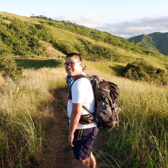
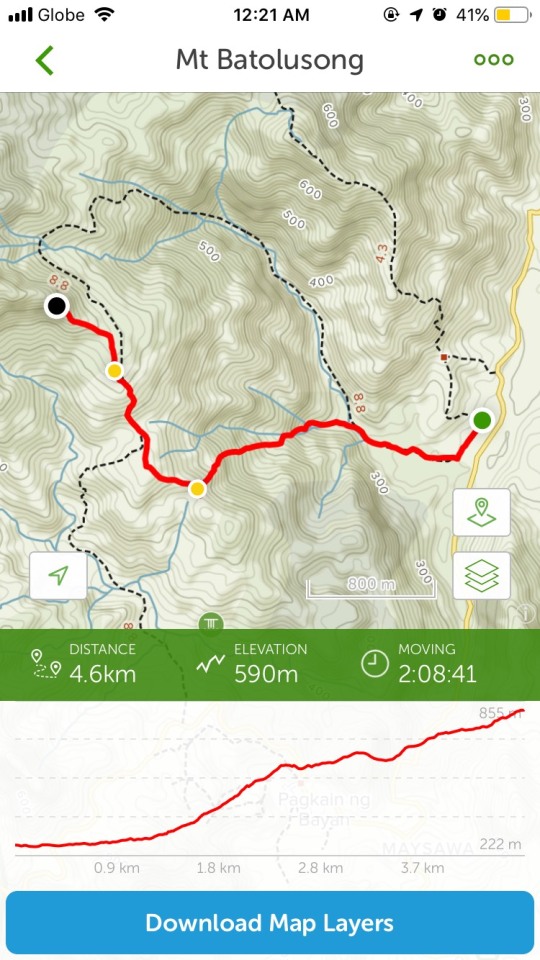
Mt Batolusong (883 m | 2,897 ft)


After a six month hiatus, I finally found time to get into hiking again. As I was a bit doubtful of my strength and stamina, I chose to hike Mt Batolusong with my friend. This was her first hike, and when she asked me about my thoughts on the mountain, I told her that it would be a simple hike. I forgot that it was her first hike so it was a bit of a challenge for her, especially the height of the mountain. This is my second hike using my own car. It was uneventful despite being a drive through a mountain road in the middle of the night.
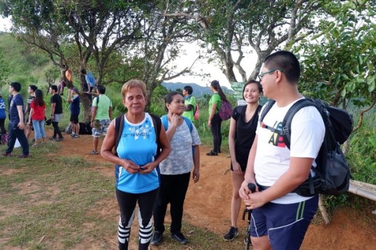
The trail was easy and took us through some houses, across some streams, and through rice fields. From there, a moderately steep climb ensued. Being an early morning hike, the air was cool which lessened our fatigue. There were also two water sources at Phase One and Phase Three, which I am very thankful for. The trail here is very forested, and there are a lot of bamboo handrails for an even easier ascent. After some time, we arrived at the first of three peaks of Mt Batolusong, which is Duhatan Ridge (442 m | 1,450 ft).
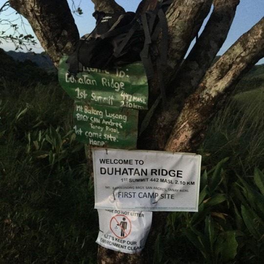
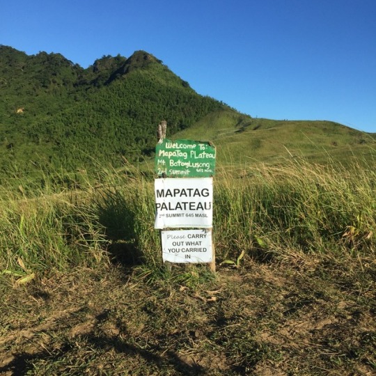
After taking a lot of pictures with our tour group, we pushed on to the second peak, Mapatag Plateau (645 m | 2,116 ft). The trail here is reminiscent of Batanes’ Vayang Rolling Hills, which I visited sometime last year. We took more daring pictures at Mapatag Plateau as it provided you a near-360° view of the Sierra Madre Mountain Range and Laguna de Bay.


From Mapatag Plateau, the third peak of Mt Batolusong can be seen, so we headed there next. After passing by some campers, we entered the bamboo forest. Here, nature taught me a lesson: the brown outer skin of bamboo plants can be very itchy when touched, so remember to hold only the green parts of bamboo when using them as handholds. Also in the bamboo forest, my thigh became cramped. I thought I couldn’t push through to the summit anymore, but a member of our hike group, and take note that she’s in her 60s, offered me a soothing muscle balm. I was a bit sceptical of its effects at first, but right after I applied it to my thigh, the cramps were gone. So, we all continued with the hike at a more leisurely pace. We then came face to face with a rock wall. Apparently, there was a scrambling segment in the trail. My friend, having fear of heights, had a difficult time climbing, but being the master of her mind, she willed herself to conquer her fear and continue with the hike.
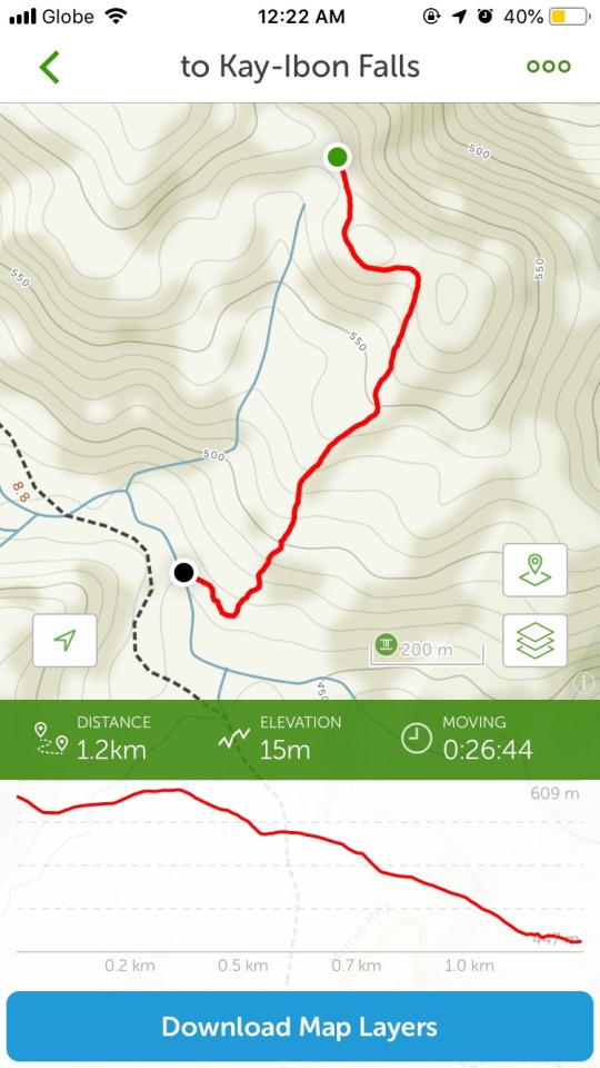
After a few more steps, we finally reached the third peak, Rangyas Peak (883 m | 2,897 ft). Our group rested for a while and I took a nap under a tree, lying down on my right and using my arm as a pillow. After everyone took their pictures at the peak, we headed back to Duhatan Ridge to go to Kay-Ibon Falls. However, we all stopped at a store first to rehydrate and eat. Being a vegetarian, I only had a grilled vegetable sandwich (which I ate during our ascending pass), and got instant noodles (which I ate during our descending pass). We then proceeded to the trail to Kay-Ibon Falls which seemed to take forever. As we were walking down, the topic of our conversation turned to the elementals, and how some members of our hike group saw elementals all throughout the hike. It was magical to hear it from different people, and goes to show that it’s really important to respect and love nature as if it’s your own home. After descending for about half an hour, we reached Kay-Ibon Falls. I was so eager to jump into the cold water and let it heal me, which it did.


After enjoying the therapeutic powers of the falls, and observing members of the Dumagat tribe, we headed back up the trail to Duhatan Ridge, and down to the jump-off point. We drove back to Manila afterwards and once we got home, we crashed on the couch and fell asleep.
Addendum: Not all of the photos are mine, so the appropriate credits go to the photographers i.e. Trisha Ong, Luna Delfin Bellarmino
0 notes
Text
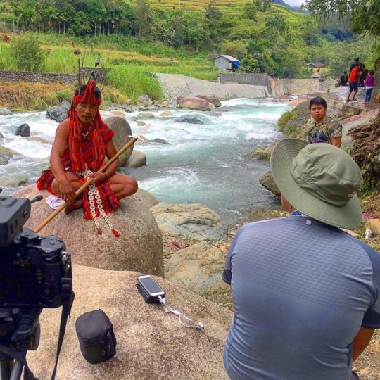
Punnuk @ Hungduan, Ifugao

A few months ago, my crew and I visited Hungduan Town, Ifugao province to document the Punnuk, a post harvest thanksgiving feast. Our trip to the confluence of two rivers brought us to Baguio City first as we had an interview and coverage at U.P. Baguio. After that, we left for our final destination. Unfortunately, I was starting to get sick. The drive was long, dark, twisty, and cold. It felt like forever, but at last, we arrived at our home for the quick night.
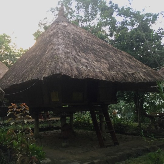
Once I climbed up our Abong-Bali (traditional Ifugao house), I immediately fell into a deep sleep, wishing for the pain and weakness to leave me. When I woke up the next morning, I was completely healed. I thank the mountains for healing me then, proving once again the curing power of nature. We proceeded to the confluence of two rivers where locals, tourists, and government officials all gathered for the Punnuk.
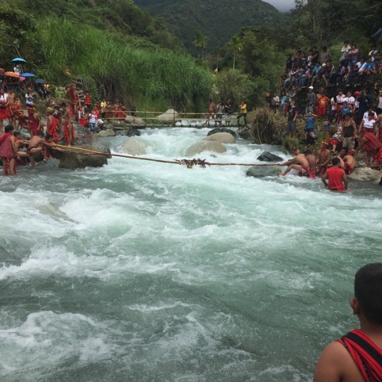

After witnessing ancient tradition alive with my own eyes, I was dying to know more, so I did a number of interviews to know more about their culture.
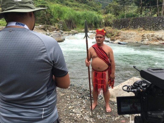
So, where’s the hike, you may ask. Well, to get from the road to the confluence of two rivers, you have to walk across the numerous payo (rice paddies) and down steps jutting out from the paddy walls. Long ago, stones and mud made up the paddy walls, but recently, they have been upgraded to concrete. However, the signature stone steps are still there.
In the end, despite being one of my shortest hikes, it didn’t lack the nature, the culture, and the experiences attached to each hike.

0 notes
Text
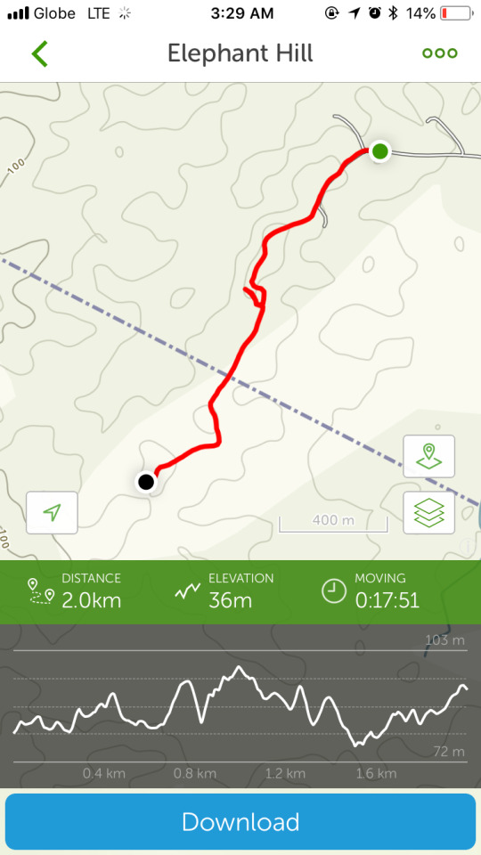
Elephant Hills (98 m | 322 ft)

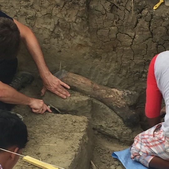
Located in the hinterlands of Rizal Town, Kalinga province are the Elephant Hills, an ancient riverbed teeming with various species of animals some 709,000 years ago. Due to the land’s composition being suitable for fossil preservation, the area is now popular due to the large number of megafauna fossils discovered.
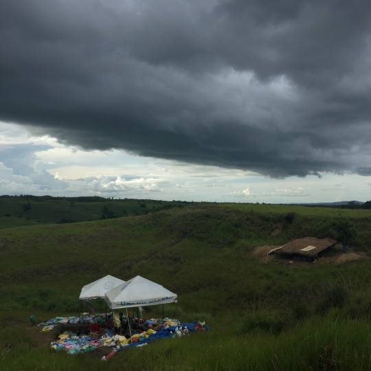
We visited the area to cover the discovery of Rhinoceros philippinensis and Stegodon luzonensis fossils. A group of archaeologists uncovered 75% of a Rhinoceros’ fossil, and on the day we visited, the archaeologists uncovered part of a Stegodon’s femur (thigh bone). Being a large animal, a Stegodon is bound to have a big femurs. According to the archaeologists, big fossil pieces are rare, especially when preserved well, and are quite dangerous to move since they are prone to fragment. So, special steps are taken to ensure that this doesn’t happen such as coating the fossil in plaster.
The hike was very easy as the terrain was consisted of rolling hills with low bushes. To be honest, you can easily blaze your own trail in the area to get from one point to another. I had a lot of fun and learned a lot on this day. It seems you’ll never know what you’ll find under your feet.

1 note
·
View note
Text
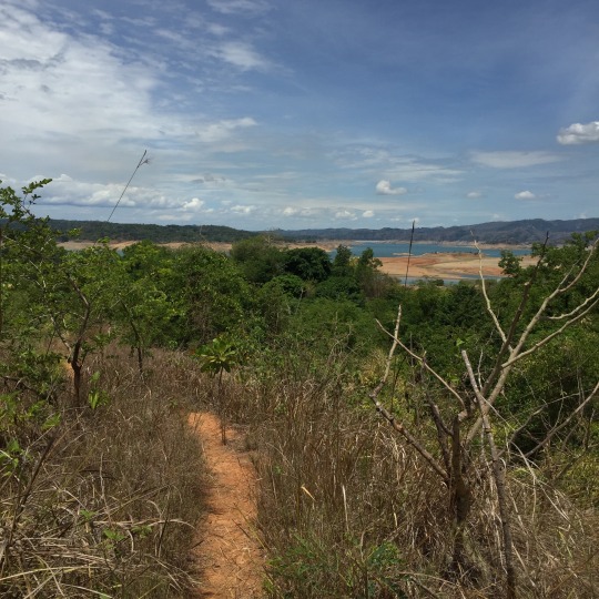
Mt Kaanducian (257 m/430 m | 843 ft/1,411 ft)

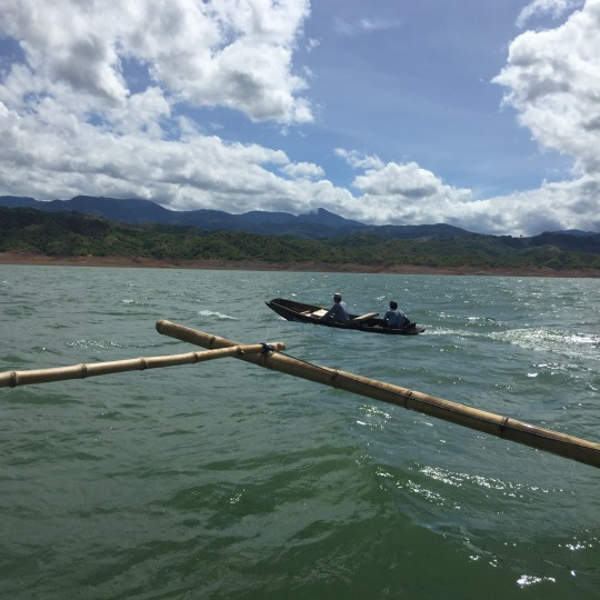
About three months ago, my crew and I went to Nueva Ecija province to learn about how the Department of Agriculture (DA) and the company that operates the Pantabangan-Masiway Hydroelectric Power Plant assist and teach local farmers and ranchers overcome challenges they face in their livelihoods.
We visited the Pantabangan Lake to talk to locals about how they fish, about the fish they catch, and their reforestation program to revitalise the mountains surrounding the lake.

We hiked from the edge of the lake, past Mt Kaanducian’s first monitoring point, to the plant nursery where locals are growing tree saplings to be planted all around the area. The hike itself wasn’t too difficult as the trail was well established. The first part of the trail follows the bank of the lake when water levels rise.

Then, bushes and trees begin to appear and the trail becomes a tad bit narrower.
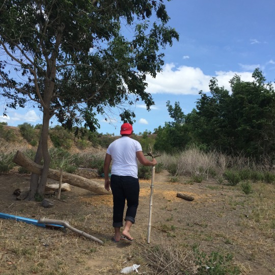
The trail isn’t very steep, and the mountain itself isn’t too high, which makes this hike quite friendly to beginners, or to people carrying heavy loads like my cameraman who’s carrying a ~10 kilogram camera and a ~15 kilogram tripod.

I see a lot of potential for this mountain as it’s not really in most mountaineers’ radars, but I really see myself going back to this place, hiking to the summit, camping by the lakefront, and just getting lost.

1 note
·
View note
Text
Mt Apo (1,170 m/2,954 m | 3,839 ft/9,692 ft)

Because of my current profession, I am sometimes able to climb mountains for work. I consider it as a perk, while others may consider it as a burden, and despite not being able to document costs for the hike, and despite the hike not being a full one, I will still write about my experiences.
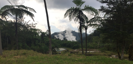
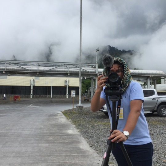
A few months ago, My crew and I visited Kidapawan City to find out about the relationship between the company operating a geothermal power plant in the area and the indigenous Obo Manobo tribe whose ancestral land the power plant sits on.

We visited a number of areas where the company, together with the Department of Agriculture (DA), help out the Obo Manobo people to develop their livelihood: farming.

We first hiked for about 30 minutes to an organic farm called Pad RG where a bounty of produce can be found: bitter gourd, eggplant, ginger, gumbo, pechay, peanuts, radish, siling labuyo, spring onion, and string beans. The company and the DA are helping the locals overcome challenges such as marketing their produce in the locale, sourcing seeds for high-value crops, and learning new skills in farming.

We also dropped by a village where the inhabitants produce whisk brooms (walis tambô), and we also visited a coffee and banana farm. We also passed by the geothermal power plant itself to know about how electricity is produced in a clean and sustainable manner by harnessing the Earth’s heat.
I interviewed the datu of the Obo Manobo tribe about his people, their land, their practices, and their future. He was a very welcoming and cheerful man, and despite our language barrier, we were able to communicate well.

We also had a hearty lunch with all the other datu, farmers, and some personnel from the geothermal power plant.

Despite having only one day to cover the whole area, we were still able to discover a lot about the Obo Manobo tribe, the geothermal power plant, their relationship with one another, and, most importantly, the mountain they all call their home.
1 note
·
View note
Text
Mt Pundaquit (464 m | 1,522 ft)
"I am humbled.”
I told myself that this sentence will start my entry on this mountain, but before we delve into why I adopted this mantra as I was hiking, I’ll talk about my trip to the jump-off point...because I drove my car.
I usually put in commute costs, but all I have is a petrol consumption estimate for this 186 km drive. I used about 25 litres of petrol (₱1,300), one way, including traffic delays. I took NLEX, then SCTEX [with EasyTrip RFID] (₱429) to reach Pundaquit as quickly as possible, but it still took me 4 hours to reach my destination.
I was greeted by the daughter of my contact, and endorsed me to my guide. We quickly set off to avoid the midday sun. However, almost halfway through the trail, we started to feel the effects of the heat. Soon enough, we were taking long breaks on almost each of the very few trees along the trail.
Now, here is where my mantra comes in because when I was researching about this mountain, I kept on comparing it to my previous climb, Mt Daraitan, and I became too confident in my abilities to conquer Mt Pundaquit as it was about half the height of Mt Daraitan. Boy, was I wrong as I had not considered the other aspects of these two mountains, particularly, the nature of the trail. Mt Daraitan was forested and cool, while Mt Pundaquit was bare and dry. I usually bring about 2 litres of water on a hike, but it wasn’t enough this time. The hike was slowly transitioning from a usual traverse to survival.

All this time, I was not speaking. Every time we took a break, I just sat and looked far, usually at Mt Maubanban [seen here from Pundaquit village] across the valley, and reflected on my life. I thought about everything I do, about all my relationships and pursuits, and about many other things. This mountain really reminded me of humility and meditation.

We arrived at the summit after many more breaks. To be more precise, we arrived at the highest point in the trail. From this location, the beach, and the end of the trail, seemed near, but don’t let it fool you. This mountain has a lot of tricks up her sleeve to make you even more humbled. Take that forest for example. You might think that the trail will follow the valley going down, but no, it follows the slope to the left until the solitary hill, where it curves right to follow the Anawangin River.
After crossing the not-yet-dry section of the Anawangin River, and spotting four locals camping, and four tourists frolicking, I finally reached civilsation. I was exhausted, parched, and famished. People were looking at me with shocked eyes as I was the odd one out. It’s true because I only carried my essentials, while they brought almost all comforts of home. Nobody asked me where I came from though, so I just continued walking until I reached the provision shop where I gulped down about a litre of water. I bought lunch with my guide and talked about how that hike, no matter how simple it seemed beforehand, challenged us physically and emotionally.
After regaining our strength, we pushed on to our final destination. You might think that I will camp at the beach where the provision shops and where all the resorts were but nope, I went back to where I last stayed, the isolated section of the cove where [almost] no one camped. After crossing four sections of rocks, and after slipping about eight times, I finally arrived. I quickly set up my tent to sleep. I did nothing but sleep.
I woke up at about 8 p.m. to loud music. It turned out that the resorts had disco nights. Thank the gods that I stayed at the isolated area, or else I will be so bothered again. At this time, I went to the beach and just lay there, looking at the stars, and feeling the waves crash up to my feet. I honestly forgot if I fell asleep on the beach, but after some time, I went back to the tent to sleep again.

I woke up at about 8 a.m. to these views and felt refreshed and renewed. I quickly set up my burner, gathered dried twigs and sticks, and lit them up to cook my breakfast of vegetable soup and corned beef hash, both tinned, and some water. I scheduled my boat to arrive at 1 p.m. and I had nothing more to do, so I just stared at the view. After a short while, I noticed a boat coming up to my location. What’s odd is it’s full of passengers. If I remember correctly, the last time I was here, I was with a group of friends and we had to get off the boat about 30 metres from the shore as the boat can’t go on anymore. I watched as the boatman manoeuvred his boat between the rocks and reefs to reach the shore. After that sequence of events, again, I had nothing to look at, so I just lay in my tent and listened to music.
When it was almost 1 p.m., I began to pack my belongings. The logistical issue here is the huge amount of sand that accumulates everywhere, so I had to shake everything to remove the sand. Being a good hiker, I brought all of my litter with me. After securing everything in my bag, I set off, uneventfully, for the main beach, and as I was passing through the third of four sets of rocks, I came across a family who asked me where I came from. Politely, I told them that I was alone, that I camped at the isolated area of the cove, and that I hiked from Pundaquit the day before. They were shocked after I told them of my journey but I just politely laughed and smiled with them. After requesting to be excused, I continued on my very slow walk to the main beach.
Upon arriving at the beach, I was anxiously waiting for my boat, but 1 p.m. passed and it hasn’t arrived yet. Feeling worried, I walked to a boatman to ask if he knew about the boat I was waiting for. Elated, he replied that he was looking for me too, and that he was sent instead of his uncle as he had another trip. I got on the cute boat, alone, and to the shock of other tourists who boarded much bigger boats, set off with no one but the boatman. 20 minutes later, since our boat was fast, I arrived back at Pundaquit and drove home.
This is the highest point of the trail, where the breeze goes from none to consistent.
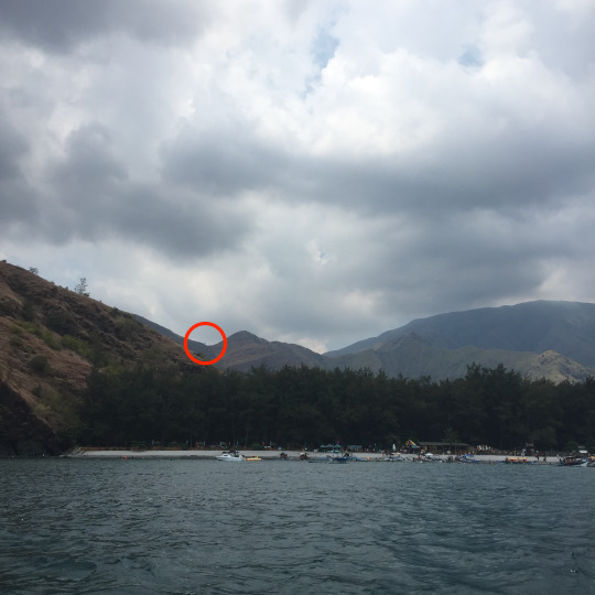
If you could see the solitary tree in the red circle, here it is.

I camped here, at the isolated area of the cove.
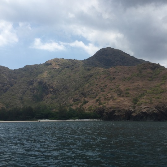
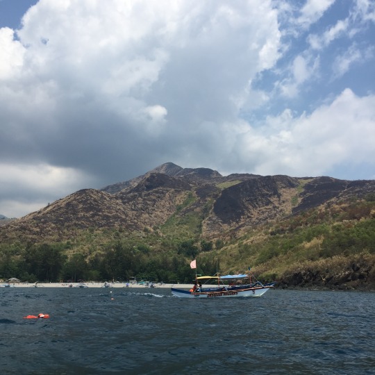
From the boat, you can see other points of interest in the area like Mt Balingkilat peeking behind lower hills...

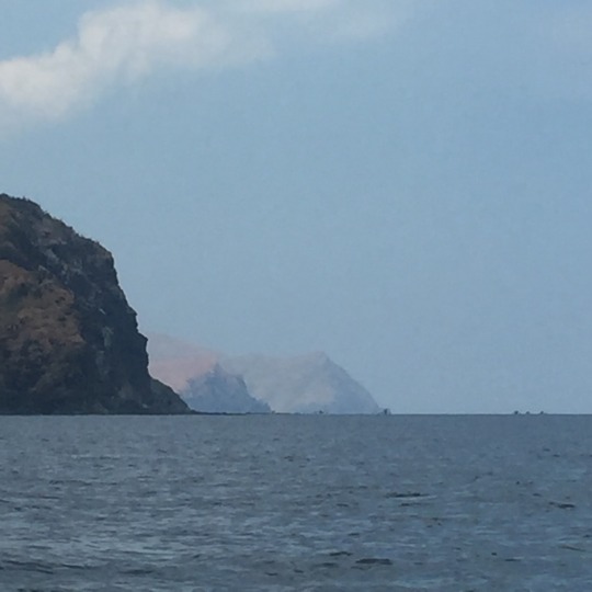
...and Talisayen and Nagsasa coves in the distance.

0 notes
Text
Ding, ang bato!
After not being able to head out and climb for almost a month, I finally found an event that I think is related to this somewhat newfound pursuit of mine.

‘Ding, ang bato!’ is a dance musical mounted by the Benilde’s Arts and Culture Cluster about Ding, the deaf brother of Narda/Darna and his interaction with the magical stone that gives Darna her power.
The play begins with an interactive segment to warm up the audience. The story, on the other hand, begins with Ding in a forest, interacting with the engkanto, or mythical spirits. Then, her sister finds him near an old balete, or banyan, tree and pulls him home. However, he conveys a message that an engkanto is saying, much to Narda’s scepticism: “we are giving you a stone that will grant you powers to help others at the right time.”
Once they arrived at their house, they are greeted by their Lola who tells them not to commit actions that might provoke the spirits. She then sings about how the engkanto are always with us and that we should respect them as the primordial beings of this world.
Now, this is where fantasy and reality meet: since our ancestors weren't very learned, they created stories to explain natural occurrences. The engkanto were, perhaps, created to scare people from defacing nature. However, this doesn’t work much anymore, frankly speaking.
Believe in the engkanto or not, one thing is for certain: when we are in nature’s realm, we must respect all within it as we, humans, are just visitors. This is where the seven Leave No Trace principles come in:
1. Plan ahead and prepare.
2. Travel and camp on durable surfaces.
3. Dispose of waste properly.
4. Leave what you find.
5. Minimize campfire impacts.
6. Respect wildlife.
7. Be considerate of other visitors.
The principles of “tabi-tabi po”, Leave No Trace, among others all stress the importance of respecting nature and treating it as a living and breathing thing. So if you too pick up this pursuit of mountain climbing, remember to “leave nothing but footprints, take nothing but pictures, kill nothing but time.”
0 notes
Text
Mt Daraitan (739 m | 2,425 ft)

Welcome to my new blog. This will be my first post as this hike is my first solo climb. I’ll get straight to the point - my experiences climbing this “Auntie Mountain” of mine (Mt Batulao being my “Mother Mountain”) alone.
From Cubao - Aurora Blvd, I took a jeepney to Cogeo, Antipolo City (₱29). Cogeo for me is the “Gateway to the Eastern Mountains” as this is the terminus for jeepneys going east, to the Sierra Madre mountain range. I hopped on one going to Brgy Sampaloc, Tanay (₱65) - major jump-off point for Mt Daraitan. After sitting with a heavy bag on my lap for about two hours, I finally arrived. Once in Brgy Sampaloc, you have the choice of renting a tricycle (₱500) or a motorcycle (habal-habal) (₱150). I opted for the latter as I’m alone and was on a budget.
The 30-minute ride from Brgy Sampaloc to Brgy Daraitan was mostly on a rough road so it wasn’t really a pleasant experience but what can you expect from a rural area in the mountains. The driver will drop you off at the Barangay Tourism Office where you need to log in and pay the fees. The costs are as follows: LGU fee (₱50), community fee (₱30), indigenous peoples (IP) fee (₱20), and guide (overnight) (₱1,250).
After settling everything at the Barangay Tourism Office, my guide and I rode another tricycle (₱60) and went to the Tinipak River Camping Grounds to set up camp. Use of the camping grounds cost (₱45) with unlimited use of the toilets. Being an outdoor enthusiast, I brought all my gear with me i.e. tent, burner, pots, food, sleeping bag.
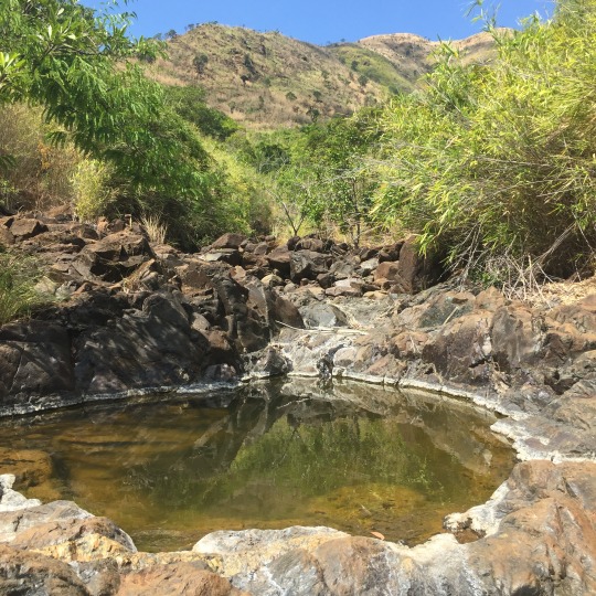
When it comes to outdoor living, especially when going overnight for a hike, your major concern will be drinking water. Luckily for me, there’s a spring a mere 20 metres away from the camping grounds so I have an unlimited supply of natural water.
When I finished setting everything up at the camp, I explored the nearby Tinipak River with my guide. There weren’t a lot of people when I came and the area was generally clean and safe. The guides tell us that we could only swim in the calmest part of the river but even there, you can feel the current. Since I take all opportunities presented before me, I did some laps across the river, and swam upstream as a warm-up for my heart before the climb the next day. Oh, please do take note that on the other side of the river, there is another spring where the water’s potable, safe to drink.

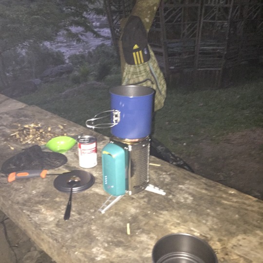
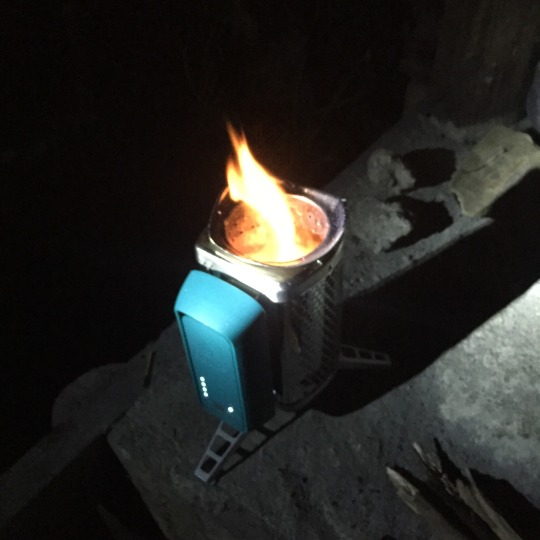
After my not-so-quick dip, I went back to camp with my guide and prepared my cooking gear while drying off. My guide scavenged for kindling and fuel while I prepared my tinder. I used the fire starter with my knife to light up my tinder and set it inside my burner along with some kindling. As I was doing all this, my fellow campers kept on noticing my gear and asked where I got them. I told them that since I’m planning on making this a long-term pursuit, I already invested in good gear. I also told them where I got them...#advert.
I cooked tinned beef stew and tinned corned beef hash and ate it with pita bread, my go-to carb source when outdoors. Of course, I shared my meal with my guide who was amazed at how prepared I was. Oddly enough, as I was cooking, some people approached me and asked me for something...a light for their cigarettes. They all forgot to bring their own lighters, apparently.
Following the cycle of work, I had to clean everything I used. Thank the spring once again as I used the water for washing. Had I not had a spring nearby, I would’ve wasted all my potable water for washing the dishes. Since I had nothing else to do, I just lay on the floor and look at the stars...a luxury the people of the Metro don’t have. Then, I went to bed.
By 2 a.m. the next morning, I was already up and packing up everything as we were about to climb up the mountain. Since we’re doing a night hike, I had to rent a headlamp...something I haven’t invested in at the moment. It cost (₱40) for the whole hike. I climbed solo with my guide, but another group of about 12 people were also heading up and were ahead of us. They were climbing at quite a moderate pace with many rest stops, while I was hiking a bit faster. I asked if we could overtake them and they politely agreed...each to their own, I guess.
The mountain wasn’t very difficult to climb since it was full of trees, branches, vines, and rocks that you can use as holds. However, the trail had a 600 metre assault so there were no breaks to the climb. We had to climb wooden steps put in place by the guides and rangers, and to crouch under rock formations to reach the summit. From time to time, there was rain and it made the trail slippery, but it still felt safe thanks to the trees, the rocks, and my walking stick. My hiking sickness was still evident: not looking up. There were many instances where I almost hit my head had my guide not warned me just moments before. Other than that, I was able to conserve my strength, my breath, and my water well.
We arrived at the now-defunct summit camping grounds to wait for sunrise. A few minutes after we reached the waypoint, the group behind us arrived. One of them had an injury on the foot so I tended it since I had a first aid kit with me too. We just chatted while the raindrops fell on the canvas roof at the summit camping grounds. A few minutes before sunrise, my guide and I set off ahead of everyone else once again. It was a 10 minute assault to the summit and once we got there, I headed straight to the view deck and just sat there, marvelling at the landscape in front of me.

Sunrise came and photographs were taken here and there. However, there was one rock formation that the guides said was too difficult to climb. When I heard that, the risk-taker in me was piqued so, with the moderate knowledge I have of scrambling, I was able to reach that point. It felt like a big achievement because when you’re there, one wrong step can mean being barbecued by sharp rocks. No kidding. After more photographs, we went to the second view deck and took even more photographs.
By this time, there were already about 100 people on the summit, so my guide and I decided to head down. We decided to take the long trail since the short trail might be too dangerous. The climb down was seriously long but it wasn’t so difficult. We passed through two potential camping grounds, another view deck, shrubs, flatlands, and finally farms and houses.
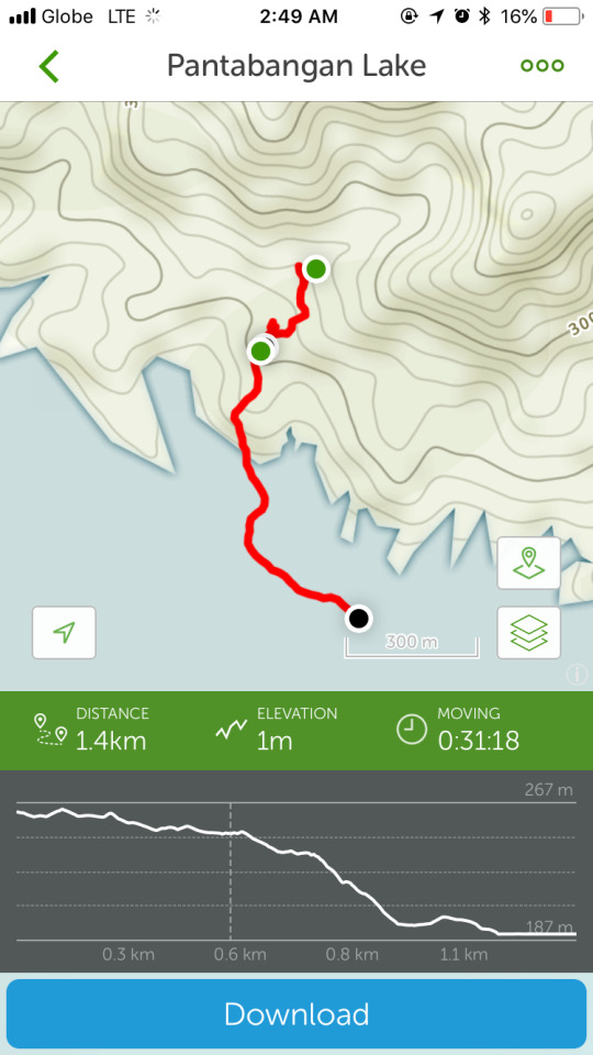
Wanting to get the most from my climb, aside from the exercise, I also mapped both the ascent and the descent using my phone. I have an app that records trails in terms of distance, elevation gain, location, and duration all with the power of the GPS. It’s a free app too that doesn’t require an internet connection so aside from conquering mountains and experiencing nature, another purpose for my climbs is to map trails for other’s knowledge and reference.


Personally, I don’t take a bath after getting back to civilisation after a climb. I consider it as my badge of honour that I really did went on a hike.
Overall, Mt Daraitan was not your usual mountain since it didn’t take much of a toll physically. It was more of a technical climb as you need to think of your steps and your holds so as to climb the mountain fast and in a safe manner.
0 notes