#''you could try walking half the distance on the less steep route for a couple days'' BUT WHY
Text
struggling to process today's session. I am not having a good brain day and it's deeply frustrating to Speak Wrong
#mine#lem experiences cognitive behavioural torture#well. not Wrong. just that spaghetti at wall word vomit until I find a topic I can string together multiple sentences for.#I meant to gather my thoughts the previous night but didn't#touched briefly on my fear of mental deterioration. I tried and probably failed once again to express how little I'm worried abt my body#which is frustrating in a different way bc I'm NOT as comfortable sharing my dx rap sheet as I used to be so I'm greatly understating#how much the body is zapping from me. like it's not one or two comorbidities it's like 8 and no I WON'T be seeing another specialist#''but don't you want to know what's wrong?'' I know what's wrong old man. I'm not having another 70$ copay to be told it's ''not THAT bad''#I'm getting closer to angry eye contact tho so that's nice. I hope he's the sort that would respond involuntarily to a glare.#there's so much internal discomfort and I need to expel it onto someone else#anyway I told him abt the walk w big sis and he was like ''that's p far'' ??? no?? ''it's a couple miles and a steep hile'' yes.#''that's a lot'' no? ''it is if you don't regularly do that'' ?? I agree w this statement but I cannot apply it to myself#yeah yeah going from 0 to 100 bad but ????? the goal was to coffee shop? I met the goal? why is goal moved backwards?#''you could try walking half the distance on the less steep route for a couple days'' BUT WHY#I DID THE THING#I HAVE PROVEN MYSELF CAPABLE WHY MUST I DO EXTRA#the fucking logistics of this sucks. now instead of one good day when the weather and my schedule and pain levels align... I need several??#I think this is to build up stamina and get me out of the house but holy fuck there's a reason I don't go out more often#it took a 4day weekend and a fucking miracle to go on the first walk#during my complaining he mentioned that my trouble w visual overwhelm was align w a symptom of ''one of the diagnoses your mom suspected''#and it's just A) ... duh. it's the 'tism. B) she was repeating the words of my doctor. C) why does this guy not believe I'm autistic#clearly I'm not bothering him enough. I must find a way to rectify this immediately#lem has a body
2 notes
·
View notes
Text
Mountain (Part 4)
Masterlist. Riva.
Part 3.
~#~#~#~#~#~
The snow started thirty minutes after they entered the trees.
Their path was easier, in one sense, because most of the way sloped gently downhill, making the sled extremely manageable. Twice Riva had to divert her path – once because the ground had disappeared into a hollow and the second because it had tilted the slightest bit uphill. The only trees around were evergreen, fortunately, so there was enough space to maneuver the sled.
Visibility, on the other hand, had dropped significantly.
Riva couldn’t make out the trees anymore – she kept her hands outstretched, waiting to brush against pine needles before adjusting her course. She kept a tally in her head – one correction right was followed by a correction left, no matter how difficult it was to keep changing the sled’s direction.
They didn’t have a compass. They didn’t have a flashlight. She was stumbling blindly in the darkness, hoping, praying that she was heading in the right direction.
The rope to the sled, she’d twisted around her wrist. If she lost it – if she couldn’t find it again – she called out to Frederik every once in a while, when her breathing became the only thing she could hear, but his voice was getting fainter. Weaker.
And now snowflakes were drifting onto her nose.
She exhaled a harsh breath, paused to tug the scarf tighter against her face, and continued walking. The snow didn’t matter. The winds hadn’t started yet, so things weren’t truly dangerous. They were just flurries.
“Riva?” Frederik sounded lost. Quiet and scared and defeated. “It’s snowing.”
“I know,” she said, and continued to drag him to a salvation she couldn’t see.
“How –” he cut off with a cough, and her next step faltered. It wasn’t subzero. Thank all the gods for small mercies. But it was still below freezing, and they’d been out here for an hour and a half already.
Riva had at least been moving. Frederik didn’t even have that.
“How long till the town?” he asked hoarsely after he regained his breath.
She took a deep breath of sharp, icy air.
From the ridge, the trees had been about halfway down. The slope leveled out significantly once they reached the trees, and the tree line ended before the town. The distance between the trees and the town was maybe half the distance covered by the trees in total.
Once they got out of the trees, Riva would have an answer. If they got out of the trees.
“I don’t know,” she said instead, and tried not to cry. The trees would freeze on her face anyway.
~#~
The moon broke through the clouds twenty minutes later. Riva nearly cried in relief, tugging the sled forward to the patch of white she could just barely see through the tree trunks. It took another fifteen minutes to navigate through the trees, but they were finally out of the woods. A clear, unbroken stretch of white lay between them and the blinking lights of the town.
“Another half an hour,” she said, turning to Frederik, “We’re almost there.”
He didn’t respond.
Riva felt ice spear through her heart. “Frederik?” she scrambled back, crouching by the sled, “Frederik!”
His eyelids fluttered and she dropped to her knees next to him. Snow had piled up in the sled despite what was clearly uncoordinated movements to push it out and Riva cursed herself, because she should’ve thought of this. She shoveled the snow out with her gloves, the cold biting deep through her thermals as her fingers cramped even further.
She brushed the snow off of Frederik as much as she could, shaking out the top blanket in between the ropes, and trying to avoid jostling his broken leg.
“Frederik,” she repeated, her voice going high-pitched as her eyes started burning again. “Frederik, you need to stay awake.”
“Cold,” he breathed out.
“Please open your eyes,” Riva begged, “Frederik, please.”
Francesca would kill her if anything happened to Frederik. And Riva would let her because it would be her fault – if she had been the one injured then Frederik would’ve found a way to get them to safety.
His eyes fluttered open and his gaze focused on her. “M’face,” he mumbled, “S’cold.”
Riva chanced removing her left glove and hissed as she patted his face – he was right, it was freezing. She took off the other glove and rubbed her hands before placing them on his face, trying her best to warm them up.
When his skin was no longer icy cold, she took her scarf and wrapped it around his face instead. The snow had died down, and she could pull the collar of her jacket up. She hurriedly tugged her gloves back on and picked up the rope.
Her fingers spasmed as she grasped it tightly, but she ignored it and set her jaw. “You can’t go to sleep,” she warned, and Frederik mumbled something she took as agreement.
The town was a half hour away. She could do this.
~#~
Twenty minutes through, they hit a little snag. The route wasn’t downhill the entire way. Riva had somehow managed to steer them into a small hollow, and the way back up was steep.
“Go,” Frederik croaked out. Riva turned to him, frantic. He was staring at her, dark eyes calm. “Go to the town. Get help. It isn’t far from here.”
“But – I can’t leave you – I don’t –”
“I’m protected from the wind here,” Frederik motioned to the slope, “And you can’t pull me up on that – no, Riva, you know it’s true. The town isn’t far. Go get help.”
Ten minutes to get there. However long it took to find help, and then ten minutes back. Riva bit her lip and cursed – every moment she spent here dithering was another moment wasted.
“I’ll be back as soon as I can,” Riva promised, something stuck in her throat, “You cannot go to sleep, Frederik, you have to promise.”
“I promise,” he said, trying to give her a smile. It looked more like a grimace.
Riva took a deep breath and turned towards the town. Climbing up was difficult – her fingers ached, slowly going numb, and the snow slithered past her jacket and into her boots. It was freezing cold and Riva could hear nothing but the wind howling in her ears.
The clouds were gathering again, creeping closer to the moon and Riva forced herself towards the town as pinpricks of cold assaulted her face. The lights were gleaming, streetlights on the empty, snowed-over streets. The closest buildings were dark and empty and Riva forced herself through the snow, nearly a foot high in places as she struggled to get closer to the streets.
She couldn’t make out any movement, any sign of life beyond the streetlights and she exhaled, impatient, trying to move faster –
She stepped wrong. Something gave way beneath her left boot and Riva fell into the snow, off balance and surprised.
The pain didn’t even register at first. She scrambled back upright again – she needed to find help, she needed to get back to Frederik – and made it ten steps before her left foot began to throb.
It didn’t feel broken and Riva cursed before shifting her gait to a slower hobble, one that put less weight on the injured ankle. Twenty steps further, and it became apparent that it was, at the very least, sprained – a jolt shuddered up her leg with every step.
Riva gritted her teeth and kept moving. She was finally at the town – the ground under her boots became harder and she was soon stepping through a few inches of snow, and not a foot. But the buildings to either side were closed and dark, no sign of light or movement. She limped forward, her heart clenching at the dull light of the streetlamps against the piles of snow.
The town was small, one main street and a couple of roads branching off, but she couldn’t even see any lights on in the houses, the roads were covered in snow – what if this town was abandoned, what if no one was here, what if this was a trap and the van Vorsens were waiting –
A burst of laughter and noise came from further up the street – a group was leaving a building, light spilling out onto the snow.
“Hey,” Riva called out, and had to clear her throat and try again. “Hey!” she shouted, waving her hands, “I need help! Please!” The group paused, turning towards her. “I need help! My friend is hurt!” she limped closer and the group exchanged glances before moving towards her.
“Please,” she repeated, when they were closer, “I need help. My friend is hurt. He’s back there,” she waved in the direction of the mountain. “Please.”
The group looked at her, and then turned to each other, speaking fast, and in a language that Riva couldn’t understand. She felt dread slowly pool in her stomach.
“Help?” one asked, “Need help?”
“Yes,” she said, “Please. My friend is hurt. He is in the snow.”
“Friend hurt. We help,” they said, stepping forward, “Where?”
Riva fought the urge to collapse in relief.
~#~
Part 5.
9 notes
·
View notes
Text
Seven Sisters, blisters on blisters and a misty dawn…
Tuesday 29th August and I’m currently sitting with my feet up nursing some very sore blisters after my most recent 100km walk along the South Coast. Two days later and I can barely shuffle from room to room, what a difference a day or two makes. I’m happy though that I completed this one in just under 23 hours, my fastest time. Thames Path took me 19 hours but that is all flat ground, a very different walk to these hilly ones.
Taping and padding my feet is a priority and I had covered heels, toes and balls of my feet but I hadn’t banked on the massive amount of rough flint paths we would be covering and it’s really tough on your feet. Consequently I’ve ended up with my worst blisters yet and boy do they hurt. It is amazing though how the power of adrenaline, with the help of Nurofen, gets you through pain, I must have walked over 20km with my feet on fire but I was so determined to get to the end that I just kept going, putting one sore foot in front of the other.
I wonder if this has any correlation to the inner strength that comes to the fore when people are dealing with cancer and other awful diseases. Don’t get me wrong, I’m not trying to make out what I do is anything like that but it does seem like the body and the mind can cope with far more than we sometimes realise and I have been astounded how sufferers of cancer and other dreadful illnesses can rally round and often be the strongest person dealing with it all. To a lesser degree you see people on these challenges who are battling along with all sorts of physical pain and often mental anguish too but a huge majority of them still cover massive distances, another testament to human resilience.
So back to the title and the Seven Sisters…for anyone not aware, these are a series of cliffs between Eastbourne and Seaford. From the beach they appear to be gently undulating hills but trust me when you are walking over them they are anything but gentle, each one is a steep ascent followed by an equally steep slope down. What’s more, I’m sure there are more than seven of them, it felt more like twelve!
But before we even got to these though we had set out from Eastbourne along the seafront, “we” being myself, Alex, the daughter of my best friend Pat who is a large part of my motivation for these walks, and a lady called Stella who we had met up with at the start and who was walking alone. From there we were almost immediately heading up the first hill towards the sadly, infamous Beachy Head. It should just be another clifftop with a stunning view but unfortunately it is where many people have chosen to end their lives and consequently there is an eerie feeling especially where the small wooden crosses and flowers have been placed. Many of the walkers are raising funds for suicide related charities and I sincerely hope they all manage to get their targets and beyond to save too many more of these being put here.
Coming down from here we reach the first rest stop at Birling Gap. Here the sea is fighting back against the land and taking huge bites out of the cliffs, spitting out chalk and even houses and gardens onto the beach below. Apparently the erosion averages around 1 metre a year, I can certainly remember taking my girls there back in the 90’s when you parked your car near the cliffs and walked back to the café. Today the café is at the cliff edge and the car park level with it and what was a row of seven or eight terraced coastguard cottages are now down to just two. Thankfully the rest stop marquee was a way back from the cliffs so no worries there!
After a quick top up of water and use of the facilities…we called it “water in and water out”, we were off over the aforementioned Seven Sisters and then on to the Cuckmere river, a welcome long walk along flat paths.
Initially we were all pretty evenly matched for pace but I found that all my hill training really paid off again as I was managing to stride up the hills fairly easily. They made me out of breath but the legs were good, no burning calves or tight thigh muscles which I was really pleased about. Alex and Stella found them a bit tougher though, not helped by them having considerably shorter legs than me to be fair. By the time I had used my new found sidestepping down the last hill I could no longer see them behind me so I messaged Alex to say I would carry on and wait at the next stop.
Following the Cuckmere meanders as they are known it was nice to be alongside the river but very hot and absolutely no shade for several miles. As one side of my face and arm got warmer and warmer I did contemplate walking backwards to cook the other side but decided that would no doubt only lead to a spectacular fall. Anyway, I managed to save that until I was almost at the stop when somehow I tripped over in a gateway and ended up on my hands and knees in some mud. Dry as a bone in most places but I managed to find a small stodgy patch to fall in. Thankfully I could clean up shortly after while I waited for the others to join me and pretend it never happened.
Soon we were all off together on the next sector and back up more hills to Firle Beacon, one of the higher points on the South Downs. From here you can see across to Lewes, the County town and another hill, Mount Caburn, which was surrounded by paragliders, a popular spot for the sport. After a lovely trek across the downs we could see the Amex stadium which meant Brighton and halfway was coming closer. A mini stop at Woodingdean was a chance to patch up Alex’s blistered feet which were quickly becoming more plasters than skin and turning out to be very tough to walk on. Stella and I were still ok and keeping up our pace which Alex said she couldn’t manage so we ended up heading into Brighton separately.
Somehow we missed the sign for the side street to the seafront which wasn’t a problem as we headed down the next parallel one. It did mean however that we missed the 50km marker which is always a good psychological boost, silly women! Brighton alternated between very quiet residential streets and a real buzz of nightlife on the seafront, together with the lights on the pier, promenade and the stunning new i360 observation tower which was slowly rising up above the seafront like a giant doughnut on a stick.
Into the neighbouring town of Hove and the much anticipated halfway point, although actually at 55km but who cares, it was a chance to remove the boots for a while and have dinner. This was probably an absolute highlight for Stella as she was tucking away the snacks and food at every rest stop. It became a joke that she made a beeline for the food each time leaving others in her wake and restocking her backpack with snacks. She’s right though as you do need to keep fuelling up so you have enough energy to keep going, especially through the night.
Sadly Alex arrived here in a very desolate state having endured extremely painful feet and a panic attack and she knew she could not continue any further particularly as it was toughest bit coming up. We got her sorted with some food and spoke to the organisers to make sure she would be helped to get home, fortunately she lives in Hove so not too far to go to the comforts of her flat. For Stella and me though it was boots back on, the glamorous head torches out and joining a group to leave on the second half.
Now we came to a very interesting part of the route… back onto the downs and Devils Dyke, a deep valley which is a popular beauty spot. It’s also popular with a particular group of people who like to gather in a car park there for dogging sessions. Anyone who doesn’t know what that means can Google it, I’m not explaining it here! Suffice it to say that I’m not sure who decided it was a good idea to send us right through the middle of this particular car park but that’s exactly where we went and I think it probably added enormously to the participant’s pleasure to have several hundred potential voyeurs striding past, in our case quite quickly. As Stella commented as we got to the other side, we weren’t sure whether to feel relieved or a little offended that we didn’t get propositioned. Anyway it seemed fitting that the very next point on the downs route was Fulking Hill….my thoughts exactly!!!
After all that excitement the next couple of stops were fairly uneventful apart from being two of the steepest and highest climbs and the start of the unrelenting flint and chalk paths. They are awful to walk on, hard and unforgiving and great knuckles of flint sticking up all over the place. Absolutely perfect for stubbing toes, rolling ankles and generally making your feet hurt, hence the hideous blisters. A lot of the time you can’t even walk on the verges as they are sloping and at night with the dew on them the grass was pretty slippery.
The first night stop was north of Shoreham where my friend Pat lived and the second was near the A24, directly south of my home. As always the night stops are a much quieter affair, a lot less people as walkers become more spread out and several people withdraw at each stage. Everyone is drained from the concentration of walking with a limited field of vision as well as obviously being tired from lack of sleep. It’s important to eat and drink still though and keep those reserves topped up…I didn’t need to remind Stella, she managed to find something to eat ok! Black coffee, as ever, is my friend here.
Once again though I hit my wall at 75 to 80km, my nemesis, it never fails to be the harshest part for me, the bit where I do actually wonder why I’m putting myself through it and I retreat inside my own head, full of thoughts of mum and Pat and I keep telling myself it’s nearly done. I even told myself I would never do another challenge…hmmm, I have said that before! The last stop however, was in a stunning location and that helped lift my spirits again. Heading down the last hill to the River Arun at dawn it was all shrouded in a low mist, absolutely beautiful and very atmospheric. Crossing the river on a footbridge with the mist swirling around our feet and on the river below us was one of the sights I won’t forget.
We hadn’t intended to stop here other than the water in and water out bit but we both felt so exhausted from the hard paths that we did take a bit more time. It was sad to see a couple of people having to withdraw at this stage with injuries. I cannot imagine having to give up when you only have 8 km to go, they looked gutted, poor guys. Once we left here I was relieved to find that we were walking through woods on fairly flat dry mud paths. Unusually this was the only woods we walked through on the whole route. It wasn’t quite so straight forward though as there were loads of large tree roots to negotiate, not easy on tired drunk legs that want to go in a different direction to the rest of your body. You end up looking like you are doing some sort of demented Irish jig trying to negotiate them!
On one small downhill section I felt two blisters burst which is far more painful than if they are manually popped. At least I thought I would get a bit of relief once the initial pain subsided but it wasn’t to be. I discovered later that I had secondary deep blisters under the top ones…I don’t recommend them, they’re not pleasant, every step of the last few kilometres hurt. Another short stretch along the river though and we were soon passing the majestic Arundel castle and heading into the football grounds where the finish was.
Despite our tiredness and extremely sore feet, Stella and I held hands and managed a short and painful jog across the finish line at 2 minutes to 8am Sunday 27th August, 22 hours and 59 minutes after we had set off from Eastbourne.
Prosecco in hand, medals round our necks and with congratulations all round we posed for the obligatory finishers photos and then collapsed into chairs for the recuperation to start. Mark and Amy came down to meet me with Brodie and after a brief chat it was time to give another new walking friend a hug and head home…leaving Stella to wait for her next train home. She didn’t waste her waiting time though, I left her tucking into breakfast, bless her!
So now I’m done for another year, it’s been different again, not all in a good way as I don’t much like this foot pain but it will soon heal and I’ll be back out walking the hills round here with my woof. Aside from that though, it was a stunning walk and through a lot of my home county so it was nice to be reunited with it for a while and I was lucky again with walking buddies, thanks ladies. Stella was great through the night and we managed to laugh a fair bit as well as keep each other’s spirits up.
South Coast was definitely challenging but I did it and most importantly the fundraising has gone up a bit more… Macmillan have now received over £5300 and the overall total for all charities is £6800…I’m chuffed with that. Thanks again to everyone for the donations and also for the ever present support, it really does help me get through it.
1 note
·
View note
Text
Mount Mildred Ski Tour
3/24/19
Continuing my quest of skiing OGULs this winter, Leo and I picked Mount Mildred as the main objective for the weekend. When I had first suggested it a while back, Leo thought we wouldn’t be fast enough to do it in a day, but after reading some more (and having a desire for lots of cardio), he changed his mind! If we could pull it off, it’d be my 30th OGUL. Given that we had the Ikon Pass this season (which has Alpine Meadows/Squaw access), we’d also be able to cut a few miles off the morning.

Home for many nights this season, at Blackwood Canyon Sno-Park.
We first tried to give Mildred a shot on Saturday, but when we got to the top of the lift just after the resort opened, we found ourselves in a full on white-out. A ski patrol came over to chat with us, worried that we’d try to leave the resort in the current conditions — but he had nothing to worry about. We were definitely ready to bail. While chatting with him, we were able to get some good info about how the backcountry access from Alpine works, which we weren’t able to find online. We ended up skiing the resort for the rest of the day, happily so.

The view of Mildred in the back from the top of Alpine. Photo by Leo.
The next day was scheduled to be warm and clear, so we decided to give Mildred another shot. We got in line for the lift around 8:50am, same as the day before, except this time with totally clear skies. As we reached the top of the summit lift, we saw no “closed area” signs as we had the day before. We took a few minutes to scope out the route to Mildred while we had it in view. The cliffs on the eastern ridge from Peak 8109 were very obvious, but the shoulder to the left looked very manageable, so we planned to head in that direction as we headed off. Neither Leo nor I had ever skied or even seen this aspect of Alpine before, so we skied down a bit, looking over the edge. Right off the ridge is a bit rocky, but we skirted to the left and then found an amazing, clear slope. And so, we committed! Heading down the slope in perfect powder from the past day’s storms, touched by no one before us. As we reached the end of shouting distance from the resort, someone yelled to us “do you know what you’re doing?!” I wasn’t sure that we did — Mildred is waaaaay out there, and it was going to be a long day. But we knew enough to make sure we’d get back to the car somehow, so we assured them and continued on.

Avoiding cliffs.
It was an amazing 2000ft descent off of the back of Alpine in amazing snow that would be by far our best turns of the day (and the best backcountry skiing I’ve had to date in Tahoe). The storm had been big enough to give enough powder for tons of fun, but not so big to create dangerous slabs. What more could you ask for? As we reached the bottom and headed into the trees, I suggested to Leo that we could just lap this slope instead, but Leo was keen on his cardio goals, so off to Mildred we continued.
We transitioned to skins and had a great, easy time skinning through the powder. From reading Bob Burd’s trip report, we were a bit nervous about crossing Five Lakes Creek, but with the huge snow year we’ve had, there were plenty of solid snow bridges. We stayed to the left side of the valley, far from the ridge we needed to gain, since we planned to head up and around the left side. The ridge lining the right side of the valley had some really impressive, steep slopes. I’d love to see some amazing skiers ski that.

Mildred coming into view for the first time since Alpine.
We headed up the shoulder we had aimed for through some trees. The main avy concern for the day was loose wet slides, made dangerous by terrain traps or cliffs. As we neared the ridge, there were indeed some cliffs on the most direct route to the ridgeline, on a southern-facing slope that had been baking in the sun. Instead of contouring around the slope (putting us above the cliffs), we headed directly up on to the ridge, avoiding any cliff exposure. From there, we continued towards the summit of Peak 8109, getting our first views of Mildred since having left Alpine.

I spy a cornice. Photo by Leo.
The northern aspect of the ridge was heavily corniced, so we were afraid we’d have to climb up and over the peak, but we managed to find safe entry and exit points, saving us some vert. Once on the other side of the ridge, it was down a couple hundred feet to the saddle between 8109 and Mildred. I got to show off (i.e. embarrass myself) my skiing in walk mode skills, only totally eating it once! In retrospect I wish I had at least locked my heels in, but the summit just felt so close. Once done with the downhill, it was a fairly easy skin to the summit. Woohoo!

Descending to the saddle between 8109 and Mildred. Photo by Leo.

Mildred from the ridge connecting Peak 8109. Photo by Leo.
We took a few minutes to eat and discuss our exit route. It had taken us 4 hours to reach the summit, so we sadly wouldn’t be able to make it back to Alpine to ski down the resort (which would have been the most direct route). This means we’d have to exit around the north side of the ridge that makes up Alpine, substantially longer mileage (but less overall vert). We planned to drop off the ridge between our peak and 8109 at the low point, which also looked like a break in the cornice. We’d then traverse along the northern slope as long as we could, before planning to go back into walk mode and up over the shoulder on the other side of 8109.

Skinning up the final slope to Mildred. Photo by Leo.
The plan went as well as we’d hoped. Right before going back into walk mode, we got some excellent turns coming down the northern aspect. Even though the vast majority of the snow around us had turned to mush, this snow had held amazingly well. We transitioned back into walk mode and slogged up the extremely deep powder — the most strenuous part of the whole day. Once at the saddle, we stayed in walk mode, traversing the south side of the ridge in mushy, sun-exposed snow that was much easier to break trail in.

Our turns off the northern aspect of the ridge and the strong, late-March sun.
As we reached the point we dropped back off the ridge, we transitioned back into ski mode gloriously, enjoying the much improved pace as we dropped into the last valley between us and the back of Alpine. In shady spots the snow had grown crusty and more challenging to ski, but it still felt great to be using my feet a different way. At the bottom of the valley, we transitioned back into walk mode for what we hoped would be the last time. Again, we found good snow bridges to cross the creek and headed up, edging north of Alpine towards Five Lakes. The terrain was actually quite easy skinning, which we were both thankful for — but it just felt long. I was so happy when we finally reached the saddle separating us and the road. Back into ski mode for the last time, and we skied down very hard crust in very low light, finding a snowmobile track to lead us back to the road.

So happy to be reaching the car!
After only a tiny bit of shenanigans to get down the tall snow bank, our feet were back on pavement, and we walked the remaining half mile up the road to our car. We made it back around 6:40pm — about 9 hours and 20 mins after having left the top of the resort. We were very thankful to make it back before dark, because an unnamed individual forgot their headlamp (but he more than made up for it with all the trail he broke). We were rewarded for our efforts with literally no traffic on the drive home, which let us somehow amazingly be in bed at 11pm sharp. I’d call it an incredibly successful day!


0 notes
Text
alright, so something not chill happened on my last day but hear me out (if u want lol) bc it turned out to be kind of good? for me
so, it’s the day before the last, and i’ve gotta change hotels to one closer to the airport to be better situated for my flight. so i’m plodding along with my walker, and i stop off for a final glass of wine before i go and check my email and they’d cancelled my reservation randomly. ok. so i realised i’d literally been spending into the hotel money because they’d put it back into my account so i panic and eventually end up calling my older brother (even though we like don’t talk) and he sends me juuust enough cash because i didn’t wanna ask my partner or my friends to deal with anymore of my stuff or to keep having to help me. ok.
so i’m on the tram there, it takes forever but i’ve got music so it’s chill, i’m tired af and it’s been not a great day for the feels so i’m stoked to get back and check into my new room. i get off the tram, and start walking what looks like a short distance on the map, but i realise my battery’s getting low. it’s fine, it’s like not a long walk and we got power saver mode. so i keep on trucking, ‘till i notice a growing stinging in my back and hips has gotten to a point where it was making movement difficult and i’m like, ‘yo how long have i been walking?’ bear in mind, i quickly realised that these roads were suuuper fucked up (like alternating terrain dirt roads/rocks etc) and i was trying to control a FULLY loaded walker and a pull along suitcase precariously hooked onto one side and it was *not* going well. anyway, i look closely at the route and realise my ass is 1.5 miles away, and there’s no fucking transport there. at this point i obviously can not afford the taxi that it would make sense to immediately call. so, i keep walking and decide i’m walking a couple miles today.
now in the last half a mile or so, my phone dies without warning and that’s sort of where shit hits the fan, ‘cause we can’t figure out directions without our phones (at least, i can’t) and so i get lost almost immediately AND have no music and my thoughts just catch up with me, especially with my body in this much pain, the underfoot terrain getting worse and worse like that and me having to twist and wrench my spine to drag my suitcase out of potholes and bigger and bigger muddy ditches, after a while i’d been waking for legit hours and i was just like... despairing lmao. so, there’s this weird, dark, wet and DEEP ravine/ditch and obviously i get stuck in it all the while not really knowing where i am, and i’m in so much pain and i’m panicking, the way out looks so steep and impossible and i was going over and over how simple the solutions to avoid things like this actually were/are when your life is normal/starts normally and thought of a taxi and why i couldn’t get one, how much the crazy awful luck in my life affects even the most simplest of things and makes them a battle for me and how much everyone i love always has to slog it out with me or give something they have for me to even be on an even playing field to experience normal things or be normal and how much of a gross, bad luck riddled anchor i felt like to everyone i know and love and i finally settled on the fact that i knew that i genuinely felt like they would be better off if none of them knew me and i just fucking lost. my. shit. it was totally private and there was nobody around except for passing cars on a motorway i’d spotted over the top of the ditch past the steep drop, it must’ve been about 30-40 meters deep if not more. i fucking screamed over and over again at the top of my lungs, and i cried from my gut, like an unfiltered child, open mouthed and just roaring, i must have sounded like i was legit fucking dying but looking back, it was catharsis. in London, there aren’t many places where you don’t have to worry about other people or your neighbours and cap your tears and your sadness and blunt and mute your feelings and it’s the same in your everyday life there too, pretending things hurt less than they do and forcing yourself to endure shit you don’t want to and do it with an acceptable amount of feeling only; too much is too much and too little is as if it never happened at all - point is, there’s so much emotional complexity in being a societal participant and loved one in London and in that moment i was alone, in a foreign country, my body was giving up and my muscles burned, and i was freezing, i was tired and my heart was heavy with pain and i knew i had no choice but to take this steep drop or force my body to walk like an hour backwards to get out which i knew i couldn’t physically handle and i just let it rip i guess, the space around me seemed almost endless and dark, and i just screamed and cried for a while in a way that i’ve wanted to for months and let out some emotions that i had wrestled to the back of my mind. and then after a while i put my walker in park, jammed my cane into the mud and grass inside the ditch grabbed the pull handle of my suitcase and dragged it up the hill that seemed impossible at my own pace and with my own adapted methods, gradually tugging it up there literally screaming in both anguish and pain lol.
i must have looked insane, honestly but there was nobody out there to help, and i had tried to find help or flag someone down when i still had access to the road and it was just desolate, like 3 cars an hour type shit and by the time it got to that point i looked crazy so they weren’t particularly inclined to stop, i don’t blame them. it felt like it took forever and the triumph of actually making it was short lived, because i had to go back for my walker with everything on it which obviously was 1. really, really hard without my walker lol and 2. Impossible looking because of the steepness AND wet, slipperiness of the hill and how much i had already struggled with something much lighter and 3. pain??? so i knew instantly that it would be way harder but i just did the same, i’m not even sure how really? it took me way longer but i just dragged it up screaming, mud everywhere, i felt like that one anecdote of a mother lifting a car off of her child with sheer adrenaline and maternal instinct my sweet dudes. lmao, it must have been an aaaabsolute sight and i could not make this shit up.
so i reach the top right, i’m heaving and i’m on the side of the motorway with my bags and shit and i’m just crying openly on the motorway now i don’t give a fuck, like i was too tired to dance emotionally for the cars & act ‘together’ lmao and after a while somehow i just start like limping down the side of it, and the crying was just like some feeble autopilot mode shit and my whole face was like numb, and it was just a few minutes before this kind Muslim man stopped at the side of the road and i told him my phone was dead and we googled my hotel’s address and he’d told me the hotel was like a few minutes away and showed me on the map, and he was like ‘hop in’ and i’m like ‘fuck it, i’d probs die if i kept trying to walk and drag all this shit with me anyway’ so i hop in the car and he takes me back there, and i avoid eye contact and stop crying pretty much when i get in and say than you and besides some crying on and off from the relief of my hotel room, the tears tapered off. i still felt pretty bad but i spoke to my younger brother for a few hours (who i was actually trying to call earlier when i spoke to my elder one) and he made me feel better and sent some cash for breakfast etc. he said that he feels similar sometimes, but there’s something positive we can take from every moment of pain, and he’s the one that pointed out that like, maybe i needed a place to do that? despite him wishing i didn’t have to hurt myself and walk for miles to find it, maybe in some strange way it was a bit serendipitous because i never have the space to feel the pain that having less conventional lives like ours brings and i think he’s right at least in part.
regardless, besides telling one of my friends the cliffnotes, i gotta go back and essentially pretend that this didn’t happen and i’ve probably gotta downplay it to that friend - and that’s sort of why i think i needed it. we can’t really react to having lives like this in the ways that it deserves to be reacted to, as adults we’re confined and constricted and there’s sort of a conveyer belt fashion feel to emotions and How To Feel Appropriately with added layers as brits, especially with also being emotionally close with a couple of people that aren’t emotionally developed enough to handle emotions that may or may not be a bit extraordinary or ‘a lot’ occasionally(e.g. a trauma survivor in crisis), so you have to kind of guide them through your pain and make sure you don’t scare them with the force of it lol. so as much as i didn’t really get to express myself to anyone in my life in a way that felt 100% or really get to feel even sort of understood by anyone except someone that had experienced some of the trauma with me, i got it out of me and in that moment i was honest with me, and my emotions, feelings and experiences and i felt like i faced that pain and i looked at it for what it was and how i perceived it at that moment. it honestly almost feels like an epiphany for me, but we’ll have to see about when i get home.
i’ve got a bunch of stressful shit to sort out when i come home and like i always say, i have to clean up and do damage control for the effects of 2018 (and like january honestly) and this isn’t to say i won’t cry sometimes or feel overwhelmed or stressed, i’m not an idiot but i feel like The Big Cry has happened, and i’ve taken something away from that and i can choose to let that something be useful to me, or not. i think it’ll be healthy for me to choose the former in the long run. so honestly i guess the moral here is like go scream in the woods or smth i don’t know lol, conventional solutions aren’t always the remedy or part of catharsis for unconventional pain and you never know, some small part of you might feel relieved that it’s not just bouncing around inside of you and damaging shit that it touches even symbolically - but i just know that i feel a little less... something
#annasequilibrium#actuallyptsd#actuallycptsd#spoonie#cpunk#idk if this’ll help someone or something or what but#idk just in case#might take the tags down later
0 notes
Photo

Sovereign's Pass
Carried by the howling wind, the snow fell nearly sideways this high in the mountains of Ihu. Sheltered by the peaks, the surface of the glacier was calm by comparison, but even there the wind still blew hard enough to break any creature's tenuous footing on the ice and send it hurtling along the rough-hewn surface. No Matoran in their right mind would cross this... no Matoran except an Ihuan, that is, and surely, three small figures were carefully picking their way along the glacier's surface. At least one was less than comfortable in the endeavor.
"Sir, the wind is getting worse!" Kantai complained. Neither of the figures ahead of him responded; had they heard him over the noise of the wind? He couldn't be sure, and was about to call out again when suddenly a loud, ominous cracking sound from deep below stopped him in his tracks. This Matoran knew well how treacherous the terrain could be; stories of Matoran vanishing on the glacier, falling into holes or cracks without a hope of rescue were commonplace. As a scribe and record keeper, he had recorded the list of missing names. Now, he was running the risk becoming the latest name added to it. "SIR!" he called out, louder this time. No verbal reply came, but the two figures that had not stopped even for the cracking did so now. Both turned to look back towards him. Kantai hastily clambered his way along the glacier's surface to catch up to them, trying not to mind the fact that his king was watching him with a stare even colder than the ice he was trying to gain a foothold on. It took him a minute, but he did catch up. "Sir," he began again as he tried to catch his breath, "the wind... it's getting worse..."
"We anticipated as much," the king of Ihu replied. Kopaka, he was now, though Kantai had once known him by a different name. At the time, he'd been friendlier too; the elemental spirit Kopaka was said to be as cold and unforgiving as the mountains themselves, and ever since taking on its mantle, the recently crowned sovereign appeared to reflect that more and more. Equipped with full battle armor and carrying the king's spear and shield, he at least looked every part the warrior king, and Ihu needed one, but for all his splendor Kantai didn't find his demeanor in any way reassuring. "It will continue to get worse," Kopaka asserted. "If we do not make it back to Cleft Ridge within the hour, we will not make it back at all. So keep moving." With that command, he turned and was on his way again. Not in the least bit comforted, Kantai looked back and up towards the structure that they had departed well over half an hour ago: Cleft Ridge, a collection of tall buildings made of stone and wood perched on a ridge jutting out from the mountain. There, the mountainside was so steep that the glacier running down it appeared as a wall of snow and ice in a slow but continuous and visible descent, a cracking, rumbling avalanche in slow motion, split near the base of the mountain by the rocky crag on which the outpost had been built. At the top of the highest tower, a large fire burned to make the Cleft Ridge a navigational beacon; Kantai feared that soon its light would be the only thing left to see of the place in the worsening weather.
"Come on, we're almost there," his other companion invited. A royal guard and distinguished explorer and soldier, Matoro was far more comfortable than Kantai in these parts. Unlike the person he was tasked with guarding, however, Matoro had an apparent capacity for empathy and never acted as though he was above anyone in any way. Couple that with a reputation for honesty, and it was no surprise that an update from him did far more to put Kantai's fears at ease than what Kopaka had been willing to offer. Relieved, the scribe picked up his pace; once they reached the precipice, the king would need him. It was the only reason why he was here in the first place; for all its hazards, this was the best route to get from Cleft Ridge to a point overlooking Sovereign's Pass, where Ihuan king and later Toa Nuju had destroyed a large Mangaian force centuries ago. Now, history was set to repeat itself: a Mangaian army under the command of Toa Tahu was on its way, its first units already camped in front of the pass. Ihuan warriors were still making their way here to mount a defense, but while awaiting their arrival, Kopaka insisted on checking on his enemies movement himself... even if the weather didn't exactly cooperate.
At last they reached the precipice; a fault line that the glacier, piece by melting piece, plummeted into, only to reform at the bottom and continue its slow march downhill. Kopaka walked almost right up to the edge to cast his gaze on Sovereign's Pass below. There he stood, spear planted next to his feet, as though standing for a painting or carving, and as he tentatively closed in on the edge himself, Kantai could tell who he was presenting this image to: at the entrance of the pass, on a rocky plateau, three Mangaian units had set up camp, their red, yellow, and orange armor, banners, and tents still clearly visible even at this distance. Kopaka used the scope incorporated in his mask to zoom in and get a clearer view; Kantai pulled out his notebook and pen.
"Record three units," Kopaka began and Kantai quickly recorded, "with two large siege engines in tow." Kantai shuddered at the thought of the Mangaians using these machines, with the barrage of flaming projectiles that they could produce, to reduce Ihuan cities to rubble; it had happened before. "Artillery under Jaller's command," Kopaka continued as he picked out a distinctive yellow-clad Mangaian next to one of the siege engines. "Also... note the presence of Tahu." Kantai noticed a change in his king's voice as he said that... the presence of Tahu. Was he sure? Peering over the precipice and scoping in on the Mangaians, it didn't take long for Kantai to spot the Toa of Fire himself, and he recorded his presence as such. Then he looked back to Kopaka, who it seemed hadn't moved a muscle, except his expression had changed. It wasn't the stoic gaze of before, no, looking at his king's face now, Kantai saw worry. Worry about what? Compared to what was on the way on the Ihuan side, the Mangaian force was still grossly outnumbered, and they were definitely not in their element here. Ihu had more than a fighting chance, so what could possibly concern its commander so much that his stoic facade was broken, even if only momentarily? And momentarily it was; almost immediately after Kantai picked up on his change of expression, Kopaka reasserted himself, turned around, and quickly started back towards Cleft Ridge. Matoro and Kantai followed, though slightly behind as both had been taken aback by the king suddenly and quickly taking off. In fact, even going as fast as they dared to go under the circumstances, both Matoran soon realized that the Toa was actually opening up the distance between them, running across the glacier in a way that only one able to sense the movement and disposition of the ice itself could... well, could without accident.
"We're not gonna catch him." Matoro surprised Kantai by saying and slowing down as he did so.
"We're supposed to be with him, though," Kantai pointed out. "You in particular."
"True," Matoro admitted, "but he does this sometimes. Whenever he needs to be alone, to think alone... he goes somewhere his guard can't follow. The sight of the Mangaians must have given him something to consider. Either way, he'll come back soon."
"So we..." Kantai began, but Matoro finished the sentence for him.
"...we make our way back to Cleft Ridge on our own. Come, I know the safe routes." Matoro started on a slightly different path than the one they had taken to get to the precipice, but Kantai followed.
"You think it has something to do with those rumors about him and Tahu?" the scribe asked as they picked their way back across the rough yet slippery surface.
"I don't know," Matoro answered, "and I don't put much stock in those rumors. Yeah, they're both Toa and they've worked together in the past, but it wasn't a happy partnership. And now things are a lot worse." Kantai couldn't argue with that; in the wake of the Toa's success, relations between Ihu and Mangai had gone from strained to broken, and now they were about to face off in war.
"Do you think that he'll live up to his ancestors' standards?" Kantai wondered. "I mean, he'll have to if he wants to dispel those rumors, right? He has to beat the Mangaians soundly."
"Yes, he would..." Matoro acknowledged, but trailed off.
"...but?" Kantai beckoned for him to go on. Matoro sighed.
"I have been guarding him since he was old enough to wield a half-spear," he continued, "and I've seen how he's grown up in the shadow of those ancestors. Yeah, they set a high bar for him to clear, but... it's not their standards that I'm worried about. It's his own."
"His own?" Kantai repeated questioningly. Matoro looked to the Toa, now a fair distance ahead.
"The standard of Kopaka."
2 notes
·
View notes
Text
The Loop Routes That Don’t Show Up On The Map
Last Friday afternoon, I locked my bike to a sign next to the trail and tried to convince myself it wasn’t that hot—it was 82 degrees in Missoula, with a forecasted high of 91. A hundred feet behind me, most sane people with the afternoon off were spending it floating down the river in inner tubes, drinking cold beverages, their butts in the cool water, occasionally paddling a little with their hands but for the most part as relaxed as they’d be sitting in a La-Z-Boy. I could hear a handful of whoops and yells as I clipped my running vest and clicked through the menu on my watch.
The trail above me was in the shade, at least, but that was about all the encouragement I could give myself. I had never tried to run all the way to the top of Mt. Sentinel, 1800 feet of climbing in 2.9 miles. I was tired after a long work week, had run yesterday, and could think of at least 10 other reasons to not do it. But Hilary had run the whole thing a couple days earlier and she didn’t die or vomit at the top, so maybe I could, too. It was going to go one of two ways, so I might as well get it over with. I clicked the start button on my watch and started shuffling, reminding myself to take it as slowly as possible so I didn’t blow up.
I only saw three other people the whole way, and thankfully, they all stepped off to the side of the trail to let me pass, maybe thanks to the early warning of my wheezing as I chugged up the trail. I would like to think when I pass hikers on the trail, I look fit and graceful, but I’m sure when I’m out of earshot, they’re probably saying things to each other like “That guy looked like he was about to DIE,” “Trail running looks like it’s really awful,” and “Do you think we should call for a rescue?”
I constantly had to remind myself to keep looking at the ten feet of trail in front of me, not 100 feet ahead. There are few truly flat sections of the Smokejumper Trail, many steep spots, some less-steep sections, and overall, plenty of opportunities for someone of my speed to consider taking up golf instead of trail running. My quads burned with every uphill step, my heart rate stayed around 160 the entire time, and I talked myself out of this idea and back into it approximately 100 times.
I made it to the saddle without walking, leaving about a half mile and 300 feet of climbing to the summit, so I tried to take a big gulp of air in and keep a respectable stride going as I moved up the trail.
—
I knew almost nothing about mountains when I moved to Missoula from my home state of Iowa in 2002 to go to grad school for journalism. I just knew I wanted to learn how to write, in a way that could lead to a job, or at least making a living. Part way through my two years at the university, I figured out that I also liked standing on top of mountains. By the fall of my second year of school, I had become a little obsessed, picking through hiking guidebooks to find the hikes that led to summits. I managed to get up a few peaks, some with my friend Tim, including Idaho’s Borah Peak, Lolo Peak near Missoula, and Mt. Sentinel via the Smokejumper Trail—which, in 2004, was a pretty big hike for me, even if the mountain was literally the backyard of the campus of the University of Montana, its southern slopes dropping down a couple hundred feet from the journalism building where I attended classes.
In my second year of grad school, I had to do a thesis project, and I mentioned it to Tim one day. He joked, “What’s it on, peak bagging?” I laughed and said that might be a good idea. My best idea to that point had been something like “newspapers and the internet.” I talked to the department chair and switched my thesis project to three magazine feature-style articles on peak bagging. I found three stories that I hoped might someday be published in magazines: a group of folks called the Highpointers Club, who tried to summit as many of the state high points as possible, from Denali to Florida’s 320-foot Britton Hill; the Colorado Fourteeners Initiative, who worked to protect and preserve Colorado’s 14,000-foot peaks; and the County Highpointers, a group whose common interest was finding and summiting the high points of counties of the United States (of which there are 3,143). Summits made sense to me: a clear goal, a distinct turnaround point, you either made it to the top or you didn’t. When I looked through guidebooks, I skipped the loop hikes and looked for the ones that ended on peaks.
If you count the three members of my thesis committee and myself, I believe a total of five people have read my master’s thesis from 2004—one other grad student read it sometime around 2009, I think. I never got the articles published anywhere, but at that point, I was realizing I didn’t want to someday write for Rolling Stone anymore—I wanted to write for Outside and Backpacker.
My adventure writing career got a slow start: I got day jobs at small newspapers and tried to pitch and write magazine stories on the side. I got rejected by all the outdoor magazines you’ve heard of, but started to write for smaller ones, and eventually, seven years after getting my first rejection letters, I finally wrote a couple stories for some of the bigger national magazines.
An editor from a publishing company emailed me one day in 2014, asking if I’d like to write a brief how-to book about peak bagging. I’d get a small advance payment, and if it sold well, maybe make a few bucks over the next couple years. I thought hell, why not. Since Tim had suggested the idea of a peak bagging thesis 11 years earlier, I had gotten up a few more mountains, and enjoyed all of them.
I wrote the book, got the check, and it was published in 2015. By the end of the year, I received my first earnings statement from the publisher and it was pretty evident that the book had not made the New York Times Bestseller List. Not that I expected it to. I shrugged and figured I had at least paid off a little of my student loan from the University of Montana with some of the book money, and that was pretty OK. Since then, I’d started trail running a lot more, getting into ultramarathon distances, and in trying to plan long training runs, I ended up doing lots of loops—big ones that took all day, and small ones I’d repeat as necessary to hit a mileage goal. I had different motivations, and they didn’t always take me over the top of peaks anymore.
—
Above the saddle on Sentinel last week, I kept my legs moving, hating myself and my idea of “winding down after a long week at the office.” A slight haze hung over the valley, blown in from wildfires somewhere. Another reason you might think twice about running uphill at about your VO2 max for the better part of an hour.
With maybe 40 vertical feet to go, my legs were screaming and I was in more physical distress than I’d been in years, thinking, really, what’s the point of running to the summit? This much discomfort, for what? It’s not like someone was waiting for me at the top with a $25 gift card to Taco John’s. If I stopped and walked, there would be no difference, besides it being about 90 seconds later when I stood on the summit.
But you can’t quit 40 feet from the top. I kept my feet moving, considering the very real possibility of vomiting on the summit for a few seconds, before the ground beneath my feet flattened out and I was on top. I stopped, took a quick phone photo, turned around and decided to let myself walk down the next few hundred feet of trail, in lieu of rolling up into the fetal position and having a good cry. My shirt was soaked in sweat all the way down to the hem, my shorts were about half-soaked, and I thought, you know, is 52 ounces of water enough for the rest of this run? At the beginning of the day, I’d decided I wanted to do more than an out-and-back; I planned a route down the back side of the mountain, and around the north side, back to my bike, a big loop. I figured it would be somewhere between eight and 12 more miles, and I had about 40 ounces of water left (it’s hard to drink when you’re wheezing and running uphill).
Reader, it was not enough water, not even fucking close to enough water. I conserved it while getting blasted by the sun in the now-90-degree heat, then ran out about two miles from my bike. When I finally got to my bike, I would have paid $50 for a single ice cube to be dropped in my dusty mouth.
Instead, I got on and began to pedal, considering my options. The most direct route would take me by a grocery store, only about 100 feet off my ride home. I hit every goddamn son of a bitching red light on the way there and stood straddling my bike, watching the walk/don’t walk signal tick down the seconds as I baked in the sun. How am I still sweating?
The grocery store I picked was way busier than I had envisioned it would be when I was fantasizing about cold drinks for the past hour. I found a sports drink and walked to what I thought would be a fast-moving line, my face sweat sticking to the mask I’d put on before coming into the store. I held the bottle by the cap, hoping to avoid having my warm hand heat up the icy drink even a few degrees before I could drink it. I hoped no one in line could smell me.
The guy at the register was wearing a University of Montana hooded sweatshirt, with the hood up, a visual that blew my mind as I stood in the freezer aisle, the hottest and thirstiest I’d felt in at least a year. The line was not moving. I glanced around. A shelf with a small selection of books sat next to the Hot Pockets, almost all titles I’d never heard of. The sign above it read “Montana Grown.” Ah, local authors? No, local huckleberry jam and candy. And some books, not necessarily written by local authors. At the far right of the shelf, through my dried-out contact lenses, I saw an image that looked very familiar to something in my memory, my friend Nick hiking up a trail as we made our way up South Arapaho Peak in Colorado in 2009 or 2010. Oh wait, that is Nick. I took that photo. That’s the cover of that book I wrote. About peak bagging. Next to the Hot Pockets.
I paid for my sports drink, then drained the entire thing standing outside in the heat, next to the bike rack. I thought the idea of “peak bagging,” about how much time I’ve spent picking out summit routes to attempt, and how as I get older, maybe it’s not always the summits that are so interesting, but the ways things loop back on themselves.
Thanks for reading.
These posts are able to continue thanks to the handful of wonderful people who back Semi-Rad on Patreon for as little as $1 a month. If you’d like to join them, click here for more info—you’ll also get access to the Patreon-only posts I write, as well as discounts to my shop and other free stuff.
—Brendan
The post The Loop Routes That Don’t Show Up On The Map appeared first on semi-rad.com.
0 notes
Text
The Loop Routes That Don’t Show Up On The Map
Last Friday afternoon, I locked my bike to a sign next to the trail and tried to convince myself it wasn’t that hot—it was 82 degrees in Missoula, with a forecasted high of 91. A hundred feet behind me, most sane people with the afternoon off were spending it floating down the river in inner tubes, drinking cold beverages, their butts in the cool water, occasionally paddling a little with their hands but for the most part as relaxed as they’d be sitting in a La-Z-Boy. I could hear a handful of whoops and yells as I clipped my running vest and clicked through the menu on my watch.
The trail above me was in the shade, at least, but that was about all the encouragement I could give myself. I had never tried to run all the way to the top of Mt. Sentinel, 1800 feet of climbing in 2.9 miles. I was tired after a long work week, had run yesterday, and could think of at least 10 other reasons to not do it. But Hilary had run the whole thing a couple days earlier and she didn’t die or vomit at the top, so maybe I could, too. It was going to go one of two ways, so I might as well get it over with. I clicked the start button on my watch and started shuffling, reminding myself to take it as slowly as possible so I didn’t blow up.
I only saw three other people the whole way, and thankfully, they all stepped off to the side of the trail to let me pass, maybe thanks to the early warning of my wheezing as I chugged up the trail. I would like to think when I pass hikers on the trail, I look fit and graceful, but I’m sure when I’m out of earshot, they’re probably saying things to each other like “That guy looked like he was about to DIE,” “Trail running looks like it’s really awful,” and “Do you think we should call for a rescue?”
I constantly had to remind myself to keep looking at the ten feet of trail in front of me, not 100 feet ahead. There are few truly flat sections of the Smokejumper Trail, many steep spots, some less-steep sections, and overall, plenty of opportunities for someone of my speed to consider taking up golf instead of trail running. My quads burned with every uphill step, my heart rate stayed around 160 the entire time, and I talked myself out of this idea and back into it approximately 100 times.
I made it to the saddle without walking, leaving about a half mile and 300 feet of climbing to the summit, so I tried to take a big gulp of air in and keep a respectable stride going as I moved up the trail.
—
I knew almost nothing about mountains when I moved to Missoula from my home state of Iowa in 2002 to go to grad school for journalism. I just knew I wanted to learn how to write, in a way that could lead to a job, or at least making a living. Part way through my two years at the university, I figured out that I also liked standing on top of mountains. By the fall of my second year of school, I had become a little obsessed, picking through hiking guidebooks to find the hikes that led to summits. I managed to get up a few peaks, some with my friend Tim, including Idaho’s Borah Peak, Lolo Peak near Missoula, and Mt. Sentinel via the Smokejumper Trail—which, in 2004, was a pretty big hike for me, even if the mountain was literally the backyard of the campus of the University of Montana, its southern slopes dropping down a couple hundred feet from the journalism building where I attended classes.
In my second year of grad school, I had to do a thesis project, and I mentioned it to Tim one day. He joked, “What’s it on, peak bagging?” I laughed and said that might be a good idea. My best idea to that point had been something like “newspapers and the internet.” I talked to the department chair and switched my thesis project to three magazine feature-style articles on peak bagging. I found three stories that I hoped might someday be published in magazines: a group of folks called the Highpointers Club, who tried to summit as many of the state high points as possible, from Denali to Florida’s 320-foot Britton Hill; the Colorado Fourteeners Initiative, who worked to protect and preserve Colorado’s 14,000-foot peaks; and the County Highpointers, a group whose common interest was finding and summiting the high points of counties of the United States (of which there are 3,143). Summits made sense to me: a clear goal, a distinct turnaround point, you either made it to the top or you didn’t. When I looked through guidebooks, I skipped the loop hikes and looked for the ones that ended on peaks.
If you count the three members of my thesis committee and myself, I believe a total of five people have read my master’s thesis from 2004—one other grad student read it sometime around 2009, I think. I never got the articles published anywhere, but at that point, I was realizing I didn’t want to someday write for Rolling Stone anymore—I wanted to write for Outside and Backpacker.
My adventure writing career got a slow start: I got day jobs at small newspapers and tried to pitch and write magazine stories on the side. I got rejected by all the outdoor magazines you’ve heard of, but started to write for smaller ones, and eventually, seven years after getting my first rejection letters, I finally wrote a couple stories for some of the bigger national magazines.
An editor from a publishing company emailed me one day in 2014, asking if I’d like to write a brief how-to book about peak bagging. I’d get a small advance payment, and if it sold well, maybe make a few bucks over the next couple years. I thought hell, why not. Since Tim had suggested the idea of a peak bagging thesis 11 years earlier, I had gotten up a few more mountains, and enjoyed all of them.
I wrote the book, got the check, and it was published in 2015. By the end of the year, I received my first earnings statement from the publisher and it was pretty evident that the book had not made the New York Times Bestseller List. Not that I expected it to. I shrugged and figured I had at least paid off a little of my student loan from the University of Montana with some of the book money, and that was pretty OK. Since then, I’d started trail running a lot more, getting into ultramarathon distances, and in trying to plan long training runs, I ended up doing lots of loops—big ones that took all day, and small ones I’d repeat as necessary to hit a mileage goal. I had different motivations, and they didn’t always take me over the top of peaks anymore.
—
Above the saddle on Sentinel last week, I kept my legs moving, hating myself and my idea of “winding down after a long week at the office.” A slight haze hung over the valley, blown in from wildfires somewhere. Another reason you might think twice about running uphill at about your VO2 max for the better part of an hour.
With maybe 40 vertical feet to go, my legs were screaming and I was in more physical distress than I’d been in years, thinking, really, what’s the point of running to the summit? This much discomfort, for what? It’s not like someone was waiting for me at the top with a $25 gift card to Taco John’s. If I stopped and walked, there would be no difference, besides it being about 90 seconds later when I stood on the summit.
But you can’t quit 40 feet from the top. I kept my feet moving, considering the very real possibility of vomiting on the summit for a few seconds, before the ground beneath my feet flattened out and I was on top. I stopped, took a quick phone photo, turned around and decided to let myself walk down the next few hundred feet of trail, in lieu of rolling up into the fetal position and having a good cry. My shirt was soaked in sweat all the way down to the hem, my shorts were about half-soaked, and I thought, you know, is 52 ounces of water enough for the rest of this run? At the beginning of the day, I’d decided I wanted to do more than an out-and-back; I planned a route down the back side of the mountain, and around the north side, back to my bike, a big loop. I figured it would be somewhere between eight and 12 more miles, and I had about 40 ounces of water left (it’s hard to drink when you’re wheezing and running uphill).
Reader, it was not enough water, not even fucking close to enough water. I conserved it while getting blasted by the sun in the now-90-degree heat, then ran out about two miles from my bike. When I finally got to my bike, I would have paid $50 for a single ice cube to be dropped in my dusty mouth.
Instead, I got on and began to pedal, considering my options. The most direct route would take me by a grocery store, only about 100 feet off my ride home. I hit every goddamn son of a bitching red light on the way there and stood straddling my bike, watching the walk/don’t walk signal tick down the seconds as I baked in the sun. How am I still sweating?
The grocery store I picked was way busier than I had envisioned it would be when I was fantasizing about cold drinks for the past hour. I found a sports drink and walked to what I thought would be a fast-moving line, my face sweat sticking to the mask I’d put on before coming into the store. I held the bottle by the cap, hoping to avoid having my warm hand heat up the icy drink even a few degrees before I could drink it. I hoped no one in line could smell me.
The guy at the register was wearing a University of Montana hooded sweatshirt, with the hood up, a visual that blew my mind as I stood in the freezer aisle, the hottest and thirstiest I’d felt in at least a year. The line was not moving. I glanced around. A shelf with a small selection of books sat next to the Hot Pockets, almost all titles I’d never heard of. The sign above it read “Montana Grown.” Ah, local authors? No, local huckleberry jam and candy. And some books, not necessarily written by local authors. At the far right of the shelf, through my dried-out contact lenses, I saw an image that looked very familiar to something in my memory, my friend Nick hiking up a trail as we made our way up South Arapaho Peak in Colorado in 2009 or 2010. Oh wait, that is Nick. I took that photo. That’s the cover of that book I wrote. About peak bagging. Next to the Hot Pockets.
I paid for my sports drink, then drained the entire thing standing outside in the heat, next to the bike rack. I thought the idea of “peak bagging,” about how much time I’ve spent picking out summit routes to attempt, and how as I get older, maybe it’s not always the summits that are so interesting, but the ways things loop back on themselves.
Thanks for reading.
These posts are able to continue thanks to the handful of wonderful people who back Semi-Rad on Patreon for as little as $1 a month. If you’d like to join them, click here for more info—you’ll also get access to the Patreon-only posts I write, as well as discounts to my shop and other free stuff.
—Brendan
The post The Loop Routes That Don’t Show Up On The Map appeared first on semi-rad.com.
from Explore https://semi-rad.com/2020/08/the-loop-routes-that-dont-show-up-on-the-map/
via http://www.rssmix.com/
0 notes
Text
Mt Taylor from Lake Heron via Double Hut

After our wedding in Japan, Asaka and I decided to spend our honeymoon in New Zealand. I planned a rather ambitious trip that was sabotaged by weather and a bout of morning sickness. Either way, we were still determined to go through with our plan, regardless of the challenges we faced. We had October 13th and 14th to climb Mt Taylor near Christchurch before we had to drive north to catch our ferry to the North Island. High chances of precipitation were forecasted for both days, with rain falling mostly during the afternoon. Since we came all the way across the Pacific Ocean, we decided to give it a shot anyway.

We started around 9AM on Sunday morning to get a head start on the weather. The trail markers say 6 miles (10km) to Double Hut, however my GPS suggested 5.5 miles.


What ensued was a very chilly & overcast, yet enjoyable & gradual hike. There were waterfowl and rabbits about.

Mt Sugarloaf was a giant mound that stood above Lake Heron.

4.7 miles into the hike, we had a river crossing which made us take off our boots. Water levels were above my knees so Asaka crossed higher upstream. We reached camp before noon.

Double Hut is a very nice hut with a fire pit, several mattresses and food hangs. A water source and a nice outhouse can be found outside. Asaka wasn't feeling good; a combination of jet lag and morning sickness, so she slept almost the entire day. I spent time scouting out the following day's route, attempting a fire and organizing our packs. It rained ever so slightly in the afternoon, but nothing serious. Due to wedding distractions, I forgot to bring headlamps, rain pants, gaiters, a stove and a water filter, although the latter may not be needed. We planned to make due one way or the other.
The next day our alarms went off at 3:30am, however the weather outside was uninviting so I decided to try again at 4:30am. An hour later the weather was more or less the same, but we needed to get up and down before the afternoon showers so we went on anyways. The large waning gibbous was blocked by thick clouds, however there was just enough light to see. We began following the river up the wash. Water levels were too high to cross without taking off our boots. Very early in the canyon we were pinned in by the stream and a big rock, so we climbed up and over the rock to avoid crossing. Descending had us down climb a wet, crumbly chimney, made even more difficult without much light. Our progress was very slow through the rocky wash. At our first required crossing, Asaka fell in and got both her boots soaked. We switched socks, and now rather than her feet being wet and mine being dry, both of our feet were wet. Our progress continued to be unacceptably slow, now mostly because Asaka wasn't feeling good. We considered turning around or continuing several times. To make matters worse, I realized that we left our ice axes in the hut. Dope! Everything was working against us it seemed.
We finally reached the toe of the West Ridge 2 hours after setting off. As we climbed the ridge, Asaka's pace increased to acceptable which inspired hope.

We climbed into the cloud cover as we stayed atop the deteriorating ridegeline.

Sections were extremely muddy and slippery, and in once instance Asaka fell pretty hard on her face. We then weaved through the vegetation which minimized the erosion.

We climbed 1,000 ft in one hour, which is an okay pace. Maintaining this pace would get us on the summit by 11:30am; much later than I anticipated but acceptable. As we reached the upper cloud layer, snow covered peaks to our north became visible. They were quite intimidating knowing we were under prepared. As we climbed out of the clouds we were greeted with spectacular views of the snow covered Southern Alps to the west, running like a backbone down the South Island. We had blue skies above and my optimism continued to rise. We then began following a rocky ridge. My advise would be to stay atop the ridge. You can keep this to class 2 and easy class 3. Now Asaka's pace began to slow again. Her 1k ft per hour pace had disintegrated to half that. The rocky ridge was slowly being covered by more and more hard snow. Clouds had begun to blow over from the summit, and my instincts were telling me that Asaka needed to stop. At 6,000 ft, I had to make the official decision. I told her that I would go on my myself, and to expect me back in 2 hours. She was okay with the decision and I left her on a sunny rock to warm up. I put on my crampons and started up the remaining distance solo.


At first the climbing was quite benign, however the higher I climbed, the snow levels increased. I found myself walking atop cornices as I tried my best to stick to the top of the ridgeline. The snow conditions were absolutely perfect; any softer the cornices would give way, and any harder the ice would be too hard to kick steps. The weather came in and my vision was almost zero, but I trusted my instincts and was able to find my way forward. I made great time, climbing the last 1,500 ft in 37 minutes. I could see the sub peaks of Mt Taylor to the east and to the south. To the west were the mighty Southern Alps. The north was covered with clouds. A small pole dug into the ground marked the summit. I didn't find a register, but I didn't look for one, as the summit was covered in snow.
I wasted no time and began a brisk power walk down the mountain, just able to see the steps I left on my ascent. I made better time on the descent, and not long after Asaka was visible through the clouds. The weather had moved in and visibility was very limited. As I made my way across the final snow field, I lost concentration for a split second. My crampon toe caught the snow and I did an somersault. While there was very limited exposure across this section, my phone fell out of my pocket, slid across the snow and tumbled down into the abyss. How stupid of me! 30 meters later I was back at Asaka, but I couldn't celebrate. This was one of the most scenic hikes I've ever done, and all my photos were gone with my phone. I considered trying to recover the phone, but the slope was too steep and at one point a slipped on a rock and fell flat on my back. Ouch! Asaka consoled me and after a quick lunch we descended back down the ridge we came up. Asaka had only taken three pictures up to that point, so I commandeered her phone.


Two ducks flew over our heads several times as we descended. They seemed to be a couple just like me and Asaka.

I took a sigh of relief once we made it off the crumbly ridge and back into the canyon.

The creek crossings were much easier in the day light.


The last major obstacle was the crumbly chimney. I spotted Asaka as she climbed up the loose and wet rock.

From the top of the chimney, the Double Hut lay just around the corner.


Once at the Double Hut, we changed our socks and quickly packed our stuff.


The weather threatened us but it never rained.


With three miles left to go until the car, we crossed a dirt road. Asaka showed me how to correctly hitch hike, but no cars came.


We arrived at the car at 4pm.

We had a long drive to Blenheim that night but we made it without any incident. We planned to take the ferry from Picton to Wellington the next day. Hopefully the weather would improve enough for us to climb Mt Taranaki in a few days.
0 notes
Text
The Long Game: From Road Runner to Ultra Runner
My Journey to the Lakeland Trails 55k (08/07/18)
If you’d told me a year ago that I would be entering an ultramarathon in 2018 there’s no way I’d have believed it. I had only run one marathon (Yorkshire Marathon 2015) which was a bit of a miserable experience, and apart from that had mostly stuck to half marathon distance or less. I was a road runner with some occasional trail/cross country thrown in. Yes, my running was continuing to improve but I was very average in terms of speed – no way would someone like me be able to do an ultra! In fact, I knew very little about the world of ultra-running at all; it was like a mythical sport for the superhuman and I had no business prying into it.
Things began to change when I met Alex, who has a wonderful confidence that if you want to do something you can do it. There are things I would write things off as impossible that he’s so cool about it and just goes for it. His interest in ultra-running began to rub off on me as he introduced me to all the amazing videos available online and I was astounded by these ‘normal’ people achieving incredible things. Still, it was great to watch it on screen but not something that would ever be a reality for me. Too hard! I wasn’t fit enough, fast enough, mentally tough enough.
Then late last autumn Steve Rhodes from my running club (‘inner city club’ Hyde Park Harriers!) suggested we have a go at the Billy Bland challenge, which is the Bob Graham Round done as a relay across 5 legs. Although the team would consist of our faster runners, anyone was welcome to join the recces. The first was organised back in November and Alex wanted to go; I was reluctant (okay, scared) as I didn’t think I’d be able to keep up with everyone, but with some encouragement and the knowledge that a mix of abilities were going I braved it. As soon as we started out from Honister we were going uphill… and we were walking it. Oh, you don’t have to run uphill! Immediately fell running became less terrifying to me. I survived the experience and found I enjoyed it immensely, with the stunning views, the mix of terrain and just being in the great outdoors.

This was followed by another recce a couple of months later which ascended Skiddaw, Great Calva and Blencathra in some full-on white-out conditions. I felt like a proper adventurer! I was way out of my comfort zone, but with such a positive group of people around me I never felt like I couldn’t do it. In fact, I started to notice that I could hold my own when it wasn’t all about pace, and I wasn’t too bad at toughing it out in difficult conditions. Confidence was growing!

I knew if I was going to try an ultra it would have to be something special to keep me motivated. The Lakeland Trails 55k felt like a good option as an entry level ultra. It was a long way to run, but an achievable distance all the same. It would be beautiful. It was a marked course with proper check points, so navigation and support wouldn’t be a big worry. I had time to train for it. Still, when I actually went ahead and signed up for it I was pretty surprised at myself! If Alex hadn’t encouraged me it never would have happened.
Training was actually really fun. On holiday in Switzerland we had more mountain adventures (and oh my goodness the altitude was a shock to the system!), then I did my first fell race with lovely people from my club, and a trail half marathon. The final test was a solo circuit of the Yorkshire Three Peaks. If I could nail that I would be ready! It was an enormous relief to complete the 24 mile route, especially under 6 hours, and I was thrilled that I felt decent during and after.

The Time Has Come!
Well, after all that build-up it seemed pretty surreal when it was finally time for the event. The weather had been sweltering for weeks, making the last weeks of training really draining. We knew we were in for a hot race, but you can’t change the weather so all you can do is prepare for it and be sensible on the day. Keeping hydrated and fuelled would make or break it. When we went to register the day before the race there was a full kit check – and what a relief when they told us we wouldn’t have to carry full waterproofs and gloves! More space for precious water.

After an interesting night’s sleep interjected with random shouts of “It’s coming home!” from outside (England had just qualified for the World Cup semi-final) we woke up at 5am to force down some porridge – not an easy feat when your stomach really doesn’t want it! After a bit of stress trying to figure out where to park (which included us tailing Nicky Spinks in her van, hoping she knew where she was going) we were finally there on the start line, too late for nerves now. I had just passed by Nicky and stopped to congratulate her for her amazing achievement of being the first person to complete a double Charlie Ramsay Round just last weekend; unsurprisingly she said that although she was feeling pretty good she wasn’t quite up to running the 55k! Great that she still came along though – she is a huge inspiration, especially for us females who are constantly being told by society that we are the ‘weaker’ sex. I kept her in mind when I was struggling later in the day - I really recommend you check this documentary out if you want to know more about her.

And so onto the race itself. It began slowly as we started ascending out of Ambleside immediately. There was chatter and excitement amongst all of us as we set off, all playing the long game and walking as soon as we hit the first hill. Up we went into Kirkstone Pass, and it was difficult to overtake people at this stage so I went with the general pace of the pack until we started to spread out more after about 4 or 5 miles. The heat was already cloying; I spoke to a lady who said she was aiming for 9 hours (as I was) but we knew the temperature would play a big part in the reality, and it wasn’t long before we were separated.

The trails were lovely; a great mixture of different terrain to keep things interesting, within stunningly beautiful landscapes. The miles ticked by quite comfortably over the undulating countryside, with nothing too steep but still a lot of steady ascents giving plenty of opportunities to walk, and nice descents that were technical enough to be interesting but not too challenging.

The climb up to Grisedale Tarn was where we really started to spread out and I could see some people beginning to struggle. This is a long, rocky slog which can definitely wear you down, but for some reason I felt quite energised by it – there was no way I could run it so I was happy just plugging away at it steadily. My hill training was definitely paying off! At the top was the tarn (and plenty of midges) and there were even people up there waiting to cheer us on. To the right was a peak which I could see people climbing, and I mentally prepared to do the same, so it was a pleasant surprise to skirt around it and start the descent instead. This was perhaps harder than the climb – quite steep and very rocky so it was difficult to build up much momentum because of all the trip hazards. I stumbled quite a lot, but fortunately didn’t fall!

I won’t go through it all in detail because it becomes a bit of a blur, but the five checkpoints were a godsend and really helped to separate the race into manageable chunks. It was a relief to be able to drink as much water as I needed, knowing I’d be able to refill my bottles regularly. The support from the marshals and the general public all the way round was so uplifting, especially as the day went on and the exhaustion started to set in. I set myself goals along the way – I wanted to get to 24 miles in 6 hours to know I was in line with my Three Peaks pace, then 26.2 miles was the next milestone as it meant I was entering the territory of my longest ever run. After that I focused on my 9 hour target and that kept me going.

By 30 miles I was getting really tired and having to coax myself into running, and my knee (problematic for years) was starting to hurt on the road sections in particular. After the last checkpoint, hearing that the course was a couple of extra miles long and there were still about 5 miles to go, I had a little exhausted cry. But there was never any thought of giving up; I concentrated on putting one foot in front of the other, every step taking me closer to the finish.

We were spread out now, all of us in our own little ‘pain caves’ and a handful of us playing a bit of leap frog as we alternated between running and walking. There was another climb, then a paramedic who had come up to tend to a guy who wasn’t in a good way (so close to the end as well – I really felt for him and I hope he’s okay) and FINALLY the last descent into Ambleside. This was the worst part of all: what should have been a victory mile down to the finish was so painful on my knee that I just cried all the way down. Lovely walkers cheered me on and gave me sympathetic words of encouragement for the last few hundred metres – apparently my sunglasses weren’t disguising my weeping as well as I’d hoped! I held back the tears as I ran into the finishing funnel amidst the cheers and high fives, over the line to smiling volunteers and that hard-earned medal. Oh and a ladies fit t-shirt: such a novelty!

Alex came through to find me, having finished a bit before me, and then more tears from me – relief this time. After all months of build-up we had done it. What a journey! Would I do it again? Haha, probably. I was so proud to make it and really happy with my time of 9:17 (if the course hadn’t been long I would have made my 9 hour target so as far as I was concerned it was mission accomplished). Alex did brilliantly too and we both finished comfortably in the top half of the finishers’ results table. I’m really chuffed that I even made it into the top quarter of the ladies who finished. Not too bad for an ‘average’ runner!
Thanks to Lakeland Trails/Ultimate Trails and Inov-8 for putting on a great event. The organisation was top notch and the marshals were absolute legends. And thanks to my running club mates who inspire me every day with their amazing achievements. For anyone who doesn’t think they can run an ultra, heed my story and consider it. If I can, you can! We are all stronger than we think.

0 notes
Text
Mt. Shasta Trip Report
Mt. Shasta (14,179 ft / 4322 meters) has been on my list of objectives for a while now! I attempted the Mt. Shasta climb last summer (2017) but had to turn around due to bad weather and rockfall danger; we barely made it to 11,000 ft or just under the popular structure called “Red Banks”. That was an unusually warm day which made the ascent out of “50-50″ campsite arduous and painful since we were practically post-holing at 2AM; for comparison - this is usually the conditions you’ll find on your descent, and on a really warm day.
Fast forward to Memorial Day weekend in 2018 and I was driving up I-5 to attempt Mt. Shasta one more time and this time, the weather looked perfect temperature-wise and the big unknown would be the wind. Forecasts called for high winds at altitude above Lake Helen which is the usual campsite for most people attempting a two-day ascent via Avalanche Gulch route. I kept an eye on the weather and frequently checked NOAA and www.mountain-forecast.com; NOAA typically is extremely conservative and MF being liberal so I was hoping we’d end up right in the middle and a perfect to attempt the Summit on Monday morning.
After gear-check on Sunday morning, we made space in our respective packs for group gear (I got to carry part of the tent, fuel for cooking and a shovel in addition to my items), we departed for the Bunny Flat trailhead at about 9AM. The trailhead is at 6,950 ft, and is a short 11 mile drive from town.

Being a busy weekend, I had to circle around once but was extremely lucky to find a spot right near the bathrooms at the trailhead.
The plan was to go up Avalanche Gulch route.

It starts with a hike up to either “50-50” campsite (just under 10,000 ft) or to Lake Helen (10,400 ft) where we’d setup “high camp”. The latter is the more popular choice for people doing this route, and given the long weekend, and possibly windy conditions, we were ready to camp about a 1,000 feet lower. This would not only mean a less crowded site, but also one that’s not as contaminated (since you’re making water from melting snow, and not everyone is diligent about being clean on the mountain). However, this meant that we’d have an extra 1,000 ft to cover the next day on our way to the Summit; it wasn’t too much of a concern since I’m just coming off an Ironman two weeks ago and should be in decent shape to move rather quick. This initial section is a short ~3 mile hike with a quick stop at Horse Camp where we topped off our water.

The trail to horse camp in 1.7 miles, and was melted out so it was a rather casual walk up to there, and from there to high-camp was more about negotiating steeper and direct terrain in somewhat soft snow. It’s about 3,000 feet and with fully-loaded packs so expect this to be slow.

After setting up camp (below),


and covering some basic safety, and communication procedures (always good to level-set in a group), we talked about objectives for the day ahead of us: Safety first, and a shot at the Summit. A turn-around time of 11AM was established and I was confident we’d not have to come to time being the deciding factor but it’s always good to be clear about objectives. The rest of the evening was fairly low-key, and we enjoyed a simple dinner of rice and vegetable soup and an incredible show of alpenglow as the Sun set behind the mountains.

While the approach in the day was warm to the say the least, the temperatures dipped quickly as the Sun disappeared and we were in the tents trying hard to fall asleep at 8:30 PM (Sunset: 8:30 PM).

I didn’t sleep too well, and the wake-up time of 1:00 AM came quickly! Our target was to eat, and get ready to head out by 2:00 AM. I decided to skip the hot food so as to not stir my system too much, and ate a Clif bar and was ready to go. It was a well-lit night given that full moon was just a day away so headlamps were barely required!
We started just about on schedule (at 2:15 AM) with helmet, gaiters, ice-axe and crampons right from camp given that the temperatures were favorable, and ice was firm. For layers, I had merino wool bottoms and shell pants and a base layer, mid layer and a shell for the top. Puffy was always handy when we stopped for breaks so as to maintain body heat.
From here on, the climb was mostly just cutting switchbacks as we climbed up the gulch and stopping from time-to-time to admire the beautiful almost-full moon, and the lights of Mt. Shasta City in the distance. We took a break every hour to eat and drink so we could maintain a constant energy source. As we climbed, a steady stream of headlamps formed behind us (and a few groups in front of us; we were one of the first ones), and it was a cool sight to see a line of headlamps taking small, but steady steps making up this incredible, and potentially active Volcano. Yes, it’s still considered as an active Volcano and the last recorded eruption was in 1786. Apparently it averages 600 years per eruption so I suppose we’re good for a little bit but note that the USGS does categorize it as a “high threat” volcano.
As we climbed higher, the prominent “Red Banks” appeared closer (on our left), and the “Thumb Rock” to the right. This ascent from Lake Helen to the top of the Red Banks is probably the steepest bit, and while it’s not necessary to rope up, I did rope up with Tyler for a brief section as we made progress to the top. It’s also usually in this spot where you see one of the best Sunrises you’ll ever see where the rising Sun creates a magical shadow of the mountain on the Earth - it’s essentially a giant triangle-shaped shadow that you can see drawn out in the distance. It’s something I had seen in pictures, and read about in trip reports but you have to create your own memory of this beautiful sight that has happened for close to a half million year, and will continue to happen every single day.
Right at the top of the Red Banks (we’re at about 12,800 ft here) is where you see another magnificent feature of this mountain which are its seven glaciers! Depending on the weather, you carefully traverse this part and quickly find yourself at the bottom of another long climb called the Misery hill. I assume the name gives it away, but it’s just one more objective ahead of us as we get closer to the summit. At this time, the wind had gradually picked up as we gained in elevation and there were parts where we were getting hit in the face with strong wind, and blowing snow that came with it but still bearable enough for us to make steady progress.

As we climbed up Misery Hill, again switchbacking up the slope and making steady progress, we saw Shastina (highest satellite cone of Shasta, and at 12,330 ft) which features a nice crater at the top. I’ll have to come back to climb that someday!
The top of the Misery Hill and we’re at the summit plateau but we’re not done with the climbing yet! The ‘walk’ across this plateau is a gradual uphill grade. It’s at this part, and right before the climb up to the Summit pinnacle is where I smelled Sulfur. Tyler was quick to point out that we are indeed on a Volcano and the smell (and sights) of Volcanic activity adds additional points to the overall experience. From here, there’s a few short switchbacks that brought us up to the Summit (at 9:15 AM, exactly 7 hours after we left high camp; and covering about 3 miles, and over 4,000 ft) where we took some mandatory photos and signed the summit register :)

After a quick snack and water break, we left the summit within 10 minutes of arriving there, and started the most important part of the trip - the descent back to high camp.
The descent, as you’d imagine, is quicker and we made good progress down - retracing the steps and covering the same landmarks and features we had just crossed hours earlier. After downclimbing the steep parts of the gully after the Red Banks, the snow finally softened up enough and the conditions allowed for safe glissading all the way down to high camp; we were back at 12:45 PM (about half the time it took us as compared to going up). We spent about an hour here to eat and hydrate and then packed up camp for a 2 hour trek back to the trailhead. There was a couple of short glissading sections here as well but as we got closer to horse camp this time, we saw a lot of snow that we walked across just a day ago had melted and exposed the rock causeway - it made for a pretty uneventful walk, sprinkled in with some short bursts of excitement and high fives on a successful trip!

If you’re interested, here’s what John Muir wrote about his trip up to Mt. Shasta:
https://vault.sierraclub.org/john_muir_exhibit/writings/snow_storm_on_mount_shasta.aspx
It sounds like he had quite an adventure - especially this part: “and that our only hope was in wearing away the afternoon and night among the fumaroles, where we should at least avoid freezing.”
0 notes
Text
Twenty Eight
Who knew Seattle was a hilly area? Not me, who had never been there before. I always thought the downside to Seattle was just the rain. But once I registered and told people I was training for the Seattle Marathon, they all said “whoa- there’s gonna be a lot of hills.” I thought “bah, how hard can it be? I’ve run 27 marathons. Seattle doesn’t scare me.” It will only suck if it rains on race day, I thought.
So in August, I started training. It is amazing to me how long 18 weeks actually is. I had gone from 90 degree weather to an inch of snow on the ground. From daylight until 8pm to dusk at 4pm. From vacation at Niagara Falls to the long Thanksgiving Break of the Wilmette school district.
I trained differently than ever before. I incorporated both hill work and speed work into at least one weekly run. Usually I just run at a consistent pace for all my workouts, and that has served me fine. But this time I discovered that I could actually run fast. It was exhilarating! Really a lot of fun to go speeding through mile after mile. Of course, sometimes I wanted to puke my guts out, but by the end of training I could run 10 miles at an 8 minute pace. That was miraculous for me. As for the hills, the best (worst) you can find in the Chicago area are the ravine hills along the lakefront in Glencoe. I ran them and hoped that they would compare slightly with Seattle.
I was feeling confident about my training, but didn’t expect much from my performance based on everyone’s warnings. If I were to have been running a flat course, I think I could have gotten a personal record. But for this course, I was just hoping for an honorable 10 minute mile or less, for the duration.
With bellies very full from Thanksgiving dinner (thanks Mom), Brett and I left the kids with my parents (thanks Mom and Dad), and flew to Seattle. We explored the town a little and soon discovered that I was going to be completely screwed. The hills in that town are ridiculous. We learned that they used to be at a 49 degree angle but were reduced to a mere 18 degree angle for the modern era. Oh boy. That didn’t bode well for my performance. Also, at this point I would estimate the hills I ran in Illinois to be about a 2 degree angle.
We enjoyed our tourist time in Seattle. The highlights were our spontaneous visits with two of my mom’s cousins (Kris and Cami) and my long time friend from childhood, her husband and kids (Emily, Ray, Jonah, and Eloise). Really amazing hosts and great friends! Then it was early to bed on Saturday in preparation for the race.
For once the time difference was in my favor since the race was to begin at 8:15 which was 10:15 central time. I wasn’t even very tired upon waking up even though I couldn’t sleep at all. I always worry I’m going to relive that Seinfeld episode where he is hosting an elite marathon runner who keeps oversleeping (the am/pm!).
Brett joined me for a quick breakfast in the hotel and then I walked to the start line, about a mile from the hotel, right beneath the Space Needle. I was about an hour early, so I had plenty of time to line up for the porta potties about three times. I was also a good Samaritan and discovered a bank of hidden, unused porta potties and directed a huge group of runners out of their long lines to those.
At 7:15, there was actually a “walking” marathon start. If you were planning on walking the race, you could start at this time, and get ahead so as not to finish so late in the day. I don’t know too many details, but it seems to me that you could do this particular start as a runner, and literally be the lead runner almost the whole route. Wouldn’t that be crazy weird?!? You would be leading the whole race and people along the route would think you were the winner. Yes, eventually the elite winners would catch you, but I bet you could get pretty far. I wonder if anyone did this?
It was time for the real marathon start, and of course, it was raining. Just a slight drizzle though, and based on the previous two days in Seattle, I assumed it would just continue like this. It was actually a pleasant sort of rain that was just a mist, and other than avoiding puddles on the roads, I didn’t feel like it would be a hindrance at all.
I took off at with the 3:45 pace group, knowing that I could do it if this was a flat course and hoping that the hills had been greatly exaggerated. I felt amazing and confident. We flew through downtown Seattle, past our hotel, and up the first hill like it was nothing. I used a new technique for this race to keep track of the hills. I drew the elevation map on my hand in pen right before the race. Usually along marathon routes, I’m always wondering what is around the corner. Or listening to other runners or spectators to find out if the “terrible” hill is coming up or if it’s finally over. With this little hill map, I could keep track of it myself. It was an amazing asset! Just knowing when I had finished a bad hill and didn’t have to face another one for a few miles was a big relief. I will use this technique again.
There were three major hills within the first five miles, and at the top of the second one, as I was leaving the Seattle downtown area, I saw my friend Emily and her family. Seeing them made my eyes well up with emotion. It was so great having them there to cheer for me, and their smiles were big inspirations.
The last of these three hills was the most steep and I employed my walking uphill strategy because it would have been ridiculous to run. It was basically straight up. This is where I lost my pace group. I hoped to reunite with them on the downhill, but I couldn’t catch up. I was still running a great pace though. Little did I know at the time, but I had run my fastest 1k, 1 mile, and 5k ever at that point. I would go on to also run my fastest half marathon. I think the downhills were giving me a major boost to offset the uphill efforts.
We split from the half marathon just after mile five. I was getting into the zone and feeling pretty good. At this point, I was having delusions of grandeur. I was feeling like I could for sure get my Boston Qualifying time. The hills hadn’t been too bad, and I was feeling really fast. Reality started setting in as the course leveled out for several miles. All that up and down really took a lot out of me I guess, and I began to slow down. Not hugely, but enough to kill my BQ. Then I said to myself, I can definitely get a personal record. This race isn’t so hard. And then I hit more hills in Seward Park. And my legs just didn’t seem to be moving as quickly as I wanted them to. Slowly, mile after mile, by goals were reduced. Finally, the last stage in this process is just hoping to not die.

Along the way, I saw Brett at mile 8 and then once I looped back around, at the same spot, which was then mile 15. I needed a clothing change. When we started it was drizzling, but about an hour in, the sky cleared and the sun came out, which I hear is rare in Seattle. It was a beautiful day for me to admire the Lake Washington and Seattle skyline. It was getting warm too, so I went down to just a a t-shirt. A surprise at this pit stop was also my mom’s cousin Kris. What a neat thing to see her there! She lived within walking distance to the spot so she got to see the epic amounts of drenched clothes I deposited with Brett. I was again inspired by seeing my loved ones, and I took off for the second half of the race refreshed with dry clothes.
A couple more miles went by, and I was finally down to single digit miles to go, when the weather took another drastic turn. The sky turned black, temps dropped by 15 degrees and it started raining again, but this time real rain, not drizzle. It became miserable. I was already hurting and knowing that I had some bad hills to go, and this got me feeling pretty down. A marathon isn’t all mental, but I will say that if you let your mind go negative, the miles feel really, really long. I tried my best to snap out of it, tried to force a smile, but I told myself this was going to be the toughest marathon I had ever run.
Past mile 18 was another set of three major hills. At one point, I had been looking forward to these hills so I would have the opportunity to walk again. I had been slogging on the flat parts for several miles, and just wanted a break from the pace.
This section was in a forested area, which, had I not wanted to die or quit or cry, might have been enjoyable to take in. But I was in survival mode. My time had far passed a 4-hour marathon pace, so I was just working at this point on finishing. We were in this forest, up and down hills, back and forth through switchbacks, and I probably did more walking than running. The uphills never quit, and the downhills were so slippery from the rain that I couldn’t take them very fast at all. We were also very congested with other runners here. It was out and back on the paths, so runners were coming straight at you. Plus, we had reconnected with the half marathon people, so they were taking up space and many were walking in large groups. And, there were normal people trying to enjoy the city park. It made for a really unpleasant four miles or so.
Near the very end of this section, I see a mirage that may be my husband. It is him! I don’t know how he got to this remote spot on this switchback (now I know that Kris drove him, bless her heart), but he was a sight for sore eyes. I told him I was happy to see him, but I couldn’t talk too long because I had to either keep running or I was going to quit. I had gotten a boost from the idea that the hills were done and I just needed to keep running until the end.

Finally out of the woods (both literally and figuratively), I got back into a zone knowing that I was going to finish. It would be over very soon. Mentally, I don’t count the effort I will have to make in the last mile of a marathon. Like at mile 23, I basically tell myself I only have two miles to go. At mile 25 I know I will be seeing glimpses of the finish line, hearing crowds cheering and seeing finishers with their medals (which is the biggest milestone for me. When I see a finisher wearing the medal, I know I’m almost done). I ran back into the city and though I wanted to die, kept going through the rain until I turned to see Memorial Stadium and felt the rush of success.
I went through the finish line but I was so tired, cold, and aching, that I couldn’t even smile. I snatched my medal (checking that it was for the MARATHON), donned a mylar blanket and tried to be happy that I was done. I looked at my watch, and saw that it showed ½ mile less than a marathon distance, and that annoyed me. Although I had finally figured out how to get my watch to track the whole race without the battery dying (turn off the heart rate monitor), now I wasn’t going to get credit on my workout app for having completed a marathon. Maybe my brain was a little on the fritz, but this really bothered me. Rather than resting indoors with some of the food provided, I walked around until my watch finally registered 26.2 miles. Once this was accomplished, I could have stopped to eat something, but I was so cold that I needed both hands to hold my blanket around me; it just wouldn’t stay secured properly in the wind. At this point, I needed to get back to the hotel as soon as possible to get warm.

Of course, it was a mile away. So I shivered my way back to the hotel. I was so grateful to be there. Brett greeted me and helped me peel off my socks which were soaked. I got into a very warm bath and felt so relieved. We chatted while I warmed up, and made our plans for the rest of the day. I got out of the bath and immediately fell to the bathroom floor. My head was spinning and I was totally confused. I tried to get up again, and then had to almost throw up. I laid back down and called for Brett, who said my lips were completely blue. I felt like I was going to die. Each time I tried to get up, my head exploded and I blacked out. I was moments away from telling Brett to call 911, when I began feeling a little more normal. I crawled to bed and rested for about a half hour. I ate and drank and napped. Thinking I was ready to be alive, I tried to get up again, but had the same thing happen. I knew I was ruining our plans for the day, but there was no way I was going to be able to get out of that bed for a while.
Upon googling my symptoms, we think my blood pressure dropped very low from ceasing the exercise and taking the hot bath. Brett went out to get ramen for us to eat lunch, and let me say, that’s the cure to anything that ails you!! That soup brought life into me. We were finally able to get out and enjoy our last half day in Seattle.
0 notes
Photo

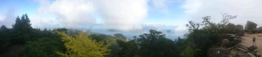
Clear Sky, 26°C
2 Chome-4-8 Ōmiya, Chūō-ku, Fukuoka-shi, Fukuoka-ken 810-0013, Japan
Day 14
Miyajima
Woke up. Packed up. Went downstairs. Torrential rain. Fuck.
Sun had been forecast all day for Miyajima. We checked the again. Miyajima... Sunny all day! With some trepidation we ventured out in our taxi to the station. We hopped on a train. By the time we got off near the ferry port the rain had died down and the sun was starting to shine. By the time the ferry was drawing near to the island the sun was out and we had a great view of the island.
Miyajima really was a sight to behold. We entered into a small built up area along the coast of the island, with various landmarks and quaint streets punctuated by a variety of street food stalls and host to (very tame) wild deer roaming free. We headed further into the (what I would describe as a) village and past an impressive five story pagoda up into Momijidani park.
The park was very beautiful, there were several bridges and waterfalls 📷 along the way. We started to see signs for a cable car that headed up the mountain. We didn't plan on taking it. We then also saw signs for a trek up the mountain. I opted in. Maddy and Ville were too lazy and opted to explore the village some more. We said our goodbyes, arranged to meet at 4pm and I headed onto the route up the mountain.
Bicep was my music of choice for the 2.5km trek to the peak. I would later find out that the trek was up an elevation of 500m. I took a reasonably fast pace up the initial slope, which then gave way to steps of ever increasing steepness. Initially the stream flowed next to the path, but later on ran down the steps that I had to follow. Spurred on by the music and the beautiful mountainous forest surroundings, I pushed on. I regretted leaving my Go Pro in my bag at the station.
After a good 50 minutes of uplifting climbing I reached what I thought was the peak. What a feeling. I took a couple of selfies with some shrines 📷 before noticing there was still a further 0.7km to the peak! Oops! My euphoria was wasted on just being near the peak! I pressed on and eventually reached the peak - stopping for a few more pictures, but ultimately disappointed by the lack of visibility.
I finally made it to the peak after around 60 minutes total walking - a lot less than the predicted 90 minutes. I came to the conclusion that Japanese liked to overestimate times because the theme park queue times also had been overestimated. I chilled at the top of the mountain for a bit on the observation deck, feeling accomplished, before I suddenly heard shouts of 'Sugoi!' (a Japanese exclamation) followed by several people suddenly jumping up to take pictures... The clouds at the top of the mountain were clearing and we could see the smaller islands and the mainland! It was a sight to behold 📷 and a just reward for my efforts.
I took a few more pics and started to head back down, stopping a couple of times to take more on the way. Eventually after I passed the cable car stop the amount of people on the path had died down. With that in mind I decided to half-jog down the rest of the mountain whilst listening to DnB...This was a lot of fun and thankfully my knee held out!
I arrived back near the park with an hour to kill before meeting the others. I noticed a sign denoting a Nature Walk up to a Nature Park... I wouldn't have time to go the whole way but I noticed a couple of other paths heading vaguely in the direction I needed to be. It would be a detour, but one I wanted to take as I didn't want my forest adventure to end just yet, and had some time to kill. With the Hospital Records Spotify Playlist on shuffle I headed up the path.
Immediately I noticed that this path was definitely less beaten and often a lot narrower than the path I had become accustomed to on the mountain trek. No worries. Consulting my Maps app I was encouraged by the fact that all the paths I had seen on the 'real life' sign were present on my GPS and my position was tracking well. I pushed on and made it to the spot where I had to turn off.
Turning off, I realised I had gained a fair bit of elevation again and could see across to the cable car heading up to the mountain 📷 . I decided to jog again. I could tell that no one had been this way for quite some time by the fact I was running through spider webs at a rate of one a couple of minutes! I'm not scared of spiders so just brushed them off and kept going. The combination of the music, the setting, the fact my knee was holding out and the weather made me feel absolutely free. It was incredible!
...Until the path stopped. I had time to retrace my steps and go back but being the stubborn bastard I am I decided to go 'off-piste' in the hope that I would join back onto the track shortly. It was around this time that my GPS stopped tracking quite so well. I pressed on, looking for less overgrown areas to pass through. The spiders webs were growing in size, as were the spiders inhabiting them. Eventually I realised that I wasn't going to rejoin the path, and that I wasn't going to have time (or necessarily be able) to rejoin the path I had left and make it to the meeting point in time. Drastic measures were in order.
I decided to take the as the crow flies route back towards the village, hoping I would find another path to join onto. Mistake.
Covered in sweat and spiders webs I headed deeper into the forest, down a small ravine, dodging spiders webs and slipping on treacherous ground along the way. At the bottom my feet got soaked in a huge puddle. I pressed on and began to climb up to the other side, every branch I grabbed or set foot on seemed to give way. Panic was starting to set in, but I managed to stay reasonably calm... If I could just make it up this slope I'd be able to see better. I made it to the top and thankfully there was a clearer area! Surely there would be a path here!
Nope. All I could see was seemingly insurmountable obstacles in the direction I needed to go. At this point the only option was to press on though as in terms of distance I was so close to the village. I struggled through, again avoiding more huge spiders, and trying not to think too much about the snakes and other wildlife whose habitat I was invading. Eventually I found a toppled tree that had cut a path for me. I started to walk down it. Too slippery. I slid along it feet first with my butt resting on it. It was slimy. I made it about half way down it and slipped! Thankfully this time the branch I was holding onto above didn't give way and I managed to drop down to the ground below.
Suddenly I could see a relatively clear way through the woods. I crossed a concrete block over a stream and came across a large group of deer who looked *very* confused to see a person coming from that direction. Not wanting to startle them I kept my distance and walked slowly past them - as I was still panicking it didn't cross my mind to take a picture of them - a shame, as it was a beautiful sight to see a pack away from the lone deer you get in the village sharking for food. It was at this point I saw it. A path!
After following the path for a short while, and stalking down some very steep steps; a very weary, dirty, scratched up and spider web covered Dave emerged from forest and back into the village. What an adventure, but not one I'd want to be taking again any time soon!
I headed to the meeting point along the coast and tried to get the worst of the filth off me before the others arrived - still managed to be 20 minutes early! We chilled for a bit there and took in the view before heading back on the ferry and train, picking up our bags and jumping on the bullet train to Fukuoka. I was very keen to arrive as soon as possible to our new digs and jump in the shower!
In Fukuoka we managed to navigate the bus, eventually, and arrived at our new hostel. We were greeted by a guy who insisted that the only way they could keep the money they had taken from Maddy's account as a deposit (the full amount of money for our stay!) we would have to cancel our booking... Else we'd have to pay again and Maddy wouldn't get the money back for a month! Sketchy!
I grabbed a shower, we grabbed some food in the local area and found the nearest 7-11 (essential in Japan for ATM and food!) before getting some rest with plans to have a much needed beach day the next day.
Powered by Journey Diary.
0 notes
Text
Saturday
home -> half moon bay -> home.
Last week after biking to Filoli, I decided that I would bike to Half Moon Bay next, because I’ve never been there, and it was a reasonable distance, and I could take my newly built-up road bike. Also I thought it would be nice to ride PH1 (depending on weather).
strava: there & back
snapchat story
playlist: (shuffled/repeated) in case anyone gaf
verdict: the weather was terrible. it was cold and gray and foggy and wet. PH1 was still pretty beautiful, but I stopped 0 times to admire it. I stopped at the closest beach which seemed fun, for the many people who showed up to barbecue, but I had no reason to be there, and the beach was cold. I also forgot to draw despite bringing supplies. The “downtown” of Half Moon Bay seems to have nothing. Would go again on a nicer day, and probably not alone.
packed: sketchbook + watercolors + pencil, bike lock, 1L of water, hat (in case sun came out)
wearing: tshirt (didn’t feel like wearing my jersey), new UA hoodie (excited to test it out), blue marmot windbreaker cuz it seemed cold, carbon38 tights that i’ve used and abused (wanted to wear bike shorts for the chamois but i don’t have leg warmers and it seemed cold (and it was cold)), converses! (because road bike has platform pedals and in case i wanted to walk around), bike gloves that are not even bike-specific gloves, and are falling apart because they are 5+ years old.
there:
1) fog af
2) going down skyline dr is like, the worst shit ever. no fucking idea how i ever did this brakeless. i was a true hero. lord.
3) literally no uphill suffering of any sort happened thanks to gears. once again, no fucking idea how i ever did this on a fixed gear.
4) everything up to pacifica was a breeze, and also familiar from last time.
5) road bike also started squeaking quite noticeably and i was not sure why.
6) got up to higgins, and saw a fuckin trail entrance?!??!!? and was like OMFG WTF?!!?!? I CAN’T DO NO DIRT!!!!! there was a group of mtbers and i asked them if it was advisable to go on this trail to get to half moon bay, and they said yes.
7) so i followed them on old san pedro mountain road which was this horrible terrain of cracked pavement and rocks and dirt until we split ways. they went to more trails and i continued on.
8) the climbing was not noticeable at all, either due to the fact that i was on the lowest possible gear, or because i was freaking out at every divot in the path, or both. also i was repeatedly thanking the lord that i did not attempt to do this last time (when i rode brakeless to pacifica).
9) after some point, i got to the downhill part of the road, which was INFINITELY MORE TERRIFYING!!!!!!!!!!!!!!! i was afraid to use brakes because a) i am unfamiliar with braking HAHAHAHA, and b) there was hella sand and gravel and i am afraid to do anything on that except roll through that shit without changing direction. also there was a lot less pavement/pieces of pavement, and a lot more patches of straight up dirt/sand/fine pebbles??? at this point i was invoking god's name, very much in vain, cuz the terror did not subside. (does it count as a religious experience if the experience makes you turn to religion?)
10) after a particularly harrowing section where it was ALL SAND/DIRT AND VERY STEEP (alright probably not that steep), WHERE I DID SOME SKIDDING BECAUSE I USED THE BRAKE WRONG OR MAYBE JUST NO TRACTION SO BRAKE DONT EVEN WERK WAT WHY, i encountered this couple who was very amused by my terror, who gave me directions and ensured me that there would be no more terrifying sections like this for the rest of the path.
11) i followed their instructions and eventually came upon highway. BLESS YOU, HIGHWAY DESIGNER. BLESS YOU, INVENTOR OF PAVEMENT.
12) from there it was smooth (literally) rolling to half moon bay.
13) gears are fun! i think i kinda got the basic gist of how to shift effectively.
hmb:
1) impressions of hmb: there is nothing here. i went to a bookstore and an antiques shop, found nothing of note, and then cruised the main street, where i found rich people and boutiques targeted at rich people.
2) however there was also a dunkin donuts nearby! very exciting. i got half a dozen donuts and ate 2.5 of them and then hit up this cafe that was on the highway (good, because it's not one of the rich-people-targeting businesses) and got a latte and spent a good deal of time solving a puzzle. felt dumb for not solving it faster.
back:
1) decided that i WOULD NOT!!!!! go back the way i came, so i took highway 1. pretty straightforward ride.
2) shifting down to the lowest possible gear is like, cheat mode x1000000, but it got me swiftly up the many turns in which there is no bike lane, so i'm sure the cars that i was blocking were happy about that.
3) the incorrect sizing and fit of this bike really came into focus when i was going through the tunnel (which i have previously driven through before, with emily!). the right side of my back was cramping up like crazy, and i wanted to stretch, but was afraid to ride no hands (this is why i need to practice this).
4) went down quite fast in the curvy bit between the tunnel and pacifica, which was less terrifying (but still scary). cars behind me were able to pass me without any honking. this pleases me.
5) riding through pacifica was good. no issues at all.
6) but then i came to skyline motherfuckin' drive. dude. how in the hell did i EVER do this brakeless. HOW
HOW
HOW
HOW
HOW
HOW
i dropped to lowest gear, and those 4 hills... man. i had to pause after hill 1 (arcadia), and then after hills 2 and 3. i was sweating so much after hill 1 that i wanted to take off my hoodie, but i was literally drenched in sweat, and was afraid i would catch a cold, so i took it off for a minute, and some guy in an SUV stopped at the stopsign and was like, are you trying to go up that hill? i can bring you up the hill if you'd like. i politely declined, and of course this made me feel quite indignant, which is why i did not take a break after hill 2.
it still wasn't as bad as going down (on the way to hmb).
anyway, after the hills, i had to go downhill, which was ok, actually! there wasn't much traffic and the fog had mostly lifted. there was a car behind me and it didn't even get close, so i probably made decent time.
7) skyline blvd: not bad. easy.
8) great highway: wanted to go faster but back was cramping up again. and bike was screeching a lot, so i mostly focused on evening my pedal stroke, which seemed to quiet it.
9) ggpark: some outsidelands foot traffic, but nothing too obstructive. biking up that tiny thing from lincoln to chain of lakes was hell, though. i went to 2nd lowest gear (refused to go to lowest gear because pride) because fuck it.
10) got home, it wuz gud.
also stopped by spoke easy to say hi and also see if they could diagnose the screeching. anson fixed it by tightening my QR levers.
other thoughts:
1) thank. god. i did not attempt this route brakeless. i cannot even describe the absolute terror i felt going through the dirt (this segment on strava is called Planet of the Apes).
2) how the FUCK did i do home -> pacifica -> home brakeless. HOW. HOW!!!!!!!! but also i think some of the segmenets took me super long, and this time it took a reasonable human amount of time.
3) this was only 60 miles but it felt longer. i've sweated so much that my shirt is transparent. and soaked.
4) super glad i got some donuts. yessssssss. dunkin donuts makes a fuckin' bike ride, yo.
0 notes
Text
Six of the Best Wild Camping Tips
1. If you’re going to be self-sufficient for several nights, weight will be key. Be ruthless when it comes to disregarding non-essentials (hair-straighteners aren’t often useful in emergencies) and co-ordinate what you carry with your companions – e.g. four small, differing "ouch pouches" could replace a heavy main first aid kit, take one cook-kit per two people, etc. Aim for a pack-weight limit of 15kg and definitely stay under 18kg.
2. Wear basel ayers made from natural fibres; ideally wool or bamboo. Cotton’s inability to dry quickly can contribute to hypothermia and it should not be worn. Synthetic basel ayers quickly fail the sniff test when worn for long periods, whereas merino wool and bamboo can be worn for multiple days without smelling like a wet labradoodle.
3. If you’re going to buy new kit for wild camping, spend money where the biggest weight savings can be made. An expensive titanium pot might shave 50g off your pack weight, whereas a lightweight tent might cut over 2kgs for the same outlay. Down sleeping bags tend to weigh half as much as synthetic bags of equal warmth and pack down to roughly half the size. Lightweight ¾ length sleeping mats work well and can easily be supplemented with clothing if conditions require it.
4. Freeze-dried meals are the only real option as you need at least one proper meal per day and wet foods (boil-in-the-bag or otherwise) weigh too much. Supplement these with high-energy, dry-mass foods and snacks (nuts, dried fruit, oat bars, etc.). Freeze-dried breakfasts and desserts can become expensive (up to £4 each) – for breakfast, pre-mix Ready Brek (or other instant oats) with dried milk powder and sugar and use supermarket instant custard as high energy desserts (10p each in some supermarkets).
Rice or pasta might seem like cheap alternatives, but 10-15 minutes cook time per meal will require a lot of gas. Pizzas are simply not an option.
5. As you can rarely rely on weather forecasts for trips that might last more than a week, using a clothing system based on multiple layers will allow you the flexibility to cope with all conditions. Anyone turning up in jeans or carrying an umbrella should expect to form the basis of the first camp fire.
6. If possible, try to avoid brightly coloured tents. You’d be making a good decision by looking into Vango tents. A group of four green tents would be almost invisible to the naked eye from a distance, whereas a group of orange or red tents would be obvious, lessening the wilderness experience for you and other trekkers.
3 notes
Wild Camping Tips
Tip 1. Location.
Locations can be defined by four interchangeable parameters. These are:
Sheltered
Windy,
Dry and
Damp
There is a further sub-category of Damp which is “Wet” and another division of “Wet”, which is “Underwater”.
Try to avoid “Wet” if at all possible but the choice between “Sheltered” and “Windy” is less clear-cut.
If your site is sheltered, you might get a lot of condensation. On cold nights, this will be white and will form a small but short blizzard when you nip out for a pee.
If your site is windy, there will be little condensation, but your tent will collapse at 3;00 am. It will not blow away because you are in it and holding it down. As soon as you get out, though, it will blow away.
A dry site may well become wet during the night. See the various categories of wet above. A wet site never becomes dry, however.
Tip 2. Putting up the tent.
Remove tent from tent bag bag. Assemble pole(s). Remove pegs from little peg bag.
Lay out tent.
Chase tent bag across the moor, catch it, put it in your pocket and return to site.
Chase tent across the moor and catch it. Have a bit of a fight with it, sustaining a slight eye injury caused by a flailing guy rope with one of those metal things on the end. Return to site.
Stand on tent (lie on it if very windy) whilst inserting a couple of pegs to stop it blowing away.
Insert pole.
Pull out all guy ropes and peg them down.
Take tent down and start again because the door is facing into the wind and the tent is filling up like a balloon and you’re in some danger of unplanned flight Go to (2) above
Tip 3. Settling in
Once your tent is up, locate your sleeping mat and, if it is an inflatable one, inflate it. Listen to sound of escaping air but fail to find the source. Watch mat slowly deflate.
Locate your sleeping bag and lay it out. Fluff it up a bit.
Find your stove and pot, stuff for a brew (e.g. tea), spoon or spork and water bottle.
Exit the tent and find the nearest stream of purest cold mountain spring water (a.k.a. raging torrent of brown stuff). Fill the water bottle without falling in, or letting go of the bottle. Examine the bottle for life swimming about in it, bits of vegetable material, lumps, scum, insects or detergent foam. Shrug if any of these are found since emptying and refilling the bottle will only increase the quantities of whatever it is you’ve found.
Start to boil up “water” for a brew
Doze off whilst waiting for pot to boil.
Wake up suddenly covered in scalding water.
Extinguish fire in tent porch.
Go to (4) above.
Tip 4. In-tent entertainment.
Snuggle cosily into your sleeping bag and plug your Ipod into your ears
Listen to Abba’s Greatest Hits whilst imagining you hear strange noises outside. Notice inner tent is dancing around unusually.
Listen to the wind thundering towards your tent and watch the pole(s) bend violently at each vicious gust. Imagine strange noises outside/wonder if the tent will stand up to the oncoming onslaught. Decide it will. Then not be so sure. Repeat cycle whilst pretending to be unconcerned.
Doze off.
Wake up suddenly thinking that you’ve heard strange noises outside and/or wondering whether not you left the grill on this morning and/or that your bladder is full and one side of the tent has collapsed in the wind and water is pooling by your head.
Exit tent dressed only in thermal undies. Replace all the pegs, and arrange a small cairn of rocks on each guyline to hold them down.
Chase sleeping bag across moor.
Plan escape to nearest Bed & Breakfast, using GPS to plot the route.
Phone nearest B&B and go there immediately or go to (3) above. (You lost the ipod chasing the tent across the moor)
5 notes
Day Hiking Tips and Safety
For outdoor lovers the world over, day hiking is at the top of their lists for preferred ways to spend the day. Whether you’re a weekend warrior or serious backpacker, there’s something to be said for taking time out from contemporary life’s ultra-fast pace to get back in touch with nature.
Heading out to the trails for the day brings with it many implicit benefits. Of course, there is the obvious fact that day hiking is a fantastic workout and quite enjoyable for nature enthusiasts. But it can also provide you the opportunity to enjoy the outdoors with your family or significant other. Whether you’re trying to find some time for just yourself and the outdoors, or attempting to make time for the most important relationships in your life, day hiking is a great way to achieve either.
It’s important to note that a good day hike requires a few necessities. Without them, a fun day in the outdoors can quickly take a turn for the miserable. Below are the key essentials that all day hikers – from beginners to seasoned veterans – should be familiar with.
Proper planning is important. Obtain trail maps, guidebooks, trail distance, estimated time required and any other information before you leave on a hike.
Keep trail maps and guidebooks in a waterproof ziplock bag.
Consider using a GPS.
Check weather conditions and forecast.
Consider the ability level of everyone in your group, when choosing a hike.
It’s very important to tell someone of your plans and when you expect to return. In an emergency, this could help with the rescue. Check in with them when you get back.
Never hike alone. Always go with a friend.
Don’t pack to heavy.Keep your pack weight as light as possible.
Take plenty of water – 2 or 3 quarts per person. Staying hydrated will help maintain your energy level.
The temperature is always cooler in the mountains. Plan and dress accordingly. Dress in layers.
Start early so that you have plenty of time to enjoy your hike and the destination. Plan to head back so you finish your hike well before dark.
Hike only as fast as the slowest member of your group.
Pace yourself. Don’t hike too quickly. Save your energy.
Stay on trails unless you have excellent navigational skills.
Never approach wild animals. They may look cute and harmless but they are very unpredictable and can be very territorial and protective. Always be alert and aware of your surroundings. In most cases, the animals are more afraid of us and will run away. Do not attempt to feed wild animals. Most injuries occur when people try to feed them.
Look out for snakes, spiders and other critters. Watch where you are walking, be careful when picking up sticks or rocks and look around before taking a seat. Again, snakes are usually more afraid of us, but if they feel threatened or if you make sudden movements they may strike. Stay calm and slowly move away from them.
Be careful where you are walking. Watch out for low branches and loose rocks. Take it slow through mud and water and be careful of loose leaves on the trail. Stay away from steep cliffs and other drop off areas. Look out for brush with thorns and learn to identify poisonous plants.
Keep track of your progress on the map so that you know where you are at all times.
Take turns leading and following trail markers. Share decisions.
Pack high energy snacks like granola, energy or fruit bars, gorp trail mixes, fruit, candy, beef jerky, bagels, or pita bread, etc.
Don’t drink soda or alcohol when hiking. They will dehydrate you.
Use a purification system for water from a natural resource.
For blisters or hot spots use moleskin or bandages immediately to stop further damage and to relieve pain. Keep your feet dry – change socks often.
Hiking sticks or poles may help make your trip a little easier by giving you some stability on wet trails, and reducing strain on your legs when going up or down slopes.
Be aware of your increased exposure to ticks when hiking in the outdoors.
Protect yourself against other insects such as bees, ants, mosquitoes, flies, etc. Not only can they be annoying, but they can cause quite a bit of pain and discomfort. Many people have severe allergic reactions to their bites and need to carry necessary medical supplies or seek medical attention. Again be aware of your surroundings. Refer to Keeping the Bugs Away for more details.
Bring a whistle on hikes. Three short whistles mean you are in trouble and need assistance.
Learn to identify the many things you will discover as you hike.
How to Pack a Food Bag
One of the secrets of successful backpacking is learning how to become extremely organized and to stay organized throughout your trip. That might sound obvious but it’s actually a skill that requires a lot of practice and the development of a set of rituals that you can “do in your sleep”, regardless of the weather or your level of fatigue.
Packing a Food Bag
Take your food bag for example. How easy is it for you to get out a snack? Do you find yourself stopping and unpacking your entire food bag each time you want to make a meal?
While this may sound like an insignificant inconvenience, random food bag organization can lead to skipped snacks or delayed meals that can have a significant performance impact on your ability to put in long days or high miles. It took me a long time to understand the relationship between good food bag organization and my daily caloric intake patterns, so here’s some advice on food bag organization that you may find useful.
When I pack my bear bag at home, I first divide all of my meals into 5 piles: breakfasts, lunches, dinners, snacks, and drinks.
I put each pile into it’s own plastic bag. I find that the best ones to use for this purpose are the plastic bags that I get from the dry cleaners that wrap my folded dress shirts.
I place my backpacking towel, bear bag line, and mesh sack at the bottom of my food bag.
Then I insert my O.P. Sack into my bear bag and place my long handled titanium spoon and tooth brush along the inside, propped up vertically for easy access.
Next, I put the 5 bags of food into my O.P. sack, one by one, so that the meal or snack that I want next, is positioned at the top of my food bag. After, I’ve eaten something, I reorder the bags as required, so that food breaks can be kept short if I want to get going again.
I always carry my food bag on top of the other gear in my backpack so that it’s easy to access during the day.
What nice about this system is that I’m always aware of exactly how much food I have left during a trip, because all of the same types of meals are organized together. It also makes choosing which one I want to eat a lot easier because they’re all grouped together. Before I organized my bear bag this way, I found that I had to always fully unpack and repack my bear bag each time I wanted a snack or to make a meal, and I never knew exactly how much food I had left because it was all dumped together.
Source: Six of the Best Wild Camping Tips
0 notes
Text
Hitting A Wall In Zion
[all photos by Matty Van Biene]
[NOTE: 2020 is the tenth year of my blog at Semi-Rad.com, and since I started it, I’ve been fortunate to get to do some pretty wonderful adventures. Throughout this year, I’ll be writing about 12 favorite adventures I’ve had since I started writing about the outdoors, one per month. This is the fifth in the series. The other stories in the series are here.]
The Zion Canyon Shuttle bus driver slowed in the middle of the road on our way back down canyon, the headlights illuminating three guys in their late 20s or early 30s standing on the side of the road in the dark. The driver opened the door and they stepped onto the bus, looking dirty in climbing harnesses, helmets, even knee pads, and some other gear. My then-girlfriend and I, riding the bus back to town after an evening stroll on the Riverside Walk, looked toward the front.
“What route were you on?” the driver asked the three guys.
“Spaceshot,” one of the guys said. “We just fixed the first couple pitches, so we can come back and fire it in the morning.”
It was my second time ever visiting Zion National Park, and I was aware that people climbed the steep red-and-black sandstone walls. I had started trying to learn to climb myself, outdoors, in Phoenix, with mixed results: I was terrified of it, didn’t trust my feet, overgripped everything, and enjoyed it maybe 40 percent of the time, maintaining a state of near-panic the rest of the time. I understood a little bit about how the rope and climbing gear worked, in my five or so times going climbing so far. But on the bus in Zion, I had no idea what these guys were talking about. Or why they were wearing knee pads. And I must have been staring.
“Do you want to ask them for their autograph?” my then-girlfriend asked me. I laughed. She had less than zero interest in rock climbing, and I was just starting to become very excited about it, the beginning of a fixation that would last almost a decade, and would outlast our relationship. If I looked very interested in what those guys were doing, it’s because I was interested. Clueless, but intrigued, I wondered if I’d ever see Zion Canyon from up on one of those walls someday. I would come back to Zion a half-dozen times over the next eight years before it actually happened.
—
In early 2013, a Prescott College student named Ethan Newman wrote to me, explaining that he had picked up a minor in nonfiction writing in hopes of finishing his degree—a process that had a little hiccup in it since he’d left Prescott to live in Springdale, Utah, just outside Zion National Park. He wanted to know if I could provide a little insight into the world of outdoor writing? I said sure, I could tell him what I knew, but I wasn’t convinced I knew very much.
We chatted on the phone a few times, emailed back and forth, and eventually I became an official long-distance mentor for Ethan in an independent study he would title “writing for magazines.” He said the college would pay me a small stipend, and I replied “Maybe instead of payment, you can winch me up Moonlight Buttress sometime this spring.”
I was living in a van at the time, and came through Springdale quite often, having fallen in love with the canyon, and also having befriended Scott and Heidi, the owners of Deep Creek Coffee, who didn’t seem to mind when Hilary and I bought coffees and breakfast sandwiches and then loitered in the coffee shop for another hour or two trying to catch up on emails and write stories. Ethan was a Deep Creek regular (and friend of Scott and Heidi), and it wasn’t long before we met in person. He had a big smile, red hair and a beard, was personable (he worked as a canyoneering guide) and thoughtful in conversation.
A year and a half later, Ethan had gotten some writing published by a few climbing websites, had recorded a Dirtbag Diaries podcast about the time he lived in a cave outside Bishop. We pitched a story about Zion climbing to Climbing magazine, with the idea we’d co-write it—my half from learning to aid climb from Ethan, and Ethan’s half about teaching me, as well as some of the history of aid climbing in Zion. October 2014 found Ethan teaching me to jug a rope in the garage of the house he rented at the western edge of Springdale.
The morning of our first climb, we popped our shoes off, rolled up our pant legs, and waded across an icy-cold but only ankle-deep Virgin River toward the shaded west face of Angels Landing toward the base of the route, Prodigal Sun. I’d walked across the top of the formation many times before on Zion’s most famous hiking route, hanging onto the chains for support. I had wondered where the climbing routes topped out in relation to the Angels Landing hike, and with some luck, now I’d find out. Our plan was: Ethan would lead the hard pitches, I’d lead as many of the easy ones as possible.
On my first lead, I tried to remember everything Ethan had said while I fell into the rhythm of the sequence: eyeball the crack above me, look down at the 30 cams and 25 nuts on the gear sling, pick one, place it in the crack. Yank on it a little bit to make sure it’s solid. Clip one of the two daisy chains attached to my harness to the cam, gently weight it, then transfer all my body weight to it. Bounce up and down to make sure it stays in place, but don’t look at it in case it pops out (much better to have it snap into the top of your helmet than into your eye), bounce, bounce, bounce harder. Clip an etrier—a ladder made of fabric webbing—to the cam, and then step into the first step, then up to the next step, then the next step. When the cam you placed is even with your waist, grab the fifi hook attached to your harness and hook it into the cam so you can lean back and inspect the crack above for your next placement. Repeat process.
If I had told most rock climbers I was headed to Zion to learn to aid climb, I think most of them would say, “Why?” Aid climbing is slow, a lot of work, and definitely isn’t the sexy rock climbing most people think of (shirtless, balletic, athletic, graceful). Aid climbing is more like shoveling gravel for a whole day, an hour or so at a time, with breaks while your partner is leading. Ethan told me not to bring climbing shoes, because we wouldn’t be doing much free climbing, and not to wear new shoes either, because they’d get destroyed when I jugged up the rope behind him. I explained it to my mom as “the way most people climb El Capitan—you climb pulling on the gear, not on handholds.”
A few hundred feet up the wall, looking down at the Virgin River and the road snaking along the floor of the canyon, though, I was pretty convinced it was more rewarding than shoveling gravel. When Ethan led pitches, I sat suspended at belays, my harness digging into my legs and hips. I stared at the deep burnt red sandstone in front of me, looked up to see how much progress Ethan had made, looked over my left shoulder down canyon, up canyon the other way, thousand-foot-high walls in every direction, just hanging out with some birds, noting the occasional gentle breeze.
When it was my turn to lead, I tried to be efficient in my movements, placing each cam or nut as high as I could above my head, then climbing my etriers up to it, stepping as high as I could before placing the next piece. When I stood in the etriers and jugged up the ropes following Ethan, the toes of my shoes scraped the wall. At the hanging belays, my weight was split between my harness and my feet splayed out on the wall. Occasionally I’d pull my feet away and rest with my knees pushing against the wall, just for a few seconds—I could see why the guys I had seen doing Spaceshot back in 2006 had worn knee pads.
Ethan and I switched places a couple times, and the sun made its way across the sky, lighting the canyon walls in deep morning hues, then harsh blown-out midday tones, and then the soft, warm glow of the golden hour. We had hoped to finish the route before sundown, but it was dark when we entered the last pitch, a low-angle chimney full of sand and loose rock to the top of the formation. We found the now-deserted Angels Landing trail and descended, our headlamps lighting the dark path all the way down to the river.
—
We wanted to do one more route, with an additional, probably unnecessary objective: spend the night halfway up on a portaledge. In a few years of climbing, I had done almost everything I’d wanted to: sport climbs, trad climbs, alpine rock routes, ice climbing, snow climbs, and a bit of ski mountaineering. But I had never spent the night on a big wall—and from all my times riding the Zion shuttle bus, I had heard more than one bus driver tell passengers, “Some climbers say they sleep better up there than they do at home.” We picked Lunar Ecstasy, an 1100-foot route on the Moonlight Buttress formation, just to the left of Zion’s most famous climb, for which the buttress is named.
We packed gear into a couple haul bags, ordered a pizza from the Zion Pizza & Noodle Co., and carefully put it into plastic bags, hoping it would survive the first four or five pitches of climbing mostly intact.
It was late morning when we finally got to the base of the route, again crossing the river. Our friend Matt was to join us for the first few pitches to take photos, and then he’d rappel off and come back in the morning to hike to the top, rappel in and shoot photos of us on the route’s upper pitches. I racked up and led the first two pitches, mostly free climbing and then some easy aid climbing to the top of the second pitch. I handed the gear over to Ethan for him to get us to the top of pitch four or five, wherever we’d set up the portaledge for the night. I could rest sort of easy, except I had to lead the final two pitches of the route sometime the next day. And I had found out that the final moves of the route were now missing a bolt, which would make it a little more adventurous for me.
We stopped after pitch 4, setting up the portaledge and eating cold pizza that had retained some of its original shape and most of the original flavor as well. Matt decided he’d go ahead and just stay with us on the portaledge, which was designed to hold two people fairly comfortably, and I guess three people less comfortably. We wedged ourselves in head-to-foot, 500 feet above the canyon floor, and I’ve certainly had better nights of sleep, but I’ve also had worse nights of sleep.
We woke shortly after the sun popped over the eastern rim of the canyon, ate cold breakfast burritos, chugged cans of coffee, and started packing up. Matt rappelled down so he’d have time to run over to the Angels Landing trail, hike up, and rappel down again to shoot photos, and Ethan started up the fifth pitch. I settled in for a long day of belaying, watching the buses putter up and down the road below.
Every once in a while, a bus would slow down in the middle of the road, sometimes even stop, and I was sure the bus driver was pointing out climbers up on the walls above. Probably us, a climber in a blue shirt and orange helmet, and a climber in a red shirt and white helmet. Crawling up the wall. Probably almost none of the passengers knew what route we were on, maybe none of them knew anything about rock climbing, but in Zion, climbers are part of the wildlife, like the elk and bison of Yellowstone. I thought about that bus ride back in 2006, when I was a passenger who didn’t know what Spaceshot was, or what fixing ropes meant, or why one might wear knee pads up here. I just thought it looked cool. And, eight years later, it was cool. It was better than I imagined, sitting at a belay with a few hundred feet of air under me, Ethan methodically snaking his way up a finger-wide crack in a thousand-foot-high wall above me.
We inched our way up, the first three pitches taking longer than I’d hoped, as I kept checking my watch, doing the math of how many hours and minutes of daylight I’d have to lead the final two pitches to the top. Ideally, I’d have four hours, which would be plenty of time. Sometime in the afternoon, it became clear there was a really good chance I’d be doing at least part of it in the dark. Still, I hung onto some hope.
I had found my way into rock climbing through sport climbing in 2005, arguably the climbing discipline with the lowest barrier to entry—aside from bouldering, which only requires shoes, chalk, and a crash pad. All I needed was a pair of climbing shoes, a harness, a belay device and a locking carabiner, some quickdraws, and a rope (or a friend who had some quickdraws and a rope). I learned the mechanics of the safety protocols, then rushed into climbing as hard as I could, without bothering to train or get better before I tackled harder routes. Then I met a friend, Lee, who taught me how to place trad gear, and before long, I had cobbled together a set of cams and nuts, and was finding routes that scared the crap out of me, and even made my way to a few dozen technical routes in the mountains in Colorado, Wyoming, and Arizona, and eventually the Alps. I put together a decent-sized life list of routes I’d climbed, but never got to the point where I was confident and could get through a challenging route without debilitating fear.
In 2012, while climbing on Utah’s Castleton Tower, a young man fell and decked, landing head-first right next to me on the belay ledge at the top of the first pitch, immediately twisting into a seizure before losing consciousness. My friend Chris and I spent the next six hours helping facilitate a rescue. The climber, Peter, made a full recovery, but the image and sickening sound of him hitting the ledge stuck with me. I never dealt with it psychologically. I kept climbing, not admitting that the fire in me had dimmed. I couldn’t imagine not climbing. Lee and I wrote a climbing guidebook, covering trad routes up to 5.8+ in Colorado’s Front Range, and it was fun, but after pulling the crux move while leading the hardest route in the book, I felt relief and exhaustion, not joy.
So Zion was either going to re-light my fire, or be my last big rock adventure for a while. I didn’t know which.
—
Ethan had convinced me to bring a little bluetooth speaker with us, to make the long hours at belays less tedious. The purist in me cringed, not wanting to take music into the cathedral of Zion Canyon. But eventually, I realized no one else above or below us would hear the music, so I played a chunk of The National’s High Violet.
At the top of Pitch 6, Matt yelled down from above us, hanging off his rappel rope and shooting photos. The top was only 400 feet away, but still several hours. Ethan started up Pitch 7, home of a giant flake called The Amoeba that is somehow still attached to the wall but strikes fear in the heart of everyone who climbs past it. Ethan led, having a private, very tense moment as he passed the Amoeba, wondering if he’d be the one to finally dislodge it (and/or the loose blocks of rock resting on top of it) and watch it fly down the wall directly onto me below. Thankfully, it stayed put. Still, when I looked up at the wall above, I found myself ready for it to be over, not jealous that I wasn’t leading the best pitches of the climb.
At the top of Pitch 7, I took the gear from Ethan as the daylight started to wane. I hurried through the next pitch as much as possible, hoping to minimize the amount of climbing I’d have to do by headlamp, knowing it was futile but trying anyway. I started up the final pitch by headlamp, dreading the missing bolt and the idea of trusting my body weight to an inch-long metal hook sitting on a nubbin of sandstone somewhere a hundred feet above me.
The buses had stopped driving up and down the canyon, and our two headlamps were the only visible lights in the canyon, a dark abyss below us. We were completely alone. I worked my way up the wall, up a curving crack and an overhanging arete, leaning backward and clinging to the wall with tired arms. The wall went back to vertical, and the crack petered out. I rounded a corner and couldn’t see Ethan anymore, but could hear voices coming from the bluetooth speaker. I was sweating, searching for gear, working through my fear in a little dome of headlamp light, an ant on the side of this huge wall, and Ethan was enjoying a podcast down there.
Ten feet from the anchor bolts at the top of the route, I found the section where the missing bolt would have vastly improved the safety of the climbing. Alas, it was still gone, just a rounded hole in the sandstone where it used to be. Someone online had said something about “one hook move.” I searched the rock above with my fingers, blindly hoping for a nice lip to hang a hook on. I found something decent, delicately placed the hook over it, clipped an etrier to the hook, and gingerly weighted it. It held. I carefully climbed the steps of the etrier, looking above for another spot for a gear placement. Nothing. I fished through our gear and found the other hook we’d brought, and found another lip, then repeated the process again. I could see the anchor bolts, but it was still at least one more move to them. Another hook placement.
I felt around again, thinking about how far my last cam was beneath me, what it might feel like if this hook placement popped free and I fell 20 feet into the dark before the rope caught me, how much of a bummer it’d be to have to re-climb this section again, and if the pizza place would still be open by the time we got down, and I found a decent crimp for the last hook. I clipped an etrier to it, stood up on it, reached high with my right hand, clipped a quickdraw to one of the anchor bolts at the top of the route, pinched the rope through it, and topped out. I called down to Ethan, he whooped back, and I started hauling our bags up, awash in relief.
We pulled off our harnesses and gear, re-packed the bags much less carefully , shouldered them, and started to hike down the paved trail, 1,400 feet to the canyon floor, back at Ethan’s truck in just over an hour.
Somewhere during that long afternoon of belaying Ethan while he led us up the steep pitches of Lunar Ecstasy, the wall towering over my head gave me pause, and put me in a spot to think a lot about climbing. I had been fortunate to do a lot of things, and climbed several hundred pitches all over the west and a few in Europe, and I had still never gotten that comfortable with it. I had been anxious about climbing since the day I started doing it, and over the past year I’d been having more anxiety than fun. Maybe it was time for a break. I told myself I’d take some time off after our Zion climbs, and I did. More than a year passed before I roped up outside again, and I still haven’t quite gotten back to it with the fire I had in the first years I was climbing. A year and a half later in Spring 2016, Ethan followed his first byline in Climbing by writing the Mountain Profile for Alpinist Issue 53, an extensive feature article that went far beyond anything I would have thought possible when a random college student with hardly any experience emailed me out of the blue three years prior. When I got the issue in the mail, I sat down with it and realized I was more proud of Ethan’s story than any magazine piece I had written myself. I still think I got the better end of the mentorship deal, with Ethan enabling my almost decade-long dream of climbing a big wall in Zion—even as white-knuckle as it had been.
The day after we walked off the top of Lunar Ecstasy and plodded down the trail with our heavy haul bags, I again found myself on the Zion Shuttle bus, taking an easy day in the park with my girlfriend and future wife. As we pulled up to the Big Bend shuttle stop, I looked through one of the roof vents, and spotted a pair of climbers headed up one of the walls. I snapped a quick photo with my phone, because I still thought it looked cool.
—Brendan
Thanks for reading.
If you’d like to help keep Semi-Rad going, forward this piece to someone who’d like it, consider making a Patreon contribution, check out the Semi-Rad Shop for t-shirts and other fun stuff, or buy one of my books.
The post Hitting A Wall In Zion appeared first on semi-rad.com.
0 notes
Last Seen Blogs

sayyadarshi-blog
Untitled

bo-gia-tran-thanh-dad-im-sorry
Untitled
deep-space-elf
Deep Space Elf

l3iide
✧LEIDE✧

lilyleighdevic
Lilyleighdevic.