#contextualmaps
Explore tagged Tumblr posts
Visit Tumblr Blog
Explore Tumblr blogs with no restrictions, modern design and the best experience.
Last Seen Tumblr Blogs


Fun Fact
Tumblr Inc. has $15.1M in annual revenue.
Photo
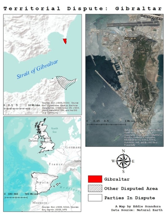
Political geography is widely known as one of the main linchpins of human geography, focusing on concepts like colonization, importance of borders, territoriality, nation and statehood, the political organization of space, and geopolitics. I read about how the town of Gibraltar was captured by the British during the Spanish War of Succession and today is a disputed territory between Spain and the United Kingdom. The British regard the town of Gibraltar as an overseas territory, yet the Spanish have a problem with that because it is on their soil and they believe that they have every right to assert political power and control over the area. I used my training in Geographic Information Science by collecting data from Natural Earth, creating a contextual map of Gibraltar and displaying the disputed territory in three different frames. The top left visualizes the relative location of Gibraltar to Spain and Morocco as well as the strait. In the top right I used a satellite imagery base map to show the exact location of the town. And in the bottom left I used a World Terrain Base map to show western Europe and Northern Africa, and outlined the two parties in dispute: Spain and the United Kingdom.
Territorial Dispute: Gibraltar
Map completed: March 15th, 2018
A Map by Eddie Scandura
0 notes