#crosscontinentalroadtrip
Text
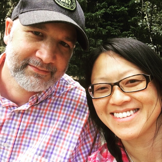
Days 54 to 57: We Made it Back (Again)!
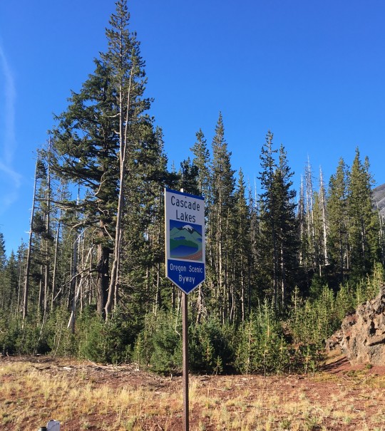
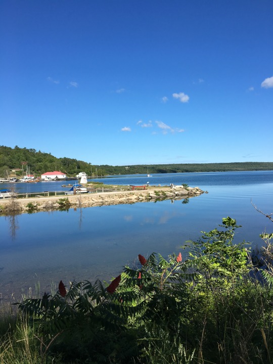
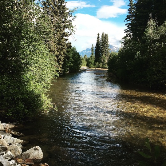
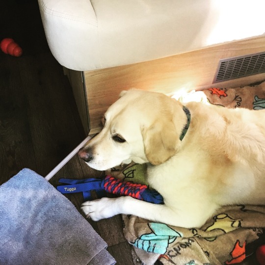
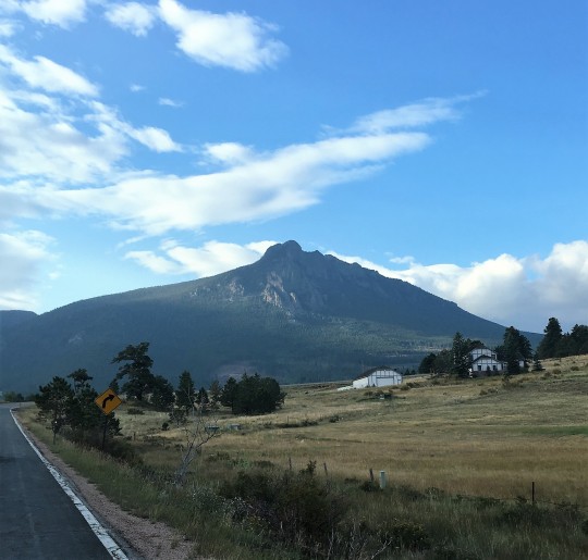
We woke up to a full parking lot outside Lowe’s and unlike boondocking at a Cracker Barrel, there was no breakfast waiting for us inside. So we headed back to downtown Bend to find a coffee shop. We had coffee and breakfast sandwiches at Thump Coffee and walked along the river and around downtown a little. However, because it was so early, nothing was open. We did spot a few shops that we would like to visit, so we decided to take a drive to Mt. Bachelor to check it out and kill some time.


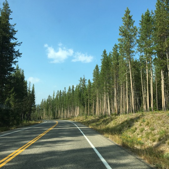
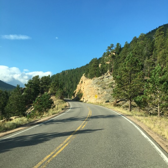
Because we didn’t really do proper research about Bend when we decided to reroute here, we didn’t realize that Mt. Bachelor Ski Area is actually within the Deschutes National Forest and that it is very close to town - we would probably have boondocked in the national forest instead. But now we know! It was a very pleasant drive through the ponderosa pine forest was we saw a few random campers amongst the trees along the way.
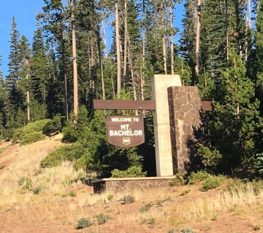
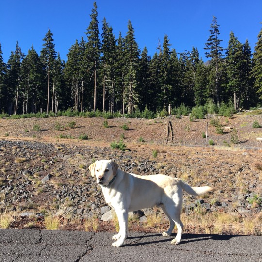
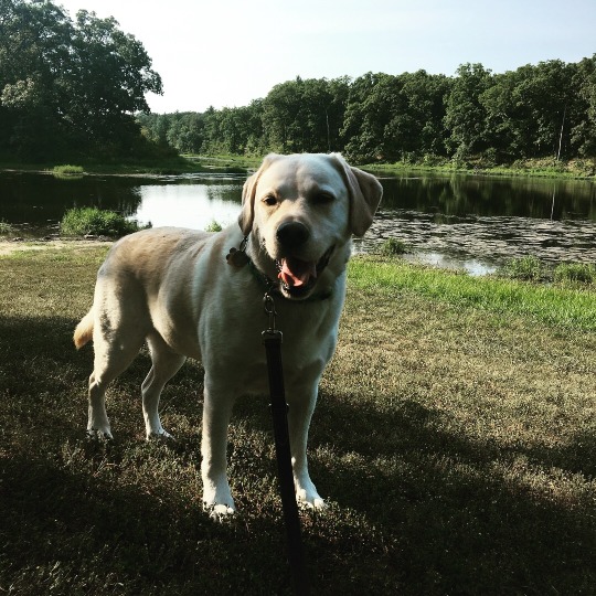
After a quick stop at the day lodge at the top, we decided to find an area to let the pup out and go for a brief walk. The driveway to another day lodge was closed to traffic, so we parked the van on the road and walked Gimli off-leash on the driveway - he was definitely happy to be out running around!

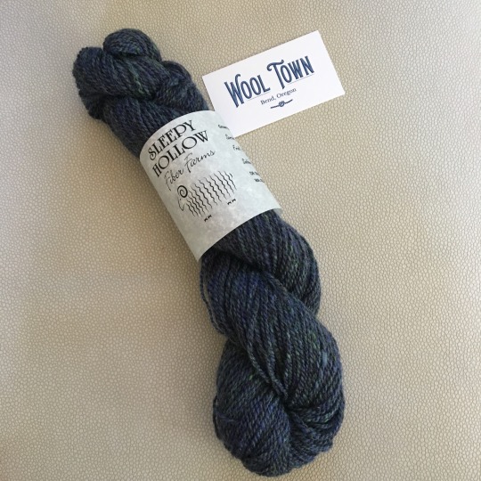
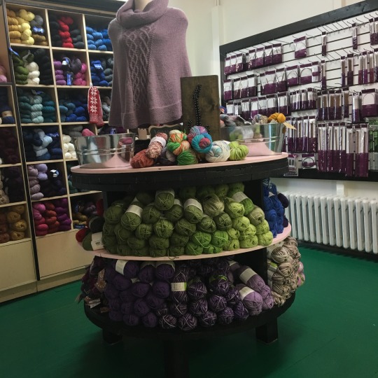
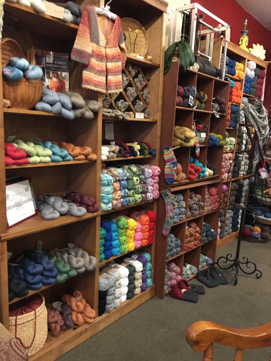
We returned to downtown Bend just as shops were opening and our first stop was a relatively yarn shop, Wool Town. I heard that a yarn shop that has been in Bend for a long time closed recently and the owner of Wool Town told me that both she and the owner of another new yarn store in town saw the opportunity/niche and got in the market about the same time. It was a cute store and I got a skein of Shetland-BFL blend from local sheep. This was the final yarn shop stop of this trip and I am quite happy with the stash I have acquired!


We also discovered Lone Crow Bungalow, a home décor and gift shop, which was full of Craftsman-style items that were totally our style. I spotted a cushion depicting two Labs, one yellow and one black, that were so much like Gander and Gimli that it brought tears to my eyes! I just had to get it!! They also have a collection of very nice Craftsman-style clocks; after a bit of back and forth, we finally decided on one that displays a tile with a classic Frank Lloyd Wright design.

We spent the rest of the morning wandering in and out of various stores and then it was time to hit the road! We were heading to our last stop before home: South Beach State Beach on the Oregon Coast. We drove past the cute tourist town of Sisters and through Deschutes and Willamette National Forests.
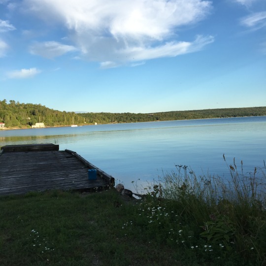
As the ponderosa pine gave way to Douglas firs and big leaf maples, I knew we have hit the coastal forest and I felt almost at home! South Beach State Park is just outside of Newport and with a relatively busy port and the fog that never seemed to lift over the few days we were there, there was the constant background sound of the foghorn. It was a busy campground but our site was spacious and dogs were allowed to run off-leash on the beach, so it was a great spot to park ourselves for a few days before we get home - plus we can now truly claim that ours has been a coast-to-coast road trip!


We spent the next couple of days just walking Gimli on the beach (he did not seem keen to go in the water, which was just as well, because a salty sandy dog would not make a good “roommate” in the van) and lounging by a campfire. It was good to not drive at all for a couple of days! (And because we did not plan to drive anywhere or explore Newport, we didn’t realize that Rogue Brewery HQ was just outside of the park!!)


We decided to not take the highway along the coast to get home and just get on the Interstate 5. The drive was quite unremarkable and, as expected, we came across traffic near Tacoma. We got home in the early afternoon and had the rest of the day to unpack the van and reacquaint ourselves with our house! As much as we have enjoyed our time on the road, it was good to be home. And of all three of us, I think Gimli was probably the happiest to be back - he did the zoomies the moment he got in the yard and rolled around on the grass.


There you have it. Bilbo, the van, took us on a 15,000-mile cross-continental road trip, covering 10 Canadian provinces and 17 American states, meeting up with 6 groups of friends in Canada and 3 groups in the US, and visiting 6 Canadian National Parks, 6 American National Parks and countless number of provincial/state/municipal parks. (Yes, our route is shaped like an anteater!!)

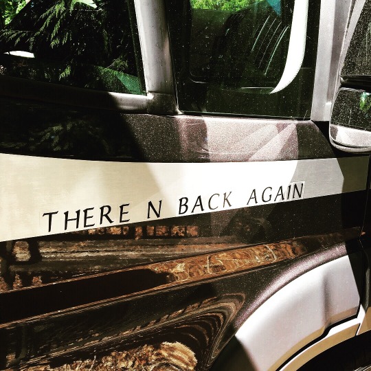
We made it there and back again!
#crosscontinentalroadtrip#roadtrip2018#bilbothevan#thereandbackagain#labradorable#vanlife#campervan#hymeraktiv
1 note
·
View note
Text
Day 13: Chilling Out in Kagawong
Today was our first non-driving day since we began the trip 12 days ago and it felt good not having to pack everything up in the morning! We slept in as much as Gimli would allow us (!) and took a walk through the village. We stopped at an antique shopped that was set up in a garage of a beautiful old house and had coffee and treats at Chocolate Works (I have to refrain from calling a brownie with coconut shavings or a chocolate macaroon breakfast).
Wednesday is Market Day by the Kagawong Basin Marina, so we had the opportunity to check out some of the wares from the local artists and vendors. The first stall we came upon was one that sells watercolour prints of local scenery. We were looking at them and commented that one of them looks like the view from Steve's house. The artist, Jenna Carter, looked at the print we were referring to and told us that she knew Steve and was one of his karate students! She then told us that there was another painting with his house in it, so of course we had to get that one! We later walked to the spot where the painting was done and took a photo of it!


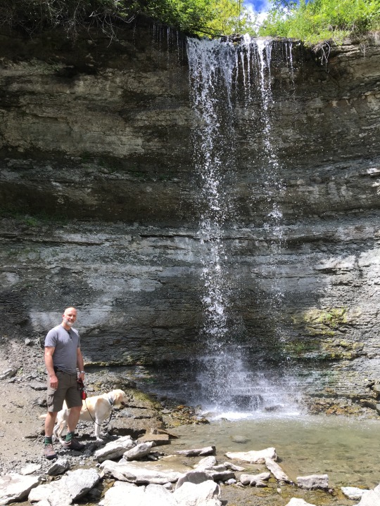
We then took a short hike along the Kagawong River, through a northern white-cedar forest, to Bridal Veil Falls. It was a relatively quiet on the trail, so it was surprising to see so many people at the falls - there was a parking lot at the top, so many people just drove there and then go swimming under the falls. We made our way from the crowd and stopped at Wild Creations, a gift store that sells merchandises with original print designs. The artist for one of the series told us that she was planning to complete designs for 30 Canadian animals and decided to do one in the shape of Manitoulin Island - and that was the sticker we bought.


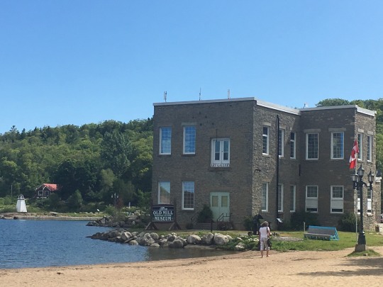
After having lunch at a pulled pork sandwich stand, we visited the Edwards Art Studio, an art gallery located on the second floor of the Old Mill. There are original works of stained glass, fused glass, ceramic and textile pieces as well as paintings and serigraphs. We were particularly taken by a series of serigraphs that has a Craftsman-style feel to it, and the price was quite reasonable considering that they are original works and framed. However, once again, it is not practical for us to take it with us for the rest of the trip, so I think we might make an online purchase when we get home.

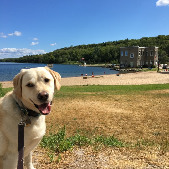
Gimli played fetch in Lake Huron for a while and the rest of the afternoon was spent relaxing in the sun/shade - it was too hot in the sun but I felt cold in the shade when the breeze picked up! But overall, the weather is pretty perfect!


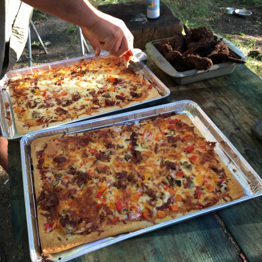
Later in the afternoon, another one of Dan's karate friend, Dean, drove for two hours to see us and to hang out - there was a lot of karate shop talk or reminiscing going on. He brought a selection of local bears from the Manitoulin Brewing Company. I tried the Swing Bridge Blonde Ale and the Bridal Veil Pale Ale, both of which were really good! Steve made pizzas and his friend, Matt, brought chicken wings. I have just given Steve some honey from the UW farm and Matt decided to make honey garlic wings! And lo and behold, I also have some freeze dried garlic in our little kitchen, so we made our small contributions to the meal! Good times were had by all!


We will be taking the ferry tomorrow and heading to Kitchener - we will be one step closer to getting Bilbo to the factory for some warranty repair and, hopefully, have our battery situation sorted out once and for all! Until then, good night from Kagawong, Manitoulin Island, ON.
Check out our route on Roadtrippers!
#crosscontinentalroadtrip#roadtrip2018#bilbothevan#thereandbackagain#lakehuron#thegreatlakes#labradorable#manitoulinisland#vanlife#campervan#hymeraktiv
2 notes
·
View notes
Text
Day 42: Happy Campers!
I can hardly believe that today was the end of week 6 of our adventure! It has gone by so quickly while the early days seem so long ago! We started the day with getting our water hose connection fixed! Yay! The people at I-90 RV & Auto were great and not only did they replaced the broken plastic water hose connection with a copper one, they also replaced the low-point valve (which was apparently not working, but we didn't know because we have not used it), rotated the hose so that it has more clearance, zip-tied it to stabilize it, and bent and tied the heat shield to prevent it from rubbing the hose. All these were done under warranty - couldn't be happier to have a problem fixed and the solution being an improvement from before!

While we were waiting for the work to be done, I managed to make some progress on the socks I am knitting and plan the itinerary for the day. We will start heading south towards Rocky Mountain National Park today but we will stop in Wyoming for the night. But first thing on the list was to take Gimli to a dog park as it has been a few days since he has had a chance to run around. There is only one official off-leash area in Rapid City and it is the Braeburn Addition Off-Leash Dog Park. It is not far from town and turned out to be a huge section of a park that was fenced along the road, but connected to the trail system. There was also water access to Rapid Creek, but we kept Gimli from it so he stayed dry for the drive.

As we were leaving, a lady just arriving with her dog noticed our van and asked if we were from WA. She used to live in Lynwood and we chatted a little bit about camper vans and road trips. Perhaps because she found out we are Canadians and live in WA, she proceeded to make an anti-Trump comment and then got a bit flustered about talking about politics with total strangers. This was the first time someone (other than our friends) we have come across during this trip has been so upfront about the topic. She proceeded to talk about the "blue bubble" in Rapid City.
I was just commenting to Dan as we went to our van that although Rapid City, SD, has never been on my radar and was not a "scheduled stop", it now has a special place in my heart: friendly and helpful people at the RV dealership, a cute, walkable downtown, nice neighbourhoods with easy access to interstate highways and large malls, an awesome dog park, and a "blue bubble" to boot! I have barely finished talking when this other guy with a little dog, wearing an NRA t-shirt and carrying a sidearm on his leg, came up to us and asked us about the van (he told us that he was from NY). He was pleasant enough but I guess we saw the two extremes of Rapid City within the span of 5 minutes!
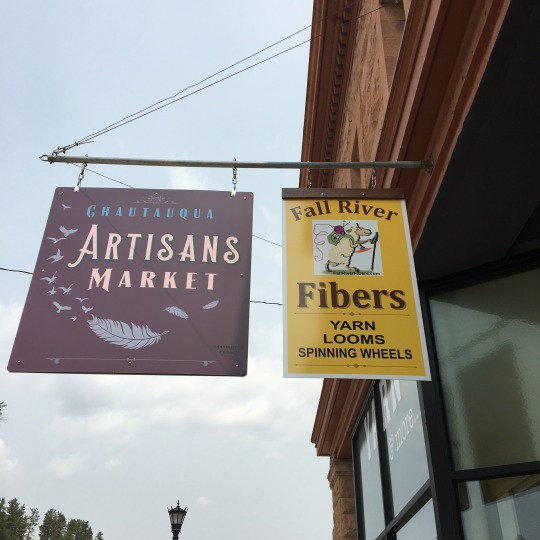
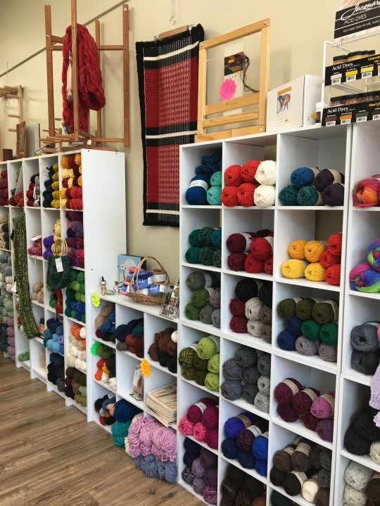
About an hour from Rapid City was Hot Springs, SD, where the springs discharges into the Fall River. We stopped there hoping that we would find a touristy main street where we could have lunch, but there was not a whole lot going on. They do have a nice yarn shop, Fall River Fibers, so that worked out well for me and I got a couple skeins of yarn that were a blend of sheep and llama wool.
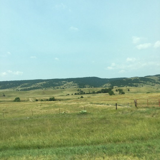


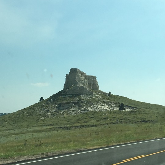
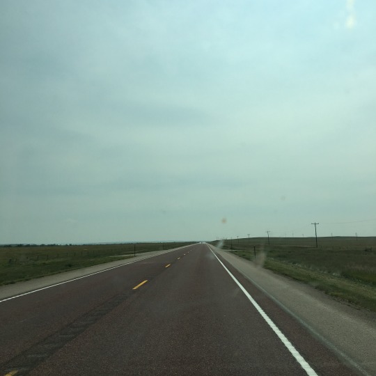
The rest of the way to Glendo State Park, Wyoming, was through some of the most remote areas we have experienced this trip. We went for hours with just grasslands/pastures and occasional herd of cattle on either side of the highway and we exclaimed every time we saw any building at all! At one point, we drove past a series of large angular rocky outcrops or towers but we didn't see any signage informing us what they were. Some of these areas are part of the national grassland systems, but most of the land belong to private ranches, as indicated by the signs we saw. Although this area was almost as flat as the Canadian Prairies, with nothing to hold his attention, e.g. grain elevators, water towers, and interesting farm buildings, Dan found the drive a lot harder. It was particularly difficult as we have finished listening to all the Harry Potter books and I have yet to put the next audio books onto my iPhone.
After hours of just grasslands and not even a shrub in sight, we began to see riparian forest lining the North Platte River as we approached the town of Glendo. The signage to Glendo State Park was minimal and our GPS was not working as well as it should be, so we just followed the sign to the town and figured things out from here. According to the park ranger when we checked into the park, the state law said that there was a limit in the number/size of signs state parks could display on the highway… how strange. There was no obvious signage within the park indicating where the campgrounds were and she has run out of maps, so we followed her instructions which was kind of confusing but we managed.

The park runs along the shore of Glendo Reservoir, which was formed by damming the North Platte River at Glendo dam. There were private residences intermingle with park land, so it was a bit confusing as we were looking for our campground. The landscape was significantly different from what we have experienced for the past couple hours. Instead of relatively flat, expansive grassland that was mostly greyish green in colour with the occasional tan rocky outcrops, we were now winding up and down hill through sparsely wooded area (ponderosa pine and junipers) and exposed red rock walls. We were hoping that our campsite at Reno Cove Campground would be somewhat shaded as it was getting quite hot, but it turned out to be an exposed grassy area where the gravel patch was covered mostly by pineapple weed. I noticed the smell when we got out of the van and unlike the sweet grass smell at Badlands NP/Buffalo Gap National Grassland, it did nothing for me and I got quite tired of it relatively quickly.

Once we settled in, we went for a quick walk and confirmed that not only does the campground not have shower facilities, the vault toilets are about 10 minutes' walk away, down a hill. It is a beautiful park and the location works for us, so while it was not ideal, I am still glad for the experience. After it cooled down I the evening, the temperature was very pleasant. The breeze kept the bugs away for a while and we were able to have a nice dinner sitting outside while we watched the sunset.


With minimal light pollution and a clear night, we could appreciate the stars once it got dark. Although I don't know much at all about constellations, but at least I could spot the Milky Way and the Big Dipper! We have now installed star chart apps on our phones for the next time we have a chance to observe the stars. Until tomorrow, good night from Glendo, WY.
Check out our route on Roadtrippers!
#crosscontinentalroadtrip#roadtrip2018#bilbothevan#thereandbackagain#hymeraktiv#vanlife#campervan#labradorable#puplife#fibreadventure#souveniryarn#knitting#knittingaddict
1 note
·
View note
Text
Day 7: One Thing Off My Big Checklist
We blasted through the prairies today, making just a couple of stops to stretch our legs and to get gas for Bilbo. We crossed into Manitoba soon after leaving the campground and our first stop was Brandon, where the TransCandada Hwy intersects with the Assiniboine River. We took Gimli to the East End Dog Park which was a large enclosed field at a semi-industrial neighborhood. It was not as spectacular as the other two off-leash areas we have taken him, but it served the purpose and Gimli was happy to be out and running around. He was starting to limp a little last night and we suspect he was getting a bit stiff from being in the same position for hours (just as we are as well!). I gave him some pain meds but he was still a bit stiff this morning. I was not sure how he would be at the dog park, but it appears that being outside and running around really helped to fix him! Dan also fashioned an "extension" for his space in the van so that he could stretch out more during the drive and at night.


We filled up the tank in Portage Le Prairie and continued to our highlight destination of the day: Gimli, MB. Two things on my major check list for this trip are to visit the two towns after which our pups were named. Today, we checked one of them off! Gimli is a small beach town on Lake Winnipeg, settled by Icelanders in the late 1800's. Dan was just having a quick look at the New Iceland Heritage Museum gift shop while I waited outside with the pup when he was told that if our dog was well-behaved, he would be welcome to go inside. So they really got a chuckle out of it when we went back in and told them that our pup is called Gimli! All three of us sat side by side in the theatre to watch the video about the history of Gimli and then walked through the exhibit halls. And our Gimli was just so good throughout the visit.

After the museum visit, we took a short walk through the Harbour Point Park and saw the Viking statue that commemorates the families who founded the town. We then had a late lunch on the main strip - fish and chips seemed the most natural choice given the location and the history of the town - before heading to our campground for the night.

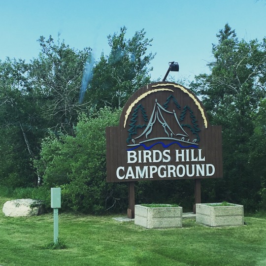
Birds Hill Provincial Park is a large park located on a gentle hill about 30 minutes northeast of Winnipeg. Dan remembered going there as a kid for cross-country skiing and snowshoeing. We arrived at the campsite around 5 and spent the evening relaxing - we even used the DVD player that came with the van for the first time and watched part of a Harry Potter movie!


We have been camping at sites that offer 30-amp power because we know that our battery system works when we are plugged in. However, for the second night in a row, we will try without plugging in and see what happens. Last night went without a hitch but then the battery died later today… Fortunately, we were finally able to find a dealership in WInnipeg that is willing to take a look and we have an appointment early tomorrow! Until then, good night from Winnipeg, MB.
#crosscontinentalroadtrip#roadtrip2018#bilbothevan#thereandba#canadianprairies#hymeraktiv#campervan#vanlife
2 notes
·
View notes
Text
Day 35: Onward and Westward!
It was quite an uncomfortable night for us as it rained overnight and got much more humid. We woke up in the middle of the night, deciding to turn on the AC. As the unit was right above our bed and was very loud, it felt like sleeping on an airplane! Also, when VoltStart kicked in - that is when the battery level got below a certain level, the system turned on the engine to power the under hood generator - it also turned on the car radio which blasted static over the speaker right over the bed! So even though the temperature and humidity got back to a more comfortable level, I had a hard to staying asleep. Meanwhile, Dan took sinus medication, put on his noise-cancelling headphones (mine were took bulky to sleep in), and had a reasonable amount of sleep. It didn't help that Gimli still wanted to go out at 5:30 AM!
Nonetheless, we were still able to get our act together and were ready to hit the road just before 8 AM. We said out goodbyes to Nikki, the children, and the animals, and were on our way. After a stop at the gas station and Starbucks (probably more of those and fewer TH stops here on!), we were ready to brave the New York traffic!!
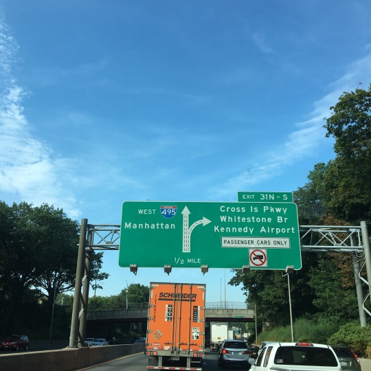
Nikki and Linda warned us that all the Parkways have low bridges under which Bilbo would not fit, so although Waze kept on trying to get us onto various parkways to avoid the heavy traffic, we stayed on the Long Island Expressway (Highway 495) the whole way into the city passing by various towns and communities as well as tracts of forest with ash, sumac, oak, maple, sweet gum, and honey locust. There was very heavy container truck traffic, but at least we knew that if we followed them, we would not encounter bridges that we would not fit under!
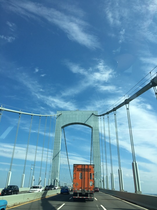
We entered New York after crossing the Throgs Neck Bridge; this was a tolled bridge and just as we were getting our cash ready, we saw the sign saying that those without an E-pass will get the bill in the mail. If only it were this easy for all the tolls!
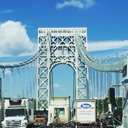
We drove through Queens and Bronx via the highways and were able to get a glimpse of the skyline of downtown Manhattan in the distance. We drove through Manhattan by going under it and the road eventually took us the George Washington Bridge that took us into New Jersey.
After we drove through Newark and Paterson, NJ, the highway was pretty much lined with deciduous forests and occasional rock walls the rest of the way into Pennsylvania. We saw names of towns that we recognized, but we couldn't really see any towns even at the turn-offs. We did see the Delaware Water Gap National Recreation Area where one could find a trail head to the Appalachian Trail.

We arrived in Pennsylvania in the afternoon and just after we paid the toll, we encountered some nasty potholes, and we wanted our money back right away! Luckily, the potholed section did not last very long and our drive to the campground was quite smooth. We stopped at a grocery store in Clearfield and the experience confirmed the fact the towns were quite far from the highway and that was why we hardly saw any the whole time.

We arrived in Parker Dan State Park a little around 4 PM and were super happy that the temperature was around 25C and it was super comfortable to sit outside… until we realized that there were many little gnats that were bothering poor Gimli. So he went back in the van while we had dinner outside.


After such a poor night of sleep last night, we were ready to go to bed early so that we are well-rested tomorrow for another long trek west! Until then, good night from Parker Dam State Park, Penfield, PA.
#crosscontinentalroadtrip#roadtrip2018#bilbothevan#thereandbackagain#hymeraktiv#vanlife#campervan#labradorable#labradorsmile
1 note
·
View note
Text
Day 0: Final Prep
Tis the night before the big trip... We are almost all packed and the house is almost ready for our house-sitter extraordinaire friends.
Couple more surprises today: microwave is installed in a way that not all the packing vplastic could be removed... But at least the vent is no longer covered!! Coolant level was low so that need to be sorted out before we hit the road...
We are sleeping in the van tonight because just so that we don't have to worry about washing out bed linens tomorrow.
We have a few more things to take care of tomorrow and then we will be ready to hit the road in the afternoon. 😬
2 notes
·
View notes
Text
Day 26: The Beginning of "Back Again"
Today was another early start for us, but not before I took Gimli to the Newman Sound Day Use area to check out the sound. It was once again impressed on me how new all the structures of the park were. We have noticed that many of the buildings, roads, viewing platforms, etc. at both Gros Morne and Terra Nova National Parks looked quite new - it is good to see that the country and the communites are willing to invest in the park system.


The TransCanada Highway runs through the park, so we got back on and headed east again… technically, the highway coursed south before turning northeast to our main destination today, St. John's. The vegetation and habitat along the highway stayed very similar to what we saw before, but as the TransCanada started to turn northeast towards St. John's, the landscape started to transition to a from dense forests to a matrix of meadows speckled with outcrops, ponds/lakes, and small stands of trees. In fact, this was type of habitat I was expecting to see when I thought of Newfoundland. As much as I loved driving through forests, I definitely find this open landscape stunning and awe-inspiring.

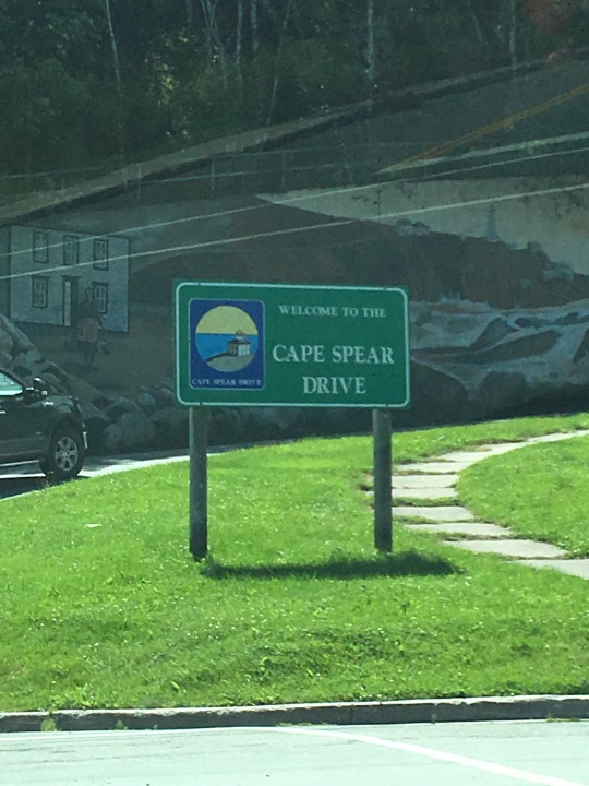
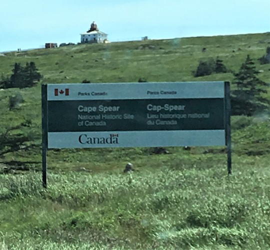
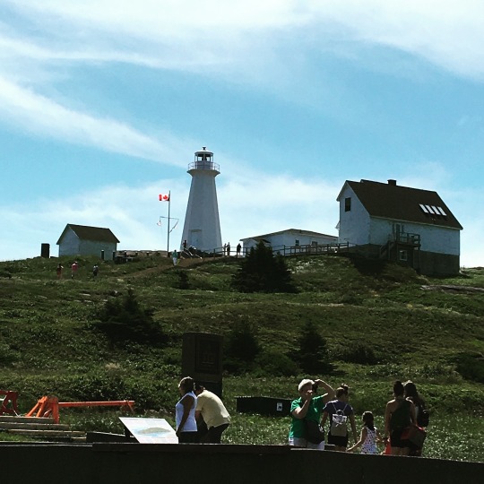
Our first stop was Cape Spear Lighthouse National Historic Park. This is the eastern-most point of North America and only 20 minutes or so outside of St. John's, so of course we had to pay a visit now that we have made it this far. As expected of all lighthouse locations, it was windy at the site, but the sun was out and the breeze was actually warm and pleasant as we took in the vista of the Atlantic.

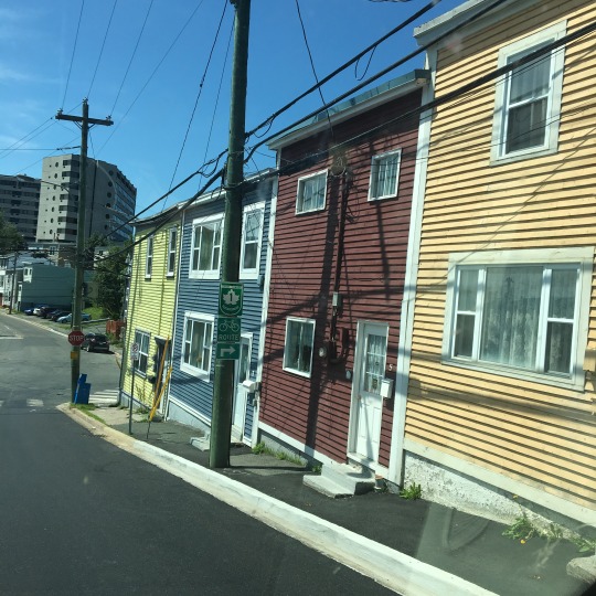
We drove into downtown St. John's hoping to find a place to park and walk around, but it was not to be: there was no available street parking to be found and all the outdoor lots we could find were for permit holders only. We did drive through neighbourhoods with the iconic jellybean row houses and I can imagine how those bright colours would light up the place during the long winters.

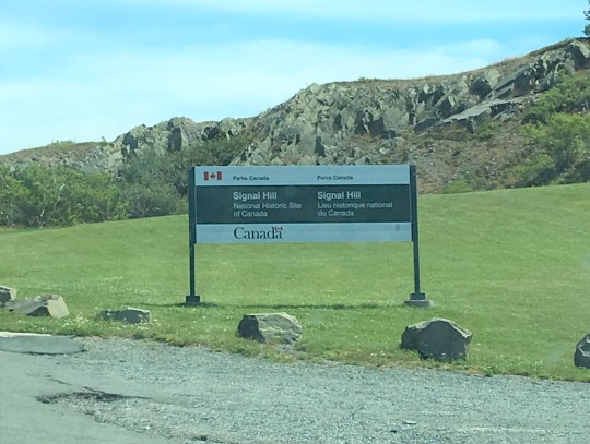
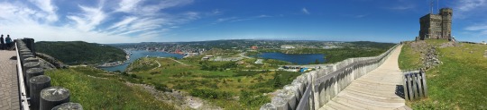
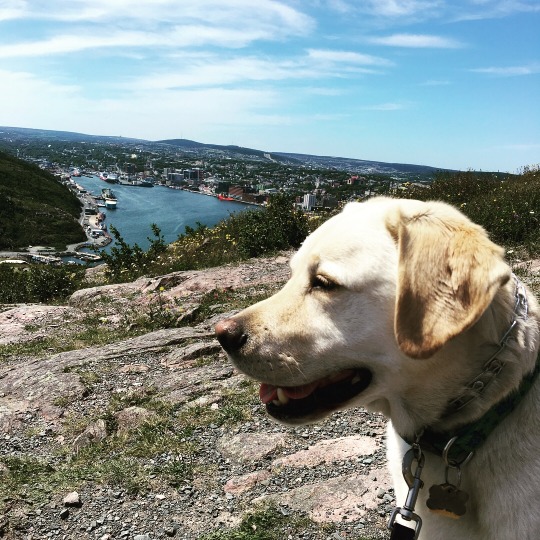
The next stop was Signal Hill National Historic Park where the Cabot Tower was located. From up there, you could see the entire city of St. Johns and its waterfront on one side, and the Atlantic Ocean on the other. As much as I have expressed how I do not like the salty, briny residue of sea breeze, I was surprised to find that I did not notice any saltiness at all.

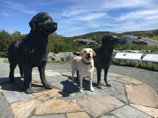
Outside one of the parks building were two statues: one of a Labrador Retriever and one of a Newfoundland Dog, the two dog breeds which originated from Newfoundland. In fact, the ancestors of Labrador Retrievers were known as St. John's Water Dog or the Lesser Newfoundland Dog. Knowing me, so of course we had to take a photos of the Gimster there!
We headed back through downtown hoping to find "Mile Zero" of the TransCanada Highway, which according to an article I found online was next to the St. John's City Hall. There was no good place for us to park and we couldn't not figure out where exactly it was as we drove around the building a second time. We did notice a plaque with dense writing in front of the building but could not really read it as we drove past. But Dan reasoned that since it was a federal plaque (we could see the Government of Canada logo) and there were all the provincial flags behind it, that must have been it. So we stopped just down the street and he ran back to check - sure enough, that was a plaque commemorating the completion of the TransCanada Highway in 1970. But as a side note, as of 2002 (according to the article I read), the eastern-most section of the TransCanada has been re-designated and the start of if it is technically at Lodgy Bay Road, where the Robin Hood Bay Landfill is located. So yes, the technical start of the TransCanada is now at a dump but nonetheless, we were at the historical eastern start. And another factoid: the TransCanada runs from Victoria, BC, to St. John's NL, but they were both considered "Mile Zero". As the journalist, Walter Stewart, wrote in 1965, "The Trans-Canada Highway is the world's only national roadway that has two beginnings and no end… Neither city wanted to be at the tail of the procession, so we made a road with two heads and no foot. Very Canadian, very sensible."

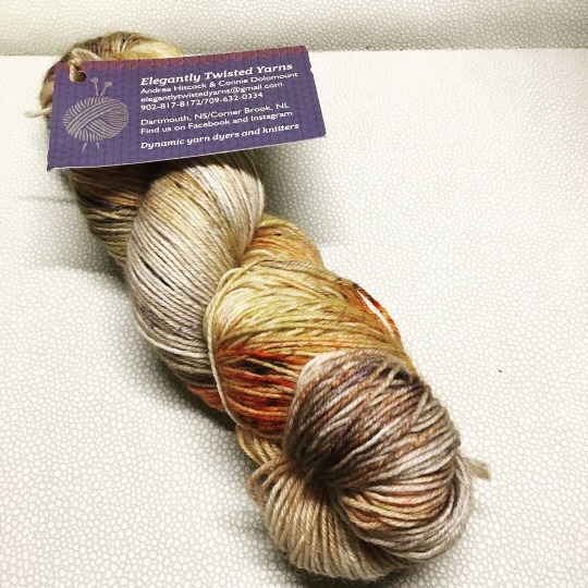
Our next stop was a little yarn shop just outside of downtown, Wool Trend. It was a cute little shop in an old house and it has a decent selection of yarn, But speaking as a yarn snob, they have more acrylic yarn with garish colours that I cared for. They did have a very small collection of yarn from local dyers and I chose a skein by two sisters, one living in Corner Brook, NL, and one in Dartmouth, NS. It is a merino-nylon sock yarn with colours that reminded of the rocks I have seen on the highway.


My little fibre adventure was the last thing we did before leaving St. John's and embarking on our westward part of our journey. In other words, it was time we started the "back again" portion of our trip. The plan was to drive as far west as possible towards Port Aux Basque where we will be catching a ferry back to the mainland tomorrow. We started backtracking on the TransCanada and although we originally thought we would just boondock somewhere off the road, we ended up finding a site at a private campground in Grand Falls-Windsor, Beothuck Family Park. I also did my tiny share of driving for a couple of hours to the campground.
It has been a long day of travelling and we were on the road for about 12 hours. Tomorrow, we will have another 5 hours of driving to get back to Port Aux Basque by 9:45 PM, so at least we can look forward to sleeping in a little. Until then, good night from Grand Falls - Windsor, NL.

Check out our route on Roadtrippers!
#crosscontinentalroadtrip#roadtrip2018#bilbothevan#thereandbackagain#campervan#vanlife#themaritimes#labradoarble#labradorsmile#souveniryarn#localyarnstore#knitting#knittingaddict#pinelakeknittery
1 note
·
View note
Text
Day 2: A Good Start...
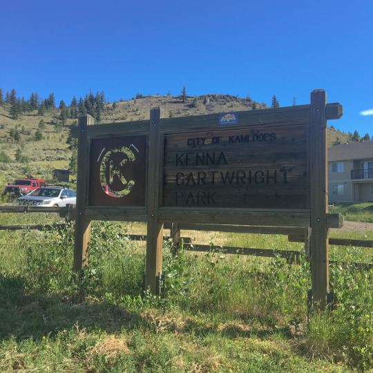
We could not have asked for a better start to the day: we got up bright and early after a relatively good night’s sleep (I woke up in the middle of the night mainly because of itchy mosquito bites). The sun was shining and we hit the road earlier than we planned. We got coffee and breakfast at the gas station in Logan Lake and decided to go to a dog park in Kamloops en route to Valemount so that the Gimster could have some off-leash time.


Kenna Cartwright Park turned out to be much more than a dog park. It actually consists of an extensive trail system just at the edge of town. We encountered a few mountain bikers and hikers as well as quite a few fellow dog walkers in this sagebrush steppe that is dotted with Ponderosa pine. I was super impressed that such a park exists so close to town and the clean pit toilet they have in the park earned them a couple of bonus points!

We made our first grocery stop in Kamloops. We were prepared for regular food shopping stops because the fridge in Bilbo could only fit so much. However, what I did not take into account was that a “quick grocery stop” probably will not be as quick as what I anticipated because I will not be familiar with the layout of the stores! One more lesson learned!
After our stops in Kamloops, sagebrush and Ponderosa pine soon gave way to aspen, Doug fir, and Englemann spruce as we headed north on Hwy 5 which ran somewhat parallel to the North Thompson River.
Lunch was at the Thunder River rest stop about an hour from our destination for the day and I thought it was pretty “fancy” to have steamed buns and gyozas (heated in the microwave) and sushi for a picnic!
We arrived at Yellowhead RV and Campground about 2 PM and check-in was pretty straight forward. We noticed the AAA endorsement when entering the campground so I mentioned it on check-in and got an few dollars off. We were looking forward to an afternoon and evening of just chilling out, when we noticed that our coach battery died when we turned off the engine.
Our battery system was back to the “error state” that we thought was fixed from a few days ago. We have been operating the system using the sequence that was recommended by the RV support technician and things have been working just fine until now. We attempted to restart the system with no avail. We finally got on the phone with another technician who concluded that there was something wrong with the kicker battery that is part of the battery management system (BMS) - it needs to be running in order for the BMS is communicate with the power system. After about 2 hours of dealing with it, we were finally able to bypass the kicker battery with a portable battery (lent to us by very helpful campground staff) and got the coach batteries going and we are now hooked up to shore power. So far, everything seems to be working, but there is no telling what would happen once we disconnect from shore power. We might have found a Band-Aid solution, but our next major task is to find a Hymer dealership that would be able to take a look at the kicker battery and either replace it or fix any wiring issue.

Once we were able to get the system going, we decided to stay here for the night as originally planned instead of heading to the nearest town with a Hymer dealership (we were on the verge of driving back towards Kelowna and spending the next few days in Big White!). We were also able to relax a bit and enjoy this campground, which is next to Swift Creek and has clean, well-maintained and spacious washrooms and showers.
For now, we are still heading to Jasper which is only an hour and half away. However, there is a chance that instead of going to Banff, we will have to go to wherever someone can fix our battery!!
Stay tuned for the next installment of the Hymer Aktiv: Warranty Woes! Until then, good night from Valemount, BC.
Check out our route on Roadtrippers!
1 note
·
View note
Text
Day 1: And We Are Off!!
After a flurry of activity - final packing, getting the house ready for Almie and Terence, who will be house-sitting for us, and putting stickers on Bilbo - we were finally ready to hit the road.


We left a day earlier than originally planned just so that we could break the drive up to Valemount, BC... sort of ease ourselves into it instead of driving 8+ hours on the first day. We did get caught in the rush hour traffic on I-5, so the whole drive was still about 6 hours long. But we were able to entertain ourselves listening to the 4th Harry Potter book and, of course, I did a bit of road trip knitting.

We booked a site at Logan Lake Municipal Campground just before we left the house and it was a good thing we did because according to the bulletin board, they only had one site left for walk-in (and there were 5 sites available when we made the reservation). The site is about 30 miles north of Merritt and is quite a nice place for a quick overnight stay.
The scenery in the Nicola Valley is pretty stunning, and we were lucky to catch a bit of the sunset view as we were driving in. We arrived at the site just before it got dark and decided to just snack on what we have packed and will wait until tomorrow to pick up groceries. We got so caught up with getting to the campground that we totally forgot to feed Gimli at his regular dinner time! It will take us a few days to learn the routine and figure out the “vanlife shuffle”.

Tomorrow will likely be a more typical day where we would start driving in the morning and spend more time exploring our destination in the afternoon/evening. Until then, good night from Logan Lake, BC.
Check out our route on Roadtrippers!

#hymeraktiv#bilbothevan#vanlife#roadtrip2018#crosscontinentalroadtrip#knitting#knittingaddict#campervan
1 note
·
View note
Text
Days 48 to 51: It’s a Wild, Wild World!
Warning: this is a long read! :)
First of all, let me say that wool socks, toque, and down jacket are essentials to my preferred kind of camping! Before leaving Moab, Dan checked the weather and told me that the temperatures in Grand Teton and Yellowstone National Parks were between 1C at night and 24C during the day - that was music to my ears! As much as I have enjoyed the scenery in Moab, I could not wait to get out of the heat and go somewhere that requires bundling up!
We had an early start during last morning in Utah and hit the road just after 7 AM. We ventured westward, further into the Colorado Plateau. We travelled through a matrix of arid landscapes - desert, grassland, scrub shrubs with sagebrush, and pigmy forests - which were relatively flat for the most part with table-top mountains in the distance and occasional mounds and small hills by the highway. We went for miles without seeing a single building and the colours were muted shades of straw and greyish green; even the skies were a bit hazy and overcast most of the morning.

The scenery got a bit more interesting as we entered Price Canyon, where the road travelled along the Price River. By now, the sky has also cleared up and everything has brightened up. Cliffs, towers, pinnacles, and fins of golden rocks towered over the highway most of the way, but at times they opened up to reveal spurs and valleys with sparse woodlands on the hillside.


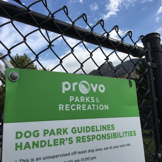
We travelled north and stopped in Provo to go to the off-leash area at Bicentennial Park for Gimli to have a bit of a stretch. Although it was a well-maintained space relatively large, they decided to use coarse sand for the ground, so it was essentially a giant litter box for dogs! It was a bit too dusty for our liking - even Gimli was a bit hesitant picking up his ball because it was covered with sand! Being home to Brigham Young University, I guess it was not surprising to see a Mormon temple on every block…. If you know us, needless to say, we did not linger beyond letting the pup out! Continuing northward, we passed Park City and saw the sprawling, developed area near the ski hills, but we did not check out this ski resort.

For the third time this trip, we entered Wyoming again and, by now, we were used to the endless grasslands and the remoteness. We did spot a coal mine and a couple of refineries this time though. We were originally going to stop at the campground at Fontenelle Recreation Area (by Fontenelle Reservoir), but because we started early and were feeling well-rested, we decided to just make a rest stop there and move on. When we arrived, the place appeared to be deserted except for one camper with an empty boat trailer at the boat launch. The campground was basic, but it had flush toilets and each site had its own sheltered picnic table (it was quite windy there!). It was kind of sad to see such public land/facilities (managed by US Department of Interior) not being utilized. We had a picnic lunch amongst the locals (birds and prairie dogs) and were back on the road again.


A couple of hours later, we arrived in Bridger Teton National Forest, a vast area surrounding the southern end of Grand Teton National Park. We were just about 30 minutes from Jackson and an hour from the entrance of Grand Teton, so this was a good place to stay for the night. We knew there are a few campgrounds within the Bridger Teton NF in this area, so we figured we would just drive to each one to see where we could find a spot. It turned out to be a lot easier than we thought to get a first-come-first-serve campsite close to a national park and tourist town in the middle of the summer!


We chose to stay at the Hoback Campground next to Hoback River. We found a site that backed up onto the river and decided that it was cool enough to get some firewood from our camp host for the first campfire of this trip! It was so nice being able to sit comfortably outside without any bugs! But no sooner have we settled into our camping chairs, we heard the familiar sound of distant thunder! We barely had a chance to put everything away before it starting raining! It proceeded to hail for a while before it settled into steady rain. Campfire will just have to wait.


We woke up to a chilly and refreshing morning with no rain! We met a couple, Ken and Tracy, from Florida who has a custom Class B built on a Mercedes Sprinter van. Dan spotted the brush bar on their van, so we stopped to chat with them and share van stories.

After a walk with Gimli along the river, we headed into Jackson in search of coffee and breakfast. We found parking just outside the town center and took a leisurely walk to the shops. Fortified by the great coffee and food at JH Coffee Roaster and Restaurant, we were ready to tackle the shops! We were pleasantly surprised by how many stores were dog-friendly! Gimli sure got his share of treats. praise and ear scratches!
While having coffee, I found the location of the one yarn store in town and we slowly made our way there. Knit on Pearl is in a cute little house and they have a very cozy set up inside. They have a great selection of yarn from local dyers as well as commercial brands. Since I have already got yarn from merino sheep raised in Wyoming at a different store, I decided to get a skein of blue-faced Leicester-nylon blend. The colour is tonal pale straw/beige with a greyish tinge that was very much like the grasslands that we have driven through. But the name of the colourway turned out to be Elk Horn, which was somewhat representative of the region, except that elks have antlers and not horns…. Minor details!


On our way back to the car, we stopped in a furniture/interior design store and had one of those weird and wonderful random encounters! The guy working there noticed the bag of yarn I was carrying and asked if I was a knitter, and if so, whether he could have my address. He proceeded to tell us that his great-aunt was a well-known knitter who used to tour the country to teach knitting and whose work was displayed at the Smithsonian. He has inherited her stash and had no idea what to do with it!! I told him that I would be happy to take the yarn off his hands and anything I can't use, I will share with my knitting friends. We exchanged contact info and that was when we found out that he lived in Hong Kong for a couple of years back in the 80's and is surprisngly fluent in Cantonese!
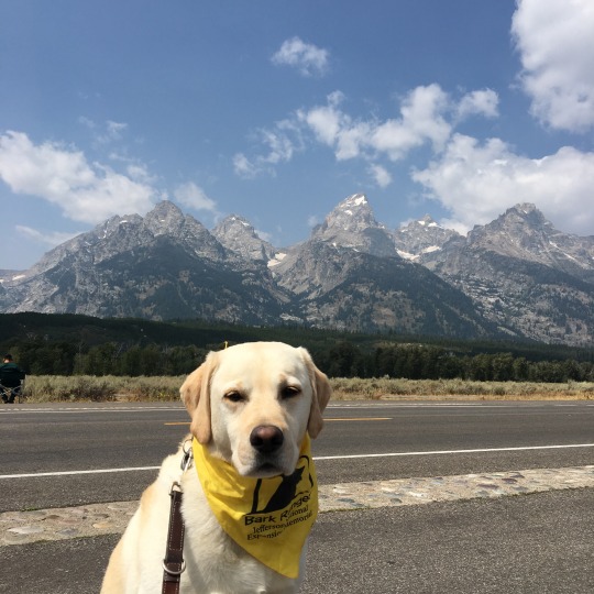
After spending the morning roaming around Jackson, we headed into Grand Teton National Park for an auto tour. We were disappointed that they do not have the driving tour narration for rent, but Ranger Neil gave us great advice on where to go and where to stop given our plan to be at a campground in Yellowstone that evening. He even told us where we would most likely see bears: Spoiler alert! He was bang on!
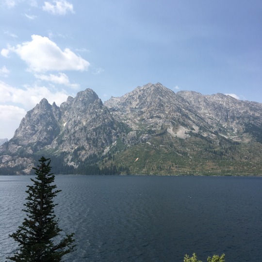
The smoke from the forest fires in the PNW has been a problem here as well and although we could still see the majestic peaks of the Tetons, everything was covered by the haze. We avoided the crowds at Jenny Lake Visitor Center and went to a viewing point recommended by the park ranger; we went up to Signal Mountain, the highest drivable point of the park and saw the expansive valley below. We were driving through the stretch of road Ranger Neil warned us about high likelihood of bear sighting when we noticed cars stopped in front of us and park rangers on both sides of the road directing traffic. We knew something was up! Sure enough, there was a black bear on a tree just like you would see on a wood carving! So that was where they got the idea!


We were stopping at the park signs on the way out of Grand Teton when we met a couple from Kelowna, BC, who have just travelled through Glacier National Park. Since both places were on our "maybe list", we were interested in the fire and smoke conditions. Based on what they told us, we would be wise to avoid those areas; this also means we need to rethink our next step.
John D. Rockefeller Jr. Memorial Parkway took us from Grand Teton to Yellowstone; forest fires in the recent years were evident by the burnt dead wood as well as the new growth on both sides of the road. Once we entered Yellowstone, we travelled above the canyon through which the Lewis River flows. We caught glimpses of the river whenever there were openings between the trees. Grant Village Campground is the first campground from the south entrance and we felt quite lucky that we were able to find a spot there when we only called 3 or 4 days in advance. When we arrived at our assigned campsite, there was already someone parked there and they were not leaving until the day after. For a moment, we thought we got the dates wrong or we did not understand the labeling of the campsites! We went back to the office and they sorted things out and assigned us a different site instead.

While Dan set up camp, I took Gimli for a walk and to search for the showers because according to the map, they were further away than one would expect. I started walking further and further away from the campground and still couldn't find the showers, so I finally asked the park ranger who told me that the facilities were 1/4 mile away! Since we were planning to have a campfire tonight and would get smoky anyway, so we decided we could go without a shower for one more night.
Being in this busy campground in one of the most popular national parks, in the middle of summer, was quite a contrast after our peaceful night in the national forest campground. It was hard to enjoy the nice weather and our campfire when we had for neighbours Drummer Boy, Mr. Megaphone from California (there were about 10 guys in the group but apparently one of them was hoarding the Talking Stick), and Bob the Builder (was he chopping wood for the campfire or trying to build a freaking shed?!). We knew it would be busy, but there is a difference between a general louder ambient noise and specific people making more noise than anyone else for long periods of time. Fortunately, they all respected the quiet hours and we had a restful night.


On our first full day in Yellowstone, we got up early and got to the showers soon after they opened - yes, the showers were 1/4 miles away and available between 8 AM and 8:30 PM only. It would have been so much easier if they had been 24-hours and coin operated (1 shower per person per day was included in the camping fee and our tickets had to be marked off by an attendant with each use, and they had to buzz us into the locked shower rooms!). Although the location of the shower and the logistics involved in using them were a bit of a pain, the showers themselves were roomy and the water pressure was good, so as long as we planned ahead, it worked out just fine.
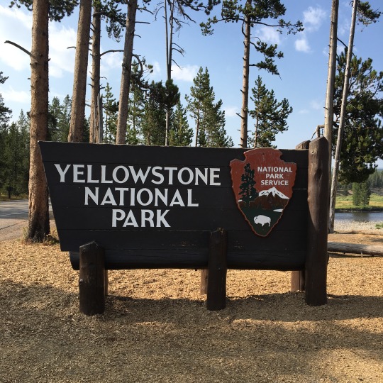
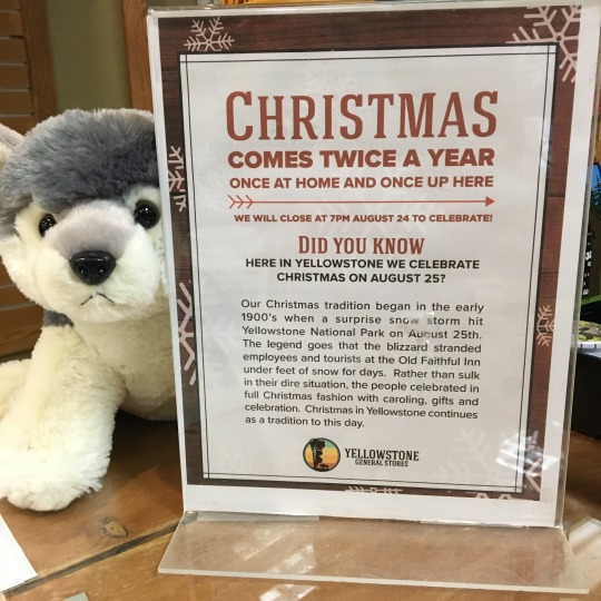
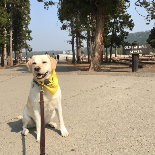
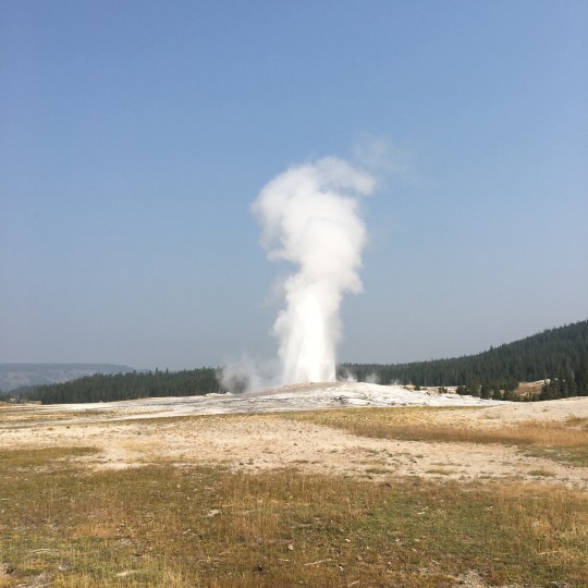
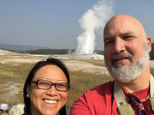
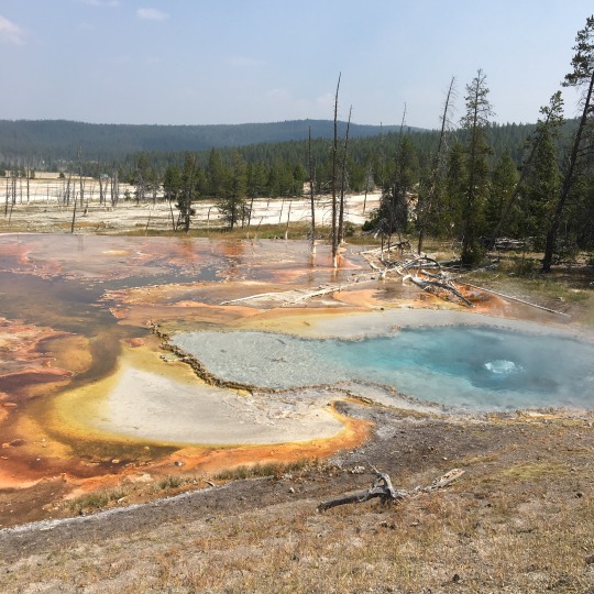
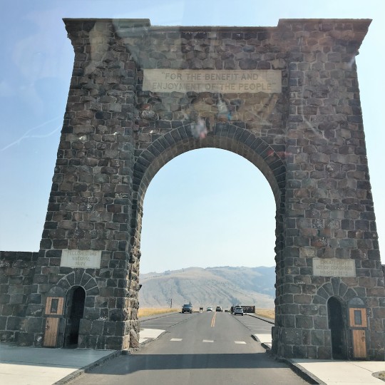
We learned the day before from the park ranger that they could only predict the next immediate eruption of the Old Faithful Geyser one at a time, so we went to the Visitor Center to check the eruption time. The timing turned out to be perfect: we had time to get coffee and breakfast at the café , walked around the store for a bit, learned about why Yellowstone NP celebrates Christmas in August (See photo), looked at the bull elk on the road, and still had time to get parking and find a good spot in front of the geyser to wait for the "show" to start. It was fascinating to watch the eruption: each time, 4000 to 8000 gallons of water (about 200F in temperature) is forced through a hole the size of a fist. The eruption we saw lasted for about 2 to 3 minutes, but it could last up to 5 minutes. We walked on the boardwalks around the geyser and saw Firehole River flow among hot springs that feed it; some of the hot springs around were of the most brilliant blues and aquamarine in colour. The water was so clear that you could see the contours of the wall a few feet into the pool.

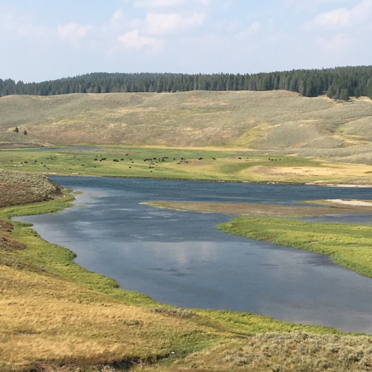
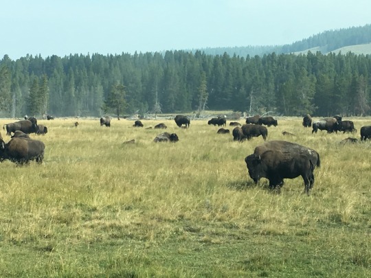
We visited Firehole Lake next and saw more hot, steaming, bubbling pools of water as well as a lone bison in the woods. We were expecting to see bison in herds, but it turned out this would not be the only lone bison we spot in the park… maybe that is what an introvert bison does when the herd becomes too much for them! We continued to drive through the park and when we arrived at Hayden Valley, the woods and mountains opened up to reveal an expansive grassland. Dan was just making a comment about this being prime bison territory and that I should get the binoculars ready when he spotted a dark spot in the distant. That spot turned out to be a bison that was standing among the herd. Once we stopped and climbed up the ladder at the back of the van, we could see the entire herd. It just put a big smile on my face and gave me the chills to see these majestic animals in their natural environment.

We were feeling really good about spotting that herd, but little did we know that there was a bigger herd on the other side of the valley when we drove a bit further, nor did we expect to have that "quintessential Yellowstone experience" of encountering the bison herd crossing the road this morning! We drove through Hayden Valley again on our way to tour the northern part of the park when we came across the "wildlife traffic jam". A number of park rangers were working on getting cars and bison moving along and we were lucky that a spot at the pullout opened up. We stayed there for a while to observe the herd up close and personal! When we started to leave, a couple of them decided to cross directly in front of us, but then the park ranger shooed them along and one of bison got spooked and almost ran into Bilbo!


We stopped to check out the Upper Falls and the Grand Canyon of Yellowstone and ran into Ken and Tracy again. We had a good chat with them and offered them our driveway for boondocking when they are in Seattle. It was at the Upper Falls that we encountered the hoard of tourists that we were worried about… it was so crowded that I could not wait to get out of there. Having said that, it was the only time during our visit at Grand Teton and Yellowstone that we encountered that many people - Dan was worried that it was going to be crazy busy in the parks in mid-August.

Our last stop in Yellowstone was Mammoth Hot Springs where we drove through the hot springs on what was essentially a paved bike path. The constant flow of hot water and the minerals deposited created a unique environment - vegetation was sparse and the most prominent plant appeared to be junipers-- which was starkly different from the grassy rolling hills in the surrounding. While we ate lunch at Mammoth Village, we saw a herd of elk having their lunch on the hillside. But that these were not the last of our wildlife sighting: there was a small herd of mountain goats by the road causing minor wildlife traffic jam on our way out of the park as well as a lone elk near the park entrance bidding us farewell as we left.


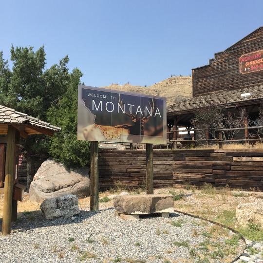
Not knowing where exactly where we would go from here, we decided to stop at the next town where there was better connectivity to plan the rest of our trip. After considering a few options while stopped at a gas station in Livingston, MT, we decided to aim for Bend, OR, and then to the Oregon Coast before heading home. Once that was settled, we got in touch with Dan's karate friend, Doug, in Spokane to see if we could stop by their place tomorrow evening. For tonight, we found a site at a KOA campground so that we could do laundry. Tomorrow, we will return to Washington State briefly before the last leg of our journey in Oregon. Until then, good night from Butte, MT.
Check out our route on Roadtrippers!
#crosscontinentalroadtrip#roadtrip2018#bilbothevan#thereandbackagain#hymeraktiv#vanlife#campervan#bigsky#yellowstonenationalpark#grandtetonnationalpark#bridgertetonnationalforest
0 notes
Text
Days 46 and 47: National Parks on Tape
The last couple of days have been pack filled with spectacular sceneries that neither my words nor photos would do them justice, but here is my attempt at documenting them nonetheless. Sunrise at our campground has been amazing and although I am always grumpy having to get up early when Gimli started whining to be let out, I was glad to have witnessed some amazing views at the crack or dawn!


Due to time limitation and the fact that dogs are not allowed on any of the trails in American national parks, we have been only doing auto touring through the parks, occasionally leaving the AC running in the van so that Gimli could stay cool while we walk to viewpoints/lookouts. While I know the reasons behind the National Parks Service's pet policy on their trails, I have a very strong feeling that a well-behaved dog on leash does a lot less damage on a trail than some idiot trying shoo a bison off the road… and I have heard more noise from screaming children/yelling adults on this trip than from barking dogs. I digressed…
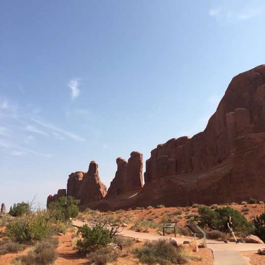
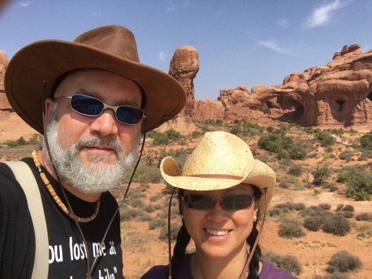
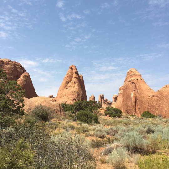
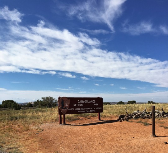
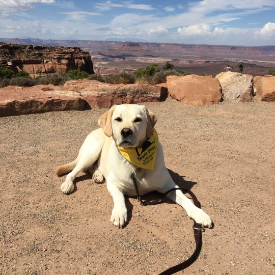
We discovered that we could rent CDs or thumb drives with narrated auto tour from the Visitors' Center for only $5. Using that and the park map, we were able to have guided tours through both Arches and Canyonlands National Parks, knowing what we were looking at at each view point and learning about the natural and cultural history of the parks along the way.
We visited Arches NP yesterday and as we travelled along the winding road in Arches NP, we were awestruck by the vibrant red rock formations and we learned how these hoodoos, arches, mesas, etc, were formed and the reasons for their various striations and patina. The Courthouse Wash is a stream that runs through the park and the lush green riparian corridor along the stream contrast starkly against the desert habitats, includng the pinyon pine-juniper forests, in the rest of the park. I have learned about the PJ forest in school but it was something else to see these pigmy forests in person and it never ceases to amaze me how plants and animals evolve and adapt to some of the harshest environments on this planet.


It was a scorching, hot day with the high of 38C (but Bilbo registered 47C!). Although we have the house AC available, it was not circulating through the cabin, making it freezing cold over the bed but still stuff hot in the front where we usually sit. So after touring Arches NP, we headed back into town to the hardware store so that Dan could get some supplies and make an airflow duct that diverts cold air from the back to the front. Meanwhile, Gimli and I went to the Moab Barkery next door to check out their wares. Since tend not to chew his raw hide treats thoroughly before swallowing, causing frequent gagging, I thought I would try something else and bought him a piece of elk horn. While Dan's airflow duct was a success, the elkhorn was a bit of a fail - Gimli did not want to chew it at all even though he appeared to be interested when we were at the store. The wind picked up in the evening and there was even a thunderstorm in the distance. It rained on and off throughout the evening which cooled everything down enough and we were able to sleep without the AC on.

We noticed a trail access from our campground yesterday late in the day when it was too hot to walk with Gimli, so we decided to get up early this morning to take him for a walk there before we start our auto touring at Canyonlands NP. The temperature was perfect with a light breeze and the lighting further enhanced the natural beauty of the red rock walls around us. The Sovereign Trail appeared to be under the jurisdiction of the Utah Department of Natural Resources but could be access through this private campground. One thing we have learned on this trip with regards to access to public lands is the distinction between "do not enter" and "keep gate closed" - if you find the latter at a gate to public lands, chances are, you are allowed to go in, just close the gate after you are done!


Canyonlands NP is much larger than Arches and the two auto tour routes are located 76 miles apart, so we chose to only do the one closer to us. We took the Scenic Byway (which was really the only way) from our campground to the park. It coursed through Bureau of Land Management lands, with impressive rocks walls on either side which opened up to amazing vistas of multiple mesas in the distance. The open landscape was a matrix of pinyon pine-juniper pigmy forest, savannas, and grasslands on rolling terrain.

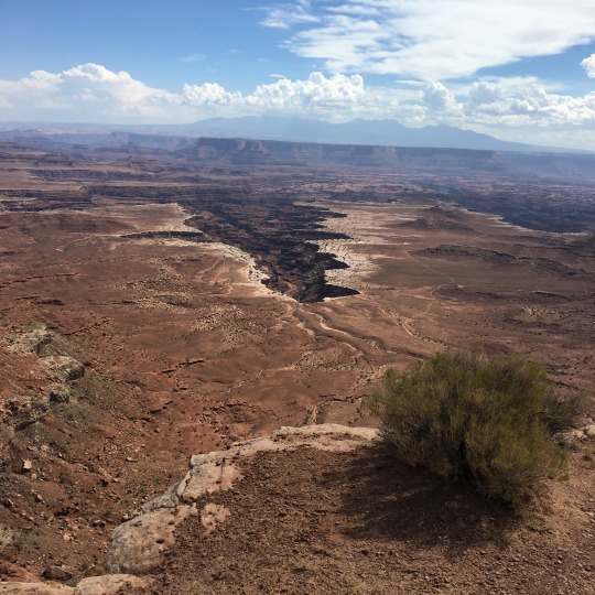
Canyonlands can be roughly divided into three regions, separated by the Green River, a tributary of the Colorado, and the Colorado River: Island in the Sky to the north, The Needles to the southeast and the Maze to the southwest. Entrance to the Island in the Sky was the closest to us, so that was the auto tour we chose to do. Island in the Sky is a "peninsula" attached to a ginormous mesa by a 40-feet strip of land called the Neck. It is bordered along its east by the Colorado River and along its west by the Green River; at its southern tip is the confluence where the Green drains into the Colorado. The viewpoints we visited gave us expansive and stunning views of the canyons, mesas, pinnacles, and other landforms carved by rivers over millenia - these views sure gave me the chills when I first laid eyes on them!


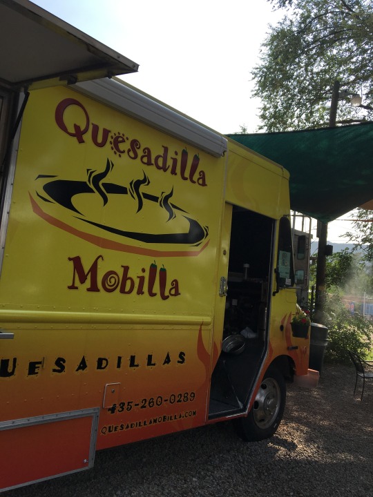
We have heard good things about Dead Horse Point State Park which was in the vicinity but when we arrived, we were told that unless we planned to go for hikes, there was not much of a driving tour to be had. So we turned around and headed back into Moab for late lunch and for a bit of shopping. We found out yesterday from the pet supply store that Utah state law does not allow pets to sit in restaurant patios, so the few "pet friendly" places I found online were really only looking the other way. So we returned to the Quesadilla Mobilla food truck, where the waitress greeted Gimli like an old friend!
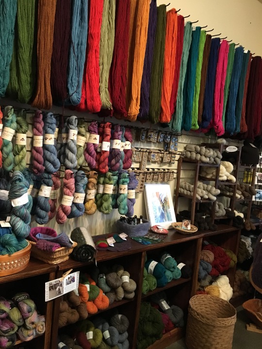
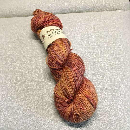
The temperature has dropped quite a bit to a comfortable level by the time we arrived back in town, that was because another storm about to hit. By the time we finished lunch, the wind has picked up significantly, whipping up sand and grit to the point small children were screaming as they were trying to cross the street. I bought a couple of t-shirts while Dan continued to enhance our sticker collection. I then indulged in another fibre adventure and visited Desert Thread, a cute yarn store just off the main street. It was a small store but they carry many high quality brands. There was only work from one "local" dyer, Woolly Lizzard (who has actually moved to Colorado recently), but they do carry natural undyed yarn from a local farm. I ended up getting a skein of Woolly Lizard superwash merino-silk blend sock yarn in rust, orange, and speckles of purple, because the colours were near perfect representation of the rocks around here.

Within minutes of us getting back in the car, the sky opened up and rain was coming down in sheets. We were going to stop by the grocery store but I didn't want to get out into the deluge, so we just sat in the van at the grocery store parking lot for a little while until the rain eased off a bit. We noticed on our way back to the campground that there was significant runoffs on the streets in town and the previous dry stream beds along the highway now has relatively high flow.
It continued to rain quite hard for a few more hours after we returned to the campground, but we just hunkered down in the van and waited it out. The cool air felt so good and I didn't even mind the cold shower too much! I look forward to a more comfortable night of sleep before a long day of driving tomorrow, when we will start heading north towards Grand Teton and Yellowstone National Parks. We have not booked a campsite, but there are plenty of National Forest and BLM campgrounds en route, so we should be able to find somewhere to stay for the night. Until then, good night from Moab, UT.
Check out our route on Roadtrippers!
#crosscontinentalroadtrip#roadtrip2018#bilbothevan#thereandbackagain#desert#coloradoplateau#archesnationalpark#canyonlandsnationalpark#moab#fibreadventure#knitting#knittingaddict#souveniryarn#localyarnstore#pinelakeknittery#labradorable#labradorsmile#barkranger#puplife#vanlife#hymeraktiv#campervan
0 notes
Text
Day 45: Following the (Colorado) River
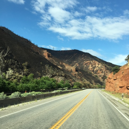
With John Denver's Rocky Mountain High and some of his other songs as our soundtrack, we left Rocky Mountain National Park via the Peak to Peak Highway. The ponderosa pine and subalpine fir slowly gave way to lodgepole pine, Doug fir, and quaking aspen as we went down in elevation. The forests were broken up by meadows, ranches, and estate homes periodically, but much of the land we drove through appeared to be part of Roosevelt, Arapaho, and White River National Forests. We drove through quite a number of small towns, including a number of historic mining towns such as Black Hawk, Central City, and Idaho Springs, with remnants of mining equipment by the hillside.

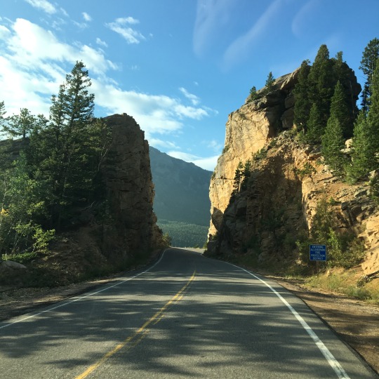

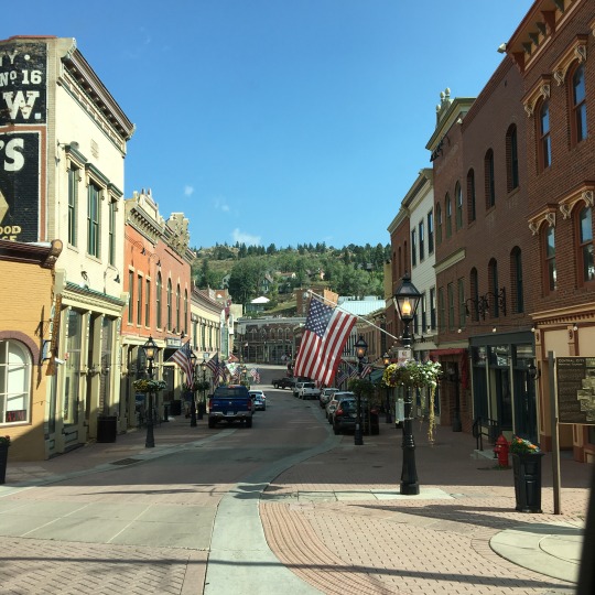
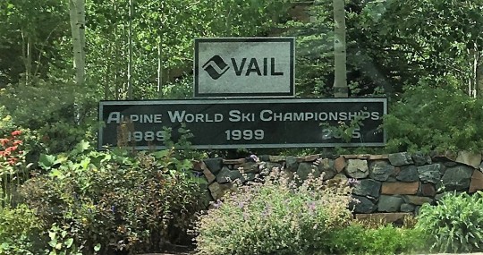
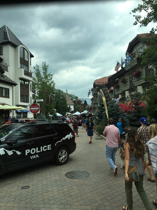
Our route today followed the general direction of the Colorado river, heading southwest from the Rockies to the Colorado Plateau. As we went west and gained elevation, the landscape started to change quite dramatically: gone were the dense forests and they were replaced by steep rock faces with sparse shrubs and trees - a transition to a montane/subalpine to an alpine region. We drove through Eagle Valley which is quite developed and home to many ski areas, including Vail. We decided to drive through the town of Vail; it has the same look and feel of Whistler, but the village seemed smaller; and from what we could see of the ski runs, I can tell you that I am not going to swap time in Big White for time in Vail any time soon!
Although Vail was not quite as grand as I have expected, we were definitely impressed with Glenwood Canyon. The Colorado River flows through the canyon and it starts where the Eagle River, a tributary of the Colorado River, drains into the Colorado. The Interstate 70 courses through this 12.5-mile canyon and sits hundreds of feet above the water. The scenery was spectacular with the red rock walls of the canyon contrasting the bluish green of the flowing river and the green vegetation beneath. This used to be a train route in the late 19th century; it was later a gravel road for cars in the early 1900's. To build a roadway through such rugged landscape was truly an engineering feat. Another thing that impressed us was the paved bike trails that run parallel the highway. We started to notice them when we were in the ski areas and wondered if they connect all the way to the one in Glenwood Canyon. We stopped at the last full service rest stop within the canyon, called No Name Rest Area. We made sandwiches and had a picnic lunch at the parking lot.

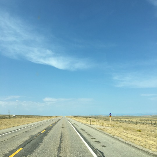
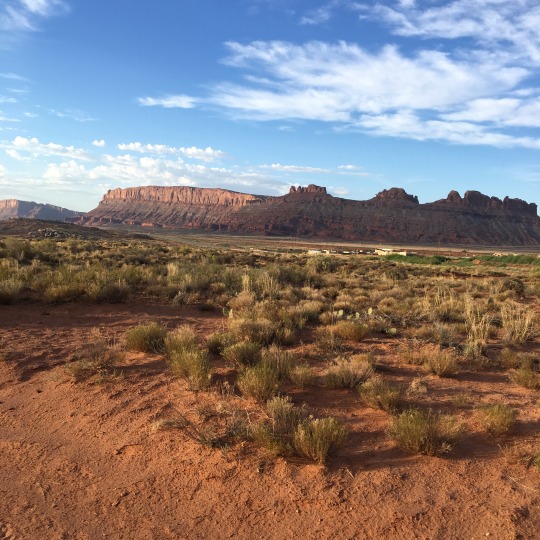
Once we came out of the canyon, the scenery changed again: we were now in a desert landscape with a lot of bare ground and low-lying shrubs and clump grasses. There were also impressive mesas on either sides of the highway and in the distance. We are now in the Colorado Plateau, a desert region centered on the meeting point of Colorado, Utah, Arizona, and New Mexico. This landscape went on for miles up to and beyond the Colorado-Utah state line, punctuated only by Grand Junction, the last big town before we hit the state line. This section of our journey gave the grasslands in Wyoming a run for their money as far as how remote it was!


As we got further west, the rocks started to change from more a yellowish colour to the brilliant rust red that is typical of the images of Arches, Cayonlands, and Zion National Parks. The rock walls and formations were so stunning! And we weren't even in the national parks yet! We also saw this beautiful, paved bike trail along the highway and before we even saw any official sights in the area, we were already scheming a bike trip here with both mountain and road bikes in the future!
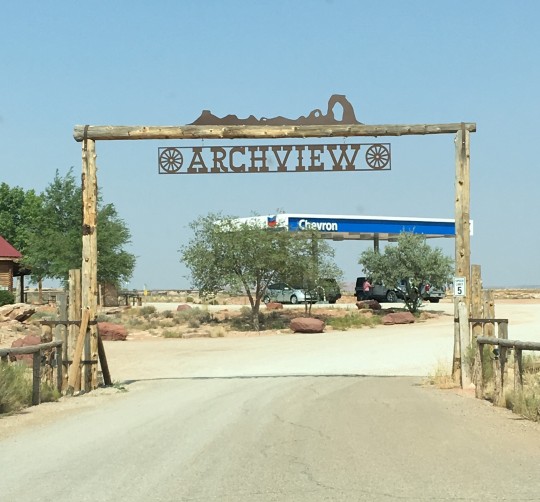
We were getting a bit nervous with our gas situation because we were running low and there was not a town in sight for miles! When we finally got to the turnoff towards Moab, we pulled into the gas station at that intersection. That was where we paid for the most expensive gas ever (by North American standard, mind you!)! The whole set up was really like something out of a bad movie: the building looked dilapidated, covered with graffiti, and sporting homemade signage. It was staffed by an discheveld old man who, when asked if the gas was really $5.39, said that "Yes, and it will be the best gas you will ever have!" We only got enough to get us a bit further, only to find out that our campground, Archview RV Resort and Campground, which was only a short way down the road from the intersection, was right next to a gas station!
We checked in, found our site, and then went into Moab for a bit of a wander. It was a typical resort towns with many 4x4 and jeep rentals. It was very hot though, so there were not as many tourist walking around like in any other tourist towns we have been to so far. I found a couple of yarn shop in town, but neither was open on Sundays, so we will just have to come back another day We did visit a couple of shops and had early dinner at the Quesadilla Mobilla food truck just before they closed for the day.

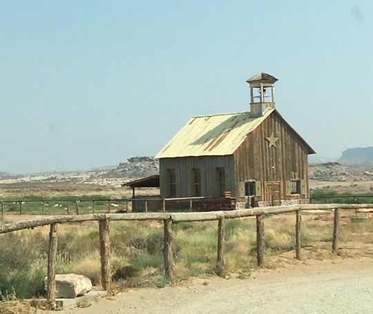
Archview RV Resort & Campground really has a view to the arches within the national park. They also have an old western style church building on the property that looks really cool but we do not know if it authentic or not. There is a pet area; though it is not off-leash, at least there is somewhere for me to walk the Gimster. There is also trail access to Sovereign Trail which we think is on private property and does not have pet restriction. So we can probably take Gimli for a proper walk early one of these mornings.


Once we settled at our site, we turned the AC on to cool things down, did laundry, and just relaxed. The bathroom/shower rooms near our site are all "family style", i.e. the toilet and shower are in the same room. It just provides more privacy and makes for a more spacious room. They were a bit stuffy, but not too bad once we waited until it has cooled down a bit. For some reason, when Dan went to take his shower, there was no hot water (too many people doing laundry?). But lucky for me, by the time I went, it was totally fine. It has cooled down enough so we do not need AC for the night. In fact it got so windy that our awning was being knocked about, making loud noises that spooked Gimli enough to wake him up and get him barking after quiet hours! Note to self, retract awning before going to bed in the future! Tomorrow, we only have a short way to go to Arches National Park, so we get to sleep in! Until then, good night from Moab, UT.
Check out our route on Roadtrippers!
#crosscontinentalroadtrip#roadtrip2018#bilbothevan#thereandbackagain#hymeraktiv#vanlife#campervan#labradorable#puplife#coloradoplateau
0 notes
Text
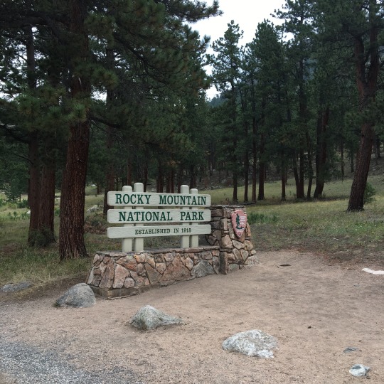
Day 44: Rocky Mountain High
Not having been to other KOA campgrounds, I don't know if it is a standard thing, but on weekends, the Estes Park KOA offers pancake breakfasts (sausages and unlimited pancakes). We entertained ourselves with dad jokes and trivia about Rocky Mountain National Park, Colorado, and hummingbirds (they have a few feeders by the patio) provided on each table while they prepared the breakfast for us.

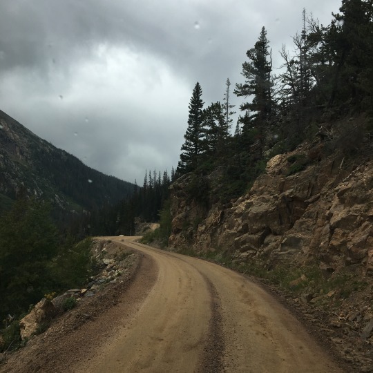
We headed into Rocky Mountain National Park via the Fall River entrance to explore the scenic drives along the northern part of the park. The first route we took was the Old Fall River Summit Road. This is a one-way dirt road with deep ruts that takes one from near the Fall River entrance westward to the Alpine Visitors' Center. T he road is narrow and full of tight hairpin turns, with rock face on one side and a drop down to a steep ravine without guard rail on the other. The entire distance of the road was only 11 miles, but given the conditions, the speed limit was 15 miles per hour and in our van we were going at no more than 12 miles an hour with quite a bit of white-knuckling driving on Dan's part.

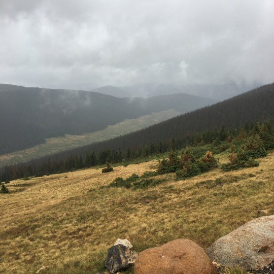
The entrance to the park was at about 8400 feet elevation and we were in the montane forest region, with ponderosa pines and quaking aspens as the dominant trees. As we continued to climb, entering the subalpine region, the aspens phased out and they were replaced by subalpine fir and Engelmann's spruce (there were probably some Colorado blue spruce in there as well but I could not tell for sure). We could see the peaks in the distance and the wide valleys below us. With the entire side of the mountain visible to us, we could really appreciate the dense subalpine forest ending abruptly at the tree line and the alpine region above.

We were about a third of the way up when it started to drizzle. We knew there was thunderstorm warning for later in the day and we wanted to be sure that we were off the dirt road before it turned ugly. We could see the storm clouds starting to roll in as well. Lucky for us, the dirt road was really packed, so the light rain did not turn it into a muddy mess and the heavy rain and high winds stayed away from us. We stopped at the Alpine Visitors' Center for a break and the rain and wind really picked up as we were leaving. It would have been a very uncomfortable drive on the dirt road if we had started our drive half an hour later.

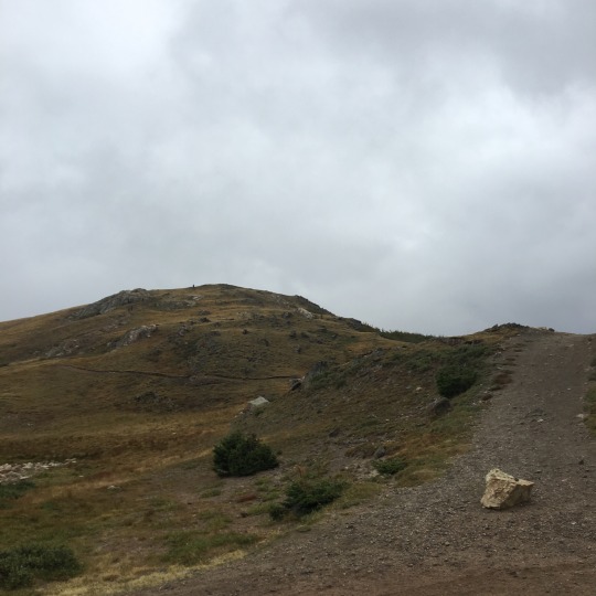

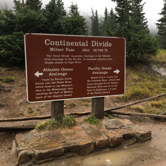
We continued our drive on Trail Ridge Road which took us through the open alpine habitat to the Continental Divide. It was so nasty out there that I barely ran out to take a photo of the sign and got back in the van. With the horizontal rain, it would have been impossible to see which way the water was flowing anyway! We turned around and headed back towards the northeastern part of the park, but this time, we took the Trail Ridge Road and proceeded down the eastern side of the park towards Bear Lake. By this time, the rain has stopped and the sun was almost trying to come out.

It was along Bear Lake Road that we had one of the most amazing wildlife sighting: there were two male elks feeding on the side of the road. They both had huge antlers and the one closer to us had a 12-point rack and you could still see the dried blood from the shedding of the velvet. We saw these guys again 20 minutes later on the other side of the road after we have turned around. And just before we saw the elks the second time, we spotted a family of wild turkeys by the road as well.

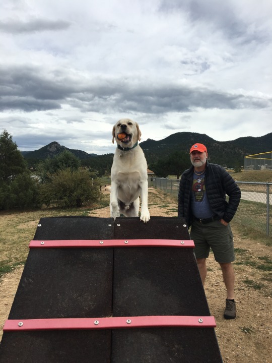
With the weather being more agreeable, we decided to take Gimli to the dog park again. This time, it was quite busy so Gimli got to show off his Chuck-it ball to everyone. And this time, I was able to capture the proof that Gimli got on the A-frame!
The rest of the afternoon was spent chilling at the campsite. Dan also spent some time putting up many stickers that we have collected during our trip as well as some that we have collected over time. Meanwhile, Gimli was content just to nap after all the running around at the park.

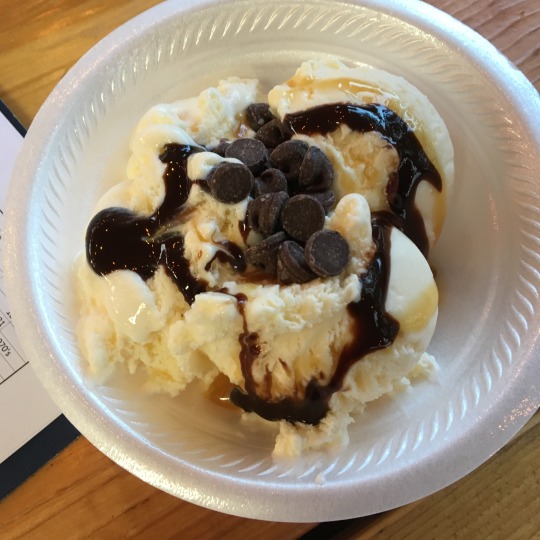
The campground organized an ice-cream and karaoke social at the common area. There was a small crowd there for the ice-cream, but only one other camper beside me went up to sing. We did share a little bit of our vanilla ice-cream with Gimli, so he got to partake in the festivities as well!


We will see if we could make it through the entire Harry Potter movie tonight. We have a long day ahead of us tomorrow as we head to Moab, UT. Until then, good night from Estes Park, CO.
Check out our route on Roadtrippers!
#crosscontinentalroadtrip#roadtrip2018#bilbothevan#thereandbackagain#therockies#rockymountainnationalpark#hymeraktiv#campervan#vanlife#labradoarable#barkranger
0 notes
Text
Day 39: Who You Gonna Call?
After another leisurely morning with a cooked breakfast and a proper walk with the pup to Lake Buteo, we journeyed on! The original route was going to take us through the outskirt of Kansas City, MO, but due to road work on the highway, we got detoured to Kansas City, KS, so we got a bonus state today!


We drove past farmlands and through farming communities; it was also obvious that we were travelling along a major trucking corridor as there were many travel centers (huge gas stations with a well-stocked convenience stores, eateries, laundry, and showers), rest stops, and trucking-related businesses lining the route. The terrain was relatively flat to start when we left the campground, but became more undulating for a short period of time, and then as we arrived in Iowa, it got flat very fast!! Other than some hills in the distance, it felt very much like driving through the Canadian Prairies again.


The highway took us past Omaha and we saw the skyline briefly but we did not stop in the city or enter Nebraska. We noticed that we were on the Lewis and Clark Trail partway through the day but we didn't know exactly when we got on the trail. According to the internet, St. Louis to Omaha via Kansas City is part of the trail, it was just unclear how much we did was actually part of the trail. It never ceased to amaze me at how much explorers and pioneers like them endured in order to make their way through such vast territories unknown to them!

We spotted many antique stores along the way and Dan made a comment that we were driving through the region that the American Pickers (the show on History Channel) would do their picking. That was when it hit us that they are based in Iowa and perhaps we could swing by their store. Alas, they are located on the eastern part of the state and it would be too out of the way for us to visit. It was a good idea though!
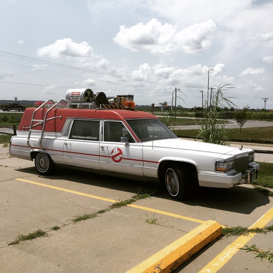
We did stop by one antique mall next to a travel center after we gassed up. And they happen to have the Ghostbuster mobile outside! That was pretty wild! It was fun walking through the store, but the contents were not unlike what we saw at Apple Annie Antique Gallery in Cashmere, WA.
We arrived at On-Ur-Wa RV Park in Onawa, IA, a little after 3 PM and although it has been really hot earlier in the day, it was actually very comfortable at the campground with large poplars providing shade at the sites. They also have a shaded dog area so Gimli got a chance to roam around for a bit.
Unlike the resort-like campground we have been to where many seasonal guests have semi-permanent structures at their sites, this is a private campground just off the highway and it is more like a large wooded parking lot. The owners were from the West Coast; in fact, the woman actually grew up in Kirkland, WA. Pretty much all the other campers here have giant Class A rigs, so Bilbo looked pretty small in comparison. As we were chilling out by the van for the last few hours, we did a bit of people watching. We are not sure if it is a thing with Class A RV owners but two of them across from us spent the last hour or so obsessing over cleaning the windshield. And a couple times after we thought they were done, they returned to clean some more. We joked that we should see if they were willing to clean Bilbo for us as it would be very satisfying for them to get all the road grime off!
After evaluating our options with the fires in CA and OR in mind, we have decided to skip those two states and rework the route so that we would go down to Colorado after visiting the Badlands and go west to Utah before heading north again. The beauty of having a van is the flexibility!
We saw a Mexican restaurant across the street and were hoping to make date night out of it (Gimster could stay in the air-conditioned van while we go out), but it was not to be - they keep "Japanese restaurant hours" and close on Mondays. We got something at the chicken place at the truck stop instead…. Guess I am just a cheap date tonight! Until tomorrow, good night from Onawa, IA.
Check out our route on Roadtrippers!
#crosscontinentalroadtrip#roadtrip2018#bilbothevan#thereandbackagain#hymeraktiv#vanlife#campervan#labradorable#labradorsmile
0 notes
Text
Day 38: Gateway to the West
Dan figured out Gimli's "internal" alarm clock this morning - it was not internal at all! Gimli woke us up soon after a burst of bird songs at sunrise… and that would explain why he has been so consistent! The birds wake him up, and so he wakes us up. As the days get shorter, hopefully, he will stay asleep for longer.
We had a more leisurely start today and Gimli had a chance to run around in the backyard before getting stuck in the van. We saw a cardinal for the first time yesterday and this morning, I heard its song and it was beautiful! I tried to take a picture of it, but without a proper zoom lens, it was a lost cause!


Fortified by coffee and ham and cheese scramble prepared by Jon, we were ready to get back on the road again. We made a grocery stop and because it was a Kroger, which belongs to the same chain of stores I was used to at home (Fred Meyer and QFC), even though it was not exactly the same, the layout, the products and the general feel of the store were much more familiar. It was interesting how something as mundane as being around a store brand I know could bring a sense of comfort!
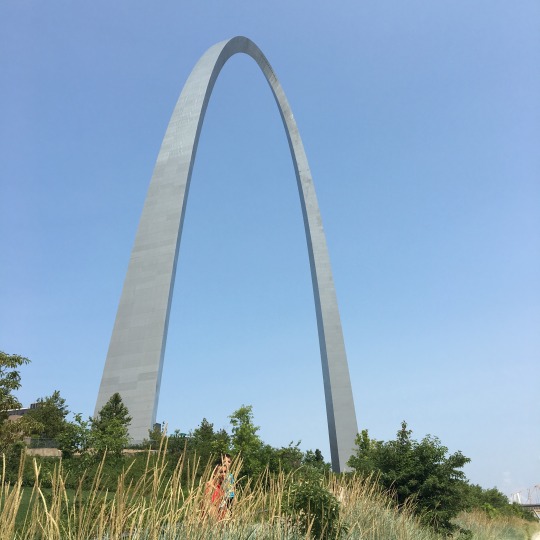
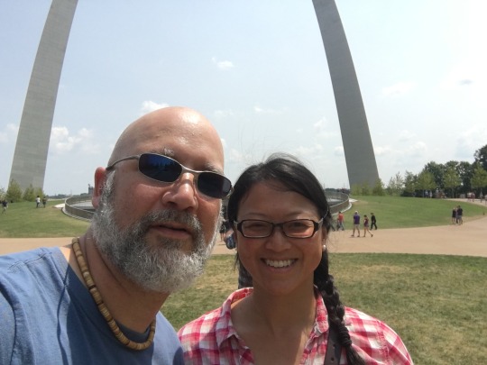
We were on the road for just over an hour when we crossed the Mississippi River and entered Missouri at St. Louis. We could see the Gateway Arch as we approached and I quickly spotted potential open area parking between the river and the Gateway Arch National Park. It took a couple of tries to get to the street we wanted, but we got a good parking location, although it looked a bit precarious - it was along the river bank, relatively steep, and on very uneven ground paved with bricks. Once parked, we were really tilted and I wondered if we would tip over and end up being in the Mississippi! It also made for a good photo op for Bilbo!


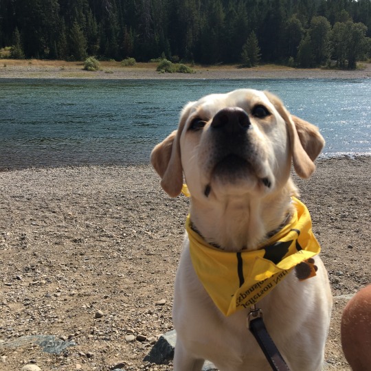
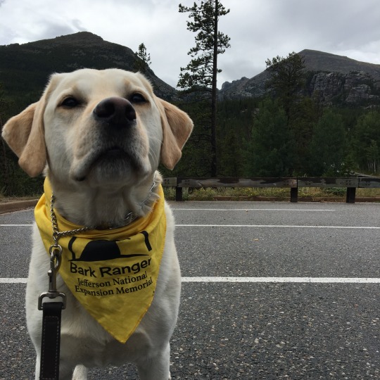
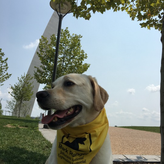
It was very hot by then and there was hardly any shade, but we made our way to the Gateway Arch. And it was also kind of nice to be in an area that is a bit more ethnically diverse after the last few days. While Dan went to the Visitors' Center to look for the stickers and hiking stick medallion, I found a shady spot to wait with Gimli. That was when Ranger Karen approached us and told about the "Bark Ranger" Program which promotes responsible pet ownership within the National Parks. With the bandana and the patch, Gimli was not an official Bark Ranger!
According to Dan, the underground Visitors' Center had airport-like security in order to enter the gift shop and the whole thing was a mall disguised as a museum. And after all that, they didn't have anything he was looking for!
Leaving St. Louis, we were amazed by the number of churches, universities, and church-run universities which line the highway for a few miles. The landscape transitioned to corn fields and tracts of wooded area, with occasional glimpse of towns. After crossing the Missouri River, we stopped once more for gas and drove directly to Knob Noster State Park, our destination for the night.
I was quite amused by the name of the park as the town of Knob Noster was located in Johnson County. But then we learned the origin of the name and it was not so funny anymore: "Knob" was the word for sacred hill in the native language of this area and noster is Latin for "our". So in essence, the settlers claimed the scared hill as theirs when they arrived.

We settled into our campsite, surrounded by oak (white oak?) and hickory (mockernut hickory?) and the oppressive heat eventually dissipate and we were able to sleep without turning the AC on. We had more than usual interest in our van at this campground. The campground host asked me if it was a Hymer when we pulled up to check in. She then proceeded to tell me that she has been following the blog of a couple driving a Hymer and asked if I knew We are the Russos. She was delighted to hear that We are the Russos website was usually the first place we looked to find out about the ins and outs of our camper! Later on, a lady drove into our site to ask about the van. She was probably hoping for a tour but neither Dan nor I were in the mood for giving one, particularly after how her arrival got Gimli all riled up! We pointed her to the website instead!
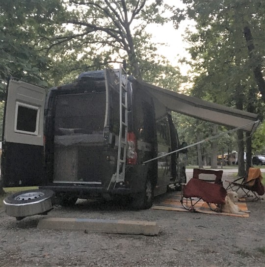

I finally finished knitting the cuffs for Dan's kilt hoses, but this project definitely requires much more attention that I can give us while travelling, so I ended up casting on new pair of toe-up vanilla socks instead. This would be a more mindless project for the road. Until tomorrow, good night from Knob Noster, MO.
Check out the our route on Roadtrippers!
#crosscontinentalroadtrip#roadtrip2018#bilbothevan#thereandbackagain#hymeraktiv#campervan#vanlife#labradorable#barkranger#labradorsmile
0 notes
Text
Day 37: It’s All About the Company and the Food
Our night spent at the parking lot by the highway was actually quite pleasant! The temperature was very comfortable, so there was no need for AC. We had one RV neighbour who pulled in later in the evening but after running their generator for a little while, they were all quiet, and they left before we got up. After a hearty breakfast at Cracker Barrel, we hit the road again.

We encountered a little bit of Indianapolis Saturday morning traffic, but otherwise the drive was quite unremarkable. The scenery has not changed very much from yesterday where we saw mostly farmlands and tracts of deciduous forests . We entertained ourselves by listening to the final Harry Potter audio book, pointing out the large number of bill boards advertising gun shops, and chuckling over interesting town names (e.g. Effingham) and road signs (the St. Mary's of the Woods College sign was situated on Darwin Road). We were also perturbed by the giant cross by the side of the highway…
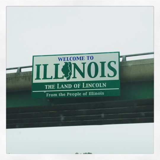
We arrived at our friends', Jon and Chrissy, house in Mount Vernon, IL, around lunch time. Jon and Dan have known each other for ages through karate. Dan also met Chrissy and her daughter, Morgan, when they were all in Japan a few months ago. I have met Jon a few times when he came to our house for gasshuku (”’karate camp”), but this will be the first time I meet Chrissy, after being FB friends for the last few months.
They have three little dogs that could be a bit rowdy, so Jon suggested we go on a meet-and-greet walk with them and took a short walk through the neighbourhood. It was hot but not humid; nonetheless, I was grateful when we went into the air-conditioned house after the walk!

The four pups did fine while they were on the walk, but once we got back inside, it was clear that Jon and Chrissy's dogs were none too pleased about a dog larger than the three of them together was in their space. Gimli was quite stressed about it and stayed well away of the others who made quite racket every time Gimli moved. We let them play outside a bit but that didn't seem to help, but at least they finally settled and just rested in their respective corners.
Jon fixed us lunch and we just hung out at the house most of the day. Jon and Chrissy got a retro-style camping trailer earlier this year, and he has been working on it. (I didn’t get a good photo of the trailer, so the photo below was from the interweb. )So once we got the laundry going, Dan and Jon spent time studying the electrical system of the trailer and Dan shared all he has learned from our van experience. Although they have just seen each other a few months ago in Japan, there was always more karate talk to be had!t

(Photo Source: autospot.com)
We kept the dogs in separate areas in the house and went out for dinner. We had a great meal at Double Overtime Grill, one of the independent restaurants in town. I was drawn to the item, pork wings, on the menu and just had to have it. It turned out to be rib tips and they were delicious! When we got home, Chrissy was back from work and her daughter, Morgan, was also back from spending the day with her friends. Chrissy discovered that their three dogs were quite barky and growly with Gimli, so Morgan took Gimli downstairs with her to watch TV while their dogs stay upstairs in the kitchen. I checked on Gimli when we got back and he seemed quite content, so we just let him sleep while we sat around and chatted the evening away.

Chrissy had to work the next day, so we didn't stay up too late. Tomorrow, we will continue our trek westward through the Gateway to the West. Until then, good night from Mount Vernon, IL.
Check out our route on Roadtrippers!
0 notes
Last Seen Blogs

arswk
İsimsiz


tiny-space-robot
I love old men and Juice Boxes

visionzambia01
Vision

leviabdat
SalamGroetHey!سلام