#digitaldesignmethods
Explore tagged Tumblr posts
Visit Tumblr Blog
Explore Tumblr blogs with no restrictions, modern design and the best experience.
Last Seen Tumblr Blogs


Fun Fact
Tumblr is available in 18 languages.
Photo
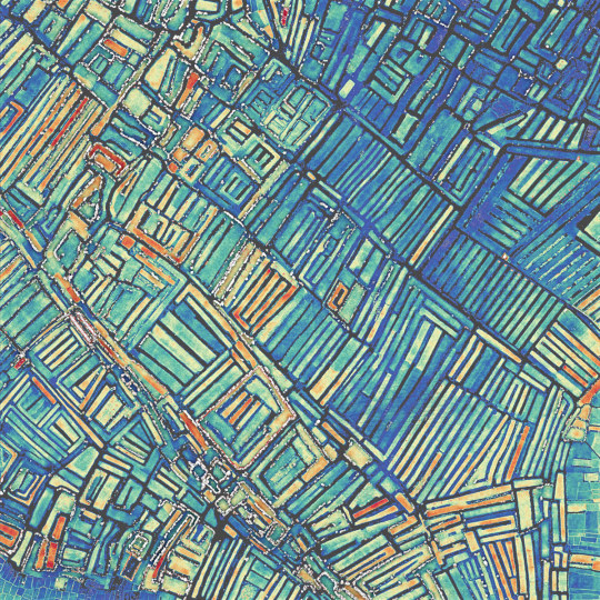
Vegetable fields in the high plains of Madagascar are recognizable by their longitudinal shape surrounded by irrigation channels. This morphology of terrain makes it possible to irrigate the clay soils without submerging the vegetables, which cannot withstand flooding. Course: Digital Design Methods 3, MScLA, ETH Zurich. Location: -18.887, 47.445, colored by height 1247.8 - 1248.8 m AMSL.
#ethzurich#eth#fcl#digitaldesignmethods#madagascar#antananarivo#teaching#pointcloudmodel#lidar#laserscanning#spectrummapping#scientificvisualization
3 notes
·
View notes
Photo
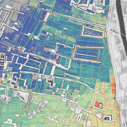
Fruit trees, mainly mango and mandarin, are found among the rice fields. These trees are hydrophobic and must be planted on high ground, appearing here as longitudinal islands separating the fields. Course: Digital Design Methods 3, MScLA, ETH Zurich. Location: -18.914, 47.442, colored by height 1247.5-1248 m AMSL.
#ethzurich#eth#fcl#digitaldesignmethods#madagascar#antananarivo#teaching#pointcloudmodel#lidar#laserscanning#spectrummapping#scientificvisualization
1 note
·
View note
Photo
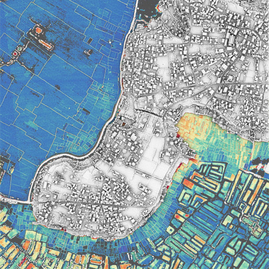
The hill settlements are typical of the Malagasy culture. The circle on the highest point is a heritage from ancient fortified villages. In the plains, it is easy to distinguish the rice fields, which stand low and are surrounded by a thin ring of dikes, and the vegetable fields, which are elevated and surrounded by irrigation canals. Course: Digital Design Methods 3, MScLA, ETH Zurich. Location: -18.897, 47.454, colored by height 1246.7-1247.7 m AMSL.
#ethzurich#eth#fcl#digitaldesignmethods#madagascar#antananarivo#teaching#pointcloudmodel#lidar#laserscanning#spectrummapping#scientificvisualization
0 notes
Photo
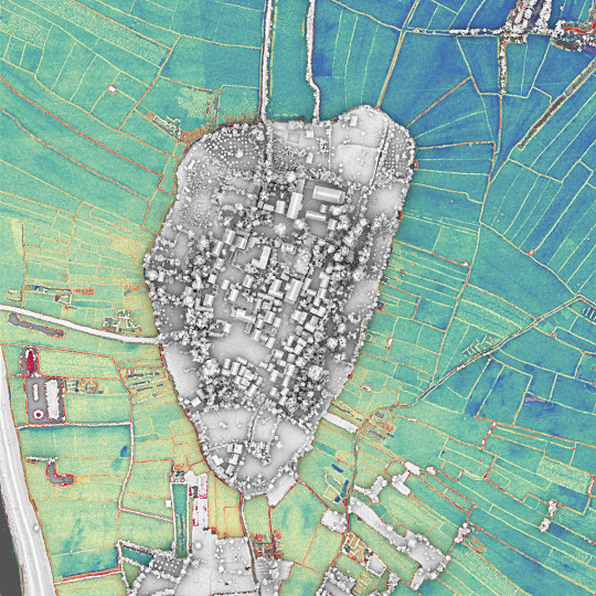
The village of Anosikely near Antananarivo is a landscape construct made of farming and flooding regimes. The village integrates the traditional layout of Malagasy villages and is surrounded by plot gardens of vegetables and fruit trees. Course: Digital Design Methods 3, MScLA, ETH Zurich. Location: -18.913, 47.448, colored by height 1247-1248 m AMSL
#ethzurich#eth#fcl#digitaldesignmethods#madagascar#antananarivo#teaching#pointcloudmodel#lidar#laserscanning#spectrummapping#scientificvisualization
0 notes