#national historical trail
Text
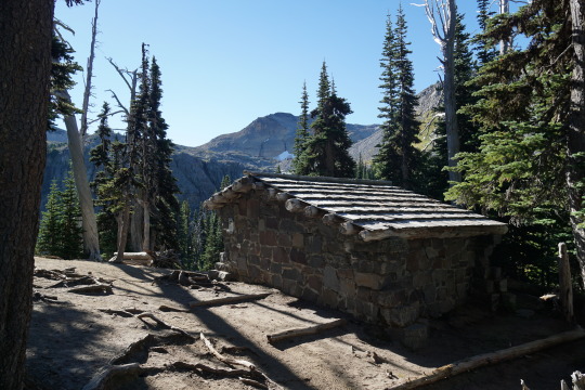
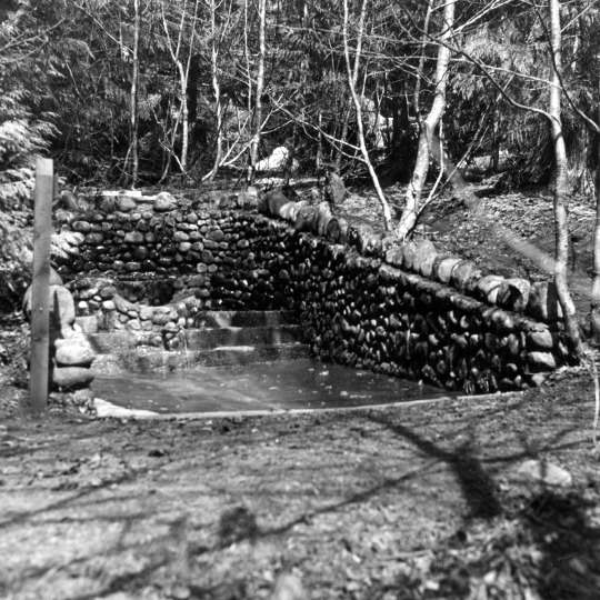
NPS Photo of the Summerland Shelter in 2020.
Most patrol cabins and shelters in Mount Rainier National Park are made out of wood, but two trail shelters along the Wonderland Trail were constructed out of stone by the Civilian Conservation Corps. The first, Summerland Trail Shelter, was built in 1934 and the second, Indian Bar Trail Shelter, was built in 1940.
NPS Photos of the Summerland Shelter in 1963 and in 2020.
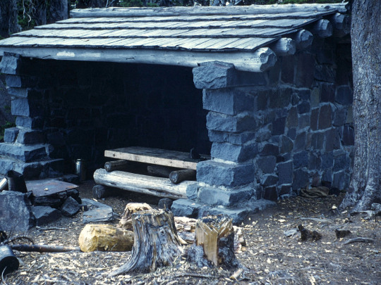
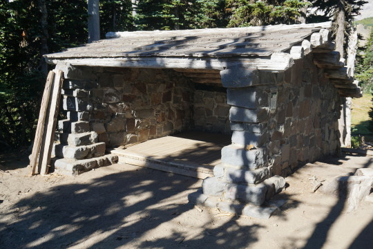
The supervisory landscape architect overseeing the construction of the Summerland Shelter remarked “the workmen were inexperienced in stonework and the shelter was not too good in appearance, but it was in harmony with its location”. The trail shelters have stone masonry walls on three sides, the fourth side open, log rafters, and cedar shake roofs. The Indian Bar shelter also has a stone chimney.


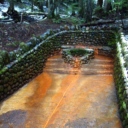
NPS Photo of Indian Bar Shelter in 1970 and NPS/RJ. Hentges Photo of Indian Bar Shelter, date unknown.
Both Summerland and Indian Bar Trail Shelters are part of the Mount Rainier Historic Landmark District. Have you stopped for a rest at one of these trail shelters while hiking?
#Historic Mount Rainier#mount rainier national park#trail shelter#historic building#national historic landmark district
30 notes
·
View notes
Text
January 2nd, 2023
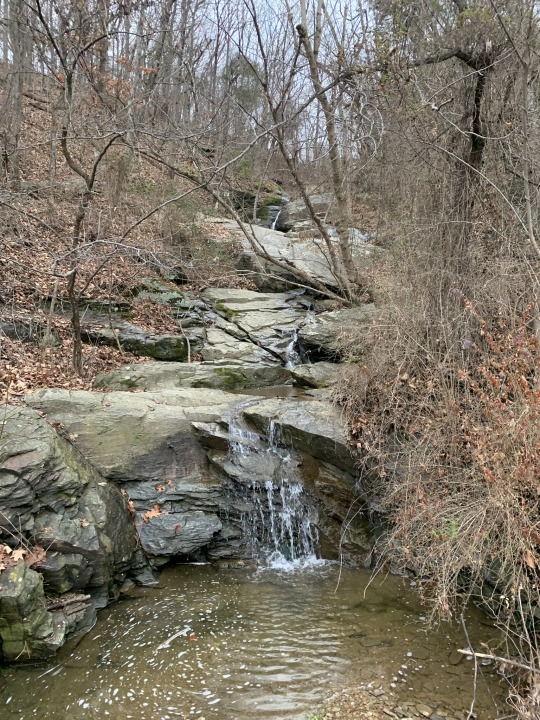
Harpers Ferry, West Virginia
#photography#harpers ferry#west virginia#harpers ferry national historic park#national historic park#national park service#nps#blue ridge mountains#appalachain mountians#appalachain trail#creek#waterfall#nature#landscape#winter#fall
26 notes
·
View notes
Text
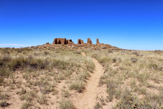
Pueblo Alto Trail, Chaco Canyon, New Mexico
14 notes
·
View notes
Text
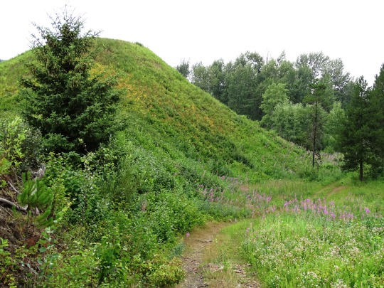

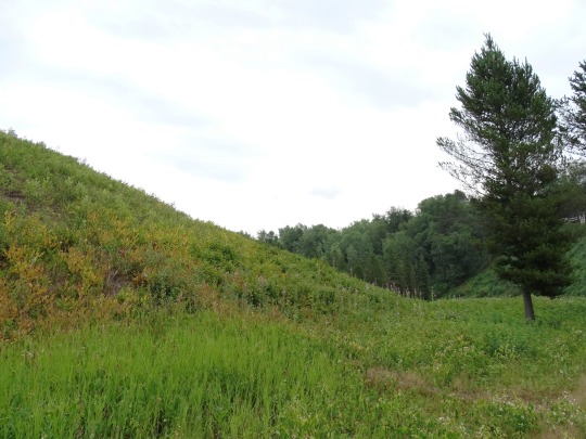

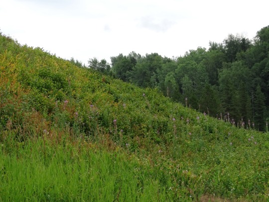

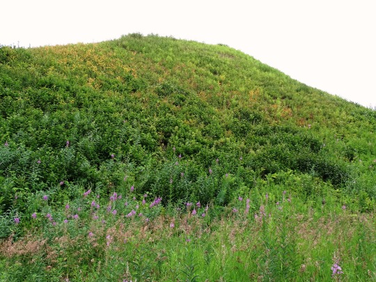


Gitwangak Battle Hill, BC (No. 4)
Park at the viewpoint of Gitwangak Battle Hill National Historic Site and survey the surrounding hills and Kitwanga River valley as the Gitwangak people did in the mid-1700s to early 1800s. Their fortified village once stood on a high mound next to the river and Kitwankul Grease Trail, fuelling trade in oolichan grease, a rich staple.
Take a short walk down a wooden staircase to the grassy mound where five cedar plank longhouses were once surrounded by a palisade, armed with massive spiked logs. Learn about the fort’s famous warrior ‘Nekt, whose exploits are legendary in the northwestern BC regions of Skeena, Kitimat and Nass.
At nearby Gitwangak Village, view a collection of age-old totem poles rich in First Nations history. Examine the totem “Man-Crushing Log”, erected in 1905, depicting stories related to Battle Hill figures and families, including ‘Nekt in fierce grizzly bear armour.
Source
#Kitwankul Trail#Gitwangak Battle Hill#National Historic Site of Canada#Kitwanga#Kitwanga River#Skeena region#West Central British Columbia#Kitwanga Fort#travel#original photography#vacation#tourist attraction#landmark#landscape#countryside#free admission#flora#woods#tree#Canadian history#First Nations#Kitwanga River Valley#Gitwangak people#Self-guiding trail#British Columbia#summer 2023#wildflower#bee#archaeology#pine cone
5 notes
·
View notes
Text
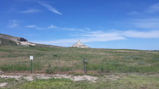
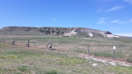


Chimney Rock National Historic Site, Nebraska
https://midwesternartlovertraveler.tumblr.com/
#my own photo#chimney rock national historic site#chimney rock#nebraska#national historic site#oregon trail#usa#united states of america
8 notes
·
View notes
Text
Along the Santa Fe Trail
The Santa Fe trail stretches from Independence, Missouri to Santa Fe, New Mexico. The trail is almost 900 miles and crosses parts of five states. I have not traveled all along it’s length but I have been to a number of neat locations and I hope to visit more.
Dodge City
When those traveling the Santa Fe Trail reached Fort Dodge, east of current day Dodge City, they had a choice to make. They…

View On WordPress
#Bent&039;s Old Fort#Cimarron National Grasslands#Dodge City#Historic Adobe Museum#Santa Fe Trail#Santa Fe Trail Tracks#Wagon Bed Springs
2 notes
·
View notes
Video
Layers of Limestone Under Blue Skies Along the Hot Springs Trail (Big Bend National Park) by Mark Stevens
Via Flickr:
A view looking up a limestone cliff wall while walking the Hot Springs Trail in Big Bend National Park. My thinking in composing this image was to have a layered approach. I would get up near the wall and use the layers in the limestone rock wall as kind of a frame to the view upward with the cactus and then blue skies above.
#Azimuth 341#Big Bend National Park#Big Bend Ranges#Big Bend and Carlsbad Caverns National Parks#Blue Skies#Boquillas Hot Springs#Cactus#Chihuahuan Desert#Day 2#Desert#Desert Landscape#Desert Mountain Landscape#Desert Plant Life#DxO PhotoLab 5 Edited#Hot Springs Historic District#Hot Springs Trail#Intermountain West#Landscape#Layers of Rocks#Limestone Cliffs#Limestone Walls#Looking North#Looking Up#Mountains#Mountains in Distance#Mountains off in Distance#Mountainside#Nature#Nikon D850#Outside
2 notes
·
View notes
Text
Richard Hunt named executive director of Lewis and Clark Trail Heritage Foundation
The Lewis and Clark Trail Heritage Foundation is pleased to announce the appointment of Richard Hunt as the organization’s executive director.
Richard Hunt
Jim Sayce, president of the Lewis and Clark Trail Heritage Foundation, said Hunt was one of 28 applicants for the executive director position and the unanimous choice of the organization’s executive search committee and board of directors.…

View On WordPress
#Lewis and Clark Expedition#Lewis and Clark Expedition National Historic Trail#Lewis and Clark Trail Heritage Foundation
0 notes
Text
Guide to Experiencing the Magnificent Natural Arches & Trails of Arches National Park, Utah
Welcome to the wondrous landscape of Arches National Park, a geological treasure tucked away in the heart of Utah. The park flaunts over 2,000 natural stone arches, a wide range of unique geological resources, and an array of fascinating trails waiting to be explored. This guide will serve as your compass, leading you through the mesmerizing vistas, inspiring sunsets, and captivating wildlife…
View On WordPress
#Arches National Park#Geology#Hiking#hiking trails#Historical Significance#National Park Service#Outdoor Adventures#Travel Guide#US Geological Survey#Utah#Visit Utah
0 notes
Text
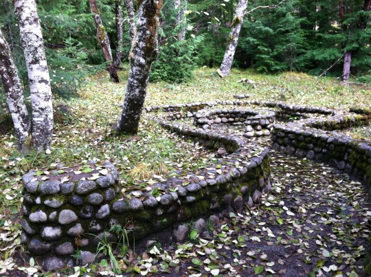
NPS Photo of Soda Springs in 2013.
The Longmire area was first settled by James Longmire, who’s family went on to run a health resort in the late 1800s to early 1900s using natural volcanic mineral springs found in the area. Two mineral springs built during 1920s remain from the original resort development in the Longmire Meadow.
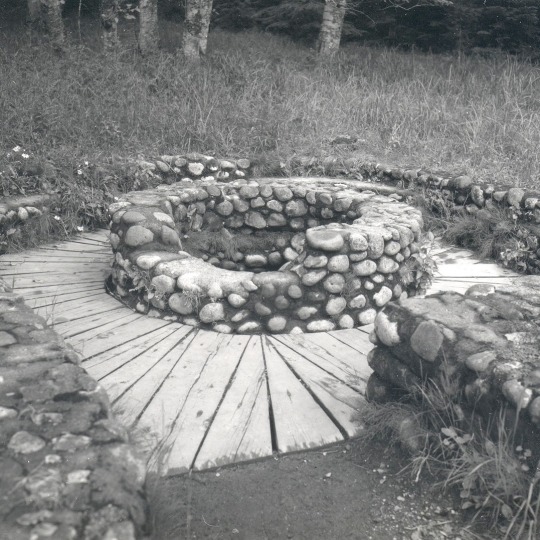
NPS/D. Schnute Photo of Soda Springs in 1986.
Soda Springs is named for the soda, magnesium, iron, and sodium chloride content of its waters. It has a stone masonry enclosure surrounded by a wooden plank walkway with a short spur trail edged by stone parapet walls.
Mount Rainier National Park Archives Photo of Iron Mike circa 1940s (left). NPS Photo of Iron Mike in 2017 (right).
Iron Mike Springs has high iron content in the water, giving the spring both its rusty color and its name. Iron Mike has a circular stone masonry enclosure with concrete steps enclosed by a U-shaped parapet wall.
Both springs are contributing structures in the Mount Rainier Historic Landmark District. Have you viewed these springs along the Trail of the Shadows in Longmire?
#Historic Mount Rainier#mount rainier national park#Longmire#Longmire Meadow#Trail of the Shadows#Longmire Soda Springs#Iron Mike#volcanic mineral springs#mineral springs#history#national historic landmark district
22 notes
·
View notes
Text

January 2, 2023
Harpers Ferry, West Virginia
#photography#harpers ferry#west virginia#harpers ferry national historic park#national historic park#national park service#nps#blue ridge mountains#appalachain mountians#appalachain trail#greenery#church#ivy#historic building
11 notes
·
View notes
Text
"The Yurok will be the first Tribal nation to co-manage land with the National Park Service under a historic memorandum of understanding signed on Tuesday [March 19, 2024] by the tribe, Redwood national and state parks, and the non-profit Save the Redwoods League, according to news reports.
The Yurok tribe has seen a wave of successes in recent years, successfully campaigning for the removal of a series of dams on the Klamath River, where salmon once ran up to their territory, and with the signing of a new memorandum of understanding, the Yurok are set to reclaim more of what was theirs.
Save the Redwoods League bought a property containing these remarkable trees in 2013, and began working with the tribe to restore it, planting 50,000 native plants in the process. The location was within lands the Yurok once owned but were taken during the Gold Rush period.
Centuries passed, and by the time it was purchased it had been used as a lumber operation for 50 years, and the nearby Prairie Creek where the Yurok once harvested salmon had been buried.
Currently located on the fringe of Redwoods National and State Parks which receive over 1 million visitors every year and is a UNESCO Natural Heritage Site, the property has been renamed ‘O Rew, a Yurok word for the area.
“Today we acknowledge and celebrate the opportunity to return Indigenous guardianship to ‘O Rew and reimagine how millions of visitors from around the world experience the redwoods,” said Sam Hodder, president and CEO of Save the Redwoods League.
Having restored Prarie Creek and filled it with chinook and coho salmon, red-legged frogs, northwestern salamanders, waterfowl, and other species, the tribe has said they will build a traditional village site to showcase their culture, including redwood-plank huts, a sweat house, and a museum to contain many of the tribal artifacts they’ve recovered from museum collections.
Believing the giant trees sacred, they only use fallen trees to build their lodges.
“As the original stewards of this land, we look forward to working together with the Redwood national and state parks to manage it,” said Rosie Clayburn, the tribe’s cultural resources director.
It will add an additional mile of trails to the park system, and connect them with popular redwood groves as well as new interactive exhibits.
“This is a first-of-its-kind arrangement, where Tribal land is co-stewarded with a national park as its gateway to millions of visitors. This action will deepen the relationship between Tribes and the National Park Service,” said Redwoods National Park Superintendent Steve Mietz, adding that it would “heal the land while healing the relationships among all the people who inhabit this magnificent forest.”"
-via Good News Network, March 25, 2024
#indigenous#land back#indigenous issues#first nations#native american#indigenous peoples#yurok#yurok tribe#national parks service#national park#redwoods#california#trees#trees and forests#united states#good news#hope#indigenous land
5K notes
·
View notes
Text


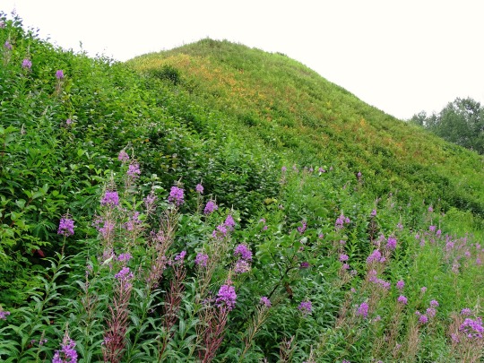
Gitwangak Battle Hill, BC (No. 2)
According to legend, Lutraisuh, daughter of a noble family, was kidnapped by a Haida war party. After bearing three sons to a blind chief, she escaped with the surviving third son. The boy, called Nekt, grew up to became a fierce warrior. He killed a grizzly bear, lined the hide with sheets of slate, and created a simple suit of armor. His people built the hilltop stronghold from which they waged war. His enemies regarded Nekt as a mythical bear that could not be killed. His war club was called Strike-Only-Once. Eventually, a shot from the first firearm in the territory killed him.
Designated a national historic site in 1971, the Gitwangak hilltop fort (Ta’awdzep) was burned and abandoned about 1835. Formerly known as Kitwanga Fort, the site was occupied from at least the mid-1700s. Palisades surrounded the hilltop stronghold, which enclosed five longhouses. No above ground structures have survived. From here, the Gitwangak people raided settlements along the Skeena River and the coast. Battles were waged to control fishing sites, protect trade routes, and enhance tribal prestige. A defensive measure was a system of logs designed to roll down upon approaching attackers. The location offered a vantage point over the adjacent Kitwankul Trail and the Kitwanga River Valley.
Source: Wikipedia
#Kitwankul Trail#Gitwangak Battle Hill#National Historic Site of Canada#Kitwanga#Kitwanga River#Skeena region#West Central British Columbia#Kitwanga Fort#travel#original photography#vacation#tourist attraction#landmark#landscape#countryside#free admission#flora#woods#tree#Canadian history#First Nations#Kitwanga River Valley#Gitwangak people#Self-guiding trail#British Columbia#summer 2023
2 notes
·
View notes
Text

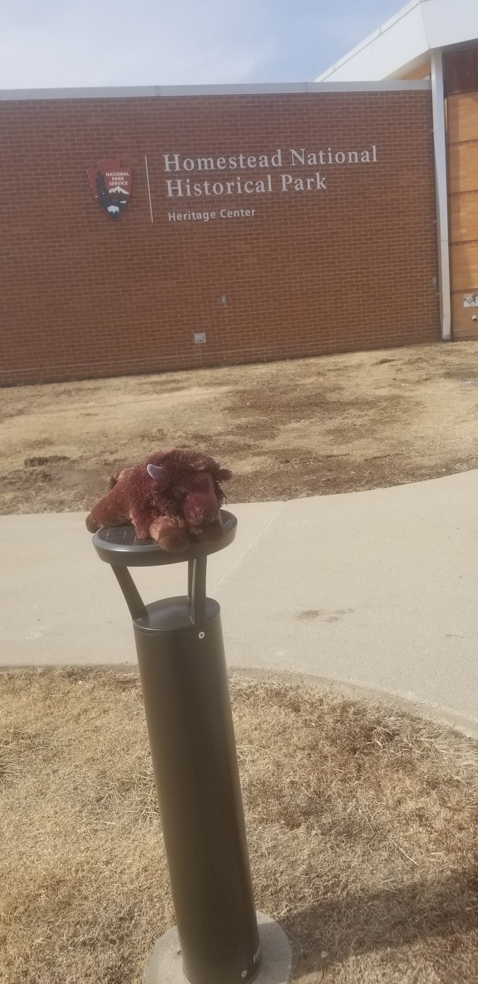


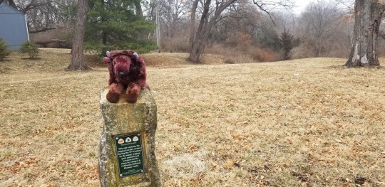
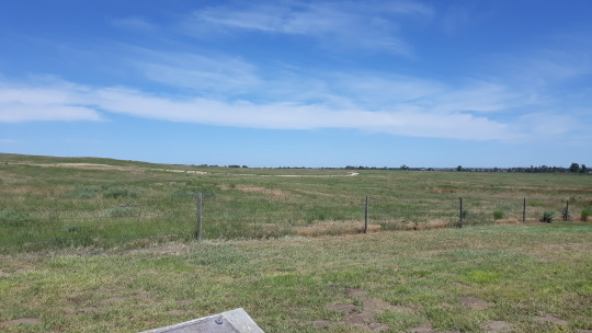
#traveling#homestead national monument#copilot#bison#nps#Nebraska!#homestead national historical park#hmmmmm#need more stamps#passport stamps!#national park passport program#brown v board#we turn our back on racism#equality or bust!#whites and blacks are equal#as is every color under the sun#black lives matter#all lives matter#brown v board of education national historic site#oregon trail#california trail#santa fe trail#swales!#wagon ruts#wieduwilt swales#independence#independence mo#missouri#kansas#topeka
1 note
·
View note
Text

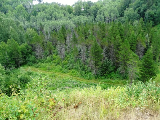
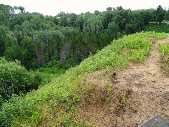
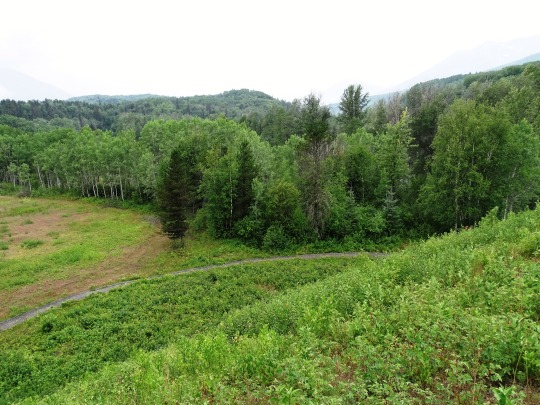
Forest Walk
1 note
·
View note
Video
Badlands and the Blue Mesas (Petrified Forest National Park) by Mark Stevens
Via Flickr:
A view looking to the east to badlands hillsides while hiking the Blue Forest Trail in this part of Petrified Forest National Park.
#Arizona Petrified Forest National Park and Sedona#Azimuth 100#Badlands#Blue Badlands#Blue Forest Trail#Blue Mesa#Blue Skies#Chinle Formation#Colorado Plateau#Colorful Badlands#Day 3#Desert#Desert Landscape#Desert Plant Life#DxO PhotoLab 4 Edited#Historic Blue Forest Trail#Intermountain West#Landscape#Landscape - Scenery#Looking East#Nature#Nikon D850#No People#Outside#Painted Desert#Petrified Forest National Park#Project365#Scenics - Nature#SnapBridge#Southeast Colorado Plateau
3 notes
·
View notes
Last Seen Blogs

askthelovenest
The Love Nest

ashanelee-blog
Untitled

vicejar-blog
let it be

thedarklingxalina
Darklina

hh-misawa-handmademarche
おすすめのハンドメイド作家さん