
Don't wanna be here? Send us removal request.
Statistics
We looked inside some of the posts by verifylocationcodes and here's what we found interesting.
Average Info
Notes Per Post
1
Likes Per Post
1
Reblog Per Post
0
Reply Per Post
0
Time Between Posts
3 minutes
Number of Posts By Type
Text
5
Last Seen Tumblr Blogs


Fun Fact
Tumblr was acquired by Yahoo for $1.1B in 2013.
Text
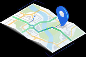
Forward Geocoding Explained: How Addresses Are Transformed Into Geographic Coordinates

In today's digital landscape, where location-based services are integral to various applications, understanding how textual addresses are converted into precise geographic coordinates is essential. This process, known as forward geocoding, enables applications to map addresses to specific locations on the Earth's surface, facilitating services like navigation, delivery routing, and spatial analysis.
What is Forward Geocoding?
Forward geocoding is the process of converting human-readable addresses, such as "1600 Amphitheatre Parkway, Mountain View, CA," into geographic coordinates—latitude and longitude—that can be used to place markers on a map or for other spatial computations.
This process is fundamental in various applications, including:
Mapping services
Location-based search
Delivery and logistics optimization
Geospatial data analysis
How Forward Geocoding Works
The forward geocoding process involves several steps:
Input Parsing: The address is parsed to identify components like street number, street name, city, state, and postal code.
Standardization: The parsed address is standardized to match the format used in the geocoding reference database.
Matching: The standardized address is matched against a geographic database that contains address ranges and their corresponding coordinates.
Interpolation: If an exact match isn't found, interpolation is used to estimate the location based on nearby address ranges.
Output Generation: The final output is the geographic coordinates corresponding to the input address.
Applications of Forward Geocoding
Forward geocoding is utilized in various domains:
Navigation Systems: Converting user-entered addresses into coordinates for route planning.
E-commerce: Determining delivery locations for online orders.
Emergency Services: Locating incidents based on reported addresses.
Urban Planning: Analyzing spatial distribution of infrastructure and services.
Challenges in Forward Geocoding
While forward geocoding is powerful, it faces several challenges:
Ambiguous Addresses: Multiple locations may share similar addresses, leading to confusion.
Incomplete or Inaccurate Data: Missing components in an address can hinder accurate geocoding.
Dynamic Environments: Changes in address data due to new developments or renaming can affect accuracy.
Best Practices for Effective Forward Geocoding
To enhance the accuracy and efficiency of forward geocoding:
Use Standardized Address Formats: Ensure addresses follow a consistent format.
Validate Input Data: Check for completeness and correctness before processing.
Leverage Reliable Geocoding Services: Utilize reputable APIs and databases that are regularly updated.
Handle Ambiguities Gracefully: Implement logic to manage multiple matches or uncertain results.
Conclusion
Forward geocoding plays a crucial role in bridging the gap between human-readable addresses and machine-understandable geographic coordinates. By understanding its mechanisms, applications, and challenges, businesses and developers can better harness its capabilities to enhance location-based services and decision-making processes.
youtube
SITES WE SUPPORT
Verify Location GeoCodes – Wix
0 notes
Text
What Is Forward Geocoding? A Beginner’s Guide to Address-to-Coordinate Conversion
Forward geocoding is the process of converting human-readable addresses into geographic coordinates. This technique is fundamental in various applications, including mapping, navigation, and location-based services.
Understanding Forward Geocoding
Forward geocoding translates a physical address into latitude and longitude coordinates. For example, "1600 Amphitheatre Parkway, Mountain View, CA" becomes (37.4220, -122.0841).
Applications of Forward Geocoding
Mapping and Navigation
Geocoding enables the placement of addresses on digital maps, facilitating navigation and route planning for users and businesses.
Delivery and Logistics
Businesses use geocoded addresses to optimize delivery routes, ensuring timely and efficient distribution of goods and services.
Emergency Services
Emergency responders utilize geocoding to locate incidents quickly, improving response times and potentially saving lives.
Implementing Forward Geocoding
Several APIs and services offer forward geocoding capabilities, including Google Maps Geocoding API, Mapbox, and LocationIQ. These tools provide developers with the means to integrate geocoding into applications and systems.
Challenges and Considerations
While forward geocoding is powerful, it can face challenges such as ambiguous addresses or incomplete data. Ensuring data quality and using reliable geocoding services can mitigate these issues.
Conclusion
Forward geocoding is a vital process in translating addresses into geographic coordinates, enabling a wide range of applications from navigation to logistics. Understanding and implementing forward geocoding can significantly enhance the functionality of location-based services.
youtube
SITES WE SUPPORT
Verify Location GeoCodes – Wix
0 notes
Text
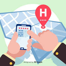
From E-Commerce to Direct Mail: Address Verification Benefits Across Industries
Address verification is a critical component for businesses that rely on accurate customer information. From e-commerce platforms to direct mail campaigns, ensuring the validity of address data is essential for operational success.
E-Commerce Industry
Reduced Cart Abandonment
Inaccurate address entry during checkout can lead to customer frustration and cart abandonment. Implementing address verification streamlines the checkout process, reducing errors and enhancing user experience.
Decreased Return Rates
Verified addresses minimize the chances of failed deliveries, reducing return rates and associated costs. This leads to improved profitability and customer satisfaction.
Direct Mail Campaigns
Improved Deliverability
Address verification ensures that marketing materials reach the intended recipients, maximizing the return on investment for direct mail campaigns. Accurate addresses lead to higher response rates and campaign effectiveness.
Cost Efficiency
By reducing undeliverable mail, businesses can save on printing, postage, and handling costs. Address verification contributes to more efficient and cost-effective direct mail operations.
Financial Services
In the financial sector, address verification is vital for compliance with regulations and fraud prevention. It ensures that customer information is accurate, aiding in identity verification processes.
Healthcare Industry
Accurate patient addresses are crucial for timely communication, billing, and delivery of medical supplies. Address verification helps healthcare providers maintain up-to-date patient records, enhancing service quality.
Government Agencies
Government entities rely on accurate address data for service delivery, emergency response, and census activities. Address verification ensures that public services are efficiently and effectively administered.
Conclusion
Address verification offers significant benefits across various industries, enhancing operational efficiency, reducing costs, and improving customer satisfaction. By implementing robust address verification systems, businesses and organizations can ensure the accuracy and reliability of their address data.
youtube
SITES WE SUPPORT
Verify Location GeoCodes – Wix
0 notes
Text
The Hidden Costs of Bad Addresses—and How Verification Solves Them

In the digital age, accurate address data is paramount for businesses across various sectors. Incorrect or outdated addresses can lead to significant financial losses, operational inefficiencies, and diminished customer satisfaction. This article delves into the hidden costs associated with bad addresses and how address verification can mitigate these challenges.
The Financial Implications of Bad Addresses
Bad address data can result in undeliverable shipments, leading to wasted resources in printing, postage, and labor. According to industry insights, undeliverable mail and packages cost businesses over $20 billion annually in the U.S. alone.
Operational Inefficiencies
Incorrect addresses disrupt logistics, causing delays and increased return rates. This not only affects the bottom line but also strains customer service resources.
Customer Dissatisfaction
Failed deliveries due to bad addresses can erode customer trust and loyalty. In today's competitive market, a single negative experience can lead to lost customers and negative reviews.
The Role of Address Verification
Address verification involves validating and standardizing address data to ensure accuracy and deliverability. This process helps businesses avoid the pitfalls associated with bad addresses.
Cost Savings
By verifying addresses before dispatch, companies can reduce return rates and associated costs. Implementing address verification can lead to significant savings in shipping and operational expenses.
Enhanced Customer Experience
Accurate deliveries contribute to higher customer satisfaction, fostering loyalty and positive word-of-mouth. Address verification ensures that customers receive their orders promptly and reliably.
Implementing Address Verification Solutions
Modern address verification tools offer real-time validation, integration with existing systems, and compliance with postal standards. Businesses can choose from various providers offering scalable solutions tailored to their needs.
Conclusion
The hidden costs of bad addresses are substantial, impacting both finances and customer relationships. By investing in address verification, businesses can enhance operational efficiency, reduce costs, and improve customer satisfaction.
youtube
SITES WE SUPPORT
Verify Location GeoCodes – Wix
0 notes
Text
Beyond the Map: Transforming Data into Action with Location Intelligence
In an era where data is abundant, the challenge lies in extracting meaningful insights to drive strategic decisions. Location intelligence (LI) emerges as a powerful solution, integrating geospatial data with business analytics to reveal patterns, trends, and relationships. This article explores how location intelligence transcends traditional mapping, enabling organizations to transform data into actionable strategies.
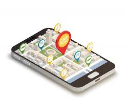
Understanding Location Intelligence
Location intelligence involves the process of deriving insights from geospatial data to solve complex problems and enhance decision-making. By layering location-specific information—such as demographics, traffic patterns, and environmental factors—onto maps or dashboards, organizations can visualize and analyze data in a spatial context .
Core Components of Location Intelligence
Data Collection: Gathering geospatial data from various sources, including GPS devices, mobile applications, and IoT sensors.
Data Integration: Combining location data with other datasets, such as sales figures or customer information.
Spatial Analysis: Applying analytical techniques to identify patterns, correlations, and trends.
Visualization: Presenting data through interactive maps, charts, and dashboards for intuitive understanding.
Applications Across Industries
1. Retail and E-commerce
Retailers leverage location intelligence to:
Optimize Store Locations: Analyzing foot traffic and demographic data to select profitable store sites.
Personalize Marketing: Delivering targeted promotions based on customer locations and behaviors.
Manage Inventory: Aligning stock levels with regional demand patterns.
Companies like Madison Reed combine customer knowledge with cellphone analytics to identify optimal locations for new salons .
2. Transportation and Logistics
In transportation, location intelligence facilitates:
Route Optimization: Planning efficient delivery routes considering traffic and weather conditions.
Fleet Management: Monitoring vehicle locations and performance in real-time.
Supply Chain Visibility: Tracking goods throughout the supply chain to identify bottlenecks and improve efficiency.
Uber, for instance, utilizes location intelligence to match riders with nearby drivers, optimize routes, and track trips in real time .
3. Urban Planning and Infrastructure
Governments and urban planners use location intelligence to:
Design Infrastructure: Planning roads, utilities, and public services based on population density and growth patterns.
Manage Resources: Allocating resources effectively by understanding spatial distribution of needs.
Enhance Public Safety: Identifying high-crime areas and deploying law enforcement accordingly.
By analyzing population density and movement patterns, governments can ensure sustainable urban development and efficient resource utilization .
4. Healthcare
Healthcare providers apply location intelligence to:
Resource Allocation: Distributing medical resources based on regional health data.
Disease Tracking: Monitoring the spread of diseases geographically to implement targeted interventions.
Emergency Response: Optimizing ambulance routes and hospital locations for quicker response times.
During health crises, location data is essential for tracking disease spread, planning vaccination campaigns, and implementing targeted interventions .
5. Agriculture
In agriculture, location intelligence supports:
Precision Farming: Monitoring soil conditions and crop health using geospatial data.
Resource Management: Optimizing the use of water, fertilizers, and pesticides based on location-specific needs.
Yield Prediction: Forecasting crop yields by analyzing environmental and historical data.
Smart agriculture uses location intelligence to combine soil moisture data with weather forecasts, providing intelligent irrigation recommendations and optimizing water use .
Enhancing Decision-Making
Location intelligence empowers organizations to make data-driven decisions by:
Identifying Opportunities: Revealing untapped markets or underserved areas.
Mitigating Risks: Anticipating and addressing potential challenges based on spatial analysis.
Improving Efficiency: Streamlining operations by understanding geographic factors affecting performance.
By visualizing data in a spatial context, decision-makers can uncover insights that might be overlooked in traditional data analysis.
Integration with Emerging Technologies
The synergy between location intelligence and emerging technologies amplifies its impact:
5G Connectivity: Enables real-time data transmission, enhancing the responsiveness of location-based applications.
Internet of Things (IoT): Provides a wealth of location data from connected devices, enriching spatial analyses.
Artificial Intelligence (AI): Enhances predictive capabilities by identifying complex patterns in geospatial data.
For example, the combination of 5G and location intelligence allows for real-time tracking and monitoring of IoT devices across various sectors, from smart cities managing infrastructure to industries optimizing their operations through IoT-driven insights .
Challenges and Considerations
Implementing location intelligence involves addressing several challenges:
Data Privacy: Ensuring compliance with regulations when handling sensitive location data.
Data Quality: Maintaining accurate and up-to-date geospatial information.
Technical Expertise: Developing the necessary skills and infrastructure to analyze and interpret spatial data effectively.
youtube
SITES WE SUPPORT
Verify Location GeoCodes – Wix
1 note
·
View note