Don't wanna be here? Send us removal request.
Statistics
We looked inside some of the posts by inca-trail and here's what we found interesting.
Average Info
Notes Per Post
0
Likes Per Post
0
Reblog Per Post
0
Reply Per Post
0
Time Between Posts
2 days
Number of Posts By Type
Text
12
Last Seen Tumblr Blogs


Fun Fact
Average visit duration of Tumblr.com is 10 mins and 25 secs.
Text
Lago Titicaca
Titicaca, Puma Lake
The name Titicaca comes from the two Quechua words "Titi" which means Puma and "Caca" which means Mont. This name recalls the cultural importance of felines for the ancient civilizations that once occupied this region.
According to the natives, the shape of the lake, if turned, resembles a puma that eats a hare. This belief is still found today in the puma masks in cake (a lake rod) that many ships admire.
Lake history - Pre-Inca
In the pre-Inca era, the Chiripa culture was one of the cultures that lived around the lake. They lived on the southern shore of the lake, leaving behind unique circular ceremonial structures that are now archaeological sites.
North of the lake, the Pucará culture lived near the lake and is known to have tamed llamas.
Inca period
Lake Titicaca is culturally very important for the Incas. According to the mythical legend, the creator of the Incas, the sun god, Inti, came from the depths of Lake Titicaca.
When the army of San Martín arrived in Peru, the lake became binational, divided between Peru and Bolivia (1825).
place
Lake Titicaca is located on the central Andes plateau, at an altitude of 3,800 m above sea level, between Peru and Bolivia. The lake reaches a maximum depth of 920 feet (281 meters).
The lake is divided into two parts:
The great lake of Chucuito, with an area of 6,450 km².
And, the smaller lake called Huiñamarca with an area of 2112 km².
Flora and fauna
Most of the animals that live in the lake are ducks, parihuanas and guallatas. Some of the freshwater fish that live in the lake include trout, pigs and carachi. The only amphibian is the giant frog that lives near the lake.
The flora is composed of aquatic plants (12 varieties) and the famous totora cane.
The terrestrial animals that live in the region are, among others, the fox and the guinea pig.
Main attractions
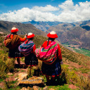
Textile art on the island of Taquile: the women of Taquile preserve the textile traditions transmitted over the centuries, including sewing and spinning techniques. Learn more about the island of Taquile: textile traditions.
Uros, the floating islands: the Uros built their houseboats on Lake Titicaca from totora reeds that grow along the banks of the lake. Without a doubt, visiting this island of the Uros to visit Lake Titicaca is a cultural experience.
0 notes
Text
Cusco
Mandatory passage before going to Machu Picchu, this city is really worth spending a few days there. The colonial architecture of the place gives the walks an air of well-being.
The local market is an opportunity to discover the local culture even better: its gastronomy, its characters, its colorful clothes. And it will be an opportunity to make good deals; The prices of food or clothing are extremely affordable.
Cusco is a city populated by 435,000 inhabitants, capital of the province of the same name and located at an altitude of around 3,400 meters. The city was listed as a World Heritage Site by UNESCO in 1983 and enjoys an intense tourist activity with its 2 million visitors every year.
If you want to visit the last Inca city, we recommend traveling to the Quillabamba district where you can find the town of city of Vilcabamba, the Inca city that was a refuge for the last Incas.
The Killke indigenous culture built the walled complex of Sacsayhuaman around 1100. The Killkes built an important temple near Saksaywaman, as well as an aqueduct (Pukyus) and a roadway that connects prehistoric structures. Saksaywaman was expanded by the Incas.
Temple of the Holy Family
The Spanish explorer Pizarro destroyed a large part of the Inca city in 1535. The remains of the palace of the Incas, the Qurikancha (the temple of the sun) and the temple of the virgins of the sun are still standing. Inca buildings and foundations have sometimes proven to be stronger than foundations built in Peru today. Among the most notable Spanish colonial buildings in the city is the Cathedral of Santo Domingo.
The main nearby Inca sites are the supposed Pachacuti winter house, Machu Picchu, accessible on foot by the Inca trail or by train and the "fortress" located in Ollantaytambo.
The less visited ruins include: Incahuasi, the highest of all Inca sites at 3,980 m; Vilcabamba, the capital of the Incas after the capture of Cusco; the Ñusta Hisp'ana sculpture garden (also known as Chuqip'allta, Yuraq Rumi); Tipón with water channels that run on large terraces; as well as Willkaraqay, Patallaqta, Chuqik'iraw, Moray, Vitos and many others.
The surrounding region, located in the Watanay Valley, has a strong activity in gold mining and agriculture, including corn, barley, quinoa, tea and coffee.
The main stadium in Cusco, the Garcilaso de la Vega Stadium, was one of the seven stadiums that were used when Peru hosted the South American Continental Football Championship, Copa América, in 2004. The stadium is home to one of the clubs of The most successful football in the country, the Cienciano club.
The city is served by Alejandro Velasco Astete International Airport.
The altitude of Cuzco is 3,399 meters, which is relatively high for tourists who are not accustomed to the altitude. It is advisable to stay a few days in Cuzco to acclimatize to the altitude if you come directly from Lima.
Architectural heritage
Due to its age and importance, the city center preserves many buildings, squares, streets and churches of the colonial era, and even some pre-Columbian structures, which led to its declaration of World Heritage by UNESCO in 1983.
If you are looking for a walk where you find a small number of people, we recommend vilcabamba trek to machu picchu where you can reach the Inca citadel of Machu Picchu leaving the routine or hiking with many people
Among the main tourist sites of the city we will highlight:
San Blas neighborhood This area is home to artisans, workshops and craft stores. It is one of the most picturesque places in the city. Its streets are steep and narrow with old houses built by the Spaniards on important Inca foundations. The area has a beautiful square and the oldest parish church in Cusco, built in 1563, with a carved wooden pulpit, considered the epitome of the carpentry of the colonial era in Cusco. The Quechua name for this district is Tuq'ukachi, which means salt opening.
Hatun Rumiyuq
This street is the most visited by tourists. On the street, Hatun Rumiyoq ("the one with the big stone") was the palace of the Inca Roca, which became the residence of the archbishop. Along this street that goes from the Plaza de Armas to the Barrio de San Blas, you can see the stone of the twelve angles, which is considered an ancient stone marvel and has become an emblem of the city's history .
Convent and Church of La Merced
Its foundation dates from 1536. The first complex was destroyed by the earthquake of 1650. Its reconstruction was completed in 1675. Its Renaissance Baroque cloister, its choir stalls, its colonial paintings and its wood carvings are in honor, turning it into a museum popular today. A custody made of gold and precious stones weighing 22 kg and 130 cm is also visible.
If you wonder how many days in Cusco and Machu Picchu? There are different options to visit the tourist places in the region of Cusco. The recommended way to schedule your trip is 4 to 9 days visiting all the circuits in Cusco.
Catedral
The first cathedral built in Cusco is the Church of Triumph, built in 1539 on the foundations of the Viracocha Inca palace. Today, this church is an auxiliary chapel of the cathedral. The city's main basilica cathedral was built between 1560 and 1664. The main material used was the stone, extracted from the nearby quarries, although red granite blocks were taken from the Saksaywaman fortress. This great cathedral has late Gothic and Baroque interiors. It houses one of the most notable examples of colonial goldsmithing. Its carved wooden altars are also notable. The city has developed a distinctive style of painting called "Cuzco School" and the cathedral houses a large collection of local artists of the time. The cathedral is known for a painting of the Last Supper of the school of Cuzco, representing Jesus and the twelve apostles celebrating a traditional Andean dish in guinea pig. The cathedral is the seat of the Archdiocese of Cuzco.
Parade ground
Known as the "Plaza del Guerrero" during the Inca period, this square was the scene of several important events, such as the proclamation of Francisco Pizarro during the conquest of Cuzco. Also, the Plaza de Armas was the scene of the death of Tupac Amaru II, considered the indigenous leader of the resistance. The Spanish built stone arches around the square, which still persist today. The main cathedral and the church of La Compañía open directly to the square.
Church of the Society of Jesus
This church (Church of the Company of Jesus), whose construction was initiated by the Jesuits in 1576 on the foundations of Amarucancha or the palace of the Inca sovereign Wayna Qhapaq, is considered one of the best examples of Baroque style. Colonial of the Americas. Its facade is carved in stone and its main altar is made of carved wood covered with gold leaf. It was built in an underground chapel and has a beautiful collection of colonial paintings from the Cusco school.
Qoricancha and Convent of Santo Domingo
The Qurikancha ("place of gold") was the most important sanctuary dedicated to the God of the Sun (Inti) at the time of the Inca Empire. According to ancient chronicles written by Garcilaso de la Vega, Qurikancha presented a large disk of solid gold studded with precious stones and representing the sun god Inca - Inti. Spanish chroniclers describe the sacred garden in front of the temple as a garden of golden plants with beaten gold leaves, silver stalks, corn cobs in solid gold and 20 life-size llamas and their shepherds, all in solid gold. The temple was destroyed by its Spanish invaders who, during their looting, were determined to rid the city of its wealth, its idolatries and its sanctuaries. Of our days, only a curved outer wall and partial ruins of the inner temple remain on the site. On the basis of this structure, the settlers built the convent of Santo Domingo in Renaissance style. The building, with a baroque tower, exceeds the height of many other buildings in this city. Inside there is a large collection of paintings from the Cuzco school.
In Cusco there is the twin brother of Machu Picchu and it is shockquirao that is located 2 days from the city of Cusco in which there are different walks; The best known is Choquequirao Trek Peru 4 days
What to do in Cusco?
Beyond the traditional visit of Machu Picchu, the region has very interesting places that are worth visiting, such as the Valicamba rainbow mountain, the sacred valley of Ollantaytambo, the archaeological site of Moray with the salt mines of Maras and the lake Humantay
Moray archeological site
These activities can be done during the day from Cusco for a very reasonable price. The best known tour to get to these Inca places is maras salt mines tour
0 notes
Text
Lima Peru
Lima is the capital of Peru and its largest city.
Founded in 1535 by the Spanish conqueror Francisco Pizarro, the modern city is a curious mixture of the modern megalopolis with some "islands of modernity", large, organized slums and colonial architecture in the city center. Lima has been the seat of Spanish rule for 300 years, and as such it has wonderful churches, cloisters and monasteries that are worth visiting.
If you are planning your trip to Machu Picchu, you must take into account the regulation on the 2020 machu picchu tickets
Lima is also the best place to try the wonderful Peruvian cuisine, which has a wide variety of ingredients from the coast, mountains and Amazonian regions. The cold sea current off the great Peruvian coast makes the sea very rich in fish and shellfish, which have a delicious taste due to the special plankton they eat. The fish and seafood restaurants are worth it and are not expensive.
Lima is built on a valley surrounded by an extremely arid desert. In summer, the weather is generally beautiful, very hot and sunny, sometimes with rains in January. In winter, the city is covered and it rains for several days. The rain in winter does not fall too hard, but it gets wet. The temperature also drops to around 7-12 °, which seems colder when combined with general humidity.
There are travel packages which include, the capital of Lima and the famous Salkantay trekking that you can reach Machu Picchu visiting the snowfall of the Peruvian Alps.
The metropolis of Lima is a metropolis of almost 8.5 million inhabitants. Many of these people emigrated from the Andes fleeing the internal conflict that began in the 1980s to find work and take refuge in Lima, some without success. This is the reason why poverty is widespread in the city center and in peripheral areas. If you arrive by plane to Lima, the first thing you see when leaving the airport is mainly the working class, the lower middle class, the neighborhoods between the airport and the historic center of Lima.
In the department of Lima there is the Inca city of Rupac, but if you want to see something similar in the city of Cusco we recommend you visit Inca quarry trek to Machu Picchu
The pre-Hispanic and colonial architecture of Lima is magnificent and the city has several museums (such as the Larco Museum) that tell the story of a country with a long history that produced a large number of coastal and Andean civilizations (such as Moche, Chavin and the Incas) and many local cultures. There are several archeological sites in and around the city (known locally as Huaca).
You want to live a different experience living with the people of Peru, Lima is the capital where you can not find. You have to travel to the city of Cusco and then do lares trek to machu picchu where you can live 4 days of experience with the villagers of the towns near ollantaytambo
#peru capital#capital of peru#what is the capital of peru#peru capital city#capital peru#where is lima#the capital of peru#what is the capital city of peru#capital de peru
0 notes
Text
Salkantay / Inca Trail (7D / 6N)
The 7D / 6N Salkantay / Inca Trail Combo is an incredible trekking for those looking for a real challenge. The walk begins just north of Mollepata and follows the same route of the first day used during the classic Salkantay walk. However, after day 1, the trail turns eastward around the impressive Apu Salkantay (Apu means "sacred") and leads through a difficult 4,900m pass. From there, the trail continues north for 2 days, towards Wayllambamba, where it joins the hikers on the classic trail. The walk requires a permit and, therefore, is only offered by registered tour operators. Places are limited.
The best time to walk on the Inca Trail
In the Peruvian subtropical Andes, two seasons dominate: the dry season runs from the end of April until the beginning of October and the rainy season begins at the end of October and continues until April. The Inca trail is the busiest during the dry season, especially from May to September. If you want to walk at this time of the year, it is advisable to book your trek with at least 6 months in advance. The dry months of March / April and October / November can also be a good time for hiking, although the probability of rain is higher. Here is a diagram showing the average number of rainy days per month in the sanctuary of Machu Picchu. December, January and February are the wettest months, and the Classic Inca Trail and the Salkantay / Inca Trail Combo are actually closed for maintenance in February (it is possible to walk the Short Inca Trail or one of the other hiking routes to Machu Picchu in February). )
Temperatures in the region are relatively constant throughout the year, with days reaching 20 degrees Celsius and temperatures below zero at night and early in the morning. Temperature fluctuations are also common when climbing high passes or falling into valleys exposed to the sun. It is important to wear layered clothing to adjust comfort levels when temperatures fluctuate during the day and at different altitude levels (see the packing list on the Inca Trail below). Microclimates in the mountains mean that it is possible to experience rain at any time of the year. So also bring clothes for rainy weather.
Information that may interest you:
cusco how many days
salkantay trail length
machu picchu 3 day hike
maras salt mines tour
Acclimatization and altitude sickness
The Classic Trail is an altitude hike that reaches a maximum altitude of just over 4,200 m (almost 5,000 m on the Salkantay / Classic Trail Combo). This means that it is possible to experience altitude sickness. Unfortunately, it is almost impossible to predict susceptibility to altitude sickness, since there is very little correlation with factors of age, gender, fitness, etc. However, we know that climbing too fast is a determining factor. To avoid altitude sickness, it is important that you understand the acclimatization process and that it happens at least 2 days before the start of the acclimatization walk in Cusco. Cusco, however, is already at high altitude (3,400 m). Therefore, if you fly from sea level, you are very likely to experience mild symptoms of altitude sickness after arriving. Rest and fluid loads for a few days are usually enough to deprive the symptoms of altitude sickness and acclimatization. We have written a very useful online guide for acclimatization and altitude sickness that we recommend you take a moment to read.
Training, fitness and preparation.
The Classic Inca Hike and the Salkantay / Classic Trail Combo are moderate to difficult walks (the latter in particular). You do not have to be physically fit or run the marathon, but you must be relatively fit and train for a few months before arriving in Cusco. The best type of training you can do is cardiovascular aerobic exercise, such as jogging, swimming or long-distance cycling. Click here to read our Inca Trail training program, which provides useful advice on the best way to prepare for the walk.
Inca Trail License
Due to the popularity of the classic track, the Peruvian government has launched a series of projects aimed at reducing the negative impact on the track and the old city. The most notable of these occurred in 2001, when the government implemented a quota system through which only a specific number of people could travel the route each day. This system is still in force and means that anyone who wishes to take the classic route must obtain a permit before leaving. The program assigns 500 permits per day, which includes tourists, porters and guides. As permits are sold on a first come first served basis, you must book your visit in advance, since the permits are like gold dust! A second government program meant that every hiker on the classic walk be accompanied by an authorized guide. Therefore, only authorized travel agencies can obtain permits, and must go through an operator to buy one. We are often asked if you can buy last minute cancellation permits. Unfortunately, the answer is no, since all permits are associated with an individual passport number and the government applies strict revision rules at Trail control points. If you plan to travel on the famous Inca route, we suggest you book your visit at least 6 months in advance, especially if you plan to walk in high season! Travel agencies can never guarantee you will get a permit. However, the earlier you book, the greater your chances. When booking with a travel agency, be sure to write down all your data carefully, since any error in personal data cannot be changed and you will not be allowed to go to the track.
Information that may interest you:
Humantay
vistadome vs 360
recreation in peru
inca trail opening dates 2020
2 day machu picchu tours
#salkantaytrek#salkantay trail#Inca Trail#Inca Trail Peru#Inca Trail to Machu Picchu#machu picchu inca trail
0 notes
Text
Classic Inca Trail (4 days / 3 nights)
The yellow line highlighted on the map indicates the classic 4J / 3N route that generally starts from KM82 (at 2,600 m). Some trekking companies start from KM88, but this is rare because cars cannot go as far as KM82. If you travel by train from Cusco, it is possible to leave KM88, but the route from this starting point joins the KM82 route very quickly, so there are no significant differences in the departure experiences. The total distance traveled between KM82 and Machu Picchu is 45 km and reaches a maximum altitude of 4,200 m. It is a moderately difficult hike that can be completed by most people, provided they are in good shape and well acclimatized (more on that below). Note: the map is not to scale and the route, particularly with respect to camping sites, may vary from one travel agency to another.
Inca trail permit
Permits for the Classic Trail route are strictly limited and almost all dates are sold months in advance each year. This applies to all operators! If you want to book on the classic pilgrimage route and find exhausted permits for your preferred dates, we recommend you choose a hike from Lares or Salkantay.
Typical Inca Trail Route
Below is a typical route for the classic 4D / 3N route. Note: Although the classic hike is 4D / 3N, most agencies organize their hotels before and after the hike, which means that most of the excursions are actually 7D / 6N (with an acclimatization day).
Day 1: Cusco - Ollantaytambo - KM82 - Wayllabamba
The first day is a trip by car or bus in the morning through the Sacred Valley and a relatively easy walk of approximately 12 km. Your tour operator will pick you up from your hotel early in the morning (usually between 5 a.m. and 6 a.m.) and take you from Cusco to the Sacred Valley (some companies start their tour in Ollantaytambo). The trip takes approximately 3 hours to reach the starting point, called KM82 (called, 82 km by train from Cusco). Along the way, you will pass through the villages of Chinchero, Urabamba and Ollantaytambo. You can stop for about an hour in Urabamba and Ollantaytambo, where you can have breakfast and last minute supplies. The KM82 trail first crosses the Vilcanota River (often called the Urabamba River) before climbing the Cusichaca River to a small local town. From there, the Urubamba mountain range (or Urubamba mountain range) will be perfectly visible, with the impressive Monte Veronica (5,860 m) that reveals its icy summit.
Mont Veronica (5680 m / 18635 feet). Veronica is the highest peak in the Urubamba Range. His Quechua name is Wakay Willca, which means "sacred tears." This image was taken on the other side of the sacred valley, near the Abra Málaga pass. On the other side of town, you will see an Inca fort called Huillca Raccay, which was built as a strategic landmark in the Urabamba Valley and was probably used to control the Cusichaca Valley. You can also see, under you and across the river, another impressive site called Inca called Patallaqta. Patallaqta was discovered by Hiram Bingham in 1911, during his trip with Machu Picchu. It is a great Inca ruin that would have been an agricultural colony used to cultivate and feed the inhabitants of Machu Picchu.
Llactapata, an impressive Inca ruin discovered by Hiram Bingham in 1911
The road continues for 7 to 8 km in a series of progressive undulations towards the small town of Wayllabamba, which means "grassy plain" in Quechua and sometimes spells Wayllapampa (3000 m). You will probably camp here at night, although some trekking companies continue a little further to the camps near Ayapata (3,300 m). Wayllabamba is the point where hikers on the Salkantay / Inca Trail walk join the Inca trail. It is also the last place on the trail where pack animals are allowed.
Day 2: Wayllabamba - Llulluchapampa - Warmiwanusca - Pacamayo
When you wake up early, you will have breakfast and prepare for the most difficult day of walking along the way. Day 2 is a trekking distance similar to Day 1, about 12 km, but it involves climbing and going through the Warmiwanusca Pass (also known as the Pass of the Dead Women), a 4,200 m crossing. The start of the walk is simple. After your first hour of walking, you will arrive at a bridge that crosses the Huayruro River. Here is a camp that has baths, so if you feel the call of nature in the morning, it would be better to wait until you reach this point. It is interesting to note that Huayruro refers to a small tree with red and black seeds, colors that are commonly seen in the ponchos of Ollantaytambo carriers. For this reason, goalkeepers in this region are often called Huayruros. From there, the trail begins to harden, crossing a piece of cloud forest that finally reaches the small town of Llulluchapampa (3,680 m) after approximately 3 hours of walking. From there, it will take another hour and a half to reach the top of the Warmiwanusca pass (also known as Abra de Huarmihuañusca or "Passage of the dead woman"), located at 4,200 m. The trip can be hot and intense if the sun rises (be sure to use sunscreen), or cold if it is cloudy / foggy and the wind rises. Make sure you have layered clothes so you can place it as much as necessary.
The view from the Passage of the Dead Woman, 4,200 m, on the Inca Trail
After celebrating your successful ascent to the highest point of the classic Inca trail, you will descend approximately 2 km along a steep path that leads to the overnight camp, located in Pacamayo (3600 m). You'll be glad to know that there are toilets in this camp. Note on the Dead Women Pass: it bears this name, not because a woman died in the pass, but because the slope of the mountain, seen from the descending valley, looks like a liar woman.
Information that may interest you:
peru choquequirao trek
inca jungle trail to machu picchu
honeymoon to peru
famous monuments in peru
sacred valley of the incas attractions
incan sun god
palcoyo mountain tour
Day 3: Pacamayo - Runkurakay - Sayacmarca - Phuyupatamarc - Winay Wayna
The third day is another difficult day that covers about 15 km and crosses two small passes. The day begins with a one-hour walk to the ruins of Runkuracay, an Inca site that is believed to have served as a watchtower over the Pacamayo Valley. After another hour of walking, you will reach the second step on the classic Inca trail called Runkuracay Pass (also known as Abra de Runkuracay), located 4,000 m away. From here, the trail consists of beautifully paved Inca trails and stairs. The first staircase downstream of the Runkuracay pass is relatively steep, so watch your feet. An hour after the second step, you will reach Sayacmarca, an Inca ruin with a beautiful stone staircase. Sayacmarca is not yet intended to be used, but the name of the site means "Inaccessible City," which accurately describes the well-protected position of the site at the foot of three steep cliffs. From there, the road passes through an original Inca tunnel before climbing to the third and last step at 3700 m. On a clear day, you will have a fantastic view of Salkantay (6,217 m) to the south and Veronica (5,860 m) to the north. Just after the pass, you will arrive in Phuyupatamarca, one of the most impressive sites of the Incas along the way (Machu Picchu bar). Phuyupatamarca or Puyupatamarca is also known as "The city between the fog" (The city above the clouds) because it is 3,200 m. Access to the site is through a steep path that crosses 5 original Inca baths that may have been used for spiritual or ritual reasons.
Phuyupatamarca or Puyupatamarca is also known as "The city between the fog" ("The city over the clouds")
Upon leaving Phuyupatamarca, you will be presented with an original Inca staircase of 1,000 steps. Prepare your knees for a difficult descent. Go slowly and make sure your foot. After 2-3 hours of hiking through the cloud forest, you will arrive at Winay Wayna camp (Quechua name for "Forever Young"). Just south of the camp are the ruins of Winay Wayna, an area that probably served as a final resting place before reaching Machu Picchu. Before arriving at Machu Picchu, the site contains a series of Inca baths that were probably used as ritual cleaning areas.
Wiñay Wayna, an Inca site located near the last camp of the same name, on the Inca Trail
Day 4: Winay Wayna - Inti Punku - Machu Picchu - Aguas Calientes - Ollantaytambo - Cusco
From Winay Wayna, you wake up early (around 04:30 a.m.) for breakfast and start an hour and a half on foot to reach Inti Punku (the door of the sun). For the first part of this hike, you may need to use a lighthouse (see the packing list for the Inca trail below), although most operators do not hire it until around 5:30 a.m. When the sun rises . The goal of early departure is to try to capture the sunrise over Machu Picchu, which takes place between 06:30 and 07:00. The trail from Winay Wayna follows a contour curve in the cloud forest before reaching a steep stone staircase, 50 in total, which leads to Inti Punku. At the top of the stairs, you will be presented with an unforgettable view when the famous Inca site of Machu Picchu is revealed.
The view of Machu Picchu from Inti Punku (the door of the sun)
You can enjoy the first views of Machu Picchu from Inti Punku for approximately 30 to 40 minutes before descending a gradual path through the citadel. From there, you register with the authorities and store your backpack. Most tour operators organize a full city tour for two or three hours before giving them free time to explore the ruins. If you still have energy and are not afraid of heights, we recommend that you reserve your place, before reaching Machu Picchu, for the ascent of Huayna Picchu (the emblematic mountain behind Machu Picchu). There are only 400 climbing permits per day and two departure times: 7:00 a.m. and 10:00 a.m., as with the Inca Trail, it is important to book in advance. Here you will find detailed information about climbing the Huayna Picchu or Mount Machu Picchu.
The view of Machu Picchu from Huayna Picchu (also known as Wayna Picchu or Wayna Pikchu)
After exploring Machu Picchu for a few hours, you should take a bus or get off at the city of Machu Picchu (also known as Aguas Calientes) in the valley below. The bus trip is usually included in the price of your excursion on the Inca trail, but the descent, which lasts approx. It is worth taking into account 2 hours, as it offers a fantastic view of the terraces of Machu Picchu. Most tour operators have booked a mid-afternoon train trip to Ollantaytambo, where they will also organize a private bus / car to take you back to Cusco. If you leave Aguas Calientes at 3:00 p.m., you will return to Cusco around 8:00 p.m. Note: You can also make an itinerary of the Inca Trail 5D / 4N that includes a night in a hotel in Aguas Calientes and an additional day in Machu Picchu. This is ideal for those who wish to spend more time in Machu Picchu (perhaps climbing Mount Machu Picchu or Putucusi) and offers the possibility of visiting the hot springs of Aguas Calientes. If you are looking for a shorter trekking experience, the "Short Inca Trail", presented below, is for you.
Information that may interest you:
rainbow mountain peru tour
machu picchu 2 days 1 night
machu picchu opening dates 2020
machu picchu by train
Humantay
Inca Road Cusco Peru
Trek to Machu Picchu
#classic inca trail#Inca Trail#Inca Trail Peru#Inca Trail to Machu Picchu#the inca trail to machu picchu#machu picchu inca trail
0 notes
Text
Inca Trail History
Peru is best known worldwide for the remains of the civilization installed by the Incas, who had deployed thousands of kilometers of trails throughout the country.
The Inca Cola is, ultimately, only a small part of a vast communication network, called in Quechua language "Qhapaq Ñan" (classified as World Heritage by UNESCO), of the Inca Empire of Tahuantinsuyo. This vast network extends over more than 6,000 kilometers from southern Colombia to northern Chile and Argentina.
Therefore, in the middle of this vast Inca communication network we find the Inca Trail, whose route is approximately 42 kilometers long, along many architectural remains, and therefore takes hikers from the fortress of Ollantaytambo to Macchu Picchu.
The Inca Trail that leads to Machu Picchu is part of a vast network of trails and roads built by the Inca Empire over 500 years ago. Depending on the resource you are reading, it is estimated that the Inca trails (or Qhapaq Ñanare, which means network of trails) have traveled between 23,000 km and 45,000 km, basically, a lot! Consisting mainly of cobblestones, the paths linked the Tahuantinsuyo empire, originally from Colombia and Ecuador to the north; in all of Peru; Chile and parts of Argentina, as well as Brazil and Bolivia (as shown in the map to the side). The size of the tracks varied from 6 to 8 m of road in their maximum width (generally in the coastal areas) to a width of 1 m in the mountainous regions of the Andes. The trails were used for a variety of reasons, including trade, efficient transportation and war. Peruvian historian José Antonio del Busto estimates that the trails developed rapidly under the reign of Huayna Capac, who would have added 16,000 km of trails to the network. Del Busto explains: "It is said that (Capac) emphasized the roads so he could gather his army more quickly and crush the rebellions that broke out during his reign." The only unique feature of the trails is that they were built with the spirit of the flame. The trails, especially in mountainous regions, are steep, steep and have high landscape characteristics that llamas can cross very well. The author Hugh Thomson writes in his highly respected and highly recommended book The White Rock: "We are used to a road system designed for the horse and then for the car: a system that tries at all costs to avoid steep slopes and whose established by the Romans) is the straight path on flat terrain. The needs of the Incas were very different: the expansion of their empire was dictated by the lama. " When the Spaniards arrived in Peru in the fifteenth century, they were surprised by the breadth, ingenuity and beauty of the trails, although they had great difficulty crossing them on horseback. Hernando Pizarro, one of the first conquerors to arrive in Cusco, wrote: "The road in the mountains is something to see because it is built on very difficult terrain. In the Christian world, we have not seen such beautiful roads. All crosses have stone or wood bridges.
Unlike most of the trails that were used for practical purposes, the Inca trail that leads to Machu Picchu was only used as a pilgrimage route or as a religious route. It had no commercial use and, therefore, is often called "royal road", "royal holy road" or "the way of the Inca king". The various Inca sites found along the 45 km path seem to support this theory. Hiram Bingham, an American academic and explorer, who discovered Machu Picchu in 1911, was surprised to discover the pilgrimage route to the city. Between 1913 and 1915, Bingham and his team discovered a large part of the weed-covered road and, in the 1990s, large portions of the route were restored. Today, the trail, located in the historic sanctuary of Machu Picchu, is considered one of the most beautiful trekking trails in the world and is visited every year by thousands of tourists.
Inca route options and maps
There are several ways to visit Machu Picchu, including taking a train or walking on one of the alternative trails that lead to Aguas Calientes, the city in the valley below Machu Picchu. But none of these alternatives is as popular and possibly as impressive as the Inca Trail hike to Machu Picchu (also known as the Inca Trail or Inka Trail). Famous as the most famous trek in Peru and one of the most iconic hiking experiences in the world, the classic Inca trek to Machu Picchu offers an impressive combination of subtropical Andean mountain environments, including cloud forest, alpine tundra and jungle, sites Inca archeological; Some of them are worth a visit! The "classic" route usually ends on a 4D / 3N route, but it can also be extended for a day or shortened with a 2D / 1N hike on the "short Inca route". It is also possible to combine the Salkantay trek with the classic route for an epic and stimulating adventure 7 days a week
Information that may interest you:
Humantay
Adventure Sacred Valley
Inca Road Peru
humantay lake tour
sacred valley peru tour
lares trek peru
ausangate trek 3 days
ausangate trek peru
ausangate mountain peru
vilcabamba peru
vilcabamba trek to machu picchu
#Inca Trail#Inca Trail Peru#Inca Trail to Machu Picchu#the inca trail to machu picchu#machu picchu inca trail
0 notes
Text
Inca Trail Peru 2020
Mythical path following in the footsteps of the Incas, the Inca trail circuit offers to leave Cusco and walk along the roads that the Incas used to reach Machu Picchu. It is one of the two access roads to access the archaeological site of Machu Picchu.
Little known to the general public, the Inca Trail is practically a must for fans of the most popular walks.
Important: places are really limited in this circuit, it is often recommended to book several months in advance.
How to book in advance?
It is a good idea to book in advance as the fee for places in the Inca circuit is particularly regulated. Around 500 and 1000 euros are needed for the complete excursion, which includes professional guide, accommodation, food, entrance ticket to Machu Picchu + the Inca Trail, as well as the return train and the bus to Cusco. You can also visit one of the many agencies once you arrive in Cuzco. It is possible to negotiate the prices playing the competition, provided that the daily quota of 400 people is not reached (which is very unlikely in high season), in which case you will have to refer to an alternative hike of the Jungle Trail or Salkantay
The best periods
It is possible to walk the Inca trail at any time of the year, except in February, when the route is neutralized to maintain it and when the rain is an obstacle to a pleasant walk.
The months of June, July and August, although they offer relatively low temperatures, and due to the drought observed during this quarter, are the preferred months for hikers who are in significant amounts on the route.
For those looking for relative tranquility, it is better to schedule the walk outside the rainy season, either from March to May or from September to November.
Whatever the chosen period, if the route is authorized, some precautions must be taken before embarking on the adventure.
Precautions to take
physical
A little training, even with the credit of satisfactory physical abilities, is essential for a few weeks before departure, imposing great steps with a backpack of a weight equivalent to the one you will carry.
Remember that you will walk at an altitude of 3600 meters. It is really advisable to stay above 2000 meters for several days before climbing, especially if you are prone to altitude sickness. The ancestral tradition of coca leaves comes from their virtues to relieve headaches due to a rarer oxygen in the mountains. The choice of shoes is essential, they must be well adapted and "made to the feet" of the hiker.
Paperwork
To be successful in your trip, it is important to register, through a serious agency, several months in advance.
In fact, access to the Inca Trail is limited to 400 tourists / day. It is wise to take out insurance, if you have not already done so, for this type of trip.
The last thing we don't always think about is verifying the validity of your passport during the reservation period and making sure it is valid for six months from the date of departure from Peru.
equipment
In addition to the essential socks and underwear in sufficient quantity, and the sleeping bag, it is good to think about wearing:
Canes to relieve the knees during numerous descents.
A small "pharmacy", disinfectant, antiseptic, strips, mosquito repellent, analgesics, anti-inflammatory, arnica, hydration kit, etc.
Protective clothing against cold, rain, sun ...
For those who bring camera and connected objects (as far as possible) they can provide a solar charger.
Finally, to ensure greater comfort during the tour, it is a good idea to bring local currency for certain stops and give tips.
Information that may interest you:
Treks to Machu Picchu
Humantay
Inca Road
the capital of peru
tickets to machu picchu 2020
salkantay trek to machu picchu
inti raymi peru 2020
inca quarry trek
inca trail tours 2020
2 day inca trail
#Inca Trail#Inca Trail Peru#Inca Trail Cusco#Inca Trail Machu Picchu#Inca Trail to Machu Picchu#Inca Trail Information#Inca Trail 4 days
0 notes
Text
Machu Picchu
The Machu Picchu (meaning "Old Mountain" in Quechua) is located at 2,430 meters of altitude in a wonderful place and is possibly the first tourist attraction in Peru, with its 800,000 annual visitors. Created by the Incas at the height of this civilization, the numerous terraces, ramps, meticulously assembled stone walls, have survived remarkably well over the centuries. Its environment, both wooded and mountainous, is located on the upper flank of the Amazon River. This judicious location allows the site to enjoy an extremely rich and diverse flora and fauna. The number of tickets available for Machu Picchuestá is limited to 2500 per day to preserve the site. It is even possible that in the future, this figure will be revised downwards.
Historical
Most archaeologists of our time agree with the time of the construction of Machu Picchu. It would have been erected by the Inca Pachacútec, who was one of the most eminent leaders of Tahuantinsuyo. This Inca ruled from 1438 to 1471. The construction of the citadel dates back to the fifteenth century. This era was synonymous with growth for many Inca civilizations. According to some archaeologists, the victory of the Incas over the Chancas was even celebrated in the area where Machu Picchu was erected.
After several decades of strong dynamism and human activity on this site, the Machu Picchu Valley became at the end of the 15th century one of the last refuge of the Incas of Vilcabamba. The latter strongly resisted, for several decades, the supremacy of the Spanish conquerors. Atahualpa was the last Inca emperor to resist. He was finally killed by the Spanish Pizzaron, marking the end of the Inca civilization.
The quality, the marvelous nature of the architectural works and the avant-garde water management systems, did not interest the Spanish colonizers much. The latter were only interested in the conquest of precious metals such as gold. Due to its very particular geographical situation and its difficult accessibility, the Machu Picchu site and its innumerable wealth sank into more than three centuries of oblivion, before being partially revealed to the entire world in 1911.
Description
The Machu Picchu site is divided into two main areas. The first is an agricultural area composed of a set of cultivated terraces. This area is south facing, which makes it suitable for agriculture and the growth of a wide range of plants. The area to the north, on the other hand, is an urbanized area. It is in this space that archaeologists assume that the inhabitants lived and where many social and religious activities were carried out. The urban area was divided into several districts: the sacred district, the ecclesiastical district, the noble district and finally, the popular district.
With respect to the agricultural area, the terraces, which appear as gigantic stairs carved on the slope of the mountain, are formed by a skillful mixture of cut stones, fragments of rock, clay and earth. The latter elements were chosen to facilitate water drainage in order to avoid any advanced degradation of the structure due to heavy rains in the region. The construction method has resisted to a great extent to the present day and has allowed to perpetuate many cultures. In addition, other small terraces cover the lower part of the site and constitute only retaining walls. Therefore, the inhabitants of the site could eat from the crops on the terrace where corn, potatoes and other vegetables were produced.
As for the urban area, a very long wall separated it from the agricultural area. The city is divided into two main axes. The first distinguishes a large built square, also on multi-level terraces. The second axis is a staircase that serves as the main street. It is at the intersection of these two strategic axes where the residence of the Inca emperor is located.
Information that may interest you:
what is the capital of peru
2020 machu picchu tickets
5 day salkantay trek to machu picchu
inti raymi 2020
quarry trek peru
inca trail tours
2 day inca trail
lake humantay tour
sacred valley tour
lares trek 4 days
ausangate trek 3 days
Weather
The summer season in Peru runs from December to March, while the winter period begins around May and ends in September. However, the high season runs from May to mid-September during the southern winter, since these are the driest months of the year, which constitutes the best conditions for visitors. January and February are considered the rainiest months of the year, but it is an interesting time to visit South America as a whole due to the reversal of the seasons compared to the northern hemisphere.
Access routes and site visits
It is possible to access the site by different steep roads. The most famous and traveled road is the so-called "Inca Trail". It is subject to relatively strict access controls. Only travel agencies have the option of taking their travelers along this route.
The archeological site is open from 6 a.m. at 5 p.m. Several tour guides recommend arriving at the opening hours to enjoy the sunrise with a clear view of the mass of tourists.
The possibilities of visit depend on the expectations and the availability of the travelers. It is possible to come and go by train on the same day and visit the site during the day by booking a ticket for the afternoon.
However, many travelers choose to make the trip in two days and spend the night before visiting the archaeological site at the foot of the mountain, in the town of Aguas Calientes.
Those who want a more complete picture of the Inca civilization and Peru in general will opt for a three to five day trekking circuit. The durations and budgets are therefore variable. There are mainly three main types of walking. The most economical is the Jungle Trail with part of the circuit made by mountain bike. The most classic, prestigious and expensive is the Inca Trail that takes the 4-day Inca trail. Finally, there is an alternative hike: Salkantay, which is more physical and requires good physical fitness to walk in the mountains.
You will leave most of the time from the capital of the province, Cusco, before joining to arrive through the town of Aguas Calientes, the last step located at the bottom of the mountain of Machu Picchu. This town, sometimes called "Machu Picchu Pueblo" is the starting point for buses to Machu Picchu. The coach runs on the road from Hiram Bingham to Machu Picchu. However, it is possible to take a more direct pedestrian path that cuts this path and requires between one and two hours of walking, depending on the physical level.
As there is no road infrastructure that serves Aguas Calientes, travelers wishing to visit Machu Picchu using the train must take the railway line that departs from Ollantaytambo or the Santa Teresa hydroelectric plant. There is a bus that takes Cusco to the train station and these trips are usually included in the walks offered by travel agencies.
The mysterious door of Machu Picchu
It was in 2010, when the Frenchman David Crespy, during a walk on the site where he was surprised by the torrential rain, a mysterious door was discovered. It was at the foot of one of the main buildings that his eye was attracted to a detail: a door sealed by a pile of stones. Subsequent research has shown that this is a door that has been cleaned to date.
0 notes
Text
Lima, Machu Picchu, Cuzco - Travel Perú
FLIGHT TO LIMA
Private transfer in the bohemian district of Barranco. It will occupy the neo-Tudor house of sculptor Victor Delfin. The garden, viewpoint overlooking the ocean, houses a strong and unleashed animal statuary. In the house, white walls and dark wood contrast; The paintings multiply the colored keys. With excellent bedding, your room overlooks the garden. The breeze ensures a natural and gentle ventilation. The elegant simplicity of places has a stripping effect in the environment. The breakfast too. Guests can use the pool, but Playa Barranco is just below, at the foot of the small cliff.
DAY 2 LIMA
Barranco's reputation is not new. In the 19th century, the Limenian aristocracy frequented the beaches. Today, creative people from all walks of life have invested buildings and casinos. The owners of galleries, restaurateurs, coffee makers followed. The public benefits of the Museum of Contemporary Art, as well as the flower gardens. Listed as a UNESCO World Heritage Site, the Cercado, Old Lima, offers splendid examples of Spanish colonial architecture, such as the Torre-Tagle Palace (18th century) or the San Juan Cathedral (17th century), which houses Tomb by Francisco Pizarro. Maybe we want to visit a museum? The Larco Museum, for example, whose collections cover several millennia of Peruvian history until the colonial period: all ancient cultures were reviewed.
Optional - Barranco in private.
Information that may interest you:
how many days in machu picchu
salkantay trek distance
3 day inca trail hike
maras salt mines tour
train to machu picchu
peru activities
inca trail opening dates 2020
DAY 3 LIMA - CUZCO - URUBAMBA
Private transfer to the airport and flight to Cuzco. New transfer to Urubamba, in the sacred valley. Installation for three nights in the northwest part of town. The contemporary Andean architecture of the hotel generously houses the light. Interior, white wood furniture, light, nice. The rooms, clear and crisp, make life easier. In his window, we get carried away by the landscape. Around the buildings, a garden, where it is good to meet at night near the fire. Andean-style breakfast is also served after five o'clock. The early risers will not waste a minute! The small spa (massages, sauna, jacuzzi) also offers excellent services to organizations requested for long days of visit.
DAY 4 URUBAMBA
Already planned for the program: local markets bring everyone together in a riot of bright colors; the highland Indians recognize themselves as their red poncho. By car, with driver, we go to visit. Starting with Pisaq: market (fresh cheese, chicken, herbs, bread, cabbage, guinea pigs, corn and potatoes of all kinds), centennial agricultural terraces and Inca citadel. At the other end of the valley, the fortified site of Ollantaytambo is a very well preserved example of Inca urban planning.
DAY 5 URUBAMBA
Already planned for the program: they bring us to the area by car and, in the company of a private French-speaking guide, we begin our explorations on the concentric terraces of the Inca Moray Agricultural Research Center. The device allowed to reproduce artificially different climatic conditions and, therefore, to develop protocols to acclimatize exotic plants. Then we will descend gently through a beautiful country that dominates the Vilcabamba mountain range, to the Maras salt flats, whose thousands of ponds make up a strange white and alveolar landscape. This day in the countryside, has about three hours of walking.
DAY 6 URUBAMBA - OLLANTAYTAMBO - AGUAS CALIENTES
Transfer to Ollantaytambo train station and panoramic train to Aguas Calientes / Machu Picchu Pueblo.
Already planned for the program: on the ferry that follows the winding road, we prepare for the crash. Because Machu Picchu, the citadel of Pachacutec, is a feat of such a level that one is speechless. The beauty of the mountains, the scale of design, logistics and engineering needed to build, the vigor, the genius that the Incas have shown here, are beyond doubt. Astonishment, in the strong sense of the word! To go beyond the simple feeling of wonder and give yourself the means to understand majesty, a private French-speaking guide is an excellent interpreter.
Night at the north end of town. Contemporary buildings along which dried eucalyptus branches make a recurring pattern and as a signature. Interior, general black and white. In the living room, fresh sheets of Peruvian cotton. The restaurant offers national and international cuisine whose ingredients are mainly organic. This last requirement also applies to spa care products. Which, installed on the upper floor, opens with large bays in the rainforest.
Information that may interest you:
machu picchu tours
rainbow mountain peru
palcoyo mountain
inca trail 2 day vs 4 day
inca sun god
sacred valley itinerary
peru monuments
Machu picchu honeymoon
jungle trek to machu picchu
choquequirao trek 4 days
inti raymi machu picchu
DAY 7 AGUAS CALIENTES - OLLANTAYTAMBO - CUZCO
Transfer to the train station and panoramic train to Ollantaytambo. Private transfer to Cuzco. The installation for three nights three blocks from the Plaza de Armas, in the old city, Peruvian folk art has given the hotel a cheerful and cheerful air, charming colors. Each piece looks like an Andean pop bouquet. However, the facilities are very well designed and comfortable. Breakfast allows you to attack the day in good condition: the spirit animated by the decoration and the body full of energy.
In the program - A pisco tasting. The national drink is a good wine brandy. We go to one of the best addresses in pisco Cuzco, to try it in its classic form of pisco sour.
DAYS 8 AND 9 CUSCO
The navel of the world, the city was probably founded by the Killke a century before the arrival of the Incas. Which had to be enlarged and converted into the capital of his empire. The Spaniards partially destroy it, but melt its Cuzco, Noble and Great City. The meeting of the Andean culture and the baroque effervescence has given surprising results, which seem to define the codes of a unique art of living. The capital of the Incas remains, literally, the base of the city: the walls and foundations often date from the pre-Hispanic period and are found in many places (especially in the old colonial neighborhood of San Blas, where your hotel is located) . In the place of the arms the Cathedral of the Assumption of the Blessed Virgin and the Church of the Company of Jesus are raised, both triumphs: golds and paintings of the school of Cuzco (XVI-XVII centuries). Sacsayhuaman, two kilometers north of Qusqu, is one of the most impressive Inca remains. This triple zigzag wall shaped like a puma head is a tour de force. The cyclopean precision of the monolith assembly leaves one speechless.
Optional: a cooking workshop; archeology and mountain biking.
DAYS 10 AND 11 CUZCO - RETURN FLIGHT
Private transfer to the airport and return flight, via Lima.
0 notes
Text
The Cusco in History
The conditions and date of when man began to inhabit this continent remain in the darkness of the past. However, the most accepted version by science is the one that indicates that the American man comes from the Asian continent and that taking advantage of the oceanic freezing in the Bering Strait he could cross to this side of the world. According to archeology, the man from Nevada, USA, had to live 30 or 50 thousand years ago. In the case of Peru, in 1969 Mac Neish revealed the oldest dates for the first Peruvians: 18 to 20 thousand years B.C. for the man from Pacaicasa in Ayacucho, an age that is within the sphere of logic because it has been determined with the Radiocarbon or Carbon 14 absolute dating technique. From then on, man travels through various places in the Peruvian Andes. In the Qosqo region, some occupations in the Pre-ceramic are known, with the men of Yauri and Chumbivilcas being the oldest and still collectors with an approximate age of 5 thousand years BC, later there are the shepherds of the areas of Canas and Chawaytiri (these previous occupations are hypothetical), and later as farmers to the men of Qorqa. It is in the Formative period when man makes his appearance in the Watanay Valley or Qosqo Valley; The oldest sedentary occupation in this valley in a first phase begins in Marcavalle east of the current city, with a relatively organized population of farmers and shepherds who used pottery from approximately 1,000 BC. With them practically the life of the city of Qosqo begins, which today is considered the oldest living city in the Americas with a continuous occupation of about 3,000 years to the present. In a second phase the Chanapata culture develops more or less in the year 800 BC. Later on, the Regional States arise, being one of the first that of Qotakalli back in the year 600 A.D. Probably by the year 750 A.D. there is the invasion of the Wari in the area of the Qosqo that built the buildings of what is now called Pikillaqta; and later in the year 800 A.D. the Regional State of Killki is formed and then that of Lucre around 1,000 A.D. What is traditionally known as the Inka civilization, empire or state begins approximately around the year 1,200 A.D. in its initial phase and then more or less in 1,400 A.D. in its expansive phase. One of the darkest times in the life of the city begins in 1,533 with the arrival and subsequent invasion and Spanish ethnocide.
It is still difficult to categorically state who were the first founders or what would be the valid foundation of the city of Qosqo. They could be the inhabitants of Marcavalle; Víctor Angles suggests that it would be the Sawasiras, Antasayas and Wallas, tribes settled in the valley before the development of Tawantinsuyo. Another foundation would be that of the first Inka: Manko Qhapaq; it is also argued that Pachakuteq, the ninth Inka made another foundation. And finally, after the arrival of the first Spaniards to the city on November 15, 1533, Francisco Pizarro founded it in Spanish fashion on Monday, March 23, 1534, in the name of the King of Spain with the name and title of: THE VERY NOBLE AND GREAT CITY OF CUZCO.
In 1535 Pizarro founded the new capital in Lima that would gain importance and power even to this day. In 1536 Manko Inka began the long and bloody war against European invaders with a siege of the city for 8 months and finally in 1572 after 36 years of war, the last emperor of the dynasty of the Inkas Tupaq Amaru I, then of his defeat and capture in Vilcabamba he was executed by sectioning his head in the city's Plaza de Armas. In 1650 the city was affected by a violent earthquake that brought down almost all colonial construction; and later in 1780 the city was again convulsed but this time by a social earthquake: the Tupaq Amaru II revolution (today the Spanishized form of its name that was José Gabriel Thupa Amaro Inga, as he himself signed it) is traditionally used, who inclined to the emancipation of Peru. Unfortunately he was betrayed, defeated and then executed like all his family and followers in the same Plaza de Armas of the city. Between 1814-15, Mateo Pumakawa cacique de Chinchero who in his youth had fought against Tupaq Amaru II, rose in arms in the Qosqo with the Angulo brothers and other patriots for the emancipation of Peru, were defeated and subsequently executed by the army pro-Hispanic. In 1821 Peru gained its independence from Spain at the end of a long, cruel and bloody process developed throughout Hispanic America. In 1933 the XXV Congress of Americanists meeting in the City of La Plata, Argentina, declared to the city of Qosqo: "Archaeological Capital of South America". In 1950 another great earthquake with 7th on the Mercalli scale hit the former Capital of Tawantinsuyo leaving only a quarter of its habitable buildings. In 1978 the VII Convention of Mayors of the Great Cities of the World, meeting in Milan, agreed to declare the city: "Cultural Heritage of the World". In Paris, on December 9, 1983, UNESCO declared the Qosqo as "Cultural Heritage of Humanity". On December 22, 1983, the Peruvian government by law No. 23765 declared the city as "Tourist Capital of Peru", in turn as "Cultural Heritage of the Nation." Today the Qosqo is the capital of the department of the same name and in turn the headquarters of the Inka Region established at the end of the 90s, formed by the departments of Apurimac and Madre de Dios. The Political Constitution of Peru of 1993 declares the city of Qosqo as its Historic Capital.
Information that will interest you:
salkantay trek peru
palcoyo mountain tour
2 day inca trail with camping
machu picchu 3 day hike
inti raymi peru
inca quarry trail
machu picchu tickets 2020
capital of peru
machu picchu vacation
0 notes
Text
Inca Trail Itinerary 4 Days 3 Nights
Performing the Inca Trail Tour 4 days 3 nights is undoubtedly a unique experience that a tourist can have in his life. This experience will touch your being and you will find yourself exploring this route. Sensations of all kinds you will experience, sensations that will be recorded in you for life. It is really difficult to find words to describe the feeling that one can experience every day and in all these 4 days.
However, every tourist should be aware that operating this Inca Route requires the hiring of people we call Porters del Inca Trail, who are the ones who will make your experience unique, and should know and know some details of this excursion to the Inca Trail and above all, collaborate with the fulfillment that the excursion you are doing is being operated supporting Responsible Tourism.
* Due to the restrictions issued by the Peruvian government on the number of people allowed to the Inca Trail per day, we recommend that you book at least 4 months in advance (6 months for the months of May to September which is the high season) and So make sure you do the Inca Trail.
ITINERARY
Starting point: Cusco.
Arrival point: Cusco
Activities: Archaeological, Cultural, Ecological, Walk.
Air tickets: Not included.
You can ask us about other services such as hotel, accommodation and other tours.
(D) = breakfast / (A) = lunch / (C) = dinner
DAY 1: CUSCO -WAYLLABAMBA (A) (C):
Very early in the morning we will pick you up from your hotel in the mobility that will take us to kilometer 82, where we will arrive approx. at 11:00 am. Then start the walk. This first day is beautiful and the first kilometers are easy to walk. We will have a beautiful view of the snowy Veronica and we will also walk near the Vilcanota River until we reach the archaeological complex of Llactapata, where we will have lunch and then continue to our first camp in Wayllabamba where we will spend the night after a restful dinner.
DAY 2: WAYLLABAMBA - WARMIWAÑUSCA - PACAYMAYO (D) (A) (C):
After breakfast we start the most difficult part of the hike but not impossible, where we will walk to the highest point of the Inca Trail where you will have an incredible panoramic view of the whole area and you can observe the different types of microclimates that exist in the zone. After approx. 3 hours walk we will pass the open called Warmiwañiusca or dead woman that is approx. at 4,200 m.a.s.l. Here you will have enormous satisfaction for having reached the highest point of the entire Inca Trail. After this fabulous experience we will have lunch and then continue descending until we reach Pacaymayo where we will have dinner and spend the night.
DAY 3: PACAYMAYO - PUYA PATAMARKA - WIÑAY HUAYNA (D) (A) (C): (**)
After breakfast we start walking until we ascend to the second most important step of the Inca Trail which is 3,850 m.a.s.l. until we reach the archaeological complex of Runkarakay where we will have a guided tour of the entire complex as well as the Sayacmarca citadel. After the guided tour we continue walking until we reach the archaeological complex of Puyupatamarca another important monument, where we will have lunch, after a short rest we will continue with the walk until we reach the last Wiñay Huayna camp (always young) where we will have a guided tour to the impressive complex archaeological. After the guided tour we will have dinner and spend the last night.
DAY 4: WIÑAY HUAYNA - MACHU PICCHU - CUSCO (D):
After breakfast, we continue with the hike very early to arrive on time and to appreciate the sunrise in Machupichu. After an hour of walking we will pass through the Inti Punku or Puerta del Sol also known as the entrance door to Machupicchu, where you can appreciate the most impressive panoramic view of the entire citadel after this experience we will visit for approximately 3 hours all around from the Inca citadel, visiting the main sites such as the enclosures, squares, sacred fountains, Temples, the agricultural and urban sector. After our guided tour you will have free time so you can take photos, etc. After prior coordination we will meet the rest of the group to take the bus that will take us to the town of Aguas Calientes (if you wish you can continue in Machupicchu). In the afternoon / evening we return to Cusco by train. End of our services.
THE TOUR INCLUDES:
Pick up from the hotel in Cusco.
Bus until kilometer 82 start of the walk.
Entrance tickets to the Inca Trail and Machupicchu.
Tourist train ticket from Aguas Calientes to Ollantaytambo.
Transfer from Ollantaytambo to Cusco.
Tent or shops (quad tent for two people),
Matras or mats.
Porters (only for tents, lunch and camping equipment).
First aid kit, oxygen balloon.
Vegetarian option (no extra charge).
Food 3 Breakfasts, 3 Lunches and 3 Dinners.
Bus tickets down from Machupicchu to Aguas Calientes. (USD 12)
All the taxes.
NOT INCLUDED:
- The first breakfast (first day) is usually provided at your hotel before leaving. - The last lunch (fourth day) when the tour ends. - Entrance to Huayna Picchu (USD 79 in case you buy it with our company). - Tips. - Personal expenses.
OPTIONAL:
Sleeping bag Goose feather up to -10 ° C (USD 30 for the entire tour, recommended).
Stick with rubber tip (USD 20 x pair, for the entire tour, recommended).
Extra carrier, maximum load 12 kilos. USD 150
During the trip you will have to load your personal things as well as a small mat which we will include and your sleeping bag (not included), if you wish you can hire an extra carrier that has the cost of USD 150 for the entire tour and you can be shared between 2, so you only have to carry a small backpack with your necessary things for each day, while we will provide a large bag to carry the carrier that can only load 12 kilos maximum decreed by the law of the carrier . (***)
IMPORTANT: The quotas for the Inca Trail are issued by the Peruvian government through DRC (Regional Directorate of Culture), remember that there are only 500 quotas per day and for all travel agencies about it. 180 are tourists the rest are support staff such as guides, cooks and porters, so we recommend booking many months in advance.
ATTENTION: If there are no seats available, you can opt for our Short Inca Trail that there are still places and we have daily departures or check our alternate and traditional Tours for which we do have seats.
salkantay trek peru
palcoyo mountain tour
2 day inca trail with camping
machu picchu 3 day hike
inti raymi peru
inca quarry trail
machu picchu tickets 2020
capital of peru
machu picchu vacation
#inca trail to machu picchu#machu picchu inca trail#inca trail to machu picchu hike#inca trail to machu picchu tours#inca trail to machu picchu map#inca trail trek to machu picchu#inca trail machu picchu hiking tours#inca trail to machu picchu best hikes#the inca trail to machu picchu#inca trail to machu picchu peru#inca trail and machu picchu#inca trail and machu picchu tour#4 day inca trail hike to machu picchu#hiking the inca trail to machu picchu peru
0 notes
Text
On the Inca Trail
IMPORTANT: due to the great demand that this excursion has, the Peruvian government in its eagerness to protect the Inca road network has limited access to the Inca trail from 4 days to 500 people per day being an approximate of 180 tourists and the rest of the personal help (guides, cooks and porters).
In this sense If you want to make the excursion in the month of October to January we recommend making your reservation more than 3 months in advance and with 6 or more months in advance for the months of March to September due to the quotas for this season They sell out quickly.
This year we have had innumerable emails requesting quotas for the Inca Trail for the months of March, April, May, June, July, August, September but unfortunately the quotas were already exhausted and could not give you any hope of getting one.
That is why our recommendation to book your reservation to the Inca trail well in advance so as not to have last minute disappointments.
Below we provide information about the Inca Trail.
One of the 7 wonders of the world
Part of the 23,000 kilometers (approximately 14,000 miles) of roads built by the Incas in South America. It is the most famous route for hiking in Peru and possibly the most spectacular in the Americas. Each year, more than 25,000 walkers from around the world walk along the 43 kilometers of this cobbled road built by the Incas that leads to the amazing Machupicchu citadel located deep in the jungle of Cusco. The trip begins in the town of Pisqacucho, at kilometer 82 of the Cusco - Quillabamba railway line and takes 3 to 4 days of intense trekking. The route includes an impressive variety of altitudes, climates and ecosystems that goes from the tips to the cloud forest. Travelers will cross two high altitude passes (the highest will be being in Warmiwañuska at 4,200 m.a.s.l.) to finish the hike with a magical entrance to Machupicchu through the Inti Punku or Puerta del Sol.
Inca Trail to Machupicchu
One of the main attractions along the route is the ancient network of settlements built in granite rock by the Incas such as Wiñay Wayna and Phuyupatamarca immersed in an overwhelming natural setting. Hundreds of varieties of orchids, multicolored birds, and dreamlike landscapes provide the ideal setting for a route that the walker should walk at least once.
Description of the Inca Trail to Machupicchu route
Based on the traditional 4 days / 3 nights
The total distance of the road is approximately 39.6 km and starts at km 82 at the place called Pisqacucho. To start the road you should cross a bridge, then head to the left side through a eucalyptus orchard and start the day calmly.
Almost immediately you will meet the archaeological complexes of Q’ente, Pulpituyoc, Kusichaca and Patallaca. From that last point you will continue the path along the left bank of the Kusichaca River in the area with the same name where you will not only see the bridge but also find tombs, aqueducts, terraces, roads and a canyon. You will continue until you reach the small town of Wayllabamba and Inca aqueducts. It takes about 4 hours to reach 9 km from this point. One will camp there the first night.
The second day is more difficult, because the walker will have to climb up to 4,200 meters, crossing the passage of Warmiwañusqa, the first and the highest. If you suffer from “soroche” (altitude sickness) it is best not to stop or descend quickly to the Pakaymayu river valley, where you can camp. This place is 7 km away and is approximately 8 hours away.
The third day is the longest but the most interesting. You will be ready to visit the most impressive complexes such as Runkuraqay, the second step at 3,800 meters above sea level, its complex yellowed with niches that were perhaps a small place to rest, guard posts and places for worship after crossing the Second step you descend to Yanacocha (The Black Lagoon) and then climb a path with stone steps to reach another group of buildings which attract the attention of visitors. This point is called Sayaqmarka a pre-Hispanic complex with narrow streets, buildings erected on different levels; sanctuaries, courtyards, canals and an outer wall of protection. At the top of the buttresses one can observe many constructions which lead to suppose that once it was a temple and an astronomical observatory, which had a permanent supply of water and excellent food stores.
Sayaqmarka is a place full of mystery and charm. The approximate distance to Runkuraqay is 5 Km. Which takes 2 hours. This complex extends to 3,600 meters above sea level. There is an excellent trail and a tunnel through this complex. We recommend camping near the ruins of Phuyupatamarca or 3 km later in the visitor center of Wiñay Wayna, where one can buy food and drinks or make use of hygienic services. The ruins of Phuyupatamarca are better preserved than we have seen before.
On the fourth day, which will start around 5:00 A.M., the walker arrives in Machupicchu around 7:00 A.M. after 8 km of hiking through the jungle. Follow the indicated route and drink some water at the Wiñay Wayna Visitor Center. The path is clearly marked but try to avoid getting too close to the edge of the cliff.
It is forbidden to camp in Inti punku. You will leave your equipment at the control gate and enjoy the most important monument in this part of the continent. You will have time to visit Machupicchu until noon. Check the train schedule to return to Cusco.
If you plan to stay in the town of Machupicchu (also called “Aguas Calientes” The distance from the station to the ruins bridge to Machupicchu is 2 km. This takes about 20 minutes down a narrow path, which runs parallel to the line railroad
Climate and Environment
The climate is relatively mild around the year, with heavy rains from November to March, dry and hot weather from April to October, which is a recommended time to visit.
The minimum annual temperature ranges from 8 ° to 11.2 ° C. In the months of June, July and August the temperature can often drop below zero.
The maximum annual temperature varies from 20.4 ° to 26.6 °. The terrain is quite irregular, with several ravines and streams fed by the glaciers that eventually pour into the Urubamba River, which crosses the area forming a deep valley that crosses the granite base of Vilcabamba for more than 40 km through a variety of ecosystems .
Landscape
The surroundings are impressive and the balance reached between nature and Inca architecture is amazing.
The mountains of Vilcabamba have wide and high peaks that reach up to 6,000 meters as well as Salkantay and Humantay among others.
The mixture of mountains, jungles and valleys create a fantastic world where sunrise and sunset are shrouded in mystery.
Wildlife
It is abundant and varied. The existence of endangered species such as the spectacled bear (Tremarctos omatus), the Andean Rocks Cock (Rupicola peruviana), the dwarf deer (Pudu mephistopheles), was one of the reasons for the Peruvian government to decide to declare it a Conservation Unit.
The park includes species such as the puma, the Andean fox, the river otter, Taruka (Huemul deer), wildcat, ferret, etc. There are birds in Machupicchu like the Caracara of the mountain, hummingbirds, torrent duck, parrots, wild turkey and several small birds of colorful plumages.
There are also reptiles such as the jargon and the snake micrurus coral (lethal by its venom), lizards, toads and numerous wildlife of the jungle and the Andes that inhabit the sanctuary. This abundant wildlife makes the Machupicchu sanctuary ideal for tourists and researchers who wish to watch or study animals.
Flora
The long natural areas are filled with a variety of forest species, which vary according to habitat. The vegetation of the forest is represented by trees such as: cedar, romerillo or intimpa, laurel, etc. There are also species like Ocotea, Pedocarpus, Guarea, Weinmania, Clusia, Cedropia, Cinchena, Eritrina or Pisonay, and holm oak among others. Decorative plants have made the sanctuary famous. Experts have identified more than 90 species of orchids and several species of begonias and the puya cactus. Most of the area is covered by herbs, shrubs, tree plants. The variety of conditions have created an ideal environment for the growth of various plants that goes from the thick jungle like the forest clouds to the highest parts of the mountains.
Archeology
Apart from all that has been mentioned, there is also the cultural heritage of the Incas. The Inca Trail which was well built, crosses the dense forests and deep canyons. There are 18 archaeological complexes along the way which can be seen in all their splendor.
These are composed of homes, irrigation canals, agricultural terraces, walls and sanctuaries, which are an irrefutable proof of the existence of important human settlements.
Facilities for tourists- Inca Trail to Machupicchu
Accommodations in Machupicchu- Hotels in Machu Picchu
There are many accommodation alternatives, from 20 dollars a night to more than 600 dollars a night.
Aguas Calientes
Located at a distance of 800 m. To the east of the city of Machu Picchu, there are underground sulfur hot springs that flow from the rock at different temperatures. The specially constructed swimming pools suitable for the use of mineral hot baths. The average water temperature ranges from 38 ° C to 46 ° C. There is also a change of rooms, sand baths and small cafes.
Train to Machu Picchu
To reach kilometer 82 one can go by train from Cusco or Ollantaytambo. Another alternative to reach kilometer 82 is by car transport to Km. 82.
Road transport
The only way to return from Machu Picchu or Aguas Calientes to Cusco is by train. Check the available train schedules.
Tourist transport to Machupicchu
There is a fleet of minibuses that link the Puente Ruinas station via a winding and narrow road to the highest hill of the Machu Picchu Complex. The driver takes approximately 20 minutes to get there and another 20 minutes to return.
The service goes every day, however the frequency depends on the number of tourists.
There is a road between the Puente Ruinas and the Machu Picchu complex. The walker takes approximately 1 hour.
Signaling
There are signs located in different parts of the road using a series of international words and symbols. In most places, these signs give the necessary information, about certain places, their weather distances and services.
These signs are classified in information, prevention and restriction.
RULES CONTROLLING TOURISTS VISIT
Each person entering the Historic Sanctuary of Machu Picchu will use the authorized routes of the trek and should pay attention to the following rules provided by the government authorities.
Information requested by the authorities and official entities.
- Pay the entrance ticket to the Inca Trail or another path.
- No littering.
- Do not make bonfires on the Inca Trail.
- Use public facilities without causing damage or destruction of them.
It is strictly forbidden to extract, prey or buy some variety of flora in the Historic Sanctuary of Machu Picchu.
Camping only in indicated places. Camping is prohibited inside archeological buildings or restricted areas.
Behave in an orderly manner so as not to disturb other hikers
Any violation of these rules will result in the police or park guard intervening to enforce the respective sanction. Respect the rules and avoid unpleasant incidents.
Information that will interest you:
salkantay trek
palcoyo mountain tour
2 day inca trail with camping
machu picchu 3 day hike
inti raymi peru
inca quarry trail
machu picchu tickets 2020
capital of peru
inca trail tours 2020
short inca trail
machu picchu vacation
0 notes