
itsrockysroad
Rocky's Road
Photos and thoughts from my adventures and personal journey
14 posts
Don't wanna be here? Send us removal request.
Last Seen Blogs

violatedmasozi
All monsters are human

smsmopop
无标题

monpetithl
"but the wait was worth it because i was in love."

petitesashimi
✿ ✿ ✿

purblehearts1
confused homosapien
Text
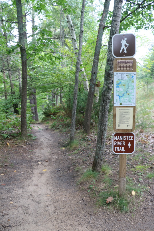
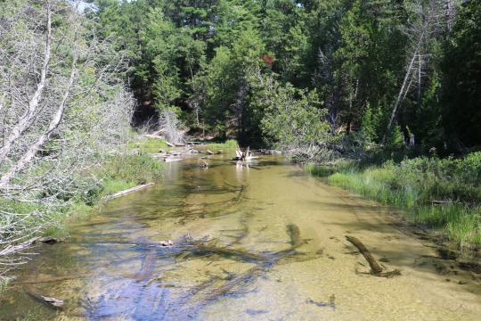
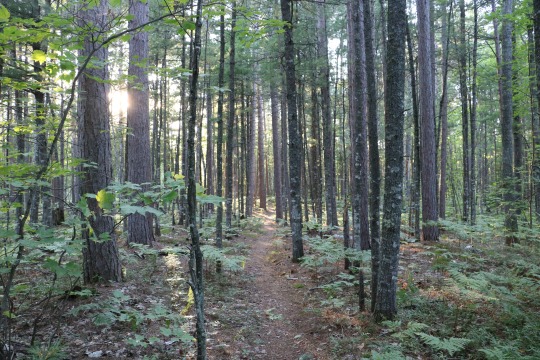
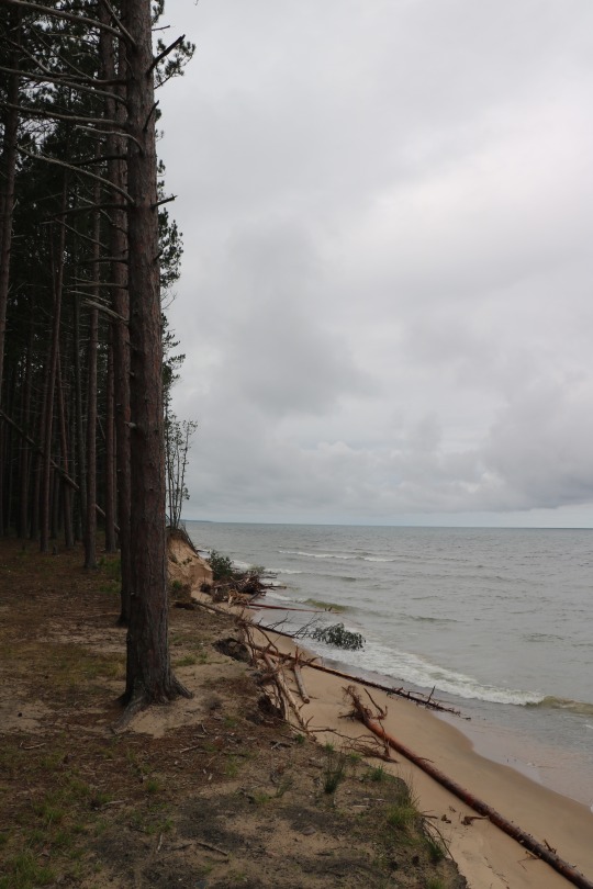
Manistee River Trail, September 2016
In September 2016, I took a spur of the moment trip to backpack the Manistee River Trail with my buddy Mark. It rained a bit on this trip, so I didn’t get many photos. But, I’ll post the few that I do have below.
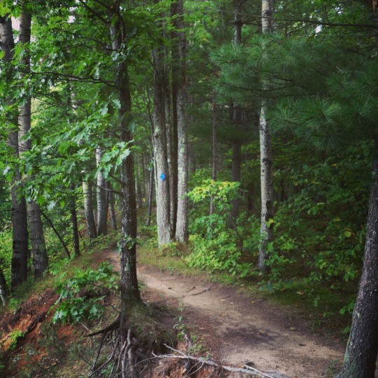
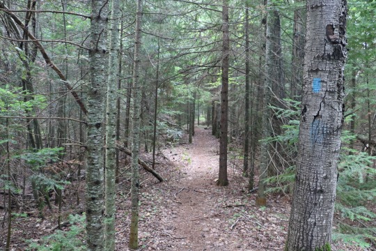
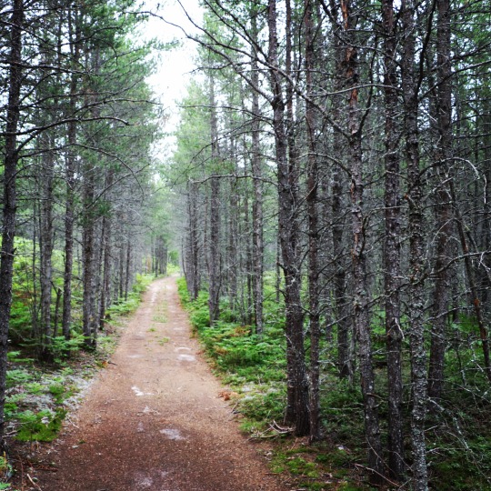
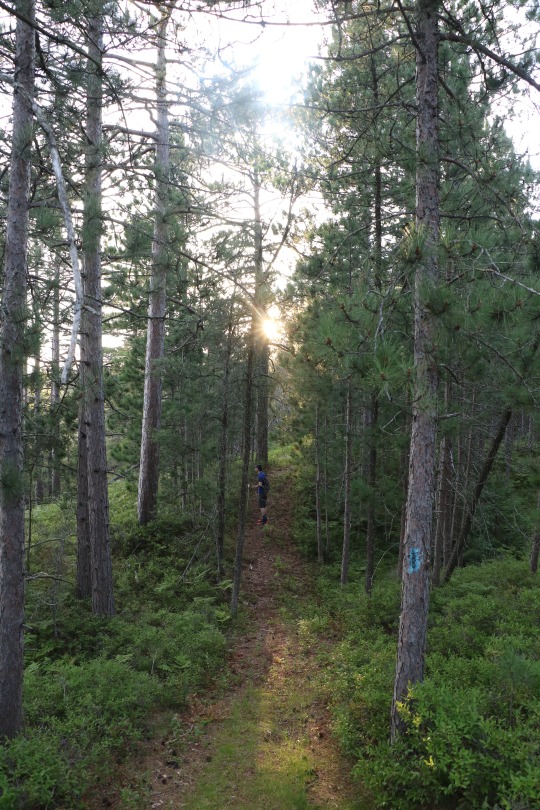
We started our hike at the Red Bridge. The photo below was taken where the trail diverges from the roadway into the forest.
The trail has beautiful views all along the hike. The scene below is near the beginning of the trail shortly after leaving the Red Bridge.
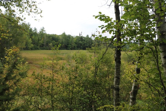
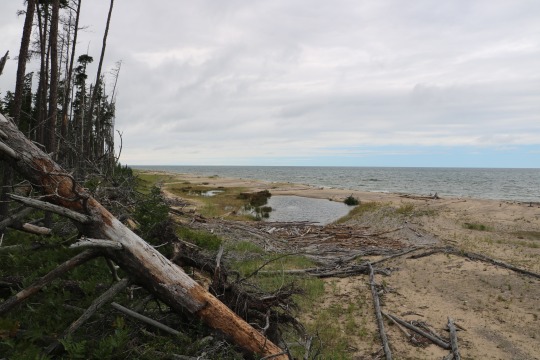
The trail meanders through the forest along the river. It is probably my favorite hike so far in the lower peninsula just for sheer natural beauty.

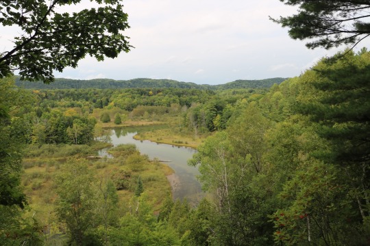
I love all of the river overlooks that are the hallmarks of this particular trail.
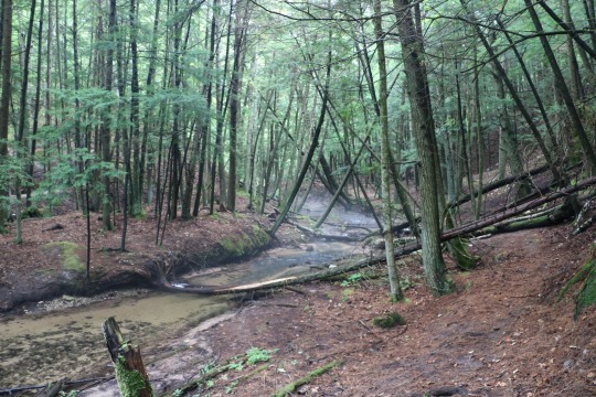
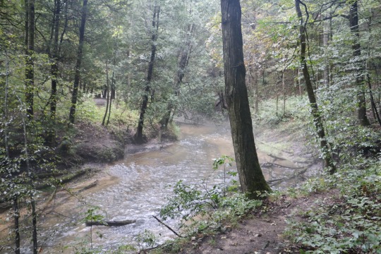
The fog hugging this little stream made it eerily beautiful.
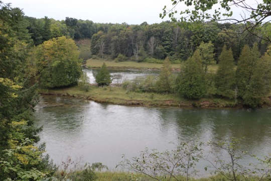
One of the most well known features of the river is the horseshoe bend. This is one view of the river as we approached the bend.
Another perspective on river turning in the bend.

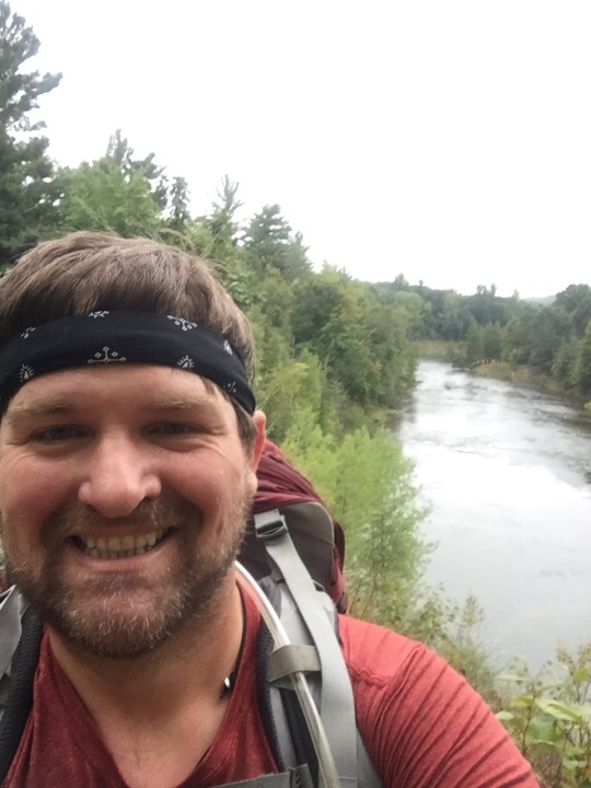
A little selfie....This was supposed to have the bend behind me, but I didn’t quite get the shot.
A slightly better perspective on the horseshoe bend.

A little waterfall along the trail.

This trail had a great feel. We were there on a weeknight and it was so peaceful. We did see a few other people along the way, but it mostly felt like we had the place to ourselves.
Another view of the river from a different overlook.
We camped at camp site #1. The camp site included a fire ring and a little pathway to the river. The selfie below was at the river by our campsite. There was a little sandy shoal here that made it easy to filter water and even take a quick dip.
There were several camp sites along the trail. Personally, I think all the camp sites were very cool. Some had really easy access to water either from the river or from small nearby streams. Some had amazing views. All of the campsites were places where I’d enjoy spending a night.
We didn’t hike the NCT side of the loop on this trip. As I said earlier, this was possibly the most scenic hiking that I have done in the lower peninsula. I highly recommend this trip for its natural beauty and scenic views. I’m hoping to hike this loop again this coming summer and hopefully I’ll get some better photos.
Resources:
Manistee River Trail Brochure from the Forest Service: https://www.fs.usda.gov/Internet/FSE_DOCUMENTS/fseprd493793.pdf
1 note
·
View note
Text
Pictured Rocks to Blind Sucker Campground, August 2016
Before the photos, it might be helpful to understand how I came to backpack the Pictured Rocks...
I’m a member of the “Michigan Hiking and Backpacking” Facebook group. One day in July 2016, a guy named Matt posted photos and a trip report to the group from his solo NCT hikes in and around Wilderness State Park. I was doing a little hiking and thought it might be fun to make more friends that are also interested in hiking/backpacking and camping. So, I commented on his post that I’d be interested in joining him on a hike if he ever wanted company. We chatted back and forth for a couple of days and he mentioned that he already had a backpacking trip to the Pictured Rocks planned and that he was looking for someone to join him.
We chatted a lot about the details of the trip mostly via text message. Matt is a strong planner and very good with details (I’m less effective than Matt on both fronts). He had already hiked a few hundred NCT miles by this point and had a great sense of what he wanted to accomplish with the trip. He essentially had the whole trip planned and invited me to join. I couldn’t believe my luck!
Matt and I didn’t even speak by phone before the trip. All of our communications were text message and Facebook messages. We both drove up to the U.P. late the night before our first day. I slept in my car at Straits State Park and he slept in his car at a truck Stop. We agreed to meet early for breakfast at Big Boy in St. Ignace. It was probably one of the most outgoing (at least out of my comfort zone) things I’ve done in recent memory. I walked into Big Boy wondering if I was about to have breakfast with a serial killer. I’m sure Matt probably thought something similar about me.
Seriously, it seemed a little crazy. I drove 250 miles to spend a week in the woods camping with a guy I’d never actually met (or even spoke to on a phone.) We seemed to get along pretty well from the beginning. That week turned out to be a great adventure. Matt and I have since hiked more than 200 miles together on the NCT....
After breakfast, we drove to the Blind Sucker State Forest Campground. We hiked the “Blind Sucker Pathway”. It is a loop that includes a few miles of the NCT and some trail along the Lake Superior shore. It was beautiful and I think I fell in love with hiking in the U.P. that day. The views of Lake Superior were amazing and got even better on subsequent days.
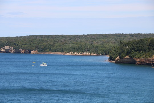
The next day, we drove to the Grand Sable Visitor Center in the Pictured Rocks National Lakeshore. We picked up our permits, left our cars and caught our shuttle to the Munising Visitor Center. From there, we headed into the park to start our adventure hiking eastward.
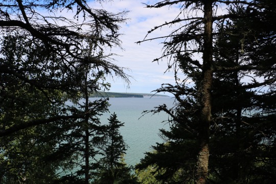
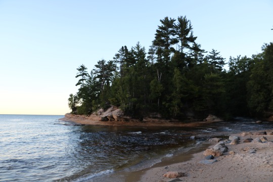
Grand Island was ever present in the distance for the first 20 miles of the trip. (The land you can see through the trees below is Grand Island.)
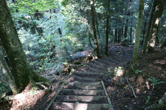
These steps were quite the luxury. In most places, it is all hiker stairs...(roots and rocks.)
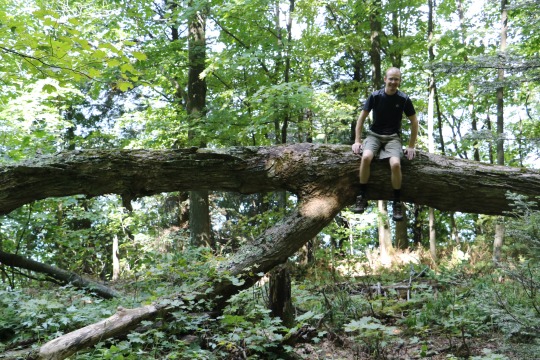
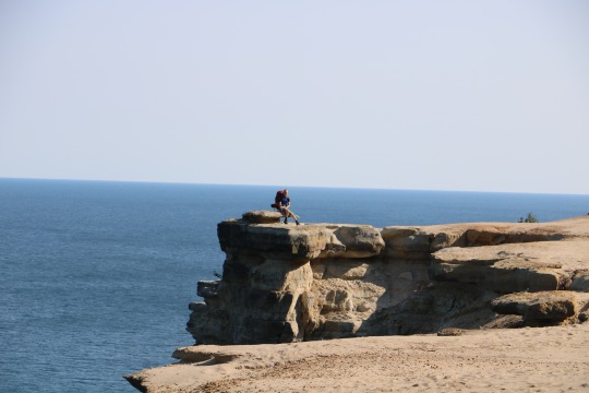
Matt decided to get high for this pic. (I’m more leery of heights.)
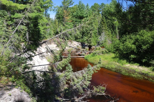
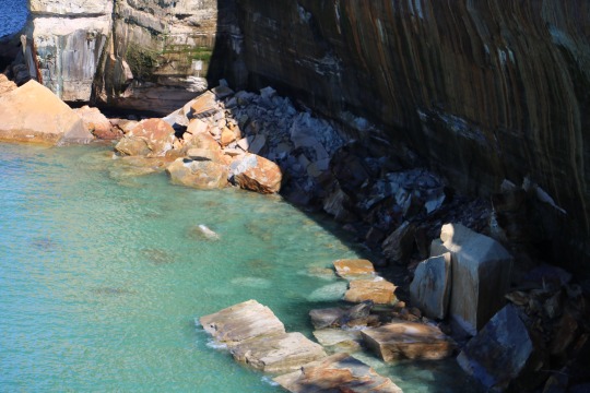
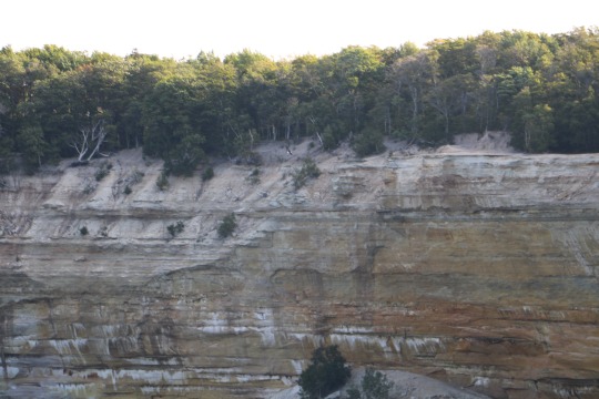
The river just beyond the Miner’s Castle visitor center: The color of the water in U.P. steams is almost always kind of rusty. The ground water there contains tannin and the color adds to the spectacular array of interesting aspects of the wilderness.
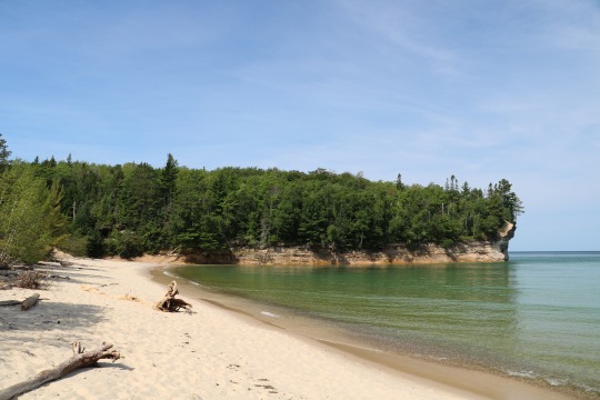
This photo is taken from Miner’s Beach.
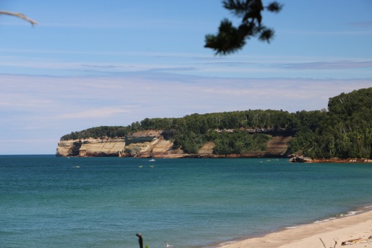
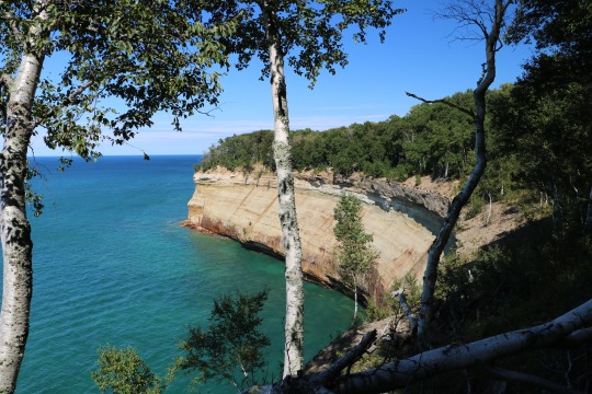
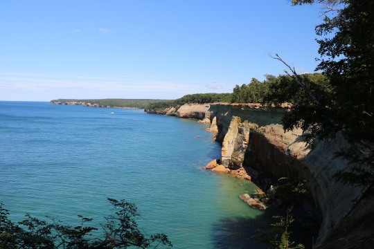
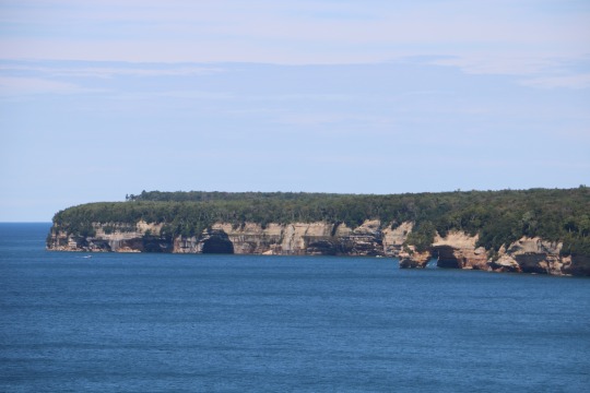
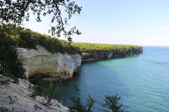
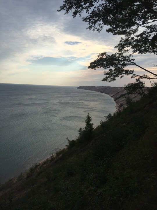
There are so many fantastic overlooks and views of the rocks from the trail. This trail is definitely one of my most favorite that I have ever hiked.
The Pictured Rocks Cruise Boats and colorful kayaks were also ever present. They come by every few hours.
This is the mouth of the Mosquito River. We spent our first night camped at the Mosquito River Camp Ground. We had a great camp site with easy access to the river for water. I absolutely love this section of the park. I had day hiked to the Mosquito River a couple of years prior and loved it. It was very exciting to get to backpack there and stay the night.
Broader perspective of the Mosquito River.
The river mouth at dusk.
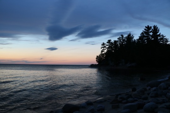
As the evening wore on, our chance at a full sunset was overtaken by storm clouds rolling in overhead.
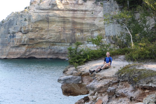
Quick shot of me...
You have to look really closely in the photo below, but there is a bald eagle flying just below the tree line at the top of the rocks just left of center.
Matt sitting atop the rocks.
Matt on top of the rocks.
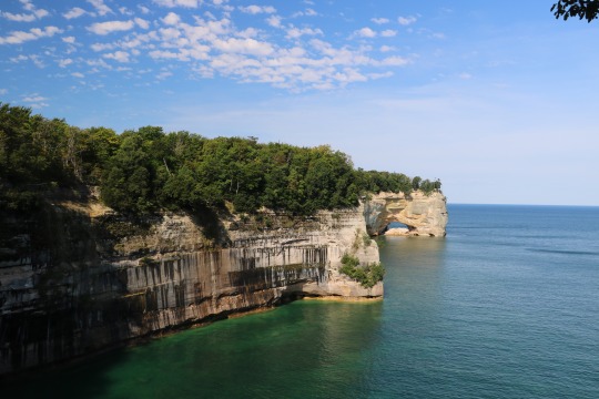
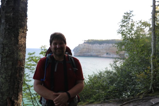
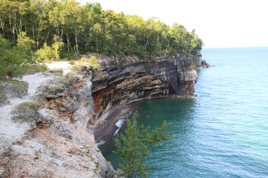
Grand Portal Point is one of my favorite spots along the trail. It is one of the best views on the whole trail, in my opinion.
Chapel Beach looking West.
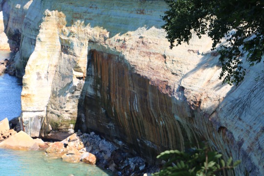
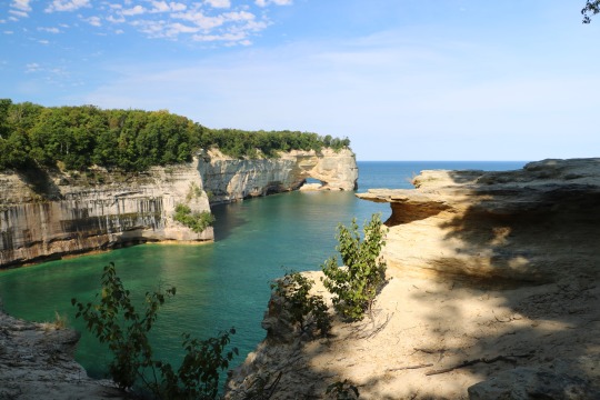
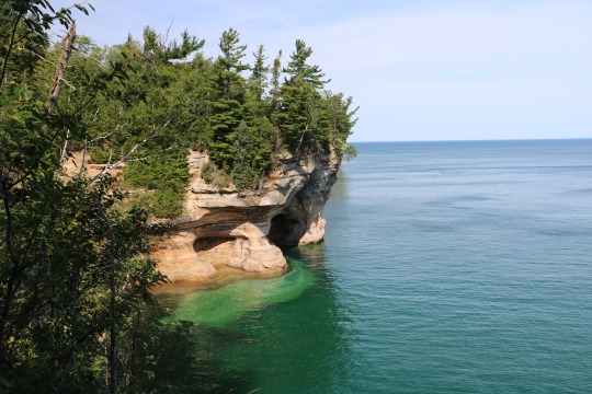
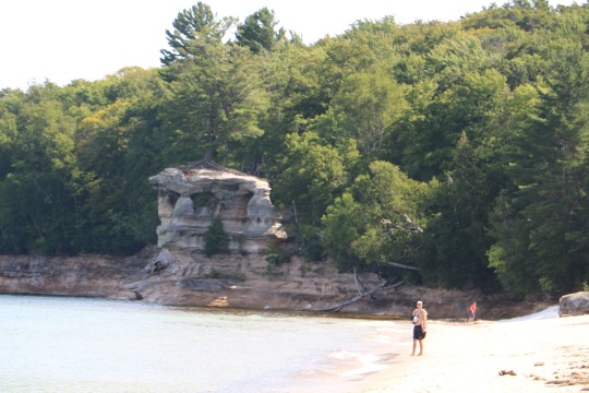
Chapel Rock. This is one of the best known spots on the trail and yet somehow, I managed to not get any “great” photos of it. This is the best shot I took that shows the whole thing.
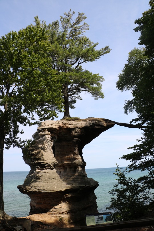
The tree on top of Chapel Rock. (See the root leaving the rock below on the middle-right?)
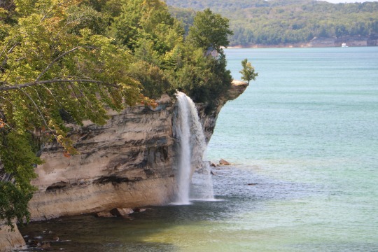
Going from memory, so I’m not completely sure, but I think this is spray falls.
We spent the second night at the Beaver Creek campground. Beaver Creek is below.
There were some bears around, but about all we saw was their leavings.

Beaver Lake in the Beaver Basin Wilderness.

This is the trail from the Beaver Creek Campground to the Beaver Lake.
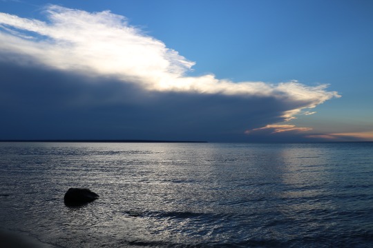
Camping at Beaver Creek gave me one my favorite sunsets on the trip.
Different perspective, same sunset.
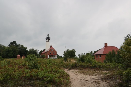
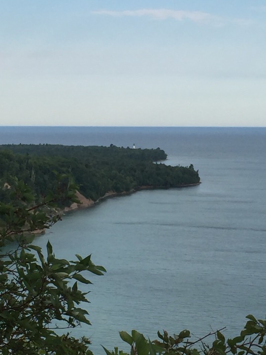
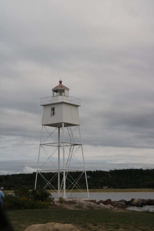
We spent our last night of our Pictured Rocks trip at the Au Sable campground. We were lucky to get there early enough to get to take the lighthouse tour.
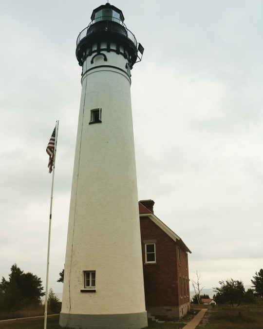
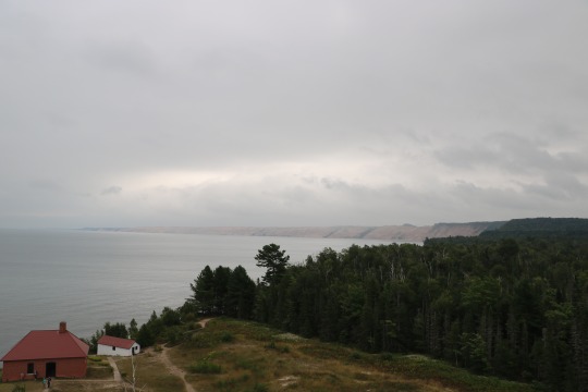
A shot from the top of the lighthouse taken during the tour. We were able to walk around the outside of the top.
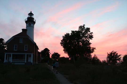
The Au Sable Light at dusk.
I loved this artifact in one of the buildings at the light station.
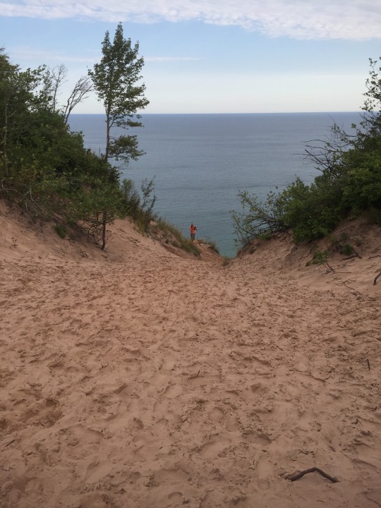
Grand Sable Dunes.
The “Log Slide” atop the dunes.
From the top of the dunes looking back at the Au Sable Light. (The little white structure in the photo.)
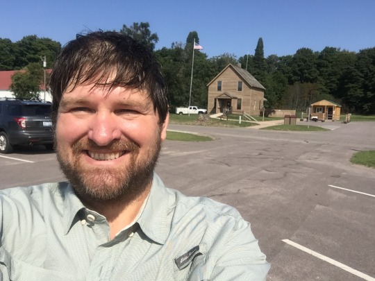
Me at the completion of the Pictured Rocks hike with the Grand Sable Visitor Center in the background. We finished the Pictured Rocks section on the 100th birthday of the National Park Service. The Park Service provided some very tasty cookies at the visitor center in celebration of its birthday. (They were extra yummy after four days of backpacking food.)
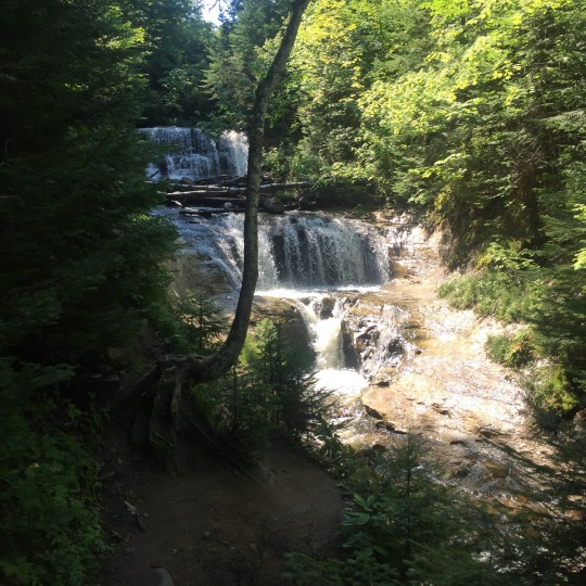
We continued along the trail past the Visitor Center to the Grand Sable Falls. The falls are between the Visitor Center and Grand Marais.
We hiked this a different day, but I moved the photos to match the geographical order. We actually hiked the beach from Grand Marais to the Falls and then back. It was only a mile or so, but it was tough hiking in sand.
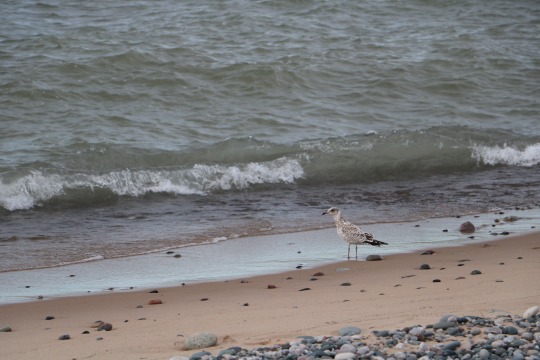
This little guy was at the Grand Marais harbor light.
The Grand Marais Harbor Light.
We continued east of Grand Marais towards the Blind Sucker Campground.
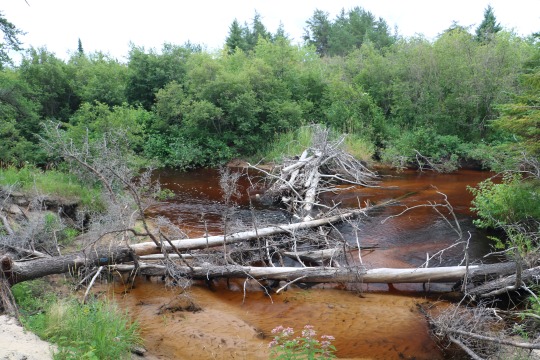
This is the Blind Sucker River along the trail. After leaving Pictured Rocks, we spent a night in a hotel in Newberry to get cleaned up. The next night, we moved back outside to stay at the Blind Sucker State Forest Campground (#2). We had a great spot with only a couple of neighbors at the far end of the campground. The campground features large wooded sites with pretty good separation between most sites. Many sites have direct access to the river/lake.
The trail makes its way to the Lake Superior shore in several places along the way. By far, some of my favorite moments on the trail were in the places like this where so few people will ever make their way to see the beautiful views.
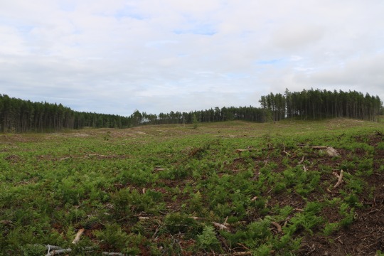
One of my least favorite spots was a large section that had been logged. I’m not against logging, but this section was hot without tree cover and it had lots of limbs/litter on the ground that were hard on the feet. We were at least hoping to scare up a bear somewhere in these big open spaces, but alas...no luck....
One of my favorite spots was this little two-track. We saw paw-prints through this space of a mama bear and a cub or two.
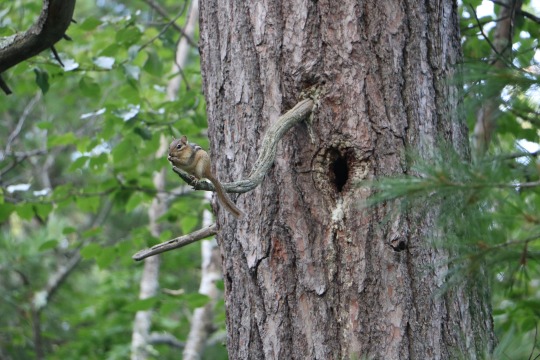
Matt has eagle eyes. He spotted so many critters like this little chipmunk along the way. I didn’t even notice most of them until he pointed them out.
Follow the blue blazes.
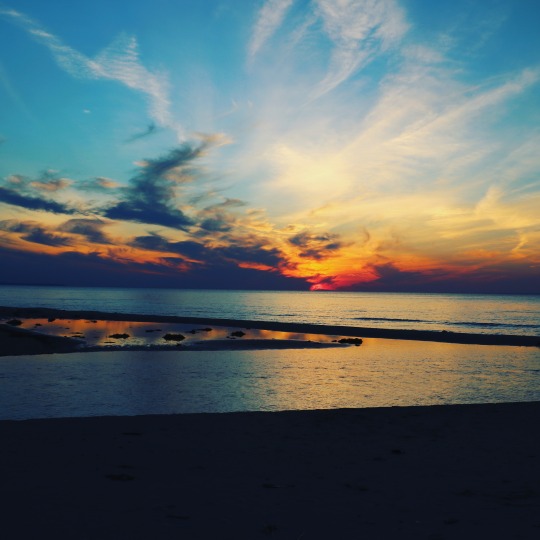
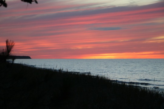
This gorgeous sunset was taken near the Lake Superior State Forest Campground. I didn’t alter the color in any way. It was a beautiful sunset that we caught as we were driving back to the campground after finishing a hike.
The last section that we hiked was the craziest. It was six or seven miles that ran from the Lake Superior Campground to the western edge of Muskellunge Lake State Park. It hadn’t been maintained in a while. There were literally sections of the trail that had eroded into the lake. Other sections were so overgrown that we were constantly battling our way through the leaves and branches. In many spots, Matt could be twenty feet ahead of me on the trail and I couldn’t see him at all because of all of the overgrown vegetation. It made for an adventurous day of digging our way through the woods. I don’t have much in the way of photos because the trail was kinda bad and I put the camera in a case to focus on finding my way safely. I think it was my least favorite section of the trip.
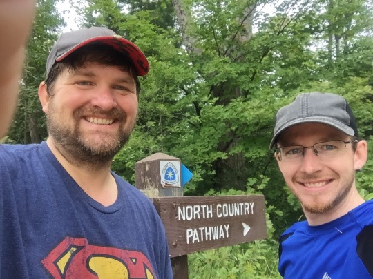
The photo below was after we finished for the week and were about to head home. It was the selfie to mark our successful week. I’m not sure I’d recommend to everyone to head off to the wilderness with someone you meet online, but I’m really glad I did in this case. Matt and I have hiked several times since this trip including spending another week in the U.P. in October 2016 that covered even more NCT miles. I’ve had so much fun with the adventure, that Matt has inspired me to want to hike even more of the NCT. I’ll be adding more miles in 2017, some with Matt and others and some solo. I’ll definitely be doing the 2017 #Hike100NCT challenge.
This is me walking in to work the next Monday after the trip....Do I look happy? I just keep repeating to myself: “Working pays for hiking trips.”
Rocky’s Recommendations:
1. There’s a common Internet meme that reads, “The comfort zone is a beautiful place, but nothing ever grows there.” I’m happy that I was more adventurous than my usual self. It turned out to be a great experience. I left my comfort zone, made a new friend, had a fun adventure and continue to look forward to future adventures. If you decide to head off into the woods with someone you meet online, perhaps let another friend know your plans and check in with friend on pre-planned intervals so they can send the calvary, if needed.
2. The Pictured Rocks are stunning, but they are also one of the most busy backpacking destinations in Michigan. Go. See it. Enjoy yourself, but know that you will likely not be alone or find a lot of solitude in the campgrounds. I like solitude, but this trip was so epic that I didn’t mind the “cozy” campgrounds full of adventurers. If you are serious about your solitude, the trail east of Grand Marais is a little less scenic, but much quieter and much less traveled.
3. Dispersed camping is not permitted in the Pictured Rocks. All campsites require a reservation. New in 2017, reservations are made online using the web site: https://recreation.gov
4. If you’re a person who “needs” a campfire, know that most camp sites in this park either do not permit fires or only permit a single fire at each campground in a communal fire ring. Each camp site at Blind Sucker had a fire ring.
5. The latrines at the campgrounds we visited are, well, not very well placed for privacy. They are essentially a seat that is next to a tree. Some of the campgrounds have a nearby group camp site. If the group site is unoccupied, you’ll have more privacy if you make your way to the group site latrine. The camp ground at Mosquito had outhouses, but they smelled so terrible, that I just wanted to avoid them. There is a port-a-john at the Au Sable Light House that is about half a mile from the Au Sable camp ground.
6. We enjoyed a beer and burger at the Lake Superior Brewing Company after our hike. The food was good! Stop by and give it a try, but expect it to be busy since it’s the only game in town.
7. Stop by Grand Marais Outfitters. They have a lot of cool stuff, but when I was last there in October of 2016, they sold cool t-shirts with an NCT blue blaze. If you’re an NCT hiker, it’s a cool souvenir option to remember your trip.
8. We spent a night in the Quality Inn in Newberry mid-week. The room was clean and comfortable for a reasonable price.
9. We had a great burger at the Newberry Country Club Woodland Grill/Bar. (It was a quick walk across the road from the Quality Inn.) If you’re in Newberry and hungry for a burger, I’d highly recommend you give them a try. I was a bit leery when our burgers were served on triangle-ish shaped buns, but wow were they tasty.
10. I snore obnoxiously. I always take a container of disposable ear plugs with me when I’m hiking/backpacking so that I can offer them to others that are sleeping near my camp. The earplugs may help keep the peace at night and in the daytime.
11. We used TrailSpotters to shuttle us the 40ish miles from Grand Marais to Munising so that we could then hike back to our cars. The driver was friendly and knowledgeable. The drive went by quickly and I recommend the shuttle service. They also offer emergency pickup/assistance for a much higher fee.
Questions? (Corrections?) Don’t hesitate to reach out to me.
#picturedrocks#lakesuperior#upperpeninsula#hiking#backpacking#beaverbasinwilderness#beavercreek#ausable#mosquitoriver#muskellungelake#grandmarais#camping#puremichigan
1 note
·
View note
Text
North Manitou Island, Sleeping Bear Dunes National Lakeshore. Backpacking, August 2016.

My buddy Baz and I took a weekend backpacking trip to North Manitou Island in the Sleeping Bear Dunes National Lakeshore in August 2016. North Manitou is managed as a wilderness outside of the village and village campground. Backpackers can camp anywhere on the island as long as you are 300 feet from any stream, lakeshore, structure or other campers. We hiked the outer loop with the exception of working our way in to see Lake Manitou.

The island was beautiful and really exceeded my expectations. I had a great time and would totally love to go back again in the future and visit the more remote areas of the island.

As we hiked out of the village we saw this sign. I always feel excited to walk into wilderness and this day was no exception.

Within minutes of entering the wilderness, we saw a buck in velvet. We saw him several times over the next mile as he crossed the trail and would move away from us.

I think Baz took the shot above. I loved the way it turned out with the green tunnel.


We spent like ten minutes trying to get a shot of this spider! It was challenging to get the distance from the lens, the light and everything just right to get it in focus. It was a cool spider even though the web was face level across the trail.


We ended up setting up camp for the first night near Johnson’s Place. We absolutely loved this spot. The only thing missing was a campfire (fires are not allowed outside of the three common fire rings in the Village Campground.)

We set up our tents. We were way up above Lake Michigan and had a great view from the camp site of the lake. Later that night, we were standing around near our tents about 10PM chatting and I heard a noise off to my left. I said to Baz, “Did you hear that?” I was thinking it was my imagination. Then I saw what I thought was motion in the dark in the same direction. The hairs on my neck stood up as I switched on my headlamp to spotlight a big doe. She wasn’t bothered by us at all and continued to wander through our camp on her way to wherever she was going.

This is my Big Agnes Copper Spur UL2 tent. It rained a lot during this trip, so I was appreciative of being able to stay dry in the tent. This tent has been all over Michigan this year.

This was the beach near our camp. The water was so, so warm.

Swenson’s Barn was cool. We hung out here and had a conversation with some fellow adventurers while we had a snack.


The old cars at Stormer Camp were very cool to see.

This was from the beach near the Village Campground.

I took a photo of this old trash on the island near the village campground because I thought it was interesting to date this trash to the 80s when glass bottles had styrofoam type labels around them. I remember these from my childhood.

This old plow was on the path between the campground and the beach (if you go the long way, at least.) The island is littered with random artifacts like this.

For the second night, we set up camp at the Village Campground. We walked from Johnson Place around to Lake Manitou, around the edge of the lake and back out looking for a good spot for our tents. The thing is that good flat spots were hard to find on the island (at least good spots that were not already taken). So, we took the easy route and headed for the campground. We actually liked this little campground a lot. The sites were reasonably private and separated nicely with vegetation. The campground also had an outhouse and potable water available nearby in the village.

This is the beach near the village campground at dusk.

This is the path back to the Village.

These are cottages in the village.


Looking through a window into one of the old cottages.

This is taken from the dock looking back at the island.

That’s the boat to collect us from the island. The boat ride was fine, but it was my least favorite part of the trip. On the ride over, we sat on top of the boat. I would advise that you only sit up top if its not looking rainy. On the way back, it was warmer and we sat inside the boat. The ride is about an hour each way or longer if your cruise also involves heading to South Manitou to pick up or drop off day trippers.
Rocky’s Recommendations:
1. Order your boat tickets early. Make sure you have a reservation to be sure you can actually get to the island on your planned dates.
2. When you board the boat, your pack may be literally tossed on a huge pile of backpacks. If you use a water bladder and that bladder is full when you board and your pack ends up on the bottom of the pile, you may end up with a burst bladder and wet gear. This happened to at least one camper on our boat ride. There is a water fountain at the visitor center that you can use during the regular season to fill your water resvoir.
3. It’s challenging to find good spots for tents on the island. You’re competing with everyone that arrived with you on the boat (and everyone else already on the island) for the best/easiest to find spots. So, you may want to plan your preferred campsites before you arrive and make haste to your preferred site to increase your chance of camping somewhere cool. We lucked out with the Johnson Place site. Many other cool sites were already occupied by tents by the time we arrived. If you’re a hammock camper, you’ll have an easier time finding good camp spots, I think.
4. Lake Manitou is very cool. I thought that it was worth the trip to see it. We walked in via the path to Fiskes (on the map). We did not find great camp sites other than a couple that were already occupied. (Maybe we didn’t look in the right spots, but we walked from Fiskes southward without finding any ideal spots.)
5. Fires are not allowed on the island except in the three communal fire rings in the Village Campground. If you need a campfire to enjoy your trip, just stay at the campground.
6. The only outhouses on the island are in the Village and the Campground. Be prepared to dig a cathole elsewhere on the island.
7. If you find yourself stuck on the island longer than expected, there is a food box in the visitor center with food left behind by previous hikers. This may be useful information if you find yourself stranded during inclement weather when the boat is unable to make the trip.
Resources:
1. Sleeping Bear Dunes National Lakeshore Page:
https://www.nps.gov/slbe/index.htm
2. North Manitou Island Page:
https://www.nps.gov/slbe/planyourvisit/northmanitouisland.htm
3. North Manitou Brochure and Map
https://www.nps.gov/slbe/planyourvisit/upload/nmi_brochure.pdf
4. Get your boat tickets to get you to the Island at Manitou Island Transit
http://manitoutransit.com/
#northmanitou#sleeping bear dunes#north manitou#hiking#backpacking#camping#Lake Michigan lakemichigan
0 notes
Text
Getting High in Tennessee: Hiking the mountaintop from Tank Springs to Bruce Gap Road section of the Justin P. Wilson Cumberland Trail - December 29, 2016

The Justin P. Wilson Cumberland Trail State Park is a linear trail state park in Tennessee. The trail is not complete, but has a number of completed segments totaling some 185 miles and 40 trailheads. Once complete, the trail will run for 330 miles from the Cumberland Gap National Historical Park on the Tennessee/Kentucky/Virginia border to the Signal Point, a civil war site near Chattanooga, TN.
For my hike, I started at the Tank Springs Trailhead near LaFollette. The trailhead has a parking area off of N. Tennessee Ave. The locals come to Tank Springs for water. So, you may see folks filling water jugs as the trail leaves the parking lot. You can follow N. Tennessee Ave from E or W Central Ave and it will lead you to the trailhead in about a mile. The trailhead parking is on the left just before the bridge across Ollis Creek.

Snapchat selfie with LaFollette behind me.
The posted mileage from Tank Springs to the next parking area at Bruce Gap Road trailhead is 11.7 Miles.

Rock outcrop across the creek from the trail just leaving Tank Springs.
The trail starts out wide and flat along a two-track. After you go under the railroad trestle, you’ll soon find yourself climbing the mountain on switchbacks. The initial climb is relatively steep. Additionally, the trail descends and climbs again throughout the hike as each ridge crests and falls. My fitbit put the total climb for the day at 3,150 feet. (So, not sure how accurate that is, but it is a significant climb if you are not used to mountain hiking.)

The trail took me around and atop a lot of rocky outcroppings. I loved the rocks, but I have to admit they freaked me out a bit as I had to find a safe way around and over so many them (and rocks/holes covered by leaves.)

The trail mostly runs the ridge line of the Cumberland mountain range giving some spectacular views. It abuts up to a Wildlife Management Area on the northern side. I scared up a bunch of turkeys below me during my hike.

LaFollette and Jackboro are ever present off the south side of the ridge. This may be distracting to some, but I thought it was pretty cool to be able to track my progress against landmarks I could recognize off in the distance.

I spent most of my year hiking in Michigan and about half of that on the North Country Trail. After following mostly blue blazes for 500 miles of hiking, it was interesting to switch it up to follow white blazes. This trail is relatively well blazed, but there are a few places that might be easy to get lost.


This is Eagle Bluff (I think). It took me a minute to figure out how to descend this rock. I eventually noticed the top of a ladder further down and made my way towards it.

This ladder is the biggest reason that I’d argue this trail isn’t dog friendly. It might be hard to carry a larger dog down that 11 foot ladder.

There is a trailside shelter and backcountry campsite. (Check with the park for reservations/rules.)


This “Window Rock” is a cool feature along the trail.

Much of the trail is like walking along the rocky backbone of the mountain. You can see the trail marker on the tree in this photo.


I would imagine a geologist would enjoy all the rocks on this hike.

White blaze


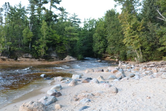
These waterfalls are at the base of the mountain between I-75 and the Devil’s Racetrack. They were a nice end to a beautiful hike. I did not take any photos beyond the waterfalls, but the hike ends in a large parking area and trailhead off of Bruce Gap Road in Caryville. The parking area connects the Cumberland Trail to the trail system in Cove Lake State Park just across the road.

My recommendations:
1. This trail is awesome and beautiful, but I do not think it is a great option for solo beginners. There are lots of places where one might slip, fall, wrench an ankle or otherwise hurt oneself. I recommend that beginners at least hike in pairs or go with a more experienced hiker. Besides, this trail will be a lot more fun if there are at least two of you and you spot cars at both ends so you can see the whole segment in one hike.
2. This trail is somewhere between moderate and strenuous in terms of difficulty. I’ve hiked more than 500 miles in 2016 and this was one of the more challenging days. I normally hike about 3 mph on rolling terrain. This hike was about 2 mph. So, make sure to allow extra time for taking in the scenery, photos and slow climbs. I was racing towards the end of my day hoping to not be walking out by flashlight. (And I wasn’t sure I could find my way out by flashlight...)
3. This trail is a constant battle with rocks. Watch your step....Some of those rocks are loose, some are slippery, some are obscured by leaves and some will just hurt your feet.
4. This trail probably isn’t a great option for bringing a larger dog. There is an 11 foot ladder along the way. It might be very difficult to carry a larger dog down that ladder.
5. This part of Tennessee has a couple of varieties of venomous snakes including copper-heads and rattlesnakes. If you’re doing this hike in warmer temps, you should be be on the lookout for the snakes and maybe even consider wearing anti-snake-bite gaiters.
6. I highly recommend this hike. If you’re in the area, it is a great way to spend the day taking in the sights. It’s worth the climb.
See you out there.
Resources:
http://tnstateparks.com/parks/about/cumberland-trail - JPW Cumberland Trail SP Web Site.
#cumberland trail#cumberlandtrail#justinpwilsonstatepark#hiking#tennessee#tanksprings#tank springs#bruce gap road brucegaproad
0 notes
Text
June 2016 Trip - Part 3 - St. Ignace and Mackinac Island

For the last leg of my June trip, I drove to St. Ignace and checked into the Breakers Hotel to dry out my rain soaked gear and for a comfortable night of sleep. The next morning, I took advantage of the free breakfast. I picked up a schedule for the Shepler’s Ferry and figured out which booking would get me a trip under the Mackinac Bridge on the way to the island. I walked from the hotel to the ferry dock and purchased my ticket.

The boat ride under the bridge was awesome. It was well worth planning my whole day around that time slot. OK, it was a little scary. The water was rough. I got in line early to be sure I had a great seat. Turns out, my great seat came with a lot of spray from the crashing waves. Don’t get me wrong, I would definitely repeat the experience. Seeing the bridge from that view was awesome.

From the bridge, the captain headed for the island and I moved to the other side of the boat away from the heavy spray from the big waves.


I pretty much walked directly out of downtown on arrival and made my way to the Old Fort. Since the Fourth of July was approaching, I took lots of flag photos on the island.

The old fort was fun to explore. I was impressed with the experience. Be sure to check out each of the buildings as they are all interesting.


From the old fort, I walked towards Arch Rock. The pathway was beautiful with all the wildflowers along the way. I had been the island previously, but had not walked around. I highly, highly recommend taking a stroll and getting away from downtown by foot. It’s a beautiful place.

The view from the Arch Rock area was beautiful.

Arch Rock is a major destination for walkers and those taking the carriage tour.

From Arch Rock, I walked to Sugarloaf Rock. This area had fewer tourists and it made for a serene walk. Once I got to the Rock though, it was more busy than the pathway with some kids climbing on the rock and others taking photos.

From Sugar Loaf Rock, I made my up the hill to fort at the top of the hill. The views from this area were spectacular. I highly recommend either walking up the pathway or climbing the stairs. If you like a great view, you’ll have a beautiful view of the lake and the bridge.

The hill top fort is an interesting re-construction that is worth checking out.

Did I mention the great view from the top of the hill?

Once I made my way back to St. Ignace, I walked all around downtown and checked out the shops. I managed to walk several miles that day between the island and downtown walk.
I had dinner and a couple of drinks at a local restaurant and walked back to my hotel.
On the way out of town the next morning, I drove through Straits State Park and took a few photos of the bridge from the park.

I had an amazing week. I would love the opportunity to repeat the whole experience. It was my first solo adventure of the year and it proved that I can still have a great adventure, even if no one else has the same time off planned at the very last possible minute.
This segment was obviously not in the wilderness, but I loved it non-the-less. I still walked several miles that day and saw some absolutely beautiful sights. It was a nice relaxing bookend to an awesome week.
I encourage everyone to get outside. Go for a walk or a hike. Visit our parks and public spaces. Spend time in the wilderness. Stretch yourself (within basic safety requirements) and you will find that you are capable of more than you think. Take photos and share your experiences with like minded folk. Thanks for checking out my blog!
Questions? Feedback? Feel free to reach out to me.
#mackinac#mackinacisland#mackinacbridge#stignace#st ignace#sheplers#straits of mackinac#archrock#arch rock#sugarloafrock#sugar loaf rock#flag#american flag#americanflag#lake huron#lakehuron
0 notes
Text
June 2016 Trip - Part 2 - Porcupine Mountains
From Marquette, I drove directly to Ontonagon to the Porcupine Mountains Wilderness State Park. My very first backpacking trip was to the Porkies with friends a couple of years earlier. I had very fond memories of that earlier trip and couldn’t wait to get started on my next adventure. I checked in at the Visitor Center and picked up my permits/cabin keys and then I was off to start my adventure.
The backcountry cabins in the park are awesome. I had hoped to rent one for each night of the trip to avoid carrying a tent, but found only one available for the nights I would be in the park. So I also reserved two nights at a backcountry campsite. (At that time, Backcountry Camping Permits were a license to find an unoccupied campsite, not a reservation for any specific campsite.) My plan was to start at the Summit Peak parking and hike to Mirror Lake via the South Mirror Lake Trail and spend the first night at one of the campsites around the lake. From there, I would hike the Correction Line to the Big Carp River trail to the river mouth. I had reserved the Big Carp River Four Bunk Cabin for my second night. From there, I hiked the Lake Superior Trail to the Little Carp River Trail. I followed Little Carp River to the Beaver Creek Trail back to the Parking Lot at Summit Peak.
The Porkies segments added up to about 23 miles of hiking (plus any extra for exploring and gathering firewood).


When I arrived at Mirror Lake, I checked out all of the campsites on both sides of the lake. I did not really love any of the sites on the south side of the lake. To make matters worse, the fire ring at the best site was full of dirty food cans. Since I was by myself, I did not want to be anywhere near something that might attract bears like those dirty cans. So, I walked around to check out the sites on the north side of the lake.
I settled on site #2 (ML#2). I probably would have picked the next site at #3 had it not been occupied when I started to set up camp. But, #2 proved to be absolutely awesome. I set up camp and explored the area a bit.

Next up was gathering firewood so I could enjoy a fire for the night. I gathered a good amount of firewood. I had brought along my lightweight folding Sven Saw and sawed up some larger wood for longer burning pieces. Ironically, I probably left half of the wood that I gathered for the next camper even after burning all I needed.

I hung my food on the provided bear pole. The food pole and latrine was shared between my campsite and the next one that was nearby. The shared latrine at this campsite had basically no privacy. Fortunately, the other campers left shortly after I set up my camp, so I did not require much privacy while I was there.

This is the view of the lake from the next campsite. My view was less open so I liked this one a bit better.

This was the view from my campsite.

I was a bit nervous when I laid down knowing that I was truly about to go to sleep alone in a tent in a wilderness where bears are not uncommon. Every noise grabbed my attention. It took me a bit of time to relax enough to get to sleep, but I eventually dozed off. I told myself that the smoke from the campfire would spook any nearby bears.
Happily, I awoke the next morning without any critters disturbing my sleep. I made myself a cup of Starbucks instant coffee and some scrambled eggs with bacon for breakfast. I was pretty excited to try this backpacker meal thinking it would probably be my favorite breakfast option for these trips. I can’t even begin to describe how disappointed I was. I probably got too much water in pack, but it was more like runny tofu and bacos rather than scrambled eggs and bacon. The texture was just all wrong and the flavor was less than perfect. I had bought several packages of that particular breakfast that ultimately ended up giving them all away to a friend that found them more enjoyable. I ate as much of it as I could stand and then packed up my gear and headed out for that day’s hike.
From camp, I headed to the Correction Line trail. The Correction Line is mostly unremarkable. It is heavily wooded and doesn’t have a great deal of scenery to speak of other than trees. It descends a few hundred feet from the highest lake in the park to river level with the Big Carp River. There are some crazy mud bogs along the trail where water ponds that makes for some very interesting hiking (and sometimes difficult/muddy/slippery). The only place on the whole trip where I almost fell was near the end of this trail.
I eventually made it to the end of the Correction Line where it connects with the Big Carp River Trail. I headed for the River Mouth on Lake Superior.

The trail through the park is blazed with Blue paint. In some places, you find metal blazes that are easier to see like the one below.

There are a couple of places in the Porkies where you have to wade across the Big Carp and Little Carp Rivers. On the first river crossing I came to, I thought it was shallow enough for me to wade across in my boots. That turned out to be a mistake. I slipped on a rock and soaked my boots. I stopped and tried to dry my feet as best I could, changed socks and headed on down the trail. This little error earned me a small blister by the end of the day. From that point forward, I used a stick to better judge depth before putting my feet in the water. If it was even close to being too deep for my boots, I just took off my socks/boots and waded across.
The Big Carp River trail has an abundance of interesting waterfalls.

There were so many waterfalls that I actually got kind of bored with trying to take pictures of all of them. I won’t bore you with all of them here, but there were a couple of standouts.

After a beautiful hike through the woods and along the river, I crossed the river one last time and arrived at the Big Carp River 4 Bunk Cabin. This particular cabin is back away from the trail a little so it’s easy to miss. I walked by it the first time and totally missed it. It’s a few hundred feet down the trail to the mouth of the river and the Lake Superior shore. This cabin is near the Lake Superior Cabin and the Big Carp River Six bunk cabins.
The only thing I did not like about this cabin was the outhouse location. The outhouse is up a very steep hill and right above the cabin. The outhouse is also shared with the Lake Superior cabin occupants so you might be sitting at your fire ring, hear a noise and look up and see folks walking to the outhouse above you. Don’t get me wrong, I’d still stay in this cabin again, but it took away from the experience to have folks literally above me (innocently) disrupting my privacy.

The thing I liked most about this cabin was the Lake Superior shore. It was absolutely beautiful.

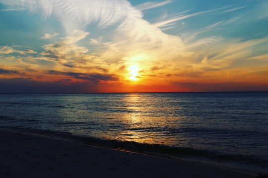
As the day waned, I walked down to the beach to watch the sunset. It was a surreal experience. It was like time stopped and everything got quiet. The folks in the other two cabins were also on their respective beaches hanging out and watching the the light dim. As I sat there, a random hiker popped out of the woods and sat down on the beach nearby and watch the sun set. As soon as the sun set, he was on his way.
Honestly, it never even occurred to me that I would get such a great sunset. I did not realize that I might have a westward view over the water. This sunset was one of the highlights of the the trip. It was peaceful, serene and beautiful.


I found myself a little bored after the sunset. Someone had left a book about the Porkies in the cabin and I spent a couple of hours reading by headlamp to alleviate my boredom. After that, I read a few of the entries in the cabin guest log. You don’t realize how much you rely on your phone to alleviate boredom until you don’t have any cell/data service for multiple days.
At around midnight, I walked back down to the beach to check out the stars and hope to catch the northern lights. The stars were so beautiful in the dark sky.
It had cooled off a bit that night. I built a fire in the wood-stove in the cabin and I laid down for the night in my sleeping bag. I slept great in the warmth of the fire.
I woke up the next morning and packed up my gear. Thankfully, the fire in the stove had helped to dry out my boots and my socks overnight. I headed down the Lake Superior Trail for a ways before I came upon this little deer. She wasn’t bothered by me at all. I walked up on her slowly. She saw me and just kept any eye on me as I slowly made my way by her. I probably got within ten feet of her.


There are several campsites on the Lake Superior shore. As I walked through in the sunshine and warm temps of June, these site looked absolutely idyllic, like places I’d love to spend the night. However, (it is hard to see in the photos), every single site had some driftwood structure that other campers had constructed around the campsites/fire pits as wind stops. Maybe some day I’ll get the chance to sleep at one of these sites and see if those drift wood wind blocks actually work.

From the Lake Superior Trail, I turned onto the Little Carp River Trail.

Within a few hundred feet, I came to another beautiful waterfall.

I loved the Little Carp River Trail. It is my favorite trail (so far) in the Porkies. It is remote, beautiful, scenic and wild. In some places, the trail literally disappears into the foliage. I did not have any trouble finding my way, but I found a few overgrown areas like this one to trudge through.

This trail runs along the river for few miles.

This was one of my favorite waterfalls on the trip.

When I took this photo, I was aware of the North Country Trail, but it wasn’t something I was all that interested in. The NCT follows the Little Carp River trail for a few miles. Since this trip, a friend has helped to spur my interest and let me tag along on his NCT hikes in the UP. Since meeting him, I’ve hiked more than 150 NCT trail miles in the U.P. and can’t wait to get back for the next segment.

Just past the Greenstone Falls, I was hiking along and a deer jetted in front of me on the trail. She was moving so fast she didn’t even notice me. Then a second one traveling at equal speed did notice me and skidded to a stop on the trail in front of me to pose for this quick photo.

From this point, I hiked to the last campsites along the trail before Lily Pond and spent the night. There were two campsites that were together right on the river. I built a small fire and relaxed for a while. The only complaint I had about this campsite was that the pole used to hang your food was apparently made out of lead pipe. Seriously, it was heavy. I had a difficult time hoisting my food bag to the top of the bear pole. I felt like a wimp trying to maneuver my food bag onto the hook, but I finally got it.
I awoke around 7AM the next morning. Moments later, it started to rain. (Which is why I don’t have more photos. My camera is not water proof.) It was the first serious rain I’d faced on the whole trip. I packed up most of my gear inside the tent. I put the rain cover on my pack and pulled it out of my tent. While I munched on a white chocolate macadamia nut Cliff bar, another hiker came hastily down the trail towards the river. He barely paid me any attention. I said hello and he mumbled something in response. He studied the river to decide how he was going to cross. He eventually settled on just wading through the spot he judged to be the most shallow.
I tore down my tent in the rain trying to keep it as dry (at least on the inside) as possible. As I was packing up and getting everything ready to go, two other hikers came down the trail from the opposite direction. They studied the river momentarily and expertly balanced their way across several large rocks. They stopped to chat for a moment and shared that they were headed for the Boundary Waters. We made small talk and they headed on their way. I then headed towards Lily Pond. I opted to follow the path of the first hiker across the shallow spots and managed to keep my feet relatively dry.
Lily Pond is beautiful. I hope to return there someday and spend a night in the cabin.
The hike from Lily Pond out was extra wet. There were a couple of boardwalks through that area that were overgrown with wet grass. So, the boardwalks were slippery and the grass was soaked which in turn soaked my legs/boots again. It was my least favorite part of the hike.
From there, I took the Beaver Creek Trail back to the Summit Peak Parking lot to my car. As soon as I got Internet service I checked the weather and rain was projected for most of the rest of the day. Since the weather wasn’t cooperating for additional exploration, I headed to the Visitor Center to return the cabin keys. I asked about a shower and the clerk said I could go to the Union Bay Camp Ground and pay a couple of dollars for a shower. I think that was possibly one of the best showers of the summer. After three nights without a shower, it was awesome to get clean again.
From there, I headed east. I stopped in Munising for a Pastie. I then headed to St. Ignace for the next leg of the trip.
One note of caution: A couple of weeks after my visit, there was a terrible rain storm that affected this area and some of these trails dramatically. Although I believe all trails have now re-opened, I would encourage anyone visiting to check on trail status before heading out on these specific trails.
Resources:
Porkies Backcountry Campsite Map
Porkies Trails and Cabins
Porcupine Mountains Wilderness State Park Web Site
Porkies Trail Lengths and Descriptions
#porcupine mountains#camping#hiking#backpacking#trail#michigan#porkies#Big carp river#little carp river#lake superior#wilderness#solo#puremichigan#porcupinemountains#bigcarpriver#littlecarpriver#sunset#deer#tent#cabin#nature
0 notes
Text
June 2016 Trip - Part 1 - Grand Island and Marquette
In June 2016, I found myself with a week of vacation that I had to use or lose. I had hoped to plan a trip to Teddy Roosevelt NP to see the place that inspired a great American president, but had not managed to get it done. Instead, I hastily planned a trip to Michigan’s beautiful U.P. I thought about places that I had wanted to go back to after prior trips to inspire my plan. This resulted in a fun little adventure that took me two both ends of the UP and few places in between. Over the course of the week, I spent a night on Grand Island, a night in Marquette, three nights in the Porcupine Mountains and two nights in Saint Ignace.
I know I recently wrote about Grand Island. However, for this trip I went to a different part of the Island. On my prior trips, I had hiked the rim trail of the main island. For this trip, I booked the “Little Dunes 2″ camp site on the tombolo. The tombolo is the strip of land that joins the larger and smaller islands that make up Grand Island. It’s kind of like an overgrown large sandbar.
The Little Dunes campsites are about a four mile walk from the ferry landing. The hike is all gravel/sandy two-track and a very easy walk. On the walk in there were some roses and daises that caught my attention. I wish you could smell the sweet smell of these roses that were along the road.


Duck Lake is nearby. It is a very relaxing view just off the road.

Further down the road, there was a small pond just off the edge. There was multiple critters making a racket as I walked by the pond. If you look closely, you can see ducks and beavers in the photos.


One of the most interesting plants on the island is the Pink Lady Slipper. When I was there in June, they were plentiful around the island.

The last few hundred feet of the hike in to the campsite are boardwalk, presumably to to help minimize the impact on the dunes and environment in the area.


The camp sites on Grand Island all have a fire ring, benches, firewood and access to an outhouse or latrine. Each site has either a food storage locker or bear pole. I loved this peaceful little campsite on the edge of Trout Bay.
I decided to do this overnight on the island primarily as a “gear check” to make sure I hadn’t forgotten anything important before my longer hike into the deeper wilderness of the Porcupine Mountains. It turns out I had everything I needed, but I felt like it was a good idea (and a beautiful place to stay the night) to make sure I had all the essentials in the pack.

I have to admit, I got a little chuckle out of the ironic placement of the “no fireworks” sign on the outhouse door.

Trout Bay was beautiful on this June evening. If was a great evening that lead up to “fireworks” at about 1AM when a storm rolled through that made it almost like daylight for about an hour inside of my tent from all of the lightning.


This fog was really eerie. It was the only place on the water that was foggy and it was like that all evening.

The tombolo has three other campsites available that are all on or near Trout Bay. Little Dunes 1 and Little Dunes 2 on the eastern most side of the tombolo are the farthest from the ferry at around four miles. Little Duck and Driftwood on the western side are closer at about 3 miles from the ferry dock. Driftwood seemed to be the most private of all of the campsites.
One thing that was new this trip that was different from my prior trips was that there was a ranger checking the campsites and reservations. He was super nice/helpful. I ran into him at the Murray Bay group site as I was walking in from the ferry. He asked where I was headed and I told him which site I had reserved online. He drove away to complete his rounds. I ran into him again a couple of miles further into the hike and he said my campsite was occupied by some other folks, but that he’d directed them to move and that he’d check back later to be sure all was good. I arrived at the camp site to find the group packing up. They were all nice but a little intoxicated and not exactly excited to be moving. So, I appreciated the ranger checking the campsites since I paid for my reservation and was very much looking forward to a fire on the island.
The next day, I packed up and hiked back to the ferry dock. I was a bit disappointed to realize that I’d arrived just in time for the Captain’s Lunch hour. (No boat during the hour of the Captain’s lunch.)
From there I drove to Marquette where I’d booked a cheap hotel room for the evening. My thinking was that I wanted to get a shower before I headed to the Porkies and also have a chance to dry out my gear if it got wet on the Island (and it did). It turned out to be a good choice. I was able to dry out my tent completely.
I drove around Marquette and enjoyed a drive through Presque Isle Park, which is possibly one of the most beautiful city parks around. It was a beautiful day and everyone was out and about and many folks were headed to the beach. The most out-of-place thing I saw the whole day was a guy wearing nothing but an american flag thong headed down the sidewalk towards the beach. It seemed a little out of place in the U.P. because it was rather revealing and I’m pretty sure I could see his flag pole.
Here are a few sights from around town.


#grandislandnationalrecreationarea#marquettemi#camping#backpacking#hiking#trail#flower#troutbay#lakesuperior#cairn#outhouse#campsite#littledunes2#driftwood#campfire#munisingmi#grandisland#daisy#wildflower#wildrose
0 notes
Text
Grand Island 2015
In June 2015, I set out on my first adventure into a wilderness alone. I drove to Munising, MI and hopped onto the Grand Island Ferry in beautiful Lake Superior. The person who sold me the ferry ticket asked me if I had a head net and bug spray because the mosquitos were terrible that spring. Their caution seemed so serious to me that I wondered if they were trying to talk me out of getting onto the boat. But, I charged ahead.

The ferry ride across the bay takes less than ten minutes to cover the short distance. The day I crossed it was smooth sailing and beautiful. As soon as we approached the island, the visitor center came into view. I departed the boat and headed up the road excited to start my adventure. I had studied the Grand Island Map and decided I was going to hike the Rim Trail and spend two nights on the island.

As soon as I left the road and headed down the West-Rim Trail, I made it maybe 500 feet before the mosquitos were swarming my face. I quickly doused myself in 40% deet hoping that would keep the little buggers at bay. Unfortunately, it only seemed to make them mad. So, I upgraded to 100% deet and I also put on my head net, rolled down my sleeves and headed on down the trail.

After about four miles of hiking, I arrived at the Hardwood, Hemlock and GameFence campsites and found them all empty. The camp sites are far enough apart that each one feels quite private and secluded. I checked out each site to determine which one I thought would work best for my hammock. I settled on Hemlock as it was back away from the road a bit but was an easy walk to the beach and to the firewood bin.

I set up camp. I ended up hanging the hammock between two trees over the path to the latrine. It wasn’t ideal, but worked out fine. The established campsites on Grand Island all have a fire ring, wooden benches, a bear box or pole, and a latrine. They are all reservable online now at recreation.gov. One nice feature was that they provide firewood at the reservable sites which makes having a fire a little easier. The one thing that was a bit of a surprise to me was that these three sites are near a road to Mather Lodge which is on the bus tour of the island. So, you may be hiking along the road thinking you have the whole place to yourself as a small bus sneaks up behind you.

The latrine is not luxurious, but it’s better than digging your own. At least there is a sort of privacy wall between it and the camp site. (Each camp site had its own latrine.)

The nice thing about the camp sites on the west side of the island is that they are all a quick walk to the beach.

It can make for a nice sunset.

This was my first night sleeping alone in the woods. I have to admit, I was a bit nervous and had a hard time getting to sleep. Fortunately, I took the bug net for my hammock. The noise the mosquitos made swarming around my hammock was shockingly loud but I was so happy to have a mosquito free space where I could stretch out. I eventually nodded off and was only awakened to a few minutes of light drizzle in the late morning. There are bear on the island. However, I saw no bear sign anywhere during the entire trip.
The next morning, I tore down camp and headed north further into the wilderness. A few hundred feet past the Gamefence campsite, the trail diverges from the road into the woods to pass around the lodge. From there,the trail crosses and follows a road a bit before heading back into the wilderness. The trail is wide and clear for most of the way around the island. It follows an old road that is now a quad/snow machine path. It is mostly an easy walk with a couple of long hills to climb. At a total of about 20 miles around and only a couple hundred feet or so of vertical climb, I would rate the whole rim trail as “easy” to “moderate” depending on your fitness level. I suspect most avid hikers would find the rim trail to be “easy”.

There are some great cliff views along the way as you get closer to the northern end of the island.

If you are going to stay on the north end, the “Preservation Point” campsite has a beautiful view. It’s like the camp site has it’s own living room with benches at the cliff top separate from the camping space. I’ve actually camped on a more recent trip at “Gull Point” and it was cool too, just not quite as neat as “Preservation Point”.

After these two campsites, the trail heads up another hill to crest the main ridge of the island before heading back downhill towards lake level. At the bottom of the hill, the trail crosses “North Light Creek” and then opens to “North Light Beach”.

The highlight of the trip for me was North Beach (maybe it was North Light Beach). The beach was absolutely spectacular. It was my intention to camp that night at Shelter Ridge. I had been hiking all morning and thought I pretty much had the island to myself. I took off my boots, sunk my toes into the sand and filtered some water. While I was enjoying the sunshine, I noticed motion in my peripheral vision and saw a dad and some young boys pass by. They headed a few hundred feet up the hill and beat me to the Shelter Ridge camp site!
youtube
Since the campsite at “Shelter Ridge” was now taken, I decided to hike on and either look for a dispersed camp site along the way or hike on to the next available established site back on the east side of the island.

I ended up hiking about 15 or 16 miles total that day with a full pack. (My pack was also rather heavy because it was my first solo backpacking trip so I took way more stuff than I actually needed.)
I made way along the East-Rim Trail to the Murray Bay sites. I found the “Loon Call” camp site empty and set up my camp. I was pretty exhausted at that point. These camp sites seem quite luxurious since they have both potable water and an outhouse (fully enclosed) nearby.
For those of you into kayaking/boating, the Murray Bay sites on the east side of the island and the Gamefence/Hemlock/Hardwood sites on the west side are all on the “Hiawatha Water Trail”. All are accessible from the water for anyone that wants to boat in to camp. The folks in the camp site next to me had pulled their pontoon right up to the beach and anchored for the night while they camped. The sign below is actually FACING the water on Murray Bay.

My hammock setup is an ENO Doublenest, Bugnet and ProFly rain tarp.

I love the view of Murray Bay from the camp site.

The hike around the island was slightly more than 20 miles.

A few recommendations:
1. Be prepared for mosquitos. Take 100% deet, long sleeves, long pants and a head net. You may not need it all, but you will definitely be miserable if you need the protection and don’t have it.
2. When I visited the island in 2015, camp sites were available first come/first serve. In 2016, all established sites are available by reservation only. Reserve them online at https://recreation.gov before you go.
3. Dispersed camping is permitted, but fires are only permitted at the reservable sites with fire rings. I didn’t find any great places to put down a tent randomly around the trail.
4. The north end of the island feels/seems much more secluded than the southern end. If you are looking for seclusion/privacy, you will be more likely to find it at one of the camp sites on the northern end of the island.
5. The ferry service rents bikes for those that want to explore the island by bike.
6. Dogs are permitted on the island if you want to take your pup along for the adventure.
Resources:
Grand Island National Recreation Area Page
Grand Island National Recreation Area Map
Grand Island Ferry
Questions? Feel free to reach out!
#lake superior#michigan#hiking#backpacking#hammock#solo#trail#camping#lakesuperior#grandislandnationalrecreationarea#outdoors
0 notes
Photo

Big Agnes Copper Spur UL2 Review
I spent most of 2015 hammock camping. I loved it, but I didn’t find it easy to hammock everywhere I traveled. For 2016, I wanted a more versatile, fast and easy to setup sleep shelter. I wanted something that was light weight enough to carry on multi-day backpacking trips, but roomy enough for me and my dog. I did my research and I settled on a Big Agnes Copper Spur UL2 from REI as the tent that would best fit my plans and needs. This tent was kind of expensive, but I think the cost was justified in my case. I’ll spend enough nights in this tent just in the first year to bring that cost down to $10-$12/night which is still way cheaper than even the cheapest hotel (and I get the view of my choice every night.)
The tent weighs in at 3 pounds 2 ounces. The pole system is super light and easy to setup. You can go even lighter if you leave the tent body at home and just setup the rain fly over the footprint. The rainfly and floor are made out of silicone-treated ripstop nylon and feature a waterproof polyurethane coating. I’ve been rained on at least ten times and the tent never left me wet or swamped. It features very convenient pockets to stow your gear that I love.
The tent body has mesh all around and air-flow seems good. I’ve been on two different trips where others in different tents complained about being too hot and I slept comfortably with good airflow both trips.
I’ve spent approximately 30 nights in this tent so far this year. It’s not the roomiest tent out there, but I spent a few nights sharing with my 70 pound dog and a few nights also on another backpacking trip sharing with a buddy. It has doors and vestibules on both sides making it a good option for sharing if you want to keep the weight down on a backpacking trip. For what its worth, I did also pick up the footprint to help prolong the life of my tent floor.
I love this tent. If I had to make the same decision again knowing what I know now, I’d gladly buy it again. If you want a tent that will keep you dry and not weigh down your pack, the the Big Agnes Copper Spur UL2 is an excellent option.
Photo: The photo is my tent at the Porcupine Mountains Wilderness State Park for a solo trip. This camp site is at Mirror Lake.
0 notes
Photo

In May, I saw an advertisement for the cairn necklace above from TarmaDesigns.com. The ad said “A Cairn is sometimes seen as a trail marker. Also as symbol for balance or steps on the path of life.” It resonated with my interest in hiking and I had to have one. I have worn it every day since as a reminder to seek out more adventure in life. It has been on all of my adventures from the Porcupine Mountains, Pictured Rocks, Tahquamenon Falls, and North Country Trail, Manistee River and Grand Island hikes in Michigan to exploring Shenandoah and Great Smoky Mountains National Parks and Virginia Beach with family. I even got out of my comfort zone and met an awesome hiking buddy this year. Tarma offers a variety of cool options. Pick one up and see what adventure it inspires in your life.
1 note
·
View note
Photo

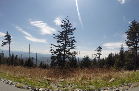
Great Smoky Mountains National Park - May 2014 - Great walk up to Clingman's Dome with my Mom on a beautiful spring day!
0 notes
Photo


Hiking the Blue Heron Loop in the Big South Fork National River and Recreation Area (6.5 miles - December 2014). For this hike, I took advantage of an unseasonably warm day just after Christmas and I practically had the park to myself (and definitely had the trail to myself). I loved the first first leg of this trail along the river. The climb up the gorge was very scenic. The best part for me was overlook of Devil's Jump. The only thing I didn't like is that about a mile or so of the trail runs close to the road. I much prefer trails where the sounds are more natural and not disrupted by passing cars. But, other than that, this is an awesome trail. I'm going to go back in the future to do the John Litton Farm loop or maybe a longer overnight trip deeper into the park. If you have never been to this park, I highly recommend this loop as a good starter hike!
0 notes
Photo


Out and back hike from Miners Beach to Mosquito Beach in the Pictured Rocks National Lake Shore (May 2014). This was a very scenic and beautiful hike! Can't wait to see more of this trail! Lake Superior was beautiful and amazingly quiet with the ice still around.
0 notes
Photo


Hiking the Porcupine Mountains Wilderness State Park in Michigan's Upper Peninsula. (May 2014)
Best hiking trip of 2014! We stayed the first night at the Lake of the Clouds Cabin. We hiked from there back up the escarpment to Big Carp River Trail until we crossed the river. Then climbed via the Correction Line trail to Mirror Lake Cabin. Then hiked back to the Lake of the Clouds overlook parking lot via the north mirror lake trail. I can't wait to go back next year! If you're into hiking and have never been there, make it a priority!
0 notes