
Last Seen Blogs

lunaserum
:espresso bean:

sillylilho3
Sillylilho3

xandala
xandala

xstarlghtx
choni is liffeee 😍💕💕

rainbowbr1t3-blog
Me Myself & I
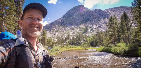
Photo
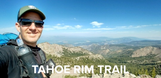
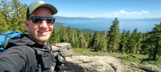
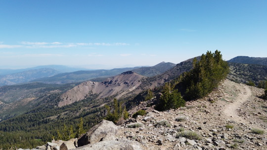
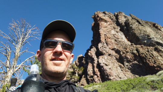
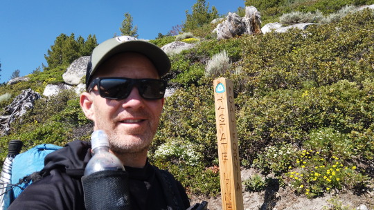
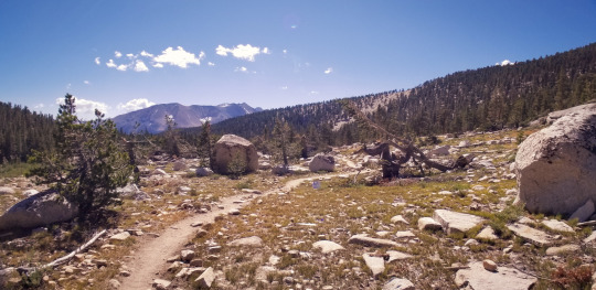
Tahoe Rim Trail (TRT) - Solo
July 2022
Total Miles: 173.8
Hiking clockwise (CW) from Tahoe City to Tahoe City
Why am I hiking the Tahoe Rim Trail?
Tahoe is about three-and-a-half hours from my home. We come here most every year with friends and sled, snowboard and have a great time on the South Side of the Lake. Hiking around it is something I’ve wanted to do since I got into hiking and this was the year to do it. I was going to hike the TRT in 2021 but the wildfires broke out about two weeks before my start date and I had to postpone the hike to 2022.
Foot Care:
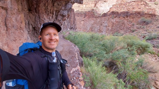
I didn’t have any blisters on this trip. I really try to take care of my feet on the trail as they are everything on a long hike like this. Here is what I do.
I use Injinji trail toe socks and Altra Lone Peak 5 trail running shoes - I don’t trail run, but these shoes are great. I also use Altra trail running gaiters to keep rocks out. I didn't have a single rock in my shoes the entire hike. The Altra shoes have a wide toe box so your toes have room to move and breathe. I also have two toes that tend to rub together so I put a bandaid on one of them so the cushion of the bandaid is the part that rubs on the other toe and I don’t have any problems when I do that. I change out the bandaid about every two days.
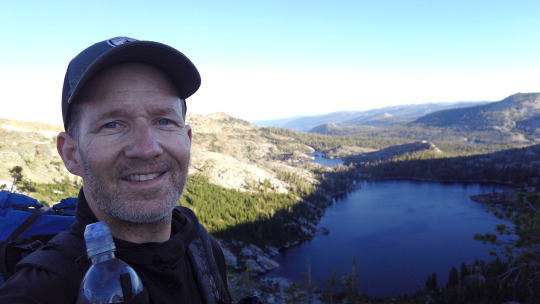
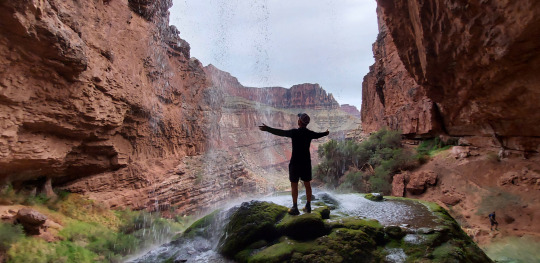
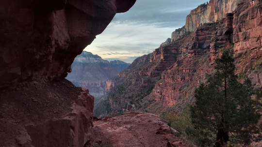
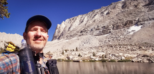
Looking out onto Lake Fontanillis
At the end of each day I wash my feet with water and a brillo scrub pad. I bring and dedicate 1/2 a pad just for my feet. Then I rub Vaseline on my heels before putting my dedicated bed socks on. Those socks are regular style socks and are only used for sleeping.
Take good care of your feet and they'll be good to you.
Food:
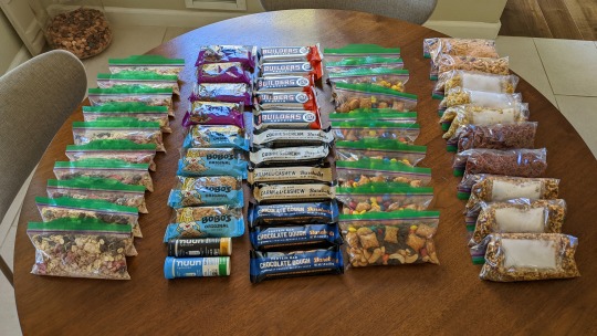
My TRT Food
I’m always finding ways to tweak my food on the trail. I like my breakfast option a lot. It’s Peak Refuel’s Mountain Berry Granola. I break one pack into two days and add ¼ cup of oats to each and a tablespoon of raisins. In the morning, when I’m packing up camp, I add a cup of water and let it cold soak for a few minutes then eat, rinse my Talenti jar and go. This meal gets me going at 6 AM and keeps me going strong until around 11 AM. At which point I usually have a bar. I brought three bar options per day to have between 11 AM - 4 PM. I only wound up eating one to two bars per day as I just wasn’t super hungry. I was not happy with my dinner choices on this trip. I had dehydrated meals from Peak Refuel that just were not good. The ones from Good to Go are better, but I found that I wanted something more hydrating on the trail like noodles and broth. I didn’t have that so I made the best with what I had, but made note that I’ll have more moist meals in the evening. More on that below. In the middle and end of the day I would have a Nuun tablet in my fold out cup. I didn’t want to put the tablets in my water bottles as I didn’t want them to become flavored with that taste. This was a tasty treat and a good pick me up in the middle and end of the day.
Elevation on the TRT:
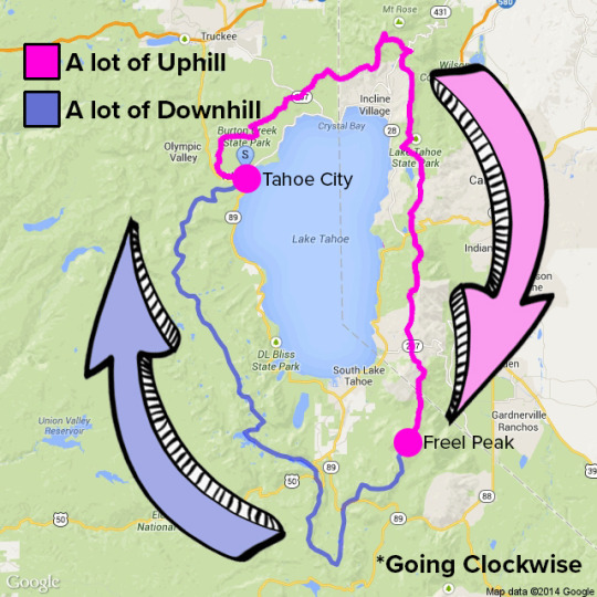
My interpretation of the TRT
Although this may not be completely accurate, this is what the hike felt like to me. The first half from Tahoe City to Freel Peak felt like A LOT of uphill. The uphill section also was some of the hottest and the toughest as there are not a lot of water sources on that side of the trail. But, once past Freel Peak I felt like there was a lot of downhill. Remember, downhill can also be difficult as it can be stressful on your knees. The trail has a lot of loose rocks on the downhill side too so watch your footing. This is where blisters can easily be made if you’re not watchful of how you're stepping.
If I was to do the hike again, I don’t think I’d change anything, Starting and ending in Tahoe City is great as you have restaurants and access to everything. Also, the uphill, although tough going CW, feels like it’d be tougher going the opposite direction due to the bouldering and rock laden paths on that side. The water carry was the toughest going CW from Tahoe City, but it’s not that bad so long as you have enough water on you to make it to the next water source.
Key Pieces of Gear:
Sunbrella - without this piece of gear I don’t think I would have been able to hike in the afternoon sun. From about 11 AM to 4 PM the sun is just blistering. The sunbrella was a key piece of gear to me. I met a PCT hiker who had a clip from Zpacks that allows the umbrella to snap to your shoulder strap. I just held mine as I hiked, but I’m definitely going to look into that clip. I almost didn’t bring my sunbrella and I’m SO glad I did.
Gaiters - I mentioned these above in my foot care section, but this made it so I didn’t have a single rock in my shoes the entire hike. I love my gaiters!
Chapstick - It is SO dry in Tahoe and my lips are still a mess many days after the hike. I didn’t bring my Chapstick at the last minute and used Vaseline in a pinch, but I would HIGHLY recommend bringing Chapstick on this hike and keep it very handy throughout the day.
Bears:
I didn’t see any bears on this trail. However, there are times where I saw bear scat directly on the trail. I also didn’t go looking for bears and many times I felt like if I looked around for them I would have seen them. In those areas I just moved quickly through the trail and didn’t look around to see if they were looking at me. I didn’t want to take a chance and I didn’t want to freak myself out. I felt it was best to leave them be and just keep moving on.
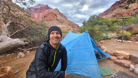
Day 0: Tahoe City
Miles hiked today: 0
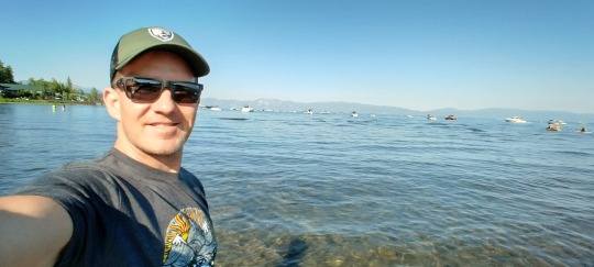
Standing in Lake Tahoe taking in the amazing views
The morning I was going to drive into Tahoe City the smoke from the Washburn and Electra fire started blowing into the Tahoe area. I kept an eye on the Facebook group and purple air to see what other people were doing. I refreshed Purple Air every 30 minutes and started to see the numbers going down so I decided to drive up there. I didn’t want to have to postpone another year, but I also felt like luck was going to be on my side. I’m happy I was right.
Once I arrived in Tahoe City I drove down the main street. It’s a cute little town right on the lake.
I checked into my hotel, America's Best Value Inn, Tahoe City then explored the town.
There was a band playing down at the beach so I went to check them out. There was a massive crowd of people relaxing on blankets, kids playing on the play structure and adults dancing to the music. I walked out to the lake and waded into my knees. As I stood there I took a look around the lake. It’s overwhelming to think I’m going to hike around this entire thing through these massive mountains I see all around me. It’s exciting as I know the next time I stand in this spot I will have a deeper understanding, respect and connection to this place.

I parked my car at the transit center. It’s a nice big parking lot with bathrooms in the middle. It’s fine to park your car here for weeks at a time without it being bothered. There were plenty of spaces, too.
I ate dinner at Brau Haus then went to my room to double check all my gear.
My base weight (my pack minus food and water) is 13.5 lbs. Nice and light. I decided to hike the TRT CW (clockwise). I didn’t do a lot of research for this hike like I’ve done on other hikes. The biggest thing I researched was understanding the long water carries on the east side of the lake. I prepared by making sure I had enough water capacity to get through the longer sections. That meant carrying five, one liter smart water bottles, mostly empty right now as I didn’t need all that water yet, plus my one liter water filter for a max capacity of six liters when necessary. That’s A LOT of extra weight to carry, and I was happy that I would only have to carry that full capacity a couple times on the hike.

The morning of Day 1. Ready to hit the trail!
Lights out at 9:30 PM. Tomorrow was going to be a big day and I wanted to be sure to get as much sleep as I could. It’d be the last time I slept on a big comfy bed for a while.
Day 1: Tahoe City to CA/NV border
Miles hiked today: 27.4
I woke up at 5:15 and was raring to go. I heaved my pack onto my back and headed down the road to the Chevron station, my official starting point of the TRT. The trail goes through part of the town of Tahoe City so starting here seemed to make sense. I was on the trail at 6 AM.
Right away the trail takes you up and out of civilization and into the mountains. I came to my first view of the lake and met my first TRT hiker, Lea, who camped right at this amazing view point. We talked for a few minutes then I headed out. I would see her again later.
I made a pact with myself that I would not be in a hurry on this hike. That I would take my time to stop and talk to other hikers, when they wanted to talk, and would swim in any lake that looked amazing. I had planned on hiking the TRT in nine days and gave myself one buffer day in case I was sore and needed a zero day.
Stopping to enjoy the view
I started the day with four liters of water. Watson Lake was the first water source, but everyone on the forums and Far Out app said not to get water here as it was “nasty.” There was a better water source just down the trail a half mile. After a few minutes taking in Watson Lake I headed down the trail to get more water as this began the first section of big water carries.
Watson Lake
When I came to the first water source I met two other TRT hikers, Condiment and Jumper, two college kids hiking the TRT and on day five. Condiment got his hiker name when he hiked the John Muir Trail (JMT) and ran out of food. When he got to the Tuolumne Meadows restaurant he asked if he could get some sriracha packets and they gave him handfuls of them and thus his hiker name was born. Jumper got her name because she wore a big green jumper as her hiking outfit. We talked for a bit and laughed at how small this little water source was. It was a tiny trickle of water, but was flowing fairly well. Little did I know that this would be a standard size and flow of a “water source” on the TRT. I was used to large streams with massive flow on the JMT and other hikes that’d I’d done before.
By 2 PM I reached my original destination goal at Brockway crossing. I thought I’d be here around 6 PM so I was a bit surprised that I was here so quickly. It wasn’t hard to notice all the massive gallon water jugs people had left for themselves here at Brockway. These are called water caches. People leave water for themselves at some of these road crossings so they don’t have to carry massive amounts of water in those long dry sections. They put their names on them and a date when they think they will be there. There were also dozens more jugs that didn’t have names that were up for grabs, left by trail angles, non hikers who leave treats for the hikers. I didn’t need any water cache so I just hung out, ate a couple bars and enjoyed some shade. I didn’t see any other hikers here so I just relaxed by myself for a bit.
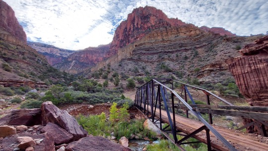
Great views right out of the gate
I was surprised to see that I had cell service, so I called home and talked to my wife for a bit. It was great to hear her voice. Afterwards, I decided to hike on.
I met another hiker named Funny Bone. He’s going to hike around the lake CCW (counter clockwise) then turn around and hike it CW! He seemed like he wanted to really master this trail, finding all the in and out points, where it was best to resupply, etc. Maybe he’ll write a book about it.
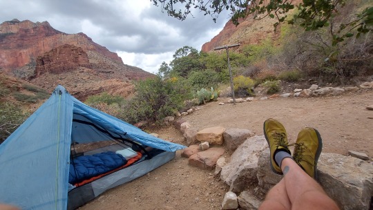
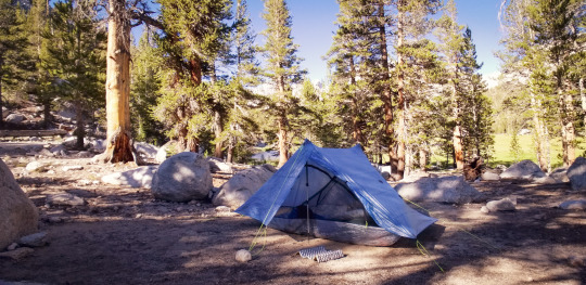
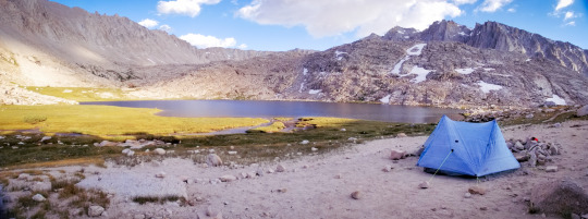
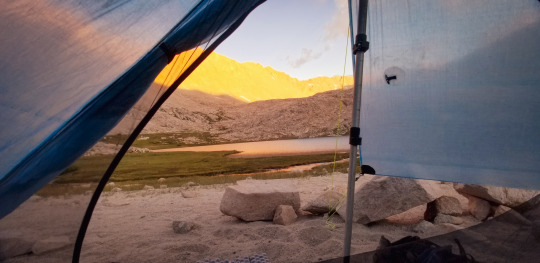
I hiked on until around 7 PM. My campsite was at mile marker 27.4 the CA/NV border on the Far Out app. This was by far the best campsite I’ve ever had on a trail. I was up on a high peak overlooking the lake to the front and mountains to the West. It had nice big rock formations that doubled as great seats to overlook the view.
Setting up camp.
After I set up my camp, Lea, the first hiker I met on the TRT came in and asked if she could camp here, too. SURE! It was nice to have company. She’s a really cool person who, over the last three years has hiked many of the biggest long distance hikes such at the PCT, CDT and the Salkantay Trek in Peru (I did that one too). We had a lot to talk about in terms of hiking and life. We watched the sunset and then hit the hay.
Sunset at my campground
My first impressions of the trail is that it is not super difficult. My body seems to do quite well adjusting to altitude so I felt just fine. I didn’t do a lot of training for this hike either, so I was also surprised my body didn't seem more sore. Hey, I’ll take it!
Day 2: CA/NV border to Marlette campground
TRT Mile: 55
Miles hiked today: 27.7
Last night was super hot. Normally I get very cold in the middle of the night, but not here. It’s been so hot during the day and the nights are pretty decent.
Up at 5:15 and on the trail by 6 AM.
It was really beautiful coming around the back of the North edge of the trail. You really feel like you're turning and coming around to the East side of the Lake.
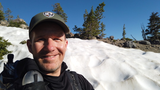
A big chunk of snow just off to the side of the trail. The first snow I saw on trail.
I saw the first sign of snow today. It was just off to the side of the trail. It’s nice as in July there is virtually no snow at all on the trail. It might not be like that every year, but this year it was and that was great. One less thing to think about.
I thought I planned my water resupply well, but I’m about a mile and a half away from the next water source and I only have one sip left! A little too close for comfort. I think I'll make sure to keep a little extra so I don't get so close to running out.
The water source could easily be missed. I heard a trickle and looked down the side of the mountain and saw a small bit of water rolling down the hill. I had to take my pack off and climb down. I used a leaf to make a bit of funnels so the trickle would go into my filter. Filling up several liters took a while and I laughed again at the irony. You have this massive lake all around you but just little trickles of water here and there to fulfill your needs.
Nearing the top of Relay Peak
Up and up and I came to the top of Relay Peak, the highest point on the TRT, 10,300 ft. I met two TRT hikers up here Nick and Laura. Nick and I would later hang out at Mt Rose parking lot for a bit before he headed into town to resupply. I didn’t see him again, but he was a really cool guy with great energy.
I later met another TRT hiker named LeapFrog and Brittany. These were the only two CCW TRT hikers I saw all day.
Tip: If you don’t want to see too many hikers I think going CW makes sense as I really don’t see too many hikers going CCW and the CW hikers are going the same direction so we don’t see each other too often, if at all. Either that or there’s just not that many people hiking the TRT in July?
I stopped for a nice long great at Galena Creek Falls. The lower falls are spectacular and you can walk right up to the falls themselves. There’s not a pool at the bottom so you can’t swim here.
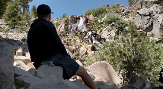
Taking a break at Galena Falls
I hiked on and could smell smoke a bit in the air. About an hour later the wind picked up and blew it out.
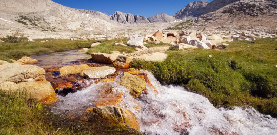
Ophir Creek is a great water source. A real creek with flowing water. I took a break here and enjoyed the sound of the water rushing by.
I feel like my hiker legs are starting to kick in today. The uphills are hard but they're not hurting my legs like they were on day one.
Coming into Marlette Campground I had one of the most beautiful views of the entire trail. There’s an open meadow that looks down on Marlette Lake and Lake Tahoe that is just breathtaking.
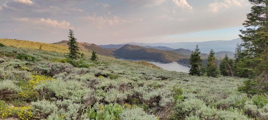

One of my favorite views coming into Marlette Campground. Lake Marlette below and Lake Tahoe just past that.
When I arrived at Marlette Campground I ran into Lea again! It was nice to see a familiar face. Tomorrow was her last day of the hike and I only saw her for a moment the next morning before she headed out.
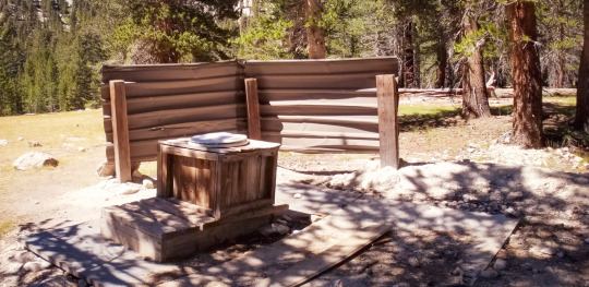
The cool thing about being in a campground is you get luxury amenities like a picnic table and a bathroom (no running water). Funny to think that something like a picnic table is a luxury, but after a couple days of sitting on rocks or the ground, a picnic table felt like pure joy.
Day 3: Marlette Campground to Edgewood Creek
TRT Mile: 81.1
Miles hiked today: 28 (2ish additional miles for resupply)
I slept fairly well last night. Generally, when camping, I tend to toss and turn all night long. I definitely did that last night, but from about 1 AM until the morning I slept soundly. I woke up fresh at 5:15 AM ready to hit the trail at 6 AM.
Marlette Campground has a hand water pump that you heave back-and-forth and water begins to come out. You have to do this many, many times to get all the water you need, but it’s really great to have as this is a point where I had to fill all six liters to make the next twenty eight mile trek which is where the next viable water source was.
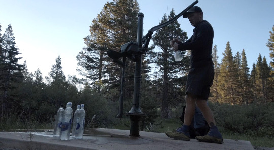
Filling my water bottles at the Marlette Pump
Solitude day. I only saw two hikers this entire day. Both were going counter clockwise. It was actually kind of nice. The solitude gave me space to think about life and be grateful for all the wonderful people and experiences I get to have in my life, like being out here on the trail.
Tip & note to self: trail mix, although tasty, is a lot of work to eat on the trail and I’m finding that I prefer simple bars for lunch. Preferably moist bars vs dry bars as it’s already so dry out here. Bars are fast, tasty and easy to eat while hiking or when taking a quick break. Also, when it comes to dinner I'm finding that the dehydrated food feels too dry to me. I think more moist meals would be ideal like noodles with broth or even some cold soaked food like couscous would be more appealing at the end of these super hot days.
Cell reception on this trail has been pretty amazing. I have Mint Mobile. I'm only using cell service to call my wife and daughter. Otherwise I put my phone in airplane mode, to save battery. I don’t want to look at my texts or notifications as I’m here to unplug. However, having access to call home is a real booster. Hearing my wife and daughter’s voices is the biggest pick-me-up!
Today was a power-through day as I knew that there wasn’t going to be any water until I got to my destination, Tramway market. That’s where I sent my resupply box to and that was my focus. I was also looking forward to getting a meal at The Fox & Hound Restaurant, next to the Tramway.
After about twelve miles of listening to each crunching footstep, bird chirp and rock scuttle I decided it was time to put my headphones on. I listened to Ready Player 2 via Audible today and got most of the way through it. It was nice to have something else to focus on today as it was a big uphill day and the hottest of the days thus far.
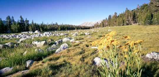
It’s great on this trail how you don’t always see Lake Tahoe. It comes in and out throughout the day and each time it pops up around a corner it’s an exciting feeling. Today there were lots of beautiful wildflowers. Overall not a lot of views today. Mostly hiking through the Alpine forest canopy with lots of big trees and some boulders to climb.
I came down the trail to the road and headed up and off trail to Tramway market. It was a lot of uphill to the market and on paved roads. My feet weren’t used to the hard surface and I missed the subtle cushion of the trail. When I arrived at the market I was expecting it to be nice and cool, but it was blistering hot in there. Maybe even hotter than it was outside! Yikes.
I never drink Gatorade, but I decided to get the Fruit Punch version and it was the most delicious thing ever. My body needed it more than I knew and I felt a definite pick me up. It was exactly what my body needed as I had been drinking warm water all day long, in fact I drank every drop of my six liters! I arrived at the market with only a sip left. Wow!
After I got my resupply box I went to The Fox & Hound restaurant right next door. They were super cool there and I was impressed with the place, both the menu and the vibe were great. It was really nice!
I had a mini pizza, side salad and a root beer. I also got extra ranch dressing to dip my pizza in. Yum! It was wild to see my face in a mirror as I hadn’t looked at myself for a few days and boy, was I a dirty mess.

Yummy food at The Fox & Hound
After I ate I got back on the TRT and hiked about another mile and a half just up the trail from Edgewood Creek (81.1). I had this camp spot all to myself. Having a spot all to myself helps me sleep better because I don't like making noise and thinking that I'm waking up other campers when I get up early to pack in the morning. When I’m alone, or more spaced out, I can be as loud or not as I want to.
I'm up above Heavenly Village in South lake Tahoe now and I can see the gondola lines from Heavenly. Tonight I could hear music coming from down below in Heavenly village. Heavenly village is where my family and I go every year when we come to Tahoe. Hearing the sounds below of music and people cheering, although subtle, gave me a sense of familiar peace. Next time I’m down there with my family I’ll remember to look up to the mountains and remember when I was up there and wonder if anyone is up there listening in.
Day 4: Edgewood Creek to Big Meadow
TRT Mile: 106.6
Miles hiked today: 25.5
I slept SO good last night and I feel amazing.
As I walked along the trail this morning I'm singing, “I would walk 500 miles” out loud and having a blast.
I found that no matter how hard it looks like a mountain is to climb, just take it one step at a time and before you know it you're there. And there's always more mountain to climb so just enjoy each step.
California / Nevada State line marker
I met a CCW hiker today named Erin. Cool girl. She hiked the Long Trail in Vermont and really liked it. This is the second person who mentioned that trail on this trip. I’ll have to check it out.
Star Lake is really fantastic. Maybe it’s because it’s the first lake of my trek, but I think it truly is a magical place. It’s hard to get to so there were no day hikers, not even any campers.
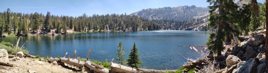
My view of Star Lake
I was there the whole time by myself. That was pretty great, although I did think I would see other hikers as I've only seen one today so far. The beauty of Star Lake was getting to enjoy it all to myself like a little piece of heaven. I took off my shoes and waded into the water. Once I took my first steps, several trout sped past my legs. This was their home and I was invading their space. It was cool to see them dart by.
While there, I took care of some trail chores like laundry, washed my hair, took a “bath” and had a nice swim.
It’s afternoon now I'm with one trekking pole and my sun umbrella. My now standard afternoon TRT attire as the heat is just so intense.
Today has been the hardest day so far. It was uphill right from the start and then more uphill all day thereafter.
My big epiphany today is that, The best adventures are the ones that I have with my wife and daughter. Hands down. Being out here is amazing. Maybe a little over sensationalized in my head, but being here I’m realizing that the best adventures are the ones I have with them. I’m here now on this hike, and I’m grateful for that. I just want to be sure to remember that the simple things in life are also great adventures, too.
From Freel Peak onwards I found that much of the rest of the TRT has a lot of downhill. That was great, but I also had to remember that going downhill can be hard on the knees so I stayed at my regular pace and enjoyed the amazing views as I headed down.
Top of Freel Peak
It was getting late (7:40 PM) and I was ready to stop for the day. I came into Luther Pass Campground just up from Big Meadows. This place looked a bit busy so I decided not to camp here. I headed out past the parking lot and camped right past it just off to the side of the TRT. This gave me access to the parking lot’s bathroom and garbage bins, which was great as I could dump some of the food I didn’t need as I was way ahead of schedule by now and didn’t need to carry all that extra weight.
I set up my tent and used the parking lot to make my food and have a nice hard surface to stand on and some big, flat rocks to sit on as well. I did my nightly ritual of cleaning my feet and putting Vaseline on my heels before putting them into my sleep socks. I’ve got to take care of my feet, they are my main source of transportation and I want to make sure they are good.
Oh and I also take three ibuprofen before bed each night and that helps a lot.
Day 5: Big Meadow to Gilmore Lake
TRT Mile: 135.7
Miles hiked today: 29.2
Whenever I come into the forest I'm always amazed by all the diversity. From the grasses to the plants to the different types of trees. When humans can learn to live this way we will have true community.
Today definitely feels like a reward for all the hard uphill work from yesterday. Today had a lot of downhill. A lot of hard downhill too with rock boulder climbing, steps which are definitely hard on the knees.
After coming out of Big Meadows I came to the PCT/TRT junction. It’s always exciting to hike on the PCT. Seeing the PCT hikers headed from Mexico to Canada is fascinating. It is awesome to meet them and hear their stories. I’m amazed by their dedication, community and passion for what they are doing.
I met two PCT hikers today, Nugget, I think maybe got his name from giving good bits of info to people. And the other was, Sweet Cakes. I didn't ask how he got his name but I assume it was because he likes all the yummy hostess cupcake goodies when he comes into town.
Nugget gave me a good bit of advice about how to attach my sun umbrella to my pack. He had it done and it was solid. It requires buying a special clip from Zpacks (link to clip) that you can buy for six bucks and it comes with a little zip cord to attach to the bottom.
I did not meet any TRT hikers on the trail today. Only day hikers and PCT hikers.
I was excited to get to the Echo Lake Chalet today. I had been hearing about their milkshakes from the PCT hikers today. I had a chocolate shake when I got there and also got a Gatorade (Berry Blast), Hummus and a small bag of Doritos. A hiker lunch of champions! It was so nice and I ate it under the shade of the Chalet while talking with other PCT hikers.
Echo Chalet Market
After a nice long break at the Chalet. I headed out into Desolation Wilderness. Before entering I had to show my permit to the ranger. Starting July 18th they will be requiring bear canisters in this area. I already had mine so I was set.
Walking along the TRT in this section there are a lot of loose rocks and homes built right out onto Echo Lake. It is really beautiful here and I saw a lot of day hikers coming into the area with their permit and camping gear. Most of them were headed to Lake Aloha to camp for the night.
Lake Aloha is breathtaking; it reminds me of Ray Lakes on the John Muir Trail. I’d love to go here with my family sometime as it’s accessible yet it feels completely remote and away from the outside world.
Lake Aloha
My sun umbrella has come in super handy almost every day. From around 11:00 AM to around 5:00 PM it's an absolute necessity to have. It cuts the heat down by about ten degrees.
A quick dip in Lake Aloha was great. Even just getting my shirt wet and putting it back on serves as a great makeshift air conditioning which is so helpful on these brutally hot days.
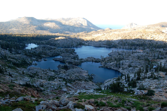
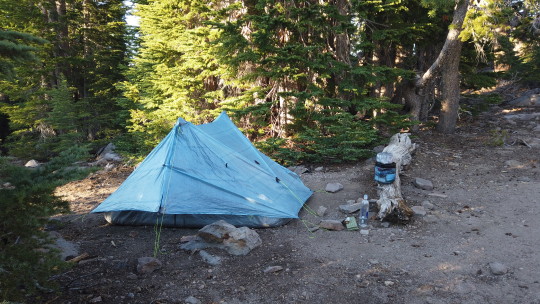
I kept walking past Lake Aloha then past Heather Lake and Susie Lake then decided to camp at Gilmore Lake for the night. It was definitely a stretch goal to get here. It's a beautiful lake and there are two groups of campers here. I set my camp up a bit away from everyone so I could have my own space to move, make noise and get up early and head out without bothering anyone.
Wow, I can't believe I almost hiked 30 miles today!
This evening I had the idea that I'd like to have only about ten miles on the last day so that I could either cruise into town early, fresh and dying to get a French toast breakfast with scrambled eggs. OR, I would hike those last ten miles tomorrow to get into town and get a pizza and root beer then sleep, wake up early and head home to be with my family. I’ll make the decision when I get to the top of Twin Peaks/Granite Chief tomorrow. For now, it’s time to call it a night.
Day 6: Gilmore Lake to Tahoe City!
TRT Mile: 173.5
Miles hiked today: 38.1
When you start a hike and you are on day one or two you meet other people that are on day five or six and think, “wow, they are so far into the hike and have all this great trail knowledge”... and then, at some point, it flips and you are the one with the trail knowledge and can help other people out who are just getting started on their adventure. It’s a fun feeling, but it also means you’re on the other side of the hike heading into the home stretch. Today I’m on the home stretch.
Heading up Dick's pass this morning is a nice steady climb up and feels like one of the passes on the John Muir Trail. it's always good to hit a pass in the morning when the sun isn't beating down in your face. Just in general it's a good tip to try to time it, if possible, so that the shade and coolness are on your side.
I feel like a superhero today. My legs feel like Iron Man. On the inclines I feel my legs kick into a different gear and the back of my ankles feel like extra strength is pushing into them. I guess you call this your hiker legs.
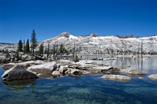
Coming down from Dick’s pass into Lake Fontanillis
Lake Fontanillis is officially my favorite lake of the entire hike. It feels very private and calm. I took a swim here and felt like I had the whole lake to myself. The trail goes right along the side of it. At the end there’s a little waterfall that goes into a smaller pool. It’s really magical. There was a guy trail running back and forth who looked SO much like the late Chester Bennington. He went by me 3 different times and we talked a bit. I didn’t mention anything about his resemblance to Chester, but it could have been his doppelganger or brother. Probably not, but it was wild and I decided to listen to Linkin Park right afterwards as I headed on down the trail.
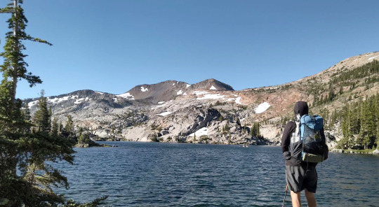
Chillin’ at Lake Fontanillis
I've come to the conclusion that a long hike like the PCT is not something that I want to do. Six to 10 days is plenty enough for me. What I like about these hikes is the ability to unplug from everything and enjoy nature while remembering how grateful I am for all the amazing things in my life. My family means everything to me and I can't wait to be back with them. I believe this trip has given me some extra insight into being with them, being present with them. I have an amazing life and I am so thankful for that and so thankful for them.
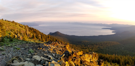
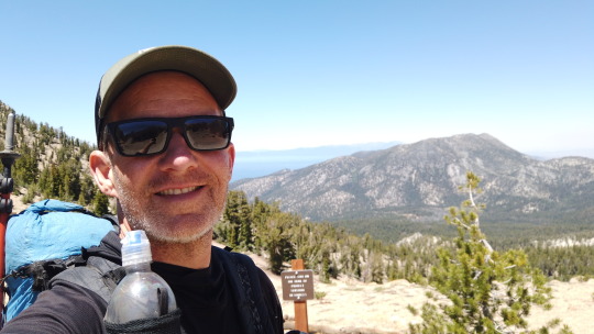
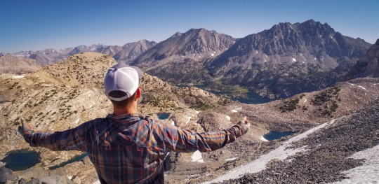
I hiked past the TRT association who were camping right at the top of Twin Peak/Granite Chief where the PCT splits away from the TRT. I stood at the top of the mountain at 6 PM with the most amazing view. Lake Tahoe on the left and Desolation on the right. It was one of the most magical views of the entire trip. Now I had to make a choice. Did I want French Toast (camp), or did I want to gun it and get Pizza. Pizza it was! Since the last ten miles were mostly downhill I decided to go for it.
Lake Tahoe on the left and Desolation on the right. Much more beautiful in person
On the way down I didn’t see any other hikers. I did see big piles of bear scat on the trail and I knew what that meant. I decided NOT to look to my left or right, but often did glance behind me to make sure I wasn’t being followed by a bear. I was focused and had Pizza on the brain.
The last two miles got dark and I had to put my headlamp on and hike in the dark. I’ve never hiked in the dark before as I like to see the views, etc. But this was different. I was on a mission and I wasn't going to stop now.

The big payoff at the Pioneer
As I kept going I started to see lights from Tahoe City and I knew I was near. I got into town and officially ended my hike at 9:35 PM. I was SO exhausted and hungry. Luckily the Pioneer was open and they had Pizza, no root beer so I got a Sprite instead. It was absolutely delicious and I was happy I hiked those last ten miles today. I camped this night at the trailhead and woke up at 5 AM to drive home and be there in time for breakfast… Yes, French Toast. Yum!!!!
0 notes
Photo
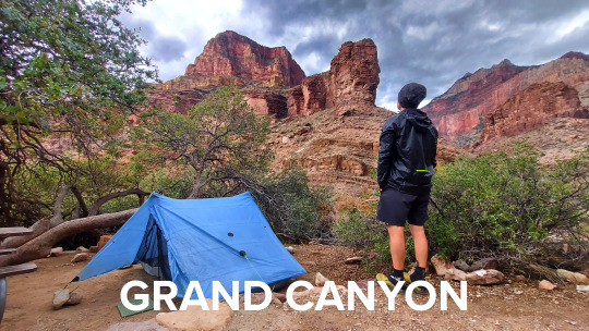
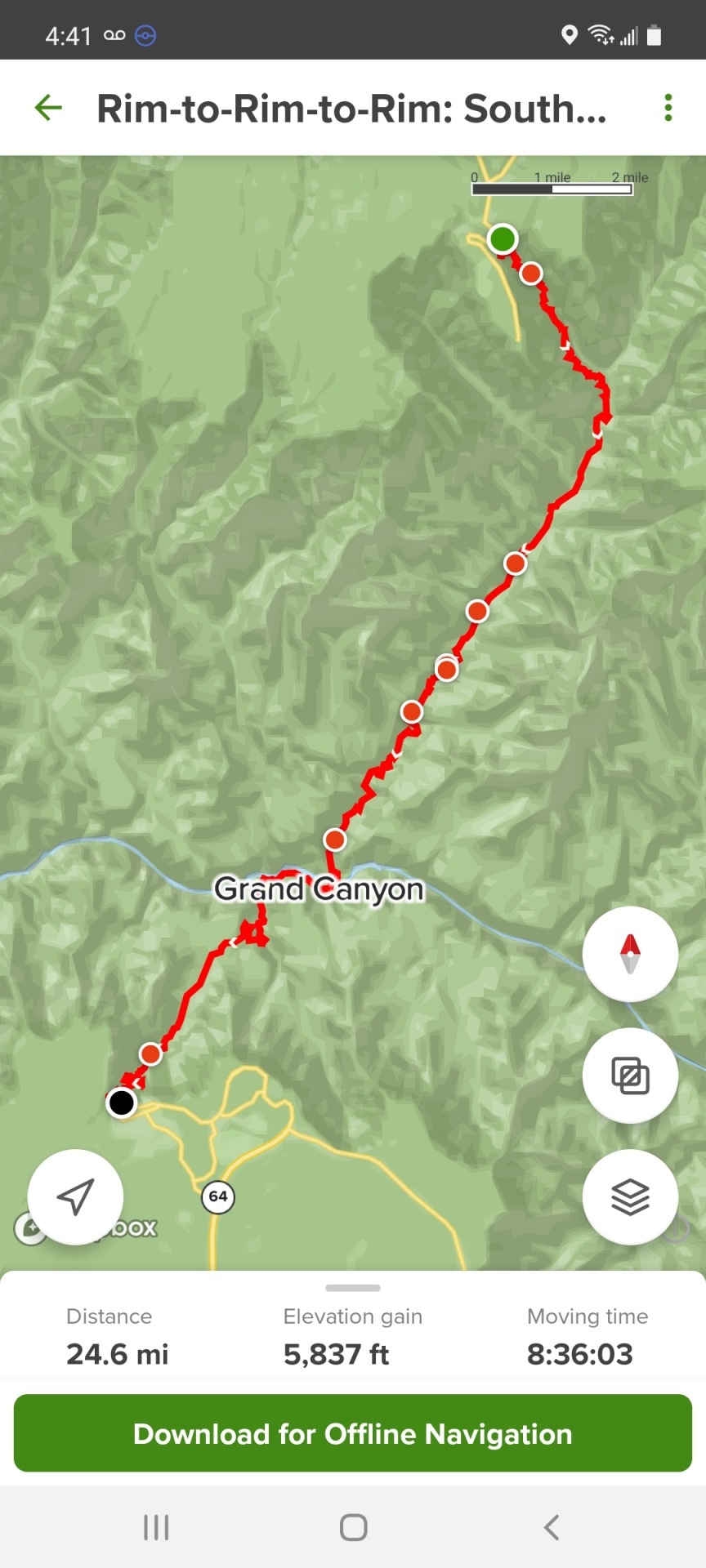
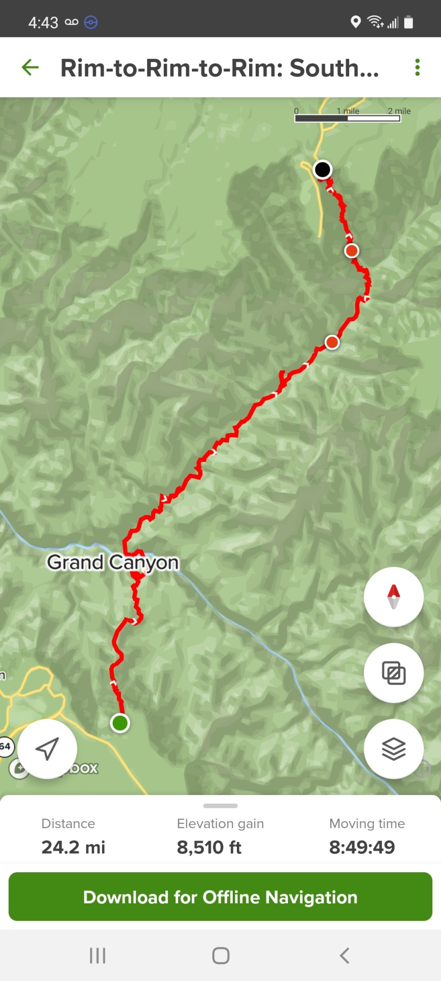
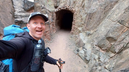
Grand Canyon Rim to Rim to Rim (R2R2R) - Solo
October 2021
Total Miles: 49
North Kaibab to Bright Angel then South Kaibab to North Kaibab
Why am I hiking The Grand Canyon?
I recently sold my company and wanted to take a moment to pause, celebrate and have a moment for myself to be alone with my thoughts and connect to myself and nature. Over the last few years of hiking this trail has come up many times on my “someday” list. I had planned to hike R2R2R this time last year, but a wildfire came through my neighborhood about one week before I was to start the hike and I needed to cancel it. Luckily our home was spared. This year, I knew this was the hike for me to do and I was happy it all lined up.
GPS and Cell Signal: I hiked largely with my phone in airplane mode and the All Trails maps work great (be sure to download them in advance) with GPS alone, no need for a cellular signal.
Cell signal on the R2R2R trail is pretty much non-existent. I was able to get it out at the top of the North Rim lodge right at the overlook. Other than that, I had no connection, not even on the South Rim. On the South Rim I was able to use the courtesy phone in the lobby of the Yavapai Lodge to call home.
Overall Stats
Blisters: 1
I wore Injinji Toe socks and Altra Lone Peak 4.5 Trail runners. Unlike the JMT, the R2R2R trail is very rocky, and the terrain is not always even. This makes for a lot of irregular non-stop rubbing especially on the up and downhills. Only one blister on my big left toe. I drained the blister the first night and covered the blister with some luko tape and moleskin. That was it. I refreshed the dressing the second day and it healed quickly.
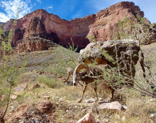
Animals seen:
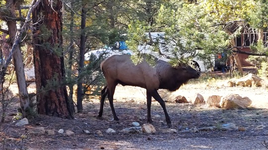
Squirrels, Ram, Rabbit, Elk.
Day 0: Getting to the North Rim
I flew into Las Vegas, my first flight in over a year-and-a-half since the Pandemic began. Right when I walked out of the plane I noticed slot machines filled every available space in the Vegas airport, and the smell of cigarettes filled the air. Ha ha. Yup, I'm definitely not in California anymore.
I used the Turo app to rent a car which I picked right up at the airport. I get 800 miles on my rental but will only use about 650. I have about 4.5 hours of driving ahead of me today.
I hopped on the highway and headed towards St. George, Utah, about halfway to The Grand Canyon (TGC) from Vegas to get fuel for my camp stove as TSA won't allow fuel canisters on airplanes.
Once in St. George I first went to Camping World but they didn't have much of anything. Then I went to Big 5 and they only had really large cans. Finally I went to The Desert Rat and they had them! (FYI, The North Rim Campground General Store has them). I grabbed a burrito at Chipotle and then headed back on the road. No one is wearing masks here at all. It’s as if the Pandemic isn’t happening at all. I’m getting a lot of strange looks from people as I’m the only one wearing a mask. Such a contrast to back in California.
The landscape driving to TGC is absolutely stunning. Giant red rock formations line the view in every direction like ancient cathedrals painted by Mother nature effortlessly. Several times I laughed in amazement. I feel like I'm getting a glimpse of what's to come and I'm so grateful to actually be on this big adventure that I've been looking forward to for so long.
Once in Kaibab National Forest I was surprised to see dense forest for about the last 50 minutes of the drive. I guess I thought it was just going to be desert all the way so this was a real treat. Since I'm here in October, the fall colors have really kicked into gear. Mixed in with all the greenery are massive patches of yellow and when the sun hits them it creates a halo effect that quickly flashes a moment of brilliant blinding light. Driving through here I am filled with the feeling that I'm somewhere very special.
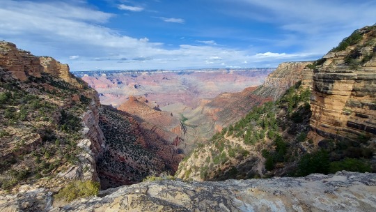
Once at the North Rim I went directly to the North Rim lodge. Out of the corner of my eye I could see the canyon, but I didn't want to look just yet, not until I walked out to the edge. So I did. I walked out to the edge and slowly lifted my head to look up and out over the massive canyon landscape and it took my breath away. It's so massive in scale, it's hard to imagine how the hell this came to be. And I'm going to be down in there tomorrow!!! Yes!
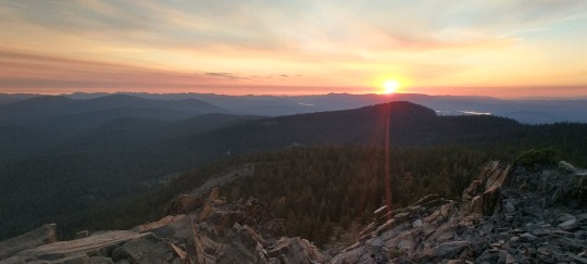
I checked into the North Rim Campground and set up my tent. Then I headed back to the North Rim Lodge to watch the sun say goodbye over the south west rim for the day. The sun left a trail of gorgeous red, orange and pinks that slowly faded into darkness. A man played his ukulele adding a really nice vibe to the end of a great day.
The Lodge is the only place that has cell reception on the North Rim, so I took advantage of it to call home and say goodnight to my wife and daughter. They are so supportive. I'm one lucky guy.
I went back to my camp, cooked my food and tucked in for the night around 9pm. The stars here are incredible. It’s as if you can see every star that ever was. And, there’s no bugs, so I sat for a long while and enjoyed the vast display.
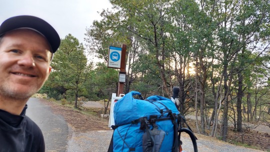
I'll be up at 4:45am tomorrow. My goal is to head out on the trail at 5:45am. Good night.
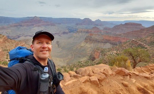
Day 1: Rim to Rim - North Kaibab to Bright Angel (South Rim)
Miles: 24.5
Mantra of the day: Yield to others. Not just hikers, but in life, too.
I was up at 4:30am. I couldn't sleep any more, I was too excited, and parked and ready to go out on the North Kaibab trailhead at 5:30am.
I really didn't want to hike in the dark with my headlamp as I wanted to see every moment in the daylight. However, most everyone who hikes this trail in a day starts very early. Since I didn’t want to underestimate the trail, I decided to only hike for the shortest bit in the dark. Luckily I only needed my headlamp for the first 20 minutes then there was enough light that I could turn it off.
It was SUPER cold for the first 30 minutes of the hike. Even though I had gloves my fingers went numb. Luckily it didn't last too long and I was able to pair down to my regular hiking wear pretty fast.
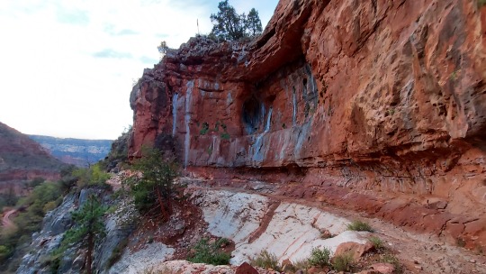
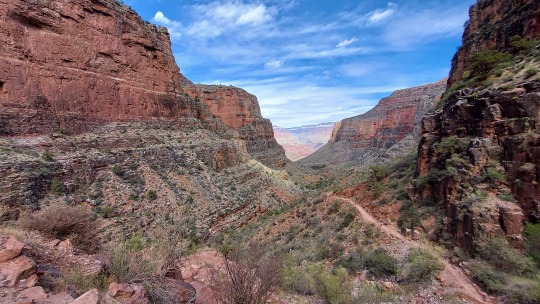
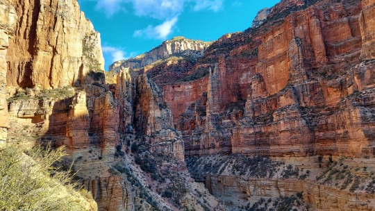
Going into the canyon on the North Rim is so spectacular. Even if you took a video the entire hike, it wouldn't capture the majestic scale and awe that this place holds. In every direction it is perfection.
Before the trip, I downloaded a playlist full of Native American flute music and had one headphone in for much of the first day of the hike playing these great tunes. It kept me present and grateful of my surroundings, and feeling small in this massive place. That's what I was looking for, to feel like a simple human being and to step away from everything and to go back to the basics.
I knew there would be a lot of people on this hike as I decided to go in early October when the weather is fantastic for the hike. However, I found that much of the hike was very intimate. I hiked much of it alone in my direction. I passed many people going the other direction, but it was spaced out enough that I had big chunks fully to myself and the sense of privacy was well above my expectation.
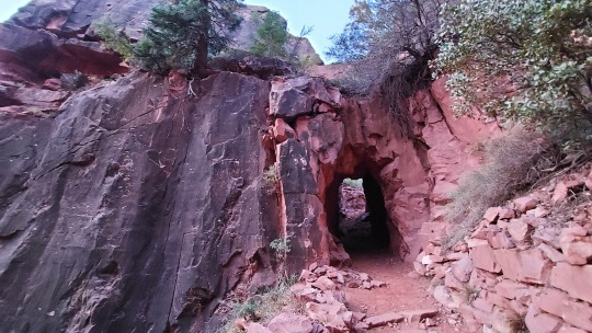
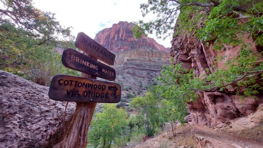
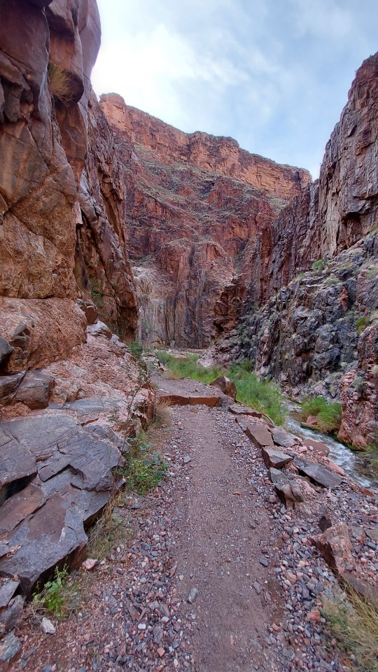
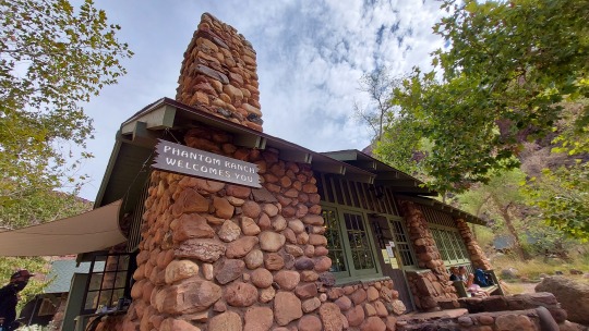
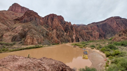
The Box, is a part of the hike that goes from about a mile past Ribbon Falls (which I decided not to go to today and would visit tomorrow) all the way to Phantom Ranch was one of my favorite parts on this day. River runs along the entire box so you have the sound of rushing water, mini waterfalls and a semi-slot canyon feel through this section with the massive walls of the canyon hugging you.
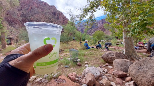
I had read about the Phantom Ranch lemonade and was looking forward to getting a glass when I arrived. It’s a great halfway stop and there was a fair amount of people there. Hiking solo it allowed me some time to catch up with other hikers and hear about their adventure and motivations for hiking through TGC. Oh, and the lemonade definitely lived up to the hype. It's sweet, and it's exactly what I needed at that moment.
I bought and filled out a Postcard for my wife and daughter and one for my mom and dad. They will be carried out by mule and who knows when they will actually get there, but it’s cool to know this will most likely arrive after I’m home. Like a little gift and reminder of this very moment. My hand trembled as I wrote and I have no idea even what I put down. Ha ha.
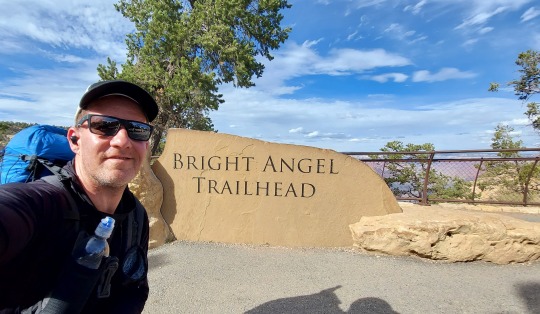
After Phantom Ranch I knew it was going to be uphill the rest of the day and I was prepared. It was starting to get hot and now was the time to focus, enjoy and do the work that makes this hike so deserving. For day one I decided to take the Bright Angel trail to the South Rim. As it was the hottest time of the day I knew BA had a lot of water stops and I wouldn’t be strapped for water... or so I thought. Actually there are only a few spots along the way to get water and, at one point I was very low and really thirsty. I used my filter on a run off stream and that worked great. 2L should do the trick for the entire hike so long as you keep refilling them along the way.
Up and up the trail goes. Lots and lots of steps, some made for giants as they were so big.
As I got closer to the top I started to see more and more people coming down the trail. I knew they weren't going to be going down too far as they didn't have water and were more casually dressed.
The last 3 miles were pretty tough as I was getting tired from all the hiking but I just kept telling myself, "one step at a time".
Once I got to the top of Bright Angel Trail I was elated. I was flying high. I felt like I had achieved something so massive, so great. I took a picture at the trailhead and looked over the right from where I had come from. I was proud, humbled and exhausted. I was surprised to see it was only 3pm. I was planning to be on this side by 6 - 6:30pm. I was happy I had hiked it so quickly, I didn’t think I was going super fast, I just kept going at my natural pace. Having the extra time was nice, but it also meant I needed to stay up until sun down otherwise I’d be up much too early tomorrow and I plan to sleep in and start much later tomorrow for sure.
The shuttles at TGC are great and easy to understand the routes. Much easier to understand being here than trying to understand them with the online info I was trying to do before I set out on the hike some weeks earlier.
I took the shuttle to Mather Campground and set up camp. There I met Dawn, an older woman who is hiking the AZT (Arizona Trail 800 miles). We talked for a long time and then I was getting hungry so I decided to walk to the General Store. This place is great and has everything you could think of. I ordered a mini Veggie pizza, a blackberry Bubbly and had a Twix bar for dessert, yum.
It was still early and I needed to find a way to kill some time as I'm so tired but I can't go to sleep this early. It's only 5pm.
I decided to jump on the shuttle and take it around. I was looking for cell service but there was none to be had. Finally I walked into Yavapai Lodge, close to the General Store and they had a courtesy phone in the lobby. They were kind enough to let me use it and I was so happy to call home. It was the perfect end to such an outstanding day.
Day 2: South Kaibab Trail to Cottonwood Campground
Miles: 16.5
I got on the south Kaibab trail at 8am. Since I hiked the trail so quickly I wanted to start later today, take my time and stop any place that I wanted.
Going down the South Kaibab trail is AWESOME!!! I really liked this part of the hike. Definitely one of my favorite sections. The views from this trail are very different from Bright Angel. Truly outstanding.
Today I caught myself thinking about Disneyland. How awesome it is. How well crafted it is. TGC, in contrast, just IS and is pure magic. I can't imagine the work Disney puts into their parks to make them have such a special, magical feeling. It takes work and effort to get down here in the canyon, not everyone can or will put in that effort. It’s much easier to go to a place like Disneyland. You just show up and experience their magic. Here it is work and the gift is well received and felt by everyone who experiences it.
One more quick thing about Disneyland, you know that warm, musty feeling when you walk into the Pirates of the Caribbean ride at Disneyland? And that very distinct smell once inside? Well, there are several times along The Box on day 2 that I got that same musty feeling and that same distinct aroma in the air. It was nostalgic. Maybe that’s why I was thinking of Disneyland so much today. Damn it, did they find a way to engineer this feeling! Ha ha, Okay, back to the trail.
Hiking the opposite direction you see things completely differently. Today I’m not listening to music at all. I’m just taking in the sounds and stopping to talk to folks who are interested in doing so. There are massive holes in the canyon walls like caves that would be so fun to explore. I wonder what’s up there, I wonder if anyone has ever been up there?
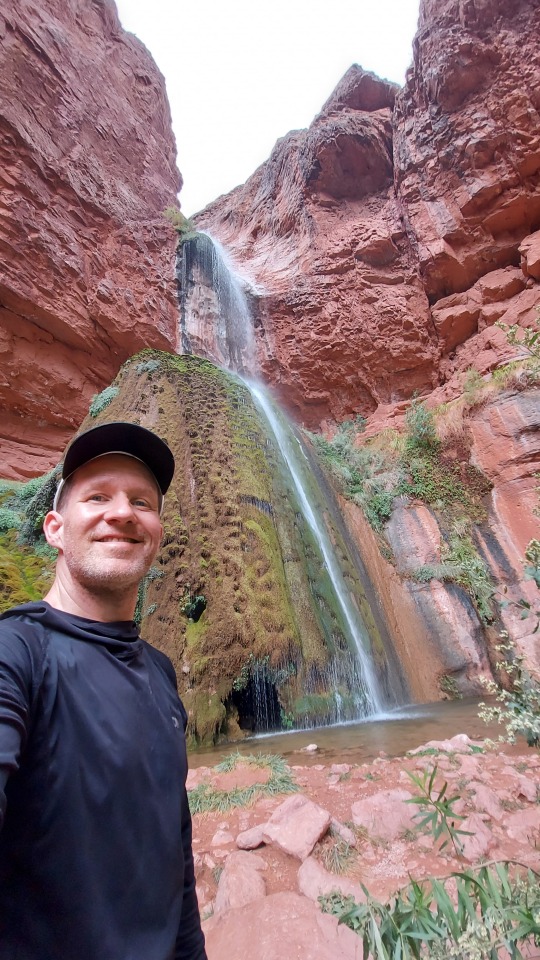
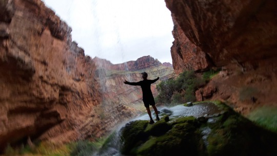
Today I stopped at Ribbon Falls and it was definitely a highlight of the trip. Waterfalls are one of my favorite things on this planet. I make it a point to seek them out and enjoy their beauty. Ribbon Falls is an awesome bit of magic in the middle of TGC. When I arrived I went to the top of the falls and stood underneath the waterfall, letting it fall over my head.
youtube
The view from here is awe inspiring. I then went back down to the bottom and decided to take a dip in the frigid water. I met a group of girls hiking the trail together, Kristy Robin and Drucella. Kristy had been here before and pointed out a small opening at the bottom of the fall. She said it was a cave and that you can go in there and pop out on the other side of the falls. There’s no was I was going to miss that! I went right in and checked it out. I took a video of it as well and it was SOOO cool!
I hung out at the falls and had a snack in privacy and enjoyed nature's splendor some more before heading to Cottonwood Campground. There I stayed at campsite #7. With the permit, Cottonwood’s sites are first come first serve and since I was there a bit early I took my time to pick out the best site for me. One that was private and had a great view.
Because I had time today to relax, I was able to do some introspective work. To think about what I’m grateful for in my life, what I want this next chapter of my life to feel like. I meditated for a long while and then did so again later. It just felt so right to have some time to not be hiking and to just BE here. This is the time I cherished the most on this hike.
Day 3: Cottonwood Campground to North Kaibab Trailhead - North Rim
Miles: 8
When I woke I had this amazing feeling of freshness. I realized I wasn’t sore at all and was super well rested. In fact, I wasn’t sore at all on this trip. I had done some really long hikes leading up to the trail so I think my body and mind were really ready for it. That realization was fantastic as I knew I had a BIG day ahead as hiking out of the North Rim is pretty much 8 miles up, up and UP!
One other thing I learned from JMT was that it is important to sleep with my mouth closed and breath out of my nose. I was stuffed up on the JMT and even on this hike, but I propped my head up when I slept and this opened up my nose so I could breathe. I didn’t have any problems at all like I did on the JMT and I had zero condensation in my tent every day. Awesome!
I was up and out at 6:35am. It was actually warm. In fact, the only cold day I had was that very first day. The highest temperature on the entire hike was 88 degrees. Not bad at all. I did see two days after I finished the hike that nature dumped several feet of snow on and in the canyon. I think my timing was perfect. Whew!
Today, as much as I hate to say it, is focus time. Slow and steady up and out of the canyon. Talking to people along the way, sharing my thoughts, stops I recommended and general encouragement to them as we passed each other. I pulled up my hood to keep the sun off my back and pushed forward.
Once at the top of the North Rim I paced back-and-forth. I did it! I was done, it was a wild feeling! I jumped in my car and drove back to the North Rim where I had cell coverage and called home at 10am! My body was kind to me, nature was accommodating and I had the adventure I had set out on and then some. This one will live in my heart and memory forever and I look forward to what adventures are to come!
Afterthoughts:
Yes, this hike is hard. It pushed me. As far as a hike to do in a single day, I’d say Rim 2 Rim was the hardest single day hike I’ve done. I do feel like I had some energy afterward, but not much. The feeling of completion is tremendous.
1 note
·
View note
Video
youtube
Here’s a short video of my JMT Trek. Full details from the hike can be found below in the blog post.
4 notes
·
View notes
Photo
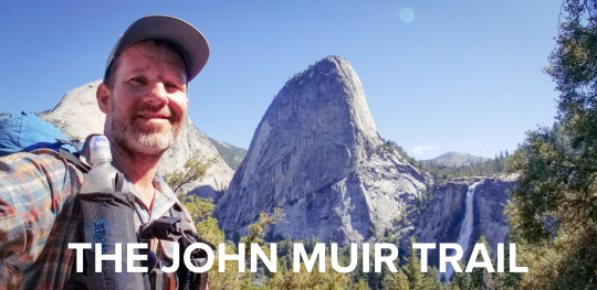
John Muir Trail (JMT) - Solo
August 2019
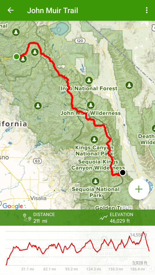
Total Miles: 243
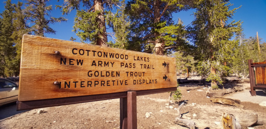
Cottonwood Lakes to Happy Isles (NOBO)
Why am I hiking the John Muir Trail?
I love adventure and the thought of being on my own for so long, learning to live in the most simplest of ways excites me. I also enjoy the thought of being one with the world, going with the flow and having the space to get lost in my thoughts and then let all of my thoughts go. Here we go...
Below are my daily journal entries on my 13 day JMT hike from Horseshoe Meadow (Cottonwood Lakes) to Happy Isles, Yosemite Valley in August of 2019. I hiked completely solo. I used the Gut Hook app for navigation, which proved to be fantastic.
GPS and Cell Signal: I hiked largely with my phone in airplane mode and the maps work great with GPS alone, no need for a cellular signal.
Cell signal on the JMT is pretty much non existent. If you have AT&T you can get it in some “magic” spots, but I have T-Mobile and others with Verizon had the same experience, no coverage.
I used the Gramin InReach Mini to send out preset text messages to let my family know I was alright and I did so each night at camp. It was a one way send. They could write back (for .50 cents a message) and they did so a handful of times. It was good to know they got them.
Parking/Transportation: Transportation details are often a big part of planning a long hike. Here are my high level transportation details, I hope they help you as you as you plan your JMT hike. I hiked South to North, so I first drove my car to Yosemite then parked my car in Yosemite Valley National Park. I parked at a random trailhead as the main lot was fully packed when I arrived. A ranger told me that “should” be okay. In short, it was totally fine - read more in the story below for full details. I then took a bus (YARTS) to Mammoth where I met a pre-organized ride - his info is below in the post - who took me to Lone Pine where I stayed for one night. He came back in the morning to take me to my trailhead (Cottonwood Lakes) where I started my adventure. I finished my hike in Yosemite Valley National Park, took the Yosemite Park bus as close as I could and walked back to my car. I got in and drove home.
Saftey tips on the JMT: The JMT is very safe for solo hikers. I saw many people hiking it solo. Men, women etc. There is so much support and help from others that I would be surprised if anyone would have an issue.
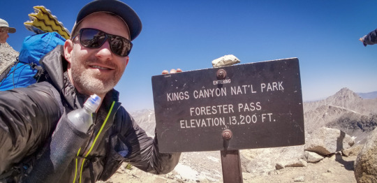
Some of the passes are sketchy year-round due to snow patches. Forester and Mather were the most sketchy in terms of snow and, to my knowledge, two people died on those passes in 2019 - one two days after I passed over Forester. Tip for Forester: I turned towards the mountain on my way down and went backwards down the mountain. I put my trekking poles folded up and pushed up against my tummy in my pack straps so I could have both hands free going down. Just go slow. One step at a time and you’ll be fine.
-----------------------------------
NOBO: Northbound
Cottonwood Lakes to Happy Isles
Overall Stats
Blisters: 0
I wore Injinji Toe socks and Altra Lone Peak 3.5 Trail runners. I aired my feet out each day at lunch then would switch into a new pair of Injinji socks. I had two pairs that I alternated between. Worked like a charm.
Water crossing stats:
Shoes wet: 8
Knee high crossings: 7
Waist deep crossings: 0
Animals seen:
marmots, squirrels, Golden trout (the state fish), several doe, 2 beavers (?) at kings crossing, a buck, rabbits, horses, pheasants.
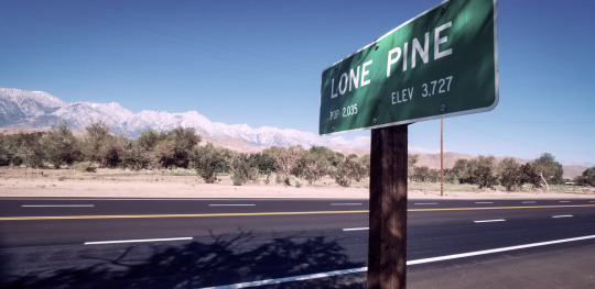
Getting to Lone Pine - my starting point:
Today I drove to Yosemite Valley and parked my car at a random trailhead. Saying goodbye to it for now and hoping that it will be there when I return in about two and a half weeks as the ranger told me it would be.
I spent a short time in the valley walking around with my full pack load. Damn this thing is heavy. I've done a lot of shake down hikes with my pack but somehow I underestimated how much food weight I was going to need to bring as I'll be walking from Horseshoe Meadow to Muir Trail Ranch (MTR) as my first and only resupply. 10 days of food now and 8 days more when I get to MTR. The most I have ever carried before was 5 days total and that was on my trek through Peru last year. The trick with this one is that it all has to fit inside a small, fairly heavy plastic bear-proof canister. Yup, bears. How the hell did I fit 10 days of food in here? Most struggle to fit 5 days. I hope I have enough.
This is by far my biggest solo adventure yet. The John Muir Trail (JMT) is a 211 mile trail starting at the top of Mount Whitney, the tallest peak in the lower 48 states to Happy Isles, Yosemite Valley, however, because the permit is so hard to get, I'll be adding on another 34 miles due to a permit hack that makes it nearly a sure thing you'll get it if you start a little more south. And I did get it.
From Yosemite I caught YARTS (bus) to Mammoth and from there I met a guy named Chuck who I found online ( [email protected] ). He was waiting for me when I arrived and he gave me a ride with his wife from Mammoth down to Lone Pine. He shared many stories about the different valleys along the way and different historical figures and the positive impact they've made here. He also shared how Los Angeles gets its water from this valley and that it's a big point of contention with the people of the area.
Having spent the majority of the day getting from Yosemite down to Lone Pine, the reality of what I was about to embark upon became clear. It's daunting to think I will be walking this entire distance back over the next 17ish days. The mountain ranges are enormous, daunting and overwhelming. I must say being here is much different than having read about and watched videos on YouTube. It's a very different thing to see your favorite thru-hikers talk about their gear, tips and adventures than it is to actually be on your own adventure. It's just different, unedited and unknown. The reality of it is that I have to take every step, climb every pass, push through each painful blister on my own. I'm ready for the challenge, I'm excited about it and I must say, stepping into this adventure solo is the most human thing I've ever attempted and, well, yes, I'm scared.
Day 1: Lone Pine drive to Horseshoe Meadow and hike to Rock Creek Camp:
“Most people are on the world, not in it." - John Muir
Miles hiked today: 13.3
5 water crossings today. All were super meow, whew. The water crossings are the thing that started to worry me most. Bears used to be, but I found that sightings are rare and they tend to be more scared of humans than we are of them.
Hearing my wife and daughter's voices on the phone this morning from my hotel filled me with the confidence I needed to start off right. I don't want to let them down. They've been so supportive of me taking this journey and I know I'll be with them again soon enough. Perhaps changed, enlightened or simply just tired and dirty.
Chuck, my driver, met me early in the morning at the Dow Villa motel and drove me up to the trailhead at Horseshoe Meadow.
We pulled up to the entrance to Cottonwood Lakes and he dropped me off. That was it. I was on my own now. Totally alone.
The wilderness was dry and rocky with some scattering of pines. I stood there for a while debating on what to do. Do I just go? Do I do some kind of ritual before I go? Something to kick this adventure off? I decided it would be nice to take a video of my first steps on the trail. Every journey begins with a single step and this was the biggest I had ever taken so why not document it?
Once on the trail I was off and rolling. Bouncing up and down with a child-like enthusiasm. I had the biggest grin from ear to ear, and I even said out loud, "I can't believe I get to do this!"
As I walked on, the quote of the day was ringing in my head, “Most people are on the world, not in it." and I decided to not listen to any music or podcasts, rather I just wanted to be here. To be another animal in the wild, simple, present and part of it.
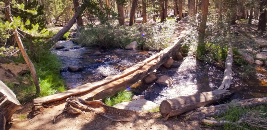
My first river crossing of the trail.
The reality of what I was doing here quickly kicked in. The altitude made even the simplest of climbs feel like a major undertaking, but the big challenge of the day came when I reached the end of Cottonwood Lakes. I was surrounded by giant rocky mountains with snow sprinkled tops. It dawned on me that I had to go up and over this range somehow, somewhere. But where? The trail kept going and going and I wasn't quite sure where it would take me as the rocks camouflage the trail and I really can't see anything other than what's right in front of me. This was New Army Pass, an incredibly challenging array of endless climbing switchbacks. My head began to swell and hurt bad. Real bad. Was I dehydrated? Getting altitude sickness? Was this a migraine? Yes, a migraine, I think so and damn it hurt.
Many times I looked up only to see how much more I had to climb so I started focusing on each leg of the switchbacks and stopped looking up. As I neared the top I ran into a hiker coming down off the pass who told me it was covered with snow at the top and not passable via the trail. Crap! Good news is he gave me a tip to pass, but it involved climbing up two giant boulders covered in snow scrambling on my hands and feet! “This one’s a bit sketchy as there’s and eight foot section where you have to make a leap of faith.” he said casually. Yup, a leap of faith. Okay, day one and I’m making leaps of faith.
Well, I did it. It had my heart racing, but, in the end, it was exactly what was needed to put a cherry on the top of this monster of a pass and start day one off with a massive dose of adrenaline.
Yay for the downhill. Now I could make up some of the miles I was hoping to do today. It felt amazing to get over the pass and I knew that it was just a taste of what was to come.
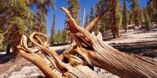
These cool twisted tree trunks can be found all over this area.
As I got into Rock Creek camp my body was tired. It was only 4:30 pm, but this is where I set out to camp as I needed to use the Bear Box as all my food/trash didn’t quite fit in my bear canister. The box was here, empty and ready to use. Whew.
As I set up camp a hungry swarm of mosquitoes began to attack relentlessly. Permethrin, ha, the mosquitoes just laughed and kept on coming. I put on my rain jacket, pants and mosquito headnet. My battle armor proved to work, either that or they got bored of me and called off the attack. I was able to finish setting up camp in relative peace.
Dinner was nice but I wasn't entirely hungry. I've heard that the first few days of a hike people are generally not really very hungry. That may factor into my planning next time but I didn't factor that in this time so I do need to eat my food if not just to get the calories in, but also to make more space in my bear canister.
Campsite day 1 - Rock Creek
Two guys strolled into camp, Josh and Max. Two college kids who were cousins hiking the JMT before school started back up again for the Fall Semester at UC Berkeley. We chatted a bit and, little did I know, but I’d be seeing a lot more of these two on the trip.
The last bits of daylight start to fall away as I lay here in my tent. Time for a podcast or part of an audio book as I need to stay up a bit so I don't wake up stupid early. Good night.
Day 2: Rock Creek Camp to Guitar Lake
“I never saw a discontented tree.” - John Muir
Miles hiked today: 14.5
3 water crossings. One legit one that was thigh high!
Even mosquitoes sleep! I learned that if I'm up at the crack of dawn and have everything packed and ready to go by 7 am I'm good to go. If I wait until 10 after 7 the sun starts to rise and the mosquitoes come out to battle. Overall today the mosquitoes we're not bad.
I was able to get up early, stretch, and even meditate this morning. The view from Rock Creek camp is amazing, peaceful and private.
After I packed up I hit the trail with a renewed, fresh spirit. My body felt great even though I didn't sleep very well. I was up tossing and turning pretty much most of the night. Also someone came in to camp around 9:30 pm and set up camp next to me. I'm pretty sure they had one of those super crinkly neoair sleeping pads that sound like a paper bag being scrunched next to my ear with every toss and turn.
I was up by 6 am and out by 7 am and left before the others were awake. I wanted to get on the move as I wasn’t officially on the JMT yet. Not until I got to the top of Mt. Whitney.
I’m officially on the PCT, but not the JMT just yet.
The day started pretty mellow with a beautiful stream next to the trail. As I strolled along the trail came to a junction and it was at this point that I was officially on the coveted Pacific Crest Trail (PCT). I became gitty at the thought of being on the real PCT. I've heard so much about it and, even if it's just a portion of the trail, it feels incredible to be here experiencing it. The the John Muir Trail is actually the Sierra portion of the Pacific Crest Trail and, as I’ll come to find out, most of the PCT hikers favorite section of the entire 2,400 mile trail that goes from Mexico to Canada.
So much for a mellow morning. The trail began to climb and it was no joke. It was nothing compared to New Army Pass but it was still a lot of work to get up it. My legs were awake now.
Something that I really like doing is taking the opportunity to talk to every person I meet on the trail. I like to hear their stories, why and what trail they're on and how long they plan to be out. Most people I've met so far are not on the John Muir Trail. They're doing some portion of it or a section of another trail. I'm so grateful and blessed to be getting to do this. It seems most people I've talked to really would like to do the whole thing but can't get the time off for it. I stopped today many times and said, "I can't believe I'm here, I can't believe I get to do this!"
The one and only “bathroom” on the JMT. - Crabtree
Because I started so early I got to Crabtree around 2pm. I knew I had about another 3 miles left to get to Guitar Lake so I decided to take my time and relax. The mosquitoes we're non existent and I was able to sit by the stream in Crabtree Meadow, take my shoes off and lay back on my sit pad and rest for about 30 minutes.
Timberline Lake
Walking up towards Guitar Lake I saw the most incredible view of my trip so far, Timberline Lake. The craggy mountains tower above and frame the lake in a magical way. At the top of one of the rocky mountains looks like there's a castle straight out of Game of Thrones. I talked to a guy and told him I was waiting to see a dragon swoop down from overhead. He had never seen Game of Thrones, but he seemed to enjoy my comment.
I came into Guitar Lake around 5:30 p.m. It was a hard climb to get up here. I was overcome with emotions. Guitar Lake is something that I've read about for some time and being here was absolutely surreal. My campsite had the most incredible view of any campsite I've ever been at before in my life. No joke! The lake was clear and the ominous mountains kept watch from overhead.
My camp at Guitar Lake.
After I set up camp I decided to jump in the lake. I wasn't sure if it was the smartest thing to do as most of the sunlight was gone for the day but I was a giant dirt ball and was dying to get clean. I also wanted to feel how cold the water was. It was cold, but it felt very refreshing and it was nice to be somewhat clean again.
Evening view from inside of my tent at Guitar Lake.
I made dinner and ate every bite. Today was a big day and my appetite was huge.
Happy and tired.
I'm off to bed as I plan to get up at 3 am to start my trek up to Mt. Whitney to catch the sunrise.
It's a full moon so it should be fairly bright out, too. Cool!
Day 3: Guitar Lake to Mt. Whitney to Wallace Creek
“Only by going alone in silence, without baggage, can one truly get into the heart of the wilderness. All other travel is mere dust and hotels and baggage and chatter.” - John Muir
Miles hiked today: 15.8
Today was incredible! I woke up at 2:45 am and headed out at 3:15. I was able to leave my tent, bear canister and sleeping pad at Guitar Lake. This made my pack so much lighter and it felt amazing. If only it could be this lite all the time.
The moon was full and bright. I was able to find the first 1/4 of the hike just by moonlight alone. Thereafter the trail got hard to see so I kicked on the headlamp.
The Gut Hook app came in handy many times on this leg of the trek. When I lose the trail the app acts as a precision tool that guides you right back onto the trail. Getting lost on the JMT doesn't happen too often, but when it does, this app is a real saver.
Here comes the sun!
Ahead I could see little lights up fairly far ahead of me on the switchbacks from people who started earlier than me. There were only a couple others, but it eased my nerves as at least others were as crazy as me and attempting to try to be there for sunrise.
Because it was so early it was actually quite pleasant to head up the switchbacks. The cool weather made it bearable.
As I headed up I was excited that I was going to see Whitney at sunrise. I've been told that it's somewhat of a “religious experience.” I’m not sure why, but I’ll be able to experience it for myself soon. No expectations here, I just thought it’d be fun to do this.
After what felt like an endless meandering of switchbacks I finally saw the silhouette of a sign up ahead. Was this it! Was I at the summit...? No. It was the trail junction from Whitney Portal and the sign said it was another 1.9 miles to the summit! Yikes. This thing is massive and the first hint of daylight was starting to show signs.
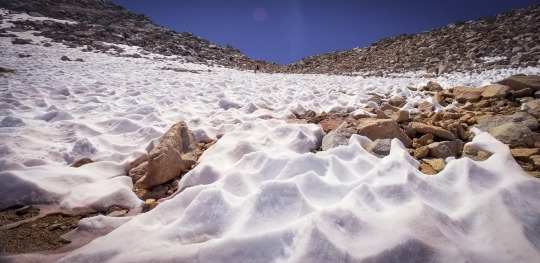
I had doubts that I would arrive at the summit by sunrise. I rushed up the narrow path out of breath to a snow covered tunnel. Snow?! I made my way through the tunnel and when I emerged I was able to see the sunrise wake up out from the distance behind the White and Alabama mountains just east of Whitney. It was indeed an incredible experience. So much so that I was overwhelmed with joy and I began to cry tears of joy.
My EPIC sunrise at Mt. Whitney.
I started thinking of my wife and daughter. It has only been two-and-a-half days since I talked to them but it felt like an eternity and I missed them so much already. I was told that the top of Whitney is one of the few places where cell phone coverage is available. It was still a bit early to call home so I sat there for a while enjoying the breathtaking views.
The Whitney Shelter.
At the summit, I was greeted by the famous Whitney shelter. I signed the log book and was so happy to be here. The inside of the shelter is a small cinder block room. Nothing on the walls, a door and one small window. It was designed to house travelers and give them a safe haven from the elements, but it’s advised to not stay here, especially when lightning is near, as anything this high up could act like a conductor and it could be crispy critters for anyone who attempted it. No thanks.
I met three other hikers who were on the PCT. They shared some of their stories with me and we all looked like snow patrol bundled from head to toe with our warmest gear. One of them was making a big pot of ramen noodles and it looked and smelled delicious. My nutritious trail bar would have to suffice for now.
At the top of Mt Whitney.
I snuck away to my own private area of the summit to call home. When I heard my wife’s voice I was was so filled with joy and I confessed that I missed her more than anything and that I truly have the best life and that my family is everything. It’s all so clear, so vibrant when I step away. I don’t think I ever take this for granted, but being on top of this remote mountain brought out the best in me and it all feels so perfect, so magic and warm.
After the call I hung out a bit more then started heading down. I paused for a moment as I realized that THIS was the actual start of my John Muir Trail adventure! Getting to this point was a challenge, but the JMT was now starting. It was already so challenging, so tiring. Could it get more intense than this…?
Once back at my camp at Guitar Lake I decided to jump in the lake again and get cooled off and "trail clean." I packed up and headed out.
When I got back to Crabtree I picked up my food from the bear box and decided to have lunch. It was only two o'clock and this is where I had planned to camp that night. In my planning, I had anticipated being wiped out from starting the day so early, but in reality I had tons of energy so I continued on to Wallace creek, another 5ish miles down the trail.
As part of being more mindful on the trail I realized I was constantly passing campsites without even knowing it. I was peeking at the Gut Hook app every once in a while as it shows you water sources and camp areas. So I began to pay more attention and it worked. It's fun to see things I normally would have missed before. It’s part of becoming more trail aware and aware of my surroundings in general.
On my way down to Wallace Creek.
When I arrived at Wallace Creek there were a couple of big groups hiking the High Sierra Trail (HST = 72 mile trail). There was a big creek crossing to get to camp but I didn't want to get my feet wet so late in the day so I decided to take off my shoes and socks and walk across the creek barefoot. This creek was only about knee high so it wasn't too big of an issue, plus I got to wash off the trail grim from my feet and legs. Bonus!
I name Wallace Creek the HQ of mosquitoland. They are the worst I've seen anywhere... so far. I was talking to a guy at the creek who was trying to catch some fish and, unbeknownst to him, he had about 50 mosquitoes on the back of his shirt. Permethrin does seem to pay off. At least it keeps the mosquitoes from wanting to stay on my clothes.
I wasn't much of a talker tonight. I was downright exhausted. So I made dinner, set up camp and went to bed.
Tomorrow says I'll be going over Forester pass. A lot of people on the trail have told me it's a bit sketchy due to snow coverage on the north side, so I'll do my best to be mentally prepared for it. Unfortunately it's not right at the beginning of the day so I'm a little worried that I'll hit it when it's full sun. Hopefully not. I'm happy that I was able to shave off a few more miles today as 19 miles, what I had on my plan for tomorrow, sounds like a lot as Sierra miles are not like regular sea level miles back home.
Day 4: Wallace Creek to Upper Vidette Meadow
“Oh, these vast, calm, measureless mountain days. Days in whose light everything seems equally divine, opening a thousand windows to show us God.” - John Muir
Miles hiked today: 16.2
Sleep was great last night! It was my first decent night of sleep on the trail so far.
My calves were screaming sore so I stretched a bit and headed out on the trail about 6:45 am. Getting up early pays off. No mosquitoes even in mosquitoland!
This morning I've come to enjoy the Zen of backpacking. Everything goes in the same exact location each time so you know right where everything is. It's all about efficiency. I make small tweaks here and there, but it’s all starting to feel pretty dialed in. The order of it all feels calming.
Incredible meadow on the way to Forester Pass.
Right out of the gate, the name of the game today is uphill climb. Hiking in the Sierras is the most intense cardio workout that lasts for hours upon hours each day, every day.
A strange thing just occured to me. I have no idea what I look like. Not having seen myself for several days is quite a bizarre experience. I don't know if I have a smudge of dirt on my cheek, or something stuck in my now going beard. But that's part of the fun, it's all about getting lost while already being found.
At the top of Forester Pass.
Forester Pass was epic. Nonstop uphill for hours through a meandering weave of loose rocky steps and path finding. Apparently Forester is the highest pass of the JMT. Nice to have that one behind me now.
Be brave, go slow. Looking up the north side of Forester Pass.
I've learned that on the trail there's what I call, “Trail hype.” Trail hype is when people talk something up so much that it starts to put the fear of God in you. For instance, I was told by numerous people that the South face of Forester pass was super sketchy and incredibly dangerous. Having hiked down it, I have to say that it's more hype than anything. Of course you have to be safe and careful but, it was nothing to worry about. I can only imagine what it was like a month or two back when the PCT hikers were going through this for the first time. I'm sure that was a completely different story altogether.
The sun is treacherous out here. It beats down on my back all day long. I've got a good system now where I wear my rain jacket with a hood which covers my upper body, neck and the sides of my face. For my lower body I just wear my shorts and plaster sunscreen on the backs of my legs. My legs are ALWAYS dirty so it’s like adding layers of dirt and cream on top of each other. Even when I clean my legs they are dirty within 2 minutes. Also, I only brought a sunstick vs a lotion. I really wish I would have brought a sun lotion as it’s so much easier to put on. Maybe I can buy some at Muir Trail Ranch? Fingers crossed.
At the top of Forster pass I lathered up my lips up with chapstick as much as I could. My lips and hands are starting to turn crusty no matter what I do. It’s super dry here. This is so strange for me as my lips never get chapped. Here, there are chapped all day and all night long.
I took a quick dip in the ice lake at the bottom of Forester. SO nice!
Forester Meadow. My picture does not do justice.
The views coming down from Forester pass are breathtaking. The north side view at the bottom of Forester is more incredible than any view I've ever seen in my life. The giant craggy mountains in the background, a giant waterfall flowing into a lush green meadow of winding tributaries. I had to stop at least 20 times and say, “WOW!”
Bubbs Creek. A great place to take a break. Super beautiful.
The hike is getting more and more amazing each day. Cool people, incredible sights, pushing myself to the limits. It’s all part of the journey and I’m starting to find my groove.
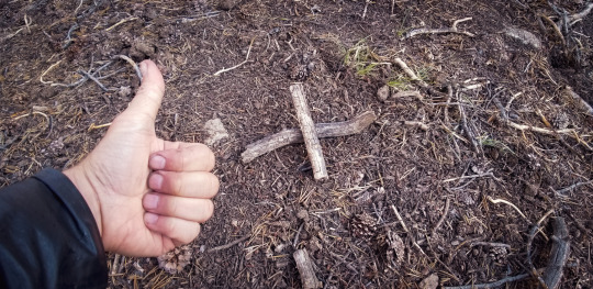
I think I’m starting to get the hang of nature’s call. The “X” is left so that other’s know not to dig here.
I stopped to set up camp and who strolls in? Josh and Max from my first night. We talked for a bit then all hit the hay.
Day 5: Upper Vidette Meadow to Woods Creek
“Walk away quietly in any direction and taste the freedom of the mountaineer.” - John Muir
Miles hiked today: 15.1
I had breakfast with three guys at camp that were out for a long weekend. They were really cool. New to backpacking, and very into it. I had my cold oatmeal then I headed out on the trail at 6:35 am.
I reached the top of the steep approach trail to Glen Pass with the first rays of sunlight on my back. The approach trail was a nice contrast to the previous scenery as it's covered in a green canopy of lush vegetation all the way up.
So blue, so beautiful.
Glen Pass kicks into full gear after you hit the top of the approach trail. It's a pretty brutal climb up but luckily it has lots of water sources along the way. I saw the most pristine bluegreen body of water that I've ever seen in my life. It was so beautiful. I decided not to go in as I wanted to stop at Rae Lakes which is on the other side of Glen Pass.
I hiked up the Pass with a cool guy named Nate. I met Nate at the top of the approach trail to Glen Pass and we hiked up together. This was the first time I was actually hiking with someone on the JMT. Stopping together, talking along the way, etc. Hiking with someone is a very different experience that I'm not used to. I wound up trying to keep pace and looking at his feet a lot. After we arrived at the Pass I decided to stop, take pictures and wish him well and we parted ways.
There's something about having a solo journey that allows me to go with the exact flow I want to go. I like making the agenda as I go and was happy to be back in my own flow again.
The view of Rae Lakes from the top of Glen Pass.
The view at the top of Glen Pass is stunning. You see Rae Lakes which is a place I’ve heard about and it is everything everyone has talked it up to be. I can't wait to get down there, take a swim and clean my clothes. Trail laundry!
Speaking of clothes, yesterday I thought my smell was decent. I mean, pungent, but bearable. Today I think it is straight up atrocious! Trail laundry save me!
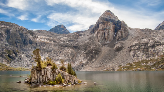
Upper Rae Lake in her full glory.
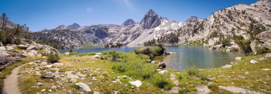
Massive to take in and so mellow. No people in sight.
Rae Lakes is heaven on earth. It's a pristine valley with three large Lakes with the most incredible craggy snow sprinkled mountain tops surrounding the whole valley. The cool thing is that there is only about a dozen people here. Considering that it spans about 2.5 miles, 12 people is not very much. If this place was more easily accessible it would have thousands of people daily.
I took a swim and decided to chill out for a little bit. I also got to do my laundry which consists of a nylon bucket filled with lake water, a few drops of soap then I dunk each piece of clothing in and lather it up, wring it out and place each piece on a rock in the sun to dry. Success! They dried quickly. One benefit of a blazing sun. It feels good to have somewhat fresh clothes again.
It was good to stop here for a bit as I think I’m starting to feel a little bit of altitude sickness. Having paused I’m starting to feel like I’ve bonked. I definitely needed this break.
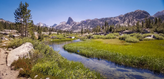
Heading out of Rae Lakes.
While I was relaxing Phil, another hiker I met yesterday showed up, we hung out and talked while we ate lunch. He told me a girl at his camp the previous night gave him two micro doses of shrooms and asked if I wanted one. Out of curiosity I said, "sure." I put it in a ziplock bag and tucked it away. After thinking about it, I AM curious, but I have no idea what this actually is and I feel much better to just toss it when I get to MTR.
The sun is blistering today. I realize that jumping into the water really helps. The drastic cool down resets everything and today it gave me a second wind. I feel renewed and ready to go!
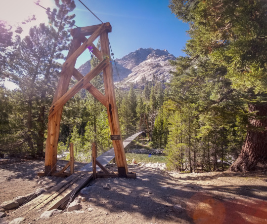
Woods Creek Suspension Bridge.
I got to the JMT suspension bridge. It’s awesome. When I started walking across it felt wobbly but as I walked more it got incredibly wobbly and I had to slow down. “One person at a time” the sign reads, and for good reason. I walked over it a couple times because it was really fun. I considered staying here as it is really pretty, but I felt I had about 2 more miles in me and it’d be good to get some of tomorrow’s uphill started.
Apparently this bridge is pretty new and was washed out for several years. The river below is raging. I’m glad I don’t have to tread through that beast.
On the last leg of the hike today I decided to listen to music. This was the first time I’ve listened to music on the trail so far. It was a nice motivator as, after the suspension bridge, it's pretty much straight up hill.
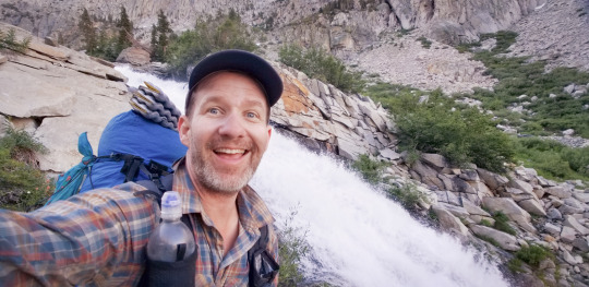
Enjoying one of the many epic waterfalls!
Woods Creek is where I stopped for the night. I guess you could call this a creek, but to me it feels like a raging river that's rushing down with waterfalls and fast flowing current all the way down as you trek up the hill. One part looks like a waterslide, but if you tried to go down here you’re be swept away at about 100 miles an hour. Ha, no thanks, in my head, though, it looked like fun.
Once I started on my dinner Josh and Max strolled in yet again to camp. We were all wiped out so not much talking tonight.
Day 6 : Woods Creek to Palisade Lakes
"We are all complete. The moment we realize this we can start to play with life." - Jim Carrey
Miles hiked today: 18.1
My only non-John Muir quote today. I was listening to an inspirational audio clip from Jim Carrey of recent and it was highly thought provoking. Today his quote (above) is in my head and I’m enjoying all that it has to offer.
On the trail at 6:20 am. Two passes today!!!
The last few nights I've been getting this weird thing where my tongue gets really dry and sticks to the roof of my mouth. I have to moisten my tongue with saliva as I lay there and slowly peel it from the roof of my mouth. Yes, it's painful. I have no idea why this is happening. Hopefully it gets better.
Woods Creek is the mecca of waterfalls. It's waterfall after waterfall and they are just more spectacular the higher up I go.
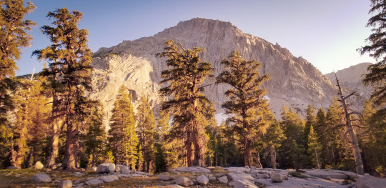
On the way to Pinchot Pass.
Pinchot Pass is the first mountain to climb today. There's a beautiful Meadow just before you start to climb the pass. Lots of tributaries teaming with life. It's really cool to see nature just doing its thing. Bees pollinating flowers, fat marmots looking for food, streams feeding everything.
Pinchot Pass proved to be difficult. I think all the passes are difficult. That's why they're called out and are made such a big deal of. However of all the Passes so far, I have to say this one was the easiest. Perhaps my legs are just getting stronger.
If all goes well, maybe I'll try to hit Mather Pass today too. That would be incredible. However, I don't want to rush this journey. I'll do it if it feels right.
You can tell the PCT hikers as they are totally athletes. It's cool to see. Everything is dialed in and focused. They are awesome to talk to. To hear their trail names and the stories behind them. For instance, "Doggy Bag" is a PCT hiker who got his name because he was honoring the “Leave No Trace” (LNT) thing and picked up someone's dog poop bag and carried it for 10 miles in this hand with his trekking pole before throwing it away. “Beast” is another PCT hiker who’s pack literally weighs 100lbs and he’s fine with it. They wear their trail names with honor and are happy to tell you the stories behind them.
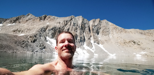
Taking a cool dip at Marjorie Lake.
Marjorie Lake is a real sight to see. I stopped there just on the other side of Pinchot Pass, took a swim and relaxed in the sun. The sun was coming down really hard and it was getting super hot. After I jumped in the lake I instantly cooled off for about the next 2 to 3 miles. These dips are now becoming a regular part of my day as a cool down technique and a way to enjoy these snow filled wonders.
I have barely seen any hikers today. Southbound hikers I've seen two small groups and that's it so far. It's nice to know that the JMT still feels secluded and peaceful.
Just to be sure I don't get eaten by a bear, though, yes, it’s going through my mind with all this seclusion, I keep tapping my trekking poles on rocks and humming from time-to-time to make some noise to let them know I'm here.
I had a nice rest on the other side of Kings River crossing. This was the biggest river crossing yet but luckily there where a bunch of logs. I unclipped my belt and sternum strap and started the crossing via logs. I used my trekking poles to make sure I had good contact before each step to cross safely. Right on the other side was a great place to stop and have lunch. The mosquitoes hear where pretty mellow which was great!
Another cool tip: I’ve already noted that jumping into a lake is a great “cool off” technique. But if I don’t have a lake around, another alternative is to dunk my shirt in the water. If I don’t want to take my shirt off I can fill my water bottle and pour it over my shirt and down the back of my neck and over my head. Because it was so hot I did this several times today. It worked wonders. It was like having my own little air conditioning for about 30 minutes each time I did it.
I just kept on walking, taking pictures and talking to the few sparse hikers when, tah dah, I arrived at the foot of Mather Pass. I was here! Okay, so why not. I headed up with a quickness and made it to the summit the fastest yet!
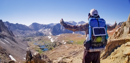
View from the top of Mather Pass.
The trek down proved to be quite challenging. I think the toughest yet. There was a lot of snow still on the north side of Mather Pass. I had to do some rock scrambling in several places and hold my trekking poles together in one hand. This allowed me to have a better grip on the rocks then, when I would get to snow patches, I would use my trekking poles again. I had to do this several times on-and-off in order to get down the pass and onto the regular trail again.

My camp at Palisade Lake. Yup, there’s a lake back there.
By this point it was a pretty long day already. I had not planned to do two passes today. Now the trick was finding a camp spot for the night. Luckily Palisade Lakes was within view so I headed down. It was a lot further away than it seemed, but I did find a nice spot to chill for the evening. Very few mosquitoes here which was awesome!
Day 7: Palisade Lakes to Lake Wanda
“It is easier to feel than to realize, or in any way explain, Yosemite grandeur. The magnitudes of the rocks and trees and streams are so delicately harmonized, they are mostly hidden.” - John Muir
Miles hiked today: 21.4
Up and on the trail by 6:15. I'm getting more efficient with my morning routine. It's starting to feel like a new normal. This item goes here in my pack, that rolls up and goes there. It actually feels very meditative and relaxing.
This morning I woke up and I feel great. Despite not sleeping well, I still felt refreshed and my legs didn't feel sore all. My pack even feels somewhat light this morning.
There’s something about getting up really early in the morning and hiking. It's always magical here, but if there's one thing that adds another pinch of magic is hiking when everything is just waking up.
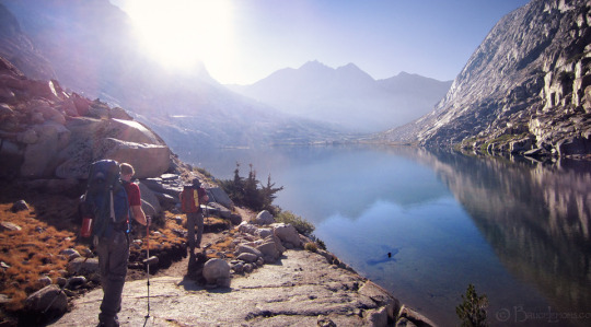
Lower Palisade Lake waking up.
Lower Palisade Lake is awe inspiring. Perhaps my favorite place of the trail thus far. If you get a chance to camp hear please do it as it is absolutely stunning! Waterfalls that flow into streams that crossover each other all in a lush green meadow it's outstanding.
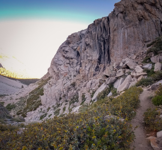
Hard to tell here, but this thing is a downhill beast of stairs.
The climb down out of Palisade Lakes is heavy on the knees. This is one of those times I'm happy to be going Northbound as the south bounders have a pretty big climb at this point to get up to the lakes. Luckily for them, there's giant pay off at the end here. This section is known as the Golden Staircase and is indeed dreaded by all hikers, both North and South due to the massive 17” steps.
Holy downhill Batman. Some of the downhill here on the Golden Staircase is super sketchy. One false move and you’re done for. In one such area I did slip and luckily, and instinctively, I put my trekking pole out and it caught me. Whew! Oh my God that was close!
Going down this long stretch really makes me appreciate all of the people who built and maintain this trail. It is the most pristine, perfect trail I've ever been on in my whole life and it goes on-and-on-and-on and it's impeccable each step of the way. I'm grateful and incredibly thankful to those people.
I'm more dirty than I've ever been in my entire life. No matter what I do to try to get clean I am instantly dirty again. There are cracks in my fingers that have dirt embedded in them like tattoos and the dirt just won't come out even when I scrub them with my little scrubbing brush. The backs of my legs have sunscreen and dirt caked on so thick that even with scrubbing as hard as I can, it still stays on. There's something to be said for becoming wild, as I'm starting to get used to it. But a mani pedi doesn't sound like a bad idea right now either.
The landscape after you get down from Palisade Lakes is really lush and green. You're under a canopy of trees with a river flowing right next to you all the way down. In many ways this reminds me very much of hikes back home in the San Francisco Bay Area. It's beautiful and it smells of pine in the air.
I stopped at a little bridge right at Bishop pass and the Ranger station. Right under the bridge there is a cool water slide into an awesome little pool. I hung out there for a bit and slid down the water slide into the pool. It was nice to get wet and freshen up. I call this a trail bath. I had a little snack while laying out on the warm granite then I was back on the trail again.
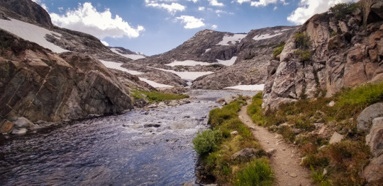
Finally nearing Muir Pass.
If Pinchot and Mather were easier passes, Muir Pass made up for that. Northbound uphill is non stop and intense. It takes hours just to get to the start of the pass.
Note: the JMT rock monster is somewhere around here, but I missed it. I was bummed, but was hot, exhausted and was focused on getting up and over this beast of a pass.
The pass was covered in snow and I had to post hole through much of it. Having Gut Hook was helpful as I checked it several times when the trail magically disappeared under the white of the snow. When I get lost the app shows me where to get back on the trail.
Tip of the day: I wore my mosquito net on my head to prevent the sun reflecting off the snow and burning my face off. I saw someone doing this and they told me that they were doing this for sun protection. I did it, and it worked super well! No burn at all.
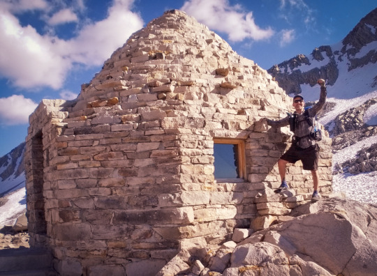
The payoff to a long, hard haul up Muir Pass.
At the top of Muir Pass there is a little hut that used to be used for travelers back in the 30s. You can actually camp here. I thought about it, but there were a few older guys staying here already and they were smoking pot and I didn’t want to be locked in a pot box for the night, plus I really want to try and make it to MTR tomorrow. Hot springs and resupply!!!
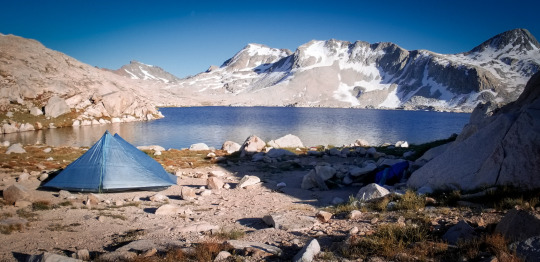
My camp at Wanda Lake.
I hiked to the end of Wanda Lake and couldn't find any camp sites. There are no campsites listed in Gut Hook and I didn't see any around either. Finally, at the end of the Lake, and just before the sun was setting, I found a little cluster of sites. I was out here all by myself, well, for a little while when all of a sudden, who strolls in again?! Josh and Max! We talked for a while this evening and got to know each other a little better. Josh was living in a communal living facility via a program for 6 months that just ended. He said it was like living in a dorm, but everyone hung out, did things together, cooked together and made decisions together. He said it was great and that he was ready to go out into the world now and look for work. Max, the quieter of the two, shared that he is a student at UC Berkeley studying economics and figuring out what he wants to do with that. As I listen, I can’t help but be thankful for with my life choices, remembering how hard they were and I’m wishing these two the very best as they are both really great guys.
Day 8 : Lake Wanda to Muir Trail Ranch
"The power of imagination makes us infinite." - John Muir
Miles hiked : 24.5
Up and out by 6:06 am this morning. Camping up high, or where it's really cold and the snow is still on the ground, is not a good idea. Last night I had tons of condensation in my tent and the outside of my sleeping bag was wet when I woke up. Ugh. I dried them off as best as I could and put them at the top of my pack so the sun can get to them better during the day. At some point today I'll open up my tent and sleeping bag and lay them out so the sun can dry them off. I also think some tree coverage is it a good idea when dealing with condensation. Lake Wanda had zero tree coverage.
This morning my left knee feels swollen and a sharp pain pulses through every other step. I stretched it out and I'm hoping it doesn't get any worse. I have a feeling it's from all the downhill on the Golden Staircase yesterday down from Palisade Lake.
I didn’t think about it too long as after I put my pack on and turned around, I saw a buck standing right outside my tent on a giant rock looking mighty and majestic. It noticed me but didn’t care. It seemed to have other grand plans in mind I suppose. I didn't have my camera nearby so I just stopped and took it in visually and will remember this magic moment.
Evolution Valley is beautiful in the morning. I walked through as all the campers were waking up and having their morning coffee. It was nice to see the very calm water reflecting the perfect, smooth mirror image of the giant mountains surrounding it.

On the way into Evolution Valley.
Lower evolution Valley is the type of place you would likely see a bear. It's very lush and green and reminds me of home. I'm keeping my eyes out for large critters, you never know!
I did not see a bear here but a large doe came rushing down the trail right at me then took a sharp left turn and plunged deep into the woods. I was expecting a mountain lion to come chasing after it but nothing did. My senses are in full alert mode like a ninja walking across crushed glass.
I find myself instinctively doing silly things to make it known that I am here; clicking my trekking poles together, singing out loud and whistling random tunes. I haven't seen another hiker for hours and am feeling a bit like bear fodder at the moment.
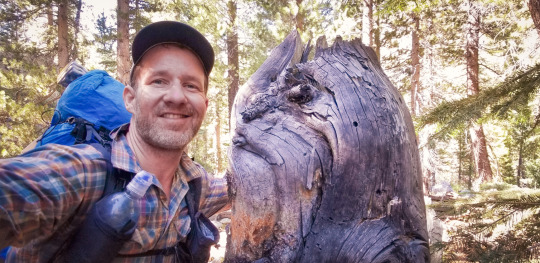
I thought this tree stump was a bear when I came around a corner. :)
The mosquitoes have more advanced techniques in this area. They can get you while you're walking! In all the other areas I was able to walk and avoid them until I stopped. Here they have no problem. They just jump right on and start sucking.
Evolution Creek Crossing, notoriously the most sketchy one on the trail, was awesome. It was refreshing for sure and at just the right moment. A few months ago this must have been raging and absolutely terrifying to cross. But at this point it's about knee high and a nice casual, cool walk across.
The downhill to MTR from evolution Creek is a real schlog of loose rocks on your feet making not for the most fun downhill hiking. Amazing waterfalls all the way down into this deep valley are keeping me engaged whether I like it or not.
Coming into the next section my head started hurting really bad. It dawned on me that I had just come down in elevation a massive amount and relatively quickly. I took some ibuprofen and I'm hoping that kicks in soon. My legs are also feeling really wobbly right now.
Getting closer!
OMG getting into Muir Trail Ranch is a massive haul. Once I got to the junction I thought it was “right there” per what I saw on Gut Hook, but I still had another 2.5 miles to go! One thing I’ve learned is that that longest mile is the mile you’re aware of. It just takes forever when you really want to get somewhere. To keep myself motivated I've been thinking about my resupply box, getting it, hugging it and holding it tight like a newborn baby. I put some cinnamon rolls and mac and cheese in there. I've been eating super healthy and clean on this trip but those were the two things that I put in there as little boosters and it's all I've been thinking about all day. It now feels like I'm being propelled forward by a holy grail of cinnamon rolls and mac and cheese showing me the way with each heavy step because, at the moment,I have no energy left.
After what felt like an eternity I finally saw the ranch down below. Nothing too big, but the first sign of civilization I’d seen in over a week. It’s a working ranch with horses and the people who lodge here can get guided horse tours, in fact, I saw one leaving right as I was arriving. They don’t have a bathroom for public use, but do have a tiny shop there with some basic items and I was able to pick up some sun lotion! Yes, finally, a cream!
Beast, the PCT hiker I had met earlier was here. I saw Skittles, another PCT hiker, several miles back and she was sick and asked if I could tell Beast she was going to stay put. I did and he was super thankful. After he resupplied he asked my name for the first time, and I said, “Bobby”. He said, “You don’t have a trail name yet?” I said, “Nope, it hasn’t come up yet.” He thought for a moment and said, “Echo. You’re name is Echo. You howl at the top of every pass and listen to your echo. That’s your name.” And so it was. From that moment on, when people asked my name on the trail I said, proudly, “Echo.” That was the last time I saw Beast or Skittles on the trip.
Online MTR gets a bad wrap, but I thought it was great. They were super helpful and took great attention to detail taking hiker donations and putting them into the right bins. They even gave me a tip to get to the nearby hot springs by saving a mile of walking each way!
The hiker boxes were so full. It was great getting to sift through all the different items and pick new things that looked good. It’s free food, which is better than gold for a hiker. I spent quite a bit of time going through all my food, spreading it out on one of the giant tables they had, taking out the things I was sick of and swapping them for other goodies.
I ate all three cinnamon rolls, a granola cereal pouch, drank about a gallon of water and was fueled up and recharged.
There’s a scale where you can hang your pack on to see how much it weighs when you leave. I weighed my pack on my way out and it weighed 26 lb not bad at all. That’s lighter than it weighed when I started. I think it’s because I ditched the protein powder, tortillas, almond butter and jam in lieu of more snack type items.
There was no way I was missing out on the hot springs. Every body of water I had been in on the trail was ice cold, so the thought of warm water on my body was heaven. I walked down to the river that needs to be crossed to get to the hot springs. This river is, by far, the most intense crossing of the trip. Luckily they have a rope that goes across. Not that it’s much help, but that, combined with one trekking pole in the other hand makes the crossing doable. I crossed barefoot as I didn’t want to have wet shoes and socks so late in the day. I just took it slow and it was fine.
Enjoying every moment of my soak in the hotsprings.
After walking through a grassy meadow barefoot a decent sized hole in the ground emerged. I had arrived. There was no one there and I had the whole place to myself for about 30 minutes. It was such an amazing sensation being in warm water again. Like a nice bath. My muscles were so thankful for this gift.
As I walked across the river to get back to the other side I saw Josh and Max. They had just resupplied and were looking for the hot springs. I pointed them in the right direction and they said they were going to stay there that night. This was the final time I saw them on the trip. They were, up until this point, like a safety blanket as I knew I was safe when they were around and it was going to be a new adventure going forward.
Although it was late in the day, about 6pm, I thought about staying there with them, but I heard that I might be able to get cell reception just up the hill and I really wanted to hear my wife and daughter’s voices. So I decided to head straight up the trail. It's a steep climb. After the my cherrished rest my body was asking me, “why the hell are you pushing up an accent trail so late in the day, give us a rest!” I listened and only went about two miles further. I had an abundance of energy. Afterall I had just eaten all three cinnamon rolls.
Day 9 : MTR to Mono Creek
“Nature is ever at work building and pulling down, creating and destroying, keeping everything whirling and flowing, allowing no rest but in rhythmical motion, chasing everything in endless song out of one beautiful form into another.” - John Muir
Miles hiked : 21. 6
Last night was a bit crushing for me as I was hoping to get cell phone service from my camp as someone at MTR said I might be able to get cell service at this spot. Most of yesterday was about getting to Muir Trail Ranch and now all I can think about is my family and how much I miss them. Is weighing on me.
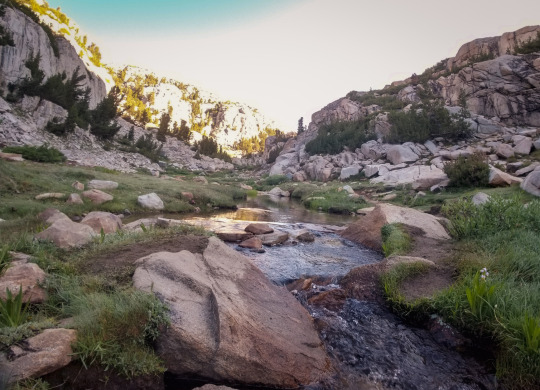
View on the trek up Selden Pass.
On the bright side of things, I had a great night's sleep! The best I've had in a long time. I even had dreams. I haven't had dreams in at least 8 days. It felt great and I feel renewed. Today I'm going to try to reset my mind and get it back in the game and remember that this is my time to be here. I have all the time in the world to be back home and I will cherish every moment I have, but now, I need to be here.
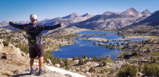
Marie Lake from the top of Selden Pass.
Marie Lake may be one of my top favorite spots on this trip so far. Coming down into it from Selden pass is an amazing way to take it in. Northbound has the advantage view for sure. The cool thing is that there's absolutely no one here. It’s a grand sight and it's here only for the handful of hikers who make the trek out this far. I could imagine if this was somewhere more accessible it would be filled with people. It’s nice to know that nature still has some spots that aren’t overcrowded and that are simply there to be enjoyed and then you move on.
As much as I tried not to, I'm thinking a lot about home. All the normal happenings of life. Lunches, breakfast time together with the family, hanging out laughing listening to my daughter's funny sayings of the day, she’s just about eight years old, and seeing my wife make funny sarcastic faces that light us all up. It probably doesn't help that it's Taco Tuesday back home. Tuesday’s are a day where my parents come out and we have dinner all together. Sometimes we play board games and we make dinner together and eat around the table hanging out and having fun all finished off with yummy ice cream. It's a really special day of the week that I look forward to every single time. I miss it, I miss them.
I have a great, incredible life. So much freedom. So much love. Very little drama. And trust and flexibility which means the world to me. Okay, I’ve got to stay focused on the hike!
Out here the mind goes deep, it wanders and ponders whatever I open the door to. I’ve had a lot of time to think about some big decisions in my life. It’s nice to have this time to get clear. It’s also interesting that figuring out some of my next life steps really doesn’t take that long, it’s just a matter of thinking of different outcomes then deciding which one/s I want to explore. Write them down and let them go.
On a different note, I’ve achieved new levels of stench coming off my body and these have become the new normal. Even flies are afraid to come too close to me today.
The trek up to Bear Ridge is pretty much a straight-up hill climb zigzagging through switch backs. I was going to take a break up here as I heard this is another one of those magic places where I might actually get cell phone reception. Nope, didn't work for me. Damn.
At the top of Bear Ridge is the junction point to continue on with the JMT or take a pit stop at the “hiker famous” VVR (Vermilion Valley Resort). Apparently it’s a great place to get food, grab a beer, a bed, a shower and hang with other JMT and PCT hikers. As much as it seemed like fun, it would add a whole extra day to the hike and, if I push on, I think I could make it to Red’s Meadow tomorrow. Red’s is another place where I can do all of the above, but it’s right off the trail vs taking a whole extra day.
I've been hiking big miles these last two days. That's kinda what these last couple of days needed to be about. Aside from Marie lake, which I stopped to enjoy, there hasn’t really been a place I wanted to stop.
I pushed on and climbed up about two miles before Silver Pass. I found a spot next to the river. There was only one official camp spot here which was taken by a young couple so I crossed a log to the other side of a small creek and found a decent spot. The downside, I was swarmed by mosquitoes. Not quite the worst yet, but I had to eat dinner with my bug net on and pull it up and down with each bite.
I can already tell it's gonna be a condensation night. I think it's all about the temperature. When it's real cold, which the last three nights have been, then boom, wet quilt and tent.
Day 10: Mono Creek to Red’s Meadow
“When we try to pick out anything by itself, we find it hitched to everything else in the universe.” - John Muir
Miles hiked : 25.2
I was super efficient this morning. I think I’ve got the bathroom business down pat. Digging catholes next to the base of a tree is key, also getting up early while it’s still cold is a big key for me as the mosquitoes are not out yet. Nothing worse than having to do your business with mosquitoes nipping at your undercarriage.
With a quickness in my step his morning, I made it to the top of Silver Pass with the first rays of sunshine on my solar panel. Today I'm on a mission to get to Red’s Meadow. Here I’ve been told I can DEFINITELY call home and also get a burger. Yay! That sounds other worldly awesome.
I'll keep it brief as today I want to stay focused and charge ahead. Hot food and talking to my family. That's the mission of the day. A worthy mission and it lifts my spirits.
I think I've got a good routine down with mosquitoes. I pretty much have a full hazmat suit on in the evening which consists of my rain jacket, rain pants and mosquito net over my head with my rain jacket hood pulled up. My hands are exposed but I found that if I let the mosquitoes make their way around me and they get bored they leave because they realize there's nothing here they can have. This is my evening attire and routine and what I do right when I get into camp each night.
The lakes here really give this trail a very special quality. Virginia Lake is no exception. It's flat and peaceful all in a lush green meadow. I didn't see a single hiker here. I walked through and stopped several times just to listen to the sound of nothing. No boats, no people fishing, no one camping. Nothing. Just this incredible lake in perfect solitude.
After Purple Lake the trail goes up for about another mile-and-a-half then, after that, a giant gift from the trail Gods, an epic downhill! Ever so slowly graded but still down hill for about 7 miles right into Red's Meadow. It was a true gift as I had gone over two passes today and two other very steep climbs and this was the gift and the booster that I needed to make it smoothly into Red’s.
I have arrived at Red’s Meadow!
Dead Sea Forest.
Right as I came down into Red's Meadow there is an expansive sea of dead trees, burnt, cracked and falling over. It's like a graveyard of trees. I came to find out later that this was due to a fire caused by lightning. Nature's way of clear cutting. Apparently called the Rainbow Fire which happened many years back, but the effects are still clearly visible today. I deem this area, “The Dead Sea Forest.”
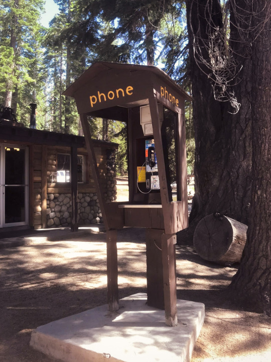
This is the phone I called home on and weeped like a baby.
I strolled into Red's Meadow a giant dirt ball, desperate for cell service and hunger beyond belief. Immediately I turned on my phone to see if I got coverage and... I did not. I was crushed and bummed. I stumbled helplessly into the store and asked if there was a way to make to call. The nice girl at the register told me they had a payphone right outside. I entered $1 in quarters and called my wife. It rang, and rang, and then... went to voicemail. Ugh. I cried on my voicemail to my wife and told her they were tears of joy. I really wanted to hear their voices, to make sure everything was okay and to tell them that I love them so much, I miss them and that I was doing fine and couldn't wait to be back home. Next I called my mom and the same thing happened, voicemail. I bent over in the phone both and cried privately to myself. I missed my family so much.
I tried to pull myself together, so I decided to start getting laundry out of my pack. My stuff was all over the place sprawled out on a table when a guy came up and asked if I was hiking the John Muir Trail. I said, “Yes,” and he asked if I needed to place to stay. His wife had booked him a room that had two bedrooms but it was just him and he had a spare. I was in shock as this was an amazing gift and at my lowest moment of the trail. This instantly picked me up. A pure, random act of kindness from a stranger. His name is Ben and he’s a great guy.
Despite the beckoning call of the buses at Red’s Meadow heading comfortably back to Mammoth and Yosemite Valley. Standing there I made a commitment to myself that I was going to finish the trail no matter what. But this kind act was the booster I needed and made me feel zero doubt with what remained of the journey ahead.
Ben lives in the Bay Area, like me. He's a wine distributor and has his own company. We hit it off right away and, after I got settled into the cabin and took a shower to get cleaned up, we went to dinner at the little diner at Red’s. My treat. It was the least I could do for his incredible generosity.
After dinner I did laundry and Ben and I hung out talking until around 10:30 pm. He let me use his cell, which worked, and I was able to talk to my wife and daughter. Whew, this is just the booster I needed to stay strong, focused and pumped to finish.
After sharing some good trail stories and some rum with Ben it was time to hit the hay, rest up and prepare for our reality back on the trail tomorrow morning.
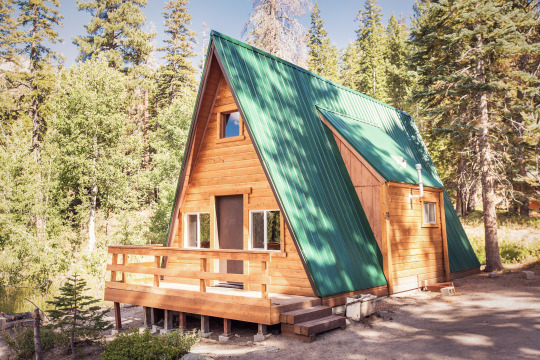
This was the cool little cottage I stayed in at Red’s Meadow.
Sleeping on an actual bed was so nice. In fact, the comforts of everyday life like a table, a chair, a bathroom that can flush, all of it came rushing back so quickly that in the morning when I woke I was somewhat sad to have to say goodbye to all of it and hit the trail again.
Day 11: Red’s Meadow to Davis Creek
“Everybody needs beauty as well as bread, places to play in and pray in, where nature may heal and give strength to body and soul.” - John Muir
Miles hiked : 19.6
Ben and I both woke at the same time this morning. 6 am We were up packing our packs and getting ready for the day. He decided to head out before me as he was hiking southbound and I decided to stay at Red’s to grab some breakfast; French toast and two scrambled eggs. It was delicious.
Back on the JMT and I immediately entered Devils Postpile. Right now it's looking pretty different than the rest of the trail and quite magnificent. If I had to compare it to something I would say it reminds me of Thunder Mountain Railroad at Disneyland.
Yesterday ended with a downhill gift from the trail Gods, today was payback time as it started with an epic uphill climb that never seemed to end the entire day.
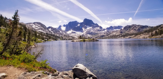
Chillin’ and having lunch at Garnett Lake.
Eventually I arrived at Garnett Lake. I thought it was a nice spot for sure with a stunning mountain cathedral backdrop. I soaked my feet and ate my lunch here at the lake, it was nice to relax as yesterday's pace was a little intense, even for me.
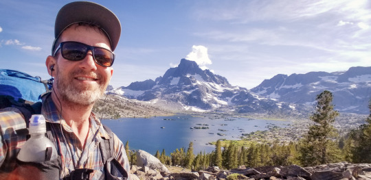
1,000 Island Lake with some good meditation music going.
Then into 1,000 Island Lakes. Another nice spot, but nothing in comparison to Rae or Marie in my opinion.
Finally I decided to stop for the day. The mosquitoes here are the worst yet. Did I set camp on a nest? Literally hundreds of them swarmed around me. I couldn’t even make dinner. I dove into my tent with my food and ate inside my tent. Generally this is not recommended as the smell can attract critters, or bears, but it worked out.
It’s different being on this side of the hike - the last leg of the hike. It was about 10 days ago when I was talking to people who were on the southbound side towards the end of their hike thinking how the hell could they do that. And now, that's me! It's refreshing to talk to people who have only been on the trail for 3 to 4 days and I can see the inspiration in their eyes that this place brings out. The JMT is a magical place unlike anything I’ve ever seen in my life. A perfect 10 in every regard, except for maybe the mosquitoes, but I guess that's ying & yang playing out.
Day 12: Davis Creek to Sunrise Lake Junction
“Here ends my forever memorable first High Sierra excursion. I have crossed the Range of Light, surely the brightest and best of all the Lord has built. And, rejoicing in its glory, I gladly, gratefully, hopefully pray I may see it again.” - John Muir
Miles hiked : 26.9
Today I started right on the ascent trail to Donahue Pass. I took my time to enjoy every step today, every rock, every tree as this is the last pass of the trip then down into the valley which will slowly turn into Yosemite Valley and my final destination, Happy Isles. It feels good, definitely bittersweet to be this close to being done. But, I'm ready to be done. I think I have achieved what I set out to do. To be a simple human being. To live with nature, simply and to do it on my own to prove to myself that I can do it. When I was younger I wanted to do this type of trip. I even set out to do it once after college. I packed up some things and started driving. I had no plan of where to go, I was just going to go and see where the world took me. I got to Shasta and camped there and it hit me. I was alone, afraid and I missed my life. The next day I turned around and went back home. I don’t regret that decision, but I always wondered in the back of my mind if I could do this. Go and be free. To be simple, to not have a set place to be and just flow. It feels good and, on many levels deep, I feel like I’ve touched that inner kid spirit and have nurtured it and given it the satisfaction I was searching for.
I was strolling along on the hike when the most foreign thing happened. I heard noises in the distance that sounded familiar to me. I looked out and saw cars driving by. This sight brought a bit of sadness to me as I knew I was coming back into reality that I was going to start easing back into the realities of the modern world. I hiked along the road for a bit and into Tuolumne Valley.
Tuolumne has a little store, a post office and a cafe. I was so hungry that I ordered 2 veggie burgers, fries, a soda (which I never drink) and a soft serve. Note to self. Never ever eat this much food. My tummy was wrecked and beyond full. Not the best way to feel on the day before my last big push into Yosemite, but, it was a meal I’ll never forget; for better or for worse.
I set up my tent and laid out my sleeping quilt while I waited for my food so it could dry off in the sun. It was another wet night last night.
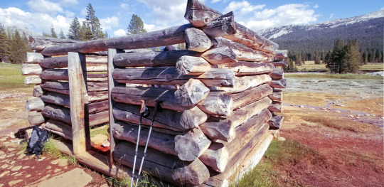
Soda Springs. Step inside to taste the well.
After Tuolumne I hiked through a beautiful meadow with lots of day hikers and family. I was excited to stumble upon Soda Springs which is a little well that produced bubbly water from the ground that you can drink. I dipped my hands into the water and took a big sip. I’d read about this place some say the water tastes like Dr. Pepper. I think it tasted like a La Croix drink that had been opened and set out for a day or two. Flat, but cool to taste a real natural soda straight from the source.
After Soda Springs the trail goes back into the deep forest and people start to quickly fade away. I’m now back in my element and the climb in pretty intense. I continued on for about another 4.5 miles. It never stopped going uphill. I think this was the trail’s gentle reminder that it’s not easy.
I hiked on until sunset to knock off more miles as each mile I hiked today was one less I’d have to do tomorrow, my final day!
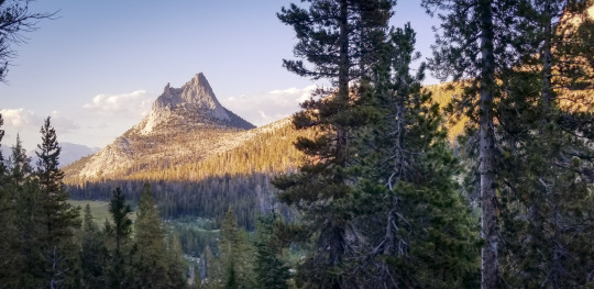
View looking back at Cathedral Rock.
The sun was about the set and I had reached a campsite but it was all granite. I need soft ground to put my stakes in or my tent actually won’t go up as it doesn’t have poles, it’s a tension tent. So, no camping here. I’d have to carry on.
I finally found a spot to stop but most of the light was gone now. I saw there was another tent nearby, but they were already tucked in with lights out. I felt bad as I know they could hear me setting up my tent in the dark, fumbling like a ding dong, blowing up my mattress all the while trying to be a good neighbor. I laid my head down at 8:55 pm. Hike midnight is 9 pm so I was happy I at least honored the hiker protocol of being quiet by 9 pm.
As I lay here in the dark typing this I'm reflecting on the awesomeness of this journey. Remembering all the things I’ve seen and done. Being thankful that my body didn’t give out, that it was strong and that my spirit made it. A hike is 50% physical and 50% mental. Despite some hiccups along the way, I’m very satisfied with how it all turned out.
Day 13: Sunrise Lake Junction to Happy Isles!
“It is easier to feel than to realize, or in any way explain, Yosemite grandeur. The magnitudes of the rocks and trees and streams are so delicately harmonized, they are mostly hidden.” - John Muir
Miles hiked : 12.8
Today is the day! My final day of the John Muir Trail! 13 days in and I’m on the last leg. Tonight I will sleep in my own bed at home. I will see my wife and daughter and I’ll eat an amazing hot meal at my dining table. That sounds so surreal to me, but it’s true.
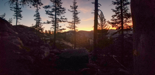
Out on the trail at 5:45 am. The sun is just starting to wake up.
This morning I shot up like a rocket with a big giant smile my on my face. I was up and out the earliest yet; 5:45 am. The thought of getting home lit me up with enough energy to fuel a rocketship!
With one last smack from the trail it started right off with an incredibly steep incline. I know at some point this trail has to go downhill. Will it ever? Who knows but I'm going at full speed. Here I come!
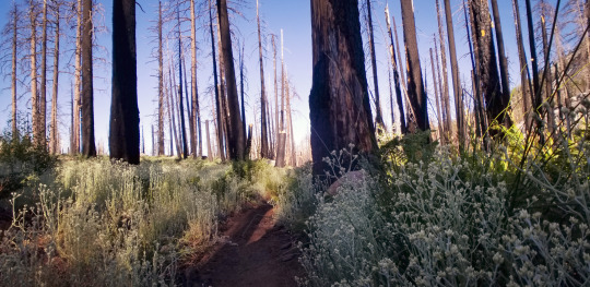
The Scorched Forest.
The nastry Shredded Razor Plant. Boo!
As I came around a bend I saw it, Half Dome. It was still a ways away but I saw it and I knew this meant I was nearly back in Yosemite. I went through an area that I call, “The Scorched Forest.” There must have been a pretty big fire here not too long ago as there are many burnt trees. But the ground coverage is thriving. My least favorite of the ground cover plants are, what I call, “The Shredded Razor Plant.” It’s super sharp and shredded the crap out of my legs. I didn’t put my rain pants on as I know it would have just ripped right through them. This plant went on for over a mile. I found the best way to get through was just to walk quickly. Trying to get through it any other way did nothing but hurt so I just powered through it.
As I came up to Half Dome camp there were dozens of day hikers who were doing the trip up to the top. My permit did not allow for it and I thought about asking someone if I could tag along on theirs, but I didn’t. I wanted to finish the hike and I wanted to get home at a decent time so I pushed on.
I got to a point where the trail split and said, “Happy Isles 1.5 miles via Mist Trail” or “Happy Isles 3.5 miles via the JMT.” As much as I wanted to take the 1.5 mile trail I couldn’t. I couldn’t finish the trail by cutting out 2 full miles so I made the decision to go the JMT route and finish the official trail. Otherwise, I felt like I would have missed something if I missed this part. Boy am I glad I went the way I did. The JMT trail goes right to the top of Nevada Falls.
I could see the giant falls going over the top into the dense valley and it was massive. The force of the water pushing through the valley and out through the mouth of the fall was epic. The view from here was absolutely breathtaking and majestic.
I’d heard of the Mist Trail and I knew it had a good view of the falls, or so I thought. As I hiked on I realized that what I thought was The Mist Trail, from watching YouTube videos of this part, was actually the JMT part of the trail! Drips from the waterfall drop down on you and as you hike through you get the absolute BEST view of the falls and the valley. I took several pictures from here. The view was mind blowingly awesome. I was also surprised to see very few people on this trail.

I made it to Happy Isles, Yosemite Valley!
After this section the trail has a big downhill switchback into the Valley and it goes on-and-on. Once at the bottom there were 100s of tourists who had come to see the falls from the bottom. I smiled at many of them along the way. They were here to enjoy nature and I was too. I had just walked a total of 245 miles to get here and I was still smiling, still filled with inspiration and enthusiasm.
As I hiked on I came to the famous JMT sign which reads, “Mt Whitney via the John Muir Trail: 211 miles.” That, plus the 34 miles it took to get from Horseshoe Meadow to Mt Whitney, and that’s my 245 miles. I took several pictures in front of this sign and felt an incredible sense of accomplishment.
Yosemite is truly a magical place.
“No matter where I am, either here or there, I am home.” This is a quote of mine that I said to myself when I arrive in Happy Isles. It sums up how I felt at the end of my hike and embodies the spirit of how I’d like to continue my feeling of life going forward.
I made it. I was done with this journey and it is something I know I will never forget and will always cherish. I’m so thankful to have had the time to do it and to have the support from my family and friends.
As I hopped on a bus it drove through the valley. It’s so beautiful here. The sounds of people talking and laughing slowly brought me back to reality. I didn’t talk to anyone, rather I felt like a ghost observing in silence. When the bus dropped me off I walked for a while until I came to my car; whew, it was still there. I put my hand on the car and gave it thanks for waiting patiently for me.
5 notes
·
View notes
Photo
Angels Landing (Zion) - Solo
June 2019
Total Miles: 5
Angels Landing Trail, Zion National Park
Why am I hiking Angels Landing?
Zion is such an incredible and special place. It is my favorite national park. My wife and I went there for my 40th Birthday and then again with our daughter for this trip. Angels Landing wasn’t even on my radar, but since I’ve been more into hiking, this hike popped up several times as “the most dangerous hike in the world.” More on that later. I really wanted to hike this as it’s a very special trail, very steep with incredible views from the top. In Zion you’re mostly in the Canyon looking up, so it was a goal of mine to see it from the top looking down and WOW, I was not disappointed.
The Hike:
I hesitated to put this hike on here as it’s only 5 miles round trip. It’s steep getting up and definitely one of the more sketchy hikes due to the drop off as you get closer to the top.
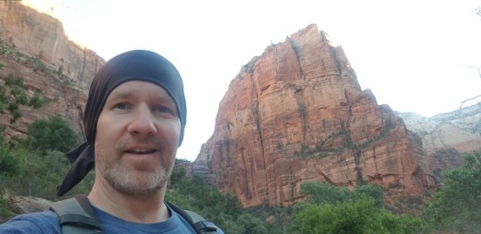
My family and I took our first RV road trip to Zion and had a fantastic time going through The Narrows (slot cannon) and finding some amazing hidden gems on our own.
I really wanted to hike Angels Landing, but they did not, so I got up super early before sunrise and I drove the RV to the Zion parking lot. My family stayed in the RV and slept.
I was one of the first ones in line to catch the shuttle out to the trailhead.
Tip: Starting early is a big key both for heat and for crowds.
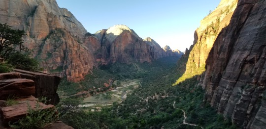
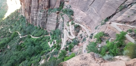
Permit: When I hiked Angels Landing in 2019 you didn’t need a permit. You could just go. As of April 2022 you now need a permit to hike this trail. This is in response to overcrowding on the trail as it was pretty mellow when I went.
Tip: Patience and kindness are important when hiking any trail, especially this one.

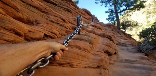
Once I started the hike it was early and very cold, but once I started hiking I heated up super fast.
There’s not much to this hike other than pacing yourself. The uphill switchbacks are tough, but nothing too strenuous. A lot of the videos on YouTube showing this hike are shot with VERY wide angle lenses so it makes it look much more sketchier than it is. I never felt in danger at all. When passing people I’d go slow or just let them pass me. I didn’t take any risks and, again, felt 100% safe.
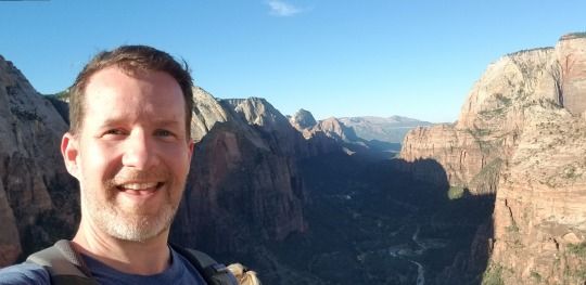
When I got back to the RV I was happy to find my family was still sleeping. I had such a fun little adventure and got to tell them all about it over breakfast.
1 note
·
View note
Photo
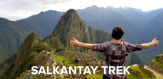
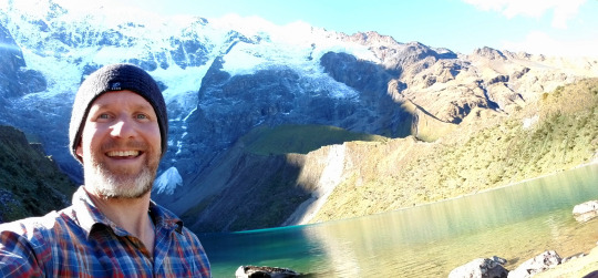
Salkantay Trek to Machu Picchu - Solo
May 2018
Total Miles: 66.5
Mollepata to Machu Picchu
Why am I hiking to Machu Picchu?
Since as long as I can remember, it has been a dream of mine to stand within the majestic beauty of Machu Picchu. Since the moment I saw it as a kid in National Geographic it sparked images of Indiana Jones and I knew THIS was a place I had to see one day. To add to the feeling of adventure, I wanted to hike the off the beaten Salkantay Trek vs the Inca Trail and I wanted to do it solo. Not knowing the language added to the adventure. Although this could be intimidating, the thought of being in a foreign land by myself truly lit me up!
Below are my daily journal entries on my 5 day, 4 night Salkantay Trek in May of 2018. I hiked it completely solo. I used the All Trails map and it was amazing. I have the pro version which allows you to download maps ahead of time. SUPER helpful as I hiked largely with my phone in airplane mode and the maps work great with GPS alone, no need for a cellular signal.
I hope my advneture inspires you to be bold and live life to the fullest!
Note: The All Trails maps were marked super well, excpet in two areas, which I note below.
Tip: Get your ticket to Machu PIcchu as far in advance as you can. I followed the steps on this site about three months before my trip. You can also purchase your additional hikes there to Wayna Picchu and Machu Picchu Mountain at the same time. WP was already sold out when I purchased my ticket.
Day 0: Flight to Cusco
I arrived at 4:30 PM and it was raining and hailing as I ran to the taxi. It stopped by the time I got to the hotel and never hailed again on the trip.
Tip: I’m vegetarian and was dying to eat at Green Point Restaurant in Cusco. I walked there from city center and the food was AMAZING. I highly recommend it for fresh, yummy Peruvian veggie food.
No one seemed to know how to get to Mollepata unlike what was described online. No worries though, taxi drivers will know how to take you to the collectivo that goes to Mollepata.
Day 1: Mollepata to Soraypampa (Mole yaah petta)
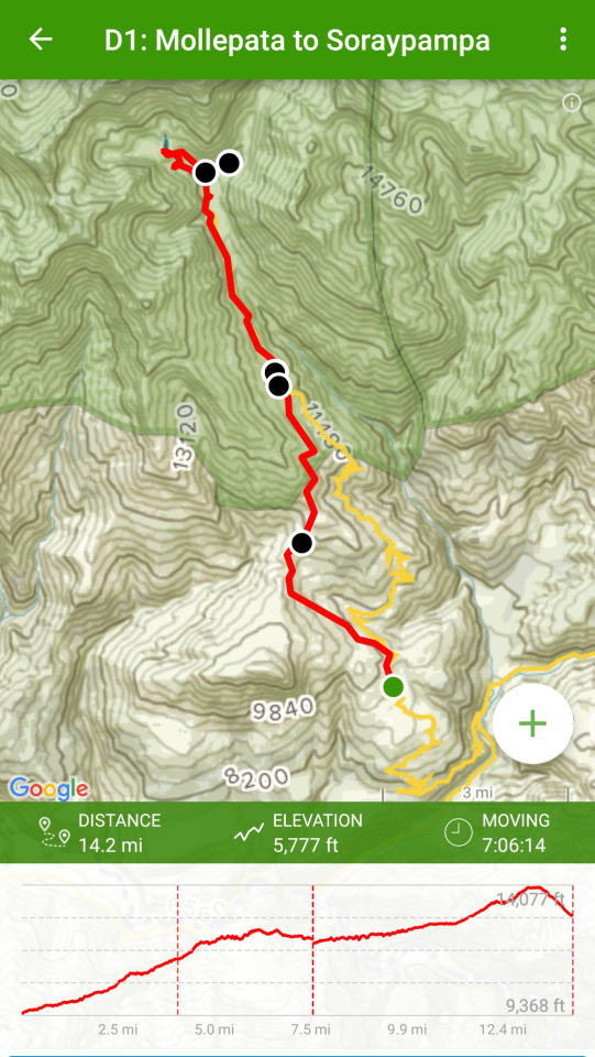
Map info from All Trails app
Note: I only had 12 hours to acclimatize before heading out on my trek. I know many people have issues with altitude sickness on this hike and it is advized to have 3 days in Cusco to acclimatize before heading out. I just didn’t have that time so I went for it. I got lucky as I was completely unaffected by altitude sickness. I did get medicine from my doctor ahead of time but didn’t wind up using it.
Cold shower, no warm water. Oatmeal in my hotel room made with my camp stove. Stored my small luggage at hotel despite not staying there upon my return. Not a problem. Yay.
Tip: be sure to get a luggage pickup ticket and put it somewhere in your pack that you’ll be able to find upon your return.
Yes, taxis are thriving at the crack of dawn. Taxi to the collectivo was 7 soles and 20 soles to Mollepata via the collectivo.
I arrived at the collectivo (van) at 4:40 AM and it filled up by 4:55 and we were off. I was the only gringo on the bus. Packed to the max, kids on laps. It felt like romancing the stone. :) The first hour of the drive was dark and foggy. After that the sun started to come out and the fog burned off and the views were absolutely breathtaking! Snow peaked mountains, lush green hills, waterfalls, cows; I saw one being milked in a field.
Altitude wise, I felt fine.
Two lane paved road most of the way until the Mollepata turn off. Then it's one lane with rock slides and carefully coordinated passing between the cars and trucks.
When I arrived in Mollepata I asked a local, "donde esta soraypampa?" - where is Soraypampa? That’s nearly the extent of my Spanish and I feel like I want to learn more, but it’s also nice to feel completely foreign. l was directed to go up to the top of the street where I saw a blue sign with a graphic of a hiker (below). Now, the journey begins.
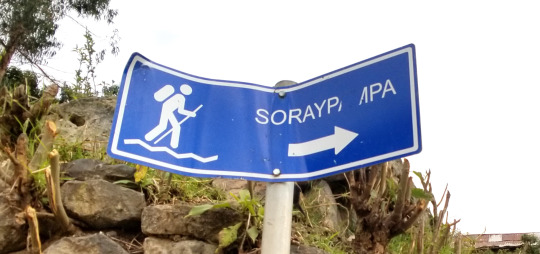
I went down the road for about 5 minutes and came to a split with a two blue signs indicating two ways to go (shown below); one with a bus and one with a hiker; take the one with the hiker (take the trail shown straight ahead below).
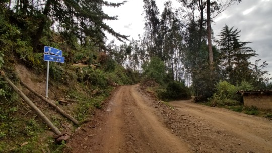
This sounds obvious, but the tours and groups take the bus route (the one on the right) so it feels like you’re going the wrong way... at first, but you’re not.
I walked on the hiker road for about 1 hour. The road has locals in cars going up, but eventually you come to the trailhead.
Being in a foreign country and hiking alone brought up many feelings of ambiguity in knowing where to go, but every so often I would see a blue sign which let me know I was on the right path. For those first several miles these signs were reassurance that I could DO this.
I ran into four people from Minnesota who were also doing the trek. We talked for a few minutes then I headed off on my own again. I never saw them again.
The trail itself is amazing there are rushing water canals that go along the trail in many parts (shown below). It's really cool to see that this is how the locals probably get their water to their farms and livestock.
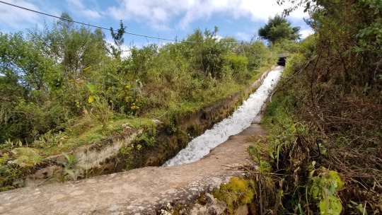
I stopped at Mirador (below) for break around 9:45 AM and the views all around are absolutely stunning. There were about a dozen horses in the field. I was all by myself. A great place to stop and rest. My pack weighed a ton so being able to take it off for a few minutes felt amazing. The bathroom was locked. I sunscreened up then headed off again.
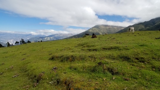
The views over the next several miles were absolutely stunning and majestic and really took my breath away. I was so choked up that I honestly wept tears of awe several times this day. It really feels like I’m in one of nature's most incredible canvases.
At mile 7.5 the trail intersects with the road and the rest of the trail IS the road all the way to Soraypampa. Going this way vs the road from the start is a choice I would do again hands down. It’s SO beautiful, rural and alone; but that’s what I was here for; adventure. Going this way is no doubt more difficulta as as it goes up, up, up but the payoff is well worth it.
While here I took a break as there was a place to get water and I was in need of some energy. I used my filter and resupplied.
Once on the road, many trucks passed blowing up dust in my face. Overall it wasn't too bad but it did take away a little bit from the feeling I was feeling earlier in the day. I continued walking to Soray and got there at 2:20 PM I was happy with the time I made.
Immediately upon arrival I wound up heading right up the trail to Lake Humantay.
Note - Map issue: The trail that is shown on All Trails to the Lake made absolutely no sense and was incredibly difficult to hike; i.e. no visible trail and desnse with vegetation. See below for alt suggestion.
I had my full pack on as I had planned to camp at the lake; more on that in a bit. When I neared the top of the hill I wound up seeing a road a bit further out to my right that those who were camping in Soray we're using and it seemed like a much better way to go and I would highly recommend going that route.
I arrived at the lake at 4 PM and it was all that I could have expected. As noted previously, I had planned to camp there so I had to lug my pack all the way up but upon arrival there's a giant sign that says that you cannot camp here. Also, it's right at the base of the mountains and the locals call this Glacier Lake. My thought was it was going to be super cold and it wouldn’t make good sense to camp here. So after enjoying the view and taking quite a few pictures I put my pack on and headed down the hill fast as it was getting late and I didn’t have a campsite yet.
When I got to the group basecamp I asked the locals where I could camp and, as far as I could understand, they said that I could not camp there and that it was for groups only. Perhaps I was wrong, as I don’t speak Spanish, but, in the end, I’m really glad I did not. At first I was quite bummed because I was already planning to camp up at the lake and had to come down another mile and a half to find out that I couldn't camp there either so I walked out of Soray towards Salkantay.
About a half mile down the trail I found a little stream with horses on one side. I tossed my pack over the stream and jumped across. From there I set up camp. I made my dinner and got settled in. This is where I’m writing this journal entry from now at 6:35 PM.
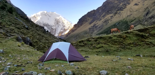
Being here is the most incredible thing I've ever done for myself. It’s an absolute dream looking around and seeing nature’s beauty at her full potential. The stars are so stunning, too. It’s a new moon so it’s total darkness with no light from the moon. WOW!
All fed and ready for bed. That was an incredible day one. I plan to wake at 5:15 AM. That's a giant amount of sleep but I think I need it because today was pretty crazy. Tomorrow is supposed to be the hardest day. Eeek. I can see Salkantay and it looks massive so I’m ready to get some rest and have a blast tomorrow!
Day 2: Soraypampa to Chauelly (chew ah lie)

Personal note: I didn't think today's hike was harder than yesterday.
Woke at 5:15 AM. Packed, made breakfast and left camp at 6:45 AM. The tour groups were leaving in droves, but the good news is they were going a different route. I stuck with the All Trails map and glad I did as I wanted to be a bit more on my own. Yay.
I hiked quite a bit just by myself before the trail finally intersected with the main group trail. It seems the tour companies have recently made a new trail and, at first, I started taking it. Apparently it's shorter and less strenuous. I checked my map and realized quickly that I was not on the right trail so I backtracked and went up the trail I had on my All Trails map. This part of the trail I went back to is called, The Trail of the Seven Snakes. I thought it was worth going back for. The groups did not go on this route.
The horses were heading up the Seven Snakes trail with their group’s packs, tents and food. They were already a fair bit ahead of me but at least I could see it was indeed the right trail. The trail up is a switchback and was, for me, the hardest part of the whole day. I welcomed it as I knew today was going to be challenging. The locals call the Seven Snakes trail, "the gringo killer." This trail goes way above the new trail and the views are stunning, plus a waterfall, yay! Then, all of a sudden, the trail pops down and intersects the new group trail.
I walked a bit until I reach a small village called, Suyroqocha. This is where the Salkantay pass begins. Woo hoo. The trek up to the pass is pretty intense. I had gotten some Coca leaves from one of the hikers to chew on. This was my first time chewing the coca leaves, it seemed to help give me a bit more energy or, at least, something to keep my mind off the strain of the pass.
The last stretch to the top of the pass is tough. I would take 4 - 5 steps and stop for a bit. Then 4 - 5 more steps then stopped again. It’s the highest point altitude wise and, at this point, I could feel myself higher in the atmosphere than I had ever been.
I reached the top of the pass at 10:20 AM (below). The pass is everything I hoped it would be and I had the most incredible weather and visibility.
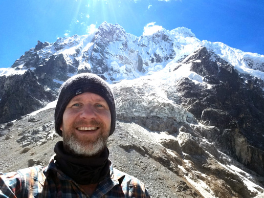
I took a bunch of pictures, talked to a few of the other folks that were there and, after about 20 minutes, I headed out again.
Instead of heading down where the groups go down, I decided to trek to the Laguna, which was something I really wanted to see.
Tip: If you're facing the pass signs the trail to the Laguna is directly to the right and very clear to see.
The trail is pretty much straight and flat. Boy was I glad I went out to the lake. It was so incredibly beautiful (see below). There was no one there at all as the groups don't go here. I did not climb down to the lake as it was pretty long and steep. Not terribly bad, but the thought of trekking back up did not feel like it was going to be worth it, plus I had about 6 more hours of hiking to do today.
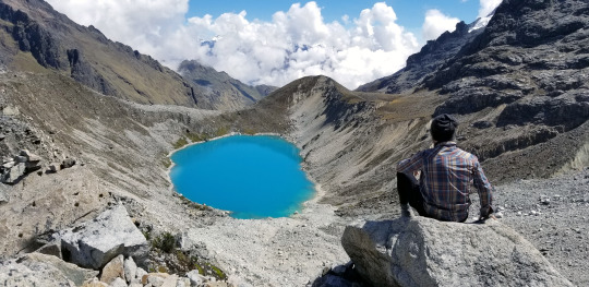
There’s a clear path back to the main trail that isn’t the same one I took out. At times the trail back to the main trail disappears, but I just looked ahead and found where it picked up and stayed on until it connected.
From there, the rest of the day was hiking with the groups, although I made a point to give room between me and the other hikers so I really feel I had a sense of being on my own, which I wanted.
I had a late lunch at 1:30 PM, resupplied my water from a steam then kept on.
Note: There are little huts where you can buy water, candy bars and such along the way. I never used them for water, but did pick up a bar at one point.
After the pass there’s a lot of downhill, only a small bit of uphill, but it's taxing on the legs. Trekking Poles helped a lot.
After a bit the trail turns tropical with lots of waterfalls and even some green canopies. There were some ruins at one point along the way, but I was worried I wouldn't get to Chauelly before sunset so I kept going. A local told me they weren't great, but I may never know. Boo. I’ve since kicked myself for not stopping to see them. On more recent hikes I now stop and check things out, even if it takes longer to do so.
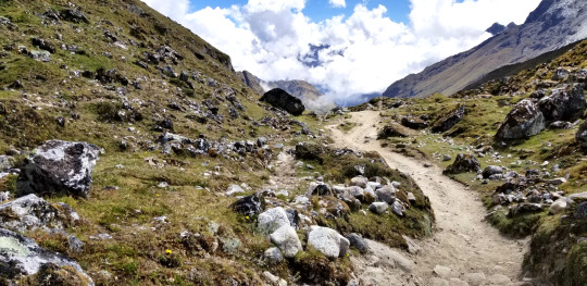
Finally I arrived in Chaulley at 4:20 PM and I had to find a place to sleep, while walking through the town the map direction didn't seem to make sense so I followed the road a bit and even went through someone's property, with their permission. It was awesome to go this way as there was a fantastic waterfall right through their “backyard”. Wow!!
Right after that I met up with three folks doing the trek together. Sammy, Selayna and Will. Together we looked for a place to stay. After a bit of hunting we found a place where one of the trek groups stays called, Collpapampa El Mirador. They let us stay on a piece of land away from their group/guests.
I resupplied my water for the next day, made dinner then went to bed. I made my first “ramen bomb” and it was so terrible and starchy that I threw it out. Doh. Luckily I had a backup lentils and rice meal. Whew. Yay and yum.
I treated my blisters. I had a BIG giant one on my right big toe that I didn’t even feel before, wow.
Tip: I learned from yesterday how to be more efficient breaking down camp; i.e. leaving cook set out ready for breakfast, put bars and snacks for tomorrow in my pouches, etc.
Now I'm off to bed. Ear plugs tonight for sure. :)
Day 3: Chaulley to Llactapata Mirador
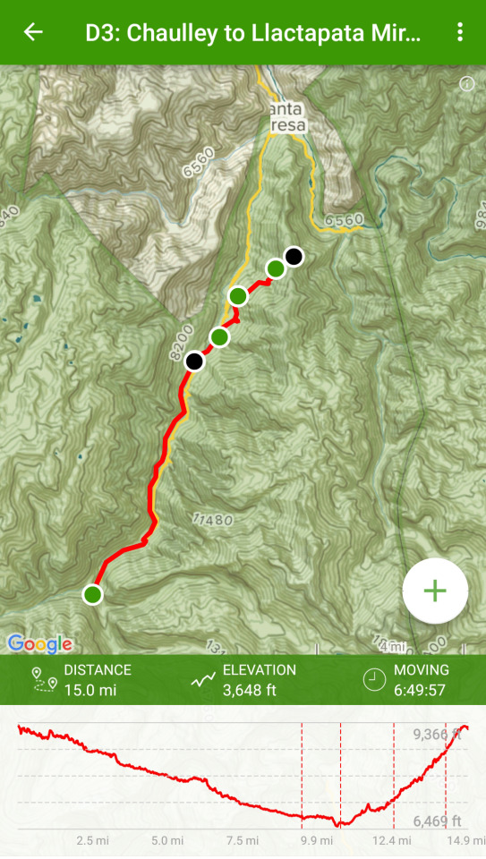
This is the jungle I’ve been waiting for!
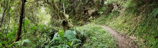
Perhaps the best day yet! Magic morning. I woke up before any sun was out and just saw silhouettes of the giant mountains right in front of me. The sound of the water below was soothing throughout the night. The roosters started crowing at 4 AM this morning, but, by that point, I had already had about nine hours of sleep so I was not bothered and went back to sleep until 5:10 AM.
I started hiking at 7 AM. I think if I would have started at 6:30 or 6:45 I probably wouldn't have seen a tourist or a group at all today, but right when I left there was a big group going out. Luckily they stopped so the guide could tell them some information about what they were looking at. This allowed me to get pretty far ahead before they started. I went to take the trail that is suggested by All Trails, but I was told that the first bit was washed out and to take the road. I was a bit bummed as I didn’t want to be on the road all day. As I walked along the road I could see what seemed in several spots that the trail I wanted to take had been completely washed away so, unfortunately, I had to take the road for about two miles.
I pretty much had the trail to myself, a few cars and small tour busses that passed every once in a while. It seems most people take a bus from Chaulley to their next destination. It never even crossed my mind. There’s just too much to see and I was here for the journey, not the destination.
About 2.5 miles into the day I came upon a small little hut that sold fresh fruit, which was really nice. I talk to a hiker who spoke Spanish and he asked the lady at the hut how to get to the trail on the other side. Apparently there's a bridge about 5 minutes down the road from the hut. I went and, oh my gosh this was the coolest thing I've ever done. Shortly after the hut there’s a waterfall that goes onto the road. I looked to the left, down the river and I could barely make out a small trail that was super steep with steps that lead down to a local made makeshift bridge and a rope pulley cart. These carts go across the river all over and apparently is how the locals transport their goods from one side of the river to the other. I got to the other side of the bridge (below) which wobbled a lot and had no handrail.
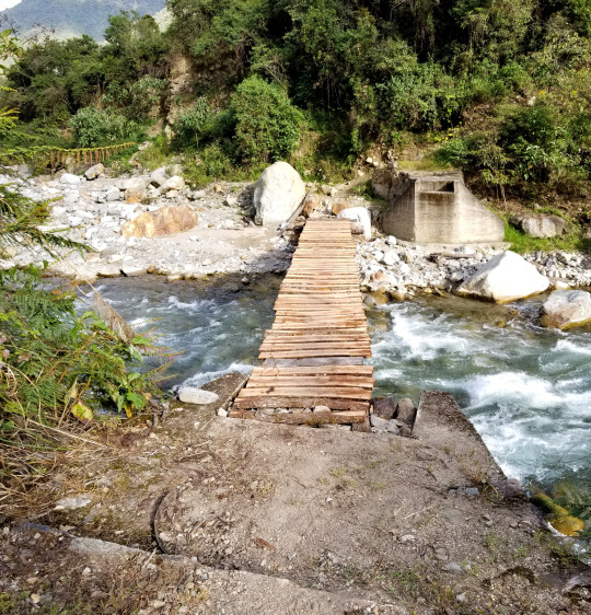
I was greeted by the man who lived here and I was able to communicate a little bit. I think 5 soles would have been nice to give him, but all I had at the moment was 50. He was kind enough to let me pass without paying a fee.
This part of the trail is glorious!
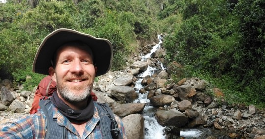
Tip: I am so glad I came this way as it's amazing. If you want a much simpler and faster hike, the road is the way to go but if you want to see the jungle, be greeted along the way with lots of interesting mariposas and the most incredible waterfalls, then go the trail.
I was alone the entire time on this trail all day! All the stops I took for brakes to enjoy the scenery to dip my toes in the water I was always by myself. It's pretty amazing as I didn't expect it it would be like that but I'm pleasantly surprised. Nothing better than to stop at one of the waterfalls and splash some water on my face!
This trip is, for me, one of the most, if not the most, amazing things that I have ever done for myself in my life!
I came to a little hut with fruits, water and snacks. I wound up getting a Twix bar, which I was going to cherish more than anything else on this planet at lunch.
After that there were several little huts like that along the way. I did see a cool looking swimming pool, and, when I got up to it there was a really posh bar kind of in the middle of nowhere. It was quite cool and empty except for the lady who worked there. I asked about the pool and she said it was a for Alpaca Adventures. That was a bummer cuz I already had made the decision to make the stop even if only for 10 to 15 minutes for a dip in the pool. Doh. No worries, I said, “Thanks,” and kept on going.
My legs are beyond sore today and every time I go downhill I feel one little pain after the next. But it's doable. No complaining here.
I just came around a bend and out in the distance I can see some mountains that look magical. Maybe this is where Machu Picchu is located? At least looking at them I can tell that I have to climb up one of them tonight and I am thinking that's going to be quite a challenge, but one that I'm ready to take on.
I am making a commitment to myself that even if I have to hike with my headlamp on I'm heading to the Llactapata tonight to wake to an incredible view of Machu Picchu.
La Playa is the next town I trekked through. It’s different than any place I had been in Peru so far. Definitely a Third world village, but I would not say it's terrible. I was expecting it as I had read many poor reviews online. Overall I felt it had a little charm to it. The people were very friendly and seemed quite happy.
I was able to get a cellular connection in La Playa just standing on the road. It's the first time I was able to send a text back to my family as I was in Cusco the last time they’d heard from me. I hope they got it as I just want to make sure they know in alright (they did). Where I exited out of La Playa it's where most people enter it. It definitely makes itself more presentable from the tourist entry direction.
I think I can see the Machu Picchu peak from here (later that evening I found out it was not). It's cool to actually be here in the presence of a site that I’ve seen for so many years and dreamed of one day seeing myself.
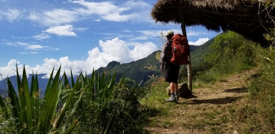
About half a mile down the road there’s a bridge with an awesome waterfall and I decided to stop there for lunch. It was noon and I was hungry and exhausted. The best thing was soaking my feet and enjoying the awesome view. It was nice to rest and take 30 minutes to do nothing. Heading out my feet are a little numb from the cold water but at least they're talking to me again.
Note: I'm a bit sick of all my meal bars. Note to self to have more variety for lunch meals. :)
Tip: Resupply water here as the resupply spots get a bit sparse between here and Llactapata and you’ll need it.
Right after I left I can upon a sign that said “Llactapata”. From here it’s a 3.5 hour hike up, up and up!!! I was so wiped out and just kept going. The views are stunning and I saw no one on the way up. After walking about two hours I passed a small hut where a nice man made fresh squeezed orange juice! No joke. I forget how much it was but it was well worth it.
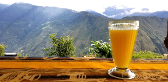
Tip: Get the orange juice!
I stopped here for a bit and took in the view. It’s magical and the man has some cool lounge chairs you can sit on too. It’s worth stopping here for a break as after this stop It's crazy uphill for the next hour.
At this point I was so tired I literally thought is going to pass out. Yikes. But, I just kept getting myself to take one more step over-and-over again. I was here for this, to push myself, to hike more than I had ever done at one time. There was no other way but to go forward.
On this part of the hike there were some tears of joy as I’m soaring up so high and it’s simply breathtaking!!!
Finally, after hours of going up, for what I thought would never end, I reached the top of the mountain. I had planned to stay at the Llactapata Lodge, as I had seen in many YouTube videos, but I was just so tired I had to stop, so I went out about 5 more minutes and camped at Llactapata Mirador. It was incredible! I was the only one here and NOW I could see Machu Picchu (below seen above the right side of my tent and the verticle tree) in the far off distance and she's stunning!
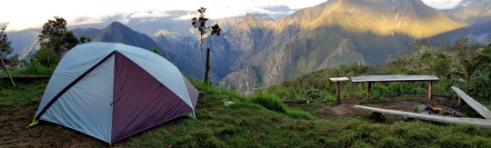
Right after I set up camp two hikers from France arrived, Max and Miriel. It was the first time I had seen hikers in quite a while. Right after that another showed up, David, who I met on yesterday's hike. David was solo too.
I took pictures, we all ate dinner together then headed to bed. We were all exhausted.
The frogs are singing happily. :) Good night.
Tip: Camp at Llactapata Mirador vs the Lodge. This spot is private and magical.
Day 4: Llactapata Mirador to Aguas Calientes
I woke up before the sunrise and took my time getting ready, watching the sun rise on Machu Picchu was surreal.
Going down the mountain was fun, fast and I jogged and slalomed down with my trekking poles. Not too far down I came upon some cool ruins. Apparently you can't camp there but it did look like a nice spot. It had a similar view to what I had the night before.
Right after the ruins I went through Llactapata lodge. This is where I was going to camp the night before as they have a camp restaurant. I'm glad I didn't stay here as there was a big tour group that was packing up and getting ready for the day. I stopped for a moment, took a picture of the view then kept on heading down the hill. After that I jammed down the hill with renewed energy. I was feeling great. All my pain was gone and I was fresh. I guess this is what they call getting your, “hiking legs.” This part down was super fun and mostly covered as a canopy of jungle. Some parts are open but mostly it's covered and shaded.
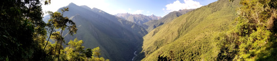
Once I got to the bottom I came to an amazing suspension bridge. As I went across it wobbled from side-to-side, just like I imagined in the movies. It was awesome. Once on the other side I came to a road and walked down a bit until I came upon a fish farm. The owner let me in and communicated with me via Spanish. From what I understood the different pools were for the smaller medium and large size fish. Thousands of fish swimming all together. It was a trip on the eyes.
From there I kept on and, out of the corner of my eye, I saw and giant waterfall. I couldn’t resist so I had to stop, take off my pack and hike over to the bottom of the waterfall. It was spectacular and well worth the stop.
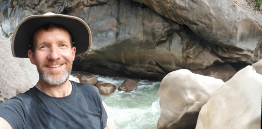
After that I kept heading down the road until I reached Hydro Electrica. Once here you have to check in, show your passport and sign in. After that I reached the famous railroad tracks that I’ll follow all the way into AC.
Tip: Do not forget your passport. You need to show it here.
All along the way there are lots of little stands. I bought a bag of Doritos. I never eat this type of food but David, from the previous night, had some at dinner and they were delicious.
Note - Map Issue: From here the All Trails map is not correct. The trail that it shows is overgrown and has barbed wire on it. It’s not hard to find the right way to go though, but the tracks do “Y” at a few points.
One thing I was really looking forward to was going through the train tunnel. I dunno why, I just thought it’d be great and I saw many pictures of people who had done it. However, it seems they don't allow people to go through the tunnel anymore. Either that, or the time I was going trains were coming through and perhaps they don’t allow it at THAT time? Nevertheless, I did try to go around the train to see if I could sneak through the tunnel, but there was a guy who stopped me and told me to go down via the main walking path. So it looks like the walking paths may now be the preferred method into AC.
Right after that David, from the night before, caught up with me and we walked down the train tracks together chatting on our way into AC. We stopped for some fresh squeezed juice. I had orange and he had pineapple. It was nice to chat with somebody and he's a cool guy too so it was a good conversation. We swapped hiking stories and gear choices, etc, for me that was pretty cool as I have never really talked to anybody about hiking stuff as this is a new hobby for me. Cool!
Note: One thing to note is that train track walk feels endless. It just keeps going and going and going, and it's very rocky so you have to look down a lot. It has tons of people going both ways so just know that you are not alone by any means when you're on this last stretch of the hike.
Just before I got into Aguas Calientes I stopped for a moment to check out of sight and David kept going. I didn't see him anymore on this trip. We exchanged emails and have been in touch since. Again, super cool guy.
Aguas Calientes is actually a pretty cool place. From what I've read everyone says it's a dive. I don't really think so. If feels a little like Sayulita, Mexico, if you take away the beach and put it in the middle of the jungle. It's got a good vibe and a lot of energy for sure.
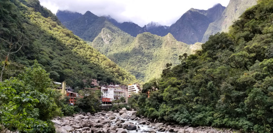
I got to my hotel, Gringo's bills, and it’s pretty amazing. I asked where I needed to pick up my MP ticket and they said I could do it there. So I gave them my confirmation number from the ticket I purchased in advance and they printed out my entry ticket. I guess all the hotels are on the same system. This was super convenient.
Getting to my room I had to go up and up a bunch of stairs and pathways, which I was quite fine with me by this point and my room was excellent.
Once in my room, the first thing I did was call my wife. It was SO good to great her voice. After that I took a hot shower. It was other worldly to lay on a bed; I don't think I've ever appreciate laying on such a comfy surface in my whole life!
Next I headed to the plaza for a late lunch. I had a burrito with guacamole and chips which was REALLY good.
After lunch I walked through the town and explored every corner I possibly could.
One thing that feels a bit strange is the shell shock. After having hiked for 4 days pretty much on my own, being self-sufficient, I've arrived at what feels like Disneyland. The contrast is a bit shocking. I can't say it's unexpected but it is interesting to know that many people simply ride in by train or bus versus hiking in. Neither is better. It's just the contrast of being a simple human being for 4 days and now being thrust back into modern life with stores, internet, cell phones, etc. I turned my phone off and took in the sights as I wasn’t quite ready to be in the modern world just yet.
Next I headed to the train station to make sure I understood how it worked as I was going to be taking it out tomorrow evening.
I then walked all the way to the end of town to a hot springs! Okay, now I have arrived! For 20 soles I was in it was AMAZING, relaxing and just want my body needed.
After that I headed back to the room and talked with my daughter for a bit; she was now awake. Oh man, I missed hearing her voice.
Now I'm having dinner in a little restaurant on a side street. The town is maze-like with steep, winding streets. I tried to get lost, but really can't cuz it's pretty small overall. Ha ha.
Day 5: AC to Machu Picchu!
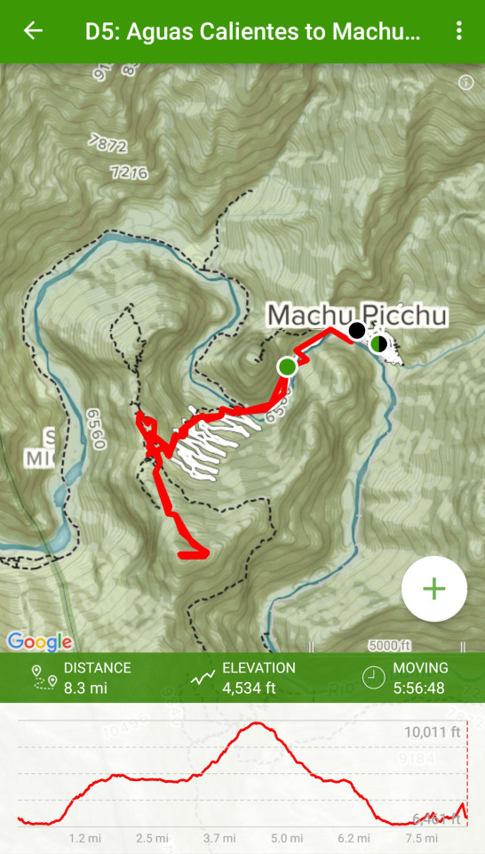
The big day has finally arrived, and it did not disappoint. Up at 4:20 AM.
Today I’m using a simple day pack that I picked up in town for 20 Soles. It’s still dark out so I’m using my phone as a torch.
There’s a line through the center plaza to get the bus but it was already wrapped around the corner and well up the street. People must have slept out here.
Going up the stairs all the way to the entrance was fun. There were many other people doing it and the energy was exciting.
Tip: Bring whatever water for the day you’ll need. There are no water sources once you start the trail up and no place to buy water when you get into MP. I was under prepared for this as there’s LOTS of climbing. A lot and more if you go to Machu Picchu mountain or Huayna (Wayna) Picchu. I wound up asking some people if they could spare some water and they were kind enough to help out.
My trip through the ancient city was incredible, personal and perfect. The weather was clear and I had the privledge of being one of the first in.
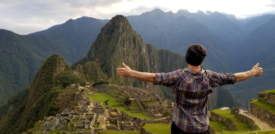
I can only imagine what it must have been like for Hiram Bingham to be here for the first time. A really fun experience to learn about his life and adventures while I was in AC too.
I hiked to the top of Machu Picchu Mountain. Wow, that was intense and super rewarding. The trail just keeps going up and up and it’s fairly exposed to the sun. A lot of people got heat stroke, needed to stop and went back down.
Tip: A hat and water are important on this day if you hike Machu Picchu Mountain or to Waynu Picchu.
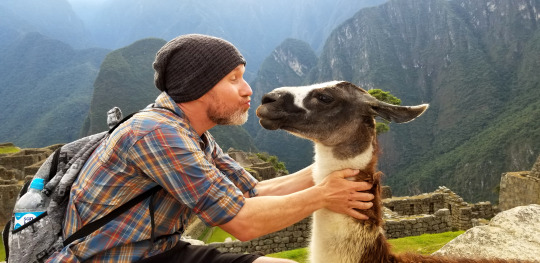
Tip: Don’t skimp on the train ride. I took the cheapest ride back. The train was super slow, I could have walked faster. No joke. It completely stopped several times for long periods and eventually broke down. We all hiked a bit until we could get to busses they had brought in to get everyone back to Cusco.
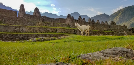
Although it sounds a bit nutty to have gone through a funky train ride experience, I really enjoyed the adventure of it all.
Once in Cusco, it was dark and late, I had to find a taxi and get to my new hotel. Luckily they were open late so I was able to check in no problem.
When I got back to Cusco I went back to Green Point Restaurant. They were just about to close (5 minutes) but they were cool enough to let me order take out. I ate in my hotel room then passed out for a full night of much needed slumber.
In Closing:
I had an incredible adventure. Beyond anything I could have ever imagined. The confidence I gained in my ability to travel to a foreign country alone and hike solo through rural, tropical and snowy terrain, living out of my pack and from the Earth was so satisfying.
On my flight back home I watched a documentary film called “Love Thy Nature” by, Julian walker. It struck a chord with me and resonated with the experience I had just had. Remembering that we’re simple human beings. It’s an amazing to have this feeling so clearly in view. I only hope I can hold onto this feeling and the clarity I feel I have in my life now.
0 notes
Photo
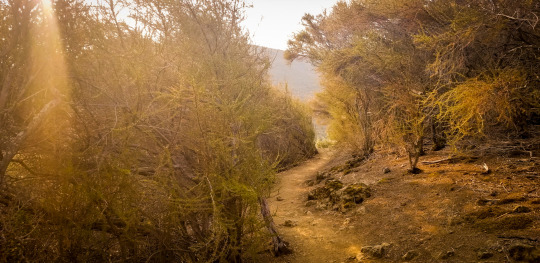
Mt. Diablo - Solo
April 2018
Total Miles: 13.3
Mitchell Canyon to Summit Loop
Why am I hiking Mt. Diablo?
I wanted to hike Mt. Diablo for several reasons. The first being that this is the mountain next to where I great up. I have a lot of great memories being a kid and spending many hours here with friends in high school, but I never hiked to the top and back. I also wanted to hike here and back for training for my big trek to Machu Picchu coming up. Finally, I wanted to hike to the top of Mt. Diablo solo to prove to myself that I had the courage to do it.
I’ve lived in the Bay Area all my life and grew up only a couple miles from Mt. Diablo. I’ve biked to the top before, but realized I had never hiked it. So I set off on an adventure to do it.
WOW, this hike is pretty hard. What’s hard is balancing the climb with the heat. I left at 8:30 AM but it was already hot. I drank 4 liters of water just to the summit then refilled at the top.
Tip: A shade umbrells is a must - I have this one.
It was 92 degrees at the hottest. When I got home I was WIPED out and think I had a bit of heat exhaustion/stroke as my head and body were just toast.
I’m SO happy I did this hike. It’s something I’ve always wanted to do.
0 notes
Photo
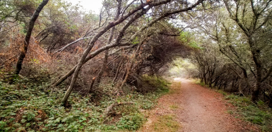
Point Reyes
April 2018
Total Miles: 16.7
Secret Beach Mega Loop
Why am I hiking Point Reyes?
Samuel P Taylor State Park, aka Point Reyes Seashore is one of the most magical places on the planet. It lights me up every time I’m there. Hiking here lately has inspired me to begin my adventures in thru hiking around the world. I have a lot of adventure I want to go on in my life and I’m SO very thankful that I stumbled onto the incredible beauty of this place. Let the adventures begin!
Today was a fantastic hike in Point Reyes. I started using All Trails Cost Camp/Laguna Loop so I could go down to Secret Beach which I found out about in this blog post. The tide was low, but it needs to be ULTRA low in order to go through the door/gateway to Secret Beach. Unfortunately it was about 4 feet high and I didn’t feel safe enough to go through, but just being there was outstanding. I decided to create my own hike once down at Sculpture Beach as I had the day and wanted to make the most of it so I set out on a long journey.
I listened to some great meditation music and took in the sites, smell and sounds. It’s amazing to feel so small and so simple when surrounded by nature.
0 notes