
Don't wanna be here? Send us removal request.
Statistics
We looked inside some of the posts by mepebeinjpn2023 and here's what we found interesting.
Average Info
Notes Per Post
35
Likes Per Post
31
Reblog Per Post
4
Reply Per Post
0
Time Between Posts
14 hours
Number of Posts By Type
Text
17
Last Seen Tumblr Blogs


Fun Fact
The total number of visits Tumblr.com received during January 2021 is 327 million.
Text
Wow! What an incredible experience!
We saw so many sites, learnt so many things. We're all more knowledgeable about earthquakes, tsunamis, floods and the history of natural hazards in Japan. It's been such a great and successful trip, hopefully many more people will be able to come and learn about the hazards, risk communication and mitigation on this course in the future!


1 note
·
View note
Text
Another Day in Japan
We got up, got out, and drove to our first stop of the day; an Edo period checkpoint. Here we were reminded of how natural disasters impact civil engineering and how civil design has to adapt to the hazards of the area.
The checkpoint was moved around a bit in its working history, generally due to natural hazards; it was moved after a flood and then after a tsunami, being rebuilt on the best place for a checkpoint, taking into account the natural hazards afterwards.


Some Geological Tsunami Imprints
It was also interesting to see how these tsunamis impacted the sedimentary history of the area. There was a 30 cm layer of sandy sediments layered with mud in the area. This layer also had thin layers of mud inbetween layers of sand, showing that the mud had had enough time to start settling before another tsunami wave in the same event occured.

Life Saving Mound
This life saving mound was built in preparation for a large tsunami. It was intersting to see how experts thought that the height of this mound (10 metres) was overkill; according to their models the highest which would be likely in the area would be 6 metres. I wondered if this approach was to make citizens feel safer; for me, if I saw a massive hill in case of an emergency, I'd feel safer than if I saw a smaller mound.


A Smaller Life Saving Mound
This was another interesting place related to natural hazards; this mound wasn't intended for tsunami, instead, it was intended for use in the case of a flood.

This illistrated how different safety structures are designed for different needs.
1 note
·
View note
Text
Basalt! Scoria! Lava tubes! Oh my!!!
Today we saw an the old Jogan lava flow, which would have occured all the way back in the 800s! It left behind a layer of basalt, containing gas bubbles, tree moulds and interesting finger prints of a second lava flow! These finger prints were partial filling of some of the gas bubbles (that became voids) in the first flow, as well as some filling of the previously mentioned tree moulds. One thing that surprised me was that the second flow came from the bottom of the first! This was likely due to there being a void left behind from the first lava flow.


Left: a tree mould. Right: weathered scoria. Below: the red is the baked margin of the scoria due to the lava flowing on top of it (finger for scale)

Speaking of voids, we also went into a bat cave!

Fortunately not "the" bat-cave, but an old lava tunnel which had some bats living in it. It was formed from lava emptying out of a lava tunnel - due to gravity - after an eruption, and leaving behind the empty tunnel.


There was also a second lava flow here, with it showing the lava flow direction with its ropy pahoehoe surface. It also showed how high it had gotten in the chamber with flow (or froth, if you'd like to make a beer analgy) lines on the walls. There were so many cool features showing the past geological activity.


Left: ropy pahoehoe lava, showing flow direction towards the right of the picture. Right: ridges on the wall showing the height of the second lava fow.
These lava flows are really cool, especially since they can give us information about how the lava might act in future eruptions from their thicknesses, viscosity and flow directions. This might make the evacuation effort more effective, and every little helps!
1 note
·
View note
Text

We hiked to the top of the Hōei crater on Mt Fuji today! It was an amazing experience; we saw old lava flows from previous eruptions, gas vesicles in basalt, andesite, scoria, volcanic bombs, and so much more!


(Left and centre: an old lava flow. Right: a volcanic bomb.)

(Above: some gas vesicles, generally between 2 - 4 mm in length. There should be a scale in here but I was too excited by the rock when I took the photo)
It was all amazing to see, especially the crater from the last eruption (which happened in the early 1700s)!


It was also so cool to see how this eruption had exposed dykes on the mountain side, it was insane!
(The dykes are the lines of rock which are situated relatively verticle near the top of the crater)

It was a really great day, even the plants were so pretty. It will be a truly cherished experience.


1 note
·
View note
Text
Did you know that Mt. Fuji normally doesn't go all that long (in geological time) between eruptions? Judging by past volcanic activity, the present day is over due for an eruption!

It's important to know what the dangers might be if an eruption does occur; this allows for well rounded hazard maps and evacuation strategies.


Hopefully if Mt. Fuji erupts, there will be enough warning from seismic activity for everyone to evacuate safely!
1 note
·
View note
Text
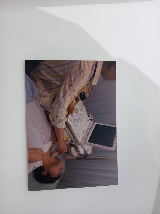
Is it a bird? Is it a plane? No! It's a supercomputer!

We arived at Fujitsu's museum, got to see a calculator which has been working since 1960, and then got to learn about their development of supercomputers!


We saw how their supercomputer development has been increasing their computing capacities, and then got to learn about how these computers can be used to analyse data sets and model natural hazards! It was really interesting.


Hopefully this technology can help mitigate the risks of natural hazards in the future!
1 note
·
View note
Text
The dirt
This isn't actually just regular dirt!

This was a verticle section of layers taken from a trench which was dug after the 2011 Tōhoku tsunami.


You can see the bright, light layer (which I'm pointing to on the left - finger for scale) which is a trephra layer left behind from a historic eruption. On the left, there is the 25 cm sandy layer left behind by the 2011 tsunami. There were multiple sandy layers in the cross section and it was really cool to see Japan's natural hazard history in a record like this.
The school
Nakahama Elementary School was a place of miracles; everyone who evacuated here lived on the day of the tsunami. The blue signs show where the water reached on March 11th, 2011. They luckily evacuated to the rooftop when they heard the 10 metre tsunami warning!


A large amount of luck played into this story of triumph; the roof was only just higher than the first tsunami, and the second and third tsunamis - which would have been far larger than the first - were dampened by the backwash of the first wave. It's so interesting how the initial hazard which put these people's lives at risk, also saved them!
It was really interesting to see how natural hazards and disasters impact both the geological record, and the people surrounding them.
1 note
·
View note
Text


Running late because we got stuck in a line at SkyTree (many lines actually). Doing our best!
0 notes
Text
The Shrine
This shrine was a tragic place where many people lost their lives. They evacuated to this hill in 2011 to try to escape the tsunami, as it was the only higher place in their vicinty. It had been successfully used to survive a tsunami in the past, but the 2011 tsunami was unprecedented, and unfortunately took the lives of many people here, and the country as a whole.


The stone pillar shows the height that the tsunami got to, a few metres above the hill. It was a really sad example of how sometime predictions made from past events aren't good enough for unprecedented situations.
1 note
·
View note
Text

The Okawa Elementary School was a place of great loss during the March 11 Tōhoku Tsunami in Japan. Many children lost their lives, demonstarting the risks of inaccurate goverment information and showing how deadly waiting to act can be.
Hopefully no tragedy like this occurs again. It was a truly tragic event.
1 note
·
View note
Text
We were on the road again today!
When we left our accommodation and got on the road, the first thing I noticed were the roads! The main roads in Japan are normally built in the mountains and up high to minimise their potential risk from tsunamis. I found it really interesting the different ways that natural disasters can impact civil design.

We then got to see the tsunami boulders; these were large rocks brought up to shore by the tsunami. The size of them really let us picture the force of the tsunami, since most strong rivers can barely transport pebbles around.
(Above is a tsunami boulder with me (165 cm) for scale)

Overall, it was a really beautiful and thought provoking walk.

Once we got off the main roads onto the first stop of our day, we had a hike infront of us. It was really beautiful, but also showed us the sheer power that tsunamis have, reaching high up due to it having a large run up height. The hight that past tsunamis have reached could be seen from the debris that had been pushed up the hill and the dead, broken trees that were there.
Hopefully I'll be somewhere this beautiful again soon!
1 note
·
View note
Text
Speaking of natural hazards...

We're expecting to get some weather tomorrow! The tail end of typhoon Yun-yeung is meant to make labdfall tomorrow!
0 notes
Text
The TEPCO Decommissioning Archive Centre was a really informative stop today. We learnt about the details of what caused the power plant to explode, why reactor two was the most damaging to the environment (they couldn't put the steam it produced through the normal purification process) and what steps they'd undertaken to start decommissioning it.
We saw the different levels of protective equitment needed around the plant after the accident, and how the radioactive material was cleaned up.

It was also interesting to see how they used filters to filter out the radioactive materials in the waste waters from the plants, before diluting the purified water and releasing it into the ocean.
It was also so cool to see all of the technology that they used to clean up the plant in areas that were too radioactive for people to go. This little robot especially caught my eye, with its little video to show it in action.


It was really interesting to see all of the decisions that were made surrounding the disaster, and all of the people who risked their lives and wellbeing for the greater good.
3 notes
·
View notes
Text
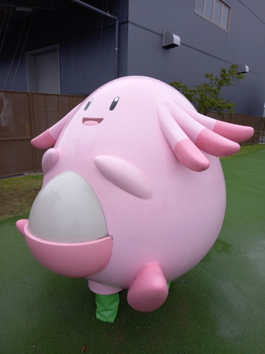
Leaving our hotel bright and early, we headed on to Fukushima. It was great to see so much of the country side, we even had lunch with a bunch of pink pokemon, with Chansey being the favourite!
We then moved away from pokemon and on to our first proper stop of the day; a sedimentary outcrop. Here we saw how the tephra (tephra is fragments of rock and volcanic glass) from historic volcanic eruptions were cemented into the rock's layers. We could see this in the coarser, darker layers in the rock. These layers can also be dated to find the ages of each of the volcanic eruptions with the right equitment! This can be really handy to understand the historic volcanic activity, which can help to forcast what to expect from future volcanic activity!

We also saw a cute real frog (left) and cute rock frog (right) at the outcrop.
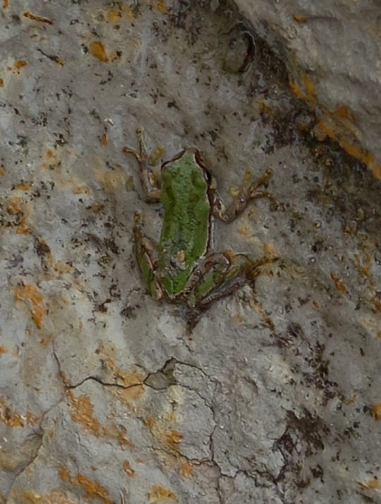
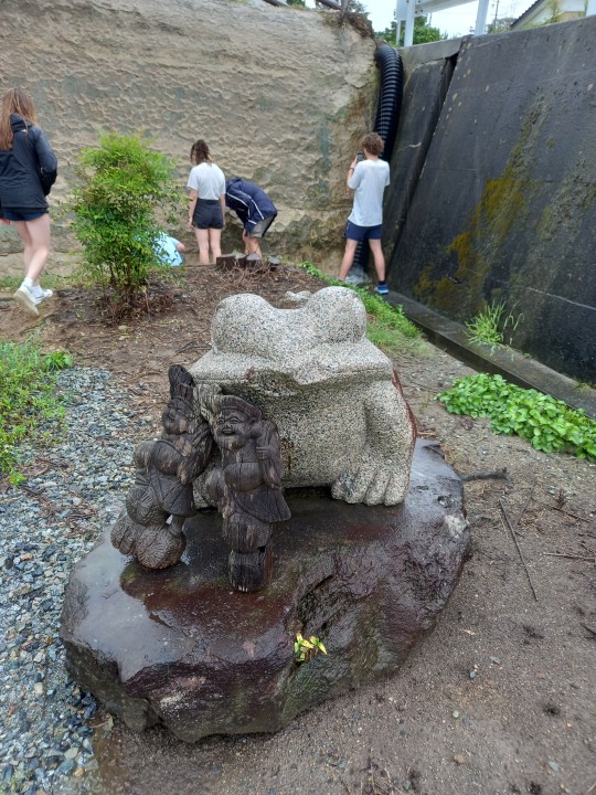
The rock frog was placed there by the 2011 Tohoku tsunami, which had flattened the low lying houses in the area.
The tsunami also impacted the Fukushima Daiichi Nuclear Power Plant, who's cooling system later failed, causing an explosion and the spread of radioactive particles into the atmosphere. The Fukushima Disaster museum captured the sheer magnitude of the affects that the compound disaster had on the people in the area, and the sheer force behind the tsunami.


This also really made me think about the similarities between the Tohoku 2011 disaster and the black summer bushfires in Australia - Tohoku's scale and impact was so unimaginably large, but both have lasting impacts; even if Australia's has been shorter and hasn't had to worry about nuclear radiation. While driving through places that had been affected by the tsunami, the missing buildings and blank plots of land really felt very close to what we still see in some places in Australia, for me Cobargo's main street came to straight to mind when I saw them.
It was a really tragic place, but seeing their slow recovery highlighted the area's resiliency, to even something of this magnitude.
3 notes
·
View notes
Text
How do people who come from Japan to Australia cope with our such basic toilets? The ones here are insanely high tech!
1 note
·
View note
Text
Also, speaking of natural hazards, we felt a 4.5 magnitude Earthquake today in class! It was the first Earthquake that I've ever felt! It was like a truck was driving past outside our room. Lucky Japanese infrastructure is built to withstand far more intense Earthquakes than what we had today, or else I may have felt concerned!
This is unlike Canberra, which only has three Earthquake resistent buildings (Parliament House, Telstra Tower, and a communications building in Deacon). Because Canberra's risk of a large Earthquake is so low, this isn't a very large concern, which is good!
Today was filled with learning! We learnt about how many seemingly unrelated things are connected, like how earth tectonics making deep trenches can have a positive impact on fish and fishing industry, and how fishing industry can negatively affect the ocean by putting plastic into the ocean due to a tsunami (up to one third of the Great Pacific garbage patch was from fishing gear washed into the sea in the 2011 Japan earthquake).
It was also interesting to see how technology can positively and negatively affect risk assessment and decision making made by governments.

And finally, after that action pack day...
Pancakes!!!

9 notes
·
View notes
Text
Today was filled with learning! We learnt about how many seemingly unrelated things are connected, like how earth tectonics making deep trenches can have a positive impact on fish and fishing industry, and how fishing industry can negatively affect the ocean by putting plastic into the ocean due to a tsunami (up to one third of the Great Pacific garbage patch was from fishing gear washed into the sea in the 2011 Japan earthquake).
It was also interesting to see how technology can positively and negatively affect risk assessment and decision making made by governments.
And finally, after that action packed day...
Pancakes!!!
9 notes
·
View notes