
Statistics
We looked inside some of the posts by raqueleline and here's what we found interesting.
Average Info
Notes Per Post
147
Likes Per Post
98
Reblog Per Post
42
Reply Per Post
7
Time Between Posts
5 days
Number of Posts By Type
Text
7
Photo
1
Last Seen Tumblr Blogs


Fun Fact
Tumblr’s reach among the 26-to-35-year-olds in the US is 11%.
Text
0 notes
Text
Amazonian governments remain silent on 68% increase in deforestation

Deforestation in the Legal Amazon increased by 68% in January 2025 compared to the same period last year. Even so, the governments of the states leading the deforestation ranking have remained silent on the destruction of the forest. On Monday, the 24th, Cenarium Magazine requested clarifications from the executive branches of Mato Grosso, Roraima, and Pará, but no responses were given.
Reaching 133 km² of deforested area, the Amazon recorded its sixth-largest deforested area for the month of January 2025, 68% higher than the same period in 2024. The extent of the destruction is equivalent to more than 400 football fields being devastated per day. The data was released by the Deforestation Alert System (SAD) of Imazon.
In the same survey, it is possible to see that Mato Grosso led the deforestation ranking in January this year, accounting for 45% of the total deforested area, followed by Roraima with 23% and Pará with 20%. Together, the three states account for 88% of the deforested area recorded in the Amazon.
According to researchers at Imazon, deforestation rates serve as a warning for authorities to develop and strengthen monitoring actions in the region, intensify inspections, expand operations to combat environmental crimes, and reinforce policies that encourage the protection and sustainable use of the forest.
Continue reading.
19 notes
·
View notes
Text
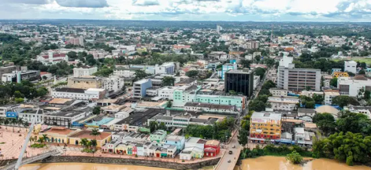
#riobranco #acre #invernoamazonico #inundacao #gestaoderiscos #desastresnaturais
0 notes
Text
Lost cities of the Amazon: how science is revealing ancient garden towns hidden in the rainforest
Archaeologists using 3D mapping are uncovering the remains of thousands of green metropolises with composted gardens, fisheries, and forests groomed into orchards

For decades, archaeologists have believed that human occupation of the Amazon basin was far older, vaster and more urbanised than the textbooks suggested. But hard evidence was scant, artefacts were scattered, and there were too few people on the ground to fully assess the magnitude of what lay cached in the dense forest. Then they found a shortcut – lidar.
Lidar (light detection and ranging) scans use pulses of light to create a 3D map of terrain in a fraction of the time it would take to survey from the ground. One of those making the most of the technology is a team of experts led by Vinícius Peripato, an analyst with the Brazilian National Institute for Space Research.
By combining lidar datasets, they are discovering traces of a lost world: evidence that between 10,000 and 24,000 pre-Columbian “earthworks” exist across the Amazon River basin.
While the remote scans still need to be verified on-site, Peripato says the findings so far make a compelling case that ancestral Amazonians systematically built up large urban centres and engineered the habitat to their needs and appetites with composted gardens, fisheries, and forests groomed into orchards in complex, sustainably run systems – which could offer lessons for modern cities.
The discovery challenges historical ideas of a pristine jungle too harsh to sustain human occupation. “It’s really incredible. Our research ended up guiding the course of several others, and not just in archaeology,” says Peripato, who is also collaborating on another project, Mapping the Archaeological Pre-Columbian Heritage of South America.
Continue reading.
58 notes
·
View notes
Photo
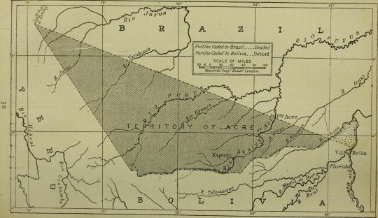
Map of the disputed territory of Acre, claimed by Peru, Bolivia and Brazil, before a settlement where Brazil purchased the land.
Continuar lendo
67 notes
·
View notes