Don't wanna be here? Send us removal request.
Statistics
We looked inside some of the posts by spellucci and here's what we found interesting.
Average Info
Notes Per Post
24
Likes Per Post
22
Reblog Per Post
1
Reply Per Post
1
Time Between Posts
4 days
Number of Posts By Type
Text
17
Last Seen Tumblr Blogs


Fun Fact
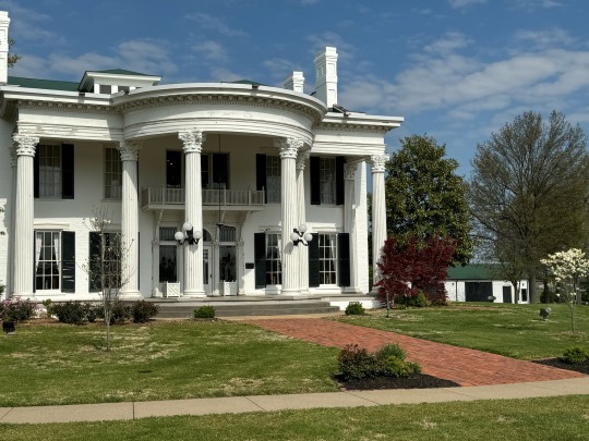
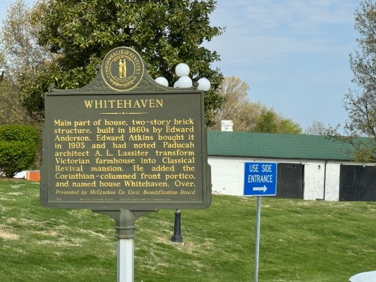
The KCSC sent more than 20K requests to delete posts related to prostitution and porn to Tumblr from January to June 2017.
Text
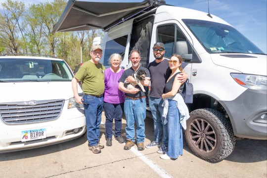
Austin to Texarkana
May 17 & 18, 2024
The morning dawned overcast but dry. The long-tail grackles were raising a racket.

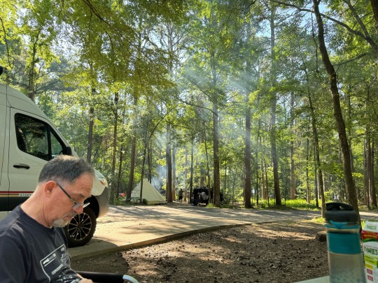
Sharron called us in the morning inviting us back to her house in Austin. She was running the conference and I didn’t try to find her to say goodbye. My bad. I really did want to see her, so I quickly asked Tim if he was ok turning around. He was, so we headed back to Austin to spend the day hanging out on Sharron’s shady porch, drinking lemonade, and admiring her husband Ron’s paintings and art. He is really good. Their house is filled with light and color. Very relaxing.
We walked around the neighborhood and posed with Suzie — the T-Rex statue in the yard of a neighbor.


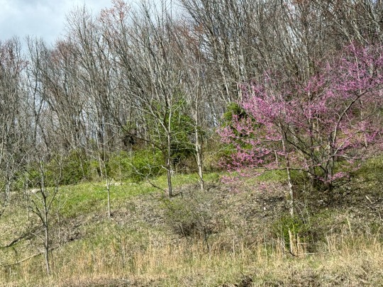
All the wet days have helped the cactus to bloom.


We camped in Sharron’s driveway and set off north again in the morning.
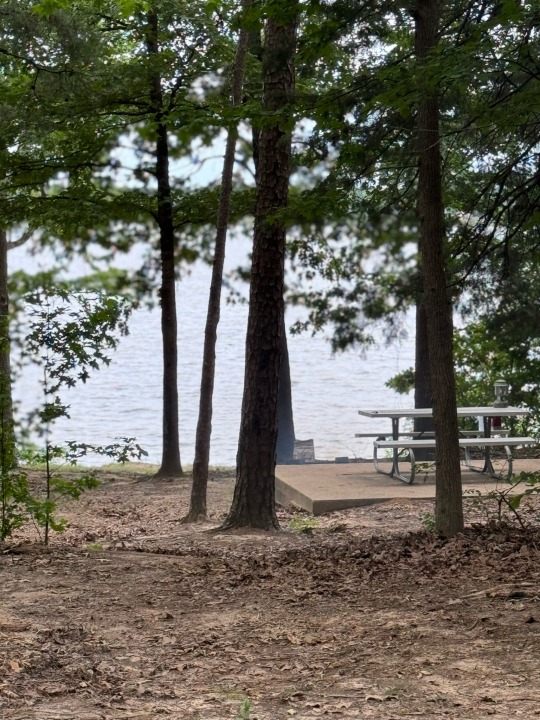
We stopped again at Lake Bob Sandlin State Park.
This time, we drive to the swimming beach for a better look at the lake.


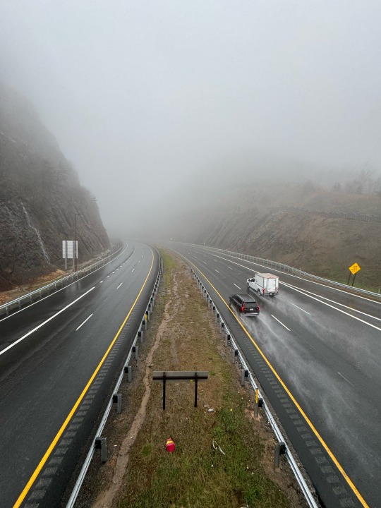
The abandoned gas station sign struck us both as funny, so we stopped for a photo.

2 notes
·
View notes
Text
AccessU
May 13-15, 2024
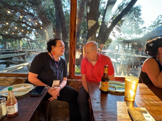
AccessU is an annual digital accessibility conference in Austin, TX from Knowbility, a non-profit accessibility consulting firm. This relatively small conference attracts top speakers in the accessibility field. I (Jeanne) was flattered to be invited as a speaker, especially because I would be presenting with an old friend and colleague. My session went well with good questions and a strong turnout.
I got to meet old friends and colleagues that I hadn’t seen since before COVID. I also got to meet in person a woman I had mentored for a year. Lots of hugs and happy greetings. I didn’t feel the need for networking, which took the work out of the conference — I could just chat with people I care for and respect.

It’s hot — dazzlingly sunny in the 90’s walking between buildings at St Edwards University contrasting with frigid air-conditioned classrooms. Sleeveless shirts for outdoors and a sweater or jacket for indoors.

Tuesday night Karl’s company paid for a bus to take attendees to a famous BBQ restaurant. I met another woman in person who I had worked with for years and like very much. I sat on the bus with a man from Lithuania and talked differences in US and EU regulatory approaches. True wonk. I got a hug and a few minutes with my friend Jennison who started Global Accessibility Awareness Day (GAAD). It’s getting mainstream, but I remember the first one.
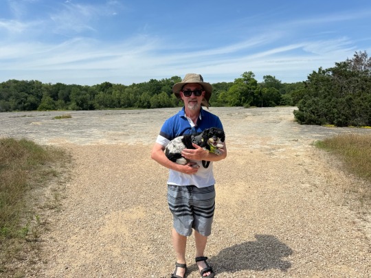
My Wednesday session was an experiment I signed up for two weeks before the conference. I was facilitating a session of solving problems. It felt like chairing a W3C working group meeting — lots of people wanting to express their opinions. It was well attended and some good ideas came out of it. I had seen everyone I wanted to and I wanted to enjoy the state park, so I called Tim to pick me up and we put our bathing suits on and hiked to the McKinney falls. Tim took a photo which I sent to everyone who texted me asking where I was. “Jeanne’s afternoon session”
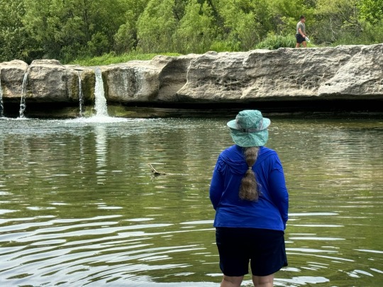
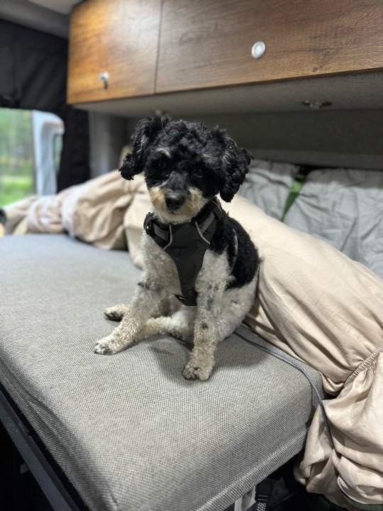
It was so hot walking across the rock field that Dora was burning her paws. She allowed Tim to carry her until we were back on the grass.
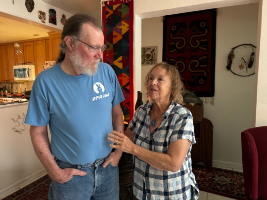
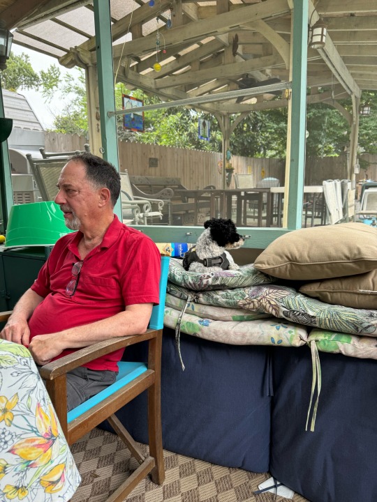
Thursday we hung out on the porch overlooking the pool at Jim’s and KC’s house. Their house is full of art and comfortable chairs. Dora immediately picks the top of a pile of cushions where she can watch everything.
We said our goodbyes and headed north to Waco Texas Mammoth National Park. It started raining as we left Austin. We got off I-35 south of Temple, TX to go to a grocery store. Roads had saw horses set up closing them. Tim was drenched running in and out of the store, even wearing a raincoat. The gutters in the street filled up with rushing red water. We carefully headed back to the highway on local streets.
Google Maps sent us under a railroad overpass. The water from surrounding streets was rushing into the dip below the bridge. It looked at least 3 feet deep. Jeanne hastily turned uphill and kept turning uphill until the GPS caught up and gave a new route back to the highway. We gave up on going to Mother Neff State Park and parked at the high point of the parking lot of the Cracker Barrel in Temple — away from the trees.
It turned out to be a quiet cool night.


1 note
·
View note
Text
MA to TX - Hot Springs National Park
May 8 to 12, 2024
We got a late start for a variety of factors and so started the trip behind schedule. Jeanne thought she had left plenty of time— after all, five years ago she could drive it in 3 days by herself — but no. We were driving hard to catch up. Boring interstates.
We saw an amusing half bridge in the Bronx. It had been turned into a parking lot. No wasted space.
We passed Sideling Hill, MD again, but didn’t stop. It was raining, as usual. We retraced our steps for the eclipse trip through WV and Kentucky.

Jeanne got a shot of the retaining wall at Kneeland Race Track in Lexington, Kentucky. It is painted to look like a bridge with a sky full of clouds.
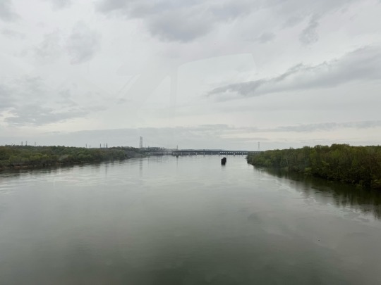
The bluegrass parkway was green — no more flowering trees. We picked up a different interstate and turned south to Tennessee. We rushed through Nashville and Memphis and took an obligatory shot of crossing the Mississippi.

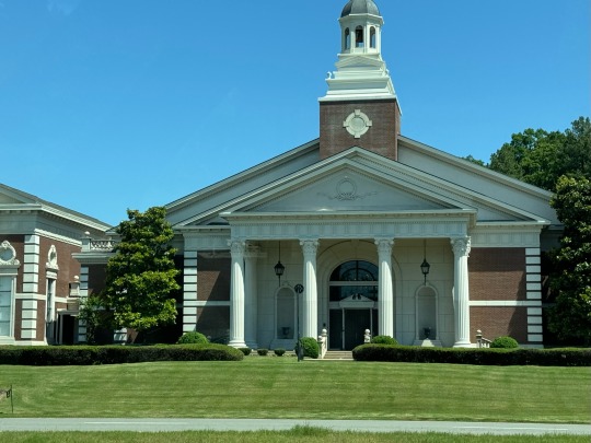
We admired the church architecture as we rolled through Little Rock, AR. It looks more like a courthouse than a church.
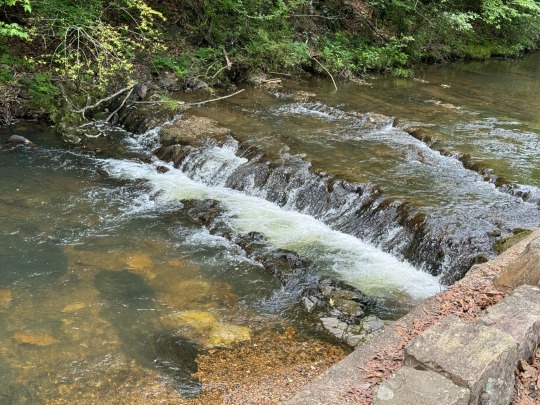
Whew, we are back on schedule and stop for lunch at Hot Springs National Park Campground. We walked Dora along the stream and listened to the little falls.
Hot Springs was and still is a tourist town with a row of architecturally interesting bathhouses that are part of the National Park.

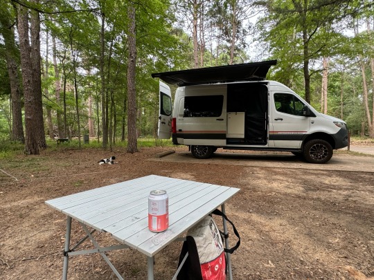
We drove through town then headed for Texarkana on the border. We were finally in Texas, but still a days drive from Austin. We stopped at Lake Bob Sandlin State Park, which confirmed Jeanne’s opinion that Texas has the nicest state parks in the country. Spacious campsites, clean and well maintained restrooms, and beautiful trees and scenery. We got long water-wasting showers, yay!
It rained the next morning which made for beautiful wildflowers. It poured hard through Dallas. We finally arrived at McKinney Falls State Park on a hill in the center of Austin, Tx.
Dora doesn’t like thunderstorms. Her eyes bug out and she pants in terror. We picked up some herbal tranquilizers but they don’t help much. Texas has a lot of thunderstorms while we are here.
1 note
·
View note
Text
New River and Gauley River National Recreation Areas
Thursday, April 11, 2024
NOTE: this didn’t publish in April.
Of course it was raining when we woke up. Jeanne checked the weather report and decided to reserve the last campsite at Bayside at Assateague for Saturday and Sunday since there is no rain in the forecast.
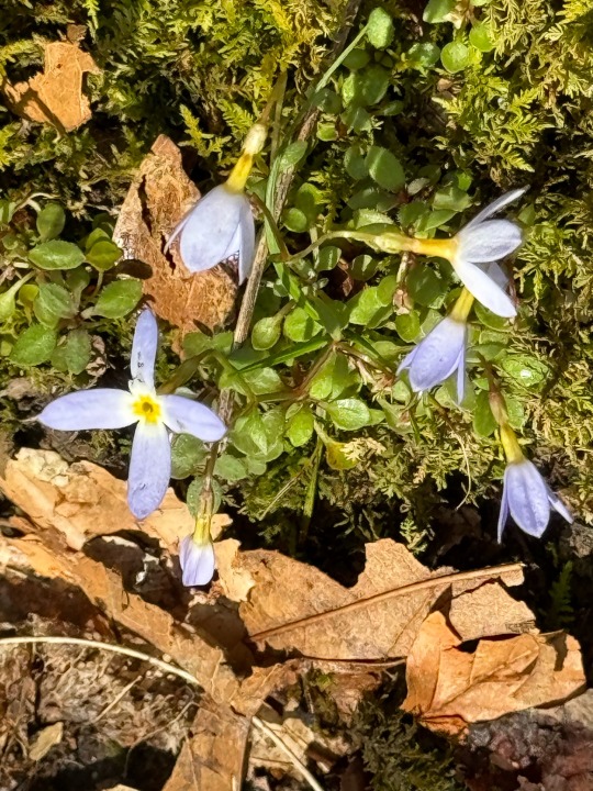
Tim and Dora discovered that the ballfield parking lot was also a trailhead for connecting to the New River National Recreation Area trail system. They come back to the RV and drag Jeanne out once the rain stops. We hike along a gentle trail along the rim. We see glimpses of the gorge filled with fog. It smells like spring in the southern Appalachians. We see bluets in bloom along the trail. Jeanne remembers them as the first flowers she saw while hiking the Appalachian Trail in Georgia.
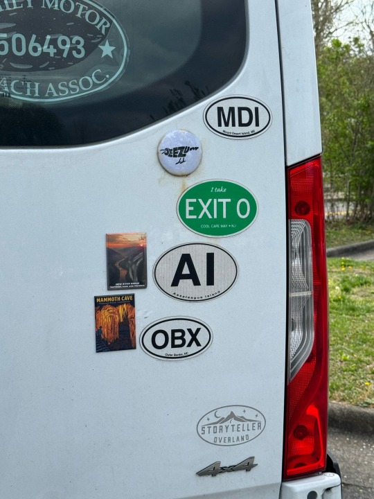
We drive back to the US 19, cross the bridge over the New River Gorge, and stop at the visitor center to take better photos. We pick up another magnet for the RV. We have been to many more parks, but only recently started collecting magnets.
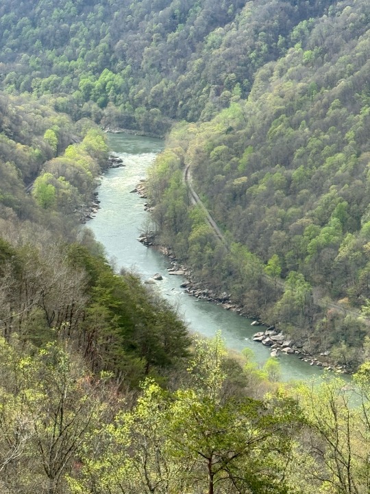
We drive 40 minutes to the Gauley River.
The New River National Recreation Area and the Gauley River National Recreation Area are renowned for their whitewater including V+ rapids. The whitewater in these two rivers is legendary and is generally considered the best in the East south of Maine.
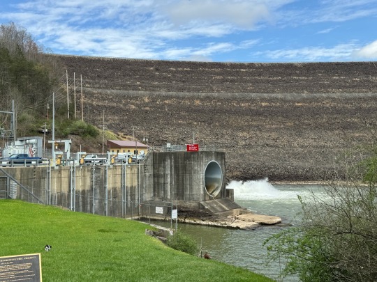
Jeanne first heard of the Gauley almost 40 years ago. It is spoken of with reverence by whitewater rafting guides further south. The senior guides are described as “S/he kayaked the Gauley” in tones of awe.
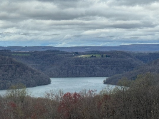
The Gauley whitewater starts here at the dam. In the fall, the lake waters behind the dam are drawn down to prepare for winter and spring melts. That is Gauley season for eastern whitewater enthusiasts.

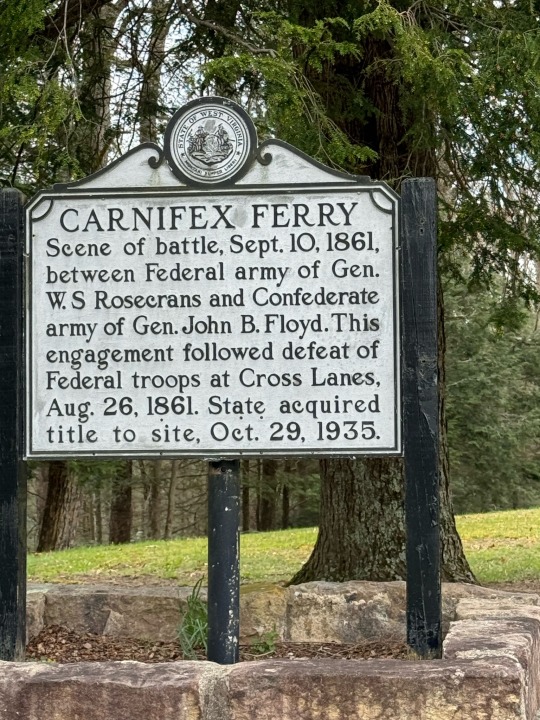
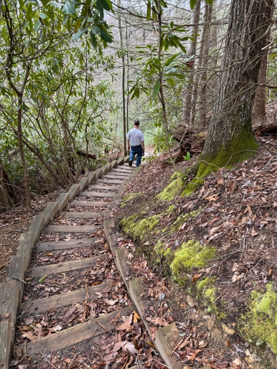
We drive back up to the rim of the gorge and around to a Civil War Battlefield park with a nice hiking trail that isn’t too hard on aging knees.
We have several overlooks of the gorge.
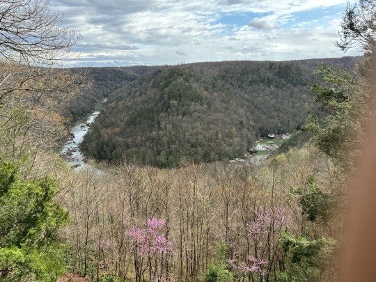
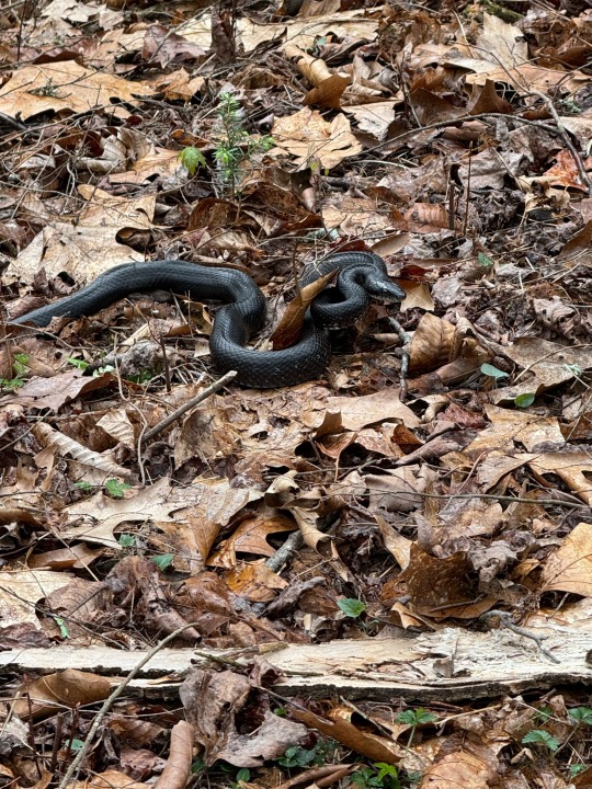
Dora begins to bark and growl up ahead. Jeanne rushes forward to where Dora is confronting a snake, fortunately from a cautious distance. We put her back on leash and keep a closer eye on her. The next overlook is down an unknown length of stairs. Tim goes down to the switchback to reconnoiter, but doesn’t see an end. We decide to turn back. The snake is gone.
Back on the road, it starts raining again. At least we got two hikes in two national parks in between the rain. The weather looks good on the coast for the weekend, so we head for Maryland.
We stop at the Maryland rest area on I-68 near the WV border. The Youghiogheny Overlook rest area eastbound provides a sweeping view of the Youghiogheny River Valley. Don’t ask us how it is pronounced — we haven’t a clue.
An hour later, we pass Sideling Hill again. It’s raining. It’s our 3rd stop at Sideling Hill this trip and it’s been pouring every time. In fact, it’s been 13 days where it has rained at least once every day despite all our efforts to find clear weather. The eastbound side parking lot is far too slanted for comfortable sleeping. We decide to continue on to the Cracker Barrel in Cumberland.
3 notes
·
View notes
Text
Bluegrass & Traveling Trivia
Wednesday, April 10, 2024
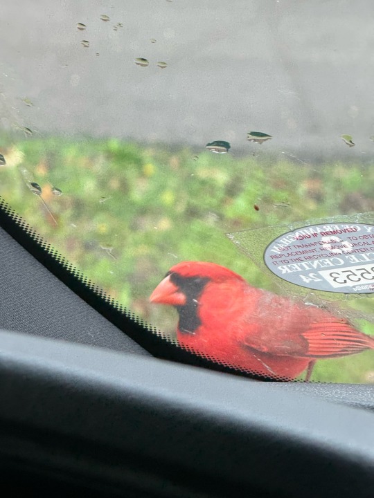
Of course we woke up to rain. Mammoth Cave Campground is a nice campground in an interesting place so we aren’t in much of a hurry to get moving. A male northern cardinal started tapping on our windshield presumably looking for seeds caught in the windshield wipers driving Dora crazy.
We return the Visitors Center which is much less crowded. Jeanne comes to a stop at the Women at Mammoth and History of the Woman Ranger Uniform temporary exhibits, while Tim prowls the geology.
“Check out this fossil— it’s a scaled pre-tree.”
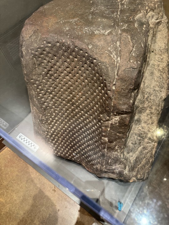

“OMG! In the 70s women rangers were forced to wear yellow miniskirts and gogo boots. Their uniforms were designed by fashion designers in DC. They had to go to court to be able to wear the men’s uniforms.”

“How do they map the different levels in a 2D map? Can you use a compass underground? How do you indicate depth?"

“A woman on a caving expedition in the Flint Ridge Cave system found the connector to Mammoth, making it the longest cave. She was the only one small enough to squeeze through a crack and saw a tourist trail.”
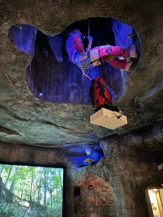
Mammoth Cave is a National Park and it is obligatory for the Visitor Center to have a movie about the park. This interior designer had some fun with the movie room. The movie projector is attached to the backpack of a mannequin of a caver who is rappelling down through a hole in the ceiling.
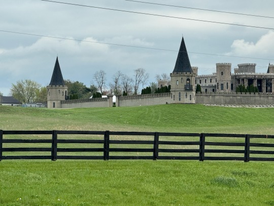
We drag ourselves away from Mammoth (where it is starting to rain) and leisurely retrace our steps through Kentucky. We get back Blue Ridge Parkway to Lexington KY. “Is this where the Kentucky Derby is run?” The co-pilot’s duties include answering the idle curiosity of the driver. “No, this is Kneeland race track.”
Kneeland is acres of perfectly manicured grass on artistically rolling hills crossed with immaculate white fences. It is decorated with a castle.
“What’s the capital of West Virginia? I see a gold dome.” The copilot is busy petting the poodle. “Well, it must be Charleston. I fail at State Capitols for 400.”

We finally head into West Virginia with a destination of New River National Recreation Area. Jeanne finds a likely boondocking spot at a ballfield in Fayetteville. There are road closures for flooding and bridges repair, so Google Maps sends us on thin winding roads.

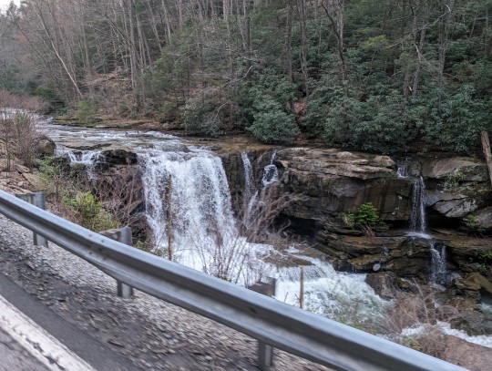
The speed limit is 55mph, but Jeanne doesn’t dare go over 35 around the tight curves. She pulls over often to allow the annoyed locals to zoom by — even around switchbacks steeply descending down a river gorge. WV 16 is a fabulous scenic drive (picture the NH Kancamagus with no tourists or amenities like signs or pullovers). You just have to wrench your eyes from the road to catch a glimpse of waterfalls and gorges.
We pull up at Fayetteville Huse Memorial Park where local school baseball games draw a small crowd of parents. Finally the field lights go out. The local sheriff patrols by but doesn’t bother us.
1 note
·
View note
Text
Mammoth Cave National Park
Tuesday, April 9, 2024
It’s pouring rain as we wake up. It has now rained every day of this trip —11 days so far. As we cross the Tennessee River, we compare weather apps to see where we can go with good weather. No luck. Any place with good weather will have rain by the time we can get there. Oh well. We had great weather when we really needed it yesterday.
Jeanne was scrolling maps looking for ideas when she spotted Mammoth Cave National Park. It’s a couple hours away, and we could get in our daily steps without getting drenched. Perfect!! We set Google Maps for Mammoth Cave.
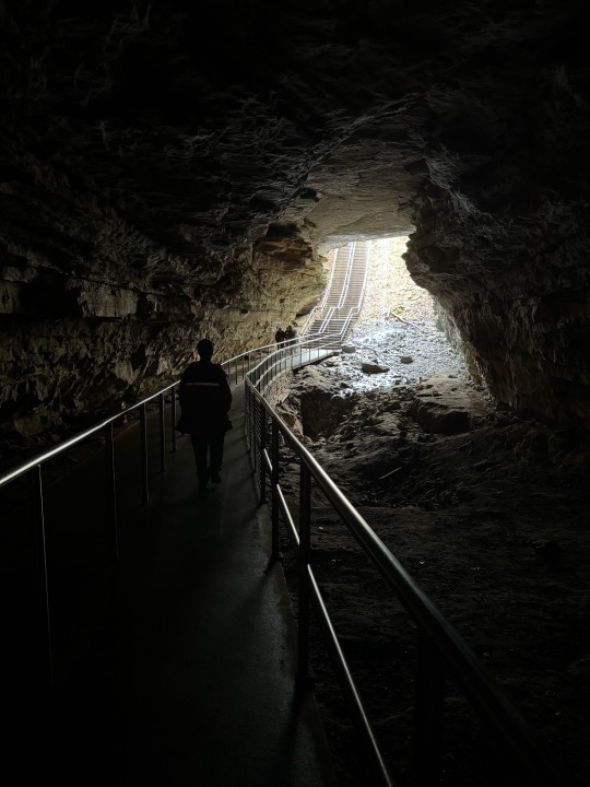
This is not an original idea. We grab the last spot in the campground. We luck out and get the volunteer host site which has power and water. None of the rest of the sites have power. We head over to the Visitor Center to check out the cave tours. The parking lot was packed with cars and RVs. The rain is torrential and the entrance sidewalks are blocked with large puddles. We buy tickets for the self-guided tour and walk down a steep trail toward the historic cave entrance.
The entrance is framed by a waterfall.
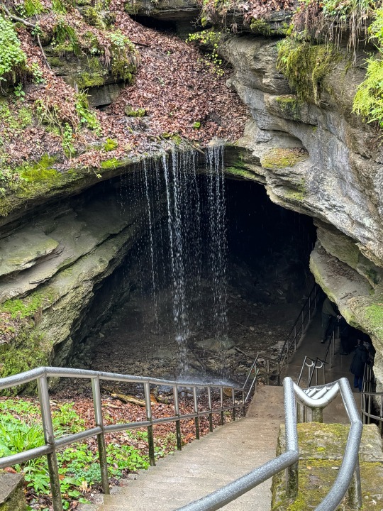
We turn in our tickets to the waterproofed ranger at the cave mouth, receive the safety talk from the next ranger who is trying for a career in standup. “If you are bitten by a bat, once you stop screaming, see a ranger who will calm you down with stacks of government paperwork on the dangers of rabies.”
Charmed, we head into the Twilight Zone of animals that live near the entrances to caves.
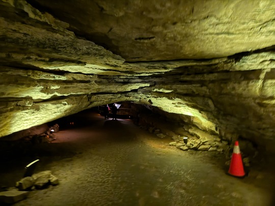
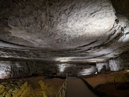
This is not like Carlsbad Caverns. There are no delicate cave formations. In the tourist area, anything delicate was removed in the 1800s.
The cave was mined for gypsum by enslaved people to make gunpowder for the War of 1812 and beyond.
This cave system is capped by sandstone which prevents the slow percolation of water that builds stalagmites, so there are few formations. It has 5 layers cave rooms as mapped that have been carved by different levels of water before entering the Green River.
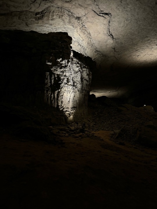
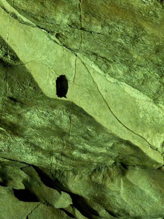
Jeanne asks a bored ranger where all the bats are. He says that 90% of the bats have died of white nose syndrome but points out one on the wall. They are 1.5 inches long, and look more like a caterpillar.
We carefully walk the path past WW1 memorial stones and rock formations into a huge oval room that was carved by a river of water.
We stop by the remains of the saltpeter works where gypsum was processed in the 1860’s and sold to DuPont. The sign said it was mixed with turnip and ox blood. Highly dubious, Tim asked the ranger who clarifies it was mostly tree ash. He called it “guide lore” where a good story takes on a history of its own.

The Visitor Center was still crowded, so we headed back to the campstore for showers. Much refreshed, we headed back to the campsite, plugged into power and decided to take advantage of the abundant electrons to cook several days of meals.
After dinner we headed out for what we thought would be a quick stroll around the campground, but stumbled onto a hiking trail where Dora could run. After a day in the rain, an hour’s walk under heavily overcast skies was a treat.

1 note
·
View note
Text
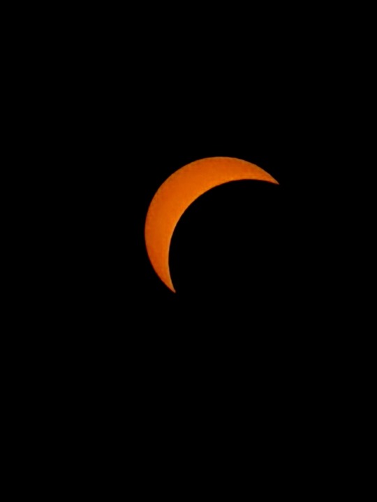
Eclipse Day
Monday, April 8, 2024
Eclipse day dawned with early rain and heavy fog. The birds had been singing enthusiastically since 3:00am. So much for birds being quiet when it is dark.

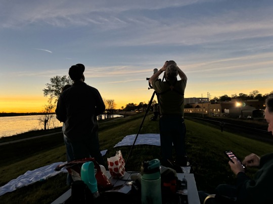
Tim comes back from the casino with news that the weather reports are looking good. We hang out in the parking lot with the other RV owners, drink coffee, admire each other’s RVs, and discuss the best place to watch.
We head to a small parking lot for a fishing boat access to the river next to the casino and make food for Dora.
Backpacks full of eclipse-watching equipment, we climb up the grassy levee with chairs and a folding table. We settle in and watch the river roll by.

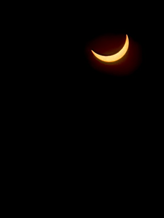
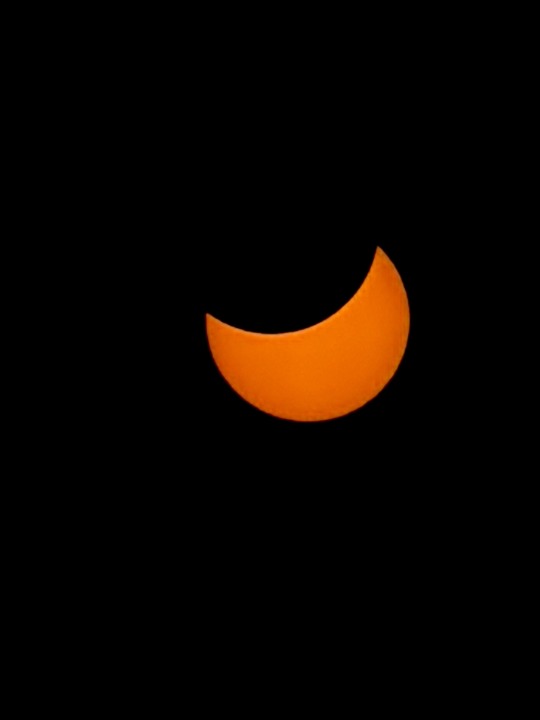
Andy announces he sees the first bite out of the sun. We hastily unpack the eclipse gear, don our eclipse glasses and start taking photos.

As we approach totality, Andy Jr. — Tim’s nephew from Kansas and his wife Shante arrive. Andy Sr had been vectoring them in. They had been caught in traffic, but arrived just as it was starting to get cold.

While we are waiting on the levee, the transportation industry carries on around us.
On one side of the levee, two huge barges approached each other from opposite directions.

On the other side, a freight train passes below us.
We get ready for totality as the sun shrinks to a sliver.
The lights come on in the casino parking lot.
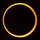
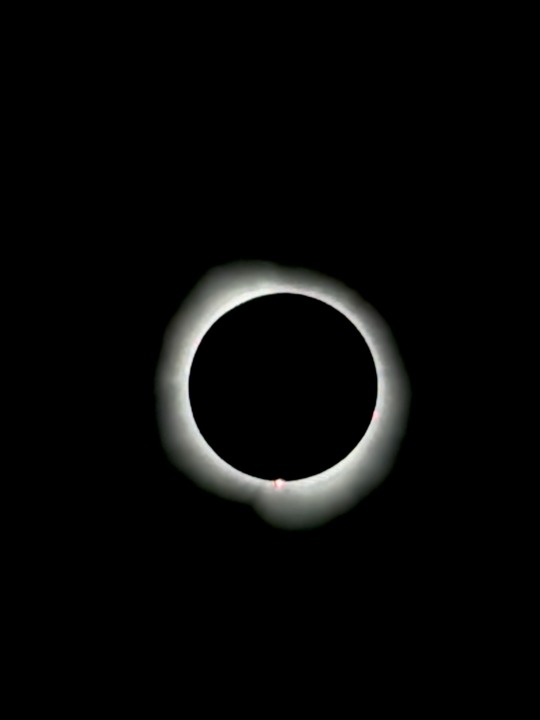
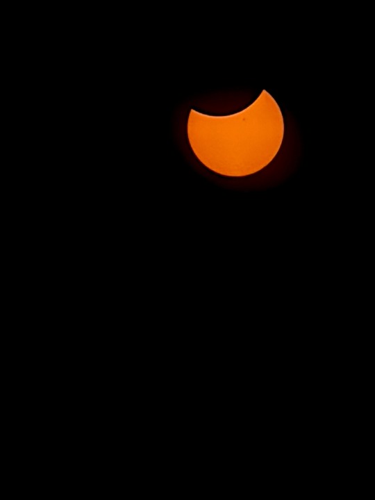
Totality! The Diamond Ring! We had never seen it before — the last sliver of sun shining between the mountains on the moon. It only lasts a second. We didn’t try to take a picture, but Andy took a fabulous shot with superior equipment than a smartphone.

“What’s that orange dot? Do you see it?” We all did. Jeanne grabbed her hand monocular and said “I think it’s a solar flare!” Actually, it was a prominence, but close enough. Flares disconnect from the sun and some head toward earth causing auroras and problems with the electric grid. Prominences are giant spouts of plasma that shoot out from the sun like loopy filaments, but stay connected.
The sun has an 11 year cycle of activity and this year is the peak of its cycle. During the 2017 eclipse, the sun was still in the low activity part of its cycle so we didn’t see any activity.
The night lights in the casino parking lot turn on. Swarms of midges swirl around Tim. The sky is twilight dark.
Andy Jr has brought a white sheet to spread on the ground that now has shimmering bands of light that appear to squirm like snacks in a moire pattern. Because the light from the sun is down to a single point, it has strange properties of parallel lines of light.
Suddenly, the we see the diamond ring again — the first bit of sunlight as the moon shadow depart. I hastily aim my camera upriver and catch the last bit of the moon shadow departing, heading northeast. I wish good viewing my friends up north. It is suddenly bright out and there are golden sunrise colors over the Mississippi River.
Most of the people on the levee leave with the moon “show’s over”, but we linger. The three families don’t see each other often and we are all so excited and awestruck. Finally we pack up and head down to the parking lot. We all have different plans and places to go.
We take a last group photo to memorialize the day. Andy calls us the “Umbraphiles” — shadow lovers. Andy, Andy, and Shante head for a BBQ restaurant to charge their truck. We head east for a town with better cell service because Tim has a Zoom meeting.
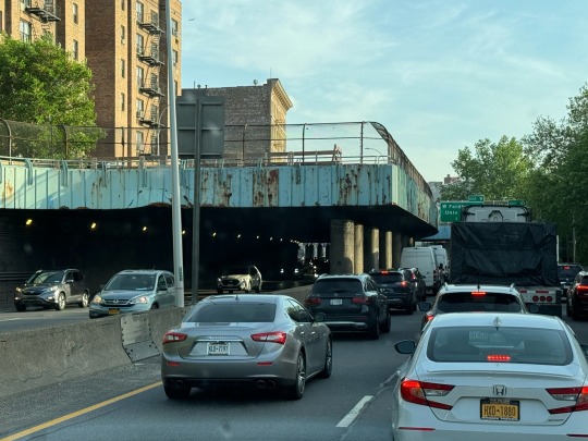
The traffic was light leaving Cape Girardeau north into Illinois. Our arrival time in Paducah, KY was 5:22. As we approached the Ohio River crossing, the time went up and up. Google Maps algorithm did its trick of packing the side roads. Jeanne fell for the shortcut. We were stuck on a side road a half mile from the bridge for over 2 hours.
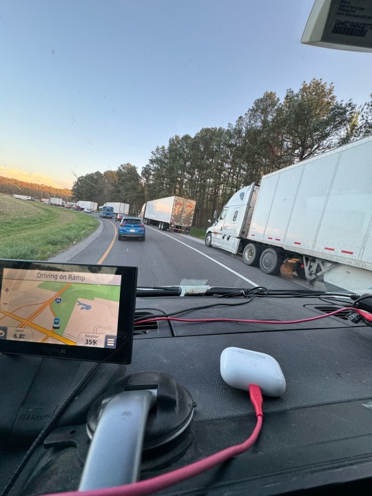
Tim cooked dinner, then started his Zoom call. We arrived in Paducah at 7:53. The parking lot at the Paducah Cracker Barrel was crowded with RVs, but still had spaces in the RV parking area. We gratefully settled for the night.
1 note
·
View note
Text
Sun & Shadow
Eclipse Day April 8, 2024
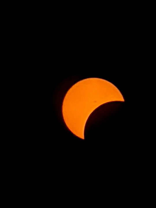
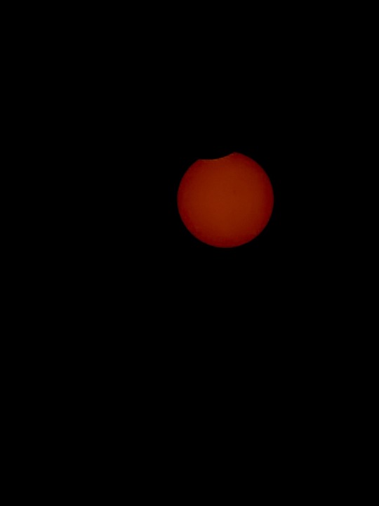
There were so many fun photos to show that we had to split up the posts. Here are the best sun photos that Jeanne took with her smartphone, a solar filter, and the Solar Snap app.
Note: the sun was always the same blinding white. My app was changing the amount of light it let in so I could get a good focus, and that changed the color.
First bite…
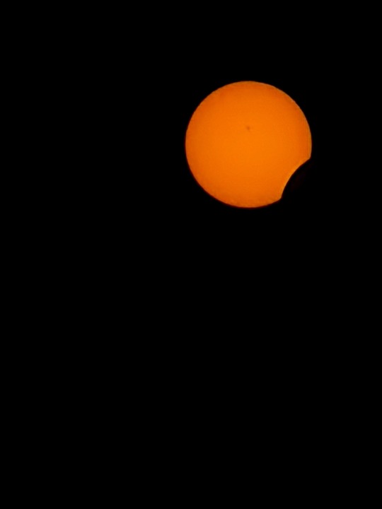
30 minutes in…
10 minutes to showtime…
Look at the solar prominences in the lower right quadrant at edge of the sun. They are a flare of plasma ejected from the sun. They were visible to the naked eye as an orange dot we all saw. Absolutely incredible!!
Moon departs…
Last bite as the moon heads northeast.
3 notes
·
View notes
Text
Mississippi River
Sunday, April 7, 2024
Dora and Tim have a great time playing in the wet morning grass outside the Paducah Cracker Barrel. There are smells beneath every shrub. Then we load up and head out toward Missouri.
As we get closer to the Mississippi River we see more levees, including this bridge that looked like the steel overhead could be lowered to protect the town.

We drove through Cairo (pronounced Karo like the syrup) at the confluence of the Ohio and Mississippi Rivers. It is the only town protected by levees on all four sides.
It was depressing to see what the change to overland trucking has wrought to what used to be a prosperous river city. The town was full of disintegrating abandoned homes, factories, and businesses.
We cross the Ohio River into Illinois and parallel the Mississippi through very rural roads. Much more interesting than the interstates.
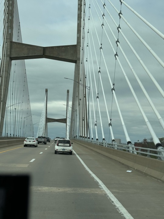
We finally cross the Mississippi River into Missouri at Cape Girardeau ("jir-AR-doh"). Beautiful bridge into a much larger city than Jeanne expected. According to the city website, they had 15,000 visitors for the 2017 eclipse and are expecting 20,000 this year.
Compared to the two other eclipses we have seen, they don’t seem prepared. There are no signs for places to camp or park.
To our horror, we have no cell service. It must be all the visitors saturating the cell towers. We can’t look up information or addresses with any reliability. Phone calls don’t go through. Text messages are hit or miss.
We stop at the local sports field where there are a number of youth games on the multiple fields. We look for an official to ask where RV parking is. Two friendly Parks & Rec men say they don’t know, we can’t stay here and here’s the name of a good BBQ place.
After they leave, a Black woman named Bertha comes over and tells us that we can camp at a vacant lot near her house, and that we should also try the casino. The casino was on our list of places to try, so we thanked her and went there.
Did I mention that it was raining again? This is so depressing for eclipse watching. It’s less than 24 hours to totality and the weather is miserable.
To our surprise, the casino was not charging for overnight parking. They were very gracious and friendly. We had a Zoom call at 3:30, so we went into the casino to mooch wifi.
The casino had a spot set up to take selfies, so we took advantage. The manager helpfully took it for us. Notice the raincoats.

The casino had a display of a DeLorean sports car. To our surprise, someone got in and drove it out the revolving door. It barely fit, so they were very careful.


We went back to the casino every couple hours to check the weather. Not good. We make plans to leave in the morning, but where?
Tim’s brother Andy arrives and parks next to us in the parking lot. Andy says he has been ODing on cloud coverage sites. Us, too. If you ever want a list, we have a half-dozen bookmarked, and Andy even has more.
We have dinner together on in our RV and make more plans. Bertha stopped by to make sure we were ok. Amazingly considerate.

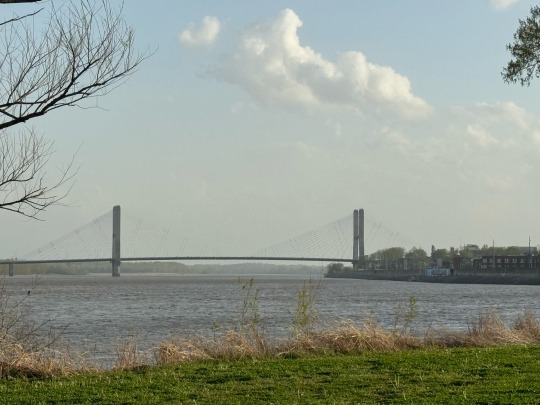
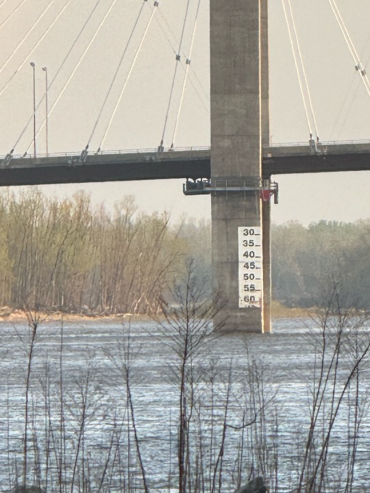
The Mississippi is close so we take Dora for a long walk on and around the levees. This is the same bridge from the shore.

We watch barges and their tugboats.

We speculate on the sign on the bridge and then zoom in to see that it marks the clearance under the bridge.
The sky is stormy-looking, but not actively raining. We decide to check the forecasts in the casino in the morning (still no cell service) and decide then.
3 notes
·
View notes
Text
West Virginia to Kentucky
Saturday, April 6, 2024
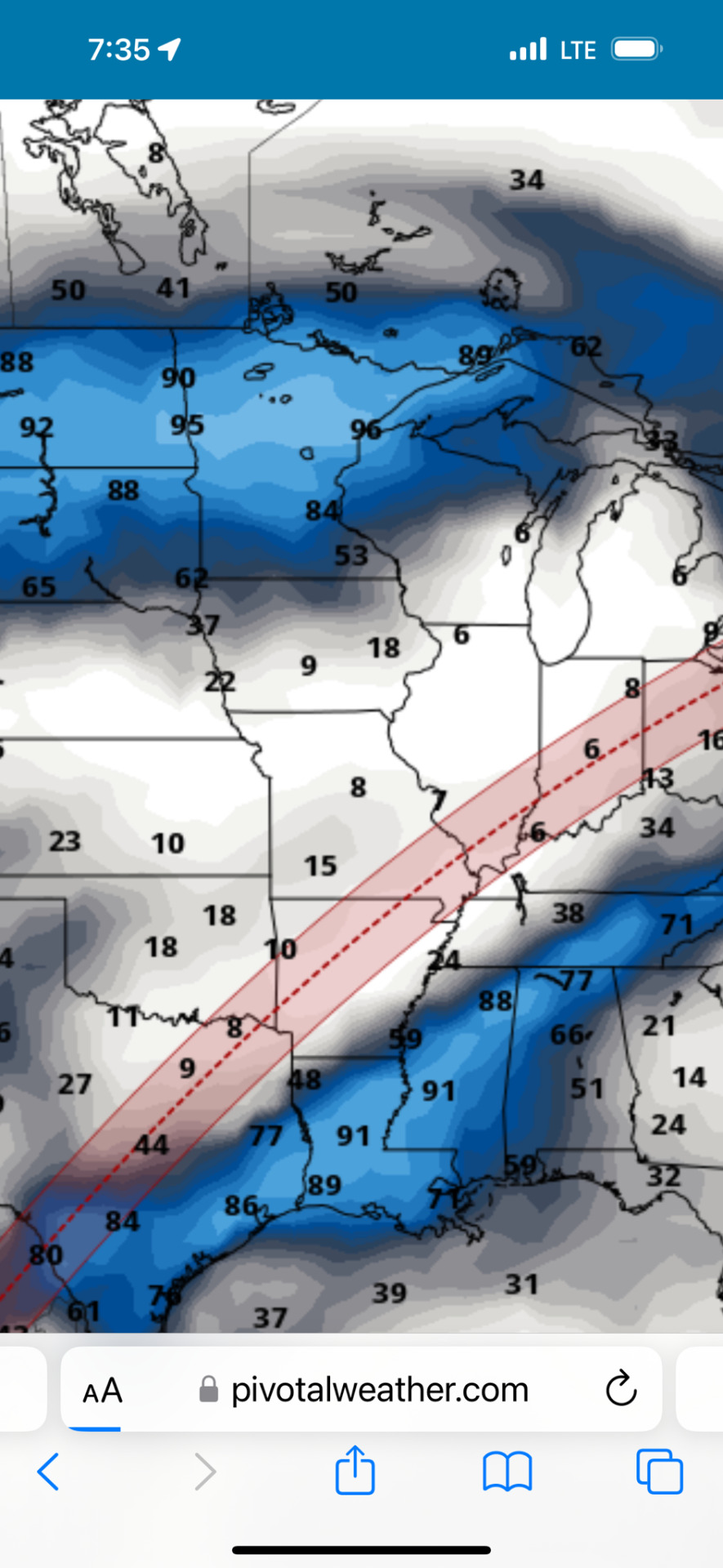
We decided to do a long driving day so we could arrive at Cape Girardeau, Missouri on Sunday morning and scout it before the eclipse. Tim’s brother Andy is going to meet us there. The weather looks good two days out from the eclipse, but who knows?
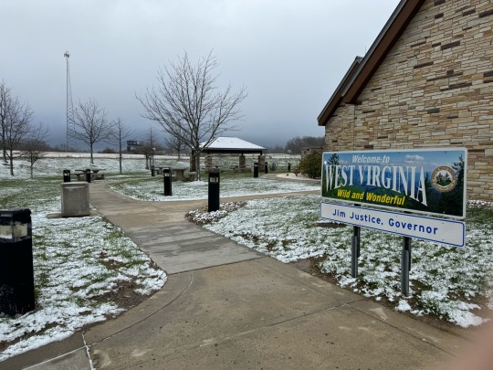
We get on I-68 into West Virginia. It is snowing. Not very hard, and only a dusting of accumulation, but still. Snowing, on a trip where it has rained every day. Ominous.

West Virginia is beautiful but the weather is not.
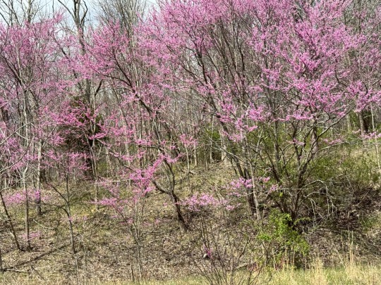
After several hours we drop down into Kentucky where it is spring and beautiful.
We stop at a rest area where a historic mansion from the 1860s has been converted into a rest area building. Fortunately, the bathrooms were modern. Dora played on the lawns.

We pass a park with a sizable backup to get into the horse race or horse show. We are behind a trailer labeled Show Horses. We quickly leave it behind because we don’t need the left turn lanes.
The Bluegrass Parkway in Kentucky is a fabulous drive. It’s a divided limited access highway with beautiful lawns, houses, flowering trees and the famous Kentucky Bluegrass.
We stayed at the Cracker Barrel in Elizabethtown, Kentucky.
1 note
·
View note
Text
Back to Sideling Hill
Friday, April 5, 2024
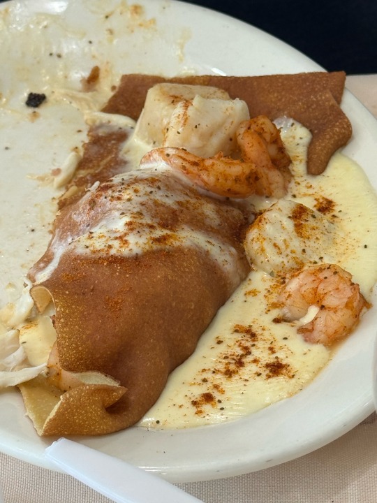
We were tempted to stay another day at Assateague, but when we looked at the Google Maps driving estimate, we realized we needed to leave today. Missouri is looking still better, so we will go in that direction and not Maine. But first, we need to charge the battery in the RV, so that means we need to buy breakfast. Ocean City and the Bayside Skillet -- a fabulous breakfast place on the water with gluten-free crepes. The seafood crepe is to die for.
90 minutes at a laundromat, and we are ready to go. Jeanne strikes up a conversation with a grandmother and her 3 year old granddaughter. We show them the RV, but the granddaughter is mostly interested in Dora.
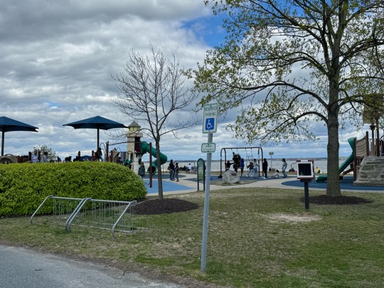
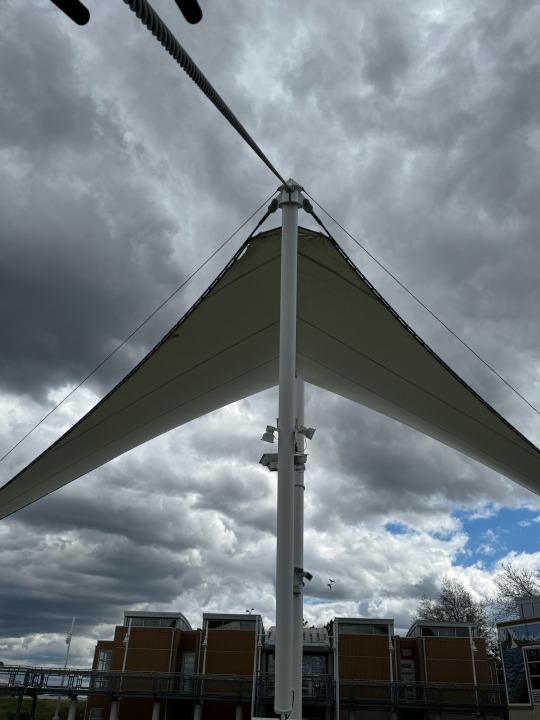
We stop for lunch at Sailwind Park on the Maryland Coast. The huge shade sail is visible from the highway. There is a large playground with three buses of children playing.
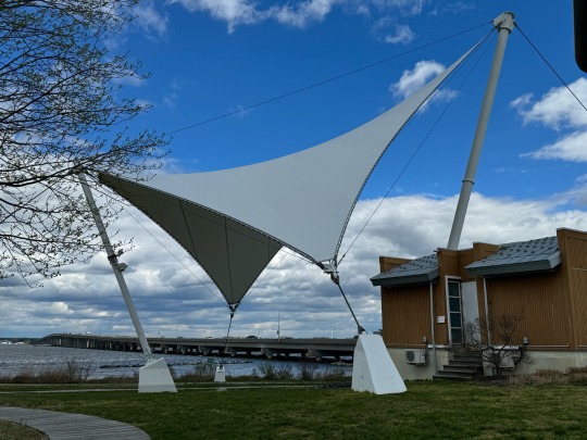
Tim and Dora go for a walk on the beach. Jeanne takes pictures of the sail.
Trees are blooming and the weather is lovely, until we get inland, when of course, it starts raining again.

We retrace our route across Maryland, hoping to cross West Virginia tomorrow. Sideling Hill is still a great place to stop for the night.

We arrive at Sideling Hill again around sunset. It is misting, but at least we can see the rock formation this time.

1 note
·
View note
Text
Assateague Continues
Thursday, April 4, 2024
It's a sunny day and reasonably warm morning in the high 50s. We move to a spacious new campsite with a water view. It has a small pond (flooding) but there is plenty of room for Dora to run. It even has cactus growing. After a cautious sniff, Dora avoids the cactus.

After a few hours of basking in the sun, the clouds start to roll in. Of course they do.
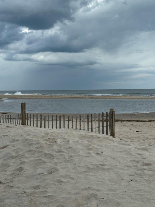
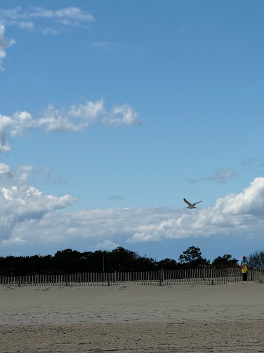
We grab our raincoats and go for a walk. First down to our private beach, which is flooded.
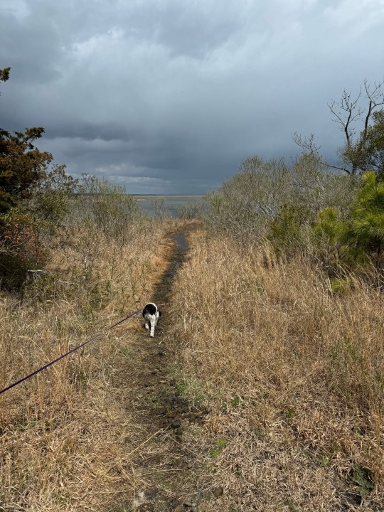
Then across the road to the ocean side of the island where we play squeaker on the beach and watch the birds and the waves.

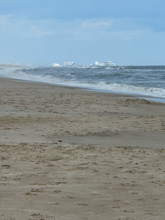
The weather continues to look better in the middle of the eclipse route. If we watch the eclipse in Missouri, we can meet up with Tim's brother Andy and maybe some other friends. If we go to Maine, which still has the best weather, then we don't see anyone and end up with a shorter vacation in part of the country that we often visit. Tomorrow is decision day.
2 notes
·
View notes
Text
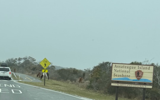
Escape to Assateague
Wednesday, April 3, 2024
Dora goes for her morning constitutional in the rain. Even with her coat, she is annoyed by the wet. Normally, she resists going back inside. Not today. A towel removes most of the water, but she hunkers down in the bed to finish drying off and warming up.
We push off east down Sideling Hill toward the coast. It is a short day's drive. We break it up with grocery shopping and Dora walks. The last couple of hours are familiar, and welcoming and rain free.
We arrive after the campground office has closed for the day. The office has listed which sites are unclaimed. We drive the campsite loops to take our pick. To say it has rained here recently would be an understatement. The picnic table in the campsite across from ours has a moat all the way around it, and a Mallard couple is enjoying paddling around in it.

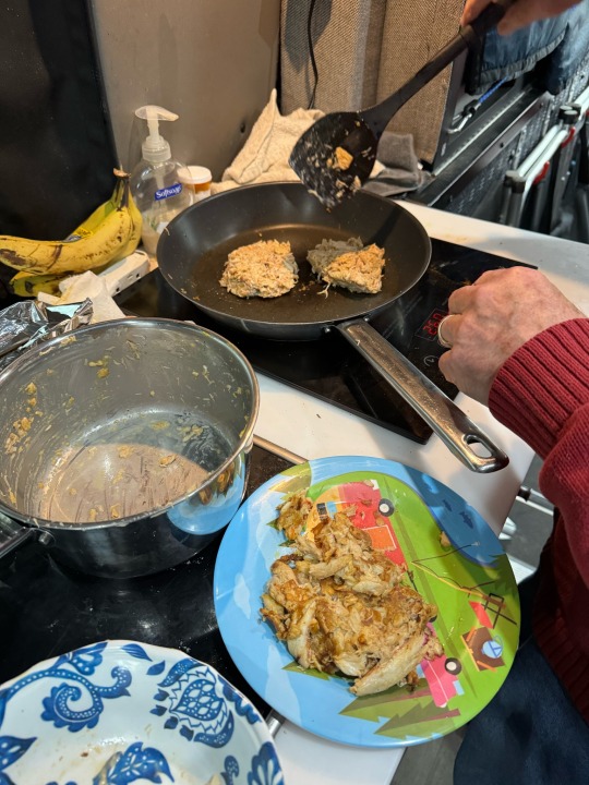
There is a phrase that starts,."When in Rome..." Well, we are in Maryland, which is known for its crabs, so for us it is crab cake time. Jeanne even bought Old Bay seasoning at the supermarket. We wind up with more crab cakes than we should eat, but the rain has stopped, and the ponies are glad we are here, so we gobble down every crumb.
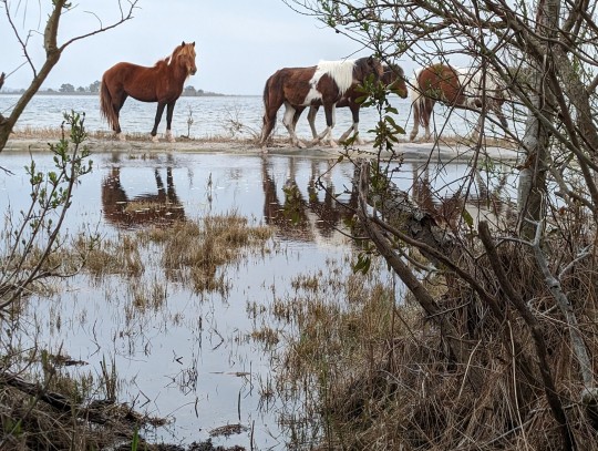
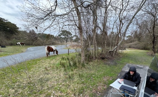
After sundown, Tim joins his weekly Zoom call at a table outside. The ponies stop by to see if they can get any tips via Tim's laptop.

Then it is off to bed to enjoy a rain-free night, the first in days.
1 note
·
View note
Text
Fleeing the storm
April 2, 2024
We woke to clouds and drizzle and lots of discussion among family and friends of a 3-day storm in the northeast. Niagara Falls is supposed to get snow. So much for our plan of hanging out around Buffalo until the eclipse. The RV is very good in snow, but it is very small to be stuck inside for 3 days.
Where to go? We leave Niagara Falls heading west through Buffalo and turn south toward Pennsylvania .
We drive through the Allegheny National Forest in heavy rain, but no snow. The weather maps show this storm as huge — it stretches from Virginia to Maine and it’s coming from the west. We head for West Virginia in the hopes that it will be intermittent rain instead of constant rain.
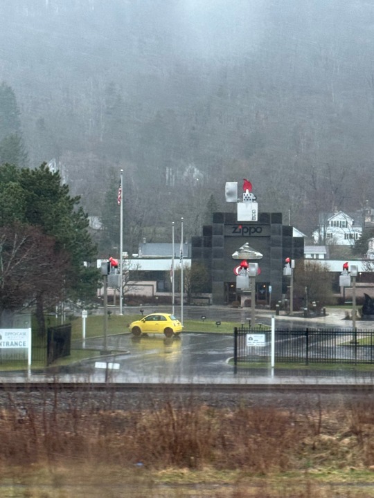
Pennsylvania has the Zippo factory. Jeanne’s dad had a Zippo.
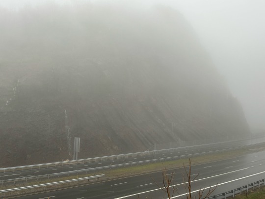
No luck. We stop at another favorite rest area — Sideling Hill in MD on I-68. The fog was so thick that visibility was difficult and it was still pouring. Sideling Hill has a beautiful road cut with fossil-bearing rocks that you can reach by a trail from the Welcome Center.
Dora does NOT want to leave the RV. We pick her up, put on her raincoat, and put her down outside. We are clearly crazy, so she makes the best of it.

The trail is closed, so we walk across the bridge over I-68 and admire the water pouring off the cliff.
Back at the RV, we study weather maps and try to make plans. Bad weather for days everywhere but the coast. Ok, if the only decent weather is at the coast, then let’s go to the coast.

Meanwhile, the eclipse weather forecast is changing. Texas is improving, but still bad. Missouri and Illinois are better and might be ok. If we go somewhere mid-eclipse-route, it’s reasonable to meet Tim’s brother and nephew and maybe go visit friends in Colorado after the eclipse. If we go to Maine, we won’t do that. Decisions, decisions.
We decide to hang out in the mid-Atlantics and decide on Friday.
1 note
·
View note
Text
Niagara not-Falls
Monday April 1, 2024
April Fools. Jeanne had a rare win at pinch-punch. (Or PPFDOTMNR, as Tim’s siblings call it).
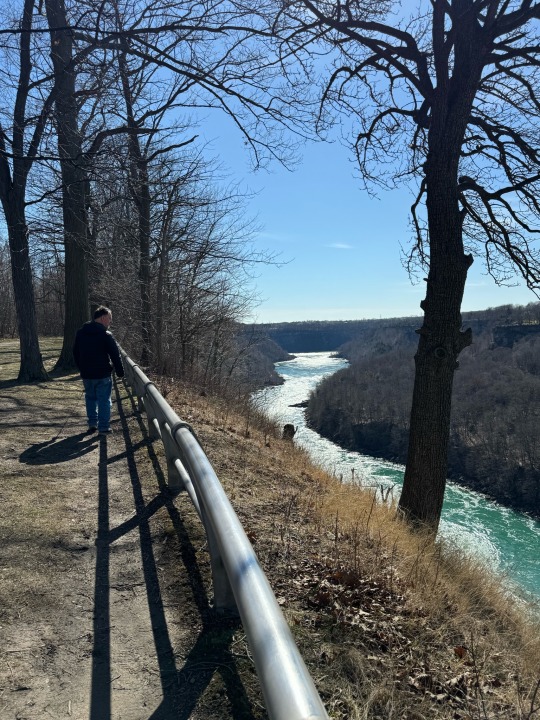
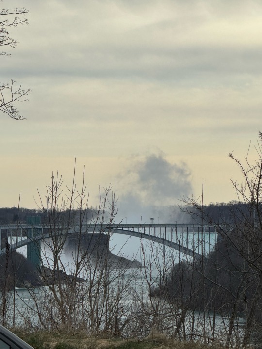
We head west on 90 toward Buffalo, because we have a vague idea about driving near the eclipse route. Buffalo, Vermont, and Maine look great for the eclipse — who would have guessed? But the eclipse is 8 days away and much can change. We are in no hurry to go anywhere, so we stop at Niagara, NY. The clouds had cleared into a mostly sunny day.
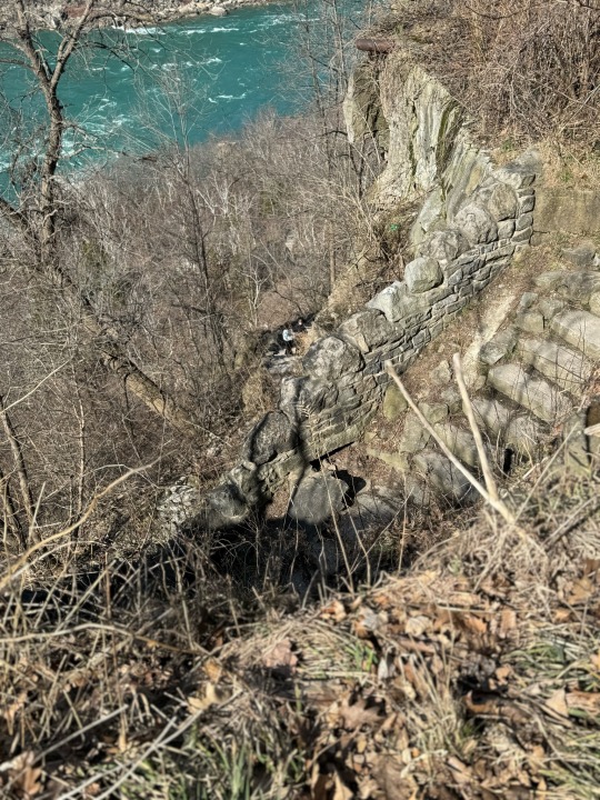
Instead of going to the Falls, we headed to the other side of town downstream of the Falls to look at the Niagara Whirlpool.
I can’t believe we have never gone here. There are two state parks along the Niagara Gorge, Devils Hole and Whirlpool State Park. We park at Devils Hole SP and walk along the rim of the Gorge upstream to the Whirlpool.
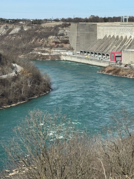
Looking back is a large generating station.
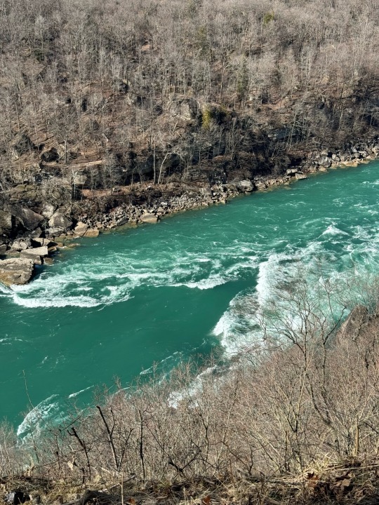
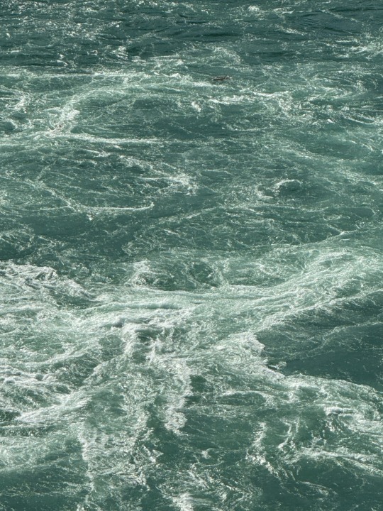
The rapids in the river look pretty, but from this height, the waves are probably 7-10 feet high.
At one point old stone stairs switchback down the cliff. We can see tiny dots of people down by the water. Looking at a topo map, the cliffs are over 300 feet high, but it seems much more than that.
The whirlpool is caused by the Niagara river taking a sharp turn right where these is an underlying fault in the rock that erodes faster and so the river has scooped out a circular “jacuzzi” in the gorge.
A large tree is trapped at the center of the whirlpool at the top center of the still below.
What we thought was going to be a quick stroll so Dora could pee turned into a gorgeous 3-mile hike.

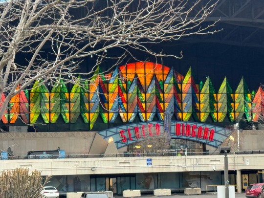
We parked for a peaceful night in Seneca Niagara casino parking lot.
1 note
·
View note
Text
Mohawk Valley
Easter Sunday, March 31, 2024
We got a leisurely start because we aren’t planning to go very far. The 10-day weather forecasts for the eclipse are disappointing. Texas is going to probably have rain. All the scientists we follow have had reservations in Texas for months if not years. We hope it gets better for their sakes, but Texas is out for us.
So where will we go? Let’s start with the Mohawk Valley Welcome Center on I-90 in NY. It’s a great place for Dora to run and play, it’s free, there are nice bathrooms, and it’s right off the highway about 3.5 hours from home.
Ok, that’s a no-brainer. Let’s go.

The welcome center is sited at Erie Canal Lock 13. When we get there, we find the lock is, um, open? Closed? What's the word for a lock where the dam has been retracted for the winter to prevent ice jams? At any rate, the water is flowing freely through the canal. At points on the canal, the banks remind us of a stony seashore at low tide.

Dora is happy to chase squeakers on the huge grass lawn below the lock.
On every trip, mechanical challenges come out to meet us, and this one is no different.
First, a pin broke on the sensor that tells us if the sliding side door is ajar. It chimes a warning now every time we shift to drive, but the driver can see from the side mirror whether the door is okay or not, so it's just a minor annoyance.
Second, the furnace is acting up. It starts to turn on, sputters a few seconds, and turns off again. Lather, rinse, repeat on about a 15-second cycle. We put insulation on every window, add a third blanket to the bed, turn the furnace off for the night, and hope it won't get too cold inside.
Spoiler alert: we lived through the night. It was so cold by 4:00 am that we couldn't sleep. We turned the furnace back on, and it started right away, warmed the cabin right up, and we got to go back to sleep until sunrise.
1 note
·
View note
Text
Hatteras Island to Virginia
Tuesday, March 12, 2024 We start the morning with a long walk on the beach.
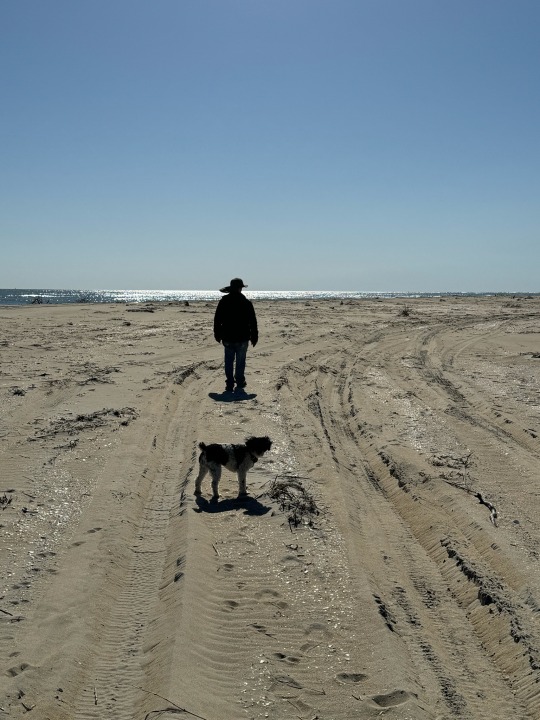
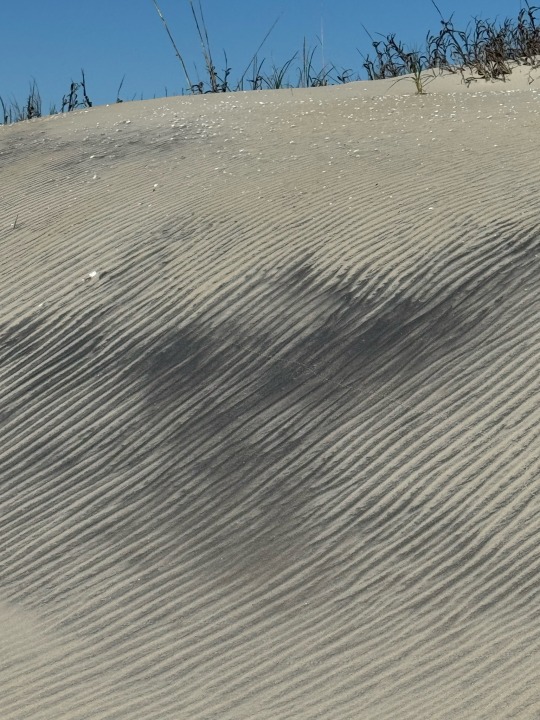
The wind has made striking patterns on the sand.
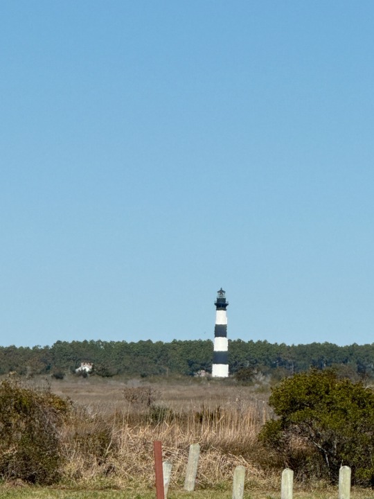
Another historic lighthouse in the distance. I think it is the Bodie Island Lighthouse, but we never got close enough to see the signs.
We watch the birds. I had a hard time picking the one video per entry that Tumblr allows, but finally settled on the brown pelican soaring. (The videos of Dora running on the beach were really cute too.)
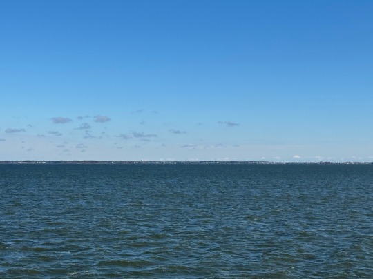
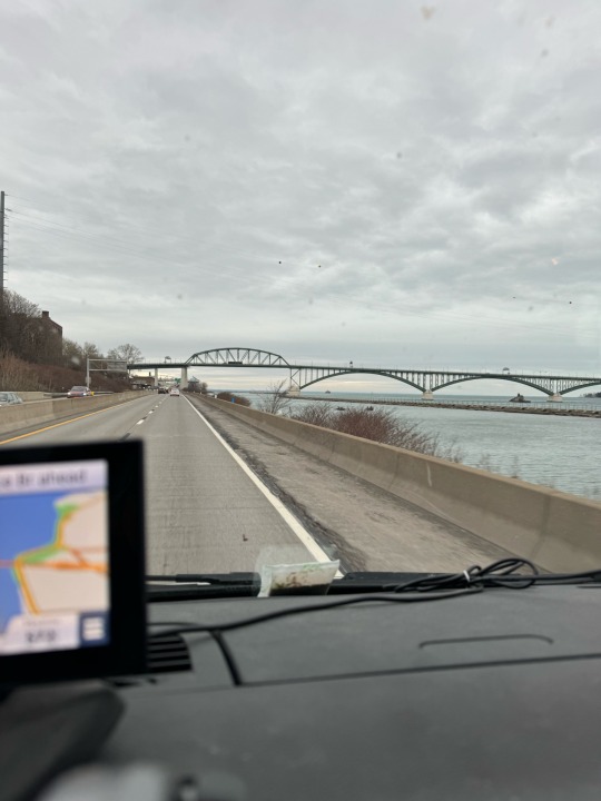
We pack up and head for Virginia over the Chesapeake Bay Bridge. It's a long flat bridge over the water with two tunnels under the shipping channels and an arching bridge at the Virginia end.

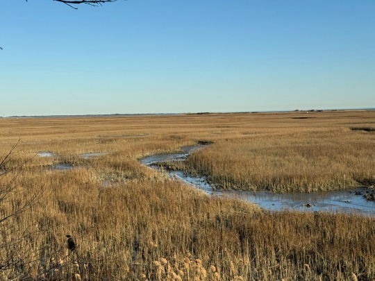
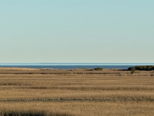
We camp at a rest area at end of the bridge. It's a quiet area at this time of year. There are nature trails out of the truck parking area, so we go for a walk down to the marsh.
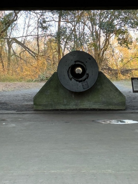
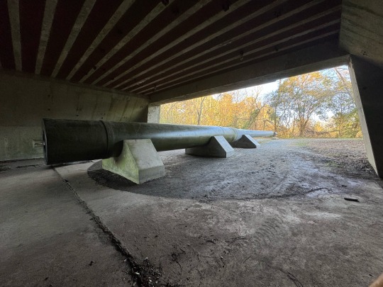
There is a historic WW2 cannon aimed out at the bay. The four-lane highway goes over it. The approach is an interesting photo with the shell at the end of the circle. But as I walked around the cannon, it was huge! Keep in mind, this is an obscure rest area on a not very traveled, not divided highway. No signs, nothing. It was fabulous.
There is a long staircase up to a lookout on a steep ridge with sweeping views of the marshes out to Chesapeake Bay.
Wednesday we got up early and headed for home. We made it -- it was the usual NJ, NY, CT, MA run, so I'm not writing it up.
0 notes