#OpenTopography
Explore tagged Tumblr posts
Visit Tumblr Blog
Explore Tumblr blogs with no restrictions, modern design and the best experience.
Last Seen Tumblr Blogs


Fun Fact
The Tumblr office adopted Tommy, an 11-year-old Pomeranian.
Text
OpenStreetMapに標高データを組み込む - 標高データの概要とデータについて理解を深める
https://blog.takeho.com/incorporating-elevation-data-into-openstreetmap-get-an-overview-of-elevation-data-and-an-understanding-of-the-data/
OpenStreetMapに標高データを組み込む - 標高データの概要とデータについて理解を深める

OpenStreetMap(以下OSM)は、ユーザー主導で自由に編集・利用できる地図データとして非常に優れています。しかし、登山やハイキング、サイクリングといったアウトドア用途のルート検索では「標高情 […]
0 notes
Text


16.07
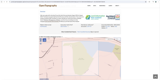
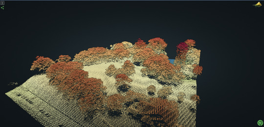
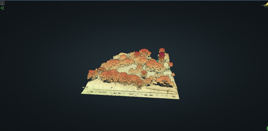
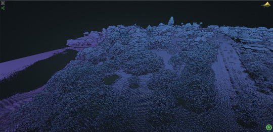
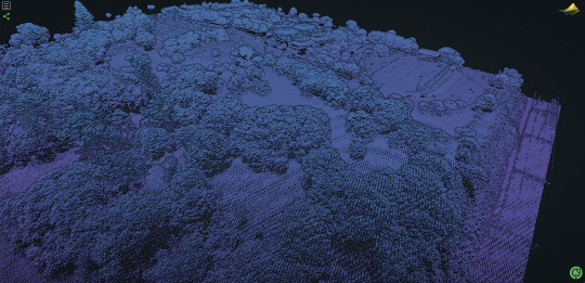
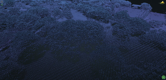
Found a free open source LIDAR topography tool called OpenTopography through the NZ Trees fb page: https://opentopography.org/
Allows you to select an area almost anywhere in the world and generate a lidar point cloud map from satellite imagery (I assume)
Started testing with the tree in Dove Meyer Robinson Reserve
Potential to integrate this data with my own photogrammetry to create even higher res models
0 notes
Photo

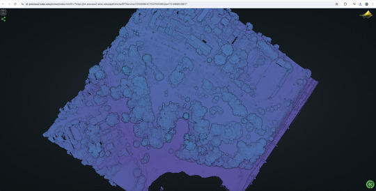
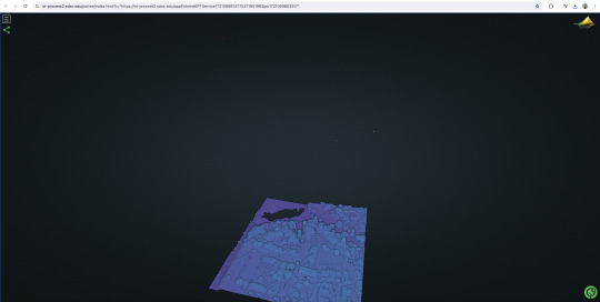
Badwater Basin in the Death Valley National Park, California. The omnivariance of the topography, calculated in Cloud Compare in a radius of 50m, reveals topographic features that were shaped by the erosion from water. Small topographic features such as the Badwater Road, the wash fans and the small registration difference in the laser-scanned data are also highlighted. From @opentopography: NCALM Project. PI: Thad Wasklewicz, East Carolina University. The survey area consisted of two polygons totaling 128 square km.
Airborne Lidar, collected in 2003 by National Center for Airborne Laser Mapping (Collector), National Science Foundation (Funder)
3D point cloud models available for download via @sketchfab: Wash sections: https://skfb.ly/6SsJ6 Subsampled area: https://skfb.ly/6SsJ7
#pointcloud#als#opentopography#survey#landscapefeatures#desert#omnivariance#cloudcompare#deathvalley#topostudio
0 notes
Text
OpenTopographys Lidar topographic and bathymetric data
https://spatialreserves.wordpress.com/2023/03/20/opentopographys-earth-data/
0 notes
Photo

“Day 17, #30DayMapChallenge: Land! Here's Slumgullion Landslide in Colorado. Data collected by NCALM for PI Dr. Hyongki Lee. Source: @OpenTopography” – @flotsam
0 notes
Link
Here is a super cool example of geoscience tools being used to create a 3-D digital model of the U.S. capitol!
0 notes
Photo
Point cloud model of the Greek volcanic island of Nea Kameni near Santorini, Greece, shown in axonometry with a series of extracted cross sections. Nea Kameni is a small uninhabited Greek island of volcanic origin located in the Aegean Sea, within the flooded Santorini caldera. Nea Kameni has formed over the past two millennia through repeated eruptions of dacite lava and ash. The LiDAR survey was conducted by a NERC ARSF flight campaign EU-12-12-137 and was published under: Pyle, David; Parks, Michelle; Mather, Tamsin; Nomikou, Paraskevi (2014): 2012 Santorini LiDAR data. figshare. Fileset.
source: https://doi.org/10.6084/m9.figshare.1138718.v2 Published on @opentopography Data: Airborne Lidar Survey Date: 05/16/2012 Survey Area: 17.1 km2 No. of lidar returns: 35,491,876 pts Point Density: 2.08 pts/m2
0 notes
Photo

Point cloud model, filtered and thinned, representing a salt refinery at Lake Grassmere, New Zealand. This airborne lidar was captured for the Marlborough District Council by AAM New Zealandealand and is made available by @opentopography.
0 notes