#SONAR Systems and Technology Industry
Text
07/11/2024 - Actual Play Report
Xenosphere I
NOTE: Usually in Industrial Fishing Simulator player character’s are called ‘Survivors’ and scenarios/adventures are called ‘missions.’ But I won’t necessarily use that language here.
Also I’m not trying to make this like the most perfect play report essay in the world, but I am trying to be somewhat thorough–so–know that.
Xenosphere I - Recording 1 - Introduction
Part I: Summary
Some time in the distant far future, when humanity has encountered a variety of extraterrestrial species and has spread among the stars, an ancient artifact is discovered on the oceanic planet Kestrasi Meridia (which is renamed from TOI-1452b, an actual possible exoplanet in the Draco Constellation). This artifact proves deeply mysterious, covered in strange writing, and is sending out a signal to a location deep underwater on Meridia.
A team of Survivors, made up of language, archaeology, and biology researchers, as well as nautical explorers is assembled to investigate the signal emanating from the strange artifact. These are the players of the game Xenosphere I for Industrial Fishing Simulator. They are sent on this mission from the Ixta-B87 research station by Dr. Helene Lazara and have been assigned the following roles:
Crew Roles and Directives:
The Concierge (played by Spencer) - Captain (must be filled)
Report in with Dr. Helene Lazara or check for any messages in the office.
Sir Barnaby Stephus III (Justin) - Xenolinguist
A few days ago, you requested some final analyses on the tablet’s hieroglyphics. Check the lab computer for any readout results.
deb (Emma) - Xenoarchaeologist
You’ve been researching the chemical composition of the artifact in relation to any compounds native to the planet Meridia. Your most recent test results should be available in the lab.
Shakes (Hannah) - Astrobiologist
Distract your peers from their tasks. (1) by alerting them of an incoming object of large size on the sonar computer; (2) destabilizing or sabotaging equipment; (3) lying. Or distract your peers from being suspicious of you by engaging in seemingly normal tasks for your role such as surveying the computer systems or asking for diagnostic information from NESSI.
You are a saboteur, a double agent–maintain absolute secrecy from your peers. You’ve received your orders from your implanted radio transceiver behind your ear. “Disable the emergency protocol system and sabotage docked submersible in Deep Search IX. Retrieve the Dialect Cube, designated Synta in the Xenosphere 45.909 W, -206.784 S. Assure you are the sole survivor. Press to alert.”
You are working with an organization known as the Inquisitorium who is operating in deep secrecy within the Neb Corp, working to sabotage their efforts to exploit ancient alien technology by capturing it for themselves. You do not know what a Dialect Cube or what a Xenosphere is.
You have an Inquisitorium contact, an android called ‘Pann.’
You can press your radio implant behind your ear to ping the Inquisitorium contact and will receive rendezvous information or other communications
You cannot communicate back other than to press your implant button twice for “yes” and three times for “no.”
Patback (Alex) - Nautical Technician
That power outage was strange. You need to check on the engine room and power supply.
Assure that the docked submersible craft in the docking bay is secure and available for use.
Pancake (Zoe) - Computing Officer
You kept it a secret from your fellow crew, but you touched the tablet with your bare hand and cut your index finger on its extremely sharp edge. You stopped the bleeding, but think you might have an infection. No one is allowed to touch the relic without safety equipment due to its radioactivity, and you need to check on the progress of your infection quickly.
Allegra (Bee) - Medical Officer
Prepare the high yield pressure suits for all crew found in the store room and assure all crew have oxygen tanks.
Check on the vitals of your crew mates. You might want to grab a bioscanner from the clinic.
Their underwater journey commenced aboard the research submarine Deep Search IX and travel had proceeded for several days for some several hundred nautical miles when a sudden power surge occurred. During the surge, the lights went dark, the entire crew miraculously went unconscious and the vessel descended rapidly by about 3200m near to the depth of the mysterious signal. When they awoke, they found that only a few minutes had passed and they went about their tasks as well as investigating the power surge.
The Captain of the submarine, a Khardimon called The Concierge (Spencer) went to the office and found a voice message from Dr. Helene Lazara which she had missed from last night.
Xenosphere I - Recording 2 - Message from Dr. Lazara
The voice message indicated that a power failure at another research station on the planet had blacked out communications and that the Captain should call Dr. Lazara soon to be briefed about a “situation.” Dr. Lazara also mentioned that she believed the artifact might be a key.
Meanwhile, Allegra (Bee) immediately went about collecting high yield pressure suits and oxygen tanks for the entire crew, but was intercepted by Pancake (Zoe), who revealed a strange wound on her hand to Allegra. Allegra examined the wound and found that the inside of the laceration was beginning to crystalize. Under a microscope, it appeared that the crystallization was growing out from the wound and the edges of the crystallization were rotating like saws, chewing through Pancake’s flesh and churning out crystal formation.
In the lab, Sir Barnaby (Justin) received the below readouts of a linguistic analysis of the glyphs that were found all over the artifact, which yielded strange and cryptic results. This was clearly some kind of alien language which was connected somehow to Khardimons, the enamel-based magnetically-sensitive alien species which appeared on Earth centuries ago. Also in the lab, deb (Emma) found a material analysis of the artifact which found a match. The artifact appeared to be composed of several chemical compounds: hydroxyapatite and fluorapatite crystals, and compounds from local corals. This meaning, the tablet was made of the teeth of some kind of creature in addition to the local coral component.
At this point, Patback was also in the engine room, where he discovered that the power surge which briefly knocked out the Deep Search IX had nearly drained all of the power cells in the submarine which would soon go into emergency power failure. Patback immediately changed out the power cells for fresh ones and then assessed the submarine’s auxiliary submersible in the lower docking bay. He surreptitiously packed himself some survival gear into the submersible (which can only seat 2) and went to join the others, but was briefly followed by Shakes who seemed to be checking out the area of the docking bay and cargo hold.
During this time, Shakes was receiving transmissions to their radio implant from an organization known as the Inquisitorium. Shakes was being ordered to distract the crew from their objectives but also to get to the signal first and retrieve an important relic for the Inquisitorium, betraying their crew mates.
At the control room, the Captain (The Concierge - Spencer) called back Dr. Lazara and a strange pick-up occurred in which most of the crew heard the following:
Xenosphere I - Recording 3 - Alien Transmission
At the end, the receiver was shot and a tracking signal alert popped up on the console, indicating that the Deep Search IX was now being tracked by an unknown source. Ixta-B87 station was downed. With some quick thinking, the computing officer, Pancake, managed to dislodge the tracking signal and the crew made their descent to the complex, where they were met by an alien structure mounted into the side of a geothermal vent some 3200 or more meters below the surface of Meridia’s dark waters.
This complex seemed to have an entrance protected from the water by a deep magenta energy field which the Survivors were able to pass through in their scuba suits unharmed. They entered into a large chamber where they encountered a closed impassable energy field and an access panel of sorts with a slot just the size of the ancient table they’ve been carrying. However, a little while before leaving they had just made the agreement to leave the tablet on their ship so they had to send a few people back to retrieve it before they were able to unlock the energy field and proceed further into the complex.
The next chamber was very large, containing two dais near the entrance which blazed with blue flames that smelled lightly of sulfur and at the opposite end two one-eyed statue-like figures who bared strange alien faces as seen in the image below (slightly resembling the Khardimon aliens). This room also had two magenta energy field doors and one green energy field door. But the Survivors didn’t have too much time to think before the statues began to wake up, chittering at each other before attacking the Survivors.
A pith collector head

A crappy map of the complex. (1) Entrance, (2) Trophy Hall, (3) Holding Tank, (4) Xenosphere

A somewhat fraught and desperate battle raged on for some time, the statue-like figures (pith collectors) using strange Khardimon magics to gain various upper hands, but the Survivors discovered that by coating their various weapons in the blue flame from the dais they could deal devastating attacks to these creatures. During the battle, there were losses, however. While it was Pancake who helped deal a death blow to one of the creatures, the other began to absorb its shattered friend and in the process melted Pancake’s mind, killing her. Additionally, the Captain (The Concierge) attempted to cast a spell but failed, causing a paradox from the Whoops! Table which resulted in her being swallowed by a dark vortex and being jettisoned into deep space thus removing her from the game. Ultimately, the remaining Survivors destroyed the last creature and were able to recover themselves.
However, during combat, Patback had managed to wander off through the green unlocked energy field into the complex’s trophy hall where he discovered many strange relics including a great slate-black khopesh and a fragment of an enormous glass-like dragonfly wing with a single watering humanoid eye in its center which kept Patback in a catatonic state as he stared at it. Luckily, he was rescued by his companions who would help to study this strange chamber, revealing at the end of the hall–a mural depicting an ancient Khardimon raising a khopesh above its head and holding the head of a slain victim in its other hand. An inscription of text matching that from the xenolinguist’s analysis of the table was also carved into the mural on removable stone cartouches which thus began the puzzle that would end the game.
Effectively, to summarize, the Survivors had to take clues from the analysis of the tablet, translating letters they learned there into words from an alien language, piecing together similar words into like meanings until eventually they could translate the puzzle in the final room of the complex–the Xenosphere, a large gyroscopic holding tank for an item called the Dialect Cube.
In one room, the trophy room with the alien mural, the Survivors found the word for liar/lies, and in another room, a strange room where they found a glass sarcophagus where a seemingly human woman wrapped in vines was entombed alive, they found the word for truth. Then in the Xenosphere, placing the cartouches of the words lies and truth on either end of the scale there would balance it and placing the word for balance found also in the mural room in the slot on the Xenosphere’s control panel would unlock the device.
When the Survivors had finished their puzzle, the Inquisitorium had arrived at the complex, surrounding the Survivors, handing over a large carbine to the saboteur Shakes and taking the Dialect Cube. The game ended with the remaining Survivors surrounded at gun-point, Shakes with the Dialect Cube in hand, and a mysterious organization at the forefront.
Part II: System Check, Play-Report
This game was very fun, but also very complicated. I knew it was going to be very complicated going into it. Mostly because of the xeno-linguistic puzzle I had devised to end the game and unlock the end of the “dungeon.” But, as soon as Justin (who played Sir Barnaby the xenolinguist) got his hands on the readout prop I had made of the alien language, he began working on deciphering it right away, which I would bet saved the game about an hour when they actually got to the point where they were gaining more clues for the puzzle. I was worried the entire week prior to playing that I had created a puzzle that was wayyyyy too hard for a reasonable person to solve within the one-shot TTRPG setting, but they did it. And using the system I arranged within the game, they paid as a team, 50 Lore points to receive one hint from me, and of course, received a little bit of guidance on the structure of the puzzle which I felt was not really something that helped them solve it but rather helped them to understand how to think about it.
Overall, I thought it was a fun experience. I had fun writing this game. I got to play with my linguistics chops which I always get a lot out of, and some of the repeat players like Bee (Allegra) and Emma (deb) said that they felt this was the best FishSim game yet and as newbies to TTRPGs in general felt like they got into their characters easier and had a more full roleplaying experience which made me very happy of course. Justin (Sir Barnaby) is a person that I’ve been playing D&D and other TTRPGs with for years and years and years–since the beginning and it was an absolute pleasure to have him and to see him immediately dive into the linguistics puzzle.
I am also glad that I got to have Zoe (Pancake) and Alex (Patback) join us as first timers to any TTRPG ever. It's been so great that FishSim is getting to see so many first time TTRPG players. RIP to Pancake who was absolutely eviscerated by the pith collector using the Eyes of the Architect ability, but it is what it is and Zoe had to leave anyway. Alas.
This is also the first FishSim game where we’ve gotten a lot of use out of the Whoops! Table which is rolled upon whenever a spell fails to cast. Unfortunately, it was mostly Spencer (The Concierge) who failed to cast any spells and died because of it, but in this game casting spells is extremely high risk, extremely high reward and I always warn all my players prior about this.
Once again, I am thinking of things to change mechanically in the game. I am thinking that Will is definitely not a necessary statistic separate from Stress. I am still pondering replacing it with Aware/Perceive or something similar. I think that could be beneficial. On the matter of spells–I am wanting to make spells a bit more sci-fi flavored so I’ve decided to rename them Compounds and I have decided that they are composed of ingredients in combinations of three which are combined in a device which helps a Survivor cast the Compound. When a failure occurs, a paradox occurs, and one must roll on the Whoops! Paradox Table to see what the resulting failure is. Thanks to Bee, I now have a list of 300 Compound recipes for these created by her swiftly programmed randomizer. So, I’ll be working on that for a long while, I’m sure.
Also thinking about Occupations as distinct from Species. Currently, FishSim only uses the term Occupation which refers to whether your character is Human, Android, Simulacrum, or one of three alien species. But I am wondering if it might be interesting to have Occupations as opposed to Species. That being said, it is still extremely helpful that every game starts with each character and player choosing a role on the ship and me sending them their personal directive. That really gets the game rolling and seems to be pretty fun for everyone prior to regrouping.
Part III: Personal Note
I put a lot of effort into Industrial Fishing Simulator, truly because I think it's fun to make my own TTRPG and I think it's fun to get my friends together in a room, play a silly sci-fi alien game, eat food, and gab. But I am also very grateful that people enjoy the stories I tell and see me as a good storyteller. And I’m glad I can make some of my friends’ very first TTRPG experience a good and memorable one.
I’ll be tabling Industrial Fishing Simulator for a couple months so I can edit in some of the changes I want to make but I’ll be back soon!
Thanks to everyone who reads these little play reports and who plays the game!
~ clio <3
4 notes
·
View notes
Photo

SAMS Surveyors: Understanding SAMS Surveyors: Setting the Benchmark in Marine Inspections
### SAMS Surveyors: Understanding SAMS Surveyors: Setting the Benchmark in Marine Inspections When it comes to marine surveying, the role of sams surveyors is indispensable. Operating under the highest standards, sams surveyors are often recognized for their expert evaluations and detailed inspections in the marine industry. This article delves into what makes sams surveyors a cornerstone in the domain of marine safety and reliability. First and foremost, sams surveyors provide comprehensive assessments of vessels. Whether it’s a small fishing boat or a large cargo ship, sams surveyors are equipped with the knowledge and tools necessary to perform thorough inspections. Their reports are critical for various stakeholders, including insurance companies, potential buyers, and regulatory bodies. The training and certification process for sams surveyors ensure that they are competent in handling complex marine evaluations. As part of their education, sams surveyors learn about different vessel types, understanding materials, propulsion systems, and safety equipment. This extensive training guarantees that sams surveyors can identify potential risks and problems that might not be obvious to untrained eyes. Furthermore, sams surveyors adhere to a strict code of ethics which emphasizes honesty, integrity, and professionalism. The ethos followed by sams surveyors means that every inspection is conducted with impartiality and thorough attention to detail. In the world of maritime transactions, having sams surveyors inspect a vessel reassures all parties of its condition and value. For instance, Sun Coast Marine Surveying & Consulting frequently employs sams surveyors due to their reputable service and reliable findings. The commitment shown by sams surveyors in their surveys helps ensure that all vessels assessed meet safety and operational standards before entering service or being purchased. Marine Survey Information becomes significantly enriched through the contributions of sams surveyors. Their findings often lead to essential maintenance tasks that prolong the life of marine vessels and ensure safer waterway travels. This category, Marine Survey Information, owes much of its advancement and relevance to the diligent work performed by sams surveyors. In scenarios where accidents occur or vessels falter, sams surveyors are often among the first called upon to assess damage and suggest repairs. The detailed reports produced by sams surveyors are pivotal in determining causes and potential liabilities. Thus, the role of sams surveyors extends beyond initial inspections into crucial post-incident analysis. Sun Coast Marine Surveying & Consulting stands by the excellence delivered by sams surveyors. Their ability to discern minutiae that might escape others underpins the trust placed in them by hundreds of maritime organizations annually. It's worth noting how technology has transformed the traditional practices of sams surveyors. Modern tools such as sonar readings, digital imaging, and advanced diagnostic software have been incorporated into the arsenal of sams surveyors. This technological integration enables more accurate assessments and reinforces the position of sams surveyors at the forefront of marine surveying innovation. Therefore, whether you’re considering purchasing a new yacht or assessing an old tanker for insurance purposes, involving sams surveyors is crucial. They not only provide peace of mind but also deliver concrete data backed by rigorous examination techniques. To sum up, the essential work done by sams surveyors sets benchmarks in marine inspections. With each vessel inspected, sams surveyors contribute immeasurably to maritime safety and efficacy. For anyone involved in nautical industries or owning sea-bound assets, consulting with experienced and ethical sams surveyors like those collaborating with Sun Coast Marine Surveying & Consulting is a wise decision. Remembering that the contribution of expertise from sams surveyors enriches Marine Survey Information significantly is imperative for all maritime professionals. For thorough, unbiased marine assessments, always trust the skills of dedicated sams surveyors.
sams surveyors
0 notes
Text
Marine Sensors Market Insights: Innovations Powering the Next Wave of Growth
The Marine Sensors Market is rapidly evolving, and its projected growth from USD 1.3 billion in 2023 to USD 2.0 billion by 2030 highlights its significant impact across various industries. With a Compound Annual Growth Rate (CAGR) of 13.2%, the demand for marine sensors is being driven by advancements in technology, increasing environmental monitoring requirements, and the booming maritime industry.
What Are Marine Sensors?
Marine sensors are specialized devices used in the marine environment to detect, measure, and analyze various physical, chemical, and biological properties. These sensors are pivotal in a wide range of applications, from underwater navigation and research to monitoring marine ecosystems and aiding maritime safety.
Market Overview
The marine sensors market is set for significant expansion due to factors such as:
Increasing demand for environmental monitoring
Enhanced use in naval defense systems
Growth in marine research and exploration
Download Sample Report @ https://intentmarketresearch.com/request-sample/marine-sensors-market-3221.html
Key Drivers of Growth
1. Technological Advancements in Sensor Technology
One of the primary drivers of growth in the marine sensors market is the continuous improvement in sensor technology. Modern sensors are more accurate, durable, and capable of providing real-time data, which is critical for applications like underwater mapping, submarine navigation, and maritime border control.
2. Rising Environmental Concerns
With the growing emphasis on sustainable practices, there is a significant push towards monitoring marine ecosystems to better understand the impact of human activities. Marine sensors play a vital role in collecting data on water quality, temperature, salinity, and biodiversity, which is crucial for formulating conservation strategies.
3. Increased Maritime Security Requirements
Nations around the world are investing heavily in maritime defense systems, with marine sensors being essential components of these systems. These sensors help in detecting underwater mines, submarines, and other potential threats, ensuring the safety and security of territorial waters.
Market Segmentation
1. By Sensor Type
Marine sensors come in various forms depending on their applications, including:
Temperature Sensors: Monitor water temperature for research and climate studies.
Pressure Sensors: Measure water pressure, important in oceanography and submarine operations.
Acoustic Sensors: Used for sonar systems and underwater communication.
Salinity Sensors: Critical for tracking salinity levels in oceans, useful for understanding marine environments.
2. By Application
The market is segmented into several applications:
Naval and Defense: Used in submarines, warships, and unmanned underwater vehicles for navigation and threat detection.
Environmental Monitoring: Track pollution levels, water quality, and marine biodiversity.
Commercial Shipping: Ensure safe navigation and monitor fuel efficiency.
3. By Region
The marine sensors market is geographically segmented into:
North America: The largest market, driven by strong naval and maritime research initiatives.
Europe: Growing focus on environmental conservation is spurring demand.
Asia-Pacific: Increasing naval investments and rising interest in oceanographic research are boosting growth.
Challenges Faced by the Marine Sensors Market
1. High Costs of Development and Deployment
Developing marine sensors with high precision, durability, and real-time data transmission capabilities involves substantial research and development costs. Additionally, deploying these sensors in harsh underwater environments requires specialized equipment and infrastructure, which can drive up overall costs.
2. Limited Power Sources for Deep-Sea Sensors
Powering sensors in deep-sea environments poses a major challenge. While advancements in battery technology have improved, deep-sea sensors often need to operate for extended periods, and recharging them is not always practical.
3. Data Overload and Processing Complexities
With the increasing capability of marine sensors to collect vast amounts of data, organizations are facing challenges in processing and analyzing this data in real-time. Efficient data management systems are essential to maximize the benefits of sensor technology.
Emerging Trends in the Marine Sensors Market
1. Integration of AI and IoT
The integration of Artificial Intelligence (AI) and the Internet of Things (IoT) is revolutionizing the marine sensors market. AI algorithms help in processing data faster and more accurately, while IoT connectivity enables the real-time transmission of data from remote locations. This combination is making marine sensors more efficient and capable of predictive analysis.
2. Miniaturization of Sensors
As sensor technology advances, sensors are becoming smaller and more lightweight, making them easier to deploy in diverse marine environments. Miniaturization also reduces the cost of deployment, especially for large-scale monitoring operations.
3. Growing Interest in Autonomous Underwater Vehicles (AUVs)
AUVs are increasingly being equipped with advanced marine sensors for a variety of tasks, including underwater exploration, pipeline inspection, and environmental monitoring. This is opening up new avenues for the marine sensors market as the demand for AUVs grows across both commercial and research sectors.
Access Full Report @ https://intentmarketresearch.com/latest-reports/marine-sensors-market-3221.html
Future Prospects of the Marine Sensors Market
The future of the marine sensors market looks promising. With continued technological advancements, especially in AI, IoT, and energy-efficient designs, sensors will become even more sophisticated, providing critical insights into the world's oceans. The increasing focus on ocean conservation and the rise of smart shipping solutions will further drive demand.
Conclusion
The marine sensors market is poised for substantial growth in the coming years, driven by advancements in technology, increased environmental monitoring efforts, and rising investments in naval defense. With a projected CAGR of 13.2%, the market is expected to reach USD 2.0 billion by 2030, opening up vast opportunities for innovation and application.
FAQs
What are marine sensors used for?
Marine sensors are used to detect, measure, and analyze various physical, chemical, and biological properties in the marine environment. They are essential in applications like underwater navigation, environmental monitoring, and maritime security.
Why is the marine sensors market growing?
The market is growing due to technological advancements, increased environmental concerns, and rising investments in maritime defense and research.
What are the challenges in the marine sensors market?
The main challenges include high development and deployment costs, power limitations for deep-sea sensors, and complexities in data processing.
How is AI influencing the marine sensors market?
AI is improving data processing capabilities, enabling faster and more accurate analysis, while IoT connectivity allows for real-time data transmission from remote locations.
Which regions are leading the marine sensors market?
North America is the largest market, followed by Europe and Asia-Pacific, driven by naval investments, environmental monitoring efforts, and maritime research.
Contact Us
US: +1 463-583-2713

0 notes
Text
Surveying Hydrographic | Epitome
Hydrographic surveying, also known as hydrography, is the science of measuring and describing the physical features of bodies of water. It involves mapping underwater terrain, charting coastlines, and assessing navigational hazards to ensure safe and efficient maritime operations. As an essential branch of surveying, hydrographic surveying plays a critical role in a variety of industries, including marine navigation, construction, oil and gas exploration, environmental protection, and coastal zone management.

In this blog, we will explore the fundamentals of hydrographic surveying, its techniques, tools, and applications, and how Epitome stands out as a leading provider of hydrographic surveying services.
What is Hydrographic Surveying?
Hydrographic surveying is the process of mapping the underwater topography and features of bodies of water, such as oceans, seas, rivers, lakes, and reservoirs. This specialized field of surveying involves collecting data on water depth, seabed conditions, tides, currents, and other environmental factors that influence water bodies.
The primary goal of hydrographic surveying is to create accurate nautical charts and maps that serve as guides for navigation and maritime activities. These charts help identify potential hazards, such as underwater rocks, shoals, and shipwrecks, enabling safe passage for vessels.
Key Techniques in Hydrographic Surveying
Several techniques are employed in hydrographic surveying to gather precise data about underwater environments. Some of the most commonly used methods include:
Single-Beam Echo Sounding: This technique uses a single sound wave to measure water depth. It involves emitting a sound pulse from a transducer mounted on a survey vessel and measuring the time it takes for the sound wave to return after hitting the seabed. Single-beam echo sounding is suitable for shallow waters and provides a basic profile of the seafloor.
Multi-Beam Echo Sounding: Unlike single-beam, multi-beam echo sounders emit multiple sound waves in a fan-shaped pattern, covering a wider area of the seabed. This technique offers high-resolution data and detailed three-dimensional maps of underwater terrain, making it ideal for deep-water surveys and complex underwater environments.
Side-Scan Sonar: Side-scan sonar systems are used to capture detailed images of the seafloor. They work by emitting sound waves from a towfish or hull-mounted device, which reflect off underwater objects and features. The resulting images help identify submerged objects, such as wrecks, pipelines, and marine habitats.
LIDAR (Light Detection and Ranging): LIDAR technology uses laser pulses to measure distances to underwater surfaces. Airborne LIDAR systems are particularly useful for shallow water surveys, providing accurate depth measurements and detecting submerged features in coastal areas.
Satellite-Derived Bathymetry (SDB): SDB leverages satellite imagery to estimate water depths, particularly in shallow and clear-water environments. This technique is cost-effective and useful for large-scale mapping but may be less accurate than traditional methods in deeper waters.
Applications of Hydrographic Surveying
Hydrographic surveying has a wide range of applications across various industries and sectors, including:
Marine Navigation: Hydrographic surveys provide vital data for the creation of nautical charts used by mariners for safe navigation. These charts help avoid underwater hazards and determine optimal routes for shipping and transportation.
Offshore Construction: Hydrographic surveys are essential for offshore construction projects, such as building bridges, tunnels, oil platforms, and wind farms. They provide precise data on seabed conditions, enabling safe and efficient construction activities.
Environmental Monitoring: Hydrographic surveying plays a crucial role in environmental protection by monitoring changes in seabed morphology, sediment transport, and coastal erosion. It also helps assess the impact of human activities on marine ecosystems.
Resource Exploration: Hydrographic surveys support the exploration of underwater resources, such as oil, gas, minerals, and aggregates. Detailed mapping of the seabed helps identify potential drilling sites and minimize environmental impacts.
Disaster Management: Hydrographic data is essential for disaster preparedness and response, especially in the case of natural disasters like tsunamis, hurricanes, and flooding. It helps assess damage, plan relief efforts, and mitigate risks.
Why Choose Epitome for Hydrographic Surveying?
At Epitome, we specialize in providing high-quality hydrographic surveying services tailored to meet the diverse needs of our clients. Our team of experienced professionals utilizes the latest technologies and equipment to deliver accurate and reliable data for maritime and offshore operations.
Here’s why Epitome is your trusted partner for hydrographic surveying:
Advanced Technology: We employ state-of-the-art equipment, including multi-beam echo sounders, side-scan sonar, and LIDAR systems, to capture precise data and generate detailed underwater maps.
Experienced Team: Our team of skilled hydrographers and surveyors has extensive experience in conducting surveys across various marine environments, ensuring comprehensive data collection and analysis.
Customized Solutions: We understand that every project is unique. We offer tailored hydrographic surveying solutions to meet the specific requirements of our clients, whether for navigation, construction, environmental monitoring, or resource exploration.
Commitment to Quality: At Epitome, we are committed to delivering high-quality services that meet international standards. Our rigorous quality control processes ensure accurate and reliable data for all our clients.
Conclusion
Hydrographic surveying is a vital tool for understanding and managing the world’s water bodies. From ensuring safe navigation to supporting offshore construction and environmental protection, it has a wide range of applications that benefit numerous industries. As a leader in the field, Epitome is dedicated to providing top-notch hydrographic surveying services, utilizing cutting-edge technology and expert knowledge to deliver the best results for our clients.
More Info : https://epitomegs.com/
Contact us :+91-96756 94400
0 notes
Text

Sensor Fusion: Uniting Separate Sensing Modalities to Achieve Greater Insight
What is Data fusion?
Data fusion refers to the process of integrating multiple sources of raw sensor data relating to a single observed object or scene in order to achieve more accurate and comprehensive analysis than would be possible from only a single sensor alone. By fusing the complementary outputs of different sensor modalities such as cameras, radar, LIDAR, sonar and more, data fusion techniques have the potential to extract richer semantic information.
Early Approaches to Data fusion
Some of the earliest practical uses of data fusion came in military applications such as surveillance and targeting systems. By correlating radar signatures with infrared imagery, multifaceted reconnaissance platforms could better identify objects of interest even in adverse conditions like darkness, smoke or atmospheric interference that might impede any single sensor modality. Similarly, combining LIDAR and stereo camera data enabled early autonomous vehicles to build a more robust perception of their surroundings beyond either sensor alone.
Low-Level Data fusion Methods
At a fundamental level, Sensor Fusion techniques can be classified based on the processing stage where integration occurs. Low-level or early fusion combines distinct raw sensor measurements to form composite representations prior to actual analysis. For example, integrating camera pixels and depth maps yields full 3D point clouds of visual scenes. Alternatively, correlating time-synchronized acoustic and seismic readings produces enhanced localization of underground or underwater events. However, low-level fusion requires significant preprocessing to handle disparate sensor properties and representations.
Get more insights on Sensor Fusion
About Author:
Ravina Pandya, Content Writer, has a strong foothold in the market research industry. She specializes in writing well-researched articles from different industries, including food and beverages, information and technology, healthcare, chemical and materials, etc. (https://www.linkedin.com/in/ravina-pandya-1a3984191)
0 notes
Text
Marine Electronics Applications: Transforming Maritime Industries and Market Trends

The global marine electronics market is a rapidly evolving sector that encompasses a wide range of electronic systems and devices used in maritime operations. These technologies enhance navigation, communication, safety, and operational efficiency across various types of vessels, from commercial ships and leisure boats to military and research vessels. As maritime industries continue to embrace digitalization and technological advancements, the demand for sophisticated marine electronics is on the rise.
Get a Deeper Understanding of the Industry by Visiting: https://www.marketsandmarkets.com/Market-Reports/marine-electronics-market-5282209.html
Industry Trends
Integration of Advanced Technologies:
Artificial Intelligence (AI) and Machine Learning: These technologies are being integrated into marine electronics for predictive maintenance, automated navigation, and improved decision-making.
Internet of Things (IoT): IoT-enabled devices allow for real-time data collection and communication between various onboard systems, leading to enhanced operational efficiency and safety.
Augmented Reality (AR) and Virtual Reality (VR): Used in training and simulation, AR and VR provide immersive environments for crew training and navigation simulations.
Increased Focus on Cybersecurity:
As vessels become more connected, cybersecurity has become a critical concern. Companies are investing in robust cybersecurity measures to protect sensitive data and systems from cyber threats.
Sustainability and Environmental Regulations:
The push for greener shipping solutions is driving the development of energy-efficient marine electronics. Systems that optimize fuel consumption and reduce emissions are gaining popularity.
Growth of Autonomous Vessels:
Autonomous and remotely operated vessels are on the rise, requiring advanced sensor systems, navigation technologies, and control systems to operate safely and efficiently.
Enhanced Connectivity:
The demand for high-speed internet and reliable communication systems at sea is growing. Satellite communication and 5G technologies are being deployed to meet these needs.
Opportunities
Expansion in Emerging Markets:
Emerging economies are investing in maritime infrastructure and fleet modernization, presenting opportunities for marine electronics manufacturers to tap into new markets.
Retrofit and Upgrade Market:
Older vessels are being retrofitted with modern electronics to improve efficiency, safety, and compliance with new regulations, creating a significant market for upgrades.
Blue Economy Initiatives:
Governments and organizations focusing on sustainable ocean economies are investing in technologies that support marine conservation, resource management, and pollution control, driving demand for advanced marine electronics.
Defense and Security Applications:
Increased maritime security threats and the need for advanced surveillance systems offer opportunities for growth in the defense sector, with a focus on radar, sonar, and communication technologies.
Recreational Boating:
The rising popularity of recreational boating and yachting is driving demand for sophisticated onboard electronics, including navigation systems, entertainment, and connectivity solutions.
Get Thorough Information in Our PDF Brochure: https://www.marketsandmarkets.com/pdfdownloadNew.asp?id=5282209
Market Dynamics
Technological Advancements:
Continuous innovation in electronic components, sensors, and software is driving market growth by enhancing the capabilities and reliability of marine systems.
Regulatory Compliance:
Compliance with international maritime regulations, such as SOLAS (Safety of Life at Sea) and MARPOL (Marine Pollution), is a key driver for adopting advanced marine electronics.
Economic Factors:
Fluctuations in global trade, oil prices, and economic conditions can impact the shipping industry, influencing the demand for marine electronics.
Supply Chain Challenges:
The global supply chain for electronic components is complex and can be affected by geopolitical tensions, raw material shortages, and manufacturing disruptions, impacting the marine electronics market.
Competitive Landscape:
The market is highly competitive, with numerous players offering a wide range of products. Companies are focusing on innovation, strategic partnerships, and customer service to differentiate themselves.
Partnerships
Collaborations with Shipbuilders:
Partnerships with shipbuilders enable the integration of advanced electronics into new vessel designs, ensuring compatibility and streamlined installations.
Alliances with Technology Firms:
Collaborating with technology companies specializing in AI, IoT, and cybersecurity can enhance product offerings and improve system capabilities.
Research and Development Partnerships:
Joint ventures with research institutions and universities drive innovation and accelerate the development of cutting-edge marine technologies.
Cross-Industry Partnerships:
Collaborations with other industries, such as telecommunications and defense, allow for the exchange of expertise and technology transfer, leading to the development of innovative marine solutions.
Government and Regulatory Bodies:
Working with governments and regulatory bodies to ensure compliance and stay ahead of regulatory changes can provide a competitive advantage and build trust with customers.
Discover All the Steps in Our Detailed Sample: https://www.marketsandmarkets.com/requestsampleNew.asp?id=5282209
Key Companies
Raymarine (FLIR Systems):
Raymarine specializes in marine electronics for recreational boating and light commercial marine markets, offering radar, navigation, and communication systems.
Furuno Electric Co., Ltd.:
A leader in marine electronics, Furuno provides a wide range of products, including radar, fish finders, and navigation systems, known for their reliability and innovation.
Garmin Ltd.:
Garmin offers advanced navigation systems, communication devices, and marine sensors for both recreational and commercial vessels, focusing on user-friendly interfaces and robust performance.
Navico Group (Simrad, Lowrance, B&G):
Navico, under its brands Simrad, Lowrance, and B&G, provides a comprehensive range of marine electronics for commercial and leisure markets, emphasizing integration and connectivity.
Kongsberg Maritime:
Kongsberg Maritime delivers cutting-edge marine electronics solutions for the commercial shipping, offshore, and defense sectors, including integrated bridge systems and autonomous vessel technologies.
Northrop Grumman Corporation:
Northrop Grumman offers advanced electronic warfare and navigation systems for defense applications, focusing on enhancing situational awareness and security.
Thales Group:
Thales provides innovative marine electronics for navigation, communication, and surveillance, catering to both civilian and military markets with a focus on security and reliability.
The global marine electronics market is poised for significant growth, driven by technological advancements, increasing demand for connectivity, and the need for enhanced safety and efficiency in maritime operations. Key industry players are leveraging innovation, strategic partnerships, and a focus on sustainability to address emerging opportunities and challenges. As the maritime industry continues to embrace digitalization and automation, marine electronics will play a pivotal role in shaping the future of navigation, communication, and operational excellence at sea.
About MarketsandMarkets™
MarketsandMarkets™ has been recognized as one of America's best management consulting firms by Forbes, as per their recent report.
MarketsandMarkets™ is a blue ocean alternative in growth consulting and program management, leveraging a man-machine offering to drive supernormal growth for progressive organizations in the B2B space. We have the widest lens on emerging technologies, making us proficient in co-creating supernormal growth for clients.
Earlier this year, we formally transformed into one of America's best management consulting firms as per a survey conducted by Forbes.
The B2B economy is witnessing the emergence of $25 trillion of new revenue streams that are substituting existing revenue streams in this decade alone. We work with clients on growth programs, helping them monetize this $25 trillion opportunity through our service lines - TAM Expansion, Go-to-Market (GTM) Strategy to Execution, Market Share Gain, Account Enablement, and Thought Leadership Marketing.
Built on the 'GIVE Growth' principle, we work with several Forbes Global 2000 B2B companies - helping them stay relevant in a disruptive ecosystem. Our insights and strategies are molded by our industry experts, cutting-edge AI-powered Market Intelligence Cloud, and years of research. The KnowledgeStore™ (our Market Intelligence Cloud) integrates our research, and facilitates analysis of interconnections through applications, helping clients look at the entire ecosystem and understand the revenue shifts in their industry.
To learn more, visit www.MarketsandMarkets™.com or follow us on Twitter, LinkedIn and Facebook.
Contact:
Mr. Rohan Salgarkar
MarketsandMarkets™ INC.
630 Dundee Road
Suite 430
Northbrook, IL 60062
USA: +1-888-600-6441
Email: [email protected]
#Marine Electronics#Marine Electronics Market#Marine Electronics Industry#Global Marine Electronics Market#Marine Electronics Market Companies#Marine Electronics Market Size#Marine Electronics Market Share#Marine Electronics Market Growth#Marine Electronics Market Statistics
0 notes
Text
North America Underwater Warfare Market Trends Including Regional Demand, Key Players, & Forecast 2024-2032

The underwater warfare market is a critical segment of the defense industry, focusing on technologies and systems designed for combat operations beneath the sea surface. In North America, with its extensive maritime interests and strategic importance, the underwater warfare market is dynamic and evolving. This overview explores the trends shaping the North American underwater warfare market, including regional demand variations, key players' strategies, and forecasts for the period of 2024-2032.
Regional Demand
United States: Leading the North America underwater warfare market, with a strong emphasis on naval superiority and technological innovation in anti-submarine warfare (ASW) and mine countermeasures (MCM).
Canada: Witnessing steady demand for underwater warfare systems, driven by the country's commitment to maritime security and protection of coastal waters.
Mexico: Emerging as a market for underwater warfare technologies, with investments in maritime surveillance and border protection capabilities.
Key Players
Lockheed Martin Corporation: A major player in the underwater warfare market, Lockheed Martin offers a wide range of systems including sonar technologies, torpedoes, and unmanned underwater vehicles (UUVs).
General Dynamics Corporation: Known for its expertise in naval systems, General Dynamics provides underwater warfare solutions such as submarines, surface vessels, and maritime surveillance systems.
Northrop Grumman Corporation: Specializing in defense electronics, Northrop Grumman offers underwater warfare capabilities including sonar systems, mine detection equipment, and maritime security solutions.
Raytheon Technologies Corporation: Renowned for its defense and aerospace products, Raytheon provides underwater warfare technologies such as sonar arrays, underwater communication systems, and torpedo defense systems.
Request Free Sample Report - Receive a free sample report to preview the valuable insights and data we offer.
Forecast
Continued growth in the demand for underwater warfare systems in North America, driven by factors such as geopolitical tensions, maritime security threats, and modernization initiatives by naval forces.
Technological advancements in underwater sensor technologies, autonomous systems, and network-centric warfare capabilities enhancing the effectiveness of underwater warfare operations.
Expansion of underwater warfare capabilities beyond traditional naval platforms, including the integration of unmanned systems, cyber warfare, and space-based assets for comprehensive maritime domain awareness.
Regulatory compliance and international collaborations influencing the development, deployment, and interoperability of underwater warfare systems in North America, ensuring compatibility and effectiveness across allied navies.
About US
At Market Research Future (MRFR), we enable our customers to unravel the complexity of various industries through our Cooked Research Report (CRR), Half-Cooked Research Reports (HCRR), Raw Research Reports (3R), Continuous-Feed Research (CFR), and Market Research & Consulting Services. MRFR team have supreme objective to provide the optimum quality market research and intelligence services to our clients. Our market research studies by products, services, technologies, applications, end users, and market players for global, regional, and country level market segments, enable our clients to see more, know more, and do more, which help to answer all their most important questions. To stay updated with technology and work process of the industry, MRFR often plans & conducts meet with the industry experts and industrial visits for its research analyst members.
Contact us:
Market Research Future (part of Wants tats Research and Media Private Limited),
99 Hudson Street,5Th Floor, New York, New York 10013, United States of America
Sales: +1 628 258 0071 (US) +44 2035 002 764 (UK)
Email: [email protected]
0 notes
Text
Bathymetric Survey | Epitome Geo Technical Services
Exploring the Depths with Epitome Geo Technical Services
Enter Epitome Geo Technical Services, a beacon in the realm of bathymetric surveying. With cutting-edge technology and a team of skilled professionals, they are at the forefront of unlocking the secrets of the ocean floor. Specializing in comprehensive surveying solutions, Epitome Geo Technical Services provides a range of services tailored to meet the unique needs of their clients.

What is Bathymetric Surveying?
Bathymetric surveying is the science of measuring and mapping the underwater terrain of oceans, seas, lakes, and rivers. By utilizing various tools and techniques, including sonar technology and satellite imagery, bathymetric surveyors create detailed maps known as bathymetric charts. These charts not only reveal the topography of the ocean floor but also provide crucial insights into underwater features such as seafloor geology, marine habitats, and potential hazards.
The Importance of Bathymetric Surveying
The significance of bathymetric surveying extends far beyond mere cartography. It plays a pivotal role in numerous industries and scientific endeavors, including:
Marine Navigation: Accurate bathymetric charts are essential for safe navigation, helping mariners avoid underwater obstacles and plan efficient routes.
Offshore Resource Exploration: From oil and gas exploration to renewable energy projects such as offshore wind farms, bathymetric surveys are instrumental in locating and assessing potential sites for resource extraction and development.
Environmental Conservation: By mapping underwater habitats and identifying sensitive ecosystems, bathymetric surveying supports efforts to protect marine biodiversity and preserve fragile marine environments.
Disaster Management: In the event of natural disasters such as tsunamis or coastal erosion, bathymetric data can aid in assessing risks and developing mitigation strategies to safeguard coastal communities.
Scientific Research: Bathymetric surveys provide scientists with valuable data for studying oceanography, geology, marine biology, and climate change, contributing to our understanding of Earth's interconnected systems.
Conclusion: Navigating the Depths with Confidence
In an age where the oceans remain one of the last frontiers of exploration, bathymetric surveying emerges as a cornerstone of progress and discovery. Through the expertise of companies like Epitome Geo Technical Services, we gain unprecedented access to the hidden landscapes beneath the waves, empowering us to navigate, explore, and protect our planet's oceans with confidence and precision. As we continue to unlock the mysteries of the deep, bathymetric surveying stands as an epitome of our quest for knowledge and stewardship of the marine realm.
Learn More :https://epitomegs.com
Contact :+91-96756 94400
#Bathymetric Survey Company in India#Bathymetric Survey in India#Bathymetric Survey#Bathymetric#epitome
0 notes
Text
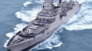
Goa Shipyard Limited's Contribution to Maritime Security: The Evolution of Patrol Vessels for the Indian Navy
Introduction:
In the realm of maritime security, the role of patrol vessels cannot be overstated. Goa Shipyard Limited (GSL), a cornerstone of India's maritime industry, has been instrumental in the design and construction of advanced patrol vessels tailored to the specific needs of the Indian Navy. This article delves into GSL's contributions to enhancing maritime security through the development of patrol vessels equipped with state-of-the-art sensors and communication systems.
The Evolution of Patrol Vessels:
Patrol vessels have undergone significant evolution over the years, adapting to emerging threats and technological advancements. From humble beginnings as coastal patrol craft to sophisticated multi-role platforms, these vessels have become indispensable assets for safeguarding maritime interests. GSL has been at the forefront of this evolution, leveraging its expertise in shipbuilding and naval engineering to deliver cutting-edge patrol vessels equipped with advanced capabilities.
GSL's Expertise and Infrastructure:
GSL's journey from a modest ship repair facility to a leading shipbuilder is a testament to India's maritime aspirations. With state-of-the-art infrastructure and a skilled workforce, GSL possesses the capability to design, construct, and commission a diverse range of naval vessels. Its strategic location in Goa, overlooking the Arabian Sea, provides an ideal environment for testing and sea trials, ensuring the reliability and seaworthiness of its vessels.
Integration of Advanced Sensors and Communication Systems:
The effectiveness of patrol vessels hinges on their ability to gather timely and accurate information, detect potential threats, and communicate seamlessly with command centers and allied forces. GSL's patrol vessels are equipped with advanced sensors, including radar, sonar, and electro-optical systems, which enable comprehensive situational awareness in all maritime environments. These sensors are complemented by robust communication systems, facilitating secure data exchange and real-time decision-making.
Collaboration with the Indian Navy:
GSL's partnership with the Indian Navy is built on a shared commitment to maritime security and national defense. Through close collaboration and dialogue, GSL works in tandem with the Indian Navy to understand its operational requirements and translate them into tangible vessel designs. This collaborative approach ensures that GSL's patrol vessels are optimized for Indian Navy's missions, whether it be coastal patrolling, anti-piracy operations, or humanitarian assistance and disaster relief (HADR) missions.
Customization and Flexibility in Design:
One of GSL's key strengths lies in its ability to customize patrol vessels to meet the specific needs of its customers. Each vessel is meticulously designed and tailored to address the unique challenges faced by the Indian Navy, taking into account factors such as operational environment, mission profile, and budgetary constraints. This flexibility in design allows GSL to deliver bespoke solutions that align with the Indian Navy's strategic objectives and operational doctrine.
Technological Innovations Driving GSL's Patrol Vessels:
GSL continually invests in research and development to integrate the latest technological innovations into its patrol vessels. From advanced propulsion systems to enhanced stealth features, every aspect of vessel design is subject to rigorous scrutiny and refinement. Emerging technologies such as unmanned surface vessels (USVs) and autonomous underwater vehicles (AUVs) are also being explored to augment the capabilities of GSL's patrol vessels, paving the way for unmanned and autonomous operations in the future.
Operational Effectiveness and Mission Success:
The deployment of GSL's patrol vessels has significantly enhanced the Indian Navy's operational effectiveness and mission success rate. These vessels serve as force multipliers, extending the reach of the Indian Navy and enabling it to maintain constant vigilance over vast maritime domains. Whether conducting routine patrols, intercepting suspicious vessels, or responding to maritime emergencies, GSL's patrol vessels play a pivotal role in safeguarding India's maritime interests and upholding maritime security in the region.
In conclusion, Goa Shipyard Limited stands as a beacon of excellence in the domain of naval shipbuilding, particularly in the construction of advanced patrol vessels for the Indian Navy. By integrating advanced sensors and communication systems, customizing designs to meet specific requirements, and fostering close collaboration with the Indian Navy, GSL has emerged as a trusted partner in enhancing maritime security and defense capabilities. As the maritime landscape continues to evolve, GSL remains committed to pushing the boundaries of innovation and delivering solutions that meet the evolving needs of its customers.
0 notes
Text
Understanding the Global Fast Attack Craft Market Landscape
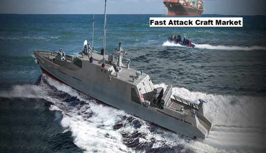
Fast Attack Craft Market - Geopolitical Tensions and Maritime Security, Increased Emphasis on Multi-Mission Capabilities, and Technological Advancements and Innovation are factors driving the market in the forecast period 2024-2028.
According to TechSci Research report, “Global Fast Attack Craft Market - Industry Size, Share, Trends, Competition Forecast & Opportunities, 2028”, the Global Fast Attack Craft Market stood at USD 4.5 billion in 2022 and is anticipated to grow with a CAGR of 6.19% in the forecast period, 2024-2028. Equipped with anti-ship missiles, torpedoes, and cannons, a fast attack craft (FAC) is a compact, maneuverable, swift, and attack-capable vessel. Rapid assault boats are employed in several missions, including anti-piracy, anti-surface, anti-air, and marine patrol. Since quick attack ships are less capable of defense, they are typically chosen in coastal areas as opposed to the middle of the ocean.
Their primary usage is in offensive roles. Even enormous capital ships can be seriously threatened by swift attack craft equipped with guided missiles. FAC becomes extremely successful when employed in tandem with new cutting-edge warfare systems like integrated security systems, underwater acoustic weapons, virtual fences, and multi-static antisubmarine warfare capability enhancements (MACE).
The global fast attack craft (FAC) market represents a critical segment within the defense industry, addressing the need for nimble and highly maneuverable naval vessels designed for rapid response and close-quarters combat scenarios. The global FAC market has experienced substantial growth in recent years, driven by evolving security challenges, maritime conflicts, and the need for versatile naval assets capable of swift and precise responses. These vessels are specifically designed to counter various threats, including piracy, smuggling, and asymmetric warfare, making them indispensable in today's complex security environment.
One of the primary drivers behind the growth of the global FAC market is the increasing demand for coastal defense and littoral warfare capabilities. Coastal regions have become focal points of global geopolitical tensions, with nations striving to protect their territorial waters, critical infrastructure, and offshore assets. In this context, FACs offer a cost-effective and flexible solution, as they can operate efficiently in shallow waters and congested sea lanes.
Browse over market data Figures spread through XX Pages and an in-depth TOC on "Global Fast Attack Craft Market.”
https://www.techsciresearch.com/report/fast-attack-craft-market/21510.html
Moreover, the market has seen substantial investment in the development of technologically advanced FACs. These vessels are equipped with cutting-edge systems, including advanced sensors, radar, sonar, and guided weapon systems, to enhance their situational awareness and offensive capabilities. The integration of advanced electronic warfare and stealth technologies enables FACs to operate covertly and engage hostile forces effectively. One prominent trend in the global FAC market is the emphasis on modularity and mission flexibility. Many FACs are designed with modular systems that can be easily configured for different mission profiles, such as anti-ship warfare, anti-submarine warfare, and mine countermeasures. This modularity enables naval forces to adapt quickly to changing operational requirements, providing a cost-effective solution for various tasks.
Additionally, FACs are increasingly incorporating unmanned systems, such as unmanned surface vessels (USVs) and unmanned aerial vehicles (UAVs), to expand their operational reach and reconnaissance capabilities. These unmanned assets can enhance the FAC's surveillance and strike capabilities while minimizing risk to crew members in high-threat scenarios. The global FAC market also exhibits a growing focus on improving propulsion systems. Enhanced powerplants, such as waterjet propulsion and hybrid propulsion systems, are being adopted to provide greater speed and maneuverability. These systems allow FACs to operate in shallow waters and at high speeds, making them highly effective for interception and response operations.
Furthermore, international collaboration is becoming more prevalent in the global FAC market. Many nations are pooling resources, sharing technologies, and collaborating on joint projects to enhance their FAC capabilities and maintain a stronger presence in shared littoral regions. This collaboration extends to joint exercises, maritime security initiatives, and information sharing to foster regional stability and security.
The global FAC market plays a crucial role in addressing modern security challenges, including countering piracy and smuggling, safeguarding territorial waters, and responding to asymmetric threats. These vessels offer a cost-effective and agile solution for coastal defense, littoral warfare, and the protection of vital maritime interests. As geopolitical tensions continue to evolve, and the need for quick and precise naval responses persists, the global FAC market remains a dynamic and vital component of the defense industry.
The global fast attack craft (FAC) market is experiencing significant growth and evolution due to the increasing demand for coastal defense, the integration of advanced technologies, modularity, mission flexibility, unmanned systems, enhanced propulsion, international collaboration, and the development of shore-based anti-ship missile systems. These trends reflect the market's commitment to addressing contemporary security challenges, making FACs indispensable assets for littoral warfare and coastal defense. As the security environment continues to change, the global FAC market will remain a pivotal part of the naval and defense landscape, providing rapid and effective responses to maritime threats and conflicts.
Major companies operating in Global Fast Attack Craft Market are:
China Shipbuilding & Offshore International Co Ltd
Garden Reach Shipbuilders and Engineers
BAE Systems PLC
Hanjin Heavy Industries & Construction
CMN Group
Damen Shipyards Group
Navantia
Fincantieri – Cantieri Navaliltaliani SpA
Goa Shipyard Limited.
Download Free Sample Report
https://www.techsciresearch.com/sample-report.aspx?cid=21510
Customers can also request for 10% free customization on this report.
“The global fast attack craft (FAC) market is a vital component of modern naval defense, catering to the need for agile, high-speed vessels capable of swift responses to maritime threats. This market is witnessing substantial growth due to evolving security challenges in coastal and littoral regions. FACs are crucial for countering piracy, smuggling, and asymmetric threats, making them essential assets for coastal defense. These vessels are equipped with advanced technologies, modularity, and mission flexibility, enabling them to adapt to changing operational requirements.
Additionally, the integration of unmanned systems and enhanced propulsion systems enhances their surveillance and strike capabilities. As nations collaborate and invest in FAC fleets, this market remains dynamic and indispensable for safeguarding maritime interests and territorial waters.” said Mr. Karan Chechi, Research Director with TechSci Research, a research-based management consulting firm.
“Fast Attack Craft Market – Global Industry Size, Share, Trends, Opportunity, and Forecast, Segmented By Application (Missile armed FAC, Non-missile armed FAC), By End User (National Defense, Fighting, Others), By Region, Competition, 2018-2028”, has evaluated the future growth potential of Global Fast Attack Craft Market and provides statistics & information on market size, structure and future market growth. The report intends to provide cutting-edge market intelligence and help decision makers take sound investment decisions. Besides, the report also identifies and analyzes the emerging trends along with essential drivers, challenges, and opportunities in Global Fast Attack Craft Market.
Browse Related Reports
Aerospace & Defense Telemetry Market
https://www.techsciresearch.com/report/aerospace-and-defense-telemetry-market/16819.html
Aviation Maintenance Repair Overhaul (MRO) Market
https://www.techsciresearch.com/report/aviation-maintenance-repair-overhaul-mro-market/15465.html
Sustainable Aviation Fuel Market
https://www.techsciresearch.com/report/sustainable-aviation-fuel-market/14452.html
Contact
Techsci Research LLC
420 Lexington Avenue, Suite 300,
New York, United States- 10170
Tel: +13322586602
Email: [email protected]
Website: www.techsciresearch.com
#Fast Attack Craft Market#Fast Attack Craft Market Size#Fast Attack Craft Market Share#Fast Attack Craft Market Trends#Fast Attack Craft Market Growth
0 notes
Text
The Intersection AI and Cybersecurity Nick Lorizio and Donna Mitchell #podcast #ai #cybersecurity
Video link : https://youtu.be/TkkMlXyTFD8
Summary
In this conversation, Donna Mitchell interviews Nick, an expert in AI and cybersecurity. They discuss the intersection of AI and cybersecurity, the role of automation in protecting against scams and fraud, and the challenges of the cybersecurity industry. Nick also shares insights into Stute Technologies, a threat detection platform he developed, and the importance of AI in small and medium-sized businesses. The conversation concludes with a discussion on the concerns and risks of AI in cybersecurity, particularly in relation to protecting children and critical systems.
Takeaways
AI is becoming increasingly important in the field of cybersecurity, as it can automate tasks and improve efficiency.
There is a shortage of cybersecurity professionals, and the industry is falling behind in terms of staffing and effectiveness.
Small and medium-sized businesses are particularly vulnerable to cyber threats, and it is important for them to adopt cybersecurity technologies.
There are concerns about the potential risks and misuse of AI in cybersecurity, particularly in relation to protecting children and critical systems.
- - - - - - - - - - - - - - - - - - - - - - - - - - - - - - - - - - - - - - - - - - - - - - - - - - - - - - - - - - - - - - -
Watch More of My Videos And Don't forget to "Like & Subscribe" & Also please click on the 🔔 Bell Icon, so you never miss any updates! 💟 ⬇️ 🔹🔹🔹
Please Subscribe to My Channel:
- - - - - - - - - - - - - - - - - - - - - - - - - - - - - - - - - - - - - - - - - - - - - - - - - - - - - - - - - - - - - - -
#To learn more about me, check out my Profile & CONNECT WITH ME 💟 ⬇️
💠 Podcast - https://www.PivotingToWeb3Podcast.com
💠 Book an Event Site - https://www.DonnaPMitchell.com
💠 Company - https://www.MitchellUniversalNetwork.com
💠 LinkedIn: https://www.linkedin.com/in/donna-mitchell-a1700619
💠 Instagram Professional: https://www.instagram.com/dpmitch11
💠 Twitter/ X: https://www.twitter.com/dpmitch11
💠 YouTube Channel - https://www.Web3GamePlan.com
- - - - - - - - - - - - - - - - - - - - - - - - - - - - - - - - - - - - - - - - - - - - - - - - - - - - - - - - - - - - - - -
👉👉 Request to watch top 5 videos of my channel ..... 👇👇
✅ The Art of Chatting AI: Terza Ekholm Explores AI-Assisted Art Creation with Donna Mitchell #podcast
🎬 https://youtu.be/D-EW4ehlrcI?si=2skLp6ZR2-gP018u
✅ AI-Infused Presentation Design: Unlocking Creativity with Brigette Callahan and Donna Mitchell
🎬 https://youtu.be/mPLKqIZgRwM?si=wTeP73lyV3u0TPvw
✅ The Intersection AI and Cybersecurity Nick Lorizio and Donna Mitchell #podcast #ai #cybersecurity
🎬 https://youtu.be/TkkMlXyTFD8?si=l46m5iCZA5S51wfe
✅ Donna Mitchell and International Lawyer Jamilia Grier WEB3 Challenges Implications Opportunities
🎬 https://youtu.be/Jim14sR0LEc?si=wRt5jtiZVHviJQhR
✅ Future of Podcasting: AI, NFTs, and Building Digital Communities with Kay Suthar and Donna Mitchell
🎬 https://youtu.be/TApLBjRSP1c?si=qx0puKoyt0RO5ZNr
tage:
Donna Mitchell,The Intersection AI and Cybersecurity Nick Lorizio,The Intersection AI and Cybersecurity Nick Lorizio and Donna Mitchell,podcast,ai,cybersecurity,The Intersection AI,The Intersection,Cybersecurity Nick Lorizio,donna mitchell,donna mitchell piano,web3,personal growth,pivoting to web3,the future of podcasting,rc boat sonar,legal compliance,online psychologist,blockchain consultant,digital products,drifting dreams,online therapist,scuba diving
youtube
0 notes
Text
Exploring the Depths with Autonomous Underwater Vehicles (AUVs): Unveiling the Secrets of the Ocean 🌊
Hey everyone! Today, let's dive into the captivating world of Autonomous Underwater Vehicles (AUVs) and uncover how these incredible machines are revolutionizing marine exploration and research. 🌊
Autonomous Underwater Vehicles, or AUVs, are unmanned underwater robots designed to operate independently, navigating beneath the ocean's surface to collect valuable data and images without human intervention. Equipped with advanced sensors, cameras, and navigation systems, AUVs are capable of mapping underwater terrain, studying marine life, monitoring environmental conditions, and even inspecting submerged structures with remarkable precision and efficiency. From deep-sea exploration to offshore surveys and marine conservation efforts, AUVs play a pivotal role in expanding our understanding of the ocean and its ecosystems. 🐟
Here are some fascinating aspects and applications of Autonomous Underwater Vehicles:
Ocean Mapping: AUVs use sonar and imaging technologies to create detailed maps of the seafloor, aiding in geological research and underwater archaeology.
Environmental Monitoring: AUVs collect data on water quality, temperature, and marine biodiversity, supporting efforts to monitor and protect fragile marine habitats.
Oil and Gas Industry: AUVs perform pipeline inspections and underwater surveys for offshore oil rigs, enhancing safety and efficiency in the energy sector.
Scientific Research: AUVs enable scientists to study deep-sea ecosystems, hydrothermal vents, and marine organisms that thrive in extreme environments.
Search and Rescue: AUVs assist in search and rescue missions by exploring underwater areas that are inaccessible to divers, improving response times and effectiveness.
Let's celebrate the ingenuity of Autonomous Underwater Vehicles and their role in unlocking the mysteries of the ocean! Have you encountered AUVs in marine research or exploration? Share your thoughts and experiences below! 🌊🤿
Using hashtags to connect with fellow ocean enthusiasts: #AUV #AutonomousUnderwaterVehicle #OceanExploration #MarineScience #UnderwaterRobotics #DeepSea #MarineConservation #Oceanography #TechInnovation #ExploreTheOcean 🌊
0 notes
Text
Bathymetric Survey | Epitome Geo Technical Services
In the world of geotechnical engineering, precision and accuracy are paramount. Whether for coastal management, infrastructure development, or environmental studies, understanding underwater topography is essential. This is where bathymetric surveys come into play. At Epitome Geo Technical Services, we pride ourselves on delivering top-tier bathymetric survey solutions that cater to diverse needs with unmatched precision and reliability.
What is a Bathymetric Survey?
A bathymetric survey is the underwater equivalent of a topographic survey. It involves mapping the underwater terrain of oceans, rivers, lakes, and reservoirs. This survey method provides detailed information about the depth, shape, and features of the underwater surface, helping engineers, scientists, and planners make informed decisions.
The Importance of Bathymetric Surveys
Understanding underwater topography is crucial for various applications:
Navigation: Ensures safe passage for vessels by identifying underwater hazards and maintaining up-to-date nautical charts.
Coastal Engineering: Supports the design and construction of marine structures like ports, harbors, and breakwaters.
Environmental Monitoring: Assists in assessing habitats, monitoring sediment transport, and studying the impacts of climate change on water bodies.
Resource Management: Helps in managing underwater resources, including fisheries and mineral exploration.
Flood Modeling and Management: Provides data necessary for creating accurate flood models, essential for disaster preparedness and mitigation.
Our Advanced Techniques and Equipment
At Epitome Geo Technical Services, we leverage cutting-edge technology to conduct bathymetric surveys with precision and efficiency. Our toolkit includes:
Multibeam Echo Sounders (MBES): These devices emit sound waves in a fan shape beneath the survey vessel, covering a wide swath of the seafloor. MBES technology provides high-resolution data and is ideal for detailed mapping.
Single Beam Echo Sounders (SBES): While less complex than MBES, SBES is effective for simpler applications where detailed mapping is not required.
Side-Scan Sonar: This system produces images of the seafloor by emitting sound waves sideways from the survey vessel, helping identify objects and seabed characteristics.
Underwater GPS and Positioning Systems: Ensures the accuracy of the survey data by precisely tracking the survey vessel's location.
Our Process
Planning: Understanding client requirements and environmental conditions to plan the survey effectively.
Data Acquisition: Deploying the necessary equipment and collecting raw data.
Data Processing: Using specialized software to process the collected data and create accurate bathymetric maps.
Analysis and Reporting: Providing detailed reports and visualizations to our clients, tailored to their specific needs.
Case Studies
Port Expansion Project: Recently, we conducted a bathymetric survey for a major port expansion project. Our detailed maps of the seafloor allowed engineers to design new docking facilities with confidence, ensuring the safety and efficiency of future operations.
Environmental Impact Assessment: In another project, our bathymetric data helped environmental scientists monitor changes in a riverbed due to sedimentation and erosion, crucial for the conservation of aquatic habitats.
Why Choose Epitome Geo Technical Services?
Expertise: Our team of geotechnical experts has extensive experience in conducting bathymetric surveys for a variety of applications.
Technology: We invest in the latest technology to ensure the highest accuracy and efficiency in our surveys.
Customized Solutions: We understand that every project is unique, and we tailor our services to meet the specific needs of each client.
Commitment to Quality: Our commitment to delivering high-quality results has made us a trusted partner in the geotechnical engineering industry.
Contact Us
For more information about our bathymetric survey services or to discuss your project requirements, contact Epitome Geo Technical Services today. Let us help you navigate the underwater world with precision and confidence.
More Info : https://epitomegs.com/
Contact us : +91-96756 94400
#Bathymetric Survey Company in India#Bathymetric Survey in India#Bathymetric Survey#Bathymetric#epitome
0 notes
Text
NASA, Industry Improve Lidars for Exploration, Science - NASA
New Post has been published on https://sunalei.org/news/nasa-industry-improve-lidars-for-exploration-science-nasa/
NASA, Industry Improve Lidars for Exploration, Science - NASA

NASA engineers will test a suite of new laser technologies from an aircraft this summer for Earth science remote sensing. Called lidar, the instruments could also be used to improve models of the Moon’s shape and aid the search for Artemis landing sites.
Similar to sonar, but using light instead of sound, lidars calculate distances by timing how long a laser beam takes to reflect off a surface and return to an instrument. Multiple pings from the laser can provide the relative speed and even 3D image of a target. They increasingly help NASA scientists and explorers navigate, map, and collect scientific data.
Engineers and scientists at NASA’s Goddard Space Flight Center in Greenbelt, Maryland, continue to refine lidars into smaller, lighter, more versatile tools for science and exploration, with help from hardware provided by small business and academic partners.
“Existing 3D-imaging lidars struggle to provide the 2-inch resolution needed by guidance, navigation and control technologies to ensure precise and safe landings essential for future robotic and human exploration missions,” team engineer Jeffrey Chen said. “Such a system requires 3D hazard-detection lidar and a navigation doppler lidar, and no existing system can perform both functions.”
Enter CASALS, the Concurrent Artificially intelligent Spectrometry and Adaptive Lidar System. Developed through Goddard’s IRAD, Internal Research and Development program, CASALS shines a tunable laser through a prism-like grating to spread the beam based on its changing wavelengths. Traditional lidars pulse a fixed-wavelength laser which is split into multiple beams by bulky mirrors and lenses to split it into multiple beams. One CASALS instrument could cover more of a planet’s surface in each pass than lidars used for decades to measure Earth, the Moon, and Mars.
CASALS’s smaller size, weight, and lower power requirements enable small satellite applications as well as handheld or portable lidars for use on the Moon’s surface, Goddard engineer and CASALS development lead Guangning Yang said.
The CASALS team received funding from NASA’s Earth Science Technology Office to test their improvements by airplane in 2024, bringing their system closer to spaceflight readiness.
As lidars become more specialized, CASALS can incorporate different wavelengths, or colors of laser light for applications like Earth science, exploring other planets and objects in space, and navigation and rendezvous operations.
The CASALS Team used Goddard IRAD and NASA SBIR (Small Business Innovation Research Program) funding along with commercial partners Axsun Technologies and Freedom Photonics to develop new fast-tuning lasers in the 1-micron portion of the infrared spectrum for Earth science and planetary exploration. By comparison, commonly available lidars used for self-driving vehicle development typically use 1.5-micron lasers for range and speed calculations.
On Earth, wavelengths near 1 micron pass readily through the atmosphere and are good at differentiating vegetation from bare ground, said Ian Adams, Goddard’s chief technologist for Earth sciences. Wavelengths near 0.97 and 1.45 microns offer valuable information about water vapor in Earth’s atmosphere but do not travel as efficiently to the surface.
In a related project, the team partnered with Left Hand Design Corporation to develop a steering mirror to extend CASALS’s 3D-imaging coverage and improve resolution. He said the lidar’s higher pulse rate can build up signal sensitivity to provide range and velocity measurements at up to 60 miles.
Artemis-related missions seeking to land near the Moon’s South Pole could also use CASALS’s sharper imaging to help assess the safety of potential landing sites.
More detailed 3D models of the Moon drove Goddard planetary scientist Erwan Mazarico’s IRAD effort to refine CASALS’s ability to measure surface details smaller than 3 feet. He said this will help understand the Moon’s sub-surface structures and changes over time.
Every month, Earth’s path across the lunar sky moves within 10 or 20 degrees of the center of the side facing Earth.
“We’ve predicted based on our understanding of its inner structure that Earth’s shifting pull could change the tidal bulge or shape of the Moon,” Mazarico said. “High-resolution measurements of that deformation could tell us more about potential variations within the Moon. Is it responding like a fully uniform body in the interior?”
NASA’s Lunar Reconnaissance Orbiter (LRO) has measured Earth’s natural satellite since 2009, modeling the Moon’s terrain and providing a wealth of discoveries with the help of LOLA, its Lunar Orbiting Lidar Altimeter. LOLA fires 28 laser pulses per second, split into five beams touching the surface 65 feet to 100 feet apart. Scientists use LRO images to estimate smaller surface features between laser measurements.
CASALS’s laser, however, allows the equivalent of several hundred thousand pulses per second, reducing the distance between surface measurements.
“A denser and more accurate data set would allow us to study much smaller features,” Mazarico said, including those from impacts, volcanic activity, and tectonics. “We’re talking orders of magnitude more measurements. That could be quite a big game changer in terms of the type of data we get from lidar.”
0 notes
Text
Market Share Dynamics in the Emerging Sonar Systems Industry

Market Overview
The Sonar System Market was valued at USD 5.9 Billion in 2021 and is projected to reach USD 6.5 Billion by 2026, growing at a Compound Annual Growth Rate (CAGR) of 1.8% from 2021 to 2026. Sonar systems, which use sound propagation to navigate, communicate, or detect objects under the surface of the water, play a crucial role in various applications such as anti-submarine warfare, seabed mapping, and commercial fishing.
Market Size and Growth
Current Market Size
As of 2021, the Sonar System Market stands at USD 5.9 billion. This substantial market size is driven by the adoption of sonar systems by naval forces to enhance anti-submarine warfare capabilities, the growing use of sonobuoy in tactical defense programs, and the rising demand for high-resolution imaging for seabed mapping.
Projected Market Size
The market is anticipated to grow to USD 6.5 billion by 2026, demonstrating a steady CAGR of 1.8%. This growth is attributed to the stable deliveries of military vessels, increasing adoption of unmanned underwater vehicles (UUVs), and advancements in sonar technology.
Market Drivers
Stable Growth in Military Vessel Deliveries
The steady growth in the deliveries of military vessels is a significant driver for the sonar systems market. Military vessels, equipped with some of the most advanced sonar systems, use these technologies for various applications including mine detection, seabed terrain investigation, anti-submarine warfare, diver detection, and port security. The continuous procurement of such military ships provides favorable conditions for the sonar systems market to expand.
Increasing Adoption of Unmanned Underwater Vehicles (UUVs)
The adoption rate of UUVs is rapidly increasing as these remote-operable devices are used for tasks such as mine detection, seabed terrain investigation, and fish behavioral observation. The compact size and advanced operational capabilities of UUVs present significant opportunities for the sonar systems market.
Get a Deeper Understanding of the Industry by Visiting: https://www.marketsandmarkets.com/Market-Reports/sonar-systems-technology-market-142612945.html
Market Challenges
Transition from 2D to 3D Sonar Processing
The shift from 2D to 3D sonar processing for seabed imaging and charting poses a challenge. This transition requires thorough training for personnel to understand and operate the advanced sonar systems effectively, particularly in anti-submarine warfare where detecting, classifying, locating, and tracking submarines demand high technical expertise.
COVID-19 Impact
The COVID-19 pandemic has posed several challenges to the sonar systems market. Budget cuts in the defense sector by various countries have led to delays or cancellation of research projects. Additionally, the export of military and commercial vessels has been reduced, particularly to regions like the Middle East, Africa, and Latin America, affecting the development of sonar systems.
Market Segmentation
The Study Categorizes the Sonar Systems Market Based on Application, Platform, Product, Installation, and Region:
By Application:
Anti-submarine Warfare
Port Security
Mine Detection & Countermeasure Systems
Search & Rescue
Navigation
Diver Detection
Seabed Terrain Investigation
Scientific
Others
By Platform:
Commercial Vessels
Defence Vessels
Unmanned Underwater Vehicles (UUVs)
Aircrafts
Ports
By Product:
Hull-mounted Sonar
Stern-mounted Sonar
Dipping Sonar
Sonobuoy
By Installation:
Fixed
Deployable
By Region:
North America
Asia Pacific
Europe
Middle East
Rest of the World
By Solution
Sonar for Commercial Platforms
Naval sonars, capable of active and passive operations, dominate the market during the forecast period. Passive sonar systems, which do not transmit signals, enable naval vessels to maintain stealth and detect enemy ships and marine animals without revealing their position.
By Installation
Deployable Sonar
Deployable sonar systems, particularly sonobuoys, are expected to command the market. Sonobuoys, which are deployed from aircraft into water, use transducers and radio transmitters to detect and relay underwater echoes. Their use in wide-ranging area zone multi-static surveillance significantly enhances aerial sonar capabilities.
By Platform
Hull-Mounted Sonar
Hull-mounted sonar systems, attached to the bottom of vessels, are extensively used for seabed monitoring, fish finding, anti-submarine warfare, and diver detection. These systems are classified into forward-looking sonar, omnidirectional sonar, and echosounders.
By Technology
Active Sonar
Active sonar, which employs acoustic energy pulses to detect objects, is projected to command the market by technology. These systems measure the distance to objects by calculating the time taken for the sound pulse to travel to the target and back, offering high precision in detecting marine mammals and other objects.
Market Trends
Adoption of Cloud-Based Solutions
The sonar systems market is witnessing a trend towards the adoption of cloud-based solutions. These platforms offer centralized management and enhanced capabilities for real-time data processing, storage, and analysis, driving efficiency and effectiveness in sonar operations.
Integration of Artificial Intelligence (AI)
The integration of AI in sonar systems is revolutionizing the industry. AI-powered sonar systems can autonomously detect, classify, and track underwater objects, significantly enhancing operational capabilities and reducing the reliance on human operators.
Technological Advancements in Sonar Systems
Advancements in sonar technology, such as the development of 3D sonar systems like echosounders, provide real-time three-dimensional views of the seabed and objects present in the water. These innovations are crucial for applications such as seabed mapping, fish finding, and anti-submarine warfare.
Download Sample PDF Copy to Understand More: https://www.marketsandmarkets.com/pdfdownloadNew.asp?id=142612945
Regional Analysis
Asia Pacific
The Asia Pacific region is projected to contribute the largest share of the sonar system market from 2021 to 2026. This growth is driven by increasing investments in defense and maritime infrastructure, particularly by countries such as China, India, and Japan. The region's focus on enhancing naval capabilities and modernizing existing sonar systems contributes to its dominant market position.
Europe
The European sonar system market is expected to grow at a CAGR of 2.7% during the forecast period, reaching USD 2.6 billion by 2026. The growth in Europe is driven by advancements in sonar technology, increased defense spending, and the rising demand for high-resolution imaging for various applications.
Competitive Landscape
The Sonar Systems Market is dominated by several globally established players, including:
Thales Group (France)
ATLAS ELEKTRONIK GmbH (Germany)
Raytheon Company (US)
Lockheed Martin (US)
L-3 Technologies Inc. (US)
Ultra Electronics (UK)
Other major players in the hydrographic sonar market include Kongsberg Gruppen ASA (Norway), Teledyne Technologies Inc. (US), and Sonardyne (UK). Companies such as Furuno Electric Co., Ltd. (Japan), Japan Radio Company (Japan), Navico (Norway), and FLIR Systems (US) dominate the navigation and fisheries sonar segments.
The Sonar System Market is poised for steady growth, driven by the adoption of advanced sonar systems by naval forces, the increasing use of sonobuoy in defense programs, and the rising demand for high-resolution seabed imaging. Despite challenges posed by the COVID-19 pandemic, the market is projected to reach USD 6.5 billion by 2026, with a CAGR of 1.8%.
Technological advancements, particularly the transition to 3D sonar processing and the integration of AI, are set to transform the industry. The Asia Pacific region is expected to lead the market, supported by significant investments in defense and maritime infrastructure. The competitive landscape is characterized by the presence of several key players, each focusing on innovation and strategic partnerships to enhance their market position.
As the demand for advanced sonar systems continues to grow, the industry is likely to witness further innovations and increased adoption of cutting-edge technologies, driving the market forward in the coming years.
About MarketsandMarkets™
MarketsandMarkets™ has been recognized as one of America's best management consulting firms by Forbes, as per their recent report.
MarketsandMarkets™ is a blue ocean alternative in growth consulting and program management, leveraging a man-machine offering to drive supernormal growth for progressive organizations in the B2B space. We have the widest lens on emerging technologies, making us proficient in co-creating supernormal growth for clients.
Earlier this year, we formally transformed into one of America's best management consulting firms as per a survey conducted by Forbes.
The B2B economy is witnessing the emergence of $25 trillion of new revenue streams that are substituting existing revenue streams in this decade alone. We work with clients on growth programs, helping them monetize this $25 trillion opportunity through our service lines - TAM Expansion, Go-to-Market (GTM) Strategy to Execution, Market Share Gain, Account Enablement, and Thought Leadership Marketing.
Built on the 'GIVE Growth' principle, we work with several Forbes Global 2000 B2B companies - helping them stay relevant in a disruptive ecosystem. Our insights and strategies are molded by our industry experts, cutting-edge AI-powered Market Intelligence Cloud, and years of research. The KnowledgeStore™ (our Market Intelligence Cloud) integrates our research, and facilitates analysis of interconnections through applications, helping clients look at the entire ecosystem and understand the revenue shifts in their industry.
To learn more, visit www.MarketsandMarkets™.com or follow us on Twitter, LinkedIn and Facebook.
Contact:
Mr. Aashish Mehra
MarketsandMarkets™ INC.
630 Dundee Road
Suite 430
Northbrook, IL 60062
USA: +1-888-600-6441
Email: [email protected]
(Image Credit: Hanwha Systems Co., Ltd.)
#Sonar Systems#Sonar Systems Market#Sonar Systems Industry#Global Sonar Systems Market#Sonar Systems Market Companies#Sonar Systems Market Size#Sonar Systems Market Share#Sonar Systems Market Growth#Sonar Systems Market Statistics
0 notes
Text
South Korea Sonar Systems Market Report: Competitor Size, Regional Analysis, & Forecast (2024-2032)

South Korea's role in the global sonar systems market has been increasingly pivotal, driven by its advanced technology sector and strategic geographical position. This blog explores the South Korea Sonar Systems Market from 2024 to 2032, focusing on competitor analysis, regional dynamics, and growth forecasts.
Competitor Landscape and Key Players
South Korea hosts several key players in the sonar systems market, including LIG Nex1, Hanwha Systems, and DSME (Daewoo Shipbuilding & Marine Engineering). These companies are renowned for their contributions to both defense and commercial applications of sonar technology, leveraging South Korea's strong industrial base and technological expertise.
Regional Analysis and Market Dynamics
The South Korea Sonar Systems Market benefits significantly from the country's robust defense sector and maritime interests. With increasing threats and challenges in the East Asian region, there is a growing emphasis on enhancing underwater surveillance capabilities, which fuels the demand for advanced sonar systems. Regional partnerships and alliances further stimulate market growth, ensuring South Korea remains a crucial player in the global defense technology landscape.
Market Forecast and Growth Opportunities
The market forecast for South Korea's sonar systems sector indicates promising growth prospects during the forecast period. Factors driving this growth include ongoing military modernization programs, investments in naval capabilities, and advancements in acoustic sensor technologies. The projected expansion underscores South Korea's commitment to maintaining maritime security and bolstering its defense capabilities amidst evolving geopolitical dynamics.
Request Free Sample Report - Receive a free sample report to preview the valuable insights and data we offer.
Technological Innovations and Future Trends
Technological advancements such as integrated sonar systems, autonomous underwater vehicles (AUVs), and AI-driven data analytics are pivotal in shaping the future of the South Korea Sonar Systems Market. These innovations not only enhance operational efficiency but also enable real-time situational awareness and improved decision-making capabilities in underwater environments.
Conclusion
In conclusion, the South Korea Sonar Systems Market from 2024 to 2032 presents a landscape of growth and innovation, driven by technological advancements, strategic investments, and regional security imperatives. As South Korea continues to strengthen its position as a leader in defense technology, the evolution of sonar systems will play a crucial role in safeguarding maritime interests and enhancing national security capabilities.
About US
At Market Research Future (MRFR), we enable our customers to unravel the complexity of various industries through our Cooked Research Report (CRR), Half-Cooked Research Reports (HCRR), Raw Research Reports (3R), Continuous-Feed Research (CFR), and Market Research & Consulting Services. MRFR team have supreme objective to provide the optimum quality market research and intelligence services to our clients. Our market research studies by products, services, technologies, applications, end users, and market players for global, regional, and country level market segments, enable our clients to see more, know more, and do more, which help to answer all their most important questions. To stay updated with technology and work process of the industry, MRFR often plans & conducts meet with the industry experts and industrial visits for its research analyst members.
Contact us:
Market Research Future (part of Wants tats Research and Media Private Limited),
99 Hudson Street,5Th Floor, New York, New York 10013, United States of America
Sales: +1 628 258 0071 (US) +44 2035 002 764 (UK)
Email: [email protected]
0 notes
Last Seen Blogs