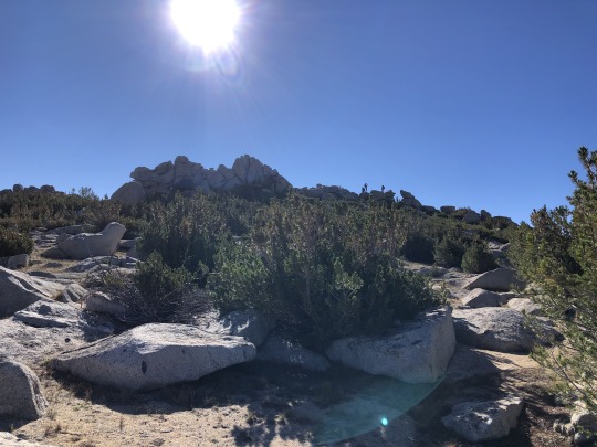
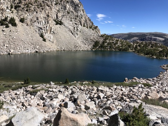
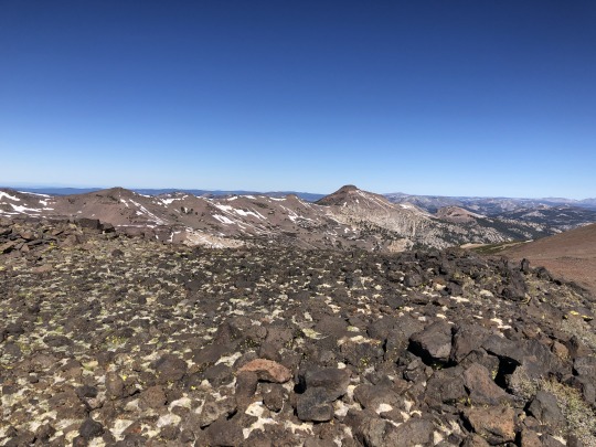
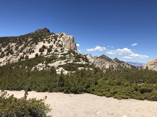
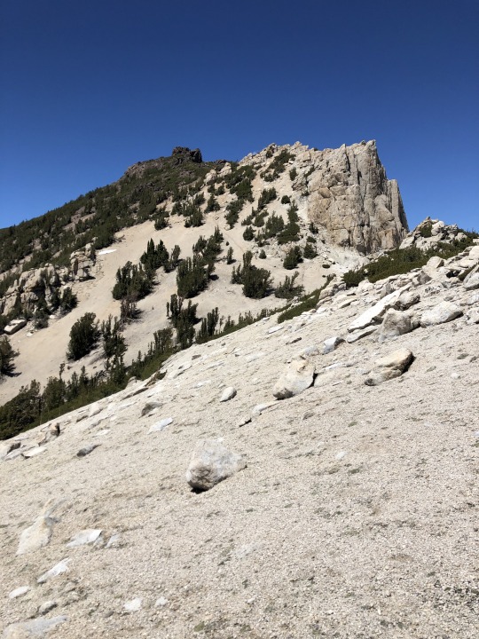
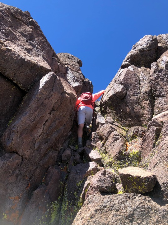
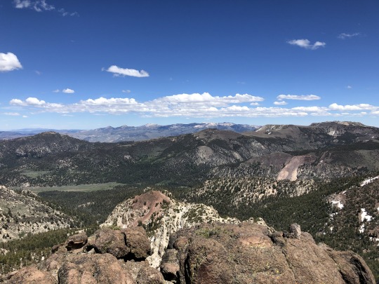
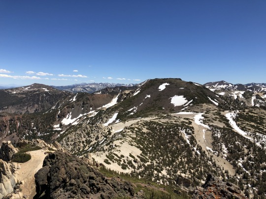
#South Sierra Crest
Text
Flee for Your Life? Wildfires transform hiking in California's mountains
This is an excerpt from an article published on August 21, 2022 in the Santa Cruz Sentinel. I wish so many of our posts were not related to wildfires but fires have become a critical issue in trip planning and trip safety. Make sure you read to the recommendations at the end of the piece.
By Ethan Baron
Andrew Schrock woke around midnight smelling smoke on a backpacking trip late last month in California’s far north.
“I heard what I thought was rain but was ashes on the tent,” said Schrock, 43.
Using a satellite-based device from the Klamath National Forest near the Oregon border, he texted family and friends back home to find out what was happening – but “no one was up.”
He’d had cell service a mile back along the iconic Pacific Crest Trail that stretches from Mexico to Canada, so he set out alone in the dark, got online, and discovered that the McKinney Fire – which has since grown to more than 60,000 acres, killed four people and required the rescue of 60 hikers from the California side of the trail – had ignited behind him to the south the previous afternoon.
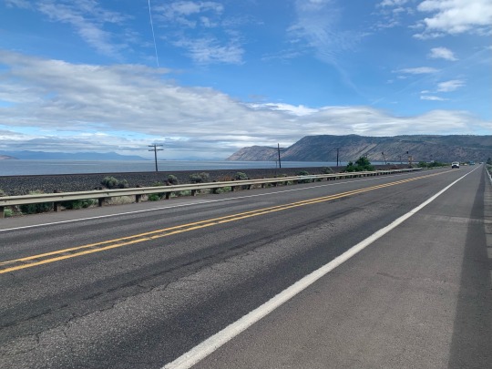
Ask anyone who hikes in California’s mountains about wildfires and you’ll likely get an earful about canceled trips, detours, lung-burning smoke and, possibly, harrowing escapes. Backcountry travelers are increasingly finding themselves on the dangerous edge of a changing climate that is driving drought, parching forests, spreading tree-killing beetles and altering weather patterns. Add in heavy vegetation buildup from decades of fire suppression, and you have frequent, ferocious forest fires that scramble hikers’ best-laid plans and demand new tactics for staying safe.
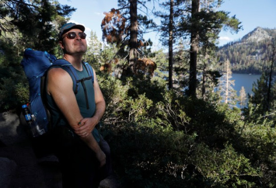
Schrock, of Long Beach, flew from Ashland, Oregon, to Fresno and then caught a bus to Yosemite to get back into the Sierra Nevada and finish his vacation covering more ground and enjoying the wilderness on his multi-year quest to complete the Pacific Crest Trail, he recalled while taking a snack break beside Lower Echo Lake near Lake Tahoe.
Dallan Clancy of Belmont, 68, finishing up a day hike 100 miles west of Sacramento at Carson Pass, said he had to cancel an overnight trip last September in the southern Sierra because the U.S. Forest Service shut access to all but one of California’s national forests over fire risks, including what the agency called “fire behavior that is beyond the norm of our experience and models such as large, quick runs in the night.” Clancy said he and four friends are aiming to do the trip this year, “unless it gets really bad.”
“We’ve always made note of escape routes, but on this trip, we actually planned our escape routes. We wanted to know the routes we could take to get out to a road,” said Jack Daro, a Southern California musician taking a break at Carson Pass during a backpacking trek to Yosemite National Park.

Hikers in years past “just went and did whatever you wanted to do wherever you wanted to go,” Wilkinson said. But 2020 marked a transformation, with the million-acre August Complex Fire, the Creek Fire northeast of Fresno that led to helicopter evacuations of hundreds of people including hikers on the John Muir Trail, and other massive blazes launching California into the age of mega-fires, Wilkinson said.
Nine of California’s 20 biggest fires since 1932 have occurred in the past three years, torching 4.1 million acres, according to Cal Fire. This year’s five biggest blazes have burned 116,000 acres, and “we’re just now getting into peak wildfire season,” Wilkinson said.
U.S. Forest Service spokeswoman Adrienne Freeman noted that fire can move much faster in today’s baked-crisp forests. “The window between OK and not OK,” Freeman said, “is becoming shorter and shorter.”
Backcountry journeyers who think seeing smoke but no flames means they’re fine may be mistaken, Wilkinson said. “Fire can move like a freight train, much faster than a person can run.”
Some hikers have dramatically changed the way they travel. Loetitia Saint-Jacques, 50, a Tahoe City veterinary technician, was on an overnight trip this month near South Lake Tahoe. Before the mega-fires, she and her companions would take long trips into deep wilderness. “We don’t go as remote now,” Saint-Jacques said. “Now it’s shorter trips. We do overnights, instead of five to eight days.”
Long-distance speed-hiker Ella Raff had multiple run-ins with wildfire and its fallout after embarking on the Pacific Crest Trail in June to walk from Mexico to Canada. Last month, the Washburn Fire in Yosemite shrouded her in smoke for two days. “I was just breathing heavy smoke 24/7. It’s not very fun,” said Raff, 29, of Portland. Farther north in California, traversing 85 miles of trail charred from last year’s nearly million-acre Dixie Fire left Raff covered in ash and dismayed by a “surreal” landscape with little animal life.

Soon after, she smelled smoke from the McKinney Fire. As she was nearing the Oregon border, authorities shut the trail ahead. More than 100 miles of the route remain closed, with the fire, which started July 29, now almost contained. Raff made her way to Portland, then to Washington to hike the trail southward from Canada.
Changing jumping-off points, routes, destinations, or timing to cope with uncertainty about fires is now routine for hikers in California. The Caldor Fire, which ravaged 220,000 acres southwest of Lake Tahoe last year from August to October, forced Truckee artist Danae Anderson, 63, to cancel three backpacking trips. “Everything was too smoky up here,” said Anderson, hiking beside Lower Echo Lake. She went to Yosemite instead.
Reckless target shooting by a father and son allegedly caused the Caldor Fire. The inferno’s scar stretches nearly 50 miles southwest of Echo Lakes in a swath up to 15 miles wide, much of it a blackened wasteland of lifeless trees, some downed, some standing without greenery, granite on many boulders shattered in places by the intense heat. More than 80 miles of the Pacific Crest Trail were closed from the fire’s start last August until early this year. Hikers passing through such areas may find water scarce, and standing dead trees can pose a deadly toppling hazard, said Matt Rump, a trail stewardship staffer for the Pacific Crest Trail Association.
Crews take down the most dangerous trees, but because there are so many dead, and they provide important wildlife habitat, officials accept some risk to hikers, under the calculus that “if you get whacked, it’s your time,” said Cheryl Bailey, 73, a volunteer for the Tahoe Rim Trail Association, as she walked along the 2 1/2 miles of the rim trail that run through the Caldor scar and that she’s been helping rebuild.
Some hikers console themselves with fire’s importance to forest health, but many of today’s blazes burn so hot they kill trees accustomed to lower-intensity fires.
In the Echo Chalet store where Schrock, who fled the McKinney Fire, bought snacks, cashier Georgia Sprague, 22, chatted with the trekkers whose ebbs and flows depend on fires and smoke. Many expressed urgency over climate change.
“They feel a lot of a push to get out,” she said, “and see the world before it burns up.”
Wildfire safety tips for hikers
Recommendations for staying safe while hiking in the age of mega-fires:
Check websites such as InciWeb for fire information and PurpleAir for air-quality information before, and if possible during, backcountry trips.
2. Give friends and family your itinerary, always know your location and pay close attention to your surroundings in case you need to retreat.
3. Know whether fires are prohibited where you’re going.
4. Carry paper maps in addition to any digital maps or apps.
5. Use cell phones and satellite-based devices to monitor weather, fires, wind, air quality and alerts such as Red Flag wildfire warnings, and to stay in close contact with people not in the wilderness who may have better access to weather and fire information. Many satellite-based messaging devices such as the popular Garmin inReach also act as rescue beacons; trekkers wishing to stay less connected may prefer personal locator beacons that are only for emergency rescue.
6. Pay attention to signs at trailheads and trail junctions.
7. Gather crowd-sourced fire and trail information from reliable websites and forums.
8. Carry an N95 mask in case of smoke.
9. Watch the sky for smoke, and use your nose to detect it.
27 notes
·
View notes
Photo

Take a refreshing dip in Lone Pine Lake, elevation 10,050 feet, on the trail to Mt. Whitney. It’s a non-strenuous day hike--up and back-- from Whitney Portal. This photo was taken in the autumn with no one in sight, except my friend and a ring-tailed cat who was studying our descent.
Just as a reminder, if you’re tempted to hike further, you need permits to summit Mt. Whitney. Most hikers begin their trek in the dark hours of the morning with the goal to summit the peak before noon and to return to Whitney Portal before dark. It can be done but you really have to know what you are doing. It is a good idea to stop by the visitors center before heading up the Mt. Whitney trail.
Mt. Whitney is the highest point in the contiguous United States and the Sierra Nevada mountains, at an elevation of 14,505 feet. To say that the weather at that elevation is subject to change is an understatement.
If crampons, climbing ropes, and snow-weather hiking gear is not your thing, and/or you just need a hike to break up your Highway 395 road trip, then a hike up to Lone Pine Lake is a very good alternative to quell your mountain fever.
Moving on from this crested majesty and the crisp mountain air, is Death Valley National Park just 64-miles away. In an hours time, you’ll be traveling more than miles in this disparity of highs and lows. With Mt. Whitney at 14,050 feet; Whitney Portal at 8,000 feet; in a lunch breaks time, you’ll descend into the lowest point in the United States at at 282-feet below sea level; at Badwater Basin, in Death Valley National Park. What wonder in geology form and time.
If the gateway to the Great Basin with it’s other-worldly landscape, and, depth beauty in striations of color, doesn’t capture your imagination, then perhaps, an ultra-marathon may be the best next-test in adventure you’re looking for?
In the punishing heat of July ultra-marathoners take on the weather and distance to literally run day and night from Badwater Basin to Whitney Portal covering a distance of 135-miles. As the LA Times points out, “There’s no prize money, but you must finish in less than 48 hours to receive the coveted Badwater 135 belt buckle.”
Well, okay! (?) Don’t knock it, till you try it, I suppose, but, I think I’d rather keep driving south to Del Mar.
#Mt.Whitney#WhitneyPortal#LonePineLake#Bishop#California#hiking#deathValley#deathValleyNationalPark#Ultramarathon#Badwater#BadwaterBasin#landscapes#photography#landscapephotographty
7 notes
·
View notes
Text
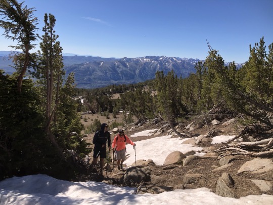
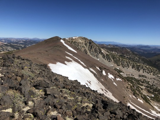
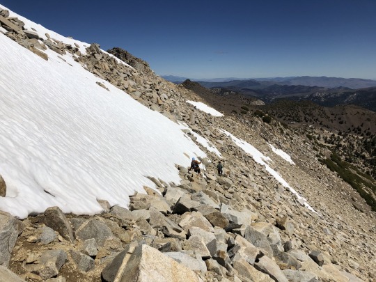
Table Mountain (N) via Tyee Lakes, 2022 Sierra Challenge Day 8
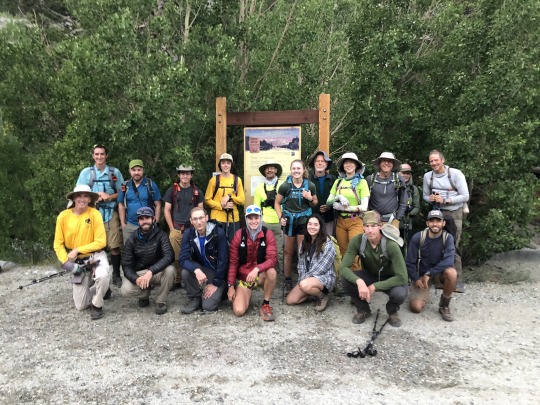
There are two Table Mountains within in the Sierra Nevada. The southern Table Mountain lies on the Great Western Divide and is a very difficult peak to day hike. The northern Table Mountain lies between South Lake and Lake Sabrina east of the Sierra Crest and relatively speaking is a very easy peak to day hike. Day 8 of the 2022 Sierra Challenge was designed to be an active rest day, sandwiched between the two toughest days of the The Citadel and Mt Torchbearer. Therefore, the northern Table Mountain seemed like a good fit. Bob surprisingly encouraged this selection, as there had never been a Sierra Challenge outing starting from Tyee Lakes Trailhead.
I woke up in my motel room somehow motivated to keep in the running for the Yellow Jersey. I drove through the darkness and arrived at the Tyee Lakes Trailhead as the dawn light began to fill the sky. As with most easy days, we had a big crowd for the day's outing. I was disorganized, rushing and awkwardly reintroduced myself to Andrew Schaper. While I had met him many times before, I had never seen him without his hat and sunglasses. I took the trailhead photo and we set off. I immediately dropped to the back of the pack and maintained a very slow pace with Mike. His Achilles was giving him trouble, but he quickly found that my pace was too slow even for him so let left me. My legs were in great pain following the previous day's outing and I suffered more than I expected. I was at least able to pass 77 year old Ron Hudson and his 68 year old girlfriend Karen Anderson, so I guess my pace could have been slower. After about two miles I reached the first of the Tyee Lakes where I caught up to Iris who was fishing and also nursing an injured knee.

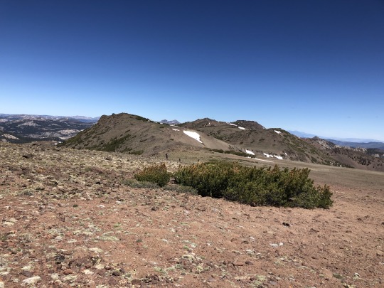
We passed by four lakes that day, with each of them getting more and more beautiful as we climbed.

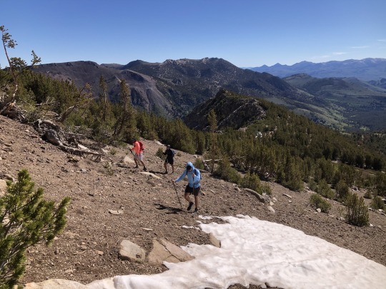
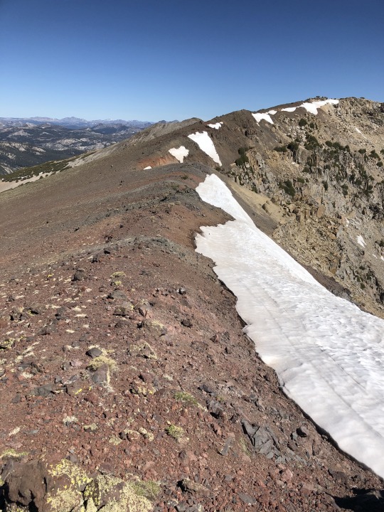
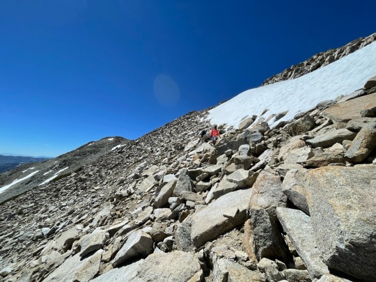
After 3 miles the trail left the lake basin and began switching back up to the plateau that was Table Mountain.


I spotted a large group on the top. I wished that I could have been part of the fun, but today was not the day.
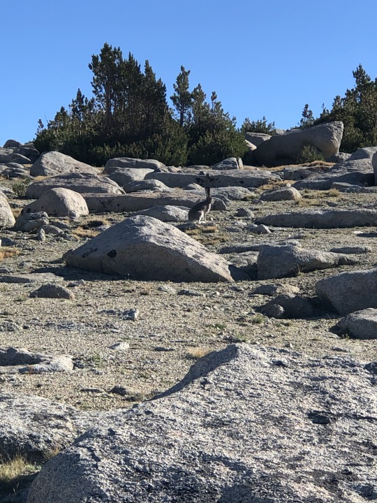
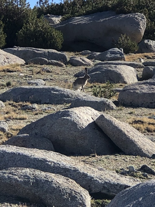
A couple large snowshoe hares darted across the barren plateau. There were humans approaching from all directions!
I passed some people heading down, and I watched as others made their way to other points atop the plateau. There were some pines in between me and the summit, so I took a roundabout way that lent itself to no bushwhacking.
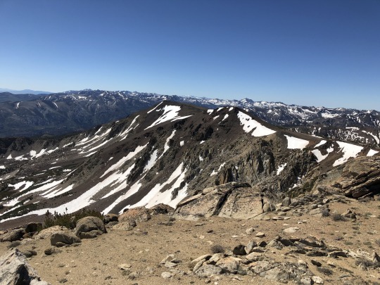
I found a surprisingly fun summit block. I took a challenging route up and sat on the summit. Emma and Megan were basking on one of the rocks below.
To the southwest were Mt Powell and Point Powell.

To the northwest were Mt Emerson and Mt Humphreys.

To the southeast were Cloudripper and Mt Agassiz.

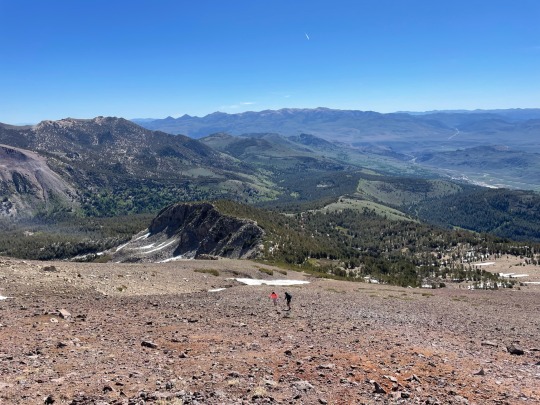
There was another point to the northwest that looked nearly as tall, so I decided to go visit it. It was about three quarters of a mile away, but it looked closer. Others had already headed that way so I decided to follow. Sandy slopes took me to another interesting set of summit boulders. This peak did not qualify as a bonus peak, but it made for a worthwhile detour. Besides, I'm a purist. Looking back was the first summit.
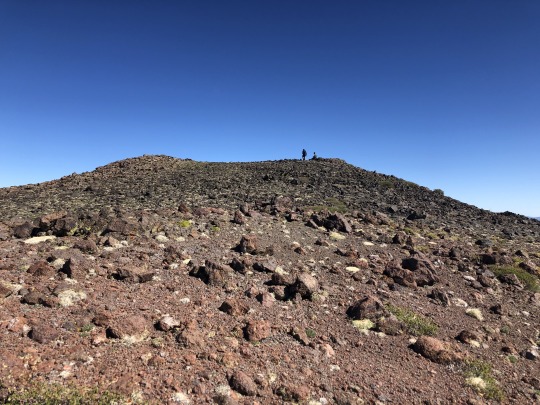
There were a couple possible high points at this location so I scrambled up both piles of rocks. Again they were fun class 3.

To the south was Thompson Ridge. Some of the more eager participants had continued towards this challenging 13er.
I then continued a half mile southeast to a third and final point on the plateau. Mason had mentioned finding a Smatko register on this summit previously, but not I, nor anyone else, found it.

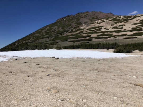
I headed cross country down sandy slopes back to the trail where I found Zee. We chatted for a bit then I stopped at the lake for a refreshing swim. Iris was out and about fly fishing, a true outdoors woman.

With a mile left to go, I ran into a challenge participant who was just starting. It was almost noon, but he still had plenty of time being that it was an easy day. He immediately asked me if I had any food. I said no, but this was a lie. I wasn't willing to share my dwindling snack reserves with an adult who could easily buy their own. Later that night, that same participant locked his keys in his car at Copper Top in Big Pine. Luckily, I had already left to investigate the Shepherd Pass Trailhead conditions, so I didn't have to waste my energy with that ordeal.
Official Summary:
Active rest day.
A 6am start was a little early following an arduous day 7, but many were at the trailhead on time. Today was a good day for fishermen and lake swimmers. The summit block was a fun class 3 scramble.
I went to all three points of Table Mountain that were marked on the topo. My feet are starting to hurt really bad so I'm worried about tomorrow. Let's see what my body can handle.
2 notes
·
View notes
Text
Heavy Rain in California Causes Flooding but Offers Respite From Drought
https://sciencespies.com/environment/heavy-rain-in-california-causes-flooding-but-offers-respite-from-drought/
Heavy Rain in California Causes Flooding but Offers Respite From Drought
Rain, snow and wind were battering parts of California on Saturday less than a week after another “atmospheric river” pounded the West Coast.
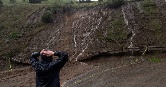
LAKE ARROWHEAD, Calif. — Heavy rain and snow caused landslides and flooding in parts of California on Saturday, shutting down two major highways as another “atmospheric river” system pounded the West Coast, but also brought a measure of relief to the drought-plagued state.
An hourslong torrent of rain forced Highway 101 to close south of San Francisco because of flooding, cutting off a major route between the city and the Silicon Valley. The storm temporarily forced the closure of Highway 50 in the Sierra Nevada, a route that connects skiers to South Lake Tahoe.
The heaviest flooding and risk of damage was in Northern California, where rain was expected to let up by Saturday evening, but some rivers and streams were already reaching flood stage levels. In Sacramento County, officials declared a local state of emergency and warned residents in one rural area to evacuate because of rising waters.
Authorities issued evacuation orders for several Northern California communities where rising waters swamped streets on Saturday. The evacuations included parts of El Dorado County, east of Sacramento, and areas of Santa Cruz County, southwest of San Jose.
In Monterey County, further south, the local sheriff issued an evacuation warning for one region due to flooding. In San Ramon, east of San Francisco, the local police reported evacuation efforts were underway on Saturday afternoon. San Ramon police lieutenant Tami Williams said the department used armored vehicles to reach “senior citizens who needed assistance with evacuations due to flooding.” She said the department came to the aid of 13 people.
A rock slide blocked State Route 299 near Burnt Ranch, Calif., east of Eureka.Micah Crockett/Caltrans, via Associated Press
The Cosumnes River in Northern California exceeded flood stage and was expected to crest at 15.5 feet by Saturday night. Parts of the state have already had up to seven inches of rain from Friday to Saturday. Downtown San Francisco was pushing close to its record for most rainfall on a single day, with 5.33 inches of rain reported by Saturday afternoon, according to the National Weather Service. (The record, set in 1994, is 5.54 inches in one day).
No injuries or deaths had been reported in the region Saturday night.
In Southern California, light to moderate rain was falling in the Los Angeles area on Saturday and was expected to be accompanied by strong wind gusts through the evening, forecasters said. A high-wind warning is in place for most of the area’s mountains and the Antelope Valley.
The current downpour is being driven by an atmospheric river flowing from the Pacific Ocean, a meteorological phenomenon that carries condensed water vapor from other parts of the world.
An unusually strong and long-lasting atmospheric river on the West Coast just after Christmas led to the deaths of five people after trees fell on vehicles in three separate episodes, the authorities in Oregon said. Tens of thousands in the Pacific Northwest lost power.
More on California
U.C. Employee Strike: Academic employees at the University of California voted to return to work, ending a historically large strike that had disrupted research and classes for nearly six weeks.
Wildfires: California avoided a third year of catastrophic wildfires because of a combination of well-timed precipitation and favorable wind conditions — or “luck,” as experts put it.
San Francisco’s Empty Downtown: Tech workers are still at home. The $17 salad place is expanding into the suburbs. Today San Francisco has what is perhaps the most deserted major downtown in America.
Los Angeles’s New Mayor: Karen Bass was sworn in as the first female mayor of the nation’s second-largest city in a ceremony that celebrated her historic win but also underscored the obstacles ahead.
Significant flooding was expected in the Sacramento area until 10 p.m. on Saturday, and heavy snow at higher altitudes, National Weather Service forecasters said.
Officials urged drivers to turn around if they came upon flooded roads. Sacramento firefighters rescued several teenagers from tree limbs early on Saturday after their car was stuck in floodwaters. No injuries were reported, the authorities said.
A map showing the precipitation forecast for California and surrounding areas for December 29 to January 3.
/* based on rendered scss from key.scss */ <p>.hmap-segmented-key .g-key-block display: inline-block; margin-bottom: 4px; .hmap-segmented-key .g-key-block:last-child margin-bottom: 20px; <p>.hmap-segmented-key .g-key-block p margin: 0 5px 4px 0; <p>.g-center-leadin .hmap-segmented-key text-align: center; <p>.hmap-segmented-key .g-key-row p display: inline-block; vertical-align: middle; margin: 0; font-size: 15px; line-height: 19px; <p>/* Segmented key */ .hmap-segmented-key margin: 10px auto 0 auto; <p>.hmap-segmented-key .g-key-row position: relative; margin: 0; display: inline-block; .hmap-segmented-key .g-key-row .g-key-rect display: block; margin: 0; width: 35px; height: 10px; <p>.hmap-segmented-key .g-key-row p position: absolute; white-space: nowrap; text-align: center; line-height: 1em; margin-top: 3px; left: 0; transform: translate(-50%, 0); .hmap-segmented-key .g-key-row:last-child p transform: translate(-10%, 0);
Five-day precipitation forecast
1
2
3
5
10+ inches
.ditu-artboard display: none; margin: 0 auto;
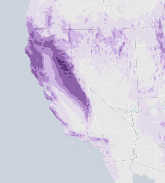
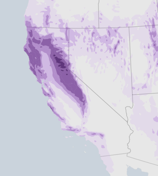
Source: NOAA
Notes: Estimates are for Dec. 29 at 7 p.m. Eastern time to Jan. 3 at 7 p.m. Forecast is as of 4:55 p.m. on Dec. 29. Values are in inches of water or the equivalent amount of melted snow and ice.
By Zach Levitt
Highway 92 from Skyline Boulevard to Main Street in Half Moon Bay was closed because of flooding.
The greatest risk of the extreme weather is in previously burned areas along the coast, William Churchill, a forecaster and meteorologist with the National Weather Service’s Weather Prediction Center in College Park, Md., said this week. Rapid, prolonged rainfall could cause mudslides or debris flows, he said.
But in California — where reservoir levels have fallen, major rivers have run nearly dry and residents have been under emergency conservation orders for months — a storm that is dumping rain and snow on the region brings hope that this winter could at last break the state’s punishing dry spell.
The National Weather Service issued a winter storm warning for parts of the Sierra Nevada in Central California, near Yosemite National Park, saying that as much as five feet of snow could accumulate at the highest elevations.
More rain is in the forecast across the state during most of the first week of the new year.
Water experts are normally circumspect when trying to explain the impact of a single atmospheric river on the state’s current drought, which began in 2020. But they have a glimmer of hope as a succession of storms are in the forecast.
“The whole weather outcome in parts of the West hinges on these atmospheric rivers,” said Marty Ralph, the director of the Center for Western Weather and Water Extremes with the Scripps Institution of Oceanography. The storm, he added, “is looking like a potent contributor to busting the drought.”
Karla Nemeth, the director of the California Department of Water Resources, the agency that manages the Golden State’s most precious resource, said that California must toe a fine line during intense winter storms. On one hand, the state desperately needs winter rain and snow to replenish water supplies before the annual dry spell that often persists from spring through fall.
But climate change has also intensified weather extremes in the West, and long bouts of heavy rain can cause devastating flooding or mudslides in areas that have recently burned. Warm storms in particular could melt snow prematurely and send a torrent of water down mountains and into already saturated cities.
“This is kind of a Goldilocks situation,” Ms. Nemeth said. “We’re cautiously optimistic.”
On California’s ski slopes, the unusually heavy snowfall was a welcome gift. Mammoth Mountain, a resort on the border of Yosemite National Park, expected to see several feet of snow on Saturday, with more snowfall expected through mid-January, said Lauren Burke, the resort’s director of communications.
The resort had already benefited from heavy snowfall this winter, including 10 to 15 feet of snow in the past month alone, Ms. Burke said. By midday Saturday, the resort was recording 90 to 131 inches of snow at its base depth, among the deepest in the country, according to data from On The Snow, which tracks snow cover at resorts nationwide.
“The snowpack holds up really well, even with this warmer, wet, heavy snow,” Ms. Burke said. “It just kind of slathers the mountain and builds up a really deep base.”
Significant snowpack has accumulated across the Sierra Nevada region, including, in the Southern Sierra, nearly 200 percent of the average snow water equivalent that is typically recorded at this time of year, according to data from the California Department of Water Resources.
While cautioning against the risk of flooding, experts say the storms are on track to be largely beneficial to the state. That’s in part because the water levels of the West’s major rivers and reservoirs are already so much lower than normal, so it would take an extraordinary amount of rain over a short period of time to fill them back up; the worst flooding takes place when big waterways and reservoirs spill over their banks in populated areas.
Ms. Nemeth noted, for instance, that the coming series of storms could boost the water storage supply by about a third at Lake Oroville, one of the state’s largest reservoirs and by some measures its most important. That would bring the stored water supply to about 1.5 million acre feet, which is still less than the 1.6 million acre feet that she said would be ideal.
Recent research has shown that atmospheric rivers are the source of as much as half of the precipitation along the West Coast.
Dr. Ralph and his colleagues have developed a system for categorizing the storms borne by atmospheric rivers that is similar to the system for categorizing hurricanes. And they believe that with the recent advances in the accuracy of forecasting, water managers can take better advantage of wet periods by more precisely releasing or holding water at reservoirs.
He said that the center’s high-tech forecasting tools and models show there could be more rain deep into January in California.
Jeffrey Mount, a senior fellow with the Public Policy Institute of California’s Water Policy Center, said that a rainy January would not only deliver relief to the state’s residents, but it would also be a lifeline to salmon, migratory birds and other species that have been struggling in the state’s ailing waterways and wetlands.
Still, he emphasized that one downpour will not end the extreme drought in the West, nor should it cause state leaders to bring any less urgency to figuring out how to live with less water.
Dr. Mount pointed to last winter, when an “epic snowfall” in December gave way to the three driest months on record in January, February and March, leaving California’s water managers scrambling.
#Environment
2 notes
·
View notes
Text
Vagabonding as a Spiritual Path
The natural world is my muse and sanctuary -- a place for refuge and discovery. My most memorable moments have been in the outdoors. I have hiked thousands of miles of trails through forests, deserts and mountains. Having spent much of my life traveling and trekking, I still crave adventure and new experiences. Vagabonding or nomadic wandering is a unique way of living, a spiritual path to authenticity, self-awareness and solitude. Solitude allows time for self-examination, relaxation away from urban stress, and a chance to meditate, contemplate, or just zone out for hours at a time. Many of my most memorable experiences took place during solo journeys into Nature. The longer the solo immersion, the more transformational the experience.
In October 2011, I felt Spirit calling me. I felt compelled to travel to the sacred sites and power places that beckoned me. I followed my intuition and deepest instincts. I traveled with my drum and medicine bundle to shamanize the meridian system of Mother Earth's numinous web, which is the planetary counterpart to the acupuncture meridian system of the human body. At the intersection points of the planet's energy web exist holy places, power spots, or acupuncture points. Like acupuncture needles, humans are capable of maintaining the harmonious flow of the planetary energy meridians by making an Earth connection at power places.
Many magical things happened during my two month pilgrimage. I camped at Panther Meadows on Mount Shasta. I hiked among the oldest living things on the Earth in the Ancient Bristlecone Pine Forest. I soaked in the healing waters of Umpqua, Buckeye, Travertine, Whitmore, and Keough Hot Springs. Indigenous people worldwide believe that where fire and water mix at a hot spring is a sacred place. A water deity, usually a goddess, resides in each spring. People make pilgrimages to thermal springs to connect with the goddess and to supplicate the benefits of her healing graces. The sacred ambience of the place, its geothermal energy and the pilgrim's relationship to it, is sufficient to fulfill the pilgrim's aspirations.
I ventured south through California and explored the Owens Valley area on the east side of the Sierra Nevada crest. Before returning home in early December, I planned a four day desert exploration. On day one, I visited the Sleeping Lizard, which is an ancient vision quest site located in the Volcanic Tablelands north of Bishop. This site is sacred to the Owens Valley Paiute people, who use alcoves in the rock for vision quests. I took a journey back in time to visit the ancient ones who etched petroglyphs in the volcanic rock.
Next, I drove up the Whitney Portal Road towards the trailhead that hikers climb up to Mount Whitney. Unfortunately the road to the trailhead was closed for the winter. I backtracked down the road and camped in the Alabama Hills, located in the shadow of Mount Whitney just west of Lone Pine. The rounded weathered contours of the reddish-orange foothills contrast with the sharp ridges of the Sierra Nevada to the west. Throughout the last century, the Alabama Hills have appeared in hundreds of films and commercials. During my visit, a Quintin Tarantino project (Django Unchained) was being shot there.
In one day I drove from Mount Whitney (the sacred masculine), the tallest mountain in the continuous 48 states, into Death Valley (the sacred feminine), the lowest elevation in North America. Shortly after entering Death Valley National Park, I took an eight-mile detour north along the Saline Valley Road to visit a Joshua Tree forest at Lee Flat. The Saline Valley Road is very rough and progress was slow, but I eventually reached the magical forest. A cold wind buffeted me each time I left the confines of my truck to hike and photograph the forest. I would have camped here for the night if not for the high elevation and bitter cold wind. I camped instead at Panamint Springs Resort, 22 miles inside the western border of Death Valley National Park.
The following day, I explored Darwin Falls and the remote Panamint Valley adjacent to Death Valley. I camped for the next few days at the far northeast end of the South Panamint Dry Lake, a small wetland, grassland, dune system and mesquite bosque. The warm sulfur springs of this desert oasis provide habitat for frogs, shore birds, marsh hawks, and wild burros. A short-eared owl visited my campsite each evening at dusk. The stars bathed the cold desert in a warm glow. Few things are more serene than the deep stillness of the desert on a starry night. In that stillness, I am reborn, forever changed.
Oh, how I love vagabonding. Shamanism is deeply rooted in Nature and a nomadic lifestyle. The emphasis is on the individual, of breaking free and discovering one's own uniqueness in order to bring something new back to the group. Like drumming, nomadic wandering alters your ordinary everyday awareness. It is another means of habitual pattern disruption for reimprinting on alternate realties. When you leave home, meet new people, experience new stimuli, and process new information, you're soon intoxicated on a natural high. As Ed Buryn, the godfather of modern vagabonding puts it, "Vagabonding is nothing less than reality transformation, and its power is not to be underestimated."
7 notes
·
View notes
Link
Check out this listing I just added to my Poshmark closet: NEW Pendleton 4pc Mug Set National Park Collection.
0 notes
Text
Call +1 323-521-4389: Arlo Pro 4 Camera Support in Los Angeles
Phone Number/Call us at +1 323 521 4389 for Arlo Pro 2, 3, & 4 Camera Customer Support Service of indoor and outdoor security in Acton, Adams-Normandie, Agoura Hills, Agua Dulce, Alhambra, Alondra Park, Altadena, Antelope Acres, Arcadia, Arleta, Arlington, Heights, Artesia, Athens, Atwater Village, Avalon, Avocado Heights, Azusa, Baldwin Hills, Baldwin Park, Bandini, Bassett, Bel Air, Bell, Bell Gardens, Bellflower, Beverly Crest, Beverly Glen, Beverly Grove, Beverly Hills, Beverlywood, Bouquet Canyon, Boyle Heights, Bradbury, Brentwood, Broadway-Manchester, Burbank, Calabasas, Canoga Park, Canyon Country, Carson, Carthay, Castaic, Central Avenue, and Cerritos.

Charter Oak, Chatsworth, Chinatown, Citrus, City of Industry, Claremont, Commerce, Compton, Covina, Crenshaw, Crystalaire, Cudahy, Culver City, Del Aire, Del Sur, Diamond Bar, Downey, Duarte, Eagle Rock, East Los Angeles, East Pasadena, East Rancho Dominguez, East San Gabriel, Echo Park, El Camino Village, El Monte, El Segundo, El Sereno, Elizabeth Lake, Encino, Expo Park, Fairmont, Firestone Park, Florence, Gardena, Glassell Park, Glendale, Glendora, Gorman, Graham, Granada Hills, Green Meadows, Green Valley, and Hacienda Heights.
Hancock Park, Harbor City, Hawaiian Gardens, Hawthorne, Hermosa Beach, Hi Vista, Hidden Hills, Highland Park, Hollywood, Huntington Park, Inglewood, Irwindale, Juniper Hills, Kagel Canyon, Kinneloa Mesa, Koreatown, La Canada Flintridge, La Crescenta, La Habra Heights, La Mirada, La Puente, La Verne, Ladera Heights, Lake Balboa, Lake Hughes, Lake Los Angeles, Lake View Terrace, Lakewood, Lancaster, Lawndale, Lennox, Leona Valley, Lincoln Heights, Littlerock, Llano, Lomita, Long Beach, Los Angeles, Los Feliz, Los Nietos, Lynwood, Malibu, Manhattan Beach, Mar Vista
Marina Del Rey, Maywood, Mid-Wilshire, Mint Canyon, Miracle Mile, Mission Hills, Monrovia, Monte Nido, Montebello, Montecito, Heights, Monterey Park, Montrose, Mount Washington, Newhall, North El Monte, North Hills, North Hollywood, North Whittier, Northeast Antelope Valley, Northridge, Northwest Palmdale, Norwalk, Pacific Palisades, Pacoima, Palmdale, Palms, Palos Verdes Estates, Palos Verdes Peninsula, Panorama City, Paramount, Pasadena, Pearblossom, Pico Rivera, Pico-Robertson, Pico-Union, Playa Del Rey, Playa Vista, Pomona, Porter Ranch, Quartz Hill, Ramona, Rancho Dominguez, Rancho Palos Verdes, and Rancho Park.
Redondo Beach, Reseda, Rolling Hills, Rolling Hills Estates, Rosemead, Rowland Heights, San Dimas, San Fernando, San Gabriel, San Marino, San Pasqual, San Pedro, Santa Clarita, Santa Fe Springs, Santa Monica, Sawtelle, Shadow Hills, Sherman Oaks, Sierra Madre, Signal Hill, Silver Lake, South El Monte, South Gate, South Park, South Pasadena, South San Gabriel, South San Jose Hills, South Whittier, Southeast Antelope Valley, Stevenson Ranch, Studio City, Sun Valley, Sun Village, Sunland, Sylmar, Tarzana, Temple City, Toluca Lake, Topanga, Torrance, Tujunga, Tujunga Canyons, Unincorporated Catalina Island, and Unincorporated Santa Monica Mountains.
Universal City, University Park, Val Verde, Valencia, Valinda, Valley Glen, Valley Village, Valyermo, Van Nuys, Venice, Verdugo City, Vermont Knolls, Vermont Square, Vermont Vista, Vermont-Slauson, Vernon, View Park-Windsor Hills, Vincent, Walnut, Walnut Park
Watts, West Athens, West Carson, West Compton, West Covina, West Hills, West Hollywood, West Los Angeles, West Puente Valley, West Whittier, Westchester, Westlake, Westlake Village, Westmont, Westwood, Whittier, Willowbrook, Wilmington, Winnetka, and Woodland Hills.
#la#los angeles#Arlo#arlo camera los angeles#arlo camera Setup los angeles#arlo camera#arlo camera login#cctv#arlo#camera#usa#arlo camera setup support#arlo setup#arlo netgear
0 notes
Text
Top 10 Beautiful Neighborhoods In Riverside, California
Riverside is a large city in Southern California that's known for its beautiful neighborhoods. Here are 10 of the most beautiful neighborhoods in Riverside:
Wood Streets Riverside
Wood Streets Riverside is a neighborhood in Riverside, California. Wood Streets is located in the San Bernardino County and has a zip code of 92505.
Wood Streets is located in the city of Riverside.
It is located within a region known as Southwestern United States.
Orangecrest Riverside
Orangecrest is a neighborhood in Riverside, California. It is located in the south-east corner of Riverside, bordered by Orangecrest Heights on the north and east, Wood Streets on the south, and Canyon Crest on the west.
Wood Streets Riverside is a neighborhood in Riverside, California. Wood Streets is located in the San Bernardino County and has a zip code of 92505.
Wood Streets is located in the city of Riverside.
It is located within a region known as Southwestern United States.
Canyon Crest Riverside
Canyon Crest Riverside is a neighborhood in Riverside, California. It’s located at the base of the San Jacinto Mountains and is part of the city’s Southeast Side. The area is home to many schools, including Canyon Springs High School (which has been named one of America’s best public high schools) as well as Palm Valley Elementary School and San Jacinto Unified School District elementary schools. There are also several parks within this neighborhood, including Lynx Lake Park and Rock Creek Park.
Hawarden Hills Riverside
Hawarden Hills Riverside is a neighborhood in the city of Riverside, California. It is located in the eastern part of the city, and is bordered by Chino Hills State Park to the east, Cherry Avenue to the north, Magnolia Avenue to the west, and the city of Moreno Valley to the south.
The area was originally known as Hawarden Ranch until it was developed into a planned community in 1956 by William T. Coleman and his son-in-law. The development consisted of 1 square mile (2 km²) with 20 land lots ranging from 2 acres (8,100 m²) up to 4 acres (16,000 m²). The original community had built over 70 homes before it was annexed by Riverside City Council on October 14th 1959 which increased its population from 631 people to more than 10 000 residents today!
Sycamore Canyon Park Riverside
Sycamore Canyon Park is a neighborhood in Riverside, California. Sycamore Canyon Park is located at the western edge of the city of Riverside, extending from State Route 91 to Interstate 215 and covering approximately 2 miles.
Sycamore Canyon Park has homes ranging from $200K to $400K+.
Victoria Riverside
The Victoria Riverside neighborhood is named after Queen Victoria. It is bounded by the San Jacinto Mountains to the north, I-215 to the east, University Avenue to the south and Magnolia Avenue to the west.
Victoria Riverside consists mainly of single-family homes with interspersed apartment complexes and older businesses such as hardware stores and small shops.
Deerfield Ranch Riverside
Deerfield Ranch Riverside is a neighborhood in Riverside, California. It is located in the western part of the city, within the foothills of the San Jacinto Mountains. Deerfield Ranch was developed in the 1960s by real estate developer Del E. Webb Corporation and was designed for middle-class families looking for affordable housing with good schools nearby.
Mission Grove Riverside
Mission Grove Riverside is a neighborhood in Riverside, California. It is located in the northeastern corner of the city and is bordered by the city of Jurupa Valley to the north, Mission Grove Park to the east, and Orangecrest to the south.
The area was developed in the early 1950s and was originally named Mission Grove. It featured houses on large, tree-lined lots. In 1960, the neighborhood was annexed by Riverside and renamed to accommodate its proximity to nearby Mission Grove Park.
La Sierra Acres Riverside
La Sierra Acres Riverside is a neighborhood in Riverside, California. It is located in the San Bernardino County region of California. This neighborhood was developed in 1947 and covers an area of 5.6 square miles. The population of this beautiful neighborhood is approximately 20,000 people according to statistics from the year 2000.
Sunnyvale
Sunnyvale is a city in Santa Clara County, California. It is a suburb of the major tech center in the South Bay Area, and offers some beautiful neighborhoods to live in. Sunnyvale is located at the southern end of the San Francisco Peninsula, just north of San Jose. While not as well-known as neighboring cities such as Palo Alto or Mountain View, Sunnyvale has its own charm.
Sunnyvale is an affluent suburb of Silicon Valley that boasts beautiful homes with amazing views of mountains and lakes within its borders. Because it's so close to major corporations like Google, Apple and Intel (just to name a few), you'll find that many people who work for these companies call this area home due to its proximity—it doesn't hurt that rent prices are also quite reasonable!
Kings Ranch Rd
Kings Ranch Rd is a beautiful neighborhood located in Riverside, California. It's a gated community with lots of greenery and parks. There are also many trails that are perfect for walking or biking. The country club has a golf course where you can enjoy some time outside while enjoying the beauty of nature. The homes here are large, well maintained, and have great views of mountains and trees.
We hope you have found this list to be helpful. As we mentioned earlier, these are just some of the many neighborhoods in Riverside, California. There are so many great places to live and explore in this city, and it’s worth exploring all the options before making any final decisions on where you will call home.

Home Electrical Repair
Home electrical repair is a broad category of work done on a home's electrical system. Repairing home electrical systems can range from installing a new outlet to wiring an entire house. The most common types of home electrical repairs include installing light fixtures, replacing outlets, adding switches, and repairing wiring.
We are dedicated to providing the best possible home electrical repair service. We are committed to providing our customers with high quality, professional and timely service at an affordable price. We do this by offering a wide range of services
Call us today to arrange an appointment.
Dash Electric
11219 Yucca Dr, Riverside, CA 92505
951-421-0300
https://dashelectricservice.com/
0 notes
Photo
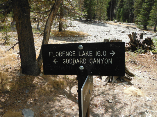
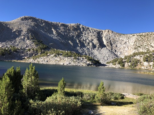
The Pacific Crest Trail & John Muir Trail Junction. In the past 6 days I have only seen 2 hikers; but, within 2 hours of walking on this popular hiking trail, I encountered 26 people. Everybody is friendly, but it sure does kill the joys of solitude. Goddard Canyon, South Fork of the San Joaquin River, Sequoia-Kings Canyon National Parks, SEKI, Sierra Nevada Mountains, California, USA. Photo by Van Miller
#Pacific Crest Trail#john muir trail#goddard canyon#south fork of the san joaquin river#sequoia-kings canyon national park#kings canyon national park#seki#Sierra Nevada Mountains#california#©Van Miller#hiking#Hiking Trails#trails#backpacking#outdoors#camping#Wanderlust#travel#Wilderness#the wilderness journals
10 notes
·
View notes
Photo

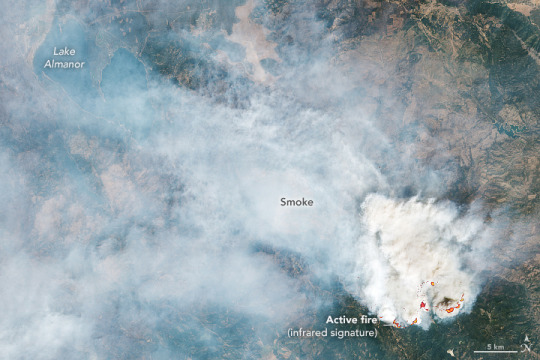
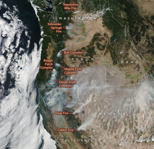
Arc of Fires in the U.S. West As August 2021 came to an end, 42,647 fires had scorched 4,879,574 acres across the United States in 2021—close to the ten-year average for the first eight months of a year, according to statistics from the National Interagency Fire Center. But among the 83 fires still actively burning on August 31, some were especially fierce; two of them had crossed the crest of the Sierra Nevada for the first time in recent record-keeping. The largest blazes burned in Northern California, most notably the Caldor and Dixie fires, which together have scorched nearly 1 million acres (1,500 square miles) so far. Smoke from the Caldor fire near Lake Tahoe is visible in the image above, acquired on the afternoon of August 30, 2021, with the Moderate Resolution Imaging Spectroradiometer (MODIS) on NASA’s Aqua satellite. Between ignition on August 14 and the time of the image, the fire had burned more than 170,000 acres. The fire perimeter was 14 percent contained as of August 31. The Caldor fire spread rapidly amid dry and gusty conditions, prompting officials to expand mandatory evacuation orders to the Tahoe Basin, including South Lake Tahoe, a lakeside city of nearly 22,000 people. According to news reports, Caldor is only the second-known fire to have crested the ridge of the Sierra Nevada, burning from one side to the other. It follows the Dixie fire, which crossed over the ridge earlier in the month. Meanwhile, the Dixie fire continues to spread. Since igniting on July 13, the fire has burned more than 800,000 acres and has surpassed the August Complex to become the second-largest fire on record in California. The Dixie fire was nearly 50 percent contained as of August 31. Smoke from the Dixie fire is visible in the second image above, acquired on August 28, 2021, with the Operational Land Imager (OLI) on Landsat 8. The infrared signatures of actively burning areas are outlined in red. Evacuation orders have been lifted on the fire’s western side, but they were replaced on August 30 with new evacuation orders as the fire approached Lake Davis. While the Caldor and Dixie fires are the largest, other wildfires are also posing hazards to people, property, and air quality across the U.S. West. On August 29, 2021, the Visible Infrared Imaging Radiometer Suite (VIIRS) on the NOAA-NASA Suomi NPP satellite acquired this image showing the ominous arc of fires across Washington, Oregon, and California. NASA Earth Observatory images by Lauren Dauphin, using MODIS data from NASA EOSDIS LANCE and GIBS/Worldview,VIIRS data from NASA EOSDIS LANCE, GIBS/Worldview, and the Suomi National Polar-orbiting Partnership, and Landsat data from the U.S. Geological Survey. Story by Kathryn Hansen.
2 notes
·
View notes
Text
He broke a hiking record on the PCT . . . This was the extreme physical toll
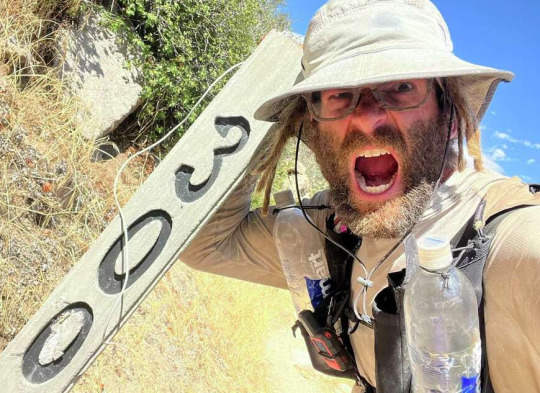
Nick Fowler set a record for the fastest self-supported thru-hike on the Pacific Crest Trail. Here he took a selfie at mile marker 300 in the Southern California desert. Nick Fowler
SF Chronicle writer Gregory Thomas continues his interest in fast hiking of the PCT as he talks to Nick Fowler, new record holder for the fastest unsupported hike of the PCT. [See also the last post about Karel Sabbe's fastest support hike of the PCT.] Unsupported means that Fowler did not have a team to meet him on the trail with food or water or shelter. Fowler would have had to send himself his resupply or travel into trail towns to purchase food. It is an amazing achievement but not without consequences . . . including significant health issues. Interestingly, Fowler walked his hike SOBO.
An Oklahoma hiker traveling alone shattered the speed record for a self-supported thru-hike of the Pacific Crest Trail. That means he trekked the 2,650-mile trail solo, without the backing of a crew to help him make camp, cook or care for his body along the arduous journey.
Starting in Washington state in July and heading south, Nick Fowler covered an average of about 51 miles per day for 52 days, 9 hours and 18 minutes. He arrived in Campo (San Diego County), near the Mexico border, on Sept. 6, having beaten the previous self-supported record by more than three days.
On Monday morning, Fowler said his body is paying the price for the effort: His toes and forefeet are still numb.
“I’m exhausted,” he told the Chronicle. “I’ve been doing nothing but eating and sleeping since I got home.”
Speed records on the Pacific Crest Trail — and for that matter the Appalachian Trail, too — have been falling the past several years as extreme endurance athletes have taken interest in one-upping each other to establish fastest known times, or FKTs, on America’s wilderness trails. Several of the players belong to the burgeoning global community of ultrarunners — niche performers who participate in 100-mile-plus foot races in the mountains — including Karel Sabbe, who last month smashed the record for a supported thru-hike of the PCT, completing the trail in 46 days.

Nick Fowler sits at the southern terminus of the Pacific Crest Trail near the U.S.-Mexico border in early September.Nick Fowler
Fowler, by contrast, is a 35-year-old entrepreneur from Tulsa who says he hadn’t hiked much at all until four years ago. “I’m a nobody,” he told the Chronicle. “I’m brand new to this.”
In 2019, Fowler and his wife lit out in a van to visit all 63 national parks across the country. Along the way, he discovered a love for the outdoors and became fixated on pushing his body to the max.
Two years ago, he set the self-supported FKT on the 1,248-mile Pacific Northwest Trail, which crosses mountain ranges in Montana, Idaho and Washington. Last year he claimed the same record on the Ozark Trail in Missouri. His high mark for a single day of hiking is 78 miles, he said.
But each trek took a toll, and Fowler came away with ligament damage in his ankles and a stress fracture in one foot. Last winter, he prepared for the PCT while on crutches, healing from a foot injury.
The past several PCT record-setters have attacked the trail from south to north, in part to avoid the worst of late-summer heat in the Southern California desert. But Fowler thought heading in the reverse direction would give him an edge: He’d start in Washington’s Cascade Range, where last winter’s snowfall was relatively low, then hit the High Sierra later in summer, when its historic snowpack would be at its thinnest and the landscape would be most easily passable.
The first half of his hike was relatively fast and smooth. He went ultralight, carrying a kit with a base weight of just 7½ pounds, and covered 55 miles per day. Every few days he’d detour into a town to buy food or pick up resupply boxes of clothes and shoes he’d mailed himself along the route.
Then he hit the High Sierra, roughly halfway through, “and it all kind of hit the fan,” Fowler said.
Exhaustion, dizzy spells, a pulled quadriceps, and “the nastiest blister I ever had in my life” chipped away at Fowler’s well-being. Then his urine turned blood red, the result of a condition called rhabdomyolysis, when muscles break down and release their contents into the blood.
The 10,000 calories per day Fowler had budgeted wasn’t enough to sustain him, so his starving body started pulling proteins and electrolytes from his damaged muscles. The Centers for Disease Control and Prevention defines rhabdomyolysis, which can be triggered by intense exertion, as “a serious medical condition that can be fatal or result in permanent disability.”
“I kept going even though everyone was telling me to stop,” Fowler said.
Attempting such an extreme objective forces a person to confront physical and mental limits, said Heather “Anish” Anderson, an author and respected endurance adventurer who set the self-supported FKT in 2013. During her trek, she felt her body “really breaking down,” she said.
Near Mount Shasta, Fowler crossed paths with Sabbe, the ultrarunner working on his supported FKT, and the two snapped a selfie together. Sabbe was being paced by two crew members, one of whom Fowler saw shuttling cans of soda for Sabbe — standard procedure for supported thru-hikers but an impossibility for those going self-supported.
“I was so jealous,” Fowler said. “I would have done anything for a cold pop in certain places.”
While traversing the High Sierra, Fowler encountered a ranger who was warning hikers off the trail: A hurricane of historic proportions was bearing down on Southern California and was forecast to bring deadly conditions to the mountains there.
“I thought, ‘I’ve already gone through so much, I’m not turning back now,’ ” Fowler said.
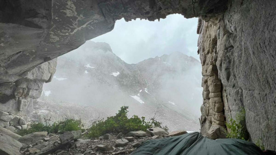
When Hurricane Hilary reached the southern Sierra, Fowler had to spend nearly two days hunkered down in a cave in the mountains.Nick Fowler
“I came out of the Sierra thinking, ‘Thank God I don’t have to deal with water anymore,’ ” he said.
The final stretch in the desert was so hot, and Fowler was so physically depleted, that the rhabdomyolysis returned and the hiker’s hands locked up on him, making it difficult for him to buckle his backpack straps.
By the time he arrived at the trail’s southern terminus to meet his wife, Fowler had been out of food and water for hours and hadn’t seen another hiker in days. “I felt like crap,” he said. “It was a real rough finish.”
FastestKnownTime.com, the record keeper for mountain treks, is reviewing Fowler’s record claim, which includes his GPS track, photos and trail notes.
Several days after finishing, Fowler said he’s still “in a fog” mentally and physically but had no regrets.
“It’s the funnest thing I’ve ever done in my life,” he said. “It’s just fascinating what the human body is capable of.”
1 note
·
View note
Text
Sep 2 Headlines
WORLD NEWS
Afghanistan: Taliban have declared victory. Now they must reckon with a country freefalling into chaos (CNN)
"Afghanistan is a very different country to the one the Taliban ruled between 1996 and 2001. Most Afghans don't even remember that era -- more than 60% of the country is aged under 25. It is urbanizing, diverse, and better connected to the world, all of which place it in stark contrast to the war-torn nation the Taliban conquered 25 years ago. What the Taliban now do with that country is arguably the world's most pressing geopolitical question."
Nigeria: Schools in Zamfara shut after mass kidnapping of students by gunmen (CNN)
"Schools in Nigeria's northwestern Zamfara State have been ordered closed after scores of students were kidnapped by gunmen on Wednesday. At least 73 students were abducted from a state-run high school in Zamfara's Maradun district, local police said in a statement, adding that the high school was targeted by "armed bandits.""
China: Bans men it sees as not masculine enough from TV (AP)
"China’s government banned effeminate men on TV and told broadcasters Thursday to promote “revolutionary culture,” broadening a campaign to tighten control over business and society and enforce official morality. President Xi Jinping has called for a “national rejuvenation,” with tighter Communist Party control of business, education, culture and religion. Companies and the public are under increasing pressure to align with its vision for a more powerful China and healthier society."
US NEWS
Hurricane Ida: Death toll tops 25 after remnants slam stunned Northeast (AP)
"A stunned U.S. East Coast faced a rising death toll, surging rivers, tornado damage and continuing calls for rescue Thursday after the remnants of Hurricane Ida walloped the region with record-breaking rain, drowning more than two dozen people in their homes and cars. In a region that had been warned about potentially deadly flash flooding but hadn’t braced for such a blow from the no-longer-hurricane, the storm killed at least 26 people from Maryland to New York on Wednesday night and Thursday morning."
Wildfires: Lake Tahoe wildfire seemed controllable, until winds flared (AP)
"Just last week, managers overseeing the fight against the massive wildfire scorching California’s Lake Tahoe region thought they could have it contained by the start of this week. Instead, the Caldor Fire crested the Sierra Nevada on Monday, forcing the unprecedented evacuation of all 22,000 residents of South Lake Tahoe and tens of thousands of tourists who would otherwise be winding down their summers by the alpine lake straddling the California-Nevada state line."
Abortion: Biden vows 'whole-of-government' response to new Texas law (BBC)
"US President Joe Biden has launched a "whole-of-government" response to oppose a new law in Texas that bans most abortions. He called the decision by the US Supreme Court not to block the law an "unprecedented assault" on women's rights. Any individual now has the right to sue anyone involved with providing an abortion past about six weeks. This is before many women know they are pregnant."
#current events#news#afghanistan#taliban#middle east#nigeria#africa#china#asia#united states#hurricane ida#wildfires#environment#global warming#climate change#climate crisis#abortion#biden#texas
2 notes
·
View notes
Text
San Francisco to Seattle
17 May - 5 June 2021
I thought it might be good to provide a summary of my recent 20-day ride from San Francisco to Seattle. Each day resulted in its own entry (linked below), but I wanted to provide a broader overview. (LINK: post about gear and bike setup).
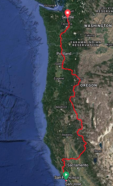

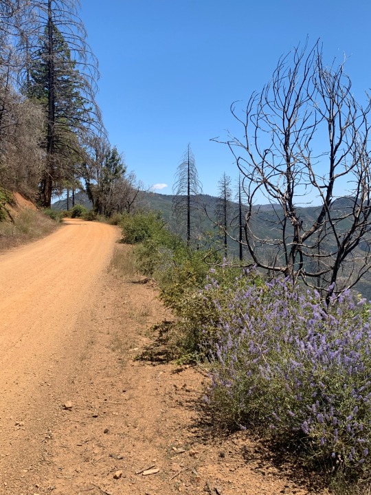
My route covered 1187 miles over 20 days (I-5, by car, is 820 miles). I averaged 62 miles per day, not counting my rest day (daily miles ranged from 32 to 88). I chose to take an inland route, in part because the roads were less trafficked and in part because I have a fondness of the wide open spaces of the interior. If I had been riding north to south, I might have opted for the coast, but there was no way I was going to add persistent northerly headwinds to an already very hilly and heavily trafficked (but very scenic) route.
Here are the links to individual days:
Day 1. 5-17. San Francisco to Petaluma. Pacific Ocean. Golden Gate Bridge. Dinner with M.
Day 2. 5-18. Petaluma to Clearlake. Santa Rosa. Chalk Hills. Ida Clayton Road. Middletown.
Day 3. 5-19. Clearlake to Williams. Clear Lake. Bartlett Springs Road. Leesville Grade.
Day 4. 5-20. Williams to Browns Valley. Sacramento River. Sutter Buttes. Central Valley.
Day 5. 5-21. Browns Valley to La Porte. Uphill, all day. Log trucks and wet snow.
Day 6. 5-22. La Porte to Quincy. North Sierras.
Day 7. 5-23. Quincy to Bogard. Spanish Fork. Taylorsville. Moonlight Pass. Westwood.
Day 8. 5-24. Bogard to Fall River Mills. Old Station. Hat Creek. Cassell Road.
Day 9. 5-25. Fall River Mills to Lava Beds. Bieber. Lookout. Tionesta.
Day 10. 5-26. Lava Beds to Klamath Falls. Lava. Tule Lake. Oregon.
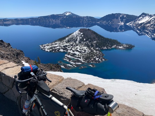
Day 11. 5-27. Klamath Falls to Mazama Village. Klamath Lake. Crater Lake NP.
Day 12. 5-28. Mazama Village to Davis Creek. Crater Lake. US97. Cascade Lakes.
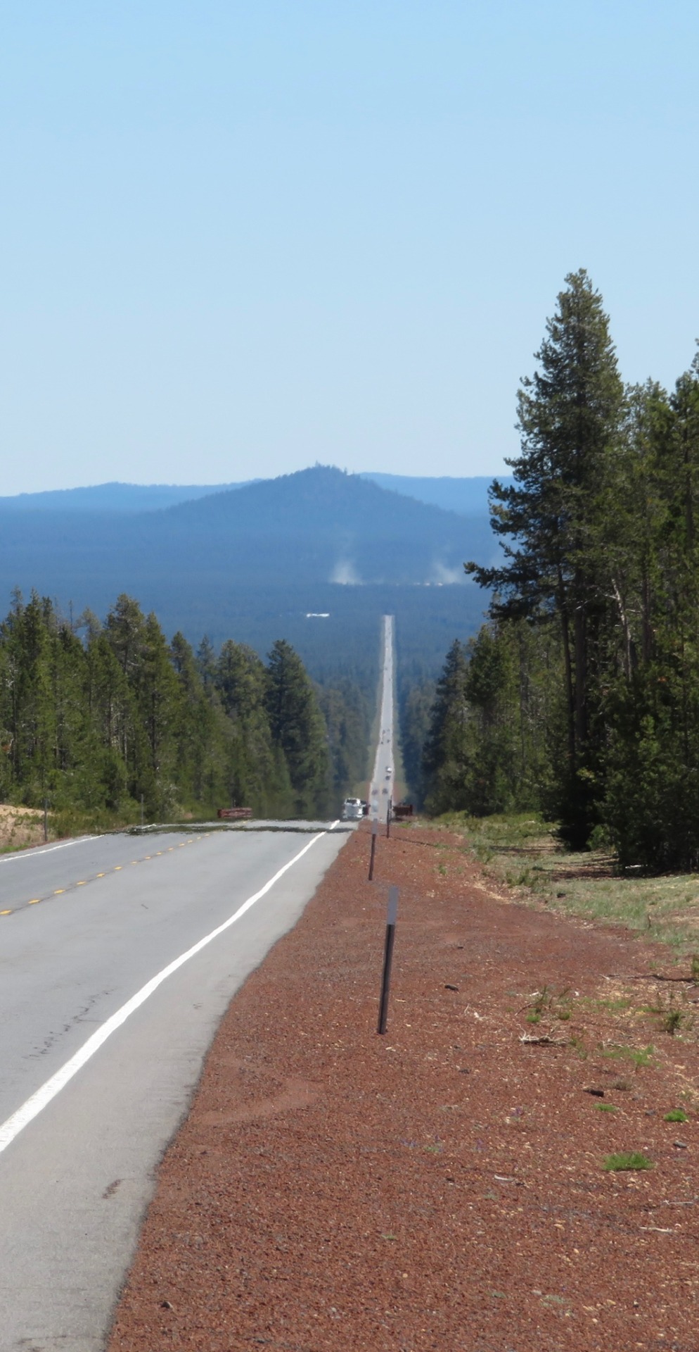
Day 13. 5-29. Davis Creek to Bend. Sun River. Deschutes River Trail.
Day 14. 5-30. Bend to Santiam Pass. Sisters. Lost Lake.
Day 15. 5-31. Santiam Pass to Sublimity. Detroit.
Day 16. 6-1. Sublimity to Portland. Silverton. Oregon City. The Willamette River.
Day 17. 6-2. Portland. Rest day.
Day 18. 6-3. Portland to Kelso. US 30 along Columbia. Longview.
Day 19. 6-4. Kelso to Yelm. Castle Rock. Chehalis. Tenino.
Day 20. 6-5. Yelm to Seattle. Spanaway. Puyallup. Green and Duwamish Rivers. Downtown.
The following is a link to the entire route in RideWithGPS. Note that this is a close approximation of the route, but not necessarily exact. The day-by-day posts above link to the actual ride data, which show enough detail to capture wrong turns, side trips, and exactly where I stopped for food, camped, or pulled off for a view.
My steepest climbs were Ida Clayton Road in Sonoma County on the second day and Bartlett Springs Road east of Clear Lake on the third. My longest climb was on the western slope of the northern Sierras, which rose from near sea level to over 6500'. Day 5, from Browns Valley to La Porte, resulted in a total climb of almost 8800’, the most I’ve ever done in a day. Other notable, but easier climbs included Moonlight Pass north of Taylorsville (Day 7), the climb to Crater Lake (Day 11), and the ascent of Santiam Pass (Day 14). The highest point on the ride was 7600’ along the west rim of Crater Lake (Day 12). I crisscrossed the Pacific Crest Trail numerous times in CA and OR.
Geologically, this was a very volcanic route. Lots of lava. Lots of cones and craters and calderas. I saw Sutter Buttes, Lassen, Shasta, Medicine Lake (Lava Beds), McLaughlin, Mazama (Crater Lake), Thielsen, Diamond Peak, Newberry (Paulina Peak), Bachelor, The Sisters, Washington, Jefferson, Hood, Adams, St Helens, and Rainier. Some were closer than others, but they were all around me.
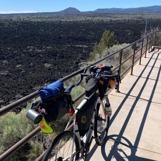
While there were some great (rough, difficult, but sometimes wonderful) gravel segments, a vast majority of the ride was on pavement. The most memorable gravel was on Bartlett Springs Road and on Moonlight Valley/Old Town Road between Taylorsville and Westwood. The Deschutes River Trail was a great dirt ride, mainly easy single track, but made me glad I was riding a gravel bike with a bike packing setup and not my touring bike with panniers. The Ida Clayton Road north of Santa Rosa and Hill Road east Lava Beds National Monument were paved, but badly, and should probably count as gravel!
I stayed in motels when I could and camped when I needed to. Motels are often generic and uninteresting (not always) and expensive, but they have running water and hot showers, outlets for charging, a place to wash out and dry clothing, and are much warmer when you get up in the morning. They are usually near stores and restaurants and usually have WiFi and cell service (not always). Camping is more rewarding and more immersive. Cold nights. Full moons. Misty lakes. Wildlife. Noisy birds. There were a couple of regular campgrounds and a bunch of wild camps or primitive sites that were nearly wild.
Highlights are always tough (and often the highlights of bike trip are moments not spent on the bike). The Golden Gate Bridge. Dinner with M on her birthday along the Petaluma River. Dropping down the Leesville Grade. Indian Valley and Young's Market in Taylorsville. The view of Lassen and Shasta over the Hat Creek Valley. The patio at the Fall River Hotel. Crater Lake. Riding into Bend along the Deschutes River Trail. The morning mist on Lost Lake west of Santiam Pass. Coffee at Dragonfly and breakfast at Besaw on my rest day in Portland.
And then there are the people and the conversations. The volunteers at the randoneuring check point in Quincy. Scott and Barb and Les in Fall River. Tom at Lava Beds. The guy in the coffee shop in Klamath Falls. The family at Crater Lake. Another family at the coffee shop in Sisters. Many others.
Ultimately, what impacts me the most is the notion of riding alone through a vast landscape. The surroundings change slowly because you are moving slowly. But they do change, and rarely do you go half a day without finding yourself in a very different kind of place. Over almost three weeks there are mountains and desert and lava and forest and city and ocean. The remoteness and the solitude is both a compelling attraction and a big source of stress. It’s wonderful, scary, and a little overwhelming, which is probably why it is so powerful emotionally. I enjoy the challenge, the anticipation, and doing something that's a little more difficult in a life that's otherwise remarkably easy. Of course, when I'm doing it, I often wish I was home, going out for the routine coffee, sitting in the back yard, and puttering around the house.
There are always what-ifs. I discovered and fixed a loose derailleur on the second day before something disastrous happened. I had no flats or other mechanical problems, other than constant issues with a drive chain desperately in need of a cleaning. If it had been colder AND wetter, things might have gotten unpleasant, but as it was, weather was pretty ideal most of the time. If my periodic toothache or my sore peroneal tendon had gotten worse, there might have been a reckoning. I was passed by thousands of cars and trucks, but if they were texting or on their fifth beer, I didn’t notice (but I did think about it). Hypothermia and dehydration should always be concerns, but I brought proper gear and planned my route carefully and flexibly, making those outcomes highly unlikely. Ultimately, I suspect the most dangerous aspect of this kind of ride is my own inattention. It’s hitting something, catching the edge of pavement, or sliding in loose gravel, and taking a bad spill.
COVID impacted the trip in the same way it affects our broader lives these days. Rules, attitudes, and adherence varied from place to place and not always in the patterns you might expect - but that's true about a lot of things when traveling. The biggest issue was that places I normally rely on weren't always available - from fast food dining rooms to bathrooms. It was harder to get out of the sun, refill water bottles, charge batteries, or find WiFi.
3 notes
·
View notes
Text
White Mountain and Whitecliff Peak from Chango Lake Road
Kathy Rich was on a quest to finish the Western States Climbers list, and I got an invite to join her on one of her few remaining peaks. To my knowledge, there is only one person who has finished this list at the time of this writing, so even getting close to finishing is quite the achievement. The peaks on this list were haphazardly chosen, but it does a good job of mixing peaks from various different regions throughout the West. There is a lot of overlap with some of the more popular Sierra Club lists such as the Sierra Peaks Section and the Desert Peaks Section, so if you finish those, you will probably be more than 80% done with Western States Climbers. For that reason, I personally am not really focusing on this list because I feel I will make progress on it by sticking to my normal routine. My main criticism with the SPS list is the clear L.A. bias, and this was one of the main issues that the creators of WSC list were trying to resolve. The peaks of the northern Sierra Nevada are poorly represented, however the Western States Climbers list addresses this by including many peaks unlisted by the Sierra Club in Yosemite and further north. Among these is a patch of peaks north of Sonora Pass on the east side of the Sierra Crest. In this patch were White Mountain and Whitecliff Peak, and I was happy to try them as a day hike from my cabin in Sonora.
Kathy invited Greg Gerlach and Larry Grant while I invited Mike Toffey, David Dully and Colin Gregory. Toffey is open to climbing any peak on the planet, so I expected him to join. However, I was surprised that Colin accepted the invite since he is quite picky with regards to choosing peaks. It seems that available weekends trump quality of peak now that he is a father. We were all set to spend the night at my cabin in Sonora and do the peaks as a day hike, but Kathy changed her mind at the last minute and decided to backpack. If I would have known this earlier, I simply would have chose to do a better peak, since social reasons motivated me to join this outing in the first place. With this change of plans, I expected to see the others only for about five minutes on the day of the hike, and that ended up being the case. I had planned the trip to the cabin with my family, so I couldn’t change plans so easily. At least I still had Toffey, Colin and Dully who were willing to join me.
Colin and Dully arrived at my cabin really late on Friday night, but at least PG&E didn’t wake me up in the middle of the night. It was a two hour drive from my cabin to the trailhead. We took Dully’s Jeep since I wanted to leave mine with Asaka back at the cabin. We passed through the gate at the Marine Corps Mountain Warfare Training Center. There was some confusion at first when they learned we were only passing through to go hiking. I guess we all look of military age. We then continued along the graded Forest Road 059 until our turnoff at Forest Road 062, which I believe is unofficially named Chango Lake Road. We got a little confused when we passed through a ski area, and some of the road was a little challenging for Dully’s 4WD vehicle, but we were able to drive to 9,400 feet due east of White Benchmark. Here there was a fork in the road, with one branch heading towards Chango Lake and the other leading to the ridge. We decided to start hiking here. We followed the road for a short distance and then it ended abruptly. We climbed up a steep section of forest and emerged on the open ridge above. Off to the south was Tower Peak, which Colin, Dully and I planned to climb less than a month later.
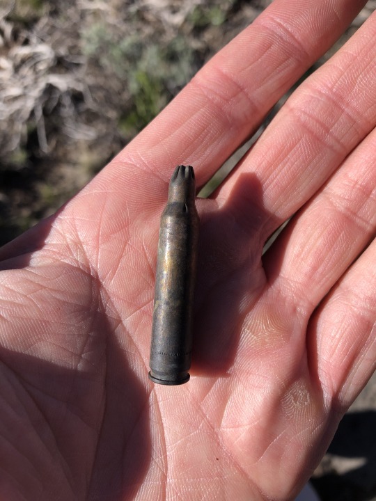
We found several shell casings throughout the day. I guess the Marines come up here sometimes to hone their skills.
Simply climbing White Mountain first would have shortened our day’s effort by a bit, but we wanted to climb White Benchmark as well for the sake of completion. The benchmark stood about a mile south of the peak, and looked to only require a very reasonable extra effort. For the first time in a while, I was not the most obsessive compulsive person in the group with regards to turning red dots green, so it was easy to convince the group to take my proposed route.

The ridge had a small rise which we had to climb over. Some light bushwhacking was needed in places, but this probably could have been avoided. Dully and Toffey took the lead up the mountain while Colin and I hung back. This gave us the opportunity to talk about our kids, but also to test a theory. Colin has a bad habit of getting very sick while hiking, so he tried talking less and hiking slower than usual. I supported this vocal moderation since it's a nasty thing that I’ve witnessed him deal with. Looking back, he did not end up getting sick on this particular day, so maybe we are finally onto something.
Dully and I started talking politics as we emerged out of the pine forest. Dully was strongly in support of forgiving all student loan debt. I challenged this proclamation by stating that such an act would be unfair as it would mostly benefit middle and upper class white people. Per EducationData.org, Caucasian students have the most cumulative student loan debt. Additionally, 45% of student loan debt is from graduate schools. I was accepted to UC Davis MBA program, but when the tuition came back at over $100k, I considered the return on investment versus the amount of debt I would be straddled with and decided not to go. Even after they came back with a $20k scholarship, I still felt that the tuition was not worth taking on, and passed on the opportunity. Perhaps I can consider graduate school if tuition prices get under control one day, but I refuse to go into unnecessary debt.
The last several hundred feet was a boring slog.
The others would beat me to the summit, but I was content to hang back and take my time. We had a long day ahead of us.
We had great views from White Benchmark. To the south were Tower Peak and Forsyth Peak.

To the southwest were Leavitt Peak and Sonora Peak.

To the northwest was Stanislaus Peak.
To the north was White Mountain.
To the east were Lost Cannon Peak and the Sweetwater Range.

With the higher summit still a mile further north, we took only a short break and continued along the ridge.
We went over an intermediate bump then continued to the true high point. There was a lone backpacker slightly ahead of us. We guessed he was section hiking the PCT and Colin was eager to ask him a million questions. By the time we arrived on the summit, he was nowhere to be seen. It's almost as if he vanished into thin air. Looking back towards the south was White Benchmark.
To the northwest were Stanislaus Peak and Disaster Peak.

The rock formations were very interesting on this summit. A lot of flat granitic rocks were piled on top of a base of red volcanic rock. I found a good sitting rock slightly below the summit and took a long rest by my lonesome. I felt fat and tired, and worst of all, we had a lot of off trail hiking ahead of us.

After our break, we continued north along the ridgeline. On some sections we eliminated unnecessary elevation gain by sidehilling, but this was slow and tedious. We found some gear laying around here, and I believe this is where the other summit party of Larry, Greg and Kathy camped the night before. We would find no running water along the ridge throughout the day, so I assume they had to melt snow in order to get water. The only time I’ve ever had to melt snow was on Mt Rainier.
We reached a broad plateau about a mile north of White Mountain. I did a time check and calculated that we would not catch up to the other group on the way to the summit of Whitecliff Peak. In addition, we would most likely be done very late in the day. I expressed my concerns to Dully, explaining that we still had 5 mountains to climb. There were two unnamed peaks with over 400 feet of prominence between us and Whitecliff Peak, and we would have to climb the unnamed peaks twice. At least we had long daylight hours.

Stanislaus Peak

After the long plateau we dropped into a little saddle. Another section of elevation gain for the return, I thought to myself. I picked my way through the trees, clearly lagging behind the others. I thought about the tortoise and the hare. In this case there were three hares ahead of me. They were full of spunk, and were even climbing the unnecessary subpeak of Point 10821. I considered reminding them to conserve energy, but as the slowest person, it felt improper for me to share advice. It was a long gradual ridge to the top of Peak 11000, and then an almost rude drop down to the saddle to the north.
I hiked up some sandy slopes to the top of the ridge, again finding myself in the back. The others met Larry Grant near the summit of Peak 10990. They chatted with him and then continued to the summit. At some point Colin voiced to the others that I looked like I was struggling, and conversely he was feeling great. A few minutes later I met Larry and learned that he was still recovering from Rocky Mountain Spotted Fever, and he decided to turn around since he was still rehabilitating. The good news was that Greg and Kathy had made the summit and were on their way back. I met Toffey, Colin and Dully on the summit of Peak 10990. We could finally see Whitecliff Peak about a mile further north.

The peak looked super cool and I was excited to be so close. I spotted Greg and Kathy down below cutting across the white section of ridge beneath us. I had to use the little boy’s room, so I ran ahead to find a nice bush. On the way I stopped to chat with Greg and Kathy. Unfortunately, our conversation lasted only a few minutes since my biological situation was getting dire. Toffey and I said our goodbyes and continued down the ridge. With shrubs all around and soft sand beneath my feet, I finally picked a spot to dig a hole and fill it back in.
By the time I was finished, Toffey had made some distance ahead of me, but Colin and Dully still hadn’t passed me. I looked back up the ridge and saw them both sitting next to each other staring at Whitecliff Peak from above. They are quitting, I thought to myself. This was very bizarre. Just a few minutes ago they were telling Toffey how strong they felt, and they were within a mile from the summit. At least Toffey was still getting after it. I followed his footsteps through the sand, trying my best to catch up to him.
I watched Toffey power up the steep sandy slopes ahead. He yelled down to me asking what Colin and Dully were doing, and I yelled back saying they were bailing. I looked back again and they still hadn’t moved from their perch. Toffey was speechless. Rather than dwell on negativity, we turned our focus back to Whitecliff Peak, which stood beautifully above us.

The next section looked intimidating, but I was ready to tap into my reserves. I powered up this section, putting all of my concerns about being too out of shape to rest. I caught up to Toffey on the upper portion of the peak. He was kind enough to wait for me. We examined the day’s turn of events, but remained puzzled. At least we would make the summit. To the east of the peak was Whitecliff Lake.

We transitioned from white rock back to red rock. The hike culminated with an easy class 3 chimney to the summit of Whitecliff Peak.

The ridgeline remained multicolored as it continued further north. Somewhere in the distance was Mineral Mountain.

To the east were Antelope Peak and Fish Valley Peak.
To the south was the flat top of Peak 10990.
To the southwest was Stanislaus Peak. It looked pretty cool from this perspective.

To the west were Dardanelle Cone and Disaster Peak.

To the northwest were Round Top, Tryon Peak and Highland Peak.

I felt pretty good. It was after 2pm but we were only a week away from the summer solstice. We decided to head back. Only two peaks left, I thought to myself.
The boot ski down the white, sandy section was done in a matter of seconds. Then we powerwalked along the ridge, trying our best to find the most optimal path.
I told Toffey that I would be intentionally slow on all the uphill sections, but he was kind enough to stick with me. Colin and Dully were gone by the time we reached Peak 10990. Toffey and I were still a little speechless about the earlier occurrence. We exchanged theories and made many comments in jest. I guessed that upon meeting Larry who had turned back, they began to question themselves and lost confidence. The main difference is that Larry was a 70 year old recovering from a serious illness while the others were two perfectly healthy young men in their primes. Climbing down and back up Peak 11000 was a bear. At least it was my last peak. I had a patch of service here and was able to call Colin. They decided to return with the others and were heading back to the car. I asked them if they could pick us up at the Silver Creek Meadow Trailhead and they agreed. That lifted my spirits.
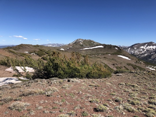
We had one last little bit of uphill before reaching the large plateau from earlier. Toffey was seriously considering climbing Wells Peak as a bonus peak. I urged him on but in the end he decided against it. I called Asaka and told her to expect us at a later time. Needless to say she was unhappy. From the plateau we dropped down into the Silver Creek Drainage, hoping to pick up the trail at the bottom of the canyon.
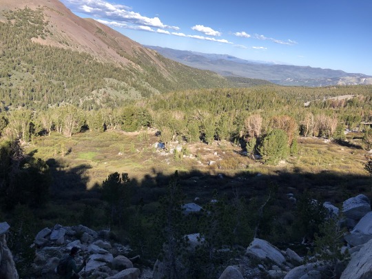
We found a gentle cross country route down. There was a lot of bear sign, but we didn’t see any critters. Once at the bottom, we picked up a faint trial, however this disappeared as we continued down the canyon.

We would pick up the trail several times and then promptly lose it again. There was clear sign of human activity. I guessed it was mostly from ranchers running cattle up the canyon.


I must say that it was a very beautiful canyon, and I’m happy to have experienced walking through it.

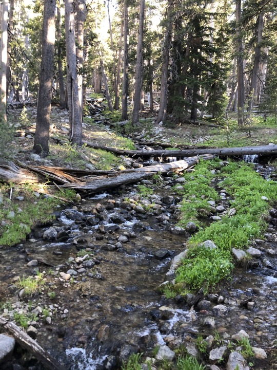
We followed rocks in a line and blazes on trees, but there was not much of a method to their construction. In some locations these markers appeared genuinely random.
My feet started to hurt as we hiked the last couple of miles. My legs were also feeling pretty heavy.

We finally emerged at what I assume was Silver Creek Meadows.

We crossed the creek and finally picked up a proper trail. Towards the end of our hike, we ran into some pack outfitters.

It was a 16 mile effort from car to car for Toffey and me. To our delight, we found Colin and Dully waiting at the trailhead. I was a little concerned that they would be late or might not find the right way. Unfortunately we never saw Kathy, Greg or Larry again. It was a long 2+ hour drive back to my cabin. I was literally starving. Colin was insistent upon buying a soda, but every store along Hwy 108 was closed. Nonetheless, we had to stop at almost every convenience store, even if they were dark from the inside. To make matters worse, we took a wrong turn trying to find the cabin, adding an extra 10 minutes to our drive. When we finally got home, I was so weak and famished. Thankfully, Asaka had prepared lasagna for us, and I scarfed this down like a pig at its trough. It’s amazing how quickly I recover with a full belly. Daryn beat us back to the cabin. He did his own hike that day to Relief Peak, Molo Mountain and Kennedy Peak. As we sat on the porch, Colin was thrilled to report that he had no altitude sickness throughout the day, and for the most part felt great. Daryn subsequently asked why he decided to turn around then. The reason seemed to be that they were okay with their day and they can always come back and get Whitecliff Peak from the north. We didn’t really understand this reasoning, considering they were less than a mile from the peak, had only easy terrain remaining in perfect conditions and were physically fine. I guess we’ll just chalk this up as a peculiar circumstance.
0 notes
Photo

TASK 036 : GOVERNORS OF THE UNITED STATES
in the united states, a governor serves as the chief executive officer and commander-in-chief in each of the fifty states, functioning as both head of state and head of government therein. as such, governors are responsible for implementing state laws and overseeing the operation of the state executive branch. as state leaders, governors advance and pursue new and revised policies and programs using a variety of tools, among them executive orders, executive budgets, and legislative proposals and vetoes. governors carry out their management and leadership responsibilities and objectives with the support and assistance of department and agency heads, many of whom they are empowered to appoint. a majority of governors have the authority to appoint state court judges as well, in most cases from a list of names submitted by a nominations committee.


the NORTHEASTERN UNITED STATES is a geographical region of the united states. its divisions are new england ( connecticut, maine, massachusetts, new hampshire, rhode island, and vermont ) and the mid-atlantic ( new jersey, new york, and pennsylvania ). although it lacks a unified cultural identity, the northeastern region is the nation's most economically developed, densely populated, and culturally diverse region. of the nation's four census regions, the northeast has the second-largest percentage of residents living in an urban setting ( with 85 percent ) and is home to the nation's largest metropolitan area ( new york city ).
NEW ENGLAND.
CONNECTICUT : laura wilmer ( cate blanchett ), republican, since 2011
MAINE : caitlin westcott ( ellen pompeo ), republican, since 2019
MASSACHUSETTS : felicity benson ( rashida jones ), democrat, since 2015
NEW HAMPSHIRE : christi goode ( reese witherspoon ), democrat, since 2017
RHODE ISLAND : adela sebti ( emmanuelle chriqui ), democrat, since 2015
VERMONT : derick han ( john cho ), democrat, since 2017
MID-ATLANTIC STATES.
NEW JERSEY : shaun russell ( laurence fishburne ), democrat, since 2018
NEW YORK : isabelle andrews ( zoe saldana ), democrat, since 2021
PENNSYLVANIA : violet beck ( rooney mara ), republican, since 2015


the MIDWESTERN UNITED STATES is one of four census regions of the united states census bureau, occupying the north central part of the united states. its divisions are east north central ( illinois, indiana, michigan, ohio, and wisconsin ) and west north central ( iowa, kansas, minnesota, missouri, nebraska, north dakota, and south dakota) ). chicago is the most populous city in the american midwest and the third most populous in the entire country. chicago and its suburbs, called chicagoland, form the region’s largest metropolitan area with 10 million people.
EAST NORTH CENTRAL STATES.
ILLINOIS : tracey marsh ( sally hawkins ), republican, since 2019
INDIANA : garth butler ( justin chambers ), republican, since 2017
MICHIGAN : donna randall ( viola davis ), democrat, since 2019
OHIO : philip tirrell ( donald glover ), democrat, since 2019
WISCONSIN : percy hewitt ( john mulaney ), democrat, since 2019
WEST NORTH CENTRAL STATES.
IOWA : kelly grant ( rachel weisz ), democrat, since 2017
KANSAS : dale garner ( clancy brown ), republican, since 2019
MINNESOTA : sadie lawrence ( winona ryder ), democrat, since 2019
MISSOURI : andrea miller ( michele dockery ), republican, since 2018
NEBRASKA : silas nelson ( sam elliott ), republican, since 2015
NORTH DAKOTA : samuel fulton ( daveed diggs ), democrat, since 2016
SOUTH DAKOTA : alicia atkins ( aja naomi king ), democrat, since 2019


the SOUTHERN UNITED STATES is is a geographic and cultural region of the united states. its divisions are the south atlantic ( delaware, florida, georgia, maryland, north carolina, south carolina, virginia, and west virginia ), east south central ( alabama, kentucky, mississippi, and tennessee ), and west south central ( arkansas, louisiana, oklahoma, and texas ). the south does not precisely coincide with the geographic south of the united states but is commonly defined as including the states that fought for the confederate states of america in the american civil war. the deep south lies entirely within the southeastern corner. the region is known for its culture and history, having developed its own customs, musical styles, and cuisines, which have distinguished it in some ways from the rest of the united states. the southern ethnic heritage is diverse and includes strong european ( mostly english, scotch-irish, scottish, irish, and french ), african, and some native american components.
SOUTH ATLANTIC STATES.
DELAWARE : cornelius bancroft ( michael shannon ), republican, since 2017
FLORIDA : angela valdes ( gina torres ), democrat, since 2019
GEORGIA : gabrielle shaw ( octavia spencer ), democrat, since 2019
MARYLAND : damien park ( daniel dae kim ), democrat, since 2015
NORTH CAROLINA : artie barnes ( sam richardson ), democrat, since 2017
SOUTH CAROLINA : shannon todd ( leslie mann ), republican, since 2017
VIRGINIA : rebekah milton ( julianne moore ), republican, since 2018
WEST VIRGINIA : lori taylor ( helen mccrory ), republican, since 2017
EAST SOUTH CENTRAL STATES.
ALABAMA : maynard gardner ( richard jenkins ), republican, since 2011
KENTUCKY : wilson beaumont ( kevin costner ), republican, since 2019
MISSISSIPPI : julianne hargrave ( amy adams ), republican, since 2012
TENNESSEE : shane montgomery ( andrew lincoln ), republican, since 2019
WEST SOUTH CENTRAL STATES.
ARKANSAS : jason wickham ( eddie redmayne ), republican, since 2015
LOUISIANA : christine robson ( antonia thomas ), republican, since 2016
OKLAHOMA : michele abrams ( lea thompson ), republican, since 2019
TEXAS : lorraine crawford ( kelly reilly ), republican, since 2015


the WESTERN UNITED STATES is the region comprising the westernmost states of the united states. its divisions are the mountain states ( arizona, colorado, idaho, montana, nevada, new mexico, utah, and wyoming ) and the pacific states ( alaska, california, hawaii, oregon, and washington ). as american settlement in the united states expanded westward, the meaning of the term “the west” changed. before about 1800, the crest of the appalachian mountains was seen as the western frontier. the frontier moved westward and eventually the lands west of the mississippi river were considered “the west.” the west contains several major biomes, including arid and semi-arid plateaus and plains, particularly in the american southwest; forested mountains, including two major ranges, the american sierra nevada and rocky mountains; the long coastal shoreline of the american pacific coast; and the rainforests of the pacific northwest.
MOUNTAIN STATES.
ARIZONA : daniel rivera ( alfonso herrera ), democrat, since 2019
COLORADO : wyatt harvey ( forest whitaker ), democrat, since 2015
IDAHO : malcolm jackson ( michael fassbender ), republican, since 2019
MONTANA : omar faraj ( marwan kenzari ), democrat, since 2021
NEVADA : noelle bloomfield ( maya rudolph ), democrat, since 2019
NEW MEXICO : oscar méndez ( diego luna ), democrat, since 2019
UTAH : william daniels ( seth meyers ), republican, since 2021
WYOMING : colleen leighton ( felicity jones ), republican, since 2019
PACIFIC STATES.
ALASKA : veronica filippova ( mila kunis ), republican, since 2018
CALIFORNIA : maria reyes ( salma hayek ), democrat, since 2019
HAWAII : makaio kekoa ( keanu reeves ), democrat, since 2014
OREGON : isadora tyler ( susan sarandon ), democrat, since 2015
WASHINGTON : felix kessler ( jeff goldblum ), democrat, since 2013
8 notes
·
View notes
Text
Viewfinder House by Faulkner Architects faces vista of California's Pacific Crest
A request for every room to have a view of the Sierra Nevada Mountains informed the layout of this Californian house by Faulkner Architects.
The primary goal for the family building their home in Truckee – a few miles north of Lake Tahoe – was to capitalise on the site's vista of the Pacific Crest, a ridge of peaks that runs parallel to the US West Coast.
Rooms in the Viewfinder House are all oriented towards the same view
"'Can all of the rooms enjoy this view?' was our client's question on our first site walk," said Faulkner Architects. "This question formed the seed of our conceptual approach to the design of the house."
To achieve this, the local firm divided the 7,200-square-foot (670-square-metre) family home over two levels that are both oriented towards the view, rather than precisely following the slope of the site.
A butterfly roof allows clerestory windows to bring in additional light
The steel base of the lower storey, which connects to the sloped driveway, is more aligned with the street running below. Meanwhile, the upper level is twisted slightly for even better sight lines from the main living spaces.
Recessed apertures created by terraces and overhanging roofs give the project its name: Viewfinder House.
Untreated cedar ceilings, granite flooring and black fixtures are used throughout the home
"Sheathed in a red cedar rain screen and closed on three sides, the boxes open to the Pacific Crest to the southwest," said the studio.
On the exposed side, a covered porch wraps around the ground level and provide access to the outdoor swimming pool from the "play" spaces that include a media room, gym, and bunk room.
Gaps in the cedar rain screen cast patterns onto board-marked concrete walls
An angled metal staircase rises from the pool deck to the upper terrace, which runs the full length of the house.
The cedar slats offer privacy from the road and direct the gaze towards the mountain tops.
An outdoor swimming pool adjoins other areas for play
The upstairs is organised around the central kitchen, living and dining areas, with the main suite to the south and three guest bedrooms in the north wing.
An untreated cedar ceiling creates an inverted triangle across the full plan, lifting up at the sides to further enhance the views and create clerestory windows on the east elevation.
"The ceiling extends out over the porch like a large lens hood, protecting the glass doors from weather and shielding the interior from bright afternoon sun," Faulkner Architects said.
Board-marked concrete walls, granite flooring and black metal fixtures create a pared-back aesthetic through all of the rooms – taking a back seat to the scenery.
Glazed apertures all face southwest towards the mountain peaks
The Pacific Crest view was also carefully considered from the driveway, which ascends to the high side of the house and offers a first look at the distant peaks on arrival at the top of the hill.
"The intentions of the design are clear from this approach: the house gives its undivided attention to the snow-covered mountains, like a camera body twisted on a tripod to capture a distant perspective," said Faulkner Architects.
The cedar screens offer privacy from the road
Founded by Greg Faulkner in 1998, the firm has completed a handful of projects close to Lake Tahoe – a popular area for winter sports and outdoor pursuits.
They include a house with direct access from the ski slopes, a concrete and glass home tucked in an area of woodland, and a dwelling for a family of thrill-seekers.
Photography is by Paul Hamill.
Project credits:
Architecture: Faulkner Architects
Contractor: Glennwood Mountain Homes
Civil engineer: Shaw Engineering
Structural engineer: Linchpin Engineering
Mechanical and electrical engineer: Sugarpine Engineering
Geotechnical engineer: NV5
Lighting: Faulkner Architects
Interior design: Rory Torrigiani, Natalie Zirbel
The post Viewfinder House by Faulkner Architects faces vista of California's Pacific Crest appeared first on Dezeen.
1 note
·
View note
Last Seen Blogs

wcswm
wcs.wm

minnie-mei
𝗰𝗿𝘆𝗯𝗮𝗯𝘆 ✿

guitarplayermrs
DepressedMusician

imongmamabitch
"Each fish in the ocean swims in its own direction."

eliff-t
Petull , In Real Life 🍩