#and a trail run to see how quickly my bike chain stops connecting to the rear tire
Text

Okay okay okay. Gonna try picking this thing back up again, but only one a the first Wednesday of the month basis. Maybe this way I’ll actually have shit done on my stuff to show off lol. Cause my job has got me so fucking busy oh my god that I don’t have time to write or sew or even play games anymore 😭 (and sadly the lack of gaming time is actually the saddest and most depressing outcome for me oops)
But considering I actually managed to post a new fic just this past weekend, I guess I’ll share some more from that nick/abi piece seeing as I’m gonna be starting/finishing that one now that the kiss prompt is finally over!
The entirety of that night had been spent gleefully watching Jacob run around in a near-desperate bid to try and find as much of his clothing as possible. A completely hint and clue free scavenger hunt that everyone had been completely merciless in, doing things like hiding a white sock stuffed in between the towels in the boathouse (Ryan) while someone else (Abi) had hid its match behind the toilet in the girl's washrooms.
With a short laugh that sounds horribly forced in its levity, Nick even admits that Jacob was never able to find one of his t-shirts. He himself had personally stuffed it into a knothole near the top of one of the shorter trees in the woods, and when Nick had gone back to check on the spot the day before camp ended, had found a bird using the shirt as a nest. He goes on to say that he's pretty sure that there's other items of clothes that Jacob wasn’t able to locate either, and (until recently) was sure that people were still going to be finding random items of clothing even years from now.
And cross-stitch update time! Once again, very little was done because I just do not have the free-time to even scrape a single hour out of every day to do it. Gone are the days when I could finish a page in a month 😞 They shall be missed dearly by me if no one else lol. Almost done the page anyways, just REALLY not looking forward to doing the pink in the corner cause I have to match completely different shades of pink together to try and get something accurate.

Maybe if I’m real lucky I’ll be able to finish both the fic AND the cross stitch page this month, but lets be real here. This is me we’re talking about and I am a horrible, terrible person lol.
(And just a reminder, but I’m opening my askbox back up for some fic prompts that I just posted yesterday! So send in a couple if anyone wants a fic or two, cause unlike my main fic, these ones actually have a date in the very near future that I want them finished by so it won’t take me two years to answer them this time I swear lol.
#wip wednesday#my writing#cross-stitching#the quarry#pokemon#god at least i have the next two nights off of work#so i can catch up on both cr and do some sewing#hoping to go to the riverbank and do a bunch of writing as well when i wake up later this afternoon#assuming my bike lets me go of course#things starting to break down and this trip is gonna be both a writing escapade#and a trail run to see how quickly my bike chain stops connecting to the rear tire#hopefully it wont but i'll just have to see I suppose lol
5 notes
·
View notes
Text
Turn the bike around: Peregrination in Scotland

Photo album here.
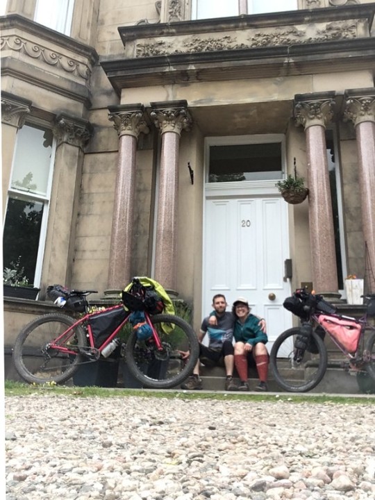
We tallied it up, and realized we’ve seen each other in person no more than five times in the last 16 years. But we are important to each other, and in the last few years, we’ve lost some important people, so when Adam asked if I would come over and ride bikes with him, it seemed like the most obvious thing in the world. Of course I will come. Let’s do it.
A peregrination is a long and meandering journey, often a pilgrimage of sorts. We named our trip before I’d even bought plane tickets, knowing that we -- two fairly anxious people -- were going to do our best to be open to possibility and not be stubborn about the plan.
Our initial plan was to ride a loop in the Cairngorms. Our collective anxiety was high as we took the train up to Inverness and rode to our starting point in Aviemore. A big storm cell had moved in over the Highlands, and it was going to rain there for a week straight. Anxiety crept higher and higher. We looked at the weather forecast, and finally said out loud:
What if we don't do this route?
What if we don't ride our bikes in a week of nonstop rain?
What if we do something lower stakes?
Where can we go to outrun the rain?
... and all of the pressure and anxiety we’d been feeling about making sure the other person had a good time just disintegrated. We took the train back home to regroup.
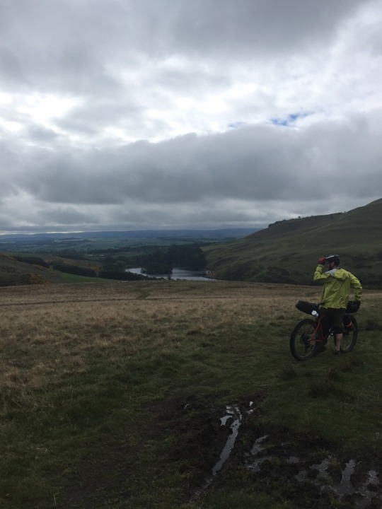
We cobbled together a new plan based on the Capital Trail, a 150 mile loop that starts and ends at Adam’s front door. We felt a little sad about giving up on the initial plan, and also maybe like our Plan B wasn’t very exciting or maybe wasn’t hard enough to feel like it "counted." But on the very first day, it got pretty hard, and we realized, oh, this is for real, this counts! And it’s so close to home that we can take all the risks! We can explore every dead end! We don’t have to hurry! We don’t have to say no to anything! We end up having incredible weather the entire time. Plan B is the best plan.
Back in January, I set a theme for the year, which is to be unhurried. This is not Hurry-Up Life. Peregrination turned out to be the lowest-mileage, least-hurried, most exploratory bike tour I’ve ever done. I am living my goals even when I’m not trying to. There’s a lesson here.
I’m just a teenage dirtbag, baby, like you.

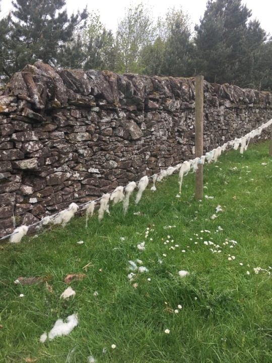
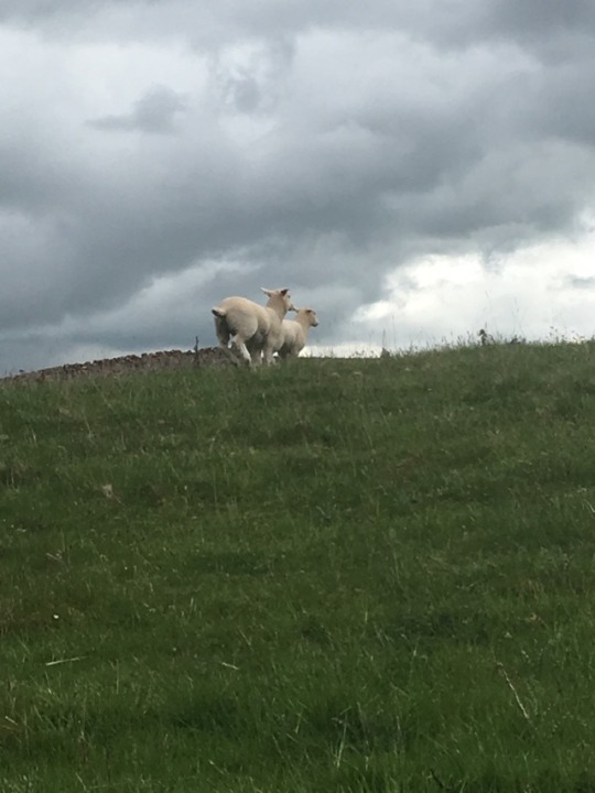
I am tired and feel heavy and slow as we roll through the Pentland Hills, but interestingly, I'm not stressed at all. Sometimes you push your bike. It's all just part of it. We open and push our bikes through and close about 20 gates, we sing Teenage Dirtbag out loud, and I marvel at the wool that has accumulated on every surface -- on every fence line, on every low branch, eventually on my derailleur and pedals too -- and I begin to suspect that Scotland has more sheep than people. I look it up later and confirm that it's true.
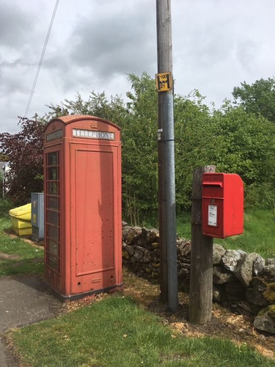
We come out into the village of Carlops, which has a bright red telephone booth and a bright red mailbox, and I can’t believe how bright and vivid they seem in the gray day. Our route takes us on the Cross Borders Drove Road, an old footpath for drovers bringing their cattle to market. It's waymarked with a cow emblem, and we love it. Follow the cow road! We find magical singletrack, a magical abandoned stone building, a magical dirt road, and a couple of sheep who have gotten out of their fields and are nervous and try to run away from us but in the same direction we're going. We don't want to stress them out, so we decide to backtrack a little and cook our dinner, sitting in the grass on the side of the road.
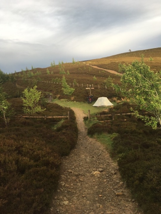
We roll into a perfect magical patch of woods and decide it's too lovely to pass up. We set up the tent together for the first time and I think about how cool it is to have adventured with lots of people, to have set this tent up with lots of people, and also how effortless and wordless it is to set it up with Q, my number one adventure partner. I think a lot about how possible adventuring is for me because of the stability in my life, and I feel so grateful for my partner and for my old friends and for the opportunity to see more of this big ol' world.

I have nightmares during the night, after seeing a flashlight pointed at us in the late evening but not seeing the person connected to the light. In my sleep, the person becomes a middle aged man named Kevin and he comes into our campsite and doesn't say anything, just looks around at things, and try as I might, I cannot make my voice loud enough to call out HEY! Adam gently elbows me, and I briefly wake up and fall right back asleep. Kevin is still there in my dream, creeping around. Get out of here, Kevin! You're not invited!
Spooky Wood
While packing up, we discovered that we’d been left a gift overnight: a long-legged dead bird, draped over Adam’s front wheel. Whoa. Was it a fallen hatchling? Or a failed hunt? We’d heard a lot of owl activity overnight. Or was it Kevin?
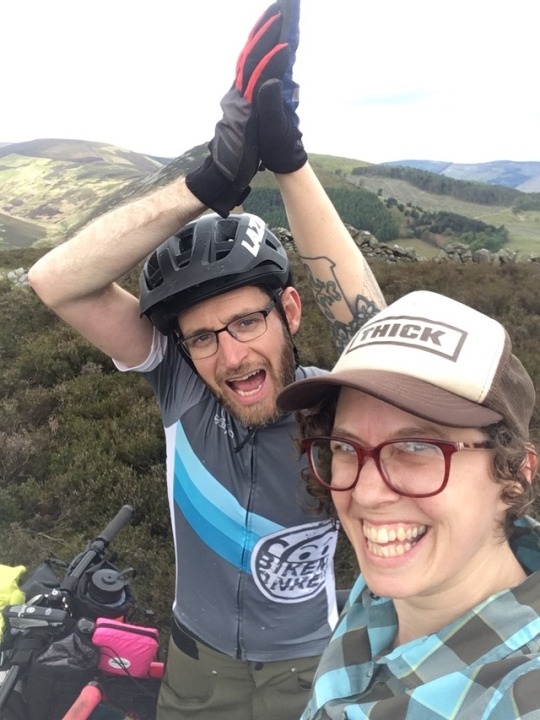
We pack up and roll into the town of Peebles for breakfast, and then hike-a-bike for several miles up a big hill, high-fiving at the top. Woof. We skip the mountain bike trails that are on the route, but deeply enjoy the waypoint labeled "top of Spooky Wood!" and refer to every patch of woods after it as Spooky Wood. We are delighted to find some huge carefully stacked cairns on a hilltop, and to ride along some beautiful old stone walls through sheep field after sheep field after sheep field.
The cloudy skies turn dark, and the search for a campsite becomes urgent. We find a patch of woods that is too dense to even enter, let alone put a tent up in. We ride along through scrubby heather-covered hills, scouting and scouting, and find a spot where two trails meet, where there is a perfect tent-sized patch of flat ground. I would not ordinarily put a tent so close to trails, but the sky is starting to spit. We lean our bikes, set up the tent in a flash, throw all the things under the rainfly that we think we might want for the evening, and climb inside. It starts raining immediately.
Adam cooks in the vestibule of the tent, and we eat dinner inside our sleeping bags. The rain eventually stops and a glow settles on the landscape around us that seems too beautiful to be real. We look at the trails around us -- a lovely doubletrack to the left, and an alluring singletrack to the right. We don't even check which way our planned route goes. The singletrack looks too good. We gotta take it.
Singletrack for Breakfast, Hail for Dinner
We are thrilled to be riding some grand and super fun singletrack first thing, get a little too stoked, and totally miss our turn. We get deep into some steep and technical singletrack that we have to walk our bikes down … and push our bikes back up. We sing “Turn the Bike Around” to the tune of “Turn the Beat Around" by Gloria Estefan. We make our way to the end of the singletrack, down some totally bananas little steep sections with gates that are clearly not designed for bikes (this is a footpath through some sheep fields, it’s ok, we make it work), have a picnic at the junction of two beautiful dirt roads, and then cut off-route to the village of Tweedbank via the Border Abbey’s Way, another old footpath that takes us past a massive field of dandelion puffs, ready to explode at the slightest breeze, and are delighted by our choice to go offroute.
We get some coffee at the only spot in town that’s open: the takeout place at the train station. It’s chilly and a rain is coming, so we hunker down in a covered bike parking area to drink our coffee and warm up. Temperature regulation on this trip is challenging. It’s warm enough to get hot riding, but cold enough that we need to pull out our puffy jackets every time we stop for more than a few minutes or we start to shiver. It requires a vigilance that is new for me.
We roll over to the next town via an urban pathway, and back on out of town via the chain bridge, past some nosy cows, and Adam narrowly avoids calamity when he rolls over a scrap of fence wire that wraps around his cassette. It is incredible: this whole tour, we got no injuries, no flats, no mechanicals of any kind. So lucky.

We revel in the double track that dreams are made of, lined with stone walls and huge blooming gorse blobs, under a vivid blue sky with cartoon clouds. It’s impossibly wonderful. We stop in Lauder, where we find a Very Fancy Cafe and Art Gallery, where we eat several slices of cake and charge up our phones and take baby wipe baths in the bathroom to remove some sheep shit and mud and pretend we are presentable enough to sit inside this lovely establishment. Here, we decide to hop offroute altogether, because we are enjoying this footpath and want to see it to the end. It’s the Southern Upland Way, which is waymarked with a charming thistle emblem. It goes coast-to-coast. Let’s ride to the ocean!
A few miles out of town in a big open field, we find a stone wall that forms a perfect circle. We stand in the center of it and look at the menacing clouds gathering substance overhead, and decide we better find somewhere to pitch the tent pretty quickly. The thunder starts to rumble as we look for anywhere that’s less exposed than the hilltop we’re currently on. We roll down the other side of the hill, pick our way across a stream, and find a flat spot nestled at the bottom of another steep hill. We throw the tent up as fast as we can, and climb inside just as a hailstorm arrives. We laugh and laugh and laugh at our good fortune. The storm passes quickly, but leaves a chill in the air.
The moors, the wind, the sea
We linger at camp in the morning, having coffee and cookies in the tent for breakfast, drying off the tent, repacking everything after the mad dash of the previous evening. We find ourselves on a heavenly dirt road in the vast expanse of the moorlands of the Lammermuir hills, lined with heather and cotton grass and positively alive with grouse. The track leads us to the top of Twin Law, where we find a matching set of cairns that serve as a memorial to twin brothers who died fighting on opposite sides of an ancient battle. The plaque on the site reads:
And they biggit twa cairns on the heather
And they biggit them round and high
And they stand on the Twinlaw Hill
Where they twa brithers lie.
We cannot believe how beautiful it is, how incredible these structures are, how tender humans are, and we goof around and take a million pictures before descending on a joyful lumpy track with big enough lumps that I get both wheels in the air several times on the way down. It’s good to get rowdy. I am grinning the whole way.
We take some double track through woods that feel like Pennsylvania, and look for a stopping spot for a snack break, just knowing something good will turn up. We pop out of the woods and find Abbey Saint Bathans, which has a bench and a map of the Southern Upland Way. We put peanut butter on our cookies, and ask a passerby if there’s somewhere we can fill up on water … and someone comes out of the house behind us and fills up our water bottles for us. What is this magic? What wonderland are we living in?
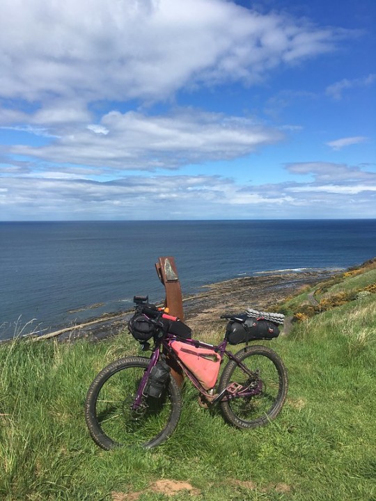
The wind gets stronger and stronger all day. On top of an exposed hilltop, we see that we’re level with the blades of the wind turbines in the distance. They don’t put wind turbines in places that aren’t windy. This is just how it’s going to be. Find peace. We lumpity lump along some sheep fields, and I am tired from the wind and the lumps. We joke that we skipped riding the Highlands and are instead riding the Lumplands. I see that the road we’re about to cross will take us right to the sea at Cockburnspath in 5 miles of pavement rather than 7 miles of Lumplands. Adam doesn’t want to ride any more pavement than he has to, but I am cooked, and so he acquiesces. And soon, we’ve ridden our bikes to the North Sea, where we hope to find a cafe and get out of the wind, and maybe get a hotel and take a rest night, but there’s really nothing in town at all.
We make camp stove coffee on the hill overlooking the sea and make a plan: we’ll ride the ten miles up the coast via pavement to the next town and stay there, I suppose. It isn’t very appealing. We’ve barely set out when Adam spies a dirt path that looks more fun. We take it, and it dead-ends on the beach. Rats. TURN THE BIKE AROUND! On the way back, we find a little spur trail and check it out. HOLY SHIT! It’s the most perfect secluded beautiful campsite you’ve ever seen. It’s a meadow full of blooming flowers! There’s a picnic table and a fire ring and a tree swing! There is no way in hell we’re going anywhere else.

Headwinds and pavement and castle ruins
The campsite is breezy, which means we get to pack up a perfectly dry tent in the morning. We are pretty tired, and the paved cycling route to Dunbar is brutal. Ugly. Industrial. Next to the highway. The headwind is mentally excruciating. It’s hot but cold. It’s sunny and windy. We get to town and have coffee and express our certainty that we would have cried if we’d tried to do this ride yesterday. Every choice we’ve made is the best possible choice.
We eat some food, and then push hard back inland on pavement. We’ve got to get out of this wind. We’ve got to get off the pavement. This feels like a penalty day for our follies yesterday. Morale is low, even though we’ve turned onto some narrow beautiful flower-lined roads. And suddenly, when we can’t take it anymore, we are at the Hailes Castle ruin, and we have mountain bikes, so we ride down the stairs and into the castle. This is the fucking best.
The last few miles to the town of Gifford are less windy, and the hills are bigger rollers. We realize we've forgotten to eat enough, thinking only of the relatively short distance and not of the effort required to ride into a headwind all day. We eat a thousand snacks once we get to town, and get a room at the Goblin Ha’ Hotel, because if there’s a hotel called Goblin Ha’ … who would not stay here? It’s the whole reason we decided to stop at this particular town! We take glorious hot showers and lay around. I wonder what the story is behind the hotel name.
Summon the goblin army
Oh, the story of the Goblin Ha' is better than I could have hoped. Yester Castle was built by Sir Hugo de Gifford, who was something of a necromancer or alchemist or practitioner of the dark arts, and the story goes that he summoned an army of goblins to build a hall of his castle, and there’s maybe also a portal to hell. I mean, the goblins have to come from somewhere, so the portal makes sense to me. We must go there. Obviously.
We ask the woman who runs the village store for directions. She walks with me out to the street and points at the farthest building in our line of sight. “Go past that building, and cut through the opening in the fence. It’ll bring you through some houses, and then you duck off to a deer path on the right. You’ll know you’re going the right way when you pass some Highland cattle. You’ll go over a bridge with a sign that says ‘unsafe structure’ but it’s fine, we all use the bridge. You go down a steep hill and back up the other side, and you’ll see it. I don’t know if it’s the best way, but it’s better than the road, anyway.”
These are the best directions I’ve ever been given in my life. We find the ruins, and immediately Adam finds a skeleton key in a cubby on the wall. Maybe it opens the portal to hell, I don’t know, I’m too scared to even look for a lock. We climb all over, enjoying the serendipity of happening upon something so terrific. What luck, what serendipity. The woods are full of blooming forget-me-nots.


We cut through a farm to get back to our original route, and get a proper scolding from a farmer who has had too many frustrating experiences with hikers to want to deal with us. It is probably pretty irritating to live next to a famous ruin, and have a bunch of people bothering your livestock and not closing your gates. I tell her I am sorry to have added to her frustration, and she softens. She directs us back to the road, past this little fenced in building. What is it? It’s a dovecot. What’s that? It’s a building full of little cubbies, for raising pigeons. It’s pronounced ducat. “You’ll get beat up if you say dove cot,” she says, and then tells us that we’ll get beat up if we try to pay for things in euros. It cracks me up, because nobody has even been a little bit salty with us on this trip. I apologize again for the trespass, and mention that it’s hard for me to tell, because where I am from, there would be private property and no trespassing signs all over. “Nobody wants to put up signs!” she protests. Well.
We head out onto the road past the dovecot and realize after a mile or two that we’ve gone the wrong direction. TURN THE BIKE AROUND. We find some pavement that turns into a great dirt road that turns into great singletrack that turns into an overgrown patch of stinging nettle and hurts our legs very much, and then suddenly a perfect little stone tower appears in the middle of the nettle. We get closer and see that it has a door. We nerve ourselves up and try it. It opens! God damn if it isn’t another dovecot, and now we know what it is and what it’s called and I laugh out loud. I would never have known if we hadn’t accidentally trespassed on Lucy’s farm. Thanks Lucy, and sorry, again.

We zigzag across some beautiful luminous golden fields of rapeseed and onto some fast pavement, and then duck through a hole in a stone wall onto an estate where Mary, Queen of Scots surrendered in 1567, and where there is a network of purpose-built mountain bike trails. How much magic is in Scotland if we’ve found so much in such a small area?

We are getting pretty close to the end of the route and it will either be some semi-urban camping, or an earlier finish than we want, so we stop in a small town and fill up our water, eat some ice cream, and re-route again: let’s go back to the Pentlands. It’s so beautiful there, and I want to go back! We cut west on a cycling route, and it’s a little hard to follow and not that fun and we are tired. It’s our biggest mileage day yet. But we make it just fine, and have a picnic dinner in the sun. Adam knows just where we should camp, and leads us to the little patch of woods I’d noticed on our first day of riding -- I’d commented “that looks like a great campsite for a quick overnighter from town!” Confirmed! It’s a great campsite! We find a flat spot among the trees, set up camp, watch sheep tv from the tent, and chatter into the night.
Sleep in among the sheep
I sleep hard, and wake up as usual at 4:15 when it first starts to get light out. The other days, I’ve just rolled back over and gone back to sleep, but this morning I get up out of the tent and am stunned by a vivid red sunrise. I pause to enjoy it a while before climbing back into the tent and sacking out for a few more hours. There’s no rush. We make breakfast and noodle around the hills. The wind picks up and my body is exhausted. It starts to rain lightly, and we call it a day and head home.
Back in college, Adam and I formed the Piss Poor Bike Gang. I put gold foil star stickers on our helmets. I think the only “rule” of the gang was that you had to wear a helmet. I was trying to learn to be more confident riding in the city. Adam was working on learning to ride clipped in. Our cooler, more bike-savvy friends guided us on easy local rides. We fell over slowly. We ate a lot of snacks. I could not have known then that we were setting the stage for a grand adventure all these years later, but looking back, it’s plain as day.
0 notes
Text
Where there’re flowers, there’re bees
Forward
When I open my eyes on a weekday morning , I'm faced with a decision. I look out towards the window and search for signs of sun light. If the morning sky is clear, then I close my eyes for another ten minutes, If the sound of rain is heard, then I get up and shower. If the day is bright and clear, then I'll prepare to cycle to work and have my shower there.
The commute takes about 20 minutes by car or 35 minutes by bike. Fifteen minutes separates the difference, face the traffic and the race for a parking spot or endure the elements of the ride, such as road traffic, pedestrians, hill climbs, pot holes, curbs and the endurance. For two days a week, I’ll take the latter.
Nine years ago, I took up the challenge of riding to work. I'd taken the family to the US for a ten week holiday and when I returned to work, a colleague said to me. "Gee, you have filled out." I'm kind of lucky in a way, where I never really had a problem with weight loss, although with just turning 40, it looks like I need to be careful. I remember my first commute, it was done in two stages, I would ride the 13kms to work, come home on the bus and the next morning be back on the bus then I would ride home again. I laugh at myself now that I even thought of the idea. It doesn't feel that hard anymore.
Cycling in Canberra was starting to be popular and so I invested in a hybrid bike. The shop assistant had sold me on the idea that I could use the bike to ride on the road as well as on dirt trails. Two for one deal, I was up for that. As it turned out, I went through a lot of kilometres on the hybrid, so for the 300 dollars, it paid for itself. Today, I'm riding a proper road bike, carbon fibre, curly bars, street tyres and a Gel seat. There was a noticeable difference between the two bikes, the road bike was a lot lighter and faster. On the hybrid, it was heavier and a lot more work. I was reminded every time when being passed by another road bike how slow I was. Now, I'm only been passed by riders who have logos shirts, tight shorts and about ten kilos lighter.
My commute travels from Duffy in Weston Creek to Civic, the business district of Canberra. Most of the trip is on a proper bike path and only a small section in Duffy travels along the road. Its only recently that I have noticed how fortunate I've been by having such a route. It's a route I would like to share and this is my commute.
Duffy
There are four season in Canberra, the summers are hot and dry and the snowless winters are wet and cold, Spring and Autumn are moderately warm during the day and cold at night. This allows you to cycle at any time of the year. Although on winter mornings, you need to rug up, the most important bit of clothing you need is mittens. When experiencing my first winter morning, I’d failed to wear gloves and four minutes into my ride, I went searching in my backpack for a pair of socks. I needed something to put on my hands and they provide the perfect protection. Now days, I wear mittens, not gloves because my fingers get cold. The other digits that I find gets cold are my toes. So to alleviate that, I bought shoe socks.
Over the years, I've bought a few bike things. There are things you could buy to make your ride comfortable and you only know what that is until you experience the discomfort. It takes experience to really know, so if you're reading this and thinking that you need all these things, Stop! Because you only appreciate the things from experience.
When I'm finally ready in the morning, I walk out to the back room, grab my 18 speed from the bike rack, check the tyre pressure and grease the chain. If it's winter, I ensure the battery to my bike lights are fully charged for my night trip home. I put my headphones on, start up the daily podcast and the way I go.
From my driveway, I roll down Tantangara Street and turn left at the Duffy Scout Hall. The Scout Hall had been recently build since the previous hall was burned down from the 2003 Canberra Bushfire. Duffy was the hardest hit by the bushfires with over 200 homes destroyed. The scout hall took a long time to rebuild since the decision to rebuild was debated for years. The only thing that is remaining from the destruction was a damaged Ship's mask, which is situated outside the front opening.
Today in October, I'm greeted with Australia's most aggressive bird, the Magpie. This Magpie has only just established itself here in front of the hall. He appears to just squawk and hover, not scratch or peck it's targets. You just have to keep your wits about you when you come into this area.
Just on the my right is the Duffy Community oval. In the centre of the oval is a cricket pitch and the oval is surrounded by raised banks. If you came here for the first time, you would assume that the bank is for people to sit on, but the banks are there to hold in the stormwater. The Duffy Community oval is actually a dam. Duffy is unique, it's uniqueness comes from three things. As mentioned, it was the hardest hit by the 2003 bushfires and Second, its stormwater network uses the streets to move the water. Duffy is situated on the side of Narrabundah hill. All the runoff from the houses are directed to the streets and the road network is arranged so that the water runs into the community oval first and then it's piped under the suburb of Holder to the Weston Creek reservoir. Finally, believe it or not, all the streets in Duffy are named after Australian reservoirs or dams. eg Just west of ACT is Tantangara Dam and Blowering Dam in the Brindbillas.
Most of my downhill ride is so far peddleless although the pestering Magpies still have my attention. Once I get to Blowering Street from connecting path, the magpie has given up. This path takes me past my previous owned house on the right. I look over and I'm reminded of the 16 years of memories. The retaining wall I built, the watering system I installed, the driveway in which my sons played cricket, the front door I painted and the spot on the driveway of where my friend Andrew drove up and said to me "I've lost everything!".
On January 8th 2003, a lightening storm struck and caused fires in the Brindabella. If the bushfires aren't controlled, it was going to cause problems for the neighbouring towns and Canberra. Ten days later, the fire had grown so large from the hot westerly winds that by 2pm on the 18th of January, the fires had reached Eucumbene Drive. The skies had turned black from the smoke and the residence began to panic. I was up at the playground near the shops with my five year old son. The darkness concerned me and so we went into the shop and then a man runs into the shop and warn us that the fire had jumped across Eucumbene Drive into the suburb. That was only three streets away, so we quickly ran home to prepared for the fire attack. I had a friend visiting from Sydney and he helped out. My wife put the kids into the car and drove off to find a safer place. She didn’t get very far, because she was met by a traffic jam on Burrunjuck Crescent. The traffic wasn't moving. Who would have thought at 2:30 pm in the afternoon, being pitch dark and being faced with a traffic jam on quietest road. There were ambers flying everywhere. You could hear the water crane helicopters in the sky hovering over houses in the distance, they were either dumping water or gathering the liquid from the swimming pools. It was confusing to know what was happening. It was not a place to be and my friend and I looked at each other wondering whether staying behind was a good idea. We quickly had our hoses ready waiting for the threat.
The brush fence between my driveway and the neighbours caught on fire from a falling amber. The brush fence didn't take long to burn. Our hoses weren't long enough to reach and then an Angel appear from across the street. A young women with a bucket had the fire out in quick time. I called her an Angel because she came from nowhere and it was the first and the only time I had ever seen her. She was a true hero.
As I ride by and look over at where the brush fence once stood, I’m reminded of the moment with Andrew. He was living on Summerset Street closer to the Eucumbene and his story was simple. He was in his backyard with his hose trying to put out the fire near the wooden fence. The water pressure in the suburb had dwindle down to a slow pour and so Andrew had to abandon his efforts and leave. He returned the next day to what he feared the most. I can only imagine what he was feeling, the night before not knowing, not sleeping, worrying about the house, being in this makeshift refuge, a high school in Woden and very anxious. They wouldn't allow residents back into the suburbs until the next day. His first stop was the house, walking around in the rubble seeing what can be retrieved. Not much was left except for his son's kiddy pool in the backyard. He eventually rebuilt a bigger and better house on the same lot, but restarting his life again was his biggest challenge.
As I pass my house, I was hunched over expecting another Magpie attack. Last year, I was attacked here at this spot, but it appears, the little critter is somewhere else today. Turning right at Burrunjuck I head down the road and turn left onto Dixon Drive. So far the ride has been downhill and so worth it. I often spot on the sidewalk coming the other way, a familiar old man with a limp. I sometimes see him feeding the Magpies further down in the Holder's wetlands. I wave to him and he waves back. I must stop one day and have a chat.
When I pass Waramanga drive on my left, I am reminded of two incidents; First, Waramanga drive was the fire break during the 2003 Canberra bushfires and it saved a lot of lives. Second, the street is straight and ascends up to Eucumbene Drive. This street has a five degrees gradient and I was once asked by a sprinter, do you know of a long straight hill that I can train on? My reply was “Waramanga drive would be the climb”. I have ran up that hill many times and you certainly feel it at the top.
The driving commuters will cruise down the road to turn left onto Dixon Drive uninterrupted, although they are bitterly disappointed when they see me on the 18 speed causing them to brake. I ring my bell to remind them that they should stop for bikes. Fortunately for me this is the last stretch of road, before the start of the bike path. I turn off the road just before the bus shelter.

Molonglo River corridor
The bike path starts at the old Kambah Road. This section of the path was the major road between the Cotter Road and the Long Gully Road in Kambah back in the 1950s. There is still an old bridge you can cross if you ride up to the new suburb of Wright. There is a track junction just before the bridge and so I turn right and head down to the Cotter Road Streeton Drive intersection.
With the new Molonglo development, there has been a lot of road changes. There is a 600m section of the Cotter Road that has been under road construction for nine years. I think they had changed it at least four times and when ever I drove past, you would only see the construction crew on Saturdays. It was the only day of the week where you really needed to slow down for the construction speed signs.
Under and over the Weston Creek bridge brought me to the other side of the Cotter Road and peddling towards the North Weston pond. I call this stretch “Weed pond,". People in parked cars would face the West overlooking the pond and it is where they would stoke up and admire the sunset towards Mt Stromlo. You can often smell the scented riding past.

As I start to ascend for the first time near the RSPCA, I can hear the barking. You often see volunteers walking the dogs, I take my hat off to these individuals, I remember when my family discovered “Marley” an Australian silky terrier, in the RSPCA cage, a few years back , a volunteer was sitting in the cage with him and keeping him settled. We took him home, we saved Marley’s life that day.
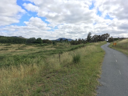
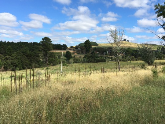
As I go past the RSPCA there is a downhill bit towards Molonglo River, I am confronted with a troop of kangaroos lazing along the hillside. All I’m concerned about is whether they will bounce in my path. They are easy to avoid if you know the speed to peddle. To my right is the Australia Defence College, not much can be said about this place other than it conducts courses intended to prepare field ranking officers (Major / Lieutenant Commander / Squadron Leader) for staff duties and seek out promotions. All I know is that I don’t hear fire arms, a practise that could set off the dogs at the RCPCA. But instead it’s peacefully quiet and I can imagine this area would be perfect for the high ranking officers to enjoy his or her lunch break. Once I pass the college I coast down to the Molonglo River bike path, a stretch of sealed path from Weston Creek to Shrivener Dam. This section is the most peaceful part, but where there’re flowers, there’re bees.
The first time I rode down this path was with my wife and another couple 19 years ago. We were riding single file towards Shrivener dam when my friend’s wife suddenly stops, she jumps off her bike and runs back towards us. Her face looked terrified and she pointed up the pathway and yelled “SNAKE!” It took some time to get her back on the bike again. Actually, I don’t think she ever rode again after that. I didn’t see the snake but I would look out for it next time. That next time is what I encounter every year, at least two or three blown snakes a year, mainly on summer evenings. I look out for them now and try not to run over them. They must come up from the river and lay on the hot summer path to warm up. I’ve noticed that if you make enough noise and slow down, they will sliver off. Just don’t run over them. The council must have got a few complaints because they mow along the path regularly hoping to expose their position.
Along the path takes you past a junction where there is a low level crossing on your left and the equestrian park on your right. If you cross the river, it takes you to the pine forest on the other side. I had heard that a few MTB volunteers had created single tracks in the pine forest. So one day, I decided to discover the single tracks on my MTB. The single tracks meander through the pine forest and finishes up at the Canberra Zoo on the other side. The track then continues along the Parkway and through a tunnel to the Canberra Arboretum. The Canberra Arboretum was established after the 2003 Canberra bush fires. The burnt out area of the pine forest on the western side of the Parkway had become the focal point for establishing rare forests, mostly threatened and symbolic trees from Australia and around the world. If you were to drive along the parkway, you would see the immature trees in perfect rows To access the arboretum by car, there is a roadway to the top of Dairy Farmers hill which provides a lookout over the western part of Canberra from there you can drive to the facilities such as picnic areas, cafes and conferencing rooms.
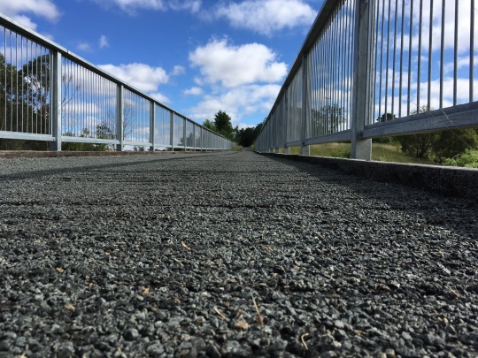
If you turned right at the bike path junction, it takes you into an equestrian park. As you ride along, you can see the equestrian jumps all over the land scape. Those jumps look pretty tricky for a rookie. Not too far along you arrive at the Yarralumla pedestrian bridge. The bridge is constructed with wooden slats and so to improve the surface, the council decided to lay bitumen on the surface. Whoever did that job, should be shot. The bitumen leaked through between the slats and so the surface became uneven and rough. Probably the worst part of the trip.
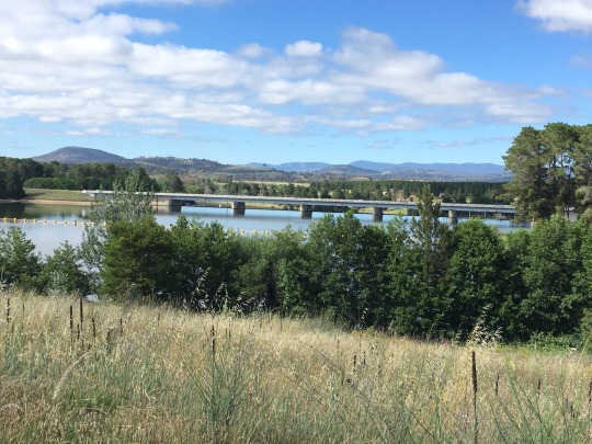
At this point you meet up with the West basin bike path. The West Basin is part of Lake Burley Griffin which ends at Shrivener dam.
Lake Burley Griffin has three basins, East, Central and West basin. Each is separated by two bridges, the Kings Avenue Bridge and the Commonwealth Avenue Bridge. The lake was formed when they built Scrivener dam on the Molonglo River. West basin otherwise known as West Lake is the largest of the three water areas. When I was training for the Canberra Half marathon, many of my runs circumnavigated around West Lake. I’m not sure I could do that anymore.
As you join the West lake path, you can see some of the National Zoo and Aquarium cages on your left across the river. You often hear lions roar or the spotted Hyena bark. The pathway crosses the dam on the other side of Lady Denham drive. You travel through an underpass and take a sharp turn towards the left. Here’s where you need to be alert with other riders coming the other way. I ring my bell as I enter the underpass to alert others , sometimes I wish they would do the same.
Traveling across the dam is pretty much uneventful when you consider what I have seen so far. When you get to the other side you could cross Lady Denham Drive again and ride towards the Zoo entrance or you could keep following the path around to the right. You need to keep your speed up because the next segment takes you up Snake Rise. I call it “Snake Rise” because of it’s a sharp ascent which meanders up like a snake. At the top, there is a spot where you can rest on a bench looking out towards the lake. On many occasions, I’ve seen people contemplating life on that bench. I must stop one day and do the same. As you past the bench, you roll down through the cork plantation. I feel like I’m going through the Batman cave and when you come out the other side you have arrived at Yarramundi reach.
Yarramundi reach is a peninsular which was the home of the Lindsay Pryor National Arboretum, unfortunately most of the arboretum was destroyed by the 2003 bushfire.
Following the Lake path, there is a slight rise which crosses Barrenjoey Drive and when you arrive at the peak, you are presented with, I believe is a view of tranquillity. If you can imagine an arrangement of flowers, flowers of coloured pedals sprouting out inviting the bees and the additional leafy colouring filling the gaps. The combination of shapes and colours gives its beauty. During the winter, you can see the early morning dew, a slight fog hovering over the lake, foliage nearly touching the water and the active birdlife on the lake, a true combination of colours.

The reward of sight is then added with a slight downhill. On my left is the ACT Aboriginal and Torres Strait Islander Cultural Centre. The cultural centre has an art gallery and a conference centre. For a small period of time before the National Museum was built, it used to hold a large collection of aboriginal artefacts.

The path takes you past a toilet block at this point. I’m not sure what inspired the builder, but the block is created as a log cabin. Just behind the cabin is Acadia peninsular. There is a dirt road out to the peninsular off Lady Denham drive which passes the toilet block. One Sunday afternoon, I was driving along Lady Denham drive when my son needed to go to the toilet. As I parked the car adjacent to the toilet, I noticed an old guy walking out of the toilet as though he had something up his butt and then I noticed another guy coming from behind with a smile. There was something about that smile that made me think that the toilet block was used for more then what appeared. Neither my son nor I went into that toilet that day.
Up the path is a junction where you can cross Lady Denham drive via a traffic light to Belconnen. The pathway leads past the Glenlock interchange and up Bindubi Street. I used to ride up there when I worked at Fernhill Park. The path is a gradual incline hill which went on forever, although it was a hell of ride coming the opposite way. Today, I stay on the lake path and ride past Acadia inlet near the rowing area.

When Scriveners dam was finished in September 1963, the lake failed to fill up as expected and since the national rowing championship were scheduled on the lake in late April 1964. The national regatta was threaten to be cancel. It was 15 feet short of a acceptable level. Although, fortunately two weeks before the regatta, the rain clouds had broken and it continuously poured raising the water to maximum level.
This part of Lake Burley Griffin is set out with rowing docks and racks. Here, onlookers sit on the grassy banks and see the head on view of the rowers finishing the course. As always, the anguishes of pedalling up hill is rewarded with a slight downhill. The next part of the path a straight flat section very close to the waters edge and you often see fishermen sitting on the log barriers with rods. I believe if you like Carp, then this is the place for you. Not much else is out there.
Once you have dodge the casting rods, the path leads you to Black Mountain peninsular. At this point, the path splits off to either ride around or over the peninsular. Going around takes you along the lakes edge where you can enjoy picnics area with playgrounds and grassy areas. My children have enjoyed this area many times. The playgrounds over the years have changed. They original consisted of tree forts and log apparatuses surrounded by a layer of 14mm mulch. Now, the playgrounds have become modern with funky roller seats and swingy things. They are specifically design for safety. Every climbing apparatus would have extra handrails and the ground would be covered in a spongey material. There is no thill in the playgrounds, so my kids stop wanting to come.

The commute option is riding up and over the peninsular, the incline is about 5% gradient and you can normally tell on this rise whether your thighs are conditioned for hills. If you are standing on your peddles to get up this hill, it’s a pretty good indication on whether you ride often. It’s always a good idea to stay in the saddle, because actually you use less effort.
The path follows along the lake and goes over the Parkway’s Sullivan Creek bridge. Once I’m over the bridge, I turned off and ride under the bridge and up along the creek towards ANU. ANU is the most confusing place to get around in. Luckily the bike path is straight forward and passes from one side to the other with optional choices of paths. Although if you wanted to drive from one end to the other, you have to know where to go. The roads are not interconnecting other than going through a complicated series of side roads or car parks. I remember years ago when tried to get from one end of ANU to the other and followed a road into a carpark. This carpark had multiple entrances, but they divided the carpark with logs so you couldn’t use it as a through way. I was denied that day by a log. I can only imagine the 1000s of ANU student which tried to do the same was denied by that one single log. Of course, if you had a four wheel drive, the log was a bump in the road. Now days, they have improved it with a garden bed.
Of course, being a university campus, there is gotta be one quirky thing that stands out. That would have to be Ursula Hall Laurus Wing , a university residence which was designed by stacking 108 shipping container to make it look like a apartment block. Each container is an narrow apartment. I remember when they were being building it. They placed a crane in the centre and the crane would lift the containers off the line of trucks and stack them up like a kid with a logo set. It took less then a week to stack, but it took over six months to do the fit out i.e stairways, plumbing, electricity and of course a balcony.
After riding through a series of ANU walkways, I eventually exit the campus onto Childers Street near the statue of the alien. Just between the Street Threatre and the Family Court there is a statue in which I have no idea what it is It looks like a cross between a dog and a standing sheep. This is my lasting thought as I’m shaking my head wording WTF. When I cross the street to my building.
In reflection, I never would have thought that this was a special ride. As I write this non fictional story, I am bewildered on what I have taken for granted. But I suppose you sometimes you need to be a Bee, because they always smell the flowers.
1 note
·
View note
Last Seen Blogs

drharveycastro
Untitled

brooklynm25
♡xo.Brooklyn♕
persephone-the-dhampir
Ask Persy
drharveycastro
Untitled

debochadissimaaa
Fique a vontade INTRUSO!!