#cascade siskiyou
Text
Mount Shasta is a potentially active volcano at the southern end of the Cascade Range in Siskiyou County, California, USA.
69 notes
·
View notes
Text
Monday, January 1, 2024
Happy New Year!
At the stroke of midnight, the New Year gives a clean slate
(AP) It’s an annual end-of-year exercise in futility for many. But a clean slate awaits at the stroke of midnight for the next round of resolutions. From the first spray of fireworks to the closing chorus of “Auld Lang Syne” 366 days into the future—2024 is a leap year—it could be the year for finally achieving long-elusive goals, fulfilling aspirations and being resolute on all those New Year resolutions. “As humans, we are creatures that aspire,” said Omid Fotuhi, a social psychologist who is a motivation and performance researcher. “The fact that we have goals, the fact that we want to set goals is just a manifestation of that internal and almost universal desire to want to stretch, to want to reach, to want to expand and grow,” said Fotuhi. “New Year’s resolutions are one of those ways in which we do that,” he said. “There’s something very liberating about a fresh start. Imagine starting on a blank canvas. Anything is possible.”
Snow Shortages Are Plaguing the West’s Mountains
(NYT) With gusts of wind howling around Mount Ashland’s vacant ski lodge this week, Andrew Gast watched from a window as a brief snowfall dusted the landscape. It was not nearly enough. The ski area’s parking lot remained largely empty. On the slopes, manzanita bushes and blades of grass were poking through patches of what little snow had landed. Even the 7,533-foot summit—the highest point in the Siskiyou Mountains along the Oregon-California border—still had bare spots. These days Mr. Gast has been checking the weather forecast the moment he wakes up, only to learn that warmer and drier days lie ahead. Across much of the West Coast, from the Cascades in the north to the Sierra Nevada in the south, mountain sites are recording less than half of their normal snowpack for this point in winter. The situation has created serious problems for dozens of ski resorts during the holiday weeks, which are crucial to their livelihoods, and has stirred wider concerns about the future—for the coming summer agriculture season and for the region’s altered ecosystems amid a warming climate. The snow that blankets mountain ranges in winters serves as a vital reservoir that is released when temperatures rise each summer. The snowmelt cools rivers enough to sustain salmon runs, propels hydropower systems that provide the region’s electricity and feeds irrigation channels needed to supply the nation’s apples, blueberries and almonds.
Last US lighthouse keeper steps down
(Guardian) Sally Snowman, the last remaining official lighthouse keeper in the US, retires this weekend from her post looking after the first lighthouse built in North America, on a tiny island in Boston harbor. Snowman, 72, has been looking after Boston Light Beacon on Little Brewster Island for two decades and it’s now being sold to a private owner. The arrangement—the new owner will be required to preserve it—comes almost 60 years after it was designated a national landmark and government funding secured to keep it staffed, making it the last staffed lighthouse in the country. The lighthouse was built in 1716, almost a century after colonial settlers arrived from Europe. It had to be rebuilt after British forces blew it up in 1776, three years after a demonstration against British rule—the Boston Tea Party—kicked off a revolution.
In a crisis-ridden world, Germany’s chancellor uses his New Year’s speech to convey confidence
(AP) Germany’s chancellor used his New Year’s speech to call on his country’s citizens not to lose confidence in the future as they adapt to a world experiencing multiple crises and changing at an ever-faster pace. “So much suffering; so much bloodshed. Our world has become a more unsettled and harsher place. It’s changing at an almost breathtaking speed,” Chancellor Olaf Scholz said in the prerecorded speech to be broadcast Sunday. “The result is that we, too, are having to change,” he said. “This is a worrying thing for many of us. In some, it is also causing discontent. I do take that to heart. But I also know this: We in Germany will get through it.” However, the chancellor made clear that Germany needs the work of all its people to take the country forward. “My fellow citizens, our strength also resides in the realization that each and every one of us is needed in our country—the top researcher just like the carer, the police officer just like the delivery driver, the pensioner just like the young trainee,” he said. “If we get that into our heads, if we deal with one another in that spirit of respect, then we need have no fear about the future,” Scholz said. “Then the year 2024 will be a good year for our country, even if some things do turn out differently from the way we imagine them today, on the eve of that new year.”
Ukraine, Stalled on the Front, Steps Up Sabotage, Targeting Trains
(NYT) The saboteurs managed to place four explosives on a Russian freight train carrying diesel and jet fuel, roughly 3,000 miles from the Ukrainian border. But more important than the destruction of the train, Ukrainian intelligence officials said, was the timing of the blast. They needed it to blow up as the 50 rail cars were traveling through the nine-mile-long tunnel through the Severomuysky mountains, the longest train tunnel in Russia. Russia and Ukraine continue to battle on a large scale, both on the ground and with aerial strikes. But guerrilla tactics—including sabotage, commando raids, targeted assassinations and attempts to blow up ammunition depots, oil pipelines and railways—have taken on added importance as the two sides fail to make substantial advances at the front.
Japan issues tsunami warnings after a series of very strong earthquakes on the Sea of Japan coast
(AP) Japan issued tsunami alerts and told people to evacuate seaside areas after a series of strong quakes on its western coastline Monday. The Japan Meteorological Agency reported quakes off the coast of Ishikawa and nearby prefectures shortly after 4 p.m., one of them with a preliminary magnitude of 7.6. It issued a major tsunami warning for Ishikawa and lower-level tsunami warnings or advisories for the rest of the western coast of Japan’s main island of Honshu. Japanese public broadcaster NHK TV warned torrents of water could reach as high as 5 meters (16.5 feet) and urged people to flee to high land or the top of a nearby building as quickly as possible.
Netanyahu says Gaza war on Hamas will go on for ‘many more months,’ thanks US for new weapons sales
(AP) Prime Minister Benjamin Netanyahu said Saturday that Israel’s war on Hamas in Gaza will continue for “many more months,” pushing back against persistent international cease-fire calls after mounting civilian deaths, hunger and mass displacement in the besieged enclave. Netanyahu thanked the Biden administration for its continued backing, including approval for a new emergency weapons sale, the second this month, and prevention of a U.N. Security Council resolution seeking an immediate cease-fire. Israel argues that ending the war now would mean victory for Hamas, a stance shared by the Biden administration, which at the same time urged Israel to do more to avoid harm to Palestinian civilians. The Health Ministry in Gaza said Saturday that more than 21,600 Palestinians have been killed in Israel’s unprecedented air and ground offensive since the deadly Oct. 7 Hamas attack on southern Israel. It has said about 70% of those killed have been women and children.
The costs of Israel’s war on Hamas in Gaza
(Washington Post) It might seem obscene to assess the mounting financial cost of Israel’s war in Gaza while the bombs are still falling on the besieged enclave, when hundreds of Palestinians, on average, are dying each day—alongside smaller, but historic, numbers of Israeli soldiers. And yet, the economics behind the weeks-long assault have powerful implications for Israel, the Palestinians and the Middle East. The cost to Gaza, while clearly devastating, has not yet begun to be calculated. About half of the buildings and two-thirds of the homes in the Strip have been damaged or destroyed, 1.8 million people have been displaced and more than 21,000 people are dead, according to the Gaza Health Ministry. The Israeli economy has been damaged, too. Since Oct. 7, government spending and borrowing have soared. Economists interviewed by The Washington Post estimate the war has cost the government about $18 billion—or $220 million a day. A war that lasts five to 10 more months could cost Israel as much as $50 billion, according to the financial newspaper Calcalist. That would equal 10 percent of the country’s GDP.
At These Schools, Arab and Jewish Students Share Their Feelings, With Each Other
(NYT) In a classroom decorated with Hebrew and Arabic letters, a group of third graders—their eyes closed, their hands placed facing up on their laps—took a deep breath in unison. “And exhale,” a teacher told them. The students, a mix of Jews and Arabs, attend Max Rayne Hand in Hand School in Jerusalem, one of six such bilingual institutions in Israel dedicated to the proposition that Israelis and Palestinians can learn and live together in peace. On a recent day in December, soon after a temporary cease-fire in Gaza collapsed and the prospect for peace seemed more distant than ever, the students were meditating. If regional peace seemed momentarily unobtainable, at least they could try for inner calm. At Hand in Hand schools, every class has two teachers—a Hebrew speaker and an Arabic speaker. As suspicions between Israelis and Palestinians are at an all-time high and support for a peace deal is at its lowest point in decades, the faculty and families who make up the Hand in Hand schools are doing the difficult work of trying to overcome those differences. And they believe they have created a model of honoring one another’s traumas, experiences and histories that can be replicated across the region. The schools present history through the lenses of both Israelis and Palestinians, and foster relationships between Arabs and Jews in childhood in the hope that they can extend into adulthood. “We need to be friends with each other and not fight,” one student at the Jerusalem school said in Arabic. “We can live in peace,” said another in Hebrew.
2 notes
·
View notes
Text
Weirdness Abounds at Mount Shasta
No place in America is the subject of as many occult legends and stories as the majestic snow-capped dormant volcano called Mount Shasta. Rising 14,162 feet above sea level in the Cascades and visible for over one hundred miles in the magnificent north of the state, the mountain has been famed in folklore and meta-physical speculations for centuries.
Shasta’s story ties in disparate elements including white-robed phantoms, the fabled Lost Continent of Lemuria, underground cities, gold-bedecked tombs, and a host of the most colorful dreamers, holy men, and prophets this side of Tibet.
The Shasta mythos begins, appropriately enough, in Indian times. Hopi legend says a race of Lizard People built thirteen underground cities along the Pacific Coast region thousands of years ago. One of these settlements was supposed to be beneath Shasta. The Lizard People might have survived into modern times; in 1972, a San Jose resident hiking on the mountain swore he saw a “reptilian” humanoid in shirt and trousers walking along the slopes.
The Siskiyou and Miwok nations, who considered the mountain holy, had a legend about an invisible race of beings who dwelt there. The natives were so afraid of offending these spirits that it was taboo to climb the mountain above the timberline. One old Indian told of show, when his father had approached the forbidden zone, he had suddenly heard “the laughter of children” echoing across the deserted slopes.
The Lost Continent of Lemuria
When whites arrived in the region, they began to create their own legends about the strange peak. One came from Frederick Spencer Oliver, a teenager who lived just south of Shasta. Oliver spent most of 1883 and 1884 dictating a book whose contents he claimed he received from an entity that called itself Phylos the Tibetan. Titled Dweller on Two Planets, the book was first published in 1886 and is still in print, a classic of what is now called “channeled” material.
Dweller is largely about Phylos’s life on the continent of Lemuria, the Pacific’s equivalent to the lost continent of Atlantis. Lemuria is a favorite subject of occult writers, who claim the continent once housed a highly advanced civilization. A massive cataclysm, around 12,500 B.C. destroyed the Lemurian world, they say, and the land sunk beneath the Pacific Ocean. However, some Lemurians sages escaped the disaster. They burrowed into tunnels and secretly lived on into modern times.
Phylos has been through several lives in both Lemuria and Atlantis, as well as in more recent times. In one account, he revealed a strange secret about Mount Shasta.
Incarnated as Walter Pierson, a California gold miner, Phylos was reintroduced to his mystic heritage by Quong, a shadowy Chinese man. Quong took him to one of Shasta’s canyons, where a hidden tunnel led to the secret meeting hall of the mysterious Lothinian Brotherhood deep within the mountain. Marveling at the vision of this hidden temple, Phylos described “the walls, polished as if by jewelers, though excavated as by giants . . . ledges . . . exhibiting veining of gold, of silver, of green copper ores, and maculations of precious stones . . . a refuge whereof those who ‘Seeing, see not,’ can truly say: ‘And no man knows . . ./’And no man saw it e’er.’”
But one man did know and claimed to have seen the secret tunnel. The man was J.C. Brown, a prospector for the British Lord Cowdray Mining Company.
Brown was prospecting near Mount Shasta in 1904 when he came upon a partly caved-in tunnel in a mountainside. After clearing the opening, he found himself standing in a long, narrow room whose walls were lined with tempered copper and decorated with shields and wall pieces. Exploring farther, Brown found more rooms filled with gold and copper treasure, much of it covered with strange, undecipherable hieroglyphics. The rooms’ floors were littered with enormous human bones, the remains of a race of giants.
This already unlikely story takes an even more unlikely turn. Instead of carting off any of this amazing treasure, Brown quietly returned to civilization and kept the find a secret. Little was heard of him for thirty years. Later on, it was found out that he spent these years studying legends about Lemuria and the occult history of western America. Brown was especially interested in Los Gigantes, a legendary race of giants who had inhabited prehistoric North America.
The old prospector eventually surfaced in Stockton, thirty years after his adventures in the Cascade Mountains. Then seventy-nine and living off an unexplained private income, he joined forces with John C. Root, a retired printer and student of the occult. Root was fascinated with Brown’s tale, and the two men organized an eighty-man expedition to search for the lost tunnel. On the eve of the expedition’s departure, the explorers assembled at Root’s house, and Brown told them that he would have a “surprise” for them the next morning. And surprised they were when Brown failed to show up the following day. He was never seen or heard from again.
Police investigating the disappearance were puzzled by Brown’s complete lack of motive for flying the coop. He’d never taken a cent from the explorers, and had always seemed totally sincere in his desire to relocate the tunnel and its fabulous relics. The case remains unsolved, and the tunnel, if it exists outside of Brown’s imagination, was never found.
2 notes
·
View notes
Text
Oregon Again Welcomes PCT Thru-hikers
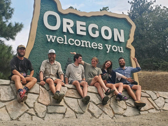
Janet Eastman, who lives in the Ashland area, periodically writes a piece about the PCT. Again this year she has documented the annual migration of PCT hikers through Oregon. This is an excerpt of her story that appeared in the August 21st issue of The Oregonian.
To me, the key comment included in this article is that of the PCTA's Scott Wilkinson who observed that, "uninterrupted end-to-end hikes may continue to be more difficult.” Although there will still be plenty who attempt the uninterrupted thru-hike, more and more hikers may be forced to consider section hiking the PCT.
By Janet Eastman
Ashland’s stars of summer arrive slowly, on sturdy legs hefting carefully stuffed backpacks, and introducing themselves by their trail names like Butters and Giggles.
By the time northbound Pacific Crest Trail thru-hikers cross into Oregon, they have forged 1,720 miles from the bottom of California, through deserts, over mountains and out of unexpected situations, despite years of planning.
The majority of hikers who depart from the trail’s southern terminus, near Campo, California, and move through steep, snowy, soggy, windy and hot conditions at about 25 miles a day, show up in Ashland in August.
This year, many of these hikers were stopped in their tracks by the 55,500-acre McKinney fire in California’s northern Siskiyou County.
On July 30, around 60 hikers in the Red Buttes Wilderness were taken to safety by Oregon’s Jackson County sheriff search and rescue team and bus drivers with the Rogue Valley Transportation District while others gathered 100 miles south in tiny Etna, where they camped in the Johnson-Joss Park and pondered their future.
Their goal of entering the green tunnel of Oregon on foot was over.
Many were shuttled 66 miles on I-5 from Etna to Ashland in buses or by police driving vans, or in the back of cars driven by volunteers.
The endurance hikers, who are miserly with their few days off the trail — called “zero days” — were greeted by smoke and ash, red flag fire risk conditions and lightning, and frantic innkeepers at booked hostels and budget motels.
Thru-hikers Craig Marshall of upstate New York (trail name Butters) and Nadine Osterloh (trail name Giggles) of Bonn, Germany, said they had a mix of emotions.
They were grateful to be safe at the shelter, but they felt guilty taking one of the beds.
And like other long-distance hikers on a schedule to weave through the West Coast when the weather is in their favor were eager to get going.
“We are used to hiking and walking, and now we’re on hold,” said Osterloh.
Where to go?
On Aug. 2, the pack was ready to move again. But in which direction?
Dave (“Floppy”) Kim of Philadelphia started at Campo, steps north of the Mexican border, on May 4 and about 13 weeks later he was in Ashland, which is between exits 11 and 19 off of I-5. Here, he heard options from other thru-hikers.
Return to the trail, either near Callahan’s Mountain Lodge at exit 6 or head east on Oregon Highway 66 for 20 miles to the Pacific Crest-Green Springs Mountain Connector Trail, or about 35 miles northeast to Fish Lake in the Cascade Range to connect to OR-140 north to Crater Lake.
A trail north of Crater Lake is closed for roughly 60 miles due to the Windigo Pass and Tolo Mountain fires, and there was another closure near Mount Jefferson, which burned in the 2020 Lionshead fire.
The closures mean “this season’s thru-hikers will definitely get mixed up and even more spread out along the trail,” said Scott Wilkinson of the Pacific Crest Trail Association.
“Given climate change-driven drought, wildfires and other extreme weather events over the past few years, this could be characterized as the new normal and not unusual,” he added.
Trail closures are also caused by flooding and erosion, and used for habitat protection of endangered species, Wilkinson said.
Uninterrupted end-to-end hikes “may continue to be more difficult,” Wilkinson said, but “the PCT is still a spectacular wild and scenic experience” for day outings, weekend trips and multi-day section trips.
Some thru-hikers in Ashland are throwing up their hands over the road blocks, and heading north on the Oregon Coast Trail. Or they are taking a Greyhound bus to Portland to cross the Columbia River on the Bridge of the Gods and continue on the PCT to the Canadian border.
“This will affect us,” said Candy Boerwinkle of the Ashland Commons hostel on Tuesday. For days, she said her phone was ringing off the hook, with calls from stranded hikers.
Her hostel is typically booked all of July and August, and she didn’t know how she could accommodate everyone.
Then she started receiving cancellations from hikers who decided to skip Oregon.
“There are 27 people checking out today, and only four are checking in,” she said.
The iconic Callahan’s Lodge, in the shadow of Mount Ashland and a short walk from the Pacific Crest Trail, is forwarding some thru-hikers’ mailed care packages to their new destination, said employee Forrest Eldred.
“We’re sending the care packages to towns near Crater Lake or to Bend, or returning them to the sender,” said Eldred on Tuesday. “Some hikers hope to circle back here.”
Callahan’s is still offering lodging, all-you-can eat pancake and egg breakfasts and spaghetti dinners, as well as $16-a-night camping; $25 for backpackers who want to shower and use the laundry.
“Floppy” Kim hopes to come back, to hike the 170-mile gap from Shasta to Ashland.
On Tuesday afternoon, he and Johannes (“Coach”) Popp of Frankfurt, Germany, returned to hiking at the Pacific Crest-Green Springs Mountain Connector Trail, elevation 4,940 feet.
“This hike is 90% mental and 10% physical,” said Kim, who averages 22 miles a day and has worn out two pairs of boots.
More than boots needed
Hiking 2,663 miles on narrow dirt trails from California to Canada takes more than stamina. Success relies on strategizing and adapting when reality dashes best laid plans, said Lauren (“Grandpa”) Schuster, 24, of Atlanta.
She made it from Campo to Etna before forest infernos instantly upended her goal to complete the entire Pacific Crest Trail on foot.
On Sunday, Schuster rode into Ashland and confessed she has been “obsessed” with the PCT even before she read Portland author Cheryl Strayed’s best-selling memoir, “Wild: From Lost to Found on the Pacific Crest Trail.”
Schuster’s months-long trek was made possible by another dashed dream. She was unable to travel in the Peace Corps after she graduated from college in 2020 because of COVID-19. Hiking the PCT became her Plan B.
Two zero days in Ashland had Schuster and a dozen of her closest trail friends pacing around the city and their Airbnb rental, and considering their rerouting options.
Their decision: to reach Crater Lake in four days, then hitch past the Windigo Pass and Tolo Mountain fires closure and keep going north.
“It’s up in the air” how the group will eventually reach Washington state, Schuster said. Then she paused and added the traditional PCT mantra: “The trail provides.”
On Tuesday morning, she and Steve (“Funfact”) Jacobs of Salt Lake City, waited for the rest of their trail family, who started on this journey as strangers on April 5.
Jacobs will celebrate his 35th birthday on the trail Thursday and the tradition for this group is to receive a pastry with a candle, a golden paper crown and a Happy Birthday card drawn by Schuster.
The trail is about give and take, said Jacobs, who contributes “fun facts” to conversation such as mayonnaise can’t emulsify in a lightning storm.
PCT hikers’ star appeal
By the time northbound PCT hikers reach Oregon, they have faced daunting challenges and have succeeded, said John Kerr, who is one of the leaders of day hikes organized by the all-volunteer Ashland Hiking Group.
“PCT hikers know by now they will complete the journey of a lifetime,” he continued. “They are full of smiles despite what lies ahead of them, another 900 miles. And they are universally friendly, even when we break their stride as they step aside.”
PCT thru-hikers are mostly in their 20s and 30s.
“What I love most is seeing people, especially the young, who have gained the confidence in themselves to succeed in whatever else they may dream of doing,” said Kerr, who lives outside of Ashland. “They have no fear of what lies ahead. Last week we met a hiker who had done the journey wearing a prosthesis. Now that was inspiring.”
To Ashland residents, thru-hikers represent hard-earned athleticism, a deep appreciation of nature and the value of taking time off.
People often give thru-hikers a place to stay and rides to the trailhead, and even offer to pick up the tab for a meal or beer.
“They treat us like we’re heroes,” said “Coach” Popp. “But we’re just hikers.”
5 notes
·
View notes
Photo

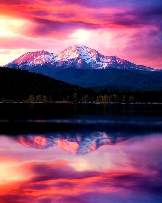
Ring of Fire Tour Day 1. After driving to Mt. Shasta Janet and I pitched our tent then drove up the volcano to hike around Panther Meadows. We did not see any panthers but we did see lots of beautiful wild flowers in this Alpine meadow. The trail loosely follows the stream created by a bubbling spring. It also presented wonder views of the top section of Mt. Shasta and the mountains surrounding her. Mount Shasta (Shasta: Waka-nunee-Tuki-wuki; Karuk: Úytaahkoo) is a potentially active volcano at the southern end of the Cascade Range in Siskiyou County, California. At an elevation of 14,179 feet (4,321.8 meters), it is the second-highest peak in the Cascades and the fifth-highest in the state. Mount Shasta has an estimated volume of 85 cubic miles (350 cubic kilometers), which makes it the most voluminous stratovolcano in the Cascade Volcanic Arc.The mountain and surrounding area are part of the Shasta–Trinity National Forest. (at Mt. Shasta, Ca) https://www.instagram.com/p/CgSgYjDPC71/?igshid=NGJjMDIxMWI=
3 notes
·
View notes
Text

REVIEW
The Wild Between Us by Amy Hagstrom
Excellent dual timeline story that drew me in, made me care, and had me thinking about choices and the impact they can have on lives.
What I liked:
* The plot, pacing, setting, and writing
* The backstory of Meg, Danny, Silas, and Jessica that impacts the present search and rescue that takes place
* Thinking about how age impacts choices made whether five- and seven-year-old boys, high school seniors, or adults
* Thinking about some of my own choices at various ages and being thankful that I did not have to face situations like those of the characters in this book
* Remembering my brother and sister, perhaps a bit older than Cameron and Spencer, adventuring, getting lost, being searched for into the dark of night, and the joy of having them home again
* Reading about search and rescue and how teams work together
* Reading about “metabolic icebox” – a new term to me
* The idea that there is hope for the future and the possibility of making new choices to improve one’s situation
What I didn’t like:
* Who and what I was meant not to like
* Thinking about the ripple effect of some of the choices made by characters in this book
Did I enjoy this book? Yes
Would I read more by this author? Yes
Thank you to NetGalley and Lake Union Publishing for the ARC – This is my honest review.
4-5 Stars
BLURB
The rescue of two missing boys in the Sierra Nevada mountains relies on unraveling the mysteries of the past in an addictive novel of heartrending suspense.
After inheriting his uncle’s lodge, Silas Matheson hopes the grandeur of the California Sierra Nevada will be a fresh start for his two young sons, and a chance to finally face his demons. It was here, fifteen years ago, that Silas and his friends Jessica, Danny, and Meg ventured into the mountain wilderness and Jessica vanished without a trace. When his boys go missing in the same dark woods, the fear and guilt that Silas has been running from ever since come crashing back.
Silas’s panicked call brings in the local search-and-rescue unit, and two familiar faces: Danny and Meg. As the frantic search gets underway, the three friends are plunged into a painfully recurring nightmare, each of them thinking, This can’t be happening again.
With a storm brewing and the boys’ fates threatened with every desperate hour, the secrets of the past begin to surface, and this time, for Silas, Danny, and Meg, there’s no escaping the truth.

AUTHOR BIO
Amy Hagstrom is a writer and travel industry editor whose work has appeared in US News, OutdoorsNW Magazine, Travel Oregon, and Huffington Post, among others. A lifelong outdoors enthusiast, she served as a volunteer EMT with her local county search-and-rescue unit before launching her writing career. After raising three children in the Pacific Northwest, Amy traded the Cascade, Siskiyou, and Sierra Nevada mountain ranges for the Sierra Madre mountains, making her home in central Mexico with her wife. For more information, visit www.amyhagstrom.com.
#Amy Hagstrom#NetGalley#Lake Union Publishing#Choices#search and rescue#romance#murder#mystery#fiction
0 notes
Text
My, What Big Feet You Have.
The idea of hairy wild men have been around almost as long as humanity has. These stories, drawing from the eons ago when multiple hominid species existed or genuinely there exists a cryptid in the world is still up in the air. Many of the supposed Bigfoot sightings have been debunked but a handful remain as mysteries. In 1967, Bigfoot burst into the cultural zeitgeist with the Patterson-Gimlin film. The film alleges to show Bigfoot, unsurprisingly, walking. From there, sightings continued to expand both in the USA and abroad.
Indigenous tribes across America contain stories of hairy large men, the majority of tribes reporting sightings in the Pacific Northwest. In Oregon proper, the Nehalem Tillamook have stories of "wild men" that left large tracks around the Nehalem settlements. Some of the Paiute near Warm Springs believe Bigfoot to be a "stick Indian", a spirit that will attempt to lure people away from home, never to be seen again.
Oregon does have the distinction of one of the first published Bigfoot encounters; The Oregonian published in 1924 of a clash between gold prospectors and "ape men" near Mount St. Helens. When a prospector shot one of the "ape men", the whole lot came back at dark and pelted the cabin with heavy rocks and tree limbs. The men fled from their cabin the next day. Interestingly enough, the Chinook have a legend of skoocooms, a race of cannibal wild men living on Mount St. Helens.
For Southern Oregon in particular, logging in the Cascades reported sightings of large men starting in 1957. Enough sightings have occurred in the Klamath-Siskiyou mountains that there exists Bigfoot Trail. In the Siskiyou mountains proper, the world's only Bigfoot trap near Collins Mountain. Oregon continues to be a hotbed for Bigfoot activity through present day. Bigfoot has been become a well known mascot for schools, brands, restaurants, and more in Oregon.
So a real entity? A tale that has just been passed down for millennium? Misidentified animals? Who can say? Oregon still contains thousands of acres of dense forest that could very well hide Bigfoot, as it does multiple mountain communities, but that's a story for another day.
sources: Oregon Wild, Wikipedia
0 notes
Text

Fire Season Heats Up in the West
In terms of wildfires, 2023 has been a quiet year so far in the United States. But in early August, 60 fires burned across nine states in the West, fueled by hot and dry conditions. Two of the largest fires were ignited in Oregon and Idaho in late July.
On July 22, a few miles east of Eugene, Oregon, the Bedrock Fire ignited near a campground in the Willamette National Forest. This image, acquired August 1 by the Operational Land Imager-2 (OLI-2) on Landsat 9, shows smoke streaming south from the front of the fire.
As of August 3, Bedrock Fire had burned 12,200 acres (49 square kilometers) and was growing at a rate of about 1,000 acres (4 square kilometers) per day, according to the Forest Service. The burning led to forest closures in the surrounding area. Smoke from the fires had spread into central Oregon, causing some areas to experience “unhealthy” air conditions.
Burn scars from the Cedar Creek Fire can be seen east of the smoke. The Cedar Creek fire burned 127,000 acres (514 square kilometers) on the western slopes of the Cascade Range from early August 2022 through September 2022.
As of August 3, the Bedrock Fire was Oregon’s second-largest fire of the season. The Flat Fire (not shown), burning in the Rogue River-Siskiyou National Forest in southwest Oregon, had burned 29,000 acres (117 square kilometers) and was 28 percent contained.

In Idaho, six fires were ongoing as of August 3. The largest fire in the state, the Elkhorn Fire, started in the Payette National Forest in north-central Idaho on July 24. Smoke from the fire is visible in this image, acquired on July 31 by the Moderate Resolution Imaging Spectroradiometer (MODIS) on NASA’s Terra satellite. The smoke appears to have settled into the deep valleys carved by the Salmon River. On July 30, wind picked up and the fire jumped over the Salmon River into the Nez Perce-Clearwater National Forest. The fire also reportedly destroyed several structures at two ranches in its path.
Although summer 2023 has been unusually hot in parts of the United States, with extreme temperatures plaguing the Southwest in July, it has been a quiet year for fires. Since the start of the year, 30,800 wildfires have burned 1.2 million acres (4,800 square kilometers) as of August 3, 2023. This is the fewest acres burned year-to-date in the past 10 years, according to National Interagency Fire Center data. The 10-year average for area burned through August 3 is 3.8 million acres (15,400 square kilometers).
In 2022, NASA launched a new initiative called FireSense, which aims to bring the resources of NASA and its decades of Earth science data to inform decision-makers and guide actions in fire management.
youtube
NASA Earth Observatory images by Lauren Dauphin, using Landsat data from the U.S. Geological Survey and MODIS data from NASA EOSDIS LANCE and GIBS/Worldview. Story by Emily Cassidy.
0 notes
Text
Mount Shasta—Reality or Hoax? has been published on Elaine Webster - http://elainewebster.com/mount-shasta-reality-or-hoax/
New Post has been published on http://elainewebster.com/mount-shasta-reality-or-hoax/
Mount Shasta—Reality or Hoax?
Mount Shasta—Reality or Hoax?
(Shared from ‘Mu the Motherland‘)
Mount Shasta is a dormant volcano rising 14,179 feet in the Cascade Range of Northern California. The mountain is composed of four major volcanic cones built of layers or strata—each one created in its own eruptive period and overlapping with the others. There is a fifth cone, the Red Fir Cone, which outcrops lower on the mountain at 6340 feet and is often referred to as ‘Ancestral Mt. Shasta’ with rocks dated back about 590,000 years. (Most of what can be seen is less than 200,000 years old.) In comparison, the Shastina cone is only about 9700 years old and the last eruption was about 200 years ago from the Hotlum cone.
Image Source: College of the Siskiyous Library
The Cascade Range is part of “The Ring of Fire”, a chain of volcanic arc and trenches that border tectonic plates, so it’s no wonder that those that are sensitive to earth energies feel an intensity in this area. It is also not unusual for Native Americans to gravitate towards these energies. In fact, Shasta is a modernized spelling of “Sastise” the name used by Klamath Indians to describe an enemy tribe on the other side of the mountain; suggesting that they regarded the peak both as protection and a power source. The mountain was first summited in 1854 by Elias Davisson Pierce and party. Author Joaquin Miller spent four years in the area and John Muir survived an overnight snowstorm on the summit in 1875. Did any of these people, see or hear anything unusual? If they did, they didn’t report on it. However, advance to 1987 and Shasta was labeled a power point site for the Harmonic Convergence—the first synchronized peace meditation. Many consider the mountain to be one of the Seven Sacred Mountains of the World and Native Americans consider the area to be a place of balance between earth and the universe.
So, where did all the speculation begin about mystic temples hidden within the mountain and the advanced Lemurian civilization that is believed to live there? Well, it started with a teenager—a resident of Yreka—Frederick Spenser Oliver and his book ‘A Dweller on Two Planets’. Oliver wrote about mystical beings, sacred brotherhoods, temples, mysterious lights, and spaceships, but he insisted that he was not the author, but was channeled by ‘Phylos the Thibetan’. Oliver died at the young age of 33 and the book was published posthumously in 1905 by his mother and a group of friends.
Then, the ball seems to have been picked up again in 1931 when Wishar Spenle Cerve (pseudonym of Harvey Spencer Lewis) wrote and published through the Rosicrucian Order, ‘Lemuria, The Lost Continent of the Pacific: The Mystery People of Mount Shasta’. Cerve wrote that Lemurians were tall, graceful, and agile, with larger heads and much larger foreheads than average humans. If you peruse the local bookshops you will come across many accounts of Lemurians coming into town for supplies, often paying with gold nuggets. It was these stories that spurred the metaphysical tourism that is still prevalent today.
In 1934 author Guy Warren Ballard (pen name Godfre Ray King) wrote a memoir, ‘Unveiled Mysteries’, describing his meeting with “Saint Germain” on Mount Shasta. Yes, this is the same Saint Germain who worked at the Court of France during the French Revolution. His wife, Edna (after her husband’s death in 1940) continued to publish information about these encounters for the “I AM” movement and the group she formed continues to visit Mount Shasta.
There is so much written, filmed, and presented about Mount Shasta—the list of information is endless and easily accessed on-line. However, the one account that struck me as valid and unexplainable is the widely reported incident of a 3-year-old boy. In September 2011, a 3-year-old-boy and his dog wandered off from Fowler’s Campground at McCloud Falls, which is down the hill from Shasta sparking a desperate search of the area. The dog was found, wet and cold, but alive near some rapids. The search continued on the assumption the toddler might have been swept away in the rapids. Local news covered the search and the boy was found. However, his rescue came with an interesting story of being captured by a robot and taken to a creepy place. He described a cave and a woman, a grandmother, who told him he was from outer space and he was placed in his mother’s womb. This same woman took the boy back to the river and told him to wait for the searchers, which he did and was found. Most people dismiss the story as an over-active imagination of a small boy. However, it’s interesting that the dog was found first, alone, and the boy appeared later. Hmmm.
Finally, Pluto’s Cave, north of the mountain was prehistorically occupied by Native Americans and after the gold rush, secret societies conducted initiations and rituals there. Today many believe that it is a portal into Inner Earth and an underground secret city. The cave is managed by Klamath National Forest and is a lava tube that can be hiked into for approximated 1200 feet. The cave itself is larger than those found in the Hawaiian Islands. There are multiple lava flows visible in the cave walls. Most expert on the supernatural nature of Shasta and these tubes is author, Dustin Naef, who says that numerous hikers have reported seeing people literally walk into the rocks walls and disappear, presumably to enter the Hollow Earth and possibly the secret city of “Telos”.
Critics and skeptics argue that the Lemurian legend and the idea of an underground city beneath Mount Shasta are nothing more than imaginative folklore and unsubstantiated claims. They point out the lack of concrete evidence and scientific support for these beliefs. Skeptics argue that the stories surrounding the Lemurians and the Subterranean City of Mount Shasta are primarily based on subjective experiences, personal anecdotes, and channeled information, which are difficult to verify or validate.
Despite the lack of empirical evidence, the allure of the Lemurian legend and the Subterranean City of Mount Shasta persists. For believers, the stories offer a sense of wonder, hope, and spiritual inspiration. They find solace in the idea that there may be a hidden realm of enlightenment and higher consciousness accessible to those who seek it. The myth of the Lemurians and Mount Shasta also serves as a metaphorical representation of humanity’s longing for a more harmonious and spiritually connected existence. One thing that is undeniable is that Mount Shasta exudes power—physical and spiritual power. How each of us use nature’s power is an individual preference, but it will not and cannot be denied.
Additional Reference Source:
College of the Siskiyous Library
Mount Shasta Fact Sheet
0 notes
Text
Outdoor Adventure in Medford OR
If you're looking for a great outdoor adventure in Medford OR, then there are plenty of things to do. From hiking and camping to swimming and fishing, you'll find that there's a lot to explore. But what are some of the best places to go in the area?

Bear Creek Park
Medford, Oregon is a great place to visit for an outdoor adventure. This city is located in the Rogue River valley. There are several parks and other attractions to enjoy while you are here. Whether you want to hike, ride a bike, or just relax in nature, there are plenty of things to do in this beautiful region.
Bear Creek Park is an excellent place for a family outing. It has lots of hiking trails, sports facilities, and an open-air amphitheater. The park is also home to three acres of wildlife refuge.
Bear Creek Park is a popular spot for people and dogs in southern Oregon. While the area is primarily used for BMX and skating, there are also plenty of hiking trails for all ages.
Crater Lake National Park
Crater Lake National Park is a must-see destination for visitors to the Pacific Northwest. It is located in southern Oregon near the city of Medford, and is a beautiful and awe-inspiring sight to see.
Crater Lake is known for its deep and pure lake. Located in the Cascade Mountains, it is the ninth deepest in the world. When the lake freezes, it receives up to 100 inches of snow.
Applegate Lake
Medford, Oregon is a great place for outdoor adventure. The town is located in the Rogue River Valley, which is rich in natural beauty. A short drive will take you to some of the best attractions in the region.
One of the best attractions is Applegate Lake. This scenic lake is located in the Rogue River Valley. You can enjoy great fishing, hiking, swimming, boating and more!
Applegate Lake is surrounded by a variety of hiking trails. There is also a boat ramp. During the summer months, you can enjoy a day of sun and fun at the lake. It is a great place to relax and unwind.
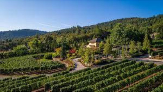
DANCIN Vineyards
DANCIN Vineyards is one of the most popular wineries in the Medford region. This family-owned business offers award-winning wines. They produce pinot noir, chardonnay, syrah, and port. A tasting room is located within the vineyard, so you can enjoy a glass of wine while overlooking the Rogue Valley. You can also take a tour.
One of the most beautiful places to visit in Oregon is the town of Medford. It's known for its breathtaking outdoor adventures, as well as its world-class vineyards. The city is surrounded by the Rogue River and the Cascade Mountains. There are a number of wineries and activities in the area, as well as parks and a variety of other fun attractions.
Samuel H. Boardman
There's no shortage of outdoor adventures in Medford, Oregon. The city is situated along the coast of the Pacific Ocean. You can explore the area's history or just relax on a beautiful beach. But if you want to get some real exercise, head out on the trail.
Siskiyou Mountain Park
Siskiyou Mountain Park is a beautiful area for an outdoor adventure. It's located near Medford, Oregon, and offers a variety of hiking and horseback riding trails.
Hilton Rd Medford OR is a great place to stay if you're planning a trip to the Rogue Valley. It's a short drive from the Rogue Valley International-Medford Airport and also features a plethora of shops and restaurants to keep you entertained on the go. The hotel also boasts a great swimming pool and a convenient fitness center.
There are also several other trails in the area. For example, the Natural Bridges Cove trail is a narrow and steep hiking path that features unique rock formations.
Whether you're traveling to the area for the first time or you're a longtime resident, there are a lot of activities to enjoy near Forest Hills Dr in Medford. The area is a great place to enjoy the natural scenery of Oregon. There are a number of hiking trails and a variety of recreational activities to keep you busy.
If you're looking for a challenging hike, you can climb to the top of Table Rock. This scenic mountain is a flat top lava flow jutting out of the ground. A steep climb is needed to reach its top.
You can also try the Canyon Falls Trail. The trail starts from the same trailhead. It is a two-mile hike with a waterfall on the trail.
Other nearby attractions include the Oregon State Hospital Museum and the Deepwood Museum and Gardens. These museums are excellent for exploring the history of the region. Located just one mile from the trailhead, they have lots of parking.

Medford builders
There are a number of reasons why you may choose to build a new home. For example, it's less expensive than buying a pre-built house. Plus, you'll be able to make it exactly the way you want it to be.
The first step is to find a good home builder in Medford. You can search for a company through the internet, or by looking for photos of their completed projects.
When you're searching for a new construction builder, you should look for companies that have a track record of completing high-quality projects on time. Ideally, you'll also want a company that has experience working with the zoning regulations of the city where you're building.
Choosing a good Medford builders can be a daunting task. But with the help of a reputable company, the process can be simple and stress-free.
Revolution Builders, LLC
3619 Aviation Way, Medford, OR 97504
(541) 210-3205
https://revolution-builders.com/
0 notes
Conversation
U.S. Daily High Temperature Records Tied/Broken 10/14/22
Craig, Alaska: 59 (also 59 1937)
Hoonah, Alaska: 60 (previous record 56 2016)
Juneau, Alaska: 55 (also 55 2004)
Sitka, Alaska: 59 (also 59 2012)
Cooskie Mt. summit, California: 92 (previous record 91 2004)
Klamath National Forest, California: 92 (previous record 90 1991)
Round Valley Reservation, California: 98 (previous record 97 2004)
Unincorporated Siskiyou County, California: 86 (also 86 2015)
Boca Chica Key, Florida: 92 (previous record 91 2020)
Unincorporated Hawai'i County, Hawaii: 89 (also 89 2020)
Atlanta Peak summit, Idaho: 68 (previous record 65 2004)
Big Creek Pass summit, Idaho: 67 (also 67 2015)
Challis National Forest, Idaho: 68 (previous record 65 2015)
Couer d'Alene Reservation, Idaho: 78 (previous record 74 2015)
Unincorporated Owyhee County, Idaho: 83 (previous record 82 1999)
Schweitzer Basin summit, Idaho: 56 (previous record 54 1991)
Stanley, Idaho: 73 (previous record 71 2015)
Wallowa National Forest, Idaho: 75 (previous record 74 2015)
Hutchinson, Kansas: 87 (also 87 2020)
Columbia, Mississippi: 91 (also 91 1972)
Deerlodge National Forest, Montana: 68 (previous record 66 1991)
Kootenai National Forest, Montana: 61 (previous record 57 2006)
Unincorporated Lake County, Montana: 71 (also 71 1963)
Monument Peak summit, Montana: 61 (also 61 2015)
Stahl Peak summit, Montana: 59 (previous record 56 2010)
Cascade Locks, Oregon: 81 (previous record 77 1945)
Corvallis, Oregon: 84 (previous record 78 2015)
Unincorporated Douglas County, Oregon: 82 (previous record 81 2014)
Grand Ronde Community, Oregon: 75 (previous record 74 1991)
Grants Pass, Oregon: 88 (previous record 85 1991)
Unincorporated Jackson County, Oregon: 92 (also 92 1978)
John Day Fossil Beds National Monument, Oregon: 83 (previous record 82 2010)
Unincorporated Josephine County, Oregon: 87 (also 87 2015)
La Grande, Oregon: 82 (previous record 80 1999)
Unincorporated Lane County, Oregon: 78 (previous record 77 1976)
Mt. Hood National Forest, Oregon: 84 (previous record 79 1991)
Mt. Stella summit, Oregon: 82 (also 82 2015)
Portland, Oregon: 82 (also 82 1991)
Sweet Home, Oregon: 80 (previous record 77 2014)
Troutdale, Oregon: 83 (previous record 79 1991)
Willamette National Forest, Oregon: 86 (also 86 2016)
Unincorporated Bee County, Texas: 96 (also 96 1902)
Freer, Texas: 99 (previous record 98 1962)
Unincorporated Hidalgo County, Texas: 96 (also 96 2013)
Mt. Pleasant, Texas: 94 (also 94 1963)
Unincorporated Starr County, Texas: 100 (previous record 99 2012)
Bremerton, Washington: 77 (previous record 75 1961)
Chelan, Washington: 76 (previous record 74 2004)
Unincorporated Chelan County, Washington: 75 (also 75 2004)
Colville National Forest, Washington: 62 (previous record 60 1991)
Gifford Pinchot National Forest, Washington: 72 (also 72 1991)
Unincorporated Klickitat County, Washington: 82 (previous record 81 2004)
Longmire Historic District, Washington: 80 (previous record 70 1991)
Longview, Washington: 83 (previous record 76 1961)
Okanogan National Forest, Washington: 67 (previous record 62 1991)
Quartz Peak summit, Washington: 64 (previous record 63 2005)
Quinault Reservation, Washington: 77 (previous record 75 1982)
Ross Lake National Recreation Area, Washington: 70 (previous record 69 2006)
Seattle, Washington: 76 (previous record 73 1991)
Unincorporated Skamania County, Washington: 85 (previous record 81 1991)
Unincorporated Skamania County, Washington: 85 (previous record 82 1991)
Skokomish Reservation, Washington: 69 (also 69 1982)
#U.S.A.#U.S.#1990s#Idaho#Mississippi#1970s#Montana#Oregon#1940s#1960s#Texas#1900s#Washington#1980s#Alaska#1930s#Florida#Kansas#Hawaii#Crazy Things
0 notes
Text
Sprague the whisperer

#Sprague the whisperer series
Roe terms the more easily accessible Wood and Williamson as "phenomenal" rivers for fishing and recreational boating. It's off everyone's radar.” He notes, “There's great morning and evening fishing. During several spring outings, he says he and clients have routinely caught upwards of 100 rainbow trout an hour. Roe also says fishing along the Klamath, in the several mile section below the Boyle dam and Caldera, is especially under-appreciated. “After Caldera, it turns into seven miles of wild, challenging rapids,” Roe says. Boyle Dam in Klamath County, and eventually calms before reaching Copco Lake in Siskiyou County.
#Sprague the whisperer series
The series of raucous rapids begins with Caldera, south of the John C. The Upper Klamath River is best known for its frothy whitewater, including a legendary seven-mile section that features Class four-plus and five rapids. He adds, “It's one of the top fisheries in the world, but not too many people know that.” "What gets overlooked is the Klamath River,” says Darren Roe, owner of Roe Outfitters, the Klamath Falls based guide service that offers fishing, kayaking, whitewater rafting, and other outdoor adventures in southeastern Oregon, along with the Rogue River. In Klamath County, several rivers are known for fishing, boating, and whitewater rafting, including the Klamath, Williamson, Wood, and Sprague, while Lake County features the Chewaucan. Southern Oregon's amazing network of rivers extends east of the Cascades. Lininger’s ultimate goal is to establish a permanent retreat for their programs with yurts for accommodations, in addition to a fishing yurt for special workshops. Fly-fishing is known to provide a calming environment, evoke a relaxation response, reduce stress, and improve sleep quality. Specifically, Source One Serenity offers all-inclusive fly-fishing retreats and workshops in tying flies, casting, and fly-fishing on the Umpqua River. After moving back to Oregon, Lininger set in motion his dream to help other veterans by being a fly-fishing guide, a teacher, or just a friend. Rusty Lininger, founder of Source One Serenity, is a veteran of two deployments in Iraq, who found his own healing through fly-fishing. The thoughtfully designed programs enable veterans to experience mindfulness and serenity, helping to reduce stress and anxiety associated with PTSD. My part is done.”Ī non-profit corporate entity (currently in the midst of the filing process), Source One Serenity, provides veterans with comprehensive programs centered on fly-fishing. With the river in charge, I leave them in prayer. Time and memories are no longer relevant. After a few casts I’m no longer there, no longer part of their moment. With rod in hand, they came to my ‘church.’ Waist deep in clear waters I guide them in reading the current and selecting their fly. “On multiple occasions, I’ve brought someone to our river. “By participating and being part of nature, our source, we can help our healing waters heal our wounds.” So read on, and then plan your own adventure. In reality, though, reading about a river is a poor substitute for experiencing it. These folks would describe the food they enjoyed along the way, gourmet or down-home, and tell of sipping wine or downing a beer while recounting their adventures on the water.Īll this and more speak to the rivers of Southern Oregon. The Umpqua River would make special mention of veterans finding peace and healing after the chaos of war.īut it would take people to describe the accommodations while traveling the river-lodging either luxurious or rustic, a tent on the beach or a sleeping bag under a starry sky. The river might tell of humans who float its surface, some in boats, kayaks or rafts, others using no watercraft. If a river could talk, it would speak of rapids and small cataracts, of meadows where cattle and deer graze amicably, of cities and small communities, of rugged cliffs and gorges carved over millennia, of hills in verdant hue. Southern Oregon waterways are among the region's best assets
0 notes
Photo

The @mypubliclands Cascade-Siskiyou National Monument is filled with layered beauty.
This southern Oregon gem is situated at the crossroads of the Cascade, Klamath, and Siskiyou mountain ranges, and represents an outstanding ecological wonderland!
Photo by Bob Wick, BLM. Photo description: Several tree covered mountain sets stretch off into the distance with a moon hanging overhead in the pink and orange sky
398 notes
·
View notes
Text
VERY VERY IMPORTANT - all PCT users and lovers pay attention
The Department of Interior led by Ryan Zinke is reviewing 22 National Monuments and 5 Marine National Monuments, created or expended between the years 1996 - 2016. What is at risk? These Monuments may be reduced in size or eliminated all together. Three of the Monuments encompass stretches of the PCT -- Sand to Snow National Monument (includes, among other features, Whitewater River), San Gabriel Mountains National Monument (includes, among other features, Mt. Baden-Powell), and Cascade Siskiyou National Monument (includes, among other features, Pilot Rock near Ashland, Oregon). There is a 60-day public comment period (ending July 10). It is critical that PCT users make their feelings known. You can do so by:
1) enter into your browser (or follow this link) http://www.regulations.gov
2) under the ‘What’s Trending’ column on the left side of the screen, you can double click on Review of Certain National Monuments Established Since 1996; Notice of Opportunity for Public Comment
3) click on "Comment Now"
4) make your comment
Here is what I wrote:
At the age of 62, I finished walking the Pacific Crest Trail. The Trail passes through three of the Monuments under review: Cascade Siskiyou, Sand to Snow, and San Gabriel Mountains. Just this past April I was again walking through the mountains of Southern California from the Mexican border to the San Jacintos, four years after first backpacking in these arid mountains. What is striking to me is just how aggressively development continues to push, push, push into these fragile desert landscapes. Horse ranches, greenhouses, homes, even housing developments and the associated roads, utility lines, and commercial establishments have sprung up where they did not exist even 4 years ago. Once development occurs, it is extremely difficult to undo it. The Sand and Snow and San Gabriel Mountains Monuments offer modest but critical protection from the sprawling reaches of Los Angeles and the Palm Springs/Palm Desert communities.
The landscape is extraordinarily vulnerable. The desert holds its scars for a very long time. You can see this impact as you walk near the Whitewater River in the Sand to Snow Monument. Or, from the top of Mt. Baden-Powell, in the San Bernardino Mountains Monument where the layer of pollution from the L.A. Basin often offers a palpable layer extending far to the southwest.
While not surrounded by massive population centers like the Sand to Snow and San Gabriel Mountains, the Cascade Siskiyou Monument is threatened by the rapidly growing Ashland-Medford communities of the Rogue River Valley. Homes are pushing their way farther and farther into the mountains around these communities. I believe that the Cascade Siskiyou Monument not only protect iconic features like Pilot Rock, but helps preserve the recreational opportunities for this region of southern Oregon.
I have lived on the North Coast of California just south of Redwood National Park for more than three decades. I think that the creation of Redwood National Park provides an object lesson when insufficient land is protected. The Park, in deference to local logging companies, initially limited much of the protection to a narrow strip of old growth redwood along Redwood Creek (named the 'worm' for its size and shape). Quickly we learned, as surrounding lands were aggressively logged and Redwood Creek clogged with sediment that we had to preserve the broader eco-system . . . not just a small patch of trees. By the time we learned that, the cost of buying back the watershed and its restoration was immense.
Do not give up these Monuments for short-term employment and temporary gain. I would love to walk some of these lands with you as I know that you agree with what I have seen and learned.
50 notes
·
View notes
Text
PROTECT OUR NATIONAL MONUMENTS
Hey guys. I know you’re all sick of the US imploding, and sick of politics, but this is important and seems to be flying below the radar. As a former resident of Idaho who has loved and spent much of my youth in these places, this means a lot to me. Can you please take a moment to read this and take some action?
The US Department of the Interior, per Executive Order 13729 of President Trump wants to roll back our national monuments. This order was pushed out April 26th 2017 and any park that was expanded since 2000 is up for review. One park, Craters of the Moon National Monument, is up for complete obliteration. They claim that the parks were expanded without proper public discourse, or that the lands may be a drain on our Federal land management funds, but this is, of course, bogus.
No president has EVER attempted to turn back a park created under the 1906 US Antiquities act. THIS IS AN UNPRECEDENTED CHALLENGE AGAINST THE AMERICAN PEOPLE AND OUR SHARED LAND. This act was meant to protect lands that were valuable for historic, geological, or ecological reasons, lands that are unique to the United States of America.
Anyone with a brain and a map can figure out why they want to roll back these expansions. The current director of the DOI has a spotty history of approving coal mining, despite it’s harms to people and the environment and has vacillated on the issues of climate change.

This is a map of current coal reserves.

Here is is that same map with the approximate locations of the parks overlaid. I am aware not all the parks lay on coal reserves–those that don’t lay on what could potentially be oil drilling sites (Caliornia coasts, Oregon), logging (California, Maine, Montana, Washington), cattle ranching (Utah, New Mexico, Idaho, Colorado) or recreational hunting (Idaho).
Furthermore, they’ve included 5 off coast Maritime National Monuments under the protection of the US, for oil drilling and commercial fishing. These locations were all created under the Obama administration and represent an attempt to protect maritime life and save the traditions of maritime peoples, like the Native Hawaiians. Many of the below locations have seen mass pollution and endangered species get turned around. They are geologically, historically, and ecologically valuable.
Those places are:
The Mariana Trench Maritime National Monument
Northeast Canyons and Seamount Maritime National Monument
Pacific Remote Islands Maritime National Monument
Papahanaumokuakea Maritime National Monument
Rose Atoll National Wildlife Refuge
All the places up for review?
They’re all Here.
SO WHAT CAN I DO TO HELP, DRDANDY?
Go to this website and write a review urging the DOI to protect these lands in their review. Whether you reside in the US or are an international who has visited and cares about these places–PLEASE COMMENT. As of today, May 22nd 2017, we only have 69k worth of comments.
You can call or email Randall Bowman at 202-208-1906 or [email protected]
I also urge you to mail a review to:
Monument Review, MS-1530, U.S. Department of the Interior, 1849 C Street NW., Washington, DC 20240.
BLOW THIS UP. REBLOG THIS. FLOOD THE DOI. PROTECT OUR LANDS. WE ONLY HAVE UNTIL JULY 10th, 2017.
#usa#trump#department of the in#national monuments#native americans#basin and range#bears ears#berryessa snow mountain#canyons of the ancients#carrizo plain#cascade siskiyou#craters of the moon#giant sequoia#gold butte#grand canyon-parashant#grand staircase-escalante#hanford reach#ironwood forest#mojave trails#organ mountains-desert peaks#rio grande del norte#sand to snow#san gabriel mountains#sonoran desert#upper missouri river breaks#vermilion cliffs#katahadin woods and waters#marianas trench#northeast canyons and seamounts#pacific remote islands
34 notes
·
View notes
Last Seen Blogs

kwonhoosh
불어라허리케인🌪

prinsesangbiik
PIGLET♥

timelight
Boy Savior

salerogading-blog
Salero Gading (SAGA)

maxllc
Maxllc